
Hekla at predawn on April 14th, 2012. (Mila webcam capture)
According to an article published today by journalist Kristján Kristjánsson on the Icelandic Internet news outlet Pressan, “Hekla is ready to erupt” and “tension is very high in the mountain”. The article, which is in Icelandic, goes on to quote (Professor) Páll Einarsson, the man who rightly won international acclaim in 2000 when he read the signs correctly and famously said that Hekla would erupt at 18:15 hours, thirty minutes before the event which duly arrived at 18:18 hours. From what the article says, it is obvious that the writer is quoting an old interview made years ago.
However, even if this article gives the impression that an eruption is imminent this is not necessarily so! First of all, neither IMO nor Almannavarnir, the organisation responsible for public safety, make any mention of noteworthy unrest at Hekla. Second, the instrumentation publicly available courtesy of the IMO show little or no signs that an eruption could be imminent even if Hekla is famous for giving little or no advance sign until less than an hour before an eruption begins.
“So what should I look for?”, you ask. Well, let me run through a few useful websites and what to look for! First of all, regularly check the IMO earthquake page for Myrdalsjökull:
http://en.vedur.is/earthquakes-and-volcanism/earthquakes/myrdalsjokull/#view=map

IMO page for the Myrdalsjökull area June 20th, 2016. Note earthquake at Hekla, a M 1.1 at 9.6 km depth (IMO)
If the map shows earthquakes at or very close to Hekla, a look at the special page devoted to Hekla, Heklavöktun, is indicated. On this page, there are links to most instruments monitoring Hekla as well the information available from the year 2000 eruption for comparison. I have placed the relevant comments in the image captions:
http://hraun.vedur.is/ja/hekla/

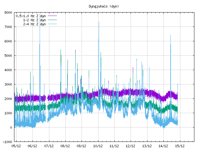
Borehole strain and seismicity (IMO). Please note the scale on the strain count! This changes and is currently high but can be as low as 1/50th of the one on display. Needless to say, if the scale is set to show minor movement, these appear large without this signifying anything in particular. When it comes to earthquakes, large distant earthquakes will show up as they did during the 2014-5 Bardarbunga eruption. Make certain that an earthquake showing on this graphic is indeed at Hekla and not a distant event! At the bottom of this part of the page is a quicklink to the five strain meters.

Borehole strain at station Hekla (IMO). The strain measured varies naturally with the tides. If there is a change due to volcanic unrest, the strain will deviate sharply and unmistakably from this normal, slow undulation. Please note that the instrument is so sensitive that large earthquakes; ~M 4-5 elsewhere in Iceland and M 7 or larger worldwide, tend to show up here.

The page also has links to the three SIL-stations closest to Hekla. The image shows tremor registered at Haukadalur SIL-station during the year 2000 eruption. (IMO) Please note how very unmistakable the immediate, sharp rise is!

Finally, the page contains links to several additional webcams including the “Burfell Dalek” looking at Hekla from the North. (IMO)
There is an additional instrument monitoring Hekla available online, the Fedgar drum plot which is accessed through the IMO-supplied page “Tromlurit” or directly via the link at the bottom of the page.

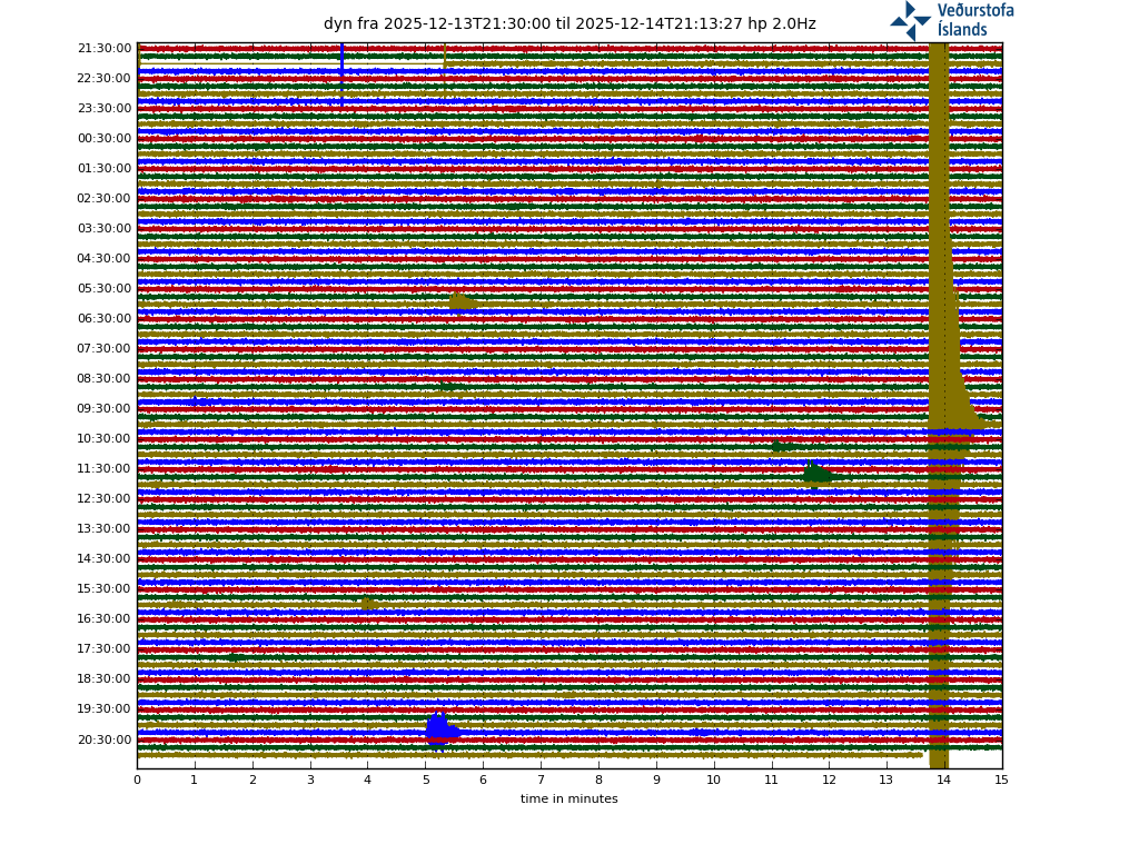
Fedgar drum plot (IMO). At present, the weather is rather heavy which is the reason for the thickness of the lines. Please note that most of the earthquakes shown here are actually teleseisms from more distant quakes, something that can be confused with harmonic tremor by the untrained eye as they are very drawn-out and lack the sharp peaks of the P- and S-waves of regular tectonic earthquakes.
So, is Hekla about to erupt? To judge from what the instrumentation shows, no. The article was probably intended to attract traffic to the site rather than factual reporting. BUT! Hekla is so unpredictable and gives such scant warning that by the time I have finished writing this article and published it, Hekla could indeed be in the process of erupting!
Henrik
http://www.pressan.is/Frettir/Lesafrett/hekla-er-tilbuin-til-ad-gjosa-mikill-thrystingur-i-fjallinu
http://en.vedur.is/earthquakes-and-volcanism/earthquakes/myrdalsjokull/#view=map
http://hraun.vedur.is/ja/hekla/
http://hraun.vedur.is/ja/drumplot/drumplot/fed.png?0.8531966300332475
http://www.livefromiceland.is/webcams/hekla/
I have added the links to two of Icelands reliable news agencies; RUV and MBL in case there is another unconfirmed story as these two are pretty quick to publish accurate information.


I commented this just as the new post came out. I saw this tremor? on the IMO drumplots for station SCO. Where is that?
Hi Bill!
It is Ittoqqortoormiit, Greenland, also known as Scoresbysund, hence the acronym Sco. If you go to the IMO tromlurit page and scroll out, you’ll see that there are two stations on Greenland and one for Beerenburg volcano on Jan Mayen.
https://en.wikipedia.org/wiki/Ittoqqortoormiit
http://hraun.vedur.is/ja/drumplot/mapDRUM.php
So maybe weather related?
I have no idea really. There is no indication about the sensitivity setting and it could turn out to be either someone running a jackhammer close by or even whalesong for all I know. Carl would know, at least enough for a qualified guess but alas, he is overwhelmed by work (that curse of the drinking classes as Oscar Wilde put it so eloquently) at present.
Thanks Henrik. No wonder I couldn’t find it on all the maps of Iceland that I poured over. Great article with a lot of good links.
It *can* be hard to read maps after spilling your coffee on them, though.
Got all excited there, for a moment. Until cold hard facts intervened, and it was just another journalist doing his “woe, disaster, volcano is OVERDUE” shtick. Still, with lady Hekla, who knows? A stopped clock is right twice a day – issue enough warnings and one day you’ll hit the jackpot. But it articles like hi dissuade tourists from climbing Hekla, maybe it’s some use after all.
Since Hekla gives little or no warning before erupting, and Hekla is doing absolutely nothing at the moment, the evidence points at an imminent eruption. O wait – perhaps not. It is also giving little or no warning before doing nothing. Actually, do we know whether the current monitoring could pick up precursors that would have been missed in the past?
In the case of Hekla, I suspect we do not know which precursors to look for which infallibly indicate that an eruption is imminent. Since the latest eruption on February 26th, 2000, more, new and more modern instruments monitor the volcano, so next time round, we ought to catch sight of them. Hopefully.
Last time, there was a handful of moderate strength earthquakes (the strongest being an M 2.6 iirc), then strain at the Burfell strain meter dropped dramatically and booom!
I should add that in 2012, both (Professor) Páll Einarsson and Carl independently of each other declared that Hekla was about to erupt. Based on the wisdom gained from 2000, subsequent research and better instrumentation, Hekla should have erupted but did not. She is one fickle woman, that hooded one!
Hekla is not (emphasis) doing anything new. Tension was alreay such by 2006 as it is now. Warning by Einarsson (or anybody), probably nothing more important than issued by him before. Wait for IMO declarations, please!
Exactly! Once Almannavarnir and/or the IMO issue warnings (like I pointed out in the article) is the time to worry.
Almannavarnir?
Almannavarnir = Iceland’s civil protection agency.
Thanks
Thank you.
I did check this, and I don’t really speak Icelandic, but by my slightly informed etymological guess-work:
“Al” = all, “mann” = person, “varn” = warn
Icelandic is like German in that compound words can be formed in it, and it’s related to Anglo-Saxon and thence to modern English.
Lol… You guys! She will do, what she wants to do, and when she wants to do it.
Good synopsis! Thank you Henrik!
In Norwegian news: http://www.dagbladet.no/nyheter/mener-porten-til-helvete-kan-eksplodere-nar-som-helst/60245421
Another good and balanced article:
http://www.wired.com/2016/06/icelands-hekla-volcano-really-blow/
This site (wired) blocks access when you have an add blocker running (which I do, for very good reason). You will need to tell me what it says – I normally assume if they don’t want to be read it can’t be worth reading!
I think this quote from the article summarizes it:
“However, I am a little perplexed by this statement from Dr. Einarsson and I wish I knew more about the context in which the quotes were given. Without confirmation from the Icelandic Met Office (the volcano monitoring agency), I don’t really know how to assess the validity of what Dr. Einarsson is saying.”
One more:
“Now, I’m not saying that Dr. Einarsson is wrong to be point out what he thinks the threat of Hekla right now might be, but without official world from the IMO or emergency management agencies in Iceland, I worry that these statements could be jumping the gun (if Dr. Einarsson was quoted correctly). One of the biggest challenges for volcano monitoring and mitigation is getting people to believe the threat when it presents itself. Too many false alarms, even if they aren’t coming from the official monitoring and management agencies, can make people feel like they can’t trust officials (see: L’Aquila earthquake in Italy).”
This sounds like a justifiable statement. Volcano prediction at short time scales is hard, and is only really done where there are strong signs of growing instability (St Helens, Pinatubo for cases in point), . It is easier over long time scales, such as ‘Mauna Loa is likely to erupt this century’. which statistically is highly likely. In between, it is a matter of risk management. What I hear, though, is that banning people from climbing Hekla without fast evacuation at hand may be advisable at all times.
Banning people from climbing Hekla?
That’s where you’re in the territory of high-impact low-probability events. Or what I call the ‘do you feel luck punk’ situation.
There’s a similar dilemma here in NZ. Have a look at this report of recent phreatic eruption at White Island:
http://info.geonet.org.nz/pages/viewpage.action?pageId=18186452
I think it’s fair to say that it would have been lethal to anyone in the crater when it occurred. And as phreatic eruptions often are it came with no precursory activity whatever. Yet every day boats and helicopters bring tourists to that crater; they walk around there. I’ve done it myself.
Let’s stipulate that such eruptions happen perhaps once a year at the present level of activity – and I think that’s a fair stipulation. The statistics are remorseless; sooner or later something very bad WILL happen when there’s a few dozen tourists in that crater… yet no suggestion of banning visitors. I’m not even sure it’s possible; White Island is privately owned.
That is where risk management comes in. In general, tourists are a highly valuable commodity and no country wants to take risks with them getting killed in advertised activities. They’d never live it down. The alternative is having a rescue helicopter on stand by, and limiting the number of people to the carrying capacity of the rescue. Where land is privately owned, insurance companies tend to do the risk management for you.
It’s also worth noting that for every Pinatubo or St. Helens, there are many man volcanoes that exhibit similar seismic signals that have lots of unrest only to go dormant before ever actually erupting.
My favorite recent example is Cerro Negro / Chiles on the Colombian border.
“Starting in 2013, there were several seismic swarms under Chiles-Cerro Negro, which culminated in a magnitude 5.6 earthquake on Oct. 20 2014 and up to 7000 smaller events per day”
To this day 3 years later, the system is still rumbling, albeit, at a much less vigorous pace.
It had only been dormant for 174,000 years so there was no magma beneath the volcano in any way near still eruptible; it had all solidified. Therefore, it’s no surprise there was no eruption caused by this particular intrusion.
Yeah, good point, although I would personally bet it has erupted more recent than 174,000 years. Either way, your point is important.
You wonder how many intrusions this volcano has had prior to the current. Was there previous instances of intrusions similar to the current? We would never really know if this has been occurring intermittently for the last 300 years. I think we see stuff like this and have a tendency to assume it is the first time it has happened, but it’s impossible to tell without any previous monitoring or records.
There is catch here. Erik Klementti has incorrect info regarding what Dr. Páll Einarsson states.
– I hope he reads this.
Its not (The) Strain, as seen on the five strainmeters – one or two are also too far to measure Hekla, but these bottom two are located near Eyjafjallajökull and Katla respectevely – and now do not show the same units -/- scale as the 2000 eruption does.
Its the old fashioned inclino-measuring points at Hekla that Páll refers to.
I had no idea these were still there, or read regularily.
These are “simple” height points, measured by Theodolite to see if certain “inclement” (degree) (swelling) can be seen on the side of the mountain ( these are not GPS monitored ).
Likely correct is: Hekla has continiued to swell “sideways” – like a blimp, Páll said last interview (last year or 2014) but we saw that, 2013-14 period, it had suspected lava run-off away to the south.
Has this returned?
The GPS points around Hekla do not indicate any off the ordinary, last trend is too few days (see ISAK (Ísakot) water-Ice-fender inlet for the Búrfells-lón.
http://strokkur.raunvis.hi.is/~sigrun/HEKLA.html
Again, there is no real reason behind it for Páll to state this.
“Everything is normal” he says in Mail-Online.
No, I am not losing sleep over this.
A while back Carl asked me to look at an odd GPS indication and after toying with the data, I saw what appeared to be that “run-off away to the south” thing. We attempted to get numerical data before it was turned into the graphical version we all see, but that was curtailed by the originator. (with valid reasoning in my opinion). Yeah, I ticked off a person or two elsewhere in another data realm, but they did not have the integrity of the ones that Carl was communicating with.
What “valid reasoning” could there possibly be for withholding data from you that is from a scientific instrument, rather than, say, a password file or something else obviously confidential in character?
Thanks Islander! The impression I got was that the journalist had quoted an old interview with (Professor) Páll Einarsson.
And while distracted by Bardarbunga, Grimsvötn, Askja and Hela, Katla just gave us a reminder that she’s still in the running to become Iceland next erupting volcano. M3.8
Tuesday
21.06.2016 03:41:24 63.613 -19.130 0.1 km 3.8 99.0 4.0 km NNW of Hábunga
http://en.vedur.is/earthquakes-and-volcanism/earthquakes/myrdalsjokull/#view=table
I almost wonder if this was a very small phreatic eruption. Scaled down to 3.0, but .1km deep at Katla is interesting. Either that, or just a large ice quake I suppose.
As officially stated by IMO, the so called “ice quakes” are not listed and/or plotted on the earthquake maps. So everything you see on the maps is ground shake, not ice shake, but it cat be caused by isostatic rebound or by ice, which is another story. 😀
Just a large summer icequake
More likely tectonic rebound caused by reduced pressure due to melting ice. To my understanding, icequakes are small and not included in the IMO lists.
Either way, it’s a perfectly normal summer quake 🙂
That sounds about right, kind of figured.
It’s been downgraded to 3.0 once analysed by a seismologist –> telltale: The assigned “Quality” is 99.0 once it has been manually verified. Also, as Down Under points out: “ice quakes” are not listed and/or plotted on the earthquake maps according to IMO policy.
Now there’s a link on the IMO map (left-hand side) that says “Tremor measurements”. If you go there and look at the relevant SIL stations, you’ll see no sign of anything being amiss. You could also check the drum plots! http://hraun.vedur.is/ja/drumplot/mapDRUM.php which show that apart from the M 3.0 earthquake and bad weather, nothing is going on except for the ubiquitous low-level activity at Godabunga.
GL Edit: Added the bolding since I think that fact/policy is overlooked by many people. It doesn’t mean that the list is devoid of them, but if they show characteristics of being ice quake related upon review, they would be removed. This also illustrates why quality 99.0 holds such relevance in analyzing what is going on.
I see the UK’s Daily Mail have picked up on the story and, of course, we are all doomed to chaos across Europe – http://www.dailymail.co.uk/sciencetech/article-3652254/Is-ash-cloud-disrupt-air-travel-Iceland-s-Gateway-Hell-volcano-explode-moment-says-expert.html
I love the way Hekla will “Explode”. Not short of drama there!
Do we know what it looks like underneath the Hekla (magma chamber, piping)? I mean, is there a shema of the cross section of the beast?
With Google translate I do not know if you can understand my questions lolll
I believe that the magma chamber is very deep. That is one reason why it gives so little warning.
Plus perhaps the mechanism of eruption; Hekla being an ‘overgrown fissure / crater row’ as Carl has described it. In other words the ‘balance’ between erupt/not erupt is finer at Hekla than at most volcanoes; the conduits are open and it only takes a couple of smallish quakes to unzip the rift and off she goes. In a sense Hekla is somewhat as unpredictable as an earthquake and for similar reasons…?
There was a mention of Hekla in a paper about the innards of a different Icelandic volcano but which? Anyway, I do recall, not the name or location of the paper, but that Hekla has seven magma sills which are in the process of becoming magma chambers. I also have this recollection of decompression melt playing a role as it does with Bardarbunga and Grimsvötn.
Every paper seems to come up with a different depth of the magma chamber. Before the 2000 eruption, there was inflation over a very large area (up to 20 km away) which indicates a deep chamber, 15 km or so. Above that you get the dykes and rifts and they may show up on seismographs but I would guess are not the main storage. Lost of dykes at shallow levels, with the body of the volcano – one paper claims to behaves like a stratovolcano in that respect.
If Hekla blows, at least we will be able to pronounce it. Even spelling it shouldn’t be too hard on journalists. Much better name than the other one.
I still managed to get the spelling wrong in a post above. Maybe it was autocorrect that changed it in to “hela”, which is a proper swedish word 🙂
Found this one instead which claims a magma chamber exists at 5–9 km depth – Soosalu & Einarsson: “Seismic constraints on magma chambers at Hekla and Torfajökull volcanoes, Iceland”
http://link.springer.com/article/10.1007/s00445-003-0310-1
If you want to read it, it’ll set you back $39.95 / €34.95 / £29.95 and it’s not even printed and set between covers. T_ _ ft…
Or here for free…
http://sci-hub.cc/10.1007/s00445-003-0310-1
2.2 99.0 6.3 km E of Goðabunga.
Good to have that analysis, Henrik.
When I first saw the report and checked the online data, I found it puzzling, too. However, I don’t agree that this is an old interview: (1) in the Visir interview, Einarsson looks the same age as he has in other recent interviews; (2) I don’t imagine Visir would run an old interview without flagging it as such; (3) I know we joke about the Daily Fail but the article Clive posted a link to above contains a follow-up interview he gave to the paper and comments from Evgenia Ilyinskaya (who we got to know when Nornahrau was happening) and Dave McGarvie in relation to the Visir interview.
True, the story seems a bit over-blown, so, why did he make the comment? My guess would be: it’s the beginning of the tourist season.
There (final sentence) you’ve hit your head on the nail methinks!
Can someone explain why this doesn’t worry people more?
http://volcanoes.usgs.gov/volcanoes/long_valley/long_valley_monitoring_1.html
Does it not clearly show deep intrusions and noteworthy inflation?
I didn’t see much going on there – but that’s the first time I’ve been to the link – so perhaps I’m just not reading it well. I see no earthquakes over magnitude 1.7 in the last 6 days, what am I missing ?
The Depth Vs Time graph has clear ‘columns’ of activity which I’m interpreting as upwards pressure. The deformation is non trivial over the last few years:
Is there something imminent? Not likely, but activity has been elevated and constant recently (I check activity daily). I’m just surprised it doesn’t get more ‘airtime’ here and elsewhere. Of course, I’m a complete amateur, so there’s always a good case to be made that I’m an idiot and this is all normal activity. 🙂
Thanks for the link/graph!
Ten metres up and five metres south over a period of ten years is not particularly worrying when it comes to a very large caldera such as Long Valley. However, one would do well to remember how the USGS got in trouble some three decades ago when they published their concerns about nearby Mammoth Mountain and got sued by irate property owners as commercial interests experienced a downturn as a result.
Very interesting. I think at least one of the “columns” is over by Bishop, a ways from the caldera. They were too small to get beach balls.
The earthquakes can be misleading. Earthquake information can tell us a lot about a volcano, but it also can mean a whole lot of nothing. For instance, Hekla and Grimsvotn in Iceland are nearly aseismic – they’ll go from quiescent to erupting with only a few mid-sized earthquakes before the action begins.
At the other end of the spectrum, you have examples like that which I posted higher up – a volcano which at one point was having over 7000 earthquakes PER DAY, yet never erupted.
The point here, is that looking at earthquake data in a vacuum isn’t really a tell-all, especially with large volcanic systems like this.
The more we know about a volcano’s pre-eruptive activity, the easier it is to predict things based on earthquake and gps information. Unfortunately, for Long Valley, it’s rarely active, so we don’t have anything to go off. But using the above example, the earthquake graph you posted may look dramatic, but considering the size of the volcano, I don’t really think it’s anything all that impressive.
Another important thing to know about Long Valley is that it is situated in a highly active seismic region, almost right on the Owens Valley fault line. So many quakes here tectonic in nature.
As for the GPS, large caldera systems regularly breathe. Just about every caldera we know of does this, and the larger they are, the more they’ll go up and down. The volume for which it is inflating is interesting, but not really a sign that it is going to erupt soon. Compared to other examples, the 6 meters in 3 years is actually somewhat pedestrian.
My final comment on Long Valley is that any new eruption here likely would not be a monstrous VEI-7, causing a secondary caldera formation and an uber mega-disaster. Did you know that there are quite a few other calderas that are just as large or larger than Long Valley that have erupted within the past 2-3 years?
Very good points, Cbus! One of the reasons we fail to notice that there is ongoing activity associated with large calderas is that they are officially connected to volcanoes situated on the caldera’s outer perimeter such as Fuego (Guatemala) and Amatitlán caldera. Other examples include Bromo and Semeru volcanoes on the Tengger caldera (Indonesia) and, why not? Sakurajima and the Aira caldera.
Mildly intriguing; a wee burst of activity right at the southwest corner of Vatnajökull – Hamarinn area. Plus one quake right out in the dead zone – Laki area.
Bears keeping an eye on and seeing what happens with the quake frequency out that way…
Just noticed it. The closest station there is HUS, and its on a roll with tremor signals that look like hydrothermal activity the last time Hamarinn flooded. But this time its perhaps not Hamarinn because its not under any earthquake activity, but that SW part that Mike mentioned, is a bit suspicious.
And no, its not wind or weather again, because weather does NOT cause the thickening of the signal, but usually does the opposite, thins the signal, and does not cause spiking like constant earthquake activity. Similar signals are present on the stations around, but HUS dominates.
Interestingly, once again, like in we see a minor jokullhlaup in Katla and increased activity at Hamarinn. It may be just a coincidence. But back in 2011 we saw two jukulhaups in Hamarinn and Katla within a week.
Glad I wasn’t imagining it! Well I called it 😀
Breaking news, Múlakvisl : minour Jökulhlaup in progress (Katla).
Definitively it seems that a phreatic event happened in Katla. And just that.
A minor subglacial eruption would show both as tremor and a flood, like in 2011. This time we see no tremor.
This is probably caused by tectonic rebounded as summer ice melts, something that commonly occurs in Katla.
We have probably seen dike intrusions over the last few years (deep quakes), and many shallow intrusions to near the surface. Tectonic rebound could cause a tiny amount of the already shallow magma to reach near surface, thus triggering a phreatic event and also a minor flood. This shows there is not enough pressure to trigger a proper sized eruption yet. Because shallow magma still lacks pressure from below.
Only weeks of deep swarms, meaning deep intrusions of magma towards the surface, will lead to an eruption. Like it happened with Eyjafjallajokull and Bardarbunga.
Hekla could also not erupt for several decades to come.
Let´s remember, Hekla only began erupting every 10-ish years, since 1947.
After the last eruption in 2000, we have seen two large rearrangements in Hreppar microplate (quakes of 2000 and 2008), this is enough to have changed enough to either increase or release pressure at Hekla.
Second, in 2014 the large rifting event happened in Bardarbunga, showing how tectonic plates largely moved in a short period of time. This, has even more changed things at Hekla, which is located in one edge of Hreppar microplate.
However we have been seeing more and more pressure and earthquakes near Hamarinn and Thordarhyrna, and I think one of these might erupt within the next few years, with risk of rifting also beginning towards the southwest.
We should have a Hekla referendum. Magma in or out?
An Icelandic “Hexit”? 😀
(Quite a few interpretations possible!)
The issue with Hamarinn and Thordarhyrna, is that they are on the other end of the Dead Zone from Hekla. If they come into play, who is to say that the Dead Zone won’t get involved also? There are about 4.16 meters worth of extension that have accumulated since 1784 along that rift boundary.
Hamarinn is definitely interesting. Wonder what is going on there, possibly something phreatic or Jokulhaup oriented? All the quakes have extremely shallow depths. Also, the tremor as Down Under pointed out is quite interesting.
This is the drum plot closest to it.
Microquakes, or popcorn as Carl calls it.
Any thoughts on what to make of this? I’m going to list the bullet points of what we do know as of right now.
-The locations of the quakes indicate a source in the Hamarinn area, although they don’t seem to be particularly centalized.
-The quakes are all shallow, small, and most aren’t being registered as we can see on the quake map.
-The heightened tremor indicates at least that something is going on here, and likely not purely tectonic. Also, these would be extremely shallow for any tectonic swarm.
-There has been no significant inflation or deep intrusions in this area prior to right now. There also is no quake stack coming up from even moderate depth.
From these bullet points, I don’t believe this is something possibly relating to any real potential eruption or activity. We would also probably need significantly stronger seismicity if that were the case (although some volcanoes in Iceland are strikingly aseismic, this would take that to an extreme).
A phreatic event could make sense, but I would imagine if there were a phreatic event, it would be much more centralized than what we’re seeing in the quake map here, which is spread out quite a bit in the very general Hamarinn region.
Would a Jokulhaup make noise like this? That would be my only real guess, but even that is tough to say.
Well, Hamarinn did fast shift into inflation again, but the quake activity we are seeing today are south of Hamarin and not at Hamarin, and are positioned sporadic, almost like outlining a caldera rim. I do believe there is another volcano in that region that could take the credit, but I just cant remember the name.
That would be Þórðarhyrna. A central volcano on the Grimsvötn fissure swarm.
Lots of interesting activity in Iceland today. It’s like the country itself is cheering for the Icelandic football team…
I watched a bit of the Copa thing… US vs Argentina. At the time, the US was getting trounced… as typical.
Þórðarhyrna volcano is under Grímsfjall ??? Last eruption in Þórðarhyrna volcano occurred in 1902.
Iceland is just behaving like this, because of the European football, as Iceland did a surprise… 🙂
It simply popped its corn…
Hehe! 😀
Some really deep activity under Katla today. Also a couple of deep ones near Hekla.
Could someone have a look at some of the GPS time series around Hekla?
I’ve looked at 3 or 4 including – and I *think* I see some kind of transition or event starting around the first week of June – or are my eyes deceiving me and I’m seeing patterns that don’t really exist?
(Annoyingly there are only two GPS stations on the southeast side of the Hekla ridge – and they’re both offline. My kingdom for an INSAR! Again!)
There has been movement north since June 1. Whether this is significant depends on how large random fluctuations are. A much longer time series would be helpful for this. You also need to consider seasonal fluctuations, for which need data from previous summers.
This one is newer – Dr. Páll Einarsson probably jumped on this (20 june)

alias 21 June plot returned to normal – so “no show” it appears, sorry.
You can see that the June fluctuations are a bit smaller than those in January. So nothing outside of normal ranges yet.
Well, there have been several fairly shallow earthquakes near the fissure over the last few weeks…
Popo is putting on a show today..

As is Fuego
Hi everyone! Frequencies rising again in Dyn… it’s possible a jökulhlaup is starting in Bardarbunga area?
Jón Frímann confirmed: A minor glacier flood has been confirmed from the western Skaftár cauldron…
http://icelandmonitor.mbl.is/news/news/2016/06/23/a_glacial_river_flood_has_started_in_iceland/
Thank’s a lot!
Bard said I’m here too. 🙂
Thursday
23.06.2016 15:27:15 64.666 -17.565 4.1 km 2.1 99.0 3.4 km NNW of Bárðarbunga
from IMO
A new star incoming in the Hekla-Torfajokull area. Could be of significance down the line.
Automatic system puts it at M2.4, but given the signal, this is quite a bit more powerful, very likely a nice star.
Waiting for the human (99%) revision…
3.5
Thursday
23.06.2016 20:36:47 63.975 -19.301 2.1 km 3.2 99.0 11.8 km W of Landmannalaugar
Could you explain how to read this line of numbers? I get the date obviously, followed bij de place (in decreet I suppose), but then it be comes abacabra to me. Except for Landmannalaugar, I was there.
It’s from the IMO website earthquake page for Myrdalsjokull:
http://en.vedur.is/earthquakes-and-volcanism/earthquakes/myrdalsjokull/#view=table
The top of the table page explains what the numbers refer to.
The link goes to a map, despite the “#view=table” in the URL, and the handy-looking link that says “Table” on that page just goes to the vedur.is front page? That seems broken.
So, let me get this straight: the immediately preceding comment by me was *so* offensive to an admin here that that admin:
1. Blocked my IP from being able to so much as *view* any pages here for one hour (nevermind *comment* again);
2. Blocked just about every web proxy in the first three pages of Google results for “web proxy”, to stop me getting in that way;
3. Blocked Tor, to stop me getting in *that* way; and
4. Had the whole site removed from the Wayback Machine’s archive;
but did not:
5. Block me from commenting once the one-hour ban had ended, or even
6. Delete the original offending comment that precipitated all of this?!
Color me confused.
GL Add: Welcome to the wonderful world of machine learning.
Welcome to the club, u should have seen the nasty message I received
You mean to tell me it was a *bot* wielding that banhammer? I’d recommend *not* doing that. At best have a bot that refers certain comments for human moderator attention, but does not take any other actions on its own. At least you caught its mistake and corrected it after a bit. What, by the way, did it *think* I’d done wrong? Spam?
Ah, thanks! That was a helpful suggestion. Now only to figure out what is meant by the quality factor.
ASSUMING that it was normal mode faulting, that’s an average displacement of about 0.37 cm along the fault face with a down-dip rupture width of 0.95 km. At 2.4 Km listed depth, there is probably not a surface manifestation of the currently failing fault.
(Using Wells-Coppersmith 1994)
That’s a bit unusual for that spot…. interesting.
All of area seems active these days, FYI area potential 7,0+ R without anything untoward else. However three very deep in KATLA are interesting.
More surprises (besides football of course (before) Monday)??
23.06.2016 07:16:36 63,614 -19,046 28,0 km 0,5 99,0 4,7 km NA af Hábungu
23.06.2016 07:16:14 63,634 -19,049 22,9 km 0,7 99,0 6,5 km NNA af Hábungu
23.06.2016 07:15:11 63,641 -19,079 25,3 km 0,5 99,0 6,8 km N af Hábungu
The Torfajokull quake seems tectonic (Carl mentioned this on facebook), but even in this area, tectonic can have a lot of implications.
Lots of oddities across Iceland right now, that’s for sure. Only time will tell what is to come of this.
Has anyone noticed the lack of medium depth quakes at Bardarbunga, following the last M4.4? Well after that lack, there is now a batch of medium depth quakes emerging where there were lacking after the M4.4. And in concentrations higher than in quite a while.
Funny enough, as this 5-10km batch appeared, the surface shallow quakes reduced. Its like all the shallower quakes from before now appear 5-10km lower. Notice the recent lack of shallow surface quakes and the higher concentrations between 5-10km. Perhaps something changed in the system? Because that latest batch does have some stars in it too.
I had ben tracking that. I think it started Wednesday with a series from 10km to the standard 4km. Different from before, these were located near the centre of Bardarbunga.
It looks like the change in earthquake depth is from the improvements to the kista station:
Good find! I knew there was a new station just installed but thought it was still off line The batch I was tracking was the deep sequence starting around day 28 on the plot, which quickly shallowed
I find the breakout to the south to be interesting, there have not been many quakes in this area and looks like a line of deep quakes, like a dike is forming, it seems to parallel other dikes in this region.
The last M3.2 @ .1 km is the top one in the line.
For a closer look and now with hover over the quake to see Mag & Depth
https://vatna.cartodb.com/viz/b765b472-3869-11e6-9b2c-0e31c9be1b51/public_map
As well
The fact the quakes are right below the cauldrons IMO is investigating is also a little interesting
Overlay for reference
I would appreciate pictures from my personal webpage not being linked here, it uses up using my limited bandwidth
I have changed the link in the image above (was this the one you meant?)
Yes, thanks
A pleasure. Your plots are very good, by the way. How much is the improvement for the stronger (M2+) earthquakes?
It is difficult to see how much the improvement has meant over a short period of time
It seems a little more apparent on the less than M2 quakes
Very nice graphics! How are the intrusion and tectonic quakes sorted out? Seems intrusion have slowed down. Has the pressure reached an equilibrium again after the last eruption?
A nice picture of Fuego yesterday to start the day with:
That apparently didn’t work. Here’s the bare link: https://www.flickr.com/photos/theopendoor/27793672801/in/dateposted/
Worth watching? At VON:
(from IMO)
And we have another star at Bardarbunga in the notorious 5-10km deth layer, this time at ~8km depth, which is quite decent for an M3.5 and directly in the caldera itself.
And as IMO said, the magma chamber inflating, is at around 10-15km depth. So there is something at works in the bowels of Bard .
Speaking of quakes directly under the caldera, Oraefajokull had an M0.8 at 12km depth directly under its crater.
I am sure Hekla won’t erupt – trust me.
Due to ending Brussels interfering policy the ministry of Silly Walks will be reopened now I guess ….?
I found the date on the image interesting. Are they suggesting Europe has now gained independence from England?
Saturday
25.06.2016 13:17:14 64.670 -17.533 1.8 km 3.8 99.0 3.3 km N of Bárðarbunga
Third one:
Saturday
25.06.2016 13:18:57 64.667 -17.508 4.6 km 3.2 99.0 3.1 km NNE of Bárðarbunga
Upgraded:
Saturday
25.06.2016 13:17:14 64.670 -17.537 2.2 km 4.0 99.0 3.4 km N of Bárðarbunga
Bárður just started “The New Icelandic President” party. Anyways party appears be “in-progress” last 30 min. Heads up please!

I’ve just had a nice message from Shérine France (merci beaucoup!) with the latest, stunning pictures of ice cauldrons at Bardarbunga:
http://brunnur.vedur.is/pub/bgo/myndir/bb_katlar/
Thanks! Whenever something like this happens I love to see what’s going on. 🙂
Thanks Shérine France! These pictures are fantastic.
Great to see those, thank you. Interesting to see the ash layers from previous eruptions, and the use of respirators suggests sulphur gases are strong in the area.
Our own IanF who is very good at digging round and finding things on the IMO website posted this link on another well-frequented website on Icelandic Geology a couple of days ago….
Confirmed magnitude 4 quake at bardy just now.
Double 4 even..
Almost double 4 😉
Exiting nevertheless!!
New one:
Saturday
25.06.2016 13:45:01 64.674 -17.528 3.6 km 3.9 99.0 3.8 km N of Bárðarbunga
I just checked 3dBulge and WOW! It’s exciting to see what’s happening on this graph. 🙂
http://baering.github.io/
Yes, the bigest quakes are more near surface…
They all followed the 3.5EQ that was 7.9km/4.9miles deep. I can’t remember what the depth of the ice plug is. Does any one recall?
IMO:
“Four earthquakes over magnitude 3,0 have occurred today on June 25th in the Bardarbunga caldera. The first earthquake occurred at 07:19 an had magnitude 3,5. An earthquake of magnitude 4,0 occurred at 13:17 and around 20 aftershocks have been measured; the largest ones of magnitude 3,2 at 13:18 and 3,9 at 13:45. The wave of earthquakes lasted between 13:15 and 14:00 but has settled down since then.”
I am surprised that the M3.9 is listed as an aftershock. I would have called it a double quake. Typically, aftershocks are a magnitude (or more) weaker than the main shock.
And as several times before the last months strong quakes are followed by silence, not only in Bardabunga but on all the drums from Reykia peninsula to Grimsey in the north. Amateur models: 1. Stress is building up and released all along the mid-atlantic ridge over Iceland observed as all the small quakes but something is stuck at BB. When it finally gives away we get the stronger quakes. the system is relaxed untill stress builds up again and… Or, 2. Barda gets tired of all the noisy neighbor volcanous and wannabe fault lines and bangs stop it!! It holds for a while….
Bardabadaboooooommmmmm………??? Shhhh……
These quakes have been pretty unusual. Of course Bardar had a caldera sinking event in 2015, with many M4/M5 quakes. So this is a bit in these lines. Or perhaps not. It started with two deeper quakes, then moved upwards. Bardar could be heading for an eruption in soon. Also several quakes at Hvannadalshnukur/ Oraefajokull, so active when compare to so quiet just a year ago. This is also a worrying sign.
Or Bardar just likes to rumble together with Europe…
Off topic, but Yes, it does feel like something (of a fairly large) seismic (magnitude) has happened in the (dis)United Kingdom. I live in a fairly solid “remain” area, and people are pretty shocked, upset, and frustrated.
However, it think there’s a lot still to be played out and, unlike tectonic and volcanic events, this one might not be irreversible.
Continuing Off Topic: I wished I shared your confidence!!
Meanwhile, you have to deal with the vindictive puerile bureaucrats who wish to punish anyone not liking their ideas.
I agree with you. Perhaps a Burocrexit is the solution.
The EU is run by the French for the French. The UK is run by the Tories for the Tories. Pick your choice. But younger people especially feel more european – for them, the UK is now becoming an island prison. As someone said, they lived in Great Britain – now they live in Little England. In the war of the generations, the older people can only win a battle, not the war. But they can still do immense damage.
As for unelected burocrats, the UK House of Lords is still the dominant unelected parliament in the EU, possibly in the world. Iceland may have the most established democracy in the UK.
Slightly reluctantly: The House of Lords is an advisory chamber and its powers are limited,. For example it cannot produce statute law: that is limited to the wholly elected House of Commons.
Personally, rather than have an upper chamber composed of another set of politicians, I’d prefer to have an advisory upper chamber composed (as it is in part, at present) of people with great experience and expertise in a broad range of fields outside politics – eg arts, media, university, religion, commerce and industry, civil service, military, medicine, and maybe even politics.
What we have at present is a less-than-ideal hybrid and it needs further reform, but I’m not convinced that what the UK really needs right now is more politicians, especially superannuated ones who can be guaranteed to toe the party line.
I think Brexit will have to occur. Otherwise like Cameron said it would be a slap in the face of democracy. And I think Scotland should choose independence and stick to the EU. The will of people should prevail.
I think this is also a slap in the current form of European Union. There is now a large percentage of Europeans unhappy with the EU, mostly in the south due to austerity enforced by the EU, but also in central and east Europe due to the migrant crisis. And then, we certainly need a burocrexit, an exit from all the little democratic unelected burocrats, like those of the European Comission. I fear their stupidity post-brexit might make Europeans even further anti-EU and this lead to a break-up of the union. Especially via winning of populist anti-EU governments.
A pandora box has opened. I believe some other countries might follow down the same road, a few years from now. Greece has many reasons to wish for that. And then we have polls suggesting a majority of anti-EU parties could win in countries like France, Holland or Austria. Nevertheless a break-up of the euro could be an economic disaster, far worse than 2008. But I remain calm, maybe it will happen and we will have to deal with it.
Anyways, this was a OFF-topic. I rarely talk politics here anyways.
Battle of the Greasy Grass
Only 140 years ago but a different world!
In a bar in Palma de Mallorca, there is an orange bumper sticker plastered on a movie poster about Little Bighorn that says “Custer had it coming”
Latest star batch added to the list. It does make you wonder how much deeper some quakes in the past would be if the new station would be installed earlier.
Swarm of quakes between M4 and 4.5 and 5 in the Reykjanes ridge yestarday and today. Source: ISIS seismic monitor.
Wrong: should be source: IRIS seismic monitor
What is that on the right?
Well, at a guess, it’s looking south towards towards the Houhraun lava field and eruption with Vatnajokull in the distance…
Wait! I’ve just noticed the date and the location, so Ive got the right river, but where was it taken..? Hmm…. It looks like the Highlands to me, but perhaps it’s a big fire in an inhabited area, or the date stamp is wrong.
Can you supply a url?
i’ve taken the image from this webcam:
http://brunnur.vedur.is/myndir/webcam/2016/06/26/webcam_jokulsaS.html
Thank you. I think it’s just steam. I haven’t been following this webcam regularly but I’ve been back through quite a few days in the archive for the last month, and it looks like it’s been steaming off and on for a while.
Also, the aviation code is green – which it wouldn’t be if there was an eruption imminent of ongoing – and, so far as I can read them, the tremor guages don’t look like there’s been significant magma movements. As to why the steam should be showing more now than on other days, I don’t know.
Do you know when steaming started?
Because this follow the road to Askja, which runs very near Jokulsá river.
If this is something major, like a new hot spring, then it will surely come in the news when an airplane notices it, or jeeps driving nearby, if they know the area and realize the change. At least I know the area and I dont know of any hot springs there other than at Askja caldera and Holuhraun crater itself. Then other hot springs are only further north at Myvatn or further south at Kverfjoll.
It’s mist from a waterfall that is off the screen.
I continue looking at the webcam data. The steaming was already there a few days ago. At least on the 23rd June, but not on the 22nd June. This hot spring has been going there since 4 days, but notoriously bigger today.
I have no idea of what it is.
This can´t be a fire, neither is in inhabited land, neither date stamp is wrong.
It’s definitely Holuhraun, looking south from the banks of the diverted Jokulsa a Fjollum, so it can’t be a fire.
I’ve been back through the archive now a bit more thoroughly, checking all 24 hours every 10 days this year. Steam defnitely shows on the 10th June: http://brunnur.vedur.is/myndir/webcam/2016/06/10/webcam_jokulsaS.html
And I *think* I can just make it out for about an hour at 18.00 on the 8th:
http://brunnur.vedur.is/myndir/webcam/2016/06/08/webcam_jokulsaS.html
But to add more interest, on both these days there is less steam and it’s further to the East (Left of the picture, above the lava field; not to be confused with sandstorms) than in the ScienzaObsoleta posted earlier on.
I’ll now check the last couple of weeks…
I have also been watching this steam for a long time. This is definitely nearer
Another big quake few time ago…
Sunday
26.06.2016 18:19:45 64.622 -17.527 5.7 km 3.4 99.0 2.1 km S of Bárðarbunga
what web cam is that? Whatever that is it is producing a lot of steam! Definitely things are heating up in Bardarbunga….pardon the pun. Interesting that the board is pretty quiet.
This is extremely interesting.
This webcam only dates from April 2015, so after the Holuhraun eruption. The steam was not there at that time, and I tried a few dates and the steam only started yesterday. The fact that it was not steaming back in April 2015 means it cannot be due to Holuhraun, because back then Holuhraun had just finished its eruption and it was steaming. So it looks like a new geothermal spot has just formed. If so, it is a big discovery and a big development.
This is located somewhere north of Vatnajokull, somewhere near Askja, but I am not sure exactly where.
The Jokulsá river is the river that travels from Bardarbunga through Holuhraun all the way to north, passing east of Askja and Herdubreid but near. I think the webcam is somewhere located in this region looking south towards Vatnajokull and Bardarbunga in the horizon.
If there is a new hot spring, then it looks it´s near Askja. Herdubreid or Holuhraun. Somewhere over there. But not in Holuhraun itself.
I watch this almost every day and it steams on and off every few days all through the winter.
Actually I posted about it a few weeks ago
Perhaps a new hot spring at Askja or perhaps it´s Holuhraun crater itself.
I browsed backwards but I only found steaming in past few days…. when did you see it also steaming?
This camera is a view to the South West along the river and is looking at the South East edge of the Holuhraun lava field, the steaming is where the river comes up to the edge of the lava
It steams after a snow fall, during snow melt and during rain
Here is a good example from May 16, press Keyra to watch the animation
http://brunnur.vedur.is/myndir/webcam/2016/05/16/webcam_jokulsaS.html
It was raining earlier today, I think the water finds its way down into the deep of the lava field and starts steaming
I reckon it’s only been steaming significantly in the last 10 days – going through the archive, there was one day in January when I wondered whether there may have been a few whisps – and the location has shifted West a bit. Also, the volume of steam in the last couple of days is significantly greater than hitherto that I’ve found.
And Askja is to the north of the camera…
@IanF: thank you for posting that link, it illustrates your point very well. I can’t have looked at the right days when I checked back.
The higher amount of steam in recent times would be caused by snow melt, then, I suppose.
From 3dBulge. Red it today, Blue yesterday. This does not look like it did when the plug was sinking.
So I was looking at the drumplots on IMO for VON and besides the M3.4 event, noticed 2 other longer-term events. After looking further, I’m thinking that the A event is water related and the B event is magma moving. Here’s why: The B event is lower frequency and it does not appear on the 2 hz highpass filter plot as the A event does. Further, the B event is even stronger on the KIS low frequency drumplot and the A event doesn’t appear on either of the high or low frequency KIS plots.
Also this is very interesting.
This shows clearly some magma is clear moving much more today that in the entire period since Holuhraun finished.
But I am still surprised by the webcam steaming, pointed by Bill.
Event B is a teleseism from the M6.4 in Kyrgyzstan. As always, check some other stations and you will see that this waveform is present on SIL stations all across Iceland, which is usually a sign that it is a very distant event.
For geolurking, and others….
http://www.bbc.co.uk/iplayer/episode/p03ybdt4/glastonbury-2016-madness
B could be the 6.4 in Kyrgizstan. The signal is showing up all over iceland.