While we are waiting for more information (and daylight) on the large Pacific eruption, here is a repost. It complements the previous post on igneousity (for which surely the ig-nobel prize was invented?). Enjoy.

Built on lava rock
What’s in a name. Would lava by any other name smell as sweet? Perhaps that is not the right question: lava is many things, but sweet-smelling it is not. It smells like a rose bush that was doused in some evil sulphurous pesticide and then put on fire. This rose also constantly explodes with a roar well above the legal maximum. No, Shakespeare’s rose is definitely the wrong analogy. The course of true lava never did run smooth.
But in geology, names are everything. The number of different minerals is staggering, and each has a different name which normally reflects its point of discovery rather than implying anything about the composition. Olivine has nothing to do with olives and perovskite is not a rock band. Do you know your cryolite from your kryptonite? How is your appetite for apatite? Studying geology must be like learning Inuit.
Volcanic rocks share this nomenclaturic nightmare. What on earth is rhyolite? What happened to komatiite? And what stuff is tuff? Even google can get confused: ask for amygdale, and it gives the right definition but images of something completely different. At least it knows not to show images of amygdala (which might require that you confirm your age). But for all of you who were confused but afraid to ask, here is help. This post gives all you need to know to understand the variety of rocks from lava, or at least help you speak like you do. Welcome to the club. We all bluffed our way into geological volcanology.
Lava is molten rock. At the end, it solidifies back into rock. So you should get back what you started with, right? Wrong. Just imagine a block of ice. Melt it, vaporize it, and let it condense and freeze, you may get snow. Both are solid water, but that is all they have in common. So too with rock, although with much more variety.
So let’s have a look at why not all lava is the same. For most of the images, if you click on them you will get full resolution. All the poor ones are from my own collection.
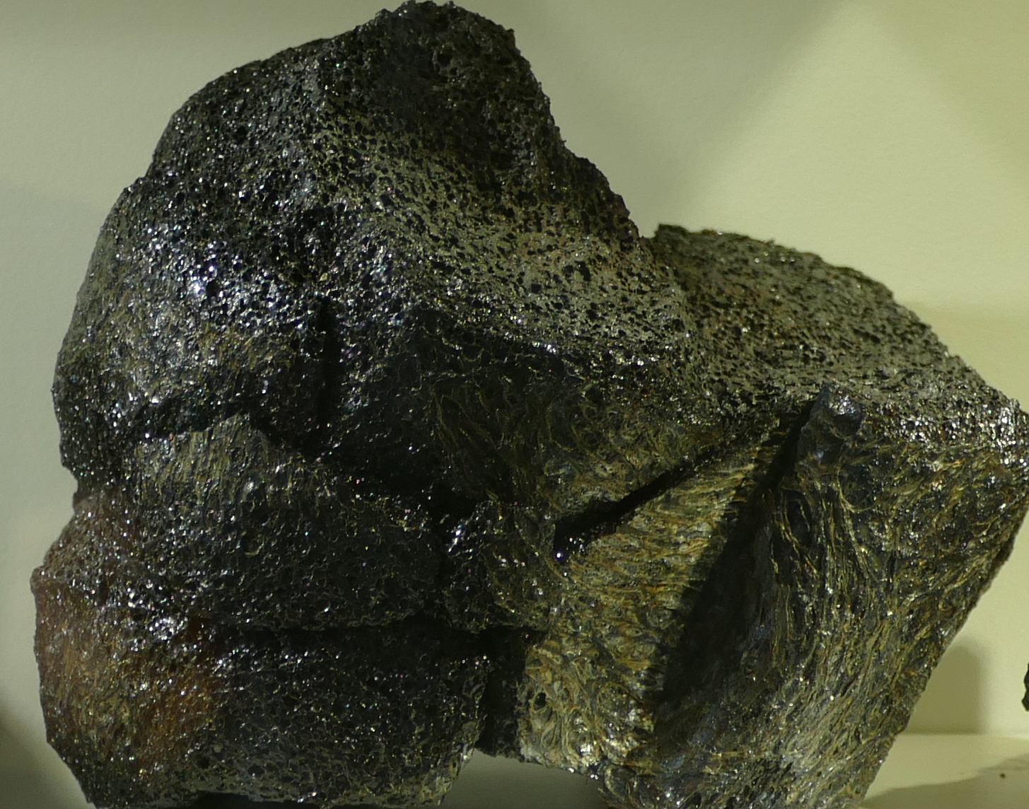
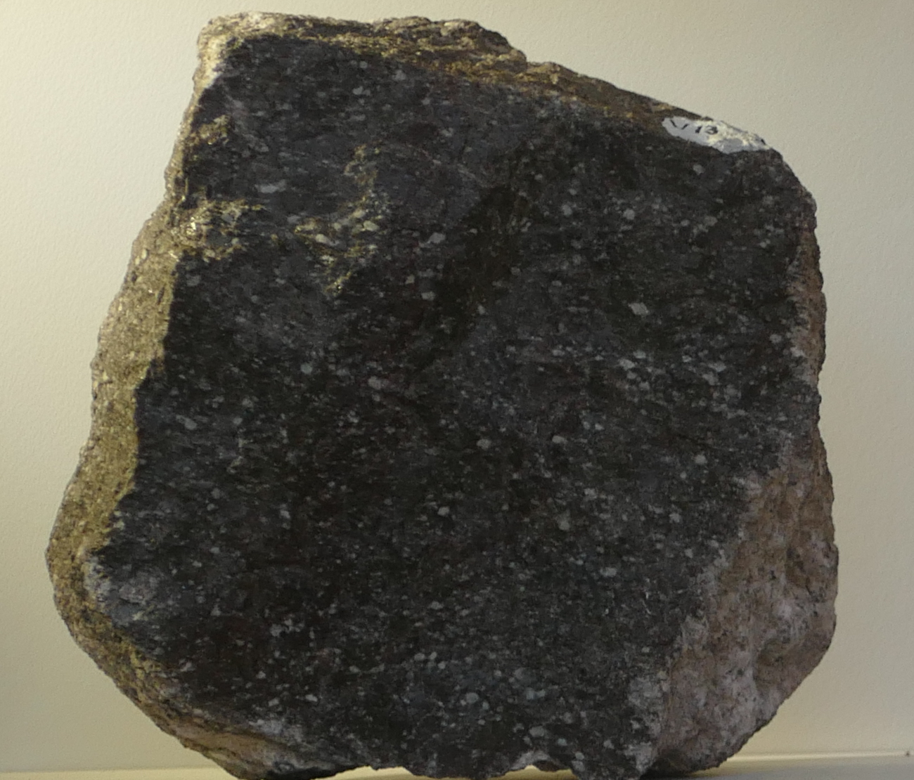
Basalt

Basalt. Photo by the author
The type specimen of volcanic rock is basalt. It is effectively mantle material, which was melted at the bottom of the crust, ejected from a convenient hole (also called a ‘volcano’), flowed downhill for a bit and solidified there. You are looking at displaced mantle material. Most of the ocean floor consists of this stuff. It is heavy because the mantle is made of denser material than the continental crust (if it weren’t, the crust would sink down like an overweight iceberg and continental existence would be short-lived). In practice, the density of basalt is close to 3000 kg per cubic meter. The continental crust is typically around 2700 kg per cubic meter.
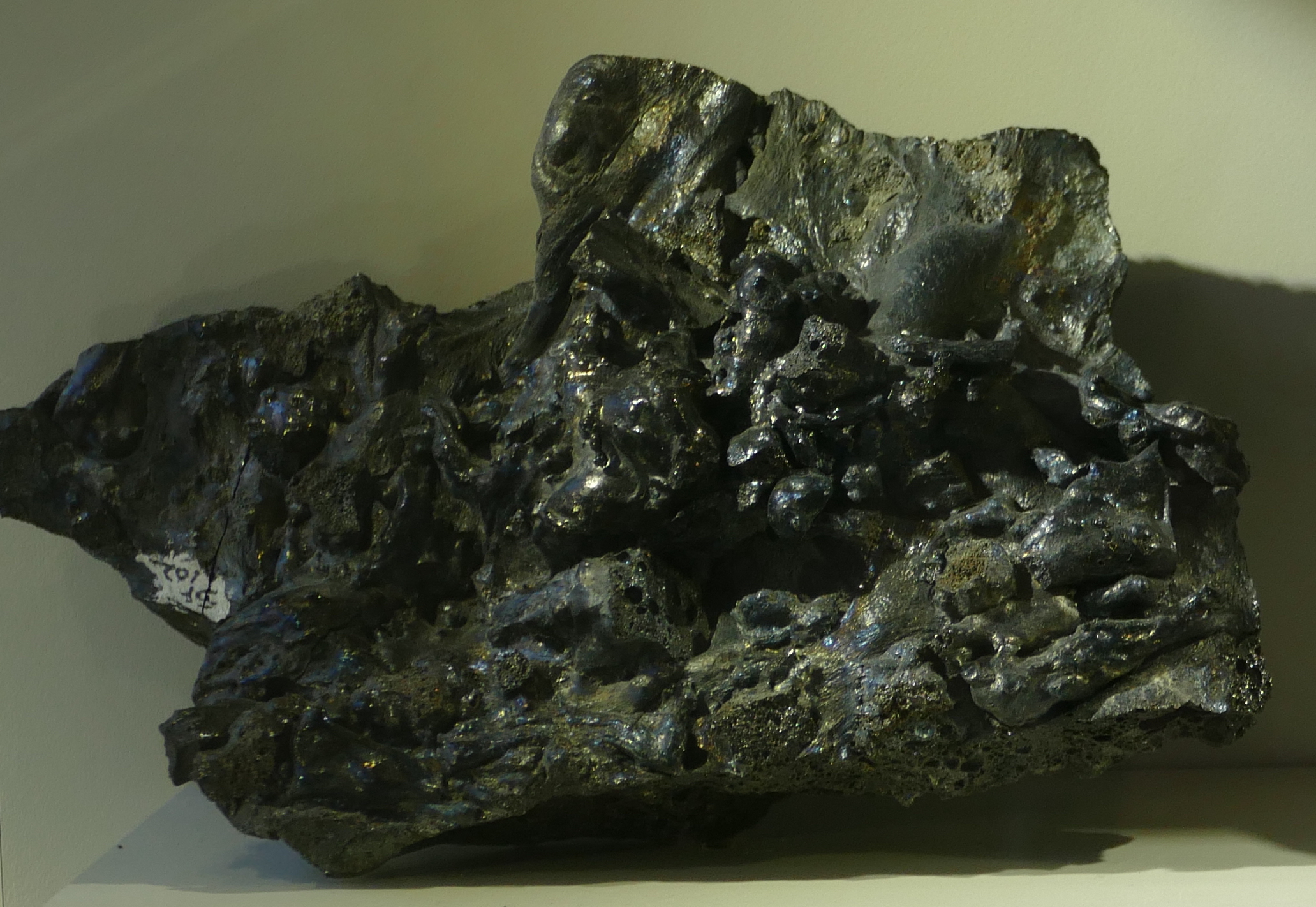
Basalt is the ultimate volcanic rock. Why doesn’t every old lava flow look like this? There are a number of reasons why not all lavas are the same.
1. Temperature and viscosity
The first effect is that of temperature and viscosity. I know, that is two, but they are closely related. Lava can be compared to honey. Warm honey flows easily, but put it in the fridge for a few minutes and it becomes much less keen to spread out, even though it is still a liquid. Honey is actually quite a complex substance, even though it is mainly just sugar dissolved in water. The melting temperature is around 45 C (depending on the sugar concentration): above that temperature, it does indeed behave like sugar water. Below that temperature, it should freeze but it doesn’t, at least not until the temperature goes down to about 5 C. In between, it is a super-saturated liquid, where there is more sugar dissolved in the water than fits. The excess sugar forms crystals and this turns the honey into a mush. As it cools, more and more crystals form and the honey becomes stickier and stickier. Finally, it freezes. (Strictly speaking it doesn’t fully freeze until it reaches -50 C, but below 5 C it is so sticky you hardly notice the difference.) Now turn the temperature back up – and nothing happens until you reach the melting temperature. Funny honey. (When we call a loved one ‘honey’ one does wonder which characteristic of honey is intended. This expression is definitely open to interpretation.)
The stickiness is also called ‘viscosity’. Higher viscosity means stickier, i.e. more reluctant to move.
So in what way is lava like honey? Should I call my loved one ‘lava’ or would that get my fingers burned? Well, lava is also a mix of substances, and these have different melting temperatures. As lava cools, some substance may come out of the liquid and crystallize. As more and more crystals form, the lava becomes less runny and more sticky. And this gives rise to the two Hawaiian words used to describe lava flows: Pahoehoe and A’a.
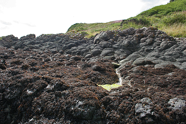
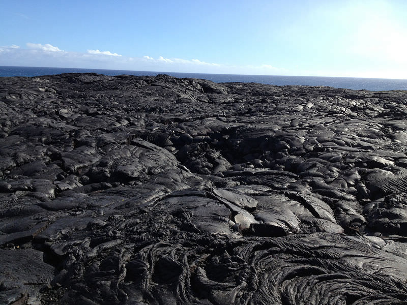
Pahoehoe
A’a.
Pahoehoe is the thinner, runnier lava that happily covers large distances and creates smooth lava flow which afterwards you can walk on. It is the hot honey.
A’a is the sticky lava that refuses to go anywhere fast. It forms very uneven surfaces and is a nightmare to walk on (even after it has cooled enough). Its surface will shred your shoes – this is the one place on earth where high heels may give an advantage. A’a is the honey that has been kept too cool and really would have needed a few seconds in the microwave.
In Puna, the early eruption brought up lava that had been in storage for decades – perhaps centuries. Even though it had stayed warm (a kilometre of rock insulates pretty well), it did not stay hot. This became the sticky stuff, with high viscosity; this explains why the initial eruptions did not produce much in terms of lava flows. It built walls – not roads. Later, the new lava arrived and this was much hotter. The hot, new, all-running and dancing low-viscosity lava ran like runny honey and in no time covered huge swathes of country side.
Even though both are basalt, the two behaved very differently. Poor Puna.
2. Composition
Let me divert for a minute. Lava contains a mix of elements. The main ones are iron, magnesium, silicon, and some other things such as aluminium (called aluminum in Trump land, a spelling that was in use in the UK very briefly but was introduced to the US through the Webster dictionary of 1812.) Each of these forms minerals (mainly oxides), and each mineral has a different melting point. Hot magma contains all these elements and their minerals, although not always in the same ratios. But keep magma for a while in a storage facility (also called a magma chamber) and it begins to cool – very slowly. The first minerals to hit their melting points are iron and magnesium oxides: they form crystals and drop out of the solution. Beforehand, the magma was called mafic (for magnesium (never to be called magnesum) and iron). Now that iron and magnesium are becoming depleted, it is called andesite – you may remember this word from Puna’s infamous fissure number 17.
Store the magma for even longer, and you are left with mainly silicates, mixed with a few other elements (aluminium, calcium, sodium). This is called felsic lava (the word ‘silicic’ is also used). Rhyolite and dacite are of this form. Dacite has made an appearance in the recent Puna stories, albeit only found in deep (geothermal) drilling and not on the surface.
You can expect that this will form a sequence in temperature: mafic lavas are hotter and thus less viscous, andesite is cooler and stickier, and felsic lavas are positively cold (as lavas go) and nearly immovable. And for the most part, you would be right. Mafic flows – felsic stalls.

Rhyolite

Andesite
There are a few exceptions: sometimes magmas form by melting rocks that themselves already lack certain elements. For instance, imagine a rhyolitic magma chamber solidifying into rock. Long after, heat finds its way to the rock and melts it: the new magma will have the composition of rhyolite, but it could well be much hotter than usual, and therefore far less viscous. You can now get a rhyolitic pahoehoe, and this is for instance found along the Snake River in Trump land.
(Hint: if you want to impress your friends, using the term rhyolitic pahoehoe in Puna will do wonders. But avoid saying the andesitic a’a of Haleakala which could leave the impression that you had a drink too many.)
Iron makes the world look black. That is true in lavas as well: mafic basalt is dark to black, while the andesite is greyer and the rhyolite is a bright lava. Of course, add oxygen and over time iron turns red, like the soils of Oklahoma.
I should point out here that the world of lava is simpler than it used to be. A few billion years ago, the mantle was hotter than it is now and therefore lava was considerably hotter as well. This gave a type of lava that is ultra-mafic, an extremely magnesium-rich, which is called komatiite. They don’t make it anymore.
3. Rate of cooling
So temperature is important. But how quickly the temperature goes down is also relevant. Lava rocks that solidify fast look very different from ones that cool only slowly. The rate of cooling has three different effects.
(i) Shape
The first of these makes sense: if the cooling is fast, the flow patterns become fixed in the material. The ultimate example is pillow lava: these are erupted under water, and in consequence cool very rapidly (in the battle between the mid-oceanic ridges and the ocean, the lava has yet to win. Luckily loosing builds character and pillow lavas do have that. Although one could argue that winning builds more character.)
Pillow lavas
Petrified lava ripples
On land, cooling is slower. Thin flows on the surface cool faster than thick ones. In the picture, the difference between the thin flow in the foreground and the thicker ones in the background is notable! The former solidified fast enough that the flow patterns froze in.

Pele’s hair
An extreme case is that of liquid droplets flying through the air. As they cool they solidify, and form long streamers. This creates the strangest rock of all, with the evocative name of Pele’s hair. You have to feel sorry for her hair dresser! What kind of comb would be needed? This lady is not for brushing! Pele’s hair can be found especially around lava fountains. But beware: the hair strands can be needle-sharp and should be handled only with thick gloves.
The strings come from wind acting on the flying droplets. If there is too little wind, you don’t get strings but tear-shaped droplets (very much like the shape of a drop of water falling from a leaky tap), about a centimetre across. These are called, not entirely surprisingly, Pele’s tears (although with the lady’s reputation, the need for tears seems minimal.)
(ii) Glass
So much for the first of the three effects. The second one is very different: this is when lava is cooled so quickly that it briefly forms a supercooled liquid, i.e. a liquid below its melting temperature. You can create this yourself by putting distilled water in the freezer. It will remain a liquid even though its temperature drops far below freezing. But disturb it ever so slightly, and it freezes over instantly. If you do this with molten rock, and let it suddenly solidify well below its melting temperature, it can create a glass. (The temperature below which this can happen is called the glass transition temperature, which is different for each material.) The trick is to make it solidify all at once, with as few separate crystals as possible.
An easier way to do this is by starting out with a lava which contains a bit of water. Water lowers the melting temperature, and so the lava can be cooler whilst still a liquid. Now evaporate the water (as can happen as the lava becomes exposed to air). Suddenly the melting temperature goes up, and the lava finds itself caught out, being a liquid well below its new melting temperature.
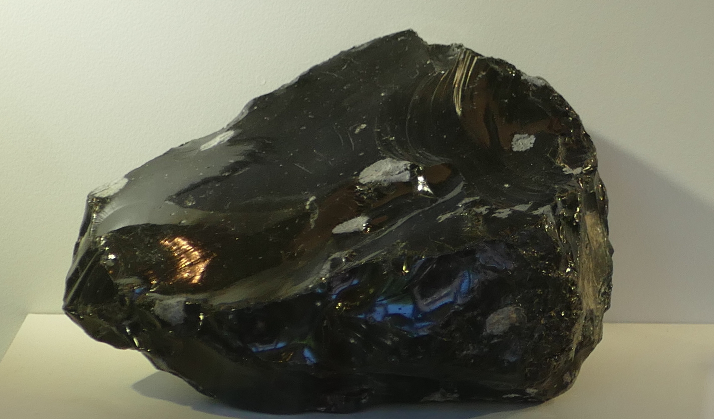
Obsidian
A well-known example of a rock that formed in this way is obsidian, a black rock of volcanic glass. It forms from silicate-rich melts, i.e. from rhyolites. Obsidian was sought-after in the stone age as it can be used for cutting (including the careless owner).
It should be harder to make a glass out of basalt, because it is hotter to begin with and readily forms crystals while cooling. But Hawaiian volcanoes manage it quite easily. Basaltic glass is called tachylite. It can be a thin edge on a crystallized lava flow, but on Hawaii it can form thick layers. And now you will not be surprised to know that Pele’s hair also consists of strands of this glass. Ouch again.
Perhaps the most dangerous of all is when lava meets the ocean. The instant cooling forms small particles of glass, and the rising steam carries them away. The white plumes of Puna, where the lava comes over the sea cliffs, are pretty only from a safe distance. There are several reasons why you shouldn’t breath in the stuff – the tiny glass particles among them.
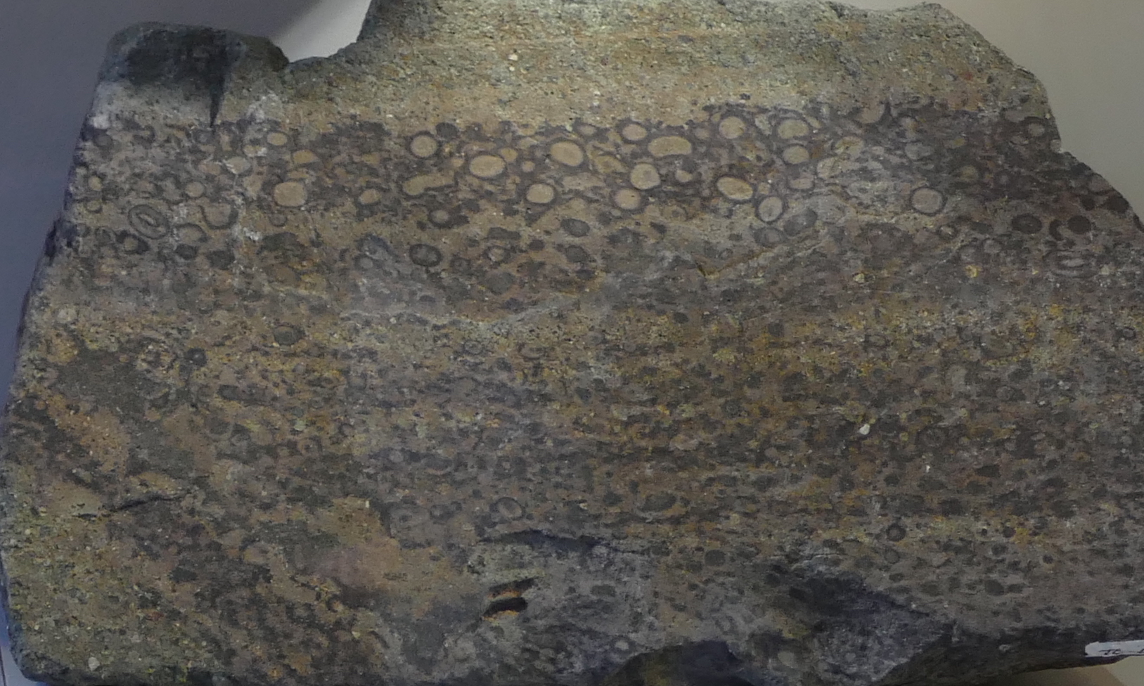
(iii) Crystals
The third effect is that of crystallization. As lava cools, crystals begin to form. The slower the cooling, the larger the crystals can become. These crystals (or their absence) are easily recognized by eye.
Compare the following wo rocks. Both are obsidian, and thus formed through rapid (instantaneous) cooling. The left one looks ‘normal’: a hard glass, albeit with a greenish tint. The one on the right contains a host of crystals, a feldspar to be precise. What happened? It spend some time cooling slowly, allowing the crystals to form, before it suddenly cooled very fast and let the remainder turn to glass. The texture shows that it cooled in two distinct phases, one slow, one fast.

Two types of obsidian, with and without crystals
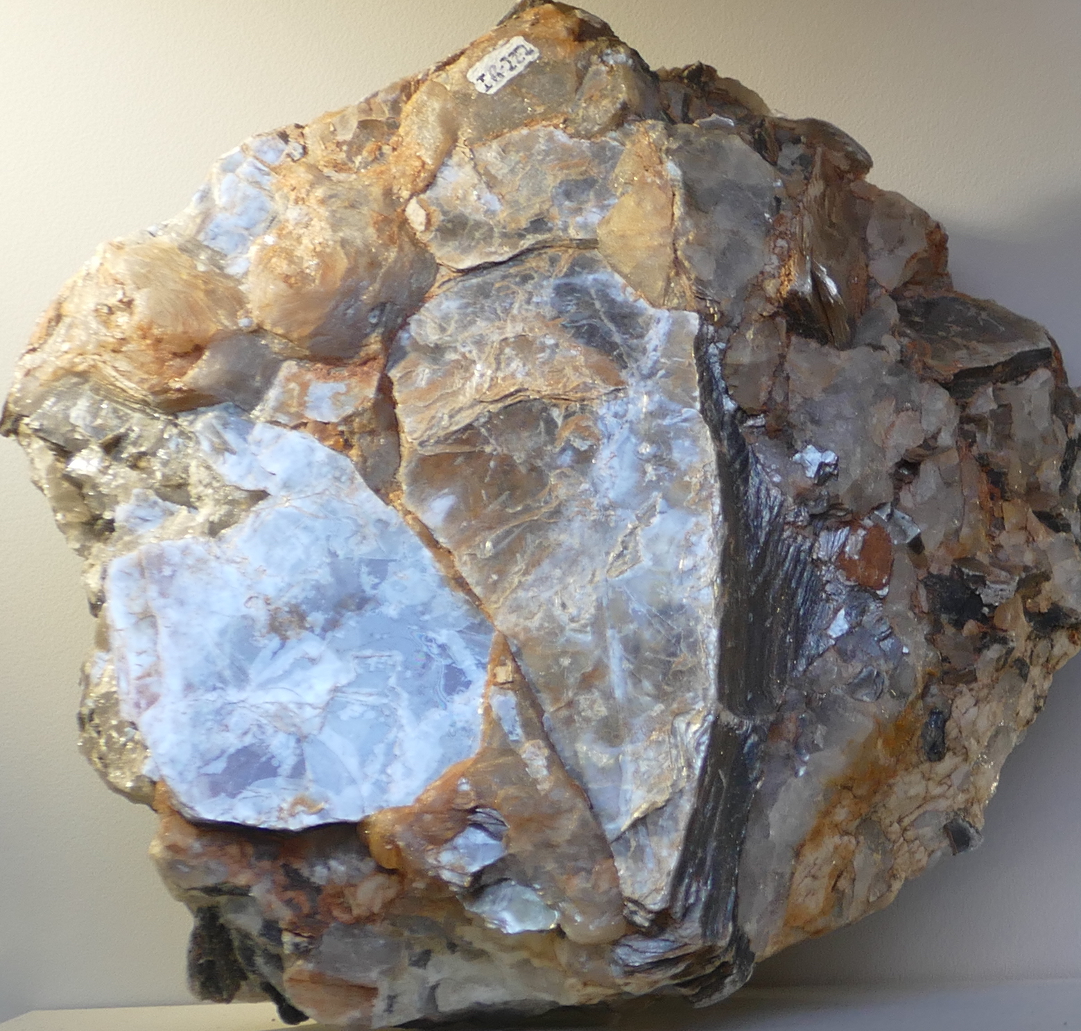
Pitchstone
The next one is pitchstone: also a rhyolitic glass, like obsidian, but containing a larger fraction of minute crystals. It gives the rock a dull appearance. The crystals are very small, and this shows that the initial cooling was fairly fast. Pitchstone contains a bit more water than normal obsidian, and so the rock has a lower melting temperature. The various minerals with the highest melting temperature had time to form small crystals before the remainder turned to glass.
Pegmatite
And finally the other extreme: this is a rock with enormous crystals which must have cooled very slowly. In fact this particular rock, a pegmatite, would have formed in the deep crust, where the cooling was so slow that the single crystal could take centuries to form, before the surrounding magma finally turned to stone.
Fragmentation
Now we know what volcanic rocks look like. But often, volcanic rocks look very different, striated or welded. They also come in a range of sizes, from the island-sized flows of Mauna Loa to the ash of Mount St Helens. What causes that difference?
Fragmentation of the lava comes mainly from explosions. Rock does not easily explode, of course: it lacks suitable chemistry, and lava is nowhere near hot enough to vaporize rock. The explosions come from trapped volatiles. Big explosions come from volatiles in magma which suddenly decide to become a gas, need a thousand time more volume for this, and end up blowing apart complete mountains. But it can also come from trapped vegetation underneath a lava flow, or even in one infamous incident, trapped snow. These kind of explosions produce flying lava bombs – the name is not entirely accurate, as the bombs are ejected by the explosion – they do not explode themselves.
The explosions produce fragments of a variety of sizes. They are distinguished by size.
Particles smaller than 2 mm are called ash.
Up to 6.5 cm it is lapilli.
Above that size it is a lava bomb.
All together it is called tephra.
Lava bombs of two different sizes
What goes up must come down – as true in volcanics as it is in politics. It is important to know that a lava bomb is made of lava – it will happily start a fire if it lands on flammable material; the danger is not just in being hit by a projectile with the size and speed of a cannon ball (although that is not entirely without danger either). They can be as large as 5 meters (although 20 centimeter is a more typical size, luckily), be ejected at a speed of 200 meters per second, and can travel considerable distances through the air: up to 5 kilometers. Lava bombs may also arrive as tachylite. Ouch!
Lapilli tuff
Smaller fragments travel further than large ones because they benefit from the lift from rising hot air of the eruption. These fragments also are much more voluminous, and the ash can cover large areas in a blanket that is centimeters to meters thick. It welds together, either through heat or over time. The welded layer is called tuff.
The name is not fully appropriate because it is the softest rock created by volcanic eruptions. The tuff can embed lapilli fragments and even lava bombs if not too far from the eruption site. Whereas the lava bombs have the composition of the lava, the tuff will often have a composition close to that of the mountain. If lava, it is often rhyolitic (because that explodes well). Tuff is often light coloured, and can be almost white. The best place to find tuff is in local buildings: it is everyone’s favourite building material. Although, be aware, if your local buildings use it, somewhere in the area is a mountain which made it, and which may have its own building demolition program.
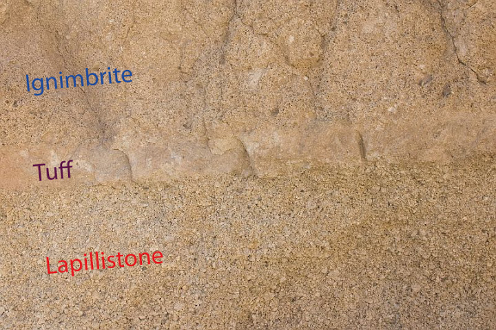
A tuff sandwich. Source: sandatlas.org
The tuff in this image is layered between lapilli (which falls first) and ignimbrite, which is debris from a pyroclastic flow. The tuff can be recognized by its smoother texture.
Gas content
The final piece of the puzzle is the gas content of the erupted lava. If the gas content is high, the lava becomes frothy, and when it solidifies it has lots of holes, like a swiss cheese. There can be so many holes that the rock weighs less than water, and floats: this is called pumice, and it forms especially well after an underwater eruption where the water provides more gas than the lava can cope with. The sea can become covered by rafts of pumice kilometres wide: after Krakatoa, they made local sea travel almost impossible for months.
A floating island of pumice

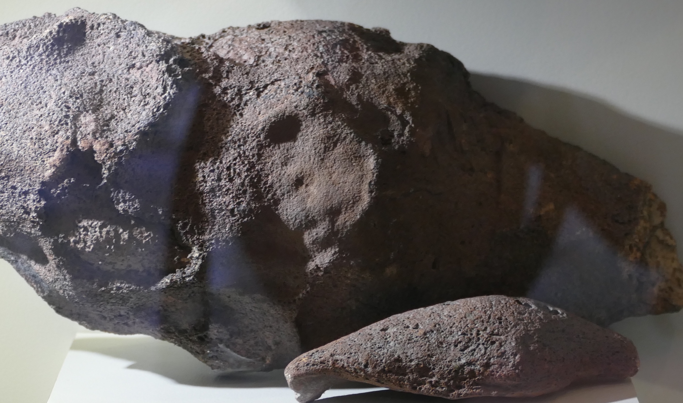
Scoria. Source: wikpedia (Jonathan Zander)
If the stone has lots of holes but not enough to float it is called scoria or cinder (the two words are interchangeable; ‘cinder’ is older). This is where Cinderella got her name from. (No, I don’t know either. And nowadays she would be called Scorella.) These form especially during volcanic explosions as the gas-rich lava is shot out from the vent.
Amygdale
But gas bubbles can also form underground, and leave magma that solidified under ground with holes. Over time, the holes may become filled with water and the water can deposit new minerals, often a calcite. These rocks are called amygdales.
But it can get even better. The rocks can have very large holes inside, and over time, anything can happen in those holes. Open the rock and you may have the surprise of a life time, with wondrous crystals and colours. Here is an example, an oversized amethyst. What causes the different colours? That, my dear Watson, is elementary. But the science of volcanic gems is a different topic – a different post, perhaps.

An oversized amethyst
Albert, May 2018


Elaborating on the last post I made in the previous post (but couldn’t post because a new post is up)
this article or paper goes more in detail about the 1108-1113 events
https://www.nature.com/articles/s41598-020-63339-3/
Scenario 1: (1) a tropical eruption in 1108 CE, responsible for the sulfur deposits in Antarctica in 1109 CE and contributing to the broader signal (1108–1113 CE) seen in the Greenland records, together with (2) an almost synchronous high latitude NH eruption (potentially of Asama in Japan in August-October 1108 CE, see below for details), and (3) a further high-latitude NH eruption in late 1109 or early 1110 CE.
In this scenario (1) could be Hunga Tonga – https://eos.org/science-updates/new-volcanic-island-unveils-explosive-past (2) is Asama and (3) could be Hekla.
The unfiltered reconstruction (Fig. [URL=’https://www.nature.com/articles/s41598-020-63339-3#Fig2′]2a[/URL]; Material and Methods) identified 1109 CE as experiencing one of the most extreme NH summer coolings of the last ~1500 years (rank 6) with temperatures of −1.3 °C relative to the 1961–1990 reference period.
Diverse societal impacts and responses to these weather conditions are revealed by our sources, starting in 1109 CE. In France, Belgium and England, persistent wet summer and autumn weather reduced crop yields in this year.
-> I also have the first part of a book series written by Jan Buisman who does research on reconstructing the climate and notable weather events and it covers this era. Shortly said the book suggests or gives evidence based on written sources at the time and applying scientific checking of validity on sources that the summers of 1109 and 1110 were cool & wet in the low countries and surroundings, while the winter of 1110-1111 is said to be the first severe one of the century.
My post seem to not get posted….
I will try again. This article goes in more detail about the events of 1108-1113
https://www.nature.com/articles/s41598-020-63339-3/
Scenario 1: (1) a tropical eruption in 1108 CE, responsible for the sulfur deposits in Antarctica in 1109 CE and contributing to the broader signal (1108–1113 CE) seen in the Greenland records, together with (2) an almost synchronous high latitude NH eruption (potentially of Asama in Japan in August-October 1108 CE, see below for details), and (3) a further high-latitude NH eruption in late 1109 or early 1110 CE.
(1) could be Hunga Tonga based on this article https://eos.org/science-updates/new-volcanic-island-unveils-explosive-past (2) is Asama and (3) could be Hekla
The unfiltered reconstruction; Material and Methods) identified 1109 CE as experiencing one of the most extreme NH summer coolings of the last ~1500 years (rank 6) with temperatures of −1.3 °C relative to the 1961–1990 reference period.
Diverse societal impacts and responses to these weather conditions are revealed by our sources, starting in 1109 CE. In France, Belgium and England, persistent wet summer and autumn weather reduced crop yields in this year.
-> I also have a book written by Jan Buisman that goes in detail about the climate and weather events in the low countries. The writer does a lot of good research and checking sources for validity and consistency in trying to reconstruct that. I only have part I but it covers this time period. Shortly said, the summer of 1109 and 1110 are definitely too cool and wet for the low countries and surroundings according to multiple sources of the time (France, UK, Germany), while the winter of 1110-1111 is said to be the first severe one of the century.
Found in the spam. Not sure why it was put there. It can sometimes be due to a time-out, with comments in too quick successions. Guessing.
It happens when there are to many URLs or a broken URL.
Basalt is the most common extrusive Igenous rock
While Nephelinite and Melinilites are the least common
This is the video of yesterday’s eruption just to clarify, don’t confuse it with the eruption of this morning in UTC time
Posted this on the last article just before.
It is a map I made of the Hunga Tonga, showing where most recent eruptions were.
https://imgur.com/a/ZdVbyM9
The yellow octagon is about the size of a crater with a radius of 1 km. It was said before that the resulting crater would need to be at least 1 km wide to be a VEI 5, though a VEI 6 would need to be a 3 km wide crater. So this would reflect a sizable 5, be about 2 km3 of material blasted out. It looks like it would take something way bigger to completely destroy all of the island, would need to be a crater of at least 6 km diameter to encompass all of the above sea level parts, which would take over 50 km3 of material to be ejected and make it a VEI 7.
I think this is simplifying too much because eruptions are not really only explosions for the most part but still, point is the majority of the island is still going to be there. However, it is likely most of the tuff cone that was made over the last month has been destroyed along with half of the 2015 cone and maybe a bit of the northeast island.
Lots of clickbait videos now in Youtube. However, this channel seems to have more authentic videos, from right there in Tonga: https://www.youtube.com/channel/UC3ZsGc03qaeZNK4HzouPpng
Also which volcanoes in Snake River plain erupted rhyolite pahoehoe? I thought all of the rhyolite was from the old calderas, the recent lava is all tholeiitic basalt.
The calderas are buried by later mafic Pahoehoe eruptions, indeed pahoehoe tumuli everywhere there
Dragons remove this comment and name: wrote my gmail again in wrong field … 🤣
The calderas are buried by later mafic Pahoehoe eruptions, indeed pahoehoe tumuli everywhere there
But there was specific mention of rhyolitic pahoehoe, which I would think means surface flows somewhere that are rhyolite composition but have pahoehoe texture. I have also seen this mentioned in other places too but never with a source.
Ryholitic low viscosity Pahoehoe???
Then that Ryholite been heated to well over 1200 C to breakdown the stiff sillica chain polymerisation
A ryholite at 1750 C in an experiment furnace woud be white hot and flow very very easly I guess
It seems like our Dungeon Gobblin have gone bonkers.
If you end up in the dungeon just munch on the cookies provided and one of us will release your comment soon.
Found a place to monitor the Hunga ash cloud. I like the infrared and dust RGB bands:
https://www.data.jma.go.jp/mscweb/data/himawari/sat_img.php?area=pi4
According to VolcanoDiscovery the plume height is 17 kilometres. Looking at the Himawari satellite it looks like the eruption lasts 5 hours, although the strongest part of the eruption occurs within 2 hours. It was a very intense eruption but certainly is nowhere near VEI 6. Large phreatomagmatic blasts must have generated shockwaves and base surges. Probably a VEI 4 I’d say, a VEI 5 at most.
https://www.volcanodiscovery.com/hunga-tonga-hunga-haapai/news/170502/Hunga-Tonga-Hunga-Ha-apai-volcano-Tonga-major-eruption-sent-ash-up-to-17-km-86-000-lightnings-in-plu.html
Probaly a very intense large VEI 3
Sorry I was wrong, the 17 km height is for yesterdays eruption, this one must have reached much higher. So more chances of making it into VEI 5.
By the way the eruption yesterday looks like a nuke:
Does not have to be a VEI 5
Coud be a large But extremely intense VEI 4 or smaller
A two week long VEI 6 looks very diffirent than a VEI 6 that last just 10 minutes..
Taupo Hatepe eruption did 30km3 in two minutes! VEI is a volume and not intensely
But is meant to be used on fast short eruptions like Kelut 2014
The new Wellington VAAC talks about ash cloud up to FL630 (but maybe higher as FL630 seems to be the max for aviation), has issued aviation colour red and talks about continuous large eruption
http://vaac.metservice.com/dynamic/vaa/243040_2022_21.txt
That would be 19,2 km height, but I think we need to find (or wait for) satellitedata – like from Himawari-8 – showing top ash/dust height of todays plume.
In an article in Tonga (Tongan? Tongish? Tonganse?) news yesterday the data from Himawara-8 showed max. height of 18-20 km though most of the plume reached 16-18 km. So volcanodiscovery seems conservative (again, I saw this with La Sufriere) on stating “ash up to 55,000 ft (17,000 m) altitude” about yesterdays eruption when satellitedata shows a portion of the ash/dust went up to 18-20 km. Up to is up to right?
See down in the article here: https://matangitonga.to/2022/01/14/marine-tsunami-warning_tonga
To Hèctor Sacristàn: When I run a 12h loop in night microphysics RGB from your link above I can clearly see the shockwave from the intitial blast in the morning (06:50 UTC). But at 11:10 UTC there seems to be a second one developing(?) Or is it just a strange outward disburstion?
https://www.data.jma.go.jp/mscweb/data/himawari/sat_img.php?area=pi4
They just quote VAAC Wellington
Japan issues tsunami warning for Amami and Tokara islands, tsunami advisory for entire east coast
They talk about an earthquake in the South Pacific of unknown size around 13:10 ? So this is a different event than the Tonga eruption?
Waves up to 2-3 metres expected they say
There was only a minor tsunami warning here in Australia (still the first legit one where I live since 2010 Chile earthquake if I recall correctly), the blast must have been directed if they are expecting something of multiple meter scale in Alaska and Japan.
Really I am surprised the waves are that big anywhere, maybe the eruption was actually not where the eruptions in December were, but on the north coast, next to deeper water.
Hunga Tonga produced a 7.4 according to the Daily Mail. (source: https://www.dailymail.co.uk/news/article-10405447/Tonga-issues-tsunami-warning-undersea-volcano-erupts-Pacific.html).
I cannot find find the earthquake on EMSC or USGS at the moment to confirm.
That’s the Daily Fail. They are good at getting photographs of things but not that good at reporting the news accurately.
There are tsunami warnings along the west coast from the Aleutians to San Diego. This includes the BC coast of Canada.
https://www.tsunami.gov/
There was only a minor tsunami warning here in Australia, the blast must have been directed if they are expecting something that big in Alaska and Japan.
Posted this twice oops
To get some clarity when this happened:
“The volcano had been active from 20 December 2021 but was declared dormant on 11 January.
Hunga-Tonga-Hunga-Ha’apai underwater volcano on January 15, 2022Hunga-Tonga-Hunga-Ha’apai underwater volcano on January 15, 2022 Photo: Tonga Geological Services
The head of Tonga Geological Services, Taaniela Kula, told RNZ Pacific that at 4am on Friday 15 January, an eruption was picked up on satellite.
Kula said the eruption on Friday was almost seven times bigger than the one on 20 December, bigger in terms of the radius of the plume that was scattered from the volcano, up to 250km away from the volcano radius.
Tonga: Tsunami warning lifted but volcano still monitored”.
4 a.m. on Friday 15th has s.th. wrong to start with, as Friday was the 14th, also in Tonga. It was 4 o’clock in the morning, Friday just starting, 8 pm (still 14th) in Europe, Friday night, Carl stitching, the rest of the Western world saying TGIF. Saturday 15th, morning: Volcanologists and media people Europe realize that s.th. has been going on there in the middle of their night, America might have realized before. There it was daytime, Friday 14th while we were sleeping, Tallis was working he wrote.
So all the videos done there on Friday the 14th are made while we slept into the 15th and all show two parts of an island and an explosion in the middle and documented it more or less, soon after the eruption started. Sunrise is around 6 local time.
NZ and Aussie news would have had the 15th as a date or written s.th. about local times.
Tonga longitude: 175.1982° W
link forgotten: https://www.youtube.com/watch?v=EwmfP0bxkB4
text under the video
For me it was extremely confusing, i was watching Geology’s hub link of yesterday while it happened, so initially i confused the two and than i saw that a much larger explosion happened because of the satellite images (that were much more recent) than the video of Geology Hub (this morning). Eruption was probably around 4AM UTC (which is around london time), here it was early morning in Europe, but it was late afternoon in Tonga – 15 december. Soon sun will rise up again.
It is always confusing around the date line, and some media are careless with that.
It happened nearly 22 hours ago, and it was Friday, the 14th of January, 4 am in the morning local time.
No it did happen in late afternoon local time, and around 12-15 hours ago. Quite sure about that.
Right. It was probably 4.10h GMT, that makes it easy, time from a decent British paper. That would be in the afternoon on Tonga. It would be 5.10h local time.
Being on EST in the States, I have to bear in mind that my Aussie mates are in summer and their are clocks are one hourc ahead of their usual time differences being in WA and VIC.
THe tusnami hit Hawaii with surges to 2.7’…originally they posted a no-chance advisory then had to scramble when the field reports started coming in. showing a much-more enrgetic wave(s).
Tsunami impact (if any) is imminent near San Francisco.
* California
Fort Bragg 0735 PST Jan 15
Monterey 0735 PST Jan 15
Port San Luis 0740 PST Jan 15
Santa Barbara 0745 PST Jan 15
La Jolla 0750 PST Jan 15
Los Angeles Harb 0750 PST Jan 15
Newport Beach 0755 PST Jan 15
Oceanside 0755 PST Jan 15
Crescent City 0800 PST Jan 15
San Francisco 0810 PST Jan 15
https://twitter.com/WeatherNation/status/1482382065177751555?cxt=HHwWhsCjhcyovZIpAAAA
Here’s another view of the #Tonga eruption from last night. Early estimates put the height of the ash plume to over 18 miles, reaching into the stratosphere!
The shockwave was recorded over 4000 miles away in Perth, Australia as a small pressure jump hours after the eruption.
I’ve seen that number throughout the day. Wo. verification. ~30 km plumeheight. And now unverified info on an associated 7,4 EQ in the location.
With that in mind (unverified) coupled with the tsunami (now on western US coast), the soundwave, the pressurechange (wave) registered in Perth, aso. Could a VEI5 do all that? And is it safe to say that “throwing it” as a VEI5 wo. even pictures of the location – or what is left of it – is a huge bit premature? As someone apparently already has….
https://en.wikipedia.org/wiki/List_of_large_volcanic_eruptions_in_the_21st_century
I do not care if it is a 5 or a 6, but at least collect all the data to support “calling” it first. Right?
Yes I guess we won’t really know until there is a volume estimate. That will be a bit complicated though being an eruption in the middle of the ocean. It will be easy to know the DRE volume if it has caldera collapsed. However if not I don’t know how we are going to know.
Lots of good graphics and images in that thread. Thanks.
This is impressive:
https://twitter.com/weatherdak/status/1482245594475155464
https://twitter.com/NWSBayArea/status/1482385582789578756
Picture comparing PInatubo’s cloud with Tonga’s. Pinatubo’s umbrella cloud is partially enveloped by a typhoon.
Multiple reports of #HungaTonga volcanic explosion(s) being heard this morning…in Alaska.
Distance from Hunga Tonga to Anchorage is 5824 statute miles (9373 km).
From NWS Anchorage Facebook feed…
https://twitter.com/SkyPixWeather/status/1482378919701618689
Nowhere in the sounding is there a reading of less than ~ -85 C. Does this mean the plume temporarily reached the mesosphere? Not quite sure how to interpret this. Either way, easily the most energetic eruption since Pinatubo in 1991. An additional note…
https://twitter.com/UpdraftwMax/status/1482351582809255937
https://twitter.com/BNONews/status/1482389879304642565
WATCH: Tsunami from Tonga volcano eruption starting to cause minor flooding in Santa Cruz, California
Tsunami on Port San Luis, CA tide gauge. Water height changed 1.5 ft in just over 5 minutes.
This picture looks kind of ominous but where is it from? (and especially what time). Source was Facebook group but couldn’t find the picture (The Pacific Newsroom Group)
Saw the same image yesterday. Probably from the first big eruption on the 14th. Some people mentioned red skies in Tonga yesterday.
Just sunset through ash
Hunga Hapai wont produce any glowing materials being a pheratoplinian eruption
There are a couple of pictures from the sunset after the first (14.01.22) eruption in this article;
https://matangitonga.to/2022/01/15/tongan-geologists-stunning-Jan14eruptions
More yellow/orange.
TSUNAMI MESSAGE NUMBER 7
NWS PACIFIC TSUNAMI WARNING CENTER HONOLULU HI
640 AM HST SAT JAN 15 2022
MEASUREMENTS OR REPORTS OF TSUNAMI WAVE ACTIVITY
TSUNAMI WAVE OSCILLATIONS ACROSS THE STATE OF HAWAII CONTINUE
TO DIMINISH BUT ARE NOT YET ALL BELOW TSUNAMI ADVISORY LEVEL.
THE FOLLOWING LIST PROVIDES MAXIMUM TSUNAMI AMPLITUDES SO FAR
ON GAUGES ACROSS THE ENTIRE PACIFIC.
GAUGE LOCATION LAT LON TIME AMPL PER
——————- —– —— —– ————— —–
CHICHIJIMA JP 27.1N 142.2E 1344Z 0.74M / 2.4FT 14MIN
VODOPADNAYA RU 51.7N 158.0E 1434Z 0.45M / 1.5FT 12MIN
KUSHIRO JP 43.0N 144.4E 1411Z 0.40M / 1.3FT 42MIN
TOSASHIMIZU SHIKOKU 32.8N 133.0E 1537Z 0.93M / 3.0FT 30MIN
OMAEZAKI HONSHU JP 34.6N 138.2E 1526Z 0.71M / 2.3FT 22MIN
https://twitter.com/TimCatteraPhoto/status/1482396514504691713
Another huge surge in the back harbor. Bigger than the first one. #santacruz
It must have been quite scary in Tongatapu Island with 75,000 inhabitants and 70 km from Hunga Tonga. Thankfully there aren’t any reports of death or destruction as far as I could see, so it seems the distance was enough to keep them safe.
“It was massive, the ground shook, our house was shaking. It came in waves. My younger brother thought bombs were exploding nearby,”
https://www.france24.com/en/live-news/20220115-tongans-flee-tsunami-following-powerful-volcanic-eruption
Wow!!! Thats one insane explosion looks like the biggest nuclear water test ever. This is more intense than Grimsvötn 2011 thats for soure. I wonder the cubic meters a second for todays eruption, Any estimates for cubic meters a second?
Yet .. its so tiny compared to other earlier prehistoric eruptions and the Chicxulub impact
Of course it is tinier than the Chixculub impact. If this was the Chixculub impact, a quarter of the world would be dead by now.
First sentence – looks like it, indeed.
Want a beach towel?
https://fineartamerica.com/featured/underground-atomic-bomb-test-los-alamos-national-laboratory.html?product=beach-towel
That’s one big scary cloud.
USGS estimates a M 5.8 volcanic eruption. I guess that is the seismic energy produced by the eruption.
“The magnitude of this event is calculated using techniques calibrated for earthquakes. The current magnitude is only a preliminary estimate for this volcanic event.”
https://earthquake.usgs.gov/earthquakes/eventpage/us7000gc8r/executive
M 5.8 Volcanic Eruption – 68 km NNW of Nuku‘alofa, Tonga
Based on the testimonies in the article from France24 and own experience this estimate seems low.
We had a 6.3 EQ outside of Mytilini, Greece apx 70 km from where we are/were then (2017) and did not feel it very much. Not at all like “ground/house shaking”.
Then there was a 7.0 EQ close to Samos last year – also apx. 70 km. from here – and that shook up the area with minor damage. Obvious damage to some uninhibited old stonehouses already on their way down due to zero maintenance since mid last-century. A 5.8 EQ 70 km away to do that shaking? Seems it might have been stronger. No expert though.
https://twitter.com/ChurchillWx/status/1482270572448862210
Plot of cloud-to-ground (CG) return strokes also quite stunning.. 15 min values peaked at just above 63,000 strikes
It is not so much the amount of material erupted as the size of the explosion
And resulting Shockwave
This seems like the 1883 krakatoa eruption
https://twitter.com/JoLatuSanft/status/1482337942945558536
View from NZ High Commission in #Tonga where people ran for shelter (it’s on a hill). Waves submerged the main road & Patangata, the poorest community on the island, totally flooded… most are struggling families from outer islands. Where will the go? #tongatsunami #TongaVolcano
USGS earthquake site shows Hunga Tonga M5.8 volcanic eruption at 2022-01-15 04:14:45 (UTC).
Oops, I see that Hector has already noted this while I was briefly away from this site.
Weird that the nearby islands had a relatively minor tsunami but there’s now tsunami watches in Japan and the US. Unfortunately there is no live or up to date info on what is currently happening at the volcano but I’d imagine repeated collapse of the column would cause this? Seems to happen in pulses also. Clearly the eruption is not yet over.
It was probably the pressure waves travelling through the globe that generated the tsunami.
Tsunami arriving to Japan
https://twitter.com/ritakhoury10/status/1482411814394683405
And some people thought that volcanic eruptions could produce long distance tsunamis.
Atmospheric pressure waves reached AZ, UT, ND and FL.
Also central part of the volcano was missing 2 hours before the eruption due to explosions of 14 january
This is over or it’s not possible to know yet?
I’m not an expert but I think Carl is right about this one. It might not be the same size of Krakatoa eruption, but it might have been a Krakatoa-style eruption. If the cone was blown apart, seawater probably leaked or entered the magma chamber, causing an explosive reaction.
Then it’s over?
So the cone blew up during the eruptive event of January 14? The one that was reported in Volcano Discovery:
https://www.volcanodiscovery.com/hunga-tonga-hunga-haapai/news/170502/Hunga-Tonga-Hunga-Ha-apai-volcano-Tonga-major-eruption-sent-ash-up-to-17-km-86-000-lightnings-in-plu.html
Yes
I guess now we are back to having 2 islands, Hunga Tonga and Hunga Haapai. What was done has been undone.
Or no island at all
Well there were 2 islands before the great explosion, there could be 0 now or several more either by the two being split up or by deposits on the caldera rim forming islands (Krakatoa for instance formed several temporarily islands).
In Oregon…
https://twitter.com/tiggirltk/status/1482406908275216385
In California…
https://twitter.com/VGuzman_TV/status/1482413117216677889
Looks like the eruption consisted of two pulses with gradual waxing and then waning punctuated by a few brief powerful explosions. As a whole taking place mostly within 2 hours:
https://twitter.com/CriticalStress_/status/1482261243918708736
I’m sure the infrasound could be used to estimate the eruption rates or the energy released by the eruption, but that is beyond my skills.
Perhaps after the WE, those who monitor atmospheric atomic tests will calculate the power of the explosion in MT.
https://twitter.com/jsunbury/status/1482419769102020614
This says 15-20 MT bomb
Effect seems bigger than that
50MT?
Thats 40% of the Tsar Bomba blast in energy
Eruption seen in a barometer from Fiji. Looks like it took something like 20-30 minutes for the pressure waves to reach this location. The hour is UTC. There was also a brief small eruption 3 hours after the end of the largest eruption, at about 9 UTC.
Iwate Perfecture tsunami waves up to 9 feet expected!
https://twitter.com/DavidHeckard/status/1482420197071986690
#Tsunami Advisory continues for west coast of US/CA and south coast of AK.
A tsunami is occurring and a wave of 1-3 feet is possible along the west coast next few hrs.
This is from an underwater volcanic eruption near #Tonga in the S. Pacific.
Jesper will like this:
From: https://matangitonga.to/2022/01/15/tongan-geologists-stunning-Jan14eruptions
From Journal:
The Hunga eruption began early on Jan.14 between 4:20-4:30am local time and was captured by weather satellites.
So went on all day, that’s why the scientists were out there at all, and might have gained steam in the afternoon. The pictures were done in the late afternoon of Jan 14th at least.
Seems there is more left than before 2015:
https://time.com/3743905/volcano-eruption-new-island/
Diptych inside, first picture
Do we know if the scientists on the boat are safe?
https://www.facebook.com/tongageologicalservice
@NWSBayArea
Here are some of the tidal gauges from across the region. Several tsunami surges have occurred already this morning, and we are not done yet. Stay away from the coast today. #CAwx
Pressure waves hitting Europe, currently England (maybe further even). When it reaches Algeria, it would have travelled around the world at least once.
Both Sweden and Finland have measured the pressure wave.
As such this is the largest explosion recorded in intrumented times.
For reference, the tzar bomba did not travel the globe.
With that number we can safely say that it is a large scale VEI-5 or bigger.
I also noticed above that people seem to have mistaken old columnal heights from yesterdays eruption for today.
Himawara gives this as 32km altitude.
At least we can safely say that this is the largest eruption since Cierro Hudson, or even Pinatubo.
It is here good to remember that we have not seen any VEI-5 eruptions or larger since 1991.
Hudson is probably the right comparison on size, although a very different volcano
It is hard to compare different styles of eruptions.
But, judging from the atmospheric pressure wave data we are pushing something like 55-60MT as a comparison. I am comparing this to recorded data from the Tzar Bomba.
Heck of a blast.
Sounds right
I don’t think there was this effect from the bikini atoll blast?
Heck their is a tsunami effect around the pacific rim
That is a lot of energy
The pulse from.the blast clearly visible on satellite imagery
Certainly the largest for explosive effect
Pinatubo was sheer volume of material
Could this be a glimpse of how a super eruption could go?
Could this potentially go there?
It is giving a picture for the pressure, but not for ash or other parts.
The volume is probably not more than 5km3, but the pressure wave was oversized.
No, this was it.
Which suggest the actual explosion was under water. The picture of the central part of the island already missing before the eruption suggests the large boom was in that central location. Water does funny things with pressure waves
I agree.
It was bigger in volume yes, but it was amplified by the water.
It was though a lot of water that was transformed into supercritical fluids (very briefly), and that then exploded.
I have to say I think that is a rather large overestimation of the size…
Hardly, we can calculate the energy release now that we have pressure data.
But that doesn’t necessarily mean large volume… and also 32km – are you sure?
Yes.
Himawara satelite data.
Consider me highly sceptical.
Consider you wrong.
The pressure wave just passed through the Netherlands.
 ?fbclid=IwAR0iPHoMPqN6Md1ZOUlxoLenZ7tqLD7XmK_Efcr-XxlTGld9ANSecawvPhU
Easily seen as well across the UK on Wunderground stations
This from someone’s garden in Scotland for example.
Didn’t the pressure wave from Krakatoa travel a few times around the globe? I mean, if it did that, we must have meassured it somehow with instruments, thus also making that in instrumented times.
Or have I just mistaken/missunderestood something?
Many of the figures from Krakatau is anecdotal.
You could not measure that exactly back then.
And the 180dB at 100 miles away is also garbage, there are no reports about loads of permanently deaf people afterwards.
Gotcha, thanks for the explanation.
The were already barometers back when Krakatau happened, so it is not just anecdotal, it was really measured.
That is correct. The pressure wave of Krakatoa passed Europe and the US seven times, based on accurate measurements. We may see this wave a second time but probably not. This eruption may have been borderline VEI 6, but it was not a Krakatoa
Yes there was.
But those where not accurate, nor sensitive enough to measure it.
We are talking about 150 years ago after all.
Prithee tell me where that data is recorded?
And on what specific instrument.
The instruments back then would have been lucky to record it even the first round.
As far as I know it is a calculated estimate from a weather station that was comparatively nearby. I think it was in Australia and Borneo, and then they extrapolated later on.
I don’t know the details, but it is reported in many scientific publications:
“The atmospheric shock wave traveled around the world seven
times (Symons, 1888; Simkin and Fiske, 1983; Bryant, 2001). Barometers in Europe and the United States measured significant oscillations in pressure over nine days following the blast”
https://www.researchgate.net/profile/Efim-Pelinovsky/publication/226036594_Analysis_of_Tide-Gauge_Records_of_the_1883_Krakatau_Tsunami/links/5ee7453f299bf1faac55f51b/Analysis-of-Tide-Gauge-Records-of-the-1883-Krakatau-Tsunami.pdf
The Eruption of Krakatoa and Subsequent Phenomena – 1888 pages 58-61 gives a list of stations, equipment and period of time the pressure data covers as was presented to the Krakatoa Committee of The Royal Society. Some of the data had been traced from the original recordings, but with equipment like the Kew pattern photo-barographs they appear to have had the actual records…
Also found images in this 1883 presentation to the Royal Society by Robert H. Scott.
https://royalsocietypublishing.org/doi/pdf/10.1098/rspl.1883.0087
The traces are here in the comments. They look very similar to those of yesterday
I can just imagine the pressure wave from Chicxulub 1000 km an hour air shockwave at the Gulf Coast and third degree burns from northen brasil to texas.. and 70 000 km3 of superhot vaporized materials ejected in a few seconds.. But its not volcanic .. a large VEI 9
The Japanese Kikai pheratoplinian eruption erupted 150km3 of materials it too must have created a sonic boom around the world. A small VEI 7
The Taupo Hatepe eruption is that was mostly steam driven produced around 120km3 of materials and most of that materials where erupted in a few minutes .. I think 30km3 every 3 minutes! As intense as a VEI 8
Chicxulub might have drowned most of them and their eggs right away. Some survived, but didn’t find partners or food. Chicxulub becomes more plastic with this, easier to imagine.
The link below seems to be a video with sound of the shock wave from an unknown island.
There seems to be a big anvil cloud in that clip. Could that be from the eruption ?
From what i have seen of the satellite imagery of this simply enormous eruption cloud then i think so but i don’t know.
https://twitter.com/DrGregDusek/status/1482427445743697927
Not sure I have ever seen this before. My
@noaaocean
colleague just flagged this. The pressure wave caused by the #TongaVolcano is also actually causing a tsunami – in this case a meteotsunami of about 10cm in Puerto Rico. Wild.
The infrasound waves of Hunga Tonga eruption travelling across New Zealand. First in Auckland, then Wellington, and finally Christchurch.
Looks like the full duration of the eruption is about 4 hours and a half. Most of the volume was however produced during two ~30 minute long pulses during the early part of the eruption. The intensity of the eruption waxed and waned 4 times, the two first pulses being much more stronger than the remaining two..
A very useful exercise would be to compare the expansion of that umbrella cloud with time. The growth rate and size of those clouds are very useful for estimating eruption flux and volume…..even more so than column height. The growth curve for the Pinatubo Cloud is widely reported and forms a good point of comparison.
This one is larger, but it is also good to remember that Pinatubo was mainly ash, this is mainly steam and steam expands a heck of alot more.
A very large phreatomagmatic explosion, the umbrella cloud seen from a satellite was white.
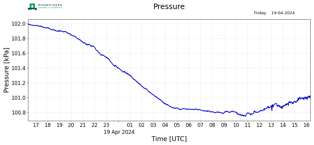
The pressure wave passed us in the past hour. The amplitude was about 1.5 mbar, lasting about 20 minutes. We are not quite antepodal – the duration is probably caused by different paths around the globe taking similar amounts of time. That focussing may also have increased the amplitude
It is also seen in the temperature: a fluctuation of about 0.2 C at the time when the rarefaction part of the wave (the pressure drop) arrived
The windspeed also dropped markedly in both the Netherlands and here in Sweden while it passed.
Not here, but the wind was quite variable this evening anyway.
Here is the data from Holland in a nice datapackage.
https://www.facebook.com/messenger_media?thread_id=809621459059555&attachment_id=4537303336392938&message_id=mid.%24gAALgWK94Q2OEkI55wV-X0k2PAfO0
Sorry, account-walled by facebook. Blocked for those like me without facebook account
Saw that, injected the picture itself for you.
Thanks. Impressive
And here it passed Iceland.
This is fun, it recorded on the seismometer network. 🙂
Great.
Did the Hunga Tonga-Hunga Ha’apai Volcano also produce pyroclastic flows during this eruption?
No way to know if it did. A pyroclastic base surge is more likely.
What an event.
Way way bigger than Grimsvotn.
I saw Grimsvotn eruption just as it happened.
The satellite jmages of the size of the plume on Pinatubo 1991 show a similar size to the Honga Tonga eruption. This hints at a very large VEI5 or small VEI6 eruption
It’s clear that hours before the big event, a smaller eruption blew the top of the small volcanic island as two hours before the big event the central part of that island was missing, so the ocean water must have entered inside the volcanic system, in a very similar way to what Krakatoa might have been.
It will be difficult to measure total volume as this was an underwater explosion. But the size seems to indicate the first VEI6 since Pinatubo.
Probably less ash and sulfur was injected into the stratosphere than Pinatubo. But I am not sure. It might be difficult to quantify the possible effect in global temperature.
This was big. And the event is probably over now.
“…, so the ocean water must have entered inside the volcanic system, in a very similar way to what Krakatoa might have been.” Some of what I have been thinking about tonight.
Seaching for similarities I came across this paper on Krakatau just now;
https://www.jstor.org/stable/41145820
“Krakatau revisited:….”(1992)
The main point: “Caldera collapse most probably occurred near the end of the eruption on 27 August, precluding large scale magma-seawater interaction as a major influence on the eruption column and characteristics of the pyroclastic deposits. Very rapid displacement of the sea by pyroclastic flows remains the best explanation for the series of catastrophic sea waves that devastated the shores of the Sunda Straits, with the last and largest tsunami coinciding with the slumping of half of Rakata cone into the actively forming caldera, perhaps during a period of great pyroclastic flow production. The large audible explosions recorded on 27 August may have been the rapid ejection of large pulses of magma that collapsed to form pyroclastic flows in the ignimbrite-forming phase. Co-ignimbrite ash columns rising in the atmosphere immediately after the generation of each major pyroclastic flow may have contributed to the magnitude of the airwaves. A reappraisal of the eruption in the light of this, in conjunction with the pressure (airwave) and tide gauge (tsunami) records from Jakarta, suggests that the relationship between the latter two has been oversimplified in previous studies.”
Does that sound somewhat familiar?
https://twitter.com/burgwx/status/1482447133529686019?t=YeZuW8LSKrKXgGczVGIFeA&s=19