
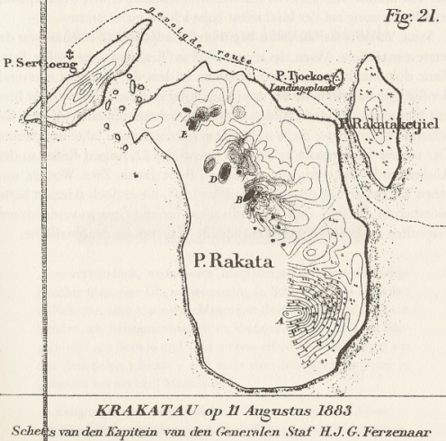
Map by Ferzenaar. The dashed line shows his route and landing place. Summits B. D and E were active. B had partly collapsed.
Map by Ferzenaar. The dashed line shows his route and landing place. Summits B. D and E were active. B had partly collapsed.