The Ethiopian volcanic situation keeps escalating. A viral video is circulating of an eruption from the Dofen volcano:

https://x.com/volcaholic1/status/1875137887160672670
To me, it’s an eruption because it’s throwing rocks and it’s on a volcano. It could be phreatic or magmatic. It’s phreatic if it’s driven by heated groundwater, or magmatic gasses from an intrusion, without fresh magma. It’s magmatic if those rocks come from fresh magma, and if so it is probably from the gas-rich tip of a dike intrusion.
*Edit: Later closer videos show the event to be phreatic, steam-driven, and throwing up mud and rocks.
Dofen volcano
Before looking into the general unrest of the region, which is to me the most intriguing part, let’s look at Dofen volcano. We are dealing with a tiny volcano, made mostly of very old lavas. It forms a series of rugged hills rising a measly 400 meters above the rift valley. Very unimpressive compared to most of the other volcanoes in the area. The hills are oriented perpendicular to the rift valley, which is quite common. The bulk of the volcano is made of viscous lava flows, likely rhyolite, but they are eroded, dissected by huge fault scarps, and covered in soil. I don’t think any of the rhyolites are Holocene. The youngest flows are a series of fissures on the north side of the volcano with tiny flows. There is one fissure where strombolian activity formed a row of cones, and basalt lava spanned 2 km2, which is dark and not covered in soil (Holocene, but hard to tell how old). This lava flow must have had a volume of around 0.02 km3. Another fissure flooded a valley with 0.1 km2 of young soil-free basaltic lava. A few other not much older fissures are located there, very closely clustered, even overlapping themselves. I’m guessing the new eruption must be from this same spot and is likely to be small and basaltic.

Young basaltic lava on the north side of Dofen volcano, 9°21’44″N, 40° 6’43″E
Another Holocene eruption happened on the valley floor, 20 km to the south of Dofen, more or less where the current dike is happening. A dike rose under the sediments filling the rift, but it wasn’t able to intrude through the low-density sediments, so must have formed a cryptodome under the sediment and then erupted from over 10 vents widely scattered over a circular area a kilometer across. The ground must have started to rise and form fractures, with steam and gasses exploding from random spots. Then powerful phreatomagmatic explosions formed tuff rings due to groundwater in the sediments being boiled to steam, followed by strombolian eruption of basalt lavas. Now let’s have a journey back to 2004 when something very interesting happened to the north in the Afar Triangle.

Phreatomagmatic and strombolian eruption on the valley floor south of Dofen. 9°13’6″N, 40° 2’1″E
The Afar-Red Sea Fires of 2004-2013
The Afar Triangle, at the junction between the Great African Rift, the Red Sea spreading ridge, and the Gulf of Aden ridge had been quiet for decades. Except for some overflows around 1974, the lavas of Erta Ale had remained concealed to its summit pits where a semi-permanent lava lake peacefully smoked into the scorching air of the Danakili. The only relevant event in the area after the Manda Inakir rifting of 1928 was the Ardoukova rifting and eruption in 1978. The Red Sea had likewise been completely quiet for over a century, at least the part above the water. But in 2004 everything changed starting with a Dallol (Afar) dike intrusion. Next year, 2005, Dabbahu had a very small rhyolite eruption. The Manda Hararo volcano, immediately south of Dabbahu, entered a series of 14 dike intrusions and 2 small eruptions in 2005-2010 in one of the largest magmatic events of the 21st century, that involved over 2 cubic kilometers of basalt magma. The unrest was spreading and two more volcanoes of the Afar depression were to erupt during these fires. Dalafilla of the Erta Ale Range produced a powerful basaltic fissure eruption from its flank in 2008, which would have been an impressive sight had there been anyone around to see it. Even more impressive was the VEI 4 explosion and lava flow of Nabro volcano in 2011 which collapsed air traffic in the region. But it was not just Afar. In Arabia, Harrat Lunayyir nearly erupted in 2009 due to a large dike intrusion, and the Red Sea volcano of Jebel at Tair spent almost a year continuously effusing lava from its summit in 2007-2008, while nearby Zubair volcanic field birthed two new islands in 2011 and 2013, ending a decade of hectic activity across the whole region.
The 2004-2013 activity in the Afar and Red Sea areas is a great example of a regional episode of volcanic eruptions that affected a vast region, and in truth, the area may not have fully calmed down from this event, since Erta Ale has been more active that usual starting 2010, with frequent overflows and the sustained flank effusion in 2017-2019. Now we may be looking at another complex series of volcanic unrest from the Ethiopian Rift, or a renewal of the same pulse. Why?
Present unrest in the Ethiopian Rift
There has already been a published scientific article that covers past year’s events on Fentale volcano, linked at the end of this post. Starting in early 2021, a very large area around Fentale started to slowly uplift, which continued to May 2024 and amounted to 6 cm of total inflation. On mid-September, a dike intrusion started 10 km NE of Fentale and gradually propagated north until late October when the intrusion ended, from the article cited at the end:
“The dike strikes N15°E, is ~11-km-long, ~6-km high, reaching ~3-km below the surface with up to ~1.8 m of opening, giving a total volume of intruded magma of ~0.08 km3”
The dike was sizable but not super-large, yet it was only the start. On December 26 a new intrusion, and a much larger one, started, that has kept intensifying and produced nearly 40 earthquakes of magnitude 4.3 or larger, the largest is a 5.1. The news are reporting 30 collapsed houses and people fleeing the area. It’s not comfortable to be on top of a growing dike intrusion, Grindavik residents learned that on November 2023. Shaking must be near nonstop and cracks must be showing all over the place. The interferogram below was shared on social media by Carolina Pagli, one of the authors of the 2024 Fentale article. It shows a massive dike some 30-40 km long, likely one of the largest such intrusions ever recorded. The central volcano of Fentale is deflating, therefore it’s Fentale volcano that’s feeding the dike (at least partly). It reached nearly all the way to Dofen, but there was no magma movement at Dofen itself at the time of the interferogram.

https://x.com/SorcerInSAR/status/1873644455263428785
But surprise, surprise… Dofen has erupted instead, at least that’s what everyone is saying, I want the exact coordinates. So assuming this is correct, and it probably is, then it seems that Fentale’s intrusion has opened up the next rift segment to the north, Dofen. Like a domino effect, one volcano has activated the next. Or it could also just be heat from the Fentale dike heating water in Dofen, but I think it’s a little too far from that, and that more likely magma is also intrusing now under Dofen itself. Not only that, but we have two Fentale dike intrusions so far, and one is HUGE. I’m getting a déjà vu, but it’s not really a déjâ vu cause the Sundhnukur Fires are still ongoing. This is the process of ocean crust generation, it’s in the middle of a continent but this is a true rift that through voluminous intrusion of basalt builds new oceanic crust, which is mostly gabbro (intrusive basalt). Now if the Salton Sea area of California goes off we would have all subaerial ocean ridges going off.
What to expect
I doubt this is the end. Almost anything can happen, this is a very long rift with a lot of volcanoes. Some are basaltic, others rhyolitic, and others are bimodal. One thing I think is likely to happen is that the area will be hit by further basaltic dike intrusions. Otherwise, let’s see how it evolves.
Fentale article:
Derek Keir, Alessandro La Rosa, Carolina Pagli, Hua Wang, Atalay Ayele, Elias Lewi, Fernando Monterroso, Martina Raggiunti. The 2024 Fentale Diking Episode in a Slow Extending Continental Rift: https://essopenarchive.org/users/847293/articles/1235148/master/file/data/fentale_grl_format_manuscript_essoa/fentale_grl_format_manuscript_essoa.pdf


Fascinating stuff! Thanks, Héctor! Rifting comes in pulses…that’s my takeway.
Rather like the Reykjanes peninsula. 800 years of slow drift, followed by 200 years of the pulse.
I wonder what the repeat pulse timescale is for the Great Rift? (If there is one!)
Agreed. Especially fascinating the thoughts about the Salton Trough.
Thanks, Clive, we might soon find out more about the workings of the Great Rift.
Thanks Hector for your insightful article and Clive for your thoughts. Clive- You know that research in this part of the world is still at its infancy and I don’t think there is a determined pulse time scale. Better understanding exists in northern Afar but not in the south where extension is an order of magnitude lower. The 2005-2013 Afar episode involved a massive basalt dyke intrusion accompanied by a small ash eruption and followed two years later by a series of fissural basaltic eruptions. Compared to this episode, how will the current pulse in the northern MER/South Afar evolve? Any insights? A local team of geoscientists is following up on the events.
The 2005 megadike has had a long lasting impact. It seems to me that the 8-meter rifting has made the later intrusions much easier. It is not evident whether it is also related to the Red Sea eruptions which were quite far away.
Wow! Hope people inn the neighborhood won’t be affected more than they already are because of the quakes, but I confess it would be thrilling to see a string of volcanoes erupting along the rift,
Thank you for the timely post!!!!
I must also confess it would be very thrilling. I hope it doesn’t get too dangerous though.
Thanks Hector for the most-timely update! Other than what you wrote, I can’t find any other info to add to your report and preliminary analysis of this evolving event.
Class is in session, fer sure.
Thanks Craig
Hector, do you know if the rhyolitic eruptions in this region largely source the rhyolite from fractionation as we’ve seen in Iceland, or is there continental crust assimilation here as well?
Hi cbus. I did look up these volcanoes on EarthChem in the past, the mafic lavas are alkali basalts, and the silicic lavas are alkaline rhyolite types and trachytes. So I think they are formed through fractionation mainly.
Thank you Hector for this update! Hopefully, the local authorities brains activate and they carry out some preparations for this “tectonic activity”.
Thanks, Tallis. Not sure how well they’ll handle it. The area is poorly instrumented and fissure eruptions can be very sudden and from unexpected places, so it won’t be easy if activity gets serious.
It’s one thing not to have any good instrumentation but it’s another to call the most obvious and severe volcanic unrest on the Earth currently “tectonic activity”
I totally agree
The earthquakes still seem to increase in size: a M5.5 about 60 km’s northeast of Fentale. https://twitter.com/NewEarthquake/status/1875231104115884542
USGS shows that the earthquakes are 10km deep. Is this the depth where “lazy” Rhyolite magma chambers get injection by hot basalt magmas?
The earthquakes are already a disaster on their own: https://addisstandard.com/over-30-homes-collapse-in-afar-as-earthquakes-intensify-in-awash-fentale-thousands-flee-to-neighboring-areas-seeking-refuge/
The most awful earthquake swarms are those, which are strong enough to be felt or to cause destruction each time. Imagine an earthquake disaster that doesn’t end after some seconds, but continues for hours again and again.
Albert stated in the comments section of his last piece that 10 km is used when they don’t really have a clue about the depth.
Plus another 3 more M5+ tremors in just over a day. That’s some serious shaking!
The Ethoipian authorities after being fairly mañana about it all have now stirred themselves.
Ethiopia is evacuating thousands facing dangerous volcanic activity in a remote area (AP, 4 Jan)
The Domino Effect has worked until Ljosufjöll 😉 IMO has stated that at great depth something magmatic has moved.
But Thanks for the introduction to the live event in Ethiopia, Hector! The Rhyolite volcanism there reminds me to the rare events of Iceland’s Rhyolite volcanoes. Last f.e. 1876 Askja, Öræfajökull 1728, Esjufjöll 1927 (unkown composition), Kerlingarfjöll, Torfajökull. Often the Rhyolite erupted, when hot Basalt intruded.
The domino effect is strong 😆 .
RÚV has an article on it today:
Deep-seated magma movement detected near Grjótárvatn (RÚV, 3 Jan)
In response to this outrageous outrage older sister Reykjanes is saying look at me, look at me!
Increased chance of next eruption in late January? (RÚV, 3 Jan)
As with the Domino Effect one should never underestimate the effect of sibling rivalry when it comes to volcanoes. 😀
Thank you for this great article! Kudos 🙂
Thanks!
https://www.ruv.is/frettir/innlent/2025-01-03-engar-visbendingar-um-kvikuhreyfingar-naerri-yfirbordi-432174?fbclid=IwZXh0bgNhZW0CMTEAAR26Fkm_MP1brAjbKkNsgm-Y8gXAOrPH5TwSLZJBtzsU9ZdAhptl1Z8A9Uk_aem_DUuz0otDm0A_i0QakO556g
Not in Ethiopia but there was magma movement detected at depth under Ljosufjoll, to put an end to the speculation on those quakes there. Still really deep so not a sign of anything imminent but it seems pretty likely at some point in the next decade, and will likely be pretty abrupt based on the large cones and tall fountains – gas rich magma rising from depth quickly.
Well based on my analysis before I estimated Kilauea might erupt for another week at its present rate, but seems the eruption was much faster than I realised or the GPS was laggy, because it dropped a lot further. By my expectation, it should stop today, but if not then it probably really will take months or years to build enough pressure to go back to the rift zones again. Meanwhile filling in Halemaumau, and possibly overflowing it in 2028 if nothing else changes. Its my 1% scenario right now, but its probably possible to completely overflow or even fill the entire caldera by 2040 at this rate if things are stable that long.
The smaller vent died yesterday but is still degassing and probably glowing. That might be a sign of reducing pressure. The other fountain looks smaller and more frothy too.
And it stopped, at about 8:50 pm local time. The vent is a glowing hole on S2 cam.
It doesnt look like any drainback is occurring this time, but inflation has still resumed if the tiltmeter is to be believed. If it is like prior episodes then fountaining might resume in a couple days but probably future episodes will be short in duration if they have this style. If short lived, then I would expect possibly some very powerful high intensity fountains. If Kilauea is quiet for longer and builds up slowly with weak activity then it might do another longer episode like the one just passed.
But it basically stopped exactly where I thought it would, meaning this was so far all overpressure. The true test of longevity for this vent might begin now, to see if it reopens or dies and the next eruption is more distant and at another location.
Been about a day now and both vents are still glowing while their surroundings are rapidly going dark. At the current rate of inflation and ground tilting it might take a while to begin episode 4, but its not dead yet. The last episode caused 30 microrad of tilting, and before that there was 5 microrad of uplift between episodes 2-3, and the same between 1-2. So far there has been about 1 microrad recovered, so eruptions might resume in 4 days, maybe in as little as 1 at a low rate. Its likely some amount of overpressure will be needed so the next episode might be closer to a week out. 10th January is my guess
I’m interested in seeing the difference in eruption characteristics between the previous episode with that head of degassed magma, compared to the next with no such issue.
Yes, whenever it starts I expect it to probably have much less of a lead up phase and probably get to peak strength quickly. So if there is any visible lava flowing out of the vent it is probably time to watch.
If my hypothesis is correct, then to have a chance at erupting elsewhere the summit will need to recover to at least the trigger point of this eruption, which will take at least a few months. More likely Halemaumau will need to be mostly filled in to 1km+ elevation at least at the vent, so 70 meters to go. That might take over a year. So this year might be quite photogenic 🙂
Was the Caldera Floor elevation until 2018 around 1000m above sea level? Maybe this is the point, when the “caldera filling” period (2020 following) slowly ends. The early 19th century shows, that magma inflow to the summit reduces, when the caldera is filled up enough. At that point the voluminous and high rate eruptions at ERZ and SWRZ happened.
Most of the shallow pre-2018 Caldera has an elevation of 3500 feet, that’s 1066m. This is probably the upper limit for the period of “fast filling” at the summit. When the fast filling has reached this, it will collapse. During this collapse, SWRZ and ERZ are going to erupt.
After 1840 Mauna Loa came back to action. It is possible that we get the same, when the magmatic inflow to Kilauea’s summit collapses. But this is a question of distant future.
Yes it was, this map still shows the old topography elevations so you can see it all. I would assume it is based of google earths terrain.
The floor of Halemaumau is about 1030 meters, but after the overflows of the lake in 2015 and 2018 the highest stand of the lava lake might have been at least 1050 meters. The 1959 vent and lava lake in Kilauea Iki are 1070 meters elevation. So getting powerful lower ERZ eruptions probably requires well over 1000 meter elevation of the summit vent, although a less intense eruption east of Pu’u O’o, like 1955, can probably happen with no increased elevation theoretically.
The 2018 caldera was a big collapse, but most of the volume was in the downdropped block falling as a piston (like Bardarbunga), and that stopped at about 900 meters. The only bit actually deeper than that was the part that used to be the shallow conduit of Halemaumau, which has already filled in. Most of us, myself included, probably all thought 7 years ago that the full nearly 1 km3 collapse volume needed to be filled, and that it would take 10 years to recover. Well, that was wrong, the supply rate has increased post 2018 and rift zone eruptions only need 900+ meter elevation to occur, which needed far less than a full refill of the caldera to get to.
Im not sure there is a good idea of the dimensions of the caldera after 1790, but in 2018 the ERZ dike broke out at about 540 meters elevation and went east, and the deepest point of the 2018 caldera was at about 540 meters elevation too. If in 1790 the eruption was on the Puna Ridge, dikes that go there start east of Leilani Estates, at only 100 meters elevation. So the 1790 caldera might have been at this elevation too, which would make it about 1.1 km deep from the summit peak, crazy. And at 4 km wide, obviously the volume of open space below 900 meters elevation was huge, 3.3 km3 more or less. To be honest I think a cone probably underestimates the volume too, based on how the similar deep calderas in the Galapagos look, more like a tapered cylinder. A 4 km wide and 1 km deep cylinder is 12.6 km3, so somewhere between this and the cone number.
Crazy thing is, the caldera was still a vast hole in 1796, but must have been filled in to at least 900 meters elevation by the 1810s to leak out on the SWRZ. Even if all those SWRZ were after 1820, thats still only 25 years at most. The lower volume is a fill rate similar to Pu’u O’o, but at the higher volume gives average filling rates of like 0.5 km3 a year. Its definitely not that, but you dont create a borderline LIP sized lava shield without some pretty extreme magma generation, and if other volcanoes sometimes surge far above their average, well… 🙂
To be honest, I think the exact same thing has happened now, just that up to 2 weeks ago it was filling underground. If such huge filling rates lasted for decades 200 years ago, then, well, dont get used to the current maps…
Comment ended up longer than intended 🙂
https://en-gb.topographic-map.com/map-smqdn/Hawaii/?center=19.40005%2C-155.28133&zoom=14
Thank-you for the big answer, Chad!
This map shows Halema’uma’u April 2018 just before it collapsed:
https://www.usgs.gov/maps/halemaumau-overflow-map
The book of Wright and Lein on HVO’s website https://pubs.usgs.gov/pp/1806/ shows in Chapter 2 well the development 1790-1840. After the collapse 1790, there was an enormous magma inflow in the summit, that happened for the most unnoticed. Maybe native Hawaiians witnessed it, but this didn’t survive in oral tradition. The collapse 1790 was probably more than 2018. That’s why 1823 Kilauea still was busy to fill the caldera again. The high speed of filling the caldera prepared the very fast and voluminous eruptions 1823 and 1840.
1823 the lava was very fluid: “A flow velocity of 12–15 m/sec has been estimated by Guest and others (1995). This rate exceeds by about an order of magnitude the median velocity of 1–2 m/sec for flow in tubes feeding the current Pu‘u ‘Öÿö-Kupaianaha eruption”
1840 the eruption lasted only 7 days, but had the volume of the first Mauna Ulu eruption 1969-1971.
1840 was fast but probably not a caldera collapse. It erupted low down but if collapses go to the elevation the dikes start not to the vent, then if it was at about 1000 meters before it would have sunk about 300 meters to the elevation of Napau and Makaopuhi where the main 1840 intrusion started, a long way but over the whole floor it is pretty shallow. More likely the core of the huge lake in the caldera drained down the open vents instead of actual collapse on the ring fault. Same in 1823, 1832, 1868. Much smaller version of this happened in 1960, and at Pu’u O’o a few times.
2018 was probably the first real caldera collapse since 1790 at Kilauea. But it was much smaller than that still, 1790 might be 10x the size of 2018.
The really interesting and potentially concerning thing about this is that the same supply increase that rapidpy filled the 1790 caldera still happened after the smaller collapse, but the hole it needs to fill is way smaller. I think magma will go into the rift zones when the active vent gets higher, but if it doesnt and the next Pu’u O’o has just started then there will be no more caldera in 20 years time. In fact, at current supply rate the caldera will overflow in about 10 years if the rifts dont take over. Theres only about 2 km3 of space to fill in before the lava will spill out to the south, west of Keanakako’i, and that assumes filling as a full lake where now it is going to be more like a lava shield so could be less.
Having actually been to Keanakako’i, knowing that its a choice of that whole massive pit area out in front being filled in to overflowing by 2035 or there is a major rift eruption, and that the only alternative to those is a major Mauna Loa eruption… There is no option of ‘nothing’, theres never even been a recorded decade without at least one major eruption in Hawaii. Its no wonder Pele is still as relevant today as ever before.
1840 was not a collapse of the caldera, but probably linked to the collapse of magma inflow to Kilauea’s summit. During early 19th century there was a very high inflow like now. When this high rate of magma inflow in Kilauea collapsed, the big SWRZ and ERZ eruptions happened.
After 1840 Kilauea changed to weak activity, while Mauna Loa became the dominant volcano. The spectacular eruptions 1823 and 1840 look like a big “endgame” of an active period of Kilauea.
Hector would probably know more, but my understanding is after 1840 the eruptions were still strong, Mauna Loa didnt really take over fully until the 1850s. So I dont think the 1840 eruption had much to do with change in supply rate as such. If anything major eruptions lead to increased supply rate, without the 1840 flow Kilauea might have actually died down faster, Mauna Loa was active by 1843 but Kilauea wasnt quiet yet either.
Not sure if the same is true at Mauna Loa though, major eruptions there actually do seem to slow the eruption rate. But I wonder if that is only because they open so much volume underground that shallow dikes dont happen.
Maybe it is just a 100 year cycle, in which case there is still 25 years left of Kilauea being hyperactive.
During the fast filling periods of the summit Kilauea exceeds its average magma support rate a lot. It has to balance this statistically by calm periods.
Maybe the end stage of fast filling periods leads to a major change in the system that diverts magmatic inflow to Mauna Loa. I don’t know whether there is a regular cycle. The cycles can be irregular with larger and smaller ones. After the collapse 1924 there was again first a relatively short period of caldera filling what was followed by quiet 1934-1952. During these 18 years without an eruption Mauna Loa was a lot active with five eruptions, including two >100 days eruptions and the voluminous 1952 eruption.
Most recent HVO update said that on the 2nd the SO2 emissions were at 30000 tons/day. Back when Pu’u O’o was going on its own it was doing 3000 tons/day and 4 m3/s roughly. So it seems each 1000 tons a day roughly relates to a bit over 1 m3/s. Not a very good explaination but basically the last episode was probably going at 30-40 m3/s.
Based on that, the last episode erupted about 16.5 million m3 of lava. Which is as much as any of the eruptions in 2023. Also actually more than on the first day although that was only 12 hours so maybe not fair.
Close to eruption, venting https://www.sott.net/category/4-Earth-Changes
https://www.emsc-csem.org/Earthquake_information/earthquake.php?id=1751906
Sorry for the spam, forgot to add it in the first comments :c
Earthquake 5.8 at Fentali/Dofen
If I remember correctly, before the Fagradallsfjall eruption the largest earthquake on the Reykjanes peninsula was a 5.7 or 5.8 as well. It will be interesting to see if the Fentale unrest has now reached its maximum magnitude of earthquakes or that it will be even more violent.
Anyway, I found this Youtube channel where the tremor plot can be followed live: https://www.youtube.com/watch?v=rzUhB8kMRGw
Maybe it’s going to follow Askja 1875 with rifting and a possible injection of Basalt in a Rhyolite magma chamber: https://www.volcanocafe.org/askja-1875/
It does not have to be a magma injection. Sometimes providing new heat is sufficient to bring stale rhyolite to the boil. That has happened in this area before, where a dike passed underneath an old volcano, and the heat caused the volcano to erupt.
This video in Youtube shows two other mudvolcanoes erupting in the Afar region {In German}. Some more especulation before th 5.8 erthquake that happened this night,
https://youtu.be/qW4pxYm3zuA
Thanks Hector for the interesting information and a happy (volcanic) new year to all.
Although I rarely write a comment I’m a great fan of VC which I read every day.
https://www.usgs.gov/media/images/salton-faults
Salton Sea. Boundary between Pacific and American Plate, hasn’t had a major earthquake in a while. Volcanoes were thought to be dormant or extinct, but newer results show that they last erupted between 0-940 BC. Before it had been assumed that the last eruptions had taken place about 30 000 years ago.
The same goes for Pisgah Crater, Rodman Mountains, Mojave, further north, Lavic Volcanic Field. It was thought that they had erupted around 20 000 years ago, now the estimation of some scientists is 2000 years.
https://en.wikipedia.org/wiki/Pisgah_Crater
This development in Ethiopia should tell us one thing: Never give a volcano up.
The two plates move by each other down there in Southern California. No subduction as subduction ceased around 12 Ma. The San Andreas fault goes right though the Salton Sea which is a remnant of Lake Cahuilla which was a lot larger and, when full, is assumed to have triggered earthquakes which led to the Colorado River changing its path to the east instead of emptying in the lake. So Lake Cahuilla committed suicide, sort of. From south to north the whole area consists of older volcanoes on the American Plate and basins which were water-filled troughs before, I guess (possibly back-arc basins), and this scenario continues from North Mexico to Mammoth lakes with Long Valley Caldera in the north.
As this is an unstable situation I tend to say:
NEVER GIVE ANY VOLCANO UP
Greetings from Pinatubo.And learned here on VC: The longer they are quiet, the bigger the boom sometimes.
@ Héctor: Héctor, did you ever take a look at the Caspian Depression east of the Caspian Sea in Kasachstan?
We have a beautiful drawing/graph here of the situation. What Andrew asked in Albert’s piece is found again here. Or maybe not at all. It is visible that there was an island arc (pinkish), behind the island arc the Salton Trough, but then something is funny. Normally the spreading ridge is behind the trough, in this case east.
So this is different. That’s why I tend to say that the US west coast is among the most complicated settings on earth. Also because those terranes add to a certain complexity.
Honestly, Héctor, I don’t believe this is a normal spreading ridge as the terrane in front is loose anyway and will travel comfortably north. The African Rift is easier.
This is only the end of the EPR. I can’t see another spreading ridge, honestly.
The Salton Through is considered a series of short spreading segments that are an onshore continuation of the Gulf of California spreading ridge. Some Holocene rhyolites are associated with a very powerful geothermal system (Imperial Valley) which is probably a large shallow rhyolite reservoir:
https://www.usgs.gov/volcanoes/salton-buttes
I remember once plotting nearby Cerro Prieto dacite, it has very low alkalinity, low sodium and potassium, which is very unbecoming of continental volcanism, but a lot like what ridges or some of the most oceanic-like island arcs might have.
Interesting what you mention about the Caspian Sea, I wasn’t aware that area was below sea level, looking it up the crust is very thin but the lithosphere is old and has deep roots.
Thank you for the detailed answer and link. They are certainly right in monitoring the area closely.
The monitoring in all of California and also Oregon up to Washington State is probably impeccable and rightly so and led to a low fatality rate at Mount St. Helens. San Diego, Los Angeles and San Francisco are sitting on a terrane with the San Andreas fault behind, a spreading ridge in the south, subduction in the north and many volcanoes.
Aside from the population – nearly 40 million, most of them sitting on or near the coast – they have more marine bases than any other state of the US – I counted over 30.
Anything bigger would be a catastrophe.
The next state to the east is Nevada and is also endangered and therefore watched closely. They had a few earthquakes between 3 and 4 there yesterday, in the north. What the h is causing that I thought and became wiser very fast.
Nevada is full of transform faults, the most notorious one being the Genoa Fault.
In 2019 they had a quake of 7.1 further south near Ridgecrest, Cal./Searles lake. That’s practically the western border of Death Valley, west of the National Park and north-west of the Mojave National Preserve.
https://pubs.usgs.gov/publication/70021022
Details of the quake:
https://www.volcanodiscovery.com/earthquakes/2019/07/06/03h19/magnitude7-Southern-California-USA-quake.html
A volcano nearby (22 miles) is Coso (stratovolcano 2400 m / 7,874 ft, source VD), which hasn’t been active for around 33.000 years and has a geothermal system with fumaroles and intermittently active geysers, so must be considered only dormant.
That’s one of my biggest gripes. Between possibly incorrect dating or incorrect assumptions due to age, so long as the serting hasn’t changed that provided magma to the system you can’t for certain rule out new eruptions at that spot.
Yeah.
On the bad side: Upt to 40 million people sitting on a terrane in front of an area full of faults.
On the good side: In the United States and closely watched by NASA and USGS.
If you can recognise a landform as a volcano, it can erupt. And some that you can’t recognize.
This is similar to a maxim I created concerning tornadoes: Don’t turn your back on atmospheric convection.
One more thing:
This broke out of a field while a peasant was working on it. He saw the earth opening up. I guess you all know it. Otherwise I’ll add the name tomorrow:
https://i0.wp.com/geologyscience.com/wp-content/uploads/2023/06/The-Paricutin-Volcano-Mexico-2-jpg
Oh, pic didn’t load, so the name is there. Beautiful pic.
Parícutin 1943:
Is it true that Rhyolite can better erupt effusively than Dacite? There are several Rhyolite lava flows in the world, f.e. Obsidian lava flows in Oregon or in Italy. But I don’t know about typical Dacite lava flows, only the recent lava domes of St. Helens.
Not the expert here, but I don’t think it’s a matter of ability to erupt better, just that Rhyolite is a more common type of magma seen in effusive volcanoes. Bimodal volcanoes are not uncommon in areas where there is a decent amount of rifting occurring, and bimodal volcanoes are almost always basaltic/rhyolitic as opposed to basaltic/dacitic.
Off the top of my head, i’m not sure why the fractionation process does not tend to produce lots of dacite, but it may just be that since Rhyolite is the eventual end product of any of the fractionation processes, it tends to be what accumulates the most over a long timeframe.
Interesting video in the this story of the boiling mud and fumaroles.
Thousands evacuated in Ethiopia due to volcanic activity (5 Jan)
The magma hasn’t made it to the surface yet, but clearly it’s very close.
Thank you. Good video. Nice people to sent their livestock away as they were scared.
OT, but yesterday, the first tornado of 2025 hit the northern Sacramento Valley at the base of the Mt. Lassen foothills only about 11 miles from my place . The tornado lasted over 10 minutes and was in unpopulated areas, so minimal damage and no injuries reported. While tornadoes like this hit other parts of California fairly frequently (one very couple of years on average) it appears this was the first-ever tornado to hit Shasta County in recorded history.
After over 50 yrs of active storm chasing, this was the first confirmed tornado I’ve witnessed (though I’ve captured several funnels). Here’s a video with a pic of the tornado (taken after sunset so quality is a bit iffy) as well as a fantastic lightning display that followed.
https://youtu.be/wCXpRKsYbXI
https://cimss.ssec.wisc.edu/satellite-blog/images/2025/01/250103_g18_ir_glm_CA_tornado.mp4
https://cimss.ssec.wisc.edu/satellite-blog/archives/62358
1831 eruption solved?
I appreciate GeologyHub for the work he does putting out content in this space that is at pretty reputable in terms of scientific integrity and information. It’s easy for Youtubers to devolve into clickbait, but he at least generally seems to care about not spreading bad info.
Now we need 1808 solved. The 19th century sure had a lot of huge eruptions, far more than the 20th and the first quarter of the 21st.
Gezahegn Yirgu, 5th January, 18.02, answer to Héctor:
University of Addis Abeba, Dep. of Earth Sciences, many papers:
https://www.researchgate.net/profile/Gezahegn-Yirgu
Has anyone seen the exact coordinates of the phreatic eruption? Do we know what kind of pre-existing activity there was in the area? They talk about a mud volcano. Does that mean there were boiling mud pits at the location? Are phreatic eruptions common there?
As we have learned from the events at Reykjanes, dyke intrusions will have effects on a larger area. Earthquakes are induced a few tens of kilometres away, and changes in the pore pressure have effects on boreholes and wells in the area. There are also examples of earthquakes triggering geyser activity through fluctuations in pore pressure. Geysir 2000, Steamboat 2022.
I see two possible mechanisms for the phreatic eruption. Either the hydrothermal system was disturbed by changes in pore pressure, in which case the eruption happened without direct involvement of magma, or it was caused by heat from the magma, which would mean that the dyke is very shallow and an effusive eruption likely to follow in the same spot.
It is a bit difficult sometimes to distinguish between hydrothermal and phreatic eruptions. The large historical steam explosions of Yellowstone during 19th and 20th century were “hydrothermal explosions”. I’d assume that real phreatic eruptions contain a minimum amount of ash/tephra. But this ash only consists of old material that is pulverized. Unlike a phreatomagmatic eruption with new magmatic ash.
An exploding mud volcano may look like a tephra eruption (phreatic), but it is already dirty by the mud and can by this also classified as a hydrothermal mud explosion. I’d assume that if magma was really close to the vent, then we would indeed have got a real phreatic explosion with ash and an explosion crater like after a bomb explosion. The hydrothermal mud system means that water is deep down in the ground. It would explode like a Maar eruption, if hot magma goes there.
I think the difference of a phreatic eruption and a hydrothermal explosion is if magma is directly involved in triggering it. Phreatic eruptions dont erupt new magma but are caused by groundwater being flashed to steam by a magma intrusion. A hydrothermal explosion doesnt involve magma moving anywhere, just depressurization of an already superheated geothermal field. Im not sure if magma is even necessary at all, that natural nuclear reactor at Oklo Gabon in the Proterozoic, probably powered a geyser field and might have blown up if conditions allowed it. I dont know if there is even a name for this, but we created our own one accidently in 1986…
Hydrothermal explosions can be gigantic though, as big as major real eruptions. Mary Bay in Yellowstone is nearly as big as the Castle Bravo crater, probably comparable to a VEI 5 or even a low 6 in terms of the explosion size that created it. No magma involved in that at all, probably just a geyser field under a glacier that melted or the lake level fell, either way pressure was too high and it all went up. Lots of smaller but still huge craters near the same area both above and below water and going up to recently enough that future ones are likely, probably comparable to VEI 4s, not to mention smaller ones that happen often, like in July last year, which arent a big explosion but way more powerful than a normal geyser.
I think though, its pretty likely USGS mostly just wants to avoid saying ‘eruption’ when describing in any present tense about Yellowstone…
I’d assume that the main difference is: Phreatic explosions let rock explode like a TNT bomb, while hydrothermal explosions let steam explode.
A prominent example for Phreatic explosions are those of St. Helens on 27 March wich ejected the first ash of the eruption series: https://web.archive.org/web/20121005165544/http://vulcan.wr.usgs.gov/Volcanoes/MSH/May18/MSHThisWeek/32228/32228.html
Also Costa Rica has some famous Phreatic volcanoes. F.e. Poas in April 2024.
Thanks! I admit I got the terminology a bit mixed up. The big question is if it’s directly caused by rising magma, or if it’s a side effect from strain changes induced by the dyke. In any case, until the next interferogram says anything differently, I think this magma comes from Fentale rather than Dofen. Dofen just happens to be closer, but it’s a bit like saying that Askja erupted at Holuhraun, since it’s closer. The interferograms so far show subsidence at Fentale and nothing at Dofen. It would be really interesting to know the exact spot of the activity.
Yes I have been curious to know where the mud geyser is too. And if Dofen is specifically the name of the mountain that is the volcano, or the whole area. If it is the latter then maybe the mud geyser has nothing to do with the Dofen volcano.
Either way, wherever it is it seems likely an eruption will result from this somewhere. More likely than not, but not a dangerous big eruption.
The only true volcano here is Fentale. It is the origin of the dike. Dofen is accidental. A phreatic explosion requires some moisture, so I guess it happened on the low-lying part of the valley and not on Dofen. But I don’t know. Right now we are waiting whether the dike re-activates. There are still earthquakes, so the magma is still trying. But cold basalt can be a hard crust to break.
It can also be a “plutonism” / “intrusion” event if a small amount of basaltic magma intrudes in a big hot rhyolite/granite chamber, that expands a bit. Even if the rhyolite doesn’t erupt, but is going to become granite one day, it may expand by an injection of basalt and increase pressure on the surrounding ground.
No Chad, just the mountain. The area is probably called Gabi Rasu (Admin. Zone 3). Not far to the South begins Oromia with Awash National Park. It contains the syllable “fen”, also “fan” like “Fen”tale or “Fan”tale. Which, in the latter case, is also a town in the district of Oromia.
Regarding reactivation, the lack of quakes could also mean that we’re in for the final push. By now we have seen enough dyke intrusions go all the way to eruption to know that the final few hundred meters can go without quakes.
West Thumb Bay may be a huge crater as well, at least according to the ranger that was giving a talk when I visited in 2000. If it was, the explosion would’ve been in the hundreds of megatons. I wonder if there was any warning signs?
West Thumb is a caldera, and a VEI 7 all on its own. It was probably big enough to be among the largest of all Holocene eruptions, but is only a monogenetic satellite of its parent. There are way more identified deposits than known calderas in the older fields, and most of them are also bigger than Yellowstone is, with the final caldera being the biggest typically.
So there is probably at least one more VEI 8 in its future, and certainly the plume is far from dead. If anything because there is no longer a long subduction zone on the west coast pulling NA west, going under the craton would probably spawn another LIP, or even split the continent, not be choked out.
About 160,000 years old, so not the youngest eruption of Yellowstone but much younger than the main caldera. The range of ages is like 200-120ka, unless it was at the young end it would have been created in a glacial climate and so could have formed under or near an icecap. But there was also a lot of huge effusive eruptions around that time too, so the West Thumb eruption might have been a bit different, maybe more gas rich magma.
Cool. https://www.usgs.gov/observatories/yvo/news/west-thumb-geyser-basin-diverse-and-exceptional-hot-springs-mud-pots-geysers
And what causes the ground to rise? If magma isn’t involved?
Oh, there’s magma involved for sure. The question is if it’s the heat from the magma, or the ground deformation that has triggered the steam explosions.
It’s not entirely correct to talk about the ground rising. Most of the deformation is horizontal, and straight above the magma intrusion, as well as at Fentale volcano itself, the ground is actually sinking.
Think of the ground as a rubber band that’s being pulled apart. The elastic deformation will cause it to become longer and thinner. If we cut the rubber band, it will contract and become thicker again, but more importantly, the ends will move away from each other. In the middle we are left with a gap. Now imagine this happens a few kilometres down in the crust. The ground above the cut will sink down in the gap and the ground to the sides will move away and rise up. The cut itself consists of the rising magma.
The interferogram shows ground motion towards or away from the satellite. Now, the satellite is not straight up, but off to the side, looking west. Motion towards the satellite can either be up, or east. Motion away can be down, or west.
Notice how the fringes east of the dyke cycle through the colors in a reverse order compared to the fringes west of the dyke. This is because horizontal deformation dominates, so west of the dyke is away from the satellite while east of the dyke is towards the satellite. In the middle, there are fringes that cycle through the colors the same order as on the west side. This is the subsidence above the gap in the rubber band analogy. It’s called a graben.
At the Fentale caldera, the fringes also indicate subsidence. This means that the magma that is feeding the dyke comes from storage below Fentale. Remove magma and the ground sinks. Much like at Bárðarbunga during the Holuhraun eruption. If an effusive eruption starts, we will probably see collapse quakes of around M5 at Fentale caldera, and some remodeling of the existing caldera, similar to Kilauea 2018.
Thank you for this explanation. It helped me a lot.
Probably interesting for Carl Rehnberg:
Mapping Hydrothermal Alteration at the Fentale-Dofan Magmatic Segment of the Main Ethiopian Rift
“Conclusion
With a multidisciplinary approach we map the surface hydrothermal alterations in the Fentale-Dofan magmatic segment. We find that the surface hydrothermal alterations are mainly focused near Fentale and Dofan volcanoes. At Dofan the hydrothermal alterations are focused on rhyolites on the western side of the volcano, in an area of intense rift parallel faults. At Fentale volcano the hydrothermal alterations are mainly associated with ignimbrite and show a circular pattern around the volcanic edifice, but also in places follow the NNE striking faults. The association between hydrothermal deposits with either the rhyolites and ignimbrites is likely due to them being relatively easily altered (in comparison to basalt), and also their brittle nature allows for fracturing through which localized fluid flow can occur (as opposed to the sediments). At Fentale, the more complex association of hydrothermal deposits and active manifestations around the edge of the ignimbrite suggests formation contacts may also localize fluid flow in places. The presence of hydrothermal deposits and active hydrothermal manifestations, along with other lines of evidence such as locus of subsurface dike intrusion, suggests that discrete and localized magma reservoirs beneath Fentale and the DVC are the heat source for hydrothermal circulation. Our study also demonstrates that this approach used in areas of lack of vegetation can be a good starting point for spatially extensive geological mapping and detection of zones of hydrothermal deposits.”
Study area:
Source
https://www.frontiersin.org/journals/earth-science/articles/10.3389/feart.2021.716144/full
Authors:
Martina Raggiunti, Derek Keir, Carolina Pagli
1Dipartimento di Scienze della Terra, Università di Pisa, Pisa, Italy
2Dipartimento di Scienze della Terra, Università degli Studi di Firenze, Firenze, Italy
3School of Ocean and Earth Science, University of Southampton, Southampton, United Kingdom
https://www.google.com/maps/@-39.4202417,-71.9399759,19z/data=!3m1!1e3
A rather large lava lake ( large for Villaricca at least ) is now present in the summit of Villaricca in sat images in maps and Google Earth, this is a violently convecting lava lake and looks rather hot ( 1150 c ? ) in direct daylight and an indicator that magma is high in the conduit of the volcano, infact I guess this is the largest lava lake since there since I was born in 1995 at least most other activity there been very small lakes or just spatter cones/ vents so fun with something new.. Villaricca is souch a sterotypical volcano too perhaps even more so in shape than Nyiragongo, should it cave in its summit cone it will form a copy of it, and both volcanoes formed in same way.. highly fluid fountain tephra piles… hopes it overflows and sends rivers of lava all over the sides
Looked at the link. Wow! Thank you Jesper.
Half a year ago, very nice:
https://apod.nasa.gov/apod/ap240717.html
Villarica always seems to erupt in the southern hemisphere summer. Some of the most badass volcano imagery I’ve seen was that of the December 1971 eruption. Villarica and Pucón are on my lotttery-win list.
Fun stuff a fully fledged ambrym style lava lake on top of Villariccas summit, will be fun to see if this one presists or shrinks down into nothing, a larger lake conduit than earlier coud be an efficent gas conduit and perhaps preventing more violent events through letting the system degass better.. its nothing compared to the city center sized lava lakes in Kilaueas Halemaumau but still fun of course
Seen from top of Llaima Volcano, at night the Villaricca is now a sinister pillar of fire at night when the lake lits the gas plume.. its Chiles own Mount Doom, it looks like Mount Doom too minus the icecap and aucaria monkey puzzle trees below
I think it always has a high magma level, just that at times it covers over so it isnt really visible outside of small vents. But that is a real lake, or at least a very big pond. It is possible to measure it on google earth, making a line across it and you can get the length.
Wikipedia says the definition of a lake is a minimum 2 hectare area, or 5 acres. A circle with an area of 20,000 m2 is 160 meters wide roughly. A circle 20 acres is 310 meters. So maybe most lava lakes are not really lakes but ponds… I think Kilauea in 2018, and Nyiragongo up to 2021 did qualify completely though, and if you include craters filled with liquid lava but not circulating then Kilauea definitely counts, or at least it definitely did in 2020-2022, maybe not now.
I wonder if Villarrica will do another paroxysm soon.
Very fluid lava too you can see the pale glowing ”veneer” on the lake walls after a lava wave have crashed and the lava fluidly receeds as the lake surface goes up and down, up and down just like Ambryms past lava lakes, Villaricca have very low viscosity, perhaps not as low as Nyiragongo and Kilauea-Halemaumau but its still very low, bulk composition with crystals is basaltic andesite, but the glass melt maybe called fluid subduction basalt, It coud be the most fluid currently erupting pure subduction volcano on land
https://m.youtube.com/shorts/FaQD3y5EQ-g
https://m.youtube.com/watch?v=afMHAeJ6Y7g&pp=ygUXdmlsbGFyaWNjYSB2b2xjYW5vIGxhdmE%3D
https://m.youtube.com/shorts/Yn9HKuM9ZlA
Very fluid indeed 🙂 it does looks like frothy hawaiian lava acually, its an older videos showing spatter splashing out into thin sheets when it lands, its shiney too …. bungee jumping in there from helicopter have been done before.. and I woud rather eat Icelandic sour shark than doing that
Very funny, really. Sour shark:
“Hákarl (an abbreviation of kæstur hákarl [ˈkʰaistʏr ˈhauːˌkʰa(r)tl̥]), referred to as fermented shark in English, is a national dish of Iceland consisting of Greenland shark or other sleeper shark that has been cured with a particular fermentation process and hung to dry for four to five months. It has a strong ammonia-rich smell and fishy taste, making hákarl an acquired taste.” wikipedia
Aquired taste:
“An acquired taste is an appreciation for something unlikely to be enjoyed by a person who has not had substantial exposure to it. It is the opposite of innate taste, which is the appreciation for things that are enjoyable by most people without prior exposure to them.” wikipedia.
And in the distance at Llaima Volcano.. at Conguillío National Park in – famous Nigel Marven is running from an imaginary T – Rex that he is trying to lure into a time portal while they are old and outdated now the WWD and Prehistoric Park shows was shot there and does inspires childhood nostalgia for soure when I see the volcano and the peaceful lake and the monkey puzzle trees, it was steaming when ”Death Of a Dynasty” was shot likey the embers of the 1998 small scale activity
WWD T Rex hasnt aged well, but Prehistoric Park Rex actually isnt too bad, probably just very anorexic for the big ones. New upper estimates of actual fossils have put adults comfortably over 10 tons on average and maybe 13 as a plausible upper size. Maybe even 15 tons for the rare supersized individual, they existed for 2 million years and we only have fossils of like 20 of them so chances are they were all pretty average sized. Maybe they should have some feathers roo, but only in display, it was too hot for something that big to be fuzzy.
The two small ones Nigel brings home actually are more inaccurate, they probably should have the same proportions as the Ornithomimus model or maybe even longer legs. Baby tyrannosaurs were extremely leggy abimals, the adults couldnt run but babies up to late teens (which were still very large theropods) were probably among the fastest of all dinosaurs.
I made this picture as a joke once, but the proportions are actually disturbingly accurate, the adults probably wouldnt care about you unless they were bored or a bit sadistic, but the small ones… good luck…
Not to mention they were probably also endurance hunters, could see you clearly 10 km.away, and were probably really smart. Scary thing indeed.
Saurian Game is still under construction you can check the devlogs, that game will be the most realistic descrption so far ever done on the hell creek paleoenviroment and its animals which differs alot from the locale where ”death of a dynasty” where shot for soure, will be a fun game to play once the online servers gets going but its a big project you will get the most up – to date animals to date when it releases in a few years
Yes T – Rex young – mature diffrence morphology is really stunning, likey an evolution for having younger t – rexes living a completely diffirent lifestyle than the more massive adult so reducing intra species resource competition. T rex where massive, likey slow reproduction and quite low in population at any given moment so we are lucky having good fossils
I saw Saurian a while back, I didnt know it was still active but thats good 🙂
Last I heard thee Saurian rex, while anatomically accurate, probably had too much feathers. Any dinosaur over about a ton was probably scaly unless it lived year round in a cold place, and scaly because making scales out of feathers or fur and back again is actually really common, most birds have scaly feet, just that but all over. But Alaska was only 5C average year round in the Maastrictian, no T Rex fossils there but its likely tyrannosaurs of some sort were, and those ones were probably fuzzy to avoid frostbite on their skin. But not Tyrannosaurus, it would have died of heatstroke if it had insulation, no Cenezoic birds got big enough to have this problem.
But, its extremely likely that adult T Rex did have display feathers, maybe on their arms and on their head and the back of the neck, and maybe it was really variable.
I also imagine that being so huge and with enormous abd complex lungs, they were probably extremely loud but not by roaring, but by kind of humming like alligators do, probably audible for many miles. Would probably be mostly infrasound. That might actually apply to all big dinosaurs, elephants communicate with infrasound. So, basically, being in the Cretaceous would put you in a constant and inescapable state of absolute irrational terror…
https://youtu.be/2eqJYtFO3SI?si=1UUY7N2r4nMEfUgV
T rex is of course being updated in Saurian as well: no feathered monster chicken like it was in the earlier versions. Tyrannosaurus where massive and likey mesothermic / likey completely endothermic due to its close relationship with the earlier theropod dinosaur – bird linage, its huge size bulks active cells generated enough heat to allow it to be mostly without feathers, latest data on Rex suggests a mostly completely bare body thats scaley at least in some places, other places where more skin like. The smaller young needed more insulation so had more of that over their bodies. T Rex likey had at least some colorful fur like display feathers. Theropods are basicaly giant ground chickens and likey possed excellent eyesight as sight predators, good eyesight at theropods likely drove the evolution of sexual display and social communication colours at the even larger theropods, Rex s head may have had some coloured spots, like coloured short furry head feathers at where it where display spots where, or areas that woud flush red with blood, or ” furry turf” that coud be raised when Rexes where interacting with eachother
All theropods were completely endothermic, and it might surprise you that endothermy is actually the basal state of all archosaurs. So crocodiles are secondarily ectothermic not the other way around. Same with mammals, permian cynodonts were endothermic. Its speculated that basal archosaurs and most Permian synapsids were also fuzzy, but so far I am noy aware of fossils absolutely proving this.
Giant sauropods might have been mesotheemic as adults, to save energy, but as babies they grew extremely fast and started off really small so it just isnt likely they were ectothermic. I think the whole idea dinosaurs were cold blooded is because it just happens almost all the obviously ‘reptile’ things alive now are. But the majority of Mesozoic reptiles were endothermic. All of the marine reptiles that lived there permanently, except sea turtles, were much more like whales than just being a lizard with flippers instead of legs. Even some modern lizards, like varanids and tegus, are almost endothermic, and big crocodiles and leatherback turtles are mesothermic.
One of my hobbies is hand feeding dinosaurs…
Managed to get a wild Pacific Koel male to accept food from my hand twice this morning! He’s a new addition to the tribe.
Once you look at an emu, its honestly pretty hard not to see it as a dinosaur. Apart from penguins all flightless birds show their obvious heritage. Look at any small theropod or ornithopod from the Mesozoic, basically a chicken with a long tail and functional hands… 🙂
I do find it fascinating that as yet we have absolutely no evidence of either bats or pterosaurs evolving secondary flightlessness, they just become good at moving on tbe ground but are still expert fliers with no compromize. But birds seem to become flightless almost immediately at any chance they get. Also, even more fascinating, both birds and pterosaurs seem to spontanepusly appear almost fully evolved out of nothing and looming only very vaguely like their closest contemporary relatives. While birds seem to have evolved quite gradually, and with pretty clear evidence of origin.
Old photo of a lava fountain in the crater very fluid likey the most fluid lava of any pure subduction zone volcano
Masaya looks pretty fluid, too.
Masaya is very fluid yes.. but thats likey a local rifing graben process generating some magma there
as well so its perhaps not only a pure subduction zone in Masayas magma origins.. still boths lavas looks similar even if composition is more evolved at Villaricca
New Sentinel-2 L2A image of the Fentale area dropped today and there is a very suspect fissure now visible, likely the source of the hydrothermal activity we saw on videos. You can see it in the Sentinel Hub EO browser at 9.30509, 40.06624 Lat, Lng.
I see 3 fissures with ongoing activity.
https://imgur.com/a/3b62Cz9
Here for the full Sentinel Hub link : https://apps.sentinel-hub.com/eo-browser/?zoom=15&lat=9.30509&lng=40.06624&themeId=DEFAULT-THEME&visualizationUrl=U2FsdGVkX19eEX%2B81sL6PjF0Dtca%2BDwKWJRHIh5w3t28L5thIB0kEG6NGRKE9xiCjKCfn%2BIjZjkctqHYZu1dFrhR96413Mv86COO%2FTzdz1zZ6or4ZODREt34RfGpNTNu&datasetId=S2L2A&fromTime=2025-01-07T00%3A00%3A00.000Z&toTime=2025-01-07T23%3A59%3A59.999Z&layerId=1_TRUE_COLOR&demSource3D=%22MAPZEN%22
Well spotted! That’s exactly in line with the dyke, approximately 10km further north from the tip of the dyke as inferred from the last interferogram.
Looking on the last geological map of that area, the fissures crosscut a formation made of holocene hydrothermally altered rock, so maybe it’s a reactivated hydrothermal system. Also, fissures 2-3 are paralelle to know faults that cut inside Dofen rhyolitic domes. Fissure 1 is slightly at an angle, so maybe it’s a Riedel shear structures. If you check the previous Sentinel 2 pictures, we can clearly see that the fissures were not here before January 2 2025.
Another M5 today
Kilauea still paused, but there is a strong glow on the livestream from one of the vents, and both of the vents are glowing on the IR cam on S2. Interesting it seems to be the smaller north vent that died first and also started first last year, not the main vent, that is glowing brightest.
https://www.youtube.com/live/w0KulR_3wQk?si=6C40cJtV5YdOF1hP
I bet if you looked down the vent there would be a visible lava pond deep down it. Im still predicting episode 4 on the 10th, so in 2-3 days.
Earthquake count at Kilauea also increasing it seems.
For reference, 60 quakes/day is really pretty low, intrusions usually start after days sustained at double that. But when the eruption was in action there was about 20 quakes a day, so this is an increase.
Visible incandescence in the north vent, even while it is still day.
https://i.imgur.com/1HAYxrz.jpeg
The tiltmeter has been showing a sort of pulsing rise, there might be gas pistoning deep in the vent.
I’ve not heard about D-I-D events lately. Have they stopped?
Im not sure, the tiltmeter was slightly moved so might not be as sensitive as the old one. The tiltmeter did tend to have alternating periods of flat or slight fall with sharp uplift between, could be the same.
But maybe they have stopped. Im not sure their cause is known for sure, but they became much more common around the same time the summit lake opened, and from that point onwards magma chemistry has been very stable, and well, a caldera formed in 2018 of course. But basically I think DI events are a magma chamber forming, probably out of what was a complex of intrusions but not a singular melt body up to 2011 or so. Would explain why there was no caldera collapse in 1924 or 1960, or in 1975.
In that case Kilauea might have a mature magma chamber, and possibly something similar in volume to 2018. I think the elevation of the floor of Halemaumau is too low to get a lower ERZ eruption, if it goes out there now it will erupt on the middle section somewhere. But there is already an open summit vent, so it may be more likely to stay there now. I had predicted another Pu’u O’o, but maybe it will be up at the summit instead of the ERZ.
HVO says “the rapid change from deflationary tilt to inflationary tilt at the time of the pause on Friday, January 3 suggests that another eruptive episode may occur in the coming days to weeks if the summit’s magma chambers repressurize sufficiently.”
It looks like an open system, maybe comparable to the present situation of Svartsengi, where an eruption can occur without much seismic noise before.
How can a 4.1 earthquake at 0.1km depth occur at Bardarbunga? Is this a sign of hydrothermal activity?
Don’t read too much into the reported depth of the quake. 0.1km just means it’s shallow. The uncertainty in the estimated depth is usually very large.
The seismic moment is proportional to the ruptured area multiplied by the average slip. For an earthquake this size, the ruptured area is probably somewhere in the order of one square kilometer. The hypocenter only indicates the point on the ruptured area where the first motion happened. It’s important to realize that the entirety of the earthquake happens over a certain depth range. One should also remember that quakes happen in rock. People often make the wrong assumption that the depth of the quake indicate the presence of magma at that depth, but usually that is far from the case.
99 mph winds fuel fires in Pasadena and surroundings. LA had only 0,16 inches of rain after two rainy seasons with much plant growth, San Francisco, to contrast this, has had 10,39 inches. Craig might chime in on this. It is not the typical Santa Ana Wind that is said to follow on Friday. Poor guys.
https://www.latimes.com/california/story/2025-01-08/fire-weather-fierce-winds-los-angeles
Photos:
https://www.latimes.com/california/story/2025-01-07/photos-palisades-fire-explodes-fueled-by-gusting-santa-ana-winds
comment deleted on request of commenter
As noted by Denaliwatch, the situation in SoCal has become apocalyptic. I’m tied in to several live feeds and here’s what I know as of Wed. aft. PST.
There are three main fires with a fourth just now ignited called the Lidia fire.
The Palisades Fire has taken out a large section of urban Pacific Palisades and has torched well over 2,000 structures so far. Then the Eaton Fire, of similar size has taken out the downtown area of Altadena. Many main egress roads have been blocked by people abandoning their vehicles and fleeing the flames on foot. This has necessitated the use of bulldozers to clear the road for firefighters to move in. An estimated 1 1/2 million households are now without power, and water hydrants and other water sources are becoming useless. The fires are being driven by a combination of low pressure over Baja California and massive High Pressure to the NNE which is producing north to east winds exceeding 100mph over the mountains east of Los Angeles. Once the winds hit the mountains, the wind then is channeled/accelerated downward in the form of mountain wave breaking…warming/drying as they progress. As of last night, the peak winds well exceeded hurricane strength all the way to the coast…with some coastal locations like Malibu reporting gusts to 84mph. Though Santa Ana winds are rather common in SoCal, this event is the strongest since 2011 when massive wind damage caused several billion dollars of damage…but what makes this event so catastrophic is it hasn’t rained in many SoCal locales since last Spring making this the driest Fall and early Winter on record. Everything is so dry that just a spark/ember is enough to ignite a fire on a moments notice..and that’s not just limited to wildlands. Both the Palisades and Eaton Fires have turned into urban firestorms where fires are raging without a lot of vegetation. Currently, there are many cities that have been completely evacuated with estimates of over 2 million people being impacted.
In terms of injuries/etc, so far only two deaths (two too many) have been reported from the Eaton Fire and none for the Palisades and Hurtz fires, though there are reports of many major injuries. Though California has probably the most extensive wildfire fighting force in the world, last night the LAFD put out an urgent request for ANYONE with current or previous firefighting experience to please contact authorities to help out. So far, resources have been pulled in from all over California and all the states in the immediate area including Nevada, New Mexico, Idaho, Oregon and Washington. I saw a report that even Canada was sending in some help, but I could not confirm the report. As of now, the winds are starting to ease up which is finally allowing some air-support to drop water and retardant, but still remain in the 40-50mph range in some mountain areas. In addition, officials are bracing for a second low to develop in another ~48hrs in the same general locale which will renew the high winds…though maybe not as strong as yesterday/last night. But even so, winds to 75mph vs. 100mph is a matter of relative comparison. Just praying that no more deaths will occur, but my fear is many more may have perished since there are so many homes/neighborhoods that officials can’t get to. My guess is at least 10,000+ structures will eventually be affected…and perhaps many more than that.
One of my favourite YouTubers, Anton Petrov, has released this update on the Tonga eruption:
https://www.youtube.com/watch?v=GWJVMVLj478 .
Well worth a look.
Dragons, for some reason my post was duplicated. Please delete the reply to Denaliwatch which was the duplicate of the one I want to remain. Thanks very much.
For anyone wanting in-depth info in near real time,
here’s a link to Dr. Daniel Swain’s ongoing series of posts on the unfolding situation.
He’s providing regular updates (several times a day) along with live video and weather-related commentary coming from a native-son Californian.
https://www.youtube.com/@WeatherWest/streams
Also, check out WeatherWest blog (www.weatherwest.com) which is the forum I am a regular contributor. Click on the Comments tab for many on-site reports and comments (and note that my tornado pic taken on Dec. 3 is featured in the main article!)
Picture of just a fraction of the devastation. Note each home here is worth a near king’s ransom.
https://ibb.co/2NP3GDq
Just now…Hollywood Hills is exploding with fire. Despite lighter winds, it’s rate of spread in incredible.
There is complex topography in the area, and so far, it’s so new that whatever fire fighters available, there is no support.
Update: The Sunset Fire is continuing to threaten portions of Hollywood but winds are easing a tad and RoS has slowed. AIr resources have been diverted from other fires and have made some progress.
Hope is high that the fire won’t penetrate too far into this historically famous city.
Paris Hilton seeing her house burn down being away, offering help. Nice message:
https://x.com/ParisHilton/status/1877151779508703444?ref_src=twsrc%5Etfw%7Ctwcamp%5Etweetembed%7Ctwterm%5E1877151779508703444%7Ctwgr%5E0a1ed582f700e9ea2f4e2cfbaaad8f4b40c804ee%7Ctwcon%5Es1_&ref_url=https%3A%2F%2F
Eucalyptus. There are lots of them in LA, since they were brought in back in about 1850 or so.
I’m an Aussie so I have a blue gum in the front yard and a red ironbark in my back yard. All eucalypts shed vast amounts of highly flammable oil-filled bark, and they mostly propagate by means of wildfires. The fire clears out the undergrowth and the eucalypts then shed their seeds into the newly bared and fertilized soil. Wildfire smoke is the trigger for release of their seeds.
Here our fire service does regular cool burns in winter to remove the shed bark and undergrowth. Never enough though, since it costs the government money. But that’s what you have to do when you have lots of trees that literally are lovers of fire.
Very interesting what you are saying about the bark.
The leaves too, which are likewise shed – although not all at once like annuals. That’s where eucalyptus oil comes from: plantations of young coppiced eucalpts. The fresh leaves are cropped and then steamed to release the oil, which is then purified for sale.
We had a very nice lunch about three weeks ago in Moonshadows Restaurant, Malibu, which we found accidentally, seeing dolphins swim by, beautiful. My son says it burnt down, my daughter is crying seeing pics of the area. How absolutely devastating. In winter, incredible.
Four restaurants gone in the area, text and pictures. We were sitting on that wooden terrace watching dolphins, having food and some nice Sonoma Wine, and now it is gone. Having been there a moment ago makes it clear how terrible it is, makes me cry too. Things are more terrible, far away from your home, when you suddenly have a personal connection. That same situation all around there. We were lucky that we could be there as one day before they had still been working on another fire in Malibu, so there was a warning.
https://www.latimes.com/food/story/2025-01-08/palisades-fire-reel-inn-gladstones-moonshadows-canyon-bakery
comment deleted – admin
How unusual are Winter Fires like this in California? The Mediterannean countries usually only have wood/bush fires during the summer half-year.
https://edition.cnn.com/weather/live-news/los-angeles-wildfires-palisades-eaton-california-01-09-25-hnk/index.html
It is the wind hitting an area that had no rain for a few months. And you know – it’s never really winter there, it’s more like spring in winter.
In CNN’s live update stream, a meteorologist says that …
“A big factor contributing to the current wildfires is the onset of prolonged dry conditions, which came after Los Angeles recorded the highest rainfall in a two-year time span in 2024. [….] once the rain stopped and dry conditions emerged, there was more vegetation for fires to sear through”
https://edition.cnn.com/weather/live-news/los-angeles-wildfires-palisades-eaton-california-01-09-25-hnk/index.html
S.th. else: Most fires start from a man-made source, often tourists. The Mediterranean is as dead as Dodo in winter. Around western LA and also on the other side there is always s-th. going on. When the tourists are gone in the Med. some places close. Fewer people is probably less ignition. The Med. has a special wind too, It has mistral, and I don’t know whether it is stronger in the spring/summer season.
The devastating wild fires in the south of France 2021 were started by a cigarette bud, not properly taken care of on a parking lot. The conditions were not unsimilar: Mistral travelling the fires around.
Then Bruce added s.th. important: Eucalytus having been importet to California.
The fires around Hollywood look also like a symbol for the future threats for culture.
It’s nothing new though. This is from 1889:
“The wildfire, which was human-made, was preceded by a severe drought coupled with high-speed winds that further dried out the land. The conditions were just right for an intense and destructive fire.” It is called the Santiago Canyon Fire. There’s a list in there. It happens everywhere from Shasta north to San Diego south.
https://wfca.com/wildfire-articles/history-of-california-wildfires/
The video illustrates hydrothermal activity in the Dofan region, which is not directly caused by volcanic eruptions but rather triggered by seismic activities. This surface hydrothermal phenomenon is closely associated with the fault line that lies between the Dofan and Meteka volcanic mountains. The fault serves as a structural pathway for geothermal processes, and its activation is linked to ongoing seismic events in the area. These seismic activities exert stress on the fault, creating conditions that allow subsurface hydrothermal systems to release accumulated pressure. As a result, the hydrothermal activity becomes visible on the surface, as depicted in the video. The interplay between tectonic movements and geothermal systems highlights how seismic disturbances can influence geological features without necessitating direct volcanic eruptions. This underscores the dynamic relationship between faults, seismicity, and hydrothermal processes in geologically active regions like Dofan.
Not directly related, but the seismic activity was triggered by the intrusion, the hydrothermal activity still needs a heat reservoir, and the lack of prior activity (?) means the system wasn’t overpressured before. (Proviso: I do not know whether there were hot springs or similar in this region.) In other volcanoes we saw an increase in hydrothermal activity in the build-up to eruptions. Indirect effects can still signpost magmatic activity, although there may be other causes.
Yes, there were abundant hot springs:
The Fentale-Dofan Magmatic Segment
The Fentale-Dofan magmatic segment is a half-graben bounded along its eastern flank by 60–80 m high scarps (Casey et al., 2006), and is characterized by intense fumarolic activity and abundance of hot springs (Mohr and Gouin, 1976; Pürschel et al., 2013).
Source:
https://www.frontiersin.org/journals/earth-science/articles/10.3389/feart.2021.716144/full
Hard to see any springs on google earth but a rift valley near active volcanoes and with what looks like a wetland or marshy lake in it, not surprised it is geothermal. Might make it really hard to get a magmatic eruption, if there is sediment of substantial thickness it could be impossible for magma to rise through.
Maybe thats why there are so many maars and rhyolitic volcanoes here, thick sediment in the rift making it hard for the basalt to erupt so it just accumulates. Seems the most basalt erupts at mature calderas where the rocks below are more dense and hot, but there is no rhyplite active, like at Kone. Or it erupts in big volume at volcanoes outside the main rift axis where rifting doesnt keep it underground, possibly. The biggest lava flows in Afar are from Dubbi which is a bimodal fissure stratovolcano a lot like Hekla but not actually on a deeper rift zone. 3 km3 of basalt in the 1860s, and 1 km3 of rhyolite.
In the article linked by Denaliwatch, figure 5d, there are blue squares marking fumaroles at the exact coordinates pointed out by Fred Warstorm in a previous comment.
Pretty good picture of the situation in here:
blob:null/13901b45-2cec-48d6-834b-0d7166f8f571 Source (with pics):
https://www.nytimes.com/interactive/2025/01/08/weather/los-angeles-fire-maps-california.html
Oregon’s submarine shield volcano is said to have a chance for an eruption 2025: https://www.oregonlive.com/environment/2025/01/scientists-predict-the-pacific-northwests-most-active-undersea-volcano-will-erupt-this-year.html
Last eruption was 2015: https://volcano.si.edu/volcano.cfm?vn=331021#bgvn_201503
It would be comparable to Reykjanes Ridge eruptions around 1990. A mainly “instrumental” eruption that does mainly effusive pillow lava.
I am just reading up a little about Cao Bằng in North Vietnam. It is partly accreted. Parts of the basement are paleozoic and mesosoic volcanoes. Most of the Cao Bằng-basin though is sediment, some of it silica, much of it limestone. About the funny looking mountains that go on in Guangxi, China, I haven’t read up yet. The limestone might be due to subduction of the Tethys Ocean.
Anyway, take a look at the climate in the link: It is, also in winter, much hotter than California, lowest temperature 32°C. Nevertheless, you rarely hear of such wildfires.
There might be several reasons: 1. More rain, subtropical; Maybe diffferent winds, typhoons come with rain. 2. Better plants that do not burn like hell (maybe California should take the Eucalyptus all down. Last but not least they have no Koala). 3. No arson, as those governments over there can be sort of strict, also in China.
For climate scroll down:
https://en.wikipedia.org/wiki/Cao_B%E1%BA%B1ng
Axial Seamount, probably a ridge- and hotspot-volcano is indeed interesting.
Its the climate, its too wet in most tropical places to get fires. The parts of Australia that get the worst fires are in the southeast, its hot but only seasonally and can be really dry in the summer. California seems to be extremely similar climate at a glance. Also yes eucalyptus, but pine trees of all kinds also usually burn really well, any plant with a high concentration of volatile organics.
The climate data shows high humidity year round, not too conducive to fires. But note that the Amazon, also tropical, does have dry seasons long enough to create a fire risk. As for L.A., I don’t remember seeing many eucalyptus trees in the hills above the city. But then, I wasn’t looking for them
One day india will burn too. Still a lot of forest and its pretty dry even now in the dry season.
Axial Seamount is probably a “one volcano hotspot” with a eruption frequency like Grimsvötn. Maybe the opposite hotspot to continental Yellowstone?
Has nothing to do with Yellowstone. Cobb-Eickelberg-Chain.
It sits on the other side of the plate border. Axial Seamount sits on the Pacific Plate, while Yellowstone sits on the continental plate.
Plain and simple…the LA fires were caused by a very strong upper level low that passed near the California/Mexico border. Due to counterclockwise rotation, the inflow to the system came from the northeast over the Southern California desert resulting in very dry hurricane force winds.
This same system is now over Oklahoma and has tapped into Gulf of Mexico moisture from the southeast and an Arctic cold front from the northwest creating bands of heavy snow over eastern and southern Oklahoma.
Y’all are late to the party. We have been battling climate change for over 100 years. 50C swings in temperature, soul crushing humidity in the summer, bone chilling cold in the winter, not to mention having a tornado go over my house 3 out of 4 years recently. We get used to it. We do something humans are very good at. We adapt!
This of course says nothing for the thousands that are currently suffering loss. Our church sponsors a crew with equipment that travels to disaster sights. They did it for the Maui fires as well as for Hurricane Helene over Appalachia. For now we can only pray…
It is good to hear about people helping out. And I hope that your house survived the tornadoes well. You seem to live in an area with extreme swings. The vegetation (and people) have adjusted to that. Perhaps that is more resilient to warming. But in many places, the vegetation it not well adjusted to the changes brought by global warming. One of the predictions was an increase in fires. We have seen that in the Amazon, Europe, Australia – California is not an outlier, it is part of a pattern.
A year or two ago I watched a video showing the (a?) Californian chief fire officer. She was answering questions. She said something like “Baja California has fires every year but nobody controls them and they are basically not a problem, here we do something and its a problem”.
Also the australian who (following devastating fires in his area) cut a firebreak around his house and was fined $AU100,000 for illegal felling. Next year his area burned and all his neighbours were burned out, but him. He said it was the cheapest fire insurance ever,
As another pointed out areas that burn have species adapted for burning and they even encourage it by making it worse to kill off competition (& reseeding etc). Do not be surprised if areas where these species predominate burn often. In these situations it seems to me that you either put up with (encourage?) smokey smelly controlled burns annually, of big big ones once a decade.
I used to live in a region where the vegetation required regular burning to re-generate. Also a region with a very high diversity of plant species (and rather fewer animals). This to me indicated that the plants hadn’t yet fully evolved for the frequent fires. Changing an ecology takes time. And of course, plants may cope with burning, but people may not do as well.
And yes, controlled burning was used but at some point people began to start fires more frequently (often by negligence) than controlled burning could keep up with.
Heather moorland, particularly in the south, will naturally get very unbiodiverse, large straggly and impenetrable… then it burns in the periodic dry year and the area bursts into life again. Cattle and sheep either destroy heather through overgrazing or cannot use it when (over) mature. Something like a mammoth (if it consumed like an elephant) would be able to consume it in bulk though. So you are probably right, it needs to evolve a neo-mammouth. In the mean time fire works tolerably well and naturally divides into a patchwork of different ages only a few of which are combustible. Apparently this is what happens in Baja californial with many small fires bounded by new(is_ growth. Some woodland types will withstand routine fires with the trees unaffected but the understory cleared by fire. I suspect its a combination of modern man disrupting stable systems that causes the biggest problem. Mind you a stable system may be cyclic over tens or even hundreds of years. See Galápagos finch diversification.
In terms of acres of virgin forests and wildlands burned in 2024, Canada and Alaska were the most prolific fire zones. In Alaska and Canada, the ignition source(s) were due to increased early Summertime thunderstorm activity with extended periods of extreme dryness and heat in between.
Another example of climate whiplash, which is increasing due to AGW…i.e. increasing floods and increasing fire (both in number and intensity).
I can imagine conditions being lethal soon, with temp/humidity above the tolerable level. In any case as you say very unpleasant. Do you have backup generators for your aircon?
When and how does basalt evolve into gabbro instead of rhyolite? Can magma erupt that is something between basalt and gabbro?
Not sure exactly, but gabbro is plutonic, where basalt evolves into other magma it is much more shallow. Gabbro also might be formed mostly at divergent boundaries, and not much anywhere else, a bit like how granites are much more common to form in places that already have felsic crust.
If I had to guess, its probably impossible for magma evolution past basalt above a certain pressure and temperature, and granites might only be able to actually form at pretty shallow depths. Thats why under almost every giant rhyolite volcano is an even bigger basaltic system, it doesnt evolve because it is probably too hot and is circulated, while the rhyolite sits on top.
Gabbro has the identical average chemical composition as Basalt, but with growing crystalls. It is kind of an evolution of basalt without the enrichment by silicia or anything else. Is the evolution to gabbro linked to high pressure and temperature at deep crust? Maybe this is a reason why it usually can’t erupt during the evolution.
Dolerite or Diabase looks like an “intermediatary” stage of the evolution from basalt ot gabbro. It often occurs in dike structures. Here they show a Dolerite/diabase rock in Scotland:
https://www.mineralienatlas.de/lexikon/index.php/RockData?lang=de&rock=Dolerit
https://www.mineralienatlas.de/VIEWmax.php?param=1190244742&width=420
There are reports on X that a fissure eruptions has started in Ethiopia, but since the video seems to be from Iceland it’s most likely false rumors.
I saw this as well. This Tiktok video is at least a month old according to replies. No eruption yet.
X is probably best removed from consideration of you’d like your news to be factual.
Maybe eX news? 😜
New InSar data is out: up to 1.3 meters of uplift between Fentale and Dohen with deflation seen at the Fentale volcano, meaning it’s the source of the magma.
https://twitter.com/Gianfranco_AC/status/1877674349236269117
Again, I don’t think it is correct to call this deformation uplift. See my previous comment for details:
https://www.volcanocafe.org/domino-effect-in-the-great-rift-valley-dofen-erupts/#comment-159883
To be fair he did put the word “uplift” within quotation marks.
The scale of deformation is comparable to the large dyke intrusion under Grindavik in November 2023.
Off topic, but almost as rare as an volcano erupting.
Last time we had this much winter precip. was the 2014 storm. We live off Interstate 85 around 35 miles SW of the Atlanta international airport.
Thats freezing weather at latitude 33 ! thats african – sourthen mediterranean in latitude in Europe and same latitude if placed in the sourthen hemisphere as many Australian places and sourthen Africa that NEVER experiences lowland deep hard freezing, even if Melbourne is quite cool in winter. I guess it shows how extremely diffirent the continetal rather ”asian style winters” are in USA compared to the much milder oceanic conditions in Europa and the Sourthen Hemisphere like Australia
American winters are really a continental extreme with canadian winter air being able to flow all way down into the tropics. I think the furthest sourthen snowfall on sealevel where recorded in mexico at latitude 20: thats same latitude as Kailua Kona on Big Island of Hawaii and thats a locale is about as warm as the equator. Asian locales are also very cold in winter due to the infuense of the siberian winter high pressure, Seoul is same latitude as Sicily Catania thats pretty warm in winter yet Seoul having nearly canadian winter conditions thats how divergent it is across the world for same latitude
The central states of USA have radical weather, it can change quickly from Canadian ice air to subtropical Gulf air or back. One week -10°C, next week +20°C. Snow Storms are rare in Europe, but usual in USA.
The fast changes of air masses cause epic thunderstorms and the tornado alley. They can get the dangerous F5 Torndo https://en.wikipedia.org/wiki/List_of_F5,_EF5,_and_IF5_tornadoes that can destroy a town like an arial bombing attack (f.e. Guernica 1937).
2021, ef4 destroyed one of our local high schools. Just reopened this year.
https://www.weather.gov/ffc/March25_26_2021_severe_EF4Tor
In December 2008, about 3PM in the afternoon, my daughter and I were playing in the park wearing t-shirts and shorts. The balmy winds were warm, moist, and strong out of the southeast at 64 km/hr. The temperature was a tropical 26C. Suddenly, without transition, we felt a blast of Arctic dry air plung upon us from the northwest. Nearby flags literally stood proud one direction and were instantly flipped to the reverse direction. By the time we scrambled to the car and got home 15 minutes later, the temp had dropped 16C. As the cold front dived on Oklahoma, it forced the warm moist aloft.
Within an hour, the temp dropped below freezing resulting in a 26C degree temperature inversion just 1km up. Rain became freezing rain, and then a driving sleet that left a sting if you were out in the tropical storm force winds. Meanwhile, the sound of continuous, booming thunder rumbled overhead. The lightning was constant, but no individual bolt was visible due to the light diffraction caused by the dense fog like cloud bank just underneath the towering vertical cumulonimbus clouds. It reminded me of a syfy alien invasion with the mother ship hidden by its shroud on the way to conquer Earth.
By 7pm it was -7C with a layer of ice sticking to everything it came it contact with, then 7cm of frozen sleet on top that. Our low temp of -9C at midnight was our high temp the next day as the building Arctic air mass muscled its way through the warm air aloft.
As the winds died down, ice fog descended to the ground choking everything it touched Solid oak trees a hundred years old groaned under the immense strain of the new weight imposed by ice. Someone I worked with had tree fall through their electrical line to house, yanked it loose, and crashed through their fireplace. With no heat and no room in the inn, the manger was all there was left. Repairs took weeks. We were lucky. With our fireplace intact, we stayed warm through the night and electricity was restored late the next day because we were near a main highway.
The final drop in temp was 35C in less than 12 hours For us Americans, that was a 65 degree Fahrenheit change. Speaking of which, the reason we love the Fahrenheit scale so much is because it is so scientific. 100 degrees is hotter than “H-E double hockey sticks” and zero is colder “than a well diggers ass”! Like I said, in Oklahoma we adapt…
That is quite a story! Makes volcanoes seem friendly
I live at 41N in the US and we’re about to enter a string of days below freezing, as cold as -15C (true cold). We have a lobe of the tropospheric polar vortex parked over Quebec, and it appears true cross polar flow is establishing with a strong -EPO sending an airmass that originates as far away as Siberia deep into the CONUS.
It’s all about the teleconnections (and ENSO + Madden Julien Oscillation), when they’re in the right configuration the US can get very, extremely cold. Other recent winters featured an extreme pacific jet shooting mild Pacific air across the country with temperatures barely scraping freezing for much of the winter.
To clarify, I’m on the coast in the NYC metro. So definitely more moderate than inland – yet still the cold this year has been remarkable.
And I myself is nearly stuck at the north pole : ( Im so far north that toronto ( thats same latitude as italy ) seems like thousands of miles south of me! we are so far up in Scandinavia that Chicago and other ”cold” US cities seems like the Equator for us.. almost as a real comedy how far north I am and I dont think the cold cloudy weather is good at all in Iceland, Sweden, Norway and Finland even if its relativly mild for latitude .. Nordic subarctic winters stinks
I really needs to move south… but most warm tropical places are dirt poor compared to Scandinavian living standards …
The North Sea is indeed as far north as Hudson Bay; and Hudson Bay freezes regularly every year. The US-Canadian border is around 50°N like the Main river (Frankfurt). New York is at 40°N as south as Rome (41°N).
The more we go east in Central Asia we get again the cold climate of continental North America. F.e. Kasachstan or Mongolia and even Afghanistan (with high mountains) have heavily cold winters. But Asia’s West-East mountains protect Central Asia from the inflow of warm air mass of Indian Ocean. So there is much less dynamics than in USA continental weather.
Some of Scandinavias population lives well above latitude 60 alot are are almost at latitude 70. Large parts of northen Norway, Sweden and Finland and Iceland are well above latitude 60 .. thats very far north indeed! inside the antarctica on the northen hemisphere.. the major Nordic cities are already well above almost any other subarctic city in latitude
The mildest part of Scandinavia is the west and north coast along Norway. Tromsø is the “Paris of the North” at 69°N. There you never have the radical deep temperatures that you can get in the Sami region.
It is simple: It is the Gulf Stream. Canada is influenced by the Labrador-Current (coldish). Where both meet it tends to be foggy leading to some catastrophes (John-John Kennedy’s plane crash, the collision of the Andrea Doria).
Its barely possible to live in these countries, despite having the highest living standards in the world, its barely possible to function in terms of not feeling very tired or sluggish for over half a year.. It coud be that I have Seasonal Depression I guess.. its also cloudy for most of the year here so direct sunlight is rather lack of
It’s an individual thing Jesper, I actually have the reverse. I hate the sun and heat, prefer the dark cold of winter. We were in Iceland this December with only a handful of daylight hours and I felt wonderful.
Albert, can humans be nocturnal? Maybe I’m a vampire – lol.
Deep intrusion in Grjótárvatn (SVB) observed:
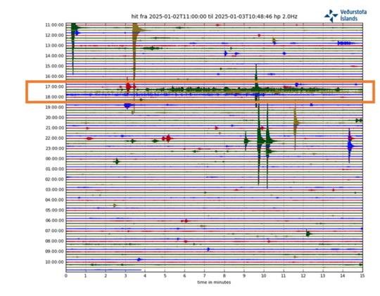
https://en.vedur.is/about-imo/news/seismic-activity-in-grjotarvatn-has-increased-in-the-last-months
Sundhnukur looking 21-28 days away from the uplift seen prior to last eruption.
9000-10000 houses burnt down, mostly in Palisades, 10 lethal fatalities, 20.000 acres down in Palisades, much less in the other areas, one reservoir out of function, not enough water pressure in hydrants. Incredible. This in a state with high-end taxpayers from Silicon Valley and Hollywood. Looting, but LAPD has called the National Guard to help them.
The water pressure issue is reported not be to due to a lack of water, as some claimed: the reservoir are filled above normal level. It is the number of fire hydrants being used simultaneously. It is the capacity of the pipes, not the water input. Of course, the fires being up in the hills does not help. But the system is just overwhelmed by the number and size of the fires.
Not trying to be contradictory, but this is the headline from an article from the mainstream newspaper, the LA Times:
State to probe why Pacific Palisades reservoir was offline, empty when firestorm exploded
https://www.latimes.com/california/story/2025-01-10/as-flames-raged-in-palisades-a-key-reservoir-nearby-was-offline
Whether it was offline for empty due to servicing and the timing was unfortunate or it was offline and empty due to incompetence is certainly up for discussion, but it apparently was unavailable.
The reservoir is for drinking water and has a cover to protect against contamination. The cover had been damaged and by law (quality standards) repairs were underway when the fires hit.
But regardless, even if the reservoir was online, there would have been little impact other than to slightly delay the inevitable.
Plus, Albert is right that the overall loss of water pressure was from overdrawing the water delivery system. Keep in mind that many/thousands of homes were burning in close proximity and shared the same water system…all with connections to the mains (including the hydrants). Once the structures burned down, their water piping (mostly/all PVC) got compromised and began uncontrolled leaking and rupture. Inna nutshell, this was a holocaust that was essentially unstoppable by man. Mother Nature wins again.
Thanks for the response. I don’t generally like to respond to headlines only, but the LA Times articles is paywalled and I wasn’t going to pay money to read.
Quick follow-up. This is probably a good example how even a mainstream media outlet can be a source of disinformation, or at least confusion.
Actually that’s a good point. Sub mains should have automatic systems for shutting a pipe when its been fractured. On first glance this doesn’t seem that hard because the flow is great there will be significant pressure differences to automate such a system. I;m sure Mr Bernoulli can be used to advantage here.
farmeroz, I’m not an expert in water distribution systems, but if I’m not mistaken all buildings serviced by a public distribution system have, or should have, a backflow preventer. basically a valve that prevents water from the building flowing back into the distribution system if there is a loss of system pressure for any reason. I don’t know this for a fact but a would assume a competently designed distribution system has valves or something similar to backflow preventers that would isolate sections of a system where pressure is lost for whatever reason from the rest of the system.
One can evade the paywall at this link: https://archive.ph/jW7uC
HVO talking about Kilauea right now and its likely future. They are expecting an eruption between the 8th and 13th January. I predicted the 10th, which is today in Hawaii, so I got it wrong but maybe not by much if HVO is guessing around the same.
https://www.usgs.gov/observatories/hvo/news/volcano-watch-pressure-within-kilauea-and-volcanologists-foretell-whats-next
Also direct observation of active lava in both of the vents. Not super obvious in this picture but its bright glowing orange in daylight.
Actually, its really hard to tell but the south vent in the big cone might have just started barely overflowing, the gas plume is much fainter and the topography in the cone looks shiny and more smooth. Episode 4 might have just started 🙂 If not today it seems likely tomorrow.
I believe something is going on in there.

It is, there is an open view of lava in both vents on an overflight today. Its not very obvious exactly in the photo posted though. The webcam did update and I was wrong there was no overflow but the vent is open.
Even if it takes another month to erupt again I expect it to be at these same vents, they are both openly degassing and glowing, where the vents at all other eruptions before this one were dead immediately, which in hindsight was a good indicator of being over. This isnt over yet.
Confirmed now, the south vent in the main cone is overflowing very slightly now. If it builds up quickly then there should be a fountain again in a few hours. But im thinking it will be a slow buildup again so far.
Interesting development. I’d go for a slow buildup too. Lava must have a degree of free motion up and down the conduit so that it stays open. I wonder how long this eruption will last.
Im thinking the wavy signal on the tiltmeter is gas pistoning, or something related to it. I havent seen spattering but the webcams are 10 min intervals and the livestream doesnt show the south vent very well, so could just be missing it.
Do we see the buildup towards a convecting lava lake? Kilauea did those, last 2008-2018 and probably also before 1924. How would the formation of a convecting lava lake begin?
Before the 208 lava lake, there were many months of small shallow earthquakes and strong gas emissions. Eventually, this became visible as incandescence, plumes of steam, followed by explosions that sent blocks of rock over the rim of Halema’uma’u and collapse of one side of the crater into a deep cylindrical pit inside of which the lava lake was eventually sighted.
Did the 2008 lava lake grow from below the ground towards the surface like a liquid, basaltic magma/lava dome?
Is the formation of a convecting lava lake possible and probable now?
It grew by basicaly collpasing the chamber roof into the live upper active magma chamber, it was a convective magma column that was eating its way into the pourus lava rocks around it. Alot of the seismisty from its early where likey due to foundering blocks thats where swallowed in the rising, expanding magma chamber column perhaps analougus to ”stoping” in geology on a massive scale . The 2008 – 2018 halemaumau overlook lava lake was basicaly the summit magma system exposing unroofing itself which is one of the most spectacular things that have ever happened on Kilauea in my lifetime, it was a joy to see it grow bigger and bigger through the years and it woud have keept growing larger if the leilani eruption did not collpase its conduit
It was basically the safety valve of the Pu’o’O’o magma flow. As that conduit became more obstructed, the level at Halemaumau rose, leading to the erosion of the roof and the opening of the pit
Yes it was for soure.. Puu Oo keept it from overflowing until the plumbing system burst by inflation pressure in 2018
Im now working on two Kilauea articles my memoirs from my first visit as adult
I wonder though, in hindsight, if maybe the supply rate from depth might have increased before 2018, just not necessarily translating to increased eruption rate. There was persistent inflation at all locations after 2011 if I remember correctly, and the flow rate of the 61g flow between 2016 and 2018 was pretty high, it had one of the longest sustained ocean entries in a single place during the whole eruption. And 2015-2018 had high pressure at the summit, the lake was always pretty high and often visible which was never the case before 2015.
I remember seeing something that Kilaueas supply in the late 2000s surged to something like 0.4 km3 a year based on SO2 rates, it then dropped, but steady inflation has been the base mode of the summit ever since at least 2010, punctuated only be eruptions or intrusions. So to me, it looks lime the supply rate has been higher than the output at the surface for about 15 years now.
Yes, the first half of Pu’u’o’o had deflation while the second half had inflation. This was not only true for Kilauea but for Mauna Loa too. The peak surge for both volcanoes was around 2005-2006 based on the steepest deformation rates. I don’t have the exact numbers of lava effused vs magma stored though.
Been thinking about the uplift seen in the last years, compared to anything in the last few decades it is pff the charts. At the summit most of the GPS have fully recovered the 2018 drop last year, only 6 years later. If the supply rate really gets exactly reflected by the GPS then the rate must have been 0.5-0.7 km3 in the past year (!) and not including the crater fill (0.25 km3? now) and filling other storage in the south caldera and ERZ.
Only other comparison might be in 1960-1961, after the 1960 eruption at Kapoho, the supply was very high too. I had thought it was ongoing from 1959, but now thinking there must have been an element of decompression. I guess maybe right now is both decompression and a surge
I did notice, Pahala is silent now Kilauea is erupting. And in recent years is most active when Kilauea is inflating fast and usually seismic. I cant recall it doing anything for Mauna Loa. Seems clear which volcano has the influence.
The high supply since the late 2000s until 2018 reminds to the current phase since 2020 to now. So we only had two years 2018-2020 without high inflow to Kilauea’s summit. Are the summit eruptions 2020 to now a continuation to the 2008-2018 eruption?
Maybe the collapse events like 1790 and 2018 are not the beginnings of a cycle, but the peak of a cycle. The beginning of a cycle should be the moment with the lowest filling rate. 1894-1918 was the weakest historical period of Kilauea with 0.0017 km³/year.
2018-2020 was high supply too, just a lot of places to go and spread it out. Late 2018 and up to early 2020 the ERZ east of Pu’u O’o then under Pu’u O’o was inflating. Then eruptions filling Halemaumau for 3 years, then more magma filling underground with leaks up to a few weeks ago.
Now I think will be another era of mostly eruption. The only part left to fill up to 2018 level is the ERZ but that wont take too long if the focus goes to it. But the summit might need to fill up more first. I doubt a lower ERZ can happen unless the summit is minimum 1 km elevation, still 60 meters to go and over a huge area.
The uplift is high, but Pu’u’o’o is not erupting either, so it’s hard to tell. And the biggest incognita as always is the dike storage under Kilauea since most magma gets stored in dikes deeper than 2-3 km, which doesn’t show as surface uplift but extension. So it’s very complex and would need someone very knowledgeable in both Kilauea’s dynamics and physical models to sort it out.
I don’t think it’s an effect of decompression though, but more likely to do with external factors:
https://eartharxiv.org/repository/view/7656/
Seems like theres nothing even slightly comparable since at least 2000, at least for the summit instruments. None of the others go back more than 10 years though but it seems too much of an increase to explain by there no longer being a flank vent.
Is it open like Stromboli’s conduit that sometimes suddenly flows over with lava?
Maybe.
The smaller but brighter glowing north vent is spattering. The livestream is out of focus but the glow is flashing, and on the S2 cam the small cone is glowing in infrared from spatter landing over it. Looks like a slow ramp up again like episode 3, unless the eruption is about to surge suddenly.
The livestream seems to be in focus and clearly showing little fountains from the north vent now; looks kind of like fireworks lifting out of the vent
Now showing up on the new 04:29 HST snapshots for the V1 cam, and as a bright spot on the 0:420 images on the B1 and B2 cams too. No overflow yet to show up on the thermal image, though
Main vent is starting to splatter now on the live stream.
3 magnitude 5s at Dofen in the last 2 hours.
Might mean the dike is still propagating. A dike this long, must have a huge magma volume even without any significant eruption resulting at all. I wonder if Fentale will have visible subsidence in its caldeta. The young rhyolite in the valdera does look kind of like it leaked out of a crack into a deeper pit, which might have been from a similar situation.
Seems the biggest dangercis that a maar forms above the dike, or the big unknown around Dofan. Fentale seems to be pretty much a gentle giant compared to some of its neighbors. But too many variables to say much for sure.
I am sure this wont end without red stuff at the surface somewhere though, rifting episodes rarely ever end underground…
If the magma keeps flowing through the dike, do you think a shallow sill well develop akin to the one at Sundukhur?
Thats already there under Fentale. I understood that the sill under Svartsengi was growing for years (maybe is permanent) before it broke through at Sundhnjukur. So this new intrusion is like the dike that formed in November 2023. Except it is a lot bigger, probably as big as the dike that fed Holuhraun, so maybe up to 1 km3 but I havent seen any model yet. I doubt it will erupt in the same way but still.
I am wondering if the caldera at Fentale might be a collapse caldera like Kilauea or Bardarbunga now too, instead of an ignimbrite caldera. Maybe even all of the calderas in the area are at least started that way, collapses that destabilized an overlying rhyolitic system, too much. The prevalence of magnitude 5s might be the same as for Kilauea and Bardarbunga, that Fentale is slowly collapsing. If that is the case then the chance of an eruption is extremely high somewhere.
A study on shifting meld composition during Spain’s recent eruption (La Palma). Only Abstract available: https://www.nature.com/articles/s41561-024-01623-x
” Erupted melt compositions become progressively more primitive until the tenth week of activity, but a sharp reversal of this trend then marks the decline of mantle magma supply and a precursory signal to the eruption end. “
Volcanoes on Mercury:
Mercury stuns in incredibly detailed new images (9 Jan)
Two more years before the spacecraft attempts orbit, but if everything works we should see some fascinating science.
The mystery volcano which cooled the earth in 1831 has been positively identified. See https://www.pnas.org/doi/10.1073/pnas.2416699122
It is Zavaritskii caldera, Simushir Island in the Kuril Islands. Finally one long-standing mystery has been solved.