
Welcome to the Volcano Café bar, a place for all things on or off topic and inane ramblings. There has been a need of late to find a place better suited to various theories, long comments and enthusiasm. This page will be less moderated than the main article pages and cleared out every month (this may change depending on use).
Have fun and don’t forget to tip the barman 😉
https://www.youtube.com/watch?v=5tq_wxP_1V4
Beautyful video of the La Palma Basanite, notice how fluid and smooth it is up at the vent where it emerges, basanites have low visocisty looks very hawaiian
https://www.youtube.com/watch?v=RGghEWabnns
https://www.youtube.com/watch?v=fxpaAxkd4ac
And some from the old halemaumau lake showing its low viscosity as well
Europe awaits a new Spanish plume the beginning of next week: A heat wave combined with high pressure. This lets summer continue throughout the beginning of October.
A sign for climate change. Usually we don’t acknowledge the effect much in everydaylife, because the change is steady and slowly. But if we look at the latest >20°C days in fall, they occur later and later with the years.
This trend is accompanied by a) warmer nights in summer and b) warmer cold periods in winter. Weather patterns that decades ago brought heavy winter temperatures during winter, now bring relatively mild winter weather.
Weird how a tropical climate is defined by over 18 c all year around, If a place is 23 c all year around its tropical althrough that feels very cool and pleasant, althrough typicaly real tropics have Noon temperatures are up to 32 c everyday
In our near Ice Age standards the 31 c equator is indeed quite cool compared to a greenhouse Earth equator that avarge perhaps 44 to 49 c .. a warning for us humans what coud happen If we dont regulate our massive cO2 outputs..
Looks like I will get extended summer weather then : )
https://m.youtube.com/watch?v=SiviOdWDl9o&pp=ygUbbm9ydGgga29yZWEgd2FpdGluZyB0byBkaWUg
The current situation in North Korea, a quite disturbing documentary how Kim Jong Un transforms the entire DPRK into a huge prison, defentivly the worst dictatorship at current today, this regime does not care at all about its citizens, Infact the Kims starves them which is unlike any other tyrannical states today.
The Kims also arms the DPRK with nuclear weapons to prevent other states from toppling them. Its all spines outwards towards the world and inwards on the population for DPRK
Found a video of the Pu’u’o’o high fountains:
spectacular for soure, remebers these early Puu Oo events from similar old videos that volcano video productions did
It’s really hard to find footage of the fountain stage of Pu’u’o’o.
That one at 4:00 with the many irregular vents gushing out at all angles is my favorite. I think it might have been E 12, the last eruption of 1983. That eruption also made an intrusion down to near the 1977 cone, it nearly erupted too as steaming fissures were seen. The longest flow flowed over the new faults in one place too.
Interesting. A bunch of these fountaining episodes did have lateral dike intrusions at the same time.
East storm at Baltic Sea: Usually winter storms come from west and do heavy Northwest to Southwest storms. This time there is a storm with eastern wind directions that push the water of Baltic Sea towards the east coast of Jutland and the whole coast of Mecklenburg-Vorpommern.
A map of Danish Weather office: https://www.dmi.dk/varsler/
All read areas along the coast get water levels more than 1m above normal sea level. There are no significant tides in the Baltic Sea. The high water level is going to persist for two days until the wind changes:
The same storm hit Scotland today with 20cm of rain
Regarding the present situation at Kilauea, it seems that there could be a similar situation as in the early part of the 19th century. The Kealaalea flows and 1823 eruption seem to be from the same crack, coming from the summit. However the Kamakaia flows do overlay the Kealaalea flows where they meet and yet were still present in 1823. It seems there were two rifts open at the time together with one beginning at Halemaumau probably with a lava lake at the summit, and another being from the SWRZ connector itself which came from the Kamakaia segment. The earliest stage might have been from the SWRZ and was a long intrusion from the connector down to the Black Cone, maybe the first eruption there in a while and was small at the end of a mostly intrusive event probably in the latest 18th century up to 1810. This dike would then stay open and intermitently erupt over the next decade, culminating with the Kamakaia eruption itself which was probably in the late 1810s. At the same time the summit was active and probably filled in rapidly between 1796 and 1810 similar to the past few years. At some point it started intruding the SWRZ cracks directly at shallow depth like happened a century later at Mauna Iki, first in a very similar manner but then with a full blown drainout in 1823, which seems to have put an end to all of the SWRZ activity, probably a combination of raining the lake and perhaps also an ERZ intrusion.
The alternative which could be interesting to consider, is that the Kamakaia Waena eruption was actually after 1823, and happened when the lake had recovered somewhat prior to 1832 or even after that just before 1840. This may have some support as the magma filled rift would have evolved in those years and this is what is seen at that eruption, and small scoria vents in the Koae fault zone are dated to the same age range and which are best aligned with the Kamakaia fissure swarm. All that is considered as ‘certain’ by HVO is that the Kamakaia Waena eruptions all happened after 1790, and before 1868. So this interpretation is not implausible by any means although it doesnt have anything directly supporting it in the literature either.
So I guess, maybe to backtrack on somethign I said before, the next intrusion there might be mostly just that, with only very small or no proper eruptions, like in 1961. But if the ERZ doesnt wake up soon then that will not be the case for long, and much of the Kau desert could get a resurfacing.
Apologies if these are too big
Kealaalea/1823 flows
Kamakaia flows
Interesting is the comparison to Mauna Loa’s SWRZ. There eruptions can be a lot more voluminous than at Kilauea’s SWRZ. But they have in common that eruptions can move quickly from the summit to SWRZ.
Is Kilauea’s SWRZ going to change with growth of Kilauea? One day in future Kilauea will grow to 4000m above sea level, if the architecture of the island can bear this.
Mauna Loas SWRZ is like Kilaueas ERZ, it is its dominant rift zone. But Mauna Loa is also very topographically prominent so its NERZ, which is more like Kilaueas SWRZ, also does large eruptions it just isnt active along all of its original length anymore, except in very rare circumstances.
Basically the rift zones of Kilauea and Mauna Loa are flipped respectively as to which direction is the dominant one.
Interestingly, and I still dont know if this is coincidental or not, but in both volcanoes the longer rift zone is also offset from the caldera and erupts alone, while the shorter rift zone trends directly into the caldera and erupts together with it…
I would expect Kilaueas SWRZ to be similar to this if it ever reaches the height of Mauna Loa, but it will probably not be the same, as Kama’ehuakanaloa will likely be above sea level by then and obstruct Kilaueas spreading in that direction. But then, it is not really very certain what will happen that far, or even how long that will take. It might be in as little as 100,000 years or in more than half a million. The extreme height of Mauna Loa might also be a result of its age and decline, it is not generally erupting as intense as it once was even if it does get intermitent revivals, and so eruptions are mostly stuck on land where many large eruptions at Kilauea empty significant volumes offshore especially those on the ERZ. Probably between 10% and 20% of Pu’u O’o, nearly 1 km3 at the high end, ended up in the ocean. In 1960 and 2018 the volume was more than 50% ended up below sea level. In 1950 and 1868 Mauna Loa eruptions a large amount of lava also ended up below sea level but these are the only cases this happened and neither eruption was close to as large as 2018 even if extremely intense. Only a few eruptions from Mauna Loa have actually even reached the ocean historically, its just hiden by how crazy 1950 was to do it 3 times within a day… 🙂
Maybe the comparison was a bit wrong, because Kilauea has rather the lifecycle of Mauna Kea than of Mauna Loa. If we look at the historical eruptions Kilauea did more random eruptions with very different types, some large, some small. But the rate was usually not as high as Mauna Loa. 1950 Mauna Loa reminded to a Laki lava flood. In 22 days it had a volume of 0.38 cubic kilometers.
The 2018 LERZ eruption was an exemption that it came close to Mauna Loa’s style of eruptions. It lasted 124 days and had a volume of 1,5 cubic kilometers. It was very different to Puu Oo’s longterm eruption which appears to be more typical for Kilauea’s eruptions (long endurance of eruptions, but relatively low-moderate rate in relation to Mauna Loa).
Mauna Loa has got a lot of its surgace covered by pahoehow, it also spends a lot of time erupting slowly like Pu’u O’o. Historical period is a little unusual as far as things go af MaunaxLoa, way mors intense volcanism.
Yesterday and today Earthquakes escalate again. Currently they focus on 155.3° West. It looks like the middle SWRZ is going to get the next eruption.
https://m.youtube.com/watch?v=lBb5TFxj1S0&fbclid=IwAR1EcNILWR-f68uf-T51OIFWmx2bT-otrthJl0lFVH77Fow2ScKTHKlwRSo_aem_AaX8nD_QnTG7yU9bI6lxkn_P-2HQmItOL34svQ9nM007zQMx7LmqXQSIM4_UKa721Ys
The food guidelines in the west are an absolute disaster
The food guidelines are an absolute joke in the west world. Here is a fantastic very good hour long documentary with doctors explaining how wrong the western diet advices are. The reason they say natural fats are dangerous is so they can sell their junk food carb products it’s the truth.
And this flawed research is also the shameful dogma being pushed in universities as the grain industry pushes its flawed science there too. The truth is that we need to skip all processed carbohydrates and sugar that damage the arteries through sugar glycation. Sugar and Refined crabohydrates cause heart disease.. not saturated fat. ( the food guidelines are result of coperate capitalism that only wants us to eat junk food )
We have been eating saturated fat and meat for millions of years in perfect health. Eat all non-processed foods that do not affect blood sugar much. We need a new food pyramid that is low carb, based on natural fats and healthy vegetables and grass-fed meats and lots of fish. We are becoming heart diseased and senile from our sugar carb western diet. But that sugar industry will never agree.
For over a hundred years now, we have been urged to stop eating nutritious butter, tallow and lard, filled with the vital fat-soluble vitamins A, D, K2, b12 and STABLE saturated fat. Fats that we have eaten for millions of years. The fat that is in our mother’s breast milk. We have been persuaded to replace it with factory-made sugars, seed oils and fake margarines that are completely alien to us as a species and consist of unstable unsaturated omega-6 fats that bind, oxidize and inflame our cells and mitochondria.
What has happened? Obesity, diabetes and all associated heart diseases have exploded in the Western world, proportional to the intake of sugar and Refined seed oils. Several generations of experts and professors who rule our academies have invested their entire life’s work in the paradigm that fat makes us fat (wrong), that saturated fat is especially dangerous (wrong), and that cholesterol is dangerous (wrong). A trillion dollar industry has grown up around medicating the world’s population for life for diseases that are completely reversible and easily avoidable if you only eat human food. All health institutions have long been based on the premise that saturated fat and meat are dangerous. Would they turn 180 degrees and admit that they were totally incompetent and that the doctors and researchers who claimed the opposite and were hunted, mocked, excluded were right?
The power to health lies in our own hands and if you want to get well, you can’t go and wait for those who profit from our illness to tell us how to get well.
I started LCHF 3 years ago and stopped all processed food 4 years ago and have never felt better. Lifelong migraines, stomach problems, eczema, dandruff etc. will soon be completely gone, but it heals slowly, the body has to replace all the cells. I encourage everyone to read up and test for themselves…
The market only wants us to eat their junk food products .. so a few years ago I skipped the western sugar laden trash diet .. for an ancestral diet and I feel much much better and have gotten controll over my blood sugar.
The doctors … ( most of them ) they dont know .. beacuse they never learnt this in the first way.
We seriously needs a New food pyramid in the west
And absolute disaster is the food guidelines in Europe and America and in most parts of the western world .. its an absolute disgrace almost is pure fascism how the market wants to cram us full with their Refined products, this is a good documentary that acually says the truth.. and with PHD doctors that dares to say the truth …
My New food guidelines is unprocessed food
Unprocessed meat souch as grass feed beef, unprocessed fish, unprocessed vegetables, and crickets in pan and seaweed and lots of nuts
Woud be very good If more doctors and most important if the cooperate thugs coud understand this one day
The human biology is tolerant to a large variety of food. But it is not built/evolved for the “Brave New World” artificial food and medicine that the profit maximizing industries supply. Therefore it’s a risk to rely too much on artificial sugar, protein, vitamins, … which are rather made for profit and not for humans’ needs.
Also too much sugar is not healthy. In natur you don’t find as much sugar as in supermarket. Added to this sugar has become cheap. There are many ways to produce cheap sugar and add it to cheap industrial food. People eat a lot of sugar without noticing it.
Exactly we are eating ourselves To death on Refined crabohydrates
That is the cause of heart disease ( sugar glyciation) that blocks the arteries
It have nothing at all to do with saturated fat. Infact meat and fat are probaly the ideal human diet
Most doctors gets it wrong
A problem with too much sugar is the risk to early get Diabetes. Better eat less sugar and be able to eat some sugar until the end …
No one would voluntarily eat the sugar that is inside a Red Bull, but it has become a foolish trend. Some people nearly live from this poison with lots of sugar. If we drink a coffee, we can controll how much sugar we add. But if we buy an Energy drink or Coke, we have no choice.
Yes sugar inflames the arteries causing colesterol to stick to that surface and the arteries gets narrower and narrower. That is the cause of heart disease..
It haves nothing to do with fat .. healthy fat that we eaten for millions of years
Sadely .. almost No doctors know that, since they learnt the wrong theories that the crazy food guidelines says are ”correct” Its incredibley how we are being lied to by these greedy capitalist intrests. My own goverment and local doctors are all lying…about this .. very sad indeed, and in the US the food guidelines are even worse https://m.youtube.com/watch?v=vaBhtg78sbA&pp=ygUSRm9vZCByYXRpbmcgc3lzdGVt
Western food guidelines are the worlds largest health crimes and real ongoing conspiracy
There’s ‘saturated fat’ and there’s saturated fat… it’s not quite right to say ‘saturated fat isn’t dangerous’ but it is true that you can eat fats and be healthy. A pat of butter from a truly grass fed cow is not the same as butter from a cow that is given supplementary feed made from soy/maize/wheat/palm oil. Spain eats absurd amounts of pork and the lack of expected heart disease was a mystery – until you take a look at the kind of pigs they were eating, ie ‘artisanal’ often acorn-foraging free range breeds. Their body fat is soft and translucent, an entirely different thing. It was a shocking revelation to me, that so much ‘Western’ disease was not just down to meat eating, but the eating of animals that had been fed exactly the sort of things we were warned not to. Eat sick animals, end up sick yourself.
With cholesterol, it’s very very much down to the *type* of cholesterol and yes, we make the bad stuff as a reaction to eating bad things. Trans fats, palm oil based fats… Refined seed oils aren’t the culprit if they’re of high quality. Trans fats are supposed to be banned in the US and much of the world now but were everywhere until the 90s
You do still have to beware saturated fat. Saying it’s not the issue is a red herring – the issue is that you *can* eat natural fats, even animal fats, but the animal fat isn’t *supposed* to be that saturated! It can be as rich in omega 3 and 6 as fish, if the feedstuff isn’t junk feed.
Yes grass feed beef is the best beef
And grass feed butter.
Althrough its good to limit meat as its very resource taking even If its healthy
Overall avoid all processed foods
Overall a its a very good documentary that explains the truth.. the food guidelines and health guidelines are an absoute disgrace in the west world ..
Its not science at all that made the food guidelines, this is pure market capitalism that created the modern food guidelines based on flawed
”fear of fat” and that we should have sugar and ultrarefined crabohydrates as base food. Sometimes it feels like the market wants to kill us all ”11 servings a day of white pasta”
Thank the Nordic gods that I gave up western diet .. a few years ago, now I eats what we ate 120 000 years ago
Here in the west world we needs competely Re – think the whole food and healthcare system .. because its dead wrong .. and been since WW2
No you do NOT get heart disease from saturated fat that we eaten for millions of years. We humans works best on meat, but the worlds population is way too large for everyone to be eating that
It is incredible how the sugar and grain industry have been allowed to manipulate the entire worlds healthcare and food systems
These greedy intrests explains why I was only learned to eat bread and white rice in Elementary school.. stuff thats basicaly junk quality and turns into pure sugar .. its a very good documentary
The food guidelines are a lie . .. almost everything that we learns about food and health in the west world .. its dead wrong and needs to be Re – thinked
Mexico’s east coast got a Category 5 hurricane, can possibly also cause fluvial movement of volcanic materials: https://edition.cnn.com/2023/10/24/weather/hurricane-otis-acapulco-mexico/index.html
El Nino Periods often produce strong eastern pacific Hurricanes. Since late summer we’re entering a period of El Nino which shall have the peak around November to January. The strong hurricane Otis can be a first sign of more weather disasters to follow. Often an El Nino increases global temperature temporarily, so it may help to see the distant future development of climate change some years before. El Nino Report and Outlook:
https://www.cpc.ncep.noaa.gov/products/analysis_monitoring/lanina/enso_evolution-status-fcsts-web.pdf
Orcas spotted in Hawaii outside Oahu .. but what are they doing there? Hawaiian waters are incredibley clear and poor in nutrients, basicaly a watery desert, the humpbackwhales birth their calves there .. but there is nothing for them to feed there, they feed in Alaska later
What are the Orcas doing in Hawaii? These blue waters are not very fertile compared to Alaska and Iceland as example so probaly meager hunting grounds
https://www.flickr.com/photos/194933949@N05/53307074167/in/dateposted-public/
https://www.flickr.com/photos/194933949@N05/53307935116/in/dateposted-public/
Basically the maps of Vermante Island, which is located at these coordinates:
28°09’06″N 30°26’52″W
What is interesting about is is that it has a big caldera at it, unusually large for a effusive volcano. The reasoning to this is that it is actually made of multiple calderas that eventually join to form one giant caldera complex. The majority of them is perhaps collapse calderas, all of which formed when massive amounts of magma drain out to the two southern rift zones (which technically are two distinct ones).
Now, there are four rift zones. The northern rift zones are not really energetic, but make up for in volume, as more commonly or not, they form shields. The northern area in between the rift zone contrast them, as the eruptions are usually small and short-lived, but very frequent. To the southern areas, there are at least three areas of constant activity, with the southernmost of them being younger, appearing sometime in the mid 1400’s, from a recent caldera collapse. Then are the southern rift zones and, unlike the northern rift zones, go underwater and mostly effect the vents within the caldera itself. It very much does what Kīlauea does, except more active and can be capable of producing fairly large lava flows (with the largest at the lower SE region in 1703, which pumped out more than 4 km³ of lava, but most are in the ocean).
Today, the volcano is very active, thanks to its high supply rates coming from the Great Meteor hotspot (or at least where I think it is) and is about 1.9 million years old. I could add on that it had so much of a supply rate it could’ve been theoretically active for longer than Stromboli. So that is the volcano right here…
Wow so beautyful and a structure thats quite unlike any other major shields on Earth today closest analouge maybe Galapagos and some pacific arc shields in structure. Vermante Island is clearly an immensely powerful volcano with souch large calderas so magma stoorage is probaly gigantic here ( what kind of event formed the larger outer caldera? was that an explosive event like Ambryms major caldera collapse? ) this is defentivly a monster volcano with larger eruptions than most other shields on Earth, I imagine its being capable of Laki sized eruptions and basaltic plinian eruptions as well, its a mean mix of Ambrym, Masaya, Fernandina in one spot and much bigger too. This is one of your best maps yet .. woud be fun to have a 3D generation of it .. magnificent volcano, the outer caldera is almost it is Ionian in scale. I guess Thoelitic basalt for a volcano as powerful as this one, highly fluid and 1200 c
( planetocopias ) Lyr thats also an excellent Super Earth concept with 100 s of tours it also have big shields volcanoes with broad slopes althrough thats a competely another level of geological activity with 7 Earth masses as world concept, yeilding arc and hotspot volcanoes many 100 s of km wide in many cases.
Well Vermante Island on Earth is located close to the latitude 30 s so probaly mild and pleasant tropical lowlands and the higlands will be cold and frequently covered in snow. The highest ridge plateau on the caldera probaly haves a Glacier I guess feeding many streams, during the Ice Age the whole summit was peobaly Ice filled, but frequent volcanism removed those glacial signs. The Lowlands are likley to be TOURSIT TRAP hot in summer and warm – mild in winter like an gigantic Bermuda filled with rich pepoles properties and perhaps even high end high rises and hotel blocks and their sail boats and severely plauged by Atlantic Hurricanes in autumn, its also a good stop for sailors comming up from the carribean before they sail over to the Azores and later UK. Vermante Island Is probaly a british colony today thats still owned by them since a few 100 years back, in WW2 the Island waters was plauged by Hitlers submarines sinking allies merchant ships just offshore as they ly in ambush.
Reminds me strongly of a huge version of Ambrym so perhaps is lava lakes in some of the intra caldera cones but visiting them woud be hard in that thin air tired of walking
5250 m should probaly be glaciated perhaps, but I also know that the snow line is the worlds highest at high 20 s latitude so probaly will be bare and without snow so correct mapping
But your mountain will not avoid seasonal snow in the highlands, and probaly falls heavy at the summit and in the caldera , while the lowlands remains t shirt weather all year around , same latitude as canaries but with milder summers
I confuse New England hotspot with bermuda area, while this is just below the Azores in reality, so the Island will probaly be portugrese or spanish in belonging and so no mass tourist trap perhaps like Islands to the west
Well I confused Great Meteor hotspot with the New England hotspot so tought your monster Ambrym was located in the west atlantic
Ooo now I see a glacier on the map there is probaly a shadow in the caldera there so Ice all year around, and in winter it woud recive very deep snow the caldera from northen low pressures frontal systems, perhaps okmok caldera and aniakchak in deep winter is similar what Vermantes summit woud look like in winter
Hurricanes wont be a problem in the cooler subtropical waters of the Canary Current that flows there
Very Impressive.. Ambrym 2.0 minus most of the pyroclastic history it have and another geological setting here.
A winter satelite shot of this one woud see a green oval with dark lava flows capped by a white snow oval in the interior of it with vigorous steam plumes drifting east
Well, there might be some pyroclastic history, it might be minor compared to the ratio of lava flows, perhaps due to perhaps past glaciation. In the same note as to why there is only a few glaciers at the NE edge is simply because everywhere else is either very little precipitation or it is just really volcanically active (I.e. melt the snow) or geothermally active. The tall mountainous northern area could provide a Etna-style snow cap all year round, but maybe only proto-glaciers on there. Heck, any evidence of glaciers from the Ice Age would’ve either be non-existent (due to intense volcanism there at the time) or buried by lava flows.
There woud be heavy seasonal snows at the summit at least… its rather very tall, woud be good skiing
And then you can drive down to the lowlands and pretty much be in t shirt at Noon in january
You may also add some tuff cones in the seas lateraly with the rift zones as slopes extends far underwater and shallow offshore pheratomagmatic eruptions woud be common too. Souch palagonite tuff rings will be densely populated
This is a monster volcano really and probaly woud do the largest basaltic eruptions of any ocean Island on avarge if it existed, the summit caldera far exceeds any other real life mafic calderas at current, it formed by drainage of giganyic tabular magma bodies where many 10 s of km of magma was removed from the caldera and the plateau sank… the rift zones during souch events woud be insane sights with erupting lava curtains 10 s of km long feeding massive pyrocumulus clouds the shallow offshore rift may erupt too during souch a large event with a long row of Grimsvötn 2011 looking pheratomagmatic columns in the water, seen from offshore it woud be a sight of armageddon! much bigger than Thjorsahraun, but souch large shows woud be very rare.
The Islands older lower warm
subtropical parts are likley very densely populated, so it woud be a high risk volcano IF it existed so a ”decade volxano” worth of intense monitoring
Knowing the diameter of the caldera its possible to store many 1000 s of km3 of basalt depending how thick the sills are inside it, so much bigger than any other basaltic caldera systems. Your volcano haves at moment a very high supply so is likley well vented and rarely go armageddon. The scale of the caldera is magnificent and some of the intra caldera cones are as big and bigger than many cascade volcanoes, some of them maybe lava shields that sit below the glacier ridge.. perhaps its little like having an Erta Ale inside the caldera constantly oozing lava.
The caldera must be a magnificent sight.. cloudy and gloomy with sunlight shining through cloud gaps and litting snow packs.. kind of like Icelandic highlands and sometimes massive cloud walls flows over the caldera walls and fills it
Stark diffrence from the warm subtropical lowlands that are packed with pepole
I would theorize that it might be dangerous, with the potential for lava flows on its rift zones, but the majority of the activity is contained within the caldera for now, forming due to multiple collapses over a long period of time…
The composition of the volcano is basaltic, but a hotter variety (say 1300°C to 1500°C) as its very large supply (WAY more than even the Hawaiian hotspot) allows that, maybe even komatiite might exist, even to the present day in the lava lakes that are currently building up the shields. However, the taller and steeper northern might erupt nearly only basalt as it has its own magma chamber that is getting less of that supply then the rest of them.
Then the lavas will be incredibley fluid indeed at over 1300 c you breaks down most of the sillica chain polymerisation that acts as plastics making it as fluid as water, so woud look like bubbling iron slag at 1500 c
Most of the polymerisation is already gone in Hawaii that is VERY fluid in Halema’uma’u today anyway
This is probaly a super madeira.. but even more green and rainy and little warmer overall, woud be packed with pepole the lowlands having souch a friendly climate, but the volcano is not always friendly .. and will not always be ..
Great maps.. you do
But the South Atlantic volcano you did last winter is even more powerful I think
Updated versions of Vermante Island:
https://www.flickr.com/photos/194933949@N05/53307765167/in/dateposted-public/ – Geology map
https://www.flickr.com/photos/194933949@N05/53308988059/in/dateposted-public/ – Physical map
https://www.flickr.com/photos/194933949@N05/53308987669/in/dateposted-public/ – Holdridge climate map
Very beautyful thank you, next is a 3D view althrough the elevation maps works for that
Hahaha whats the Islands population?, reading real history it should be pretty packed If you looks at other subtropical atlantic Islands
Is this a fictional map? Still, that looks realistic. A huge Mauna Loa-sized shield in the middle of the Atlantic!
Mauna Loa is bigger But this one is huge too, and this one probaly have done larger eruptions
The whole island is something like 80 x 50 km wide and its caldera 40 x 25 km wide – roughly the size of Maui or a little bigger than Reunion Island, maybe.
You’re right that it’s not as big as the Big Island, but its caldera size puts anything in the state Hawai’i to shame (except maybe Kaua’i’s Olokele Member). Not to mention it’s 5250 m (17,224 ft) tall – this puts even Mauna Kea (4207 m/13,796 ft) to shame. However, it’s possible that Haleakala was probably at least that tall while it was directly on top of the Hawai’ian plume approximately 1.2 Mya.
Kilauea currently does both earthquakes towrads SWRZ and Hi’iaka crater. At Hi’iaka crater 1968 an eruption occured: https://www.usgs.gov/observatories/hvo/news/volcano-watch-kilaueas-1968-hiiaka-crater-eruption-was-a-ground-breaking
“The August 1968 eruption was noteworthy—at the time—for several reasons: (1) No other fissures documented in written records had opened so far west on Kīlauea’s east rift zone; (2) the active vents were the northernmost eruptive fissures along Kīlauea’s east rift zone in at least 550 years; and (3) the fissures erupted the smallest volume of lava of any known Kīlauea eruption.”
This happened some years before the SWRZ did its 1970s eruptions. Can an active SWRZ facilitate upper ERZ eruptions in the area of Hi’iaka?
Both the Hi’iaka eruptions and SWRZ eruptions 1968 to the 1970s happened when Mauna Ulua paused and the Middle ERZ was a bit blocked. Maybe there is now a somewhat comparable situation since Puu Oo is shut off and the upper ERZ has some advantage.
🤣🤢poor dogs they are de – evolving into useless blobs due to cruel human breeding. Many modern highly breed dogs have smaller brains and poorer health than their magnificent Wolf ancestors, LoL wow .. a daschound is a disgrace compared to the Magnificent Wolf ancestors
Is this a hole in Jupiters upper ammonia coud deck? looks quite creepy, wait its even a hole in the brown ammonia sulfur clouds that sit below the ammonia Ice layer so this is looking pretty deep into the atmosphere.
There should be a water cloud layer at 5 bars that sit below the upper two cloud layers and thats been confirmed by Juno, perhaps this is a downdraft thats heating up the air and evaporating the clouds, like at jupiters hotspots but it does not look like that either, it more resembles the brown barges on Jupiter, but smaller and more round.
Pardon me, but is anyone else weary of ceaseless comments & speculation about Grindavik and Iceland in general? Please, Dragons, a whole world of volcanoes awaits our interest & attention. How about Japan, islands of calamities, past and future? Or a tour of the Ring of Fire. Or what will likely erupt in the next 10 years, 50 years, 100 years, that most, if not all of us will miss? Whatever you think.
There is a bit of a thing for Icelabd on this forum. It has reasons that probably go back to Holuhraun or perhaps Eyjafjallajokull. I agree it is a bit overwhelming.
I think now that it is pretty clear an eruption of any significance (or really anything at all) is not immediately upon us it is a bit pointless to keep obsessing over it. For those who want to see lava Kilauea is doing pretty much exactly what everyone is speculating is going on under Grindavik only at Kilauea there is no speculation, only waiting until something bursts and the red stuff is on the surface in an hour.
I guess, if Hunga Tonga Hunga Ha’apai is a good model then high VEI explosive caldera forming eruptions dont give much of a show, which is why that subject isnt as often a topic of discussion. Anything close enough to see something is too close, and its all over in a few hours. And depending on the location, many casualties may result from those hours…
That is typical for volcanoes – as pointed out here, they are like cats. Sometimes completely unexpected, at other times refusing to turn up. Yes, we were planning to move on. Iceland has the most watchable eruptions on Earth, and so it is not surprising that they attract a lot of attention.
I totally agree. In recent days, fumes from the geothermal power plant have attracted more attention than the Ulawun eruption. People were also evacuated due to this eruption. I really like predictions about caldera-forming eruptions, despite how wrong they may be. I also like to observe explosive eruptions and I don’t need live cameras for that. In case of the Ulawun eruption, it was possible to observe it almost live from a satellite. Later, photos from the ground and from the air appeared. For me it is much more interesting than looking at seismograms and watching the noise of waves, wind and bulldozers building a wall.
Indeed VC was formed because of Icelandic eruptions so they will always be special for the community and a great intrests for many here, Iceland is close to many readers here too so feels more relevant for them than more remote volcanoes thats feels off, but yes as you say.. the most Impressive induvidual volcanoes are the Hawaiian Giants. But Iceland is a huge treat for many and specialy now when Porbjorn is about to burst a Krafla fires, both Hawaii and Iceland are extraodinary really in their geological offers and scenery sights 🙂
I like them both defentivly .. they are both incredibley beautyful, scenic and massive and have their geological uniquenesses althrough Hawaii is indeed unique among induvidual volcanoes with the mass and productivity over short timescales and Iceland massive too, defentivly giant as a whole area its monsterious that plateau in just 14 million years. Iceland overall geologicaly coud be the most unique spot in the world
Sadely Im very injured and feels less and less intrest in volcanoes, and anything at all really, feels like Im not intelligent enough at all to even contrubute to VC anymore, I guess my Osteomelytis is really wrecking my health now loosing all my capabilities, but antibiotics are my best friends and its at least not getting worse
But I do have an upcomming VC article but its not done yet, it needs to be keept working on as an uploaded VC draft thats in pendling stage. Im so poor at writing so needs to be keept working on before posting it .. and I dont think Im allowed to send in a newer version
The upcoming article has gone through the initial edits and it is looking very interesting.
Doing the last spell corections and word improvents.. will be fun
Will be next saturday if svartsengi does not erupt
Coincidentally my wife asked me yesterday, why are you so fascinated and solely focused with Iceland and volcanos when there is a whole planet to observe. My answer was that it sings to me in a way that the rest of the planet doesn’t. It must be something about an island, with glaciers, snow, auroras, eternal days and eternal nights, a charming and lovely friendly folk, barren landscapes, countless volcanos, active and dormant, visible history, and a forum like this. I guess my love for Iceland isn’t unique and the people who frequent this site are for the most part awesome.
Mike, so in answer to your question, I can only apologise and say no I am not weary and my cup is full but your mileage may vary 😉
: ) Here are perhaps the strangest planetary interior in the solar system! the materials they are made of are not strange at all .. But its the whole compositon thats feels strange compared to our Rocky Earth and rest of the inner stoney planets. Uranus and Neptune are litteraly Unearthly! you you all know how Jupiter and and Saturn where pretty strange being Gas Giants thats mammoth bulks of compressed hydrogen with No solid surface at all
Uranus and Neptune are perhaps even stranger than that, they are too ”Gas Giants” But of a very diffrent sort compared to Jupiter and Saturn thats mostly hydrogen. These two are instead formed from a heavier element mix. Uranus and Neptune are giant bulks of water, ammonia, cyanide, methane, co2, carbon, with lots of water in this mix they are known as ”Ice Giants” the two Ice Giants of this solar system. But being Ice Giants does not mean a solid surface that you can walk on try to walk Neptune and Uranus and same terrible fate as Jupiter you sink into the goo, outer atmosphere is hydrogen, but as you sink down you gets into a denser and ever denser hotter water – ammonia – methane medium. These two planets are mostly water vapour and ammonia.
The deeper you go the stranger it becomes too in these two planets and the higher the pressures and temperatures. Water boils at 100 c on Earth but on Uranus / Neptune it cannot because the pressure prevents it .. deeper down the pressure transforms the medium into a very hot fluid, water and anmonia under millions s of atmospheres of pressures and at 4000 c forms a strange white hot ”ionic liquid” where the electrons falls of the atoms and their electrons flows around in the soup. High up in the upper atmosphere thunderstorms ligthing may flash methane into carbon soot, the heavier soot then sinks down into the atmosphere and gets compressed into diamonds that sink towards Uranus/ Neptunes center just around their Rocky cores there maybe superhot seas of ”liquid Diamonds” at ten thousand degrees c. Water and Ammonia that makes up these planets also .. becomes incredibley strange under souch pressures. Neptune are incredibley strange the Ice Giants of the solar system .. its the depths that things get superodd.
Here its water, ammonia and methane thats the ”air medium” and thats keeps getting stranger as pressure builds further down Superionic Water is really super strange and can only exist under extreme pressures and extreme temperatures, its so strange that most persons cannot grasp it because souch conditions does not exist on the surface of the Earth. Water, methane, ammonia and cyanide crammed into enormous pressures and temperatures that reach over 6000 c.
What woud the deep deep interior of Neptune be like? If a sample coud be brought to Earth without decompressing into a giant explosion? It woud probaly like liquid steel immesely hot, glowing hot, flowing and being quite good at conductivity of electrical currents. Yet its an fairly normal water – ammonia mix just under immense perssures and temperatures. Its its so strange to hard to grasp. Ultra Ionic Water is extraodinary stuff really
The snowstorm we have today here coud be very similar to weather in the upper atmosphere of Uranus and Neptune but there its methane snow and methane rain that falls from methane clouds. Earthlike clouds of water also exists but thats more than 150 kilometers below the upper visible clouds, and they may snow normal as well. We really needs an atmospheric probe to explore Neptunes atmosphere and its clouds, take photos and make physical particle measurements, an Neptune entry probe wouds be less diffcult than Jupiter
On the gas planets it’s hard to say how far the dynamics are like “Meteorology” in Earth’s atmosphere or like geophysics in the mantle. Usually the gas planets are so far away from the sun, that the sun’s rays don’t really heat and matter. They have their own planetary convection, so a bit like the Earth’s mantle, but with completely different chemical composition.
Yes weather driven by their own internal heat, when it comes to “Ice Giants” they are giant masses of hot very water rich sludge with a gassy colder upper atmosphere, there is no real boundary between the liquid ans gaseous parts.. its a constant increase in temperature and density.
Neptune and Uranus compressed interiors probaly looks like liquid iron.. yet its a water ionic liquid, glowing hot and incredibely dense
Interesting that the “Ice Giants” in fact have no ice surface where you can walk like on planet Hoth, but that gasses are in a fluid “swamp” state.
The chemical composition on these plantes it difficult to understand on Earth. We have a very different atmosphre, pressure, temperature, gravity and distance from the Sun.
All this difference allows Uranus and Neptune, to make chemical compositions of water, methan, ammonia and iron that are unkown for us.
The deep interior probaly is is like liquid iron, yet its a water – ammonia solution under high temperatures and pressures, glowing hot, incredibley dense, its an extreme enviroment that we cannot reproduce here on Earth for more than a fraction of a second with giant lasers, and no probe woud be able to widstand that for more than a fraction of a second. But an upper atmosphere probe is very possible
No you do not get heart disease from saturated fats, infact saturated fats are prime human nutrients and a major part of our natural energy source and important for our body chemistry and the main thing that nakes you feel really feed. we eaten meat and fats for 2 million years now, and many natural tribes eat little else with perfect cardiovascular health in older days. Meat and fat contains pretyy much all the nutrients you needs. The old dogma its “unhealthy” is simply not true. Infact.. there are no proofs at all that its unhealthy. Stuff that we eaten for millions of years.
Its resource intensive and not kind to animals.. but not unhealthy for humans, and the best is grass feed.
I eat alot of moose and reindeer wild meat and homemade butter from friends in Norrland: do i get bad colesterols? the answer is NO…everything we learnt about that in the previous decades is completly wrong..
The food guidelines here in the west world are the biggest scam ever… based on decades of fake sicence and investments in sicence thats not based on reality. All that is driven by economic intrests and been so for decades. When my parents grew up it was only inflammatory bread and pasta that was mainstaple, it turns to inflammatory sugar in the body. the true cause of heart disease is sugar inflammation and sugar glyciation, but that the industry trys to hide. I have now avoided all processed foods and unnatural products and high glycemic items
That makes you feel full… I never get full on the cereal junk my country guidlines wants me to eat, we humans works pretty well on fat
So No … I never follows my countries food guidelines.. they are pure market capitalism https://m.youtube.com/watch?v=_DISGLjg8Kw&pp=ygURRm9vZCBweXJhbWlkIHNjYW4%3D
HLNA station east of lower/middle SWRZ has made a sharp move to the east. Also a southward and soft upward trend:
https://www.flickr.com/photos/194933949@N05/53400481529/in/dateposted-public/ – Bathymetry map of Vermante Island
https://www.flickr.com/photos/194933949@N05/53400345853/in/dateposted-public/ – Fault lines map of Vermante Island
Sorry for the dormancy, but I may have suffered a bit of a block there. If anyone wants to help me flesh it out a bit (history, culture, biology, etc.), it would help me out a bit, although I may not respond.
Beautyful! I likes this volcano and is certainly an incredibley powerful one, the most powerful in the Atlantic If it was a real thing. I guess the Island belongs to Portugal and is a popular place to buy winter retreat apartment. For me its very much a monsterious Ambrym minus the subduction in geology terms
Well, the history would be a little speculative to say to the least. It was discovered by the Portuguese in 1429 (initially called Ilha de Fumaça Constante, “Island of Constant Smoke”), but was taken over by the French when Portugal was under French Control, (renamed Île de Furmas Constante in long form, but later Furmante short form) in 1807, recaptured by the British in 1817 (following fierce fighting between the French and the inhabitants), where Vermante stuck and under British control (somehow). From there, it became a independent country in 1939. That is the whole history of it as far as I know.
Although, I haven’t even accounted for the eruptions or earthquakes that would happen on the island though…
Besides that, it may look smaller in volume subaerially, but it is a monster underwater, with a volume of roughly 350,000 km³ of lava, also accounting for its “footprint” on the oceanic crust.
Looks like the Iceland Crack has finally reached surface !!
Iceland volcano erupts on Reykjanes peninsula
Published 6 minutes ago
https://www.bbc.co.uk/news/world-europe-67756413
quote:
A volcano has erupted on the Reykjanes peninsula of south-west Iceland after weeks of intense earthquake activity.
About 4,000 people were earlier evacuated from the fishing town of Grindavik and the nearby Blue Lagoon geothermal spa was closed.
The eruption started north of the town at 22:17 local time (22:17 GMT), the Icelandic Met Office said.
The region around the capital Reykjavik has been experiencing an increase in earthquake activity since late October.
Images and videos posted on social media showed lava bursting from the volcano just an hour after an an earthquake swarm, or seismic events, were detected.
A coastguard helicopter has been sent to the area to confirm the exact location and size of the eruption.
The Met Office said that the eruption was located about 4km (2.5 miles) north-east of Grindavik.
The length of the crack in the volcano is about 3.5km, with the lava flowing at a rate of around 100 to 200 cubic metres per second, it added.
It said that this was many times more than in previous eruptions on the Reykjanes peninsula in recent years.
A senior police officer at the Civil Defence told national broadcaster RUV the eruption had happened quickly and appeared to be “quite a large event”.
Vidir Reynisson said the lava appeared to be flowing in all directions from a large crack in the volcano.
/
Lots of vivid pics…
Nik
The IGEPN just released the first monthly report on CCN since May of last year! And it’s JUICY! I am going to OD on all this volcanic GOODNESS!
Just testing how to embed images in comments on here. Can be deleted by the dragons
https://www2.sgc.gov.co/LibroGeologiaColombia/tgc/sgcpubesp36201906.pdf
Intresting stuff
Git an astronomy question for Albert
Has it ever been explored whether dark energy could just be the combined gravity of the distant universe pulling on stuff? As in, the gravity of distant matter. Gravity of one object can be overpowered by a larger one beyond a certain distance, like the concept of hill spheres around the planets where their gravity overpowers the Sun. Or the Suns own gravity well within the Milky Way. The rest of the galaxy still pulls on us, just less than the Sun and much less than the Earth.
When something inevitably goes wrong this century, whether it be a nuclear war, climate meltdown, volcanic winter, asteroid impact, or high-mortality pandemic. Rest assured I’ll be laughing like a maniac the whole time.
Its incredible how cold the southern heimsphere is compared to similar latitudes in the North. At latitiude 49 south Kerguelen is as far from the south pole, as paris is from the north, yet the climate here is arctic tundra. The south hemisphere is completely controlled by the antartica icecap infuense and the cold sea around it cools everything down, latitude 49 yet its quite alot colder than Iceland is at latitude 64. South hemisphere lacks large landmasses that heats up, and the cold antartica current is isolated from warm currents, and thats the reason, why the sourthen hemisphere is cold and windy all year around, Antartica and its isolated current and windflow is really the perfect Icehouse and everything is keept cool below Australia because of this cooling from huge masses of coldwater and Antarticas icecap, this cooling is quite extreme with latitude 49 in south is more equal to latitude 77 in the north in terms of climate conditions. Its clear that the sourthen heimsphere really never left the Ice age 🙂 with over 90% of all the worlds Ice there, latitudes that are warm temperate in the north are pretty polar in the south, with polar fauna present as far north from Antarticas edge as Marion Island.
If Hawaii was at latitude 55 s then Kilauea woud be the worlds most productive subglacial volcano, Puu Oo woud be one huge tuya fromation I think, halemaumau lava lake coud still have formed as Halemaumaus high heat loss woud stop glaciation around the summit, perhaps woud be a geothermal hot lake in Kilaueas summit then
Heard Island and mawson peak is at latitude 53 s and is totaly polar, really extraodinary is this cooling effect from Antartica and its cold current
If Scandinavia was dragged to the sourthen hemisphere it woud not be habitable at all really I guess, its the large summer land heating by Euroasia in summer thats why Finland have warm summers and forests at all..in sourthen hemisphere the Scandinavian Penninsula woud become a tundra desert if placed in same latitude, its mindboggling how diffirent the Sourthen Hemispheres weather is compared to the northen, and mainly due to the lack of large landmasses outside Antarctica
https://pbs.twimg.com/media/FAiMfvaXIAgYpmm?format=jpg&name=4096×4096
Marion and Crozet Islands at latitude 46 – 45 s are also very subpolar almost at same latitude as northen Mediterranean! this is stunning how chilled the sourthen hemisphere is by Antarticas coldwater circumpolar current that locks out all warm air, the fauna is the same as heard Island.
I think only at Amsterdam Island volcano it starts to become ( somewhat warmer at latitude 37 s ) still it looks pretty chilly too
If Australia was placed south, I wonder what woud happen with its weather, well Tasmania where Chad resides wont be very livable even with a small change south in latitude, Auckland Island is just sligthly south and is downright tundra polar in enviroment! magicaly moving it down woud subject Australia to the roaring 50 s and its massive weather fronts and extratropical cyclones, so the simpson desert may turn into forests if this was the case, but I dont know for soure
Hello. It’s Clive here, using the bar as a place to change my e-mail address.
While my new message loiters in the dungeon awaiting clearance, may I have a pint of Mild, please?
Cheers!
One pint of Scarecrow’s Revenge coming up!
Thank you! I drank that and turned into a demonic scarecrow… 🙂
I’ll have another pint and become Peter Cosgrove…
Hello there, I am working on a newer project, this time just a proof of concept (I.e. not too realistic), so here is a picture of the physical map:
So, the coordinates to this location is centered at -45.29, -15.27 (45.29°N, 15.27°W). Anyways, here is another picture but on each of the volcanoes status of activity –
On that note, each of them are actually systems (similar to Iceland), so the concept is a combo of Iceland and Hawaii, with a tint of Galapagos, Comoros and Heard Island in there –
Also, one with the actual sea floor from Google Maps and a bit of plate tectonics –
Volcano 1 is mostly offrift like kind of snafellsness, should be the most alkaline stuff here. The larger Inland volcanoes should erupt stuff similar to Holuhraun basalts
, this is quite enormous stuff so should have been some large lava flows in historical times, that little scale bar.. is chilling showing how large this place is
Volcano 10 but looks like a 16 me reading it into a mess
Then, of course, the geology of it. Basically, I have not added the sedimentary rocks yet, as I very much only focused on the volcanic rocks –
And the age map of said rocks –
For now, the island has no erosion added onto it (especially glacial erosion, which will drastically change the island), nor is it truly, well, realistic enough. After those changes, however, is when I could make a height map and a climate map of the island, but this is what I have for now. Feel free to comment any changes I could do.
Very interesting, kind of like if you combined Hawaii, Iceland and the Galapagos,
Would presume there are some very tall stratovolcanoes at some of the mature spots, something like El Teide or Pico do Fogo.
I was thinking more of a cross between Hawaii and Iceland for the main systems (think Level Mountain but bigger and taller, with calderas, and glaciers). The only stratovolcanoes of the main island (more like Edziza or Kilimanjaro than a typical old-school stratovolcano) are volcanoes 7c, 7d, 10c, and 10d (although, there might be more). The only volcano close to Pico or Heard Island is system 18.
As for the others, volcano 10b is more like Erta Ale/Kīlauea, being active enough to have a lava lake or two. Volcano 15b is a more shield-like and less alkaline version of Mount Cameroon, where as its parent 15a is closer to Mauna Loa. 12a is a taller Torfajökull. System 20 is a near-ploygenetic system that has created an island, of which a shield-forming eruption was going on fairly recently (1900’s to 2000’s). System 16 is a bigger, abiet less alkaline, version of Karthala
The western islands are pretty much mostly dead, becoming resembling more like Gough Island or Saint Helena. I was also intending on a multi-system slump version of Hilina between systems 13, 15 and maybe 16. It is a Frankenstein of everything else.
Speaking of 10b, I might have it as a sort of Nyiragongo of the island…
Except instead of the very alkaline nephelinite or melilitite lavas, it would be komatiite, very fluid and hot stuff. It would’ve began formation during the Ice Age as a glacial feature (tuya), being explosive at times due to water. The ice then melts, putting it on overdrive, overflowing its caldera rim and forming a komatiitic lava lake.
Very nice indeed: your volcanic systems are powerful and imaginary ( Perhaps Earth needs to be larger and because of that cool more slowly ) to be able to have so many powerful systems at once in holocene: all these powerful volcanoes fits basicaly a Super Earth, ( Lyr comes into mind ) well Vermante Island is just below a few 1000 km.
At latitude 45 N in Atlantic it should have a very mild oceanic climate, similar to Islands of sicily at UK or a sligthly cooler version of Azores but Vermante Island will be overall more pleasant than this as its further south. This place is well inside the cyclone storm zone so will get alot of extratropical cyclones. I woud like a much larger map of this Island. Volcano 16 and 13 are indeed totaly massive stuff reminds me of Grimsvötn and Bardarbunga and with their icecaps perhaps similar stuff. The landscapes woud look like a greener version of Iceland with much less volcano – glacial landforms in the lowlands as LGM glaciation was less severe here.
I imagines heavy battles here during WW2 and secret submarine bases, later in late 1943 its used as a platform for allied B17 bombers flying from US factories to military bases in UK to bomb germany.
Its probaly some kind of UK colony today… or coud be a fictional nordic state 🙂 colonized by vikings long long ago then you needs invent a nordic flag to it
Well, I am actually thinking that some culture from South America would set up shop via sailing there, forming a culture, only to disappear by the time the first European discovered it. An earlier culture (maybe from Africa) might also take root here and form another culture, which also disappeared by the time the South Americans show up.
Pretty much, these cultures might take some inspiration from the Atlantis legend (more specifically, the Disney version of it in the movie Atlantis: the Lost Empire) but more mysterious.
Perhaps, it is because of large eruptions that happen on the island. There are two modes of this – either a common VEI 6 eruption of the central volcanoes (forming the calderas) or large Laki-type eruptions.
The most common types of the so-called Laki-type eruptions (greater than 10 km³ in volume) are the ones that happen maybe once every millennia. However, there are ones that involve most of the system itself that happen once every 10,000 to 100,000 years. Those are comparable to flood basalts (greater than 30 km³) and extend throughout the system and extend for many kilometers (more than 30 km length), if not the entire system.
Those such eruptions of that volume would’ve gotten the magma from somewhere. As a result, those reservoirs would’ve been drained out to the point where they slowly collapse with more magma pumped to the surface, resulting in massive grabens.
Near the sea, the land would disappear more into the sea. Villages disappear underwater as a vision of apocalypse encroach the sea and covered huge swaths of land in molten rock and towering fountains of lava reign. Hypothetically, they may last a few years until they burn out and the system takes a whole to recover.
Now, they would’ve produced tephra deposits, perhaps as a result of water interaction or simply gas powered. There is also a possibility that these lavas would’ve been buried by many smaller later eruptions or erased more by erosion, to the point we may interpret these deposits as been from a smaller eruption than it actually is…
I just realized I might’ve hypothesized about a possibility of a very big effusive eruption in Iceland, or Afar in more geologically recent times.
Atlantis The Lost Empire is one of the most beautyful animated films ever made in the west, its really quality stuff, the art and chose of cartoon style is beyond beautyful and the soundtrack is fabulous that James Newton Howard composed for it and the worldbuilding is unique and spectacular, Its a Sci – fi – Fantasy Steampunk film with a heavy Jules Verne-esque technology and steampunk aesthetic, althrough not very realistic in anyway because of that. Still The Lost Empire is quality stuff and have become little of a cult film in the years that passed since 2001. Still they coud have fleshed out the caracthers more and for souch a very large scale worldbuilding that this film had, the film feels very compressed and rather hurry. But despite that its really wonderful stuff, and is probaly the most unusual of any of the Disneys cartoon classics.
Its defentivly a childhood memory for me and haves its own unique atmosphere. And not forget the volcano. I like the Jules Verne themes there
Mine too. It is a cool concept, having some lost city near a “dormant” volcano while underground and having some kind of god-like AI there. I will admit, there are some plot holes (I.e. how the heck they learned English), but overall it is really good, even as an adult to this day. In my opinion, with a few tweaks, it would make a good live action movie. I have not watched the sequel, I tried to watch it but clicked off as soon as there is the first scene.
Although, I am a bit on the horror movie side (especially those taken underground or in areas where there is a lack of mankind and creature features). I will take some of these elements into this island.
The rough hydrology of what it might be. Again, a rough copy for now. The white lines represent the glacial and hydrological divides, the black like represent the elevation of the islands by 1 km per black contour. The light blue flowlines represent either glacial or part-glacial drainage routes, whereas dark blue is for non-glacial drainages. This would significantly change the island.
This is not volcano related at all but something that could turn out to be a huge game changer for our energy needs.
https://www.nature.com/articles/s42004-022-00626-2
Lithium sulfur electrochemical cell with 4000 charge cycle life to 82%, and energy density of 800-650 mah/g, or about 1.5 kwh/kg. So likely around 1 kWh/kg when packed into a casing and a battery pack. A 300 kg pack (same weight as pack of a standard model 3) would have a capacity of at least 300 kWh, the same as the energy density of 27 L of diesel, only with 90% usable capacity instead of 40% so it is really more like 60 L equivalent. Model 3 long range has 650 km range on an 80 kWh pack, so this would be something like 3x as far per charge, there is your 1000 mile EV. With that kind of range even if the bulk battery only lasts 1000 cycles to 80% that is still 1 million miles/1.6 million km, and the thing still drives 1250 km at that point anyway so it isnt even important when it does degrade that much. Basically a car that drives at highway speed for longer than there are daylight ours, and will drive for a couple million km with basically 0 maintenence. Let alone such a battery could potentially power long distance aircraft providing they can discharge fast enough.
As I can tell, the production process is not unlike Li-Ion, only there is no graphite anode and the cathode is a carbon-sulphur composite. I imagine a sodium version would be possible too if the anode is a pure metal. So it would only require retooling rather than totally redesigning the whole factory.
Oh wow.. that you even can process this stuff you are highly intelligent, Im competely unable to, lacking the iq but I have not even tryed. Yes electric cars and systems are indeed very underestimated by the general public
Less being intelligent and more just very interested. Intelligence in the way we use it basically just means the individual is very knowledgable on a subject that society considers valuble.
I just post this here to demonstrate that battery tech is still in its infancy. It took nearly a century to get ICE cars that actually do what everyone thinks they can all do (drive more than 600 km, and not break for 200,000 km without maintenence). We went from golf carts to the Rimac Nevera (which does both of the above) in 20 years…
If you made an EV with that battery in Iceland you could circumnavigate the country twice and take a day trip to the highlands, for about 10$ 🙂
Also not volcano related exactly but a very fascinating video about what the upper physical limits of sauropods are. Being realistic, most would be relatively quite small numerically just because they started out as tiny babies, but the fact we have a large number of fossils with estimates of many 10s of tons probably means such animals were not particularly uncommon. The largest (oldest?) Sauropods were probably pushing well over a century old and as many tons as years they had lived.
https://youtu.be/pXwSsUv1924?si=MY0Oj5Qy-2CC6FIG
The upper limit that biology allows is 600 tons by the way, which would probably make that individual physically twice the size in every dimension as our largest actual fossils, if it was ever found. Real life limit set by the ecosystem itself was probably still going on 200 tons, which is getting up there with the largest known blue whales and the thing would be physically a lot larger. Such a thing would basically be invulnerable to predation, only environmental damage would be a real danger. 200 ton sauropods would have been extremely rare, maybe a one in a million chance to survive that long, but there were probably trillions of individual sauropods over their existence so thats still a chance 🙂
I was thinking about this for a bit, but I am quite fascinated by komatiites because of their hot temperatures and supposedly fluid nature of it. It is pretty much a staple of the Archean Eon (more here – https://www.volcanocafe.org/time-for-komatiite/, by Albert), with most ceasing to erupt 2.5 Ga years ago. However, it is not quite extinct, as it erupted 83 mya in the form of the Tortugal komatiites (https://www.researchgate.net/publication/317382845_The_hottest_lavas_of_the_Phanerozoic_and_the_survival_of_deep_Archean_reservoirs), likely caused by the Galapagos hotspot during the formation of the Caribbean Large Igneous province. Some of the hotspots (especially the Hawaiian one) could hypothetically produce such rare magma, although a few characteristics would prevent that (which I would describe here).
So, the main question I always had is would komatiite form a centralized volcano? Well, my immediate thought goes to Nyiragongo (nephelinites/melilitites), of which both are fluid and low in silica. (Jesper’s Nyiragongo articles), but also noted is that both are more commonly of monogenetic nature (as noted here: https://www.google.com/url?sa=t&source=web&rct=j&opi=89978449&url=http://www.itg.cam.ac.uk/people/heh/Paper66.pdf&ved=2ahUKEwjR_4qM17aEAxWaHjQIHSkLCCQQFnoECB4QAQ&usg=AOvVaw0b1j7549O0e0W7XO2b8krb), but Nyiragongo, in spite of its lavas, managed to produce a centralized volcano. They seem to be a match in heaven except for a few problems.
First, Nyiragongo’s lavas are ultrabasic, with a higher proportion of its lavas made of alkali elements (sodium, calcium, potassium, etc., refer here: https://www.volcanocafe.org/the-bizarre-miocene-volcanoes-of-germany-vogelsberg-urach-and-kaiserstuhl/, by Hector), a byproduct of a rare process of crystal fractionlization, whereas komatiites (ultramafic, more than 30% MgO) are a byproduct of a hotter mantle. Second, ultrabasic magma, in spite of their fluidity, are rich in volatile, mostly carbon dioxide, whereas komatiite has a poor record of preserving volatile, likely due to its primitive nature (water and sulfides likely volatiles in komatiite). Thirdly, the ultrabasics are more likely to form in a continental setting, whereas komatiites are more of an oceanic nature (although, there are exceptions).
So, how does komatiite form? Well, there is a chart to show this:
(From the same paper as the Tortugal komatiites) As anyone could tell, to get the same level of melt at the Tortugals, the temperature would have to reach at least 1750°C (1800°C to be conservative) and from deeper, which would mean a much faster ascent rate, hence its monogenetic characteristics. If this magma would’ve stalled somewhere, it would go through fractional crystallization, becoming basalt, or (and), being so hot, melt and assimilate the surrounding rock.
So, what does it take to form a centralized komatiite volcano? Well, first off, it would have to be constant and the ascent fast enough that it doesn’t go through fractionlization. Despite the fact I did say that if it stalled, it would ruin the chances, but we would need pressure and volatiles to keep on going, henceforth a faster emplacement rate, flushing out the old material and getting the new. Another factor is to have a larger reservoir, fed constantly by fresh komatiitic magma. How would this magma form?
I could think of a few possibilities, but the hotspot is the only way, as it is very hot. Flux melting (subduction zones) lowers the melting point of the mantle and decompression melting (divergent zones) only melt when there is less pressure, remaining at the same temperature. Hotspot are perhaps the only way. However, that presents another conundrum, as in the case of the Hawaiian volcanoes, they add more and more magma to themselves where the crust basically thickens and also have large storages where the magma would differentiate.
There is a chance of komatiite eruption in a hotspot-only setting, and probably had before somewhere in Hawaii, but not purely. So, it might be a hotspot below a divergent setting, a combo of higher temperatures and decompression would make it produce large amounts of hotter magma.
So, how does a komatiite volcano form? Well, I will take this out of the shield building rule book (https://www.volcanocafe.org/making-a-shield-volcano/, also by Hector) and, due to its nature, it would be more comparable to the Fagradalsfjall or Reykjanes eruption, although it is most likely unique in this case.
So, a large reservoir has formed underneath the crust for a while, kept hot due to the constant influx of magma. One day, for some reason, a dike has began to form, rapidly growing towards the surface.
Now, in most cases, it wouldn’t reach the surface, however, this one is different. Eventually, a fissure a few kilometers long forms, erupting out a lot of lava. According to the same study that mentioned its more monogenetic nature, the eruptive rates are comparable to the eruptions of flood basalts, making it very intense. Imagine a Sundhnúkur eruptions but with taller fountains, with the lava basically very fluid and maybe white hot, covering the ground in a thin sheet of it.
Typically, this is where it would end, but we are talking about making a centralized volcano, not a monogenetic one. So, the eruption would erupt at its very high rates but significantly decreased in a few minutes in a logarithmic trend until a few localized vents and, after a few hours to days, they all focus to one vent, of which begins to go in a cycle of high fountaining, that lasts only a few seconds but makes for it in volume. This is where the composition begins change slightly, as it melts the surrounding rock in the and contaminate the magma, maybe xenoliths could appear. At the same time, the high fountains would create a cinder/spatter cone and produce tephra.
From there, the pressure becomes too great, so the magma gains advantage of a crack, eventually forming a sill and, while this is happening, the magma is contaminated even more, perhaps nearing a more basaltic character. The conduit gets wider, too.
The sill later expands until it stops relying on “magmatic fracking” and more like assimilation, further changing the composition. As that goes, the eruptive characteristics began to change, with dormacy periods shorter, eruptive periods getting longer but less intense, with fountains decreasing in height, a gusher of sorts.
Eventually, it settles into a more stable eruptive phase, henceforth a lava lake forms, the partial solidification of the sill and the walls of the conduit. From there on, lava tubes carry lava long distances and the lava lake overflowing to add a new layer to the very low-lying shield.
Now, it would still be monogenetic, albeit longer. Eventually, dormancy would come along. Either it would crystallize to form a less primitive magma, or become psuedo-polygenic, repeating all over again. Either way, the lava would travel very long distances in lava channels and tubes, forming vast pāhoehoe fields. Due to the hot temperatures, it would thermally erode into the ground and resulting in deeper channels.
Hope you find this hypothetical pretty interesting.
Nearly forgot about this, but the partial re-solidification would also end the contamination of the magma, going back to the more komatiitic characteristics that it had.
Will look like floods of liquid iron slag anything thats above 1400 c, above these temperatures the polymerisation is broken down almost completely making a magmatic liquid thats as fluid as water. IF we are dealing with an 1600 c hadean eruption it will look like liquid sunlight flowing out, a totaly hellish sight, one can imagine komatite fissures like walls of thermite fires going up, the stuff is bright enough its just a glowing sunlight like liquid.
Liquid iron slag in apparence is probaly very analougus.
Hawaii is an immensely hot magma source and 13 million years ago one of its volcanoes had an 1700 c magma generation zone at Pūhāhonu volcano, at 1700 c its hotter than many hadean volcanoes eruption temperatures. But true Komatites forms at even higher temperatures close to 2000 c and typicaly erupts at 1600 c or so. Still been some very hot hawaiian eruptions before, But Earths upper mantle maybe too cool for real hadean temperature magmas today, but clearly can get quite close to that
https://youtu.be/N9rGAA6eF10?si=V6_HOd8dvU4KttGO
Convdnient way to make your own superfluid lava 🙂
Turns put thermite only needs to be a powder to start the reaction, once there is a large volume of reacting liquid then you can use much larger particle size or just not bother with particles at all. Leaves you with a nice pit of lava. It is weird aluminium oxide based lava but still 🙂
That looks like a good description, in spite of the fact they are made of totally different. The only image I could find about what komatiite volcanism looks like is this:
(Thumbnail from this video about komatiites – https://www.youtube.com/watch?v=BgZXuhlOUoI) It is quite a bit of a let down that no one else would really depict what komatiite volcanism apart from the diagrams.
As a matter of fact, back in my younger years, I always thought there was a large reservoir of komatiite underneath the Albertan Rockies and may flood Calgary and even reaching Saskatchewan. Looking back, I find that quite funny, knowing more about geology of Alberta.
Komatiitic lava, or superheated basalt, would look like this:
https://youtu.be/zIL2Uv29zAM?si=zVRgkOD_II7SrkZO
Komatitic lava channels are so very hot that they will not become grey skinned as quickly as they do on Mauna Loa, the liquid komatite at 1750 c is all beyond yellow hot, even 1400 c skinn woud be white hot it woud glow like rivers of doom! and whole pahoehoe areas with glowing orange hot crust, it woud form a dark crust after a while depending on heat conductivity that should relativly low.
But yes will look night shots at the La Palma rivers but like that in middle of the day! it woud look very much like flowing metals and form flow structures similar to slag dump heaps because of its low viscosity
Imagine Super Earths ( the rocky exoplanets that are larger than Earth ) souch planets should be very komatite friendly due to a larger interior that will retain more heat from formation than Earth will. Even a moderatly small Super Earth ( 3 Earth masses ) will have ALOT more internal heating than Earth will due to more mass and if composition and radioactive content is same as Earth the internal heating will be wastly larger than ours. Many Super Earths probaly display high magnesian ultramafic hot volcanism for billions of years, and not the first billion, because their greater mantle heat than ours. Infact maybe they will be so hot that the geology and tectonics will be quite diffrent from our own example..
Earth only gets really superhot volcanism today when the heat is tapped from the lower mantle thats not cooled very much, on larger rocky exoplanets that deep stuff will be alot more hotter than ours..
Problem is we dont factor that into habitability of planets. Where the Earth is relative to the sun is good for liwqid water under a nitrogen atmosphere but a CO2 atmosphere would be a lot hotter, maybe too hot.
Its also the fact Earth only has an N2/O2 atmosphere because of photosynthesis, otherwise the atmosphere would be N2 and gasses based on carbon (CH4, CO2, CH2O, CO, C2N2 HCN etc) which would make it much hotter. The Archean Earth was as warm as today but in the early Proterozoic it was around -90 for 300 million years during the Huronian glaciation, the Earth would have been as totally frozen as Europa, the result of all the greenhouse gasses being absorbed by photosynthesis. Obviously we have yet to find a planet with photosynthesis, so the climate on most of the so called habitable zone exoplanets is probably very different to what we think, although maybe not completely hostile.
I have read somewhere that carbon based planets, where rocks are based on silicon and metal carbides as opposed to oxides, those planets would still recieve a lot of water which would react with the carbide rocks to make oxides and carbon in the form of methan and as elemental. The carbon would be compressed into diamond. Diamond is the vest thermal conductor there us and would ve so rigid that mantle convection would be impossible. So, basically, the mantle heat would conduct right to the surface and lead to a planet that is basically just a glowing hell planet for billions of years regardless of where it is.
Venus did something similar, its last global resurfacing probably heating the whole planet to near magmatic temperatures, hence the continent sized lava flows. Particular for larger super earths, near the boundary with mini neptunes, those planets might be greenhouse hell planets just from their own internal heat.
Yes rocky planets starts out at hot high pressure cO2 enviroments thats later reduced to a nitrogen enviroment, and the nitrogen pressure and distance to the star haves an enormous impact on habitablity
Earth does not have to be ideal for carbon based life. We are way too stuck with old dogmas that Earth woud be ”ideal for life” the factors that makes an exoplanet habitable is indeed many and its possible to imagine worlds that are even more habitable than our own, but its very speculative. But there is nothing that says Earth specifications and Earths Sun are perfectly formed for life..
Some Super Earths IF they are in the correct situation coud be ideal .. better than our planet
Many Super Earths have a longer lived Sun
Astronomers look way too much on sunlike stars but sunlike stars are not that common most stars are smaller than the sun, and Infact those are the most common, Super Earths in the outer habitable zone around a larger red dwarf on the border of orange dwarf, souch stars acually shine rather sunlike, just being dimmer overall and having a smaller habitable zone, but worlds with dense nitrogen pressure like some Super Earths may have can orbit further out and stay warm with that density and avoid tidal locking that so many other sunhugging Super Earths suffers from. Complex life seems to take a quite some time to evolve on Earth it took almost 4 billion years! So having a long lived star is crucial to allow life to evolve on Earth it have taken almost Half the suns lifetime thats 10 billion years to get large animals, so all larger stars are out of the question to search for exoplanets they live too shortly.
Many exoplanets suns is a bit smaller than our sun is K to borderline M dwarf star and that one will live around 500 billion years so thats 50 times longer than our suns entire lifetime! giving plenty of time for complex life to develop on souch planets around souch stars, and beacuse of this fact, Red Dwarf Stars and Orange Dwarf Stars that live much longer than our sun will do are today prime candidates in search of habitable exoplanets among astronomers beacuse of their incredibley long lifetimes, today larger red dwarfs and orange dwarf stars are seen as ”superhabitable stars”
Super Earths may haves a stronger magnetosphere on Earth that will last longer too
Having a larger and hotter interior will also cool much slower than Earth will, alot so that means the the geo dynamo will keep going in the core for much much much longer than our own will perhaps 15 times longer or even much much more so due to their slow cooling with it being 7 times the mass of the Earth so results in way slower cooling of the core, having a magnetosphere is crucial to protect the atmosphere from stellar wind erosion that eroded Mars atmosphere away. Super Earths enchanced geomagnetic field will outlast Earths own by alot of billions of years defentivly and its life depends on it.
Gravity wont be crushing even with 7 Earth masses
They coud be as heavy as many Earths, yet you could walk! Gravity rises only as the cube root of mass. Also, larger worlds are not as dense, since they can hang on to more light matter– The result is Similar gravities. Saturn’s mass is 110 times Venus’s–and their gravities are both Earthlike. And If the core is quite small for its size and that means less density, and its fast spinn also lowers gravity, and being more rock than metal Many Super Earths may have a lower overall density than Earth haves and results in only marginals higher gravity. Even huge worlds can have supprisingly earthlike gravities. You needs 100 Earth masses to get 10 times the gravity you haves on Earth.
Super Earths may have more active tectonics than Earth haves
Being a much larger planet will be ideal for keeping Plate Tectonics active, beacuse of a much hotter interior than Earths, The interior retains more heat from formation, and more radioactive decay in a larger planet keeps cooling slower. Plate Tectonics are indeed crucial in recycling Carbon Dioxide and Minerals. On the Larger super Earths, Tectonics are indeed very very lively with a thinner litosphere under more stress that may result in twisted small active hilly landmasses, they may have very fast tectonics indeed, forming an oceanic planet with a chaos of microcontinents, and mountain ranges and volcanoes everywhere. Icelands and New Zeelands everywhere on souch planet. There is Chaos Tectonics in these big oceans. Plate Tectonics is crucial for keeping the CO2 levels stable so biosphere can photosyntesis and breathe. On Super Earths there is plenty of volcanic outgassing and as well as fast subduction may keep the CO2 levels more steady than Earths and avoid snowball events and climate disasters. Tectonics is the planets CO2 thermostat. Super Earths class planets like these maybe ideal at this cO2 recycling with their larger mass and increased geological activity.
Their volcanoes belch far more cO2 than Earths But the seas aborb it quickly but they needs to Belch under their dim red dwarf suns. They bubbles with volcanoes and tectonics and therefore suffers little swings in climate togther with the insulation of its dense atmosphere. Having large l oceans are useful as well to absorb excess volcanic cO2 from lively tectonics
Their highly active tectonics have formed a very diverse enviroment and every continent and landmasses are hilly rugged and active and therefore diverse enviroments and therefore a more rich enviroment for life. Super Earths being hyperactive does not have Earths endless craton interiors, but have highly diverse hilly, rugged volcanic arcs, protocontinents and mountain belts all these enviroments woud be alot more habitable than Earths interior continent plains that results in lower biodiversity here on Earth. Their enormous size and numerous isolated protocontinent clusters and diverse landmasses may allow the evolution of many intelligent life forms and the air pressure is also there … every landmass is lush and fertile.
They have a denser atmosphere than ours and correct orbit
Having haves a much denser nitrogen atmosphere than Earth haves, say about 4 to 6 atmospheres, and that haves so many advantages in terms of habitability over Earths just 1 bar atmospheric pressure, it keeps a Super Earths – equator – pole temperature diffrence much much less than Earths contrasts, so lowland polar landmasses are mild and temperate and habitable. The denser air evens out the equator – pole diffrences, so the poles are MUCH warmer than Earths poles and Ice free at sealevel, dense air traps heat better and disturbute its better, the equator are not warmer than Earths, but its poles much warmer.
The dense atmosphere also traps humidity much better than Earths, so they are rainy and humid and that allows enormous rainforests to sprung up on its numerous active protocontinents, poles are thanks to that dense airs greenhouse effect temperate and covered in polar cool rainforests, the worldwide climate is much much more even climate compared to Earths and also much warmer globaly, yet also much milder overall than Earths harsh contrasts. Thinner -aired worlds like Earth can have wide sterile belts–desert zones and polar caps. Pole – Equal Temperature gradients are more gentle on thick-aired worlds like these and less cO2 is needed too to keep the planet warm too. Much of their Lowlands coud be tropical rainforests due to greenhouse effect of the dense atmosphere. Global Temperatures will be less contrasty than ours with more air pressure, and how warm, cold it woud be depends on the orbit
Their thick atmosphere is the reason why its even habitable at all in its colder orbit and why its superhabitable compared to Earth, Thick-aired exoplanets like these , with their stronger greenhouse effect, can orbit further out, to balance their greenhouse effect where the zone in which water is liquid (and life can evolve) is going to be much wider. This may not increase the number of such habitable worlds–the match between atmosphere and orbit is still a matter of chance–but rigid formulas declaring outer solar systems totally sterile are just plain wrong. Small red stars, for example, have been too often written off, since their liquid-water zone was so close that tidal drag becomes a problem. But thick-aired worlds could orbit further out with their bonus greenhouse effects, where they run no risk of ending up with one face always to the sun. Super Earths thick air keeps it warm in a cold orbit and despite it recives sligthly less sunlight energy than Earth recives. They needs its dense air to stay warm.
Their dense atmosphere also makes contents of oxygen and cO2 that woud not be habitable on Earth with 1 bar, very habitable on this scenario with say a couple of bars of atmosphere pressure . Due likley having enormous nutrient poor seas and relativly small landmasses the oxygen maybe % is only 12% and due to erosion weathering cO2 is only 150 ppm…BUT thanks to more atmospheric pressure its pressure equalent is 3 times more oxygen than we haves here on Earth and cO2 is equal to 1000 PPM with 7 Earth atmospheres of pressure so a thick atmosphere can make an atmosphere composition very habitable .. when it woud not be under lower atmospheric pressures..
The thick o2 pressure of more nitrogen atmosphere pressure on Super Earths will also supercharge muscles and organs at creatures and even more fuel to fuel evolution or complex life and complex brains even If oxygen is lower than Earths, alien creatures dont need as much red blood cells either with the thick air pressure that increase oxygen density. This rich dense air is the major reason why intelligent lifeforms coud be common too on worlds like this its easier to develop large brains compared to Earths thanks to the air density and brain – oxygen ratio. The thick cO2 pressure alos benefits plant growth, but 6 Earth atmospheres are good pressure on their own, having high cO2 and O2 are not very important when you haves a high gas nitrogen pressure that elevates the partial pressure of even small ammounts of cO2 and Oxygen to very habitable levels.
Here on Earth more atmosphere pressure wont work as we are too close to the sun and woud overheat, but Super Earths needs it thats on the outer rim of the habitable zone in a cold zone.
This is VERY SPECULATIVE but based on real sicence and most Super Earths will not be livable
If Mars was a Super Earth ( impossible due to Jupiters hungry obese mass) but if that was the case.. it coud be very habitable, with a thick atmosphere ( possibley earthlike ) and likey having very active tectonics, more so than Earth, infact Earth maybe a borderline case barely large enough to have tectonics, its a shame there is No Super Earths in our solar system when there is everywhere else
Blame our Gas Giants for that
Its not possible to imagine a living intelligent biosphere with 1/10 th of our surface pressure, that woud mean an extremely harsh dry climate and cold and very high oxygen and co2 levels woud be needed to even be breathable and be warm.. souch biospheres constantly risks snowball disasters unless they are very close to the stars
But its easy to imagine healthy biospheres with 5 to perhaps even 15 atmospheres of pressure or even more, souch dense air increase oxygen and co2 power and keeps the worldwide climate warm and globaly even, and distant orbits maybe viable too, to avoid tidal locking, woud be a very even global climate with more air pressure. Animals and plants preforms well in high pressure chambers on Earth, our own current mix is breathable all way up to 6 atmospheres of pressure for humans. A higher air pressure also increase oxygen power for evolution. Thick aired earthlike worlds maybe jungle planets with a global even climate.. the variation of worlds will be extreme, depending on air pressure, distance to the star and water content
https://imgur.com/A9uYOZ1
Link with description
Woud be a fun scenario ( if it pops up ), althrough defentivly not for some human populations and loosing the great wilderness of Africa woud suck. But Scandinavia and Russia woud get a wastly improved living conditions compared to what it is today. Iceland woud be a very nice place to live in this tilt scenario.
Poor Hawaii 🙂 stuck all way out in the cold sourthen ocean but perhaps more suitable now for strong heat dislikers like Chad
Where Hawaii is there it has no chance to be habitable. Without a continent to anchor it the existence of ice at the south pole is uncertain but every bit of land south of 40° os going to be glaciated. Ironically the situation in the southern hemisphere of this alternate Earth is not much different to real life. Only there is no south polar continent so all of the weather is likely even stronger without any land to brake on.
Having such a gigantic glaciated continent in the north, and one that is not disconnected from the other continents as we have today, I imagine the whole planet would be colder than it is to us. One of the books I had actually mentioned that the snowball earths might have been caused by supercontinent formation at the equator and unrestricted sea ice growth to low latitudes. But that seems less likely than atmospheric changes.
Still you would probably last longer on Mars than you would trying to look at Kilauea in this timeline, the polar jetstream being basically a permanent planet sized hurricane, only it is invisible without the clouds. It is cold enough that dry ice wont evaporate outside in the polar winters…
Yes the location of land over the pole strongly impacts the formation of continetal thick Ice or not and the cooling from that. This scenario means a strong cooling effect over Africa and glaciation there even with same co2 levels as today, so yes world perhaps locked in an Ice Age from its sheer geography rather than from tilt and co2 variations, it should perhaps be much drier too than the map suggest, large icesheets haves a drying effect. South Pole without the tall continent wont be as cold as today.. so should be around – 30 c in winter.. While Africa gets as cold as Antartica is today
But one can also think a scenario where both poles are over the oceans, that woud likey mean only sea Ice and thus no base for cold continetal glaciation. Souch an Earth woud have 75 m higher sealevel even with an Icehouse co2 level, and probaly be globaly much warmer than today, due to without the cooling effect, and it woud be globaly more humid too without continetal glaciers, you coud have the north pole in Indian ocean and the south pole in the pacific. In this scenario, unable to form continetal icesheets, Earth maybe almost as warm as Jurassic era even in the pleistocene.. without continetal icesheets it should be globaly quite a few degrees warmer than now
I woud strongly welcome the Equator over Scandinavia, Im having one of the planets very poorest quality weather, while not as cold as central siberia or antartica, its still quite cold for most of the year around, and unlike the other locales thats dry and sunny in winter, here its cloudy and gloomy with atlantic humidity and there is very little sunny skies unlike Antartica and Siberia thats very sunny.
as you are familiar with, South Australia is famous for its ”Anticyclonic gloom”.. thats basicaly the Scandinavian skies for most of the year.. with even more extra gloomyness added, so suicide rate is high here and many suffers from lack of light depression even if the larger cities does recive winter light
Iceland will be even much worse.. in terms of weather and skies.. pretty subantartic almost.. but they have volcanoes 🙂 just looking for a work skill usable there, hopes my deteriorating iq is enough for that goal
The weather and conditions here ar the most complete low tier trash
In June 2024 Iceland is going to show the world how to do a good presidential election: https://en.wikipedia.org/wiki/2024_Icelandic_presidential_election
Maybe the long democratic history of Iceland supports the stability of the political system unlike in younger democracies. Switzerland is another example for the oldest democracies in Europe.
Iceland has a parliamentary republic in which the president is head of state, but has limited powers and mainly ceremonial function. A bit more power than the British King/Queen, but much less than French and Finish presidents (semi-presidential system).
Increasing risk for continental war close to Nyiragongo and Nyamuragira with Congo and Rwanda as main opposing governments: https://www.theeastafrican.co.ke/tea/news/east-africa/explainer-why-fighting-is-flaring-in-eastern-drc-4530916
We’ve just had 3 spectacular X-flares today, X1.8, X1.7, and X6.9. No major CMEs though. ;(
It seems no matter what excellent essay is posted, comments on Iceland events/non-events soon dominate. With so many active and dormant volcanoes in other land & sea areas, relentless focus on Iceland is tedious for at least one reader. In reference to previous heading for Taal as precedent, I respectfully recommend Dragons retitle “Ongoing Events” heading to “Iceland” and invite readers to post their Iceland-related comments there.
Thanks to our very knowledgable writers & mentors for most interesting & educational essays. At least one reader has learned a lot and is grateful. // jms
That is a good idea, but the Ongoing Events area are just links, with no place to comment…
https://thebulletin.org/2021/11/the-untold-story-of-the-worlds-biggest-nuclear-bomb/
One of the things I have heard so many times is about how much larger big eruptions are than anything we can create. What is never said is that is not because we cant but rather do not dare.
Project Sundial, a 10 gigaton nuke. This thing has a starter that is more powerful than the total yield of Tambora and in total probably compares to a VEI 8 in energy but is vastly more powerful,
Alpha
Ahoy! Just watched 1997 volcano disaster movie Dante’s Peak. A dormant volcano in US Pacific Northwest erupts producing earthquakes, tephra, lava flows, lahars and pyroclastic density currents. Seemed like movie was well technically advised. For those who have seen it, did you like it (or not) and why?
If WW3 happens before I get my VEI 7 eruption, I am going to be pissed
We don’t know yet if it already has begun. Since 2014 the war in Ukraine is going and has enlarged 2022. The present Gaza war is related to this, because Iran likely coordinated the attacks of Hamas and Hisbollah on Israel in October 2023 with (secret?) advice from Russia. Maybe the Russians in October 2023 wanted to divert attention and ressources of the USA and Europe from Ukraine to Middle East. An ongoing war like this is always prone to escalation. China can anytime join the mess with an attack on Taiwan.
It’s like during the first years of Japan’s China war since 1937 when no one could imagine that it was the onset of the second global war.
Pretty much every war since WW2 has been related to stuff directly after WW2. Israel was created for the displaced Jews, which would be find but it pissed off everyone else nearby. And then the US and USSR turned hostile after the war and basically dragged out every conflict they got involved in to last decades.
Not to say it isnt concerning but no one has the power to just fight the whole world without being annihilated and I dont mean nukes. Russia couldnt even invade a country that they claimed was basically defenceless and was part if them less than 40 years ago. If China wanted to invade Taiwan and thought they could do it easilt they would have already, but it hasnt happened yet and if it ever does they are basically comitting economic suicide, they cant even win a trade war against Australia which is basically defenceless. Maybe the US could take them both militarily but at the cost of probably starting a civil war which might as well be a collapse. The US is way more divided than Russia or China its disturbing no one is apparently concerned by this…
So basically no one wins, the only way to keep the peace.
If WW3 happens before I get my VEI 7 eruption…
https://youtu.be/JywBpfS1zUk?si=tdci5S4uHI62Ep9R
https://en.m.wikipedia.org/wiki/Ichthyotitan
We are getting very close to one of these things legitimately dethroning the blue whale as the biggest ever animal. The fact they got this big by being generalist predators and sometimes even macropredators and not filter feeders like most giant whales is pretty crazy, like a 20+ meter dolphin but with sharper teeth…
Some people ask me, “Why am I a conspiracy theorist?” and I usually say cause governments, corporations, or just about any major organization run by humans are untrustworthy. Case in point.
https://www.military.com/daily-news/2024/06/14/pentagon-stands-secret-anti-vaccination-disinformation-campaign-philippines-after-reuters-report.html
This is fairly cool: https://www.frontiersin.org/journals/earth-science/articles/10.3389/feart.2024.1342468/full
Quite a fun concept I was thinking about, although unrealistic, a flood basalt event in Saskatchewan. The science doesn’t quite support this, but then again why not. Pretty much, it started on the 3rd of July of this year and this map is 450 years from now. It contains 16 episodes of large fissure events, 12 of which is in the 1st stage (red in color) and the last 4 in the 2nd stage (mostly orange in color with the darker red the more recent episode). The two stages are separated by about 163 years of dormancy and, combined, have a volume of about 1,570 km³, a volumetric rate of about 3.5 km³/yr.
What got me into this, and maybe the inspiration for later volcanoes, is this:
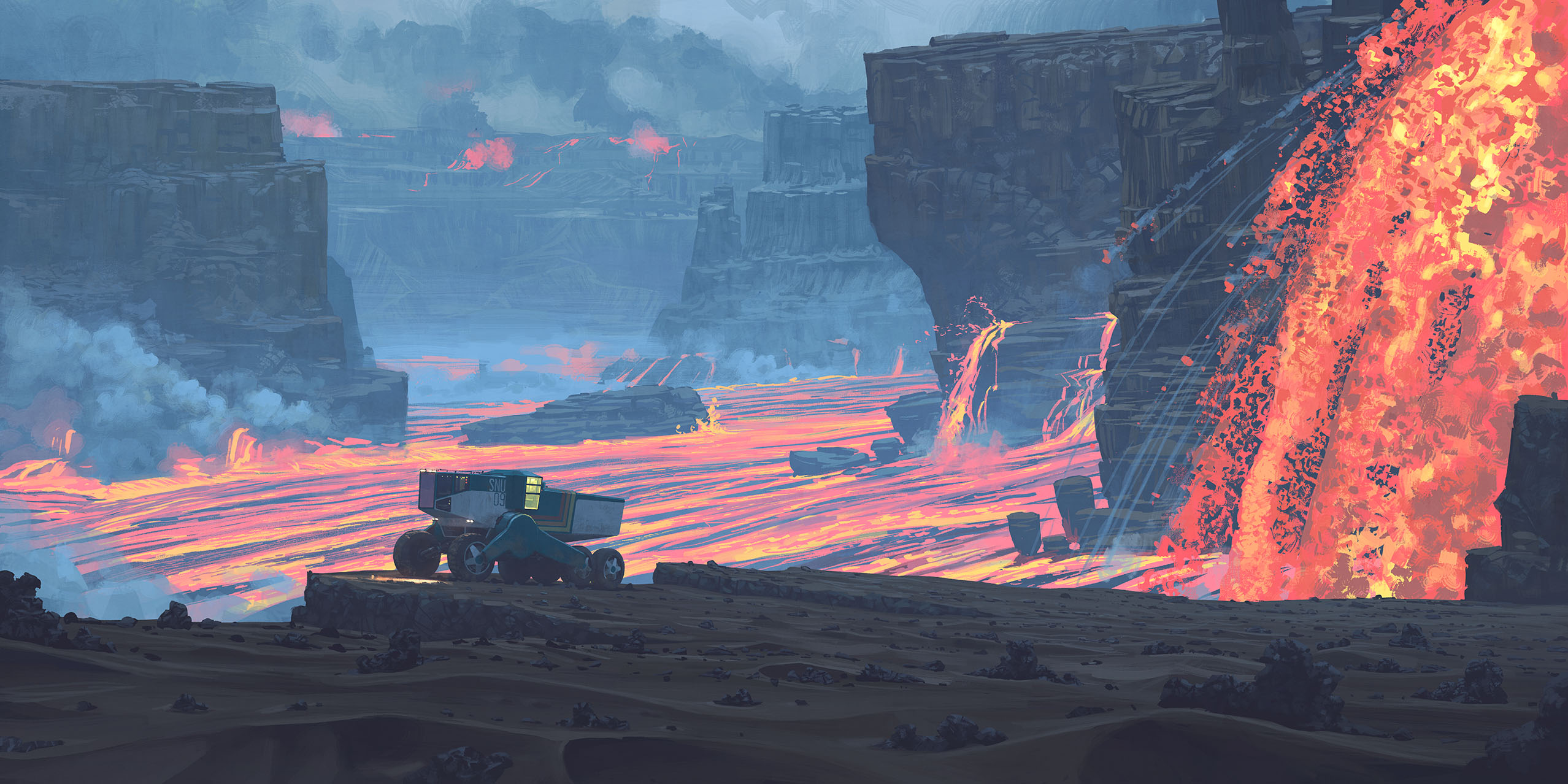
On this: https://www.simonstalenhag.se/other.html
Basically by Simon Stålenhag, which he mostly does works not related to volcanoes, except this one. The art gives off this sort of haunting feeling and I have no idea why, but he intended to be used as the Hadean period part of a discarded project.
Essentially, I am thinking about writing this as a book (plus a few more fantastical elements in there), but the problem is I am bad when it comes to motivation or the steam, of which leads to procrastination and not doing anything much really (other than work or other simpler things), which has been the fate of many projects before it. Basically, I needed some sort boot to start myself on it, but I couldn’t find that boot yet. I just don’t really know what to do.
Just in case the Stålenhag image is too big.
FYI, Stage 1 lasted for 202.6 years, with a volume of around 1070 km³, then the 162.7 year-long dormancy, then the 84.7 year current activity of 505 km³.
Here is a conceptual map of one the few vents (no scaling, so imagine the larger of all the lava lakes to be ~5 km), of which this this current episode is alo one of the largest, with a volume of about 217 km³ in the past 34.9 years.
Super Earths with their higher internal heating will have alot of this stuff for soure when you haves more internal heating that haves to get out.
Anyway Etna is doing the next show now
https://m.youtube.com/watch?v=nDsyxhh2nxg&pp=ygURZXRuYSB2b2xjYW5vIGxpdmU%3D&fbclid=IwZXh0bgNhZW0CMTEAAR2f1Sh4YRdd8at9dxbluub3JQx6kilS67myKuy7Ijz9JqOaHXEWGiXAPdo_aem_KMQ6PZkY1UKuLhAMgY0y2Q
Etna now
On the right-wing part of political ideologies we can clearly distinguish between conservatism and fascims:
1. Classical Conservatism wants to conserve the social economical state of people, keep calm order and the rule of traditional elites. It is a relatively individualistic ideology that wants that everyone keeps his/her position in society. It relies on free market (close to neoliberalism) without government intervention. Although it may have some authoritarian tendencies with a strong state and police, it accepts different political views.
2. Fascims wants to disrupt the society with a national (and social) revolution that gets the members of the movement in powerful positions based on partisanship instead of personal merit. It is a collective ideology that judges people depending on the group (f.e. ethnical) they belong to. It is a mass movement. It is a totalitarian ideology that wants everyone in the state to align to the same movement. It seeks a command economy like communism, but in the favor of national companies. Fascism also often has a supreme leader with a personality cult like Italy’s Mussolini.
Both are right-wing ideolgies that can cooperate from time to time or mix, but are very different in their ideal types.
https://www.youtube.com/watch?v=1Xbo2bHZC7c
Another fun one whats glowing is not Lava but superheated vapour and liquids, Neptune and Uranus haves to be one of the strangest worlds in the solar system being enromous masses of superheated water and ammonia fluids infact superionic water, there is so much water in there that they are really not hydrogen gas giants at all. Neptune is quite huge compared to the Earth so it sourely contains enormous internal heat thats left from its formation its likey too hot for the shallow water to be a liquid now, thats saied give it another few billions of years to cool down and the hot soup may condense itself into a true water ocean under a very thick hydrogen atmosphere
I wants an atmospheric probe there the Ice Giants are completely unexplored and because Neptune haves a lower geothermal gradient than Jupiters gradient, an atmospheric probe will be able to go to much deeper pressures before the electronics undergoes thermal failure. I do expect that Neptune haves some incredibely massive water clouds, more massive than Jupiters and Saturns water cloud decks,due to an Ice Giants water rich nature but on Neptune thats colder they are much deeper down in the atmosphere perhaps as deep as 60 bars pressure, and atmospheric probe maybe able to reach pressures of 100 s of bars before the temperatures gets too high for electronics
Do anyone know how warm Neptunes center is? it should be quite a bit hotter than Earths trapped inside… there are no ways to measure that sadely
I cant remember where I read this but the ‘mantle’ of Neptune is meant to be almost like a liquid. There isnt a distinct surface but the transition between atmosphere and the mantle is much more abrupt than just being compressed. As you said it is not really small Jupiter at all. The atmosphere is under 10% of the total mass but possibly as much as 40% of the total diameter.
Neptune is denser than water too. So is Jupiter (and the Sun) but at that mass it is expected from compression alone. But Neptune isnt really a giant planet, it is compared to Earth but it is closer to Earth in size and mass than it is to Jupiter. Maybe if it formed closer to the sun the ratio of ice would be higher and it would indeed be an ocean planet. Or maybe ocean planets like we imagine dont actually exist and they all have thick opaque atmospheres that mame them look more gaseous. Maybe liquid surfaces only exist in old ocean planets that are colder. Maybe very old ocean planets actually freeze over and become solid surfaces, with water cryovolcanoes, like a giant Europa.
Maybe Neptune itself will be like this one day, a very dense but clear and still hydrogen atmosphere and a frozen surface possibly with lakes of liquid methane or even nitrogen, a real life Hoth but much colder. The zombie Sun invisibly faint as a slightly brighter background star framed by the ragine binary quasar of the merging Andromeda and Milky Way, probably the brightest object in the permanent night sky.
Core of Neptune is supposed to be about 7000 C. So a bit more than the Earth. It is 4x bigger radius but also 4x less dense so maybe not so surprising it is similar.
That will be a very ghostly sight, I almost imagine a bone coloured glow from the deceased retired Sun thats barely iluminating the frozen dead landscapes of Mars that survived the last Red Giant solar phase. The Mars atmosphere was stripped away by the previous intense heat and intense red giant solar winds leaving an airless mooonlike enviroment thats much darker than todays brightly iluminated lunar landscapes, and its outer upper mantle completely melted and by now re – solidifyed into dark gloomy basalt plains, no mountains, no valleys, no olympus mons just empty airless plains resembling the floor of Kilauea Iki or the current Halemaumau interior crater. The departed Red Giants heat have completely resurfaced Mars surface erasing previous topgraphy. It woud be a depressing sight a dark plain without much features and only very weakly illuminated by that calcium like ghost glow. The only Mars surface processes later from that point is impact cratering as the martian surface is left to decay over 100 s of billions of years slowly boombarded into a smooth powderlike material by eons eons of micrometeors, 20 trillion years into the future a permanent total blackness also settle over these dark frozen plains when the cosmos sucumbs to entropy of time.
Jupiters core and Io s tidal heating will be the longest lasting warm places in our solar system after the Sun quits, althrough white dwarfs also takes ages ages ages eons to become a black dwarf
It is actually something worth considering how exactly gas giants would evolve over very long timescales. H2 is a gas until 20 kelvin and He is a gas until barely above the modern CMB temperature, so planets that contain a lot of these in elemental form would just get cold but maybe not change much for billions of years.
But Neptune is not exactly like this. Its atmosphere is mostly H2 and He but that is only 10% of its mass. The core is silicate material and about the same mass as the atmosphere. The rest is ‘ice’ made of ammonia, methane and probably the majority is water.
So oxygen is probably the greatest part of the mass of Uranus and Neptune same as it is for silicate planets. After that then nitrogen, carbon, only then hydrogen, and probably silicon over helium. By absolute number of atoms hydrogen is the most common but water usually has an atomic mass of 18 and only 2 of those are hydrogen, ammonia is a mass of 17 but only 3 are hydrogen etc, so it isnt significant in total bulk.
If Neptune does eventually cool enough that it can form a distinct surface it would be a crazy place. 40% of the total diameter of the planet is the atmosphere, so about 9800 km of atmosphere above. H2 is 7% the density of air but that is still like being under 680 km of sea level air, compared to only about 5 km that we actually experience. So something like 100x as much air. Far future Neptune in this scenario might be a warm ocean but with a crushing atmosphere, and totally pitch black regardless of proximity to a star. Wikipedia gives a number of 10 GPa for the pressure in its atmosphere now but no distinction of where that is exactly.
Would be a really weird place for sure. Even if it gains a distinct surface and has 0 weather at that point the remaining atmosphere might be too dense abd opaque to see through. Maybe also refracting light so much it looks almost like a black hole visually 🙂
I guess we will never know, unless we can directly image up close an ocean planet, or a 10 billion year old Neptune analogue.
Thats very intresting for soure!