
Source: Howard Hitchock
Visiting Big Island and seeing live lava at Kahauale a 2 lava flow of Kilauea part 2
Into the belly of the beast
Jesper Sandberg

Google Earth showing the trail
Introduction
It is hard to describe how incredibly special for me those days in Kilauea were and the insanely strong nostalgia for that. In part two I will take up the highpoint of that journey seeing the active 2014 Puu Oo flows in the steamy highland rainforests of Kilauea on the rainy side of the Big Island. This was for me and my father the highpoint of all past Hawaii visits, because this was the first time I got really close to lava, despite having visited Kilauea before as a small child and seen ocean entries with parents from a remote point. Back then good cameras where very expensive so getting good photos was a challenge. That of course had changed a lot in 2014 compared to 1998 and the earliest 2000’s. My father managed to get incredible photos of me at the 2014’s lava flows armed with only a small primitive digital camera that was superior compared to ones we had much earlier trips to Hawaii. We are lucky we made analog copies of the photos as soon as we got home! As told in part one, two years after Hawaii in 2016 our small good camera companion was lost forever in the Mekong River in Vietnam, when father stumbled in a wet river tour boat. The memory card and camera where lost forever in the river. Luckily analog copies at home meant that our precious memories where not lost, they where digitaly re-scanned in 2020. I have wanted to share this for years on VC.
Seeing an eruption is an incredible sight and Kilauea is the best place to do that, it is the world’s most active and individually the world’s most productive volcano by long term. It’s huge supply makes it possible to plan a trip a long way ahead and see an eruption. That makes it into the best tourist volcano on earth. It is nearly impossible to do on almost any other volcano expect a very few. In part two part we find ourself in the Kilaueas Kahauale‘a 2 lava flow episode of early 2014. We also went in 2017 with 61G ocean entry watching and inspecting Leilani in winter 2019. But since the lava looks much the same, it is best to post about my most fun lava hike. Kilauea is hyperactive and by now in 2025 supply is near record high at the time of writing. The summit caldera is filling up by the eruptions and a new Puu Oo is maybe possible when magma moves out to the ERZ later.
In part two of my Big Island adventure we will re-live the the most fun parts of my 2014 adventure on the eastern side of the Big Island. Kilauea like the Big Island is such a large and complex place with so many hiking trails and geo-sites of interests that I have to limit myself to just what my own eyes saw and what me and father and our friends did and where. Warning! This post may contain images thats offensive to some traditional believers but I do not mean to offend anyone.
Preparations in Hilo

Photo: Harry Durgin, the windward wet side of the Big Island contrasts strongly with the drier west side.

Photo: Stephanie Launiu. A steamy tropical evening in Hilo
After tiring of the cold and low oxygen at 4 kilometers at Mauna Kea and Mauna Loa and the dead Venusian looking lava wastelands along the observatory road, me, father and our friend from California took the rental car downhill to warmer and more liveable altitudes. In the car I did the same odd experiments with letting increasing air pressure crush mineral water bottles thats been opened and well sealed up at at Mauna Kea and Mauna Loa’s summits, letting the thicker air pressure crushing them in the lowlands. Hilo is right ahead 80 km away and two kilometers downhill driving the saddle road. Here is the windward side of the Big Island. A cloud sea of stratocumulus with isolated cumulus towers was right ahead. Here moist tropical air is forced upwards by the trade winds forming orographic rainfall, making the windward side of the Big Island ( Lower Puna, Hamakua, Hilo, Kau, Kohala districts ) one of the rainiest and greenest areas in the world. What is not covered with recent lava flows from Mauna Loa and Kilauea is covered in lush rainforests. In the lowlands the heat and humidity at noon is simply overpowering even in winter if the tropical sun peeks out from the cloud blankets and shines on your back. The green steamy tropical rainforest enviroments here in Hilo are very different from the drier sclerophyllous ”Australian looking” vegetation that you find in the sunny drier lee side of the Big Island.
Arrival in Hilo was as green and nearly as warm as Singapore, the clear sunny Kona skies replaced by a grey sky with light raindrops. We arrive in Hilo in the evening and we spot yellow lamps and stylish neon lights twinkling in the dusk, and raindrops peck the car glass as the rental car drives down to the old district. Hilo is lovely. It looks like a tropical version of a wild west town with a charming Art Deco look to it that is combined with the local Hawaiian architecture. The locals are friendly and many of their 80’s, square and flat-looking retro cars are homely decorated with Polynesian patterns. We are also joined in the hotel by a FB friend coming down from Alaska’s freezer for warmth and fun lively lava. Hilo Seaside hotel was our base for the next two special days in Hilo before going back to Kailua Kona. Hilo is very beautiful but despite that I did not took a lot of photos. Hilo is as humid and nearly as warm as the equator, drenched mountain rainfall is one of the most even and least seasonal climates in the entire Hawaiian chain and the entire USA, making Hilo the most tropical place on the Big Island. It is classified as an equator type tropical rainforest climate. Here in an ultra green tropical paradise you can grow anything. It was ultra green perhaps even more so than the Azores and much warmer in winter. House owners grow all kinds of tropical fruits and decorative plants, in a seasonless tropical paradise their ”green vegetable pets” often escapes. The result is that lowland rainforests in Hilo, Puna and Hamakua are totally overrun by invasive weeds. Hilo’s forests are full of alien hardwood trees and weeds so by today they resemble very little of what native lowland Hawaiian rainforests used to be. Higher up at cooler climate elevations at Kilauea and Loa forests, native Ohia forests are in better shape but even Hawaii Volcanoes National Park has huge problems with invasive weeds. Invasive animals are also a giant problem for the island ecosystems on the volcanoes that arrives through plant trade and trade as pets. Tropical Hawaii is today full of ”alien organisms” that does not belong here, invasive plants, ants, reptiles, insects, amphibians and mammals are running amok in a friendly ”paradise climate” brought here by humans. It is a total ecological nightmare that very few talks about. Some invasive Hilo and Puna pests makes me nostalgic. Favorite is the chrip of Coquí frogs, one of the Islands baddest frog pests, whose beautiful chirp is now a true Hawaiian icon. The nostaliga is simply immense if I listen to these frogs today.. reminds me of these humid sleepless tropical nights we had in Hilo and Puna and the red eruption skies of Kilauea’s rainforests. Residents that tire of chirping frogs, lowland humidty and rotting warmth can move higher up Mauna Loa and Kilauea where the Gleenwoods, Volcano, Fern forest, Mountain View and Royal Hawaiian estates communities can be found, whoes steamy temperate cloudforests is a rather New Zealand looking experience with pleasantly warm days and chilly nigths in winter. The forest flora is also much more native there.
We disscused the possibility of doing the lava hike ourselves on that humid tropical evening while having dinner outside in the old Hilo district. In reality it would be very simple indeed. We drive the car towards fern forests misty cloudforests and locate the trail in the rainforest that goes out to Puu Oo s lava fields, by using gps and google earth and park the car there. I’m very familar with the area. But we came to the summary that its better to go with a local tour guide group, the pahoehoe lava fields are dangerous even if they are the most tourist safe type of surface eruption otherwise than the bubbling lava lake in halemaumau at same time. Getting lost in a place as big as Kilauea is disastrous too. You may die of thirst before you are found. We also discussed in the warm rain among the firefly like lights in..the near night, the edea the coming day before the lava hike to drive up to the astoningly beautiful HVNP.. but Hawaii Volcanoes National Park is a 52 km drive thats 110 km of driving. That would steal too much time for other stuff that is better used for preparations.
The lowlands in Hilo are hot and very humid and sleeping was not that sucessful even if AC was on and I could not get dry. The excitement inside me was growing with every hour as we booked a tour hiking trip through the rainforest and getting to see the lava! still I was worried as some locals at the resturants in both Kona and Hilo been critical calling the lava ”unaccessible”, indeed which it was compared to before 2013 when it flowed into the ocean, but I knew it was possible. We had booked a guide now even if we could do it by ourselves. The only real worry was perhaps the possible opening of a new side vent at Puu Oo s cone ( there was one day left before the lava hike! ). In Kilauea, things can change fast in a ”new york minute” even if Kilauea is a very constant lava provider indeed. This is the world’s most productive induvidual volcano so that keept me at least less worried of missing the lava. The next day was overcast but no rain. We started to load up on goods for the lava hike. We knew it would not be an easy hike, muddy and boggy and a good 10 kilometers hike through the forest back and fourth. We bought dark cholocate, nuts, peanuts and had with us dried meat. All these are energy rich, keep a stable blood sugar and keep you full. It was exactly what is needed for what’s to come. We also ready ourselves with raincoats and good shoes. Having no time that day at driving up to Halemaumau we did explore Rainbow Falls and Hawaii tropical botanical gardens. Onomea Bay is very beautiful and we spent lots of time there that day I clearly noticed the seawaters being more much murky than in crystal clear Kona side due to the river runoff, caused by all orographic rainfall here.
Through the swamp of sorrows

Photo: RhondaSuka. A good analog of the conditions in many parts of the forest trail.

Photo: Johnny Soto. We took no photos from the trail, but looked like this, inviting but sinister.
I don’t remember much more than getting up early, immensely excited for the tour bus to arrive to our hotel. The noise from the Hilo airport made resting hell anyway for the hike out to the lava fields. Me father and two other companions awakened early and got ready fast for it. We had packed backpacks and good hiking shoes with thick soles ( that would soon melt! ). I knew it was a muddy trail through the fern forest so was ready with worn out long pants, little did I know how difficult the trail would be. The buss arrived early and there where at least 10 others I think that booked the same hike. And off we drove upslope. Kilauea is simply a gigantic volcano it made Etna feel like a dwarf and I did not notice that we were driving upslope a volcanic mountain, as we climbed upwards the long long Hawaii belt road that can take you all way down to south point at Kau. From a frog’s perspective Kilauea is invisible. I was also surprised how insanely smooth Kilauea is despite all rain with no sign of river erosion but that is expected for a hyperactive shield volcano which is the chase of most Big Island’s volcanoes. The daytime muggy thick heat of Hilo gives way to milder pleasant warmth of the temperate highlands. We are now about 40 kilometers upslope ( middle Kilauea) at 1000 m. The bus turns to a smaller road and in it goes on a smaller road that would be left of my seat. The bus stops at Fern Forest, me and father and the rest of what is now a huge tour party steps out as the engine stops vibrating. Our tour guide now presents us with the un-assuming trail as we are all given wooden walking poles ( which we would disrespectfully push into liquid lava later ) and the whole column of people starts to move into this forest. The trail appears to be of native Ohia trees and small native birds likey Apapane flicker like flying darts between the trees. The native rainforest is dense and lots of ferns and fallen logs, at first the trail is very easy with only a few water pools that you can easily avoid. The day is a light grey overcast sky and apparently it had been raining a lot two days before. Due to the tropical sun’s intensity it did not feel gloomy despite a steel overcast. The trail through the rainforest from the nearest house to the tube fed lava flows is about 5 kilometers long and 7 to 3 meters wide. The easy walking makes way to more and more mud that is red brown and very tropical African looking. At first the mud is just a centimeter deep and I who is light and young avoids it by walking on fallen logs while 60 year old father just carefully goes through it. It is a beautiful sight with fern trees, native ohia trees and moss everywhere and pleasant temperatures. The sky is soon not visible anymore as the rainforest canopy closes in with a narrower and narrower trail. Deeper in the forest the trail conditions deteriorate even further with both standing mud pools and slippery logs every kilometers. It gets slower the further in the column of hikers goes and by 2 kilometers inside, the trail has become a real challenge indeed with reddish mud as deep as your lower half of the lowermost leg in some areas that means your pants and shoes gets messed up by all the dirt. Soon everyone has muddy legs and shoes and the column of lava tourists moves very slowly indeed the mud and grime makes it a such drag. Some parts, say 500 m, can take 90 minutes to cover. It was awful. In the hardest parts you sink down to your knees in the mud making progress nearly impossible and there was one part that was hard enough that even I almost gave up with it when the boots filled with slurry. In other parts of the trail the going is much easier where fallen logs can be used as bridges over the most annoying mud pools.
The trail to Puu Oo s lava fields was a difficult one but not impossibly difficult, just very annoying. But for a person with less than average health in terms of legs it would be a very questionable hiking trail at least that day, the mud in places was impossible to avoid and quite deep. Luckily we never got stuck as most of the mud seemed to lack that quality but it was still a very difficult mud that burned off many hours that day. During such activity it is important to eat and drink and 3 hours in the tour party from the buss of I think 15 persons stopped for food and rest, with waterlogged boots and muddy pants I sat on a moss clad tree fern stump and we spent 15 minutes eating as much as I could. As many peanuts as I could, half a bar of dark chocolate and a whole load of dried meat was washed down with half a liter of water. Father, and in fact everyone, was gulping down food. If we don’t eat or drink, the conditions could be lethal if we ran out of energy and water is crucial. We had plenty with us. If you run out of energy or lack body reserves you could end up stuck unable to do the whole ordeal back and end up stuck here and that could be fatal in the worst chase. There is still a couple of kilometers to go before we came out on the lava fields and the trail was very difficult in places, it was impossible to believe that such a lush, green boggy place was the world’s most active volcano. Father did not snap any photos from the trail. It only exists in my memories, we just only wanted to go to the lava flows that kept us going forward and we must also of course do the same absolute hell on the way back from the lava flows.
After my giant ”keto meal” I felt sluggish but as the fat later began to burn inside my cells 20 minutes later I felt fresh that I had enough energy to keep going through this muddy mess, avoiding the deep mud and standing water when I could. Father who is older less mobile still managed to push along very well. In terms of difficulty from one to ten where one is running and ten is nigh impossible, I gave the trail as it was during that special day a solid seven in that scale, so its a pretty hard one. Had all the mud filled pools had a sucking ability at boots then the trail woud have gotten a nine on the rating. There were of course days when it was a much more easy trail, but when we did it it was quite tough. The hardest part was about 60% into the forest trail to Puu Oo, then there was a good decrease in difficulty. Had the climate been drier it woud been an easy trail. Walking the open smooth concrete like pahoehoe fields was a child’s play compared to the forest trail, where you could even runn ( as long as you were not at active flow front ). Struggling with the mud, fetid pools and rotting tree stems, we all hoped for the advancing lava field to completely incinerate this ”awful” place with all its ills that was in reality a beautiful native highland Kilauea rainforest.
In Pele’s claws ( most photos at the end of this post: see far below text )


After many hours of treking through the ”forest of horrors” the pace began to become more easy and there were sinister or rather very exciting signs of what to come. The trees, once so ever lush, once so ever fresh began to look sickly and yellow and brown leaves began to appear, it was the inferno’s acid gases that were killing the living green. When seeing these signs everyone picked up the pace. It could only be about 100 meters further. And sure enough the forest trail’s end was seen and the fluid dark grey mass of numerous pahoehoe lobes that spilled into the forest trail were clearly obvious. The path out to the active lava flow fields flows was right ahead. Carbon charred ohia trees and tree ferns and brown leaves was a sign that the pahoehoe lava likey spilled into here just a week or a few weeks ago or something like that. We were lucky that the lava flow front was not active just here at the forest edge, as pahoehoe flowing over vegetation and waterlogged ground can result in dangerous methane explosions and steam bursts. The whole crowd got very happy with the walking sticks held high when we finally made it out on the active pahoehoe lava fields.
Kilauea’s lava flows are one of the world’s hottest and most fluid, so it’s lava flows when tube fed forms smooth pahoehoe that is very easy to walk over. It is very different from the more viscous lava flows of Etna that is nearly impossible to walk over. When I got outside there on the pahoehoe lava fields, the landscape was simply vast compared to the narrow corridor confines of the rainforest. Looking around I could see steam and smoke plumes at forest edges in the distance, there active hot live lava were flowing into the forest edges burning vegetation. We did not hike into these for saftey reasons. The landscape was a completely otherwordly sight! And because of the recent heavy rains, heavy steam plumes rose from the smooth hummocky landscapes of the Kahauale‘a 2 pahoehoe lava flow fields. I was a sight that evoked scenes of impending doom. This island is paradise but it is also the biggest hell in the world that flowed right below our feet!. Jacob the tour guide spoke briefly on the hazards of an active tube fed lava field and how it works. For me that is very familiar because I had been following activity over Kilauea since a small child, but now I was very excited for seeing live lava in person. When hiking active lava flows on Kilauea it is very important to use good shoes to protect against hot newly formed ground, to use good clothes and gloves, even smooth fresh pahoehoe lava crusts is more than razor sharp. The lava flows we were walking on were perhaps only two weeks old or so, they had inflated a lot as more lava from the tube system below accumulated and lifted up the original thin flow surface many meters. This meant that active 1160 C basaltic lava was maybe a person’s height below us. Steam poured out of cracks in inflated crusts with the sickly smell of sulfur. Walking was very easy indeed as it was almost like someone had poured runny concrete everywhere. Father, me and friend were very excited as the tour guide began to search for active ”breakouts” breakout, which is an active runny flow lobe that spills out from an overinflated lava crust that crust over and swells up and breaks out again. The slowest flow lobes advance as lobes, a little like pillow lava but more flat. The faster lobes forms sheets that develop a ropey skin.
The Kahauale‘a 2 flow that we now searched for active breakouts is vast. A mature single pahoehoe field fed by one tube can have thousands of breakouts along the edges that we tried to avoid. The lava field itself was fed by a lava tube, a tunnel from an underground river of lava kilometers upslope fed by a small lava pond at Puu Oo that fed the flow field downhill where we were hiking. Placing my hand on virgin ground that is more than 20 years younger than myself I noticed how sharp the lava crust was, with almost glass-like fibres. Small chips stuck in the hand of me. Here a stumble or fall woud be disastrous, scarping away the skin of an entire lower leg if that happened, and if you break the crust and fall into an active breakout that results in burning to death, so running around here in the middle of an active lava flow field is not an option. In this environment good hiking boots and welders’ gloves are a must have. The whole tour group closely followed the tour guide for saftey. I was also very surprised in just how grey and shiny the lava flows are when the sun came out, after all massive basalt is almost black. The grey is caused by stretched glass bubbles in the fluid of the expanding lava toes, breakouts. Those bubble walls is where the sharp glass chips came from that got stuck in my hand. The gloves and body protection is very useful here against such a sharp and abrasive environment even if fluid pahoehoe is very smooth. It is a sinister hellish landscape. Water vapour steam rises everywhere that reminded me of Mordors Gorgoroths plains below Mount Doom ( Puu Oo flank vent of Kilauea is a good analog here). We made every attempt to avoid the rising steam plumes from the lava field after the recent flash floods. Clouds of suffocating steam that rises from lava flows can kill a person with displacing all the the oxygen around them. A few years later Big Island photographer Sean King was killed just by that thing.
The ground crunches nicely as half a milimeter sized glass bubbles break under our feet and the ropey lava surfaces are very nicely visible, the pahoehoe ground is warm to touch not only in inflation fissures so I knew we were getting close. Active tube fed pahoehoe flows like these that has been going for almost 30 years at that time is a rather unspectacular form compared to Leilani or Holuhraun, most of the lava flow is covered by a thin silvery reflective crust and active flowing lava river canals or fountains are non–existent in this type of activity. Most of the lava is having an insulating skin, but it was still the sight of a lifetime for many visitors! And we are very close indeed. I remember seeing a red 800 c glow in deep fissures in the lava flows inflated crust in a cracked low inflation mound, such as are everywhere, swollen but still not quite a tumulus and much flatter. We were getting very close indeed and we started to feel sick from sulfur that escaped as blue gas from glowing deep cracks in the flow fields crust. There!! shouts my father and points the wooden pole towards a low inflation mound full of ropey breakouts, and there it was! Something moves and a glowing yellow lobe oozes out, shiny yet yellow, the whole crowd of 15 cheers in joy with the walking pole sticks held high like an Arabian sword dance. The lava breakout flows downhill very fluid, its surface cools quickly turning from yellow- white to yellow to orange to dull orange to red and quickly to a shiney grey when the atmosphere chills a thin flexible glass crust. Very soon the pahoehoe ropes starts to form, a crackling sound is heard too from expanding microbubble walls. We jump in joy seeing the birth of liquid rock and new land the lava tongue fluid moves at many centimeters per second crackling. Above the breakout the air shimmers from the extreme heat escaping from the breakout. The breakout is a part of a whole section of flowing lava lobes, creeping foreward, deforming, crackling expanding. The tour party films as much as they can and we go closer to have a really close look at Pele’s liquid ground. Its a barren and otherwordly almost sickly landscape that was once a rainforest.
I am the first, going forward while my father films and photographs me armed with my walking stick held forward. I go forward towards the fractious heat of the breakout, and in an instant of addiction I plunge my waking stick in the soft fluid pahoehoe lava! all live and flowing. Other hiking members in our tour party soon follow that behaviour. The pole penetrates the fluid lava with ease that now flows beside me. When I tore through the thin glass skin, combustible gases jets out from the hole. When the pole is inside the lava hot flow and a hissing sound is heard and roaring flames spew out. This was the wood that is decomposing into flammable gases in the 1160 degrees C of the flow interior. Out comes a yellow blob that cools quickly into grey. The lava flow’s flexible surface is much cooler. Lava has low conductivity and the surface quickly chills to a insulating crust and many of our tour friends are struggling to measure the temperature of the surface with their handheld lasers pistols, for that you needs a penerating probemeter that volcanologists use to give corrrect readings under the crust skin. Father also takes a shot at poking the flowing lava breakout and plunges his pole as well deeply into a swelling live slivery pahoehoe lobe. While father photographs and films I keeps messing aroung with liquid lava. It is so hot that I can barely stand it, and the sulfuric fumes smelling like fireworks makes me feel sick, yet I love that smell too. I noticed while messing around with this lava from Puu Oo how fluid it is, yet how dense it is and how much more viscous it is than it’s appearance suggests and how heavy it is and how fast it cools when spatter is drawn out from a breakout flow. I was so happy that I almost went into some kind of trance. Everyone in the tour party had now found their own pahoehoe breakouts to mess with and many were taken out glowing glops of basalt that cooled quickly on their wooden poles. Both lava and wood have low conductivity. The wooden poles likely had very little contact with the lava when we plunged them into a breakout or lobe. The combustion gases prevented direct contact and flames that were combustible gases roared out when lava was penetrated and ignited when in contact with Earth’s atmosphere. When pulled out the wooden pole was only a little blackened and nothing else. They where likely fresh wet wood as well as they did not retain fire when pulled out from the lava. My father photographed many times when suitable breakouts were active, many breakouts here alive for minutes before they stopped, the more sluggish breakouts had somewhat thicker skins, and puncturing the skin of such lobes yields a hole and out comes a expanding hot ”lava ball” to seal the wound in the lava’s crust. Pahoehoe lava flows advance with a very typical pattern with swelling lobes and inflating crusts and folding skins. The surface is overall always keept smooth, which only very low viscosity lava flows can do.
After messing around for a while with Pele I heard a cracking sound and a much larger 10 meters wide lava tongue, half a foot thin, fluid and glowing hot rushed foreward from an inflated ”mound” and a silvery sheet creeps forward from a yellow hot extrusion point. The lava crust around is thin and bubbly and pieces can with ease be kicked loose. In my addiction I threw a large piece in the breakout and big orange ribbons of fluid lava splashed up everywhere cooling into silvery sheets. The tour guide Jacob ran to me and laughed and warned me to not do that again in case I would splash myself or another person with hot lava, as I underestimated the high fluidity of this lava. While very fun to experience this and really go and mess with lava flows and learn how liquid basalt behaves, messing around with Kilauea’s lava is in reality very disrepectful indeed towards the local Hawaiian culture. In Hawaii lava is Kino Lau ”body form” of Pele and by doing all these craziness I was severely poking the firegod! In HVNP we do not poke the lava, we do not steal lava, we do not pee in the lava and we do not incinerate our trash in the lava flows, it is a watch-and-see thing and leave nothing behind. I was young and perhaps immature and in later lava visits I did not do this. More ”disrespectful” behaviour was seen by others tour groups too not only by me. I remember a woman dragging out liquid lava with her walking pole, from a rupture in the skin out comes a brillant hand sized orange splat that is dragged and kicked away from the lava front, there its allowed to cool for 30 min and later she cools it further with water. After its cold enough it goes into her backsack and later home to Europe as ”stolen trophy”.
Feeling the need to pee I hide from the tour party behind a low 3 m high and 40 meters broad inflation mound, doing the thing in a crack.. where a hellish yellow glow could be seen two meters down, and a hissing sound was heard and an acrid fume resulted. Father unsure what was active or inactive pahoehoe, worried to walk anywhere, began to look and we were reunited. We also let our friends photograph us. The photography has to be done quickly to avoid us being surrounded by swelling lava flows. There is a hazard even if this is the most gentle of all tourist activity beside lava lakes. After lunchtime the weather got more sunny and tropical solar rays shone on shiney fluid looking lava flows. I was surprised that fresh flows where grey and older ones where darker, perhaps due to the thin bubble glass being chipped away in older lava flows, but some fresh pahoehoe lava flows in USGS archives are darker than new, still I guess that my theories are correct in this case. We had plenty of lava breakouts that whole day and I estaimate that my eyes saw at least ten medium sized breakouts with over a sixty small lava toes. Individual lava flow tongues haves a slow eruption rate, but up at the vent kilometers away the eruption rate was a few cubic meters per second at the lava tube opening, that eruption rate is then channelized downhill and spread out over a wide area. This type of eruption can last decades, even centuries on Kilauea because it is erupted at mantle supply rates so is the ideal tourist eruption, Kahauale‘a 2 lava flow was feed into nearly flat ground so advancement in the forest was incredibly slow despite the lavas fluidity. Many other later pahoehoe flows at Kilauea had faster supply and eruption rates.
Playing around with the pahoehoe lava was very interesting. I noticed how dense this fluid is, it is strange indeed. Lava have a density of around has a density of 3100 kg/m3 and light things such as apples seems to simply bounce off the lava even if this lava is very fluid, but that could also be due the thin outer moving skin. I was also interested in watching the outer skin move on a fresh breakout, how it keeps being flexible and deformable even if it is not glowing. It is likely a combination of heat and thinness that keeps it so flexible so the pahoehoe’s skin can fold like cloth. The thin skin starts forming as soon as hot lava touches the atmosphere. Lava with higher viscosity cannot form such features, such as at Etna. My father was photographing all the time given up more time to enjoy the lava himself. The photographs themselves are valuable memories. I was also able to reproduce Pele’s hair by ripping quickly through the crust of a swelling lobe, a so called ”pahoehoe toe ”, out comes yellow – white hot glass fluid leaving whitish glass trails that reflect in the sun. The lava globs pulled out flattens quickly as they hit the ground and cool almost instantly. After just under a minute you can if you are very fast touch the pieces with a finger even if these lava pieces will be very hot indeed so a very quick poke. USGS personal tends to cool lava samples in water buckets after scooping up a sample with a hammer. Had we had thicker glassmakers furnace gloves we might been able to play around with very small molten lava globs in our hands until they became too cold to deform. An extremely hot material at Puu Oo 1150 – 1160 C that is hotter than the average crematorium. Up at Halemaumau it is about 1210 c so even hotter still, extreme care is important. Playing around with the molten lava reminded me of liquid soda glass, but the lava is not as stretchy as soda glass and it was likely more fluid than soda furnace glass. Everyone in the tour group was enjoying Kilaueas flowing lavas and it was time for lunch two: eating food and drinking water was once again incredibly important to cope physically with such a hot and acrid and downright nasty hot environment. I remember one tour member with gloves having a small metal spade scoping up hot liquid lava from a small swelling pahoehoe toe and flatteing it as a hot pancake that went from yellow hot to solid and dark grey. That hot ”lava pancake” she made was later crushed to pieces under my own hiking boots. A tour member also incinerated a banana, watching it dissappear under that moving slivery lava sheet with a orange edge. In the skies chopper blades where heard quite loudly and the insect like machine was seen in the sky, that was very likely Paradise Helicopters carrying local photographers Mick Kalber and Bruce Omori.
By now after a whole day most of our shoes bottoms had long melted walking on a recent lava flow crusts that was well over 100 degrees C, possible over well over 200 C in places, making it very hard to find a place to rest and eat without burning your butt. The smell of sulfur and metallic odours mixes with the smell of burnt rubber shoe bottoms. My own shoe thread pattern was by now completely gone with abrasive lava glass fiber needles stuck in the rubber. I even very briefly poked the soft hot flexible crust of a lava toe with tip of my shoe that flamed up, I coud not resist. The weather cleared up more as late afternoon came. By early evening it was time to get home to Hilo. The falling darkness makes these totally hellish lava landscapes even more hellish and scenic, every inflation crack that was steaming is now glowing like Mordor’s plains, the lava breakouts more colorful than ever in the fading light. As night came the landscape are now glowing red in many places, fiery steam plumes spew from glowing cracks and other tour groups that just arrived from the forest enjoy the vividly glowing lava breakouts at nightfall. The sinister ”plains of gorgoroth” landscape really made it feel like the world was going to end. We were constantly surrounded by a display of natural wonders. The hot flowing lava perform beneath ballets of fluffy red illuminated the clouds above me. We were constantly surrounded by a display of natural wonders. The clouds slide across the sky until they join at the horizon to form whirling, flaming spectacles with Puu Oo and Halemaumaus glow, then thousands of glistening galaxies appear into deep black night and the nostalgic chirp of the coqui frogs starts when its almost dark. There is no bigger night landscape than the steamy Kilaueas flow fields. Still we were lucky to have done it during the day with very good photography conditions. The long hike back in the muddy trail was next which was not fun for either me or a tired father or our friends from the US. I have been on Kilauea a few times after this adventure and its definitely fun to have done this stuff! This trip turned out to to be the most memorable of them all getting that close to liquid lava! which in reality was perhaps too close.
What happened to the camera and original memory card
The mind completely races towards the Vietnam visit in 2016 when we rode the brown silty waters of the Mekong River. My father wanted to photgraph a large bird that seemed interesting on a good spot so he quickly wanted to change seat to get a view of what kind of odd species it was, but in the slippery boat father stumbled and the digital camera contaning our digital Hawaii memories was thrown by the force out of his hands and directly into the murky river, being lost foever with all our photos. Lucky the photos from the Kahauale’a 2 lava flows where made into analoug copies and have been re-scanned so we can enjoy this on Volcanocafe today.
PHOTOS CLICK TO ENLARGE: all where taken by my own father and by some friends: Im proud of sharing them on VC.


And some Coquí frogs to add some hawaiian sounds from the trail.
Jesper Sandberg February 2025


Part two is up! adims may correct some word errors that still remains, I have a very busy scheme so had to put these two posts up quickly
The whole post should perhaps just be on the fields ..BUT .. this was nearly 12 years ago ..and I dont remember that much really from these days in Hawaii. This post, this content is as much as I can scrape togther 🙂 from those precious few hours so its perfect as it is .. the memories are very hazy .. we are very lucky that the photos are still here!
Good old days…I was young and happy by now today Im early middle aged and more and more grumpy
Hahaha complete utter addiction 🙂 and that was certainly a hot one!!
Wow! I wouldn’t ever go so far!!!
Kudos Jesper!
Insanely hot too.. not strange USGS wears thick clothes when working with this stuff! I should have packed thick clothes in my backsack .. woud be useful for resisting the lavas radiation for longer. But more gear means that I woud be heavier and the muddy trek woud become much more of a struggle, that muddy trail was already stuff of nightmares
It seems a fascinating experience! I would imagine a long cold shower afterwards.
It was FUN for soure! and Im so lucky that it was possible to share this moment thanks of us making analouge copies that we coud later re – scan as digital files, the paper physical formats now exists in my new album given to me by partner as christmas present 🎁 Im very lucky I chosen to print them in 2015 because otherwise they woud be completely lost today ( 61 G at 2017 s ocean entry was not really the same type of adventure but still fun )
I showered alot when I came home from the hike and later swimmed
original camera is perhaps in the south china sea now 🙂
Precious memories indeed! and the photos helps me to remember a bit and on a hairstrand of luck they exists here today!
The analouge copies thats digitaly rescanned ended up being much better color and contrast than the original digital ones! the original digital ones ( only one photo from that exists ) are too bright and simply washed out while these re – prints had excellent color and darkness.
Now on VC they have found a nice very purpose finaly after 11 years 🙂 these photos are almost like made for this rather than being un – used forever in a family archive. I will later make even higher quality prints of these and store on cloud services
But the blog is their best use
Hazy memories.. this was nearly 12 years ago ..and I dont remember that much really from these days in Hawaii. This post, this content is really only as much as I can scrape togther 🙂
I hope you gave Pele a flower Jesper, thats what most people did up at Keanakako’i, not only locals too. Maybe it wasnt common before 2018, back when people thought Kilauea was the volcano you see on the demo version before the main game instead of the final boss 🙂
I too remember obsessively looking at the website daily for updates on the flows, pretty much every day from 2011 to now. Not sure thats a good or bad thing lol.
Kind of crazy to realise this stuff, the flows out of Pu’u O’o and to the northeast, eventually to Pahoa, all of that was 10 years ago or more… Really, I think we all know what 2018 was like, I started contributing here on a different name back then, and that is almost 7 years old now in a couple months time…
Its crazy that in only a decade, Kilauea has gone from an overflowing shield on the ERZ and summit lava lake, to a Holuhraun-sized lava flood and caldera collapse, that caldera actually getting a water lake for the first time in centuries, and today only 5 years after that the same caldera is mostly refilled in elevation back to the 2018 level and turned into a lava geyser… I said the caldera would be unrecognisable in a few years back in 2018, but I honestly thought I was being hyperbolic, crazy even, yet somehow I underestimated it all.
Hopefully now we have the next Pu’u O’o, and all the magma movement is above ground for the next 30 years, where it is slow and obvious. Any caldera overflows of large scale will be southwards for the forseeable future and not destructive to inhabited areas. It also is in a national park, so viewing is likely to be possible or even encouraged to boost tourism. Although, poking it with a stick isnt allowed, maybe if you ask Pele nicely 🙂
When I was there I was told Aloha is more a respectful attitude, not just a greeting. Seems a lot of the issues I have heard about tourists in Hawaii are from being disrespectful, and particularly from mainland US… I found everyone I met and talked to was very friendly. Although it was funny to see everyone else up at Keanakako’i saying just over 10 C was freezing 🙂 felt just like home.
This is my picture, at Kilauea Iki, in April 2022.
(Sorry admins if this is too big 🙂 )
Image incinerated and reduced in size by a minor admin-dragon
10 years since Holuhraun ended! The first eruption I ever tracked.
The last 10 years has been crazy for effusive eruptions. Only just beyond that now is Holuhraun, the 4th or 5th biggest flow in Iceland in its whole recorded history. Then, only 3 years later, Kilauea went and bested it, and then refilled the hole already as well as erupting on both its rift zones within a single year…
And not to forget Reykjanes waking up and going crazy, both Erta Ale and Nyamuragira engaging in shield building, Nyiragongo draining out on video, Mauna Loas 15 km curtain of fire, 3 major effusive eruptions in the Galapagos, and Etna having the most intense lava fountain in the global historical record as well as the next 30 places on that list too within 12 months. That last one actually might be the most insane thing on this list by far. All in a single decade.
Make it 20 years and you can add when Nyamuragira, Tolbachik and Puyehue-Cordon Caulle all did large volume mixed effusive/explosive eruptions within 2 years. And Pu’u O’o and Etna too…
Plus La Palma and the enormous submarine eruption at Mayotte too!
Yes, I forgot to include La Palma. Something felt off after posting.
Actually I did remember about Mayotte but was going to stay on land. Mayotte has been confirmed in size but I doubt it is the only large effusive eruption in the submarine realm in the past decade if all 3 of the big volcano islands did so in that interval… There was a big quake swarm at the most southern tip of the Reykjanes Ridge, far far south of Iceland, and that might have been a big eruption. I suspect there have been submarine lava flows in the last 25 years as big or bigger than Laki down in the abyss out of sight. Something like this but newer.
https://www.researchgate.net/publication/240669460_A_220_km2_recently_erupted_lava_field_on_the_East_Pacific_Rise_near_lat_8S
It has been quite a decade and a half! In fact ever since VC was started, volcanoes have gone hyper. And explosive eruptions should be made to feel left out. HT was the largest explosion since Krakatau!
Mayotte should be in the list, I think. The signals were picked up across the world. It was a very unusual eruption. We do not know as much about submarine eruptions as we should, but this was big by any standard.
Yes she is by far the greatest volcano on the planet.. its so big and massive her whole edifice can swallow a very small country in Europe, I dont think even supervolcano can describe a volcano like Kilauea at least in volume and long term supply compared to other volcanic edifices on the mainland continents. I been seeing the caldera from Kipuka Puaulu trails gave some scale just how gigantic this geological beast is. Kilaueas summit area alone with its shield and caldera can swallow major urban centers on the continents. Out on the lava flow I feed her little food scraps at the lava flows watching a chocolate square dissapear under a moving pahoehoe toe
Kilauea is a beast really! and she been my favorite volcano since 5 years old too, its also very fun now with a potential mega mauna ulu forming in Kilaueas summit if the summit eruption is allowed to reside there for decades, before 2018 it felt like this woud last perhaps for most of my life, but it likley will, since its just that the shield activity just moved up to the summit since the deep supply is always present. I already knew in 2014 that Kilauea with its supply woud recover quite fast from an event like Holuhraun, but quite asthonishing been the refilling of halemaumau and reinflation since 2023
And now in 2025 its extra fun with almost all the deep supply going to the summit caldera
Yes the deformation last year was very impressive, Keanakako’i has moved 1.4 meters away from U’ekahuna since I was there, and at least 80cm up vertically. Not withstanding that CRIM is the only GPS station at the summit that didnt already get higher up than 2018.
The summit has contracted a bit since the current eruption began, it might still be a little bit. I assume this is because having an open vent is limiting pressure compared to back in December.
The lava fountains of Episode 11 were tall enough to put out frothy clasts on the western caldera rim. They observed that “many smaller clasts … have produced a thick carpet of new tephra.”:
Here are links to my two trips, first was with my wife, second, her and our two daughters:
https://cycloneranger.wordpress.com/2009/11/19/hawaii-island-hi-1988/
https://cycloneranger.wordpress.com/2009/11/20/hawaii-island-hi-2007/
Very nice! those where very nice days with a huge base supply and massive ocean entries
The glow is much brighter than before earlier episodes, and at both vents.
There are lava flows which are independent from the vents: “Lava flows continued to encroach on the eastern side of Halemaʻumaʻu crater floor and onto the downdropped block. Flows were active both in the NE corner and also south of the September 2023 vents. These are “rootless” flows that appear to be coming through the floor of Halemaʻumaʻu crater and are not directly associated with the eruptive vents.”
There is probably a magmatic conduit from the dike through the lava lake below to the eastern part of the crater floor.
I dont think there needs to be a connection, it was speculated on but the lava flows are quite thick now and tend to get about the same distance from the vents, so at some point the lava might be able to flow out. Or instead the weight of new lava could push the crater floor down and the breakouts are from the deep lake. Or the lava erupted now is able to seep into the lake.
Yes, lava has the weight of a solid landslide. It is liquid rock, but is rock. So it may cause inbalances on the layers of the 2020-2024 lava lake/field. The filled caldera is somewhat a “strato-volcano” now with layers of solid basalt, of semi-solid basalt and liquid lava lake parts. The weight, pressure and heat of new lava may push out older lava like toothpaste.
Interesting that the summit area has zero earthquakes now, although we’re in the midst of a “Kilauea Fires” series. This shows how open the summit’s magma conduits are now.
Not sure I would say Kilauea is in a ‘fires’ phase. That happens to sleepy volcanoes that wake up sometimes and have to catch up time.
Or, alternatively, Kilauea is always in a fires phase unless Mauna Loa is instead…
I’m wondering if (though it’s probably only a matter of time) until HVO takes a picture down the conduit
They kind of did a while ago, but that was when a spatter cone formed in the north vent crater. If they did it now I think at least one lava pond would be visible.
The last episode had over half an hour where the north vent stopped but the south vent kept going. And the north vent started up hours before the south vent. To me this suggests they are actually separated deeply and maybe even completely independant down to the magma chamber. And especially with the south vent being much more active in the last episode it apparently isnt closing up as I thought. Its likely they will both be long lived and could end up turning into a convecting lava lake covering both vents of the cone grows big enough around them.
A great historical journey to a unique period of Pu’u O’o eruption! I didn’t imagine that the walking tour would be so wet and muddy.
I understand the temptation to play with lava. It is both fascination of a volcanic phenomen and the skill to cope savely with a natural danger. It reminds me to the challenge to cope with rising tide in Wadden Sea.
The mud was hell on Earth..! indeed.. this was so very bad that I almost gave up completely and one woman in my age sank down to her lower belly in this mud in a deep spot and she almost wanted to give up, it was like dog manure or horseshit everywhere and it was deep indeed in many places. The Great Horse Manure crisis in 1894 in New York is a good analouge of what the trail looked like. Anyway of course the irresistible lure of messing with molten rock keept me and father and the whole group going foreward towards for that huge reward. My nostalgia for these days in Hilo are simply enormous ..Im sickly craving Kilauea.
I ( silly polluted ) left one little metal object a coin from scandinavia that I stamped myself in friends workshop and let the lava swallow it, lava cannot melt steel so its still inside these inactive flows today.. at least a small part of me is there today forever!
Yes, the melting point of iron is higher than the usual lava temperature. So an iron wall is able to survive a lava flood without melting.
Was the Chain of Craters Coast Road an alternative option to the “Jungle Hike”? It was flooded by many Pu’u O’o lava flows. Was it excempted during your visit?
I remember some wet fjellhikes around Bergen (Norway) where you had trails with rocks & mud, and you had to choose the right footsteps. But your trip through Big Island Jungle sounds much worse. You had both a subtropical rain forest climate and a volcanic ground. That’s different to Scandinavian climate and fjell conditions. Both tephra and aged basalt can become soft and muddy, very different to Granite, Gneiss and schist.
Better to call it a ”tropical highland rainforest” there are no temprature seasons at all in Hawaii at any given altitude. The swamp of terrors where the shortest route of course to the active lava flows, it was in reality not that long in lenght I think little over 6 kilometers so back and fourth you have perhaps walked 13 kilometers and due to its nightmarish nature it was more equal to walking 40 to even 50 km..due to slow progress and I does
NOT think this was the Kahaualeʻa Trail at all because conditions where simply so sinister, so muddy and the forest looked sinister and more sickly. It took almost a whole day at least 60% of a day to cover that distance from the bus to the lava fields because of the terrfying conditions it is the most terrfying forest that I have ever been in, the deeper mud baths that had a sucking quality coud kill a person, and I remeber seeing a skull that was from a small lifestock stuck there and died unable to free itself
Mauna Ulu to – Kahaualeʻa 2 lava flows is a 15 kilometers hike over easy to walk lava flows; it should have been a much better alternative that was never disscused at all but in the end the forest provided an adventure
How would Big Island look like if it was on Ireland’s position? A huge westwind rain island with a wet westside and a dry eastside. Probably contrary to the present distribution of wet and dry land. Also a lower snow line and a small glacier on Mauna Kea and Mauna Loa. Both Mauna Kea and Mauna Loa are higher than Austria’s highest mountain Großglockner (3798m).
Iceland’s glaciers couldn’t exist on Ireland’s latitude, but Hawaii’s volcanoes are high enough. The volcanoes of British Columbia, Aleutes and Kamtchatka are close to Ireland’s westwind latitude; but Kamtchatka lies too much in Asia’s wind shadow.
The ground is very young there 400 to 500 years old from the observatory lava pahoehoe flows I think this mud was rather decomposed organic matter rather than volcanic glass and rock minerals, if it was mostly organic then it woud be very analougus indeed to horse or dog manure it looked alot like horse poop without grass fibers in. It behaved like horse / cow dung too in consistency and apparnence and texture it was quite awful it was like a million horses a week had crapped on the same day at the same trail, and add in some cows and buffalo for consistency .. it was awful but memorable
Nostalgia, Nostalgia Nostalgia, Nostalgia Nostalgia, Nostalgia Nostalgia, Nostalgia Nostalgia, Nostalgia Nostalgia, Nostalgia Nostalgia, Nostalgia Nostalgia, Nostalgia Nostalgia, Nostalgia = those where the good old days in my life, I was young and felt alive ( 19 ) and I had plenty of time to travel to Big Island frequently
Putting up these lava photos on VC
( those where nearly lost forever ) feels like myself escaping near death! they are precious indeed… and I dont remember that much, so the photos helps and they have also come to their right place on the internet
Im 30 now after 25 your body cell protein systems can no longer resist the scary second law of thermodynamics very well anymore and the long road to death and decay starts still men and women can look fresh and do highly physical heavy stuff well into their 50 s or even further.. with souch a long lifespan as we have here in Europe I woud only count the 80 s as ”advanced age”
Still I feels old and tired… but its my brain tiring of cold and lack of volcanism in this country
Probably replace 30 with 50… 30 only feels old because of society and the distance from childhood, but its still when you are a young adult really. Basically 18-45 is young adult, thats when you can safely have children which is technically the only objective of biology and evolution.
Yea… and I will likey never have kids.. Im very busy and rather use those 20 years of child – keeping to other much more satisfying life goals than just caring for childern until Im middle aged, its now been 8 years with her and she thinks very much the same and both me and her are very busy with working on and buildings up careers. I had no partner sadely during that one special lava hike
The trail was awful its hard to describe it even, it was if as all the horses used everywhere in WW1 and WW2 in all sectors and all fronts had
”storm pooped” for hours on the same trail… : ) I will call it the ”great manure hike”
If a person does not have even remote intrest in seeing lava then.. this trail will be a mental impossiblity to do
https://m.youtube.com/watch?time_continue=8&v=g-DeFADQZFA&embeds_referring_euri=https%3A%2F%2Fwww.volcanocafe.org%2F&source_ve_path=MjM4NTE
😍😍😍 total nostalgia its night while almost completely dark there is a pale red glow is in the skies as result of pahoehoe lighting up vapors in the sky
Definite uptick on the 10 day quake charts, also quite a jump today (even with error bars) for the upward inflation at SENG and HS02. Although the reinflation hasn’t been as dramatic or as quick as the Aug ’24 eruption it is now above that in terms of ground uplift. Can only be hours-to-days away from eruption at Sundhnukar.
Don’t wish to be political but we could see some of the brilliant services provided by NOAA and USGS reduced.
Quote from earth.nullschool.nt ‘Weather and climate data shown on this website and countless others are at risk.
The National Oceanic and Atmospheric Administration (NOAA) is the U.S. agency responsible for global weather forecasting, hurricane prediction, ocean observation, and many other services vital to public safety. Its satellites, supercomputers, and research teams provide essential data that help us understand our planet and protect lives.
On February 27, the new U.S. administration initiated mass firings at NOAA. These actions are unethical and deeply disruptive to the talented scientists and engineers who dedicate themselves to the public good. The firings, along with expected budget cuts, have serious implications for the availability and quality of weather forecasts produced by the United States. They must be reversed immediately.
Much of the data on this website is downloaded directly from NOAA’s servers. In this environment of uncertainty, access could be disrupted at any time. While I’ll strive to keep all features on this website functional and switch to alternative data sources if necessary, some datasets have no substitute if they go offline.
If this concerns you, speak up. Share on social media. And if you’re in the U.S., contact your representatives.
– Cameron ‘ End quote
We are very concerned about this. Obviously it is not for VC to judge US politics, but volcano observatories are not a luxury and do important work to keep people safe.
Are the volcanic obervatories at risk by DOGE? Can the state and communal agencies of Hawaii, Alaska, Washington, Oregon, California … subsitute a possible collapse of support by the federal institutions?
VC, of course, had foreseen this development a long time ago
https://www.volcanocafe.org/the-usgs-volcano-observatories-can-we-save-vdap/
On the county level Hawaii has some abilities to cope with natural disasters: https://hawaii-county-civil-defense-agency-hawaiicountygis.hub.arcgis.com/
The state of Hawaii only would need to decide to fund HVO in case Musk shuts down the federal budget.
The USA will understand the value of these “wasteful” scientific endeavors, one way or another.
They will learn it the hard way, if NOAA can’t predict Hurricanes anymore and the Gulf Course of Trump is flooded suddenly. The managing of the Bird Flue (spreading to Cows and humans) in USA already appears to be a desaster.
https://browser.dataspace.copernicus.eu/?zoom=14&lat=-1.41484&lng=29.19866&themeId=DEFAULT-THEME&visualizationUrl=U2FsdGVkX195BfeCnuIMXuAgiHpGdLAPsxYT8kWtPzSekTEswXrhDx1KZsV3kmNoUxql4%2FPA%2F6AF9oPcwZlNPVx7fOBrjDmYF4%2FqigZXARVGE4jIwOdER01G3cS0Qul8&datasetId=S2_L2A_CDAS&fromTime=2024-09-02T00%3A00%3A00.000Z&toTime=2025-03-02T23%3A59%3A59.999Z&layerId=6-SWIR&demSource3D=%22MAPZEN%22&cloudCoverage=30&dateMode=MOSAIC
Wow..And shield building keeps going at Nyiramuragira .. Nyiragongos prolific sister volcano! and might very well be the worlds 2 th most productive individual volcano after Kilauea its been doing this since 2016.. the lava lake in Nyiramuragira is quite big now too
This coud be halemaumau in 10 years!
Kilauea will likey form a whole shield now at the summit, there is an open conduit there since christmas and all magma supply is now going up to the summit of Kilauea its litteraly insane how Kilauea have recovered so fast from 2018 that was as large as holuhraun. I guess that the vents will keep getting wider and eroding as the year goes by until you ends up with a giant overflowing lava lake just like at Nyiramuragira
Latest sat from Congo
Yes its been overflowing a lot. The eruption rate seems to be lower than Kilauea, but its also not very clear how fast the lava moves either without continuous observation.
It would be nice to know how old the caldera was before. Part of it was created in the 1920s but it already existed as a whole before that. But the forest isnt as dense on Nyamuragira either, which is probably partly because of altitude but even far away is faint outlines of ifs lava flows at lower elevations. So it seems likely that a large part is less than 1000 years old. There doesnt seem to be any particularly big flows nearby to create a caldera though. Maybe it erupted under lake Kivu, or the caldera formed very incrementally over a long time period with no particularly big single event.
Same at Nyiragongo, its drainouts are mostly intrusive but the flows go a long way with relatively small volume on the steep slopes.
Either way it is interesting that 3 of the planets lava lake volcanoes are overflowing or about to in the next few years.
The lava lake is quite sizable too I gets around 300 meters long when I measure in Google Earth in same lenght scale, thats longer than the width of the past overlook lava lake at Kilauea but this lake is also thinner in diameter. Looks like the same conduit area as 2015 is used again numerous times for lava lake now its connected to lava tubes as well
Many of Kilaueas previous open conduit lava lakes been larger before than this one, a future overflowing shield in halemaumau should be a gigantic lava lake
Nice glob that I pulled out from an expanding silvery pahoehoe toe, it was very much like liquid glass which it technicaly is its a glass melt with a few mineral crystals in it, while a it was a very fluid lava this was much more viscous looking, it seemed more viscous seeming than the lava up at the Puu Oo vent in the video that below that spatters like flowing water almost and as it does in many other videos. Perhaps this lava flow have cooled a bit inside inflated flow crusts before breaking out? all pahoehoe flows are well insulated indeed so there should only be perhaps few degrees c difference between the lava flows we had and the superfluid lava up at the vent. But since this was a very slow flow on flat ground and not sourced directly from an underground fast flowing lava tube channel its very possible that the lava there where a bit cooler and more viscous than it was kilometers up at the vent, this was very close to Puu Oo so we had many nice thin fluid pahoehoe breakouts that day
The video below is a personal favorite.. showing how very fluid this lava can be
https://www.usgs.gov/media/videos/lava-pond-puu-crater
It may be a partial melt, which includes some already solidified fraction. And exposed to air, the outer millimeter or so cools very fast
Do not forget to watch the video link: these lavas are very runny indeed and indeed they where as well down at the flows, but that spot was very much like liquid glass in consistency
It was very fluid where I where too! : ) I threw a large block/ stone slab in a lava flow and large sticky ribbons of hot lava where thrown up, I likey underestimated its fluidity due to its high density
I hopes Denaliwatch haves fun with this post too
Is the Svartsengi eruption cycle moving toward a more “ordinary” behaviour of Iceland’s big volcanoes? If we look at the 13th century Svartsengi Fires, there were six “discrete eruptions occurred at 2 to 12 year intervals.” This aligns much to typical intervals of EVZ’s active volcanoes. Do we and can we observe a change from episodic eruptions to single discrete eruptions?
There is probably not a large enough supply to erupt as often as it has been. It is reliant on buoyant fresh magma from below intruding into the crust where the plates are faulting, not really a great sill network as such with the thinness of the crust there. Definitely could revert to long repose times between eruptions and a slow refill, unless some further intrusions occur elsewhere or it receives a ‘pulse’ from the plume head.
Maybe the high frequency of eruptions 2024 was a reaction to the millenia old “anti-pressure” by solid rock and other subterranean blocks between the Moho and the surface of the volcanic system. Magma had to overcome this anti-pressure with high pressure. The last episodes probably eliminated most of both the anti-pressure and the magmatic pressure. So now we’re moving towards a period, when “normal” magmatic fluid/gas pressure is needed to do an eruption. The system is open now like Hekla, Katla, Grimsvötn, Bardarbunga and only needs the usual magma recharge to do the next eruption.
If we look at the volcanic history of Iceland, around 800-1300 the western volcanism (Reykjanes Belt, Snaesfells Belt, WVZ) was approximately as active as the eastern volcanism. We probably enter a time, when we can expect a similar average activity in western Iceland and on EVZ/NVZ for next five centuries.
Would be very interesting to see an eruption at Snaefellsjokull, I think it would be quite explosive, VEI3-4 range. Lot of stale & silicic magma there
Yes, Snaefellsjökull is the geographically NW opposite to Örafajökull in SE. They are two important silicic volcanoes of Iceland, and they are very old volcanoes. Örafajökull sits on “upon 5-7 million year old volcanic rocks”, and Snaesfellsjökull has had volcanism since 10 million years ago (originally like Reykjanes Peninsula).
Snaefellsjokull is less than 1 million years old, there was a gap between the original Snaefellsness volcanism and the recent stuff which only began in the Pleistocene, older stuff was back in the Miocene.
Same for Oraefajokull I assume although I dont kniw its age. I doubt it is over 1 mya though. I dont know what the oldest still active volcano is but over 1 million years seems to be very rare in general without breaks.
One if the geological maps shows the top of Trolladyngja at at Krysuvik is actually at least 1 5 million years old, and immediately adjacent to lava from 900 years ago… So Reykjanes and its systems are probably actually very old but being a plate boundary and the most actively resurfaced part of Iceland the evidence is usually buried fast.
Is the Örafajökull Belt the future successor of EVZ or is it just a subordinated volcanic system?
I finally got the chance to sit down and enjoy this part-2 of the Adventures of Jesper in Hawaii. Thank you for including all the little details about the sights, sounds and smells of the trip. You and your dad got some amazing photos and yes I’m glad you got printed copies before the camera went for a swim in Vietnam.
Thank you Spike! these where my
most memorable adventure even if I been there many times we saved the most fun stuff for the last part to build up tension and excitment. I think the photos have found their true purpose now they are unique
The original camera coud be inside a giant catfish now or washed up rotting away on the ricefields near Ho Chi Min city or likey buried in the Mekong sediment fan forever out of reach.
We lost many volcano photos from canaries and sicily from 2011 and 2009 that vanished into the river those coud still perhaps be recovered since the memory card is inside a well sealed watertight compartment vessel that will take perhaps decades to degrade but those lost photos are not that important at all …
The most important from Hawaii in the camera where saved and I hopes VC can curate them very well here over the comming years, decades. I also planns even higher resolution prints from the analog copies but those are too big for VC
Noticed this today – see https://en.vedur.is/earthquakes-and-volcanism/earthquakes/reykjanespeninsula/ so are we getting closer to episode #11 of the Svartsengi Fissure eruptions?
Some estimates have it between 9-11 March, personally think it could happen at any given moment. The underlying quakes/inflation data all suggest it is highly pressurized.
Thank you for part II and the beautiful lava pics. I will never go there for sure. This is a place for real volcanic nerds I think.
However I am used to reading a lot of interesting stuff about places I will never visit and so, I enjoyed this description and say thanks very much.
Great you enjoyed it : ) thanks!
If you have or later haves the cash and haves the time needed for souch a trip .. I suggests you should do it.. Hawaii Volcanoes National Park is one of the most beautyful places you can ever visit, but as you says Big Island maybe only truely fun for persons thats really are crazy intrested in Hawaii geology like me, chad and hector.
The muddy hike to lava flows as they where in early 2010 s was very repulsive and you woud likey instantly give up that hike as soon as you entered that trail
The South and West with Mauna Kea I would do. You can do a voyage to the Hawaiian islands without Kilauea. Learnt from both parts, therefore perfect.
The Pahoehoe is very nice though, can imagine you had fun.
Chad must have been disappointed as it was quiet then.
You go to the Big Island and not visit the HVNP? why not? 😉
It wasnt quite when I went, no lava flows in accessible locations but there was a lava lake in Halemaumau basically all of 2022.
Of course you should do HVNP Hawaii Volcanoes National Park is super acessible by roads and parking thats the best drive in volcano on the planet, they have some many beautyful hiking trails and seeing an eruption is almost certain as well, Kilaueas summit and its lava deserts and rainforests is an otherwordly beautyful sight. My lava hike happened a bit “off road” where most tourists does not even go
OK, I get it. Thought yours was the only way.
Nice one: we had many thin fluid lava flows that day, with the real viscosity perhaps hidden behind that thin glass skin, the guide noticed
”these are the most fluid lava breakouts I seen since I started hiking lava flows” but the lava up at the vent looks even more fluid in videos
Orange glow again in the active crater: https://www.youtube.com/watch?v=oG5zz9Sjw3E
Episode 12 is probably close. HVO predicts it to occur “between Tuesday March 4th and Thursday March 6th”
The thermal webcam shows the passive activity in the caldera:
This is the KW webcam above the west cliff, where the vents sit in. It is a point of view like the thermal webcam:
Soon the next lava geyser it will be fun to watch this… its better called “orange faithful” for now 🙂
Lava is running! HVO says that “Lava began erupting from the south vent … 7:30 am HT” (17:45 UTC/UK time)
(17:30 UTC)
Lava is now flowing from the south vent in Kīlauea. Episode 12 is now beginning.
Looks like a leak on supply rates…its getting more and more open eachtime 🙂 but I guess that the fountains will start up at any minute now, but yes maybe the new Puu Oo have really started now in the summit caldera
(Live)
Seems the south vent is leaking from lava pond. Also, this the first time since the earliest episodes that the south vent erupted (unless if you count the north vents glow…)
Dome fountains… that later will rise into a iki like geyser…
*south vent erupted FIRST. (Sorry, just the excitement of an resumption of activity got my grammer all messed up).
Both vents are going now.. waiting for the fountains to rise https://www.usgs.gov/volcanoes/kilauea/summit-webcams
We’re probably still in the effusive build-up phase towards the main lava fountain eruption. This time it will be a daylight eruption. So we can watch if the lava fountains will reach until the caldera rim altitude again.
The south vent is more towards the SW bay of the caldera. I’ve noticed that inflation before the current episode grew with a S/I-curve (stagnation/inflation) similar to DI events, but with a neutral, even part instead of deflation:
Seems correct
That was quick. Lava flow stalled and USGS saying there is no spattering at south vent (but north vent is still spattering).
Its still going, both vents were wide open all weak so there might be more of a degassed cap than last time.
Episode 19/20 of Pu’u O’o was like this too, instead of rapid escalation the vent overflowed slowly and filled the crater with a lava shield before eventually fountaining properly. Because of this lava didnt pond in the crater anymore so lava flows were less chanelluzed and fluid, but fountains also got way taller. Episode 17/18 were also very voluminous, particularly 18 which nearly reached the ocean. 17 was also simultaneous with Mauna Loa erupting in 1984, and 18 was not long after, so one has to wonder if Mauna Loa deflating might have let off pressure to Kilauea and maybe elevated its supply slightly to result in that.
Anyway, maybe something similar happens now or soon, filling in the cones a bit or even completely, letting the vents be totally unobstructed by ponded lava. Might get fountains to rival 1959 if that happens 🙂
The north vent is starting to erupt.
Proper fountaining from the north vent now.
And then south vent is now active. Both very tall. Should not have spoken too soon.
South vent is absolutely going nuts right now.
Well above the rim. 🙂
How high? 300 meters? Seems really high!
at 18:38:19 hawaii time in the USGS camera a burst really went high up
Apparently the rim is 180 meters above the floor, so probably 200 meters at least.
Deformation only dropping sligthly now so the left vent is closer to supply rate but are still quite far from it.. its crazy crazy the magma supply influx to Kilauea now, I guess still it should depressurize and stop in a few hours I guess. This coud still it coud be a sign of evolution towards a more open vent effusive system later this year I guess less and less pressure needed to make it erupt, earlier episodes have all stopped at steep deflationary tilt
The first lava flows were ‘sluggish’ (HVO). That was the plug of cooled lava that was being pushed up and out. The two cones are probably connected ~50 meters deep, and as they act somewhat independently, the plugs are in each of the cones. (The same situation between several twin cones was seen in the Fagra-I eruption.) The fountaining started at the same time that deflation was recorded. That instant response indicates the inflation/deflation was caused by gas pressure. The fountaining releases this gas, and this opens up the plug for effusive flows from hotter, deeper (fresh) magma. This will eventually abandon one of the two comes when the pressure drops, but now the pressure from the magma is no longer high enough to sustain longer eruptions without the gas pressure. So the second cone also quickly fails and eruptions have become brief. Thew difference with Fagra-I is that the underlying magma reservoir is much larger. So the sequence of repeat eruptions can last much longer. But eventually the cones will plug up so badly that they won’t re-open, and there will be a longer repose while the magma looks for another way out.
Sounds plausuble except for the last part, this vent isnt like the summit eruptions of 2020-2023, those all stayed open entirely under pressure and had to compete with the magma system still refilling.
The only times open conduits formed at Kilauea they have needed a lower ERZ eruption or a major south flank slip earthquake, or both, to destroy them…
Kilauea have near unlimited magma supply so this will keep going so long as the whole supply focus on halemaumau crater, when the vents keeps eroding later you will get an over flowing lava lake Kilauea will likey evolve into sometihing like Nyiramuragira in the comming years .. but perhaps much bigger in scale as magma supply is faster, the whole caldera may simply be almost gone when Im 45 unless the magma supply focus elsewhere
The first flows where slow but incredibely fluid the western vent looked like Nyiragongo splashing and out came a thin runny aluminium looking lava sheet so the magma should be pretty fresh now
The fountains were again up to 600 feet = 180m high, but are already decreasing towards the end of the episode. Big Island News has published photos in a slideshow in the latest article:

https://bigislandnow.com/2025/03/04/enormous-lava-geysers-once-again-erupt-from-kilauea-summit-as-episode-12-begins/
Both the photo and the video show that the tall 180m high lava fountains reached to the caldera rim. That only applies to the bright red/orange fountain. Above them is a unkown ammount of light pyroclasts that may fly higher and cover the summit outside the caldera. Can Kilauea do Pumice stones?
Kilauea makes reticulite, which us like rock sponge, its even lighter than pumice but too porous to float. Sometimes the two are confused.
Pumice is made from more silicic lava but I dont know is there is a formal definition of what is pumice and what is just vesicular lava. Always seemed to be completely arbitrary, or related to if the volcano making it was percieved to be explosive or not.
This mineral atlas shows photos of Kilauea’s reticulite: https://www.mineralienatlas.de/lexikon/index.php/RockData?rock=reticulite
They say that the solid (glass) part inside the mineral is 0.5 to 1.5 %, and 98.5-99.5 % is gas or air. It is a foam like type of lava. The images show that the mineral looks like a wire sponge (but a glas wire instead of metal).
Here we see a pyroclastic deposit of Episode 11 outside the caldera that looks “similar to that of a kitchen sponge, due to abundant gas bubbles”. I resembles more to Pumice than reticule; maybe it’s just an ordinary gasrich lava bomb:
Thanks Jesper – a fine read!
I’ve never visited an erupting volcano, but I did a couple times work on smelters, including a test bath smelter operating at about 1500 C. We wore helmets and face shields and leather protection over our overalls but I still got scars! Another time I had the job of digging out a congealed fluid-bed roaster – we were given a silver suit, boots and gloves…and a shovel. Five minutes of frantic shoveling then outside to pant and cool down. Such is the life of an industrial chemist.
Thanks! yes liquid steel is incredibely hot stuff to work with, it haves a way higher thermal conductivity and much higher temperatures than any lava thats erupting out today, its high thermal conductivity makes for thick working gear. I guess if my pahoehoe flows where liquid steel it woud not be possible to go that close due to fact that an insulating skin woud form much slower on the high conductivity of liquid steel rivers.
The lava flows I visited where still death hot.. and a bigger flow or lava fountain is nearly impossible to go closeby without heavy thermal gear. Pahoehoe lucky have an insulating skin.. and that made messing with the lava flows in t – shirt at least possible even if it was very hot indeed for me
Fwiw the bath smelter was vaporizing zinc out of a zinc residue (we were testing how effective that could be), and the fluid-bed roaster was converting gold-bearing copper sulfide into copper sulfate.
My main job in the latter stint (apart from digging out intransigent roasters) was to look after the section that dissolved the copper sulfate out of the calcine, using water, so that the gold-bearing stuff could then be sent to the Merrill-Crowe gold extraction plant. Copper isn’t a good thing for gold extraction.
I hope you don’t mind the anecdotes, I’ve had an interesting time. Retired now.
Copper sounds more useful than gold to me.. I love the anecdotes!
More anecdotes, please ….
😀 Ok in another stint I worked in a gold room. Different mine. We would collect the carbon granules which absorbed the gold leached out of the ore and dissolve the gold out of them with cyanide and alkali. Then electrolytically deposit the dissolved gold onto steel wool cathodes.
After that was complete we’d gather up the steel wool cathodes, which were stiff with gold, and shove them into a crucible, with fluxing agents and manganese dioxide and fire it all up.
The result was molten slag in the crucible with a gold/silver alloy at the bottom of it. I got to pour the alloy out into cast iron moulds.
One day the gold/silver alloy stuck in the mould and wouldn’t come out. So we got a sledgehammer and cracked off the brittle cast iron mould. Which left a bar of gold/silver with several iron-grey warts all over it – bits of cast iron still stuck to it.
So we thought about this. And decided ok we’ll take it down to the workshop and grind off the warts of cast iron. I got the job.
Down to the workshop we went in the Hilux with the gold bar (with warts).
Into the workshop, fire up the grinder. At this point a bus full of tourists arrived, since it was a historic mine. They get out. And see a pair of extremely dirty metallurgists grinding away on a gold bar. So they all took photos of us with the ingot.
After we’d got as much of the cast iron off the bar as we could, and returned it to the gold room, a helicopter came and took it way.
Pouring molten gold into a mould is fun!
I wonder whether there is an exo-planet that does hotter volcanism than Earth. Earth is the hottest volcanic planet in our Solar System. Imagine a Jupiter sized rock planet with volcanism, would it be hotter than our volcanism?
Isn’t Venus the hottest volcanic planet in our solar system?
Hottest temperature, but that doesnt mean it erupts hotter lava. Actually Venus us smaller than Earth, and maybe had less colissions in formation, so should be slightly cooler. But without true plate tectonics the heat in the upper mantle could still be higher. I dont know if the atmosphere would insulate heat or convect it away faster, 400 C is hot but not to lava. Although lava will cool slower so the same lava will flow further at the same viscosity.
Neither compares to Io that is basically stuck with Hadean level volcanism. I dont think its lava is ultramafic by composition but it is in temperature and how it flows. And because its heating basically comes from the angular momentum of Jupiter spinning its probably going to take many billions of years or more to start calming down. It might even melt completely at a time the other planets are largely quiet and the sun is about to betray them…
Super Earths thats larger and more massive than Earth is will have more internal heating and more radioactive materials than we does so much slower cooling rates even 2 Earth masses adds alot of internal heating compared to 1 Earth mass
Jupiter has more heat inside than Earth, but it’s a hydrogen gas planet with a totally different physics than normal physics.
I guess Super Earths maybe having hyperactive plate tectonics: they are larger and haves slower cooling, more heat from compression as the planet formed, and they haves more radioactive elements trapped deeper and a larger planet retains its internal heat more.
A Larger earth would have stronger mantle convection and more and smaller plates
A larger Earth would likely be very geologically active with numerous ocean ridges and hyperactive spreading centers and subduction zones, the larger and more massive a rocky planet is the higher gear the geologically activity
-many plates, rifts, ranges and volcanoes; possibly so hot inside that its plates are more elastic than Earth’s.
Super Earth exoplanets maybe displays hyperactive tectonics and a faster mineral cycle
The continents are small and no or very small cratons because the high level of geologically activity
The result is an island world with no stable landmasses
Myself turning away due to the intense heat I had to get away
https://www.youtube.com/watch?v=oG5zz9Sjw3E
Nice standing lava waves in the lava channel now
It looks as fluid as Alkali magmas (Nyiaragongo, Vesuvius). Imagine a surfing trip on the wave like in Munich’s English Garden … if there exists a lava surfboard.
But deflation is deep now. I’d guess that the eruption stops soon. Deflation is deeper/stronger than during Episode 11. So volume might be larger, but we have to wait for the results.
Kilauea Iki shows a radical trend:
UWD:
Halemaumau is always as fluid as that, just that it have not been acting up very much until very recently after 2008 when we had high quality cameras, Im so happy my favorite volcano is ultra ultra active alllowing us to see souch stuff almost everyday
Now both vents are hyperactive with high (100m?) lava fountains. They look healthy despite the strong deflation. KW webcam indicates that the down-dropped block is becoming the drowned block soon:
This is fascinating… the episode looked like it was almost over just a couple hours ago, with the north vent completely shut down and the south one barely splashing above it’s cone’s rim. Definitely different behavior from previous episodes.
The north vent (the one more close to the USGS lifecam) shows an intermittent, episodical behaviour between a tall fountain and a lower fountain phase every few seconds. The episode 12 looks as if it has got micro-episodes inside its macro-episode.
The episodical behaviour during the likely final phase of the eruption continues the stairway shaped inflation before the eruption.
What makes you think this is likely the final phase? Genuinely curious.
The deflation was deeper than during the end of the previous episode. Therefore I assumed that it was likely that the eruption was going to stop soon. But it can happen suddenly.
Wait, did you mean just the *episode* being in its final phase, or the entire eruption?
I was thinking you meant the latter, but want to check to be sure. Given the reinflation and the continued glow in the crater after the end of the episode, it sure seems like it is gearing up for another one (episode that is).
Its definitely not the last episode. The only thing that would stop that is an intrusion somewhere else, which isnt likely any time soon. Although if the cones get much taller than the rest of the floor I could see secondary vents open nearby as often happened to Pu’u O’o
I only applied to the single episode (sometimes I confuse the use of “episode” with “eruption”). The recent episodes have been pretty short, so it’s easy to predict their end. And the deflation helps to estimate when an episode soon is over.
Interesting, tiltmeter has just bottomed out but only flat not steep inflation. The south vent is still going. I wonder if it has just become steady state and open. Its likely to stop very soon indtead but maybe…
I was wondering the same thing. In prior episodes, the tilt has gone from sharp deflation to inflation essentially at the same time as visible lava effusion ceased. Not this time.
I went back to look and it actually stopped probably within minutes of my comment… 🙂
But still, at some point the vent or vents will be too wide to fountain and will convect instead, so episodes will become overflowing lava lakes. And at that point its pretty easy to evolve to continuous overflow. Like Fagradalsfjall in 2021 although that never quite made it.
Mauna Ulu and Pu’u O’o made flank vents to do this but I dont kniw if that is plausible at the current summit vent yet, would need to erupt west of Mauna Iki at least which is quite far away. Maybe in a couple years not so much…
Still outgassing
its an open conduit down into the magma chamber so it will always be a heavy sulfur output now, there is likey a very small spattering lava pond now there deeply down which is seen as a weak glow
Seems not… But E13 might be less predictable than before now too.
The north vent was dominant for most of the eruption this year but not this time, and yet it also didnt actually completely stop either, and was still the first to start fountaining properly too. I saw earlier Albert speculated on them connecting 50 meters down but for there to be such a difference in fountain strength I would think the connection needs to be a lot deeper than that. Both vents at times have gone above the rim but never together. And both vents have now also gone relatively long periods without the other erupting much or at all. I
wouldnt be surprised if they are separated most or all if the way down to the magma chamber, actually. Although it is very likely they will merge or one takes over the other at some point.
The recent trend of last three episodes (10-12) was positive. The difference between the point of max. inflation and max. deflation on UWD increased with each of the last three episodes. The episodes grew in strength, although I don’t have the number of volumes yet.
We have to wait and see whether UWD again does some kind of “stairway” inflation with positive and neutral phases. Before Episode 12 they indicated that something micro-episodic was going on, caused by the possible dynamics ~50 meters below the surface. Was this a new rule of behaviour or an excemption of Kilauea’s behaviour?
Photos compressed to 200kb for VC format turned out to be much much better than I never woud ever imagine, this photo is a good way to show how fluid this lava is, its globs itself very easly on the stick as a thin sheet, we where quite close to Puu Oo and the main tube so should be quite runny, still perhaps not exactly as up at the vent, but it was a thin runny lava, the skin on the lava flows perhaps held it togther and making it look much thicker than it really was it coud also be the slow eruption rate induvidual breakouts that made it look thicker than it was. Had we been at place where the main tube rivers whole output had ruptured then there woud be a lava tsunami with centimeters thin flows. Messing with this lava in terms of rehology was not that diffirent from the videos I seen poking Etnas lavas up at its effusive vents, it is just that this Hawaii lava is much much more smooth and glassy due to its very low crystal content compared to crystal rich Etna
It was pretty hot too my eyes remeber exposing fresh lava under the crust as a yellow – white thats well over 1100 c thats something that the camera may not always catch, it of course cools incredibely quickly on its surface once the lava is exposed to Earths atmosphere. The only true way to measure the temperature there is penetration probes into lavas interior to escape surface air cooling. USGS likes to measure in lava tubes to get fresh samples and good temperature results because thats an well insulated envrioment. Pahoehoe is is of course well insulated too with flows able to flow for 10 s 100 s of kilometers
How dangerous is the collection of lava samples there? I don’t know how safe the ground of the down-dropped block is.
Safe as long as you dont get a lava splatter on you, on these insulated pahoehoe flows it its quickly pulled from the crust and into a water bucket for fast freezing the glass chemistry
According to the locals, it isn’t polite to touch Pele’s body. and she has a temper.
Exactly but I coud really not resist 🙈 we gave her lots of food that day, many bananas and apples where happly swallowed by the hungry expanding lava sheets. The bananas due to leiden frost effect and their low conductivity, rode the glassy hot crust slowly turning black and boiling black liquids roared from its outer shell with a nasty smell. If a Banana was thrown with force it splashed in the lava after drying out for many minutes the outer parts catch fire and it woud keep burning until nothing was left
Inside a lava flows hot dense interior it burned instantly
D : : D
After finishing with our meals everything that was combustable was thrown togther in a large plastic bag food scraps, plastic waste, and some destroyed shoes ( persons in the party had replacement ) where all thrown into same heavy sack and one tour member got the task of finding a good breakout for instant inceniration, he placed the massive heavy bag infront of a fast moving breakout.. it catches fire instantly and the roaring fire grabs it as it where a treasure when the lava flows around it, huge meter high flames shot upwards with dark grey smoke and in a a few minutes there is nothing left at all of it only a pile of ash on the lavas skinn
Wow, ancient rocks contain enough gas in tiny inclusions to analyse and determine the composition of the atmosphere way back.
Earth’s rocks hold whiffs of air from billions of years ago | Science | AAAS
https://www.science.org/content/article/earth-s-rocks-hold-whiffs-air-billions-years-ago
Do we see since Dec 2024 the continuation of the summit eruptions that ended in September 2023? 2023 saw a shift of the eruptions from long/steady to short/episodic. The first eruption lasted for two months (Jan-March), the second 12 days (June) and the third in September only six days.
After September 2023 the summit eruptions were interrupted by rift zone behaviour that all in all lasted for one year (SWRZ and ERZ) with major intrusions and minor eruptions.
All episodes since December 2024 were shorter than the September 2023 eruption. The longest was 3 days on 15 January. Imagine the interruption by SWRZ and ERZ hadn’t happened, the present eruption style might have followed soon after the September 2023 eruption.
Im not sure its that simple, back in 2023 the rift zones were still deflated and magma was only filling the caldera and mostly directly. Then it filled high enough to push into both rifts sequentially and refill both mostly to pre-2018 level. Enough to start intrusions on both that erupted. But Halemaumau was still not filled up that far so despite the rift activity it us still easier to erupt there and based on the total lack of deformation abywhere else magma only seems to be going to the summit and immediately erupting.
Based on deformation on the GPS, its likely that all of the elastic deformation at the summit and SWRZ created in 2018 was recovered now, not all of the ERZ but a good part if it. This was about half the volume of the 2018 eruption, so 0.6 km3. And the volume of lava in Halemaumau about 0.2 km3 before this eruption. So out of 0.8 km3 in 7 years only 25% erupted. But now since probably late 2023 to present the supply rate is both even high (~4.5 years for 1 km3) and probably all of it erupts basically immediately, none is going underground now. That last part is probably why none of the 2023 eruptions became episodic even though 2 were not in the lava lake.
I guess, for magma supply vs actual eruption rate per year, its probably something like this.
2020: 10%
2021: 25%
2022: 50%
2023: 20%
2024: 100% (net slight deflation)
No actual maths done, just a rough number. But you can see right now is pretty different. I dont kniw about Mauna Ulu but Pu’u O’o caused net deflation at Kilauea all the way to the mid 2000s, so its eruption rate was basically over 100% on average. It wasnt until the 2000s that magma supply overtook eruption rate. I believe Mauna Ulu and Kilauea Iki also had initial steady deflation at least for a short time, but being the sane elevation as Halemaumau makes it different.
Good analysis from Chad thats also what I woud guess
Thanks for you analysis Chad!
1800-1840 it looked as if high magma supply was caused by the deep depression in the caldera. Now the caldera is much more filled than during that time. So Kilauea can also do high magma supply to the summit, if/when the caldera is filled up largely.
I think the reality is, there is a PERCEPTION that the two volcanoes have alternation. That seems to be entirely because Kilauea was less active in general between 1840 and 1950, and Mauna Loa erupted much more often in frequency before 1950. But Kilauea did still erupt the majority of the time between those dates, filling in the caldera with multiple km3 of lava and only a few decades of that total century actually being truely weak activity. And Mauna Loas last 4 eruptions combined are around 0.84 km3, possibly as high as 1 km3, while supposedly ‘low supply’. Its unknown how Kilauea filled before 1823, when it was first properly observed and reported up close in writing, it is assumedto be the same way it did after that date but the post-1790 tephra around the caldera and now the present activity is making me doubt that personally.
All of this is only 200 years though too. Supply rates long term in the last millennium, or the whole Holocene, are a bit of a guess. But Mauna Loa has a number of very large and very fast erupted lava flows low on both rifts going back to the Pleistocene. As in, flows of a scale to rival Laki in both eruption rate and even volume potentially for a few, and as recently as about 1700. Kilauea has resurfaced itself in 1000 years but right under that are pyroclastic flow deposits that went at least 20 km from the caldera and 500 meters up the side of Mauna Loa, within the last 2000 years.
I would say, at this point, we are in uncharted territory. The only comparable event to 2018 with good observation is in 1959-1960. And magma supply after that event accelerated about 5x from before that and never let up. But all the data we have now is showing eruption rate about 80% higher than 10 years ago and more than double what it was in the 60s.
Indeed Im so happy these photos where saved! I dont remember that much in reality so they are super super super super important
https://browser.dataspace.copernicus.eu/?zoom=16&lat=-1.4122&lng=29.20471&themeId=DEFAULT-THEME&visualizationUrl=U2FsdGVkX18frmKgnIEuIH7IXkMiITEqcefbEKx8lHQYuBZqtGVkB7w3K9zMq0sb3DNvNocQQrkKTWOChckY4md%2FE6hIrWPkT8qjAg7p732w5oA3VEGP30G3mDonX%2FKk&datasetId=S2_L2A_CDAS&fromTime=2025-02-20T00%3A00%3A00.000Z&toTime=2025-02-20T23%3A59%3A59.999Z&layerId=1_TRUE_COLOR&demSource3D=%22MAPZEN%22&cloudCoverage=30&dateMode=SINGLE
Nyiramuragiras lava lake from space in real color: its quite big indeed Its perhaps 230 meters wide, making it nearly as big as Kilaueas 2008 – 2018 summit lava lake was in the early 2010 s this is togther with Nyiragongo responsible for the constant sulfur emissions there. You can even see the lavas glow from space in daylight! so it haves to be convecting like crazy I guess for that stuff to be visible from space in visible light. Its a result of course of Nyiramuragiras rifts eruptions that have been shut down for years and results in an overflowing lava shield when magma supply goes there instead.
So cool to see the top basanite and nephelinite volcanoes of the world with low cloud cover. It’s a shame the area in such a state of political unrest. And thanks for the article Jesper, it must have been amazing to poke into that silvery fluid pahoehoe.
It was a great visit.. I miss Kilauea thats my favorite volcano as well, big and fat I remember seeing her from Naalehu road from Mauna Loa gave some sense how ginormous these oceanic shields are and when you removes the ocean it gets even more crazy crazy the scale of Kilauea 🙂
The site with the image seems to block it being viewed (which makes you wonder what the point of it is). You could upload it to VC, perhaps?
Picture doesnt load well. But this is basically what I imagine Kilauea being like in 10 years. Will be perfect viewing, Volcano House will still be out of reach but the south end of the caldera could be completely gone.
A lot of the people on Hawaii Tracker seem to be under the impression an overflow is never going to happen because its too big. Yet the 2018 caldera is already 1/3 full volumetrically in only 5 years of eruption at lower than average rate. The current eruption is half the volume of the 2021-2022 eruption that lasted a full year, in only 2.5 months, and about 2 weeks of actual erupting. So in theory about 0.24 km3 after a year. And do that again the 2018 caldera is gone start of 2027… Not even a full decade.
Thanks! yes was a great visit to my fav volcano with my father. Kilaueas summit future coud indeed be like Nyiramuragira summit but on larger supply scale if the rifts does not take the incomming magma supply soon. This is what I think too will happen in Kilauea the summit will do in a decade or so fill in with something that resembles a large version of an overflowing Kupainaha pahoehoe shield. Well way before that happens the growing vent may become like fagradalsfjall in late summer 2021 with dome fountains overflowing with episodic lava floods. And if that episodic behaviour keeps going for a very long time in halemaumau you coud end up with something crazy like Jabal al-Qadr shield in saudi arabia that must have been an insane sight that was a ”mega fagradalsfjall” behaviour eruption. Thats saied the vents in Halemaumau should erode and open up before something crazy like Qidir happens, so as times goes by so it will likey become a larger and more active version of Nyiramuragiras summit due to Kilaueas excessive magma input. Kilauea thats always fun in general have never before in my lifetime been as fun as it is now when magma supply is now much higher than when I was younger. Its completely crazy a hole big enough ton swallow a small city have not much left to fill up since 2020
A new big pahoehoe shield at Kilaueas summit woud be back to the 1400 s summit shield phases and is really the ideal tourist eruption, with lava lake and pahoehoe being acessible hiking right from the volcanohouse parking lots almost! so hopes it keeps going a long time at the summit so me and mother can hike out to it via the trail that goes down to Kaluapele caldera floor when I gets over 30. Its of course best to wait and see how Kilauea behaves and if the rifts will take the supply, Kilauea is general the best tourist volcano in the world, so I really wants possibility for mother and partner to see more of this so hopes for a long lived shield phase at the summit or a new Puu Oo 2.0 lower down on the ERZ, Kilauea is so very constant overall in activity so I seen most of my active lava there because of that.
Nyiramuragira is one of the few non-Hotspot volcanoes that resemble much the big shield volcanoes above a hotspot. Can the extension on a rift or divergent zone lead to a “pseudo-hotspot” that behaves similar like to a hotspot, but is caused by the extension gap?
Northamerica also has some shield volcanoes outside hotspots/plumes.
Jesper – Your photos are awesome!
I’ve just been watching Elon’s latest enormous rocket launch, live, which was just as awesome. The booster catch was surreal. Unfortunately the second stage went kaboom, again though. Ah well. He’s very near to making it all work, just not yet.
I think you mean SHE is very near to making it work.
Gwynne Shotwell is the actual engineer, the brains behind SpaceX. She’s been with them since the very early days and is President and COO of SpaceX. Odd that her name isn’t well-known, it’s almost like there’s a man with an enormous ego getting in the way.
Never mention Musk’s name ahead of hers!
To be fair, Elon also takes the blame when it goes wrong, too, sometimes its a blessing to be second place. Im sure Gwynne would be more outspoken if she really wanted the spotlight on this, I know I wouldnt like that distraction in her position.
Gwynne Shotwell is a babe. I’m a bit older than her but I’d take her out to dinner any time. No limit on budget.
Since the rocket failed again, I am happy to mention Musk .. This is actually a bit of a disaster for space-x. They clearly had not fixed the underlying problem. And again there is debris all over the place, with flights also affected. You would expect that launches will be stopped for a considerable time: these explosions are endangering lives. (And with debris raining from the sky, the message that the rocket is non-toxic is not the most encouraging message.) But since Musk now owns the FAA which is the authority in charge of oversight, the line management is a bit confused. No telling what will happen. But I would guess the next launch may be 8-12 months away, and perhaps won’t be from Texas but from a place with a safer launch path.
I doubt it will be anywhere near that far off. They probably have a backlog of upper stages ready to go and might be using a vehicle that is not actually the one with the latest tech. And if Elon has final say on regulations theres no way it will be delayed more than necessary. Good or bad I wont decide that.
I think they wont launch in Florida until the tower and ‘mechazilla’ is fully functional. Surprisingly the booster catching is actually reliable already, and the boosters dont have landing legs to land on the ground or a boat.
It isnt likely to happen, unfortunately, but even if Starship fails as a reusable upper stage, having a functional booster of such magnitude is still a massive selling point, its basically a bargain reusable Saturn V but better. Again, good or bad I wont decide…
( Personally, it is an extraordinary pleasure for me to see these stupid rockets explode. Hope that happens even more often. The whole endeavour is childish and dubious, as if it had been invented by awkwardly silly star trek nerds. )
Gwynne Shotwell. Appropriate name for launching rockets. Though it is Shotnotsowell at the moment.
When is he going to fly to Mars?
I just realized that something is different with the quake pattern at Sundhnúkur this time around. At first glance, it looks like the usual pre-eruption quake cluster, right around where most eruptions have started, but a closer look in Skjálftalisa shows that this time the cluster is 500m further to SE, in an area that hasn’t seen any quakes during the whole sequence. There were a couple of M3.8 quakes in that general are during the big intrusion of November 2023, but other than that this is a new spot. The quakes seem to line up with an old, mostly buried and eroded cone that seems to predate the Sundhnúkur row.
I’m not sure if this means something has changed below the surface that will impact how the next event will play out. I just find it a bit curious.
Actually, almost all new fissures have been to the east of the old Sundhnúkur row, and the very first eruption in December 2023 opened right next to the old cone I’m referring to.
I still find it interesting with the shift in the quake pattern though.
I was thinking they were slightly shifted too.
Could that be the eastern edge of the graben that formed in 2023? Some GPS stations (like Eldvorp) have recorded interesting changes in the north/south direction in the last two weeks. east/west movement has slowed down a lot at some stations as well. Maybe that’s related, but I’m not qualified to interpret those changes.
It could be faults from the graben, but then I expect there would have been quakes there before. Why now, and why are there so few quakes in the usual spot?
That N-S movement is probably just noise. It stands out at Eldvörp since the overall N-S movement is small for that station so the scaling on that axis is more zoomed in. Look at other, more distant stations, like Krísuvík, Móhálsadalur, Reykjanesviti, etc, that also have small overall N-S movements. All share the same 10mm S then 10mm N movement in the last part of the series. That tells us that it’s a common error source. The bad weather lately comes to mind.
The mapped surface cracks from the graben are aligned with the current quake pattern. Both the cracks and recent quakes are available as map layers at map.is. Much of it is under lava, but at least the cracks outside the lava point in that direction.
Can there be a local intrusion (possibly without eruption)?
A dyke intrusion would be noisier and would also be very obvious in the GPS-data. Maybe the sill complex has extended towards the east and changed the stress pattern. That would be less obvious for us looking at the graphs, but might show up for the professionals doing proper Mogi models based on the data.
This might be the fastest inflation I have ever seen on this graph. 5 microradians in just over 1 day. 1 microradian is a fast rate, this is extraordinary. Last article I put up a comment that 1 microradian of change on the tilt seems to corellate to about 0.5 million m3 volume change. So supply rate after E12 is something like over 2 million m3/day.
At this rate, E12 will be recovered in about 2 days, and E13 might begin a day or so later.
Interesting. Also, unlike in earlier episodes there was barely any drain back if we go by lava lake levels. In other episodes, there was a very significant drain back that seems associated to fast recovery of tilt. This time it must be supply driven and may have even kept the lava from flowing back inside. But it’s soon to tell if the supply has surged or is just a brief anomaly. I think supply dropped after summer 2024 judging from inflation rates so if we surge back to those levels we will probably see more intense eruptive activity.
Hi Hector, just in case you tackle the subject again, there is a huge mistake in the comment section of your piece which is important:
https://www.volcanocafe.org/ten-volcanoes-with-super-eruption-potential-part-ii/
Somebody pointed out a plateau there. It is called Madison Plateau which another reader added. The first commentator then said:
“Consider the scale of the picture I linked. The Teton range in the distance is perhaps 100km distant if not more.”
This is plain wrong. What you see in the distance is the Absaroka Range with clearly Eagle Peak. It is about 50-60 km away in the east, the Tetons being in the south. This means that Madison Plateau is west of the lake and the geysers and about 150 m high at the border.
The piece is very good, had not seen it before.
https://www.usgs.gov/media/images/rhyolite-lava-flows-madison-plateau-ynp
The date of the Long Valley eruption of 2.1 Ma coincides with the first caldera forming eruption in Y-stone: “At 2-1 Ma rhyolite eruptions took place from Glass Mountain at the future east rim of the caldera, these included lava domes and plinian eruptions with some reaching VEI 6. The caldera-formation took place at 760 ka and erupted around 790 km3, falling short of a VEI-8.” (Long Valley)
Both places are at a distance of 824 miles by road, est. 700 miles like the crow flies.
Both eruptions probably coincide with the end of one of the huge glaciations of the Gelasian.
I believe that those huge eruptions in the American West west of the continental divide might have had to do with huge amounts of water and uplift when ice melted.
For fun the most famous dike (or one of them) in the Middle Teton, the Black Dike:
And The Black Dike of Mount Moran, also Tetons:

Age estimate max. 1.300 Ma (1,3 billion)
Between end of July and start of December is when magma was going down the ERZ, I always assumed that is what caused the inflation on the GPS to appear to slow. Right before the current eruption it accelerates upwards again.
Right now the magma supply is a bit over 0.2 km3/year, based on the eruption rate at equilibrium. I guess it probably had to be higher to fill in all the underground storage in a single year back to 2018 level though… But right now it is already probably a record high level otherwise so a surge to multiple times that value for even only a couple months again could basically cut years off of the filling process. Which might only be a few years already…
I think the downdropped block still being visible is throwing it off how much higher the floor is now vs 2 months ago, the lava surface near the vents is at least 958 meters, which is higher than all of the surface of the downdropped block, so it might soon rush out and flood the 2023 vents. The vents are significantly higher than the adjacent floor too, at least 10 meters higher, maybe 20.
I have the idea that after a collapse Kilauea fills the caldera too much with an above-average speed, volume and rate. It is like if you let water run into a gap, there will run in more volume of water initially than the volume of the gap. After the caldera collapse the recharge speed is so high, that it can’t stop when the collapse has been counterbalanced. It is like a heavy truck that can’t brake fast, but runs a bit too long.
Maybe it is this “too much eruption” in the caldera filling period that exhausts the source of Kilauea’s magma and let it do a Sabbatical afterwards.
If thats trye though, after 1790 it took 50 years to slow down, and the peak was 40 years after the collapse. 2018 also didnt destroy the plumbing of the volcano at all only collapsing the caldera floor and partly draining one magma chamber significantly.
There is also the magma at Pahala too, which has unknown presence further back in time at all but clearly wasnt important before the late 2010s. If that is involved in this then all the other stuff goes out the window. Theres probably so much magma down there that only 1% of ut getting to the surface coukd keep Kilauea going like this for the rest of our lives even if Mauna Loa gets its turn.
The caldera hasn’t filled up to the level of 2018 yet. Added to this it’s possible that it’s going to be filled until an even higher level, until the volcano is satisfied.
Inflation now shows a intermittent change between steeper and flater (but still positive) growth:
The rythmical behaviour continues, but with a steeper average. It looks as if the general activity accelerates, but unknown whether it’s kind of an “optimum phase” or the beginning of something larger. If the second option comes true, we may get something like Mauna Ulu 1969 with much taller fountains than we’ve had since Christmas:
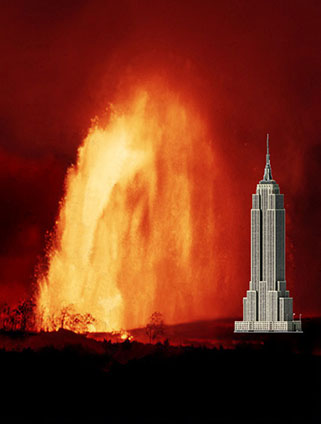 ?maxwidth=650&autorotate=false&quality=78&format=webp
” Fountains soared as high as 540 m (1,770 ft)”… “Lava fountain of June 25, 1969 reached a maximum height of 220 m (500 ft)”. Here is a visual comparison of Mauna Ulu’s ultra founatin with NYC’s Empire State Building: https://www.nps.gov/havo/learn/nature/mauna-ulu-eruption.htm
The variations are probably something to do with solar heating, they happen consistently daily. So maybe real rate is slightly less than it actually is exactly but still much higher than I can remember seein it ever go outside of a DI event or when an eruption actually first starts. This is just magma supply refilling though, which is the crazy part.
I would put a good chance on the fountains getting into similar height range as the older eruptions. The last one was particularly strong, but all of the last 4 have gone higher than the rim.
It seems to be 2 micro radians per day now or a little more, so higher than in the lead up to earlier episodes but I don’t think unprecedented.
The crater is already glowing strongly: https://www.youtube.com/usgs/live
So it looks likely that the eruption starts tomorrow, on the first day of HVO’s prediction.
The degree of the inflation is higher/steeper now than during last dormant phase. Kilauea may surprise both us and HVO with a faster episode than it was expected. If this is true, I assume that the eruption is already possible today.
If there happen repeatedly tall lava fountains that go higher than the caldera rim, they will leave a lot of pyroclastic deposits behind there. It’s also getting dangerous for hikers on the W and NW side of the caldera, where lava drops and tephra may fall during an eruption.
SDH has recovered faster than UWD. SDH is a bit closer to the location of the vents. Are the magma conduits of the vents towards the south (SDH) or vertical below the vents?
They are on the caldera ring fault so the original dikes were probably cone sheet intrusions tilting slightly outwards with respect to the magma chamber under Halemaumau. But because SDH responds so quickly too I imagine there is a direct connection to that too, and the deeper major magma chamber, we need a full composition analysis of post-2018 lava to see that.
It is worth noting in 1959 the original fissure and dike went across the caldera and erupted along the south side of Kilauea Iki, but the main vent and only one to last over a few hours was exactly where the fissure crossed the outer ring fault of the main caldera, so you have to wonder if it all started as a ring fault eruption that got slightly diverted near the surface.
Maybe both the current eruption and Kilauea Iki were of a similar eruption type. They are a bit outside the normal, usual steady Halema’uma’u eruption mode. They were/are linked to the cladera ring fault.
What is the role of eruptions like this in Kilauea’s eruption history? Kilauea Iki/Kapoho happened 1959-60, when Kilauea was slowly waking up from the calm 1934-1952 period. Kilauea introduced the highly active 1960s with many more eruptions than the 1950s. It looks as if the volcano first loaded the vertical summit magma reservoirs by Kilauea Iki eruption, before the “usual parts” ot Kilauea increased their activity. 18 months after Kilauea Iki/Kapoho the first eruption on middle ERZ happened in September 1961.
This is its own thing, hence ‘uncharted territory’.
There is tephra from between 1790 and 1823, mostly lava fountain fallout. This might be from when Halemaumau first formed, and is maybe similar to what we see now. But no one wrote anything down about Kilauea back then, probably because of what happened in 1790… So its hard to say anything really.
Apart from this there is nothing recent comparable in terms of chronology. Only other open vents forming which did so because the only option was to erupt until it breaks. If you use that as a comparison then Pu’u O’o is similar so we should expect this to last for as long as pressure doesnt break out somewhere else.
1790 to 1823 were during the age of oral traditions, but the witnesses were probably lost. There is a possibility that an episodical lava fountaining eruption period like ours precedes the formation of a new Halema’uma’u caldera with future lava lake activity inside the big Kilauea caldera.
Both vents are glowing now. Next episode probably begins soon. Deformation is at a flat part now. When it changes upwards, it is probably going to be the beginning for the next eruption:
Today Iceland has a chain of earthquakes from Eldey to Hekla. Is it caused by good weather and increased sensitivity of instruments or are there really more earthquakes now? The earthquakes are on SISZ and Reykjanes Volcanic Belt with Hekla as a mediator between EVZ and SISZ. Do the earthquakes indicate a higher general geological activity of western Iceland?
Have the volcano-seismic crises at Fentale and Santorini diminished? Can’t seem to find much news about them for the past fortnight.
Well, there are lots of small quakes around 2 in the Aegean Sea. I am not aware whether this is the normal state all year around as I started to follow this only when it became more prominent.
The Africen Rift north seems to be quiet.
Rifting last year and then early this year, seems a good chance the area north if Fentale isnt done yet. Rifting at Manda Hararo and Krafla lasted for years, Sundhnjukur is into its second year too. So its likely Febtale isnt done yet.
Especially if parts of its caldera sank, there us a magmatic element involved now too and the volcano might start force feeding the dike, increasing the chance of an eruption somewhere.
Theres also possibly a chance nearby sections of rift start moving too now that one part has snapped. Fentale doesnt have a lot of really young looking lava but some of its neighbors do, and if the 1820s dates are at all accurate they may be tectonically connected and erupt in close sequence. Like Reykjanes.
Its a bit of a meme that extinct animals always get their size massively overestimated when first discovered. But apparently megalodon somehow keeps getting bigger.
https://palaeo-electronica.org/content/2025/5450-biology-of-otodus-megalodon
The fact there is a fossil vertebra to base this on is a big deal, it means this individual was probably not a 1 in a million freak of nature that a couple of teeth might indicate but something common enough to beat the statistics, like a 6m white shark, rare but not unusually big. There are a good majority of whales that would be the lightweights next to this thing… Its crazy that Otodus sharks ruled the ocean for 90% of the Cenozoic, and O. Megalodon itself for over 20 million years. Yes there were a lot of formidable predatory whales but there is more evidence they were potential prey than the other way. Certainly 1 on 1 its hard to see anything standing a chance really.
I can imagine there were a lot of Megs around the older Hawaiian islands, they liked cold water but not as much as white sharks or they would probably still exist… 🙂
How warm was Hawaii waters near the PETM? I guess the reason why the tropics are even livable for humans today is simply because we lives in an Ice Age with cooler overall temperatures in the tropics.. looking at greenhouse simulation maps for tropics with cretaceous and eocene co2 and temperatures overlays makes really my skin crawl…
Im not sure, I guess a guess would be warmer but being an isolated island the climate might have been unpredictable compared to a continental landmass.
When the PETM happened the active volcano at the time was probably one of apparently several within the Nintoku seamount, which is a bit smaller than the Big Island but clearly was still a huge island. Actually theres about 6 of the Emperor Seamounts that date to the PETM interval, which seems unlikely, but Nintoku is the youngest in sequence of these. And even if past its peak was probably still the biggest island at that point anyway. The Ojin seamount might have also emerged, and could have been the actual main volcano, but probably a smaller island.
The Otodus teeth found at the PETM are a lot smaller the Meg teeth though, and not serrated. Still from huge sharks, probably looking a lot like basking sharks with big teeth, 6-10m long. But whales were still basically like otters at this time and only in India, the biggest marine tetrapods were crocodylomorphs that werent fully aquatic, and some snakes of unclear overall size. So there wasnt a niche for the kind of giant hypercarnivorous sharks of later times up to present. Actually the late Mesozoic wasnt a great time to be a shark, mosasaurs apparently were ecologically too similar and occupied the niches, but it was only after the K/Pg that the giants over 8 meters long reappeared. There were huge sharks in the middle Cretaceous but they disappeared around 90 million years ago, at the same time as ichthyosaurs and pliosaurs. Mosasaurs kind of converged on all 3 in many ways.
Its a shame the islands get pulverised to dust, no doubt all of them had unique and crazy life on them. The Detroit seamount was as big as the modern islands, it might have had a whole ecosystem of terrestrial pterosaurs or even truely flightless ones that would probably not really look like anything alive today in any way. Or flightless birds but totally unlike any we have now, considering birds often had teeth back then. There is absolutely no chance of ever finding any if this too, its a true lost world, a speculative evolution project that actually happened.
The bite force on the tips the tops of teeths of giant sharks and whales during miocene and pilocene was stuff of insanity compared to pretty much any jawed animal today. Some the bite force on the tips of Livyatan s crushing teeth to be between 100,000 to 200,000 newtons at souch pressure tissues and bones just vaporize into meat clouds. Miocene is really the cenozoic version of ” cretaceous hells aquarium” great diversity of large sharks, predatory whales but also crocodilomorphs so not going to swim there any time soon.. if I coud go back in time
Yes there was a lot of crazy evolution going on back then. But all of them were second place to Megalodon.
I would bet a pod of Livyatan probably could take a megalodon, perhaps some pods had a preference even. But Orcas today can take sharks easily by being bigger, but that wasnt true of the Miocene titans, it wasnt one sided. Actually, Megalodon has physical evidence of attacking a smaller relative of Livyatan in a predatory manner. And isotopic analysis of teeth show Megalodon ate animals that themselves would eat Orcas if they existed today, which sounds like Livyatan basically…
Basically, all the fanboys who hype it up actually won the argument. It really was the ultimate predator, its literally written in stone… And not just that, Megalodon might have also been the biggest animal to evolve on the planet since the Triassic, the new numbers are heavier than all the accepted weights of every single dinosaur, out of all animals it is only less than modern Balenoptera whales and Triassic Ichthyotitan, which is also only very tentative. I think its incredible popularity clouds how insane it is that a nearly blue whale sized hypercarnivorous shark existed for 95% of the last 30 million years… 🙂
Yes Miocene seas where scary stuff .. I have called the middle – late miocene seas it ”chop chop pond” for years after ”chop chop square” in arabia which is a fitting description or simply ”devils aquarium” Are the the new data for the Megs size and weight very solid? most sharks fossilize poorly making real life biology reconstruction very hard
I think nothing is very solid regarding Megalodon size estimates. I doubt we can find a fossil of an adult that is complete, most of them would have probably died out in the deep abyss, and those closer in would have been eaten. Maybe articulated skeletons could exist in the abyssal sediment (and other extinct sea monsters too) but I dont think those will ever be accessible.
Modern Lamniform sharks are diverse in form, but Otodus evolved from the small Cretalamna which was either also the ancestor of the white sharks too or was the first branch away from the common ancestor of both, and it looked basically what you expect. So Otodontidae very likely didnt look anything like goblin or megamouth sharks for example… 🙂
But from the mouth back probably basking sharks are a better body form analogy for Megs, that is a short snout, big gills for respiration, big pectoral fins, and a crescent shaped tail. So it probably wasnt too different to popular image but a young meg would have still been pretty distinct from a white shark the same size.
Visitng the Big Island felt like visiting a prehistoric lost world, stroling its beaches and numerous enviroments, maybe its just nostalgia but really felt so, of course no current island evolution of flightless petrosaurs or flioghtless toothed birds but felt so primeval anyway
Fuego impressive.
Mount Doom…
I find the current swarm at Kleifarvatn a bit more interesting than previous ones. Why? The frequency and persistency of quakes is high compared with previous swarms and the quakes line up in an east west orientation aligned with the main Reykjanes fault. Why is this interesting? Well, prior to the 2021 eruption at Fagradalsfjall, the main Reykjanes fault shifted in the Fagradalsfjall area. Prior to the Sundhnúkur series, the portion between Eldvörp and Sundhnúkur shifted. The starting point of the eruptions have all been close to the main Reykjanes fault. My point is that before the eruptive activity moves on to the next segment of the Reykjanes fault, we will probably see significant slipping in that segment. Seeing a swarm align in that direction at least gets a raised eyebrow from me.
Do you expect a major, destructive earthquake in this area like the Selfoss quake 2000? Kleifarvatn is also a bit Iceland’s Campi Flegrei with up and down (bradyseism) around the Lake. Events like this are geologically exciting, but scary as human experience.
I assume that the extension of Svartsengi’s dike before an eruption causes above-average tectonic stress on neighbouring volcanic systems. This may explain tectonic quakes both on Reykjanes End and Kleifarvatn.
If and when (big if, big when) the eruptive sequence moves to Krisuvik, I expect very similar quake activity like that we have seen both at Fagradalsfjall and Svartsengi. Multiple M5 quakes, almost continuous M4 quakes for a while, etc. We might even get some single quake around M6. To get into really large quake territory we would have to go further east towards Brennisteinsfjöll. Of course, releasing strain along the Krisuvik stretch of the Reykjanes fault might add stress at Brennisteinsfjöll.
The thing I wanted to point out is that previous swarms have mostly been on N-S striking faults. This is the first swarm I have seen that so clearly lights up a stretch of the E-W main fault. There might be some swarm I have missed, I haven’t checked the entire recorded history.
I miss the Big Island of Hawaii and the tropics in general! the difference in ambient daylight compared to northen europe is simply enormous in comparison and apparence. I can be stuck with grey skies and gloom for almost 8 months of the year or for a whole year if there is a cloudy rainy summer. That is usualy the case in Scandinavia a constant cyclonic gloom, I have been having mostly grey skies since august almost. This is not a good place for persons with seasonal depression
You should move here to Australia! Excellent. Bit wet in Brisbane right now but Newcastle, where I live, is nice. Here’re a few of the locals, photo this morning.
The one on the left is a blue-faced honeyeater (Entomyzon cyanotis). She’s learned that if she bounces off my screen door I will hear it and come out and give her bread. It’s been wet this week and there isn’t much nectar for her. The one on the right is the matriarch of the local magpie family (Gymnorhina tibicen). They’re very tame and take food from my hand.
Is the one on the bottom right also a blue-faced honeyeater?
Yes, she’s a juvenile and also accepts food from my hand. The younger ones have greenish heads and only get the bright blue when they’re adults. They’re clan breeders, so the parents get a lot of help from the younger ones.
Nearly impossible to live in Scandinavia with souch weather that we haves here despite having the highest living standards on the entire Earth
Brisbane is much better weather of course, but perhaps a bit too geologicaly stable for me so will be Iceland anyway despite the terrible weather
Brisbane just had a cyclone, so timing on that comment might need to be improved… 🙂
Also while it is a myth Australia is always hot, when it is hot it is pretty intense. All the capital cities have 30+ C days in summer. Also I am saying this as a fact, no one is safe from sunburn in the southern states, the UV is actually dangerous to be in sometimes, 20C ambient but feels like standing next to a fire in direct sunlight.
Sourthenmost Australia is basicaly analogus to a warmer version of UK with some meditteranean like summer qualities, Northen Australia the tropical Drawin is what many thinks almost whole Australia is like right?
No most people think Australia is a desert filled with giant spiders. But few people live in the interior. Even pre-European history most people lived in the same areas as higher population density today.
I have family in the UK, I cand remember them ever saying it felt similar at all. Basically all of Europe is closer to the pole, its warm because of the gulf stream but the solar cycle isnt so easy to trick, and the UK is a lot colder. I have seen -1C as an extreme low in winter at sea level personally but that is normal winter in most of Europe north of the Alps as far as I know.
The pacific northwest US and Canada is very similar I have been told personally by about 3 different people. And I thought New Zealand was basically identical without the eucalyptus when I was there. I imagine parts of Chile and Argentina are very similar too but only guessing as similar plants live there.
The top of Kilauea also is extremely similar too just a bit warmer 🙂
Eh, I always figured it was a desert filled with giant scorpions, surrounded by a narrow belt of rain forest filled with giant spiders, surrounded by a narrow belt of reef-riddled shallow water swarming with lethal cone snails and jellyfish, surrounded by sharks. 🙂
(Makes you think something didn’t want humans going there, and badly underestimated humans.)
They certainly underestimated Australians
No Australian scorpion is dangerous, actually. Also that while dangerous funnelweb bites still dont usually require medical intervention. Redbacks are the same as black widows, so not unique.
Snakes are a totally different story though, all Australian elapids are basically sea sakes that live on land so have extremely potent venom. Also, that the Taipan specializes in eating rodents that wake up and choose violence and can easily kill it, so its venom is meant to be almost instant.
Sourthen Spain and Sourthen Italy are about same latitude as Melbourne in Aussie if these places was placed in the sourthen parts of the hemisphere. Sourthen Hemisphere at least outside Austrailas interior have quite cool summers overall compared to Europe due to the lack of large land masses. Had the Mediterranean Sea been much wider with Africa placed further down it woud not be as hot in summer as it is today there
Yes, only problem is when the Mediterranean was much wider a lot of Europe was like South East Asia today, and the world was generally warmer anyway…
Also that Europe at this time had the closest thing to dragons that evolved as a real animal. Kaiju storks…
Still sounds much better than what im stuck with for sometimes nine months or a whole year if the weather is humid and cloudy. Scandinavia is in some way much worse than most other arctic locations due to our high humidity that means ALOT of clouds and gloom. Infact most other arctic areas like northen Canada, northen Russia at same latitudes as me are dry, continental and very sunny all year around because dry cold continental air that cannot hold mositure. Scandinavia thats more marine is cold and humid which is a rarity in cold regions, that means so almost all year around here there is a steel grey stratus concrete sky, which is not good for seasonal depression. The high humidity also makes it feel MUCH colder than it really is as well. “Anticyclonic Gloom” in Melbourne is very analogus to an Nordic sky condition almost all year around ( photo ) so the brain is not working that well for many persons here
Im stuck with same skies as the furious latitude 60 s below australia all year around… which stinks, but in Iceland souch weather only makes the landscapes even more dramatic
Compared to many other arctic areas Scandinavian winter is not that cold due to marine moderation, still because the humidity is sky high being outside it feels like swimming in freezing water, minus ten feels like minus 30 and lack of blue skies is almost the biggest annoyance its like skies are covered in ash or lead here almost all year around
Souch a stratiform cloud sheet can be 10 kilometers tall or more, and often consists of multiple thinner sheets stacked on top eachother
Souch a stratiform cloud sheet can be 10 kilometers tall or more, and often consists of multiple thinner sheets stacked on top eachother, and it can cover an entire small subcontinent, the annoying sheets it can strecth from Svalbard all way down to northen Spain its that extensive! I prefers tropical convective cumulus skies
Do you live in Göteborg? Not all regions of Nordic Countries are like that. Here where I live (in Northern Karelia), it’s not so gloomy all the time, and indeed, the freeze feels much better than say in Helsinki (or other south coast towns), because it’s much drier here.
Except in this winter it has been much too warm, gray and overcast for too long. And in summer, there’s a fresh breeze coming from Lake Pielinen, and many sunny days, but with some clouds too, which is good as I can’t stand direct sunlight in summer.
By the way, I just bumped to this:
https://www.iqair.com/us/world-air-quality-report
Found from it that the best air-quality in USA is at Hawaii, which is not surprise, as it is in the middle of the Pacific.
Best air except in the south part of the Big Island right now lol
Im so dead angry tired of this weather this constant cold cloudy humid gloom, that im almost mad, so maybe that Elon Musk ( shady he maybe ) but maybe he can have some geoengineering so i can have better weather. Hawaii is awsome but lacks jobs so maybe Australia coud be something for me later… but Iceland is still very hard to resist
I woud like to live in a warmer tropical or subtropical place but Im quite spoiled like many here used to the Scandinavian wealth: most other countries even today are really dirt poor compared to Scandinavia and some tropical ones are still stuck in the 1600 s in terms of infrastructure quality or planning in many of their rural areas: the wealth inequality between the world nations is really astronomicaly deep and problematic even today. Still Australia is one of few warm countries today that haves a wealth and living standards thats perhaps equal to Germany
Scandinavia is really ultra rich, richer than most arab states, but its cold and dark here and gloomy and infrastructure and city planning are very modernist and completely lacks beauty in my opinion. Sweden today that have adopted the modernist architecture in many areas looks like DDR or NK just concrete boxes and slabs that gets very depressing during our long grey polar winters.
I defentivly felt much more alive in the stylish romantic sunny Sicily in the MED
Most of south east asia is rapidly developing, or is already developed. That is tropical. Even large areas of Africa and the Amazon that most people think are so remote enough dinosaurs could hide there (not joking…) are a lot more developed than even Europe was only 200 years ago. Its very rare to find any society without any electricity at a town level or above. Yes a lot of Africa is not exactly ‘civilised’ but thats because of conflict not inability.
Maybe the most stark example is the western perception of China compared to the reality of China…
Yes thats true most countries today have electricity and public infrstructure. But I just mean in direct comparison to our Nordic public infrstructure quality stanards. The richest warm humid country today is likey Singapore that ranks very high indeed in human development ratings, still thats basicaly a rich trade town thats became an independent country. Its a mega city and I woud likey never thrive in that messy loud enviroment even if its warm
Aussie with climate analouges in other parts of the world map but not soure how correct this really is. Still pretty much all Australian locales on the continet have much much better weather than I ever does
https://www.reddit.com/r/MapPorn/comments/4qazuf/climate_analogues_of_australia_oc_2036x3242/
Link to map
With a M 6.5 earthquake right next to Jan Mayen Island, isn’t anyone going to speculate about a possible re-awakening of Beerenberg Volcano?
It doesn’t seem especially likely; the earthquake seems to have been entirely tectonic, with a pure strike-slip moment tensor.
Episode 13 hasnt really started just yet, the vents are glowing very bright and sometimes spattering though. As I write this it might be about to start up, there is lava at the surface but not flowing out.
Tilt at SDH has far overshot the trigger for the last few episodes. UWD is right now at about exactly the point E12 started. So if E13 isnt within the next 24 hours it could be a lot bigger than anything else so far.
Im not sure if this happened in the earlier episodes but there are actual flames at the north vent on the USGS livestream, not just spattering. The activity now is stronger than an hour ago, E13 must be very close now.
Tall fountains will start up at anytime there is already an angry fountaining lava pond inside there
https://www.youtube.com/watch?v=oG5zz9Sjw3E
Kilauea started
Very tall indeed its crazy but had built up more pressure this time compared to previous
The rain stops the camera overexposing, so its visible now that the fountain is way higher than the rim.
https://i.imgur.com/JdZFtFI.jpeg
Both vents are about equal too.
https://i.imgur.com/PDbQlaK.jpeg
Did someone finally find the “Start” button? 😉
I think that around 0:00 HST inflation began to increase more steep and did the build-up towards the eruption start. Around Hawaii’s midnight the spattering on the N vent became more continuous.
Around 2:35 HST the eruption increased slowly but significantly with more bright lava and the first exit of lava from the cone(s).
4 microradians in 3 hours. If 1 microradian is about 0.5 million m3 of volume change then its 2 million m3 in 3 hours or close to 200 m3/s eruption rate. At this rate E13 might be over in about 6 hours time for under 10 hours duration and 6 million m3 in volume.
Its very fast the eruption rates yes soon it starts to looks like the Kilauea iki fountains : )
It would be nice if they both major the height of the cones and the lava layers. Do they grow together or at different speeds?
Interesting are “passive” lava flows the occur above the vents, because the tall lava fountains put lava on the upper slopes of the W Wall. The S vent has a tendency to do this a lot.
They do measure it but only release the data randomly it seems
Based on the webcam views, the cone is about half the height of the wall now, which was said to be 180 meters. That was a few episodes ago so probably less now maybe 170, but still the cone is probably around 80 meters tall. I would put it at least 60 meters anyway. The south vent has also about doubled in size its cone in the last 2 episodes, and both vents are less enclosed and now elevated aboce the floor enough that they dont drown and fountains are much bigger. So the cone should grow faster now than before.
It also seems that episodes are both more intense and more voluminous than their predecessor now but still ultimately have a net equilibrium, if this is a trend then it will be exiting for sure, its a real lava geyser.
The eruption since December 2024 has something with Mauna Loa 1949 in common: Both happen on the caldera wall, both build two twin cones and they last long. Mauna Loa 1949 nearly a half year from January to June. The summit eruption was a pretext to the SWRZ eruption June 1950. Maybe caldera wall eruptions like this 1949 Mauna Loa, Kilauea Iki 1959 and the present W Wall eruption have more in common than the usual Halema’uma’u eruptions. It is possible that the current eruption precedes some kind of rift zone eruption afterwards, either lower ERZ like 1960 or SWRZ like 1919.
A difference was that Mauna Loa 1949 was a steady eruption until May and became episodic in the last weeks.
That could be true, but Mauna Loas usual style is to have a summit eruption followed by a rift eruption, or a single eruption that starts at the summit and goes down. Kilauea was thought to be similar because of the eruptions in 1959-1960 but since then there really hasnt been any consistency. Kilauea seems to just erupt wherever its magma system is most pressurized, and unlike Mauna Loa that includes permanent large volume storage in the rift zones.
That doesnt mean this eruption wont be followed by a big eruption low down, it probably will, but its probably going to be a long time before that. Like Pu’u O’o more than Kilauea Iki. Mauna Loa at least in recent time hasnt really done large scale summit activity, the long eruptions up there in the 40s were more like standard fissure eruptions that didnt quite stop on the first day, most of the volume was erupted fast immediately. There was a lava lake in the 1870s but it didnt fully transition to shield building and then drained out. Even the long lived eruptions towards Hilo and in 1859 werent really steady state, they started off as lava flood eruptions that became continuous but there was a steady decline unlike at Pu’u O’o where flows were continuous and new vent opened to replace dying ones.
I guess Mauna Loas eruptions were like the 2020-2023 eruptions in Halemaumau, staying open from pressure but not becoming fully open conduits so they close up when pressure us too low. The eruption right now is a fully open vent, not held open by pressure but kept open by enormous heat flow, which is an entirely different thing. Between fountains there is probably a convecting lava pond although it seems to be covered by a spatter cone.
A difference of the current eruption to 1959 is that it happens on the W or SW side of the caldera. 1959 was on the E side … and the following rift zone eruption happened on low ERZ. 1949 Mauna Loa’s summit eruption was on the W wall, and 1950 the rift zone eruption happened on SWRZ. So the summit eruption showed the direction of the rift zone eruption that followed afterwards.
If we assume that the position of the current eruption indicates the direction of the following rift zone eruption, a SWRZ eruption like 1919-1920 appears probable. I don’t know much about the 1919 eruption. The history table says “The “Postal Rift”: several separate flows, with short intervals without extrusion”, the eruption lasted for 223 days, had a volume of 0.03 km³ and coverd 4.2 km² in the caldera.
“The end of the 1919 “postal rift” eruption in Kïlauea Caldera is accompanied by a major draining of the lava lake, a moderately intense earthquake swarm beneath the east rift zone, and a small deflationary tilt change” https://pubs.usgs.gov/pp/1806/pdf/pp1806_chap2.pdf (p. 15)
The “Postal Rift” eruption lasted from February to end of November 1919. Only two-three weeks after this eruption the Mauna Iki eruption followed. In January/February 2024 a big volume intruded in SWRZ that only needs a small input to erupt.
It did erupt in June last year. I dont know if it would still be viable although another intrusion in the same place could happen.
In general though I dont know if there is a particularly good correlation of a vent in the summit to which rift might erupt. 1971 eruption went down the SWRZ but only weeks after an eruption in the south caldera and between the two eruptions of Mauna Ulu. And Kilauea Iki isnt on the ERZ connector either.
Also the last year has been particularly complicated, in the last 12 months both rift zones have erupted too as well as the summit now. It really could go anywhere, but the fact the summit erupted and made an open vent and both rifts shut down again is why I think it ishere to stay for a while
But 1949, 1940, 1933 and 1914 all has sustained eruptions in the SW portion of MOK (14, 33 and 40) built cones on top of each other, and the subsequent rift eruptions were split (14 SW in 1916, 1919, 1926), 33 NE in 1935, 40 NE in 1942, 49 SE in 1950). Tutu Pele doesn’t follow patterns. 🙂
I mean that when Mauna Loa does erupt it either has a summit eruption alone or a rift eruption that starts in Mokuaweoweo or close to it and moves down. Only 1919 I think didnt have an eruption in the summit area in the early stage. Although SWRZ eruptions dont necessarily start within Mokuaweoweo but just to its south.
Basically as far as recent history shows Mauna Loa can only start dikes in its summit area.
Kilauea though really is random, it can start inyrusions anywhere pressure has built up which is basically the entire length of the ERZ above sea level. Although obviously the summit is still the central part overall.
Kilauea’s “Postal Rift” eruption 1919 was maybe a bit similar to our eruption, although I don’t know much about the development. Both the “Postal Rift” eruption and “Mauna Iki” 1919-1920 were fed from the Halema’uma’u lava lake.
I imagine that our eruption once might shift towards a lava lake eruption that then is able to feed a SWRZ eruption. Or after a voluminous summit eruption the lava/magma drains into the SWRZ. The present vents are very close to the entry of SWRZ. So it’s not far away to move there.
Found this article interesting, looking at links between solar cycles and earthquakes:
https://watchers.news/2025/03/10/study-reveals-how-solar-heat-affects-earthquake-activty/
Latest IMO update (Icelandic)
https://vedur.is/um-vi/frettir/reykjanesskaginn-2024
They have also noted the shift in location towards the east and say that it’s likely to be trigger earthquakes related to the strain induced by the inflation, but that further analysis is underway.
They also state that there is more magma accumulated now than before any of the other eruptions and that the upcoming eruption could be larger than previous ones.
During next 300-500 centuries the volcanic systems may behave a bit like Vatnajökull’s volcanoes with once an eruption here and then one there. 900 AD was an Afstapahraun eruption (Krysuvik) and 1150-1188 was again a Krysuvik Fires period. So it’s possible that the same system does something repeatedly while the other also do something. But Earth has time, humans not, so we’ll miss most of the future show. We needed a biblical life like Methuselah (969 years) to really get to see something of volcanoes.
The lava shield is doing lava shield things–the flows are heading more to the north than they have been.
Yes its getting big, the cones are not so much spatter cones abymore but actual cinder cones.
South vent is wide open and turns to a’a not long after leaving, north vent gets ponded in the cone and stays hotter and more fluid.

Nice outflow, was a bit bigger after pushing some big rocks.
https://i.imgur.com/bjxQB0X.jpeg
Updated the plotting with new data for Santorini/Greece…
The 13 episodes appear to have a bimodal mode with either 12-14 hours or 21-27 hours https://www.usgs.gov/volcanoes/kilauea/science/eruption-information
The grade of deformation (first mathematical derivative) changes every 9-15 hours. Between the changes the grade of deformation is constant. The switch from one grade to an alternative one determines the duration of the episode and dormant phase. Short episodes only last for one constant phase of deformation grade. Long episodes last for two deformation phases. During short episodes (E13) deflation goes down like a straight lightning, while during long episodes (E12) there is a buckle to a different negative deformation.
https://www.volcanodiscovery.com/photos/nyiragongo/jan11/lava-patterns.html
https://www.volcanodiscovery.com/photos/nyiragongo/jan11/observers.html
https://www.volcanodiscovery.com/photos/nyiragongo/jan11/lava-fountains.html
https://www.volcanodiscovery.com/photos/nyiragongo/jan11/lavalake.html
https://www.volcanoadventures.com//nyiragongo/july2015/tour/photos.html
Nice old photos from Nyiragongos previous lava lake while visocity does not seem to be much lower than Hawaii, a nephelinitc lava lake still looks very diffirent from a basaltic lava lake at Kilauea, it coud just be that conduit circulation was faster in Nyiragongos previous lava lake than at Kilaueas old overlook lake, resulting in more plates and smaller fountains. Kilaueas overlook lava lake did looked like this when it was disrubed by rockfalls so likey makes sense. Nyiramuragiras current lava lake is a real monster its 360 meters long/ wide so bigger than Nyiragongos old lava lake by this scale bar to the right: Still with Kilaueas crazy supply its future potential as a shield lava lake may exceed this alot in 2035 : ) when the new halemaumau conduit keeps eroding up https://browser.dataspace.copernicus.eu/?zoom=15&lat=-1.38888&lng=29.17346&themeId=DEFAULT-THEME&visualizationUrl=U2FsdGVkX1%2BiCiIdcpcDO5%2Fnc9BsWtBe7DDzeV8HyJUjJwHT7709eYCJzMU0QeO4dJynFxWvgIok5AX%2BAfBwZW1TjNzi%2Fh8RSnDOOpxCG9QCxHp84Y3UAMxYHw%2Bp3kWu&datasetId=S2_L2A_CDAS&fromTime=2025-02-20T00%3A00%3A00.000Z&toTime=2025-02-20T23%3A59%3A59.999Z&layerId=1_TRUE_COLOR&demSource3D=%22MAPZEN%22&cloudCoverage=30&dateMode=SINGLE
https://browser.dataspace.copernicus.eu/?zoom=17&lat=-1.41066&lng=29.20488&themeId=DEFAULT-THEME&visualizationUrl=U2FsdGVkX1%2FR3oF8qTdNy3upz5SOKksOmsHN14fdSw9rAfgw94hWyRmQSJ6d1%2F5nMXOLUSgw0%2FUKhtaYudhs5U8oUmqUbicUCJWww4APsgqhwlYbRHnpS7YVr6%2FZuhMH&datasetId=S2_L2A_CDAS&fromTime=2025-02-20T00%3A00%3A00.000Z&toTime=2025-02-20T23%3A59%3A59.999Z&layerId=1_TRUE_COLOR&demSource3D=%22MAPZEN%22&cloudCoverage=30&dateMode=SINGLE
Nyiramuragiras New open conduit Lava Lake is perhaps 450 meters wide if you go by the scale bar in deskop version, so its an absolute monster. Due to the size of the glowing area where magma is comming in from the pipe conduit, it can be perhaps assumed that the conduit pipe is quite wide too. This is the currently worlds largest open conduit lava lake and woud be the first time since 1930 s that Nyiramuragias summit hosts souch a large lava lake. Its a result of Nyiramuragiras rifts eruptions that have been shut down for years and results in an overflowing lava shield when the magma supply goes there instead.
I will put up an article on this
ongoing EQ swarm at Reykjaneskagi
I bet this is going to prime the next Reykjanes eruption before the weekend
I’m willing to bet the opposite. This just looks like a regular tectonic swarm, triggered by some M3s and is unrelated to Svartsengi.
It is not unlikely that it is indeed related to Svartsengi, but the relation is the opposite of what Steve suggests. This swarm will not prime the next Reykjanes eruption, but it happens because Reykjanes is is primed for the next eruption. The most likely explanation is that inflation and ongoing rifting is increasing the stress on neighboring systems, triggering quakes.
IMO is reporting eruption is on going but not seeing anything on the cams.
Intrusion rather than eruption?
Do you have a link to that statement for us?
Scrap that – just refreshed the alerts page and it has filled the headline in now with “Expectation of a…..”
Not helpful, then again it may have been the translation to English that was an issue.
Swarm is well to the south west, is that because the automated location sensing is off kilter or are we seeing a new direction of break out?
Nah think it’s just a tectonic/volcano-tectonic swarm induced by the pressure at Svartsengi. My two cents is that the magma chamber/sill has expanded and it is now filling up higher than it ever has prior to a previous eruption, which is creating a huge amount of strain on the nearby systems. There was a large swarm at Krisuvik two days ago, and another at Hengill. Kleifarvatn has had some quakes recently.
When it does go we’ll be in for a pretty sizeable eruption.
Live from iceland website has a camera on the end of the peninsula – Reykjanestá
I see two such swarms from the IMO webpage. (time:02:39 UTC Thur 13-Mar-2025) Interesting to see 2 swarms close together.
Six Magnitude 3 earthquakes at 3-4.5 km depth. Probably normal earthquake swarm there, but supported by the Svartsengi activity: “The earthquakes are likely triggered earthquakes due to increased stress on the Reykjanes peninsula in connection with the unrest the last years.” Specialist Remark on https://en.vedur.is/
This is beginning to look like a rifting event.
independent or related to the Fagradalsfjall-Svartsengi system?
Looks like a bit of a chain reaction. First a bunch of M3s around 14:30. These quakes and their aftershocks are aligned with the spreading axis, so I could place a very high bet that they are normal faults. Then around midnight, there were new M3 quakes some 2km further west. Again, their aftershocks are aligned with the spreading axis and look like normal aftershocks. The aftershocks show a bit of progression towards SW that keeps the swarm going. It might jump over to yet another fault, or it might just stop. Sometimes these things can go on for quite some time and activate several different segments of parallel faults.
Everything points to a bit of crustal extension, so it’s part of the rifting process, but on a very small scale. The intensity of quakes also seems too low to be a magma intrusion. If it starts to produce M4 and maybe even M5 quakes it might be a good idea to turn a few cameras around.
AVO is reporting gas emissions from Mount Spurr. An eruption there is getting closer
Article about the report: https://alaskabeacon.com/2025/03/12/a-volcanic-eruption-near-anchorage-this-year-is-growing-more-likely-scientific-observers-say/?fbclid=IwY2xjawI_a_tleHRuA2FlbQIxMQABHcFRv9zPyhrgAMQNGgT0cuGkWzv6X9OGIITNgbBrMEyPxBkwig6BNptVQA_aem_g-gCNltQVZKvoeIyQdhOrw
The signs are similar to 1992, when the volcano erupted three Plinian VEI4 eruptions.
I will put up an article on the congo Nyiramuragira stuff in the comming weeks
Jesper, I just came across this https://earthobservatory.nasa.gov/images/154037/nyamulagira-brings-the-heat
New HVO map out, the eruption is now just over 52 million m3 on the 4th when the map was made. On the 7th last month it was 39 million m3, so 13 million m3 added. It was made before E12 and E13, so already outdated.
E8-E11 happened between these maps, so about 3 million m3 per episode on average. Also an average of over half a million m3/day supply rate or still about 0.2 km3/year.
Kilauea Iki 1959 was 50 million m³ (0.05km³), so the eruption is larger now than that one. Our eruption is also larger than the “Postal Rift” 1919 with 30 million, if the data are correct.