
The extinct volcano Sierra de Guadalupe rises 750 metres above Mexico City, it’s highest peak within 15 km of the centre of the city. In spite of conservation attempts, illegal buildings continue to sprout and at present the crater and debris avalanche have been completely covered by urban development. (Hotu Matua)
It is inevitable that the higher we get in this series, the more speculative our choices may seem. If everything was known about every volcano, identifying and motivating the choice of the ten most dangerous ones would be a relatively simple matter. As it is, our selections have to be based on what meagre information is available and educated guesswork as to what the full story might or could be. In our choice of number five, this is highlighted as we cannot even identify a single volcanic system as the main threat, but then the area occupied by the cities Mexico City, Toluca and Puebla is highly unusual.
Throughout almost its entire length, the Ring of Fire produces volcanoes aligned on and along the subduction zone forming a great arc of stratovolcanoes which has given rise to the term “Arc Volcanism”. But running across Mexico from Colima in the west to Pico de Orizaba in the east, the subduction zone makes an almost 90-degree turn and the volcanoes seem to align on a N-S line, perpendicular to the subducting plate. Three main such alignments are identified in recent scientific papers; Cántaro–Nevado de Colima–Colima de Fuego in the west, Tláloc–Telapón–Iztaccíhuatl–Popocatépetl (Sierra de Nevada) just east of Mexico City, and Cofre de Perote–Las Cumbres–Pico de Orizaba–Sierra Negra at the eastern end of the Trans Mexico Volcanic Belt, alternately known as the Trans Mexico Volcanic Zone. For the entire TMVB, volcanism has trended from acidic (dacite and rhyolite) to intermediate magmas (andesitic) as well as from north to south although there are numerous and noticeable exceptions to these identified trends.

The geological setting of the Trans Mexico Volcanic Belt. The numbers next to the arrows showing the direction are the annual subduction rates. The numbers along the isolines display the depth of the subducting plate as inferred from earthquakes. The TVMB is outlined in grey and the alignment of volcanoes mentioned are in yellow. Note how volcanoes (north-)west and (south-)east of the TMVB seem to align along the 300 and 100 km subduction isolines as opposed to transversing them as is the case in the TMVB. (Adapted from Macías 2007)
In addition to these three main lines of active volcanism, there are further lines of dormant or extinct volcanoes, one bordering the Mexico City plain to the west and the Toluca plain to the east with another one bordering the latter plain to the west. To complicate the matter even further, both north and south of these plains run lines of ancient, heavily eroded and extinct(?) volcanic edifices that seem to follow the subduction zone. If we also include the Puebla plain to the east of the Sierra de Nevado, there are more than 1.6 million inhabitants of Greater Toluca, 22.5 million of Greater Mexico City and 2.1 million of Greater Puebla, in all well in excess of 25 million.

Landsat image of the Toluca, Mexico City and Publa plains. The names of active to potentially active volcanoes in yellow, possible volcanic alignments are marked in blue and the 90-km-long Chichinautzin volcanic field immediately south of Mexico City, centred on the Aztec temple El Tepozteco, is circled. (Author)
Not only is the north-south alignment perpendicular to the subduction zone of the most recent volcanoes highly unusual. There is as well a dearth of large, explosive calderas in the TMVB. The semi-official blog GeoMexico laments: “There is still lots of work needed to fully unravel the geological secrets of Mexico’s Volcanic Axis which crosses the country between latitudes 19 and 21 degrees North. Unlike most volcanic belts elsewhere in the world, this one does not appear at first sight to correspond to any plate boundary. Another of the mysteries of this volcanic region, where igneous upheavals have shaped the landscape for several million years, is the relative dearth of calderas, the “super craters” formed either by collapse or by giant explosions.”
As of 1999, there were seven calderas known in the belt, one of which is in fact no more than a crater lake, Lake Alchichica, with a diameter of 1888 meters. The largest of these seven calderas is the 15 by 21 km Los Humeros caldera in the state of Puebla, close to its border with Veracruz. It lies 55 km west-north-west of the city of Veracruz (Xalapa), relatively close to Puebla (Teziutlán). The main caldera is about 400 m deep and roughly oval in shape. Prior to its formation 460,000 years ago, lava emitted from this vent covered 3500 square km with ignimbrites. Later, two smaller calderas formed nearby, with ages of about 100,000 years (Los Potreros caldera) and 30,000 years (El Xalapazco) respectively.
The 11 km wide and 400 m deep, heavily eroded Amealco caldera is located at Garabato (= unintelligible scribbles), midway between the towns of San Juan del Río and Maravatio, about 125 km NW of mexico City. Caldera-related activity started in the Pliocene ca. 4.7 Ma ago and ended around ca. 2.2 Ma. The total volume of pyroclastic flow deposits and ignimbrites is in the region of 500 cubic km. The Huichapan Caldera in the central sector of the TMVB, also referred to as the Donguinyó-Huichapan caldera complex is 10 km in diameter and appears to be the result of two overlapping calderas that date to 5 and 4.2 million years ago respectively. The rocks from the older caldera are intermediate to basic in composition, while those from the more recent caldera are acidic (high silica content) rhyolites, another relatively unusual feature.
Since then, one very interesting albeit ancient feature has been discovered in the Coxcatlán-Tilzapotla region, about 100 km south of Mexico City, just south of the TMVB. The elliptical NW-SE oriented dome structure, approximately 30 x 52 km, encompasses the Tilzapotla collapse caldera, rhyolitic domes, large volumes of ignimbrites, as well as the Buenavista intrusive body, and the Coxcatlán and Chautle plutons located west and east of the structural margin of the caldera, respectively. Previous geochronological studies carried out on the silicic and intermediate magmatic rocks places the uplift in the dome area in the late Eocene (~38-34 Ma). This suggests that doming was related to emplacement of magmas into the crust prior to collapse of the Tilzapotla caldera at 34.3 Ma.
The approximately 11 x 13 km Tilzapotla caldera is located on top of this large, rhyolitic dome feature. “The caldera is defined by a 33 x 24 km semi-elliptical structure that encircles the largest exposures of the Tilzapotla ignimbrite and corresponds to the structural margin rather than the topographic rim. A central uplifted block limited by NW-trending faults is the main indication of a resurgent stage. The caldera structural margin is surrounded by extensive exposures of Cretaceous marine sequences that structurally define a broad elliptical dome (45×35 km) originated in the first stage of the caldera evolution. There is evidence showing that the 34 Ma Tilzapotla ignimbrite represents the climatic event of the caldera collapse.” (Morán-Zenteno et al 1998) This begs the question of how the very large dome feature itself was formed. It covers some 1500 square kilometres to a height more than 1,000 m above the surrounding plains with a total thickness in excess of 800 m. If we make allowances for surface depression and 34 My of erosion, the total volume emitted is in excess of 1,500 cubic kilometres of silicic magma.
The observed absence in the TMVB of the elsewhere omnipresent large explosive calderas is a conundrum. Either they have been masked by the products of subsequent volcanic eruptions and rapid, tropical erosion and still await discovery, or, volcanism in the TMVB is sufficiently different to almost preclude these eruptions. However, the presence of the >500 km3 Amealco caldera, the 15 by 21 km Los Humeros caldera and the 10 km Huichapan Caldera rather points to the former being the case. In order to gain an insight into how very complex Mexican volcanism can be to unravel, at this point I recommend a look at the reconstruction by Diaz & McDowell (page 11); “Figure 7. Volcanic evolution of the Amealco caldera and peripheral volcanoes”. It is unfortunately too large to reproduce here, so please, take a look!
Click to access 2000_GSASP_334_Ame.pdf
If we turn our attention away from the very largest types of eruptions, there are several large and highly dangerous volcanoes in the Toluca – Mexico City – Puebla area. To the SW of Toluca lies the giant stratovolcano Nevado de Toluca and 50-70 km east and southeast runs the Sierra Nevada mountain range comprised of four major volcanoes:

The 4,680 m a.s.l. high Nevado de Toluca volcano as seen from the city of Toluca, 24 km away. (Wikimedia Commons)
Nevado de Toluca
In the Nahuatl language, “Xinantécatl” means “naked man”. Alternately, the name has been interpretated as “Chicnauhtécatl”, “nine hills” which given the volcano’s appearance seems the likelier. Nevado de Toluca is a composite volcano of late Pleistocene-Holocene age with a calc-alkaline andesitic to dacitic composition. The northern flank of Nevado de Toluca has a relative elevation (prominence) of 2015 m with respect to the Lerma river basin, and its southern flank has a relative elevation of 2900 m with respect to the Ixtapan de la Sal village. The elliptical 1.5 by 2 km wide crater of Nevado de Toluca is breached to the east. The interior holds a dacitic central dome and the remains of two ancient scars, located on the SE and NE flanks of the volcano which are related to the partial collapse of the edifice. Unusually for volcanic lakes, the two crater lakes are alkaline, not acidic.

El Refugio quarry located 15 km northeast of Nevado de Toluca crater showing an exposure of the 37,000 yr B.P. block-and-ash flow deposits (Macías 2007)
Nevado de Toluca was built upon the intersection of three fault systems with NW-SE, NE-SW, and E-W orientations. This structural geometry favoured the formation of coalescent pyroclastic fans that reach all the way to the cities of Toluca and Metepec, 25 km to the NE of the volcano. During the late Pleistocene, the southern flank of Nevado de Toluca collapsed twice, originating debris avalanche deposits that were transformed into debris flows with distance. The scars produced by these collapses have disappeared due to subsequent volcanic activity and glacial erosion. The older flow can be traced to distances up to 35 km from the summit while the younger event near the end of the Pleistocene ( > 40 kA) generated a debris avalanche, the “Pilcaya Debris Flow”, that travelled more than 55 km from the summit. Activity then continued with three very large explosive eruptions – the Lower Toluca Pumice ca. 21,700 yr B.P., the Middle Toluca Pumice ca. 12,100 yr B.P. and the Upper Toluca Pumice ca. 10,500 yr B.P. The pyroclastic deposits of these eruptions are mostly covered by subsequent and “smaller” Plinian eruptions.
The Sierra Nevada Volcanic Range
From north to south, the Sierra Nevada Volcanic Range comprises the volcanoes Tláloc, Telapón, Iztaccíhuatl, and Popocatépetl. Previously, it was considered that volcanic activity began to the north and migrated south but new evidence obtained from previous studies, field reconnaissance and radiometric dating paints a slightly different picture.
During the past 10,000 years, there have been repetitive Plinian eruptions of Popocatépetl including some historic events and the 1994–present eruption, but Holocene activity has not been limited to Popocatepetl alone. 9,000 years ago, Iztaccíhuatl produced the Buenavista dacitic lava flow. As is obvious, magmatism of the Sierra Nevada Volcanic Range has not kept a continuous north to south migrating path as had been previously surmised. Rather, it has shifted back and forth chaotically throughout its evolution.
Tláloc
Volcanism at the Sierra Nevada Volcanic Range likely started 1.8–1.4 Ma years ago with the construction of Paleo-Tláloc volcano, today buried by younger deposits. The activity continued between 1.07 and 0.89 Ma with the emplacement of dacitic domes, lavas and associated pyroclastic flows (“San Francisco” 1 Ma, “Chicoloapan” 0.9 Ma). Then between 0.94–0.84 Ma, the main edifice of modern Tláloc was built up through the emission of dacitic lava flows. Although Popocatépetl took over as the centre of eruptive activity about 320 kA, Tlaloc reawakened with the emission of rhyolitic magma at 129 kA followed by the emplacement of the El Papayo dacite (118 kA) to the south and Téyotl summit lavas (80 kA).
Tlaloc has always been considered the oldest volcano of the Sierra Nevada Volcanic Range (and extinct), but recent field data have revealed that Tlaloc was very active during late Pleistocene with a series of five explosive eruptions at 44, 38, 33, 31, and 25 kA and the growth of the summit dome. One of these eruptions produced the 1.58 km3 (DRE) Multilayered White Pumice (MWP), a rhyolitic pyroclastic sequence that consist of abundant white pumice (up to 96 vol.%), rare gray pumice, cognate lithics, accidental altered lithics, xenocrysts. The pumice clasts contain phenocrysts of quartz, plagioclase, sanidine, biotite, rare Fe–Ti oxides, monazite, zircon and apatite. Xenocrysts are represented by plagioclase, microcline, orthoclase and quartz likely coming from a deeper plutonic body. Both pumices have a rhyolitic composition (74.98 ± 1 wt.% SiO2 in water free basis) which represents one of the most acidic products of Tlaloc and the entire Sierra Nevada Volcanic Range. (Macías 2011)
Telapón
The inauspicious 260 m high (elevation 3,600 m) steep-sided Cerro Papayo dacitic lava dome marks the vent of the Telapón volcano on the north flank of Iztaccíhuatl formed approximately between 0.38 Ma and 0.34 Ma ago with the emplacement of lava flows and a dome. The 21 cu km compound lava field covers 84 sq km and includes flows that travelled long distances in opposite directions – into the Valley of Mexico and towards the Puebla basin. In addition, the Papayo lavas overlie glacial moraines about 12,000 years old, thus Telapón has been active until the very end of the Pleistocene. The lithology of Telapón shows two periods of activity. First, an andesitic-dacitic Lower Volcanic Event that was emplaced between 1.03 MA and 65 kA, and second, a dacitic-rhyolitic Upper Volcanic Event emplaced between 65 to 35 kA. (Macías 2007).

Photograph of Iztaccihuatl which clearly shows the resemblance to a sleeping woman. (Uncredited photograph, labels added by author)
Iztaccihuatl
The name “Iztaccíhuatl” means “White woman” in the Nahuatl language. Linked to the Popocatepetl volcano to the south by the high saddle known as the Paso de Cortés, it is a 5,230 m (1,560 m prominence) dormant volcanic mountain. Despite its relatively modest prominence, the volume is a staggering 450 km3, which is 100 km3 greater than that of Mount Shasta, Oregon. Iztaccíhuatl began its activity ca. 1.1 Ma ago. From then until 0.45 Ma several volcanic edifices were formed. At that date, the Los Pies Recientes cone was devastated by a Mount St. Helens–type event which destroyed the southeastern flank and produced a massive debris avalanche accompanied by large pyroclastic flows.
The summit ridge consists of a series of overlapping cones constructed along a NNW-SSE line to the south of the Pleistocene Llano Grande caldera. Andesitic and dacitic Pleistocene and Holocene volcanism has taken place from vents at or near the summit. Areas near the El Pecho summit vent are covered in flows and tuff beds younger than glaciation approximately 11 kA, yet GVP states that “The Global Volcanism Program is not aware of any Holocene eruptions from Iztaccihuatl.”

The once glacier-covered peak of Popocatépetl stratovolcano rises above Tlamacas to its north in this photograph from 1968. The sharp peak at right is Ventorrillo, the summit of a predecessor to Popocatépetl, the eroded Nexpayantla volcano. (William Melson)
Popocatépetl
Popocatépetl is the most active volcano in Mexico, having had more than 15 major eruptions since the arrival of the Spanish in 1519 with the most recent in 1947. In Nahuatl, the name means “Smoking Mountain”. Popocatépetl reaches 5,426 m a.s.l. with a prominence of 3,020 m with a base diameter of about 25 km. The crater is elliptical with an orientation northeast-southwest. The walls of the crater vary in height from 600 to 840 m. It lies 70 km southeast of Mexico City and more than one million people live within a radius of 40 km from the summit. According to paleomagnetic studies, the volcano is about 730,000 years old.
Popocatépetl used to be covered by glaciers, but due to increased volcanic activity in the 1990s, the glaciers covering Popocatépetl greatly decreased in size and by 2001 they were gone. Historically, Popocatépetl has erupted predominantly andesitic magma but it has also erupted large volumes of dacite. Magma produced in the current cycle of activity tends to be a mixture of the two.
There are at least four debris avalanche deposits around Popocatépetl volcano. The oldest comes from the failure of the SE flank of Iztaccíhuatl volcano, and the other three come from the flank collapse of paleo-Popocatépetl, the youngest being the 23,000 yr B.P. deposit. The modern volcano was constructed to the south of the late-Pleistocene to Holocene El Fraile cone. Three major Plinian eruptions, the most recent of which took place about 800 AD, have occurred from Popocatépetl since the mid Holocene, accompanied by pyroclastic flows and voluminous lahars that swept through the basins below the volcano.
Some 23,000 years ago a lateral eruption, greater than the 1980 Mount St. Helens eruption, resulted in the lateral collapse of the ancient Popocatépetl cone. The explosion generated a debris avalanche deposit that reached up to 70 km to the South from the summit. The decompression of the magmatic system caused a lateral blast that emplaced a pyroclastic surge deposit accompanied by a Plinian eruption column which deposited a thick pumice-fall layer on the southern flanks of the volcano. The column then collapsed and formed an ash flow that charred everything in its path. The deposit reached up to 70 km from the summit, covers an area of 900 km2, and if we assign an average thickness of 15 m, a volume of 9 km3 is obtained. This deposit overlies paleosoil that contains charred logs radiocarbon dated at 23,445 ± 210 yr. Disseminated charcoal found in the ash flow deposit yielded an age of 22,875 +915/−820 yr. (Macías)
During the past 20,000 yr the explosive activity of Popocatépetl has been characterized by four major events (14,000, 5000, 2150, and 1100 BP) and four minor events (11,000, 9000, 7000 and 1800 BP) The events that occurred at 5000 and 1100 BP had a similar evolution. They began with hydromagmatic explosions that dispersed wet pyroclastic surges up to 20 km from the summit. These explosions opened the magmatic conduit, decompressed the magmatic system, and formed >25-km-high Plinian column.
From our perspective, it is of interest to note that the last three Plinian eruptions of Popocatépetl coincide with three important events in Mesoamerican history: The 3195–2830 B.C. eruption coincides with the 3114 BC beginning of the Mesoamerican Calendar. The 215 BC eruption coincides with the transition from the Preclassic to the Classic period. The last major eruption, which probably occurred in 823 AD, coincides with the Classic-Postclassic periods transition.

The Parque Nacional El Tepozteco is at the centre of the Chichinautzin volcanic field. It consists of a small temple to the Aztec god Tepoztecatl, a god of the alcoholic pulque beverage. (unearthingarchaeoblog)
The Chichinautzin Volcanic Field
The Chichinautzin volcanic field contains more than 220 Pleistocene to Holocene monogenetic vents and covers a 90-km-long, E-W-trending area immediately south of Mexico City. It is formed primarily of overlapping small cinder cones and shield volcanoes with a mainly basaltic-andesitic to andesitic composition with a thrachytic component as well as some dacite evident. The highest peak of the Sierra Chichinautzin is the Volcán Ajusco lava-dome complex at 3930 m a.s.l. There have been at least eight eruptions within the past 10,000 years with the most recent about 1670 radiocarbon years ago (~340 AD) from the Xitle scoria cone. These eruptions have typically been VEI 3 with one registered as a VEI 4. A very modest estimate based on an oval 60 x 90 km with an average emplaced height of 250 m yields a figure of 1,050 cubic km for the volume of the dome but the true figure could be more than double that. From the list of sources in the GVP entry for the Chichinautzin volcanic field, it would seem that some individual cones, vents and flows have been studied, but not the feature as a whole. What is it? What is its true age? Why is it so large, far larger than the initial shield deposited during the first development stage before volcanism shifts to construct (a series of) stratovolcanic edifices? Is there a significance to its position on the same isoline above the subduction zone as Pico de Orizaba, Popocatépetl and Nevado de Toluca?
Summing up
The geological setting of the Mexico City basin is unusual in that the subduction zone makes an almost 90-degree angle and that the major volcanoes do not follow the subduction zone but rather form lines at right angles to it. Instead of showing a neat progression, volcanic activity has been shown to jump “chaotically” (Macías 2011) both geographically as well as petrologically. There is a marked absence of identified caldera structures in the area, yet in the middle of it, right at the southern edge of the city limits, lies a more than 1,000 km3 large Pleistocene to Holocene dome structure that has been active until recently, one that is not well studied.
In addition to this, the Nevado de Toluca volcano has already produced eruptions sufficiently large to deposit ignimbrites at distances greater than 25 km from its summit and Popocatépetl clearly has the potential to do so. Both these volcanoes (and Iztaccihuatl) have suffered several major edifice collapses where deposits have been traced to distances greater than 55 and 70 km respectively.
With almost 30 million people living within 100 km, Mexico City will remain on our list until the mysteries of why the “currently and recently active” volcanoes of the TMVB align perpendicular to the subduction zone as well as where and why the very large, caldera-forming eruptions (VEI 6 to 7) have disappeared to have been unravelled. It will remain on our list until we have a thorough investigation of the past and likely future evolution of the gigantic Chichinautzin volcanic field as well as a better understanding of the risks posed by the large stratovolcanoes in the vicinity.
The more I delved into this subject, the more intricate it became and the more I realised just how little I understood. The TMVB as it passes the Toluca – Mexico City – Puebla area once fully investigated may well deserve a place higher up on the list (or possibly even be struck from it), but with the material and understanding at present, we will leave it at a provisional fifth place on our list.
Henrik
Major sources:
José Luis Macías, “Geology and eruptive history of some active volcanoes of México” 2007 http://www.geo.mtu.edu/EHaz/ConvergentPlatesClass/Delgado/01_SPE422_06%20Macias%20GSA%20Special%20paper.pdf
Gerardo J. Aguirre-Díaz, Fred W. McDowell, “Volcanic evolution of the Amealco caldera, central Mexico”, Geological Society of America (Special Paper 334) 1999
Click to access 2000_GSASP_334_Ame.pdf
Barbara M. Martiny, Dante J. Morán-Zenteno, Luigi Solari, Margarita López-Martínez, Shanaka L. de Silva, Diana Flores-Huerta, Lilibeth Zúñiga-Lagunes, Laura Luna-González, “Caldera formation and progressive batholith construction: Geochronological, petrographic and stratigraphic constraints from the Coxcatlán-Tilzapotla area, Sierra Madre del Sur, Mexico”, Revista Mexicana de Ciencias Geológicas 2013


Nothing wrong with loving Iceland volcanoes . Discussion is key.
http://www.vnet.bosai.go.jp/strace/view.php?orgid=03&netid=02&stcd=V.SKD2&tm=2015081608&comp=U&type=24H&area=030243
Seismicity has died down quite a bit today at Sakurajima, but I think this is just a temporary lull. These things tend to go in waves.
President Correa of Ecuador calls state of emergency over Cotopaxi
http://www.reuters.com/article/2015/08/15/us-ecuador-volcano-idUSKCN0QK0P220150815
Definitely a good precaution. Many people may think this extreme, but a minor disconvenience in daily life in the event of no eruption simply is not that big of a deal compared to what could potentially happen if the threat of an eruption is ignored.
Ecuador definitely know what they’re doing, good to see :).
The interesting thing from here is that there still may be quite a long time before we see an eruption. From the natural progression of things, all we know is that some magma has likely reached the water table at a certain depth, but it may take another month to reach the surface for all we know. Pinatubo is a good example of this, where it had a long period of phreatic eruptions without any major eruption, which caused a lot of the volcanologists to second guess themselves. And their second guessing wasn’t off base, because even in this instance, there is still a chance we don’t see a large-scale magmatic eruption.
At the same point, without knowing the depth of the quakes and other information, we may see an eruption sooner than later, We just don’t know, and that’s why this situation is quite interesting to watch.
The thing about magma reaching the water table, is that it has to meet the water table above the critical point of water. Anything greater than about 2.1 km or so and the hydrostatic pressure is too great for water to flash to steam.
(I have to double check the pressures, but I think 2.1 km is it)
ABC News claims that there was a pyroclastic flow; not seem any corroboration, was it journalistic spin?
http://www.abc.net.au/news/2015-08-16/ecuador-villages-evacuated-as-cotopaxi-volcano-rumbles-to-life/6700534
“Cotopaxi registered several eruptions on Friday, following decades of inactivity, spewing ash columns as high as eight kilometres into the sky.
The volcano spewed a current of hot glass and rock — called pyroclastic flow — which authorities warned could trigger avalanches or landslides of volcanic debris, also known as lahars.
“Due to the pyroclastic flows that can generate lahars, preventative evacuations [are ordered] on the southern part” of the volcano, the Risk Management office said on Twitter.¬
Yes, a pyroclastic flow was reported by the Instituto Geofisico on 15 August, although it was not accompanied by visible explosive activity, nor by any elevated seismicity. Since visibility was hampered by weather clouds, it is not clear how the ground-hugging cloud seen in webcam images was formed.
https://www.facebook.com/instituto.geofisico/photos/a.201067140073247.1073741827.201053783407916/466040583575900/?type=1
No explosion, no marked seismicity…no apparent lahar developed. Could this perhaps be a straightforward avalanche of fresh snow, dark because ash-covered?
Probably quoting this joker.
If he were joking, it would be one thing, but Kookoo tends to take himself all too seriously and tends to believe his own B/S. Unfortunately, he’s the “go-to” boy for all the media shits who are just looking for something to keep their mundane “news” story exciting and drag his carcass out to comment on stuff that is only marginally related to his own field of study. It’s like getting a septic tank engineer to comment on air conditioning because buildings tend to have air as well as septic systems. In his field, he is the one to see, in geology? Not so much. I would rather hear Sparks, Caracedo, or Mastin’s opinions about stuff dealing with Geology. And Kiyoo Mogi, Boris Behncke or Erik Klemetti or for volcano stuff.
(Yeah, I went there. So what?) There are also a ton (probably literally) of Icelandic Scientists that could run circles around Kookoo with regards to volcanoes. Dirty little secret… some of you can likely out-class him with your volcano knowledge.
That’s why I like ‘yall, you tend to absorb knowledge and kick various ideas back and forth on here. 😀
First saw this cat on Good Morning America following the 2011 Japan earthquake/tsunami. His tone and mannerisms were bugging me so much I was about to change the channel when he blurted something–can’t remember what exactly–so blatantly dunderheaded that I stood there staring at the TV with my jaw hanging open.
Later he was talking about megathrust earthquakes but was describing strike-slip fault mechanisms.
I started to write ABC news a letter but stopped when I realized they wouldn’t care, that they had a charismatic physicist talking head that fit the story to a T. Japanese, even! Perfect!
Didn’t realize at the time that they’d bring the clown back *every* time they had a science story.
I wonder what level this eruption will be.
OT
“Though scat singing is improvised, the melodic lines are often variations on scale and arpeggio fragments, stock patterns and riffs, as is the case with instrumental improvisers. As well, scatting usually incorporates musical structure. All of Ella Fitzgerald’s scat performances of “How High the Moon”, for instance, use the same tempo, begin with a chorus of a straight reading of the lyric, move to a “specialty chorus” introducing the scat chorus, and then the scat itself.”
https://youtu.be/8mq4UT4VnbE
Last spring, I rescued two orphan kittens about 4 weeks old. The male immediately revealed himself as a bit of a thief after pilfering some tidbits from the dinner table. The female just came up and purred constantly until somebody offered up a treat. So, we now have Mooch and Minnie.
some bad news (illness due to ash polluted well water) in Papua new guinea followed by some better news
http://www.radionz.co.nz/international/pacific-news/281395/png-govt-releases-relief-funds-for-manam-islanders
I was trying to find an up to date report and found a picture of mayon being used in place of manam
or at least I think this radioaustralia article http://www.radioaustralia.net.au/tokpisin/2015-08-10/png-manam-pipal-i-kisim-halvim-nau/1479670 seems to be using a cropped version of the picture from reuters that you see at the top the article here http://mobile.abc.net.au/news/2015-08-06/volcanoes-explainer-why-they-erupt/6676400
that last article actually looks pretty decent with a bunch of general purpose volcano questions answered.
Yay! 30,000 foot cloud tops just 5 miles out and headed this way. Gonna sleep like a baby!
Any speculation on Sakurajima?
It’s somewhat strange how abrupt the seismicity seems to have stopped. Going back to speculation from a few days ago, it definitely seems that the primary conduit is blocked, considering we’ve had almost zero eruptions in the last few days. I just wonder if the seismic event that occurred yesterday was pressure building and trying to force that blockage through the conduit.
I wouldn’t call it especially abrupt… it rose fairly steadily to a peak for a little over an hour, declined over a few more hours, and is still somewhat elevated from background. I think it’s possible this activity will prove cyclical and intensify in strength and duration over the next few days/weeks, probably ending in an eruption.
As for blockage, I wonder if magma is on the move in there and has either 1. caused deformation that has closed or constricted the plumbing associated with the Showa crater, or 2. caused some more evolved magma to move into the edifice, magma that is too viscous for vulcanian activity, and a small dome has been growing unnoticed in or under Showa? Eruptive activity has been way down – zero or near zero – for the last few weeks.
I ran both these possibilities past a volcanologist who is working on Sakurajima, and he agreed they both were plausible scenarios.
Thank You. It’s also plausible that many nations are over-run by idiots and we just haven’t noticed it yet. (Yes, mine included)
Good reply Mike. One could add the possibility that the magma currently in the pipe has a low gas (water) content, something that would require far more energy to force through the plumbing (greater mass, less JATO).
That has legs too, I agree – although Sakurajima magma is pretty consistent IIRC… the rate of delivery into the edifice varies, affecting eruption strength and frequency, but the composition doesn’t change much.
This just leads to the question of what’s going on, what the cause is, if some more dehydrated magma has appeared in the system.
I will say, while it hasn’t been erupting in recent weeks, it *has* been steaming/offgassing quite heavily at times, moreso than usual in my judgement.
the picture of Mexico City encroaching into the ‘caldera’ gives me a shudder, not good.
Then Kagoshima or Naples should give you the utter collywobbles…
And Auckland…
Well Auckland eruptions are generally fairly non-hazardous, modulo explosive maar possibilities. It’s not like building a city *in* a flaming active caldera!
Taupo and Rotorua are much dodgier places – but they’re relatively small towns.
it does and I keep an eye on it with a few others, having said tat I live in a volcanic field, more of that at a later date.
Keep in mind, that’s an ancient, and for the most part, extinct caldera system.
Ref Auckland: “the only city in the world built on a basaltic volcanic field that is still active.”
90 eruptions from 50 different cones (“volcanoes”) over the last 90,000 years…
Hábunga’s bowels have been showing signs of disturbance recently, and this swarm from this morning is, I think, the largest:
Monday
17.08.2015 09:38:28 63.630 -19.054 24.8 km 0.6 99.0 6.0 km NNE of Hábunga
Monday
17.08.2015 09:37:18 63.628 -19.044 25.5 km 1.0 99.0 6.0 km NNE of Hábunga
Monday
17.08.2015 09:37:05 63.631 -19.056 20.3 km 1.0 99.0 6.1 km NNE of Hábunga
Monday
17.08.2015 09:36:42 63.649 -19.055 23.8 km 0.6 99.0 7.9 km NNE of Hábunga
Monday
17.08.2015 09:36:05 63.627 -19.049 27.3 km 0.6 99.0 5.8 km NNE of Hábunga
Monday
17.08.2015 09:31:59 63.633 -19.073 20.1 km 1.4 99.0 6.0 km NNE of Hábunga
Monday
17.08.2015 09:31:50 63.641 -19.068 18.0 km 1.8 99.0 6.9 km NNE of Hábunga
Anyone with more knowledge than me care to speculate?
Good spot! That’s the kind of swarm to take notice of even if the quakes are puny, most of them with an energy release similar or smaller to than that of a BigMac. At that depth it can only mean magma is moving into the system but how much, at what rate and for how long is impossible to say at this point. Also the surface projection of the position means little as conduits never are absolutely perpendicular but should this begin to migrate upwards and remain in the same position, there’s an outside chance things could become interesting as it’s in one of two possible positions where any evolved magmas may not have been released by the more recent, large eruptions of Katla.
Speaking of the unexpected – England have a chance to whack the Aussies 4-1 in the Ashes later this week. 😉
Thanks for that – helpful, informative and interesting.
The Ashes! The Aussie press will erupt if we get 4-1!
They are in a state of eruption anyway, Red Alert. The only matter in doubt is whether it will be a VEI-3.1 (catastrophic) or VEI-4.1 (cataclysmic) eruption and if the pyroclastics will travel all the way into the ACB boardroom.
Well, they can’t say there haven’t been precursor events –
http://www.abc.net.au/news/2015-07-13/volcano-cluster-discovered-off-the-coast-of-sydney/6614828 ;-0
George Vitton has reported that otopaxi had been having moderate eruptions with ash and one pyroclastic flow.
http://lechaudrondevulcain.com/blog/2015/08/17/august-17-2015-english-cotopaxi-sakurajima-villarica/
For anyone who want to go to Jon’s Iceland geology website, he has written his latest entry on the pre-eruption earthquake activities at Bardarbunga a year ago.
What happened at around 8:40pm, august 17 helicorder at Sakurajima? Looks too low frequency to be eruption, but the amplitude is rather large to be a teleseism.
Could be a long period event? I’m not an expert seismologist however, and the JMA webicorders are formatted differently than most online webicorders are, so they’re a bit different from an interpretation standpoint.
If I have got the time difference right, this:
http://www.emsc-csem.org/Earthquake/earthquake.php?id=455145
A 5.1 just south of Sakurajima.
Thanks, that looks like it – close enough for the amplitude, far enough away to attenuate high frequencies, and at 30 km depth, Mike is probably spot on.
Looks entirely tectonic to me.
Surtsey is heating up:
At http://www.jonfr.com/volcano/?p=5749 I read the following:
“Increased ground heat measured in Surtsey island
Posted on July 22, 2015 by Jón Frímann
It was in the news yesterday (21-July-2015) that scientists have measured higher ground heat in Surtsey Island. The change is 10 degrees (Celsius) from measurements taken some two to three years ago. The theory is that the ground in Surtsey island started to warm up after an earthquake that happened last spring (2015). There have been few earthquakes in Vestmanneyjar volcano system during the past few years, no major swarms have taken place so far.
It is clear by the increased ground heat that magma is on the move in Vestmanneyjar volcano system. It’s too early to know if an eruption is going to take place in next few years. At the moment there is nothing imminent suggesting that is the case, volcanoes often warm up at the surface just too cool down. The largest risk now in Surtsey island are possible steam explosions. They are only risk to local bird and plant life in the summer time.”
Will Surtsey come back to life after being quiet for almost 50 years?
it came into being in 1963
The thing that worries me most about SakuraJima in the event of a mid-sized eruption is the fact that it is on an island. Water adds so many extra risks to a volcano, most of which are highly unpredictable. For instance:
-Water increases the distance and speed at which pyroclastic flows travel. This adds a considerable risk for even a small pyroclastic flows reaching water, since there are populated areas on pretty much all sides of Kagoshima bay.
-Water also adds explosivity to an eruption, especially if it interacts with a magma chamber. It was widely speculated that this was the cause of Krakatoa’s major eruption, although there has been some more recent studies that indicate water was not the cause of the caldera formation. Regardless, water won’t make the eruption more benign if there is any interaction, which is always a risk on a island volcano. Especially worth noting is that Sakurajima has had large vents form away from the summit during larger eruptions, some of which were very close to the shore.
-Water increases tsunami risk, which is always a factor during an eruption. A small tsunami occurred during the 1914 eruption, along with major earthquakes (which triggered landslides). A major landslide, even if it’s not directly on the volcano could cause a large tsunami to form in the wash-basin like Kagoshima bay.
The thing is, these risk factors are worth considering during even a moderate eruption at Sakurajima. While I don’t think it’s likely we’d see a large (VEI-5+) eruption here, we know you don’t need a large eruption to see disasters occur. Additionally, many of these factors are very difficult to predict or plan for beyond simple evacuation.
Another quick note on something I’ve seen come up is the Sendai nuclear plant, which is somewhat nearby. I wouldn’t worry too much about this, it’s over 50 kilometers away, which is well out of range of a pyroclastic for any reasonable eruption. If we have pyroclastic flows traveling more than 50 kilometers from Sakurajima, a nuclear power plant meltdown will be one of the least of our worries here as this would likely imply a VEI-7 sized eruption.
My very non-expert take on the nuclear plant is that the risks are volcanic ash, a large explosion from Sakurajima, should magma and water meet, and / or, but less likely, large earthquakes, which may reactivate a fault near the plant. Or, depending where they live, the workforce cannot get to the plant during an eruption. But all of this should have been taken account of in the disaster planning for the plant.
Experts may have a different view of the risks.
Volcanoes do not normally activate faults. (Large earthquakes can activate volcanoes.) Nuclear plants are more resilient than they are given credit for, and I think they are not the main risk coming from Japan’s volcanoes.
Presume that the mitigation of volcanic risks is built into the design of nuclear reactor in, e.g. Japan.
In the case of caldera subsidence, there can be pretty large earthquakes. The 1914 eruption of Sakurajima was accompanied, a few hours after eruption onset, by a magnitude 7 earthquake that may have been due to subsidence along the caldera boundaries once a large volume of magma had started being extracted from the reservoir below the volcano (although there was no caldera collapse in the proper sense during that eruption). Also the collapse of the Pinatubo caldera in 1991 was accompanied by a lot of magnitude 4.5 – 5.6 earthquakes, which are not potentially devastating but if they are shallow they can cause significant damage in the epicentral areas.
That’s interesting , I didn’t consider that, thanks
Ash can be forecast, and if significant ashfall is forecast they may well shut down the grid to prevent damage (since ash, especially wet ash, can short out substations etc).
Sakurajima has no history that I’m aware of, of significant water/magma interaction; it’s never gone Krakatoa. Not to say it never could, of course… but no evidence.
Sakurajima eruptions can be accompanied by large earthquakes, as evidenced by 1914, but they’re still significantly smaller than the entirely tectonic quakes which can occur in that area, and which are – we hope! – allowed for in the design.
I just think water is a factor of unpredictability that comes into play with island volcanoes like this. It may or may not play a role in a future eruption, but if it does, it can throw a few curveballs into any normal predictions.
Also rhyolitic magma could be fed into the system causing much more explosive eruptions and flank collapse. or it could do a Mt St helens type of eruption and erupt laterally. There are many possible options.
Possible, but her lavas have tended to be dacite, andesite and basaltic andesite.
https://volcanocafe.wordpress.com/2012/11/12/sakura-jima-what-type-of-lavas-does-she-produce/
http://volcano.si.edu/volcano.cfm?vn=282080&vtab=Eruptions
I would exclude a St Helens scenario because Sakurajima has a different morphology and the area of recent swelling is near the base, not on the flank as at St Helens, and the amount of swelling is vanishingly small compared to that seen at St Helens before its 1980 collapse and explosion. Most likely a major eruption would be similar to those of Sakurajima in the past, and three of them (1471, 1779, and 1914) are well documented.
More activity at Cotopaxi.
https://twitter.com/chematierra/status/633395311524745216
Image from Cotopaxi.
 :large
I wonder how much longer until the big show starts (if at all)
Looks like it’s a very clear morning in Ecuador with splendid sight of Cotopaxi. A lot of fresh pics available on twitter. The one above is from Christian Lopez. I hope it does show up in here.
Greeting to all! Barb
Now new activity is reported by a lot of tweets from different angles. The one above is from a “Paloma”.
If it’s not okay to post those twitter potos in here, a dragon may extinguish the posts, please. Have a nice day everyone, and thoughts to the people near the slopes of Cotopaxi!
small eruption from turrialba – with a video
http://news.co.cr/new-eruption-of-turrialba-volcano-in-costa-rica-video/40926/
and not sure if this has been shared either – it claims to be a timelapse of colima on august 12th http://www.bbc.co.uk/newsround/33951586
Good picture of Cotopaxi eruption now. The smoke and ash are going away from the camera. It is rare to get a clear picture of this mountain. http://www.igepn.edu.ec/cotopaxi/camaras-cotopaxi
Great view, thanks Bio. I am wondering which volcano has a greater chance of going VEI4+ this year Cotopaxi or Sakurijima. The sudden stop in Sakurijima activity is either a plugged conduit or a release of pressure at depth. Cotopaxi may not have enough coming up to go big. Who knows.
It’s really pretty tough to say how much magma each system has “ready to go”.
Unfortunately, you can’t really use the level of seismicity as a basis for how strong an eruption would be projected as. I know a paper I read on Cotopaxi had established that it had been inflating in an aseismic fashion for years. As such, magma inflating into a system won’t always rumble until it starts to form new conduits as the pressure wants to get out.
Sakurajiama has a ‘ring’ over the top now, one sees those rings quiet often around volcanoes, heat from below with gases escaping? looks pretty, but maybe just a pre-curser to….
The heat is definitely there. This pic was taken at dawn today. Apparently there was a minor eruption an hour or so later. I think we have a bit of a dome forming…
https://twitter.com/nhk_seikatsu/status/633799120658894848
Indeed, a dome is forming in Showa crater : http://headlines.yahoo.co.jp/videonews/nnn?a=20150819-00000049-nnn-soci
Here are links to the latest satellite data to Sakurajima
http://www.jaxa.jp/press/2015/08/20150819_daichi2_j.html
http://www.eorc.jaxa.jp/ALOS-2/img_up/jpal2_sakurajima_20150816-17.htm
Great link. In addition to the impressive lava dome in the Showa Crater, did you see that, in the next crater along, magma was glowing orange?
It is not the magma. The red / orange color in the crater Minamidake is colored water by the dissolution of volcanic gasse. For the moment incandescent were observed in the Showa crater.
https://youtu.be/IShbLsnQf7M
http://www.data.jma.go.jp/svd/vois/data/tokyo/STOCK/monthly_v-act_doc/fukuoka/15m08/20150819_506.pdf
Does anybody know the estimated total amount of material ejected by Sakurajima since the 50’s? It’s been active ever since, so it would be interesting to know.. Probably this could give a first figure on how much material could be blown out after a certain period of congestion. Lets leave the water-component out for a sec, it would be too much to add into the calculation. Still, more pressure than normal could blow out more than the normal amount of ejecta. Quite hard to estimate that as well..
But indeed, the water makes it a very unpredictable beast. Definately worth monitoring, not only because of the proximity to the city and open waters. However, I try to ease myself not to check the webcam every one to two hours.. Same goes for Cotopaxi.
Both volcanoes could last like this for months, with Sakura-jima being less likely to last that long given the frequent eruptions for the last 60 years!
I don’t have a source handy, but I’ve read that the actual ejecta in the last 60 or so years has actually been very small despite how awesome some of the eruptions look. I’ve heard that the cumulative VEI would be somewhere around a VEI-2/ VEI-3 eruption.
GVP have given it a VEI 3
http://volcano.si.edu/volcano.cfm?vn=282080&vtab=Eruptions
From out of the blue shall Sinabung ever stop. What are the possibilities there about what could happen. The probability of the lava dome growing and trapping magma leading to an explosive ending or a just stopping to erupt. What do the scientists know or are trying still to figure out? Is it a difficult one when you have a volcano at the onset of the eruption that has been dormant for 400 years? I just want this one to stop for the people who have been in shelters for how long?
A bunch of questions to try and figure out about Sinabung.
I read that 20,000 people had been displaced but I think the article was very old and I think it must be more than that. I came across this, not sure if it’s already been posted. Drone footage of Sinabung:
https://youtu.be/ET0kEBpCd3g
She got a nice clear view. I don’t mind drones when they’re used for things like this. 🙂
excellent use for drones
Buahah! Inside the Drop Zone…
https://youtu.be/haDE5rwgyjg
Does anyone have a link to a Sinabung web cam that works ? What is the best way to keep up with this volcano ?
Thanks
The “Beidar Sinabung” Facebook group seems to be pretty up-to-date, but much of the messages is in Indonesian.
https://www.facebook.com/groups/beidarsinabung
Does anyone here have an estimate as to when Cotopaxi is gonna truly blow its top?
Also, is it worth keeping an eye on Hakone anymore?
No one knows but St Helen’s had it’s first eruption March 27th and did not blow until May 18th. Also there have not been the major 4.0+ mag quakes at Cotopaxi as there were in St Helen’s. So there may not be as much magma set to erupt. I am only using St Helen’s as an example and not trying to say Cotopaxi will be like St Helens just showing what one timeline was for an eruption.
There is no estimate for such a thing other than to sit back and wait. It may never blow its top for all we know.
Unfortunately there is no way making any sort of forecast unless the volcano gives that sort of signal which tells us what it is up to. And very often, volcanoes behave in a rather undecided manner for periods that can last from days to years. They can speed up in terms of unrest, then slow down again, speed up a bit once more, slow down, and then suddenly speed up very dramatically and erupt (see the Rabaul unrest and ensuing eruption, 1983-1994). Or speed up a couple of times and then go back to sleep (see the Soufrière de la Guadeloupe unrest without ensuing major eruption, 1975-1977).
This is so, because magma is a rather peculiar stuff, it’s not like milk or water or blood, it’s extremely heterogeneous, and it moves in an extremely complicated environment as it attempts to reach the surface. It can be really fit to come all the way up and erupt, but a lot of things can go wrong on the way, causing the magma to stall and – if enough of its gas is lost during the stalling – render it uneruptable. That’s what we then call a “failed eruption” or a “non-eruption”, and such events (or non-events) are becoming an increasingly important field of research in volcanology.
I call a ‘failed eruption’ a ‘successful intrusion’… 🙂
New live cámara in Cotopaxi:
http://www.seguridad.gob.ec/volcancotopaxi/index.php/en-vivo-volcancotopaxi/
Leonardo..Thank you
Are the cracks in the car park new? Or just showing because of the light conditions?
http://www.sizenken.biodic.go.jp/live/view.php?camera_no=48
Kidding aside. This is the parking lot circa May 2015
And the difference operation ran on the current vs the May image. Note: The parking space lines show up so bright due to the different lighting conditions. Ignoring that and focusing on the pavement itself should yield any new cracks, if any. Personally I don’t see anything of note, but other eyes may have a different opinion.
Not sure how the image should be interpreted. Are the differences light or dark?
Light mostly… at least for what we are looking for.
And, I can’t rule out the parking spaces showing up so well as being an effect of the whole she-bang being offset by a couple of inches. Not likely, but entirely possible. (especially since this would be in relation to the camera… which could have shifted as well due to a bird landing on it or something.) My gut feel is that if the lot itself shifted, then the structure holding the camera would have had the same shift. It’s not that far away. Lighting changes seem to be the simplest answer.
Might be some differences in the roofs and in the rocks on the RHS of the difference image.
Definite crack in the road on the left. But whether or not this is due to inflation or earlier wear and tear is anyone’s guess (I have seen cracks in roads like that in non-volcanic areas).
Given the available data (imagery) that’s a pretty good call in my opinion.
Now, is it due to activity at Hakone or is it due to the parking lot subsurface gaining or loosing moisture? I come from a town renowned for something called “Yazoo Clay.” This stuff is insidious and causes a lot of damage to building foundations due to it cycling through wet and dry periods.
MetroCenter Mall in Jackson MS… (mostly defunct now) had one of the worst parking lots I had ever seen. When built, it was as flat and smooth as you could want, but after 2 years, it was a total mess with it’s undulations.
When dry, it’s a blueish grey material as hard as concrete. Get it wet and it turns into a gooey mess. The only clay that I have know of that is more alarming is the quick-clay that can be found in some Nordic countries. That stuff turns liquid if the salt content is too low and it gets disturbed.
https://youtu.be/3q-qfNlEP4A
Well I guess that answers my question as to weather or not Hakone is worth watching anymore. :p
Well, the typhoon that you mentioned will likely add a bit of water to the area of Hakone. It will be interesting to see how that affects stream production.
(Phys.org)—German based publishing company Springer has announced on its website that 64 articles published on ten of its journals are being retracted due to editorial staff finding evidence of fake email addresses for peer reviewers. Springer is one of the biggest academic/research publishers in the world, with over 2,200 journals dedicated to printing the results of research efforts.
Read more at: http://phys.org/news/2015-08-publisher-retracts-articles-fake-peer.html#jCp
I bring this up since a lot of our spelunking for data tends to brush close to Springer hosted papers from time to time. This is mainly a cautionary note for all readers.
This tempts one to increasingly question the supposed justification Springer and similar entities offer for their paywalls with insanely high prices. Purportedly they provide the essential, utterly vital service of peer review. If they’re doing a shoddier job of that than Wikipedia’s volunteers do, though, then academia could operate far more efficiently and with far less money by abandoning Springer and its ilk wholesale and adopting some of Wikipedia’s methods.
Springer is actually one of the reliable science publishers and I would normally happily use papers in their journals (bit not pay for access). Peer review is almost always a good thing. You need a validation of a paper. Sometimes the author’s reputation is sufficient but peer review gives an independent validation. In a way, attempts to cheat on peer review are a sign that it is a valuable system. Note that the peer review is done by academics, not by publishers. The editor (who in this case seems to be at fault) may be an employee of the publishing company or be an academic. In either case, science is very good at finding and correcting honest mistakes. But scientists find it much harder to deal with fraud: science requires total factual honesty from its practitioners. Cheating is alien to the culture.
I know peer review is valuable. It is Springer whose value I was questioning, as compared to some other method of achieving peer review. Because from the sounds of it Springer is charging an awful lot for it but is no longer doing a good job of delivering the product. For the amount they ding people the least they can do is vet the E-mail addresses of alleged peer reviewers *before* publishing something…
Apparently most of the fraudulent articles are in bio-med.
http://link.springer.com/search?query=The+Publisher+and+Editor+retract+this+article+in+accordance+with+the+recommendations+of+the+Committee+on+Publication+Ethics+%28COPE%29&date-facet-mode=between&facet-start-year=2015&previous-start-year=1995&facet-end-year=2015&previous-end-year=2015
Apparently a typhoon is forcast to hit japan next week, and go directly over Sakurajima. Hopefully, if it does decide to erupt it happens after the storm passes. 🙁
I figure a typhoon would wash the ash and poisonous gases out of the air faster than normal – so that should be good rather than bad ? rain falling on lava has a place to escape as steam so I’m speculating that it should not give extra pressure issues ??
Not even slightly good news. Use imagination; large eruption starts, evacuation ordered… but unable to evacuate due to typhoon…
Well the typhoon isnt supposed to be too strong by then, more like the equivalent of a tropical storm in the Atlantic with about 65mph winds.
Also, we are a few days ahead so who knows? Maybe it will miss completely. 🙂
Dunno, I’ve seen some pretty anemic tropical storms dump up to 12 inches of water. We had one stall out just over the state line in Alabama and cause massive flooding in what normally amounts to swampland. That storm tried it’s best to turn it into a lake.
Yes. Also Lahars and building collapses due to heavy wet ash. Not good.
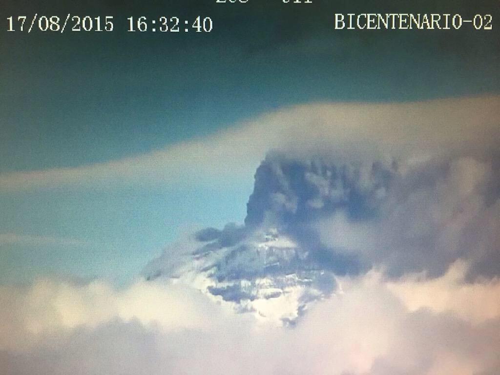
Cotopaxi is throwing up a pretty big plume almost off the screen.
http://www.seguridad.gob.ec/volcancotopaxi/index.php/en-vivo-volcancotopaxi/
Is this still phreatic? The helicorder shows tremor and the eruption in the webcam goes on and on!
I don’t know, but would guess there is some fresh magma near the surface at least. Many times phreatic eruptions are just explosions and you are correct this is going on for some time.. With the length of this eruption I would not be surprised if we hear of some lahars. The Volcano is covered in glaciers and is now black with ash cover. Hope all stay safe as this is a dangerous situation.
[IMG] [/IMG]
Still lively
Washington VAAC says
ERUPTION DETAILS: ONGOING EMISSION OF GASES WITH
OCNL BRIEF BURSTS OF ASH EST FL250 MOV W-SW
OBS VA DTG: 21/1815Z
OBS VA CLD: SFC/FL250 S0022 W07933 – S0038 W07826
– S0047 W07826 – S0100 W07913 – S0022 W07933 MOV
W 15KT
Ash to 25,000ft. only 5000 above summit.
what is the reason for the spikes at 17:20 and 18:10? Stronger explosions than normal? Earthquakes?
“The most recent radar measurements done by ALOS-2 satellite of the Japan Aerospace Exploration Agency (JAXA) show that the summit of the volcano has inflated by the enormous amount of approx. 16 cm during the interval 4 Jan – 17 August this year.”
That’s a pretty high level of uplift at Sakurajima – especially in comparison to the trends. Also, most of this has likely occurred in the last month or so. With the sight of a lava dome, it seems pretty likely that fresh magma is trying to work its way up here, it just has to pop the lid more or less.
One interesting aspect of the 1914 eruption is that it seemed to exhibit intense seismicity prior to, and during its eruption. There were mag 5-6 earthquakes during the eruption itself that caused a lot of landslide problems (along with a small tsunami). While there was intense seismicity, it doesnt seem like the seismicity occurred for a long time period prior to the eruptive episode, with only 1-2 days of intense quaking prior to eruption.
EQs of around 5 to 6 are more tectonic than volcanic. Was there an episode of rifting with the eruption?
Sakurajima is near a continental rift boundary, in addition to the subduction zone of the Philippine Sea Plate.
https://en.m.wikipedia.org/wiki/Amurian_Plate
Sakurajima being “Hekla of the East”
Image from 373 webcam: http://373news.com/_sakucap/
Helka is the Sakurajima of the west. This is much more important than Hekla.
Update with image of the blocked Showa Crater
http://ajw.asahi.com/article/behind_news/social_affairs/AJ201508210033
I haven’t found any obvious volcanoes yet, but if you want to poke around for yourself…
http://photojournal.jpl.nasa.gov/mission/Dawn
Given how small Ceres is, the dynamics for volcanism may not be there… at least nothing that we are accustomed to.
So what about this one then? Image caption “Tall Mountain” (NASA, Dawn)
Judge it by it’s size, do you? ~Yoda 🙂
New post is up:
http://www.volcanocafe.org/science/the-trans-mexico-volcanic-belt-cotopaxi-sakurajima/