
The extinct volcano Sierra de Guadalupe rises 750 metres above Mexico City, it’s highest peak within 15 km of the centre of the city. In spite of conservation attempts, illegal buildings continue to sprout and at present the crater and debris avalanche have been completely covered by urban development. (Hotu Matua)
It is inevitable that the higher we get in this series, the more speculative our choices may seem. If everything was known about every volcano, identifying and motivating the choice of the ten most dangerous ones would be a relatively simple matter. As it is, our selections have to be based on what meagre information is available and educated guesswork as to what the full story might or could be. In our choice of number five, this is highlighted as we cannot even identify a single volcanic system as the main threat, but then the area occupied by the cities Mexico City, Toluca and Puebla is highly unusual.
Throughout almost its entire length, the Ring of Fire produces volcanoes aligned on and along the subduction zone forming a great arc of stratovolcanoes which has given rise to the term “Arc Volcanism”. But running across Mexico from Colima in the west to Pico de Orizaba in the east, the subduction zone makes an almost 90-degree turn and the volcanoes seem to align on a N-S line, perpendicular to the subducting plate. Three main such alignments are identified in recent scientific papers; Cántaro–Nevado de Colima–Colima de Fuego in the west, Tláloc–Telapón–Iztaccíhuatl–Popocatépetl (Sierra de Nevada) just east of Mexico City, and Cofre de Perote–Las Cumbres–Pico de Orizaba–Sierra Negra at the eastern end of the Trans Mexico Volcanic Belt, alternately known as the Trans Mexico Volcanic Zone. For the entire TMVB, volcanism has trended from acidic (dacite and rhyolite) to intermediate magmas (andesitic) as well as from north to south although there are numerous and noticeable exceptions to these identified trends.

The geological setting of the Trans Mexico Volcanic Belt. The numbers next to the arrows showing the direction are the annual subduction rates. The numbers along the isolines display the depth of the subducting plate as inferred from earthquakes. The TVMB is outlined in grey and the alignment of volcanoes mentioned are in yellow. Note how volcanoes (north-)west and (south-)east of the TMVB seem to align along the 300 and 100 km subduction isolines as opposed to transversing them as is the case in the TMVB. (Adapted from Macías 2007)
In addition to these three main lines of active volcanism, there are further lines of dormant or extinct volcanoes, one bordering the Mexico City plain to the west and the Toluca plain to the east with another one bordering the latter plain to the west. To complicate the matter even further, both north and south of these plains run lines of ancient, heavily eroded and extinct(?) volcanic edifices that seem to follow the subduction zone. If we also include the Puebla plain to the east of the Sierra de Nevado, there are more than 1.6 million inhabitants of Greater Toluca, 22.5 million of Greater Mexico City and 2.1 million of Greater Puebla, in all well in excess of 25 million.

Landsat image of the Toluca, Mexico City and Publa plains. The names of active to potentially active volcanoes in yellow, possible volcanic alignments are marked in blue and the 90-km-long Chichinautzin volcanic field immediately south of Mexico City, centred on the Aztec temple El Tepozteco, is circled. (Author)
Not only is the north-south alignment perpendicular to the subduction zone of the most recent volcanoes highly unusual. There is as well a dearth of large, explosive calderas in the TMVB. The semi-official blog GeoMexico laments: “There is still lots of work needed to fully unravel the geological secrets of Mexico’s Volcanic Axis which crosses the country between latitudes 19 and 21 degrees North. Unlike most volcanic belts elsewhere in the world, this one does not appear at first sight to correspond to any plate boundary. Another of the mysteries of this volcanic region, where igneous upheavals have shaped the landscape for several million years, is the relative dearth of calderas, the “super craters” formed either by collapse or by giant explosions.”
As of 1999, there were seven calderas known in the belt, one of which is in fact no more than a crater lake, Lake Alchichica, with a diameter of 1888 meters. The largest of these seven calderas is the 15 by 21 km Los Humeros caldera in the state of Puebla, close to its border with Veracruz. It lies 55 km west-north-west of the city of Veracruz (Xalapa), relatively close to Puebla (Teziutlán). The main caldera is about 400 m deep and roughly oval in shape. Prior to its formation 460,000 years ago, lava emitted from this vent covered 3500 square km with ignimbrites. Later, two smaller calderas formed nearby, with ages of about 100,000 years (Los Potreros caldera) and 30,000 years (El Xalapazco) respectively.
The 11 km wide and 400 m deep, heavily eroded Amealco caldera is located at Garabato (= unintelligible scribbles), midway between the towns of San Juan del Río and Maravatio, about 125 km NW of mexico City. Caldera-related activity started in the Pliocene ca. 4.7 Ma ago and ended around ca. 2.2 Ma. The total volume of pyroclastic flow deposits and ignimbrites is in the region of 500 cubic km. The Huichapan Caldera in the central sector of the TMVB, also referred to as the Donguinyó-Huichapan caldera complex is 10 km in diameter and appears to be the result of two overlapping calderas that date to 5 and 4.2 million years ago respectively. The rocks from the older caldera are intermediate to basic in composition, while those from the more recent caldera are acidic (high silica content) rhyolites, another relatively unusual feature.
Since then, one very interesting albeit ancient feature has been discovered in the Coxcatlán-Tilzapotla region, about 100 km south of Mexico City, just south of the TMVB. The elliptical NW-SE oriented dome structure, approximately 30 x 52 km, encompasses the Tilzapotla collapse caldera, rhyolitic domes, large volumes of ignimbrites, as well as the Buenavista intrusive body, and the Coxcatlán and Chautle plutons located west and east of the structural margin of the caldera, respectively. Previous geochronological studies carried out on the silicic and intermediate magmatic rocks places the uplift in the dome area in the late Eocene (~38-34 Ma). This suggests that doming was related to emplacement of magmas into the crust prior to collapse of the Tilzapotla caldera at 34.3 Ma.
The approximately 11 x 13 km Tilzapotla caldera is located on top of this large, rhyolitic dome feature. “The caldera is defined by a 33 x 24 km semi-elliptical structure that encircles the largest exposures of the Tilzapotla ignimbrite and corresponds to the structural margin rather than the topographic rim. A central uplifted block limited by NW-trending faults is the main indication of a resurgent stage. The caldera structural margin is surrounded by extensive exposures of Cretaceous marine sequences that structurally define a broad elliptical dome (45×35 km) originated in the first stage of the caldera evolution. There is evidence showing that the 34 Ma Tilzapotla ignimbrite represents the climatic event of the caldera collapse.” (Morán-Zenteno et al 1998) This begs the question of how the very large dome feature itself was formed. It covers some 1500 square kilometres to a height more than 1,000 m above the surrounding plains with a total thickness in excess of 800 m. If we make allowances for surface depression and 34 My of erosion, the total volume emitted is in excess of 1,500 cubic kilometres of silicic magma.
The observed absence in the TMVB of the elsewhere omnipresent large explosive calderas is a conundrum. Either they have been masked by the products of subsequent volcanic eruptions and rapid, tropical erosion and still await discovery, or, volcanism in the TMVB is sufficiently different to almost preclude these eruptions. However, the presence of the >500 km3 Amealco caldera, the 15 by 21 km Los Humeros caldera and the 10 km Huichapan Caldera rather points to the former being the case. In order to gain an insight into how very complex Mexican volcanism can be to unravel, at this point I recommend a look at the reconstruction by Diaz & McDowell (page 11); “Figure 7. Volcanic evolution of the Amealco caldera and peripheral volcanoes”. It is unfortunately too large to reproduce here, so please, take a look!
Click to access 2000_GSASP_334_Ame.pdf
If we turn our attention away from the very largest types of eruptions, there are several large and highly dangerous volcanoes in the Toluca – Mexico City – Puebla area. To the SW of Toluca lies the giant stratovolcano Nevado de Toluca and 50-70 km east and southeast runs the Sierra Nevada mountain range comprised of four major volcanoes:

The 4,680 m a.s.l. high Nevado de Toluca volcano as seen from the city of Toluca, 24 km away. (Wikimedia Commons)
Nevado de Toluca
In the Nahuatl language, “Xinantécatl” means “naked man”. Alternately, the name has been interpretated as “Chicnauhtécatl”, “nine hills” which given the volcano’s appearance seems the likelier. Nevado de Toluca is a composite volcano of late Pleistocene-Holocene age with a calc-alkaline andesitic to dacitic composition. The northern flank of Nevado de Toluca has a relative elevation (prominence) of 2015 m with respect to the Lerma river basin, and its southern flank has a relative elevation of 2900 m with respect to the Ixtapan de la Sal village. The elliptical 1.5 by 2 km wide crater of Nevado de Toluca is breached to the east. The interior holds a dacitic central dome and the remains of two ancient scars, located on the SE and NE flanks of the volcano which are related to the partial collapse of the edifice. Unusually for volcanic lakes, the two crater lakes are alkaline, not acidic.

El Refugio quarry located 15 km northeast of Nevado de Toluca crater showing an exposure of the 37,000 yr B.P. block-and-ash flow deposits (Macías 2007)
Nevado de Toluca was built upon the intersection of three fault systems with NW-SE, NE-SW, and E-W orientations. This structural geometry favoured the formation of coalescent pyroclastic fans that reach all the way to the cities of Toluca and Metepec, 25 km to the NE of the volcano. During the late Pleistocene, the southern flank of Nevado de Toluca collapsed twice, originating debris avalanche deposits that were transformed into debris flows with distance. The scars produced by these collapses have disappeared due to subsequent volcanic activity and glacial erosion. The older flow can be traced to distances up to 35 km from the summit while the younger event near the end of the Pleistocene ( > 40 kA) generated a debris avalanche, the “Pilcaya Debris Flow”, that travelled more than 55 km from the summit. Activity then continued with three very large explosive eruptions – the Lower Toluca Pumice ca. 21,700 yr B.P., the Middle Toluca Pumice ca. 12,100 yr B.P. and the Upper Toluca Pumice ca. 10,500 yr B.P. The pyroclastic deposits of these eruptions are mostly covered by subsequent and “smaller” Plinian eruptions.
The Sierra Nevada Volcanic Range
From north to south, the Sierra Nevada Volcanic Range comprises the volcanoes Tláloc, Telapón, Iztaccíhuatl, and Popocatépetl. Previously, it was considered that volcanic activity began to the north and migrated south but new evidence obtained from previous studies, field reconnaissance and radiometric dating paints a slightly different picture.
During the past 10,000 years, there have been repetitive Plinian eruptions of Popocatépetl including some historic events and the 1994–present eruption, but Holocene activity has not been limited to Popocatepetl alone. 9,000 years ago, Iztaccíhuatl produced the Buenavista dacitic lava flow. As is obvious, magmatism of the Sierra Nevada Volcanic Range has not kept a continuous north to south migrating path as had been previously surmised. Rather, it has shifted back and forth chaotically throughout its evolution.
Tláloc
Volcanism at the Sierra Nevada Volcanic Range likely started 1.8–1.4 Ma years ago with the construction of Paleo-Tláloc volcano, today buried by younger deposits. The activity continued between 1.07 and 0.89 Ma with the emplacement of dacitic domes, lavas and associated pyroclastic flows (“San Francisco” 1 Ma, “Chicoloapan” 0.9 Ma). Then between 0.94–0.84 Ma, the main edifice of modern Tláloc was built up through the emission of dacitic lava flows. Although Popocatépetl took over as the centre of eruptive activity about 320 kA, Tlaloc reawakened with the emission of rhyolitic magma at 129 kA followed by the emplacement of the El Papayo dacite (118 kA) to the south and Téyotl summit lavas (80 kA).
Tlaloc has always been considered the oldest volcano of the Sierra Nevada Volcanic Range (and extinct), but recent field data have revealed that Tlaloc was very active during late Pleistocene with a series of five explosive eruptions at 44, 38, 33, 31, and 25 kA and the growth of the summit dome. One of these eruptions produced the 1.58 km3 (DRE) Multilayered White Pumice (MWP), a rhyolitic pyroclastic sequence that consist of abundant white pumice (up to 96 vol.%), rare gray pumice, cognate lithics, accidental altered lithics, xenocrysts. The pumice clasts contain phenocrysts of quartz, plagioclase, sanidine, biotite, rare Fe–Ti oxides, monazite, zircon and apatite. Xenocrysts are represented by plagioclase, microcline, orthoclase and quartz likely coming from a deeper plutonic body. Both pumices have a rhyolitic composition (74.98 ± 1 wt.% SiO2 in water free basis) which represents one of the most acidic products of Tlaloc and the entire Sierra Nevada Volcanic Range. (Macías 2011)
Telapón
The inauspicious 260 m high (elevation 3,600 m) steep-sided Cerro Papayo dacitic lava dome marks the vent of the Telapón volcano on the north flank of Iztaccíhuatl formed approximately between 0.38 Ma and 0.34 Ma ago with the emplacement of lava flows and a dome. The 21 cu km compound lava field covers 84 sq km and includes flows that travelled long distances in opposite directions – into the Valley of Mexico and towards the Puebla basin. In addition, the Papayo lavas overlie glacial moraines about 12,000 years old, thus Telapón has been active until the very end of the Pleistocene. The lithology of Telapón shows two periods of activity. First, an andesitic-dacitic Lower Volcanic Event that was emplaced between 1.03 MA and 65 kA, and second, a dacitic-rhyolitic Upper Volcanic Event emplaced between 65 to 35 kA. (Macías 2007).

Photograph of Iztaccihuatl which clearly shows the resemblance to a sleeping woman. (Uncredited photograph, labels added by author)
Iztaccihuatl
The name “Iztaccíhuatl” means “White woman” in the Nahuatl language. Linked to the Popocatepetl volcano to the south by the high saddle known as the Paso de Cortés, it is a 5,230 m (1,560 m prominence) dormant volcanic mountain. Despite its relatively modest prominence, the volume is a staggering 450 km3, which is 100 km3 greater than that of Mount Shasta, Oregon. Iztaccíhuatl began its activity ca. 1.1 Ma ago. From then until 0.45 Ma several volcanic edifices were formed. At that date, the Los Pies Recientes cone was devastated by a Mount St. Helens–type event which destroyed the southeastern flank and produced a massive debris avalanche accompanied by large pyroclastic flows.
The summit ridge consists of a series of overlapping cones constructed along a NNW-SSE line to the south of the Pleistocene Llano Grande caldera. Andesitic and dacitic Pleistocene and Holocene volcanism has taken place from vents at or near the summit. Areas near the El Pecho summit vent are covered in flows and tuff beds younger than glaciation approximately 11 kA, yet GVP states that “The Global Volcanism Program is not aware of any Holocene eruptions from Iztaccihuatl.”

The once glacier-covered peak of Popocatépetl stratovolcano rises above Tlamacas to its north in this photograph from 1968. The sharp peak at right is Ventorrillo, the summit of a predecessor to Popocatépetl, the eroded Nexpayantla volcano. (William Melson)
Popocatépetl
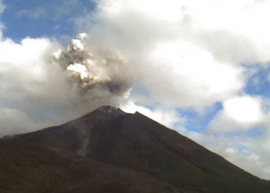
Popocatépetl is the most active volcano in Mexico, having had more than 15 major eruptions since the arrival of the Spanish in 1519 with the most recent in 1947. In Nahuatl, the name means “Smoking Mountain”. Popocatépetl reaches 5,426 m a.s.l. with a prominence of 3,020 m with a base diameter of about 25 km. The crater is elliptical with an orientation northeast-southwest. The walls of the crater vary in height from 600 to 840 m. It lies 70 km southeast of Mexico City and more than one million people live within a radius of 40 km from the summit. According to paleomagnetic studies, the volcano is about 730,000 years old.
Popocatépetl used to be covered by glaciers, but due to increased volcanic activity in the 1990s, the glaciers covering Popocatépetl greatly decreased in size and by 2001 they were gone. Historically, Popocatépetl has erupted predominantly andesitic magma but it has also erupted large volumes of dacite. Magma produced in the current cycle of activity tends to be a mixture of the two.
There are at least four debris avalanche deposits around Popocatépetl volcano. The oldest comes from the failure of the SE flank of Iztaccíhuatl volcano, and the other three come from the flank collapse of paleo-Popocatépetl, the youngest being the 23,000 yr B.P. deposit. The modern volcano was constructed to the south of the late-Pleistocene to Holocene El Fraile cone. Three major Plinian eruptions, the most recent of which took place about 800 AD, have occurred from Popocatépetl since the mid Holocene, accompanied by pyroclastic flows and voluminous lahars that swept through the basins below the volcano.
Some 23,000 years ago a lateral eruption, greater than the 1980 Mount St. Helens eruption, resulted in the lateral collapse of the ancient Popocatépetl cone. The explosion generated a debris avalanche deposit that reached up to 70 km to the South from the summit. The decompression of the magmatic system caused a lateral blast that emplaced a pyroclastic surge deposit accompanied by a Plinian eruption column which deposited a thick pumice-fall layer on the southern flanks of the volcano. The column then collapsed and formed an ash flow that charred everything in its path. The deposit reached up to 70 km from the summit, covers an area of 900 km2, and if we assign an average thickness of 15 m, a volume of 9 km3 is obtained. This deposit overlies paleosoil that contains charred logs radiocarbon dated at 23,445 ± 210 yr. Disseminated charcoal found in the ash flow deposit yielded an age of 22,875 +915/−820 yr. (Macías)
During the past 20,000 yr the explosive activity of Popocatépetl has been characterized by four major events (14,000, 5000, 2150, and 1100 BP) and four minor events (11,000, 9000, 7000 and 1800 BP) The events that occurred at 5000 and 1100 BP had a similar evolution. They began with hydromagmatic explosions that dispersed wet pyroclastic surges up to 20 km from the summit. These explosions opened the magmatic conduit, decompressed the magmatic system, and formed >25-km-high Plinian column.
From our perspective, it is of interest to note that the last three Plinian eruptions of Popocatépetl coincide with three important events in Mesoamerican history: The 3195–2830 B.C. eruption coincides with the 3114 BC beginning of the Mesoamerican Calendar. The 215 BC eruption coincides with the transition from the Preclassic to the Classic period. The last major eruption, which probably occurred in 823 AD, coincides with the Classic-Postclassic periods transition.

The Parque Nacional El Tepozteco is at the centre of the Chichinautzin volcanic field. It consists of a small temple to the Aztec god Tepoztecatl, a god of the alcoholic pulque beverage. (unearthingarchaeoblog)
The Chichinautzin Volcanic Field
The Chichinautzin volcanic field contains more than 220 Pleistocene to Holocene monogenetic vents and covers a 90-km-long, E-W-trending area immediately south of Mexico City. It is formed primarily of overlapping small cinder cones and shield volcanoes with a mainly basaltic-andesitic to andesitic composition with a thrachytic component as well as some dacite evident. The highest peak of the Sierra Chichinautzin is the Volcán Ajusco lava-dome complex at 3930 m a.s.l. There have been at least eight eruptions within the past 10,000 years with the most recent about 1670 radiocarbon years ago (~340 AD) from the Xitle scoria cone. These eruptions have typically been VEI 3 with one registered as a VEI 4. A very modest estimate based on an oval 60 x 90 km with an average emplaced height of 250 m yields a figure of 1,050 cubic km for the volume of the dome but the true figure could be more than double that. From the list of sources in the GVP entry for the Chichinautzin volcanic field, it would seem that some individual cones, vents and flows have been studied, but not the feature as a whole. What is it? What is its true age? Why is it so large, far larger than the initial shield deposited during the first development stage before volcanism shifts to construct (a series of) stratovolcanic edifices? Is there a significance to its position on the same isoline above the subduction zone as Pico de Orizaba, Popocatépetl and Nevado de Toluca?
Summing up
The geological setting of the Mexico City basin is unusual in that the subduction zone makes an almost 90-degree angle and that the major volcanoes do not follow the subduction zone but rather form lines at right angles to it. Instead of showing a neat progression, volcanic activity has been shown to jump “chaotically” (Macías 2011) both geographically as well as petrologically. There is a marked absence of identified caldera structures in the area, yet in the middle of it, right at the southern edge of the city limits, lies a more than 1,000 km3 large Pleistocene to Holocene dome structure that has been active until recently, one that is not well studied.
In addition to this, the Nevado de Toluca volcano has already produced eruptions sufficiently large to deposit ignimbrites at distances greater than 25 km from its summit and Popocatépetl clearly has the potential to do so. Both these volcanoes (and Iztaccihuatl) have suffered several major edifice collapses where deposits have been traced to distances greater than 55 and 70 km respectively.
With almost 30 million people living within 100 km, Mexico City will remain on our list until the mysteries of why the “currently and recently active” volcanoes of the TMVB align perpendicular to the subduction zone as well as where and why the very large, caldera-forming eruptions (VEI 6 to 7) have disappeared to have been unravelled. It will remain on our list until we have a thorough investigation of the past and likely future evolution of the gigantic Chichinautzin volcanic field as well as a better understanding of the risks posed by the large stratovolcanoes in the vicinity.
The more I delved into this subject, the more intricate it became and the more I realised just how little I understood. The TMVB as it passes the Toluca – Mexico City – Puebla area once fully investigated may well deserve a place higher up on the list (or possibly even be struck from it), but with the material and understanding at present, we will leave it at a provisional fifth place on our list.
Henrik
Major sources:
José Luis Macías, “Geology and eruptive history of some active volcanoes of México” 2007 http://www.geo.mtu.edu/EHaz/ConvergentPlatesClass/Delgado/01_SPE422_06%20Macias%20GSA%20Special%20paper.pdf
Gerardo J. Aguirre-Díaz, Fred W. McDowell, “Volcanic evolution of the Amealco caldera, central Mexico”, Geological Society of America (Special Paper 334) 1999
Click to access 2000_GSASP_334_Ame.pdf
Barbara M. Martiny, Dante J. Morán-Zenteno, Luigi Solari, Margarita López-Martínez, Shanaka L. de Silva, Diana Flores-Huerta, Lilibeth Zúñiga-Lagunes, Laura Luna-González, “Caldera formation and progressive batholith construction: Geochronological, petrographic and stratigraphic constraints from the Coxcatlán-Tilzapotla area, Sierra Madre del Sur, Mexico”, Revista Mexicana de Ciencias Geológicas 2013


Great post!!
indeed a great post.
for those of us close to the southern border of the US, this field could have direct effects very quickly after an largish event.
Another very nice post. I admit, I was feeling a bit reserved about the serie at first with terms like MDE … But I am enjoying the articles. Thanks a lot. 🙂
Something very OT: I have a question for the geo specialists.
One of the latest thundereggs I worked on has a particular phenocryst, I expect it to be a twincrystal of some kind of mineral, a Feldspar?
I like to ask you comment. 🙂
Nice! My guess is that it’s a feldspar of the plagioclase series (endmembers albite and anorthite) but the one you should ask is Evan Chugg – http://home.clear.net.nz/pages/evansite/index.html
I will do. Thanks Henrik.
A very good post! It is difficult to make a coherent story out of such a complex region but you have managed it. Based on what you present, this easily makes the threshold for the size of a ‘one in ten thousand year event’ which we should be prepared for.
The volcaniic bellt connects on the western side to the east pacific spreading ridge, and the young Gulf of Mexico. Perhaps the belt is related to these movements?
Exactly! Why the bend? Another thought that occurred to me while searching for information on the missing calderas is that the region has managed to almost obliterate the Chicxulub impact in a mere 65 million years while the 2 billion years old Vredefort crater in South Africa is still visible. Since the 180 km wide Chicxulub impact occurred quite nearby, ~1,000 km, it is not too wild a flight of fancy to imagine that it might have played a role in the formation of the TMVB.
I doubt that Chiculub can have much to do with it It is obliterated by sedimentation. Vredefort was left unperturbed in one of the most stable continents. My guess wold be ‘triple junction’ although the angles are not quite the 120 degrees one would expect (as in the red sea). But a line of volcanic activiity does suggest a rift, albeit one that may have failed to develop further, or a transform fault.
I was thinking more about the energies involved, where they went during the impact (in the ~½ second it took the impactor to bury itself before you got the surface plume) and what a M12-13 shockwave travelling through the semi-liquid astenospere / upper mantle at >1,000 m/s could do when it hit a subducting slab and then the contact zone between two such slabs. Even at a distance of ~1,000 km, even if attenuated by a factor on the order of 10^4, such an impact ought to carry more energy than even the greatest earthquakes ever observed on Earth.
The exact forces is something Carl could work out on the back of a napkin in less than 30 seconds. Me, I can just imagine it and then instantaneously be bludgeoned insensible by the sheer volume of numbers involved!
Dunno if the impactor had any influence on the ongoing flat-slab subduction. I wish I had known that this was the next article, I have a link on my desktop that I revisit from time to time concerning slab rollback. It might be of interest.
http://web.gps.caltech.edu/~clay/MexWeb/MexSubduction.html
One interpretation is that a subducted portion of the Yucatan plate segment has sliced through the subducting Farallon/Cocos plate somewhere under central Mexico.
(From the linked page… more imagery available there.)
Now that is interesting! A counter-clockwise rotation of this Yucatan plate could possibly explain why the main subduction zone has been bent and why surface volcanism deviates from the expected – a second Benioff zone. Against this, there should be observable evidence of this interfering slab in the form of deep earthquakes, yet Macías and other researchers do not include this (as is obvious from the isolines of the subducting plate they reproduce).
Andrew! Could we be so bold as to ask you? 🙂
how deep ? like the subduction zone around Fiji ?
As deep as there are earthquakes, possibly down to 500 km, and the view would have to be from different angles in order to allow us to visualise the subducting plate(-s).
Are you offering your services…? 🙂
if you mean a post, not at this point, I am snowed under with work, getting older things slow down, so I am playing catch up at the moment, I have a few things in mind so
Earlier subduction zones could be detected from lavas, especially if their direction differed.
* direction of the subducting slab.
For more reading on Popocateptl specifically, I wrote a post back in 2013 for it – https://volcanocafe.wordpress.com/2013/09/16/popocatepetl/, although a lot of that information was already covered here.
Yes, it was a nice article Cbus although Siebe perhaps is a bit keen on lateral blast eruptions. Macías 2007 and others seem to have toned down the possibility of the other two main collapse events being lateral blast eruptions. I particularly liked the point you made about familiarity breeding, if not contempt, at least indifference. Nevertheless and never mind the actual causes, debris flows that reaches 70 km (Popocatepétl) or 55 km (Nevado de Toluca) from the summit are truly fearsome prospects and ones I hope I never have to read in the newspapers about the consequences of.
Mexico City is sitting on sediment from a lake, those type of lakes are usually found in the vicinity of volcanoes, this would make the volcano on the outskirts of the city something to keep an eye on, the current residents would have primary exposure to any activity developing, as for where volcanoes are appearing, Paracutin is one to remember
Parts of Mexico City (such as the university) are built on the most recent lava flows from the Xitle scoria cone (Xitle = navel in Nahuatl). The rest on what is mostly volcanic ash transported into the basin by lahars and erosion. Liquefaction in the case of a major earthquake is a far more obvious and present danger to Mexico City than volcanic eruptions.
More info on the Xitle Scoria Cone and lava flow: http://www.geo.mtu.edu/EHaz/ConvergentPlatesClass/Chichinautzin/Siebe-xitle.pdf
Am i seeing something on the first Cotopaxi webcam or is that just me? http://www.igepn.edu.ec/cotopaxi/camaras-cotopaxi
Its brown colored and on the side of the mountain.
I can see what you mean, it’s really illusory even if it’s only the slope seen through a gap in the clouds,. However, if you go to the BREF Helicorder, there’s a nice long-period event between 08:38-50. 🙂
Near by Hekla has occurred a few earthquake.
http://en.vedur.is/earthquakes-and-volcanism/earthquakes/myrdalsjokull/#view=map
Thanks for another great post, Henrik. It goes a long way to promote the need for more science. I was wondering, how would you rank the amount of science being done on the TMVB as compared to, say, the Mt. Rainier or Iceland volcanic science? Also, I imagine there is a lot of proprietary information that the major petrochemical companies have, especially around the Yucatan region. Is there a moral dilemma when the safety of millions is measured against the interest of (heavily subsidized) oil company profits? Certainly they have detail magnetic and gravity maps that would aid volcanic scientists???
Glad you liked it and thanks for the kind words, yours and everyone else’s. I have to say that I am not an expert but my impression is that due to the great upswing in interest for volcanology after St Helens and the incomparable work by Maurice and Katia Kraft to popularise volcanology, most volcanoes located conveniently close to already existing institutions have been quite extensively studied. Not only are there many more highly skilled geologists in the field, methods and methodology too have evolved and been refined to an amazing degree.
It would seem that we are now at a point where geology students, postgraduate as well as undergraduate, have to go abroad in order to find virgin ground for study. The problem as always is one of funding. Who can foot the bill for a possibly decade-long, in-depth investigation of the TMVB or the most dangerous part thereof (or the Cammeroon Volcanic Line, or…) which would swallow a great number of highly trained professionals and some seriously expensive equipment as well?
And what if such a project was funded, the correct target chosen and the right questions asked, and then Rainier had an unexpected minor eruption that buried Ashford, Washington (pop 247 as of 2010) beneath a lahar?
Techniques for monitoring volcanoes are advancing. Is the cost coming down? Can some of fhe costs be shared (e.g. satellites can monitor more than one volcano)?
Science that effects millions of lives or pictures from Pluto? Maybe volcanology needs better PR to get politicians to move.
The only place politicians need to move is out of the way or to the gallows.
… old school “keel hauling” comes to mind.
I could not agree more. No matter their “colour*, creed or calling”, nothing is more ruinous in every sense of the word than to satisfy the itch for personal approval on a grand scale that constitutes politics. There are other completely unproductive black holes as well such as the “beauty sector”. As early as the 1960s, American women spent more money prettifying themselves than the US Government spent on the Apollo Program. But it has always been thus. The cost of maintaining social order via “panem and circenses” always takes precedence over far greater challenges to society that lie at distances in time and space too far away to immediately concern Joe and Jane Public.
*red, blue, green
Ref; Beauty products. I sadly have to acknowledge this… but I think it’s just an outward manifestation of my Homo Stultus idea.
For a more recent example of the idiocy and incompetence of government… there is a toxic plume of water making its way to the Colorado river… mine tailings waste water. Who put it there? The Environmental Protection Agency.
perhaps a subducted midocean ridge explains the perpendicular angle? subducted long long ago though.
Not an unreasonable possibility. But it is possible that the Cocos represents the remaining western section of the Farallon. The East Pacific rise being the original ridge that was the western bounday. If there were another ridge that would fit in quite well… but evidence of that has long since been subducted.
Volcanoes perpendicular to the volcanic front may be due to extensional fault zones where the lithosphere has been distorted by relative plate motions. How did North and South America join up?
Great article, Henrik. Which of the volcanoes in the TMVB is number five? Seem to be straying from the concept of single volcanoes being in the NDVP (perhaps with very good reason).
Thank you! I will answer with a couple of questions of my own if I may: First, what constitutes “the” volcano? The visible volcanic edifice, the magma reservoir/magmatic system or the deep source from where the energy that drives it comes? Second, in the days before the realisation of the true nature of Yellowstone, would anyone have been concerned about other areas without a single, large and smoking edifice to alert us to what lies beneath places such as Taupo or Campi Flegrei?
From Wiki: “volcano is a rupture on the crust of a planetary-mass object, such as Earth, that allows hot lava, volcanic ash, and gases to escape from a magma chamber below the surface.”.
Source: https://en.m.wikipedia.org/wiki/Volcano
Think I might have worded that to include any magma reservoir, not just the rupture.
Think people were aware of Campi Flegrei before the extent of the Yellowstone caldera was recognised. Don’t know about Taupo.
I think there are a lot of simple theories for why the TMVB may be perpendicular towards the subduction front, but it’s difficult to know which reason is “why” at this point. But I would at least point out the fact that the angle isn’t that far from straight-on, so it’s not like this is a 45 degree tilt on the volcanic line.
My first guess would be that the subducting slab is subducting at a steeper angle the further west you go. Since melt comes out at around 120km in depth, if the slab is subducting at a shallower angle further to the east, it would make sense that the volcanic front would be placed further back. This may or may not be affected by the Yucutan / Caribbean regions geologically speaking.
As for the lack of Calderas, I think there is a combination of factors here. First off, not all volcanic areas of the world are littered with calderas. From what I’ve seen, only the more prolific regions with a fast subducting plate exhibit this characteristic (the cascades range hardly has any calderas for example).
Second, in writing about Popocatepetl a while back, one thing mentioned frequently was that the magma came from a very deep source. A deep magmatic source would make it more difficult for calderas to form, as the strength of the overlying rock will typically be enough to hold the ground in the event of a sudden de-pressurization of the magma chamber. Deep source magmatism I *believe* also lends itself towards monogenetic cones, so that could explain the abundance of monogenetic volcanism in the TMVB, but that’s speculation at best on my behalf. The caveat to deeper magma chambers is that when a caldera event does happen, it’s usually larger since the overlying crust will accomodate more pressure (this is exhibited in the Andes quite a lot) build-up before a caldera eruption occurs.
Third, Mexican volcanoes have a very high rate of flank collapse events. These large flank collapses likely relieve pressure in the same way that a caldera event would. So while you don’t see collapse calderas, you instead get flank collapses, which reduce the load on the underlying magma chamber until the edifice rebuilds, and you repeat the process.
Some very interesting point here. I’ll get back to you later as I haven’t the time until later this evening.
Also, I would personally wager that there are quite a few caldera systems (extinct or active) that haven’t been formally listed or discovered. Of the large calderas present and known, none are very much “visible” in the way that other calderas often are. Nature has a way of concealing these quicker than we would believe, especially in Mexico it seems.
Worth noting is that there is a surprising amount of Rhyolitic volcanism in the TMVB, much of which is simply doming, or small-scale lava flows. Doing a flyover in google earth reveals quite a few volcanoes that are not listed in the GVP, some of which are likely extinct.
http://www.landofnod.com/all-new/new/to-the-center-of-the-bedding/f17376
Finally a cure for that bad moment where you have take a break from volcanoes to sleep.
That’s awesome! Especially the volcano pillow 🙂
Sorry I’ve not been on here for quite a while. I’m trying to get my house in a fit state to sell – but now I’ve given up and hope to sell it as it is – ripe for refurbishment! It’s taking up all my time but I do try to stay in touch with the Café.
That is really great. They even have a mosquito in amber under ground like Jurassic Park movie. 🙂
As many of you know, I live along the Gulf Coast. We get Hurricanes. It’s what we do. One of the hazards from Tropical systems are the short period fast spin-up tornadoes that can pop up in the feeder bands of the hurricanes. They don’t last a long time, and can’t get to the massive size that you see in Oklahoma. However, their quick genesis can catch you unaware and off guard.
Notice how quickly this thing shows up in Taiwan. It was almost a karmic like event for the white car that cut the guy off. Had he not done that, it would probably have been the guy with the cam that got caught up in it instead.
http://www.washingtonpost.com/blogs/capital-weather-gang/wp/2015/08/10/dashcam-records-terrifying-video-of-typhoon-soudelor-tornado-in-taiwan/
Incredible footage!!
Wow 😮
How ElNino looks in 3D? Why not. 😀
And sea surface height. 😀
And so you wont think I just do graphics all day long, I am actually a physical worker first. 😀 Ax_men all day lol 😀
Ummmm… Read this… Climbing Cotopaxi.
http://www.essexchronicle.co.uk/Double-lung-transplant-survivor-Justine-Laymond/story-27569501-detail/story.html
I don’t care how many lung collapses you have survived. One pyroclastic flow and you are done, period.
Yes, way to active to climb safely.
Eh, I don’t think the volcano is in a restriction zone right now. I personally wouldn’t climb Cotopaxi, but considering her knowledge, I don’t think she was that crazy.
Well, then she should do something impressive. Like a 3 week camping trip on the top of Hekla… with no phone. If she wants the attention so badly, something like that would gain my interest. And yes, I would also ridicule that stunt.
In her defense, she was likley not doing the Cotopaxi climb for attention, but more to overcome an issue and prove to herself her ability. Leave it to a reporter to make it into an attention gathering orgy.
If I ever overcome some decades long affliction that makes it difficult to walk, I’m not going to prove to myself that I have overcome it by sedately strolling across the interstate. Or peer down the barrel of a loaded gun to see the bullet in the chamber just to prove that I can see.
Even bears can adapt and overcome, learning as they go. Homo Stultus seem to have forgotten that skill set.
https://youtu.be/pdM9YOYrcbs
Interesting how two different volcanoes, in the same country can have such a different response to them…
We would like to announce a special issue of JVGR on the recent eruptions of Sinabung and Kelud Volcanoes.
Explosions and ash emissions at Sinabung (Sumatra) in 2010 marked a renewal of activity following 800 years of quiescence. Three years later, phreatomagmatic and magmatic eruptions were followed by extrusion of lava domes, lava flows and block-and-ash type pyroclastic flows that continue through today. Because of a lack of eruption experience among the local population, the long-duration of the eruption and evacuations, and an assertive regional culture, the Sinabung eruption has proven to be challenging for both volcano hazards scientists and emergency managers.
In contrast, the 2014 eruption of Kelud was short in duration (~6 hours, on 13-14 February 2014) but large in explosivity (VEI 4). This powerful eruption produced a spectacular vertical ash column that penetrated the equatorial troposphere and reached an altitude of 26 km into the stratosphere. and destroyed the lava dome that had been erupted passively within the volcano’s crater in 2007. Because of well-known eruption precursors at Kelud, timely monitoring and warnings by local authorities, public familiarity with eruption hazards, extensive education and evacuation planning, and a cultural acceptance of hazards and government authority, an organized evacuation of 200,000 people took place in a period of only a few hours preceding the nighttime eruption.
Good observation! In my opinion, the main difference is the effects caused by the temporal duration and how “volcano-savvy” the residents are:
In the case of Kelud, the dangers are well-known by the locals who probably know of relatives, friends or people in the next village that perished in the 1990 eruption and from the stories passed down by the elders of the 1919 disaster. But they also know that with Kelud, once it has blown it’s safe to go home after a few days, clean up the mess and a week or so later life is back to normal. But with Sinabung, whole villages have been evacuated for years and farmers have lost their arable plots of land, their livelihoods, and there is no end in sight.
In short, Kelud was a quickly forgotten nuisance whilst Sinabung is a life-changing, ongoing disaster for thousands.
Not volcano related so feel free to remove this, but there was a masive explosion in china earlier today: http://www.theguardian.com/world/2015/aug/12/explosion-chinese-port-city-tianjin?CMP=Share_AndroidApp_BaconReader
“Police have confirmed the highly toxic substance sodium cyanide was found at the site, but a complete list of chemicals is yet to be identified by authorities.”
http://www.radioaustralia.net.au/international/2015-08-15/china-explosions-new-blasts-hampering-search-in-tianjin-as-residents-evacuated-over-chemical-fears/1481914
Eh? Sodium Cyanide? Err…. why?
“Sodium cyanide is used mainly to extract gold and other precious metals in mining industry. This application exploits the high affinity of gold(I) for cyanide”
Additionally: “Several commercially significant chemical compounds are derived from cyanide, including cyanuric chloride, cyanogen chloride, and many nitriles. In organic synthesis, cyanide, which is classified as a strong nucleophile, is used to prepare nitriles, which occur widely in many specialty chemicals, including pharmaceuticals.”
And evidently, it’s a cheap way to fish. https://en.wikipedia.org/wiki/Cyanide_fishing
Looks like a small puff of steam at Cotopaxi is visible in this loop.
http://www.igepn.edu.ec/cotopaxi/camaras-cotopaxi
I am not the only who has declared open season on drones. lol
http://www.huffingtonpost.com/entry/angry-eagle-punches-drone_55cc289ce4b0898c48868b09?kvcommref=mostpopular
Pickup of earthquakes near oreafjokull?
And an M2.6 22km below Hamarinn.
Weird signals on the Cotopaxi helicorder today.. Did they turn down the amplitude on the drum plot to accomodate for higher-magnitude quakes towards the end?
http://www3.nhk.or.jp/news/realtime-1/ is it me or is Hakone steaming a lot right now?
http://sta.sh/020gaseyj2h2 and is that grey smoke there?
Also, sorry for the linked site. Thats the only way I know how to show screenshots. :/
Most likely fog, but may be some steam coming from another vent further back (unlikely). I see no smoke right now or in the graphic you linked.
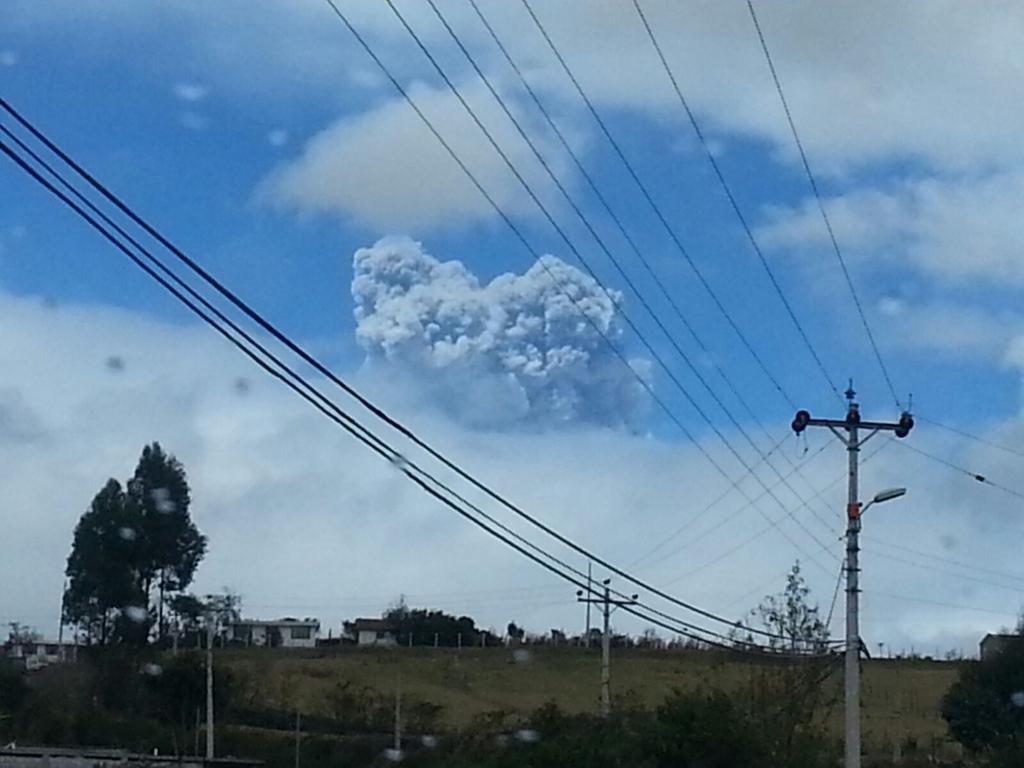
Cotopaxi had two phreatic eruptions today with ashfall reaching Quito.
Also see http://www.ibtimes.co.in/live-cotopaxi-volcano-ecuador-erupts-after-75-years-642954
Interesting, so I was right in noting that the drumplots were scaled down after more intense earthquakes were showing up.
And I’d just like to state that they’re not closing the volcano off to climbers despite this. This is a bit ridiculous. This is google translate of their most recent statement:
“The climbers are especially recommended caution in the area of the crater, to the possible occurrence of explosions, which throw blocks or very energetic emissions of steam and volcanic gases , which can be harmful to health.”
I would *maybe* say that “harmful to health” is the understatement of the century.
Well, as Tongariro showed in the 2012 Te Māri “eruption”, a phreatic blast alone can easily hurl stuff 6500 meters straight up. If the launch don’t get ya, the sudden deceleration at the end of your ballistic excursion probably would.
And this is where things start to get interesting – this is a pretty obvious sign that magma is rising now, and is shallow enough to reach the water table. Earthquake intensity has picked up quite a lot – you can see the scale below here.
Where do you get the drumplots from?
All can be found at http://www.igepn.edu.ec/cotopaxi
“a pretty obvious sign that magma is rising”
Although I am not an expert on acoustics unlike Carl, that looks more like phreatic than magmatic or magmato-phreatic. That said, dramatically heightened phreatic activity is indeed a sign that magma is rising in the system. If you recall St Helens, phreatic explosions began in March 1980, almost two months before the main eruption. While Cotopaxi could erupt “any day”, it could also take considerably longer and there is even an outside chance of there not being a magmatic eruption.
Photo of the Cotopaxi eruption.
Source? This doesn’t look like Cotopaxi. Cotopaxi has a glacier covering most of its summit.
Found it on twitter.
For reference, this is a 2011 picture of Cotopaxi, I think whoever posted this on twitter probably just grabbed a random picture of a volcano erupting, but who knows. I may be wrong (the ash could be coating the glacier and dis-coloring it)..
George Vitton shows the same image on his blog. He is likely to show the real thing, it is his profession.
http://lechaudrondevulcain.com/blog/2015/08/14/august-14-2015-english-cotopaxi/
George does indeed often use archived images and sometimes also images of some volcano that’s not the one the piece is about, and the photo up here is definitely Reventador (all photos of Cotopaxi’s latest activity show only ash plumes, with the volcano itself being hidden by clouds),
That’s Reventador, actually (note absence of snow and glacier in this photo). One aerial view of ash emission from Cotopaxi appeared in an online newspaper today: When I find it again, I’ll post the link.
The overall Iceland map might seem more quiet at the moment but their does look like Grimsvotn, Esjufell volcano and Oreafjokull are having Conversation. Has anyone seen eq’s headed southeast of Grimsvotn like this before?
As far as I am monitoring it, this began after the eruption stopped. The quakes were appearing in a line going from Bardy, over Hamarinn to Grimsvotn and down SE to Oraefajokull and Esjufell.
I was wondering what is E/SE of Grimsvotn where the quakes are appearing for a while now. There is no volcano recorded there, where the glacier tounge starts.
I think it might be along a fissure.(s)
Washington VAAC report 20150814/1244Z
ERUPTION AT 14/0930Z.. VA MOV SE TO FL450
AND E TO FL400.
http://www.ssd.noaa.gov/VAAC/messages.html
and while I was typing that, updated 20150814/1500Z
http://www.reuters.com/article/2015/08/14/us-ecuador-volcano-idUSKCN0QJ1ML20150814
Two small explosions reported. Apparently its still safe to visit the rim of the crater if you are really careful.
But I assume this is going to change. It does not seem things are de-escalating.
New possible explosion at Cotopaxi.
I am finding it nearly impossible to connect to normal sites for cameras looking at Cotopaxi. I suspect their servers are swamped with requests.
It seems their normal server is down (probably overloaded), but the helicorder direct links are still up –
Thanks for the article Henrik. This area definitely does show the potential for MDE. Why people continue to build upon it is a wonder. No doubt money and/or ignorance. It’s amazing how ‘larger forming calderas have disappeared’ yet there is evidence they did exist.
http://www.igepn.edu.ec/cotopaxi/camaras-cotopaxi
Webcams are back up – I *believe* with very limited visibility that there is heavy steam and degassing occurring right now (not ash eruption), but this may just be clouds rolling by. Difficult to differentiate high levels of degassing from the active cloud formations that are in the area.
On the 18h46 image, there is a big dark cloud visible on top of it, at the same moment that the hellicorder move…
And I captured the start of another phreatic eruption (at the very end) I mirrored the GIF on imgur.
That is definitely not a storm cloud on the cotopaxi webcams. Its too dark (at least compaired to storm clouds I’ve seen)
The ash plume from Cotopaxi has gone up to 16,000 feet.
Nueva explosión con importante carga de ceniza del volcán #Cotopaxi altura de la columna de ceniza mayor a 5 Km
https://twitter.com/Tame_Trade/status/632272625281183744/video/1
Video of the most recent eruption
That’s six out of eight for Carl although these are (most likely) only phreatic precursors to the main eruption. On June 16th, he wrote the following on the old place – https://volcanocafe.wordpress.com/2015/06/16/cotopaxi-a-most-dangerous-volcano/
Quote Carl:
If an eruption occurred today it could be anything from a VEI-2 eruption up to a VEI-5 eruption, there is no discernible pattern to what the size of an upcoming eruption would be. But, since the volcano has had an unusually long repose period and at least two magmatic emplacements since the last eruption it is likely that the eruption would be in the higher spectrum of the possible eruptions with a VEI-4 being the most likely.
A VEI-4 eruption is unlikely to carry enough force to send pyroclastic flows as far as into the suburbs of Quito, but villages closer to the volcano would be likely to be hit.
Lahars can travel in almost any direction from the Volcano, and potentially a lahar from a larger eruption could travel into Quito destroying houses and causing material destruction. It is likely that the population living within lahar risk zones will be evacuated as an eruption starts.
Lack of drinking water is a high risk factor after a larger eruption even though the authorities have good plans for solving this. Additional resources for water purification would be needed after an eruption.
If a VEI-5 eruption would occur there is an increased risk for large scale material destruction in Quito.
Conclusion
Due to the type and prolonged high count of seismic events combined with heightened degassing and inflation I think it is likely that Cotopaxi will erupt. If Cotopaxi erupts it is likely to be within a span from VEI-3 to VEI-4.
For those worried by the fact that Cotopaxi has not erupted for 73 years (1942, VEI 3 Uncertain, GVP). Even should build-up have been steady during this period of repose, the twenty eruptions after the 1877 VEI 4 eruption up until 1942 if added up would only yield a mid-sized VEI 3. Besides, nothing is certain with volcanoes which is why Carl said VEI2 to VEI 5 with a VEI 3-4 eruption the most likely.
All week long–ALL WEEK LONG–I’ve had the Cotopaxi webcam feed open on my second screen at work.
My mouse software glitched earlier and I had to restart my computer. Forgot to open the feed back up immediately and when I did. . .
I am only now, quite some time later, regaining the power of coherent thought.
Crap! CRAP!
/checks Hakone car park webcam
Whew!
Another Cotopaxi pic
http://www.independent.co.uk/news/world/americas/ecuador-volcano-activity-cotopaxi-shoots-ash-2miles-into-the-air-coating-roads-homes-and-cars-with-powder-10456688.html
R.I.P. Pink Floyd (No, not “a” person, More of a concept.)
https://youtu.be/gOqblSqx_VI
You will be missed.
Big heads-up on Sakurajima; just gone to level 4 alert – “prepare to evacuate” – on basis of seismicity and inflation:
https://translate.google.com/translate?sl=ja&tl=en&js=y&prev=_t&hl=en&ie=UTF-8&u=http%3A%2F%2Fwww3.nhk.or.jp%2Fnews%2Fhtml%2F20150815%2Fk10010190751000.html&edit-text=&act=url
Um… so crazy weekend ahead it seems, this along with Cotopaxi is BIG news. Mike, could you by chance email me any additional details here? The link isn’t working properly – my email is gstockmaster@gmail.com
Okay, nevermind, no need to email, I got the link properly (don’t include the google translate url at the start).
With that said, here is what struck me as %^&$ via google translate –
“Japan Meteorological Agency, as in the Sakurajima has become a very high possibility that the big eruption of scale occurs, announced the eruption alert on Sakurajima in 10:15, the eruption alert level was raised from Level 3 Level 4 . That basis, Showa crater and Minamidake summit crater within three kilometers from, serious impact eruption is believed to be imminent in the Arimura the town and hometown the town of Kagoshima, strictly to alert a large cinder and pyroclastic flow, evacuation ready we have the need of. ”
Shaping up to be an EXTREMELY intersting geological weekend. Two extremely high risk volcanoes are set to erupt in bigger ways than normal, I hope for the best, and hope that in the worst case, the disaster mitigation firms prove their worth.
Final related note – Sakurajima’s 24 hour helicorder can be found here – http://www.vnet.bosai.go.jp/strace/view.php?orgid=03&netid=02&stcd=V.SKD2&tm=2015081511&comp=U&type=24H&area=undefined
There are others, you just have to click the links at the top of the page. http://www.vnet.bosai.go.jp/strace/view.php?orgid=03&netid=02&stcd=V.SKRC&tm=2015081511&comp=H&type=24H&area=030243 looks pretty grim… was wall-to-wall tremor for an hour around midday.
Can I please encourage any visitors / lurkers to comment:? The lack of response to today’s news of two major volcanoes in highly populated areas is somewhat surprising. I’m not an expert geologist for sure, but I know more than the average layman and enjoy discussion. Considering Bardarbunga’s effusive eruption in the middle of nowhere received more than 400 comments in a matter of hours, it’s pretty baffling that a potential MDE / Decade Volcano and Sakurajima evacuating major populated areas haven’t received more comments here yet (given Sakurajima is NEW news in full fairness).
It’s the weekend, give us time to let the Mimosa’s ease our hangovers 😉
Thank goodness we now have the internet, although visiting friends will curb a lot of my volcano viewing this weekend.
Worrying news for Sakurajima, I hope all that steaming of late isn’t a precursor to a Krakatoa type event.
A lurker in the shadows..
You probably all have this stream on. Anyway newcomers might find them interesting:
http://m.ustream.tv/channel/ushine-2
Well it probably has to do with the fact that so far the recent Sakurajima activity has been relatively smallish, so probably people dont take much notice until it blows big time.
I can understand that somewhat.
Bardarbunga and Holuhraun were hyped by the media to repeat the whole ash cloud disaster again. The month leading up to the eruption was filled with very obvious signs something was going to blow eventually. And when it eventually did erupt. It was a spectacular red eruption. Beautiful lava fountains and rivers which occurred in an area well covered with webcams.
IMO is very open with its data and the eruption was very simple in nature. While still a mystery enough to allow for reasonable speculation. This opened the field for everybody and that the time it ended was roughly predicted by an amateur using simple maths is a testament to that.
These new volcanoes. They are grey eruptions of a vague nature. There is a lack of web cams and the news barely covers them and probably wont until they really start to become spectacular or deathly. They also are complex and require a much deeper knowledge of volcanism to understand. So we prefer to sit back to listen to what the experts have to say.
Through the biggest reason i think is that we want to root for the volcano. Holuhraun occurred in a desolate empty landscape and would only endanger lots of people in the worst of the worst case scenarios. While these two pose a serious risk to millions just by doing what we expect a volcano to do.
Just awake here on the east coast of USA. I came to catch up on Cotopaxi and just learned of Sakurijima. These are major developments. The inflation is very worrying. Lets hope for the best. As for Cotopaxi at this point Lahar’s seem to be the biggest risk right now.
As for comparing to Iceland…There are Iceland volcano fans out there that will comment on any minor swarm even though almost all of these swarms add up to nothing but there are hundreds of them every year.. They just love Iceland volcanoes and quite frankly have a pretty good chance seeing an eruption every few years.
Sorry, probably shouldn’t have stated this (I don’t recommend blog commenting after a night out drinking 🙂 ), but I do encourage discussion!
Sakurajima, or rather the Aira Caldera, is also a potential MDE volcanic system, one that Carl and I discussed when we made our selection. Fortunately, to judge from the JMA bulletin, while it may be a big eruption for Sakurajima (at least in comparison to her activity over the past 60-odd years), it is still a minor one for the Aira Caldera. That said, it can still be exceptionally nasty. Think Taal! Base surges across water in a densely populated area…
For Sakurajima, Inflation is fairly large and the number of earthquakes increased in recent hours. Here is the report of the JMA unfortunately in Japanese with the risk map and the latest geophysical measurements observed : http://www.jma.go.jp/jma/press/1508/15a/sakurajima150815.pdf
Excellent, thanks!
This is my first post here – my knowledge of volcanoes are quite general and more textbook than technical, so I have yet to feel like I have much to contribute to the discussions. However, the knowledge and awareness I have gained from this site is immense. The fact that I eagerly told my husband about Cotopaxi and Sakurajima today is proof of that…well, that and the 20 or so volcano webcams I have in my favorites.
As a side note, I’m almost finished reading “In the Path of Destruction,” (Richard Waitt) that was published in January of this year and I can’t recommend it enough. Being a kid and barely remembering the Mt St Helens eruption, I had no idea the gaps in knowledge that existed then and how that completely changed the field of Vulcanology in the US. It is essentially a time lapse of interviews and first hand accounts starting with the first magma intrusions to the aftermath months and years later.
Hopefully now that I got over my initial shyness, it won’t be as big a deal for me to post more 🙂
Welcome and don’t be too shy to ask! When it comes to volcanology we are all amateurs, well, with one or two exceptions. 🙂
On a slightly more cheery note, my recent birthday present, a … Lava lamp! 😀
http://tinypic.com/r/1zn8ia9/8
I like that one better than the old lava lamps. Happy late birthday. 🙂
http://en.glaz.tv/online-webcams/vulkan-sakuradzima
Please delete if posted already.
Howdy and bye for now
Nice link, thanks Hen! 🙂
JMA have handed down an excellent stone tablet. Look at this, in particular the first two graphs. The first graph is GPS extension, the second is tiltmeter… that’s *abrupt*!
http://www.jma.go.jp/jma/press/1508/15a/sakurajima150815.pdf
Here you go… GPS & tilt…
People are fully aware of the risks and are prepared for any eventuality. JMA has issued a notice of Evacuation for 51 families around the crater Sakurajima and two shelters have been opened for the first evacuees : http://news.tbs.co.jp/newseye/tbs_newseye2563473.html
News in English on the alert for Sakurajima:
http://the-japan-news.com/news/article/0002359146
From Erik Klemetti:
http://the-japan-news.com/news/article/0002359146
Sorry wrong link
http://www.wired.com/2015/08/sakurajima-japan-might-headed-towards-large-eruption/
Thank you for that. I ran across a naysayers yesterday that stated that nothing would probably happen (due to the fear mongers hyping every volcano). I corrected them in that eruptions are quite common at sakurajima, and it’s far more unlikely that no eruption occurs.
Thank you Karen! I have to say Erik K seriously underestimates the threat of a VEI 4-5 from Sakurajima when he says but ash from any eruption (depending on the winds) could impact Kagoshima (population ~600,000), located only 10 kilometers from Sakurajima.
If there is a VEI 4-5 eruption, please let it be a pure Plinian one and not a Vulcanian-Peléean!
The longer she is quiet, the bigger the chance of a larger eruption. Magma is suppose to be fairly close to the surface so there may be a chance of lava flow?
But if you check GVP (which I am sure you have done 😉 ), Aira tends to do VEI 1, 2 and 3s, some 4s, a few 5s and a 6 (not all from Sakurajima).
Link. http://volcano.si.edu/volcano.cfm?vn=282080
Well, I wouldn’t call Sakurajima a “quiet” volcano, it’s been erupting nearly constantly over the past 60 years 😉 — and magma has always been very close to the surface in its active vents, often building small lava domes that were blown away by the frequent explosions.
By “quiet” here, I mean a few days since her last eruption. But did not know about the lava domes – are they relatively recent?
It’s obviously no guarantee, but the last major eruption from Sakurajima (1914) was a large-scale ‘mixed’ eruption -heavy ash column, at least one pyroclastic flow (going by a contemporary account in National Geographic, back when they did fairly detailed reports) but mostly massive lava flows. There appear to have been no fatalities from the eruption itself, but 50-60 in Kagoshima from an earthquake -possibly eruption related?- at the same time