
Sete Cidades photo by Pawel Prokocki
Part 2: The Volcanoes
In this part we are touring the volcanoes of São Miguel. I wanted to write a good tour post on these and as told in part one it is meant as an accompany that you read on your phone when you are visiting the island. São Miguel Island consists of six major volcanic zones that we will tour from east with Nordeste as starting point, to west where we finish the tour at Sete Cidades. You can imagine travelling by rental car doing this journey along the island’s length. I will talk about the large scale sights and main attractions that each locale stop provides. There is enough to see here so I cannot cover everything.
The Nordeste volcano

Upper photo: Google Earth, Lower photo: Michael Mehl. Nordeste massifs seen from Povacao caldera
After the hotel check-in I took the rental car and drove east as far as you can get, to the oldest part of the island, Nordeste – ”northeast” in English translation. It is the oldest volcano on the entire island and is heavily eroded by the heavy rains. It is a ruin of what was once a fissure shield volcano that rose high above its surroundings, very likely much taller and broader than it is today. Its peak, Pico da Vara thrusts into gloomy cloud blankets that cover most of the stunning greenery on this island. The warm wet subtropical lowlands contrast with the cooler peak, but the peak is still much too warm for snow. At the coast, Ponta Sorgesso provides a spectacular viewpoint out over the Atlantic and the steep sea cliffs that drop into the deep blue waves.
Nordeste is a heavily eroded pile of thin mildly alkaline lava flows 1300 m thick and dated to the Pliocene era, 4,01 million years old for the lower lava flows. Lava flows higher in the pile are more potassic than the lower stack member of the pile. Some other datings give a much younger age for the lower lava sequence. Nordeste has no obvious volcanic features on the ground. It is heavily eroded and lava flows are only visible in road cuts, as is the case of most of the Island, but in Nordeste you don’t even find cinder cones. Nordeste is basically a pile of fissure-fed thin Aa flows and there are no signs of major trachytic productivity other than minor exposures. In its youth, it may have resembled Marion Island combined with Hekla (minus Heklas evolved magmas). It would have been a fissure eruption shield volcano dotted with past cinder cones, by now it is highly eroded, cut by younger calderas and landslides and river streams drape the scenery. There are arguments for the pliocene datings from other sites, with genetic studies of the islands land snails that diverged around 4 to 3 million years ago that will support pliocene datings on lava rocks.
Nordeste offers little in terms of visible volcanic features and the coast scenery is the main attraction so I drove west again to the Povocao volcano. There is no clear evidence of a past caldera at Nordeste. Nordeste may never erupt again; it seems pretty extinct.
The Povoação volcano

Photos: Google Earth the immense Povoação caldera which borders with Furnas and Nordeste volcanoes
Driving west from Nordeste the lush landscape opens up towards the spectacular Povoação volcanic complex whose enormous caldera has carved out large parts from the Nordeste’s old shield. The feature measures seven kilometers wide and the caldera wall borders with the Furnas and Nordeste complexes to the west and east. The scenery is spectacular and reminded me of a subtropical version of UK farmlands or North New Zealand’s countryside, very pleasant with small towns and groves. Like Nordeste, Povoação is a very old and extremely tired volcano who has not erupted for a very long time. You don’t find any hot springs or geothermal mudpots here unlike the island’s more westerly volcanoes that have lots of geothermal features. It kind of looks like a landslide, but Povoação does have tectonic fault features of a true caldera, so it is not an erosional or landslide feature.
There are four post caldera extrusive features in Povoação that have been mapped by geologists. one trachyte coulee ( thick stubby flow) and three alkaline scoria cones have been mapped, suggesting that the magma system remained alive after the collapse. Povoação’s floor is gentle and without much terrain other than river valleys. The caldera has lots of trachytic pumice in its soil deposits, not from the caldera itself but trachytic tephra airfall from the nearby Furnas volcano to the west which is a much more active caldera for sure. At the northern rim of Povoação there are 100 m thick trachytic pumice deposits that predate the caldera formation with more than one or two layers responsible for the Povoação caldera collapse itself. At the village of Povoação, steep cliffs drop into the ocean. Povoação offers relatively little volcanic features compared to the other São Miguel volcanoes. The eruption that formed the caldera was enormous and laid waste to wast areas a long time ago. Povoação may erupt again sometime in the far future, but seems pretty dead for now.
The dangerous Furnas volcano

Photo: Google Earth and https://azoresgetaways.com/en-us/destination/azores/islands/sao-miguel/furnas-village Furnas caldera is one of the most beautiful and most dangerous volcanoes in the entire Azores island group. Lower photo is an unusually clear day often is cloudy
Driving towards Povoaçãos western rim the road climbs into the mountains. At the caldera wall of Povoação you enter another magnificent caldera volcano. Furnas is one of the most dangerous volcanoes on the entire island and it is also one of the most beautiful. It is home to lush forests, a magical lake, geothermal springs, geothermal baths, small towns and a botanical garden. For me it was one of the most beautiful sights that I have ever visited. Furnas caldera is little like a lost world, almost like Jurassic Park or something like that. It is an isolated sheltered world deep inside the caldera, its own little society inside this volcano that has an immense peaceful scenery and atmosphere.
Furnas is often cloudy and mists hang over it and inside it. It adds an otherworldly feel where grey clouds hug subtropical forests that grow in the caldera walls and where huge cryptomeria trees giants rise over the mysterious mist layers. Tree ferns, moss, palms and the huge conifers add a ” Jurassic” feel to Furnas, perhaps not unlike Kilauea’s fern-filled summit area, but here the volcanic landscapes are much more developed by man with agricultural fields and small towns. Despite that it feels very primordial. Primordial for sure, especially so during a cloudy day, when everything here becomes extra green and extra mysterious. The rainforested caldera walls where waterfalls stream down, ferns cling to rocks and the crater lake, often having a low cloud ceiling where drooping tree branches hang over emerald green lilly pad-filled waters, were extra surreal for me. It is a place for meditation and thinking and indeed a neogothic church was built long ago at the volcanic lake shore side. The beaches you find in all the island’s caldera lakes are beige due to the trachyte materials. Furnas together with Sete Cidades, while not my geological highpoints in terms of volcanoes, are still among the most beautiful places that I have ever visited. That is because of their private ”lost world” atmosphere and spooky lush greenery and especially so for Furnas geothermal steam. I spent a lot of time there with friends exploring all the geothermal features and we ate the volcano-cooked local foods.
Furnas unlike Povoação and Nordeste does have a real, alive-and-kicking magma system which remains active even if magma supply is slow. Geothermal activity is everywhere, hot water pools, mudpots and mineral-rich springs can be found. In the center of town, Furnas boasts close to 30 bubbling geothermal features some of which are boiling hot, their steam plumes dragging in the mists add to the mysterious otherworldly, slightly unsettling atmosphere that exists here. There are numerous geothermal baths too, all having warm brown iron oxide rich waters. All of these baths are artificially built but use warm volcanic waters from the magma system. Terra Nostra is the largest bath in Furnas: it can house hundreds of guests. I swam in it briefly. I liked the heat but the water quality seemed like a mudpool, even if it was in reality very clean stuff just with rust in it. Geothermal activity in Furnas can be found both in Furnas-village and on the lake shore where there is another set of hot mudpots with mud so fine it seems like paint. The locals boil some of their foods in these hot holes which are then served at fine dinners. The plentiful geothermal steam is a cruel reminder that 1439 persons live inside a timebomb. The last eruption in the year 1630 was as large as St Helens, 1980. 1 km3, and around 200 persons were killed. Previous eruptions here dwarfed the 1630 event. Eruptions in Furnas caldera are of a highly explosive evolved type. The eruptions are plinian, subplinian, vulcanian, phreatomagmatic; lava domes are often formed in the end. The volcano vents constantly produce CO2 gases that collect in deep lying areas. Many homes have gas alarms in case concentrations get too high. A description of Furnas chronology follows below.

Upper photo; Michael Runkel, lower photo Tiffany, lush scenery near the caldera wall of Furnas
Furnas is a nested evolved caldera structure that has collapsed numerous times. It is almost 8 kilometers wide and many 100s of meters deep. There have been major Pleistocene explosive eruptions here, some of these vastly larger than the most recent explosive eruptions. Post caldera eruptions been smaller pyroclastic events (if the 1630 event can even be called ”small”). All of the magmas are sourced from an evolving shallow large trachytic magma body that is compositionally zoned. In many studies, the violent history of Furnas is seen in the abundance of light pumice and grey ash in outcrops. Eruptions outside the caldera are mafic. Furnas, unlike the other volcanoes to east, has well studied history, even if geochronology is hard for all volcanoes in the greenery of São Miguel.
Furnas, like Agua De Pau and Sete Cidades, is an excellent example of the evolution of a mature Azores volcano from a fluid mafic one to evolved caldera volcanism. Furnas began its life on the seafloor as a slowly active alkaline mafic shield in the Pleistocene, 800,000 years ago, later emerging above sea. Furnas is today a sillicic nested caldera structure. The oldest and largest outer caldera likely signaled the change to trachytic caldera volcanism. The Pleistocene was plagued with sillicic caldera forming events at Furnas. The largest each happened after 1000 s or even 10,000 s of years of dormancy. The older caldera was an enormous event (Tambora sized in collapse area but volume is unknown ) The second large inner caldera collapse, four km wide dates back to the Povoação Ignimbrite that happened 30,000 years ago, when the Furnas volcano had its most recent major caldera collapse. The eruption was enormous and massive pyroclastic flows engulfed everything laying down ignimbrites in valleys. The pyroclastic flows also flowed into Povoação caldera giving this Furnas eruption the name of the wrong volcano even. Around 11,000 years ago there was another enormous pyroclastic eruption that collapsed the inner caldera once again, but smaller than the earlier two.
After the last large caldera collapse the volcano stratography becomes a bit better known with tephra zones from many series of trachytic eruptions. In the last 5000 years there have been 10 smaller trachytic eruptions from Furnas that have laid down their pumice airfall in the caldera. The Furnas C eruption was the largest of the group of later eruptions and dates to 1900 years ago. A 2 km wide collapse feature formed where Furnas town now sits; carbonized ”fossil” leaves have been found in ash from this event..
Since humans came to the Island there have been two plinian eruptions in Furnas, in the years 1439 and 1630. Both ended with a lava dome extrusion as the final gas-poor stuff came up. The 1630 event occured when the caldera was nearly as densely populated as today. It was known as the “Year of the Ashtray” it was disastrous with 200 persons were killed in the eruption with ash and destruction spreading over vast areas.
If we take 5000 years divided by 10 eruptions gives an eruption once every 500 years, but there is no timetable for that. Eruptions at Furnas are very likely caused by injection of a more mafic mugearite or hawaiitic magma into Furnas trachytic magma chamber. Furnas will erupt again and in geological times likely soon. Any new eruption poses a lethal threat to all of the caldera residents who seem to have formed a friendly relationship with the time bomb they are living in. In short, Furnas is a mature Azorian central volcano. It has evolved a silicic heart and has a long history of repeated collapse and refill.

photo by Erika
The Congro Fissural system

The Congro Fissural System
Driving west from the Furnas caldera I entered the first monogenetic field on the Island on our tour from east to west. CVFS Congro Fissural Volcanic System is a series of cinder cones between the Furnas and Auga De Pau central volcanoes. The eruptions here are one go and then erupt elsewhere, caused by numerous small magma pockets. Some monogenetic eruptions here are fully trachytic like Lagoa do Congro an indication that there are many melt pockets here, some which are in an advanced state of fractional evolution. Most cones are less evolved magma and the whole landscape echoes Chaîne des Puys but the climate is even milder and huge cryptomeria trees dot many of the cinder cones. The landscape is as beautiful as it is everywhere on the island, with cow pastures and tree filled cinder cones.
One of the most magical sights in the monogenetic Vulcânico Fissural do Congro field are the hidden forest lakes that you can find inside numerous cinder cones and one such lake in a maar crater. Just as in the Furnas and Sete Cidades lakes it is a private enclosed and slightly mysterious atmosphere where subtropical forests drop into green anoxic looking waters. The easiest of these hidden gems is Lagoa do Congro (lagoon) which occupies the base of an explosion maar crater maar. It is 500 metres of diameter, with steep walls emplaced in basalts and trachytes and a maximum elevation difference of approximately 120 metres. This crater, formed about 3800 years ago, is associated with a hydromagmatic eruption. There is even a trail to it and you walk along laurel and cryptomeria rainforest on the way down to its shores. There are three other monogenetic cinder cones that have such magic lakes here, but they have no trails up to them. One is named Lagoa do Arieiro, which is another very peaceful place where misty forests loom over a lonely cone lake. One of these other cones just north of Lagoa do Congro is likely almost never visited by any tourists. Another similar one is found just west of the Congro maar but seems more accessible.
The area seems dead silent with only birds song and wind, but in 2005 and 2011 – 2012 there was intense seismicity and some ground deformation an indication of magma rising and stalling at shallow levels in the crust. The area has been quite active in the Holocene, but it is nowhere near as large as the Pico’s fissural monogenetic system close to the main city, where you find 100 s of cinder cones (well green as always). An interesting note is that CVFS is one of the most seismically active regions on the entire island.
The dangerous Auga De Pau volcano

Lower Photo: Kiko Jimenez, upper photo Google Earth
Driving west from Congros monogenetic cones, I came up into more hilly terrain and a gentle slope was right ahead, a huge cloud cumulus castle hovered right ahead in the highlands. The massif right ahead was the Agua De Pau stratovolcano, the tallest active stratovolcano on the entire island. The volcano is, just like Furnas, dangerous for the local populations which face threats both from pyroclastic flows, tephra falls, and even fast-moving lava flows, due to its bimodal nature, meaning it has erupted both mafic and sillicic magmas before. Since the island was settled, two eruption events have caused problems for villagers.
Agua De Pau is hardly a magnificent stratovolcano like Etna or Fuji, it is lumpy and its summit is strongly eroded by the subtropical rains in these latitudes. Auga De Pau’s lumpy upper parts are a combination of factors of erosional rainfall in pyroclastic deposits and all trachytic lava domes and coulees (short stubby viscous lava flows ) that have been extruded around the nested caldera complexes. The road upwards to the summit snakes through the eroded trachytic domes. The summit crater provides the Lagoa do Fogo lake, one of the 3 caldera lakes on the island and its highest.
Much of the land surrounding the crater lake is occupied by large parcels of median 283 hectares (2,830,000m2) in size, 61 hectares (610,000m2) of forested cover and endemic Macronesian Azorian species. Among that is the everpresent japanese cryptomeria trees that dot the grey trachytic pumice beaches. The caldera lake was formed 15 000 years ago and that was the last really large eruption, but there been numerous trachytic explosive eruptions since that. The last one in 1563 erupted one km3 of trachytic materials.The caldera also contains very eroded pumice cones and remains of lava domes. Agua De Pau, like Furnas and Sete Cidades, is an excellent example of a mature Azorian central volcano that have developed a sillicic central magma system and bimodal flank eruptions.
This volcano has like furnas a strong geothermal activity and hot baths and springs can be found in the jungles on its flanks. Caldeira Velha (thermal baths ) have wonderful jungle trail and hot baths. A geothermal power plant can also be found on the volcano’s north slope. Agua De Pau shows the typical evolution of an Azorian central volcano from basaltic to silicic magmas.
Auga De Pau has a long and studied history. It began to grow 200,000 years ago as a basaltic shield or basaltic stratovolcano that grew out of the ocean, during this time São Miguel was not one island but perhaps a series of islands. The oldest basaltic rocks in this region have an absolute age >250 ka – most of them were formed in a submarine environment. The volcano then grew and grew forming a tall structure that rose above the sea. The oldest materials from this volcano in cores are about 280,000 years old and consist of alkaline basalt trachybasalt lavas. The volcano later developed into a evolved explosive stratovolcano with bimodal flank behavior. The volcano is draped with tephra and pyroclastic deposits and tephra chronology have been done on available outcrops. The volcano has a long history of explosive tephra rich eruptions, that have draped the edifice in deposits. Some events will be very briefly described here.
Since 40 000 years back the volcano’s eruptive history is much better understood with many layers of trachytic pumice materials emplaced from pyroclastic currents that have formed a series of dated formations. The Porto Formoso sequence is a series of pyroclastic deposits dated to 21,000 years back from a series of trachytic events; ignimbrites with fiamme stones can be found in road cuts. Another eruption formation is the Cha Gatas sequence that forms a whole series of pumice flows and ignimbrites some with syenitic xenoliths in that outcrop. (Syenite is the plutonic version of trachyte.) The Coroa eruption is another one which laid down a single trachytic formation dated to 18,000 years ago. In its later phases it formed a pumice cone and dome visible 2.5 km south east of the Ribeirnha village. Obsidian fragments and coarse pumice blocks can be found in abundance in this deposit in exposures. Roida da Praia formation is an impressive formation almost 100 meters thick in roadcuts from Agua De Pau. Rodia is the product from a group of 65 explosive trachyte eruptions. Five of these eruptions were very large. The older member eruptions have a lot of light coloured pumice and lapilli from subplinian activity which is dated to 34,000 years ago. The middle member of eruption groups is dated 14,000 years ago and has darker materials than the older unit. Lapilli and pumice are mixed with syenitic mantle xenoliths like in earlier deposits.
The Ribeira Cha eruption formation is a particularly spectacular one, from a very violent short-lived eruption that has been dated around 12,000 years ago. Other dating methods yields up to 16,000 years ago for the formation. Syenitic xenoliths (plutonic magma pieces) are common in this deposit too. The ignimbrites from this eruption show many deposits from the same eruption repeated pyroclastic flows. Ribeira Cha is generally agreed to be the culprit behind the larger outer summit caldera formation. The Ribeira Cha eruption is overlaid by smaller deposits from the Pisao formation that contains bubble rich lapilli and pumice stones. The Fogo A eruption overlies this and is one of the most studied in the island. The eruption was very violent and laplli pumice rained down over the entire island and the layer is the best age key in stratography because of that. Another younger unit above that is Lombadas formation that spans 3000 years with three eruption events over that time.
The last major eruption from Agua De Pau was on 28 June 1563 and that was witnessed by the locals. It had a very interesting explosive first plinian trachytic phase in the summit. The 1563 eruption was on the northwest interior flank of the summit caldera and took place after days of tremor in the surrounding towns. It likely started with a loud phreatomagmatic detonation. The Fogo 1563 plinian eruption formed a set of more than 70 stratigraphic sections were documented, allowing to establish eruption layer correlations and to understand the internal structure of the deposit. The 1563 eruption layers is characterized by alternating ash and pumice lapilli layers and it was possible to discriminate two deposits defined by their dominant lithofacies and stratigraphic position, which are representative of two eruption phases. Eyewitnesses reported late at night June 28 1563 an intense glow over the summit and thunderous booms that would be the hot base of a plinian column. During the first night, grey lapilli and pumice fell on the eastern and northeastern parts of the Island. By the 29 June changes in wind directions meant that ash began to fell on Ponta Del Gada leaving a 10-centimeter thick layer.

Photo: Stromboli Online website: the 1563 lava flow buried the whole town Ribeira Seca under fast-moving lava, a fountain can be found half-buried, while the new town was later built on top. Today 100 s of years later pretty much no fresh surfaces of the lava flow can be found.
Four days after the trachytic eruption stopped, on 3 July there was a final very interesting effusive flank event caused by fluid basalt emerging from the deeper parts of Aguas plumbing system. Fast-moving Nyiragongo-like mafic lava burst out at Pico Do Sapatiero, an older trachytic dome through the western tectonic fault, and very fluid lavas rushed down the slope towards the villages below. The locals saw a column of steam and a mean glow litting it up, and reading from accounts from diffuse sources. A fast-moving lava stream ran straight trough the Ribeira Seca settlement where it crashed into the ocean waves. The priest Gaspar Frutuoso wrote down the event as did others,in the ”Phoenix of Angra” Fénix Angrense account. The lava was described as very thin and fluid and flowing like a river in flood, a good sign that it was from deep and primitive materials. Some of these lava flows contain both alkaline basalt and pieces of evolved trachytic materials, a clear sign of magma mixing in the central volcanoes, in a magma system with a zoned composition.
Picos Fissural System

Picos
Driving west from Augua De Pau’s eroded pyroclastic hills and trachytic domes, the landscape opens up as you heads down its slope towards the next volcano Sete Cidades. On the way to Sete Cidades you are driving through the youngest part of the entire island, the Picos Fissural system. It is named Picos Volcanic Fissural System and it is the largest monogenetic field on São Miguel. Here you visit more than 200 cinder/scoria cones which dot the landscape and are beautifully green. It’s a beautiful green landscape with lush gardens, pastoral fields, hedges and flower gardens and small towns. Some cinder cones are covered with small subtropical rainforests, others are crop fields with intense blue hydrangea hedges making interesting patterns with the green pastures and crop fields.
Picos Volcanic Fissural System is young, the most recent addition to the island. Before its formation Sete Cidades and Agua De Pau volcanoes were not joined. The whole region is young and I saw almost no signs at all of erosional valleys or rivers. Still eruptions are infrequent enough to allow the subtropical greenery to flood everything leaving no fresh barren lava surfaces. Monogenetic cones are everywhere here, some are half crescent shapes while some others are true cinder, scoria cones. The geological youth is also shown by the coasts not having very steep cliffs, with frequent lava flows called Fajãs ”lava shelfs” extent out in the water making it easy for boats to make landfall. These were almost definitely the cause of why Ponta Del Gada was built in this part of the island. Picos Fissural system is young and compared to the rest of the island is very active. Any new monogenetic eruptions could cause mayhem in this densely populated area. Most messy woud be a fissure eruption upslope of Ponta del Gada sending Aa lava flows steaming through the city.
The Picos fissural system has been estimated to have emerged from the ocean around 30,000 years ago with monogenetic eruptions using tectonics faults, forming cinder cones along fault lines in the crust. Eruptions have been more frequent along the middle of this fault system, forming a distinct ”spine” where the cinder cones been heaped up. More than 270 scoria cones have been mapped in PFVS, they are so abundant that the landscape is almost saturated, they also have buried each other under a thicker and thicker pile. At Miradouro da Reserva Florestal de Recreio do Pinhal da Paz its possible to peek out over this cone filled young landscape. Over the past 5,000 years there have been 19 monogenetic eruptions and that gives an average of one cone forming eruption every 260 years in this region. There may seem to be few other volcanic features to see here, but below the surface there are lava caves scattered about, as is often the case with basaltic volcanism and near Ponta De Gada you can visit Gruta do Carvão lava tube system. The largest lava tunnel on the island of São Miguel. The cave is located on the western edge of Ponta Delgada and extends for 1,650 metres, I visited it last in May 2023. It exceeds expectations with well formed fluidal features and staligmites and well preserved surfaces. The last eruption here lasted from 19 to 26 October 1652 and broke out north east of Ponta Del Gada. It was rare for this area, being an evolved eruption with very tall fountains and explosive likely vulcanian detonations building up cinder cones. Two viscous short almost ”pancake” like dome-like lava flows were also emplaced. Today the eruption site is a forested hill. The eruption was seen by locals who described it in writings as a dark cloud of ash and hot black stones being thrown high in the day skies. The night scene was described as a fire with shooting fireballs going up into the night skies.
Sete Cidades volcano

Photos: google earth, Ivankyryk lush scenery inside the Sete Cidades caldera
The last volcano on our tour is also the most famous and scenic one on the entire island. Sete Cidades at the western point is one of the most spectacular sights on this island and is a major reason tourists visit São Miguel to hike its awe striking caldera landscape. I had the huge luck of being able to visit this collapsed bimodal stratovolcano just a few years ago. Sete Cidades rivals Furnas in terms of scenery and beauty. Both calderas can be called comparable in natural beauty, but Sete Cidades maybe could be called more scenic and its caldera walls are much sharper than Furnas and Aguas due to young age. This is the youngest central volcano on the island so has the sharpest features and sharpest edifice.
This is one of the worlds best examples of an explosive caldera that can be visited and be walked inside, although the green framework shows it is certainly not frequently active. Sete Cidades edifice is visible as a shield-like bulge if seen from Picos or Agua’s summits on a clear day. Visiting the caldera was a spectacular sight for me. It is an area that evokes awe and also a soothing calm. It is a captivating landscape that is perfect for an explorer who wants to take a long hike and return to same starting spot. There are many trails here one around the caldera rim and many paths to stroll in its lush interior. This is its own little world just like Furnas that is kind of enclosed and hidden away from outside by the caldera walls around. I found this green subtropical caldera immensely peaceful where the subtropical forests crowd the caldera walls and interior pumice cones and where their lush greenery hangs over mystical lake shores of Lagoa Verde and Lagoa Azul thats two peaceful (if slightly overfertilized lakes) that can be found in the caldera. When seen from up at the caldera rim the two lakes can under ideal light conditions get two colors, one green and one blue, lagoa verde and azul, and this is one of the most photographed spots in the caldera. Photographers often add extra saturation and sell them to media advert sites, but on closeup inspection lagoa azul appears just as green and mucky as lagoa verde: the cattle pastures are a source of too much fertilizer. The two lakes are connected but a scenic bridge runs over their narrow connection.
There are four lakes in the caldera. The other two can be found in a very large pumice cone complex, lagoa santiago and lagoa rasa. The caldera rim is often windy and breezy yet it is not cold. The subtropics make a great place to run around in it, which you cannot do in warmer places without overheating. When you hike down into the caldera’s interior after having done the caldera ring road, you are greeted with a scenery that exceeds expectations. I myself found it lush and scenic, scenic pastures and small villages mix with subtropical forests and the trachyte beaches provide scenic views over the lakes. It is a peaceful scenery and during cloudy days with mists, it becomes just as mysterious as Furnas to walk these lake shores during a misty day. The lush subtropical forests rise into misty caldera walls and tree branches hang over mysterious green waters. The caldera floor feels humid and hot compared to the cooler windy caldera edge which was noticeable when I did my hike. Observing it from the shore of the lake, the surrounding caldera looked like a giant green football stadium. The caldera has four enormous post intra caldera trachytic pumice cones whose postcaldera growth has filled the eastern and southern part of the caldera. The pumice cones are named Caldeira Seca, Caldeira do Alferes and Caldeira Santiago, with the last having two smaller freshwater lakes. It’s a serene place where you can stroll the beaches and the cones through the numerous hiking paths that are often lined with blue hydrangeas.
Between Caldeira Seca and Caldeira do Alferes pumice cones is the town with same name of the volcano. I spent quite some time walking its streets which were just as peaceful as those in Furnas. Here man has carved himself a peaceful pastoral existence inside a time bomb. Today almost 800 persons call the caldera home. The beautiful neogothic church of São Nicolau can be explored when you walk around the town. In such a green lush place there may seem to be no evidence of any recent volcanic activity, but the lake beaches have grey sand that turn out to be pumice and the hiking trails and sandy outcrops are littered with trachytic pumice stones. Other more clear signs of ongoing deep volcanic activity at Sete Cidades can be seen if you drive to Ponta da Ferraria tidal hot springs at the volcano’s south west coast. Here geothermal hot water wells up in a bay where you can swim in warm tidal waters that are heated by magma. Close to the geothermal pools is Pico Das Camarinhas, a very nice mafic scoria cone whose viscous looking Aa has formed a little lava delta that can be explored. Interaction between hot lava and seawater has also formed a well formed littoral pseudocone that is one of the best preserved examples on Earth. Such features don’t last very long so this one is an exceptional preservation 100 of years after the eruption.
Sete Cidades just like the other central volcanoes on São Miguel began to grow on the seafloor as a basaltic shield volcano, later evolving into a bimodal caldera. It began to grow before the Picos fissural system emerged. The start of construction of the submarine edifice is not known but its thought to be many 100 000 s of years ago, although it is not as old as the other volcanoes on the island. Sete Cidades emerged roughly 210 000 years ago from the sea as a separate island. Since then the complex above water has grown to about 70 km3. Doing some simple maths 70km3 in 210 000 years that gives us an estimated rate of 0.02–0.03 cubic kilometres (0.0048–0.0072 cu mi) per century, so 20 to 30 million cubic meters of erupted materials per 100 years, which is a lot less than than Hawaii that may do 10000 – 15000 million cubic meters per 100 years. Still the supply is certainly enough for one or two eruptions per century. Eruptions here since settlement have happened on submarine flanks, the Sabrina ephemeral island 1811 being a famous example. Sete Cidades have a long history of both trachytic and basaltic eruptions, flanks mostly produce mafic eruptions making mafic scoria cones, while the trachytic caldera produce explosive pyroclastic eruptions whose pyroclastic flows and tephra falls have laid down pale lapilli and pumice over the entire peninsula, seen in cliff exposures at the coast. The caldera has had no historical eruptions since people came to the island.
The volcano’s chronology for the past 36,000 years has become better known. The Risco formation consists of well-preserved pyroclastic flow deposits and can be found as meter-thick deposits around the coast. It consists of many members as units and some have well-developed charcoal deposits in them. It has been dated to around 35,000 years old. Above that is the slightly younger Ajuda formation that has been dated to around 28,000 years old. That is in turn overlaid by the massive Bretanaha Formation that covers the entire volcano and reaches 6 meters thick at the volcano caldera rim. Pyroclastic flows raced all over and carbonized forest remains have been dated to around 28750 years. The lower layer consists of yellow pumice and fine lapilli, the upper layers consist of block and ash flow deposits. Some of the ash flows were so hot that they almost behaved like lava flows after being deposited. That is in turn overlaid by the much younger Lombas Formation which happened 15,750 years ago, so 13 ka after the Bretanaha tephras. It consists of 12 eruption units of mostly pumice fallout. Not all of these are trachytic, some eruptions were mafic.
One of the most significant pyroclastic formation deposits at Sete Cidades is the Santa Barbara formation, that has a three step chronology. Pyroclastic flows raced down the edifice laying down hot deposits and some of these have fossilized carbonized tree trunks in them. The caldera itself has formed through repeated collapses in the late Pleistocence. After the last Ice Age ended the Sete Cidades caldera had assembled its current form after numerous explosive caldera ”re collapses” that laid down all these trachytic deposits. The present caldera developed in three phases associated with massive paroxysmal eruptions which occurred approximately 36,000, 29,000 and 16,000 years before the present. Post caldera activity are associated with more trachytic tephra layers, such as formation of the large pumice cones in it. In the last 5000 years there have been 17 smaller trachytic eruptions inside the caldera laying down pumice and lapilli. Many deposits have hydromagmatic features. In the same time span there have also been 15 radial, rift alkaline basaltic eruptions on Sete Cidades flanks. These eruptions happened as either mafic monogenetic cone forming, evolved dome forming events, forming cinder cones and domes on Sete Cuidades flanks. Many monogenetic flank eruptions where also submarine, some forming tuff cones leaving behind palagonized cone remains offshore.
If we do the maths 15+17 = 32 thats thirty two eruptions in 5,000 years so once every 156 years for Sete Cidades. There is no timetable and the evolved caldera has not been active since 500 A.D when the Seca pumice cone formed. The last eruption that was well documented on Sete Cidades happened in 1811 offshore in the sea, when a mafic flank eruption burst the ocean surface forming a temporary island that grew. The newborn island was given the name Sabrina Island. The first person to land on the island was commander James Tillard, captain of the British warship HMS Sabrina, who hoisted the Union Jack on the erupting island and claimed sovereignty for Great Britain. Tillard’s great discovery was to be short lived, the islet made of loose tephras was soon washed away by the sea.

The lost sabrina Island formed by the 1811 flank eruption of Sete Cidades. Source wikipedia
Sete Cidades is the youngest and historically (in terms of geology) the most active volcano on the island. It is possible or even likely that it will erupt during our lifetime. A very likely eruption scenario is a flank eruption that happens offshore in the sea. Most of these likely only form warm water plumes and discoloured seawater. The larger ones in shallower waters break the waves forming Surtseyan eruptions and short lived tuff islands. Even larger eruptions offshore may form Surtsey-like islands leaving behind palagonized islands and lava towers sticking up from the blue. An ocean eruption would be a good tourist eruption. A flank eruption on land woud be more problematic and would perhaps resemble Canaries eruptions. Sete Cidades is densely cultivated and small towns are everywhere. A flank eruption will destroy roads and homes and fields and the area won’t be usable for agriculture for well over 100 years due to loss of soil.
The flank eruptions can have numerous compositions. Flank eruptions of alkaline basalt will form fluid Hawaiian style eruptions with fast moving lava flows causing material damage. Slightly more evolved lavas (trachybasalt) may form strombolian eruptions and more slow ”basaltic” flows. A flank eruption of trachyte could either form a pumice cone with explosive action destroying entire flank communities, or if gas poor the extrusion of a slow lava dome or blocky flow ”coulee” with only local minor damage. The evolved caldera is most problematic, here the residents face similar hazards as those in Furnas. Any eruption in the caldera will be highly explosive, and even a small hydromagmatic eruption will cause damage to valuble land. A larger intra – caldera pyroclastic eruption puts the entire caldera population at lethal risk.

photo by Marco Medeiros. A Hydrangea road in the caldera of Sete Cidades
Summary
São Miguel is an excellent example showing that even sleepy volcanic islands can have a fascinating and varied volcanic geology. The fact is that most volcanic islands are like this, peaceful and green serene spaces where volcanic activity is infrequent and mostly a past memory. São Miguel is a good spot for a geology student to see almost all types of volcanology phemomena preserved as depoists in certain spots. Even a sleepy volcanic island have a lot to offer and see and because of that it has become a popular spot for geological field trip
Jesper, July 2024
Literature sources: https://www.amazon.com/Volcanic-Geology-Archipelago-Geological-Society/dp/1862397317


Part 2 is up…more ( green ) volcanoes as expected
Very green – and blue. Somehow not the colours one expects from volcanoes!
Exactly the Azores are infamous for their rich shades of subtropical greenery and the neon blue hydrangeas. I think São Miguel is even known as the ”garden island” yes its magicaly beautyful with the blue sea, black cliffs, stylish archictecture intense greenery and the hydrangeas adds an otherwordly beauty to this archipelago. Its not the most fascinating induvidual volcanoes but in terms of beauty its one of the top among volcanic island groups
And in terms of weather I gives the Oceanic Subtropical marine climate of São Miguel the top rating for soure. I does not like cold, I does not like strong heat .. I wants it mild and pleasant all year around without temperatures extremes, so the Azores woud suit me perfectl indeed. But it will be Iceland anyway thats the easiest option
Crap = the Auga De Pau volcano lacks a white ring around it.. I forgot that too in the map editing 🙁
What the hell has gone wrong with the mbl Hagafell cam?
Bad weather?
Still “temporarily offline” after two whole days. What is going on? Every day brings the next eruption closer. How can I alert mbl that they’ve got a bug in their system?
It’s back to normal now. Still no word of explanation for what happened.
My guess is maintenance. Someone needs to go out there and the places are not easily accessible: it takes a lot of time and effort – and cost-a-lot if a helicopter is needed! There is no eruption at the moment, so a few days wait is not really an issue. A big thanks to whoever fixed the connection.
Maintenance that took three full days to complete? One one lousy camera? Plus, there were no people or vehicles visible near the camera at the moment it switched back on. It seems that was done remotely. Either there was a cable break between the camera and HQ (but again, three days just to fix a cable break?) or it was all just button-pushing at HQ (but now we’re asking why it took three days to try switching something off and back on again … or at worst restore something from a backup tape). And it’s not like it’s in a remote, helicopter-requiring location — it’s an hour or so from the capital city and a hop skip and a jump from the nearest town, along a dirt road.
I just don’t see a maintenance window of three whole days being necessary here. There was foot-dragging involved.
At least it’s back now, without missing the start of the next eruption.
Superb first-hand article, Jesper.
A great deal was learned after reading this.
Beautyful place right? : )
I’ll say.
Beauty and Nature comes in so many forms. My only experience with that kind of lushness was in Hawaii…and frankly not close to what your great pics/tour show!
But then again, few have had the pleasure of experiencing the intense emersion of sensations while hiking around Mt. Shasta during the first low-elevation snow with views through majestic trees that touch the sky and crisp, clear rivers that reveal the colored rocks below and frosted rocks above.
Sao Miguel is such an interesting island, it might be the most atypical oceanic island of all of them, being that most of the volcanism is silicic calderas and stuff you usually see in arc zones. Pacific islands just dont have these traits, even where evolved magma is present. The Azores really is a very varied area, probably the single best example of bimodal volcanism.
I think there is also a race track inside one of the calderas, I remember seeing it once a long way back on tv, before I really cared much but still knew it was volcanic 🙂
I remeber a PS2 game which you are doing the same types of dirty rallyes, maybe featuring the caldera of Sete Cidades.. I dont remeber much from that game but you coud chose from various european dirt tracks. I fantasticaly tryed to crash what I think now was into the caldera lakes all the time but the games invisible walls saying no. I dont remeber much from 2003 really more than sitting with those dirt road car games at evenings. Ps2 while weak today .. in resolution it does have like Wii a relativly high polygon count.. so 2000 s games emulated in 4K acually stull looks very good even today.
I lost that game long ago… and the dead console is probaly been recycled into other stuff. But I think it coud have been Sete Cidades volcano yes. I have walked these trails was very beautyful
Azores is a must do in Flight Simulator 2024 flying over the volcanoes : )
A very beautyful and green pleasant place… and the volcanoes are not stone dead in anyway at all, they are as alive as any sleeping volcanoes can be.. maybe coud erupt in our lifetime
I think this got missed, Etna has got a lava lake now or at least something very close. Its not like at Kilauea but I definitely wouldnt call this lava viscous as far as lava goes, and this is at nearly half crystals.
https://youtu.be/xJEcbjdrZUo?si=6MhWvzJ8q_A6iEHt
Brilliant video. The sounds are amazing, like a beating heart with an irregular pulse.
Just when you think it’s having a heart attack it’s just gastroesophageal reflux.
Thoroughly enjoyed this Jesper. Sao Miguel reminds me of Kyushu with it’s emerald and sapphire beauty.
Thank you! its very pretty for soure.. a common place for Scandinavians to visiting those that wants a cooler more pleasant vacation experience than example high summer in Sicily, São Miguels lush greenery also beats the burned mediterranean for soure
If you plot the trajectory of the near Sundhnukur GPS graphs you arrive at the previous level required for eruption on around the 23rd/24th July, so we aren’t far away at all. I’ve said 31st but that’s just on the idea that the eruptions will get gradually larger (to a point) like Kraflas.
Excellent article Jesper. Enjoyed reading this very much.
Dont forget to read part one too
Thank you for a thorough and fascinating part 2! Both articles are superbly put together and presented. Thanks Jesper! I really enjoyed reading them.
Thanks .. Azores are beautyful so I planns to cover more tourist guides over the other Islands later
Im curious if we will see a São Miguel eruption in our lifetime, its true that the island is very sleepy and supply very is low but not impossible that it will erupt, its been a few 100 of years since last eruption on land in São Miguel and thats typicaly the avarge time that goes between eruptions there.
Possibly, although it seems like eruptions are not randomly average but are more clustered. Actually it seems like in the 1400s to 1700s there were a number of eruptions on land in the Azores and nothing really at all on land since, it might be a tectonic interaction that occurs in a loose cycle. There was the massive Lisbon earthquake of 1755, which presumably was a shift of the same plate boundary, and maybe the fact subaerial Azorean eruptions are mostly before this is not unrelated. Maybe even such quakes are the termination of a movement of this plate boundary which also causes eruptions in the Azores.
I’d assume that small eruptions are more probable than Plinian ones. The historical experience with the Plinian eruptions of Furnas are not representative for what is typical. They are like the Plinian eruptions of Mount St. Helens the greatest case to expect, but not always to expect.
Mount St. Helens shows a big variety of eruption types. It can do phreatic explosive, effusive dome eruptions and fluid basaltic lava eruptions. The 1980 eruption was like an “End Game” of a longer development.
The Canaries showed with El Hierro 2011 how a possible small Azores eruption can look like. Something Surtseyan, but weaker than Surtsey. Maybe a bit like the Eldey eruptions of Iceland.
The next eruption in São Miguel is most likey to happen in the young cinder cone filled western parts of the Island. Picos is the youngest section of the Island so are most likey to erupt by sheer statistics. Any eruption there will be a monogentic event perhaps resembling La Palma eruptions making a cinder cone
Jesper, how could one acquire a fresh Sao Miguel pineapple? or are they off limits to the US? Sao Miguel is known for this fabulous tropical fruit.
Better you travels there and buys some of them before you goes home, I guess these are the worlds most northen grown pineapples at latitude 36
Thank you for the reply. I have had some fabulous pineapple from Maui, Hawaii, but I suspect that the Azores pineapple might be better than this.
Hawaiian breeds maybe more sweeter due to sunlight is much more intense there than in the Azores.. but I dont know for soure infact I have never tasted the local São Miguel breed of pineapple so I cannot really say anything really. São Miguel is not a deep tropical locale with their intense sunshine
Thanks for your competent expedition on Sao Miguel’s volcano (hi)story, Jesper!
Which system has the highest frequency of eruptions? Usually the youngest volcanoes are more active, here Picos Volcanic Fissural System and Sete Cidades in the west end of the long island. Should we rather expect an eruption here than on the eastern systems?
I like monogenetic volcanic fields. They can do random eruptions with a variety of styles that normal cone volcanoes don’t do.
http://www.mounts-project.com/static/data_mounts/kilauea10/2024/kilauea10_20240702T161641_20240714T161641_VV_ifg.jpg
Kilauea interferogram from July 2 to July 14. Each full colour interval is 5.6 cm, about twice the one HVO showed. The total uplift in this interval is about 17-22 cm.
SDH has shown about 45 microrad of tilt in the same interval, so my earlier take on it being about 500 meters from the center of uplift seems pretty consistent. OUTL station hasnt updated in a while. But its last plot point is nearly 60 cm of uplift since the January intrusion, which could show as well over 1 radian of tilt at SDH if the instruments were so calibrated. The fact this is all happening without so much as a slight quake swarm or any hint of erupting soon is surprising, but it probably means the next event is going to be larger than we have seen in recent years, and still might be some weeks or months off.
http://www.mounts-project.com/static/data_mounts/kilauea10/2024/kilauea10_20240702T161641_20240714T161641_VV_ifg.png
‘1 radian of tilt at SDH’. This should probably be 1 millirad of tilt. 1 radian would be 60 degrees and the next eruption would be a landslide. 1 millirad is 0.06 degree of tilt
The tilt measurements are remarkably sensitive!
Yes you are right.
Just for fun I looked up the accuracy of spirit levels. The best seem to manage 1mm in 2m or 0.5mR, which is quite interesting, not to say doubtful.
Low cost self-levelling laser levels seem all to be around (or a bit better) than 4mm over 10m which is 0.4mR (their specs). I would say that is probably understating it as I was getting repeatability of ~2mm (ie as good as I could read it) over 15m last I used one.
So resolutions of ~1mR should be considered ‘normal accuracy’ in my view and highly sensitive should be in the microradian range.
PS Before I did the above I had no idea if 1mR was low or high accuracy, the motto (as always) being never take someone else’s statement as gospel, they just heard it from someone else and (like me) repeated it in good faith (until they checked).
PPS I imagine Albert measures his astronomical stuff in seconds of arc, and 1s-o-a is about 5microR.
PPPS Check out Irving Finkel videos on cuneiform texts. The people from 4000 years ago writing to us. The noah ark one is best left till last. They gave is minutes and degrees etc and had an excellent mathematical ability.
We mostly work in milli-arcseconds these days – but we don’t use spirit levels! To get to microrad with a leveler requires a very stable system. The system of 360 degrees comes from the Babylonians, based of course on the movement of the sun which makes a large circle across the zodiac in one year. We will forgive them the 5 day mismatch – their mathematics used base 60, so 360 was nice to work with. (It also happens to be a decent compromise between the solar year and the lunar year.) The further division of 1 degree into 60 minutes was much later, by the ancient Greek. Somehow this system survived the metrification. It is interesting that while units of length largely come from the human body (foot, inch, ell(bow), yard/meter, palm. step), units of angle are derived from the Sun.
milli arc secs …..ye gods ….
Actually its before the babylonians, the sumerians had number system base 60. Interestingly, they didn’t have fractions, but did have things like 60 whatsists equally a something and 60 somethings equalled an big thing (ie units).
I really do recommend reading up learned speakers on the babylonians/sumerians etc. Its truly mindblowing how much is written down from 4000 years ago. Much online and very entertaining (everyone here is a geeky nerd, right?).Everything including builders covering the arses is letters to the ruler complaining they have been supplied with fir, that is not strong enough when they asked for cedar and essentially asking the king to take responsibility if it falls down.
‘Babylon’ refers to the old empire it had after 1900BC under Hammurabi, not the one 1300 years later. Yes, the constellations of the zodiac are a bit older still: some date to about 2500 BC, which puts it in the era of Sumerians, from the same general region, and they used a base-60 number system. whether they used ‘degrees’ is a different matter – I don’t think we know. The detailed mathematics of the motion of the sun across the sky dates from later: it was in place during the second Baylonian empire around 600BC.
I think each full-colour interval is 2.8 cm, though. About 9 cm uplift. Which is still a lot for 12 days.
The colours at each end of the scale are different which is why I took it to mean a full interval is 5.6 cm. But it isnt really specified, and it could be 2.8. Without OUTL giving a second data point its hard to tell how much uplift has really happened yet.
9 cm of uplift is still a lot in 12 days yes, its nearly 1 a day. At this rate the upper SWRZ connector is going to be 3 meters higher in a years time. It would also suggest SDH is actually even closer to the epicenter, about 200 meters. It may not have much time left in this world…
Perfect timing as Kilauea is having a quake swarm now. Southwest end if Halemaumau, inside the caldera but in the trend of the SWRZ. Will be interesting to see if it becomes a dike, and if that dike can go down the rift or only erupt in the caldera. I have assumed this area, the fissure swarm from which Mauna Iki was formed, cabt erupt at present but maybe that isnt true after all. The next few hours will be interesting
On second thought it looks like it is slowing a little but it us more on the south caldera wall, west of Keanakako’i. So possibly nothing to do with the rift faults.
I do wonder if there is any possibility of a lava geyser eruption in Halemaumau, like 1959. If the eruption is powerful and doesnt open under the lake it might work but that did happen last September without doing this too…
Yes, it is the area where 2023 was a vent on the cliff of the caldera rim. Maybe this eruption already showed a trend towards the SW.
But in general I have the impression that the whole summit area is uplifting and preparing to a major summit eruption that might also include activity on both upper rift zones. Maybe we get a fissure eruption from W to E close to the suthern rim of Kilauea Caldera somewhere between Halema’uma’u and Keneakoki Crater.
Iki Tilt shows a recent upward trend:
A summit eruption I agree with, but however big it is it is still above the magma chamber so can only be as big as there is overpressure. So big eruption rate but maybe not big volume. Maune Loa does what you are talking about but this seems to be a recent thing starting in the 20th century, before that it had a deeper caldera and it had more variable eruption intensity in it. So Kilauea might need to nearly or completely fill the caldera and then let it solidify to get a long summit fissure eruption that way. In other words it might not be for a long time.
Other problem is all of the upper ERZ is basically above 1 km elevation, and the SWRZ seems unlikely to be able to rift low enough to drain out. So the eruptions will occur, and possibly be of impressive volume and intensity at times, but maybe not relieve pressure. Same as when this happened in the 1970s it will eventually break through into the middle ERZ again. And with Pu’u O’o there now it could be forced even further eastto do another similar eruption. Worst case is that it immediately goes all the way down again like in 1960 although I dont think this is particularly likely.
SDH indicated that the focus of the uplift had moved north, back to the caldera in the past several days. It is hard ot believe that the kind of large movements we get now would not end in an eruption. Predicting when and where is a different matter, a bit like predicting where exactly metal fatigue will cause a break, or exactly where water will break through the flood defences. (The remnants of hurricane Beryl are moving through here at the moment – it doesn;t seem to have too much rain left in it.)
Was it possible prior to Mauna Ulu and Pu’u O’o to see that a major eruption is coming with Insar observation? What else signs indicated prior to the eruptions that something like this was going to happen?
I dont think a major eruption can be immediately predicted at all at Kilauea. It has a general cycle and trend,but 2018 up until it actually began was a total unknkwn, it started with inflation at Pu’u O’o same as in 2016, 2014, 2011,which all were pretty small. And if the 6.9+ quake didnt happen its also possible the eruption in Leilani Estates would have stayed small, and Pu’u O’o resumed later or at another new shield further to the east.
So basically, yes we will see a major eruption precursor with the INSAR, but probably not know it until its too late. The best that can be done is a confident guess but theres about as much chance of something completely unpredictable happening as it is to be correct. The rapid uplift of the upper SWRZ might be such a precursor but its probably not immediate.
What would we see with INSAR 1980-1982 about the development that led to Pu’u O’o? There must have been a magma accumulation someswhere in the three years before this major eruption.
Apparently there was uplift on the lower middle ERZ in 1976-77 before that years eruption, then summit uplift and both SWRZ and upper ERZ intrusions, mostly without eruptions. Two eruptions at the summit in 1982, then Pu’u O’o started.
In some ways the same as recent years, there was lower middle ERZ inflation from late 2018 to early 2020 but it didnt erupt and stopped ending 2020 when the summut erupted and began uplifting. Now there has been two SWRZ intrusions and probably an attempt to intrude on the upper ERZ. Pu’u O’o started 2593 days after the 1975 quake, and it has been 2141 days since the end of the 2018 eruption that had a broadly similar affect on the south flank. So about 450 days to go, or about 1.5 years. With the speed of uplift right now, either that date is very overestimated or the summit and SWRZ are going to get lively in the mean time… or both 🙂
The onset of Pu’u O’o 1983 was very spectacular with long fissure eruptions (Curtain of Fires), very unlike the later more calm effusion of lava through tubes and channels. There is a sharp contrast of surface activity between the first months of Pu’u O’o 1983 and the 1982 months before. But something must have happened to prepare the longterm eruption of Pu’u O’o. The magma system has to be built before to keep a long ongoing eruption like this for 35 years and with high activity.
Did the frequent and relatively small eruptions during the 1960s already indicate that Kilauea was preparing for something big on MERZ? There were eruptions near Napau Crater which later was the highest part of Pu’u O’o eruption. Maybe there was a longterm trend which wasn’t very obvious on the surface.
My idea on what happened to cause Pu’u O’o is that from about 1950 to 1960, but particularly the very voluminous 1959-1960 eruption, Kilauea was rapidly recharged and responded by erupting far dkwn the ERZ, possibly as a lingering affect from 1924 or maybe not. I dont kniw exactly why but the eruption in 1959-1960 gets quite downplayed, it was actually one of the biggest effusive eruptions of the 20th century, only those of Mauna Loa 1950, Hekla 1947 and Tolbachik 1975 being absolutely larger. It was at least 0.3 km3 all up, and based on the tilt record released by HVO (1956-2023) showing the tilt drop 1/3 of the 2018 value, was maybe as high as 0.5 km3. But 0.25 is an official minimum value gjven by HVO, along with abkut 0.05 in Kilauea Iki.
After that Halemaumau collapsed and refilled the next year before a long rift opened in 1961 and expanding over the decade, in two places offset at Napau and going from the Koae faults all the way to just uprift of Leilani Estates, really huge rift. Mauna Ulu formed on the west segment in 1969 and the east side died, but was greatly expanded in 1975. Pu’u O’o formed above the area that slipped and saw multiple meters of extension in 1975, and after 1975 the summit was much less active while the middle ERZ took over.
Today we are in the same state as between 1975 and 1983. 2018 had another huge flank slip, only this time everything uprift was full of magma so it all burst out. Only difference that us significabt is the depth of the summit collapse meaning an eruption there was always the easiest option and the ERZ lost pressure and apparently has been choked off by the SWRZ. But it us temporary and I think Kilauea will push through soon. Whether it does that before erupting in the summit or SWRZ multiple times is unknown.
Basically, in the historical period.
1791-1823 is cycle 1
1823-1832 is cycle 2
1832-1840 is cycle 3
1840-1868 is cycle 4
1868-1918 is cycle 5?
1919-1924 is cycle 6
1924-1960 is cycle 7
1961-1975 is cycle 8
1975-2018 is cycle 9
2019-now is cycle 10
Each cycle starts after a major lower ERZ event or a south flank quake. 2018 was both, same in 1868. It is likely that when the pressure is high enough to do so the magma will push past the bend in the ERZ and move the flank, followed by an eruption east of Pu’u O’o after. Might become long lived or take a few false starts.
Maybe to add too, cycle 1 of my list was the last time a proper actual caldera collapse took place, or rather it was just after. That cycle saw voluminous SWRZ eruptions as well as the caldera filling with a lava lake equally fast, probably only filling up folliwing 1800 yet being high enough to have flank eruptions within 20 years or much less. All of the SWRZ eruptions were on the rift zone itself coming from the connector, except 1823 that was from the summit lava draining down a crack. 1823 was also probably an ERZ slip like 1975, explaining why no more SWRZ eruptions happened.
By contrast, eruptions that happen on the bit of the SWRZ coming directly from the summit are associated with a high level of activity there, not a recovery from a collapse. They also might be indirect warning of the ERZ being about to open but not a reliable one especially short term. Mauna Iki and the 1971 eruption were as such, followed within years by major middle ERZ activity. But there are exceptions like the 1974 SWRZ dike being from high pressure despite starting from the connector directly.
If I had to make a bet then I would put another SWRZ dike and probably an eruption as my next big thing, likely soon. Next is a summut eruption in the caldera. Then an upper ERZ eruption or an eruption in Kilauea Iki. But all of this except maybe the summit stuff will be immediately shut off when pressure is high enough to push into the middle ERZ, same as in 1975. I think it will be much less than 8 years to erupt there though, and we get a new shield by 2030.
During last 200 years there was no major activity on MERZ like 1961-2018. This was an exceptional period. Usually the summit hosts longterm steady volcanic activity like this. The 19th century was dominated by gradual filling of the caldera and repeated small collapse events.
2020-2023 the filling of the caldera happened much faster than during 19th century. Is the caldera filling competed or shall we expect more to come? The level of before the 2018 collapse is not completely reached. So it’s possible that the Kilauea Caldera awaits more intra-caldera eruptions. The eruption history shows that it’s possible that eruptions happen both inside the caldera and outside. If magma pressure is high enough and cracks allow the magma to rise, there can happen different things on different locations at the same time.
In September 1982 there was an eruption both in the caldera and on the rim, from where a lava flow ran towards the June 2024 eruption site. Maybe we get a “mixed eruption” like this, where magma runs both into the caldera and from summit towards the SWRZ.
My last sentence should have used the word “Lava” instead of “magam”.
Kilauea has been hiding its true self for more than the past 200 years, is the problem. It sounds crazy but after what has happened this year I think we really might have, somehow, underestimated how active the most active volcano on this planet actually is…
HVO has released a graph of the entire tilt record since 1956, up to 2023.
https://encrypted-tbn0.gstatic.com/images?q=tbn:ANd9GcT6xqBFtE-S5zGRuLFyPjZN-Xq8cQJasoE_xCcPxS_63P7QaC-KDEaNimJx&s=10
The 2018 drop was about 650 give or take 80 microradians, which is about twice as much as the next biggest drop in 1960 that was 300 microradians. The tiltmeter since then has measured 250 microrad. It measures tilting not uplift but the known volume of the caldera at 0.8 km3 does compare reasonably well to a bit under 1 microrad for a million m3. So the interval saw 0.25 km3 of magma added to the magma chamber, in addition to 0.2 km3 of lava erupted and a hard to measure volume deeper underground. So 0.4 km3 in 5 years, just in Halemaumau. The whole summit was also inflating at the same time, and in the time since last September the rate of uplift has over doubled and that is despite the strongest uplift being outside the area of effect of both CRIM and UWE. So maybe another 0.15 km3 post September, 0.55 km3 to Halemaumau post 2018. And a very significant volume in the SWRZ that I have no idea how to calculate, but I would not be surprised if the present supply rate us over 0.2 km3 a year or even more right now.
200 years really isnt long enough to gauge behavior too. Below on the page I put up GPS that shows the ERZ has been active after 2018 just not erupting.
There is also this paper, detailing the olivine of 2018, and it discusses the likely case that at least half of the 2018 magma was from a source other than the magma chamber under Halemaumau that collapsed…
https://www.sciencedirect.com/science/article/abs/pii/S0012821X22004058
If this interpretation js correct, then it is possible the rapid uplift now is the south caldera reservoir refilling and possibly all of the offset of 2018 at all of the stations south of the caldera are actually not stress fields of the caldera but purely vertical sagging. In that case, looking at AHUP and OUTL, they sank an average of about a meter, or roughly 10 cm of deflation or inflation for 60 million m3. The average uplift between those two is about 0.6 meters since September last year.
That is to say, potentially, Kilauea has got a supply rate that is high enough to put 0.36 km3 of magma into the south caldera in 10 months, fuel 2 large SWRZ intrusions, AND tilt the UWEV tiltmeter enough that it implies about a 1 million m3 daily supply to Halemaumau as well, without any DI events now for over a month.
So at least 0.4 km3 a year supply rate presently if my interpretation on this is sound. Up until now this has been contained underground filling space but within this year it will run out and have nowhere to go. 0.4 km3 a year is like funneling the entire magma generation of Iceland through a 3×3 km hole, that is what Kilauea is now…
Do you think there coud be magma inside Jupiters core? Jupiter have 40 Earth masses of rock and metal in its center so perhaps 30 of these are sillicates and should be diffirentiated like Earths mantle.. as Jupiter seemed to formed first as a rocky core in accreation and later accumulated its enormous hydrogen envelope
But hard to know how sillicate mantle rock behaves under 20 000 c or even 34 000 c and under tens of millions of earths atmospheres of pressure from all hydrogen above… 🤔 it coud be so very hot that its all dissolved togther with the convecting liquid metallic hydrogen interior with no clear boundary or form…which is likey the case in a ”fuzzy” core that Juno data suggests
Etna at it once again, looks similar to the previous paroxysms. Also, Kanlaon is showing strong uplift so it might be preparing for a full magmatic eruption.
Both Etna and Stromboli have active days now, maybe there is a positive relation now. They show variants of alkali to alkali basaltic volcanism that is typical for the European volcanism from Azores to Italy. The monogenetic volcanic fields of the Azores can occasionally do Strombolian eruptions. Monogenetic cones usually are Strombolian “one eruption” cones. They erupt like Etna and Stromboli for a closed period of time and die afterwards.
There was a pretty big lava flow that overflowed from Bocca Nuova, which has been filled by recent paroxysms. Its also looking like the Voragine is becoming a cone instead of a crater now, its very obviously higher up. The NEC also had a weak vulcanian eruption, so it seems to be open even if not erupting lava. It did erupt lava a few years ago, but failed to do a full paroxysm.
At this rate Etna is going to be WAY taller in only a decade ir so, SEC is on the edge of the Valle Del Bove so collapses frequently, but Voragine is basically the old central crater, it might even be able to get to 4 km before a side becomes too steep to grow rapidly without collapse.
To be honest though I think before this one or more of the summit vents will create a lava lake. Basically a really long term version if what happened to Pu’u O’o or Mauna Ulu, a conduit widening until it cant fountain and starts convecting. And lets the crystals settle out, resulting in a magma that s technically evolved but is probably still just as hot and has no suspended solids to increase the viscosity.
Actually, back in the first fountain of the spectacular 2021 sequence, I think the magma did actually separate in the upper conduit because there was not a lot of ash and the lava was very fluid, it was racing down the side of the SEC as fast as any flow I have seen in Hawaii or Iceland. Might be an insight into what the future has in store.
By INGV Osservatorio Etneo data, relased on 10/7, the eastern rim of Voragine is now 3369m above sea level, more than 10m higher the SEC 3354m, so Voragine is now the new peack of Etna, the highest since data are collected.
From June the 14th the rim has grown almost 107m, especially during the two events of 4/7 and 7/7. In the ingvvulcani.com blog there are two posts explaining, with images and graphs, the new Etna altitude and the methodology they used to calculate it.
I was catching up on Icelandic YouTube volcano enthusiasts, when one mentioned Svartsengi is refilling so swiftly that an eruption from the rift may occur between now and mid-August. https://www.youtube.com/watch?v=86WSfpIXt5Q
I can’t tell if he knows any better, but it will be interesting to see if he is right.
The dates of the first day of each 2024 eruptions:
I 14th January
II 8th February
III 16th March
IV 29th May
Three weeks from first to second; five weeks from second to third; ten weeks from third to fourth eruption.
The pause is related to the complex physical conditions between pressure/anti-pressure in the sill, dike and magma reservoirs of the system. When the magmatic pressure overcomes anti-pressure, the eruption happens. The magma inflow is nearly constant with a slightly positive tendency. But anti-pressure has increased as well and delayed next eruptions. The next eruption will probably wait at least for 10 weeks again after the start of the last eruption on 29th May. This would be mid-August or later.
May well take longer to erupt and be bigger. But conversely it is inflating a good bit faster than between III and IV, which pushes things earlier. If it takes 10 weeks like IV it will have about 25% more magma to work with.
It’s possibly as little as a week away from an eruption, and possibly as long as 6 weeks away. 6 weeks of refilling at current rate would produce a substantial and destructive eruption that will probably reach the sea depending on where it came out.
The number of earthquakes has already increased on parallel systems within the past 10 days or so, I am thinking that the dyke will erupt over a longer length as the last one did, and probably in the area next to Hagafell where it has not yet broken through.
The last eruption would have reached the ocean very fast if it flowed northeast around the dividing wall instead of around the west side of Grindavik. The big mostly unseen flow that went towards the east away from the livestreams towards Fiskidalsfjall and away from Grindavik has also filled up enough of the area that it can now also reach the ocean that way too.
Really, the only thing that has stopped multiple ocean entries at this point is the barrier. Grindavik would already be long gone without it. Its pretty likely the eruption will focus to the same place again, but the first fissure stage seems to be getting increasingly powerful each time. Maybe my assumption of a big initial rift like at Krafla that then gets smaller intrusions and then eruptions of increasing size, that might not be how this system works. Krafla took a long time to recover to the point of triggering the rifting evebt but Sundhnjukur has already long surpassed the high of November and is just getting started…
Past sequences have erupted 5x the volume of lava at Sundhnjukur so far. Either we get many more eruptions, or they get much bigger.
IMO wrote on their webpage:
“As of today, the estimated magma recharge to the Svartsengi reservoir has reached the lower limit of what was lost during the 29 May diking event and first week of the eruption. The lower limit is around 13 million cubic meters and the upper limit 19 million cubic meters of magma.
Assuming a similar volume of magma needs to be recharged to build up enough pressure in the system to trigger the next event (dike and/or eruption), geodetic modelling indicates that there is a very high probability that this will occur within the next three weeks.
If, however, a higher volume change is required (similar to that reached prior to the 29 May event, ~ 20 million m3) then this will be achieved within the next three to four weeks. This is based on the assumption that the inflow rate of magma from depth remains constant as of today.”
https://en.vedur.is/about-imo/news/volcanic-unrest-grindavik
Hence IMO’s prediction is three to four weeks.
The increasing anti-pressure (higher volume of magma required to do next eruption) may be linked to heating rock that makes it more soft an able to keep magma for a while.
The new magma reservoirs below Svartsengi changes the ground. There is likely a lot of metamorphose of old volcanic rock.
Hello everyone, new here, has anyone more information About mount apo? Because I’m interested in this mountain
Thanks
Hello! Welcome.
Philippine volcanoes are not extensively studied. Looking at topography it looks like a voluminous complex, but old-looking. Three large stratovolcano edifices rise up to 3 km above their base covering an area 50 km in diameter, likely built in the last 1 million years or so. All three are largely dissected by erosion, so although comparable in size to the great Indonesian complexes, it’s probably not been as active recently. The western volcano does have one young-looking 500-meter tall dome and a blocky lava flow that’s possibly over 100 meters thick that runs eastward down the saddle between the edifices. I’m guessing andesitic-dacitic.
Four human cases with Bird Flu: https://www.reuters.com/business/healthcare-pharmaceuticals/us-colorado-probe-additional-h5n1-bird-flu-cases-poultry-farm-2024-07-15/
13 US states already have seen the spread of Bird Flu in cow herds. https://www.cidrap.umn.edu/avian-influenza-bird-flu/tests-confirm-h5n1-oklahoma-dairy-herd-13-states-now-affected
It’s possible that Trump’s second presidency begins with another pandemics.
Those cases were poultry farm workers and there is still no H2H transmission. The Virus still needs to make several more mutations
At the same time the African Swine Fever is sweping through the world. Both pandemics kill millions of animals (Birds/Pigs), they threat extensive farming and wildlife, and they increase the risk for spread to other species.
Last real São Miguel eruption woud be year 1811 as it belonged to Sete Cidades system thats 213 years ago, last time on land was year 1652 .. so 372 years ago. .. there where 159 years between these two São Miguel eruptions eruptions
Peaceful Lagoa Congro
Lagoa Arieeo.. a lovely lake filled ciner cone thats a common sight in Congro Volcanic Fissural System on São Miguel, four souch lakes can be seen in this volcanic system
One for Lurker
https://www.bbc.co.uk/news/articles/c9wv19gv119o
They are also ultra – processed gabrage foods.. I woud not even toutch it.. yet that is pretty much the only thing the mass market coperation coglomerates wants us to eat to earn their fast cash income and they are specialy strong in the west world. I gave up all processed foods years years ago … as they are extremely inflammatory
Apparently HVO fixed access to all of their GPS stations, giving a way better insight on what is going on.
This is NUPM, which is north of Makaopuhi crater and mostly north of the ERZ, keep that in mind.
Despite being north of the ERZ the station has moved south by 80 cm from the 2018 collapse to present, and 20 of those in the time since August 2021 when the SWRZ became active and the long summit eruption of 2022 started. The station also subsided 20 cm in the same interval, after rising the same amount following the 2018 eruption.
But, the whole station has been pushed east by 15 cm since the ERZ became inactive in August 2021. Keeping in mind that this station is both far down the ERZ and pushing it eastwards actually pushes along the rift axis and even slightly towards the middle ERZ… To give a sense of the scale of inflation up at the summit, its pushing things tens of km away…
All of the ERZ stations show this same trend. Those that are south of the rift crest however, show no southward movement following the shift to the SWRZ and summit 3 years ago, up until this past few months… its still minor but it could be a sign the flank is starting to give way and may well commit soon.
Here is MKAI, directly south of NUPM but also south of the ERZ center. Showing nicely the rapid south flank movement from 2018 to 2021.
Looking at HOLE, KAEP, GOPM and such, the south flank has accelerated in 2024, compared to the period mid-2021 to late 2023. The south flank decelerated when activity broke out along the SWRZ connector in mid-2021, while with the return of the ERZ connector this year, it looks like the south flank is again shifting rapidly. Although still there’s no movement down of Mauna Ulu. Meanwhile, inflation keeps jumping between the upper SWRZ and ERZ, judging from how OUTL shifts between east and west all the time. This is a known behavior of Kilauea. Probably jumping between Keanakakoi and Halema’uma’u/Puu Koae sills. Next event could very well be tomorrow or in a month, this is the problem with sheet intrusions, all of a sudden something snaps and hell breaks loose, the system is strained but the snap remains a surprise.
https://www.usgs.gov/volcanoes/kilauea
Based on this, what do you think would most likely happen? I think, most likely, it might just erupt in Halemaumau again, but then again Kīlauea is full of surprises.
I think it is less about where it will erupt and more long term. It will erupt in Halemaumau again, but it wont loose pressure doing that, hence not solving the problem… 🙂
I agree Halema’uma’u is a very likely option, but it’s hard to tell, the Chain of Craters down to Mauna Ulu is under a lot of strain as shown by earthquakes and some minuscule dike intrusion attempts over the past several months, once pressure gets high enough the Chain of Craters will probably snap and make a dike (maybe with a smallish eruption and lava ponding in one of the craters), hard to know where the threshold is. I think there are many options: somewhere in the ERZ Chain of Craters between Keanakakoi and Mauna Ulu, Halema’uma’u maybe propagating from there towards Mauna Iki, or an event just north of OUTL. If I have to choose only one then I’d go with a dike in the Chain of Craters, eruptive or not.
I guess, there is the black swan eruption to consider. That of a dike starting in the Chain of Craters and intruding all the way down to the lower ERZ and skipping all of the steps inbetween. 1840 was probably something like this.
And there is also Kilauea Iki. It doesnt show any activity at all now but its position outside the rift zones and often large eruptions are something to consider. Particularly in the case that it might be somewhat deep rooted, more like a parasitic volcano, quite literally what it is named. 1959 showed the true heat of Kilauea, its 1300 C heart at the surface. Although the 2018 lake was just as hot at times, which suggests all of the summit system could be this hot now too, probably explaining how it was radiating over 1 GW continuously for years.
At this rate of supply too, without a gigawatt radiator to cool things down, the next big eruption might be almost something out of the Archean. Maybe not quite but I dont know if that has ever been considered before actually, that heat is still there but isnt leaving. Since 2018 ended theres been about 4 years without an open vent, 4 years that 1 GW has been unable to escape, and possibly 2-3x higher heat than that with todays supply rates… about 50 terrawatt hours, 180 billion megajoules. It takes 1.6 billion MJ to heat 1 km3 of basalt 1 C, so starting at 3 km3 for the Halemaumau chamber that could be increased by 60 C. It wont be that high because of heating other stuff, but its probably at least 40 C hotter than whatever it was 4 years ago.
Eruption history shows that Kilauea can do “mixed” eruptions both inside Kaluapele Caldera (Big Kilauea Caldera) and outside the caldera.
September 2023 did an example for a Kaluapele eruption how next might look like (maybe on different scales and extension): September 10, 2023, 3:13 p.m. HST: Eruption begins within Halemaʻumaʻu crater and on the down dropped block to the east in Kīlauea’s summit caldera
This Big Island News Video of September 2023 shows the onset of the eruption that happened in the Kaluapele Caldera on a W-E axis:
https://www.youtube.com/watch?v=cYWUYpmSiLs
The current earthquakes indicate a bit, that a similar eruption on the same axis may be probable. But an extension outside of the caldera is possible.
That should be 112 C not 60 C. So its a very real possibility that the magma chamber is all about 1300 C now. The lava erupting in June and September last year outside of the lake did look to be particularly low viscosity although not glowing unusually bright. The lava this past June could be stuff from January pushed up to the surface after all, maybe accjdently even as a result of huge inflation at the source area, not an actual intrusion.
In recent decades Kilauea’s big stuff has been steadily jumping East presumably because of the effects on the rift of piling material there. However even after 2018, a bit past Puʻu ʻŌʻō elevation drops off a few hundred meters so may well be possible for another eruption near Leilani either a bit up or down rift.
Pu’u O’o is 880 meters elevation, and the area west of it is about 760 meters and so is the floor of Makaopuhi. The 1977 vents are around 600 meters elevation, and the area the 2018 dike started at is a bit over 400 meters elevation. This same area is as far from the summit as Kilaueas ERZ has been able to sustain an open vent in recent centuries, at Heiheiahulu in the mid 18th century. Summit of that now is 520 meters.
I guess the real question is how much of an affect did 2018 have on the eastward trend.
I’d like to see an en echelon eruption that passes through the Puhimau geothermal area, there’s got to be some hella differentiated magma there.
Although we’ll probably see just a >1 day burp at Pauahi, Murphy’s Law.
I think personally theres a good chance of another eruption in the same area as the last one, an upper SWRZ fissure eruption, maybe much larger than the last one or the 1974 eruption. Although, still probably fairly small overall.
To be honest I think the only way we get an eruption that is anywhere considered ‘large’ without the ERZ opening up at Mauna Ulu, would be for a repeat of the intrusion from January but shallower. The eruption in June was at 1 km elevation but tiny, an upper ERZ eruption would be like this too I think, its even higher up. But the two 2024 SWRZ dikes got down to 600 meter elevation and very shallow in June, if that dike was more voluminous we would have got a fissure all the way to just south of Mauna Iki. With how much the same source area is inflating it surprises me this hasnt already happened actually.
Theres an equally likely chance a similar sized eruption happens in Halemaumau, like last September or June. But that lava lake is heavy and even vebts outside it seem to get squeezed shut if the output drops even slightly close to a sustainable level. An eruption on the SWRZ even above Halemaumau might actually be easier despite the elevation.
I think though, if the ERZ doesnt open up the sipply could spawn a new shield at the summit, probably in the south caldera area maybe not necessarily in Halemaumau though. But only if the ERZ doesnt get forced open.
At the rate of present uplift its very likely we will knkw the answer well before new years
Actually I just measured it, the lowest part of the June 3 dike got to about 800 meters elevation. Which is still a lot lower than anywhere else Kilauea has actually erupted from recently but a lot higher than I said earlier too.
Thing is though I dont know is the length of a dike is important for this unless it is a really big eruption. All of the eruptions at Kilauea that have been sustained have happened vertically above a longer lived source. Long dikes shut at the kind of supply rates to make a shield, its why Holuhraun or Laki stopped. Lower ERZ eruptions stop for this reason too. At the moment the only way Kilauea can erupt at low elevation is through a massive intrusion going all the way down in one go, which will take a huge volume and likely be very intense, like in 1840.
Without the south flank slipping I dont think this is likely, and the strongest inflation is in an area that might be actually pushing against the ERZ and making establishing that connection harder… If my earlier epeculation about sudden immensely increased supply and the magma chamber temperature is plausible though then the next summit eruption could give the record from 1959 a go, 0.5 km3 of fresh magma and potentially a very hot existing one…
Was a bit of a quake swarm near the Puhimau thermal zone just now actually, if a dike does break out of the ERZ connector this might be the most likely area, which is in a historical gap interestingly
In the latest update from IMO yesterday, they have increased the risk of lava flows into Grindavik in future eruptions.
That’s due to south west migration of the fissure openings and also fault movement since November 23.
Source: https://en.vedur.is/about-imo/news/volcanic-unrest-grindavik
The tendency since December was, that each eruption has been larger and more violent than the previous one (mainly concerning the output rate on first eruption day).
This leads to the question: How long is this tendency going to go upwards? When do we see the “Boss Eruption” with the highest activity? When is Svartsengi going to decline its activity and eruption force again?
The increasing size volume/force of eruptions on day 1 imply that the risk for Grindavik and the harbour growths with each eruption.
I remember one of the Iceland volcanologists say that the Svartsengi activity might last the next 50 years. Geology occurs very slowly in human terms.
It could be both, a fast series of eruptions for a few years and there could be several of those in a 50 year period, possibly with different rifts or not. Eldvorp and Arnarsetur were not in the same year but came from the same source.
It us after all the case that the sill under Svartsengi grew several times before without intruding since 2020, usually at opposition to intrusions at Fagradalsfjall, and both of those have erupted the same magma now too. Fagradalsfjall is quiet again now but if the slurce s robust then it might wake up again when Svartsengi gkes quiet, and this might well alternate for decades.
Theres also the tip of Reykjanes and Eldey, Krysuvik, and Brennisteinsfjoll, that are all active, Eldey had an intrusion a year ago too but deep. Reykjanes is going to be the most active part of Iceland for the rest of our lives now.
Adding to Chad’s comments about Kilauea’s magma supply, I remember when 2 millirads of tilt on Mauna Loa was a big deal to the HVO in the lead up to the 2022 eruption. I would imagine that it takes a lot to move the needle (literally) on a mass as large as it is. The MOK station has moved almost 3 in the last month. Any of you experts want to take a stab at Mauna Loa’s magma supply since 2022?
Im definitely not an expert, if HVO says a number go with that over anything I post here, they are more conservative as is necessary with the responsibility that I dont have as a curious observer 🙂
But, MLSP fell 40 cm in 2022 and has gone back up 30, while MOKP fell 25 cm and has gone back up 20… so by that metric Mauna Loa has recovered about 3/4 of its 2022 eruption, which might be as much as 0.3 km3 including the intrusion. So 0.23 km3 of magma in a bit under 2 years, supply of 0.1 km3 a year although it has slowed a lot over that time. Not as fast as Kilauea but still faster than any Icelandic volcano at present except Svartsengi. Hawaii is crazy really.
So from what we are saying, at least 0.3 km3 of magma confined to an area only a little over 30 kms wide?
No that the total volume of the 2022 eruption was about 0.3 km3 including the intrusion. The lava is reported at 0.23 km3 but a 20 km long dike 1 meter wide and 3 km deep is 60 million m3, so just under 0.3 km3. Mokuaweoweo spread apart by only half a meter but it is likely the ERZ dike segment was a lot wider, the eruption rate until the last 2 days was higher than the peak rate of Holuhraun, it was a crazy eruption. So the total magma loss from the summit might be more than 0.3 km3 but it rounds well to that for simplicity.
As a side, just today was a pair of quakes on the outer northwest flank of Mauna Loa, in an area that would get noisy in the years before 2022. Its not there yet, but it does seem to be filled up enough that the next eruption will be a lot sooner than the 2050s…
And all of this is happening alongside Kilauea getting fed about the same supply rate as the entire melt generation of Iceland. Actually, Hawaii has erupted more lava since 1783 than Iceland has including Laki and by a significant margin too. Ill have to check but it is something lime 22 km3 🙂
How do you do the mathematics for intrusions? I have really never understood any mathemathics.. but coud be because my IQ is so very low.. lack of abstract thinking. Did you calculate the 2022 intrusion for yourself? or found a source for that volume? USGS seems very conservative and sometimes overlooks or misses intresting features of an past eruption ..
I just do a rectangle that is as deep as the magma chamber and the length of the dike, and 1 meter wide. Its probably wrong but it gets close enough to give an idea. I actually havent looked at the depth of the 2022 intrusion quakes so the number I gave might well be off quite a lot.
In Hawaii though intrusions individually dont seem to be paryicularly well correlated to the size of the eruptions. The biggest eruptions for example at Kilauea occur when the magma system is full and only smallish dikes are needed. Pu’u O’o started from a dike only 10 km long or something like that, it started at Napau but I read something about it being probable the dike was fed along its entire base which allowed Pu’u O’o to erupt the way it did where similar eruptions in the 60s stopped quickly.
Its very different from Iceland where magma seems to pool in big chambers and really deep, so you get slow deep source eruptions or fast massive intrusions from magma chambers. Mauna Loa is more like Iceland than it is like Kilauea, at least it seems to be right now anyway. Its eruptions are always fast intrusions that go away from the summit a long way and must be very voluminous at times. I wouldnt be surprised if 1950 involved over 1 km3 of magma, it had at least two parallel dikes.
I dont understand the maths at all.. but anyway my IQ is not very good.. and thats not a good prospect at all having in terms of doing careers in a west society thats ultra- meritocracy as avarge job market ideology. .. thats saied I finds mathematics simply too boring .. I finished high school as 27
Whats the calculations formula you use?
Its literally just a rectangle, 20000 meters x 3000 meters. If it is 1 meter wide it is already in square meters for volume anyway. 20000 x 3000 is 60 million. So I put that on the number of 0.23 km3 (230 million) and rounded it a bit. HVO hasnt given a number for the 2022 dike volume as far as I know but it must be significant.
Mathematics looks difficult, but it is in fact a toy for stupid humans to simplify the world and understand something. The scientific record of a volcanic behaviour (f.e. earthquakes) is more complicated than a mathematical approach to understand it.
Without the intrusion in February the summit would have inflated slowly until summer 2024 and then began to skyrocket, as GPS station OUTL shows. Was the eruption of June 3rd a game changing moment? Maybe it was only the tip of the iceberg of things changing below:
Maybe the eruption of June 3rd 2024 showed the point in time when inflow of magma had overcome the loss by the SWRZ intrusion in February 2024. It is possible that the return of the magmatic pressure after a period of volcanic recreation led to this tiny SWRZ eruption in June, but that the next intrusion/eruption is preparing now.
CRIM station on southern rim of Kaluapele shows a sharp east trend of this GPS station. This shows that the epicenter of inflation must be west of CRIM. Maybe somewhere between CRIM and the vent on the SW wall of Kilauea in June 2023:
I dont know if it is that exactly specific but yes I think we have seen just the tip of the iceberg. The 2018 eruption was, apparently, as much as 1 4 km3 DRE, and even the lowest puts the DRE at 0.9 km3. Most of it ended up offshore and the real volume was underestimated while active. I kniw that most of the calculations of volume did significantly underesyimate the depth of the lava channel.
The biggest part actually is that only around half of the magma was from Halemaumau, that whole massive collapse was just half of the full picture. I think up to this past year only Halemaumau was refilling but now the second source is refilling and very fast.
Basically, we are seeing Kilauea in overdrive but it is hidden by the last of the 2018 deflation. But in only a few months all of the south caldera stations have shot up to their pre-2018 points, and one has actually exceeded it… At present rates of uplift all of the stations at the summit and south of the caldera will be past the 2018 level before the end if the year. If nothing happens before that then I think we get some very voluminous ERZ activity in 2025. We already saw Mauna Ulu flood the chain of craters area, and then Pu’u O’o the area just east of the last craters. Now there is just the heavily rifted terrain between Pu’u O’o and the start of the lower ERZ, an area that very much resembled where Pu’u O’o formed before 1983…
Or, the summit does actually start doing voluminohs shield building instead, and starts going all over the place. In fact, maybe both if these things happen, summit overflows followed by a shield east of Pu’u O’o, and likely another flood lava eruption in the lower ERZ. At this point we also have to consider Mauna Loa erupting again too, maybe opening the SWRZ this time, which is much more dangerous.
Thanks for Part II, Jesper. I am planning a trip to the Azores in 2026, just trying to pick which Island. Perhaps you have made the pick for me 🙂 Steve
You shooting start with São Miguel the largest one and it dows have some of the rop scenery in the archipelago
You should start with São Miguel the largest one and it dows have some of the rop scenery in the archipelago
Corrected… No shooting.. I guess they dont need a massacre 😉
You shooting start with São Miguel the largest one and it does have some of the rop scenery in the whole archipelago. The calderas are one of the top sights and souch deep wide visible calderas of that magnitude and strong beauty does not exist on the other islands to the west
Looks like there is something wrong with my phone typing… the sentences are noot spelled correctly… the hardware is ttt old I guess its an Iphone 12 pro thats been in heavy heavy usage for soure and started to type oddly.. coud be the machine hardware thats getting old rather than needing a battery change as battery is still strong after those years
That’s just the AI typing assistant. 😉
You should visit all the Islands but start with São Miguel as first stop
Well asks here too: Have you set a solid date when you go to Azores ?
You can go there during all seasons as seasons barely exists in the Azores winter will be more cloudy and 7 c to 8 c degrees in lower temperatures compared to summer
Rain onto the lava turning into warm steam is spinning up dust-devils on the Hagafell cam today.
The activity continued until around 04:30. The last hour or so of it is still available in YT’s buffer, but not for long. I hope someone made a more permanent record of this phenomenon, for science’s sake.
It would be a great help if the URL can be posted. There is apparently more than one Hagell camera.
Jesper:
Wikipaedia has some information on Sabrina Island, but I am puzzled by the following paragraph (quoted as free use right)
“Today, the area where the eruption occurred measures 75 metres (246 ft) deep. The underwater rock formation there slopes toward the southeast, and the surrounding area has an average depth of 350 metres (1,150 ft). Volcanic activity continues: volcanic gases can still be seen rising to the surface.”
I have tried to pull up the bathymetric maps for Sao Miguel, but there is a deep basin called Hirondale Basin. See https://www.researchgate.net/figure/a-Bathymetric-map-of-the-Azores-plateau-showing-the-nine-islands-east-and-west-of-the_fig1_233860902 and see https://www.researchgate.net/figure/Bathymetric-maps-of-the-Azores-Plateau-in-the-North-Atlantic-with-the-tectonic-structures_fig1_345805960.
Did the land sink? Does someone know about the gases bubbling to the ocean surface? I am very curious about this, as it is apparent that future volcanics for Sao Miguel will continue westward, but the Hirondale Basin is also really deep.
Your thoughts? (or anyone?)
Washed away by the waves… as is often the chase with failed azores islands, yes shall São Miguel keep growing westwards then a new volcano haves to grow out that 1000 s of meters deep basin and that takes 100 000 s of years. Dom João de Castro Bank that looks strong will likey form the next polygenetic island in the Azores archipelago but a far cry from extending Sâo Miguel westwards as its long away. São Miguel likely grew this long by growing out on a shallow prexisting volcanic submarine chain ridge, those are common on the Azores and probaly acts as basements for long lived polygenetic islands, an Azores Island starts is life as a collection of submerged volcanoes that grows strong, but Dom João de Castro Bank likey will grow into a strong solitary central volcano forming a new Island very soon from its shallow summit
Have you set a solid date when you go to Azores ?
How would a possible dome eruption on f.e. Auga De Pau run? Would there first be an explosive phase before the dome eruption of can we also expect a mainly effusive dome eruption?
How often do dome eruptions occur on the Azores? Where else in Europe are lava domes possible?
Wikipedia mentions Katla and Nea Kameni (Santorin) as european lava dome locations. The Auvergne volcanoes of France are likely another rarely active location for dome eruptions: https://en.wikipedia.org/wiki/Lava_dome#Examples_of_lava_domes
The Chaine des Puys remind indeed a bit to the variety of Azores Volcanism with “basaltic and trachytic cinder cones, basaltic maars, and trachytic lava domes” https://volcano.si.edu/volcano.cfm?vn=210020
Most Azores domes happens after first phase of explosive trachyte eruptions finished when the gas rich magma been removed and the last gas poor dregs erupts forming a round lava dome … at the end of an eruption its a typical behavour of caldera subplinian and plinian eruptions at Furnas
So a bit similar in smaller size as St. Helens 1980-1990. First a Plinian eruption, afterwards a lava dome. A lava dome is a bit like a frozen, nearly solid lava lake.
Many subplinian eruptions from Auga De Pau, Furnas and Sete Cidades are smaller than St helens 1980 some maybe short lived pherato- subplinian eruptions with a strong hydromagmatic component .. but Sete Cidades eruptions that made the pumice cones where gigantic and likey lasting weeks
OT: Eye candy from Astronomy Picture of the Day:
https://apod.nasa.gov/apod/ap240717.html
Eruption of Villarrica against a stunning night sky.
https://youtu.be/FoKVud8ZzgM?si=G3_dDEl6m0yieeKX
Found this video on the 1973 eruption of Eldfell (at least somewhere at the beginning).
Nice trachybasalt… looks very Etnean I guess similar composition and crystal content ending up with a magma that looks just the same
How big was last year’s eruption at Iwo-jima? I guessed around 15 million m3
Why is Vatnajökull so quiet now? It is the heart of Iceland’s volcanism that does most frequent eruptions. Does the rifting on Reykjanes Peninsula reduce tectonical and magmatic pressure there?
https://www.researchgate.net/figure/Condensate-clouds-predicted-for-the-upper-atmospheres-of-giant-planets-of-different_fig10_319035778
https://www.researchgate.net/figure/Schematic-of-cloud-layers-in-atmospheres-ranging-from-Jupiter-to-the-warmest-brown_fig2_24009187
In this models Jupiter should have very deep clouds of silicates and even condensing iron, hot glowing clouds raining iron and rock. These sillicate and metal vapour clouds woud be very deep down and competely hidden from instrument sensors. I dont know how accurate this is… glowing clouds of lava vapour… and metal vapour in an incandescent deep atmosphere … it woud be an incredibley hellish and otherwordly sight.. for Jupiter these clouds woud be in atmosphere pressures of over a 1000 bars
I guess the poor atmospheric probe that was vaporized after lost contact.. and its metal vapurs have joined the deep hot metal cloud decks in Jupiter.. some of the metal and lava sillicate clouds may snow olivine or iron crystal… hot snow then
Pity they couldn’t have slowed it down enough to deploy a balloon.
That may have given a long observation period and probably some amazing photos.
I still think the jovian atmosphere is a potential location for life.
Seasonality eg
https://ntrs.nasa.gov/citations/20120013577
Admittedly assigned to physical cloud changes, not life (unsurprisingly).
Jupiter is a hydrogen atmosphere and the only thing thats ligther than hydrogen is hot hydrogen, you needs an enormous hot hydrogen balloon to be able to float in the upper atmosphere, maybe a gigantic balloon painted with vanta black color coud work that woud absorb sunlight and stay bouyancy afloat through that. Below the balloon there woud be a gondola with instruments and sensors and cameras. The higher up you want to float the larger the balloon needs to be as air density is not that much above the upper ammonia clouds
And before that your balloon probe needs to surivive the entry in the uppermost atmosphere thats 60 kilometers a second to subsonic in just a few minutes, resulting in an
16 000 c fireball enveloping your capulse
With ammonia and assorted ammonium sulphide. not to mention water, clouds its likely that higher levels of more complex and denser molecules are found at lower levels. After all its covered in clouds that must be denser than H2. Sadly the Gallileo probe seems to have entered a non-typical location. The presumed water clouds seem to be at close to 1Bar and around 50C -+.
Just a thought.
The jovian water clouds resides at around 5 bars pressure level thats below the upper ammonia cirrostratus at 0,5 bar and also below the ammonia hydrosulfide clouds at 2 bars pressure. What woud the top of the water clouds be like? how bright woud be sky above these clouds be through 2 upper clouds layers above? Woud I see massive cumulus towers formimg a gloomy grey cauliflower landscape under a very dimly lit sky?
Sad that they never covered Gas planets like Jupiter in Science-Fiction movies. Neither Star Trek nor Stargate nor Star Wars …. ever showed gas planets. As if they didn’t exist. But would be a good view to see how they deal in a science-fiction future with gas planets.
I’d suppose that theoretically only some kind of balloon or ship can swim/fly in Jupiter’s atmosphere. We can try to imagine how a swimming/flying station would work there.
Avatar did, Pandora is a moon of a gas giant. Although Alpha Centauri has no such planet in reality.
Its probably because such planets are inaccessible. Even if life does exist therr it would need to be deeper down in denser air and not up high, not in an atmosphere of H2.
A planet like Neptune is maybe better, not completely H2 but much more CH4, H2O etc. Neptune has no surface but it is almost lile an ocean, with a dense fluid mantle and thick atmosphere. If it had more water it would probably be an actual ocean planet with a liquid surface, although probably still a dense opaque cloud layer not clear air like popular depiction of such planets often is.
Maybe distant ocean planets are frozen over with a sort of crust and have ice tectonics and cryovolcanism too. Not a terrestrial planet but there is a solid surface.
There have been a few sci-fi stories about gas giants. Evolved life from bacteria/algae floating/living in the swirling clouds to house-sized photosynthesisers essentially as a balloon, and their predators. The light levels are exceedingly low, so it will have to be a low energy very slow growing system although I can imagine chemistry powered by heat, and movement from low pressure cold to high pressure heat providing locally reactive chemicals. As a bijou example, N2 + 3H2 -> 2NH3 is energetically favoured at high temp and pressure (Haber process) but the reverse is energetically favoured at low temp and pressure.
Of course the jovian atmosphere is really what passes as vulcanology there ….
Honest.
If you are in a dry spot in Jupiters atmosphere its likey to be very sunny and bright… the sun is still incredibley bright at Jupiter.. and the sky color woud depending on air pressure .. Galileo Probe sank into a bottomless pit a blue sky over a dark hazy abyss with a fuzzy horizon
“Of course the jovian atmosphere is really what passes as vulcanology there ….” Or here.. except that if our volcanoes emitted as much hydrogen as Jupiter has in its atmosphere, our volcanoes could be quite explosive..
Hmm….
The windspeeds on Jupiter are pretty exceptional, mind you…
Maybe ‘explosive’ level?
I suppose life could evolve that was wind powered, that’s an idea I have never come across before. Big things with an “anchor” at low level and a “sail” at high level. Perhaps powered by bio-stretch (ie muscle in reverse), reeling in and out.
My guess is that any energy differential is capable of producing life somewhere in the universe (slight exaggeration here, possibly).
Life requires an energy source plus a place to dump entropy. That is all that is needed to generate complexity. Wind is in itself not an energy source: you need a differential movement. On Earth, that is by putting wind turbines on stationary ground, or have wind cause waves in water. On Jupiter, the turbulent areas between the different bands in the atmosphere (which move at different speeds) may be useful, or the vertical variations in wind speed. The vortices between the bands may be ideal. Certainly one to write a good science fiction story about! Of course, having life is one thing. Recognizing it as life may be something else!
There is a difference between the energetic possibility of life and it being able to evolve. The evolutionary equivalent of the energy barrier in chemistry (and elsewhere). However it does seem that on earth it was very easy to get started. A bit longer to have supposed intelligent life of course.
That is the entropy issue. You need a separation from the environment in order to use energy for complexity (i.e low entropy). Something like a cell wall.
Opinions differ on that supposed intelligent life. Evidence for that is not entirely compelling
Jupiter’s atmosphere becomes gradually denser with increasing depth. So there must be a certain depth, where a fictional “submarine” from earth would swim on. But Jupiter’s gravity would be difficult for humans. It is 2.4 times of Earth’s gravity. A human with 80kg would weigh 192kg on a weighing machine on Jupiter
https://m.youtube.com/watch?v=2EKL4yjWtcY&pp=ygULam92aWFuIGxpZmU%3D
https://m.youtube.com/watch?v=RuogBbt07us&pp=ygULam92aWFuIGxpZmU%3D
Fun Ideas these two videos.. and as Chad says they woud likey need to live deep down to stay bouyant on Jupiter. Jupiters air only becomes as dense as Earths in terms of lift at 14 bars pressure, molecular hydrogen is very small molecules so dont provide much lift or bouyancy at 1 bar level the 2,4 G gravity only makes that worse too .. so you haves to go deep on Jupiter to get lift and bouyancy.. but a giant vantablack balloon maybe able to float at the tropospause through solar heating .. souch a balloon probe woud have to be gigantic to stay bouyant above the upper ammonia clouds.
Peak heating from the 1995 atmosphere probe entry
16 000 degrees c and over 200 G of deacceleration happened over 200 kilometers above the 0,1 bar level on Jupiter, remarkable knowing how thin the air density was at that altitude and how very little mass hydrogen molecules haves
If Jupiter haves lava sillicate clouds and iron clouds they woud be very deep down in the atmosphere at below a 1000 bars pressure or more so are invisible for remote sensors. On more massive hotter ”super jupiters” and specialy Brown Dwarfs these incandesecent lava vapour clouds occurs high up in the atmosphere
The discarded carbon phenolic heat shield was the last thing that was destroyed from the 1995 atmosphere probe it coud widstand 4000 c and so coud have sunken almost to the first liquid hydrogen layer before being vaporized …the Nylon Parachute was the first thing to be destroyed
Jupiter’s atmosphere becomes gradually denser with increasing depth. So there must be a certain depth, where a fictional “submarine” from earth would swim =
= At those jovian medium densities the temperatures maybe 14 000 c hotter than the surface of the sun, most of Jupiters interior is a white hot ocean of liquid hydrogen thats more akin to superhot liquid iron than any cold liquid hydrogen on Earths surface in a chiller tube. The deeper lquid Metallic Hydrogen at around 24 000 c woud be like a superhot liquid iron like plasma substance or the upper mantle of the sun … its hard for anyone to even imagine this. Jupiters internal heating kills humans and atmospheric probes at prolonged exposure at 22 bars level the internal heating is very strong on Jupiter and it gets scary hot not far below the water clouds ..
Woud it be possible to see the red furnace hot interior of Jupiter on the nightside in a cloud free area?
Liquid Iron ( but much hotter ) is likey analougus for Jupiters liquid metallic fluid hydrogen interior .. a blindingly hot dense fluid hydrogen plasma almost
Temperatures like this would indeed kill anyone quickly and melt any submarine there … maybe a balloon in upper atmosphere layers is more suitable.
Jupiter’s gas atmosphere is like a mixture of mantle and atmosphere. It has convections like Earth’s mantle with energy from the planet’s core and the Coriolis force by planetary rotation.
I was poking around Grindavik drumplots and wonder if we have an increase in general tremor?
It’s the weekend, and the daily machinery isn’t at work on the Grindavik berms. And the power plant looks quiet, too. The weather is very settled.
The tremor looks like something is on the move in the area. Are we on the run up to the next eruption?
RUV news is reporting an increased chance of a magma outburst within Grindavik.
https://www.ruv.is/frettir/innlent/2024-07-21-afram-toluverdar-likur-a-kvikuhlaupi-innan-grindavikur-418097/
I’ve heard that being reported. But I don’t understand why the next upwelling of lava should not take the easiest path – the one previously opened in the Sunduknur fissures.
Agreed, Grindavik had a minor fissure in the early days. But to my mind progress southwards has only been slight.
Whatever – I sincerely hope it does not come up in Grindavik!
There is definitely some small background quakes creeping in if you take the guide on vafri.quake onto show all magnitudes. I’d say a week/10 days yet.
Kilauea is getting lively again. More quakes on the ERZ connector and tilt at SDH is still going up steadily. HVO update said it stopped but it seems that was very temporary.
It is very interesting that there is little evidence of uplift on the ERZ connector but it is the place showing the highest strain. While there is rapid uplift at the same place that has already spawned 2 intrusions this year but is basically silent and so is the rest of the SWRZ connector.
Its also interesting that every eruption since the end of 2022 has been very short, and seemed to slow to the supply rate and stay stable for a few days before very abruptly stopping. That includes the June eruption, the intrusion stayed active for at least another day extending but it never erupted again, and the deflation was very small so seems the event got shut off prematurely. Its really weird considering how Kilauea has often had vents stay open reliably for years or even decades at supply rates lower than now.
Im also curious what is going on here, at Pu’u O’o. I thought this was a bad data point at first but now it looks real. Neither of these two stations show any weird movement individually though, possibly some sudden westward movement at JCUZ, but nearby OKIT station has moved east and down by 5 cm. Best guess is these stations sit near lava tubes from the early 2000s and might be subsiding into them but why now and not any other time in the last 20 years or indeed in 2018 is a mystery.
Most unlikely thing but still something I thought of anyway is a new pit crater forming on the southwest side of Pu’u O’o. But chances of that right now are very low.
Nice catch! Looking at all the GPS’s in the area, you can see abrupt movement east with some rebound west. It is quite chaotic. My feeling is that this is from the sharp inflation in the upper eastern rift zone, close to Kilauea. It is so much it is deforming the entire area, with some sharp adjustments when faults accommodate movement. The crater is getting smaller because it is being pushed from the west. But there is no magma here (any longer): it is tectonic deformation from distant stress.
That would make sense but it is only present at the stations around Pu’u O’o, the stations further east or between Pu’u O’o and the upper ERZ dont either. The stations between Pu’u O’o and the upper ERZ do show accelerated southward movement in particular though.
It is most likely still an error, maybe one HVO cant do anything about right now. You are right there is no shallow magma at Pu’u O’o.
Look at KERZ. It shows east-west jitter. DEVL shows it too but in the vertical direction. The earthquake swarm would be an obvious culprit.
Its still strange why this happens bow and not a few weeks back in the last swarm which was more numerous, or during any of the recent intrusions. Have to see how long it takes to settle or become consistent.
Currently upper ERZ (Pauahi Crater) is a focus of uplift and earthquakes. But unkown whether it stays there or moves anywhere else:
1973 to 1979 there were three eruptions at Pauahi Crater. So it’s a possible eruption location, and the low altitude of the crater’s base maybe can facilitate possible eruptions: https://www.nps.gov/places/pauahi-crater.htm
There are some instances where a pit crater focuses an eruption, but I can think of plenty where it doesn’t. Look no further than Pauahi in 1973, for example. Bottom of the crater, then out into the forest past Puu Huluhulu. 1965, the Makaopuhi crater wall, out into the forest with a sizable lava flow, then across the bottom of Napau. If depth was the only metric, those eruptions would have never left the crater floors.
But yeah, if we are to assume that pit craters are caused by evacuation of smallish magma chambers, it stands to reason that there were significant numbers or intensity of eruptions in a certain location to form a magma chamber or sill or dike complex..
ERZ pit craters seem to be easily ignired by larger intrusions as far as confining eruptions, although many eruptions in the upper ERZ start in or very near one. The most consistently active spot on the ERZ connector is at Kokoolau crater though which is a collapsed cone not a proper pit crater. Also very uncretain how old it is anywhere from 1500 years to under 300 years… but it does show that the connector itself can erupt directly at least on iccasion and not require the main rift necessarily.
An episodic high fountain up here or even a shield would be maybe destructive to a lot of historical stuff both recebt and ancient but will be minimally dangerous and maximally spectacular, and very visible 🙂
But I doubt it can last too long without breaking out lower down like in 1960. Still this style seems to be a new favorite of Kilauea in recent decades so its only a matter of time. Or we can watch Etna do it right now too.
Well something is going on there.
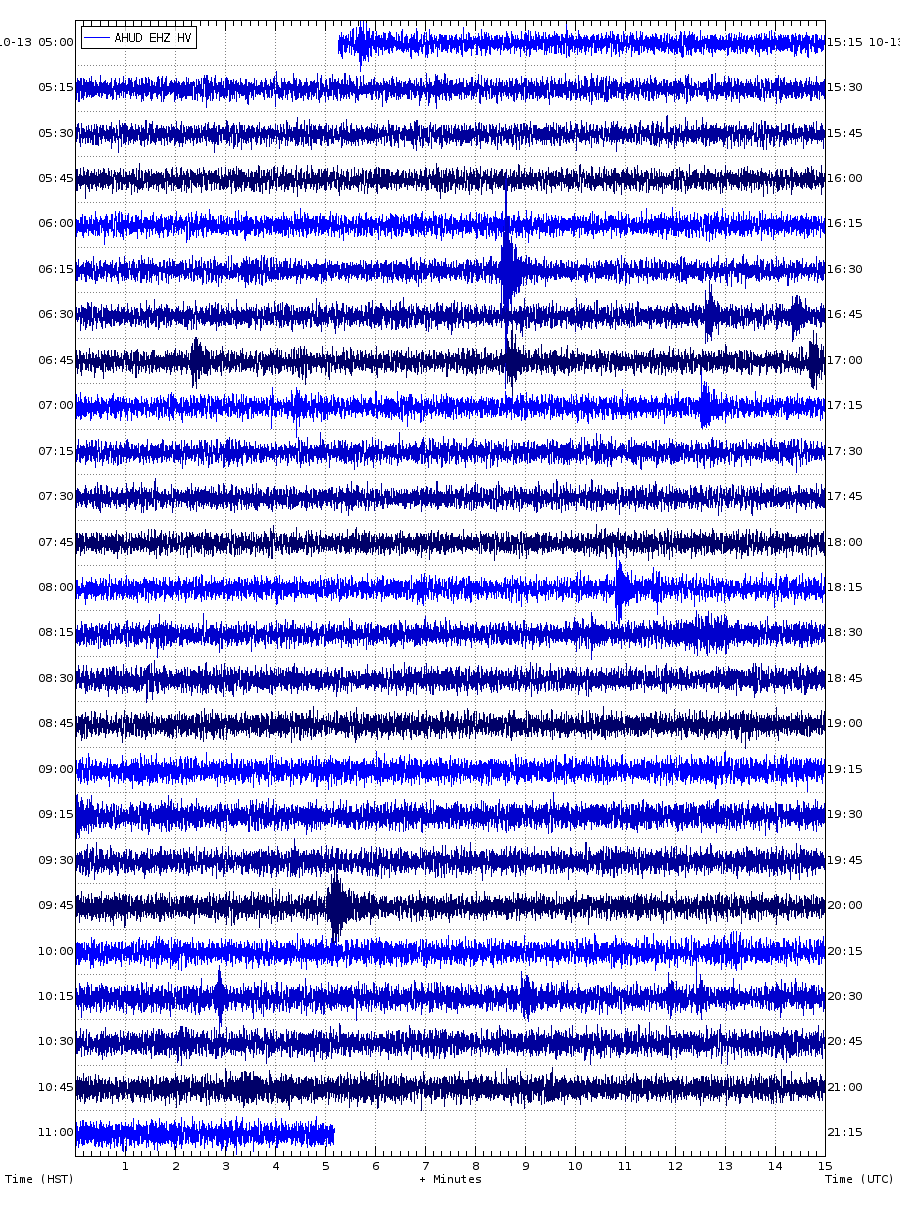 ?fileTS=1721683903
Looks like this only a minute ago (past 2 hours).
Might not be anything special but just something to note.
The forest moon of Endor. Endor is a gas giant referenced in Return of the Jedi. Also the movie Jupiter ascending. Terrible movie.
Stanley Kubrick’s Space Odyssey happens partially in Jupiter’s orbit. I haven’t seen the movie completely, but parts of it. It is one of the more realistic Science-Fiction movies.
So does Wandering Earth. One of the less realistic movies (at least as far as the physics is concerned) but it is fun
https://www.frontiersin.org/journals/earth-science/articles/10.3389/feart.2023.1144151/full
Looks like Congro system is very seismicaly active
https://strokkur.raunvis.hi.is/gps/8h.html
The above link to the gps land-rise charts no longer works for me, though they are still accessible via
https://vafri.is/quake/
Problem at my end, or have the Institute taken them down?
I’ve searched, but can’t find any answer, perhaps it’s site maintenance?
Edit: found another means of access, I think this is an IMO site:
https://www.vedur.is/gogn/gps/reykjanes.html
https://m.youtube.com/live/QVp_Sb9PtSM?si=A5DjYx51ceOlQCxX&fbclid=IwZXh0bgNhZW0CMTEAAR32ne3Mf4VSFVJ6j-tWeV5eeY4DUceFZMSiW8KYdVi6WvWs9wn9dyKu0zU_aem_uXaVvthPB6Amxsl5ht1MNQ
Next Etna show …
Very ashy now, it covers the view in darkness
Big earthquake swarm and increase in tremor at Kilauea.
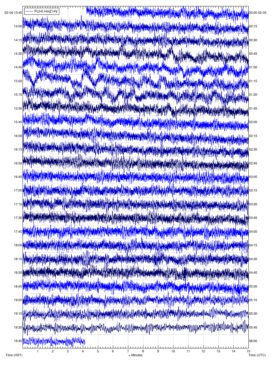 ?fileTS=1721684851
Tremor = intrusion? … and possible build-up to eruption?
Looks like a slight drop on the UWE tiltmeter?
 ?fileTS=1721687150
It looks as if earthquakes interrupt the observation of the station.
But UWE GPS station shows an accelerating inflation since June 2024. The eruption on June 3rd was maybe only the tip of the magmatic iceberg. It was the onset of the overall/general high speed summit inflation that we’ve witnessed until now.
New Kilauea update:
KILAUEA (VNUM #332010)
19°25’16” N 155°17’13” W, Summit Elevation 4091 ft (1247 m)
Current Volcano Alert Level: ADVISORY
Current Aviation Color Code: YELLOW
Activity Summary: Kīlauea is not erupting. Increased earthquake activity and rates of ground deformation at Kīlauea’s upper East Rift Zone began at approximately 11 a.m. HST on July 22, 2024. About 40 earthquakes have been detected, the largest of which was a magnitude-3.1. The Hawaiian Volcano Observatory is watching the situation closely and will issue additional messages as needed. Currently, there are no signs of an imminent eruption; however, conditions could change quickly. Past eruptive activity in this area of Kīlauea’s upper East Rift Zone has typically occurred between Hiʻiaka crater and Maunaulu in Hawai‘i Volcanoes National Park.
Seeing around 70 quakes from around 20:24 till 23:42 UTC, with around 5 with magnitude 3 or higher, 3.5 mag the largest.
Tilt at ESC shows some good movement, see where it levels out.
Macusn
Big drop on ESC now.
 ?fileTS=1721695784
It is perched right on the edge of Pauahi crater I wonder if that is why it tilted so much. If the feed is how I interpret it then it has tilted to the east mostly, but the amount seems excessively steep for dimple uplift. Maybe there was an actual intrusion too just a very small one. Its a 50/50 that it dies down again for a few weeks or erupts in the next day I think.
Yeah, looks like it’s slowing down.
Kilauea Iki has an astonishing increase of inflation:
How well is Kilauea Iki Tilt station related to upper ERZ? Can it work as an indicator?
The ESC deformation is interesting, it does indicate dike intrusion deformation, but without involving the summit, fed from ERZ magma.
Deformation initially comes from inflation to the NNW of ESC, the inflation then shifts to ENE of ESC. It possibly shows a dike intrusion starting under Pauahi Crater and then propagating to the ENE, which seems to be faintly traced by a line of earthquakes.
There may have been other tiny dikes intruded along the Chain of Craters since there are multiple WSW-ENE oriented lines of earthquakes cutting across the Chain of Craters near the locations of the Puhimau thermal area, Kokoolau Crater, Hiiaka Crater, Pauahi Crater, and Puu Huluhulu. If this is right it’s interesting what may have triggered this multi-dike event.
Looking at all the GPS signals, they show movement south and southeast along the entire line of earthquakes. KOSM on the western rift is moving west. East of the earthquakes there is deflation (!). The inflation is highest at AHUP. My feeling is that this is a tectonic response to the rapid inflation at the southern edge of the caldera. Everything is moving away from this point, but there has been some adjustment (movement along a fault) along the line of the chain of craters. Perhaps the rift is opening a bit but this is not obvious from the GPS stations (which of course are a day behind the events). Little or no magma is involved at this point – but this may change quickly.
I’d be surprised if the GPS stations are already updated, often it takes a few days for the data to be plotted.
AHUP has now surpassed its 2018 value, so has CNPK. The rate of uplift at AHUP is crazy, 10 cm a month since the intrusion at the end of January and in a nearly linear trend. At this rate not only will the 2018 point be passed but by the end of the year the uplift will be past the point that you get if you extend the pre-2018 trend to the present…. OUTL will also be at the 2018 trigger in a few months.
As yet the ERZ connector stations havent shot up but that seems likely to happen now too. It seems like all of the plumbing system is being rapidly filled now that Halemaumau isnt an easy way out anymore. And it is filling crazy fast, the supply rate must be multiples higher than normal, maybe the highest rate of supply ever seen at Kilauea and maybe anywhere.
This event:
Vs typical connector seismicity:
I think those earthquakes lines might be very small dikes. Evidence is a different earthquake distribution compared to normal seismicity along the ERZ connector, swarming locations that do not have earthquakes in typical Chain of Crater swarm. Sudden onset with very intense seismicity (many earthquakes per minute) followed by exponential decay, consistent with exponential decay in magma intrusion rates that dikes follow. And for the Pauahi dike, presence of rapid deformation in the ESC tiltmeter that shows migration in the deformation center consistent with magma propagation.
The volume in the dikes is likely minimal except maybe in the Pauahi Crater dike that did make some meaningful deformation and also has relatively deep earthquakes (2 km deep) along its trace to the ENE consistent with dike-induced spreading straining the base of the intrusion, whilst the others have mostly very shallow earthquakes, more consistent with some light cracking in existing faults above a minimal intrusion.
I think this might be a fore-intrusion to something bigger in the future, maybe to an event with eruption inside Pauahi or Hiiaka craters.
It is also possible that minor small dikes prepare side-events like 1973/1979 on the smaller craters (like Pauahi) and that a major event happens somewhere else, f.e. around Mauna Ulu. Maybe the smaller events need pressure by a major eruption.
During the whole Mauna Ulu session 1969-1974 eruptive activity fluctuated between it and minor side-events. When magma/lava drained at Mauna Ulua, one of the other events happened, even on the summit occasionally. Even the SWRZ eruption 1971 can be seen as a side-event to Mauna Ulu.
Can Mauna Ulu do a comeback after 50 years?
I don’t think Mauna Ulu can do a come-back, but maybe we can get a new Mauna Ulu at some point.
Did they observe inflation like now during the 1960s in the summit area?
During last two hours, the earthquakes have moved closer to Mauna Ulu area. Maybe one of the pre-Mauna Ulu cones wants to erupt again? Puʻuhuluhulu, Aloi and Alae Crater are three of the older craters in the Mauna Ulu area.
The Mauna Ulu Trail Guide shows on page 4 the pre-Mauna Ulu landscape there which was buried 1969-1974. This helps to get an orientation for the area: https://www.nps.gov/havo/planyourvisit/upload/mauna_ulu_trail_guide.pdf
Everyone should be worried about Iwo-jima right now as it is erupting yet again
https://watchers.news/2024/07/21/iwo-jima-volcano-enters-new-eruptive-period-japan/
Ioto has been doing some form of eruption every other damn week since Oct 23, which is not a good sign, and writing an update on my big 3. Just so I don’t blunder, how large was the eruption last year?
Hard to find a single source on the volume of that eruption, but if I had to guess, it might be about VEI2 scale at most, although arbitrary. It is just a guess all around, though.
Yeah it was notable, but it was not a big eruption at all! Remember it erupted in like 10m-deep water and had little surface height.
There is no chance in hell places like Shanghai are getting evacuated. Just the concept of volcanogenic long distance tsunamis was considered unlikely up until Tonga. Volcanic Tsunamis don’t have enough “street cred” to cause warrant the needed reaction to avoid or minimize fatalities in this case.
This vent will do nothing but develop and grow stronger as it has done over the last few years. I am dying to see how this eruption develops
Yeah, that roof is creaking these days and as you mentioned the pattern of eruptions suggest it may already have a sort of built-in ring fault (not small either! 4.5X5.5 km!). Question is if it keeps escalating. From past big bangs, decent odds the final event will be triggered by a VEI 4/5. Then a few days-weeks later… Realistically if Iwo Jima does a VEI 4 arguably reasonable to evacuate places like Shanghai, though that is unlikely to happen.
There is no chance in hell places like Shanghai are getting evacuated. Just the concept of volcanogenic long distance tsunamis was considered unlikely up until Tonga. Volcanic Tsunamis don’t have enough “street cred” to cause warrant the needed reaction to avoid or minimize fatalities in this case.
This vent will do nothing but develop and grow stronger as it has done over the last few years. I am dying to see how this eruption develops
Well something snapped.
 ?fileTS=1721742533
Yes, so it seems. A major dike intrusion may be underway in the Pauahi Crater area.
ESC tiltmeter is not updating, I don’t know if damaged by the earthquakes or just taking its time to update.
HVO just raised the alert level.
Just updated
 ?fileTS=1721746199
Well, look like it has dipped significantly. IKI is at a standstill, although UWE is going up.

(ALL LIVE)
SDH is doing nothing special.
I would think that 120 microrad in a month is pretty special..
Yes. And then it unsnapped.. But this is a clear indication that the current sequence may well end with not just an intrusion but an eruption. Never guaranteed though
The earthquakes of last two hours indicate to the area of Mauna Ulu: https://www.usgs.gov/volcanoes/kilauea?inst=101742,101743&date=2hr
Maybe the west wing of Mauna Ulu (Alo’i Crater) is going to get an eruption.
Alert level has been raised now
Iceland: Today very shallow quakes at Keilir and Sundhnukur. Depth between 2 and 0.1km. What can cause shallow quakes like this?
Looking busy over on the big island.