
Austin feels laid-back. The small down-town area has bars and restaurants with live music of varying quality. One person does morning percussion on the sidewalk. There are quite a few self-driving cars on the roads, a few with bored-looking drivers but many devoid of driver or passengers, making one wonder what they are there for. Presumably the different companies are testing them out. Most drive well, perhaps a bit more smoothly than the non-self-driving ones, and taking more care not to block roads near traffic lights. One car shows erratic driving, seemingly randomly changing lanes, but this might be caused by a car from the other direction intruding into the wrong lane. Driver at fault. Outside of the city, but never in it, a few cybertrucks appear, electric but with the appearance of ancient world-war-I tanks. Their curious mix of past and future feels like typical Texas. History means something here, ranging from the many memorials to its brief independence to its curious state flag. The museum of Texas history has quite a lot of history (no surprise there), with a focus on the colonial era and slavery. One floor is dedicated to modern (i.e. 1960’s) Texas. The small exhibition on problems of oil focusses on spillage and carefully avoids any mention of global warming. And Texas is clearly on the frontline of this, with temperatures well above average during our visit and farmers very worried about the on-going drought. The nearby Texas Capitol is fantastic, built with rocks from the state, making it an emblem of state geology. In Texas, geology is there to be used.
Drive south to San Antonio and you pass a series of quarries, all on the west side of the road. In the Natural Bridge Caverns, water has done its own quarrying, creating large underground rooms full of strange limestone formations and full of tourists. Although it lies on the line of the quarries, as an expensive touristic attraction it should be safe from those. Go southeast instead and the landscape becomes more featureless. Go northwest from Austin and hills appear with the ancient granite dome of the Enchanted Rock – an easy climb were it not for the heat. Different directions – different rocks. Austin lies at a geological border.

Texas Capitol
Austin also has a volcano. It was active a long time ago but the remnant is still visible in the city landscape: Pilot Knob. And there is a faultline which runs through Austin. Although not currently active, the fault zone is recognizable in the cityscape.

Ages of Texas. Source: earthathome.org
Texas and the Gulf
The geology of Texas is basically a simple one. There are several zones, arranged roughly concentric around the Gulf of Mexico, which are all called ‘plains’ (for good reason, although it includes the Hill Country northwest of Austin), and with older ages and higher elevations further from the Gulf. The only outlier is at the centre, where some ancient rock comes to the surface, with some of the most scenic scenery of Texas. Austin lies at the border between the coastal plains and the central plains.
The coastal plains are exactly what the name implies. Once, the Gulf of Mexico spread far inland from current coast, a time when the name ‘Gulf of America’ actually made sense. (Renaming it now seems a bit irrelevant since everyone just refers to it as ‘the Gulf’.)
The Gulf of Mexico is in effect a compact failed ocean. It is an oceanic basin which remains almost entirely surrounded by continental crust. The northern half of the Gulf is shallow and has mainly continental crust. The oceanic part lies further south, wide in the west but narrow in the east. The spreading rate was high in the west, and slow to ultraslow in the east, with an end-point near Miami. This difference in spreading rate caused the crust to the south to rotate away from the north: this became the Yucatan block. In effect, the Yucatan opened the Gulf of Mexico.
The spreading may have been initiated by a hot spot. The evidence for this comes from an apparent hot spot track which has been split in two by the spreading. We can envisage that the hot spot caused spreading and thinning of the continental crust, which dropped below sea level and was invaded by a shallow sea. This happened some 160 million years ago. The sea left salt deposits that are still present in the Gulf. After some 10 million, oceanic crust began to form along a short spreading rift. This split the salt deposits which are now found on either side and not at the centre.
The oceanic spreading ceased after 10 to 20 million years, around 140 million years ago. This places the formation of the Gulf during the late Jurassic, some 30 to 50 million years after the central Atlantic ocean opened, but 20 million years before South America split from Africa.

Source: Bird et al, 2011, Tectonic evolution of the Gulf of Mexico basin. Published in The Gulf of Mexico origin, waters, and biota, volume 3, p. 3-16. The yellow line indicates the oceanic basin. The two black lines are the split hot spot track.
The borderline between the oceanic and continental crust in the Gulf is not well known. North American rivers have been depositing their sediment in this small ocean every since it formed. This continues to this day, with the Rio Grande and especially the Mississipi rivers. In places the sediment is 20 kilometers thick! There may be oceanic crust buried underneath this sediment but it is hard to tell. But in any case, the basin associated with the Gulf of Mexico is much larger than the Gulf itself. It includes the entire coastal plain, underlain by the thinned continental crust of 160 million years ago with 10-20 km of sediment on top. The Gulf coast is rather more than knee-deep in mud.

Source: William Galloway, Depositional Evolution of the Gulf of Mexico Sedimentary Basin. https://www.researchgate.net/publication/251471670_Chapter_15_Depositional_Evolution_of_the_Gulf_of_Mexico_Sedimentary_Basin
The origin of the Gulf of Mexico is sometimes described as part of the westward growth of the Tethys Ocean. But the Central Atlantic Ocean had already opened at this time, and the Tethys was located on the east side. The Gulf formed on the west, too late to be part of the Tethys. It was an independent event which may have been related to the rifting in the central Atlantic. The Gulf did eventually open to the Pacific Ocean, thus helping to split North and South America.
At the termination of the oceanic rifting in the Gulf, there may have been volcanism around the Gulf Coast. The evidence is deeply buried and the indications come only from seismic reflections. It would be similar to the harads in Arabia north of the Red Sea, caused by sideways convection of heat from the spreading centre.

Source: wikipedia
The formation of the Rocky Mountains (or at least its precursors) led to a new event. On the east side of the mountains, the ground sagged and a seaway formed. This is called the Western Interior Seaway and it stretched from north to south across America. Around 100 million years ago, the Gulf connected to it and the seaway now covered much of Texas. A long period followed during which the region remained under a shallow, tropical sea. As in many places around the world, at this time of high sea levels and high temperatures, a thick layer of chalk was deposited at depths of a few hundred meters. It is now known as the Austin chalk, but is also found around Dallas and extends as far as Kansas. Volcanic ash layers show the presence of marine volcanoes, dated to 80 million years ago – we will come back to those. Where plankton was less abundant, limestone (in effect, non-biological chalk) was deposited. It is found (and quarried) across much of Texas. The Edwards plateau consists of limestone.
After 70 million years ago, the seaway began to close and retreat towards the Gulf, and the limestone and chalk deposition was replaced with sedimentation. This was part of the so-called Laramide orogeny, a period between 80 and 50 million years ago with uplift of the southern Rocky Mountains, over time extending further east. (The same orogeny formed mountains from Mexico to Alaska.) During this phase, the Chicxulub impact left its waste all over the northern Gulf.
In later eras, sea levels went up and down, while the thick sediment depressed the crust further. Sometimes the sea flooded the coast and sometimes the coast pushed back. This coastline see-saw continues to the present day. Sedimentation from the major rivers has built large deltas which in general have extended the coast line outward. But at the moment, sea level rise, in places amplified by extraction of ground water, is reversing this trend. This would be a good time to sell that beachfront property and move inland as the see-saw reverses – perhaps to Austin. History provides a warning. It may not repeat, but it can rhyme.

The faults of Austin
Starting some 25 million years ago, the Edwards plateau began to uplift (or uplift further), thereby forming the Hill country. This uplift re-activated an ancient fault zone on its southern and eastern edge. It is called the Balcones fault zone, and it forms an escarpment which delineates the edge of the Hill country and separates it from the coastal plain.
The zone is 600 kilometers long and 40 kilometers wide; it runs across Texas northeast to southwest where it ends in the Gulf. The zone is a mess, containing many series of short faults. The faults are ‘normal’, meaning the movement is mainly up/down. Individual faults may either have their ‘up-side’ on the northwest or on the southeast, but combined the northwest side is ‘up’. The downside is covered by sediments from Gulf incursions: this hides some of the total amount of uplift of 350-500 meters.
The age of the Blacones fault zone has been uncertain, with both young (25 million years mentioned above) and old dates (80 million years) being suggested. Dating of veins in some of the faults now indicate that both were roughly right. Several faults are dated to similar ages of around 61-57 million years. This was when the Laramide uplift reached the region, making it the likely cause of the break. The Edwards Plateau likely already obtained some uplift at this time. It is also the time that limestone formation in the region ceased and was replaced by river sediment: the Gulf was withdrawing and the rivers were eroding the new Rockies and dumping the waste into the sea.
Other faults are found to be much younger, with one dating to 30 million years ago and the other to 12 million year. It indicates re-activation, perhaps (as previously suggested) a second phase of uplift caused by the tectonic mishaps in the western US. (The quiet interregnum may have been related to the change of plate movements in the Pacific Ocean 45 million years ago, seen in the bend in the chain of the Hawaiian hot spot, but this is speculation.) Another suggestion is that the re-activation was caused by the sediment filling up the Gulf and pressing it down. In fact, this is a stronger possible explanation for the older fault formation date: in that case the fault zone would have developed from subsidence of the Gulf crust rather than uplift of the Edwards Plateau: it was gravity driven. It is difficult to separate the two effects, as uplift causes increased sedimentation: the two are linked.

Sedimentation rate in the Gulf of Mexico (‘GOM’). The numbers at the top are in units of km3 per thousand years. Source: Hyppolite et al., 2024, Terra Nova 36:457–466. https://onlinelibrary.wiley.com/doi/epdf/10.1111/ter.12734 The times of peak sediment build-up coincides with activity of the Balcones Fault Zone, but whether that is due to the pull of the sediment or the push of the uplift that causes the sediment is hard to tell!
In Austin, the Balcones faults mainly (but not exclusively) run west of the city, on the far side of highway 1. Austin lies on the Colorado river (no, not that one, but another one of that name) which comes off the Hill Country, flowing through the escarpment. The cliff on the river where it enters the coastal plains is called Mount Bonnell, and it is a popular place for a short climb to a good viewing point. The city has grown around it, bringing the Balcones Fault Zone into the city suburbs. If this sounds risky, remember that there has been little or no activity for many millions of years. There are many faults associated with the zone, and one of these runs on the other side of the Austin downtown. However, on the Texas risk register this does not warrant a mention.
Go south to San Antonio, and the I-35 runs parallel to the Balcones Fault Zone, on the side of the coastal plain. (Within the city limits, the road runs briefly on the edge of the escarpment.) Those limestone quarries that can be seen from the road are located on the fault zone. That is what uplift does: it brings geological riches to where they can be profitably mined. There is money to be made from Texan faults.
Volcanoes of Austin
The same risk consideration applies to Austin’s volcanism. It was a long time ago. And it was only one.
Pilot Knob volcano lies about 2 kilometers south of Austin’s international airport, 0.5 km from the township of that name. It is on the coastal plain but only a few kilometers from the edge of the escarpment. It doesn’t look much. (There are locations with the same name in Iowa, Kentucky and several other states – don’t be confused by some of the images returned by google.) There is a small hill, with three more outcroppings to the south and east, reaching 60 meter above the surrounding plain. The total diameter is 2.5 kilometers. The nearby McKinney Falls shows evidence of pyroclastic falls.

Pilot Knob volcano, Austin. Texas

Source: Loucks et al 2024, GCAGS Journal, v. 13 (2024), p. 53–74. https://doi.org/10.62371/DSUE4387
But this is only the eroded remnant of what once was a larger volcano. The area covered by volcanics (lava and ash) is 60 km2 which may conceivably put the airport runways partly within it. In laid-back Austin, your plane may land on debris from an ancient volcano.
And it really is ancient. The volcanics have been dated to around 80 million years ago. Even though this volcano is associated with the Balcones Fault Zone, it is considerably older than the fault. The eruptions happened well before the up (or down)lift. This makes Pilot Knob a submarine volcano, as the Western Interior Sea still covered this region sea at this time. Chalk formed, and in fact this layer is called the Austin chalk. The volcano grew to above sea level. This allowed reefs to grow around it, also leaving some remains. It was Surtsey-like but located in a tropical sea, and it formed a small atoll. The depth of the surrounding sea can only be estimated, but the pyroclastic layers appear to have been deposited in water below wave depth. A depth of order 100 meters seems plausible and this fits with the depth of the Western Interior Seaway. It all points at a Surtsey-size volcano. Pilot Knob is often described as Texas’ largest volcano, but this was no St Helens. Not everything in Texas is Texas-sized; it’s (reportedly) largest volcano was no cybertruck but more like a mini-cooper.

Pilot Knob was not an isolated event. There are some 400 identified volcanic plugs spread out over a distance of 400 km, all roughly following the Balcones Fault Zone. The volcanic rocks are all located within the Austin chalk, and therefore are of similar age. It is called the Balcones Igneous (or magmatic, or volcanic) Province. One of these sites is also in Austin, at Williamson Creek Volcanic Mound. This site is about 5-km north of Pilot Knob, much closer to Austin downtown and located in the densely populated suburb of East Congress. The tuff layer is up to 10 meters thick, with a 1-meter ash layer, and contains large chalk blocks thrown out by the explosive (phreato-magmatic) eruption. It is considered part of the Pilot Knob volcanics, but may have come from a separate vent.

The basaltic volcanic outcrops have dates between 81 and 85 million years ago, with a second set of more evolved (phonolite) rocks which are a few million years younger. All outcrops are small: this was a large volcanic field but it was not highly active, and all mounts were marine. The mounds typically have multiple vents, as is common in low-intensity volcanics where every magma recharge has to find its own way out.
What caused this volcanic field, and why is it in the same region as the later fault zone? The line of the Balcones Igneous Province follows roughly that of the Ouachita structural belt. This is a mountain belt stretching across the southern US. If you now wonder why you have never seen these mountains, they formed 300 million years ago and are now long gone and buried. The suggestion is that the Balcones volcanics made use of this belt as a weakness in the crust. That may be true, but the volcanics only affected this area in Texas and not elsewhere, although the mountain rage extended much further east and southwest. Also, the magma erupted in the volcanoes derived from the mantle and not from thickened mountain crust. This can’t be the full answer.
The second suggestion is that the volcanic activity was caused by sediment build-up in the Gulf of Mexico. This was the beginning of the Laramide orogeny, with the mountains building in the west and the formation of the Western Interior Seaway. Rivers from the new mountains dumped their sediment into the young new ocean – more than 10 kilometers of it, which depressed both the oceanic crust and the surrounding continental crust. This had formed the Gulf basin, shown in one of the images above. The Balcones Igneous Province follows the edge of the basin quite well. The idea is that the depressed crust caused the mantle material to ‘flow’ (an optimistic word for ductile rock) sideways to make space. This mantle material experienced some decompression melt when reaching the edge of the basin where the pressure from above was less. The model explains the location of the volcanoes, the fact that they derived from 100-km deep mantle material, and the small size of the volcanoes which is because the melt fraction would have been low. It was shortly after the thick Austin chalk had been deposited during a worldwide sea level high-stand. At 80 million years, the Gulf was deepening. Thus, the ‘ayes’ have it and this model seems to be more likely. Whether the ancient Ouachita mountains are also involved is up in the air: perhaps their deep crust was what stopped the magma flow and deflected it upward.
A hot-spot origin for this volcanic has also been suggested. It is hard to rule out but there is no direct evidence for its presence and the volcanic seems to be too weak and too spread out for this model.
The volcanics lasted for only a brief time. 20 million years later, the Laramide uplift reached Texas, the Edwards Plateau went up and the Balcones Fault Zone formed at the edge of the depressed basin. The volcanics and the faults have the same origin – different children of the same parents.
Secret Santa Science
There are quite a few scientific papers on the Balcones volcanics, but almost invariably they are behind solid paywalls which are clearly meant to hide rather than reveal their content. Economic reasons can be invoked. The volcanic plugs often act as oil traps. There are more than 100 known oil fields related to these plugs. In Texas, oil is big business. The Texas geological society is not there to disseminate data to the public. It serves different customers.
There is a bit more scientific openness about the Balcones Fault Zone. It also has a commercial side, but related to a much less profitable but perhaps more important resource: water. San Antonio, and to a lesser degree Austin, depend for their water on the Edwards aquifer. The aquifer feeds the major springs in the region and these springs in turn feed the cities. Rain water sinks quickly through the chalk and limestone and becomes stored in the aquifer. The Edwards aquifer follows the escarpment of the Balcones Fault Zone. The individual faults provide pathways for the rain water. The water quality and salinity can change dramatically across a fault. Most recent papers on the fault zone study the interaction of the aquifer with the faults: e.g. see USGS
The fault, the cavern and the aquifer

Stalactites reflected in a cave pool: water of life. Photo by the author
Remember the Natural Bridge Caverns? The chambers have all been carved out by water. At times there has been more water than the caves could cope with: after a hurricane, the chambers were flooded to the top. But why are there so many large chambers in this cave?
It turns out that the caves follow one of the faults of the Balcones Fault Zone. When a stream crosses a fault, as it does here, the water can percolate down into the fault. Limestone dissolves easily. Once a cave has formed, water will flow along it. Hence this set of large chambers of variable depth which follows the line of the fault. At the bottom, the water enters the aquifer that nearby San Antonio depends on. Austin’s geological border is the lifeblood of Texas.
Texas lives of its history. Whether oil, cities or tourism, the resources come from seas, faults and volcanics of a deep past. In Texas, history matters.
Albert, December 2025

Pilot Knob marker that is (or used to be – it has been reported as missing) on highway 183 in Austin


Thanks!
BTW, in New Mexico, one state westward, there is Bandelier Tuff, but it is much younger formation. It would be interesting to read about that.
New Mexico has much more volcanics. We have written about its most current site
https://www.volcanocafe.org/m-stands-for-magma-the-socorro-cover-up/
Albert:
NASA has flown special survey planes over the western US. Once I stayed up for over 6 hours watching a 747 flight on FlightAware. They paid special attention to Mt Shasta, Craters of the Moon, Idaho and to the NW portion of New Mexico.
I wish that NASA would publicly release what their finding are, but for the most part, they are silent.
Amazing write-up. Always good to be read about my state’s geology.
Still hoping for that M4.5 quake In houston but unless we get some fracking I wouldn’t bet a penny.
Myself, I’m looking for an VEI-4 from Colima or Orizaba so I can get a measurable deposit at my home near Houston!
I didn’t know I had a fellow houstonian up in here! A safer bet would be a VEI 4-6 in new Mexico but that wouldn’t be likely unironically we’d see a VEI 7 before that happens
Yep, I quasi-retired and moved from Omaha to Montgomery County! Traded tornadoes for hurricanes 🙂
The opposite thing for me, I wanna see a tornado and I’ve had enough tropical cyclones
Now I am curious whether you can recognize (or not) my description of Texas!
https://www.micahvanderlugt.com/middle-earth-biome-map
Zoomable map with all of Middle Earths bio climate – zones its of course obvious that Mordor ( Gorgoroth ) is a lava wasteland
It only works on stationary computer click to explore enviroments
https://www.gsi.go.jp/BOUSAI/ioto_kisen.html
my media files ain’t uploading despite being the right format
While looking around the HVO map this morning I clicked on the SMC tiltmeter, and it was working. I do not remember how long it has been since I checked it. I also saw that ESC, JKA, and BLB are also working, but again I am not sure the last time I had looked at those instruments.
Interesting development at Mauna Loa. For the past two weeks it has been deflating quite a bit, visible on both tiltmeters and GPS. The last time this was seen was in early 2021. That was interpreted as a sign magma had begun moving to shallower depths. Seismicity has also been slightly increasing recently.
Could Mauna Loa already be almost ready to erupt again?
Mauna Loa can certainly erupt again: separations of only a few years were not unusual before the recent quiet period. Eyes peeled but don’t expect too much – the mantra of volcano watching.
Probably won’t have as much pre-eruption seismicity this time as the summit rift should still be fairly open. Will be interesting if this means ML has returned to a high-activity era or just a temporary increase.
It is possible, that we come close to the moment of 1840, when Kilauea had its final major eruption, and Mauna Loa began to become more active beginning 1843.
The 1843 eruption was similar to 2022, but 1/3 more volume. The next eruptions happened on the summit, but were very weak. 1849 was “only a lofty column”, so maybe some kind of phreatic or fumarolic eruption. 1851 was also very small lava eruption. Maybe we have to expect small eruptions like this. They would be boring, but would count as eruptions.
Here’s the monthly HVO ML report. They’re still keeping it close to the vest, but they leave an out–‘should conditions change significantly’. That’s as close to panic as HVO will get:
“Mauna Loa seismicity rates returned to long term background levels in late November similar to seismicity rates during the prior months. A total of 147 M3+ and smaller earthquakes were detected beneath Mauna Loa’s summit region in the November reporting period, while the prior month had 123 earthquakes. Modestly higher rates of seismicity were observed from late-October to early November with 8-16 earthquakes per day in earliest November. Recent seismicity is much lower than unrest prior to the 2022 eruption and has returned to 3-6 earthquakes per day.
Data from Global Positioning System (GPS) instruments on Mauna Loa show a slight increase in inflation beneath the summit starting in mid-November. These rates are normal as the volcano recovers from the 2022 eruption and magma replenishes the reservoir system. Recent data indicate that the center of deformation has shifted to the southern caldera region, indicating refilling of a south caldera magma chamber.
Gas and temperature data from a station on Mauna Loa’s Southwest Rift Zone indicate these values are at background levels, with little change relative to previous months.
HVO continues to closely monitor Mauna Loa and will issue another update in one month, or earlier, should conditions change significantly.”
Thanks! It doesn’t sound like ‘panic’ to me, but the mountain is recharging. (Is that phrase still allowed in the US or do we need to call it ‘refuelling’?)
As the history shows, an eruption of Mauna Loa doesn’t have to be big. It can just be some days of degassing and spattering. After long dormant periods, it may take some time to wake up again.
“refilling of a south caldera magma chamber” may indicate that the next eruption is going to happen and stay in the southern part of the summit caldera. That was typical for past summit eruptions that stayed there for days. Both 1940 and 1949 were in this region.
Pretty unlikely, Kilauea just did an eruption much bigger than in 1840 and supply has only increased since then. Mauna Loa appears to be more active than most of the late 20th century though that depends on how long or deep this apparent deflation is too.
The second option is Hawaii has two cycles, one is the familiar if pretty vague alternation of Kilauea and Mauna Loa, but there could be another longer cycle that causes simultaneous increases in both together. This would need greater knowledge of the ancient eruptions abd of Kilaueas surface in general though to be sure.
3rd option is the Pahala magma is feeding Kilauea, and Mauna Loa is going for its turn with the plume but Kilauea is still highly active anyway. Which coukd be very interesting… Again pretty hard to prove without public records of this years lava composition yet.
The development doesn’t have to be like 1840, but can have some similarities. The two volcanoes behave irregularly, but usually shift between periods with higher and lower activity.
If we have a moment like 1840, Kilauea would now do the summit eruption and afterwards some kind of climactic low rift zone eruption, either (low) SWRZ oder (low) ERZ.
But it’s also possible that we’re apporaching a time like 1823-25, when the magma filling rate was on the peak of 0.32 km³ per year. In this case the “caldera filling” eruption of Kilauea may continue for 1-2 decades, interrupted by possible rift zone eruptions.
Here I’ve found a video of 1940, I didn’t expect that there exists one:
Interesting paper in Nature linking the Black Death of 1345 to volcano-induced cooling and subsequent importation of grain from central Asia:
https://www.nature.com/articles/s43247-025-02964-0
They have not identified any specific volcanoes but they did do the ice-core/tree-ring/historical records correlation..
This is something that VC has written on before. Both major pandemics of the black death were shortly after major eruptions. So that is not new. The main finding of the paper is how the link worked.
https://www.volcanocafe.org/volcanohistology-when-eruptions-make-a-difference/
I knew the plague of Justinian had a volcanic culprit but didn’t know they had established that for the 1345-47 plague.
It doesn’t always happen after a major eruption. I think it requires a weather event that creates a subsistence crisis and causes grain import for Asia, and second a virus that has already made the jump to infect us and is waiting in the wings. The last subsistence crisis was after Tambora, but no food was imported over longer distances.
Sure. Zoonosis (when diseases jump from animals to humans) do not require volcanoes. They don’t always require fleas either. Plague is caused by a bacteria, Yersinia pestis. Not a virus. A related species causes a disease called yaws in Africa.
It seems in this case that the direct cause of the epidemics was importation of grain from areas with endemic disease in rodents (giant gerbils were mentioned in the paper), but the need for such importation was driven by a volcanic summer.
Interestingly plague is endemic in several species of rodent in California, so not just in Mongolia. Ground squirrels and marmots, specifically. There are a couple of plague cases every year. Quite treatable with antibiotics.
Yes, a bacteria in this case, not a virus. Is it known how old the plague bacteria in the western US are? America escaped the black death (obviously) but even the Greenland colonies escaped because any infected ship would’ve succumbed before reaching Greenland. There have been many later outbreaks of plague, smaller ones, so did one of those reach America? At the moment, the bird flu virus is starting to infect mammals: a new carrier can perhaps develop quite quickly. Or was plague endemic in America before Columbus?
Plague is also endemic in marmots in Mongolia. There was a land bridge during the icee ages. We know people went across. Maybe the marmots did too. The paper describes the source region for the plague as central Asia.
Papers attribute the continuing US plague cases to the 1900 outbreak in San Fransisco, part of the extended plague epidemic that started in China a few decades earlier and badly affected Hong Kong in 1899. There are quite a few species in the Western US that can carry the disease although many animals succumb quickly. People can be affected through domestic cats and dogs, or presumably directly from contact with wildlife. But this suggest the decease was not originally endemic in the US.
Canthisbenull,
Yersinia pestis probably did not yet exist during the Younger Dryas.
I’d assume that the Little Ice Age was caused predominantly by astronomical developments. Volcanoes (f.e. Örafajökull on Iceland) contributed, but weren’t strong enough to cause a cooling that would persist for 450 years. The transitional weather during the switch from warm Medieval climate to the Little Ice Age included probably many unusual weather phenomena … similar to many weather phenomena we can observe during our rapid climate warming.
Maybe some deep tremor?

2025-12-05 11:51:15
Earthquake
Magnitude: 2.62 M
Depth: 43.13 km
Found another one.
Depth: 41.82 km (25.99 mi)
Magnitude: 2.25 M
Date: 2025-12-03 23:56:35 (local)
2025-12-04 04:56:35 UTC
Age: 1.41 days
Distance From: 12 km E of Naalehu, Hawaii
Deformation on Piton de la Fournaise:
https://www.ipgp.fr/volcanoweb/reunion/Bulletin_quotidien/bulletin.html
It seems likely to me that Piton will do the Christmas eruption 2025.
It looks like the seismometer has a significant paper jam!
Last night Piton did an intrusion that stopped, before it could have developed into an eruption.
However, they expect an eruption soon. Magmatic pressure continues. I didn’t believe that Piton would hurry so much.
https://www.buletingeologi.com/index.php/buletin-geologi/article/view/500
More study on the Tambora tsunami
https://d9-wret.s3.us-west-2.amazonaws.com/assets/palladium/production/s3fs-public/styles/full_width/public/media/images/IMG_2127.jpeg
Spatter-fed flow at Kīlauea, although they said it came from episode 34.
https://www.usgs.gov/observatories/hvo/news/volcano-watch-tracking-growth-a-new-puu-kilauea
Also, appearently, the hill is over 100 feet (30 m) now and only grows if fountains are 1,000 feet high (300 m).
I think it made spatter fed flows on the rim in both E34 and E35, theres a ridge in the flow in their picture just behind the flow front, which is probably the other flow front. Its hard to tell which is on top though. Im not sure how HVO missed it on the live unless most staff were absent at the time or didnt see it, but I can see them not noticing in the recent overflight. Idk though.
I guess its also possible the lava flowing down the backwall in E35 didnt flow that far away in the other direction and is fully buried, so the flow they pictured might all be E34
Reply to Zach lol
Two stars at Hamarinn, Iceland.
Saturday 06.12.2025 10:13:52 64.457 -17.716 0.6 km 3.4 90.17 5.6 km SE of Hamarinn
Saturday 06.12.2025 10:10:27 64.464 -17.743 9.1 km 3.1 99.0 4.1 km SE of Hamarinn
3.4 not reviewd yet, but it is the larger one of the two indeed. 9 ish km depth is the usual spot where it rumbles under Hamarinn.
Is this technically episode 38? The overflow from the North vent has gone on for close to 2½ hours…
Tilt “Summit and ERZ” has grown convex in first days of December:
B1 shows a lava flow:
This time Kilauea wents relatively quickly from sleep to eruption (with rising inflation) compared to the previous episodes. It’s likely still the “inflation eruption” phase, but maybe the coming “deflation eruption” phase will be a major one again, after E36 and 37 were minor episodes.
The magma is relatively gasrich, does more “Strombolian” spattering than previous build-ups towards episodes. It looks as if the gasrich magma has reached to the surface, that previously pushed out degassed magma first. The system appears to have become more open for new hot magma.
Maybe – maybe – with a lot of speculation – it’s a step towards a future continuous summit eruption.
Anyways, looks like Ep. 38 is truly starting right now…
Looks like the south vent might get involved too.
Looks like we’ve got 3 seperate fountains going on at the same time.
“During the Jurassic period about 150 Mya, Cimmeria finally collided with Laurasia and stalled, so the ocean floor behind it buckled under, forming the Tethys Trench. Water levels rose, and the western Tethys shallowly covered significant portions of Europe, forming the first Tethys Sea. Around the same time, Laurasia and Gondwana began drifting apart, opening an extension of the Tethys Sea between them, which today is the part of the Atlantic Ocean between the Mediterranean and the Caribbean. As North and South America were still attached to the rest of Laurasia and Gondwana, respectively, the Tethys Ocean in its widest extension was part of a continuous oceanic belt running around the Earth between about latitude 30°N and the Equator. Thus, ocean currents at the time around the Early Cretaceous ran very differently from the way they do today”
I must admit this is “only” from wikipedia (which has become much better), but the precise assumed location of the Tethys Ocean running around the world was properly described by Dorrik Stow, Edinburgh.
The migration of the Caribbean Plateau with CLIP and accordingly massive volcanism would have finally added to the isolation of the Gulf and also to massive sedimentation (~ 80 – 56,5 Ma)
So, Tethys only disappeared earlier here, next station was Asia. Accordingly there might be some of the crust of Tethys under the Caribbean Plateau.
When Tethys was still extant Texas and Florida and probably parts of the gulf coast were certainly under water. As Tethys is one of the main birth places of oil, Texas’ ressources are well enough explained.
Tethys might have even gone up north into Wyoming more than 80 Ma.
Map 50 Ma, Ron Blakey
Looks like the south vent is very tall again in this episode.
Yeah, it’s massive.
At least twice the height of the north fountains at this moment…
I think something just broke on the south vent. There’s been a big change.
And something just broke in the south vent, making the fountain more massive than before.
V3 is going to melt soon, that is if a tornado doesn’t get it first!
And the south vent fountain is getting closer to the V3 camera. We might be seeing its demise…
And it is gone. RIP V3 camera…
Apparently the side of the south vent quite literally exploded after which the south fountain has greatly increased in vigor and is shooting some 600 meters horizontally across the caldera, destroying the V3 webcam.
You can just about see this happen at 09:46 if you wind back V3.
I wonder if the ground around the south vent foundered, due to a fissure reaching the surface or due to gas erosion–a bit of that ejecta reminded me of a Yellowstone mud pot.
A few seconds before 9:46. The eruption intensified and 40 second later the ground exploded in two places. It could not contain the pressure from the lava spouting out of the conduit. This episode beats them all
Link? Pix?
Not all of us keep these on our machines 365….
Probably all over now, anyway….
Wow, stepped away from the computer for a bit and the south vent is nuts
(KOcam, live)
Episode so insane it is seen from Maunaulu.
V3 was hit by lava bombs at 9:57, 11 minutes after the explosion. The camera was on the caldera rim, so the jet reached that far
The lava jet shortly after it hit the V3 camera on the caldera rim. That was well aimed
Absolute insanity! If you watch the stream you see a flash flood of lava pour across the caldera floor as the vent walls rupture and fountain explodes.
Oh thank you good sir….
The eruption plume from Mauna Loa caldera: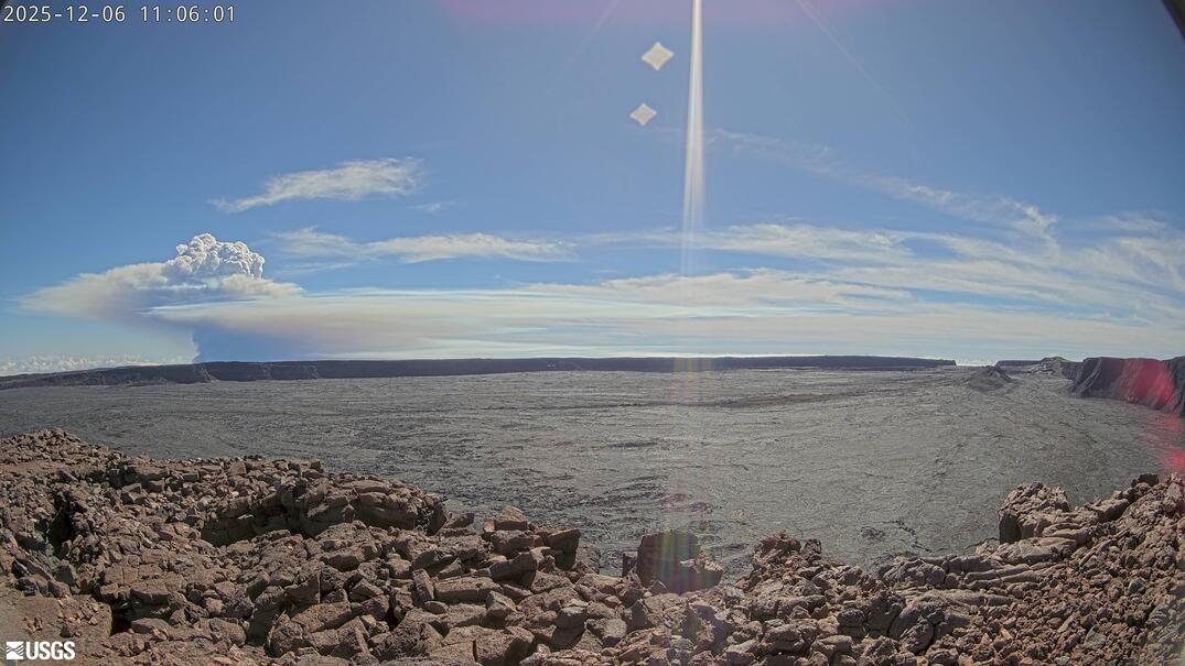
(MKcam, live)
Also visible from Mauna Kea.
VAAC advisory states the eruption plume is reaching 22,000 feet.
And for more excitement: a very shallow M7 at Mount St Elias on the Canada/Alaska border. Mid-winter so presumably no one would have been ion the area, but expect massive damage to the mountain.
It’s in the Elias range, but it’s closer to Mt Vancouver, about 100 km from the Alaska Highway. I assume that’s far enough away to have avoided serious damage.
Pretty close to a Hubbard Glacier on Disenchantment Bay. around 25 miles.
Looks like the north vent is weakening.
Wow… while the northern vents are losing steam… the southern vents are still going strong… and continue to erupt powerfully.
Something tells me the pressure on the southern vent has been so intense that it’s opened up completely and is now at full power… more so than the other eruptions.
Has supresed the north vents…

The north vents has gone… and the south vent dont stop… As if he’d killed them… it seems he’s going to be the main vent from now on…
Of course there’s only one way to find out, and that’s with episode 39, but I don’t think south will be the main vent. Even during the significant gas pistons which affected the tilt meters, south never managed to start an episode during one. North vent always needed to do that. North vent on its own is, also, good for roughly 200 m³/s lava effusion for some time now, although south does have the edge here as it contributes 250 m³/s to the total. It’ll probably be more now, but aside from being the most efficient at expelling lava, it otherwise seems north can do without it, as shown by the numerous episodes where it erupted solo, while south needs to be coaxed into fountaining by north.
Based on this I consider north to still be the main vent, while south is, perhaps, a stupidly powerful satellite/parasite vent of north. In any case it’s still a unique situation to me, because usually a long-lasting eruption centers on a vent until the end. Here are, for some reason, two on which it has centralized. Tall fountains? Been there, done that. In the summit crater? Been there, done that. Building a tephra hill tall enough to now be referred to as a pu’u? Been there, done that. But two central vents? Don’t think that’s happened, for so far I know, before in the recorded history of Kilauea. I believe the central vent of the June 2023 eruption was one conduit with an upper and a lower outlet, not two central ones in the sense of the current eruption?
Honestly, at 9:36, something changed in the south vent, and it escalated until 9:46, when it “broke down,” and in all three cameras, it’s clear that something “detonated.” A collapse? The north vent has been “dead” for two hours.
I don’t think it was a collapse, quite the opposite. Looking at the V3 camera before its demise, there was a vent popping to the east of the south vent and before 9:46 hit, a series of vents (SE of the south vent) BLASTED, Jurassic World volcano-style, from the base of the cone in a line, flinging debris and quickly bury them in lava and pumice and quickly becoming dominant.
That blowout at the south vent happened in E35 or E36 too, and in the same spot I think. RIP V3 cams lol
Strange to think alot of this driving these mega fountains is just superhot water vapour its mantle water that been freed from minerals chemical bounds when they melts into magma. The water from the deep mantle coud be 100 s of millions of years old if not billions. Our primodial oceans themselves where steamed out from active volcanoes a very long time ago after Earth formed its first crust from the primodial magma ocean
The ash at Semeru is still causing steaming lahars though this doesn’t seem to be a new eruption, just the ash from the last one. Though to me it looks like there is a fumarole under that bridge.
I am watching the current Kilaeau eruption episode with the south vent still fountaining. I want to ask what might be considered a dumb question, but why does this fountain keep being angled to the south? If the high pressure of the magma is flowing, wouldn’t it carve a straight up vertical fountain?
Hard to know! The angled fountains have always been away from the caldera wall, so one possibility is deformation of the upper conduit by the sliding of the thick tephra down the side of the caldera. Another option is that this is indeed a side shoot of the real conduit. It is like a constricted hose pipe with a bend, except that the driving force comes from the rising bubbles and therefore a bit deeper the conduit has to be up. But once the flow reaches its final velocity if 100-200 m/s, it can bend with the conduit
So very interesting discovery, and one which might be especially relevant right now.
Basically the deep Pahala quakes return to pre-2018 background at about the same time the current summit eruption starts. There was no affect with any other eruption at all since 2018, including at Mauna Loa in 2022.
IRIS earthquake browser with all settings:
https://ds.iris.edu/ieb/index.html?format=text&nodata=404&starttime=2020-12-18&endtime=2055-01-01&mindepth=20&maxdepth=100&orderby=time-desc&src=iris&limit=25000&maxlat=19.55935081&minlat=18.93361616&maxlon=-154.96053411&minlon=-155.59171843&sbl=1&zm=10&mt=hyb
https://i.imgur.com/e4O4a7W.jpeg
In addition its possible the recent and seemingly significant deflation at Mauna Loa in the past few weeks, after pretty much continuous inflation since its last eruption, could be related. That is Mauna Loa is deflating to repressurize the Pahala source, because it is erupting at Kilauea.
Basic idea Mauna Loa could be draining into Kilauea, technically. 🙂
This episode 38 was different to the previous weak two episodes. Maybe there was a significant amount of deep magma involved that found the way to the southern caldera.
E38 showed strong deflation on SDH and IKI stations (south and east of caldera), while E36 and 37 mainly had deflation on UWD (Halema’uma’u). The weak episodes were probably mainly driven by a shallow magma chamber, while the strong episodes like E38 are mainly driven by deeper magma reservoirs that can in good circumstances “communicate” with Mauna Loa somewhat.
https://browser.dataspace.copernicus.eu/?zoom=13&lat=-1.40836&lng=29.18776&themeId=DEFAULT-THEME&visualizationUrl=U2FsdGVkX1%2BuvmavLVx6Owd7veZG8wcD6GtGTblzw7jkSt1W2nb%2BxeDVmrT3hUQyAL%2BLYqBWVy9sQ4uhI06Lx2E77Eu72yfueDjts8A6HW24itNRnAEhIOG3H%2BqBebEr&datasetId=S2_L1C_CDAS&fromTime=2025-11-27T00%3A00%3A00.000Z&toTime=2025-11-27T23%3A59%3A59.999Z&layerId=6-SWIR&demSource3D=%22MAPZEN%22&cloudCoverage=100&dateMode=MOSAIC
The huge lava lake and pahoehoe fields are still active at Nyiramuragira this is a likley future scenario for halemaumau if the vent system manages to get more open and wider
Even HVO sounds impressed
https://volcanoes.usgs.gov/hans-public/notice/DOI-USGS-HVO-2025-12-07T00:34:25+00:00
An impressive tephra clould, looks like a VEI2 to VEI3:
https://d9-wret.s3.us-west-2.amazonaws.com/assets/palladium/production/s3fs-public/styles/half_width/public/media/images/IMG_2170.jpeg?itok=bIbkEfxe
https://www.usgs.gov/observatories/hvo/news/photo-video-chronology-december-6-2025-episode-38-kilauea-summit
There once was a mountain on fire
that tried many times to retire
every time it stopped
both north and south vent popped
and the fountain of fire went higher
That’s really nice! Thanks Albert!
Episode 39 will be fun and perhaps even taller…behind this is the true wrath of Sauron/ Melkor…his next one will be even more severe
Eruption Wipes Out Live Webcam With Lava Fountains! Episode 38 of Kilauea
Shawn Willsey: Geology Explained
And the final `10 minutes of V3Cam
How far did the lava drops solidify during the long flight?
The demise of the V3 camera has attracted a lot of attention. The explosion that caused it – not as much. Here is the HVO video stream of that moment. The explosion occurs around 1 minute in
Extremely hot! is completely orange in daylight if the Pahala sourge surfacing so it maybe up to 1250 c. Still colorwise it does not look that much different from Fagradalsfjall lava and Galapagos lava but it coud be much hotter still, the deep magma source in the astenosphere is perhaps over 1600 c but it will cool of course on its way up. I hopes we gets magnesium and temperatures and olivine compositions soon from USGS that will allow us to estimate how fresh the magma is compared to earlier magmas even if all Kilauea summit magmas are all rather very primitive compared to many other thoelitic basalts. lava cools very quickly on its surface so the hot clasts hides their true color inside the lava fountain
How can we explain this enormous lava explosion? Was there a similar effect like the suddenly decreasing gas pressure in a Plinian eruption?
I can only guess. In these fountains, you need a magma with a gas fraction that is low enough that it remains magma with gas bubbles, rather than a gas with magma drops. As the gas bubbles expand as the pressure reduces, it accelerates the magma to the speeds seen in the fountain. If the gas fraction gets too high, the gas just escapes and leaves the magma behind (as happens in the overflow pulses before the fountains). Now if you get a new batch of magma with a bit higher gas fraction, it will accelerate more. That runs into the slower magma ahead. This wave of compressed magma caused the explosion. Just speculation. HVO may have a better explanation.
Very similar looking to Io s lava but
Io s lava is likey much hotter still than this. IF Halemaumau/ Kaluapele calderas was on Ionian scale it woud have to be around 120 kilometers wide and have walls perhaps 2 km high
Next time I wants an Ionian scale eruption but its really suicidal wanting Twasthar Catena in Halemaumau
Very nice video now that is orange! it kind of looks like Bardarbungas lava but this coud be even still a bit hotter than that and it woud not supprise if it is
E38 had the highest volume of all episodes so far: 12.6 million m³ = 0.0126 km³.
BREAKING: Major M7.2+ quake just off the east coast of Aomori. Tripped my warning software. Tsunami advisory issued. Hit 6+ on the Shindo Scale despite being 50-60 km. depth.
Upgraded to tsunami warning. Another bad night for Tohoku.
Now magnitude upgraded to 7.6. This is a bad one.
Tsunami did occur but the height was limited and no damage from it reported. There is some damage from the earthquake itself
Related to recent article about Venus, perhaps:
https://watchers.news/epicenter/hku-researchers-uncover-new-tectonic-regime-reshaping-our-understanding-of-earth-and-venus/
Quote:
Using advanced two-dimensional mantle convection models, the researchers simulated planetary interiors over a period of 10 billion years, incorporating mantle melting, crustal differentiation, and magmatic intrusion.
The result was the identification of six distinct tectonic regimes, each representing a unique way planets release internal heat and deform their surfaces.
“Through statistical analysis of vast amounts of model data, we were able to identify six tectonic regimes for the first time quantitatively,” said Dr. Lyu. “These include the mobile lid, the stagnant lid, and our newly discovered ‘episodic-squishy lid’. This new regime is characterised by an alternation between two modes of activity, offering a fresh perspective on how planets transition from an inactive to an active state.”
The six regimes, mobile lid, stagnant lid, sluggish lid, episodic lid, plutonic-squishy lid, and episodic-squishy lid, capture different levels of surface mobility and internal convection. Earth operates in the mobile lid regime, dominated by plate tectonics, while Mars remains locked in a stagnant lid, preserving ancient impact scars. The newly defined episodic-squishy lid lies between these extremes, alternating between partial motion and quiescence, bridging a long-standing gap in planetary dynamics.
New post is up! Tallis goes quantum
https://www.volcanocafe.org/my-treasured-trio/