
Hekla during the 1980 eruption. Photograph by Oxonhutch, Wikimedia Commons.
I was asked to write a small weekend piece while we wait for Albert to finish the second part about Grimsvötn. My original idea was to write about people eating volcanoes, but thankfully Iceland saved us from that.
As many of you have noticed Grimsvötn has thrown some big ones since my part of the two-part article, but I know that Albert is diligently working those ones into his article, so I will leave out Grimsvötn being hard at work to meet that 31st December 23.59.59 o’clock deadline to outshine the Reykjavik fireworks.
Stars

Stars in the night. Image by the Icelandic Met Office.
Iceland is most likely the only place on earth that will cause people to look down towards the ground if you say, “Oh, look at the stars”.
As many of you know a “star” is an earthquake above M3 on the Icelandic Met Office earthquake page. As I write this there are 3 stars in Iceland at Bláfjallaskal, Grimsvötn and Hamarinn. And as we all know, big earthquakes in volcanoes can be signs that things are about to go down.
Problem is that Hamarinn can throw these now and then without any impending doom, and the same goes for the tectonically active part of Iceland that houses Bláfjallaskal. So, if big things are not necessarily a sign of big eruptions, where do we look?
Hekla

Sideways plot showing the earthquakes of Hekla. Image by Andrej Fliis using data from the Icelandic Met Office.
The last 24 hours are among the most interesting and downright intriguing in volcanological history, and that is even counting eruptions like Cerro Hudson, Holuhraun and Pinatubo. The air was filled with the brimstone smell of heavy science data collection being done in the dark.
Before and during the 2000 eruption of Hekla the monitoring network was not bad for its time but compared to today it was a kayak crossing a small lake compared to a rocket hurling a Tesla playing David Bowie towards Mars.
Not only have we gotten more seismometers, GPS-stations, strain meters and a new funky multigas-measuring station. All of the old equipment has been replaced with new and far more sensitive instruments.
Basically, what will trigger the automatic system today would be hard to manually find back then. Today the automatic threshold is a staggering -1.2 on the moment magnitude scale. And it is possible to manually see earthquakes that are even smaller.

Possible location of deep conduit, upper magma reservoir and vent conduit. Image by Andrej Fliis using data from the Icelandic Met Office.
The same level of upgrades is also there for the GPS and the strain meters. And we have the gas station on top of the mountain and an infra-sound detector down at Katla.
Yes, there are more pieces of equipment on a couple of volcanoes, but nowhere on earth is the average density versus quality higher.
I am mentioning this for two reasons. One is so that you will understand that there are more earthquakes picked up now than during the last eruption. And the second reason is that we can now be almost certain that we will be able to pick up the pre-eruption signs of Hekla.

This is my prefered interpration where we see a wedge shaped magma reservoir with earthquakes indicating pressure release zones and/or vertical sills. Image by Andrej Fliis using data from the Icelandic Met Office.
Obviously, we are not entirely sure what those signs are, since we have never seen them before, but we can make educated guesses. And, we can also compare it to the 2000 eruption signs that we did pick up and extrapolate from there.
Only problem is that apparently Hekla is throwing us a Black Swan moment. Because according to our known extrapolations and guesstimates Hekla started an eruption this morning. At least if we go with the seismometer network data.

2018 earthquake activity showing well the location of the current activity. Image by Andrej Fliis using data from the Icelandic Met Office.
So, where is the brimstone and fiery doom that our beloved Hekla is famous for? I will now try to answer that question.
In 2011 all seismic network upgrades except station HES was in place. From that moment the data quality does not increase a lot and we can safely say that there is no large technology skew increasing the numbers of earthquakes. Well, except in the direction of HES obviously, and that HES gave us better depth resolution.
The 2013 Hekla Seismic Crisis

IMO earthquake page showing the earthquakes that caused this article. Image by the Icelandic Met Office.
In 2013 Hekla threw up it’s most numerous post eruptive earthquake swarm. At the time it was assumed that Hekla would erupt, and even the Icelandic Met Office put up a bulletin that an eruption at Hekla was imminent. I was also fooled by Hekla and thought it would go off.
In the end no eruption occurred but post the seismic crisis that has been the benchmark of what the maximum unrest Hekla could withstand without an eruption following.
I had a bit of a problem with that idea. The location of those earthquakes was not in line with what had been observed prior to Hekla’s last eruption in 2000.

Hekla seismic trend plot. Notice the difference in M0.8 earthquake count between this month and 2013. Image by the Icelandic Met Office.
In 2000 against what most people believe there was a small swarm about two weeks prior to the onset of eruption. That small swarm occurred slightly west of the southern terminus of the Heklugjá fissure swarm.
It is normally said that Heklugjá is 7 kilometres long and that it runs the length of the actual mountain. But that is the top of the fissure that normally opens during an eruption, the fissure at depth is a bit longer. Perhaps 3 km to the NNE, and some 7 to 10 kilometres further SSW. This is very clear on the plots that Andrej has made for this article.
The pre-eruption swarm in 2000 is a logical place swarming for a fissure system under intense magmatic pressure, because the pressure will attack the weakest points to make room for that magma.

Earthquake trend plot for Hekla of all data. Please notice the increase as the big upgrades of the system came online. Image by Andrej Fliis using data from the Icelandic Met Office.
The NNE end is fairly blocked off due to the neighbouring Torfajökull volcano, and the Vonarskard and Veidivötn fissure swarms taking care of the business Icelandic continental spreading.
That means that the best spot to grow is the SSW end, and this is evidenced by that part being considerably longer than the NNE part.
In 2000 the ever-increasing magma pressure tried to make more room at the southern end causing pressure induced earthquakes there. In the end that did not work well enough, and the pressure after a while attacked another weak spot, the topmost part of Heklugjá that runs the length of the edifice known as Hekla proper.
No such thing was seen in 2013, so in hindsight the obvious conclusion is that the pressure was not high enough for the earthquakes to be part of a pre-eruptive sequence.
Under pressure

Earthquake versus depth plot over time. Image by Andrej Fliis using data from the Icelandic Met Office.
If the relatively small earthquake crisis in 2013 can be called a seismic crisis what we are seeing now is more like seismageddon (in a piddly Hekla way). Just to put it into perspective, the total earthquake count now is 3 times larger, and the amount of earthquakes per month above M0.8 is by now twice the number.
So, just on pure numbers this has transcended 2013. But that is not the point that is important. The important thing is the location.
This time a large percentage of the seismic activity is slightly west of the southern terminus of Heklugjá indicating intense pressure. The earthquakes are though small, the same as in 2000.
Since the network now is far more sensitive than in 2000, we are seeing quite a few more small earthquakes. That is why the IMO is using the M0.8 and upwards as the divider for their master plot. A M0.8 earthquake was easy to detect in 2000, and none of those would have been missed even at the old network, so this makes it easy and accurate to compare with now.
All things taken together, we know that the GPS-system says that the pressure levels by now are higher than they where back before the 2000 eruption, we are seeing magma system pressure earthquakes at the correct location, but we are not seeing any untoward twitching on the strain meters.
So basically, we have 2 out of 3 of the prerequisites known for an upcoming Hekla eruption. And the strain twitching normally starts just a few minutes prior to onset of eruption.
Conclusion
I will not say that Hekla will erupt soon. Suffice it to say that there are far more signs of an eruption being on the way now compared to 2013.
It has been an interesting and exhausting 24 hours, and even if there will not be an eruption this time around, Hekla gave us all a true masterclass in volcanology, and for that we will have to be thankful.
CARL REHNBERG


This is the all things Hekla article for the moment.
Albert is coming with the part 2 article about Grimsvötn in the beginning of the week.
so, we have a reasonably good chance at an eruption, but we also have a ton-o-data to use as future reference. Wonderful.
Sweet sulphuric smell of science in the morning!
yeah, but for it to be real science, we’ll have to watch a few more swarms and eruptions. it’s not science if it can’t be repeated. On the other hand, we’re recording it, so we will have more data in time, and that’s all that matters, no?
And just as I posted a fourth swarm in 24 hours started.
Interesting thing I just noticed. The strain twitching increased up to the earthquakes started and then it calmed down after the pressure was released.
This is not healthy in any volcanic system since it means moving magma at depth.
interesting, so it’s basically going up, cracking, thus creating more room so strain is lost till that room is filled and the pressure builds again. seems like a textbook set-up. joy.
And we now have swarm number five. I am now officially saying that we are not in Kansas any more.
Personally, I don’t want to be in Kansas right now. Too cold for me even though I love the cold.
Additionally, Fort Leavenworth is in Kansas…
Dunno if it was Kansas, but years ago (WW-II era) One of my uncles was stationed in a frequently snowy part of the US. He was raised in central Mississippi… his letter home stated that the snow was so deep that “A mule would have to jump to fart.”
Where I come from I had to jump to just be able to see where I was as I burrowed my way to school.
So? Should we put bets on the show starting tonight, tomorrow, next week after Christmas? Any decent oddsmakers here?
You know, just for fun.
Hmm, i’ll place a bet on some time between tomorrow and Wednesday. probably wrong, but meh, i tried~
I seen many old Hekla lava flows in Google Earth, they are just south of Hekla.
These basaltic andesite or andesite lava flows are enromous! a few km3 for each one.
Carl did Hekla do huge lava flows in the past?
I wish i coud get a Google earth screencut here
No it didn’t, the flows are a recent thing. The big flows came out of Vatnafjöll.
Thanks for these articles, Carl. Interesting stuff!
Meanwhile of course, I have to be on a holiday on a laptop with poor wifi 300 miles from home.
So calm down, naughty Iceland. No erupting while I’m away. Can’t have you huffing and puffing, it won’t do you any good until I am back at my home PC.
Look forward to Albert’s mathematical and algorithmically intense work.
Is there currently a good webcam for Hekla? Mila seems offline and the Burfell ‘dalek’ webcam on the IMO website is still showing an image from 2017!
I was going to ask the same thing. I need to wear out my F5 key again.
Someone should give Mila a holler so that they go and fix it before the show starts.
It works, a little hunting through this place and you might just stumble upon it. Sorry no direct link to post
http://brunnur.vedur.is/myndir/webcam/
Hekla was once belived to be the gates of hell.
In sweden the remote fiery peaks of Hekla and Katla is deeply rooted in folklore.
“dra åt häckelfjäll” in swedish means “go to hell” “go away from me”
That volcano was blamed for alot in the old good days. Always to be feared and never to be visited.
Today we knows that Hekla is just a volcano ; )
The bane of politicians and stand-up comics, the last thing they appreciate is a noisy Hekla…….(I’ll get my coat) But more seriously, this cycle of strain buildup and release sounds like the sort of environment for Long-period quakes (ie tornillos) or is this something else entirely?..
Tortillas are a valid indicator here as well. Magma + Crack in rock = fill the crack → Tornillo. The mechanics are the same, though you may see the little cousin of tornillos that I call “poppers.” I saw bucket-loads of them on Redoubt’s drum plots.
What do they look like? Like time squashed tornillos. Itty bitty “wet” quakes. (“Wet” as in Carl’s description of a slight harmonic component along with a quake. The coda stretches out a bit more that a standard quake. Not as long as a tornillo, but a similar effect. (From what I’ve read, bona-fide tornillos can be 10 second or more in length.)
(They look like a screw, hence the name)
Tortillas? What about their cousins, Burritos – the rolled over seismic signal, or their flatter cousin, the Taco? Very common around Californian and Mexican volcanoes.
I’ll shut up now…it’s late.
This is a really interesting swarm. Looking at it in 3d shows that most of the quakes are aligned on a plane that cuts the surface along the Heklugjá fissure. The magnitudes so far are small – not a single one above M1 – but I would stay well clear of the mountain anyway.
I would stick outside the 32 kilometre mark. It’s the furthest it has killed someone with a lava bomb.
Sounds wise. One of my strongest memories from my first visit to Iceland was when I realized that i was on road 26, 15-20km north of Hekla and the landscape was full of old lava bombs.
I’ve been there too.
Seeing that is when you really start to grasp how insanely powerful the initial blast of Hekla is compared to other volcanoes.
I also had “nightmares” when hiking 10km east of Katla in a black sandy desert and the landscape is littered with plenty of lava bombs around.
I will make a prediction. I would say that there is a 70% change of Hekla erupting within the next two weeks. If 2000 repeats as a pattern (a swarm two week before the eruption), then we will be seeing an eruption by the 8th of December.
And a 90% change of an eruption until April 2019.
Remember that once I did a statistical study and realized that Hekla seems to have a preference to erupt in winter and early spring time, between December and May (and especially between January and April).
It’s odd, but also remember that Katla seems to have a preference to erupt between July and October. No other Icelandic volcano has a seasonal preference for their eruptions.
MARK MY PREDICTION: 2019 may well be the year with two Icelandic eruptions, both quite predictable: Hekla, followed by Grimsvotn.
Why Hekla: because I find this November 2018 swarm is a sign that the volcano is about to erupt. Why Grimsvotn? Because cumulative seismic release is so predictable for Grimsvotn.
I will eat my chocolate hat if I am wrong.
Well, there’s always the chance that Katla could do something over the next year to. They’ve mentioned that the caldera floor is steadily weakening and that it likely can’t take another intrusion.
I wait for a clear period of sustained inflation, plus many strong and noisy earthquakes of M3 and M4, for 3 months before the actual eruption (like it happened in 2011). At the moment, changes of Katla erupting in the next few months are relatively small. So is Oraefajokull. I also expect noisy earthquakes swarm, similar to Katla 2011. Both volcanoes will erupt in the next decade or two, but not in soon.
Hekla and Grimsvotn are much more likely to the be the next ones to erupt.
Reykjanes could throw a surprise.
Also interestingly is this: Iceland seems to have came alight. It’s not the first time that I have seen this and I start to suspect if sometimes magmatic pulses from the Icelandic plume affect the whole of Iceland in a single instance.
If a pulse occurred yesterday, it may explain why we saw so many earthquakes around Iceland. Including one in the dead zone again. But this is a more surprising theory, that would require extraordinary evidence to confirm it.
As I am doing a lot of microscope work, I am used to zoom out to to get an overwiev. Doing this with north atlantic view, I get the feeling (would be nice to check with time/map plots) that these episodes of increased activity often are coming after or together with swarms north of Iceland along the MAR.
The same thought occurred to me. Sudden increased activity from Reykjanes to Tjornes. Interesting. Exciting times; Hekla is looking like a banker since I voted for it in the recent poll.
Thanks for this article. Can’t wait for Grimsvotn part two.
Nice description Irpsit. I once likened these to Iceland “breathing”. They certainly seem to come in waves of a kind.
I remember such an eruption in 2011. We saw in the same week, unrest in many Icelandic volcanoes, and the two suspected subglacial eruptions in Katla and Hamarinn.
That period was part of a longer period of significant unrest in Iceland, because 2 months earlier, Grimsvotn had also its very big eruption.
I think there was a pulse back then.
It’s possible that another such pulse happened in 2014. I am not sure what else (other failed eruptions and intrusions) happened in Iceland that year.
Also it’s important to state that in 2000 eruption, there were several M2 earthquakes before the eruption.
Now we have not seen yet a swarm with earthquakes above M2.
So I await a few M2+ earthquakes at Hekla proper, as a clear sign that an eruption will be starting. At least two of them within an hour should be a clear sign.
The network is just very sensitive now at picking what may be earthquake swarms before the eruption. This is probably one of them.
On the previous article, Jesper Sandberg wrote:
Iceland inspired Tolkien’s Middle Earth.
https://meetinreykjavik.is/tolkien-inspired-iceland/
Inspired by Iceland
https://youtu.be/f88UJyCA__M
It would be very unlikely but imagine if hekla erupted on its 19th anniversary of its last eruption. That doesn’t happen very often on any volcano.
That also has a personal significance to me because I turned 1 on that day and predictably I will turn 20 on heklas 19th anniversary 🙂
Hekla is my second favourite volcano after kilauea.
All Icelandic volcanos remain at green alert and nothing is mentioned about Hekla in the news. They are really careful about crying wolf, aren’t they?
Yes they are. They unfairly got a bit of flack after the 2013 bulletin.
1947 was a good example of a compostionaly zoned magma chamber.
It started with a very violent gas rich plinian andesite,with very fast flows of hot andesite.
Later was an effusion of andesite lava. As 1948 came the lavas turned more fluid and mafic as hotter materials deeper from the system came up. At the end of the eruption the lavas was likley completely a viscous basalt and this old video shows viscous lava tubes and channels: https://www.youtube.com/watch?v=oD8c_BN99QE
1991 and 2000 was more mafic than 1948 ( Basaltic Andesite to Basalt ).
The longer Hekla stays quiet the more the magma in its system evolve and change.
Thats why the large medevial eruptions that followed by long periods of sleep was very violent and sometimes ryholite at start. Some early middle ages eruptions was very violent and evolved.
The longer she sleeps the more violent it may get, but it also depends on how fast magma is supplyed to Heklas plumbing. A fresh basalt mix is something very diffrent than a stale old angry ryholite batch
Daring expeditions indeed! Hiking in rain of lavabombs. Wonder if any were killed?
Yes, one volcanologist was killed as a lava wall collapsed.
very similar to a distillation collumn, light ends to the top
That is exactly how Hekla works.
Due to rapid heat convection the light explosive stuff is rapidly carried to the top, while the heavier non-explosive stuff build the next layer.
Thanks for the video link. I was amazed at the audacity of the geologists at 11:00 in all the lava bombs, and the sombre reminder of pooled CO2 in the hollows, at the end.
The life expectancy of Icelandic explorers and volcanologists must have been at an all time low, back then. What with dragging on cigarettes and pipes before going up Hekla for a few hours of sulphur and other noxious gases, before returning for a load more ciggies. Made of stern stuff in those days. Made me feel chesty just watching it.
It is reasonable to expect now a slightly stronger eruption, as Hekla has remained almost 20 years without an eruption. Most eruptions in the medieval times were about 50 years apart. So this eruption can be sort of in between the more recent eruptions and the violent intensity of those medieval ones. We could then expect a VEI4+, around 0.7km3. It could be pretty strong.
I doubt it would be that big. Low VEI-4 at best but most likely a mid VEI-3. 1947 was only 0.2 km3.
One should remember that we are on both a rifting cycle and a plume cycle.
It could theoretically super-charge things a bit, even this far from the center of the plume head under Kistufell.
Yup hiking fast moving viscous blocky lava flows are dangerous
The tall flow front sheds glowing hot rubble constantly ( like a Aa flow does )
Heklas blocky flows are just a more massive and viscous version of Aa.
Heklas Andesites are hot and rather fluid for andesites and they go fast down the slopes.
Its crazy they climbed the active flows in that 1947 Hekla film, Also rubbly blocky and Aa flows are extremely hard to climb almost impossible all the rubble and clinker as the crust gets grinded to rubble.
I have climbed massive Etna Aa flows thats resembles Heklas more fluid ones and they are pretty impossible to climb. Shoes gets grinded to a plup and its risk of falling and breaking bones.
Many viscous Etna flows resmebles heklas flows alot even IF Hekla is more sillica rich and much faster eruptive rates.
Aa lava flows move quite slowly and the crust breaks into rubble called clinker that tumbles down the moving flow front.The plastic flow core is hidden beneath this crustal rubble.
It advances like a tank caterpillar wheels. In cross section an Aa lava flow haves an outer rubble layer, a hard dense flow core that show some cooling joints and a lower rubble layer. The lower rubble layer is the falling clinker that the flow have overridden. Aa flows can be very massive and crushes everything in their path.
Jesper, I think Askja saw your video and wanted to join in on the fun. There is an unusual swarm to the SE of Askja. I think there were a couple of quakes earlier this week between Askja and Kverkfjöll.
Askja is a fun volcano : )
It either do basaltic eruptions ( Hawaiian and Strombolian ) from mantle source
Or evolved plinian eruptions from a crustal magma chamber in the central volcano.
Decompression melting after the ice age made the huge Odadahraun is the most extensive pahoehoe lava field in Iceland, with a total of 6000 km² area, Askja is sourrounded by that lava field
Yes, that area of Iceland has seen really huge shield eruptions. It’s in the region between Bardarbunga caldera and the north coast. One finds shield all the way along.
Holuhraun erupted right in the middle of such region, and this was the reason why I thought it was the start of a small shield eruption style volcano. It could even erupt again in the future and form a shield. Who knows…
The only exceptions in the region, central volcanoes with calderas, are Askja and Krafla.
Almost everything else there is a shield or sort of.
But 1875 eruption started as a major rifting fissure, that drained the Askja caldera. The fissure was located some 50km north of the caldera.
Just 2 weeks left until I goes to Hawaiis Big Island < 3
My favorite place on this cosmic stoneball
It will be fun to visit my favorite volcanoes Mauna Loa and Kilauea!
Giant Shield Volcanoes and Tropical climate and worlds clearest tropical ocean
Jesper,
Some tips;
Make sure you pack any stuff that cant get wet in plastic in your suitcase. It can rain at any time on the big island, including when you are getting off the plane. Depending on the airport, there may not be a jet bridge. A plastic garbage bag in each of your carry on bags can be used as a “bag raincoat” that will protect that stuff from the trip from the plane to the gate, to the car rental bus. Bring poncho’s for hiking, bring them with you all the time, we could have used them getting off the plane in Kona the first trip! Don’t leave valuables in your car when you go hiking.
Send more later.
Mac
Jesper has been there at least once before and to a lot of other odd places to hug big volcanoes. I think he will be fine 🙂
Stuff to do, near Hilo, other than the park.
Akaka falls state park 400 ft fall, rainbow falls (to see the rainbow you need to be there early)(huge Banyan tree off to the left), both near Hilo. On the way home from Akaka stop or just drive by the Hawaii botanical gardens, lovely drive, old Mamalahoa highway. There is a lava tube you can visit in Hilo. Turtles can be found in Hilo at Carl Smith Beach park, very busy on weekends, you can snorkel there but the water in the back right corner is fed by very cold fresh water springs. The turtles may approach you here since some locals fed them lettuce, don’t feed them, just enjoy.
Nice drives, depending on road closures; Government beach road (1 lane), drive thru Hawaiian Beaches subdivision to the coast and go east/SE, until they stop you (we were stopped at Papaya Farms road during the eruption).
Highway 130 from Pahoa toward Kalapana, then 137 toward the NE (one lane road) to Isaac Hale park, the lava flow will stop you there unless the law stops you earlier (Kalapana Kapoho RD). You can also go the other way on 137 towards Kalapana, amazing that you cant see Mona Loa from there since Kilauea blocks your view. Both of these drives have trees growing at angles due to the winds.
Mauna Loa road may give you a view of the Kilauea caldera, was closed when we were there, you might have to get to the second tree line to get a view?
Green Sand beach, read about the hike before you attempt. Many of the black sand beaches have easy access.
Mac
remind them if they try the green sand beach and don’t want to hike the long distance there are usually truck owners who will give you a ride for a price (bargain down, we did) was the ruoughest ride I ever took but worth it!
We are in quite interesting times with Hekla acting up a bit for the first time since there is proper monitoring in place and a rather high number of deep quakes in the whole of Iceland! It definitely looks like a small pulse is going on right now.
Is somebody able to comment on the regularly occuring deep quakes below Dreki? Which system do they belong to and is there something brewing up?
Dreki is another local name for Askja. And it has been having these deep earthquakes from 2013, but not much showing on the GPSes.
Yeah a few on the flank of Valdalda. I would say Askja is right at the start of the path of preparing to reawaken so I think it will be a fair while before it starts acting up big time. A few little jolts in Krafla caldera as if to remind us it’s still there. So I say to it “you’ve had your moment so shut it!” 😀
Interesting! Any idea why that is? Maybe a rather deep magma chamber that suffers regular intrusions? The depth would help to obscure bigger movements.
It’s a big volcano, and it suffered from 40 years of deflation after Krafla. But I am more voting for quite small intrusions so far.
There’s a smattering of small quakes to the north of Vatnajökull. But I think from past experience, at this time of year, quite a few of those could be ‘frost quakes’?
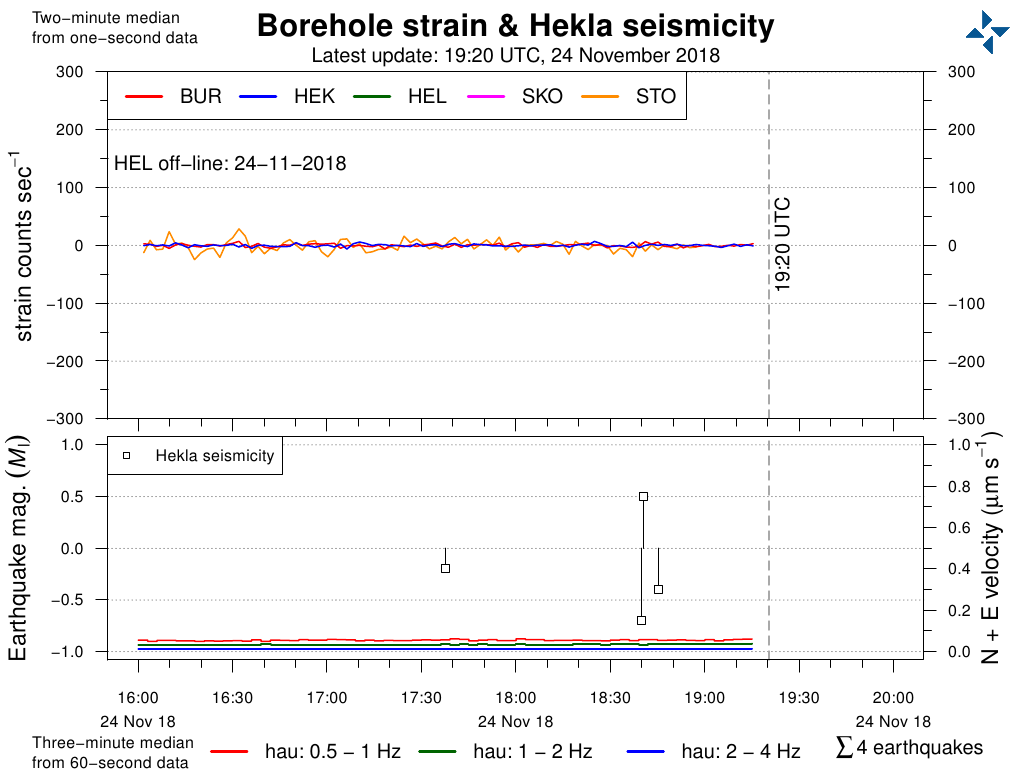
Quite a fair twitch on the STO strain plot around 17:10.
Distal earthquake, It was at the Iran/Iraq border, a M6.3
The largest basaltic eruption known in the vicinity of Askja central volcano is the Kollóttadyngja lava shield 17 km3. That happened some time between 4300 and 7000 years ago. The lava field covers an area of 74 km2.
Long lived slow shield eruption that likley lasted for decades.
It left lots of pahoehoe lavas and small tube systems. The active vent likley had lava lake and spattering hornitoes when it was going.
It is one year since the start of Agung’s eruption already!
Hawaiis Big Island is my favorite place on the planet= Soon I will be there again!
17 Decemeber I will drive up to the Co2 obervatory on Mauna Loa and hike to the summit caldera.
If the weather is good. I must be careful and follow trails and keep track to not get lost on this enormous volcano. Mauna Loa is the worlds largest volcano she is 250 km wide and 18 km high in total.
All other volcanoes are nothing in comparison to Hawaiis mass and size.
I will drive around and explore many parts of Mauna Loa including Papakolea olivine beach.
Hawaiis Big Island is home to over 10 climate zones beacuse Mauna Loa and Mauna Kea blocks the trade winds causing one dry and wet side and they are elevated. Big Island haves amazing natural beauty.
I will also visit Mauna Keas summits with the big telescopes, there you can drive all way up.
Kohala and Hualalai will be visited to by me volcanoes that I never been too.
I will also visit Kilauea thats my favorite volcano : ). Im going to spend 6 whole days at halemaumau caldera and explore the new 2018 s caldera formations. I will inspect Halemaumau.
Kilauea IKI will also be visited the famous 1959 s show and I will visit the vent of that too.
I will inspect and hike the Chains of craters at Kilaueas ERZ zone and look at all pit craters.
I will also hike Mauna Ulu to look at drained lava crusts and lava trees and Hike to Mauna Ulus summit.
I will hike lava tubes and also visit the 1983 – 2018 Puu Oo flow fields. There will be loots of hiking over the old 61 G flow that was active last spring. Thurston lava tubes and Kazumura lava tubes will be explored too one of earths very largest lava tubes all in the HVNP park.
I will also visit the South Rift zone on Kilauea and see the Kau desert thats a good place to look for peles hairs that was blown from Halemaumau lava lake.
Fissure 8 at Leilani eruption is a freaking must visit for me! Thats the site of one of the largest lava eruptions since Laki. KIlaueas summer eruption relased more than 1km3 of lava. The lava fields will still be very hot when I gets there some months after the eruption stopped. Leilani and Kapoho is in for a visit by me this is a must see to see where it all happened this summer.
Wow! That is quite a complete volcanic tour around the Big Island.
Hawaiian runny fluid pahoehoe flows are much easier to Hike than Etnas nightmarish Aa rubble.
But Hawaiian pahoehoe is razor sharp when its fresh its glass, its smooth and flat but my boots will still be grinded to a pulp on the sharp glassy crust.
Fresh Pahoehoe is shoe destroyers and specialy shelly pahoehoe
Bring along good quality hiking boots if you can. Or even steel-toed boots (I actually own a pair of those). And a walking stick. Sharp pahoehoe pieces shouldn’t be too much of a problem as long as you have good hiking boots and a stick (to keep from falling over if you trip). What you really might want to be careful about is that you could potentially fall through thin shelly hollow pahoehoe – or God Forbid, still-molten hot lava underneath.
Also a good idea is to bring along a warm enough spring jacket – winter nights at higher elevations like at Kilauea’s summit can get surprising cool. Same goes for even at the beach after dark. Trust me, I’ve even had the misfortune to not have a jacket or a long sleeve tee with me while at a luau* in Maui on a January night few years ago.
* Traditional Hawaiian feast. You should try going to one of those at least once.
Seismometer to Mars!
https://www.nasa.gov/feature/jpl/nasas-insight-is-one-day-away-from-mars
NASA’s InSight Is One Day Away from Mars
In just over 24 hours, NASA’s InSight spacecraft will complete its seven-month journey to Mars. It will have cruised 301,223,981 miles (484,773,006 km) at a top speed of 6,200 mph (10,000 kph).
Engineers at NASA’s Jet Propulsion Laboratory in Pasadena, California, which leads the mission, are preparing for the spacecraft to enter the Martian atmosphere, descend with a parachute and retrorockets, and touch down tomorrow at around noon PST (3 p.m. EST). InSight — which stands for Interior Exploration using Seismic Investigations, Geodesy and Heat Transport — will be the first mission to study the deep interior of Mars.
https://mars.nasa.gov/insight/spacecraft/instruments/seis/
Measuring the Pulse of Mars
InSight’s seismometer, SEIS, the Seismic Experiment for Interior Structure, is a round, dome-shaped instrument that sits on the Martian surface and takes the “pulse” or seismic vibrations of Mars. Its measurements provide a glimpse into the planet’s internal activity. The seismometer waits patiently to sense the pulse, or seismic waves, from marsquakes, and thumps of meteorite impacts. A suite of wind, pressure, temperature, and magnetic field sensors help fine-tune the seismometer’s measurements. This helps it sense surface vibrations generated by weather systems such as dust storms, or by turbulence in the atmosphere due to phenomena such as dust devils, which can also generate seismic waves. SEIS measurements tell scientists about the nature of the material that first formed the rocky planets of the Solar System. As it reveals what lies beneath, the seismometer may even be able to tell us if there’s liquid water, or plumes of active volcanoes underneath the Martian surface.
Tech Specs
Main Job To measure the pulse of Mars by studying waves created by marsquakes, thumps of meteorite impacts, and even surface vibrations generated by activity in Mars’ atmosphere and by weather phenomena such as dust storms.
Location Placed on the surface of Mars.
Power Up to 8.5 watts
Vacuum Chamber About 0.8 gallons (3 liters).
Data Return 38 megabits per day.
Live at NASA tv
There’s a live briefing and Q & A going on now which you can also rewind for the next few hours.
In one of the Q&A’s they are asked whether InSight might detect evidence of volcanic activity – the response was they weren’t in the best place on Mars for that and it wasn’t a main goal but, “We can hope we might hear magma deep underground“.
Landed successfully, The Marco relay cube-sats worked perfectly and telemetry was maintained all the way down. First picture received okay. The lander reports all normal so far and has already made direct X-band contact.
And if you doubted that IMO is taking things seriously. Fear not.
In the article I wrote that Hekla has the most dense qualitywise network on the planet.
Well, they just rewrote the book on sensor-sensitivity with 5! new seismometer stations. Pure nextgen stuff.
And here at Volcanocafé we are datahoarders so we ferreted them out as they where installed.
To not over-burden the IMO computer bandwidth we are mirroring them on our dedicated Hekla-page.
So, go and check out the brand spanking new HE1, HE2, HN1, HN2 and HS1 here:
http://volcanocafe.net/brennstein/graphs.html?fbclid=IwAR3LXNrxifci56V4_4mvNT6vxNp4Fl0WOkhvjX0Z2z1vK7D-0cJQrq97TKE
And just since we are crazy with back-uping our shit nowadays, here is our other Hekla doubling site.
Remember that these are F5, not automatic update. IMO updates them every 5 minutes, so no need to hit F5 every two seconds 🙂
https://www.volcanocafe.org/icelandic-volcanoes/hekla/?fbclid=IwAR2FZIRNbsdgA4Oq2sVkkaGJL-8TDuMFU3I-wAR3u1WXPnl2tAhSym5Ht18
What’s your take on Hekla?
Do you think it will erupt in soon, due to the recent swarm?
This is IF it follows the pattern developed between 1947 and 2000.
I think there is a possibility that prior to 1947, Hekla behave just this way, with occasional small swarms in between each eruption, just like most volcanoes.
If that’s the case, we will never know what to expect.
I always remind that the area suffered substantial change, in 2000 and 2008, due to the big SISZ earthquakes. Previous big earthquakes were prior to 1947. So maybe they affected the stress of the entire region.
I will say that this is the closest we have seen Hekla to an eruption. This is far closer than in 2013.
But, the network is so fantastically more sensitive that we missed a lot of data in the runup to 2000 so it is hard to compare.
As long as we do not get that final swarm under Hekla with a couple M2s it will not erupt, but I would not be surprised if that came in the next few weeks.
Basically not for me to say that it will erupt, especially since this time around there are people living next door to the volcano. So, I will leave it to IMO this time.
That being said, I think you can guess what my opinion is. But since I like to keep track of my ability to forecast eruptions, I have given my opinion to the other Dragons as of now. They can later be the judges if I caught it or not. But, not in public no.
So I reckon that you do not want to make a public forecast because of people living in the region close to the volcano. I understand that.
I guess that there is more danger or liability to predict a no event and than something happening (giving a false prediction of security), than the other way around (which you may be accused of scaremongering in that scenario).
You are indeed correct. Near Hekla, one finds a few farmhouses, and summer houses too, and an hotel or two. At least within the 25km radius.
If that is the case, then that also applies for Oraefajokull, because that volcano is also smack in a region littered with farms and tourists. And even closer to the volcano than in Hekla case.
Katla is another problem. Vik and a quite many farms just around 10km of the volcano.
Exactly, predicting a volcano in the middle of Vatnajökull is less of a liability. Near people I happily leave it to IMO and Almannavarnaild.
I think you’re wise.
I get the thing about activity starting at the distal end of the fissure to the southwest, before Hekla proper gets into the act. But do you think there’s a possibility it may stay there, and a distal/flank eruption close to Vatnafjöll might ensue?
It would be surprising if it did.
There is always a chance for anything, but in this case it should be slim pickings. First of all Vatnafjöll has a separate magma system running in from a different angle, and secondly it has not erupted for more than a thousand years.
But then, Holuhraun pinball… 🙂
I think I noticed these in the list a couple of weeks ago. Could it be that the swarm of really small quakes that we see now is actually quite normal, only that they passed undetected before the addition of the new stations?
Sunday 25.11.2018 21:32:23 63.99 -19.646 0.1 km 0.2 99.0 1.1 km ENE of Hekla
Carl why is Bardarbunga less active than Grimsvötn , despite that Bardarbunga is much closer to the Mantle Plume focus?
Its Bardarbunga that should be Icelands most active volcano not Grimsvötn
Or Maybe its Kistufell that should be a monster central volcano and not a dead hill
The plume is just one part of a two part puzzle. The other being the center of the spread. Grimsvötn spreads more than Bardarbunga. It should though be stated that there is a dead race between them in regards of which volcano has erupted more lava.
Why Kistufell is not causing havoc is a very good one. I think the roof is to sollidified.
The centre of the plume is probably under Grimsvotn. It has been under Snaefellsnes, Langjokull, Hofsjokull, Bardarbunga… It moves in the SE direction, towards Oraefajokull.
In the long run, Bardarbunga will become as dead as Hofsjokull. Veidivotn will be dead.
The rifting will be taken by the dead zone near Eldgja and Laki and into Grimsvotn.
And in the far future, rifting will occur south of Laki and into Oraefajokull, And it will occure between Reykjanes and Westman Islands, and from there connected to Katla and to Oraefajokull.
How this changes north of Askja is a bit of mystery.
The plume does not move at all. It is completely static. It is the tectonic plates that move.
Right now the center of the plume head is smack bang under Kistufell, that has been proved by petrological tests.
As it is, it resides under the spread center of Iceland, so sooner or later the volcanoes will move away from the plume that in a sense of it is the center of Iceland and it’s growth. The center of spread right now is on the Grimsvötn fissure swarm. So Kistufell and Bardarbunga will in the future slip away to the west. In a more distant future Grimsvötn will slip away to the west.
But rest assured that Öraefajökull will never reside above the mantle plume again since it is moving away at 1.8cm per year from the static plume.
Öraefajökull sits on a remnant of an old rifting part of Iceland known as the Snefell-Öraefajökull belt. It used to take care of the rifting, but as it slid away it changed into the distance, and as it sliped away it started to die, as evidenced by the rhyolite dredges that are erupted now. And in not a to distant future it will join the dodo among extinct features of nature.
What we will see in a not to distant geological future is the slow dying of the entire western side of Iceland as more and more rifting is taken up by the line running from Theystareykir down via Grimsvötn onwards via the Vestmannaeyar.
The reason for this is obvious, this rift part is fuelled by the plume lifting it up creating a permanent tension regime through gravity, that is lacking in the western parts.
Hekla eruptions, since 1947. Could not find a 1991 eruption video.
Crazy to see the Icelanders going there, already back in the days…
https://www.youtube.com/watch?v=oD8c_BN99QE
https://www.youtube.com/watch?v=N7WP20BxynY
https://www.youtube.com/watch?v=Kfdb3MPbtZw
On the other side of the world, I was turning 1 :>
Excellant information on the formation of iceland always thought that the expansion caused the volcanoes to the west. Does this line extend west onto the Snaefelljokull pennisula or is this a separate system? Wow I think I have learned more in the last 24 then the last 4 years. Exciting and informative as to how a good team works. Impressed as hell with the 3D. It’s a Cadillac with all the extras. Looking forward to the upcoming days.
Harley
Snaefellsjökull (not to be confused by Snaefell on the eastern side) is also a remnant rift that is slowly dying off. The systems running out into the Reykjanes is though still on the Mid Atlantic Rift, but the MAR is as I mentioned above currently starting a jump to the east and will in the future go through the Vestmannaeyjar and it too will slowly die off.
Based on heklas last eruption, it erupted 0.11 km3 of lava. That gives a supply rate of about 0.01 km3 per year, although it is probably a bit more than that if not all of it erupts. This means that an eruption now, if no increase in supply has happened, might erupt about 0.2 km3 of lava, not small by any means but also not huge either. However if a lot more magma has been supplied due to increases in the hotspot (especially as the area probably got a lot more magma in 2010) then the next eruption might be a lot bigger.
Also along these lines, how high would the supply rate be expected to reach? Grimsvotn obviously has an enormous rate but also sits on the hotspot, hekla is far from the hotspot and also far from the ridge axis on either side, so it’s magma supply wouldn’t be expected to be huge, at its current rate it could probably erupt about 1 km3 a century.
Also a question, how is it known that the 1913 eruption happened from hekla, it looks like it was off to the side a while and so maybe it was a small eruption from vatnafjoll, same with 1878 and maybe also some of the other basalt flank eruptions in earlier centuries.
It was not from Hekla, I wrote an article about way back when based on Professor Erik Sturkells ground breaking work on Hekla.
Grimsvötn haves indeed an enromous supply rate
0,8km3 is the higher yearly estimation from from decompression rift+mantle plume sources and thats pretty crazy. Im soure this volcano can do enromous stuff much bigger than Skaftareldahraun
There is an estimated 500km3 of eruptible basalt magma inside Grimsvötn.
It can either do a huge fissure flood basalt or large plinian caldera eruption.
Iceland as a whole has about 1km3 per year. You do need to leave some for other volcanoes and for the rifts. A reasonable estimate for Grimsvotn is 0.01-0.02 km3/yr.
Then Kilauea haves a much higher magma supply as I always belived it had.
Hawaii winns spectacularly
I just looked up the volume of magma made every year, and kilauea at 0.25 km3 per year accounts for 1/100 of the entire Earth supply of 25 km3 per year, which does include mid ocean ridges.
This doesn’t seem that impressive, however there are at least 1500 active subaerial volcanoes in the world, so kilauea is equivalent to at least 15 average normal volcanoes…
In theory if the magma was divided among all volcanoes equally then each would receive 16.7 million m3 of magma per year, or about the same as fissure 8 erupted in 1.5 days. Kilauea in reality receives that much magma every 3 weeks or so right now, and in the time since the first eruptions in leilani about 0.12 km3 of magma would have theoretically been intruded, not yet enough to offset the lack of pressure but it wont take much longer, probably only another 3 months or so before the pressure returns to the level it had before the eruption. Somewhere around 1 km3 of magma was lost in 2018, but 0.8 km3 of that was replaced by a physical hole in the ground, so only 0.2 km3 of stresses in the rock need to be relieved, which will take maybe 10 months or less, despite being far larger than 1960, the combination of this and the apparently twice as high supply rate will probably lead to the recovery taking maybe 1/3rd as long, 1/3 of 18 months is 6 months, and it has been 4 months since the eruption ended…
That process is also not at all the same as recovering the distance dropped, that is a much longer process dependant on the gradual increase in height of the magma column through increased supply and growing structures and takes many years. Inflation above the base level requires extra, returning to the base level is inevitable, and in fact currently kilauea has probably reached that base level it was last at in maybe 1840 if not 1790 and will take a long time to reach the point of last year (quite plausibly it might take 200 years again), but in that time many eruptions, some very large, will occur, and probably with the same high frequency as this century.
No other single volcano on Earth can really compete with kilaueas combination of not only extreme supply rate but also its very high percentage of eruption (since 1955 about 60% and 1983 probably about 90% or more, meaning over 90% of the magma is erupted almost immediately), grimsvotn is knocked out on that last one by passive rifting and only erupts about 10% of its magma.
Yup Hawaii winns
I doubt that Grimsvötn coud have a yearly 0,6km3 supply
Grimsvötn is likley 0,1km3 at highest
Whats your opinion about Grimsvötns magma supply Turtlebirdman?
Carls numbers seems too large
I think it probably gets above that but the rift takes most of it. I dont know much about Icelandic magma supplies compared to Hawaii so I tend to leave Iceland discussions to the others.
The 1840 intrusion was huge though, the biggest Kilauea has done in historic times, so I don’t even know when was the system more pressurized, at the start of past may, or back in 1840. An intrusion of the size of 1840 starting from Pu’u’o’o would have probably reached the Puna Ridge and erupted there and with the good connection summit-ERZ back in may (and now) with an open conduit to Pu’u’o’o then a dike down to Puna Ridge would have resulted in a longer fissure (both subaerial and submarine), more volume output than this year’s eruption and it would maybe have drained all the reservoirs in the summit area and UERZ leaving the entire system dry of magma, or at least that is my take on what would have happened. Back in 1840 there was a very actively overflowing lava lake but the ERZ had been inactive and probably under a blockage for a few decades, that maybe allowed the summit to build up a lot of pressure which is impossible or more difficult now with the magma seeping into the ERZ
I don’t know about supply but in terms of volume erupted I don’t know for sure either but I would say that Hawaii surpasses Iceland. The oldest subaerial rocks in Iceland are about 16 my old while the oldest of the main Hawaiian Islands is Kauai being 5 my old. In this 5 my the Hawaii hotspot has covered an area a little more extensive than Iceland itself in monster shields many of which are an order of magnitude taller than the icelandic volcanoes. I also understand that a lot of erupted volume in Iceland either gets carried far away in the form of tephra or ends up in the ocean transported away by water and ice, but the difference is still too big to think Iceland erupts more than Hawaii.
It is interesting to consider whether 1840 was going to be the start of a high volume east rift period but for whatever reason the hotspot diverted to mauna loa and kilauea was cancelled, or at least postponed. There were several probable quite large intrusions into the east rift after 1840, 1868 is not confirmed but given that the east rift had to move to be involved in the earthquake and kilauea collapsed at that time I think it is very likely. There were also probably some intrusions in the 1880s, there was even a very brief and small eruption just off cape kumukahi, no pictures exist but it is acknowledged as a real event by HVO. That eruption was probably stored magma.
In 1924 obviously there was the big intrusion, but there must have already been a path because two eruptions happened in the two years previous in the area near makaopuhi crater.
1840 and 1960 do have some similarities, they are comparable in volume (0.21 km3 vs 0.15 km3) and also in duration (26 vs 36 days), although 1840 was probably a higher average flow rate and likely more like thus years eruption rather than high fountaining like 1960. 1955 seems to have been more of a delayed 1924 eruption, except the last part which erupted newer magma but was a lot further up the rift than 1960. 1955 was also only about half the size of 1960 and much slower eruption rate average.
1840 and 1960 were both also immediately preceded by very vigorous summit activity, and the summit activity also broardly mirrored the rift activity later (kilauea iki and kapoho both had very high fountains, 1840 was more just a flood of lava as was its preceding summit eruption – a literal lava lake 3 km wide). And finally both also have rather primitive magma compositions, especially kilauea iki which was borderline ultramafic at one point.
1960 is when things really start getting busy on the east rift, the rift erupted about once a year after that and probably instead of each eruption there being a dike intruding from the summit, the summit was just the top of a large magma body extending probably down as far as heiheiahulu probably with a top about 3 km deep and the bottom at an unknown depth, and all the eruptions in the 60s were just from magma rising up vertically from this. This would also explain why some of the eruptions, like pu’u o’o and mauna ulu, were able to reach impressive fountain heights that would be more expected at a deep set summit vent.
Given that the supply rate probably hasnt deviated too much from 0.2 km3 up until maybe the start of this century, in the 60s about 2 km3 of magma was emplaced, and only maybe 0.1 km3 of that actually erupted, but in the 1st half of the 70s probably almost all the magma entering kilauea erupted in the end, and then in the second half of the 70s almost none of it erupted. After 1983 almost all the magma seems to have erupted again. Basically, the storage of magma in the east rift seems to be between 2 and 3 km3, although it probably isn’t a single homogeneous chamber and might be more of a semisolid mass which has melt in it and which is too ductile to have earthquakes most of the time. This year about 1 km3 of magma was removed from kilauea total, but all of that seems to have been from the summit and not the rift, except the small system at pu’u o’o. The east rift conduit extends as far as heiheiahulu, where recovery and magma intrusion seems to be happening, and this is the lowest point so it would seem likely that another eruption of long duration could happen here but probably not immediately, rather after some summit activity and maybe a few eruptions in the middle rift that are much smaller, like 1977. pu’u o’o formed in the middle of the area that 8 eruptions happened in during the 60s, and mauna ulu formed in an area that was frequently active in the years before it erupted. In general it seems like the conduit is able to penetrate further down the rift with every major earthquake, 1975 terminated mauna ulu and allowed pu’u o’o to form, and now the events of this year will probably allow another large eruption even further down the rift. Maybe after that eruption another eruption like this year could occur, but it might be even more draining and lead to collapse of the entire summit and expansion of the caldera to the south into the koae faults. Eventually the summit might end up here completely, and with this change it is quite likely that kilauea will begin growing to the south a lot more as well as eruptions on the southwest rift maybe becoming larger and more like the east rift. Kilauea could change a lot over the next 100 years. By the end of this century nearly the entire coastline of the east rift could be resurfaced, already an impressive 37 km of coastline has been covered, half of the total.
I think your estimations are more correct than Carls.. about Grimsvötns magma supply… it cannot be larger than Hawaii, otherwise Grimsvötn woud be a massive Mauna Loa like thing ( if thats even possible on that thin litosphere in Iceland )
“Thin” lithosphere? {snicker}
Some parts of that “Thin” lithosphere are 40 km thick. It doesn’t really get down to 20 km until you get near Eyjafjallajökull. This is the reason that some people {me} think that Iceland is a stack of crust segments left over from the previous subduction zone in this area. (Iapetus Ocean time-frame during the Caledonian orogeny {490–390 million years ago})
I think Carl holds the same idea. In part, it could help explain Hekla’s occasionally wonky geochemistry.
Carl coud be correct too about the 0,5 to 0,8km3 every year.
Grimsvötn have inflated quite alot since 2011
Its in Vatnajökull the Mantle Plume focus is housed.
Its also here where the mar spreading runs through.
These ridiclous huge numbers is likley a result of both plume melting and decompression melting. The spreading rift steals alot of magma that intrudes underground in sheet like blades. So Grimsvötns input is robbed by the spreading ( filling the gaps ) Thats why this monster only erupt maybe 20% of what it gets feed into itself. Grimsvötn is certainly a very impressive volcanic system.
1996 and 2011 was impressive as heck
Redacted by myself, I redid the math down below in more detail getting a better result.
however, less than that is actually erupted because of spreading, right?
I still say that Hawaii winns!
KIlauea have done 17 to 22km3 of lava since 1790
If you calculate lava flow thicknesses and eruptive rates
and all the lava that was lost to the pacific ocean and all the caldera fillings. In Holocene thats many many 100 s of km3 done if Kilauea keept that avarge rate as it had in recent history
Carl! : ) Kilauea is the grandmaster of magmatic influx
Kilaueas current supply is 0,2 to 0,3km3 every year.
Leilani erupted volume was 1,2km3
At Kilaueas refilling rate it will only take 4 to 5 years for Kilauea to completely refill to march 2018 s magma pressure.
The magma suppy in Hawaii is totaly mindboggling.
When Kilauea enters her main sheid boost in the future she will get a suppky of 0,8km3 every year and everything of that will erupt since there is no rift
And to further muddy the waters…
A normal mode fault occurs when the two side of the fault face move apart. (like a rift), reverse mode faulting is when they move towards each other (thrust faulting).
This is a rough estimate of the volumetric increase from various size normal mode quakes. The data points were derived from Wells-Coopersmith. The fitted curve shows a correlation coefficient of 1.0 to the fitted points.
Several Months ago, I took the quake descriptions at various locations in Iceland and worked backwards through the USGS “Did You Feel It” formulas and the attenuation effects over distance. What I came up with is that the opening sequence of quakes for 1783 Laki were around Mag 5.0.
And to correct the Kilauea figures.
The influx rate varies wildly for that volcano.
From the recorded high peak at 0.18km3 all the way down to 0.0009km3. Let’s be generous and put it at a theoretical maximum of 0,5km3 in 10 000 year maximum value.
The higher figures are based on magma entering the upper reservoir, but one should go with total systemic influx.
https://pubs.er.usgs.gov/publication/70186482
The figures for Grimsvötn that I prefer is based on a sum of the known influx needed to keep status quo as the rift separates, that figure is 0,069km3, we also know that the minimum erupted volume is 200km3 in the last 10 000 years, that add another 0.02km3 per year.
Now we need to account for the constant uplift of the system. We know that to be 1cm year, this value is not the same as inflation to erupt factors, this is horizontal sill formations and delamination intrusion, this is 0.024 km3. Totalled up we get 0,113km3 per year as an average over 10 000 years. Remember that Uturunku is totalling 0.012km3 per year and that the estimate for the entire Altiplano-Puna Volcanic Center is 0.05km3, that is enough to keep 5 VEI-8 systems cooking.
Let us now have fun and calculate for the 25km3 that has been replenished since 1783, plus spread, plus permanent uplift. That leaves us at 0.2km3.
But is this the maximum possible? No, not at all. If we do a Mogi on the entire system running from 2011 up to today we get a far higher value. The Mogi for Grimsvötn leaves 0.3, but for the system as a whole we get 0.5. Plus the spread and average mean uplift.
I am fine with the 0.113km3 10 000 year average. The beauty of that is that it removes the Formula 1 styled inflation race years. 🙂
.
So Grimsvötn haves a current supply of 0,5km3 then?
Aboutish yes.
I tend to use this other publication when it comes to supply rates of Kilauea: https://pubs.usgs.gov/pp/1806/pdf/pp1806_report.pdf.
It is more recent (2014), also it is really long so if you want to check the parts that are related to the supply into Kilauea then those are pages 21 and 188. The maximum supply rates estimated are actually of 0.3-0.4 km³/year. Around 0.32 km³/year back in 1823 from the estimated volume of caldera filling back then, there is room for error in this first one. And then in 2007-2008 a supply of 0.4 km³/year, and that is the most recent the graph reaches. As you said the supply into Kilauea varies wildly, from 1934 to 1952 no magma erupted in the surface and the deformation trend had been deflationary until 1950, since that year the supply has been ever-rising and estimated to have stayed above 0.2 km³/year since the onset of Pu’u’o’o. The estimated rate of dilatation of the rift zone since 1983 is estimated to be of 0.05 km³/year, so surprisingly high, at least to me.
Problem is that the paper in question reference the upper reservoir only, and that can for tectonic reasons influx far more than is actually coming into the system as a whole.
Total systemic is the true value.
It is true that the method they use for the 1952-2008 period is confusing, I don’t think it is a very good way to estimate supply into the system, I think it could both be an underestimation or an overestimation. To calculate the supply into the volcano during a certain period I imagine that a better way would be to add all the estimated volumes from inflation events along both the summit and the ERZ and then substract to those all the deflation volumes of also the summit and the ERZ. Then you will get either a positive or negative number and then you add to that the erupted volume during the period and the corresponding rift dilatation volume. Would that be right?
I don’t see any problem with the method they use for the 1823-1840 period though, they estimate the caldera filling rate at a time when both rifts were inactive. It should represent the magma influx, the mean rate from 1823 to 1840 is of 0.2 km³/year and peaks in the supply, mainly after the 2 collapse events in 1823 and 1832 are likely higher.
I shouldn’t have said both rifts were inactive during 1823-1840 because one of the rift zones must have been responsible for the 1832 collapse. No one knows for sure where the magma went but a 0.52 km³ hole appeared in the summit and that intruded magma isn’t represented in the graph and it rises the mean rate of the period to 0.23 km³/year. The number is maybe still an underestimation because in 1838 there was an ERZ intrusion with south flank seismicity and presumably rift spreading.
If the rift has moved apart by that much every year then that adds another 1.5 km3 to the amount of magma that kilauea has been supplied with since 1983, and makes its total about 0.3 km3 per year right now…
That really means that it will be very surprising if no eruption has happened at all by the middle of next year, and that if nothing happens for any real length of time then a significant eruption could happen again.
Although it seems more unlikely now, if this years eruption was in fact the terminator event of this rift episode and all activity stays at the summit for the next decades, then basing this recent rift eruption next to the 1780s flows would indicate that there is about half as much magma stored in kilauea as there was this year, and that it was often closer to the surface, so that could be the logical train of development for kilauea as it goes through a rift episode, magma collects under areas, often under existing craters, and over time it rises until it maybe either erupts (which would probably form a shield) or a lower eruption drains it out (pit crater). In some cases these probably both happen to the same magma body, as at pu’u o’o this year, and maybe makaopuhi on the side of kane nui o hamo.
Carl sorry for talking alot
0,8km3 is the highest estimate for Grimsvötn supply right?
It’s the highest figure I have seen.
But I prefer my own numbers that are slightly lower.
It depends on what you count. The rift system of Grimsvotn is about 90 km in length. The spreading rate is about 2cm /yr. The crust is 30 km deep but the deep part is not really connected to Grimsvotn as a surface system. I would limit it to the locking depth, say 5 km. That makes a total of 0.01km3 per year. If you count the full depth of the crust (20 km – you need to use the thickness away from the ridge system where the crust thins) the value goes up by a factor of four. However, Grimsvotn only takes up a fraction of the spreading rate. Some is taken by the Bardarbunga system, and some by the western rift system. Add the actual volcanic ejecta which comes to about 0.01 km3/yr. And finally, Laki. That is a big one but we don’t know how often such events happen. Say 15km3 per 1000 yr, or 0.015 km3/yr. You come to less than 0.05 km3/yr.
I have to argue the numbers here.
Grimsvötn is 120 long, and I will contest for the full 30km since it is an open bottom system. And the standard measured spread is total 2.8cm year not including the rifting episodes.
The rifting episodes do not really count on a macro-tectonic scale, but they do count a lot locally. These are never counted into the 1.8cm that we know is the standard spread at Grimsvötn, and we know that figure from the GPSes located on either side of it.
And we still have the known 10 000 year figure of minimum eruption rate + the constant uplift ratio with the subtracted eruption/influx variations.
I will stand my ground for the 0.113km3 ratio. 🙂
Another way to settle this would of course be to calculate the magma plume output and have that number + total NS spread over Iceland divided by the known output of Grimsvötn versus all other volcanoes on Iceland over the last 10 000 years.
But that is for a day when I am not falling asleep.
The total for Iceland comes from the length of the rift, times the depth, times the spreading rate. The spreading rate accelerates a bit further from the rift where the crust thins. You need to use the thickness at the place where the spreading rate is measures (not an issue here as you are not using the 40 km maximum thickness). That gives 500 km times 30 km times 2.5 cm per year which is 0.4 km3 per year, for all of Iceland from bottom to top. Spreading rates at the plume can be a factor of 203 higher, and so this gives a value up to 1 km3 per year.
You miss that you have to do a mogi for almost all of Iceland and add that to the figure? Otherwise you are not taking into account that the plume is lifting the entire shebang a centimetre per year.
The intriguing part with that is that it creates a conundrum on it’s own. If the going rate was constant the plume would be only 45 000 years old, and we know that is not the case.
Instead I think it supports a model that the plume is increasing in volume over time. Or, it would explain those trap formations over at Siglufirdi. Anyhoos, I am to tired to solve mysteries. Time for bed Albert.
By the way, are you back in Manchuria now?
The Mogi is a constant presence. Inflation in one place is compensate by deflation elsewhere. Eventually, the land sinks below sea level. But if you take the total volume of Iceland above the ocean floor, you get some 1 million km3. Iceland is 20 million years old, so that gives a rate of order 0.1 km3/yr. Yes, that should be added to the number but it doesn’t make a massive difference.
I should be back in manchuria in a day or two.
On the previous post I did a lot of calculations for the volume of a number of kilaueas eruptions recently. It isn’t perfect because it uses assumptions that I could not confirm, but I found pu’u o’o to have a volume somewhere between 8 and 10 km3 when you include the volume that probably ended up in the ocean. These numbers over a 35 year period give a supply rate average of between 0.2 and 0.3 km3 per year average for pu’u o’o. For mauna ulu I found the average to be slightly lower but still around 0.2 km3, so I think that ever since the large 1959-1960 eruption Kilauea has been supplied with magma at a rate that is at least around 0.2 km3 per year. In 1975 it might have gone down as the earthquake probably opened the rift at depth and so a lot of the magma flowed in really deep and took a long time to reach its old level. This deeper connection might have explained why pu’u o’o lasted 7 times longer than mauna ulu though and had comparitively much less interruptions. The 1975 quake was the biggest deflation on kilauea befire this year so it was definitely more than just a tectonic event.
The 2014-2016 June 27 flow was the only major flow to have its entire volume on land, and using the fact it responsible for most of the burying of pu’u kahualea (30 meters tall roughly) then it has a volume of somewhere around 0.5 km3 (I found 600 million m3 but I think that is a bit too high). In this period kilauea was initially not inflating or deflating, and in the second year it actually started inflating, and this flow was often noted by HVO to be flowing at a lower rate than most previous flows.
Using these numbers, the best estimate I can come up with for kilaueas current magma supply is about 0.24 km3 per year.
I don’t think any other single volcano on earth can compare to kilauea when it is really active, it is like a flood basalt that constantly leaks instead of flooding. Also to add, the 1840-1950 low supply was exactly when mauna loa was very active but that doesn’t happen very often, maybe once every few centuries. What has been happening since 1952 is more normal for hawaii and how it is most of the time. In saying that, maybe kilauea being completely inactive for 20 years is why the 1950 eruption was so big and fast despite having no unusual forewarning.
I also thought about that, but usually the frost quakes are detected by the automatic system and then removed in the manual review process. These have been manally verified, so I’m a bit confused about that. The appearance on the drumplots does look a bit like frost quakes.
That was a response to Mike Ross regarding quakes north of Vatnajökull. Don’t know why some of my replies end up as new comments. It only happens when I comment using my Android phone. It’s not all the time. Most replies written on the phone end up as intended…
Snaefellsjökull volcanic belt is indeed dying.
The magmas there haves in holocene and plesistocene turned highly alkaline.
Alkaline Magmas are signs that partial melting in the mantle is lower and deeper.
Thats signs that magma production in that place of Iceland is slowing.
That volcanic rift zone is still active and been holocene eruptions of mafic and intermidante alkaline lavas.
It may do a monogenetic cinder cones a smaller explosive event when it erupts again but nothing major.
Wait another 35 000 years and volcanism in Snaefellsjökull may be completely dead
That area is today far from the mar rifts and hotspot plume and therefore magma starved as Alkaline compositions shows. Snaefellsjökull is still alive but in a very comatose state.
The western rift zone will show a similar evolution in the future magmas become more alkaline and seismicity slows down to a crawl before the Mar jumps over to the eastern rift zone.
The high temperature geothermal sites transformed to low temperature geothermal wells.
Carl! : )
Katla and Grimsvötn haves very happy futures if the East Rift Zone becomes dominant.
As it spreads south Katla will get a higher level of partial melting and shallower melting and she will turn into the thoelite seriers. Katla will become more like Grimsvötn in the future I think. She will erupt thoelites and VEI 4 and some VEI 5 every 5 to 10 years in the far future.
Grimsvötn will become even more lavaly as the plume gets stronger and rift system more established.
Today katla is alkaline and quite active, if the Iceland ERZ spreads south Katla will turn into the Thoelite seriers.
Katla is one of the volcanoes that will get very happy as the ERZ Iceland zone spreads south.
That will increase both partial melting and supply to Katla and specialy if the Plume gets more powerful.
Katla may become like Vatnajökull in the far future.
The Dead Zone will get very happy too as it becomes dominant in the future and maybe it will form some central volcanoes there in the future.
Vatnajökull area will continue to be highly active as the rift stays in place and spreads outh
Hello!
I wrote quite a long comment that I sent just now. Working on it for hours (to and from) I had a power outage here where I am on a Greek Island as I wrote. So I switched to the wifi hotspot on my cellphone and didn’t think any more of it…. Before Murphy struck; as I pushed “post comment” the whole textfield turned black. A dinosaur (!) became visible in the middle of the piece, with the text “no internet connection” below. The wifi-hotspot had disconnected itself. When I reconnected there was a sound like on a 1980’s videogame… 😀
So, Am I totally utterly screwed or is it a possibility the long comment reached you guys once I reconnected?
I would appreciate it if you looked in the dungeon. Delete this if so. If not… not up for it now.
There’s nothing in the dungeon I’m afraid 🙁
That’s Murphy for you. I will just have to try again. Thanks for the reply, and thanks to everyone that makes this such an amazing place on the web. 😉
Technically, YOU guys make it “amazing.” Anyone who wants to learn and discuss volcanoes in a not hyped up way is more than welcome to toss out ideas for discussion on the topic.
I think its time for Albert and Carl to build a timemachine for me
and allow me to visit the erupting Siberian Traps when it was at its peak.
Carl! press Spike Pages hidden erupt button he haves in his lab
Paraná – Etendeka traps and Central Atlantic magmatic province are events that I woud want to see in Action too : ) absoutley amazing it must have been!
IMO still has Hekla set to green. I have friends traveling to Iceland this weekend – and when they booked a while ago I joked that I hoped Hekla wouldn’t go off when they were there. Maybe I jinxed it 😉
I was a bit disappointed today.
I read on the news that NASA would livestream the landing of Mars InSight mission.
It turns out that there was no livestream of the touchdown, which I was expecting.
I would have like to have seen a real time touchdown, as promised…. Maybe the news got it wrong too and we all misinterpreted it.
Yeah… When they land the first men on mars they better send a whole camerateam ahead so we get proper footage. Or even better, shoot the whole thing in a movie studio.
http://news.marsbar.space/2018/04/01/apollo-11-moon-landing-set-found-on-mars/
Quietly dying now…
Apollo 13. Re-acquisition by Aria 4. “Aria 4 Hot to the Net”
https://www.honeysucklecreek.net/audio/A13_audio/A13_Re-entry_ARIA4_mix.mp3
Full recording https://www.honeysucklecreek.net/audio/A13_audio/A13_Re-entry_Recovery_ARIA4.mp3
Oh now that’s funny. 😀
I think that Mars Bar has been deep-fried
Because of the sheer distances involved, there’s a minimum four minute time lag between something happening on Mars and us seeing it. It can go as high as 20 minutes, depending on where Earth and Mars are in their orbits.
There was never going to be a truly “live” video of the touchdown; closest would be a few-minutes-delayed unedited one where you’re seeing it as soon as anyone on Earth is.
Eh?
There was a full livestream of the touchdown live. Link up-page. Unlike with some previous missions there was full live telemetry counting down the distance to Mars and a landing photo relayed immediately by both Marco relay sats.
Earlier link https://www.volcanocafe.org/hekla-small-things-and-stars-in-the-night/#comment-32700
I mean we actually heard “…17 metres from surface (from live telemetry), awaiting landing confirmation. Toucuhdown confirmed.”
That probably was just a projection. Or a live feed of the data as it came in.
The distance was live from the landing radar telemetry as InSight confirmed it was in constant velocity descent. I’m not sure of the bit rate they used during landing and the NASA DSN site which normally gives the signal strength and bitrate was blank – the relay was capable of megabits/sec but likely much lower during entry.
At the post landing briefing they confirmed they hadn’t lost a single byte of data.
If you mean specifically live video then that’s been proven technically possible but it wasn’t something planned for this landing, The cubesat relay of live telemetry was an add on to the mission to prove future technologies.
M2.9 north of Herðubreið:
Tuesday
27.11.2018 10:56:45 65.237 -16.272 0.7 km 2.9 90.08 5.4 km NNW of Herðubreiðarlindir
Note that it is still not manually checked, so it might change.
Checked and downgraded to M2.6:
Tuesday
27.11.2018 10:56:45 65.236 -16.288 1.1 km 2.6 99.0 5.6 km NNW of Herðubreiðarlindir
Tuesday
27.11.2018 10:56:45 65.237 -16.272 0.7 km 2.9 90.08 5.4 km NNW of Herðubreiðarlindir
Tuesday
27.11.2018 08:30:28 65.235 -16.276 2.1 km 1.4 90.02 5.3 km NNW of Herðubreiðarlindir
Herðubreið is happy!
The longer hekla stays quiet the more the magma will differentiate and evolve.
Thats why the large medevial eruptions with long sleep between was highly evolved at start
Ryholite and Dacite have been produced by some Hekla plinian eruptions before.
Ryholite and dacites are made in Iceland by sitting in crustal magma chambers where basalt collects and sit evolves and changes cools and crystalize. Poorly or slowly supplyed magma chambers are best fit for that.
Viking 2 seismometer detected one possible Marsquake but there was lack of wind data for the event – Viking 1’s seismometer failed to deploy. InSight’s instrument is so sensitive it can “measure ground movements as small as half the radius of a hydrogen atom”
https://www.drewexmachina.com/2018/11/21/viking-the-first-seismometers-on-mars/
“On Sol 80 during the solar conjunction period, a single seismic event was recorded which bore the signature expected for a genuine Marsquake. The apparent 13-second difference in the arrival times of the P and S waves indicated that the candidate event took place about 110 kilometers from the lander with a magnitude of 2.8 on the Richter scale, assuming that the properties of the Martian crust are roughly similar to Earth’s. A pair of spikes in the record suggested that they might have come from reflections from the base of the crust at a depth of about 15 kilometers, although later analysis of Viking orbiter gravity data (as well as that from subsequent orbiters) are consistent with the crust being about triple this thickness. While the high frequency of the event is in line with a quake, unfortunately, there were no wind data taken at the time of the Sol 80 event making it impossible to definitively identify it as a genuine Marsquake.
Plots for the amplitude and frequency over time in all three dimensions for the possible Marsquake event recorded by Viking 2 on Sol 80. The arrival times of the P and S waves are indicated with the peaks labelled 2 and 3 being possible reflections from the bottom of the crust. Click on image to enlarge. (Anderson et al. 1977)”
Nice article about short-term seismic precursors in relation to eruptions in Iceland by Páll Einarsson.
https://www.frontiersin.org/articles/10.3389/feart.2018.00045/full
New post is up
https://www.volcanocafe.org/living-dangerously-another-grimsvotn-prediction/