
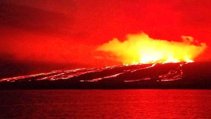
There has been a lot of discussion on what will happen next at Kilauea. For 30 years it overflowed through Pu’u’O’o, leaving the summit safely under-pressured. That had been changing slowly as Pu’u’O’o declined, and the summit had become restless. A lava lake made its appearance and slowly enlarged itself. But this mode, with pressure at the summit and a partially open conduit at Pu’u’O’o, became unstable (imagine a tyre with a double puncture). The overfull summit reservoir channeled more magma to Pu’u’O’o, it couldn’t cope and the east rift zone gave way, in the process triggering the major earthquake. That was in April/May. Now we are half a year later, with Leilani half destroyed, the Puna Geothermal Energy Plant out of business through excess heat, Kapoho gone (presumably this time forever), Pu’u’O’o dead, Kilauea caldera collapsed, and HVO having abandoned its headquarters and taken up residence in Hilo. The park was closed for 134 days. It has now reopened and the iconic Volcano House is again taking reservations. Only the tropic birds still fly: they have lived through all events and seem unperturbed, taking it all on the wing. Who would have predicted all this, even 6 months ago?
Kilauea remains utterly unpredictable. Every year, decade, or even century seems different. Attempts to look at past behaviour to predict the future run into the trouble of insufficient history. If nothing else, the past year has shown that this volcano does not do re-runs. It is an adventurer, always looking for new expressions. Kilauea is the unforeseeable volcano.
When you go (as I hope you will) you will gaze at history, a reminder of the events which left this gaping hole. The views of the caldera are clearer than they have been for decades. But it wasn’t always just a scar. A century or more ago, people came to gaze at the spectacle of an everlasting summit eruption. Kilauea was where the red blood of the Earth flowed on the surface. People came from far and wide. One of the more famous visitors was an adventurer whose quest for new experiences matched that of the mountain itself. The letters he wrote turned an active volcano into a tourist attraction, and the travel writer into a national celebrity. Who would have predicted it?

Jules Tavernier, 1887: The lava lake of Kilauea. Source: wikimedia
Samuel Clemens was in fact a rather unlikely volcano explorer. He grew up in the entirely non-volcanic region of Missouri, and his early career choice was to be a Mississippi river pilot. When this didn’t quite work out, he moved to riverless Nevada and tried his hand at mining, before finally finding his calling as a travel writer. He became best known by his pen name, Mark Twain. Samuel was commissioned by the Sacramento Union to go to the Sandwich Islands, as Hawai’i was known, and report on life in the deep Pacific. He wrote 25 letters detailing the stormy journey and the people and customs of the island, culminating in the visit to Kilauea. The letters are readily available (out of copyright) and still well worth reading. They give a picture of a world in rapid change, and his writings bring countless characters to vivid life. He was a gifted writer who could tell a gripping story with a minimum of words.

Mark Twain in the lab of Tesla. Source: wikimedia
As an example of his volcanic observations, here is his description of a visit to Kealakekua Bay, in 1866, taken from one of his Sacramento Union letters. (From here on, italics indicate my text, and the rest is Mark Twain speaking.)
A PETRIFIED NIAGARA
The object of our tramp was to visit a great natural curiosity at the base of the foothills – a congealed cascade of lava. Some old forgotten volcanic eruption sent its broad river of fire down the mountain side here, and it poured down in a great torrent from an overhanging bluff some fifty feet high to the ground below. The flaming torrent cooled in the winds from the sea, and remains there to day, all seamed, and frothed and tippled – a petrified Niagara. It is very picturesque, and withal so natural that one might almost imagine it still flowed. A smaller stream trickled over the cliff and built up an isolated pyramid about thirty feet high, which has the resemblance of a mass of large gnarled and knotted vines and roots and stems intricately twisted and woven together.
NATURE’S MINING ACHIEVEMENTS
We passed in behind the cascade and the pyramid, and found the bluff pierced by several cavernous tunnels, whose crooked courses we followed about fifty feet, but with no notable result, save that we made a discovery that may be of high interest to men of science. We discovered that the darkness in there was singularly like the darkness observable in other particularly dark places – exactly like it, I thought. I am borne out in this opinion by my comrade, who said he did not believe there was any difference but if there was, he judged it was in favor of this darkness here.
Two of these winding tunnels stand as proof of Nature’s mining abilities. Their floors are level, they are seven feet wide, and their roofs are gently arched. Their height is not uniform, however. We passed through one a hundred feet long, which leads through a spur of the hill and opens out well up in the sheer wall of a precipice whose foot rests in the waves of the sea. It is a commodious tunnel, except that there are occasionally places in it where one must stoop to pass under. The roof is lava, of course, and is thickly studded with little lava-pointed icicles an inch long, which hardened as they dripped. They project as closely together as the iron teeth of a corn-sheller, and if one will stand up straight and walk any distance there, he can get his hair combed free of charge.

Kealakekua Bay. Source https://snorkelaroundtheworld.com/2017/05/kealakekua-bay-hawaii-snorkeling-spot/
The story of his volcanic exploration is picked up again in one of the subsequent letters. The party now approaches Kilauea from the southwest, following a path parallel to the south coast.
THE PROCESSION MOVETH AGAIN
Brown bought a horse from a native at Waiohinu for twelve dollars, but happening to think of the horse jockeying propensities of the race, he removed the saddle and found that the creature needed “half-soling,” as he expressed it. Recent hard riding had polished most of the hide off his back. He bought another and the animal went dead lame before we got to the great volcano, forty miles away. I bought a reckless little mule for fifteen dollars, and I wish I had him yet. One mule is worth a dozen horses for a mountain journey in the Islands. The first eighteen miles of the road lay mostly down by the sea, and was pretty well sprinkled with native houses. The animals stopped at all of them – a habit they had early acquired; natives stop a few minutes at every shanty they come to, to swap gossip, and we were forced to do likewise – but we did it under protest.
Brown’s horse jogged along well enough for 16 or 17 miles, but then he came down to a walk and refused to improve on it. We had to stop and intrude upon a gentleman who was not expecting us, and who I thought did not want us, either, but he entertained us handsomely, nevertheless, and has my hearty thanks for his kindness.
We looked at the ruddy glow cast upon the clouds above the volcano, only twenty miles away, now (the fires had become unusually active a few days before) for awhile after supper, and then went to bed and to sleep without rocking.
We stopped a few miles further on, the next morning, to hire a guide, but happily were saved the nuisance of traveling with a [native Hawai’ian] we could not talk with. [Here I have ‘updated’ a term which may have been in common use in those days but which would be disrespectful nowadays. Even Mark Twain has to abide by VC’s first rule, ‘be nice’.] The proprietor and another gentleman intended to go to the volcano the next day, and they said they would go at once if we would stop and take lunch. We signed the contract, of course. It was the usual style. We had found none but pleasant people on the island, from the time we landed at.
To get through the last twenty miles, guides are indispensable. The whole country is given up to cattle ranching, and is crossed and recrossed by a riddle of “bull paths” which is hopelessly beyond solution by a stranger.
IN FAIRY LAND
Portions of that little journey bloomed with beauty. Occasionally we entered small basins walled in with low cliffs, carpeted with greenest grass, and studded with shrubs and small trees whose foliage shone with an emerald brilliancy. One species, called the mamona, with its bright color, its delicate locust leaf, so free from decay or blemish of any kind, and its graceful shape, chained the eye with a sort of fascination. The rich verdant hue of these fairy parks was relieved and varied by the splendid carmine tassels of the ohia tree. Nothing was lacking but the fairies themselves.
THE KINGDOM OF DESOLATION
As we trotted up the almost imperceptible ascent and neared the volcano, the features of the country changed. We came upon a long dreary desert of black, swollen, twisted, corrugated billows of lava – blank and dismal desolation! Stony hillocks heaved up, all seamed with cracked wrinkles and broken open from center to circumference in a dozen places, as if from an explosion beneath. There had been terrible commotion here once, when these dead waves were seething fire; but now all was motion less and silent – it was a petrified sea! The narrow spaces between the upheavals were partly filled with volcanic sand, and through it we plodded laboriously. The invincible ohia struggled for a footing even in this desert waste, and achieved it – towering above the billows here and there, with trunks flattened like spears of grass in the crevices from which they Sprang.
We came at last to torn and ragged deserts of scorched and blistered lava – to plains and patches of dull grey ashes – to the summit of the mountain, and these tokens warned us that we were nearing the palace of the dread goddess Pele, the crater of Kilauea.
That particular letter ends at this point. Kilauea was not the quiet caldera it is nowadays. It was full of activity, lava lakes, outbursts, all at the summit. Volcano House was close to the action, and lookout point, at the rim of the caldera, must have had a spectacular view, albeit with an air quality that may not have met modern health standards. The story from here becomes spectacular. The Sacramento Union did not publish the continuation until almost a month later. It was worth the wait.

Jules Tavernier, 1887, Full moon over Kilauea. Source: wikimedia
I was disappointed when I saw the great volcano of Kilauea (Ke-low way-ah) to-day for the first time. It is a comfort to me to know that I fully expected to be disappointed, how ever, and so, in one sense at least, I was not disappointed.
As we “raised” the summit of the mountain and began to canter along the edge of the crater, I heard Brown exclaim, “There’s smoke, by George!” (poor infant – as if it were the most surprising thing in the world to see smoke issuing from a volcano), and I turned my head in the opposite direction and began to crowd my imagination down. When I thought I had got it reduced to about the proper degree, I resolutely faced about and came to a dead halt. “Disappointed, anyhow!” I said to myself “Only a considerable hole in the ground – nothing to Haleakala – a wide, level, black plain in the bottom of it, and a few little sputtering jets of fire occupying a place about as large as an ordinary potato-patch, up in one corner – no smoke to amount to any thing. And these ‘tremendous’ perpendicular walls they talk about, that inclose the crater! they don’t amount to a great deal, either; it is a large cellar – nothing more – and precious little fire in it, too.” So I soliloquized. But as I gazed, the “cellar” insensibly grew. I was glad of that, albeit I expected it. I am passably good at judging of heights and distances, and I fell to measuring the diameter of the crater. After considerable deliberation I was obliged to confess that it was rather over three miles, though it was hard to believe it at first. It was growing on me, and tolerably fast. And when I came to guess at the clean, solid, perpendicular walls that fenced in the basin, I had to acknowledge that they were from 600 to 800 feet high, and in one or two places even a thousand, though at a careless glance they did not seem more than two or three hundred. The reason the walls looked so low is because the basin inclosed is so large. The place looked a little larger and a little deeper every five minutes, by the watch. And still it was unquestionably small; there was no getting around that. About this time I saw an object which helped to increase the size of the crater. It was a house perched on the extreme edge of the wall, at the far end of the basin, two miles and a half away; it looked like a martin box under the eaves of a cathedral! That wall appeared immensely higher after that than it did before.
Mark Twain later retold the story in ‘Roughing it’ where he added some more of his impressions and reflections:
I have seen Vesuvius since, but it was a mere toy, a child’s volcano, a soup-kettle, compared to this. Mount Vesuvius is a shapely cone thirty-six hundred feet high; its crater an inverted cone only three hundred feet deep, and not more than a thousand feet in diameter, if as much as that; its fires meagre, modest, and docile.–But here was a vast, perpendicular, walled cellar, nine hundred feet deep in some places, thirteen hundred in others, level- floored, and ten miles in circumference! Here was a yawning pit upon whose floor the armies of Russia could camp, and have room to spare.
Going back to his original letter:
I reflected that night was the proper time to view a volcano, and Brown, with one of those eruptions of homely wisdom which rouse the admiration of strangers, but which custom has enabled me to contemplate calmly, said five o’clock was the proper time for dinner, and therefore we spurred up the animals and trotted along the brink of the crater for about the distance it is from the Lick House, in San Francisco, to the Mission, and then found ourselves at the Volcano House.
On the way we passed close to fissures several feet wide and about as deep as the sea, no doubt, and out of some of them steam was issuing. It would be suicidal to attempt to travel about there at night. As we approached the lookout house I have before spoken of as being perched on the wall, we saw some objects ahead which I took for the brilliant white plant called the “silver sword,” but they proved to be “buoys” – pyramids of stones painted white, so as to be visible at night, and set up at intervals to mark the path to the lookout house and guard unaccustomed feet from wandering into the abundant chasms that line the way.
By the path it is half a mile from the Volcano House to the lookout-house. After a hearty supper we waited until it was thoroughly dark and then started to the crater. The first glance in that direction revealed a scene of wild beauty. There was a heavy fog over the crater and it was splendidly illuminated by the glare from the fires below. The illumination was two miles wide and a mile high, perhaps; and if you ever, on a dark night and at a distance beheld the light from thirty or forty blocks of distant buildings all on fire at once, reflected strongly against overhanging clouds, you can form a fair idea of what this looked like.
THE VISION OF HELL AND ITS ANGELS
Arrived at the little thatched lookout house, we rested our elbows on the railing in front and looked abroad over the wide crater and down over the sheer precipice at the seething fires beneath us. The view was a startling improvement on my daylight experience. I turned to see the effect on the balance of the company, and found the reddest-faced set of men I almost ever saw. In the strong light every countenance glowed like red-hot iron, every shoulder was suffused with crimson and shaded rearward into dingy, shapeless obscurity! The place below looked like the infernal regions and these men like half-cooled devils just come up on a furlough.
I turned my eyes upon the volcano again. The “cellar” was tolerably well lighted up. For a mile and a half in front of us and half a mile on either side, the floor of the abyss was magnificently illuminated; beyond these limits the mists hung down their gauzy curtains and cast a deceptive gloom over all that made the twinkling fires in the remote corners of the crater seem countless leagues removed – made them seem like the campfires of a great army far away. Here was room for the imagination to work! You could imagine those lights the width of a continent away – and that hidden under the intervening darkness were hills, and winding rivers, and weary wastes of plain and desert – and even then the tremendous vista stretched on, and on, and on! – to the fires and far beyond! You could not compass it – it was the idea of eternity made tangible – and the longest end of it made visible to the naked eye!
The greater part of the vast floor of the desert under us was as black as ink, and apparently smooth and level; but over a mile square of it was ringed and streaked and striped with a thousand branching streams of liquid and gorgeously brilliant fire! It looked like a colossal railroad map of the State of Massachusetts done in chain lightning on a midnight sky. Imagine it – imagine a coal-black sky shivered into a tangled network of angry fire!
Here and there were gleaming holes a hundred feet in diameter, broken in the dark crust, and in them the melted lava – the color of a dazzling white just tinged with yellow – was boiling and surging furiously; and from these holes branched numberless bright torrents in many directions, like the spokes of a wheel, and kept a tolerably straight course for a while and then swept round in huge rainbow curves, or made a long succession of sharp worm-fence angles, which looked precisely like the fiercest jagged lightning. These streams met other streams, and they mingled with and crossed and recrossed each other in every conceivable direction, like skate tracks on a popular skating ground. Sometimes streams twenty or thirty feet wide flowed from the holes to some distance without dividing – and through the opera glasses we could see that they ran down small, steep hills and were genuine cataracts of fire, white at their source, but soon cooling and turning to the richest red, grained with alternate lines of black and gold. Every now and then masses of the dark crust broke away and floated slowly down these streams like rafts down a river. Occasionally, the molten lava flowing under the superincumbent crust broke through – split a dazzling streak, from five hundred to a thousand feet long, like a sudden flash of lightning and then acre after acre of the cold lava parted into fragments, turned up edgewise like cakes of ice when a great river breaks up, plunged downward and were swallowed in the crimson cauldron. Then the wide expanse of the “thaw” maintained a ruddy glow for a while, but shortly cooled and became black and level again. During a “thaw”, every dismembered cake was marked by a glittering white border which was superbly shaded inward by aurora borealis rays, which were a flaming yellow where they joined the white border, and from thence toward their points tapered into glowing crimson, then into a rich, pale carmine, and finally into a faint blush that held its own a moment and then dimmed and turned black. Some of the stream preferred to mingle together in a tangle of fantastic circles, and then they looked something like the confusion of ropes one sees on a ship’s deck when she has just taken in sail and dropped anchor – provided one can imagine those ropes on fire.
Through the glasses, the little fountains scattered about looked very beautiful. They boiled, and coughed, and spluttered, and discharged sprays of stringy red fire of about the consistency of mush, for instance – from ten to fifteen feet into the air, along with a shower of brilliant white sparks – a quaint and unnatural mingling of gouts of blood and snowflakes!
We had circles and serpents and streaks of lightning all twined and wreathed and tied together, without a break throughout an area more than a mile square (that amount of ground was covered, though it was not strictly “square”), and it was with a feeling of placid exultation that we reflected that many years had elapsed since any visitor had seen such a splendid display – since any visitor had seen anything more than the now snubbed and insignificant “North” and “South” lakes in action. We had been reading old files of Hawaiian newspapers and the “Record Book” at the Volcano House, and were posted.
I could see the North Lake lying out on the black floor away off in the outer edge of our panorama, and knitted to it by a web-work of lava streams. In its individual capacity it looked very little more respectable than a schoolhouse on fire. True, it was about nine hundred feet long and two or three hundred wide, but then, under the present circumstances, it necessarily appeared rather insignificant, and besides it was so distant from us.
I forgot to say that the noise made by the bubbling lava is not great, heard as we heard it from our lofty perch. It makes three distinct sounds – a rushing, a hissing, and a coughing or puffing sound, and if you stand on the brink and close your eyes, it is no trick at all to imagine that you are sweeping down a river on a large low – pressure steamer, and that you bear the hissing of the steam about her boilers, the puffing from her escape pipes and the churning rush of the water abaft her wheels. The smell of sulphur is strong but not unpleasant to a sinner.
THE PILLAR OF FIRE
We left the lookout house at ten o’clock in a half cooked condition because of the heat from Pele’s furnaces, and wrapping up in blankets (for the night was cold) returned to the hotel. After we got out in the dark we had another fine spectacle. A colossal column of cloud towered to a great height in the air immediately above the crater, and the outer swell of every one of its vast folds was dyed with a rich crimson luster, which was subdued to a pale rose tint in the depressions between. It glowed like a muffled torch and stretched upward to a dizzy height toward the zenith. I thought it just possible that its like had not been seen since the children of Israel wandered on their long march through the desert so many centuries ago over a path illuminated by the mysterious “pillar of fire.” And I was sure that I now had a vivid conception of what the majestic “pillar of fire” was like, which almost amounted to a revelation.
ACCOMMODATIONS FOR MAN AND BEAST
It is only at very long intervals that I mention in a letter matters which properly pertain to the advertising columns, but in this case it seems to me that to leave out the fact that there is a neat, roomy, well furnished and well kept hotel at the volcano would be to remain silent upon a point of the very highest importance to any one who may desire to visit the place. The surprise of finding a good hotel in such an outlandish spot startled me considerably more than the volcano did. The house is new – built three or four months ago – and the table is good. One could not easily starve here even if the meats and groceries were to give out, for large tracts of land in the vicinity are well paved with excellent strawberries. One can have as abundant a supply as he chooses to call for. There has never heretofore been anything in this locality for the accommodation of travellers but a crazy old native grass hut, scanty fare, hard beds of matting and a Chinese cook.

Halema’uma’u lava lake in Kilaeua caldera. 1894, Howard Hitchcock. Source: wikimedia
The last letter ends here. But in Roughing it, Mark Twain adds a twist, and tells the untold part of the story. This was extreme tourism, well beyond the remit of the Sacramento Union: they never published it (as far as I know) and perhaps Mark Twain never told them about his silly exploit. The most amazing part about the untold adventure was that Mark Twain survived it. Anyone stupidly trying to follow his example would be at severe risk of dying, and perhaps it was indeed wisest to keep this skeleton in the closet.
The next night was appointed for a visit to the bottom of the crater, for we desired to traverse its floor and see the “North Lake” (of fire) which lay two miles away, toward the further wall. After dark half a dozen of us set out, with lanterns and native guides, and climbed down a crazy, thousand-foot pathway in a crevice fractured in the crater wall, and reached the bottom in safety.
The eruption of the previous evening had spent its force and the floor looked black and cold; but when we ran out upon it we found it hot yet, to the feet, and it was likewise riven with crevices which revealed the underlying fires gleaming vindictively. A neighboring cauldron was threatening to overflow, and this added to the dubiousness of the situation. So the native guides refused to continue the venture, and then everybody deserted except a stranger named Marlette. He said he had been in the crater a dozen times in daylight and believed be could find his way through it at night. He thought that a run of three hundred yards would carry us over the hottest part of the floor and leave us our shoe soles. His pluck gave me backbone. We took one lantern and instructed the guides to hang the other to the roof of the lookout house to serve as a beacon for us in case we got lost, and then the party started back up the precipice and Marlette and I made our run. We skipped over the hot floor and over the red crevices with brisk dispatch and reached the cold lava safe but with pretty warm feet. Then we took things leisurely and comfortably, jumping tolerably wide and probably bottomless chasms, and threading our way through picturesque lava upheavals with considerable confidence. When we got fairly away from the cauldrons of boiling fire, we seemed to be in a gloomy desert, and a suffocatingly dark one, surrounded by dim walls that seemed to tower to the sky. The only cheerful objects were the glinting stars high overhead.
By and by Marlette shouted “Stop!” I never stopped quicker in my life. I asked what the matter was. He said we were out of the path. He said we must not try to go on till we found it again, for we were surrounded with beds of rotten lava through which we could easily break and plunge down a thousand feet. I thought eight hundred would answer for me and was about to say so when Marlette partly proved his statement by accidentally crushing through and disappearing to his armpits. He got out and we hunted for the path with the lantern. He said there was only one path, and that it was but vaguely defined. We could not find it. The lava surface was all alike in the lantern light. But he was an ingenious man. He said it was not the lantern that had informed him that we were out of the path, but his feet. He had noticed a crisp grinding of fine lava-needles under his feet, and some instinct reminded him that in the path these were all worn away. So he put the lantern behind him, and began to search with his boots instead of his eyes. It was good sagacity. The first time his foot touched a surface that did not grind under it he announced that the trail was found again; and after that we kept up a sharp listening for the rasping sound, and it always warned us in time.
It was a long tramp. but an exciting one. We reached the North Lake between ten and eleven o’clock, and sat down on a huge overhanging lava-shelf, tired but satisfied. The spectacle presented was worth coming double the distance to see. Under us, and stretching away before us, was a heaving sea of molten fire of seemingly limitless extent. The glare from it was so blinding that it was some time before we could bear to look upon it steadily. It was like gazing at the sun at noonday, except that the glare was not quite so white. At unequal distances all around the shores of the lake were nearly white-hot chimneys or hollow drums of lava, four or live feet high, and up through them were bursting gorgeous sprays of lava-gouts and gem spangles, some white some red, and some golden – a ceaseless bombardment, and one that fascinated the eye with its unapproachable splendor. The more distant jets, sparkling up through an intervening gossamer veil of vapor, seemed miles away; and the further the curving ranks of fiery fountains receded, the more fairylike and beautiful they appeared.
Now and then the surging bosom of the lake under our noses would calm down ominously and seem to be gathering strength for an enterprise; and then all of a sudden a red dome of lava of the bulk of an ordinary dwelling would heave itself aloft like an escaping balloon, then burst asunder, and out of its heart would flit a pale green film of vapor, and float upward and vanish in the darkness – a released soul soaring homeward from captivity with the damned, no doubt. The crashing plunge of the ruined dome into the lake again would send a world of seething billows lashing against the shores and shaking the foundations of our perch. By and by, a loosened mass of the hanging shelf we sat on tumbled into the lake, jarring the surroundings like an earthquake and delivering a suggestion that may have been intended for a hint, and may not. We did not wait to see.
We got lost again on our way back, and were more than an hour hunting for the path. We were where we could see the beacon lantern at the lookout house at the time, but thought it was a star, and paid no attention to it. We reached the hotel at two o’clock in the morning, pretty well fagged out.
After this confession, Mark Twain continues to give some historical information about the 1840 eruption
Kilauea never overflows its vast crater, but bursts a passage for its lava through the mountainside when relief is necessary, and then the destruction is fearful. About 1840 it rent its overburdened stomach and sent a broad river of fire careering down to the sea, which swept away forests, huts, plantations, and everything else that lay in its path. The stream was five miles broad, in places, and two hundred feet deep, and the distance it traveled was forty miles. It tore up and bore away acre-patches of land on its bosom like rafts – rocks, trees, and all intact. At night the red glare was visible a hundred miles at sea; and at a distance of forty miles fine print could be read at midnight. The atmosphere was poisoned with sulphurous vapors and choked with falling ashes, pumice stones, and cinders; countless columns of smoke rose up and blended together in a tumbled canopy that hid the heavens and glowed with a ruddy flush reflected from the fires below; here and there jets of lava sprung hundreds of feet into the air and burst into rocket-sprays that returned to earth in a crimson rain; and all the while the laboring mountain shook with nature’s great palsy, and voiced its distress in moanings and the muffled booming of subterranean thunders.
Fishes were killed for twenty miles along the shore, where the lava entered the sea. The earthquakes caused some loss of human life, and a prodigious tidal wave swept inland, carrying everything before it and drowning a number of natives. The devastation consummated along the route traversed by the river of lava was complete and incalculable. Only a Pompeii and a Herculaneum were needed at the foot of Kilauea to make the story of the eruption immortal.
What a story he had to tell. Vesuvius had Pompei, but Kilauea had Mark Twain.
The Letters from Hawai’i can be found at http://www.twainquotes.com/sduindex.html. The later reworking is available at http://www.online-literature.com/twain/roughing-it/, chapter LXXIV.

May 15, 2018. Golf and Kilauea.
Appendix
As an appendix, here is a modern retelling of Mark Twain’s proposal to improve English. This version was written a decade or two ago. Both this and its original feel as fresh as ever. (I should confess that there is some disagreement whether the original piece came in fact from Twain. To me it does sound like him.) Enjoy.
Euro Plan For Improving English Spelling
The European Commission have just announced an agreement whereby English will be the official language of the EU rather than German, which was the other possibility. As part of the negotiations, Her Majesty’s government conceded that English spelling had some room for improvement and has accepted a 5 year phase in plan that would be known as “EuroEnglish”:
In the first year, “s” will replace the soft “c”– Sertainly this will make the sivil servants jump with joy. The hard “c” will be dropped in favor of the “k”. This should klear up konfusion and keyboards kan have 1 less letter.
There will be growing publik enthusiasm in the sekond year, when the troublesome “ph” wil be replaced with the “f”. This will make words like “fotograf” 20% shorter.
In the 3rd year, publik akseptanse of the new spelling kan be expected to reach the stage where more komplikated changes are possible. Governments will enkorage the removal of double letters, which have always been a deterent to akurate speling. Also, al wil agre that the horible mes of the silent “e”‘s in the language is disgraceful, and they should go away.
By the 4th yar peopl wil be reseptiv to steps such as replasing “th” with “z” and “w” with “v”. During ze fifz yar, ze unesesary “o” kan be dropd from vords kontaining “ou” and similar changes vud of kors be aplid to ozer kombinations of leters.
After zis fifz yer, ve vil hav a reli sensibl riten styl. Zer vil be no mor trubls or difikultis and evrivun vil find it ezi tu understand ech ozer.
ZE DREM VIL FINALI KUM TRU
Viz gretings from Kiloveja


Thank you Albert. I never knew Mark Twain was at Kilauea. What a fascinating account!
The waters in Kealakekua Bay is totaly crystal clear!
Hawaii is the worlds clearest tropical ocean.
Clear and Blue… lack of nutrients and plankton
marine desert… the visibility is totaly amazing
Veri gud ya! xD
English could definitely do with some adjustments though!
Translation to Simplish™:
Inglish kud definitlee doo with sum ajustmunts tho! (how to sound like Arsene Wenger??!)
hmm…
Oh crap! Simplish is already a thing! Damnit I thought I was being clever! 😀
https://www.youtube.com/watch?v=A8zWWp0akUU this seems to work but it does take a while to get used to 🙂
The perched halemaumau lava lake that Howard Hitchcock painted are amazingly realisitc.
That rasied rim formed by numerous short overflows that built the lake rim higher.
I loves that overflow in the painting… its very life like and realisitc.
He have even managed to paint the pahoehoe lobes and inflated crusts and broken plates.
The snowy winter Mauna Loa is amazing too.
The lava lake painting is what woud happen to Halemaumau if it keept overflowing in spring 2018
Oh LoL its
Hells Angles!
Kilauea overunned by MC gangs… ehhh
Now we know where that name came from. Sadly the name is now hijacked by criminals.
Altamont 1969
“Passaro was arrested and tried for murder in the summer of 1971, but was acquitted after a jury viewed concert footage showing Hunter brandishing the revolver and concluded that Passaro had acted in self-defense.”
Albert, if you enjoy this kind of reads then I have to recommend you reading Journal of a Tour around Hawaii or at least chapters VI-VII which are the most KIlauea-ish. They describe the journey of William Ellis through Kilauea all the way back in 1823, chapter V has some interesting bits too and towards the end they have already arrived at the flanks of Kilauea but chapters VI and VII are the ones that are more volcano-centered:
https://books.google.es/books?id=dN8wuzrh6m8C&pg=PR1&redir_esc=y&hl=es#v=onepage&q&f=false
I love the “doesn’t do reruns” bit. Even volcanoes have more of an imagination and penchant for originality than does Hollywood. Maybe this is why I would rather watch a good earth science documentary on YouTube than whatever reboot/remake/sequel-of-the-week that happens to be out at theater.
I would like to say something about the ‘doesn’t do re-runs’ part. The correct terminology should be doesn’t do repeats, as it has in fact done a lot of re-runs of previous events, but they have played out a bit differently every time. Eruptions like pu’u o’o have happened before but pu’u o’o was by far the biggest. Same again for this years eruption, there have been many similar events but this one was much bigger than nearly all of them. This years collapse is also analogous to the events of the late 1700s, as is the location of the eruption.
There is one clear consistency to all of that though, the historical events after 1955 have generally been a lot bigger than the comparable eruptions during the 1700s, which is a trend that should be taken into account as it could infer some rather dangerous situations are possible in the near future.
Also there is enough data about prehistoric eruptions to be able to infer such patterns are not one offs but are actually real patterns. It is pretty clear from geology as well as observations that this years event was not unprecedented and that many such summit collapses have occurred before. Even the situation where this eruption was a follow on from another eruption is not entirely unprecedented, as the large flows erupted in the LERZ around 1790 (probably in the 1780s) have a margin of error that overlaps with the eruption duration of the heiheiahulu shield, lending to the plausible assumption it was terminated by those flows. Another example is the significant tephra erupted in the 1500s and 1780-1820 periods (not to mention between 500 and 900 AD…) – big and often very violent summit eruptions seem to be a consistency of recently collapsed calderas during a high eruption phase, which also describes the situation now which is why there is reason to be cautious.
I will agree with unpredictable, especially this year, but unforeseeable is incorrect and after doing a lot of research it is not difficult to notice similarities between recent events and older ones.
Well great I forgot to add the / to stop the italics…
we are very good at finding patterns where none exist. Kilauea does shift between periods of summit activity and rift activity, but there is no evidence this is periodic. It may just be stochastic. It depends on where the main weakness is in the magma confinement, and that can move around with breaks opening and closing. Pressure from Mauna Loa may play a role as well, as does the stress regime along the southern faults. Too many variables. After a collapse, it seems likely the magma inflow underneath Kilauea will increase for a while. Where that magma goes is far from certain.
Well by that logic we should stop trying to predict anything at all because it will always go differently than expected and any attempt at trying to react in advance will be futile.
We are good at seeing patterns because patterns are a real thing that happens and knowing when they happen will allow you to respond to the next cycle before it happens, it isn’t foolproof but it is better than being caught off guard.
This cycle of activity on kilauea is obviously not the same as the last cycle, there has been no equivalent to mauna ulu (meaning an UERZ shield eruption) identified in the 1700s, and likewise there is no equivalent to kapoho crater from this century, and we will never know exactly where all of the previous cycles eruptions were because a lot of them have been buried and weren’t well mapped before pu’u o’o formed. However there are overall patterns and similarities, pu’u o’o formed as a long lived rift vent after two decades of increasing supply rate and frequent smaller eruptions mostly in the same area. In the mid 1700s heiheiahulu formed as a long lived vent after a period of smaller eruptions and presumably a high supply rate also. Both eruptions predate a large flow in the LERZ by a short enough time to be considered a continuation (the end of heiheiahulu and the 1790 eruption have an overlapping margin of error for their dates). There are also tube fed pahoehoe flows exposed in a cliff near kehena in lower puna which were erupted in about 1500 and are presumably erupted by a lava shield which has since been buried by heiheiahulu, and shortly afterwards there are very voluminous flows erupted in the leilani area. All these big flows also line up in age with summit collapses. The 1500s and 1790 collapses were followed by vigorous activity that was often explosive and effected areas beyond the caldera, it has been too short a time period to know if that will happen in the near future now but it is a likely bet.
Likewise and leading on from that, it is not a random coincidence that every large caldera collapse known on kilauea in recent time (last 1000 years) has a big lava flow in the LERZ that is roughly the same age. The one this year is obvious as millions around the world watched it in real time, but big flows occurred in the late 1700s around the time another collapse happened, and a very big lava flow probably as big as this years flow happened around the early 1500s at a similar time to when the broader caldera structure is believed to have formed.
Yes it is not periodic, some periods of summit activity may have been as long as 700 years while the last one was less than 200 years long. The volume and intensity can also vary a lot with the Pu’u’o’o-Mauna Ulu pair being unprecedented, at least in the last 2000 years of activity.
Well it could be argued that the period between now and 1500 is a continuous line, there have been many periods where there was no rift activity at all, but no lava has left the caldera by overflowing so it will probably be inferred in the future that there must have been a deep caldera between ~1500 and (2100?) even though we know that it was not very deep for most of the last 200 years. It is more of a distinction between whether there is a large caldera and when there is a small caldera or no caldera at all, with the latter being dominated by summit overflows and the former being rift activity that is also voluminous but not localised the same way. I dont think there was that much east rift activity before 1500 but probably quite a lot afterwards including the main caldera eruption that probably collapsed the summit in the early 1500s.
You are right though in that there doesnt appear to have been any other eruptive series in the current exposure that is as voluminous as the one in historical time. Since 1955 there has probably been around 16 km3 of lava erupted (11 km3 at pu’u o’o, 3 km3 at mauna ulu, 1 km3 at leilani this year, about 1km3 in everything else) and if you include this eruptive episode to have included everything since the current caldera first formed (say 1790) then it also adds about 6 km3 of caldera fill (actually more than that as many collapses occurred and had to be refilled) and maybe 0.5 km3 of flank lavas on the SWRZ and 1840, which brings the total up to 23.5 km3 of lava erupted in the past 230 years. That is an average of 1 km3 every 10 years but obviously it was a lot higher in the early 1800s and now and lower in the late 1800s-1950. This probably means there is a very open and wide conduit in the east rift that contains a lot of magma and so there could still be a few more big eruptions before anything permanent, I think Don Swanson has brought up this possibility before, talking about potential for much more extensive collapse and summit explosive activity as well as more big eruptions on the rifts.
One of the largest summit collpases occured in 1500 s with over 5km3 drained from the summit magma chamber… that formed a 4 kilometer wide caldera that coud have been 100 s of meters deep.
This caldera have almost completely filled up by later lava lake overflows.
The magma supply is so very large that it wont stay quiet for very long.
At current supply ( 0,3km3 every year ) it will only take 4 years to completely refill the Leilai volume that was lost. Kilauea is a stunning machine for soure.
Im soure the summit lava lake returns soon enough in the comming 10 years.
When it returns it coud be like a massive lava fountain and huge hole in the bottom of the pit
maybe the next lava lake in Halemaumau will look alot like Nyiragongos lava lake… a large round lake in the middle of the deep pit and overflows building platforms around the lake
It is interesting to think about where all that magma went, there is a big flow that formed around that time very close to where this years eruption happened (most of it is buried now) but even though that was a big eruption probably similar to this year it is still way less than 5 km3. I guess it must have just intruded really deep and filled the rift from the bottom up and it breached the surface between leilani and kapoho, the lava of that flow, as well as halekamahina cone further down the rift is picritic with lots of olivine so this supports that interpretation. Maybe that is ultimately the reason why the 1955-now episode has been so big, the rift has been filling and expanding over the past centuries and it just happens that it reached true full capacity in 1983 and now it can’t really move apart more without the surface fracturing and an eruption happening. This year was a big drain, about 1 km3 and so it might take a while before another big eruption happens, something like the period between 1975 and 1983, a 5 to 10 year gap as the rift refills, but afterwards I think there could be another shield eruption maybe a bit downrift of pu’u o’o near heiheiahulu and 1977 vents, this area has not got a shield yet and is currently showing activity, the other option is between pu’u o’o and kane nui o hamo where there is also a big gap. Either that or there could be another big LERZ eruption, or both.
I think pu’u o’o is over, it’s not going to reactivate and will turn green over the next centuries, but I think some point in the near future another long lived ERZ vent will form again. There could even be a big summit eruption then another rift eruption like 1959-1960.
The Pele-Hiiaka legend shows that at some point Puna was devastated by a huge eruption. HVO thinks it refers to Aila’au but what the legend describes is way more cataclysmic that a tube fed eruption that lasted decades. That eruption corresponds probably to the flows dated in 490 BP which already have an impressive extension in the middle LERZ even when an unknown surface of it is buried under lava flows, it was likely bigger than this year’s and responsible for a major part of the Kilauea caldera collapse. But the caldera may have been enlarged in later events.
After tracing out and colouring in the 490 BP lava flow from the 2005 map, I can agree that it was definitely a very big eruption. Even just the upper part is about as big as this years flow, and if the assumption that halekamahina is also from the same eruption it extends over an even bigger area towards and including cape kumukahi as well as probably a lot of the pre-1960 lava in the kapoho area. Back in July on one of the livestreams from Phil and John they brought in someone who gave information describing a prehistoric eruption that devastated the area hundreds of years ago, covering kapoho and flowing to the ocean at kehena. Apparently kehena means ‘a hellish place’ when translated, so that could be a hint at this.
I also think there is a pretty good chance this chant describes the 490 BP flow, and 490 years ago from 2005 was in the 1510s which is right in the ball park, and after aila’au (I don’t know why that map has the aila’au eruption being as young as 1670, every published date has it older than 1500). Anyone born at that time would have seen basically almost all of kilauea as a desolate wasteland, as the observatory flows would still be relatively unforested if not completely barren like the kau desert is today, the aila’au flow was still new and even before the 1500s flow there had been a string of eruptions in the general area.
Ironically one of the only areas that was probably green was where pu’u o’o is now…
Something Interesting and possibly volcanic happened in the vicinity of Mayotte yesterday:
https://twitter.com/seismo_steve/status/1062019597212286976
Suggestions on a postcard…
Interesting!
I think this guy has it sorted:
Jamie Gurney @UKEQ_Bulletin
“This resulted in Mayotte shifted east 50mm & down 25mm… data sourced from @BRGM_fr official). With a more empty magma chamber, a small quake triggered a magma chamber collapse, which is the low-frequency signal detected in the morning of the 11th November.”
There was a swarm in that precise area in May/June (which is not that unusual) followed a by a few quakes in September and one last week. They seemed tectonic but who knows. A underwater landslide on a shallow slope seems most likely for yesterday’s event.
Interesting. Back in May this island had a large seismic swarm that was thought to be a magma intrusion. Something odd happening there. Anyone know when the last eruption happened here? Possible article in there 😳
What a great story. Poetic and adventurous at the same time. “The smell of sulphur is strong but not unpleasant to a sinner.”
I love these dark .. mordorish paintings of halemaumau lava lake
Here goes another one then, one that I find particularly interesting. 1842 by Titian Ramsay Peale.
And a map of the caldera from the year before, 1841:
I think both the painting and the map are realistic because they match with each other surprisingly well and with what I know, realistic to a certain point of course, they are not images, and it becomes obvious when you look to the shape they give in the map to Kilauea Iki crater (The one referred to as Lua Pele) or to the painting’s version of Mauna Loa in the background. I believe that the painting was drawn from the place named in the map as Waldron’s Ledge (or the current location of Volcano House), looking towards SW. Mauna Loa was falling outside of his view so I think he moved the mountain a little to the left and made it steeper and smaller so that it would fit within the painting and below the pyrocumulus clouds. The highest walls of the Caldera are right in the foreground and rise from a chaotic terrain of slumped blocks that are partially buried by lava, towards the center a spectacular nested caldera within the larger main caldera can be apreciated and is being filled by fresh lava, near the opposite side of the caldera and where the source of the lava is, there is what probably is a lava lake glowing and shooting a plume upwards. The location of the lava lake in the painting is near the recent location of the Overlook lava lake and where the new caldera has formed. The caldera complex is what I find most impressive of the painting and also most interesting, the larger caldera is probably a combination of collapses from 1500-1790 of which at least 1 or 2 were considerably larger than this year’s from how far the ring faults reach outwards from the main caldera (this last thing not very well seen at the painting or the map). A more recent nested caldera cuts trough post-1790 filling (referred to as Black Ledge in the map and now buried), this nested caldera must be the combination of the collapses of 1823, 1832 and 1840. These three collapses were the largest known during the historic period until Leilani happened, from what I remember 1840 had a volume of 0.4 km³ and 1823 and 1832 a bit higher.
1823- Is said to have formed through the Keaiwa eruption in the Seismic SWRZ, this is usally taken as a fact but it is not. A man called William Ellis, and was not a volcanologist, was the one who came up with this idea and he hadn’t seen it happening, it was from what he was told by others and the things he had seen at the volcano. But since 1823 was a relatively big eruption, happened far downrift the SWRZ it makes sense and there is not a better candidate so it is assumed to be this way.
1832- I don’t think anyone has a good idea of where the magma went this time. Only the rift zones are known to be able to remove this much magma from the system in a short time so it was either the Seismic SWRZ or the ERZ (the Volcanic SWRZ ruled out because it is too shallow and short), the only eruption happened in Kilauea Iki (as the only clue, and doesn’t tell too much) but unless there was a submarine eruption in one of the rifts, the collapse event was from an intrusion. As far as I know there wasn’t the usual south flank seismicity that accompanies intrusions into the ERZ either.
1840- This collapse was from an intrusion and eruption in the ERZ. Cracking and steaming extended across the whole ERZ with fissures opening also along most of the subaerial rift zone with vents extending from Alae Crater to the LERZ and the dike reaching deeper than usual (inferred from the high olivine content of the eruption). 0.2 km³ were erupted mostly in the LERZ and the intrusion was probably the biggest in historic times, no other historic eruptions have affected the UERZ, MERZ and LERZ at the same time.
The map and painting seem to agree in that the northern parts of the caldera collapsed into the nested caldera so that this area that now seems so dead with as far as I know no eruptions in historic times was actually somehow active before 1840 if reservoirs existed in this area that were drained away.
Kilauea Halemaumau lava lake thats the most fluid basaltic lava I ever know.
It was so runny it remided me of liquid aluminium in daylight.
Under a sunny day the halemaumau lake skinn was very relflective on HVO webcams.
Thats so liquid very fluid. But Hawaiian basalts are known to be madely runny
https://www.youtube.com/watch?v=w_XX4r6jzUo
3:29 – 3:52 gas bubble breaks the lakes skinn… looks heck like molten metal.
In the video its about 1210 C
This is likley the hottest basaltic lava for now on earth.
Thats so runny it coud easly flow in pipes and tiny small channels
Hawaiian basalts are made from very very high levels of partial melting in the mantle and is 1520 C at the base of Kilaueas roots.
Apparently the interior of the 1959 lava fountain was yellow-white hot, which according to a fire temperature grading is a flame temperature of 1300 C. It was a more normal lava temperature by the time it landed but the initial eruption temperature seems to be rather higher than the measured temperature. It must cool down a lot in the first few seconds.
I think I read somewhere that the lava erupting from fissure 8 was over 1200 C and was when lava from directly under the summit started erupting, as opposed to lava that was within the east rift when the eruption began. HVO was quoted in mid June? as saying that the lava temperature is about as hot as it can be without being in the mantle. Even in the channel far down the lava river near kapoho cone there were videos of lava washing up over islands and the standing waves exposed lava at yellow heat in the day.
Kilauea IKI was easly 1300 C
But I think Leilani 2018 was not as hot as 1200 C
I have read in most sources something like 1175 C for this summer eruption
Thats Halemaumau and East Rift zone magma that came out together
And Nyiragongos 2002 was 1370 C at upper vents according to all sources
OT apparently the big fires in Califronia weren’t exactly “Natural” .
The Daily Fail: https://www.dailymail.co.uk/news/article-6384559/PG-E-SoCal-Edison-shares-plummet-amid-California-wildfires.html
I’ve been a victim of PG&E myself except it was a week without power in the dead of winter…
The I had to show the crew/contractors where the underground power lines were…
I have my own opinion about the shuttering of local gen capacity and the reliance on long haul lines to keep the power running. But I was always taught not to kick a man when he’s down.
Here’s a PDF of some rather interesting paintings and drawings of Kilauea and a few of Mauna Loa from the 19th Century to in or near the dawn of the 20th Century by various artists, including D. Howard Hitchcock.
https://pubs.usgs.gov/of/2018/1027/ofr20181027.pdf
Oh, and here’s a cool full image image of that painting of a snow-covered Maun Loa in eruption (the right side is frequently cropped off). You will notice Mauna Kea in the background to the far right.
Due to the insane size (this is from Wikimedia), it’s as a clickable link rather a direct image.

Please be aware that I’m not entirely familiar on posting images, videos and other links on this site. And I’d prefer that link from Wikimedia posted as a URL link b/c I’m unsure what will happen if tried posting such a large image on here.
Okay, I didn’t know that any supersized image can actually be automatically be resized to fit in this section. Just click on the Moku’aweo’aweo Caldera pic if you want to see it full size (I must warn you all once again – [B]BIG[/B] image!).
Oh, I meant LEFT side, not right.
I have found that it is difficult to make a plain link to a valid image. WP will automatically sniff it out and try to present it as an image… even if it’s formated to just show text with a link to an image.
It depends on where the image is located. If it is a ‘trusted’ site, the image is displayed. Otherwise, it is given as a link.
I’ve fixed some other image links that were causing a problem further down the page.
HVO linked image removed as they had server issues, replaced with VC media – Admin
Here is the collpased interior of Puu Oo, it looks very dead indeed
The rusted oxidized tephra and lava fountain spatter layers from 1980 s are clearly visible in the cones walls.
The lava lake and small caldera totaly drained and vanished last spring.
R.I.P Puu Oo but it was just a monogenetic shield building vent.
Long constant effusion of lava flows is the way Hawaiian volcanoes are built.
In 30-50 years I think that tephra on the side of it will be green, the solid lava not so much though, but it will probably be more green than mauna ulu looks now because this part of the island is wetter than the chain of craters area – the 1980s a’a flows were already going green and covered with small ohia trees before being buried in 2013-16.
I think the part just a bit downrift will see a shield form in that time though, that is where the deformation now is happening and is the lowest point that shows activity.
Seeing the regular layering is fascinating. The lava vs tephra layers perhaps indicate that this ‘lava’ layer is now finishing, and we will move on to the next tephra stage. This is what has happened in the past, though we can see the time / amounts vary.
No doubt Turtlebirdman will be able to give a better diagnosis of it than me. But does the tephra layer mean we could return to an explosive period? That Kilauea vents will spread ash and debris around the area over some considerable time period before the next effusive lava period?
Food (or ash) for thought!
For Kilauea to be explosive … the magma gas content needs to be very high
Lavas that are as very fluid as Hawaii normaly allows gases to bubble out from the melt. But Hawaii have one of the very highest gas contents for basaltic magmas. The Halemaumau lake when it was alive relased copius ammount of gases gently
Now when eruption is paused and gas emissions are low, No flank eruption or lava lake. This allows the gas and magma pressure to build up under halemaumau and ERZ zone. Next time Kilauea awakes we coud get very tall fountains in Halemaumau ring faults or caldera pits.
There is basaltic pumice layers near Halemaumau I think= Kilauea can do some impressive fountaining if it really wants.
Its basicaly like Etna 2015 and Villaricca 2015 when this stuff happens, and much more powerful as Kilauea is a system with higher capacity.
Kilauea did these stuff before modern history.
Kilauea have capacity of doing summit basaltic plinian events: Think Kilauea Iki but much much more violent. A basaltic plinian event is basicaly a overpowered lava fountain. It woud appear as red flame column merged with a black ash column and extremely heavy tephra fallout near Halemaumau.
A strong VEI 4 basalt plinian event woud be very bad for example volcano village.
The current supply to Kilauea is around 0,3km3 every year
Thats so much that it will only take 4 years to refill what Leilani erupted
In 180 000 years when Kilauea reaches its peak in activty ( Peak of main shield building phase ) she may have get supply of 0,7km3 every year.
Looooooots of lavaly action ahead in the future
The layering there formed over a period between 1983 and 1986, it was formed by lava fountains and not explosive activity and it is entirely historically observed. You will get explosive eruptions at the summit but not large ones on the rift. Pu’u o’o is probably also dead now so no more eruptions. Eruptions will happen on it but will not be a renewal of that eruption anymore than eruptions on the side kane nui o hamo just uprift of pu’u o’o are a continuation of its shield building eruption (which could have been over 1000 years ago).
In saying that it is very plausible that large explosive eruptions could happen in the next years but at the summit. As Jesper says, VEI 4-5 basaltic plinian eruptions, lava fountains over 1000 meters high which are erupted fast enough that even the highly fluid basalt of hawaiian volcanoes is turned into ash, it probably requires eruption rates about 10-100 times higher than fissure 8. Eruptions like this did happen during the last prolonged period of large caldera formation, in the so called powers caldera that was filled in around 1100 years ago. One of these threw rocks big enough to kill you over 20 km from the summit, and others made pyroclastic flows that travelled a similar distance as the deposits are exposed in pauahi crater on the UERZ. Even much more recently there was the 1959 eruption, at the low end of this scale, although much more powerful than any of kilaueas other summit eruptions since 1790.
Things get exponentially worse if a lake forms in the bottom of halemaumau, a real possibility if it cools down enough. A 100 meter deep lake could form and if a full scale eruption happened it could evaporate almost all of it in less than a minute, which would make a nuclear level explosion and a pyroclastic surge out of the caldera on all sides. There are 20,000 people at any one time in the kill zone…
Worse still is kilaueas hidden habit of going hekla-mode during summit eruptions, despite its intensive monitoring none of its historical summit eruptions there have been preceded by a real warning of more than 2 hours, and the fractured and broken ground of a recently collapsed caldera makes this even worse. The only warning could be a slow signal of rising magma which could erupt some point in the general near future, and the longer that takes the more gas-rich the magma will be which makes things more likely to feature high fountains and bigger eruptions. At least 20 really high fountains happened between 1790 and 1815 after a very similar collapse to the one this year.
I will trademark long comments 😉
And come back when Kilauea have grown to 122 000km3
She is 220 kilometers wide and 19 km tall and warps down the oceanic litosphere.
Her loong wide flanks are covered by thousands of long grey and black ribbons Aa and Pahoehoe flows. Her caldera grown huge a 9 km wide snow dusted nested drainge caldera complex that often contains really large lava lakes.
Formed by drainage of really large upper magma chambers.
Kilauea will become a huge shield hulk .. with dusting of snow.
Kilauea will be above sealevel around 4 km tall or little more.
The Puna Ridge will have grown and the volcano will grown outwards too.
The East Rift zone and Puna ridge grown massive and have long rows of fissure vents and vent shields and massive lava flows from north to south radiating from the rift, it will look alot like Mauna Loas rifts. The Growth of Loihis mass have likley then killed the South Rift Zone and eruptions in Kilaueas South parts become like radial vents and rounded with inumerbale radiating lava flows.
That part of Kilauea will be ridden with flank cinder and spatter cones that dots in radial all directions. Puu Oo and fissure 8 will have vanished under many many kilometers of new lava layers. The magma supply is much higer then.. and lava gets to the surface more quickly temperatures at some summit eruptions reach well over 1300 C for summit and above 1175 c to 1200 c for avarge rift activty
Magma supply is enormous perhaps 0,9km3 every year.
Actvity is very high, summit lava lake churns for 100 s of years and constantly overflows and refills the calderas.
The rift and the summit eruptions also makes large basaltic plinian eruptions ( VEI 5 ) and small flood basalts every 5 to 7 years.. with 1 to 5km3 erupted in a few weeks or months when that happens. Kilauea will do Holuhraun quite frequently when that time comes. There are also loong lived shield tube eruptions that keeps going for decades maybe 100 s of years at a slow Puu Oo like peace, either from flank shields or high standing summit caldera lava lakes with many 10 s of km3 maybe a 100 km3 erupted for each slow episode, that last for more than decades.
If humans are still around they will have photos of the volcano today and compare it.
Poor Kalapana or what remains of that small town heaven will vanish under kilometers of new rock
I freaking love the small town Big Island
I would imagine that during its peak shield building stage it will probably be somewhat less than its maximum height, I think mauna loa is tall because since the late pleistocene it has generally not erupted as much and so less lava ends up at the ocean and more builds up closer to the summit. I also think that apart from the south flank along the east rift which would be free, kilauea will probably still be pretty flat at this time for the same reason as above. Everything else is probably pretty plausible though, especially the size – kilauea is already the tied 2nd biggest hawaiian volcano by volume (same volume as mauna kea and 1/3 the volume of mauna loa) and one of the biggest volcanic structures on the planet and it hasn’t even gone through its big growth stage yet.
I dont know if having such an open magma system would allow for large explosive eruptions though, you sort of need rapid ascent of very gas rich magma to the surface for that and I dont think that can happen through a big magma chamber.
Still, I think at this point kilauea would look like a way bigger version of sierra negra with a magma supply rate that the entire rest of the world cant keep up with.
This but to scale… 10 times bigger
Link fixed – Admin
One thing about its peak shield-building stage is that the mean supply will likely not rise above 0.4 km³/year, the highest supply observed for Kilauea is of 0.3 km³/year in 1823 when observations started and a few decades later it was of less than 0.05 km³/year. The supply now might be around 0.3 km³/year but it is more difficult to estimate with the kind of activity going on. Back in 1823 Mauna Loa was not very active and Kilauea was getting most of the supply of the hot-spot and it was also boosted by rebound from a collapse event. There is no reason to think Kilauea will be able to do much more than that in the future, it will just keep the high end rates for longer times which is very impressive still. Pu’u’o’o and Leilani sized eruptions will become more common and Kilauea will grow much faster to a Mauna Loa sized shield, but the supply will still not get very far from 0.3 km³/year. That is assuming that the hotspot won’t fluctuate too much in intensity through its development.
Its still going to do eruptions like the one this year maybe once a decade with a supply rate like that though. There is the notable trend of the hotspot increasing over time though, it is definitely a lot higher now than it was a few million years ago just by looking at the islands size.
I freaking love Jules Taverniers Paintings of Halemaumau!
Mordorish! freaking Mordor he painted!
Every dark nature romantics dream!
Yup Kilauea will become like a minatyre LIP when she peaks
its worth notice that Grimsvötn haves a supply of 0,3 to 0,9km3
But its very handicapped by the ridge as you says
0,7km3 is what I have most words for Grimsvötn yearly
Yup the high fountain Aa flows are more easy for things to grow in.. roots can get down into the clinker and scoria rubble
Pahoehoes solid glassy crust… is hard as anything … and very hard for roots to penerate deep.
Its hard for roots go through Pahoehoe… but ultimately they do and finds way into old lava tubes to collect moisture
The webcam links have now been updated, many thanks to Spike Page for providing the data.
More quakes near Grimsvötn now
Very small magnitudes and very shallow. Probably just Grímur farting in his bath…
Thanks, Jesper and Turtlebirdman. Awesome to realise those Pu’u O’o layers were put down in such a short time! Here’s me thinking it was hundreds of years. Your knowledge of Kilauea is also awesome! Such interesting posts. Thank you!
You are welcome : ) There was many really tall fountains in 1983 – 1986
These fountains built the Puu Oo cone and the oxidized tephra layers
Mauna Ulu 1969 cone haves similar layers in the vent.
At http://advances.sciencemag.org/content/4/11/eaat9401?_sp=99afa9f1-26f5-4d31-a3e9-361e5e80558f.1542225061098 “Long-term magmatic evolution reveals the beginning of a new caldera cycle at Campi Flegrei”.
Oh dear Goddess I can see the Faily Express headlines already…!
Got a lot of work to do then…. the 41ka event occurred right in the middle of Neanderthals home range and put a serious kink in their population.
Moderns (Homo Stultus) have a much wider home range than Homo Neaderthalis.
Homo Sapiens is already extinct, we quit thinking years ago. There might be a few archaic populations here and there, but for the most part, we are done.
The Neanderthal genome is still largely living on within us although the pure population is gone.
Which is due to a trait hominids share with Pan paniscus. Breed with anything, or at least try to. General rule of thumb, if it sits still long enough, a Bonobo will try to mate with it. Some moderns seem to have more in common with Bonobo than Neanderthal.
😁
This is interesting…
http://advances.sciencemag.org/content/4/11/eaar8173
A newly-discovered large impact crater under the Greenland ice sheet. From what I can gather, the dating is currently poorly constrained – between 3ma and 12ka years ago – but they believe it to be towards the more recent end.
Very interesting! One of the larger craters on earth, at 30 km diameter. The evidence for the crater is convincing. That for the age less so. Craters this size may form once every 10 million years or so. They find that is somewhere between the early ice age and 50 million years ago. No strong evidence for a particular age, in my opinion, but 5-10 million years sounds reasonable.
https://ntrs.nasa.gov/search.jsp?R=19890011920
And an open access paper, I am happy to see
Also saw it. Must have made a significant impact on climate and our early relatives..
Yes – a lurking event (‘don’t be there’)
I was going to give the idea of a sub-ice sheet idea a ration of $#!^ for not having the much vaunted shocked quartz signature required of other unproven craters… but I would have been a myopic jerk for doing so. → “Fig. 2 Shocked quartz grains from glaciofluvial sediment sample”
… but, I am a fan of the “Dryas Impactor” idea and this seems to be very intriguing.
BTW, “Shocked Quartz” is not achievable on Earth in any but the highest energy events. (Nuke Blast, Meteor Impact etc…) And it the coup de gras in pretty much any impact crater debate. {Shocked Quartz → Okay, likely an impact event, No shocked quartz → You better be finding some compelling evidence because it’s not looking good for the impact idea} *The nano-diamonds of the “black mat” were an alternate argument along this line, but not a lot of people bought into that one.
Not having a firm date for the impact crater beneath Hiawatha Glacier is still problematic. But it’s in the ballpark. 😀
If it was fairly recently it is interesting to speculate how it could have changed the activity at Iceland. A burst of activity perhaps?
Also, it would be interesting to look into antipodal effects. Dating is essential!! With the limited erosion it should be fairly young.
A relation to the younger dryas seems ruled out by the fact that they see the ice layer corresponding to that in the data, and it is not the bottom layer of ice. That is why they give that as a age limit. But in my opinion, it is a LOT older. They say it can be up to 2.5 million years old but even that may not be enough.
I wouldn’t rule out a link to the Young Dryas extinction event right away.
Something big see to have happened at that time that requires a massive crater somewhere near Greenland or Canada.
https://m.phys.org/news/2018-02-ice-age-human-witnessed-larger.html
If course, dating times can be inaccurate, for some if these studies.
What is the antipodes of Greenland?
Where there any other craters in N America around this time?
Answering questions about Iceland: yes, interestingly Iceland experienced some very large eruptions around that time, but the cause may have simply been end of glaciation.
The antipodes to the impact crater in Greenland are almost exactly near Mt Erebus, in the coast of Ross Sea in Antarctica.
And interestingly the volcano is 1 million years old.
What do you think of that?
Mount Erebus is a volcano I wants to visit..
Thats the only volcano in the world .. that haves a high viscosity lava lake about 100 times stiffer than Hawaiis lavas. That alkaline evolved phonolite lava lake is the strangest stuff I can ever imagine in my head.
That lava lake behaves completely diffrent from the more fluid basalt lakes.
Erebus is proof that even more viscous magmas can have lava lakes under correct conditions.
Petrologicaly that volcano is intresting too.. with similar compostions as Kilimanjaro.
Erebus is anorthoclase tephritic phonolite and phonolite with huge crystals
Erebus magma rocks seems sometimes to have green light grey tone .. or even dark green – grey.
Alkaline Continetal Rift volcanoes in the west antartic rift system.
Visiting Erebus rim coud be dangerous as that stiff lava lake sometimes explodes with gas slug slow.
I seen enromous phonolite spatter bombs thrown on the rim in old photographs etc… scary
Despite being souch a cold cruel place, I wants to visit Erebus
Exciting!! Again, accurate dating of the Greenlandcrater has to be done.
Personal Opinion. The Antipodal theory gets beat up a lot. I don’t really buy into the antipodal hot-spot idea very strongly, but I do feel that an existing antipodal volcanic structure can be put into over-drive from the focusing of an enormous amount of seismic energy.
If the Greenland crater is very young as speculated, this could be an oppertunity to test the much disputed antipodal effects hypothesis. If there are such effects, they could be expected to still be detectable on the antarctic side. Some information on how much Antarctica and Greenland has drifted during the last million years?
Did a drive by of some of the seismographs over on the big island. A few around Kilauea looked a little more “wet” than the post eruption new normal. Quick glance at the weather and did not see anything?
OTLD, WRM, OBL even over to JOKA
Mac
I know it’s only been 500ish years since the Powers Caldera formed, but since she went caldera, Kilauea hasn’t added one inch to its height, and has probably lost a fair bit.
It’s possible that Kilauea may be a runt, similar to Māhukona. We’ve got a lot of time to find out, I’m not going anywhere…
Mauna loa hasnt added an inch to its height in 1500 years, and kilauea is already as big as all the other volcanoes before mauna loa and it is showing no signs of decreasing activity, quite the opposite actually. It hasnt added much height because most of the lava has been erupting out of the east rift.
Kilauea is higher now, just not in the summit but in the rift zone. Some places in the ERZ are now 100 m or more higher than they were 50 years ago thanks to Mauna Ulu and Pu’o’o’o.
The Powers Caldera btw refers to the older caldera that existed more or less 100 BC-1000 AD. Around 1000 AD it started overflowing with the Kalue Flows and gained probably 1 to 3 hundreds of m of height by the time the summit collapsed again in 1500 AD in the current caldera which still seems will be around for some some time but then maybe a long period of summit activity will come that will make Kilauea higher again.
Mauna Loa is in slow decline. But she remains very active.
As eruptions gets less vigorous and less big… the lava flows often dont reach the sea anymore and stops higher up on Mauna Loa. Thats why Mauna Loa is getting her steeper slopes.
Mauna Loa peaked not long ago, with centuries long slow pahoehoe tube eruptions and tube feed lava lakes at the summit, and large almost mini flood basalt rift fissure eruptions.
Mauna Loa is earths most massive and one of the most active volcanoes on the planet
Since 1840 she have erupted an amazing 33 times!
Mauna Loa is one of the basaltic volcanoes thats done the largest numbers of large fissure eruptions.
Kona and Western Big Island coast and Hilo are under threat from fast moving Aa flows and channels.
1950 is a scary example with almost Iceland mini flood basalt eruptive rates.
Mauna Loa will be quite creepy when she sends her runny lava down to steep sided Kona.
Imagine a wall of Aa lava moving fast very fast comming towards your kona home. Behind the lava front is the forming lava channel that flows faster than any human can runn.
Large Mauna Loa rifitng eruptions can be very very impressive..
It starts with an earthquake swarm as the massive dyke breach the rift.
You gets long curtains of fountains that can be tens of kilometers long in the largest Mauna Loa cases. Massive lava flows spread from these large sheet Aa and smooth fast moving pahoehoe close to the lava fountains. 90% of the erupted volume may be erupted in a the first days.
The lava reach the ocean in just a few hours.
The eruption then focus on one vent…forming a very tall lava fountain.
Souch eruptions forms impressive channelized lava flows.. that can flow at 100 km an hour on Mauna Loas upper steep slopes. Huge rivers with standing lava waves and currents and huge slabs of rock carried in the moving lava channel. Souch channelized systems like 1984 can carry massive ammounts of lava.
Maurice and Katia krafft visted these channels in 1984 with huge standing lava waves and torrents and lava waves crashing against obstacles in the channels.
It is quite fortunate that mauna loa gives a lot of noticeable warning before going big, it might only be a day in advance but it is unmistakeable, unlike some of kilaueas flank eruptions which give long warning but are rather uncertain until things suddenly get a lot worse without any obvious change before (May 18 when the new lava started erupting). This is really the only chance people living on mauna loa would get, especially ocean view estates which is a disaster that hasn’t happened yet…
A number of people were trapped by lava in May when the effusion rate increased by 50 times in a few hours and the lava flooded down the slope, someone was also almost killed by fissure 8s flow a week later, if fissure 8 was instead fissure 11 the lava would have raced down to the south coast in maybe an hour or two and taken out some inhabited areas, it was lucky in a way that the flow went over flat ground so it couldn’t threaten lives (although apparently someone did die in kapoho but I can’t confirm it was the lava). Mauna loas really big eruptions are basically what kilauea did this year but with steep slopes added in. Even lava rivers fed at low effusion rate can move frighteningly fast on steep slopes (like when pu’u o’os otherwise slow pahoehoe flows first went over the pali) so a flow at 100 times that rate is going to be impossible to outrun. Mauna loas 1950 flows were advancing at 10-15 km/hour and the channels flowed at over 70 km/hour at one point…
RE our newly discovered Greenland impactor, here’s an off the wall speculation. Two things around the end of the last glaciation have always stood out for me. First up, the catastrophic collapse of iced meltwater lakes in the USA than poured into the Atlantic, reversing the melting trend (causing the Badlands, etc).
Secondly the general ‘flood’ stories passed down from human history. I’d always assumed that to be linked to the Dryas era. But if our impactor is young enough, the chance of large tsunamis / shocks from the event might have caused ice dams to fail, and a surge of water to break through form North USA and places like the English Channel, the Mediterranean, Black Sea, etc.
Shrug. Just a speculation really. Look forward to the dating processes.
Not enough coffee: “form North USA and places like” should be from North USA meltwater lakes..”
And books on “how to date an impact crater” – step one: take it out for a meal. Step two: take it back for coffee……. Writing was never my strength.
I think the impact might make a meal out of you..
Gives a new dimension to the phrase “first impressions last”
The impact will totaly vaporize you!
Dinosaur Impact reached 22 000 C at ground zero in Mexcio.
Any dinosaur or mosasaur became hot plasma togther with the asteorid and thousands of km3 of bedrock.
Just imagine that searingly hot plume, its much brigther than the sun.. rising from chicxulub impact
The rock vapour plume will rise into space… and cool into zillions of tiny glass droplets: That and the ejecta later reenters the atmopshere in a global firestorm setting the worlds forest ablse.
Is it true that Wilkes Land is an Impact crater?
If thats an impact crater… its much much larger than chicxulub impact
Wilkes Land Crater and Siberian Traps plume togther killed almost all life then.
Wilkes Land Crater is still not known to be a an impact crater
This was the Kilauea Halemaumau lava lake last spring.
The lava lake is almost 300 meters wide and somewhat enlogated.
The summit lava lake was basicaly a 300 meters wide pipe down to the summit magma chamber.
The lava lake is the top of a column of magma rising from deep inside the Earth.
The lava wells up at the south end of the lake and then moves across the surface where it sinked down at the northen halemaumau caldera wall. Its a circulation convection that keept going for 11 years.
This conection in the conduit is why lava lakes can live so very long and dont stop.
lava Lakes can be very very very long lived and earlier Kilauea lakes have lasted more than 10 times longer.
The lakes hot surface cools as it contacts the air forming that grey lava lake skinn.
The skinn is only a few milimeters thick and is broken into numerous crustal plates that rides and move across the lakes molten interior. Thats called “lava lake crust tectonics”.
Lava Lakes are best seen at night… where the full glow and colour and glowing cracks in the crust.
In daylight lava lakes can appear very grey and reflective like molten metal due to the sillica glass in the lava lakes skinn. This photo was taken in overcast daylight in full daylight its very reflective.
The bubbling is gases that escapes at the downwelling site.
Last spring this was the very largest lava lake on the entire planet.
A sourge in magma supply caused it to overflow spring 2018 and 2015.
Had the Kilaueas flank slide and intrusion not happened the lava lake woud still be here today.
I freaking loves the old Haleamumau lava lake pit walls collpases, awsome old stuff.
Wonderful it indeed it.. causing a huge lava wave to sourge across the madely runny lava.
If you look to the left… you can see a lava wave thats splashed up on the caldera floor.
This is really really impressive stuff. Its like throwing a huge lump into a vat of molten aluminum almost.
reminders why the area around Halemaumau lava lake was closed to the public.
Freaking awsome…. just imagine the lava wave that travels over the lake.
The lake becomes upset and disturbed and a boiling mess
Churned up Haleamaumau lava lake Kilauea!
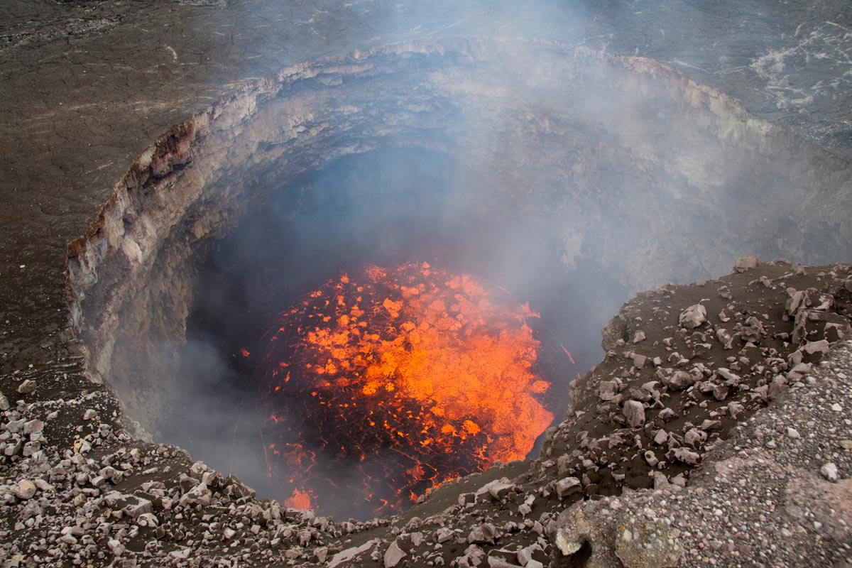
When pit walls falls into the lava lake
Hells cauldron/Saurons bath
Blub Blub Blub lots of gas bubbles breaking the lake surface.
really shows how very very fluid this lava is.
The viscosity is very very very low. Its also very gas rich. Its often described as a highly fluid lava foam that floats just under the lava lakes crust. This photo is from a very old halemaumau collapse many years ago.
The gas content of these magmas are one of the highest for basaltic lavas.
In this photo the lake was young and much smaller than it was in spring 2018.
The lake grew a lot with the years, from a small hole to a magma sea larger than a football stadium.
The pit walls are curious white and old and it don’t look basaltic.. I guess its gas condensates and dust and mineral deposits on them that coats the dark basalt rocks.
Popping sounds were heard to after rim collapses from heat stressed rocks and rocks falling into the lava lake.
Kessler syndrome, one step closer.
Sad thought that just as it becomes possible to go to another planet the human race could be about to trap itself on earth forever.
Heh, from article:
“SpaceX thus has to deploy half of the 7,518 newly approved satellites within six years and the remaining satellites within nine years unless it successfully re-applies for a waiver.”
That’s an average of ~626 launches a year, or 52 per month, for six years, and with no failures. Better get started. That’ll be some fireworks.
May I ask: I seriously doubt there is any way of accurately determining the volume and severity of an eruption that has not been documented properly. This includes every eruption before 1823, when monitoring started.
The more volume an eruption has, especially in the LERZ, the quicker a real channel will form. A proper channel will end up transporting the major part of the erupted lava to the sea, where any evidence is washed away. Even if the channel gave some idea of how much was transported in it, there is no way to tell how long the eruption lasted etc..
Smaller on-off eruptions potentially end up with a bigger total surface of the produced lava field: Instead of one quickly built channel, various smaller eruptions will form more channels, add bips and bops here and there. The surface of lava fields is the only thing we can determine, if we have no detailed records.
The very same problem makes it impossible to say, whether Kilauea´s magma supply is currently elevated or not, not even 200 years of records is a blink of an eye in geological standards..
Yes, that is one big problem and not the only one. The full extent of prehistoric eruptions is usually not known either, older flows will be buried by new ones and that happens very fast in Kilauea, some fissures can also be very long, 35 km for the 1840 eruption, a prehistoric fissure that is that long will most likely be interpreted as different flows from different eruptions. I say this because there is a suspiciously high number of small of eruptions mapped in the LERZ, though this also owes to the first thing I said about only parts of the flows still being exposed and the rest laying covered by new lavas. But still the different cases have to be analyzed individually, the Aila’au eruption as an example. Aila’au had its vent very far away from the ocean so that most of the numerous resulting flows didn’t reach the shore, the only one to have had a substantial ocean entry was the Kazumura flow and it built a small lava delta on a shallow shelf where the lava delta could not collapse. With no volume lost to the ocean and the flow field well mapped a volume estimate has been made and is of 6.5 km³, there is still room for error though and that is the thickness of the flow which for prehistoric eruptions is not known and has to be estimated by comparison to a similar eruption.
There are obviously some problems with volume estimates of prehistoric eruptions so that there isn’t any really reliable estimate of how much lava has Kilauea erupted through the last millennia or of the supply rates, HVO is very quick to say that recent eruptions are breaking records but that can’t be said with what we know. I don’t think though that smaller eruptions have bigger surface extension, the trend during the historic period where we have been able to observe is of small eruptions having small subaerial volumes while bigger eruptions have covered wide extensions. How fast will the flow reach the sea and start pouring volume into a lava deltas or underwater flows that may collapse is in my opinion determined by the location of the vent, even 1955 that is a relatively small eruption for the LERZ was able to reach the ocean because the flows followed the steep slopes of the south flank to reach the sea. Flows from the ERZ that go north or that pond or follow the central graben will cover wider extensions before reaching the shoreline, if they do. I don’t have volume estimates but try to see which eruptions may have bigger than average by looking at various hints. If a flow is aa but had thick and wide channels then it is probably an eruption that had high rates and then has more chances of having been a voluminous one, I think this is the case of Puu Kaliu. When an eruption already has an impressive subaerial extension and also posseses important ocean entries (like 490 BP) then this eruption was big. Or for example ERZ shield-building eruptions (which historically amount to most of the volume erupted from the rift zone) can be used as a way of maybe getting an idea of how much was erupted from the ERZ in the past. The size of the shield could also be used as a hint of between these which eruption was bigger, and these structures are extensive and topographically prominent so don’t get completely erased easily. Mauna Ulu, Kane Nui o Hamo and Pu’u’o’o are the three big shields of the rift zone so most likely represent some of the top eruptions the rift zone has had in the last 2000 years and also contain an important part of the volume erupted. With supply rates I also like to look into the historic periods to infer prehistoric ones. For example rates associated to long sustained activity in the summit have been historically of less than 0.05 km³/year so I tend to assume those rates for similar activity in the 1000-1500, but I already know of someone who is not going to agree with this 😉
Anyways I don’t usually give volume estimates of prehistoric eruptions though I may try to identify those that were bigger, but I agree that giving exact estimates is very risky and will usually be wrong.
I agree, when the eruption was entirely on the surface, it may be possible to determine the volume. However, a big factor for the thickness of the flow is the effusive rate.. If it is rather low, the flow will be thicker, even with the most liquid of lavas.
It depends on how small the eruption is of course. But if Pu´u happened 300 years ago, it would seem like a pretty big eruption because the surface total is quite high! Of course it was a substantial eruption, but it was stretched over a long time with a low effusive rate.
Any ocean entry could have been active for years (like Pu´u) or maybe just minutes.. I agree there are hints like that the eruption might have been bigger when it is a wide entry, but I can imagine a really big eruption could end up losing most of it´s lava to the sea in a rather narrow and fast flowing channel.
When you look at eruptive rates over a longer period of time and consider structures as a whole, the estimates may become more reliable. 0.05km³ per year seems like a realistic guess. I refrain from trying to see an increase in eruptive rate just because the LERZ drained all the magma that accumulated at a higher elevation than the LERZ. Gravity was the driving factor of the eruption this year.
I completely agree with GeoLurking above, that we tend to see patterns, even if we do not have reliable records, while at the same time forgetting to look at the time frame in a geological context.
I don’t really think small eruptions result in thicker flows, the perched lava flow of fissure 8 is up to 20 m thick and that is much more than the average Kilauea aa flow and if pahoehoe flows are thick that is because a lot of units get piled up meaning the eruption has lasted long and has been big too. In fact, the shield of Pu’u’o’o even if it had low rates and because of this might seem not to have been a big eruption still holds more volume than all other historic ERZ eruptions together, but like more than 2 times the combined volume. Its subarial size is in a certain way proportional to its size. I am having a hard time imagining a big eruption losing most of its volume through a narrow channel and into the sea because first the flow would have to turn south if it goes north or east from the rift it will pond at places and feed very wide massive aa lobes, even if all lava would turn south eruptions in Kilauea tend to have multiple vents and feed multiple channels so that in a large eruption this would result in multiple entries or very wide ones when they merge. Even the channels I think would rarely stay narrow, blockages usually happen within a perched channel that can trigger large aa overflows or to even redirect the channel into another direction. Short-lived perched channels will maybe not go through any of these processes but long-lived ones will experience many overflows that will gradually thicken and widen the flow. So I think that scenario would only be possible if a very short fissure (which I can’t recall happening historically during voluminous eruptions) would erupt at high rates a channel south-directed from the rift zone and I believe that the morphology of the lava flow could still indicate that it formed through very high rates (this last only probably if a field study is carried out). I don’t think it is a very likely scenario.
The current rate is higher than average for the historic period, eruptive rates and presumably the supply too have been rising since 1950, a time where Kilauea was basically dormant with no lava having been erupted to the surface for almost 20 years, and activity in the 1840-1934 period had also been very low comparatively to recent events. Pu’u’o’o is the best indicator that activity has been higher than average lately, this structure would still be recognisable as a big eruption if it had happened 3000 years ago. The only shield that is comparable in size but probably still smaller is Kane Nui o Hamo and when it may be around 1000 years old it is still very well preserved as an ancient high island that deflects the newer flows away and will need the surrounding rift to get 100 m higher to get buried, the structure gets intensely faulted though.
The Leilani eruption drew its volume from the stored magma in the system, but there was much more than gravity, other eruptions have happened in the LERZ even at lower elevations, like 1960 that yet it had less than 1/7 of the volume of Leilani. The system was pressurized to begin with, pressurized enough to send an eruption so far downrift which is something that doesn’t happen that often and already means Kilauea was very active, pressurized enough to also move the south flank aside in the 6.9 quake. And then it erupted a very large volume, of what maybe the 6.9 quake may be to blame or maybe it was the conduit between Pu’u’o’o and the summit allowing a better connection and draining of the summit.
We don’t have reliable records but finding patterns and putting them to test in future activity is still very usefull and may help better understand volcanic systems in general. Some patterns may also be associated to a certain part of the lifespan of a volcano, volcanoes are very dynamic and maybe geological time frames are not that usefull when studying certain aspects. Not that there is a very good way to study Kilauea in a geological context either since most of its eruptive history is literally buried in time.
Pressure is a funny thing. The summit had become more pressured after 2010, as shown by the growing lava lake, but not overpressured as such as there was an open conduit. Two open conduits, in fact. The reason for the ease with which lava travels long distances in the rift zone lies below the sea. The island fall off steeply to the south, towards the ocean floor. This is unstable, and the island slowly slides downhill. Note the evidence for these slides under water, south of Puna. That movement downhill creates low-stress direction along Puna, which behaves similar to a spreading rift. Once Lava enters, it flows down the rift almost unimpeded.
The M6.9 quake shows that the stress was already low before the intrusion began: the island was ready to give way and move downhill. That is one reason why I don’t think eruptions repeat the past: it depends on whether the rift zone is primed for the next move.
As for subsea eruptions: the rift zone extends a long way into the sea. Eruptions can happen anywhere along it. You don’t need a tube: the rift itself provides the channel and it can carry a much larger volume than a lava tube can.
Well it would actually be something weird to find Kilauea without an open conduit, I estimate that one or more open conduits have existed in Kilauea for around 85 % of the time during the last 1000 years.
If everything depends on wether the south flank is ready to slid down or not then ERZ eruptions should be equally distributed through time since the gravity driven sliding of the south flank would be constant through time and yet the period 1790-1955 had 3 ERZ eruptions and near continuous summit activity while the 1955-present period has had 20 ERZ eruptions including the long sustained ones of Mauna Ulu and Pu’u’o’o and a summit much less active. ERZ activity would seem to be controlled by other factors. Around the same time the change from summit to ERZ took place Mauna Loa ended a period of very frequent eruptions, that is why it is interesting to study these patterns because the summit and ERZ of Kilauea are interacting between them and with Mauna Loa and it would be great to understand those interactions. The pressure-driven spreading of the rift is another model used in interpreting south flank movement and slip events, this paper goes well into it, for anyone interested: https://pubs.usgs.gov/pp/1801/downloads/pp1801_Chap4_Denlinger.pdf
The decollement fault which would be responsible for the large quakes dips towards the center of the island and responds to pressure of the volcanic systems. The 1984 eruption of Mauna Loa was already underway with high levels of seismicity in the summit and northwest flank by the time the south flank gave way in the magnitude 6 Kaoiki earthquake that preceeded the NERZ eruption by a few months. Both gravity and forcefull intrusions are known to play a role in the island’s spreading but how much does each of them contribute to it I think is still unclear.
There are several processes that interact with each other. If it was just the sliding, it would be stochastic as that is what earthquakes over short time scales (centuries) do – and note that not every part of the rift zone slides at the same time, so stress varies. Magma input fluctuates. The situation at the summit, especially the connection to the rift zone, makes a difference: sometimes the magma just can’t get out any other way than through the top. It makes a difference whether there is or is not a caldera (clearly at the moment the way to the summit has become much easier as the caldera is deeper). The competition between Mauna Loa and Kilauea, with changing paths of least resistance. The processes affect each other: an earthquake can open or close pathways, the weight of the mountain affects both the melt zone and the stress pattern, Mauna Loa is still recovering from the 19th century eruptions, etc. The interaction makes it a complex system. Not quite chaotic but perhaps not far off.
There is the question too of whether the east rift (and therefor pu’u o’o) was also actually being fed from the same direct source as the summit lava lake. The lower SO2 measurements after 2008 would seem to support this but the SO2 measurements from the LERZ eruption were extremely high and this indicates that the lava erupting there had never been near the surface before. The strombolian eruptions and spattering/fountaining of all of the main vents would add support that this activity was driven by gas rich magma that had never been near the surface before even if the early stuff had been in place for decades since 1955 or earlier (I think the fissure 17 magma was probably from ~1790 as the fissures in that eruption line up best, the 1840 dike doesn’t go on the same trend, 1924 didn’t erupt so it is unknown, and 1955 is a bit too young). The lava lake at the summit was fed by a shallow source (source 1) which extends also at a shallow depth down some of the more inland part of the SWRZ and apparently into kilauea iki, that is what drained out this year and probably doesn’t exist anymore, and it drained out to a lesser extent also in 1924, 1868, 1832, 1823 etc. Source 1 might be a more ephemeral feature that has formed and been destroyed many times, and it is fed by source 2, which is the main chamber and is probably a collection of molten pockets that is in the south part of the summit and connects to the east rift and the rest of the SWRZ. This is probably what drained in 1840, although not by a huge amount. This source also drained out this year, though again by not a huge amount as it is still intact. The final source is source 3, which is not a magma chamber but is the collective deep feeder system, which ultimately feeds into source 2 but sometimes appears to bypass that and erupt on its own, last time for sure was in 1959 but by extension it likely happened in 1960 too and the high olivine content of 1840 probably means it was fed here to some extent.
The most interesting part of all of that is that most of the fissure 8 lava also contains a lot of olivine, much more than the other vents, and so it is possible the lava erupted here was coming from much deeper in the volcano than the original lava which was more like what was erupting at pu’u o’o. The last pu’u o’o-type lava probably erupted in late May from fissure 7 which had little olivine despite its proximity to fissure 8 (about 400 meters). Fissure 8 was also assosiated with an observable increase in SO2, which has been interpreted to mean it was magma from under the summit that was draining out, if the vent wasnt so wide the lava probably would have erupted as high fountains, much higher than earlier, but the extreme eruptive rate eroded the vent to the point it was too wide to sustain a fountain. The fountain height on the 4th June was getting close to 100 meters, up from 50 meters on May 30, but it started going down after that.
It would actually make a lot of sense that the east rift would be open at a depth with magma inside, the big quakes would involve movement of the flank down to the basal fault, which is at at least 7 km deep for kilauea and maybe as much as 10 km (and probably even deeper for mauna loa). The 1868 quake definitely opened the east rift, which is probably why there was no eruption associated with the draining then, and the 1975 quake also lead to a reduction of activity, and curiously the spot where the lava first reappeared in 1977 was at the end of the part that moved in 1975. This years quake moved the same area, so it probably wouldn’t be surprising to see activity in this same area in the future, as we already are. The magma moving along the deep area as far as to where pu’u o’o opened is probably not coincidental, and with that also is the duration of the eruption, it was fed by and unusually open source that had filled completely by the 1980s and then filled too far in 1983 where things have been ongoing since up to earlier this year. Effectively the east rift has been acting like a massive diffuse extra magma chamber, and the upper bit of this drained out this year with loss of the summit plumbing and depressurisation of the rest of the volcano, but the first part showing re-pressurisation is the lowest elevation extension of this magma body, which is in the heiheiahulu area, over time it might be expected to see inflation further up and then maybe eruptions at the summit or possibly at pu’u o’o again (increasingly unlikely but still cant be ruled out yet) but at some point there will be another eruption on the rift, probably quite significant as the system is very open right now and a lot of lava can be erupted quickly.
Kilauea might behave quite differently now than it has historically because it wouldn’t take much to recover from even big events when it still has many km3 of magma in store. It is notable that quite a lot of the lava flows from the previous ERZ period, predating the heiheiahulu eruption, seem to extend down the flanks a long distance, with similar extension to the 1977 and 1955 eruption. So far only 1977, pu’u o’o and mauna ulu had sent flows beyond the rift zone out of all the eruptions on the UERZ and MERZ since 1955 (20 eruptions) and only one of these eruptions could be considered a ‘brief’ eruption. The next 10-20 years could be characterised by eruptions lasting generally under a week, maybe up to a month, which erupt quickly and send fast lava flows down the slopes which stall out after the first days. These would probably be clustered between pu’u o’o and napau, and pu’u o’o and heiheiahulu, as these areas are lower and less topographically prominent than the surroundings and probably more likely to draw eruptions towards them. Eruptions will also happen at the summit too, probably more so initially but with decreasing frequency over time. Eventually either another large LERZ eruption or another shield will probably happen, or maybe both in succession again, but I think the idea of this years eruption being the terminator event of this episode is looking unlikely now that the activity still includes the east rift more than the summit, and no wide scale collapses happened outside part of the existing caldera.
Hawaiian very very fluid basalts generaly never forms any thick flows.
Close to the vents its extremely fluid and flows can be only centimeters thick.
Pahoehoe flows thicken as they inflate with lava and lifts the crust.
At start slow moving pahoehoe flow fields are just centimeters thick, but they inflate with time as a crust forms and that lifts the lava surface.
Pahoehoe flows are generaly feed by lava tubes and low eruptive rates.
Aa lava flows are thicker since they are more massive and somewhat more viscous, but even they can be very fluid and thin and fast moving on steep slopes.
Aa lava flows are generaly feed by tall fountains and very very quickly moving smooth skinned lava channels with very high eruptive rates that wont allow a good crust to form
Aa flows can be very thin (~3 m) or can be much more thicker. Depends on what you consider thick but the 20 m thick of the levees in the fissure 8 channel is pretty good and that was also the thickness of the lava channel at most places when a surge came in, perched channels are thicker than most aa flows. Single pahoehoe units are very thin but when they inflate or pile up (which happens often) will usually be thicker than the average basalt aa flow.
Finger pointed at Iceland for 536 event.
Why 536 was ‘the worst year to be alive’
https://www.sciencemag.org/news/2018/11/why-536-was-worst-year-be-alive
Historians have long known that the middle of the sixth century was a dark hour in what used to be called the Dark Ages, but the source of the mysterious clouds has long been a puzzle. Now, an ultraprecise analysis of ice from a Swiss glacier by a team led by McCormick and glaciologist Paul Mayewski at the Climate Change Institute of The University of Maine (UM) in Orono has fingered a culprit. At a workshop at Harvard this week, the team reported that a cataclysmic volcanic eruption in Iceland spewed ash across the Northern Hemisphere early in 536. Two other massive eruptions followed, in 540 and 547. The repeated blows, followed by plague, plunged Europe into economic stagnation that lasted until 640, when another signal in the ice—a spike in airborne lead—marks a resurgence of silver mining, as the team reports in Antiquity this week.
…In ice from the spring of 536, UM graduate student Laura Hartman found two microscopic particles of volcanic glass. By bombarding the shards with x-rays to determine their chemical fingerprint, she and Kurbatov found that they closely matched glass particles found earlier in lakes and peat bogs in Europe and in a Greenland ice core. Those particles in turn resembled volcanic rocks from Iceland. The chemical similarities convince geoscientist David Lowe of The University of Waikato in Hamilton, New Zealand, who says the particles in the Swiss ice core likely came from the same Icelandic volcano. But Sigl says more evidence is needed to convince him that the eruption was in Iceland rather than North America.
I thought Ilopango was given as the 535/6 culprit… but on the GVP database there is a listing for Katla in 540 so maybe…
I have studied tephra layers in Iceland.
See my post of a few years ago, “history if Iceland in my backyard part II”.
There is an unknown gray ash later around that period. It astonished me because it was unlike any other layer in Iceland. Very metallic.
Could it be there this was a meteor impact somewhere in the north hemisphere?
Well maybe someone with access to a lab could go there dig, take the sample of that layer and study it’s composition
It’s between the Hekla 3 layer and the 870 settlement ash.
Evidently, nature thinks we are zombies… it tried to give us a “double tap” (The second rule for surviving Zombieland). Both 536 and 540 are noted as significant volcanic events.
(Rule #1 → CARDIO. And along that line, some group did an analysis of the best strategy for surviving a chainsaw maniac. The conclusion? Running works. You are not encumbered by the mass imbalance of the perusing chainsaw wielding psycho and have a better chance of navigating any obstacles you encounter.)
… and a side note. The general rule of thumb for ELE in the geologic record, is not a singular catastrophe that wipes out a species, but a combined effect of 2 or more “unfortunate coincidences” that stress a population beyond it’s ability to recover.
Example 1) Deccan Traps going full bore at about the same time the chicxulub impactor arrives.
Example 2) Siberian Traps erupting THROUGH a coal seam and adding a massive amount of fly-ash to it’s gas and particle load.
More on that side note: One common thread among “disasters” in many of those disaster documentaries, is that a single failure item isn’t usually the blame, but a cascade of coincidental failures that taken together, lead up to a massive calamity. Sort of a common thread in killing off mass numbers of individuals. And if you want to take it one step further, Campi Flegrei going off right in the middle of the Neanderthal home range 41,000 ybp certainly didn’t help the population at all. The residual population really had no option but to assimilate or cease to exist. As noted above, some of their genes survived, but as an extant group, they are gone.
I should pay attention to 28: “Double-knot your shoes” – always tripping over them.
My favourite way of escaping certain death in the zombie apocalypse is to have Jadis call in a MedEvac helicopter to whisk me off to movie spin-off land – (c) The Walking Dead.
I had questioned another historian a couple of months ago. Krakatoa was his reasoning.
Since Zombies have been mentioned : If You want to raise Your eyebrows, consider the Nicene Creed of the Catholic Church… believe in the seen and the unseen… and that the dead will rise again…. i tell You i always get a chuckle when the youngsters realize that could be Zombies as “Some will rise to Everlasting horror.” …. Faith is really not for the weak. Enough, Best!motsfo
I’m a member of a gaming clan that specialized in FPS matches. Sure, shooting the crap out of AI bots can be fun, but the most entertaining are going up against real people. We aren’t really into any specific game right now, but are eagerly awaiting the next incarnation of Seven Days to Die. In the next Alpha build, they have a new pathing routine where the AI zombies can “smell” where you have walked before and start following your “scent.” This is done via a bread crumb routine that remembers and ages where you have been. It should make the next incarnation quite a tough thing to deal with. In previous versions, on “horde night,” It was quite exhilarating trying to keep the building repaired while your team-mates were shooting the zombies just outside the windows and doors. One of the nastier bits about horde night, is that at night, all zombies can run. Caveat: Football zombies always run.
Watching the pre-A17 release live streams, the zombies have become quite tough with their pathing.
If you look back in time during the island’s highly active periods from the 17th century Laki eruption. Has every period of high activity had a really great eruption?
Kilauea wont shut up for very long
Give it 6 years and she comes back.
Kilauea haves an enormous supply
At 0,3km3 every year it will only take 4 years to completely refill what was lost during the Leilani – Halemaumau drainage. The volcano will come back soon enough ; )
Hekla won’t shut up either. Another quake under the summit. M1.4 this time.
Hekla may never erupt in our lifetime… the time between hekla eruptions are often very long.
1970, 1980, 1991, 2000 was frequent. But often… its not that frequent at all.
Often it can go 200 years or more.. between a Hekla eruption.
Hekla may never do anything in generations.
The huge mediveal eruptions had very long repose time between them.
Some old massive basaltic andesite flows from Hekla are over 16 km long these contains more than 1km3 of lava each.. they can be seen just south of Hekla in Google Earth
South Australian Heat Flow Anomaly… Spoiler Alert: They aren’t really sure why it’s there, but they make a pretty detailed effort to figure it out and examine the merits of potential sources.
Ran across that paper while looking into the statement about it possibly being an example of “radiogenic granitoids” in the “Anomalously high geothermal flux near the South Pole” paper. Again, no definitive conclusion about what is going on… but it is about 350 km from the Antarctic Rift system.
There is likley lots of Mantle Plumes under the West Antarctic Rift system.
The Erebus plume upwelling is one of them.
The ice is so thick in Antartica ( 5 km ) in some places that less intense eruptions can take place under the glaciers without anything happening
Old Kilauea summit lava tubes.
Old lava tubes exposed in Haleamumau pit walls as the lava lake and caldera floor dropped.
These lava tubes was feed by high standing lava lakes in the halemaumau conduit.
Souch lava flows coud have lasted 100 s of years and covered large portions of the South Rift Zone in pahoehoe lavas. These lava tubes was likley active before any Europeans came to Big Island.
Or they coud be from the 1910 s and 1800 s overflows.
Impressive, but not good at transporting high volumes. The tubes are probably around 4 m2 in cross section. For a typical flow speed of 1m/s, that gives a flow rate of 4 m3/s. The fire hose flow did around 1-2 m3/s. The flow in a tube is laminar: the centre flows faster but at the edges it is almost stationary. So the average speed is much less than the highest speed.
To get a high volume, you need a dike or a surface flow.
Souch halemaumau tubes woud have temperatures of over 1210 c almost white hot
Puu Oo was 1150 C yellow orange
I think you might be underestimating the lava volume of the tube a bit, I looked at the lava fire-hose that was present in early 2017 and the cliff it falls down is apparently about 20 meters high and the lava is about 1/6 of the height at the top, making the flow about 3 meters deep and maybe a bit less wide about 2.5 meters, so the flow is about 7-8 m3/s. That is probably the best number we have for the base rate supply of kilauea, at that date there were no surface flows and the volcano was not significantly inflating anywhere.
8 m3/s is equivalent to 691200 m3/day, or 0.25 km3/year, around the high end of what most measurements have been on here. This would give pu’u o’o a volume of 8.75 km3, already twice what HVO gives it, so it really highlights how much lava actually ends up underwater in the ocean. Up until 2007 kilauea was steadily deflating still from when pu’u o’o started, so the average flow rate to the eruption was higher than the supply rate for the first 24 years, maybe as much as 50% higher but probably about 30% overall, so 2/3 of the eruption had about 12 m3/s average flow rate. This is 0.37 km3 per year, which gives 8.8 km3, + the 11 years of 8 m3/s which gives another additional 2.75 km3, so the final total volume of pu’u o’o is 11.5 km3.
Mauna ulu was fed at a probably rather higher average eruption rate, maybe 15-20 m3/s, which over the 5 years it was erupting would give it a volume of about 3 km3 of. Leilani this year was roughly 1 km3, and 1955, 1960 and all the 1960s+1977 eruptions add about 0.5 – 1 km3 total, so since 1955 kilauea has erupted about 16.5 km3 of lava. That is a 63 year period, but 80% of the lava has erupted in the second half of that time, so the first half apart from 5 years of mauna ulu was largely intrusive activity building a large open conduit in the east rift, probably pretty deep as there were no collapses this year apart from already open conduits. This ultimately gave way this year to drain down to the LERZ, and that dike remained open some of the way down past pu’u o’o to heiheiahulu. This would seems a high risk location for another eruption eventually, maybe in a few years like 1977 followed the 1975 quake, but maybe next year or after about 5-8 years like pu’u o’o followed 1975. This could be accompanied by summit filling and maybe a mauna loa eruption again, but I think things arent over there yet.
That supply rate would also mean 0.13 km3 of magma has been fed into kilauea since May 18 when the new lava started erupting in lower puna. That is already as big as the 1960 eruption, and rather bigger than the 1955 eruption, so whatever space was created by this year events probably isnt going to take long to fill. Assuming about 1 km3 space has been created by the draining of magma this year, that will probably take about 5-6 years to fill, but because the summit collapsefilled in 0.8 km3 of that maybe only 0.2 km3 of that space was not filled by collapse and is instead just stress in the rock, and at the rate things are going it will only take about another 100 days to have completely filled all of that too. 100 days from now is on 26 February 2019.
From that date onward it would have been 19 years since hekla last erupted, I will no longer be a teenager, and kilauea will be in a state where it is poised to erupt somewhere at any time.
The magma supply is so large, that a smaller ERZ eruption can happen at anytime.. heiheiahulu is inflating and refilling..
My calculation takes into account that there is a lack of pressure right now too. The area where the JOKA station is (on the 1961 jonika flow) deflated a lot during this activity, and the amount of deformation that has happened there since the eruption ended has not recovered to the pre-eruption point. Im ignoring the big drop caused by the 6.9 quake because it was a single movement on a fault rather than a larger movement of ground subsidence, the deflation can be reversed but the quake is a permanent drop. Currently the JOKA station has risen 15 cm, but it fell about 30 cm so it has only recovered about half of that and it probably needs to fill that before an eruption can actually happen. At the rate of 5 cm a month that gives about 3 months before it could be eruptive and that is also about the same time as my other calculation. The station has slowed its rise though recently so it is not very consistent now.
My calculation only predicts when kilauea might be at a state of equilibrium too, it doesnt mean an eruption will happen then, and it probably wont either, but the longer an eruption doesnt happen after that point the larger it will probably be (pretty self explanatory). 1961 happened about 1.5 years after 1960, but the supply rate now is probably around twice that of 1960 so theoretically 0.7 years after august 4th. That is 255 days, which is on 10 April 2019, about 1.5 months after the other calculation. Basically my calculations all predict an eruption of some sort could happen before the middle of next year and it also might be quite sizeable even only a few months later – nothing like this year but an eruption even only 1/10 the size of this year is already fairly large and could be damaging. 1977 almost took kalapana and sent a lava flow 10 km away, yet it erupted only 0.035 km3 of lava, already much less than the amount supplied since this years eruption ended. Eruptions now could generally be somewhat more extensive than eruptions that occurred before pu’u o’o, as the rift is probably very open and very full now and so it wouldn’t take much for eruptions to occur at any point along the active part of the rift (anywhere between mauna ulu and heiheiahulu). Such activity could also easily evolve into more shield building eruptions.
Even a small eruption seems unlikely right now, the system is still far from recovered from the draining. The summit is if anything still deflating, and same goes for the UERZ. The MERZ has slightly inflated but still has a long way to go to be as pressurized as it used to be. The upper LERZ near JOKA has been the fastest to recover and if it kept its uplift rate an eruption could be expected a few months from now, but I don’t think it will keep it as it already seems to be slowing down because more magma will probably start refilling the other parts of the system. Kilauea is an almost restless volcano and the time span between eruptions since 1960 ranges from months to 2 years… And the period of activity that started in 1960 would seem to continue for now (there is no reason to think supply rates have lowered and activity seems that will continue to be centered around the ERZ in the close future)
HVO gave the flow rate of the fire hose as 1-2 m3/s.
I dont really see how that can be true, the lava tube is level and nearly full on the coastal plain and flows slower than on the pali or near the vent, but the lava fire-hose was flowing out fast enough to free fall out of the end of the cliff, ending up 10 meters from the cliff and starting about 3 meters wide. To make it move that far it has to be going pretty fast and looks like it is flowing about 5-10 meters/second and that added with the size of the tube means it must have a pretty decent rate of effusion. I dont know if it is actually the number I used before but I struggle to see how it is 1 m3/s or even anywhere near that low.
That is the number quoted by HVO, who I do consider an authority on the matter! The fire hose was about 25 meters tall. Looking at the images the lava forms a wide fall, reaching 3-10 meters from the cliff. That means a range of flow speeds, just as expected in a laminar flow. It takes about 2 seconds to fall 25 meters in free fall, so that gives a flow speed ranging from 1.5 to 5 m/s. Note ho smooth the inner and outer edge of the fire hose flow is: that shows tat this is a laminar, non-turbulent flow. The area of the exit hole and the depth of the flow is not visible on any image I have seen. A typical size for a lava tube is probably around 1 m2. To get a flow requires that you know how much lava moves fast and how much slow. If the distribution if uniform, the flow is just over 3 m3/s. If it scales with distance to the edge of the tube (more likely), than the flow becomes a bit smaller. By the way, the best way to make the flow faster is by narrowing the exit hole. You can’t read off the flow rate just from the speed.
In 1911 the lava lake was enromous in Kilauea.
It covered the whole inner Halemaumau pit I think and was almost 1 km wide at one point.
Its worth notice that Halemaumau pit was much more narrrow before 1920 s explosions that enlarged it.
The 2018 lava lake was already huge.. sad it dissapeared.
These where loooooong lived slow constant lava lake overflows
Souch Kilauea eruptions can last 100 s of years knowing how long lived some lava lakes are. Souch eruptions covered large parts of Kilauea in Pahoehoe lavas and built the summit area up. The halemaumau forms a kind of perched lava shield when it does that.
If the lava lake and summit area built up and buried the active tubes deep in high lava lake levels, it can last a very long time indeed for many years.
This is how hawaiian volcanoes grow. The effusion rates of souch eruptions are lower than large rift eruptions,but the erupted volumes after many years.. gets enromous.
Have in mind Puu Oo did almost 11km3, Halemaumau in a similar situation can do much more and haves a higher capacity and magma inflow than Puu Oo.
This was the halemaumau lava lake a while ago.
In daylight lava lakes can appear very grey and reflective like molten metal due to the sillica glass in the lava lakes skinn. This photo was taken in full daylight its very reflective.
On HVO webcams in direct daylight the lakes skinn was very very shiney.
The lava lake is one huge pipe down to the magma chamber
It was also a glass blowing machine as the splashing formed tons of peles hairs daily.
Here the lava in halemaumau really looked like molten aluminum, very very fluid basalt
Looks like molten metal due to fluidity and shinyness of the skinn
Another shot with a extremely shiney sillica glass basalt Lava Lake skinn in 2015.
In direct daylight. This was the most recent lava lakes first overflow in 2015.
This was one of the last HVO photos of the recent Kilauea Haleamaumau lava lake
Nice views of the shiney crust and spreading zone cracks in the lava lakes crust.
These crusts moves across the lake as minatyre plate tectonics “lake tectonics”.
The lava lake haves a surface temperature of 400 c in the grey crust and 1215 c in the molten lava.
The lava wells up at the south end of the lake and then moves across the surface where it sinked down at the northen edge. Its a circulation convection that keeps these lava lakes open and permanent and keeps them mostly from spilling over. Its huge… here the lake is bigger than a football stadium
Heavy splashing and sloshing as the gases escapes where the cooler lava sinks down into the magma column as the lake convects.