Each volcano is an expression of a magma architectural construction, a great sculpture of chambers, pipes and sills, as intricate as an ant colony, or rather like the roots of a plant. This is all hidden away from our view, under kilometres or tens of kilometres of rock that makes it impossible for us to know what lies down there, or perhaps not? To me a volcano is a puzzle of many aspects, geochemistry, earthquakes, structure and eruption behaviour, among others. A puzzle can only be completed by taking all the pieces and putting them together. Not an easy task. I will attempt to assemble the puzzle, or at least part of it, of my favourite volcano. Kilauea. And it all starts with a caldera collapse in 2018.
As I write this, three years ago the summit of Kilauea volcano in Hawaii was collapsing into a caldera. Its shallow magma chamber emptied laterally through fissures in its rift. It might seem like this was a while ago and is now over, but is it? The collapse set off a series of cascading consequences that are still rippling through the molten structures of Hawaii Island. The deflations of Mauna Loa, a swarm of tremor and earthquakes under the town of Pahala, the recent eruption of Kilauea, all might be connected and it has just barely started, I will argue how this all happened and how all the events would be related.
We should first know a little about the connections of Kilauea with Mauna Loa and Pahala.
Kilauea and Mauna Loa
These two volcanoes have quite an interesting relationship. When one volcano is more active the other is less so. In particular each takes over for a period of 100-250 years, during which it gets most of the magma supply in Hawaii, then this activity goes to the other. They share the same magma supply. A far as I know this has been going non-stop for at least 2000 years. On a future article I will talk more about this aspect.

Volcanoes of Hawaii Island. From USGS.
Kilauea was dominant throughout the 18th century and until 1840. 1840-50 was a transition decade. Mauna Loa was dominant from 1850 to 1950. And Kilauea from 1960 to present. We are currently in an era of Kilauea and there is still more than forty years to go.
This relationship is best seen in the supply and the chemistry of the magmas. While Mauna Loa was dominant it erupted every ~3-4 years at an average rate of 1.2 m3/second. The total supply would also include dyke intrusions and slow spreading which could increase the total number by a factor of two or so. After the 1950 eruption its eruption frequency plummeted spectacularly. Dormancy periods have been 25, 9 and 37+ years. The output was reduced to 0.11 m3/second, a difference of a whole order of magnitude!
Kilauea mirrors Mauna Loa but in the inverse way. When Kilauea erupted continuously in the 1840-1920 period it did so at a rate of 1 m3/second and there were practically no large dyke intrusions. In contrast when Kilauea erupted continuously after 1960, during the Mauna Ulu and Pu’u’o’o eruptions, it did so at a rate of 4.1 m3/second, four times greater than in the subdued state. Ever since 1960 Kilauea has been rapidly inflating, spreading, and erupting. It has produced over 6 km3 in this time. The most productive volcano in the world. Overall Kilauea seems to erupt more, but it is clearly impacted negatively when Mauna Loa is more active.

From USGS.
Both volcanoes must feed from the same magma reservoir at depth, and through some mechanism the supply to this reservoir goes to either one or the other. But where? And how? All will be answered, but will have to wait for future articles, lets first take a look at the Pahala Swarm.
Kilauea and Pahala
A swarm of earthquakes has been raging under the town of Pahala since 2019. Actually the swarm has always been there, but its earthquake rates have skyrocketed starting in January 2019 and rising to unprecedented levels. The earthquakes are 30-40 km deep. And there is the tremor. The area just offshore Pahala is an extraordinary source of volcanic tremors. Almost all deep tremors of Hawaii originate from this location and are thought to be caused by magma rising up from the depths. Pahala would be a magma conduit then. The swarm has two parts the southern, deep, offshore swarm of of tremors, and the northern, shallower swarm of fracturing earthquakes. These two distinct parts are important when looking at the post-2018 series of events.

Deep earthquakes August-October 2019, when the Pahala Swarm was starting to ramp up. From USGS.
The Pahala Swarm is thought to be the magma feeder to Kilauea. How could we know this? When looking at a map the connection shows up quite clear, the Southwest Rift of Kilauea, which runs straight from its summit to the swarm, providing a useful connection. However the Pahala earthquakes are very deep, 30 km, does the rift really extend down to here?
Hawaii has a peculiar tectonic system powered by the magma supply. The rifts and the decollement faults. A rift is like a fracture system that is opening up and filling with magma, when simplifying things down a lot. The rift pushes away the flank of the volcano to open up space for the magma. The flank creeps on top of a nearly horizontal fault that is slightly upslope, a reverse fault, this fault is know as the basal fault, the basal detachment, or basal decollement. Why basal? Because it runs through the base of the giant lava pile that is Hawaii. Here the volcano rests on top of the depressed ocean floor 8-10 km below sea level.

The flanks of Hawaii Island are moving like a series of blocks away from certain rift zones. Crustal decollement refers to the basal fault. Created in Google Earth.
Because Kilauea is the volcano getting most of the magma now, then it is in front of Kilauea’s main rift, the East Rift, where we see these processes in action. The East Rift is continuously spreading very slowly, pushing against the south flank which swells upward and contracts, being squeezed by the lateral pressure. This can be seen in action if one visits the data of the GPS stations that the Hawaiian Volcano Observatory is monitoring on the south flank. When the basal fault can hold no more it breaks. The fault can rupture in earthquakes reaching M 7.9, some of the most powerful volcano-tectonic earthquakes in the Planet.
With all the mightiness of the basal fault a second, more modest system is often forgotten. Which is this unfortunate fault? The Mantle Fault Zone. It is called this way because it runs at a depth of 30 kilometres, in the lithospheric mantle. It happens to be a nearly horizontal fault similar in many ways to its shallower, larger relative, it can produce earthquakes reaching up to M 5.2, but most importantly has a very particular slip direction, 137º clockwise from the north, exactly perpendicular to Kilauea’s southwest rift, and positioned is such a way that it would open up the line from Pahala to Kilauea’s summit, and at the perfect depth. To put it simple, the southwest rift extends down to the Pahala Swarm and could provide an effective pathway towards Kilauea. More evidence for a Pahala-Kilauea connection is seen in the events following 2018.

I should also say that the magma chambers of Kilauea are most of them aligned with the southwest rift. This shows when there are deep sources or deflation or inflation, one of the most common sources of deformation that shows up is an egg-shaped pattern that is centred just southwest of Kilauea’s summit, is aligned with the southwest rift, and has the long end pointing towards Pahala. The main caldera of Kilauea formed in 1500-1790, has its outer scarps rectangle shaped with its long sides running parallel to the strike of the southwest rift. Currently the main axis of the Southwest Rift runs more or less coincident with the southeast margin of Kilauea Caldera, making a nearly perfect N 47º E direction line, that is perpendicular to the Mantle Fault Zone slip, and connects the most primitive magma eruptions of Kilauea, at Kilauea Iki, and Keanakako’i Craters, and the December 1974 dyke which marks the main rifting axis of the rift zone. This is seemingly a little detached from what must have been its original position.

The “egg pattern”. From USGS.
There is yet another structure that links Pahala to the summit of Kilauea. The Kaoiki Pali. I think this pali, which means cliff, is none other than the rim of an large ancient caldera of Kilauea. Why? you may think. Because it hasn’t ruptured in over 9000 years. Fault-related scarps like those linked to the slumping or to the rifts rupture frequently over and over. Kaoiki Pali also wraps around the summit of Kilauea like other caldera faults do.
The formation of this structure happened at a very particular time. Kaoiki breaks the Pahala Ash layers that formed until 11,000 years ago, but is covered by 9000 years old flows of Mauna Loa. It formed at 11,000-9000 years. This marks the most important transition in the recent volcanism at Hawaii, where Kilauea ended a lengthy period of powerful explosive eruptions known as the Pahala Ash, and resumed summit overflowing. Mauna Loa went from a period of low activity to a period of very high activity, maybe even almost uninterrupted dominance lasting a few thousands of years. It was a big change. Kaoiki Pali could have formed if the whole complex of magma chambers and sills placed along the Southwest Rift of Kilauea collapsed. Which I think is the best, although perhaps not only, explanation.
After the 2018 eruption
Back to the big eruption. In 2018 Kilauea erupted 1.2 km3 of lava and its summit caldera underwent a nested collapse. An event on this scale had not shaken the island since at least the 1868 eruption of Mauna Loa, if not since 1790. If there was any eruption that could disturb the hellish furnaces deep under the mountains of Hawaii it would be now. What do I mean by this?
An eruption drops the pressure of a magma chamber by extracting magma from it, which may increase the resupply from the magma source to restore the pressure. It just happens that 5 months after the 2018 eruption ended the seismicity of the Pahala Swarm started ramping up towards record levels. The seismicity of the previously suspected feeder to Kilauea Volcano. So presumably it did react to Kilauea’s pressure drop.
First came the tremors. As I’ve said the Pahala Swarm has two parts, the tremor swarm at ~40 kilometres deep, and the fracturing swarm at ~35-30 km. The Pahala tremors tend to always start with a sudden jolt and then a series of later spikes, these can be located much more easily, like they were earthquakes, than other types of tremor.

The tremor came much stronger than usual in 2019. There were 4 pulses. The first pulse had its main phase in January 11-January 23. The second pulse peaked March 14-April 2. The third May 12-June 3. The last pulse came more dispersed in a series of peaks and could be considered more like a bunch of small pulses lasting from June 26 to July 27.
After the 4 big pulses the tremor activity dropped to the typical low levels until mid-2020 or so when a second series of strong tremor pulses started. I will focus only on the first series though. I do know however that there was at least one pulse in the second series, in January 2021, that does rival the 4 big pulses of 2019.

Characteristic Pahala tremor episode.
The fracturing swarm exploded into existence in August 2019. I remember being really impressed by this strong activity and yet this was nothing compared to what was to come. The rock fracturing of this type is thought to be volcano-tectonic, caused by an increase in magma pressure which shatters the rock around the magma. The Pahala Swarm started almost above the location of tremors. If the tremors were related to magma flow, then the fracturing may have been due to this same magma pulse pushing against the rocks on its way up.
The swarming initially exploded near Palima Point, and then propagated 10 km northeast, towards Kilauea, until it reached the opposite end of the Pahala Swarm, where I suppose the magma must have dived into the southwest rift of Kilauea. This happened around the time of peak earthquake activity on February 2020, when HVO was locating 80 earthquakes per day here. Unprecedented for Pahala. The levels then gradually dropped through the remainder of 2020. In 2021 earthquakes rates have started rising again and have nearly reached the levels of February 2020. The first rise August 2019-February 2020 seems to correlate with the first series of strong tremors, the second rise in 2021 seems to correlate with the second series of tremors.
Magma waves?
I was eagerly waiting the magma pulse to hit Kilauea. Perhaps a bit too impatient. It took more than a year for the pulse to move just 10 km up and 10 km sideways from the tremor area to the closest end of the swarm to Kilauea, it was obviously going to be a long wait! But finally something happened, not in the way or the place I would have expected however.
Mauna Loa got weird. Weird means that the volcano started deflating quite markedly with no apparent reason to do so. This was around October 20, 2020. Hawaiian volcanoes, and volcanoes in general, deflate when magma is removed from their magma chambers to feed intrusions or eruptions. There was certainly no eruption. I didn’t notice any intrusion either, and I think I would have noticed, or at least HVO would have. If magma wasn’t removed by the conventional ways, where did it go?

Mauna Loa deflates twice. Modified from USGS.

2nd deflation event. From USGS.
The next thing did happen where I was expecting the way I was expecting. On the morning of December 2 a sudden surge of magma hit the summit of Kilauea. It was quite dramatic. I had been following Kilauea since the 2018 eruption and not much had happened. But all of a sudden there was the fastest inflation I had seen, within a matter of hours the summit “broke”, a dike rose towards the surface but failed to erupt. Kilauea kept inflating, on December 20 it snapped again this time the dike intersected the crater of Halema’uma’u and started an eruption.
History then repeated again, Mauna Loa started deflating abruptly on March 23, 2021. Then on June 1 Kilauea set off in another episode of rapid inflation. It was time to write down the hypothesis.

Kilauea getting two magma surges. The first was responsible for the December 2020 eruption. The pause in supply that ended the eruption could be correlative with the pause in tremor activity seen in Pahala before the 2nd tremor pulse started. Modified from USGS.
Timing of events
What do we know? First, Mauna Loa and Kilauea share the same supply and must be connected at some depth somewhere. Second, a large amount of magma rose through the Pahala Swarm in a series of 4 pulses in 2019. Third, Mauna Loa and Kilauea each have been hit by two rare magma waves, producing inverse effects on them.
Here is what I think. There was a magma chamber which reacted to the 2018 eruption, this chamber is where Mauna Loa and Kilauea are connected. A series of magma pulses rose, each pulse sent two waves, a positive wave towards Pahala and then Kilauea, and a negative wave towards Mauna Loa. Why negative? With each pulse the magma chamber pressure would have dropped pressure, remember that pressure drops when it feeds an eruption or an intrusion. This is an intrusion. The pressure drops would have manifested eventually at the summit of Mauna Loa, which is apparently closer to the source because it was hit by the changes earlier. Basically it would have lost magma due to the 2018 draining of Kilauea needing urgent resupply.
Presumably each volcano has been hit by the first and second pulses of tremor that took place in 2019. There is one problem though, the distance between them seems to have changed. The first and the second came 62 days apart in the tremor region, 154 days apart as they hit Mauna Loa, and at 181 days as they hit Kilauea. This would suggest the second pulse is travelling slower than the first. It is possible that the speed at which the waves move could be slowing down. The depressurization wave created by Kilauea was the fastest to reach Pahala in 8 months, the first pulse took 23 months to travel the same route up, the second 25 months.
This makes predicting the arrival of the third pulse complicated. Assuming that the interval between the second and the third changes by the same factor as the first interval, the arrival of the wave can be estimated, though how accurate it may it be remains to be seen. It may arrive at Mauna Loa on August 17, and at Kilauea on November 20. The third could be the strongest if the number of tremors are a good indicator.
Conclusion
The 2018 eruption of Kilauea keeps giving new surprises 3 years later. It seems that it set off a series of waves that are rippling right now through the magma system under Hawaii, and might continue to do so for years to come. There could be a lot to learn from this. The third pulse could provide the final confirmation that Kilauea and Mauna Loa are connected through a magma chamber that feeds into Pahala, and it may also provide data regarding the properties of this connection.
Kilauea is likely to keep erupting from Halema’uma’u Crater episodically and fill up the caldera or part of it. Seeing how the pulses interact with the filling of the caldera will be most interesting.
I plan to continue this article with some others about Kilauea too. See you in the next one!.


A timelapse from above of Nátthagi filling up https://youtu.be/XG1Ryl53elc
Last night the Langihryggur cam failed — blank grey. The mbl closeup stayed working at least until when I went to bed, but by the time I got up this morning it too had conked out, with the same symptoms, and the RUV one had not been fixed.
Does anyone have any working, current cam URLs? 🙁
The mbl.is close-up is working – https://www.youtube.com/watch?v=WqwjnMjSIwI
So is the Natthagi one – https://www.youtube.com/watch?v=XwN-u4Ccygs
All the others are working, but in the clouds. Weather, an occupational hazard for Iceland volcano watchers.
They are all back. The fog has lifted.
Well, seeing as this article is actually about Kilauea, I do have one question, is there any sort of way at all to quantify how much magma is on the way to Kilauea right now? The Pahala source cabt be the only source, they get magma elsewhere too, but maybe it is the driving force of which one is more active, seemingly it is going to be Kilauea for a long while this rate.
All this boils down to it really looking like something big is in the making there, you dont get quake swarms down at magmatic depth that big unless it is going to mean business later, maybe not surprisingly the only place anything like this exists is Hawaii, whatever Greip is that is probably the only comparison but still way smaller, and that is at the source of the volcanoes that did Laki and Thjorsahraun… Probably I have not worded it well before I dont think it will be anything crazy, no 15 km3 flood basalt down at Kapoho but an event as big as Holuhraun – again – is on the table. Really the fact 2018 was so big yet counts as a ‘minor’ collapse compared to some of the others, or that the chamber was only minimally damaged, should be concerning. Also such a strong draw on the magma source should induce a lot of decompression melt, and likely a great excess on what is needed to fill the void.
As in how much magma is causing the recent surge in the Pahala swarm?
That is an interesting question. Unfortunately I don’t know of any way to estimate that. It also needs to be considered that the amount of magma supplied to Pahala could mostly accumulate there and be released up slowly over the years.
The changes are showing in strange ways that haven’t been seen before, for example the waves impacting Mauna Loa have caused the deflation events but also an episode of accelerated inflation, the waves could be more like ripples in a flow of magma that on the long term hasn’t changed much, or that has changed very little. It could be the same supply but just fluctuating up and down/down and up due to the tremor pulses propagating upwards.
https://m.youtube.com/watch?v=WqwjnMjSIwI
Webcam is back
Well it looks like Bob is no more, it was buried by the new lava finally 🙁
🙁 🙁 🙁
https://www.youtube.com/watch?v=qgAdpZ69YgA
Nice over flight at iceland. Good to see the aria around the volcano also to get some perspective, Still its strange for me it eroupt where it did.. Not a spot i would have think.
Looking at the local scenery, much of the geography seems to look like some massive lava flows have happened in the distant past, particularly to the north. Flat valley floors which characteristic ruffles on with an abrupt change in slope at the hillside.
Hopefully someone will post a map showing sequential lava flows (possibly dated) over the whole peninsula. Then we can see what constituted “big” and “small” eruptions there.
http://jardfraedikort.is/?coordinate=63.95%2C-22.13&zoom=7
🙂
Many thanks, lazy on my part.
They are mostly ‘rather large’ assuming each shade is a single eruption.
By rights we should have months, surely?
No probably the eruptions were mostly over in days, with one vent maybe lasting a few weeks at most. It is like Krafla in 1984, a lava flood eruption. Laki was a series of these recurring, apparently at least 10 times, so in effect the intensity of the eruption will probably be comparabel to that on the first day. Potentially right in the middle of Grindavik…
Any idea how long it takes fresh lava to become productive soil, and how dependent is it on climate? I’d imagine ash could become soil much quicker than lava.
Example – the slopes of Vesuvius are pretty fertile (you can buy wine from grapes grown there – at least that’s what it says on the label), despite a lot of activity over the last 2 millennia.
https://en.wikipedia.org/wiki/Mount_Vesuvius#Later_eruptions_from_the_3rd_to_the_19th_centuries
Whereas the lava you see on the Keflavik – Reykjavik road looks suitably ancient and mossy, but not much soil there. How much of that is due to age, and how much to climate (plants only growing in sheltered crevices)?
How old is that lava, and how old are the various other Icelandic lava fields? Is there a map showing when they were laid down?
See my above link 🙂
All the lava that actually looks like lava in Iceland is from the Holocene, but probably it is not a good enough climate for it to break down. I think areas with soil there are in valleys downstream of glaciers or close to volcanoes with more explosive characteristics.
Thanks, I am looking at the maps but can’t see what the colour codes mean – is there a key anywhere that will give me the approximate age of each area?
I assumed that all the lava was geologically recent, just wondered if (for example) the stuff between Keflavik and Reykjavik was already there when the Vikings arrived. I take your point about climate – plants have to cling on in sheltered spots, and I’d have thought plant life was a major factor in breaking down lava into soil.
” areas with soil there are in valleys downstream of glaciers or close to volcanoes with more explosive characteristics”
Sounds like Þórsmörk !
Yes, Katla and Hekla are more explosive, so a lot more ash that is more readily turned to soil.
If you click on the map it shows the ages, if they are known. Historical flows are often labled with the age.
The lettering is different ages, so many may be quite modest, although they may be overlaid by adjacent layers,
How many km3 have been erupted since holocene start ? most numbers puts it on Around 450 to 500 km3 If you adds in subglacial tephra
Pleistocene lava flow structures been scraped away by glaciation
Odd, really, because you would think that freeze-thaw would work well on relatively porous lava, but this is clearly very slow. Perhaps biodegradation though a biome evolved to handle it (as in Hawaii) is more efficient than physical means. Clearly water is not limiting (eg Galapagos).
It would seem biodegradation is much faster, and trees also seem to be much faster too. Hawaii has Ohi’a trees, which grow very fast on lava, the 2014 flows near Pahoa are only 7 years old and have small trees on them already, likely there are some growing on the 2018 lava too but still small. Iceland has moss but that doesnt really weather the rock, and trees there seem not very well evolved for volcanism, maybe because rate of resurfacing in Iceland is much less than in Hawaii outside a couple select areas.
It is best seen I think on Kilauea, where you have lava from 1823 looking brand new down near Pahala, and lava from 1840 north of Leilani estates which is so overgrown you can only see it from space, even though it is almost 20 years younger than the 1823 lava. Difference is there is no plants but thats about it.
Above a certain porosity, increasing porosity reduces susceptibility to freeze thaw damage. The natural porosity of wood makes it quite resistant to ice damage, and air-entrainers are added to pavements in temperate and colder climates to make them freeze/thaw resistant.
Lots of factors affect the development of soils. The climate is the major factor, as it affects the availability and activity of biota to break down and process the lava into soil.
I haven’t looked deeply, but from snippets and scraps of oblique references, I infer that there’s also been a lot of soil erosion in this area since the first human occupation of Iceland. The big clues are in the valley names; I cannot imagine anyone being able to farm horses and sheep on this land as it was, just before the eruption. It’s no coincidence that the old farmhouse is by the coast, and hasn’t been a farm for many years. There’s a YouTube video describing the recent history.
In contrast, the ‘abandoned village of Hesteyri has good levels of soil, although it’s further north. I spent an idyllic day being taken around the village by one of the families who use the former homes as summer houses.
To be honest not much evidence of erosion. No deep gullies where the soil was washed away, and even the winter lakes seem to have perfectly good soil material. However Iceland is a long way north and will have a very short growing season and livestock will remove tree saplings very efficiently. There are certainly patches of scrubby grass, enough to burn, and the area is quite large and could have supported limited livestock during the summer. That the farms lie derelict suggests the lifestyle was pretty basic and quite marginal with the farms basically providing little more than subsistence. They existed in the UK until quite recently (I’ll be a few still exist) where the farmer had an income of under £5000/annum, some cash for diesel for the old van and the generator for a few hours lighting in the winter, vet bills and a few basics. They heated the house from their local trees, killed the odd animal from time to time and had a house veg garden. They were totally unaware that support was available.
Here I suspect people have gone to work at fishing or at the odd factory/whatever rather than live hand to mouth.
Farming has a lot to do with it. In Greenland, soils were actively improved using manure. I assume that was done in Iceland as well, perhaps using the horses. Sheep at high density can be very destructive, and if they were kept here it could explain a lot of the land. The basic problem in the area is that soil is removed faster than it is created. That leaves the moss which does not need soil.
Its quite hard to remove soil unless rainfall is high and slopes are significant. From what I can see where the bulldozers have been working there is quite a bit of dirt under the surface layer of stones. In stony soils (and even in my garden) stones tend to rise to the surface as smaller particles fall underneath, its well known.
The purported statement that sheep at high density are damaging is largely an urban myth.
What you DO get is grazing of uplands (even worse arable farming like on the downs) harvesting nutrients, mostly phosphorus, and bringing it to in-bye land and it never goes back. This depletes the uplands and makes any plant growth stunted and impoverished. Its why common land (and also downland) which was once hugely productive, is now marginal.
Manure, human or animal, in general redistributes available nutrients as P&K are elements and not made any more. There is a mass of urban myth, largely derived from the organic movement’s muck and magic, that powers governmental thinking to this day.
Don’t even get me started on the myths of grassland, woodland and carbon capture….
PS A good way to improve soil is to remove the stones and make great big walls of them.
I like your know-how. Fagradalsfjal is upland and looks bare in many places. The peat fires followed the gullies very well, and I assumed this was because the soil ended up there. The valleys must have been fertile enough at one point, but I think you pointed out that Meradalir must have been better then Geldingadalir as the mares were kept in the best gras. Neither did look very fertile on the pre-eruption images. Rain can of course leach out nutrients. But Iceland can also get dry and suffers from sand and dust storms. The winter after an eruption was often called a ‘sand winter’. So wind should not be ignored.
Hoping this ends up as a reply to Albert.
The fires were much more than the gullies, you can see where they were from the black, which still remains. I suspect the fires burned where there was shortish grass (the sides of Natthagi before and after show this quite well). Above that its hard to know but I suspect its solid rocks with any small stuff well down. Leaching really only applies to N & K, N is from lightning (not much) and either cyanobacteria or legumes (some lichens, I believe) but will be very limiting. K comes from weathering (or K-clays) but is readily leached BUT plants hang on to it for grim death. Phosphorus is from weathering and unless the soil is acidic is completely immobile.
Drought on these sorts of soil will be damaging to plants, mosses handle it better, they just dry out and await the rain (see roofs).
Without K & P levels of the lava, its hard to comment.
Vast amounts of smoke? dust? at the Route A retaining wall. Ah, it’s dust – two diggers making the wall even higher!
Sensitive or depressed people: refrain! Lot of suicide or murder in live at the end of the season. All images are dark (ashes hide sunlight). The pictures are maybe realistic in the event of a volcanic eruption, but at the end everything looks black. It gives a particular image of Iceland. In addition to ghosts and gudrun, there is a zest of alien life. The future will tell us.
sorry, the previous comment is related to “voice of Katla” from Luis Godinho
Thank god for that.
The book bit.
link removed on suggestion by a commenter, with apologies – admin
Wow another camera dance – how enjoyable to see another family doing that loads of others have done (NOT)
Don’t know if this has already been commented on, but the Visir cone close-up webcam is dark now. I wonder if it got over run by lava.
IMO makes assumptions about the progress of the lava field.
https://www.vedur.is/um-vi/frettir/hraunflaedilikon-hafa-sannad-sig-i-eldgosinu-vid-fagradalsfjall
That map is very off in very many ways. The orange layer extends beyond Natthagi, but is way to narrow to reach the elevation necessary to reach the exit, and thus it is physically impossible for a flow of that shape and extent to occur (the flows in Natthagi are already wider than the orange area). 3.1 km^3 would be a quadrupling of the current volume, which should be more than enough to reach the sea. An eruption of 29 km^3 is not going to happen and would cover a very slightly larger area (aka a much, much, much larger area).
Do they mean millions of m^3 rather than km^3 (which is a billion m^3)? That would mean more sense, then the orange would be showing flow down the middle of the lava pond to the exit to the road and that could take a couple million m^3
Sorry, 3.1 km^3 would be a 40-fold increase, which is what I meant too say, not 4.
Still confused, it would be 400-fold increase, since eruption is 0.073 km^3.
No, 40-fold, should get a brain reset!!!
Can probably round to 0.1 km3 now, its been a good while since that 73 million number was released and theres maybe 1-2 million m3 erupting per day. So now actually quite a normal size eruption just a bit of a slow one.
I think the legend on that particular photo is wrong, when I followed the article the same image had 3.1 million m^3 and 29 million m^3 respectively. Looks like someone got in a hurry and made a boo-boo.
Alternatively, they may have meant to use the little know hm (hectometers) in which it would have been 3.1 hm^3 and 29 hm^3 but somehow I doubt that 😏
The map is a reasonable assumption.
I sip wine in a lush high CO2 early 21st century Wester European land.
Everything looks fine to me.
But.
That map is on drugs.
Currently 0.065km3 has erupted, and then stating that the eruption will become 29 or even 3.1 km3 is just fevered dreams not based on feasability.
I am trying to understand what the numbers on this map mean. It is not obvious. For the light orange region, the quoted volume corresponds to a thickness of about 5 meters. So I think it is just what is needed to cover this area on top of what has been deposited already. The dark red area would need a thickness of 10 meters to get to the listed volume. Assuming that 5m3/s flows into Natthagi, that volume will take 2 months which is about the time they quote (summer/autumn). But I am guessing
It is cubic kilometres they are stating Albert.
So, to cover that area it would take years at the going rate.
The numbers on the plot are in million cubic meters. If they really mean 3 km3, then the lava would cover a much larger area than shown. I think we are missing some information about the plot
I think it is an error in numbers on their part, an eruption that big would bury all of the peninsula pretty much, not just a slight extension of the flow as it is now, it would be something on the scale of the Observatory flows at Kilauea, or Theistareykjarbunga, a centuries long eruptive event.
Most likely it is meant to be km2, for flow area. It is still an issue that mistake was made at all from this source but at least one that is recognisable.
That is possible, that it is the plotted area in m2. But that still doesn’t explain where the numbers come from.
Carl, they since fixed it.
The scenarios assume a lava flow of 3.1 million m3 on the one hand and 29 million m3 on the other, using Google Translate.
Source: https://www.vedur.is/um-vi/frettir/hraunflaedilikon-hafa-sannad-sig-i-eldgosinu-vid-fagradalsfjall
Which is bizarre as the latest volume is 62.9 millj, m3. from the Institute of Earth Sciences. or, perhaps, “millj.” is not an abbreviation for million. https://jardvis.hi.is/eldgos_i_fagradalsfjalli
They corrected the map, it is now in millions of m^3. It no longer says km^3, which makes much more sense. I think it was fixed between Carl and Albert seeing it.
I think it is measuring the volume needed to flow into the Natthagi area to cover the colored regions. Since it is almost all downhill, I would like to know what their estimate is for likely slope/depth.
My thought precisely. Particularly as the flow quite readily channels itself once a good flow happens (as against just flooding a level area).
I said way back when the eruption started that we should standardise on km^3 for all volcanoes, that being a geographical natural number, and use milli/micro/pico as appropriate. That way scaling is obvious. In many ways it should have a name, like an Albert or a Kimcu (abb Ku). Then 10 m^3/sec would be 10 nKu/s or 26 mKu/month or 0.3 Ku/a. The size of the eruption is immediately clear.
Hi All,
Just a heads up, my channel on youtube got a copyright strike from mbl.is.
I am a bit surprised, since I always mentioned the source and I don’t monetize it in any way.
However, in the end it’s their images, their copyright.
I guess it has something to do with that they started their own channel with timelapses.
I will contact them about it, but it might be that that the mbl.is timelapses are over.
(I only hope they will not claim all the other videos too, it’s too good an archive to disappear)
Your record is lost because $$$$/££££
The Internet is now a hollow shell of the beautiful thing it once was.
Thanks for what you did, I enjoyed them all, the volcano grew before our eyes.
Regards.
There has always been a dark side to the internet, if anything it is better now because that part is getting the attention it doesnt want.
I am sorry to hear this. Why don’t you sell the video to them? You have edited the original data, after all
I wonder if that is what happened to tokolosh. All of his videos and livestreams disappeared one day
I believe MBL.IS felt he was in breach copyright. He has set himself up now with another name.
The lava has found the shortcut into Meradalir, at last.
I thought it was already all over Meradalir? Or am I getting confused with Icelandic horsy valley names?
I thought there’d be neigh chance of that….(sorry.)
Meanwhile, Chad’s “Hell Machine” is beginning to creep to the front of my mind with this volcano. I have been watching the close proximity MBL camera, and the lava continues to pour relentlessly to either side of the vent. Carl’s assurance it may shut down in a few days is not looking like an odds-on favourite.
I never said within a few days, I said between 1 week and 3 months. Still sticking to that. 🙂
Oops, sorry boss!
This eruption will last many many years perhaps a decade.. yes the ”Hell Machine” have been turned on
Carl is wrong about this one ; )
We will have to see how strong the hell machine affect really is though, I originally thought of it to describe Kilauea with its endless magma and cycles of intense decompression melting when it has collapses, like now. I realised though it might also apply to eruptions of direct mantle origin, like Lanzarote, which typically are large in scale but not very intense.
The one crucial thing is if decompression melting can keep up with the eruption rate as it accelerates, it seems what Carl is talking about is the eruption rate is higher than the rate of magma generation now, so will not stay this way forever, but of course that could change too. Reykjanes is though much less active than Hawaii, by about a factor of 100 in fact, so possibly wishful thinking of this lasting so long. Shields in Iceland seem to end quietly by just seizing up from old age, where large shields in Hawaii are terminated early by a major rift eruption, as we saw in 2018.
Not sure the canary islands are known for a high volume/annum either, yet …
Yes, but the eruptions on Lanzarote were many millennia in the making, maybe even tens of millennia of magma accumulation. Magma there was also mostly very alkaline, even of similar composition to Nyiragongo, nephelinite lava. Reykjanes is of course MORB tholeiite, so much larger melting, though not as much as under Vatnajokull, or especially Hawaii.
I guess Carl’s estimate is based on the ground deformation, which makes sense to this amateur though I’m not competent to critique it.
It did look last night as if more lava than usual was heading east, which is good, but on the other hand the vedur Meradalir camera doesn’t show much difference to the usual activity.
Amazing changes to the cone in that timelapse. Even in the last week it’s changed. Back in March you could stand right by it, now the lava is everywhere. The rising height of the cone is obscured a bit by the rising height of the lava it stands in.
One thing I’m not sure the videos give you is a sense of the size of the cone – it’s got to be near the height of former Theatre Hill – or the baleful impression it gives when you see it with your own eyes, a dark tower in a dark lava sea, even on a sunny day.
http://brunnur.vedur.is/myndir/webcam/2021/06/22/webcam_meradalahnukurSSV
You mean around the back of Communication Hill, I presume.
Sure. It´s Coming. Better view here:
http://brunnur.vedur.is/myndir/listi/webcam_meradalahnukurSV.html
Use with care, heavy load.
I checked, it’s a done deal by about 3pm when the cloud lifts.
Somehow this site doesnt work for me.. I was waititng for this to happen for weeks now, and now I cant even see 🙁
Thought be of interest, sorry if it’s old news!’Analysing volcanoes to predict their awakening ‘.(22.6.21) http://www.sciencedaily.com
00.15 am, a couple of high lava kicks from the vent pond.
will someone tell me what happened at 1:06 am on this cam?????
https://www.volcanocafe.org/kilauea-i-magma-waves-from-the-phantom-rift/comment-page-1/#comments
this one above
looks like the pond found or broke through a hole or tube and had a big drainage event.
Was like a blocked drain who has opend.
The Air can’t escape as the Lava drains down. So it started to bubble.
Like a drain on the Streets
You described it better than I did, but that was my impression.
That was pretty wild. It looked like that lava pond sprung a leak from below and drained pretty quickly, and then managed to refill itself in a couple of minutes.
1:06 and 50 seconds – looked like very vigorous degassing and fountaining of a perched lava pond just above that bright outflow on the right. There’s been a few such episodes in that area over the last hour, but 1:06:50 was by far the most impressive.
Back to my work … 🙂
Just watched a YouTube video report of a new vent has opened! Be honest I could not see it! It just look like a lava flow from main vent.I have my doubts!
Fairly sure it just strong flow from the existing vent, and some strong degassing in perched ponds. I interpret the apparent dome fountain centre right on the MBL close-up cam as the result of strong flow down a slope into a lava pond.
Am with you,I don’t think that guy who made the call did not bothered with proper research.
Sorry to go on – he was referring to the ‘small’ activity on the far left(slight splatter)
If it is a new vent it will fountain, probably to a significant height by now too. Dome fountains are different, they can be vents but also can be skylights overflowing, rootless structures. A true deep source vent will also probably be a fissure, and probably somewhere north of the main cone where the other older vents are or maybe further north still, instead of on the high existing lava.
I totally agree,a. Puzzle why this guy went to the trouble to put it on YouTube-now I can’t find it?
I assume it is this it
Chad good find 99! Have you come across this bloke before?
Not watched him, he seems to not really actually know a lot about the subject, just talks about it well, like that dutchsinse guy only not claiming to know better… 🙂
In this GutnTog video it looks like there are earthworks in progress on the coastal plain (for lack of a more specific name). They may be preparing to guide the lava once it escapes from Nátthagi.
I think that is just the way they drive up to the wall on the hill, or where they put the machines when not in use (better there than on the hill next to the lava). There is probably no point trying to stop the lava now, the volumes are sufficient that if all of the lava erupted gets ponded in geldingadalir even for only a few days – where it will flow into natthagi – it will flow to the ocean very fast. it is not going to flow like a slow pahoehoe flow, it will be a sheet flow, or a fluid a’a flow, much faster moving and probably very dangerous to be around, if it can be avoided it will.
Floe from meradalir will also eventually flow to the ocean in more or less the same place anyway, as long as the eruption continues it is more or less inevitable.
i want to Thank everyone who answered my question above…. i tried to give everyone a star but was unable too.. So Just Know… Everyone gets a star… Thank You. i think You are all correct.
Etna is going nuts again.
I have been waiting for Etna to make an appearence here again. It took a month break after the massive paroxysms in February-April but it has been doing more moderate ones almost daily since May. Probably going on 30+ this year so far if not more. Hard to see this not ending with a flank eruption in the coming years, its a lot like it behaved in 2000 and it had major flank eruptions the following years.
Today’s video looks like a flank eruption, am I correct?
Also a ton of black smoke.
Wow. Has Etna always been this gassy, or are these vigorous fountains a new trend?
woooow, I should have chosen Sicily instead of Iceland to travel to next week!
Unless you are from the UK, Iceland is the only country on our green list 😀
Iceland is great, have fun
Geldingadalir RUV webcam has been moved, turned around. Timestamp 10.58.21. Vandals, presumably, there were 2 persons close to the camera, obscuring the left hand edge.
Correction: looks like it’s being moved. Mucking about with solar panels. Waiting for dust to settle…
Has anybody got a clue where this is? It can’t have been moved far, and is showing a shallow path. Is this in anticipation of Nátthagakriki being overrun? Or is it tracking the southern path to Nátthagi?
The ‘south’ end of Geldingadalir perhaps? Unsure how far that flow has gone, but if that’s where it is pointed, that might be kinda close to breaching the valley?
Been a long time that camera has been in one spot – the original one, yes?
Yes, the original. A landmark of sorts.
Look at:
– https://www.google.com/maps/d/u/0/viewer?mid=1e4waWgJKj0cujWRkQyX838qk7t3HblU1&ll=63.88524118476331%2C-22.298686033160635&z=14&fbclid=IwAR3LOHnVEPdiUrJVZggmXMEwOIklD0H9VL_d-MMjHcLYLMZ2ZWEYF_iOngM&entry=yt
In the NW corner you have this camera and as it is not moved much, one can guess that it is pointing west towards the original western trail now. look at the shadows from the equipment in the picture. The sun should be at it’s highest point now and to the south.
i don’t know when You posted this or where You live but it’s helpful to remember here in the far north it’s not “sunrise in the east and sunset in the west” Sun placement gets real WONKIE near the solstices.
The caption at the bottome says “Natthagi fra Borg” – “Natthagi from Borg”. It looks like it is pointing at the low, narrow point above Natthagi, to the west, below where the lava flow was diverted by the wall on the second of the viewing hills on Trail A.
Perhaps it’s been stolen? 🙂
We’ll know soon when we see the inside of a car, followed by a garage and house….
Could just be a strong DI event, but the inflation at Kilauea has abruptly stopped. It looks like magma could be filling in the Pu’u O’o area though, the GPS there is noisy but it does have a slight upward trend as of late, to mean slight rift extension.
Maybe this pulse was not enough to restart the eruption, or is just a result of the vent actually closing while supply continues. But if your hypothesis is correct on a mid November magma pulse that I expect is going to erupt. To me it looks like the rapid inflation up to April was initiated by the December intrusion, and that an eruption broke out as a consequence but didnt accomodate the influx after the main vent was drowned. Halemaumau is filling up rather quickly, wont be long at all before a Nyiragongan eruption is a possibility.
I’m the last one to buy into patterns–I’m not convinced that Kilauea follows one–but if we want to turn to the past, look at 1961. There were either three eruptions at Halemaumau (or three phases) followed by a middle ERZ eruption. All of them were minuscule compared to 1959 or 1960.
Two of the 1961 eruptions were the same source and maybe an accidental eruption of magma sitting near the surface. 3rd eruption was like the recent one but not as big, it was probably the first eruption after 1960 to be directly sourced from the magma chamber. The rift eruption was deceptively large, it was a major intrusion that set off a 7 year rifting episode, the same fissure erupted again in 1963, 1965 and 1968. At the same time a second rift opened in the chain of craters, smaller but better connected to the summit, and it became Mauna Ulu.
Pu’u O’o also formed very close to the line of the 1960s rift, not exactly, but close enough that it seems beyond coincidental. Especially as the quake of 1975 would have encouraged magma to fill this area more, the same could be happening today as a result of the quake in 2018.
The lava shield is almost up to the cone level on the south (former Theatre Hill) side, if you look at the view from the mbl camera to the east of the cone, looking across to Geldingadalir.
That’s going to make it harder to tell where lava is going, as the exits (which are already beneath an apparent rock/lava bar across the channel) will increasingly be hidden from the camera on Theatre Hill.
That uncertainty might explain the “new lava source” story referenced earlier.
I think I have located where the Geldingadalir RUV camera is now placed and what it is looking at (namely the flow from Geldingadalir to Natthagi)! The yellow outlined area in the attached image shows where the camera is looking toward. Grey is where it was pointed initially after being placed in the new location, and the purple line is the direction to the old location. https://imgur.com/a/SSU0GKg.
The hill at the bottom of your screenshot is Borg, I would put it at the point of the western part of your triangle.
Actually, Borg is further south, which is what it says for the location on the caption. As Albert describes below, it looks like it is pointing across the exit point for the lava from Natthagi.
Is anyone else having problems with this Website when using Google Chrome? Since yesterday, Chrome only shows links and graphics on the background starfield. No text is visible, and clicking on a link doesn’t make any difference. The site looks normal when I use MS Edge as the browser.
It is fine for me. Perhaps clear the Chrome cache and see it that helps?
Thanks, Clive. That worked perfectly and was very easy to do: just press Ctrl and F5 with the VolcanoCafe Website open.
https://www.youtube.com/watch?v=WqwjnMjSIwI
The lava is tipping out more today alright.
Nice lava fall and wide too.
Timestamp 16:38
Just Wow! It went on for ages too.
From about 16.10pm, great panningand zooming right in to various locations and features visible from the close camera, including a great view of the lavafall, showing the recycling of the thin crust as it gets churned over in the plunge pool. Excellent stuff.
And the lava ponds extend further into Geldingadalir, looking more like travertine terraces. Bob/Smeagol is definitely gone now.
That Theatre Hill webcam could really do with some love and attention. It is smeared with crud and the colours are off.
The MBL techies will have to hike out to it.
It will be a struggle to keep their cases and equipment above their heads as they wade through the lava rivers, but I’m sure they’re up to the job.
I see the RUV cam that normally overlooks the vent from the west is getting a feed from another place. It looks like the view is of the Natthagi exit path from Borgafell, with Langerhyggur rising to the left. (Apols for spelling)
Have I placed this view correctly?
I assume it is for the anticipated flood of lava exiting Nattaghi
Wait, a picture is worth a thousand paragraphs of my incoherent drivel:
I lost track.
What is the dark green patch.
A one sheep meadow? 🐑
I thin it is somewhere around here. Lava is not too far to the left
That makes more sense (frm a viewing point of view), than where I was saying. I think it is pointing across ot the opposite sidoe of Natthagi to where I thought. There wouldn’t be much to see where I thought and pointing across there shows the Natthagi exit.
Thanks Albert. That was my estimate too. I wonder how long it will be before the lava output reaches the camera’s viewpoint?
You can see the “One Sheep Field” on the slagaNNA camera
https://maps.acme.to/gos/slideshow.php?getcam=webcam_slagaNNA
Progression of the lava will be easier to spot from here, although it is stills only.
Yup. Good place for an additional view. Lot better than missing a close up of the eventual breakout.
I think that the very top of the image of the Langihryggur camera (when watching Natthagi) overlaps with the view from the displaces Geldingadalir camera. at least I thought I could see the same people..
Lots of people arriving now. We are awaiting bummer time
Ok…let’s see if I can get this right…(ha)
The upper (farthest) pathway goes towards the RUV camera covering the volcano, the upper dam, and Natthagi.
The middle pathway goes towards the MBL camera, featuring the Bums of Iceland.
The close pathway goes towards where this camera was originally pointing towards The Twins.
Careful: the ‘Bums of Iceland’ camera may achieve notoriety!
RUV bring you “BumCam!”
well here’s a wild hare===== anyone else think the constently degassing plume near the main vent( which some believe could be the new vent) MIGHT also be the original vent number 2 which just constantly had the actual flame and acted more like a pilot light instead of a lava vent? Just weaving random thoughts. i’ll get my coat… it’s a little cool here… 59F with north wind.
Not a bad suggestion. It is the spot that was a smoking pot some weeks ago. I think.
Coffee time!
i’ll take black no sugar, Thanks!
I don’t know. Certainly looks like a fairly wide stream of lava moving quickly and with the illusion of a nearly aqueous consistency. Not even allowing lavabergs to form until it’s well away from the cone – and we’ve seen those AT the cone plenty of times. Put it this way — I won’t be surprised if you’re right and that it’s the impression of increased volume, brought about by the stream remaining consolidated and flowing in a fairly straight stream to the edge of the frame — BUT I won’t be surprised if it’s an increase in flow rate either.
Darn it. Meant to reply to your comment regarding lava flow rate below. Sorry.
The impressive new lavafall has been going constantly for hours. Any thoughts on what this tells us?
(Mbl 1)
i think it’s due to the direction the lava is funneling… i don’t think it’s any increased amount of actual outflow.
After only 12 hours, Etna again for its 39th paroxism…
Poor Etna, jumping up and down trying to gain our attention…
Futile. I mean, look at this place. Everything here orbits around Iceland. Even the timestamps on all the comments are in Iceland local time! So when there’s an eruption there, the rest of the world almost ceases to exist.
Etna’s best bet would be to wait until the eruption in Geldingadalir stops … and then to act fast before Grimsvotn pops. 🙂
As an ‘ancient’ follower of Volcano Cafe, and its predecessor, there is actually a reason for it.
Long, long ago in a blog far, far away, a number of us followed Jon Frimann’s blog on Icelandic Volcanos. Carl opened up his own blog (VC) with a wider scope but Eyjafjallajökull’s eruption of 2010 swiftly grabbed our attention from expecting a Katla eruption.
So, it’s more a matter of history causing VC to be Icelandic oriented. Don’t forget we have monitored many other volcanoes around the world, including our long observation of ‘Bob’ in the Canary Islands. We also spent a long time monitoring and reporting the recent Hawaii event.
Please don’t fault the Iceland focus. It’s our roots! (Says he, fingering his Mjölnir amulet..)
and some of us remember Erik Klemetti.
and isn’t Iceland on Greenwich mean time? i don’t know?
Mots it is, but the UK is currently on British Summer Time, which runs from the last Sunday in March to the last Saturday in October. The clocks switch forward and back at 02.00 am. So we are currently +1 hour compared to Iceland.
hahahaaaaa booobbb…the real bob not to be confused with the actual iceland bob (youtube stuff sort of)….as far as i remember VC starts to let us disscuss kinda volcanology where iceland is a good lab obs….with sheeps…and daleks….to stay focused.
etna is there no more no less than its grumpy spufs…
you shouldnt lost the big picture, we are (some big chunk of the group of visitors of this amaizing place) regular ppl with a bigger degree of curiosity in volcanology…and we chat, read, ask, comment once that there is an poi largely known….some of us answer, teach, explain….we sometime joke….we stay focus with the www focus related to volc….human natural behaviour not volcanology dear, whilst we like some etna gossip…once again dont be so harsh dear
Other volcanoes do get interest. Remember Leilani, Taal, Agung, El Hiero. But Iceland has a number of advantages: lots of coverage, open data from IMO, easy access, long lasting eruptions, and pretty but not too destructive. And I would dread to be forced to watch ‘bums of Hawaii’.
If you add up the number of days that Iceland has erupted since 2010, it is close to a year. Hawaii betters that because of Pu’u’O’o but its cone was not televised, and the lava flow did interesting things only a few times in that period. Leilani got massive attention here.
Poor Etna needs a better PR department.
well Boris covers Etna so well; no one else need add anything (not including Carl’s burning tires) and the Local Team is on every eruption with beautiful coverage… and (just a real arm-chairer here) but Etna’s plumbing is pretty well understood so Etna doesn’t NEED any PR department. jmho We really can’t add any better coverage.
Language, perhaps? Etna speaks only Italian but Geldingadalir has English as a fluent second language
I’ve learned a lot of Italian following all Boris’ Etna reports. It might be via Boris that I found VC all those years ago, trying to find out stuff about the Restinga undersea eruption.
I’m signed up to tour it off my cruise in 12 mos. One can only hope that the mood has changed. But Etna will be Etna. Vesuvius and Santorini are also on the list. Portents? I’m wondering should I visit Delphi first and bring an offering.
Sort of back to topic.
That Pahala tremor shown in plot, is split in two sections. First 10 minutes a variety of ‘shocks’ and a long fading tail.
I can imagine that the shocks are fracturing/breaking rock and the tail shows the signal of the magma moving. Amateurs eyes!
Pahala from the article:

Greip was busy past days and I am always keen to see how the signal there develops.
Most times the drumplot readings are weaker compared to Pahala, allthough not that deep 15 – 25 km.
In a way they look the same. Greip has about often a 6 to 8 minutes long cracking signal as the first section of Pahala, but Greip lacks the tail mostly. The 21.20 and 12.10 of the plot underneath do have tails though.
Can we interpret both, Pahala and Greip, signals as being alike events? Or could there be a different something going on under the glacier?
Greip by IMO’s station Dyngjökull:

Is DJK the nearest station to Greip?
They are similar, Pahala is much bigger and deeper though. Greip is also at least plausibly able to erupt on its own too even if it hasnt, where Pahala is way too deep to have a chance especially if it is getting drained into Kilauea.
So what is Pahala? Let me guess. Magma flows through but it does not erupt here, nor has it created any notable bulge (so no large magma chamber). It is at the end point of the southwestern rift of Kilauea (in fact I think that rift is the exact eastern border to the earthquakes). On the map in Hector’s post, you can see indications for a past flank collapse of Mauna Loa, leaving a depression on land and a raised area in the sea.
Perhaps the earthquakes come from a pressure imbalance from the weight of Mauna Loa pushing from the north, where the friction that fixes it to the original sea bed is a bit too low to hold it back because of the local weight removed by the collapse. The area was activated when Mauna Loa inflated over the past decade. The moving faults allow magma to move through towards Kilauea
But Mauna Loa saw inflation in the early 2000s, and before 1984, the Pahala swarm didnt get stronger after that, but it did now after a major collapse of Kilauea. Would seem more plausible to me that is the real reason. Im sure Mauna Loa has a part to play here but it seems Kilauea has a much bigger presence and affect on all of this than its visible size would suggest, it isnt just sitting on the side of Mauna Loa.
Kilauea clearly has some connection to Pahala. But the topology at Pahala is from Mauna Loa. The flank collapse was from Mauna Loa. Kilauea has not yet reached the size for that. And I think (Hector would know better) that the Pahala swarms predate the 2018 eruption
Pahala quakes have been noted since the 1960s, but HVO contends that these are different:
https://www.usgs.gov/center-news/volcano-watch-new-research-sheds-light-recent-p-hala-earthquake-swarms
Yes Pahala has been active as long as observations exist, but only in the last 3 years has it been significant, it didnt behave this way after 2 Mauna Loa eruptions in the observation window or several other episodes of activity there, but it has gotten much more intense after a major eruption at Kilauea.
If you look at the magma systems of both volcanoes they are actually very comparable in size, Kilauea is probably even the bigger of the two. Mauna Loa did erupt the majority of the lava that is underneath the summit and southwest rift of Kilauea but that has now been intruded by the magma system of the latter, and is tectonically controlled by it. I believe Hector has said the Kaoiki quakes are strike slip faults because Mauna Loa has to push around Kilauea, it is not able to push its magma system out of the way, his picture shows this I think.
M5 in northwestern Australia. Is nowhere safe? Everyone is safe though because I don’t think anyone lives there. The area is called ‘the great sandy desert’ (obviously by people unfamiliar with the Sahara)
More like some 205 km off the coast ‘Indian Ocean’ .People in Broome would more likely felt it than anyone in the Great Sandy Desert.
Who in the great sandy desert..? Yes, you are right, it was a considerable distance off-shore.
I don’t know.
Broad, slowish lava stream flowing non-stop from the cone to the west of Theatre Hill this morning, not good news for the diggers still working on the Route A barrier, as I presume that’s where it’ll all go.
This really does change from day to day.
Volcano gurus – what’s the approximate ratio for solid lava to liquid lava in say Natthagi at the moment? Indeed how would you do the calcs? How much heat needs to be lost per m3 of lava for it to solidify? Are we considering mostly solid lava with liquid pipelines and channels, or mostly liquid lava with a pie-crust of solid lava on top?
I see people saying a barrier at the Natthagi exit would be a bad idea because of the risk of a fast-moving lava flood if it fails. Surely the likelihood of that depends on how much of the Natthagi volume is liquid?
The top meter or so is probably solid, same maybe for the bottom, though a bit less. The rest is likely still liquid though. This will apply in all the areas of ponded lava too, just that natthagi is currently stagnant, or fed at a low rate. Thing is all the lava erupted into geldingadalir will overflow to that direction now, so there will be much more lava to come.
The liquid lava though is probably just as hot and liquid as it was when the pobd was active though. The last overturning event observed at Kilauea around a month ago was nearly 2 weeks after the eruption actually ended and the lava was still a thin fast flowing liquid, the crust is extraordinarily insulating.
Thanks, I feared the lava might be a good insulator, lot of trapped (entrained) gas bubbles in it for starters.
I wish one of the Theatre Hill helicopter tourists would take a couple of tissues to clean the mbl camera. It really is filthy. There’s a chopper there right now.
I doubt that is is yet 1 meter thick, unless deposited in thin layers which each solidified. More likely some tens of centimetres. In any case, this was taken on the Natthagi lava flow – no idea where precisely
I’m going to waste an inch of scroll here to provide my pool entry into how much longer the Fagradalsfjall volcano (still named that?) will produce surface lava. My guess = until April of 2026. The value of that guess plus $5 U.S. will buy you a medium cup of jo from Starbucks.
I don’t think this video has been posted here. It shows another neglected area of the eruption, with the slumped former cone from fissure 5a, and the spaces behind.
https://youtu.be/22bLZvk0pfw
That’s pretty much the view from Route B, the only path now that A is gone. We took that route on 12th Jun.
Here’s the view from between Route B and Route A – the lava field below was about 5m high at its edge, and about 9 hrs later it sprang a lava leak and cut off Route A.
I’d have liked to have done the Grand Tour and walk round the north to Meradalir and the other side of Natthagi, but we were 7 hours as it was.
Lava leak video here
https://icelandmonitor.mbl.is/news/nature_and_travel/2021/06/18/startled_by_life_threatening_lava_stream_video/
Road closures discussed here
https://icelandmonitor.mbl.is/news/nature_and_travel/2021/06/24/what_to_do_if_lava_closes_road_along_coast/
It is back!
Can you translate, Albert? Meaning?
I think the blue line above the 7:45 red line starts pulsating around 12 minutes in, so I’m interpreting that as 7:42-ish. I’ve really just started reading these too, though. Whatever the exact time interpretation, the pulsing pattern every few minutes is exactly what the drumplot looked like a few weeks ago when the volcano was alternating between apparent silence and 100m+ high fountaining for days on end. That said, it looks like the period is shorter now than it was then. That’s what Albert is referring to as being back.
Oooh small-scale pulsing!
Honey, I’m home!
At nearly the same periodicity as before, no less.
How intriguing that this a system can return to an earlier state so fast.
Except that only the tremor has done so. The vent continues to be steady-state, or close to: no quiescences alternating with massive overspills and/or very high fountains. Instead there is continual moderate activity, with occasional non-massive overspills.
There is a lava activity in Meradalir with new surface flows. Most of the lava is going there at the moment, I think
Forget everything I said earlier about flow rate. It’s now doing something completely different. You’d think I’d learn.
A bulldozer and backhoe have been busy all day adding to the wall protecting Nátthagakriki. In the nameless valley, they were building experimental walls. This time they are playing to win!
I’ve been having to explain this a lot to people who viewed the first berms as failures. Having listened to one of the project engineers in a webinar helped, I could explain the thinking behind the experimental non-maintenance, and the difference now, where they are building up the berm every day, including weekends.
While Etna had glacier cap thats now gone
How cold was Sicily during the Last Glacial Maximum? I know that Mediterranean Sea
did not Freeze in winter even back then ..
But perhaps winter ice edges where common at france coast
But it must have been much colder than today.
Knowing that Reindeer and Wholly Mammoths lived in Sourthen Spain back then = https://www.google.se/amp/s/phys.org/news/2010-09-reindeer-mammoth-iberian-peninsula-years.amp
https://www.google.se/amp/s/phys.org/news/2009-07-steppe-mammoths-roamed-southern-spain.amp
Looks like Mediterranean cooled alot during the glaciations .. so much that the regions biome became radicaly diffrent than today!
Perhaps better to Ask this in VC BAR But then these questions dissapear in the main thread
The smaller Black Sea must have frozen over severely in the cold LGM winter. Cold high pressure blowing from the great European icesheets. Treeless Tundra strecthed from Spain to China
The Mediterranean Sea did not freeze even during the LGM winters. But its Sea temperatures came close to freezing around 2 C in winter and around 16 C in summer .. with 1 to 7 C in france coast depending on season.
Air temperatures in Mediterranean cooled dropped 10 C in both seasons during the glacial maximum becomming perhaps like Northen Ireland and Scotland is in climate today but drier
Water level in the Black Sea was much lower than it is now. It had lost its connection to the Med and a lot had evaporated away. Temperature at water level would be higher by 1C for every 100 meter drop in level.
The weird thing about the black sea is that it has salt water and fresh water layers, and the bottom one is anoxic. They have found very-well-preserved ancient Greek trading ships at the bottom.
https://www.theguardian.com/science/2018/oct/23/oldest-intact-shipwreck-thought-to-be-ancient-greek-discovered-at-bottom-of-black-sea
Indeed, I suspect it was the actual garden of eden and when it filled up advanced agriculturalists were driven out producing the fall (adam/eve) and noahs flood and seeding anatolia and mespotamia and even india that had warmed up enough to be productive to an organised society. Whether they spoke proto-indo-european would also be interesting to knw (remember the Hittites spoke indo european).
If you remember the Hittites, how old are you .. ? A lot of the people of the time would have lived on what is now sea bed, around many coasts. The australian aborigenees still have stories about that. It makes it hard to know what really went on. And one reason to live this low is that it was warmer.
It was probably idyllic compared to its surroundings and indeed probably very isolated as a result.
One day I am hopeful so e very difficult underwater archaeology will produce some evidence, possibly of what would be small towns today.
The earliest pre-harrapan society started circa 7500bp at about the time of the flooding of the black sea, and of course hinduism has the story of the sea of milk.
For interest ave depth of the black sea sea is 1250m, and some bits over 2000m.
That is a very substantial temp difference.
It was likely flooded about 7500BP which is well into the interglacial with global temperatures only one or two degrees less than the pre-industrial average (summer).
The LGM was cold enough for hominids to abandon the British Isles and Doggerland regions, it was mostly covered in ice and had a periglacial climate. Refugia were in the southern areas of the Med countries. Hominids clung on very precariously, in southwestern France, Northern Iberia and Ukraine, a cold steppe environment. My book concentrates on Britain, so only has an oblique reference to the Mediterranean climate then.
You have a book on this period? Fascinating! May we please know the details?
I have Barry Cunliffe’s ‘Britain Begins’ ISBN 978-0-19-967945-4 from 2013, I’m sure it’s been updated since. There’s a piece on the LGM setting the stage, then snippets in the chapter introducing the hominids.
There’s a whole series of books about the Celts. They’re on my presents list, but academic books are pricey.
You’ve prompted me to go back to my bookshelves; there should be a lot more in my ‘Climate Change in Prehistory by William J Burroughs, but again, it’s from 2005 so probably some updating has been done. ISBN 978-0-521-82409-5
Thanks!
I have a number of books on the Celts, some more…um mainstream than others :P. One book I often go back to is “Celts and Saxons: 410-950 AD” (I think I have the later year correct) by Peter Beresford Ellis. I also have one or two looking at the early sources, such as Gildas and Nennius, as well as the Anglo-Saxon Chronicles and some early Welsh sources, plus a translated manuscript somewhere on my hard drive.
The Iberian Refuge. A fascinating topic but leading into genetics, origins of people, way away from geology alas. From the wiki on Basque origins:
“4,200 years ago, at the transition between the Neolithic and the Bronze Age, when the Y chromosome landscape of Western Europe was thoroughly remodeled”
What a volume of slaughter in that dry phrase “thoroughly remodeled”.
Back on volcanos and engineering mitigation, they do indeed seem to be building a new barrier at the Natthagi exit. And the lava flows seem to have stopped or greatly reduced.
Europe vegitation at Glacial Maximum
Extremely cold and dry.. with permafrost going down to sourthen romania. Much of Europe became tundra and forests almost competely dissapeared. Mediterranean Sea experienced a 11 C drop in temperatures and Europe a whole much much lower drop.
An Ice Age is also very dry and loess and sand dunes and camels and saiga antelopes where common in eastern and central Europe back then.
Forest and woodland were almost non-existent in Europe at LGM.
Sand and dust storms where also common. Wholly Mammoths and Reindeer where present in Sourthen Spain
Mean temperatures were at least as low as -19 Celsius in central Germany and -27 Celsius across most of the Ukraine.. and much lower farther north.
Mediterranean became a ”cool steppe” climate while rest became arctic. cO2 levels where as low as 170 PPM during LGM.
The Highland conifer forests in Mediterranean are probaly northen taiga refugia that migrated there during the glacials
Jesper, you’ll like this article the illustrations are from.
https://www.nature.com/articles/s41467-019-11601-2/figures/1
In a way, I would like to see the Icelandic eruption end ……… so the tubes and tunnels would cool and let us go and explore them. There must be a great network under all that lava.
that’s a christmas wish maybe…mean while lava starts to pour all over the place, left, right and front…. see https://www.youtube.com/watch?v=WqwjnMjSIwI now
Great Scott….it’s Armageddon!
I’m intrigued over the chasm the lava is pouring into!
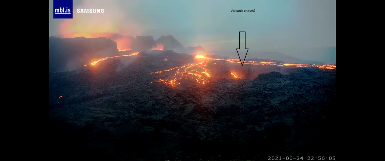
Picture:
i’ve checked the other cams (that i know about) and i can’t find out where it’s going…. Maybe back into the fissure???
PeRpEtUaL mOtIoN mAcHiNe!!1!!!!1
I believe that’s the ‘old’ lava lake that was overflowing a day or two ago. As for where it goes….?
Meradalir has a lot of new lava.
There is lava literally everywhere and I too wonder where it is going into the great maw. Very large pulses coming out of the cone area too and into the lava channel. Looks amazing tonight: should have taken the inaugural PLAY flight from Stansted….
Crater really active, many waves.
I believe lava goes to underground lakes and finally to Meraladir. All surface there is hot and growing.
Except for the river going to the left in the cam. Should be going towars Natthagi, but quiet there for days.
I suspect it’s infilling low spots and chasms in Geldingadalir. There’s quite a gradient radiating from the cascade, and the lava field height is high enough for there to be substantial room for storage behind the vent, into the northwest corner.
Best part of gutntogs vids is the commentary. “Is much lots of lava. Who knows where it’s going. It’s going go over there. Much oxidations.”
Love his vids and will buy him a tripod.
Etna three paroxysms in 48 hours. This doesn’t seem normal, but I’m not an Etna expert.
Its not normal, this is a volcano going from active to hyperactive. 40+ paroxysms in a single year though, that is extraordinary, the last time anything like this happened was at the turn of the century, and that ultimately resulted in a major rift episode, the flank eruptions of 2001 and 2002-2003 erupted out of the same dike and combined have a volume of 0.4 km3, one of Etnas largest eruptions.
Thing is, today is already far beyond even that, not only has it taken only 6 months to reach 40 paroxysms, where it took 3x as long to do that before 2001, but the current set includes the all top 3 of the biggest eruptions from the SEC, and one of those was the second biggest lava fountain ever seen from any volcano full stop and it is still going, Boris must be exited 🙂
I can only imagine a large deep resupply has occurred, so that magma now is very hot and fluid, and especially rich in volatiles. I know there have been temperature readings of 1150 C for the similar fountains in 2015, which is approaching plume basalt temperature, and the flank vent that opened in April had pahoehoe texture when seen up close.
Does Boris ever write reports in English? I normally use Google translate on web pages, but that doesn’t really work on a PDF.
I can read Spanish so Italian is about 30-40% understandable, mostly missing the verbs.
Etna haves indeed a very big supply compared to most other volcanoes.. and an open conduit system
Woud not supprise me at all If Voragine opens an Ambrym Looking lava lake soon
What worries me is that etna is really huge and conical and a side failure might result in a side blast which would likely hit VERY heavily populated areas.
The top seems to be largely made of ash cemented by ice, which is problematic.
Its done that in the past but I believe it was also erupting a different sort of magma back then, in the final stages of the Elittico sequence, where it was much more evolved. Since then all of the magma has been mafic, probably if it wasnt erupted on top of an older edifice Etna would be a shield today, though not exactly like in Hawaii, it is a bit more viscous than that.
Still, a major low altitude flank eruption would be a disaster, and that is an inevitability in the long run.
Indeed. The coast to the east is entirely built on pyroclastic flow which goes out into the med. I have no idea of the populations there but perhaps 100,000’s?
Not pyroclastic flows, lava flows. The collapse that happened in the early Holocene has been buried by later lava. There are ignimbrites but those are late Pleistocene and predate the current stage. Having a lava flow as big as Holuhraun descending on a city though is not a better option, it just takes longer for the destruction to happen…
Population is also well in excess of 1 million…
Thanks for your corrections and further info.
I don’t necessarily believe that Etna will have a sector collapse, I think it’s more likely a small caldera the limits of which are proscribed by the numerous summit craters. It’s got to be rotten rock, all that acid over the past few centuries.
It is 40 paroxysms in four months!.
This is a case of extreme vomiting, and yet no dry heaves. How much magma is down there?
Swarm of quakes under Kilaueas summit today, forming a stack going from 4 km deep to near surface.
Looks like it was related to magma too with signals like that.
https://imgur.com/a/4lR7vD2
Those were long period earthquakes, they often happen when there is a DI event with a violent start, which was the case this time too.
Vocano turned off….
4:42 am
Still flowing into the tube system ..
Its as active as its ever been
What you see is an illusion caused by its tube system
i hope so …. That would be nice.