Here is the third part of my Kilauea series that was promised, a bit more delayed than I would have wished though. Many things have happened at Kilauea since the previous part. A sill intrusion took place in the Upper Southwest Rift in August, then on September 29, about a month after the sill, lava erupted inside Halema’uma’u Crater and has been filling it up ever since, meanwhile earthquakes never cease raging under Pahala, a M 6.2 earthquake took place not too far from the Pahala swarming and at similar depth in October. However what I’m here to talk is about the plumbing of Kilauea
Knowing the plumbing of a volcano is something really difficult, because we can’t see it, it is underground. The magmatic structures are invisible, or are they? Here I piece together different types of evidence and observations that helps unravel a little about how the interior of Hawaii and Kilauea is structured.
One way of knowing the plumbing is by looking at earthquakes. These happen when one block of rock slips past another. The movement of magma can cause earthquakes by applying pressure against the rock that surrounds it, known as volcano-tectonic earthquakes. There are also other types of earthquakes thought to be caused directly by the movement or the volumetric changes of magma, like long-period earthquakes and tremor.
In Hawaii the distribution of earthquakes is also related to the residual gravity anomaly. Residual gravity highlights the differences in the strength of the gravitational field depending on the location, and corrected for altitude and other factors. Anomalies in the gravitational field can be used to find underground masses of denser material. For example the volcanoes of Hawaii have a high gravity anomaly, because the interior is thought to contain heavy material, like gabbro, that has formed from solidified magma, causing the stronger gravity attraction, and revealing the internal structures.
The deep rifts under Hawaii
When the location of earthquakes occurring under Hawaii is plotted there are some interesting things that show up. Most activity seems to be concentrated in a band oriented WSW-ENE that runs across the southern flanks of Kilauea and Mauna Loa. The activity happens at two levels, 0-12 km and 30-50 km depth. Below 50 km there are very few earthquakes in Hawaii, probably the rock is too hot here to break. The band does not show in the 12-30 km range either.
In the map below, 6-10 kilometre-deep earthquakes are shown in yellow-green while those that are 36-50 km deep are shown in purple-pink. A main WSW-ENE band can be distinguished. The deeper band has the same direction but it is displaced more to the south. Another N-S band of earthquakes shows up on the southeast flank of Mauna Loa which merges with the main WSW-ENE band.
Clusters of earthquakes are also seen under the summits of Mauna Loa and Kilauea with contrasting depths. They are long-period, LP, earthquakes presumably related to gas bubble growth in magma. Mauna Loa’s LPs are centred at a depth of 45 kilometres. In contrast Kilauea’s LP activity has been identified be 5-10 kilometres deep using relocation methods, much more shallow. The main vertical conduit of Mauna Loa must be very robust and deeply rooted compared to Kilauea.

Most earthquake activity of Hawaii occurs under the southern flanks of Mauna Loa and Kilauea, adjacent to the active rift zones of these two volcanoes. Earthquakes shown are 6-10 km (green and yellow) and 36-50 km deep (purple and pink). Seismic data is from USGS, viewed in Google Earth.
The band of earthquakes is well aligned with the East Rift Zone, the ERZ, of Kilauea, and as we will see is parallel to the contour lines of residual gravity. This is why I think the earthquakes occur in front of a deep rift zone of which the East and Southwest Rifts of Kilauea are their shallow expression. The term ERZ was created to refer to the linear zone of intrusions and eruptions extending east of the volcano. Kilauea however occupies a rather central location behind the band of earthquakes, which goes both WSW and ESE from the volcano, so the term East Rift doesn’t quite work. So in order to refer to it I will be calling it the Ka’u-Puna Deep Rift.
The deep spreading of Kilauea has been well studied in the past. Magma is continuously flowing into the deep rifts under the volcano, which inflates the rift zone, and causes the south flank of the volcano to bulge seaward, it moves up, east and south. Over time the flank is contracted until can no longer resist the strain. It breaks. Then the whole flank shifts seaward by as much as meters, and at the same time subsides as it falls back to its former relaxed shape. The cycle of rift swelling and flank contraction then repeats again. That is why Hawaii is a prolific source of large earthquakes, having produced 55 Magnitude ≥ 6 earthquakes since 1823, on various faults, including those in front of the Ka’u-Puna Rift axis.
The largest earthquake was an M 7.9 in 1868. The Great Ka’u Earthquake. It is easier to understand what happened when taking into account the Ka’u-Puna Deep Rift. Shown below are 5-3 km deep earthquakes, in white, that follow the Ka’u-Puna structure, the other N-S rift is also marked in yellow, which I here call Kapapala Deep Rift. In 1868 a large dike intrusion preceded the earthquake which would. The location of the intrusion must have extended from the summit of Mauna Loa, which erupted before the earthquake, to the eruption fissure of 1868 marked in red, which erupted afterwards. The Ka’u earthquake was observed to cause a 1-2 meter subsidence of the entire coast of Hawaii Island, from Kalae in the southwest to Kapoho in the southeast. The event was disastrous. A tsunami obliterated many settlements along the southern coast of Hawaii which were never rebuilt. Still today this coast remains largely unpopulated. The death toll was 77 people.

5-3 km deep earthquakes in Hawaii. The earthquake data is from USGS and viewed in Google earth, I highlight the two earthquake alignments.
The rupture would most likely have extended all across a reverse fault in front of the Ka’u-Puna Deep Rift, from Kalae to Kapoho, relieving the strain accumulated throughout the rift flank, it was a full rupture. The 1868 intrusion occurred at the western end of the rift setting off the earthquake. The flank then slipped away. Because Kilauea is also on top of the rift its Southwest Rift Zone snapped open and erupted immediately after the slip, the summit of Kilauea drained and collapsed.
The deep rift is usually thought to extend to a depth of only 8 kilometres under the rift zones of Kilauea. However I think this could be an incorrect assumption. Looking at the earthquake distribution I find it more likely that the deep rift extends down to more than 50 kilometres and that it extends under both Kilauea and Mauna Loa. I do think that the Ka’u-Puna Deep Rift is a most important structure to Hawaiian volcanism producing most large earthquakes, it is perhaps responsible for the apparent connection between Kilauea and Mauna Loa too.
Inflation of the rifts of Kilauea has been modelled and shows that in the 1961-1982 period it averaged 0.18 km3/year, this is nearly 6 cubic meters of magma every second that end up under Kilauea! During the 1983-2018 Pu’u’o’o eruption the spreading slowed down. Nonetheless, considering that there may be further regions of magma accumulation at depth, then most of the magma supplied to Hawaii actually remains underground to make intrusions, probably dikes and sills.
The Pahala Swarm is an enigmatic clustering of earthquakes under the town of Pahala. In the past 3.5 years seismic activity has skyrocketed spectacularly in this location. Shown below are 26-38 km deep earthquakes under this area. The location of 41 km deep tremor is also marked, most Hawaii tremor events originate from that spot. The swarm has a somewhat rectangular shape and the long axis is parallel with the Ka’u Puna Rift, probably because it is caused by it. As I mentioned earlier as it gets deeper the earthquake band seems to shift southward. This could be because of two reasons. First, the rift might widen as it becomes deeper. Second, dike intrusions in the East Rift Zone are known to be inclined, they dip southwards at 80º degrees, if this slope is extrapolated then, as you go down, the East Rift Zone ends up where the deepest earthquakes are happening.

26-38 km deep earthquakes of the Pahala Swarm shown as circles. Ka’u-Puna Deep Rift is shown as the yellow line. Seimic data from USGS viewed in Google Earth.
One interesting possibility is that Kilauea is a satellite conduit of Mauna Loa. A conduit meant to feed magma along the Ka’u-Puna Deep Rift. The Pahala Swarm and the deep tremor source could be involved with this pathway. None of this however is clear, rather an interpretation of how the structure works, and it could be otherwise too.
Apart from the Ka’u-Puna Deep Rift and the Kapapala Deep Rift, there is also a third more faint linear swarm of earthquakes. It extends from the Southwest Rift Zone of Mauna Loa towards Hualalai. I will refer to it as the Ka’u-Kona Deep Rift. Large earthquakes have also occurred here, including a M 6.9 in 1951. This swarm is less active, however it is nonetheless quite dangerous since the Kona coast is heavily populated and a future large earthquake could have devastating consequences.

View of the Ka’u-Kona Deep Rift which runs under the western slope of Mauna Loa. Earthquakes shown are 6-10 km deep and data is from USGS. Plotted in Google Earth.
I find it interesting that the Southwest Rift Zone of Mauna Loa looks almost like a symmetry axis, with the Ka’u-Kona Deep Rift and Hualalai on one side, and the Ka’u-Puna Deep Rift and Kilauea on the opposite side. The residual gravity map of the island also seems to reflect this structure. The strongest positive anomalies are near the summits of the volcanoes, which is expected since there is a lot of shallow intrusive activity there, but the anomalies extend parallel to the seismic lineaments. Mauna Loa’s intrusive core is oriented mainly southward along the Kapapala Rift. Hualalai’s anomaly is offset from its summit and elongated along the Ka’u-Kona Rift. And finally Kilauea shows a strong alignment with the Ka’u Puna direction. Overall the shape of the residual gravity field over the southern half of the island is somewhat triangular, centered on the south of Mauna Loa and with three vertices marked by Hualalai, Kilauea, and by the Ka Lae Ridge, the submarine rift zone of Mauna Loa.

Map of Hawaii Island I’ve made with topography + bouguer gravity data, and highlighting the seismic lineaments.

Earthquakes 20-50 km deep under Mauna Kea. A ring shows up under its summit. Data from USGS plotted in Google Earth.

Earthquakes at 38-50 km depth under Hawaii Island. The long-period earthquakes directly under Mauna Loa are visible. Also the main seismic cluster under the south flank of Kilauea and Mauna Loa. USGS data plotted in Google Earth.
Right below, the surface rift zones of the three volcanoes are shown. Initially near the summits, shown in orange, their direction is somewhat different from the seismic lineaments, but as they extend away they align with them.

Map showing the relationship between the rift zones of the volcanoes and the earthquake lineaments, the deep rift zones. Created in Google Earth.

Another map of the earthquake lineaments.
My interpretation of the earthquakes, gravity, distribution of fissure eruption is that there is a tremendously complicated magma structure down there. Magma makes pathways along rift zones, accumulates in sills and dikes, and connects various volcanoes of the island.
This is not unique to Hawaii, the Pacific seafloor is full of ancient volcanoes many of which are tens of million of years old. There is something however that they all have in common, rifts/dyke swarms. The volcanoes can be shaped like ridges or stars, because eruptions happen along linear zones which intrusions propagate through. Hawaii is however a magnificent opportunity to see these structures live and breathe.

Ridge shaped volcanoes in the Pacific Ocean seafloor as seen in Google Earth.

Volcanoes with rift zones at 90º angles in the Pacific Ocean seafloor as seen in Google Earth.

Star shaped volcanoes in the Pacific Ocean seafloor with 3 or more radiating rift zones as seen in Google Earth.


Nice.
“The deeper band has the same direction but it is displaced more to the south.”
Would this corelate with relative plume / hot-spot motion ? And, in time, will increasingly segue over to feeding the Lōʻihi Seamount ??
It could be. That hadn’t occurred to me but it seems possible.
The plate moves by about 4 cm per year. If the magma rises by 1 meter per year (reasonable but a guess), that would give an angle of ascent of 75 degrees or so. Close enough
Those enormously long submarine volcanoes outside just south of the middle hawaiian chain
Coud they be feed my megaintrusions? Looks like the cause of leaky faults there https://www.google.com/maps/@21.2580518,-167.2946735,7z/data=!3m1!1e3?hl=sv
I would say they are formed dyke warms not faults. The largest longest one, the Necker Ridge you can see, if you look carefully, it’s a system of en-echelon volcanic fissures. It’s a huge dyke complex.
http://ccom.unh.edu/theme/law-sea/necker-ridge-pacific-ocean/perspectives
Here I’ve marked some of the most prominent eruption fissures:
Neat view of the fissure swarms:
Feed by huge underlying Intrusions from the mantle?
I have always assumed that those are either faultlines or compression rifting and not volcanic as such.
But, that is an assumption.
Hector, have you ever seen if there is any paper where they have sampled those ridges?
If it is volcanic it would be easy to spot in a sample, same if it is uplifted seafloor.
Interestingly enough, you find a lot of similar structures around the Azores.
There I tried to find a paper of a study, but to no avail.
A careful analysis of the landforms shows its made of lava flows and volcanic cones. Submarine volcanoes often have these shapes because the lava piles up next to the fissures so that the fissure swarms dominate bathymetry. This is the only paper I’ve seen but they haven’t sampled it:
https://www.sciencedirect.com/science/article/abs/pii/S002532271300220X
They are volcanic, If you zoom in on Google Earth You can find craters and submarine cones on them.
Yes Azores haves these too. Probaly is leaky faults that produce magma
https://www.google.com/maps/@21.2580518,-167.2946735,7z/data=!3m1!1e3?hl=sv
Faults would be like a Mid-Ocean Ridge, with normal and transform faults, these are different in shape. They are fissure swarms, like La Palma, the rift zones of Hawaiian volcanoes, the rahats of Arabia, or the Chaine des Puys, only underwater.
You often get weird faultlines all of a sudden out in the oceanic plains from where patches of new crust get twisted and crushed.
It could also be something very old from back when the crust was created.
It is very hard to answer this without some actual data on the structure and composition of the ridges
I can only read the abstract. Found s.th. to it by a private oceanographic institute:
https://schmidtocean.org/cruise/necker-ridge-bridge-or-barrier/
So, magmatic in origin.
I do though have a problem with it being related to Hawaiian volcanism.
First of all, the altitude is trending from another feature towards the Hawaiian chain with diminishing altitude as it goes.That seems to point towards the dyke originating in the other feature since dykes tend to build higher features towards the center.
It is also good to note that several dykes stop well short of Hawaiian chain.
Now what on Earth is that other feature?
It looks like there is an impact crater there of rather notable size, there also seems to be a failed LIP (judging from the size).
Mysterious to say the least.
Old Cretaceous volcanism probably, most likely formed near a ridge. Probably is just coincidence it is near Hawaii.
An impact crater? Interesting.
Note that I said “what looks like”, that does not equate to being one. 🙂
The Necker Ridge was part of the Mid-Cretaceous LIPs in the Pacific that created the Ontong Java Plateau, the Hikurangi Plateau, the Hess Rise and the Mid-Pacific Mountains. The Necker Ridge and nearby volcanoes appear to be radial fissure swarms of the Mid-Pacific Mountains.
Goody, then we have one mystery solved in life. 🙂
OT: If you’d like to see a short video of the various volcanic events of 2021, the German news magazine “Der Spiegel” compiled a ~4 minute video with this year’s highlights.
https://www.spiegel.de/wissenschaft/natur/vulkanausbrueche-2021-von-la-palma-bis-indonesien-kraterstimmung-a-ee175dd6-5fd6-4f8c-b3ae-bad36b8f4bfc
No worries, no knowledge of German needed for this video, no comments or narration – just erupting volcanoes and flowing lava from around the world.
Its very Clear now that shield building have started in Kilaueas Summit, Kilauea is my favorite volcano and the most active volcano on the planet. With the Puu Oo vent removed, the huge supply haves to go somewhere, and now its comming up at Kilaueas summit. Looks like We are infor an eposide of vigorous caldera filling with lava flows filling an rising rootless lava lake. As the rootless lava lake rises, the crust and Islands rises togther with it. Its truely an extraodinary ammounts of magma Thats being pumped out in Halema’uma’u. It also looks like this will be a long lived open effusion vent that may last years, perhaps decades until something breaks.
And there is No flank eruption. Its possible that Open conduit summit lava lakes woud behave souch too on Kilauea, knowing that the magma supply is simply so high. Kilaueas supply today is way too high for normal circulating lava lakes, so they overflows constantly and becomes shield vents like we perhaps see now.
The 2008 – 2018 overlook open vent pipe lava lake was keept from overflowing by the Puu Oo flank eruption that constantly tapped lava from the summit magma column. In 2018 Puu Oo conduit backed up and the overlook lava lake started To overflow constantly.
Had Puu Oo eruption never happened then the 2008 – 2018 Halema’uma’u eruption woud have overflowed like hell constantly .. the entire caldera woud be gone today If that was the case
If Halema’uma’u keeps filling and filling it may become like Kupainaha an overflowing lava lake shield pahoehoe vent, If not the rising lava liquid pressure from the lava stops the vent. But this one seems likley that it will keep going. Seriously deep rootless lake we haves now. Kilauea is doing Impressive stuff now.
I guess its normal for it to erupt almost non stop during a humans lifetime. Kilauea is incredible, and I will visit it soon again. We are perhaps back to the Ellis Days with huge rootless lava lakes in Kilaūeas summit, but perhaps the magma system is even better recovered now since 1790 so will perhaps be even more capable now, intresting times at Kilauea
If there is enough pressure to stop the eruption now then it will be enough to make it erupt somewhere else. The caldera isnt technically deep now, the lava surface is over 800 meters elevation.
It is fascinating watching the lake in thermal while it is active, the whole crater floor lifting up and lava welling up around the edges, it really looks just like a rising bathtub. This is surely one of the biggest lava lakes we have got a solid record for, the active surface is 17 acres, and the whole lake is 1x that large, all liquid only a few meters down or less. One day we are going to see the entire thing just founder and sink with the crater draining
Webcam of the filling Halema’uma’u
I wonder how thick the crust is on this rootless lava lake, the crust is rising togther with the lava lake as the lava lake fills up. Its not circulating or Re – newing the crust. Perhaps Half a meter a meter thick. Its surface will be very cool since its an excellent insulator.
The 2008 – 2018 overlook circulating lava lake that was the top of an exposed magma chamber column only had a thin glass film, a milimeters thick That woud be Impossible to walk on
Crust started forming in January, so is now nearly a year old. Kilauea Iki lake crust was formed at a rate of about a meter per month, but was also inactive so today might be formed slower. Still, the crust is probably at least 10 meters thick. That is why when lava erupted in September it fountained out of a crack instead of just foundering the crust, it is solid enough to survive that. The edges of the crust is probably a lot thinner though as it is still forming.
I have to read this tomorrow. Great pictures, Hectór.
Very interesting, the deep rifts go so far down maybe direct mantle connection is possible after all, maybe not to the extent it is in Iceland but more than usually assumed.
I take it that there is possibly a part 4, adressing surface volcanism 🙂
The next few decades are going to be very exiting, Kilauea is going to show its full potential. Seems maybe not likely anymore but I do hope to see a big lava fountain show up again, in Halemaumau. Maybe if a vent opens on the dropped block just west of the current vent it could go somewhere, though the existing one is pretty well wide open now it seems.
“I take it that there is possibly a part 4”.
There is, and it’s in the making.
🙂
New photo of Nyiragongos crater interior
2021 was a seriously deep drainout that drained the magma system almost all way down under Kivu lake. Looks like the open conduit system have managed to survive the drainout. Still No new open circulation conduit lava lake yet. But perhaps will reform, althrough after 1977 it was little over two decades before an open conduit lava lake reformed in 2003.
Perhaps we will have pahoehoe fillings for now at Nyiragongos summit
Crater interior
https://mobile.twitter.com/DarioCongo/status/1447627695567822851/photo/1
Also Goma is growing seriously Big .. here are city from the air Photos: https://mobile.twitter.com/nelsonman11/status/1434893354819543048/photo/2
https://mobile.twitter.com/nelsonman11/status/1434893354819543048/photo/1
https://mobile.twitter.com/nelsonman11/status/1434893354819543048/photo/3
https://mobile.twitter.com/DarioCongo/status/1447627695567822851/photo/1
Looks like we are up for vesuvious style 1930 s activity in Nyiragongos crater bottom 🙂
Carl/Chad/ anyone
Do you think it will be any open conduited lava lake anytime soon in Nyiragongo? Nyiragongo haves open conduits, and seems to have a very constant magma supply. The current supply is not very large to Nyiragongo But Seems to be a very open system.
Still Nyiragongos supply is not anywhere near Kilaueas at current
But its possible that before, Nyiragongo have vent through times of very high supply, both Nyiragongo and Nyiramuragira are very young Highly active volcanoes, possible a young local hotspot thats just started to emerge in the Albertine Rift, to explain why its the only place there with souch high activity. Nyiramuragira seems to be getting the most of the regions supply
Let us just say that I would not be surprised if a new lake came into being.
After all it seems to be what the volcano does best.
It is most likely some distant cousin of the African Superplume.
Nyiragongos partial melting is very small ammounts, absoutley nothing compared to Iceland and Hawaii, I think less than 1% melting of the mantle pedriotite makes Nephelinite magma
Iceland and Hawaii can have more than 50 to 70% melting of the pedriotite to form the standard Thoelitic and Picrite Basalts.
Erta Ale erupts Icelandic and Hawaiian type Thoelitic Basalts and indeed the African Plume is shallower there and melting is much more extensive than at Nyiragongo.
Nyiragongo and Nyiramuragira and specialy Nyiramuragira are productive But very very alkaline, and feed by a large region of very small ammounts of melting per square kilometers. Virunga Arera is the only place in the Albertine Rift Thats this active, and is a round Uplift there. I think We are talking about a competely seperate perhaps emergent hotspot that feeds Nyiragongo and Nyiramuragira. The both volcanoes emerged at very latest Pleistocene and most of the volume of the is from holocene era. Perhaps not related at all To the African Superplume. It coud also be an arm from African Superplume. But I think this is a invidual New Hotspot thats forming in Virunga Volcanoes
Did you happen to mean peridotite?
There are many reasons for peridotite to be included, most likely in this case the mantle or hos rock is just depleted of manganese…
Nyiragongo and Nyiramuragira is the only place in the Albertine Rift thats that active and Nyiramuragira is defentivly a productive volcano, even more productivity than Etna. They are both very young volcanoes too.
Its probably is a local emerging hotspot in the Virunga Arera. And If partial melting keeps Increasing in the arera, we should soon see normal basalts erupt like Erta Ale in the future althrough that maybe a few tens of thousands of years in the future. Nyiramuragira is the least alkaline of the two ( Basanite still very alkaline) and perhaps is feeding on the most vigorous melt pool. In the future Big things will happen there If partial melting increases
Perhaps we are seeing the early alkaline dregs of what will become a small flood basalt as the emerging Virunga hotspot strenghtens
Rest of Albertine Rift is very sluggishly active, so passive you gets kilometer deep Rift lakes, without almost any fillings of volcanic materials, tropical baikal lakes all along there
How alkaline a magma is depends mostly on the ammounts of partial melting and depth of partial melting.
Very small ammounts of melting in the mantle favours alkaline sodium rich melts. Nyiragongos Nephelinites are the result of the smallest ammounts of melting and you get very sillica undersaturated often ”cold” CO2 rich melts. Many alkaline magmas emerge quite cold and Viscous in strombolian explosions, despite their low sillica content. Etna is alkaline magma and haves lower sillica than Hawaii and Iceland… But is more viscous because of its lower temperatures. There is a whole World of alkaline magmas, depending on their alkalinity.
From mildly alkaline magmas like Katla and Surtsey, To extremely alkaline magmas at Nyiragongo.
Nephelinites are the very Peak end of Alkalinity and are very rare, Beacuse they are produced in souch very small ammounts in the mantle. The more alkaline they are the rarer they gets. Even if most land lavas are alkaline. Subduction Zones haves often alkaline basalt, depends on melting rates.
Nyiragongo is the only example now of live Nephelinite volcano thats on the peak of alkalinity.
Hawaii and Iceland with their huge melt rates produce mostly Thoelitic Basalts. With strongly alkaline magmas only in the older dying Hawaiian Islands
Alkaline magmas are only generated deeper in the mantle than their subalkaline relatives, But the rates of partial melting of the mantle rocks must always be small
In Oahu you finds Nyiragongo Nephelinites too as the last dregs of post – shield stage volcanism of a Hawaiian Island. The Oahu Nephelinites emerged as cold and Viscous CO2 rich melts with strombolian eruptions and thick thick Aa flows. Nyiragongo is probaly quite hot for being a Nephelinitc volcano
Despite Nyiragongo is very very low in sillica, its Not an ultramafic rock, beacuse the iron and magnesium is quite low. Its a ultrabasic rock ”ultra – low in sillica” and strongly enriched in sodium potassium rich minerals. Very rare stuff Is Nephelinite and is mostly confined in slow spreading continetal rifts or weak continetal volcanic fields
The rocks may appear dark When they erupt, But a cross section of these reveals a fairly light coloured grey groundmass, perhaps because low ammounts of Iron rich minerals
Nyiragongo is notworthy for being extremely active for being a Nephelinite volcano, most other souch volcano compositions are monogentic
If I wrote articles here it would frustrate me to no end that you write about Nyaragongo on the first comment page when Hawai’i is the topic and about Hawai’i when another region is the centre of attention.
Sorry, but I don’t understand it.
thank you for the article I have yet to read. again. 🙂
meanwhile
Prof. Simon Carn
@simoncarn
#Eruption of #HungaTongaHungaHaapai #volcano in #Tonga on Dec 20 at 20:30 UTC. #GOESWest (#GOES17) images show water/ice-rich #volcanic cloud and lightning detected by #GLM. Some SO₂ also being detected by UV/IR sensors. @Eruptn @MetService @MichaelFieldNZ @NOAASatellites
https://twitter.com/simoncarn/status/1472760245869064195?s=20
So, TongaHungaHaapai is at it again.
Interesting.
yup
https://twitter.com/NOAASatellitePA/status/1472990716104224773?s=20
Great work, Héctor. You wrote:
“I find it interesting that the Southwest Rift Zone of Mauna Loa looks almost like a symmetry axis, with the Ka’u-Kona Deep Rift and Hualalai on one side, and the Ka’u-Puna Deep Rift and Kilauea on the opposite side.”
Here I don’t know exactly what you mean. For me it looks like Kilauea practically sitting on the rift, Mauna Loa on one side and Lo’ihi precisely opposite on the other side. And I think Lo’ihi is important as a key to the setting.
In part IV?
The Ka’u-Puna Deep Rift seems to run parallel to the Necker Ridge.
I hope I’m wrong but La Palma is not over yet
Something has shifted. LP01 & 03 up, LP04 & 05 down and the rest stable.
General rule on GPS is wait for a stable trend with at least 5 data points prior to making assumptions.
GPS-signals are inherently jumpy, so single data points are almost useless, and will often lead you astray.
The tremor is still low
https://www.ign.es/web/ign/portal/senales-sismicas/vlc-ayer-y-hoy
The tremor has risen, but this could be the ocean, El Hierro also shows slight tremor.
Not to be the party pooper, but I see nothing currently pointing towards an eruption resuming.
What I hather the most from this proposal, is that Kilauea is best visualised as the point where the deep rift actually has effects on the surface. Koae faults and ERZ are one structure, along with probably the Kaoiki pali, it is the outline of the deep rift where it is close enough to the surface to disrupt it visibly, like a thin layer of brittle rock on top of the crystal mush, the active magma system is probably sitting on the top of this mush.
Mauna Loa lacks the graben structures on its rifts because it is more or less a standard central vent shield in its beahvior today, the rifts are not magma filled, deep rifts there are much deeper down. That is probably also why its eruptions are so fast, it is just a dike, no old magma to push out of the way, so full force immediately, just like I said last article it is like Nyiragongo but with a massive magma supply (well, episodic massive supply).
Does anyone have any idea to what is going on in the South Atlantic, South Sandwich Islands? The region has been churning out M.4+ earthquakes almost constantly for a good few months.
Could it have anything to do with the South Atlantic Anomaly? The quake seemed to drop off when cycle 25 finally started picked up. More recently as the sun has been quiet, (until a few days ago) activity resumed.
Aftershocks from the M8.1 in August.
South Atlantic Anomaly? No. I know that some people claim earthquakes and volcanic eruptions are affected by cosmic rays, but I’m very much convinced that they are completely unrelated.
I agree. This region had a very large earthquake, and aftershocks can be expected to continue for years. The solar cycle is not related in any way to earthquakes.
Ever wanted to listen to a volcanic eruption? This place is fantastic (scroll down):
http://matoza.faculty.geol.ucsb.edu/download.html
Volcanic jet noises!
Lava keeps flowing into the Halema’uma’u crater, here is the latest photos
Great pictures,thank you.
Thats Thoelitic Basalt too, very very similar to holuhrauns and some of the fagradalshraun basalt, an igenous rock produced by large ammounts of melting, similar to the moons mares lavas too.
The viscosity is low too for Kilauea, very very low. In Hawaii its High temperatures that breaks down the sillicate chain polymerisation, resulting in very mobile fluid basaltic melts
I cannot see any diffrence at all between Hawaii and Nyiragongo in lava viscosity, temperatures are important too, not only sillica content.
I guess at over 1200 C most lavas that are low to moderate in sillica, behaves like highly fluid melts. Even high sillica ryholites, gets quite alot of mobility at 1000 C and form obsidian flows that can flow for many kilometers
What a Ryholite woud do at 1200 C I haves No Idea really, they does not usualy erupt at even 900 C, But it does not form lava domes at over 1000 C
Fagradalshraun was Thoelitic / Picrite too and like Kilauea a product of very large ammounts of partial melting, Thoelitic Basalts are their Picrite relatives Often described as very
”sillica poor” But they are quite saturated in silica, half of the entire rock composition is sillicon dioxide locked into mafic minerals.
They are so very very fluid because of their high temperatures as this video excellently shows. Looks like liquid copper gushing out, But its lava. At 1240 C its one of the very most fluid lavas ever seen on camera, temperatures keeps down the chain polymerisation. Kilaūea Iki 1959 also had this kind of lava, and reached 1280 C briefly.
https://m.youtube.com/watch?v=wceLE0gHs6U
Looks alot like liquid copper gushing out. But we are also looking at something very large here. And that makes it look even more fluid I guess.
Still this is a very very very low viscosity lava.
thanks Hector for this article. It makes me wonder if there was an article about the shapes on ocean floor.
I really enjoyed the article, Hector. I’m wondering why you never mentioned Hilina slump? or Hilina fault? Is that just semantics?
The Hilina Slump is a system of shallow faults that are mostly inactive, sometimes they can creep but as far as I know they don’t make many earthquakes. The faults I was looking in this article are deeper, located along the base of the island (the basal decollement) and in the mantle.
Big overflows from the Halema’uma’u pond now, Impressive
Looks like the lava lake overflows then drops down associated with what looks like a DI event on the tiltmeter. I think these are not DI events actually but rather a similar episodic behavior we saw at Fagradalshraun in May.
This is obviously also not new for Kilauea, recalling 1959, 1967, Mauna Ulu and Pu’u O’o, all being episodic.
In episodic behaviour the volcano would inflate during pauses and deflate during activity, that is what happened in 1967-68, Mauna Ulu, and Pu’u’o’o.
No-one talking about the explosion/eruption in Tonga?
Is it getting bigger? Full pheratoplinian- surtseyo – plinian now?
https://www.google.se/amp/s/www.newshub.co.nz/home/world/2021/12/undersea-volcano-sends-plume-of-steam-into-the-skies-near-tonga.amp.html
Looks like the eruption colum have hit the tropical tropospause, so its at least 16 / 17 kilometers tall.
Hunga-Tonga Hunga-Haapai is still going strong as I understand it (I am assuming it is Hunga-Tonga Hunga-Haapai) we are talking about?
I like Hunga-Tonga Hunga-Haapai, it is refreshing to have an unpronouncable volcano that nobody can remember the name of without googling, that is not Hawaiian.
Anyway, it seems that Hunga-Tonga Hunga-Haapai is racking up towards being a small VEI-4 event.
I accidentally just discovered that you can sing Hunga-Tonga Hunga-Haapai to the tune of Hooked on a Feeling…
Hunga-Tonga Hunga-Haapai
Hunga-Tonga Hunga-Haapai
Hunga-Tonga Hunga-Haapai
Hunga-Tonga Hunga-Haapai
I can’t stop this magma
Deep inside of me
Earth, you just don’t realize
What you do to me
When you hold me
In your crust so tight
You make me blow
Up into the night
I erupt with a feeling
There’s ash through my ceiling
And lava on my floor
It’s a Swedish thing 🙂
As the worlds comes to an apocalyptic end you bet that there will be a Swede somewhere singing about it to the tune of Hooked on a Feeling as the dragon Nidhögg cometh gliding down from the glittering mountain for the reckoning.
Obviously this will give a seat at the table, and the singer will munch on Särimner the sixlegged pig and drink mead until the world is created anew.
Hunga-tonga Hunga-Haapai is much easier for me than some Icelandic names. You have to know that Polynesians like to repeat words.
It took me a while to figure out that third letter: Bárðarbunga and to keep in mind Fagradalsfjall, might be written wrong. Or Eyafjallajökull for that matter, might also be written wrong. Or these guys: Fremrinámur, Herðubreið, Hrómundartindur, Hveravellir, Hrómundartindur, Kerlingarfjöll, Kollóttadyngja, Kollóttadyngja, Öræfajökull, Ljósufjöll and my favorite: Loki-Fögrufjöll.
The Polynesian one easy-peasy: Hunger for Tonga, Hunger for Haapai Volcano.
I must say though that for that reason Katla, Askja, Hekla and Laki are my favorites, one word, two syllables, who needs more. Grimsvötn you can get used to.
Yes, Polynesian languages pronounce all of the vowels, because they never had an indigenous writing system the modern one is almost completely phonetic if you know English sounds.
It is probably made confusing because of the common use of Hawaii, which is pronounced more like ‘Ha-why-ee’, as adopted into English. Properly it should be more like ‘ Ha-va-i’. In modern Hawaiian too it is altered a bit by common use, so some vowels do combine, most obvious one I can think of is ‘au’ together sounds the same as it often does in English (the same as ow in ‘how), and that is mostly because it shows up in the spelling of both Mauna Loa and Kilauea 🙂
Easter Island had an indigenous writing system, called Rongorongo. It is not deciphered, I believe.
Nope, Icelandic is dead easy to pronounce and most logical.
You two are just confused. 😉
I find basically every language easier to pronounce than Icelandic… 🙂
That might be because I live in Australia though, our accent (actually accents, there is more than one) is very different to most English accents. In particular that pretty much every word either ending in a vowel except I, or ending in an R, is pronounced like it ends in an A… But also only if it is actually the end of a sentence, a word ending in R that is followed by a word that starts in an A usually has the R actually pronounced. T that is not the start of a word also often sounds like a D, and the level to which a T at the end of a word is pronounced at all might as well be totally random…
Australian is fairly hard on its own…
I am good with English, but you guys are mostly ununderstandable.
Its all: Fair dinkums mate 🙂
Even over the time I have been visiting Australia, the accent has changed. It has become stronger. I expect that will continue until it becomes as hard to follow as Glaswegian (lovely people! I think – having no idea what they are saying.). At that time, trade will end and TV shows will no longer be exported, language equilibrium will be punctuated, and a new pidgin language will develop bringing together all southeast Asian languages, supplemented with single words to express entire concepts such as ‘our nationwide fires prove there is no global warming. Have some more coal’ and other useful trade terms.
The bit that really gets me with Icelandic is the pronunciation of the letter L, it sounds like it has got a K in it, but it is not a hard K, more like a K and a T sound combined following an L.
:I
Once you get used to it, Icelandic’s not too bad.
But what gets me is Icelanders only speak the first portion of any word. They sort of forget about the rest. Take Eyjafjallajökull.
The Icelandic speaker puffs out his beard with enthusiasm. He starts volubly: “Eyja!” Then a tin of Hákarl catches his eye and the “Fjalla” withers rather. The final “jökull” is then largely left to the wind as he strides off to open the tin and drink some Brennivín with it.
First map of Tongataboo Harbour, sketched by Captain Cook in 1777:
https://agupubs.onlinelibrary.wiley.com/doi/full/10.1002/2017GL076621#
Cook’s sketch from Wikipedia about Tongataboo Harbour.
There is still quakes at Vatnafjoll 🙂
Quite a bit of activity.
I do not see it stopping anytime soon, it depends obviously on how the dyke forming towards Tindfjallajökull evolves, and if/when the roof of the Fissure starts to crack.
It is definitely an interesting form of volcanic reawakening to witness. So far it is just an intrusion after the big earthquake, and not as such a sign of any eruption coming along.
But, if we start to see earthquakes propagating above the 4.8km mark, then we might get something extremely interesting coming our way.
What is the sort of timeframe is an eruption looking possible? 🙂
I currently have it at 10 percent in a year. 30 percent for the decade.
But, this being Iceland I say that it could change any day.
If the earthquakes start to progress upward in a stacklike feature, and there is magma movement signals, then it could blow in a month.
Indeed looks like something is developing there, I say perhaps a few years to a decade
So if we’re talking about Vatnafjöll we are referring to Hekla I reckon?
At least from the magmatic aspect…
SI GVP doen’t appear to have a distinct info page about Vatnafjöll, it is a fissure of the Hekla system (or somehow the likes).
Nope, Vatnafjöll is a completely different volcano. It is the Sociopathic Brother of the Psychopathic Hekla…
Completely different, except the being insane part.
GVP is about 20 years out of date…
Uh ok, so what magma does Vatnafjoll erupt? (Tholeitic) Basalt?
Hekla can rhyolite, as I saw… (unfortunately only on GVP as well, so is there a similar up to date data base?)
Vatnafjoll is basically basalt Hekla. VEI 4-5 intensity effusive eruption, not a lot of tephra but really huge flow rate, probably also very fast lava flows. Mauna Loa in 1950 is probably a good visual of that sort of intensity. There are some videos if that around.
Eruption intensity should have a different scale altogether. VEI refers just to volume, and just to ash, so saying VEI 4-5 intensity effusive eruption can be a bit confusing…
Eruption magnitude is probably what you are talking about. In which case both the typical VEI 5 and a VEI 1 effusive eruption at Vatnafjoll probably have the same magnitude.
It will erupt semi alkaline basalt, perhaps similar to Etnas magma But hotter. Partial melting is medium sized in that region. Its close to the semi alkaline Katla and the mildly Alkaline Eyfjallajökull.
Any eruption will be hell on Earth.. quite fluid with kilometers high lava fountains that are on Edge of subplinian, looking like dark tephra curtains in daylight with massive pyrocumulus steam. It will look like an competely oversized version of the first hours of Nyiramuragira 2011, massive Aa sheets too
Big Big Big white cauliflower pyrocumulus clouds will rise over the fissure, perhaps even creating its own rain and ligthing as large Galapagos eruptions does
Mauna Loa 1950 is my comparison, the first hours of it anyway. Km high fountains probably not, fissures are usually under 200, tall fountains form when most of the fissure shuts down and a few vents are left open.
Hunga Tonga’s south island breached the water in 2009, and hit 30000 km with a blast in 2014. I’d imagine it’s primarily andesitic? It is also said that the rock is very hard and hence not easily eroded.
Welded ignimbrite was found on the older parts. Caldera is roughly 4×2 km, might be slightly larger.
One pyroclastic flow deposit contained charcoal, which we dated to the period 1040–1180 CE. This deposit correlates closely in age and chemistry to ashfall deposits found on Tongatapu Island, 65 kilometers to the southwest [Cronin, 2015]. It also corresponds, within uncertainty bounds, to an unknown tropical eruption in 1108 CE that produced more than 1°C of global cooling [Sigl et al., 2015].
If I remebers correct, There Are submarine welded and even submarine reomorphic igmigbrites, so these PDC s can flow underwater too, absoutley terrfying, althrough If a PDC flows over water from land it generaly sits on top of the water. Submarine evolved Pumice eruptions must be a strange sight underwater, with deep vents gushing out pumice, I remeber also reading that plinian eruptions too can sort of happen in submarine setting
Lava flows too that haves very low conductivity flows well underwater, water forms an insulating skinn. Fast submarine eruptions forms raging lava channels just like on land, they are called ”submarine sheet lava flows” Water perhaps help the lava to flow further by forming an insulating glass skinn. Fast submarine effusive eruptions can form lava whorls, open lava channels, sheet flows, and even submarine lava lakes. There is even submarine lava fountains and spatter cones. Only slow submarine eruptions forms pillow lava.
Submarine eruptions are very diffrent, yet very similar to land eruptions
Hello!
Is there something going on at Geldingadalir Volcano?
I can see small red glowing dots at the volcano…?
https://youtu.be/LTOZxPb-UCo
Cheers
Christian
vedur.is/ja/oroi/faf.gif shows some increased activity aswell…
Just resudual heat from the eruption
Probaly is weather that shakes up the seismometers
It will glow like that for years, its very deep lava pile, takes time to cool off
The glow is just heat left from the eruption 🙂
Thank you for the answer Jesper! 🙂
Fagradalshraun is basicaly a lava filled valley, the rootless lava lake inside the lava pile in the valley is more than 100 meters deep inside. Its going to take many many decades for it to solidify.
And 100 s of years to cool down to ambient temperatures. It may still be steaming in 300 years at some spots.
By then perhaps other Reykjanes eruptions have already happened.
There is a Big liquid lava body inside fagradalshraun Thats buried under the lava flows, going to take time for it to cool
Lot of quakes in the Fagradalsfjall area now.
Looks like 520 parallel swarms going on an the fagradalsjokull and the one to the right. Size looks to be increasing too, but on a visual scan the depths seem to still be around the 6km mark.
Another pulse of lava?
Ooops with auto correct. I meant 2 parallel swarms. There might be 520 actual earthquakes but no idea how the keyboard came up with that number
And as I typed there was a mag 3.
Faf is also starting to look lively. Weather is calm, not a lot of wind as far as I can tell.
Something brewing?
left upper corner,a.lot of movment: people? kind of vehicle? and some lightning at the middle upper part of the image (22h35)
Just tectonic swarms.. for now
Quite Dense, But Not as dense as fagradalshraun or holuhraun swarms
I dont think it Will erupt, but who knows
Starts with small earthquakes building up in frequency and magnitude. It is possibly a dyke intrusion. A volcanic fissure might open up somewhere in Fagradalsfjall, most likely in a new location.
It’s getting quite dense now.
Its getting very dense indeed. Perhaps its a new dyke intrusion: Reykjanes Penninsula have enetred a new cycle of eruptions
https://en.vedur.is/earthquakes-and-volcanism/earthquakes/reykjanespeninsula/
Not just a new cycle, but this location is now rifting so eruptions should be expected until that ends at least. it is like Krafla, only eruptions are slow. That being said the eruption rate of Fagradalshraun was not nearly as high as the rate of magma flow from the source in the original intrusion, so the bottleneck might not have been fundamental but possibly just a shallow feature, and a new eruption could be much more intense.
https://www.youtube.com/watch?v=LTOZxPb-UCo: artefacts
Drum plots for Fagradals look like rock cracking. So we’ve either more ‘pull apart’ rifting, or the dyke is reinvigorated. Or most likely both. The fine tremor is rising,too.
Personally, I think we’re having a full rise to another extrusion of magma. Very much “watch this space”.
Those of you who remember my predictions for Keilir may safely nod wisely and twirl a finger by their left temple.
Looking like a dyke. Here is the swarm viewed in Google Earth, green is older and red younger :
It’s under the fissure system of earlier this year and seems to be propagating southward. I think a dyke is most likely option given the location, the elongation of the swarm, and the volcano-tectonic distribution of earthquakes in time.
Keeps growing south, “dyke” is 4-5 km long now. Yellow is older, deep orange is younger:
Most readers may already be aware of this, but it’s worth pointing out that Google Earth’s default view does not always show the latest satellite image of the area. For example, in this image you can zoom in on the Fagradalsfjall Volcano on the left side and you will not see the volcano. But if you turn on the historical imagery view and zoom in on the volcano, you will see an image from April 25, 2021, that shows the volcano very nicely.
La Palma’s volcano has resumed activity. Small, but some coughing out of the central peak and tossing a few bits out.
Picture
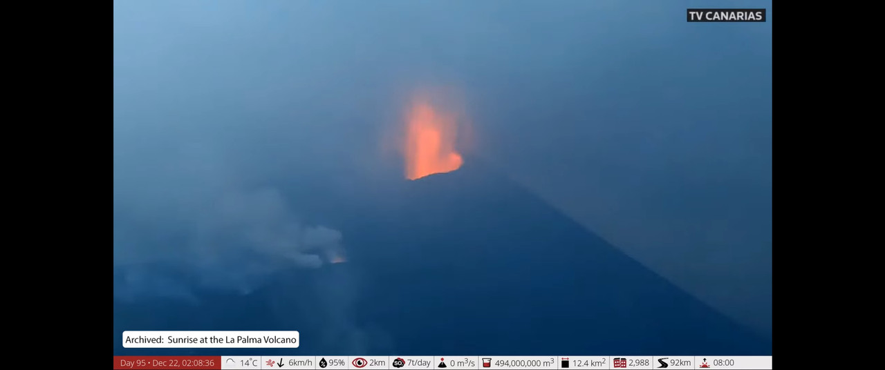
Mods – please scrub the last two entries. They are archived film from AFAR.
Oh dear Gods what a fool I am….
Appears IMO’s system is picking up ghost quakes. Must be quite intense.
Alert level for Reykjanes raised to Orange again.

If it erupts it will look like Krafla, or most likley the 2011 Kamoamoa eruption
Reykjanes peninsula has a lot of 3+ mgnitude quakes
Well, um, something sure seems to be going on at Fagradalsfjall. That quake pattern looks (to me, anyway) a lot like we saw before the eruption; some activity on nearby faults due to intrusion stresses. I see the quake count is 597 in the last 48 hours. Quite a few larger quakes as well, such as the 4.2
In fact, this is, I’m afraid, already creating a grave danger: that I may soon be in a position to say “I told you so!”. Why? Because when the eruption quite a few months back, I made a prediction: That the eruption was only pausing, and would resume as soon as the La Palma eruption ended. I even explained the reason why this would be so; because the Fagradalsfjall volcano does not like sharing the limelight and attention with the eruption in La Palma, so it would wait until La Palma was over, and then resume.
Yes, yes, I know, don’t anthropomorphize volcanoes (they hate it when you do that) but, I did post that prediction, and if there is an eruption fitting it, my theory thus has predictive value. I shall call it “Volcanic egotism as an eruptive causal factor in basaltic magmatic systems”.
🙂
rofl!
You’ve convinced me 😜
Obviously a supply chain issue. There is only enough magma transport available for one effusive eruption at a time
Hrmm. That could be too, Albert. There are certainly all manner of shipping delays these days, especially seeing as the shipping situation is always busier before Christmas.
There are other aspects to the supply chain problems than delays, though. I recently experienced one myself due to purchasing a blender. Not only were there major delays (weeks), what arrived was the wrong blender. So, I think we should, if Fagra-unspellable does indeed erupt, keep an eye on what sort of lava it erupts – it might have ordered basalt, though that’s no guarantee that that’s what it got. I do wonder if it might have received my missing blender…
Has anyone direct link to Fagradalshraun GPS monitoring page ?
Gps Reykjanes peninsula.
http://brunnur.vedur.is/gps/reykjanes.html
https://notendur.hi.is/~hgeirs/iceland_gps/rnes/rnes_100p.html
Looking pretty serious now at Fagradalshraun, probably will be another eruption soon at this rate.
M4’s now. If it continues to move in this direction (towards the south), there may be on off-shore eruption. Explosive would be possible
M4.9
Getting stronger…
Epicenter right under the protective berm above Nátthagi. Is the magma perhaps trying to find a shortcut?
Not sure it is likely to go that far, it seems to be reactivation of the earlier dike. All the hard work has been done though, this swarm is very strong but has been going for but a few hours, I think if there is an eruption it will be soon possibly very soon.
Will be interesting if it follows the fissures of March and April, or if that one is totally dead and it just opens a new vent. I expect given there are now no more depressions to fill that a new eruption could be fast to cover a lot of ground, especially if it is concentrated only on one side of the mountain.
I have copied the earthquake data of IMO into excel and turned them into kmz for different time period showing the propagation of the dyke. Yellow is oldest and purple youngest. It is 8 kilometres long now. It might erupt, although is best to keep in mind that many dykes do not reach the surface.
https://www.volcanocafe.org/wp-content/uploads/2021/12/Fagradalsfjall-dyke4.jpeg
Image copied to VC because it was very slow to load – admin
Is there any evidence of shallowing?
Not really. The shallowest part is the northern end of the dyke. I would not be surprised if activity in the south stalls and a new eruption site pops up just north of the old eruption. Somewhere near Þráinsskjöldur.
I don’t see a clear trend, but I wouldn’t expect to see one either. Earthquakes always concentrate along the base of a dyke intrusion. Most earthquakes here happen to cluster around 5 km depth, like the depth of the dyke that fed the Fagradalsfjall eruption. If the earthquakes were to be relocated with precision you would probably see almost all earthquakes line up at this depth. It is impossible to know how close to the surface it has reached using earthquakes because the upper part of dykes does not made quakes. You would need to look at deformation or crack opening to know that.
Example from Holuhraun dyke. Earthquakes happen along the base:
https://www.sciencedirect.com/science/article/abs/pii/S0012821X18306289
Question from a silent reader:
Are the earthquakes located at the bottom of the dyke, because the “pushing” and cracking is mainly located there, and the magma then can just fill the expanded upper parts?
There are no earthquakes in the magma. They only occur in rock. In a stable, magma-filled dike, the stress on the rock is mainly at the bottom. It is different in a growing dike: this has to crack the rock ahead of the dike, and here earthquakes can happen at a range of depths. When magma breaks to the surface, you will get a stack of earthquakes towards the surface. When it is close to the surface this can go quiet again, before the actual eruption. During the dike growth a year ago, the larger earthquakes were deeper, earthquakes at shallower depth were smaller. The stack formed a day (or two?) or so before the eruption, but not really noticed in the seismic noise of the time. The eruption came as a surprise.
That could be true, I’m not sure what’s the exact reason though. Could also have to do with how the base of the dyke is locked in place by surrounding rock so builds more stress, while the top of dyke is close to the surface and can deform the rock away with less resistance.
The “checked” version on the IMO site: smaller quakes are not in this map.
https://skjalftalisa.vedur.is/#/page/map
From 17.00 yesterday the moment of this reply.
And the long/lat/depth of these quakes. Credits IMO.
Nearest to the former eruptionsite Gps FEFC and FAFC show an uplift of about 30 mm since september. Krisuvik about 20 mm. The stations with more distance as in the Thorbjörn area about 10 mm. The western tip of Reykjanes has no uplift.
It looks like the flow of magma is still ongoing and builds up supply sice the Fagradal eruption ended.
https://twitter.com/krjonsdottir/status/1473603984833327105
Activity is seriously picking #Fagradalsfjall! The map shows reviewed earthquakes since 21/12 at 18:30. A trend is clearly seen as the they move to SW where we also had the largest earthquake so far M4.9 this morning. Aviation Color Code raised to Orange!
Hmmm… so, perhaps we are in for some New Years Eve fireworks? 😀
Most confirmed activity appears to be between 7km down, and up to 4km. Some as near as 3km.
I’m guessing that’s the top of the dyke intrusion with gasses seeking a passage. The original active conduit zone was Fagradalsfjall, so it would make sense for magma to recharge that semi-open path and reach the surface in that area. While the drumplots only show rock cracking, I suspect it would not take long for the old conduits to give way. Magma could reach the surface very swiftly if the old conduits cracks open.
Good live wide angle camera view here: https://www.youtube.com/watch?v=EQsXsx1toXE
There’s an aseismic zone above that.
was that steaming in the bottom right hand side always there ?
Was wondering why the webcams are pointing back to Fagradalsfjall.
A new swarm. https://en.vedur.is/earthquakes-and-volcanism/earthquakes/reykjanespeninsula/
It appears to be two quakes a minute, on average. That’s impressive!
Think that’s the rate they can confirm them at.
IMO may be spending Christmas in the office / in the field.
According to this article, IMO interprets the ongoing swarm as a possible precursor for an eruption. Interestingly, they mention that the uplift has now brought the crust back to the same level as it was when the eruption started in March.
https://www.ruv.is/frett/2021/12/22/tulka-atburdarasina-eins-og-undanfara-eldgoss
There are a glow rising in the center of webcam… i don’t know if it is ilusion or not…
PS: I think it is an eruption starting…
There are an helicopter in the area…
I’m not sure but I think it is steam from the geothermal plant being lit up orange in the low sunlight.
True, if you scroll back that place also had a light during the night. Must be the geothermal plant.
Thank’s!
Looks promising. It is to the south (in the direction of the sun), so chances are that light is along the dyke path.
Release the Laki …. 😈 bwhahaha ha
Mwhahaha ha! hughgh hmm hmmm hmpf, knweff! ..cough!!
The intrusion is no longer propagating horizontally. It has been stuck in the area west of Natthagi for the past six hours, I think the eruption could break out there, if it does erupt.
Bad news is that it will cut the coastal road and destroy some farms if it erupts there.
Don’t know. The dike did this before erupting at Geldingadalir in March 21.
It would be a worse place for an eruption than Geldingadalur as there is nothing in the landscape to block the lava from flowing towards the west and north where it could pose a threat to important roads and electric grids. However, I think the current location of the earthquake swarm doesn’t really need to indicate the most likely place for an eruption.
Iceland: It is interesting to see the web cams are firing up once more! Time to get the popcorn, sit back and enjoy hours of landscape doing nothing!
This view has a small mushroom cloud for our entertainment. OK, the lens needs a wipe…
Forgets link. Sigh
nice eruptive column here. This was taken 22/12/2021 around 0700 (I assume local time).
Stole this footage from my cuzn of Hunga Tonga & Hunga Ha’apai where an undersea volcano erupted on Sunday night.
https://twitter.com/alakihihifo/status/1473530975342579712
Looks alot what a future westmannaeyjar eruption woud look like 🙂
Think we all said at the beginning of the year that things were quite slow on the volcanic front and not much was happening.
And then we had Taal, Soufriere St. Vincent, Fagradsfjall, Stromboli, Cumbre Vieja & Hunga Tonga, along with the usual culprits Piton, Kileaua & Etna, and probably more I’ve missed.
Quite an interesting year it’s been.
Prediction time – Fagra is going to re-erupt on new years eve, this time slightly further south/in the sea.
The quakes look like they’re trending that way, also one or two at Grindavik.
All cams page: https://www.oroapuls.com/webcams
I see Fagradals going back to sleep for now. Not good enough, these volcanoes taking a nap. If we start discussing Taal perhaps that will wake it up again.
https://en.vedur.is/earthquakes-and-volcanism/earthquakes/reykjanespeninsula/
Swarm is still going strong
Now exacly under the last eruption site.
Behold the power I have over Fagra!!
Need any other volcanoes starting? £500 plus VAT.
Me, the almighty newest shield volcano in the world, yet to last intermittent eruptions for the next 30 years, is wishing everyone in this blog a beautiful, fiery, vibrant, serene, and colourful Christmas, and may the New Year ahead bring you all, plenty of smiles, that are witness to some of the most fantastic shows on the planet, like mine. Greetings, Fagradalsfjall (Irpsit alter ego)
We wish you a merry Christmas, and are happy to see that there has been a magma delivery, ready for the Fargradalsfjall Christmas meal Christmas crackers.
Oh Irpsit. I for one am so wishing the 30 years is a true prognosis for Reykjanes peninsula. Hopefully in an area well away from Grindavik of course. Nice to see you around again or is it just myself that has been absent for a while too? Regards to all since I have been absent.
https://en.vedur.is/earthquakes-and-volcanism/earthquakes/reykjanespeninsula/
Earthquakes are increasing again
so USGS just posted this about earthquakes risk in Hawaii. Certainly focused on human impact
https://www.usgs.gov/news/featured-story/new-usgs-model-shows-earthquake-hazard-probability-hawaiian-islands