
Stunning photograph of the eruption. Photograph by Haussman Visuals.
To me the part of a volcano that is visibly erupting is the least exciting part. Perhaps a better way of stating it is, that it is only the effect of the cause. This is obviously not true to most people on the planet, so I think I owe everyone an explanation.
And that explanation is especially important since we need to look deep into the volcano, to understand its future.
Like most people I can obviously spend hours looking at lava bombs being hurled, and lava slowly filling valleys. But, getting to know the hidden innards of a volcano, and understanding their functions, is making the experience even better.
So, let us take a journey through the volcanic features of the Ballareldar from the bottom up. During this journey I will try to impart the wonders I see, and why this cute little tourist eruption is one of the most scientifically important eruptions ever witnessed.
To do this we must employ many tools of the trade, petrochemistry, geophysics, chemistry and garden average physics, to be able to look below the ground we walk on. As I go on, I will try to tell you what we know, what we can assume, and what are open questions to science.
In the beginning there was the mantle
The Geology department at the University of Iceland did wonders in the opening stages of the eruption taking samples and analysing them at breakneck speed. I wish we had later data at hand, but I think that is saved for some juicy future articles by the scientists in question. Which is fair enough, and they have let a few tidbits out that is highly intriguing.
What we do have is still enough to make me feel like a kid visiting his first candy store. Because things are sufficiently “out there” to make my eyebrows lift quite substantially.
Regular lava in Reykjanes is indicative of Mid Oceanic Rift Basalt (MORB) origin, coming up from the Mohorovic discontinuity between the crust and the mantle, it is normally partially evolved (fractionated), and has ample amounts of inclusions indicating that it has resided in the crust for a while.
Normally you will see a medium amount of sulphur in the lava, and it will be fairly cool compared to the plume derived lava coming out nearer to the Icelandic mantle plume, and the plume derived lava is among the most sulphur rich lavas on the planet.

Image by the Geology Department of the University of Iceland.
If we look at the current magma being ejected as lava, we find that it is, first of all, unusually hot. The confirmed temperature is 1190 ºC from the first observations, but I have seen later unconfirmed figures up towards the 1220 ºC.
Higher temperatures than 1190 ºC is by far not impossible, remember that the official temperature was taken early on when the magma had been cooled and partially quenched as it passed between the cold sides of the 7km long and 15 km high dyke leading from the deep feeder conduit near Keilir, all the way to the surface.
As the surrounding rock is heated by the passing hot magma, over time the cooling effect will diminish and the temperature of the lava will go up a bit.
As far as I know the previous temperature record holder in Iceland was the Holuhraun III eruption at 1180 ºC. Here we had an origin that definitely was from a well-formed mantle plume, yes it had partially resided inside inside of Bárdarbunga and had travelled for a long stretch across a very long dyke.
But a big part of it was fresh material from inside the mantle that was newly arrived. On top of that the flow rate in the dyke was large enough to heat it very well indeed, decreasing the cooling effect considerably.

The telltale low TiO2 and high MgO. Image by the Geology Department of the University of Iceland.
The temperature of the lavas erupted during the Ballareldar is high enough to be seemingly congruent with plume origin.
If we look at the regular lavas erupted at Reykjanes through the eyes of groundmass glass, we see that it usually contains about 250ppm of Sulphur, but the current lava is erupting an average of 1140ppm of sulphur.
And we do know that the Icelandic plume produces record breaking amounts of sulphur as the associated volcanoes erupts.
Here it is easy to think that what we are seeing is a tendril of magma that has squeezed itself merrily along the underside of Iceland until it arrived below Reykjanes during the last 800 years. Looking at the evidence so far, it is not a bad idea.
But we need additional data to prove or disprove our little plume origin hypothesis. This is the point where petrochemistry shines.

Rare Earth Minerals chart. Even the lantanides are unusually absent. The Geology Department of the University of Iceland.
The first we see is that the lava is rich with olivine, a crystal that is called Peridot and Chrysolite when used as a gemstone. It forms in the upper mantle, so now we know that at least the magma is from the upper mantle.
Olivine comes in three distinct flavours, the magnesium flavour called foersterite (peridot) that can be green or transparent. It can only form above 400km depth, below that you get wadsleyite.
The other common one is the reddish-brown fayalite (chrysolite) that contains iron, this forms at lower pressures than forsterite, so as such it is not pointing towards deep mantle origin.
I will just briefly mention the third flavour, the whacky Manganese olivine named tephroite. From a volcanologic standpoint, it is the least understood of the 3. It can also have any colour visible to man, since it has a propensity to make love to pretty much any other metal. It is the penultimate slut in geology, making it into a darn good precursor when looking for mineralisations to mine.
The Ballareldar lavas are rich in magnesium olivine (forsterite), this means that the origin of the magma is somewhere between 15-400 kilometres down. We also know that many Icelandic lavas are forsteritic, so it seems like we have once more proved a plume provenance.
Now we need to compare the Ballareldar eruption (2021-) and the Holuhraun III eruption (2014-2015. The first thing that we see is that Holuhraun III has less olivine (forsterite) than Ballareldar has.
If we look at the weight percentage of TiO2 at Holuhraun III we find that it is at 1.75 to 1.9%, whereas at Ballareldar we see a figure of 0.9%. On the other hand, we see weight percentages of MgO at around 6.7% at Holuhraun III versus 8.8-9% in the Ballareldar samples.
Did we just find a spanner crashing into the spokes of the wheel of our hypothesis? Can we save our our pet theory?
Yes, sadly our pet theory dies here in the warm embrace of TiO2, this is due to us knowing that the distance from the Icelandic plume center does not indicate decreasing TiO2, or vice versa. Plume derived forsteritic basalt does not drop in TiO2 with half. Bummer!
At best we have a partial influence of the Icelandic plume, but sufficiently small to not explain the sulphur and the temperature as such.
Here one could come up with the crutch-theory that it is another unknown plume at work. That is amply gunned down by geophysics, since we know from tomography mapping of the mantle, using measured differences in the travel speed of sound indicating temperature variations in the mantle. In simpler terms, we have a fairly good map of where there are plumes, or not, in the mantle.
There is obviously no special plume under Reykjanes. At this point we will have to wait for new data from young strapping Ph.D. students.
New data

The gassy belly of the beast. Image by the Geology Department of the University of Iceland.
This is written a couple of days later as an addendum. I had already edited in the article when I found new data from the geology department at the University of Iceland. Problem is that the new data made mince-meat of what I had written above.
My first instinct was to do a complete rewrite of the article, so that it would no look like I used the southern end of northbound donkey as a brain. Instead, I am leaving out the first part as it is, as an example of how new data is driving scientific discovery and creates the need for new models and hypothesis-formation.
I love the smell of fresh science in the morning, well that and coffee. So, without further ado we will boldly go where no person has gone before.
Let us begin with what is the same. The sulphur content is same at the high levels, and the release of SO2 is keeping steady at 2000 to 3000 tons per day. The variations closely follow eruption flow rates, so we can safely say that it will not increase nor decrease over time in any significant manner.
Several people have asked me lately about the noticeable increase in “smoke and gas” from the vents. And yes, there has been an increase in the visible gas volumes at the volcano. Problem is that there is no increase in release of CO2 or SO2 from the volcano, and this is to be expected since the lava flow rates are constant while the Sulphur content has been consistently high.
So, why then are we seeing more gas? There are two reasons for this. The first is that it is likely that water vapour has increased due to the magma moving through a number of aquifers, and that a few of those contain super-critical fluids.
I have however not seen any data on water content, so this is speculative. The second reason is simple: from an actively erupting vent you have sufficient thermal uplift to chuck the gas straight up and out of the way as a visual hindrance.
That is why we see more visible gas from dying colder vents; they do not have the energy for effective thermal convection.
In short, the gas increase is mainly more a question of altitude than attitude.

Petrochemical differences over time. Image by the Geology Department of the University of Iceland.
Now, let us talk about the differences. MgO has increased from the previously high number of 8.8-9 percent, now it is 9.7-10 percent. This means that there is more forsterite in the mixture. This in turn points towards greater depth.
Now, let us turn to the TiO2, it has increased from the low number of 0.9% to 1.5%. These two increases in TiO2 and MgO indicates a deeper origin.
This indicates that the original magma most likely was of Icelandic Plume origin and that the plume head is slightly wider than previously believed. It also points towards some process depleting the magma during its long and slow movement towards Reykjanes from the plume core under Kistufell.
One solution that is likely, is that TiO2 due to it’s higher melting point trends towards attaching itself to the bottom of the crust in a process called underplating, whereas the MgO does not.
Now, here we arrive at a monster of a question. Was the eruption caused by arriving deeper material that first pushed up the depleted magma under the eruption site? Or, has the eruption depleted the supply of depleted magma and new deeper material is going up to fill the gap?
If it is the latter, we are most likely seeing a smaller version of the process that created the Icelandic plume to begin with, eruptions causing a void creating lowered pressure increasing the melt process at depth.
At the Icelandic plume this process has been running for 14.4 million years now, so it has burrowed itself deep and become a true monster among plumes. Whereas Ballareldar is too small in the greater scheme of things, and it will putter out when the eruption dies out.
I should here point out that we do not know which one of the two options given above is true, I lean towards thel atter idea of burrowing. But, as per usual, until a strapping young Ph.D. Student has done the heavy lifting and done a garnet study we will not know for sure.
Final words
What I would like to see is a study of garnets in lava. Various garnets form at different depth in the mantle, so have a garnet study would be helpful to constrain further the depth of the formative melt. Want to get a doctorate in petrochemical volcanology..? Go garnets, go!
I had initially planned to write about the dyke, and the future for the Ballareldar. I had also planned to write about the name Ballareldar. That will though have to wait for part two of the article since I got rolling with the petrochemical part of life.
So, in part two we will leave the mantle behind and become crusty indeed.
CARL REHNBERG
Sources:
characterization_of_the_1st_and_2nd_day_of_volcanic_products_from_geldingadalahraun_2021.pdf (hi.is)


Anyone any clue as to how high these fountains are now?
I guess it depends on what you consider the fountain, the sustained part or the highest jets. I think typically it is the sustained part, example at Pu’u O’o the highest sustained fountain was 450 meters or so but some of the jets went much higher, not measured but way over 600 meters based on descriptions. That case also brings up if the fountain is measured at ground level or from its visible base, Pu’u O’o in 1986 the actual vent was something like 150 meters above the 1983 original fissure, so is the fountain 150 meters higher or is that included. That case could actually apply now too, the vent is raised up a bit.
In this case the sustained fountain is about 50 meters but the jets could be going 150-200 meters.
Iceland Uni (Eldfjalla og náttúruvárhópur HÍ) claimed it reached 250m today.
Definately higher tonight.
Yes I have to say I underestimated, the sustained fountain is way higher than the cone now and the cone is about 100 meters wide and nearly as tall.
I havent seen any estimates on the effusion rate in numbers but it did say it has increased on one of the RUV updates, which makes sense given the long open channel and tall fountain.
Its quite an exiting situation to be watching an eruption like this, where its peak in not near its start but well down the line and where there is no actual decline in the eruption, its like watching Kilauea in 2018, only even more drawn out and also most importantly there is no easy way to predict when this will end, its quite literally a hole in the Earths crust and we have no idea how much magma is down there already or how fast it is generated. This could really be just the beginning and who knows how much bigger it could get, if it can do a 200 meter fountain with possibly only 10 m3/s how big can it go with 50 m3/s… 🙂
I like the crow family much. Intelligent birds.
A raven family is living nearby my place. Every time they fly over, almost always two or more together yelling or whispering to each other, they cheer me up.
This raven song is my whatsapp song https://www.vogelstimmen.info/Vogelstimmen_GRATIS/Kolkrabe_Corvus_corax_R_AMPLE-E12591R.mp3
🤫 😁
As comment to Virtual.
Briljant! My better half raved something like “Want it, want it, WANT IT!” Guess what her WhatsApp will sound like shortly. 🙄
On the Corvids, One year ago I walked around a our small harbor and heard a noise from a barrel with salted herring (to be used for fishing baits). Looking into it I found a drowning crow making small noises. I felt i could not leave it there but when picking it up I found it unable to move and with all its feathers in a mess. I brought it back home and gave it a. 40oC bath with some soap. Washing everything of carefully see video https://youtu.be/EwGZlTrtgkM . Ig got bread, a raw egg, cheese and water and dried up in our hallway. Next morning it could fly again..
Thank you on behalf of raven. That was really great.
The fountaining is seriously impressive tonight on the FLOcam!
(Almost as impressive as this article – a thoroughly riveting read, Carl, thank you!)
Extremely strong activity tonight.

I think at the moment this is the highest fountains so far.
The time in seconds ejecta falls from top ejected back to base is not easy to asess 100% correctly when the base is “on fire” but here is a nice calculator;
https://www.omnicalculator.com/physics/free-fall
Seven seconds max for instance gives height of apx. 240 meters from base. And you can of course play with numbers there. Not quite scientific but it gave me this song on my mind, so that makes it ok…
Love love love this. Both artists are super talented. I especially like Youssou’s collaborations with Peter Gabriel. The live version of ‘In Your Eyes makes me weep with happiness. So many memories of a wonderful gig with my lovely husband.
The hang time calculation is none too shabby too.
Just for you, Stars Die.
When I saw PG play at Glastonbury back in the 90s I had to accept (no hardship) him doing the song with Lucky Dube, and then “suffer” him doing “Don’t give up” with Tracy Chapman… Both more than acceptable substitutes.
https://youtu.be/3z_OZOS-upw
I defy anyone not to get up and dance to this. I used to watch this video on repeat when I was a youngling. The Secret World Live version is superb too. So happy, soooo happy.
Can anyone explain why the lava is blue? 😮
https://youtu.be/t2pST86j_LM
Some weatherization process of some type?
USGS has this on colours;
https://www.usgs.gov/center-news/volcano-watch-lava-rocks-come-many-colors
Excerpt: “Another type of “blue rock” is a blue-glassy pahoehoe only found in small, thin flows at the base of tumuli such as in the current Kīlauea eruption flow field. The shade of blue of this rock is closer to gun-metal and is probably caused by the refractive index of the glass. Eventually, with exposure to the elements, the color of the rock turns to black.”
Looking at the video is does look blue-glassy, but I am absolutely not sure.
Its degassed lava that has been stored in the flow for a long time, its common on inflated pahoehoe flows, which although this isnt exactly it behaves the same way. HVO has described it a lot.
test
I was flying virtually over the latest 3D model of the flow, trying to figure out what had happened to the eastern exit channel earlier today (see my previoius posts in response to Virtual’s latest time lapses (thank you, thank you once again to Virtual, I truly appreciate your time and efforts), when I came across what looks like an aeroplane stuck in the lava behind the line of fissures! I’m assuming the lidar plane must have overflown another fixed wing plane whilst surveying, but it did give me a shock and a giggle.
https://sketchfab.com/3d-models/fagradalsfjall-volcanic-eruption-26042021-fc66734f90734ed39e54356a646c4452?utm_medium=embed&utm_campaign=share-popup&utm_content=fc66734f90734ed39e54356a646c4452
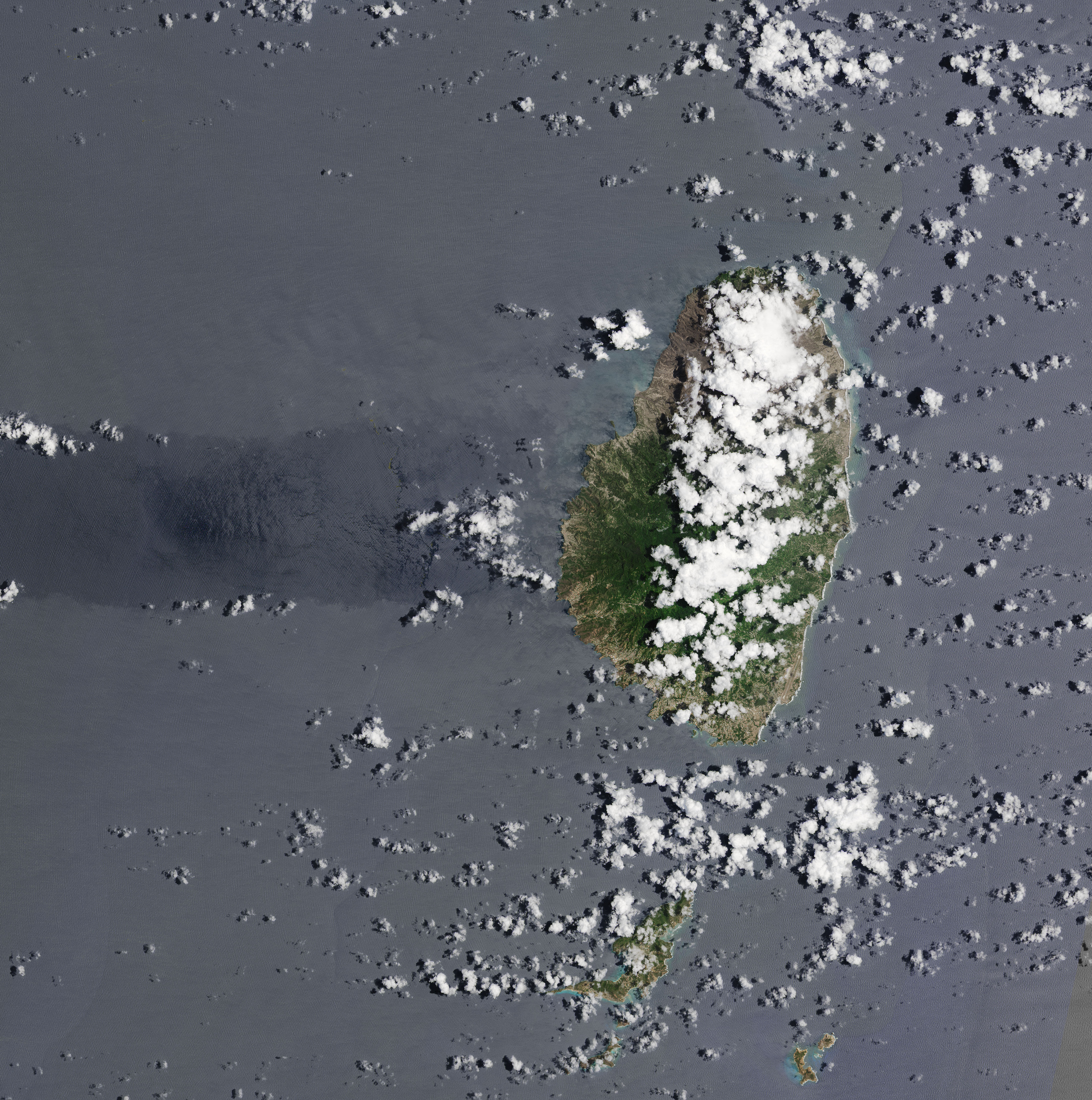
NASA published some images of La Soufriére volcano pre- and post-eruption showing the deposition of ash and pyroclastic flow debris:
Pre-eruption:
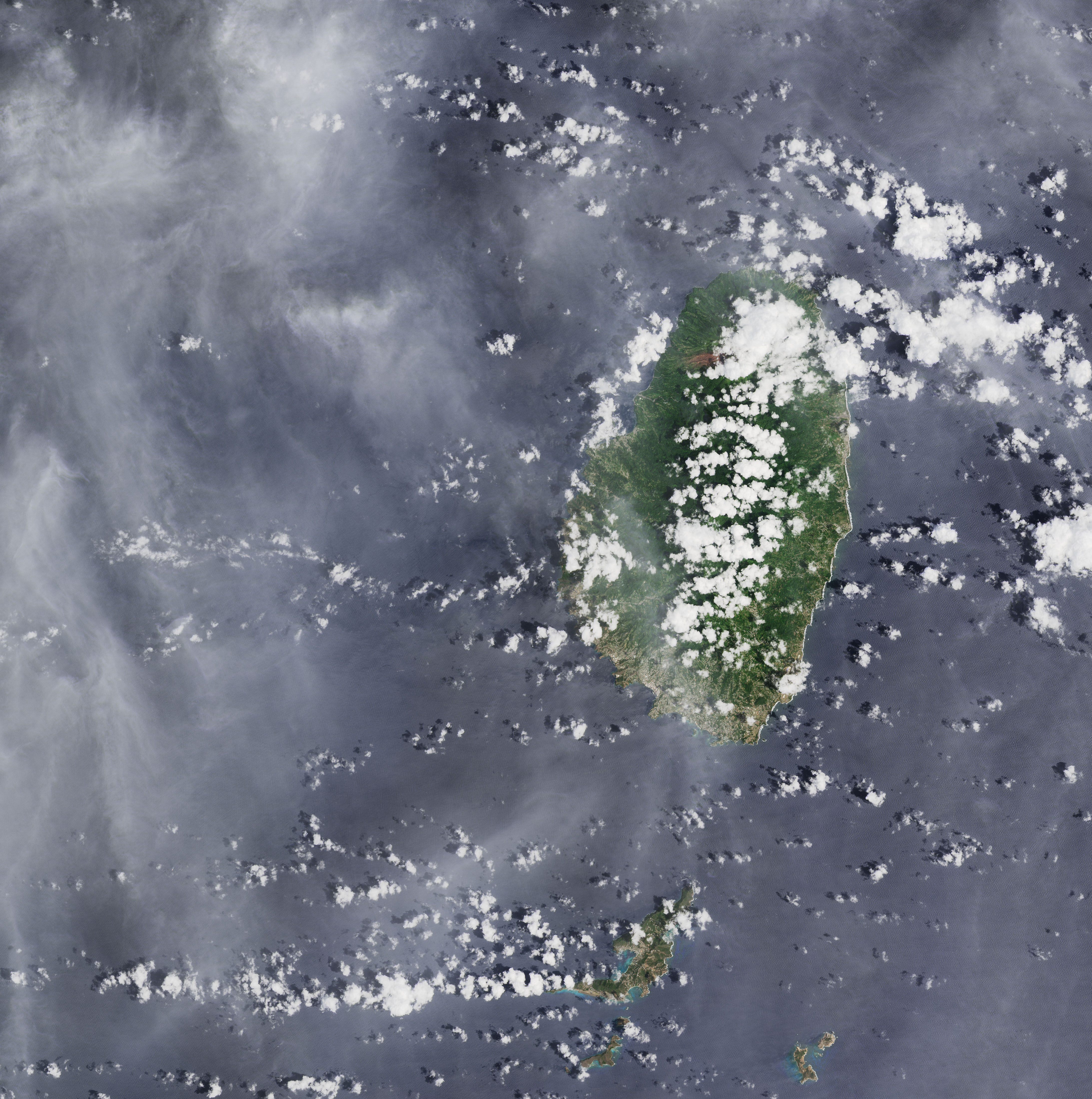
Post-eruption:
Like
totally non professional thought… who else thinks the temperature of the eruption is increasing? The gasses are seeming to ignite above the eruption tonight and staying lit for longer. Anyone, anyone? Maybe the official smart people will be able to tell us. 🙂 from mots just sitting on the edge eating popcorn.
You are probably right. I noticed that there is a lot of pumice type lava in the flows, indicating much gas decompressing. Tonight the fountain height is definitely higher than it’s ever been. I am wonder if the higher temperature causes more rapid gas decompression, or if the entrained gases expand quicker due to the lower viscosity of the hotter lava or both?
I asked last night about temperatures, when I noticed the plumes were showing up brighter on the Keilir IR webcam.
Looks like the 4.9 Banda Sea eq took about 6 minutes to show up on the eq plots in Iceland. I was wondering why I couldn’t see that blue eq in the Iceland lists when I thought to check worldwide. Every day’s a learning day. It’s gone midnight here in the UK, time for a journey to the Land of Nod. Laters, taters…
More gases coming out of the fumaroles at Taal, with background tremor continuing for 3 weeks so far.
Upwelling of hot volcanic fluids in the Main Crater Lake occurred last night and this morning accompanied by 600-meter tall steam-laden plumes emitted from active fumaroles.
“Hot volcanic fluids” is new on the list of ongoing events, but what do they mean with that?
I am thinking it’s volcanic gases or stuff from the hydrothermal system because if it was magma it would be an eruption.
I just came across a very interesting paper with a surprising result which shows that lava can actually abrasively erode a channel very quickly through rock. Please see https://physics.aps.org/story/v17/st2
This interesting phenomena begs the question of whether or not mechanical erosion can cause the changes in the lava eruption which we saw take place the past two days.
Doesn’t particularly surprise me. Most lavas, excepting the very hottest, have some crystals mixed in rather than being purely liquid. Which means its erosive power will be like water that’s carrying a heavy sediment load rather than like pure water. It is picritically sandblasting the sides of the channels as it goes through, even before we consider the thermal and chemical insults it is also capable of dealing. (Thermal: obvious; chemical: the accompanying gas forms very nasty acids given half a chance, e.g. upon interaction with groundwater, and in some volcanoes that gas can gradually turn tougher rocks into clays that give way relatively easily, producing eventual flank failures like the one at St. Helens.)
Or the pending one at Ranier…
which side of Mt Rainier? (the $64,000 question)
I’ve always thought this. When you consider the erosive power of water and its myriad forms in shaping the planet inside and out, surely any liquid substance must be capable of the same. Look at geomorphological processes on most other planets in the solar system…
Just a general question, why are people so quick to contradict when you mention seeing a possible fissure opening up? In the previous web article here, Hopper posted a video of the ground steaming and flames or lava spitting out. I purposefully waited 2 hours, carefully watching the camera and sure enough, 3 more fumuroles appeared, and in a zone further up, lined up fairly neatly.
It is very interesting now that the active cone occurs in an area that I first pointed out to person and sent this person photographs, showing flaring occurring in that exact spot, about 2 weeks ago, and expressed my concerns. But sometimes it seems hard to convince people.
I didn’t expect to be shot down so quickly tonight.
Oh, Randall… don’t take it too bad…. remember…. You have to be flying for people to ‘shoot’ You down… It’s all just due to people being less than perfect… i, for one, am happy to live in an imperfect world… less stress to be perfect… and perfection would stick out like a sore thumb. i fit right in… so make Yourself comfortable, put Your feet up, and pass the popcorn. Besides, just because someone has a different opinion doesn’t mean they are right either. All vents eventually close anyway.
Hope none of my remarks make You feel bad…. not my intention.
Best!mots
“Perfect is the enemy of good” – Voltaire (?)
Am with you Randall- some can be quiet dogmatic about their opinions. In truth even volcanologist get it wrong! Predicting volcanic behaviour can be a mugs game.In truth all things related to volcanology is not fully understood, the good thing is more is been discovered and learnt by the current eruption in Iceland. So keep on plugging away – tell what you see and open our eyes in what we are currently seeing.cheers
Sometimes scientists can be very set in their ways and be quite resistant to new ideas. I’m sure that’s as true, at least to an extent, as in other branches of science.
As the resident ‘thick-o’ who has submitted enough daft ideas to fill Etna’s crater, I would far prefer to hear from people with opinions and ideas than not. We’re all here to learn from each other and it should be an enjoyable process. If we get discouraged, VC might fall silent.
Don’t lose heart Randall – keep the ideas and observations coming!
Am with you Randall- some can be quiet dogmatic about their opinions. In truth even volcanologist get it wrong! Predicting volcanic behaviour can be a mugs game.In truth all things related to volcanology is not fully understood, the good thing is more is been discovered and learnt by the current eruption in Iceland. So keep on plugging away – tell what you see and open our eyes in what we are currently seeing.cheers
Ooops, my mistake -one was more than enough!
A nice post.. Have been with my head “underground” try to understand the Physics of this eruoption. And when i log in Carl have write this 🙂 So looking forward to next post.. i am more of a thinker, not so much about watch the ongoing eruption.. Even if it is very nice and use it as a background on screen. Looks like the magma have easyer pathway now through the system. Wonder if the conduit can hold this higher flow and become more of a one went show, or it crack somewhere.Ok time for a Swedish coffee… Again.. Have a nice day out there.
https://m.youtube.com/watch?v=7-RhgB1INII&fbclid=IwAR3PQzqY6NJTaeDrq1yxTTXHwygF9-HOgJq9o_8rlzR8wDem0OHsE367NLk
Webcam .. If the fountains gets even taller with more loose materials we May end up with a cinder cone … but for now it remains a large spatter cone .. ejecta is too liquid to form cinder scoria
Looking at the small quake swarm in Hengill it probably will not be anything significant, but in the small chance it does become volcanic I think that is where we could see a shield form. Hengill seems to be somewhere half way between the rifting volcanic fields of Reykjanes and a proper central volcano, it probably was an actual central volcano at some point in the past, so its eruptions probably do begin more or less with magma rising under the actual mountain. This swarm is not underneath Hengill mountain so would be another example of a independent magma feed. Theres no young shields on Reykjanes but there are some young shields between Brennisteinsfjoll and Hengill, and this swarm is directly north along the same rift area and also south of Langjokull where there are more young shields. There seems to be an old shield structure that was created in a previous interglacial but no Holocene volcanism at this location. Its also very close to Thingvellir.
That is though assuming the 1% chance it is not just a normal tectonic swarm or a borehole.
https://imgur.com/a/GUJBPwd
Location of the swarm more or less. The red is the fissures that were active in the last eruption at Hengill.
It’s certainly possible a sloping dyke or feeder tube may be rising to the previously active fissure. Given the crustal movements over time, a reactivated dyke may have become tilted? Looks like it may arrive at the main Hengill mound, or north-east of it.
I guess it would not erupt in open territory north of the fissure.
Time will tell!
I dont know but I would not expect a dike to go towards a central volcano at shallow depth from nowhere, that happends deep down but its sort of the opposite at shallow depth, its like a tree I guess 🙂
Thing is its also not actually in the fissure swarm of Hengill proper, that is pretty abrupt where the faulting begins and is non eruptive at this location I think based on what happened in 1789. Hengill seems to be a fusion of a Reykjanes cycle volcano and the Thingvellir rift which is connected somehow to Langjokull, it might only be able to erupt if both line up, so there was no magma in 1789 and there was no rifting in the middle ages, but there was both 1900 years ago? Its quite an interesting volcano, its kind of like Krafla but without a caldera.
A timelapse from yesterday evening to this morning from the working mbl camera
I have added sound from the 2 videos found in this article
https://www.ruv.is/frett/2021/04/29/eldskystrokar-vid-gosstodvarnar-i-gaer
Someone posted this several comments above, for which I’m thankful.
Though the sound is not from the same place and location, I thought it could add some atmosphere and if you mute it it’s just the same anyway.
https://youtu.be/mZNRZ0mMaLQ
Enjoyed the whatsapp crow call by the way and farmeroz’s crow rescue. But for crowtalk maybe the VC bar is a better place.
Wow. I wouldn’t just be sitting drinking my coffee if a lava devil was throwing chunks around like that!
And did you spot the steaming/degassing ground to the right foreground? At least 3 puffs of gas that I can see on first watching. That’s no dust devil. Yet another piece of evidence that the ground all around is cracking up, not just the ‘official’ fissure lines.
Yes I spotted that too. Clearly visible for first 10 seconds of video and again at about 35 seconds. Not sure I’d be so nonchalant with lava devils chucking stuff around nearby, some chunks can be seen hitting the ground external to the flow field.
It looks like the lava channel broke and the flow is going back into Geldingadalir, behind the original cone.
Yes! And there are no cameras left looking at that, so it’s been missed… Hopefully someone documented it… 🙁
There will most certainly be videos of it, someone will probably upload it in time 🙂
On your timelapse, some vehicle spends time on the threatened kipuka. Hopefully the PTBs are retrieving valuable hardware before the lava cuts it off. I wish we could see what’s happening in Meradalir… and what’s behind the original F1 Smeagol/Sudri… sighs
But my first reaction was, wow. As perfect a volcanic night as I have ever seen; several sweet breakouts, the human ants and their lights; the lightening of the pre-dawn sky and sweeping cloud bands moving into the sunrise. Excuse me for not paying much attention to your ambient soundtrack, I had Kate Bush Aerials playing in my head…
To take the topic off of Iceland for a bit, HVO Volcano Watch for this week is about lava lakes and how one with a high level is a massive danger probably to be taken a lot more seriously than it generally is, obviously after what happened in 2018. They particularly mention Nyiragongo…
https://www.usgs.gov/center-news/volcano-watch-rise-and-fall-lava-lakes
https://www.youtube.com/watch?v=3Yx23T76z_0
First video of 30th April by GutnTog. Enjoying the biblical references, although there’s no prospect of a return to the Zion of Geldingadalir…
https://www.youtube.com/watch?v=Yx8GT2lhTtI
Another posted a few minutes ago, showing braiding of the lava channel. If these are rafted cone debris, it’s possible that they could blocked the channel and caused the overflow last night. I have yet to find any video of behind the original fissure twin vents.
During the day the lava has continued to move towards Meridalír and has now reached the low point where the slope towards the valley starts (more than a day later than I thought it would). This could perhaps make the lava channel drain quicker in that direction, but as with ice in a spring river, one never knows if and where the blocking is going to happen.
I couldn’t help but notice that the fumaroles in the bare ground are still steaming.
Rúv have moved one of their cameras https://www.ruv.is/frett/2021/03/18/eldgosid-i-geldingadolum-i-beinni-utsendingu?
And mbl has both of theirs working again https://www.mbl.is/promos/elgosid-i-beinni/
The second RUV camera has been moved, all the way to the other end of the eruption area, looking down from Langihryggur.
https://youtu.be/BA-9QzIcr3c
You’ll have to take my word for it though, because it just blacked out.
I think that must be zoomed in. Even at 1080p it’s ripply and poor.
It’s actually further away than the RUV static webcam, judging from the angle, based on the 3D maps and some other topographical maps, so it has to the zoomed in considerably. It would however be in the perfect position to capture any overflow into Natthagi, assuming it zoomed out.
The view changed at about 15:30.
Ooh, that’s high!

@16:33:45
Is it really beyond the ability of the MBI field staff to straighten their camera up? The volcano looks like its going to slide off the scene. Come on guys! Use that bubble leveller.
The sinking cone of Fagradalsfjall
Slid slowly to the right
People peered through smoky pall
It had vanished in the night.
LOL
OCD much? 😛
Does anyone know how I might obtain a piece of that blue lava from Iceland? I have never seen light blue lava before.
I would second that request!
Do you have a picture?
I had a quick look- I see there’s ebay selling of Icelandic lava stones, alot of Jewellery stuff(who would have ever thought).Must be geology groups in Iceland-may direct you to blue lave samples!! Alas alot of googling I guess.
https://translate.google.com/translate?sl=is&tl=en&u=https://www.ruv.is/frett/2021/04/30/na-mogulega-afram-i-kviku-thratt-fyrir-litla-virkni
10m^3/sec*60*60*24*3(sg)=864k mt/day. Making a significant amount of rock each day. Now someone smarter can calculate the released heat energy to the atmosphere
Has anyone seen any Nickel/copper/PGM assays on the erupted lava?
Does anyone know how we can get high resolution maps like this from the IMO?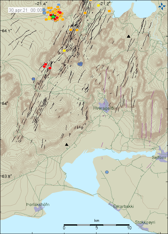
This is very useful for matching known faults with earthquake epicenters.
I think they are commercially available
At slightly lower resolution but free, this seems to be the best
http://kortasja.lmi.is/mapview/?application=kortasja
Under ‘basemap’ (top right) you can select several options. The top one gives the detailed contours.
The English wikipedia website reports:
New results from measurements published by University of Iceland on 26 April 2021 show that the composition of eruption products has changed and ressembles now more the normal Holocene basalts of Reykjanes peninsula.[44] The eruption itself has also changed its character parallel to this and was producing lava fountains up to 50 m in height on Sunday, 25 April 2021.[45]
A rather unusual sight was captured on film by some people from Iceland’s RÚV on 28 April 2021: a sort of small “fire tornados” as the Icelanders called it (icel. “eldskýstrókar”). The lava fountains from the still active main crater reached a height of 250 m the same day.[46]
See https://en.wikipedia.org/wiki/Fagradalsfjall
Maybe the deep source that this eruption came from feeds all the volcanoes but it gets stuck under shallower magma chambers under the other locations, with this just being a spot where there is no shallow magma. This could well mean all of the Reykjanes volcanoes have been recharged recently, so eruptions could be in the works at all locations. It also could mean the eruption now has tapped the Krysuvik magma reservior and that could be why the fountains are taller, and might have a lot of implications towards future activity.
I have been able to find that counter to the common source there was an eruption at Krysuvik in around 900 AD, which was at the same time as Brennisteinsfjoll was most active but before the Krysuvik Fires in the 1150-1180 period, and it was not a small eruption either. The progression is nearly east-west but its not absolute, and all the volcanoes can erupt at any time it seems. The 21st century is goign to be very exiting, a lot of places around Reykjavik are going to look a lot different in 2121 🙂
It is maybe fortunate that Reykjavik was built back in the last cycle so was not built in a risky area.
This is the reference noted in teh Wikipedia article. I can’t see anything about lava composition for 26th April though, unless I’m missing something.
http://jardvis.hi.is/eldgos_i_fagradalsfjalli
April 26, 2021
Measurements of lava flow
The latest data on the sizes of lava and lava flows are based on flight at 15 today. Aerial photographs were taken from Garðaflug’s aircraft with the Hasselblad camera of the Institute of Natural History, and land models of the lava in and around Geldingadalur were made based on them.
The total flow from all craters in the last 5 days has averaged just over 6 m3 / s. This figure is similar to the long-term average, but during the 38 days that the eruption has lasted, it is calculated at 5.6 m3 / s.
The volume of eruptions has now reached 18.5 million cubic meters and the area of the lava is 1.13 km2 square kilometers. The average thickness is just over 16 meters. The biggest change in the last five days has been in the depression between Stórahrút and the knolls east of Geldingadalur, where the lava has thickened by many meters as well as spreading. The new tongue is also down in Meradali, where the thickness exceeds 10 m in the gorge.
Size
The best way to estimate the size of the eruption in Fagradalsfjall is to map the lava and calculate its volume at any given time. This gives an average lava flow between measurements. The volume of the lava at any given time and the lava flow are shown in the accompanying graphs, in addition to which the results of chemical analysis of the magma and calculated gas emissions from the eruption are shown.
Geochemistry
There is a bit about composition from the 23rd, referencing this article.
http://jardvis.hi.is/lysing_bergsynum_sem_safnad_var_fyrstu_tveimur_dogum_eldgossins_i_geldingadolum
The Grindavik High pass seismogram looks interesting: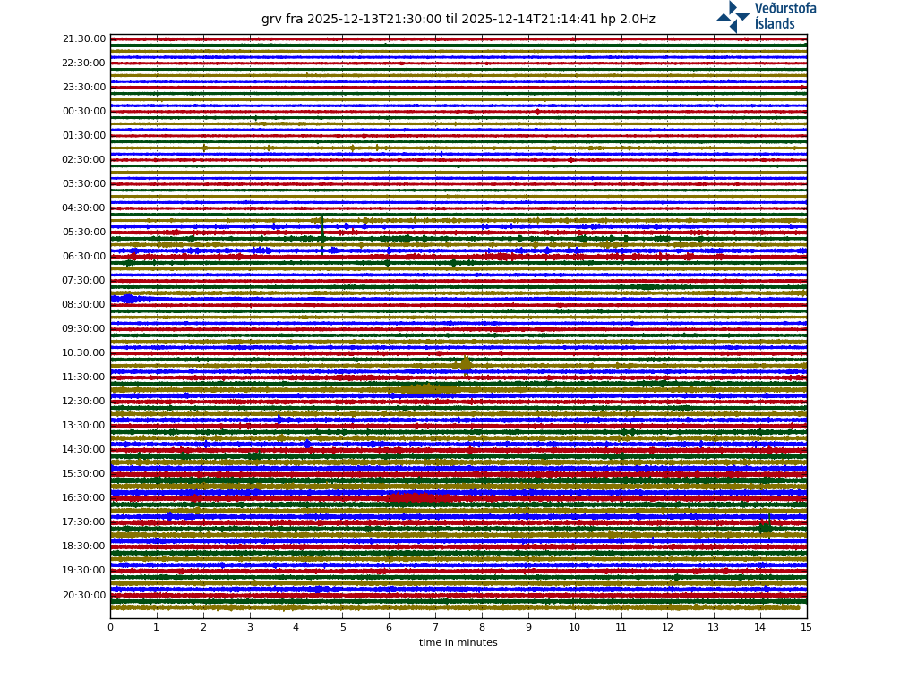
The weather is calm, and there’s no reason to have any low-flying jumbo jets over the area.
I’m wondering about gasses pushing through the system, perhaps something on the brew? A change in the system? Something to watch for?
Experts? Have any suggestions for this signal?
Dyke closing? The vent activity appears to be subsiding a bit.
Are you referring to this seismogram?
I am still trying to find the webpage for all the seismograms. This is NOT the period graphs with the frequency bands shown in red, blue and light purple.
Sorry! I meant drumplots. Here: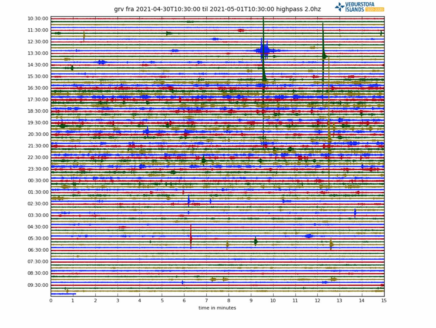
[I added a static image / Lugh]
Second attempt at the link:
http:// hraun .vedur .is/ja/drumplot/drumplot/grv_highpass_2.0 .png
[I added some spaces for the link to the drumplot image to show up as a link, you just need to copy the URL to yoiur browser and remove the spaces / Lugh]
Comment cleared as requested. As a general rule, links to images show up as the image itself… –Admin
Comment cleared as requested. As a general rule, URL’s that end with .png or .jpg show up as an image … –Admin
Well, this is a new one. My links usually work first time.
Dragons? Draaagoons! Something broke!
Because you link an image!! So the image shows! And it is a dynamic image that is updated each time someone updates/opens this page.
If you want to show the image as static to make sure that unrest you want to show can still be seen next week, download it & rename the image or take a screenshot and link it here after you upload it to
https://imgbb.com
https://pasteboard.co/
https://postimages.org/
(imgur typically does not show well for older browsers)
http://hraun.vedur.is/ja/drumplot/drumplot/
is the page with al the drumplots
Or if you want to see them live all in one page:
http://hraun.vedur.is/ja/drumplot/allarsort.php
http://hraun.vedur.is/ja/oroi/allarsort.html
is the page with the 3-banded seismograms
Thank you!
Perhaps a Dragon could please delete my useless posts so as to tidy up the page? It might help. Thanks!
The lava channel is full and has broken near the vent :O
2.56.40. Collapse and lava wave. Intense activity
Icelands owns its spectacular Tolkien landscape to both ideal climate location and geological processes of volcanism interaction with Ice Age glacials as well as lack of tall trees.
Its volcanism interacting with glacials and Interglacials that have formed these magical landscapes at an ideal latitude of around 64.
Do anyone know here what Icelands landscapes woud look like If Iceland Hotspot emerged at latitude 19 close to equator at the ridge? I expect much flatter landscapes without any glacial Ice Ages. And the Island woud probaly be Spanish or Portugrese.
Perhaps the landscapes woud be clogged by tropical vegitation and not be spectacular at all.
Iceland woud be a tropical mega resort today If it formed near Equator. Probaly woud belong to Spain?
Iceland in this scenario woud be alot flatter and perhaps not as spectacular in landscapes?
And perhaps Vatnajökull area woud be a kind of shield volcano complex without being worn by glaciers?
It woud be a very diffrent Iceland indeed! without the glacial interaction
Perhaps looking like a huge strange combination of Big Island, Oahu and Samoa as well as Virunga
Icelands coasts woud also be alot rounder smooth without the glacial fjord history
Anyway one webcam stopped working again : (
As the Pacific is very different from the Atlantic Ocean I would consider it more similar to the Canary Islands, and Timanfaya, Lanzarote, has already been compared to Iceland on VC, recently, by Hector I think. The CI are at 28, 29 N latidude, so just add a few plants. Now everybody is different. I personally think the Canary Island landscape is altogether, counting all seven islands, as spectacular and more diverse than the nearly arctic landscape of Iceland. Very Interesting: Isla de La Palma with the old Caldera de Taburiente in the North and the active volcanoes Teneguia and San Antonio in the South. Isla bonita! I love that island, the few beaches grey to black, no white sand at all, steep walls into the Atlantic, great fish. on the East side beautiful view of El Teide on clear days. And then Jesper, many Scandinavian tourists on the Canaries. So, some sun in winter must be nice 😉
Some sun in the summer would be nice ..
Iceland is a very very very much more powerful Hotspot magma source than Canaries ever is
Canaries are peanuts compared to Iceland
Jesper, I didn’t say it is the Canary Islands. I just assumed that it could be similar further South, and the Canaries were more active in the past, thinking of Timanfaya, El Teide and especially La Caldera de Taburiente.
Hawaii isn’t sitting on a MOR. After comparing the story of the Atlantic, heir to Tethys, although now longitudinal, and the Pacific, heir to Panthálassa, I’d say they are both very fascinating and very different.
Place Iceland at Canaries in MAR and you ends up with a gigantic Madeira like country : )
That sounds good. Concerning tourism La Palma is (was?) much better than the rest of the Canaries, not many big hotels, wheather worse than say GC. Unfortunately they built a larger hotel near Fuencaliente. Before there was just that village with the two volcanoes, one bar. We had vinitos in the bar and stayed on the beach over night after climbing down through the basalt (?, black volcanis stones). There were birds talking in the night like humans. I was with local people who said they were birds, otherwise I would have been afraid. I stayed awake all night and studied the stars. Knew many stars back then. There were very primitive fish restaurants on beaches, very nice, fresh fish. Mass tourism destroys too much, I agree. In Iceland it’s getting bad as well. In the North of LP near Garafia they have an observatory and dark yellow lights at night. It was the island were I stayed awake all night to see the stars.
Before I spend several holidays there the North burnt down twice without any real reason at all as there is enough rain. So, I basically think it was arson.
https://www.youtube.com/watch?app=desktop&v=I1I-0PUhFmU&fbclid=IwAR0BY3wjmpoGODRFz-ucI2iz-iHsWbswt2CtxUhgWDqVCfvQMRkf2_hRZgU
Working again : )
We already have a “low-latitude Iceland”; it’s called Hawaii. Without periodic glacial erosion pulses to wear it down Vatnajökull would be Mauna Loa and the area around Katla and Hekla would be Kilauea. And yes there’s a lot of tropical vegetation and, between that and the lack of glacial erosion, very different landscapes from Iceland.
Would probably look quite a lot like Hawaii, but bigger. I guess though most of it will probably be too far away to be resurfaced if it is as old as it is in real life, so that would be eroded and fertile. Vatnajokull would probably not be anywhere near as big as Kilauea or Mauna Loa as a mountain though, the rifts take too much magma away from the central volcanoes to allow them to get so big as Hawaii.
Kergualen was probably a rifting LIP plateau like Iceland back in the Mesozoic, and it was temperate-subtropical. I know it has got fossils of trees dating to the early Cretaceous, so there was land. But that is pretty boring, I want to know what sort of animals lived there. New Zealand had no mammals except for bats until less than 1000 years ago and its last native mammals in the mid Miocene were weird Mesozoic holdouts that were extinct tens of millions of years earlier anywhere else.
Maybe Kergualen was a land of flightless pterosaurs, or birds even as they did exist at that point. Maybe there was a small enough distance to allow mainland megafauna to colonise it, but even then that could be dinosaurs of the mid Cretaceous that persist into the Cretaceous possibly even as late as the K-Pg extinction. Kergualen was still a huge island as late as the early Miocene only sinking 20 million years ago, way more speculative but even post K-Pg non-avian dinosaurs… so many mysteries we probably wont ever know 🙁
Like Albert who knows a lot more though I tend to think that not all dinosaurs died out when the Deccan Traps were acitve. But they certainly could have damaged flora and fauna on Kerguelen being much closer at the time. As it’s under water, it’s difficult to find them. Besides there is more erosion. Also, the swimmers among them might have migrated on time. Where? Antarctica, enjoying a semi-tropical climate at the time, it seems.
Fossils from Antarctica:
https://www.bas.ac.uk/data/our-data/collections/geological-collections/fossils-from-the-antarctic/
Yes, its quite a shame really our best understanding of late Cretaceous fossils is from North America, close to the impact. There was a recent study done though that the Deccan traps would not have been enough to wipe out as much as actually went extinct, so it is likely the impact was the primary culprit, it was really a colossal event, it was probably more energetic than every explosive eruption in the Cenozoic combined. Its not really something that occurred to me until just now but the crater is actually wider than the entire thickness of the atmosphere, its like dropping a cannonball in a blow up pool from 10 meters up, there was no chance…
K-Pg to me is the extinction that probably deserves the title of Great Dying, not P-T. Less species went extinct, but there was nothing at all on land that was over 10 kg that made it, and in the water probably nothing much bigger than a person. There was a surprising large number of big animals that made it through the P-T, it was a prolonged event, in fact a lot of them thrived through the boundary only to go extinct a million years into the Triassic. K-Pg was instant, the best evidence we have shows dinosaurs were wiped out within a single generation, the only reason that modern birds survived is because wetland environments and coastal settings recovered quickly, and genetics show all modern birds evolved from ancestors that were small mostly seed eating birds that probably had similar habits to ducks.
Maybe a better topic for the bar, or I might write an article on this 🙂
Added some thoughts in the bar.
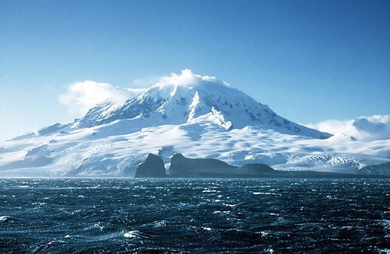
Nice picture of Heard Island where the Kerguelen hotspot is supposed to be and McDonald:
Yes indeed …
But Hawaii ..huge volcanoes have
No Ridge combination and sits on a fast moving plate
Yes Tropical Iceland woud Probaly look like an oversized Virunga – Galapagos combined with Samoa and Maui thrown in for fun .. it woud be very diffrent indeed
Vatnajökull woud be a huge volcanic centre .. But unsoure what exactly it woud look like .. But perhaps gigantic without glacier erosion .. 2 million years of Glacier erosion on Vatnajökull have removed alot of productivity and transformed alot into ash..
Without perhaps it woud be alot bigger as volcanoes there ..
Iceland woud be at least .. a tourist winter trap 😂 with Mega hotels everywhere and horrible crowds and home to a few millions
Reykjavik woud be something like Atlantics Honululu …or Gran Canaria on steriods terrible crowds and by 2021 home to mega hotel complexes cheap vacation spot for european tourists.. and probaly falling out of taste by now .. among most European vistors after around 100 years of ”mass tourism”
But it coud also be something very European old historical .. like a Portugal colony of steroids ( perhaps like an oversized ponta del Gada ) Tropical Lissabon full of history and art
But it woud be a very diffrent Iceland indeed .. perhaps better at VC Bar
Anyway webcam is working now
Remember that crack near Suðri that was emitting lots of steam during the very early days of the eruption? One tourist posted video of walking right up to it and watching it puff?
Well, it’s emitting steam again, or vog perhaps, occasionally visible on ruv1. Watch from 02:13 for about a minute to see one instance.
Why the hell is this comment here, and not where I put it at the bottom of all of the comments?
The Geldingadular live cam is showing a white glare screen.
Just checked-it’s all systems go! Can’t take the credit,!
Interesting article about the ownership of the land on which the volcanoes stand:
https://icelandmonitor.mbl.is/news/news/2021/04/30/burning_interest_in_buying_eruption_land/
I assume that Iceland has open access land laws, with all the people roaming over the site. Interesting to see how the volcano would be monetized. A VERY mobile hot dog stand?
<>
Drone jockeys with U-tube channels ..
Hooper good one, hey money talks! I thought a National park,but it’s there show.Also love the pic in the article-a gem!
Sorry meant Hopper.
“This map shows the activity at the eruption site in Geldingadalir, SW Iceland, in the evening of April 30th 2021. The analysis is based on short wave and near infrared bands of the LANDSAT-8 satellite, NASA & USGS. It is possible to distinguish between the vents, lava ponds and active lava flow. The background hillshade map is based on digital elevation maps from the Icelandic Institute of Natural History, The National Land Survey of Iceland, and Loftmyndr ehf. (map.is)”

Has to be noted, that the hillside/lava backgroundmap is from the 26th, so a few days out of date.
This is a very interesting infra-red picture. One thing catching my eye is the very dull red upon the hills such as those to the south. Is this an artifact, or are they really hotter? They are not directly near the very hot lava flows.
I’m wondering if the gas temperature is being picked up, this would account for the randomish pale reds on the hillsides. Otherwise it’s a fascinating overlay, showing the locations of new overspills and aeaas where the flows are filling in gaps.
It also is great evidence that the extreme fissures are no longer active. It’s also the first proper look at the rest of the lava field for weeks. (Days probably, but it feels like weeks.)
You are right, now that I look at the hill to the SW next to the active vent. The whole hill is obviously not hot, ground temperature wise, but would be warm in the air from the active flow field. So we’re reading both the ground temps and a bit of the air temperature here.
Some of the inactive cones are still hot.
Is something happening on the flanks of vent ?2, the one nearest Meradalir, as seen on the panoramic mbl cam? Looks like lava.
Is a car I think
https://m.youtube.com/watch?v=I1I-0PUhFmU&fbclid=IwAR0t7A7W1RIyQzyPndLDcvavOYowMZ89tGn4HVIpYvgekH_vyZgU7rkjPDo
Eruption continues on the webcams
It looks very stable indeed with decompression melting feeding the eruption .. coud this eruption reach 1km3 in volume? soon because It just keeps going.. perhaps 0,1 km3 will have been erupted soon with these rates
I took an audio spectrogram of the active cone, discovered there is a period of 10 secs (1/10 hz) in the eruption spattering. https://drive.google.com/file/d/1uiZiNWGEogf1Sw6ZH4hqvhUO6lSZTw5S/view?usp=sharing
My reason is to track down why some of the drumplots are showing a periodic signal on the lowpass plots, when we’re having nice weather in Iceland.
Quite a big new flow on http://brunnur.vedur.is/myndir/webcam/2021/05/01/webcam_langihryggurN.html It is covering the rise in the centre of the flows.
I keep getting back to these and just hitting the down arrow on the keyboard, speeding through the images, gives a really nice timelapse effect.
There does seem to be a surface log-jam just outside the eastern exit. Lava isn’t showing hot, so must be running through ‘tubes’ from there. That Mildly Moist Boggy Bit flow is really filling in. The million dollar question is – where does it go from here? Which is the way that’s clear??
Essex, obviously.
(For those unable to understand what I’m rambling on about, Stars Die’s final line are the lyrics from “Rock On” by David Essex).
And there was me thinking you’d gone all TOWIE.
I’ve just been playing about with the playback of the
http://brunnur.vedur.is/myndir/webcam/2021/05/01/webcam_langihryggurN.html#
webcam, and there’s something going on at the back of the active vone. There’s a slow collapse of the flank going on all day! Going with a whimper, not a bang…
I’ve got some snips, but dinner needs preparing… sigh
Stars Die, you are right, I can see the same zone which seems to be in the very slow meltdown mode. I believe that the jets of erupting spatter are directionally oriented (this is a fascinating question as to why the jets are oriented this way, as you would think erosion (thermal and abrasive) would have resulted in a symmetrical spray pattern) and the heat of the spatter is causing this slow slumping.
I cannot wait to see your snips.. great job!!
Well here goes, It’s only taken me an hour and a half of snip editing and trying to get an image on Imgur…
I hope this works, dear dungeon dragon be kind and don’t laugh too much..
https://imgur.com/QuWHyh6
The first photo should have had a red line too, only I selected the original screenshot, not the altered one. It will have to do, it’s the baseline photo to compare with the others. It’s not just the slow collapse, which I think started earlier, but the 5.10 am shot was the earliest with the best contrast to see the slope shape.
I wonder if the weight and force exerted by all the spatter constantly raining down on the vent’s sides caused a slow flank collapse. Oh for a camera angle behind there. The camera that is focused there is too tightly zoomed in. What happened to all the nice panning and zooming out we had at the beginning of the eruption?
After seeing Randall’s fascinating spectrum comment (above – and thank you!) do any of the webcams have sound? All the ones I have been accessing carry no sound. It might be my settings?
Thanks for any info.
can You imagine what we would be subjected to if there was sound too? i do like the idea of hearing the whoosh tho.
Most of the live webcams of RUV and m,bl.is have ambient sounds, but usually canned as the cameras aren’t close enough to pick the sound up now.
20:15:54 pm a major part of the cone collapsed, and more collapsed in the 20:17 min interval. Very vigorous fountaining now.
20:23 pm, noticed that the other quiet cones are starting to smoke a bit now, so eruptive activity has picked up.
The lava field to the north of the 3 cones in a row is now slightly smoking too. See https://www.ruv.is/sjonvarp/beint/ruv2 as activity has definitely increased (20:32 pm)
Went to see the degassing, stayed for the music… oh yesssss
https://imgur.com/a/tsDU2o8
What’s that coming over the hill? Is it a monster?
An Icelandic chart comparing the eruption to various stuff, to give an indication of size and such
i’m missing the “refrigerator” or “large bolder” comparisions.
21:55 and on, directed jetting is splashing a certain portion of the cone on the outside with orange hot lava. Lots of people watching the fountaining tonight.
22:01:21 pm, a big chunk of the cone falls off, in the lower area at the top, falls over, breaks off the crust and a huge yellow hot chunk starts slowly rolling down the hill. It was spectacular!
anyway to see it now that the time is passed?? Is there a way to scroll back?
Yes on youtube.
https://youtu.be/I1I-0PUhFmU
https://youtu.be/BA-9QzIcr3c
https://youtu.be/-A182zOjRnc
Thank You! You get 3 extra points for helping an old lady.
This opening of a second gap is all a consequence of the slow flank collapse happening all through today. The fountaining splatter is heating up the rocks and seems to be contributing to the erosion of the cone on that side. There’s tremendous percussive forces being exerted on the cone material, which is proving too weak to withstand the barrage.
People taking pictures, of a major gushing fountain event, 22:46 pm, but the ruv.is RUV2 camera is blacking out periodically, and so we miss the major action. https://www.ruv.is/sjonvarp/beint/ruv2
Arrgh!!!
It looks like the lava level has risen inside the cone, like fizzing liquid, very white hot in the RUV2 camera
The ruv2 camera is overexposed and that is creating problems with knowing where the lava really is. Some better gamma control needs to occur, some of the shots are misleading and lead the watcher to think that more lava is gushing.. it’s not. The mbl.is camera corrects this mistaken impression.