
Þorbjörn Volcano seen from across The Blue Lagoon. Photograph taken from unknown photographer (Please tell us who we should credit for this lovely photograph, and please excuse our theft in the name of science).
The Icelandic Met Office has released an Official Bulletin about the possibility for an upcoming eruption at Þorbjörn on the Reykjanes Peninsula in Iceland.
Þorbjörn belongs to a class of volcanoes that I normally like to call Unknownabunga, one of all of those volcanic features in Iceland that pretty much nobody knows anything about, until they all of a sudden erupt out of the blue.
Currently it is not certain if Þorbjörn is a standalone volcanic fissure (central volcano), or is part of a wider known central volcano called Svartsengi. This will probably become clearer in a few hours as we get around to plotting things and checking against more well-known culprits on the Reykjanes Peninsula like Svartsengi.
So far both we and IMO are happy to call the volcano Þorbjörn and are treating it as a standalone unit. Suffice it to say that we are in for a possible treat.
For anyone who wishes to go to see the possible future eruption I recommend A) that you go quickly since this will close down Keflavik International Airport as soon as it starts, and B) that you head all instructions from the helpful and very competent local authorities.
Currently this has been an ongoing seismic episode with tectonic and volcano-tectonic signals, and marked inflation as evidenced on INSar.
We will update this article as news comes along, and there will be a new article as soon as we are done with the usual juicy plots so that we have something solid to interpret.
CARL REHNBERG
Iceland Met Office Bulletin in full

Sentinel-1 data for Þorbjörn Volcano. Image from the Icelandic Met Office.
(1) VOLCANO OBSERVATORY NOTICE FOR AVIATION — VONA
(2) Issued: 20200126/1715Z
(3) Volcano: Reykjanes (371020)
(4) Current aviation colour code: YELLOW
(5) Previous aviation colour code: green
(6) Source: Icelandic Meteorological Office
(7) Notice number: 2020-164
(8) Volcano location: N6349 W02243
(9) Area: Reykjanes Volcanic Zone
(10) Summit elevation: 140 M
(11) Volcanic activity summary: Change to yellow code for Reykjanes – ICAO 371020,
because of signals above normal background. GPS-system and InSAR images indicate rapid rise of the surface around
Reykjanes volcano system has ICAO location N6349 W0226 but Mt. Thorbjorn, is located seven nautical miles to the east at N6352 W02226.
(12) Volcanic cloud height: N/A
(13) Other volcanic cloud information: N/A
(14) Remarks:
Possible magma accumulation beneath Mt. Thorbjorn on Reykjanes peninsula.
• Inflation has been measured the last few days.
• An earthquake swarm has been ungoing during the same period.
An inflation has been measured since January 21st and it‘s centered just west of Mt. Thorbjorn on Reykjanes peninsula. The inflation is unusually rapid, around 3-4 mm per day and has accumulated to 2 cm to date. It has been detected both on continuous GPS stations and in InSAR images. The inflation is most likely a sign of magma accumulation at just a few km depth. If the signal is indeed a magma accumulation it is very small, first volume estimate is around 1 million cubic meters (0,001 km3).
This is the conclusion of a meeting held with the Scientific council of the Civil Protection at the IMO this morning.
Accurate measurements of crustal deformation on Reykjanes peninsula span appoximately three decades. During this period no comparable signal has been measured. This is unusual for this period. An earthquake swarm has been ongoing, since January 21st, alongside the deformation signal just east of the inflation center (northeast of Grindavík). The largest earthquakes occurred on January 22nd and were of M3,7 and 3,6. They were felt widely on the Reykjanes peninsula and all the way up to Borgarnes region. The earthquake swarm is currently in decline. Swarms like this are common and not unusual by itself in the area.
The fact that an inflation is occurring alongside the earthquake swarm is a cause for concern and closer monitoring.
Background information:
The inflation is occurring on plate boundaries and within the volcanic system of Svartsengi which is either considered a separate system or part of the Reykjanes volcanic system. The last known eruption was during Reykjanes fires, which occurred between 1210-1240 AD. Within that period a several eruptions occurred within that system, thereof there were three eruptions in Svartsengi system. The eruptions were effusive (non-explosive) fissure eruptions erupting on 1-10 km long fissures. No explosive eruptions are known from this system. The largest eruption in the swarm, from 13th century, formed Arnarseturshraun lava (estimated 0,3 km3 and 20 km2). The duration of these eruptions are usually from a few days up to several weeks. Seismic activity is very common in this area and is linked to the plate boundaries, geothermal activity and possible magma intrusions. The largest earthquakes measured in this area are about M5.5.
For more information Catalogue of Icelandic volcanoes.
Possible scenarios:
The activity has only been ongoing for a few days and it is uncertain if it will escalate to more serious activity. Based on current information, the following scenarios are considered possible, without stating which is most likely or within what timeframe.
1. If the inflation is due to magma accumulation:
• Magma accumulation will cease soon without further activity.
• Magma accumulation continues for some time without further activity.
• Magma accumulation will lead to a magma intrusion.
• Magma accumulation will lead to magma intrusion and eruption (effusive fissure eruption).
• Magma accumulation triggers seismic activity with larger earthquakes (up to M6.0).
- If the inflation is not caused by magma accumulation:
• The inflation might be linked to tectonic activity and lead to larger earthquakes (up to M6.0).
The Civil Protection has declared Uncertainty phase.


Quick plot of the seismic stack under Þorbjörn. Image by Gaz Dale.


I am a bit grumpy about IMO beating me to it, but… They are the best agency on the planet, so I guess they will beat me to it now and then! 😉
I’ll give it 24 hours before the Daily Express mention it in the same sentence as Yellowstone.
Don’t worry, they will be pre-occupied with the Coronavirus at the mo, so they’ll not mention YS/Super volcano until after it has erupted.
I think that you are under-estimating their fetish for Yellowstone. 🙂
What’s the problem with probjorn?
Þorbjörn
Thanks Carl.
Found two road cams. One mounted on Mt. Þorbjörn, and I believe one where you see the mountain.

From this site.
https://www.extremeiceland.is/en/multimedia/iceland-through-webcams/south-west-corner
Neither of these show the Volcano sadly. In the one looking North, the volcano is behind you, and in the one looking south the volcano is off to the right.
I’ve driven that road many a time 🙂
I was watching this http://baering.github.io/ and wondering and just though, well, if Carl hasn’t said anything 😀
Love the prediction that (with good reason, IMHO) is known in the weather business as a “Partly to mostly with a chance of..” Interesting nonetheless.
Just finished Nick Zentner’s “Supervolcanoes” post on the Central Washington Geology website…
No he’s not a big fan of “overdue!!!” anything…
My idea is that -more likely one of Lurk’s “black swans” will land in the pond before Yellowstone goes…
I’d post a link to Nick’s site but I’m having issues with my old Coal Fired Steam powered Toshiba, getting a new one next week.
I like Toshiba. They are generally easy to work on and very intuitive in the layout.
Yep the next one is a Toshiba. I was turned on to the line when I worked with a Retired Coast Guard CPO- he swore by them..
Except their keyboard layout is wrong for a touch typist. The Enter key is too far away from the so called “Home” finger positions ie. 3 keys away instead of two. At least on North American models.
It will be a fissure eruption and may have little impact on airport traffic? Maybe the onset of an eruption will put off some plumes as the magma interacts with some ground water but should quickly turn into lava fountains.
The current intrusion and inflation is small
But it coud inflate over time…
Any eruption coud be fairly small and short lived.
Fluid basaltic producing lava fountains and Aa flows.
The Blue Lagoon Maybe buried under Aa lava if it happens? Blue Lagoon buried under lava?
After all Blue lagoon is in an earlier Aa lava field
There will be a town-hall meeting tomorrow at 16.00 in Grindavik where the relevant authorities will inform the locals. I hope one of our readers can attend the meeting and relay any pertinent info.
Public information meetings is to be considered as an upping of things in Icelandic terms.
This is pretty far from the Iceland Hotspot focus
So any eruption at Reykjanes Penninsula is Not going to be super – sized.
But Blue Lagoon coud dissapear under steaming Aa lava?
Possibly, but it is more likely to run towards Grindavik. It might also cause problems for travellers to and from Iceland since it bound to shut down Keflavik.
All depends on which side of the volcano fissures. Northern side and Bláu Lónið and the Svartsengi Geothermal plant are in the firing line; Southern side, and Grindavík Anna the NATO ULF facility are in the firing line. East/West and it’s anyone’s guess which way the lava would flow…
Correct, but the bulge seems to be more indicative on Grindavik, but that may obviously change quickly.
I bet they are monitoring the buttocks out of Blue Lagoon for temperature changes, and also that someone is keeping a very close eye on the steam intake valves at the Powerplant for temperature changes.
If we add salt, pepper and apples into the Blue Lagoon we might get Longpigs in Apple-sauce, a longstanding favourite snack for discerning Dragons. 🙂
Homo Sapiens is considered Least Consern, according to the IUCN-redlist of endangered species
I have heard that Dragons only eat species that are not about to be extinct, and that goes well with ketchup…
Carl, really! The mind boggles at measuring the temperature of bathers’ buttocks in the blue lagoon. Have we a permit for it?
Who would we seek permission with? 🙂
Is the nato facility the big antennas off to the south?
“Homo Sapiens is considered Least Consern”
Makes sense when you concider Sapiens is already extinct. Stultus is the only remaining hominid.
For the first time since 1966 in Iceland we may get an ocean entry and land building as lava enters the atlantic.
But Iceland grows in the middle…
By the Iceland Hotspot filling the ridge spreading gaps.
Lava dont need to enter the ocean to add land to Iceland.. its unique geological setting allows alot of intrusive and extrusive growth in the middle as land addition
Reykjanes Penninsula have both Aa and Pahoehoe
The speed of eruption determine the texture.
Fast basaltic eruptions Aa lava
Slow basaltic eruptions pahoehoe
If Thorsbjörn erupts the opening phase may be rather fast and pour out sheets of fountain feed Aa lava.
Most of the lava flows in Reykjanes Penninsula is of the pahoehoe texture: suggesting Reykjanes eruptions can be rather slow and last for a few years. Lava tubes near Blue lagoon is another Good sign of long lived eruptions
Carl Maybe we gets a new spatter /or cinder cone if fountains are high enough at
Þorbjörn : )
But knowing that eruptions in Reykjanes Penninsula are rather infrequent I doubt that anything will happen
Hmmm…I wonder if dragons like BBQ sauce? Because this sounds as delicious as ketchup, if not more so!
I’m quite sure they’d close off Blue Lagoon pretty quickly if there was any noticeable rise in temperature and also changes in the pH levels.
I also wonder just how reliant this part of SW Iceland along with Reykjavik is dependent on the Svartsengi geothermal power plant? I hope there’s a backup on case that power plant gets threatened.
Isn’t KEF the only airport in Iceland capable of handling jet aircraft, including widebodies like the A330 or the 787? It’s also possible that any significant amount of ash gets thrown up due to magma hitting the water table, this could lead to cancelled transatlantic flights between Europe and North America, and of course, closure of KEF. But I doubt this would be anywhere near as bad as Lady E if this does happen.
I think that they have a spare airport in the north that can take large jet airplanes in a pinch.
There will be no problem with electricity, Iceland produces a shitload more electricity than they consume, there may though be a small problem with heating since it is also a central-heating powerplant.
Some of the central heating comes in from Hveradalir, I think. If so, that might well offset problems at Svartsengi.
Eruptions There will likley be effusive
Lava fountains with quickly channelized rivers. The gases and fumes coud be a problem.. But westerly winds will blow them away from Reykjavik
Thorbjorn is an Icelandic volcano thats very far from the Iceland Hotspot and the dominant Eastern Rift zone in Icelands interior.
Any eruptions there in Reykjanes rift:
Thats far from the Vatnajökull plume and dominant rift, are not going to be large.
Western rift zone in Iceland is quite silent and magma starved compared to highly active Vatnajökull in the center of Iceland.
I like south Indian ginger pickle on burgers. Do dragons like spicy food?
I smoke my own chipotle using habaneros in Hickory.
Taco Hell’s™ “Diablo” sauce is cute and amusing.
I can understand them not wanting a lawsuit… but I’ve had tobasco that is far hotter than that.
(Not really a fan of flavored salt and vinegar for a pepper sauce)
IMPORTANT NOTE: I am a fan of hot and spicy, but if it’s too hot to taste the food, you’re wasting your time and money. At that point it’s not about flavor, it’s about testosterone. If that is the case, you are in the wrong game.
The Svartsengi geothermal plant provides central heating to the whole Suðurnes region with about 20 000 inhabitants. That would be the most significant disruption from damage to the plant. Electricity wouldn’t be a problem and heating for the Reykjavík area is an entirely different system.
The domestic airport in Reykjavík (RKV) can handle some smaller jet aircraft (A320/737 sized aircraft) and the airports at Akureyri (AEY) and Egilsstaðir (EGS) can as well. AEY should be able to handle some widebodies as well, Icelandair’s 767s have landed there in the past. All these airports have very limited stand space and passenger facilities though.
I think part of the towns Hafnarfjörður and Garðabær get their electricity from Svartsengi (HS Veitur). I know we do (Álftanes).
And Grimsvötn has managed to get yet another yellow bar in its montly earthquake counter graph
Yup, Grimsvötn was supposed to be the article in about 2 weeks, but right now most things are postponed while we much on things waiting for Þorbjörn.
The 20s are getting of to good start!
Certainly, first Taal and now this. Someone with better memory than me can probably remind me of any newsworthy eruptions last year, but so far none come to mind for me.
Kilaulea?
That was 2 years ago.
If an eruption happens There
I will go there and photobomb myself infront of the lava fountains like Maurice Krafft did with Krafla
The Kraffts 1980 s and 1970 s Iceland footage needs Ri be re – lived: I cannot wait 😛
You probably need to fly out now, because when it starts to erupt Keflavik will be closed.
Silly closing it
Reykjanes eruptions are basicaly Hawaiian style
The mildest and most gentle and most colourful eruptive style
But Im soooooooo souch a nerd
Im so bad 🙂 waiting Iceland to go Traps full on
Mild and Gentle?
The cones at Fimmvörðuháls turned into veritable blow torches before a train of quakes shot over to the Eyjafjallajökull upper chamber and blew the cork off.
I wants that site open to vistors if an eruption happens … dumb agencies
I wants that site signed open if it blows..
Maybe Guðni Jóhannesson, Katrín Jakobsdóttir
Coud force an opening for tourism if it happens
But Thats completely outside their powers and unsuitable.
The Icelands goverment and agencies should allow it to be open This time 🌋
Iceland the most friendly and equal country on Earth
Hey Carl, My main worry is the blue lagoon. It supplies power, cold and hot water to the whole reykjanes peninsula .Some of Reykjavik as well I believe.
Icelandic agencies will likley block the eruption site off anyway : (
IF any eruption happens it will be effusive
Perhaps similar in size to Fissure 22 or
Kraflas Final 1984 eruptive phase.
Because Reykjanes eruption frequency is rather low
I dont expect anything to happen.
Iceland is very active every 3 to 6 years on avarge
But Thats for Vatnajökull and highlands Hotspot frequency
“Icelandic agencies will likley block the eruption site off anyway”
… so they are aware of the capabilities of Homo Stultus…. nice.
Perhaps the use of the word “bomb” in this context is a poor choice? 🐑🎇
Thors Bear or Thors Beer?
Thor Bear so closer to Thunderbear
Good name for a beer though.
If it does erupt (wait and see..), luckily the prevailing easterly winds should take the fumes out to sea and away from Reykjavik.
Hey ya’ll. That’s….my back yard. So if..(when), it goes, I’ll let you all know first. 🙂
Hi,
Not a joke, instead of “bavardage” could we have some info/hints/ to enjoy this future touristic eruption?
Can we use a drone in Reykjanes?
Happy new year
Im looking on google earth in 3d. Is it the mountain between the blue lagoon and Grindavik? And if it is, what are the lines of stone running across the mountain/volcano? Thanks.
Yes it is that mountain.
It seems that the volcano suffered a Graben event after the eruption and partially collapsed down into the dyke under it.
Thank you Carl.
What we need is a comet, followed by some “good omens” (TM).
I would love to be able to watch Good Omens, but it is sadly not on Netflix, nor is Pickard. 🙁
A few surprises in tonight’s Doctor Who as well! 🙂
Good Omens got me checking out other offerings of Amazon Prime Studios… The quality of the adaption is extraordinary. I don’t know what the distribution looks like outside the States but if you can find it I definitely recommend it
I refuse anything Amazon just on good measure, so it is sadly a nogo. I get the hives from Jeff Bezos.
I just get the notion that he is about one kettle of boiled child-slave workers away from running for President on the premise of turning all of the US into Amazon-slaves.
Its currently on BBC iplayer.
Recorded, as is Dr Who, although the scripting of Dr Who has been very poor in recent series.
IMHO, Northern hemisphere hasn’t had a decent comet since that ~1997 beaut. Clear night after clear night, my wife and I would walk down to the local park, let our eyes dark-adapt, admire Hale-Bopp…
Hale Bopp in 1997 was not that impressive as it never came close to Earth. Hyakutake in 1996 was much better. But the best since a LONG time was McNaught in 2007. That was unbelievable. Where I lived at the time, people stopped their cars on the motorway to have a look.
http://www.cometwatch.co.uk/historic-bright-comets/comet-mcnaught/
I totally missed McNaught. Possibly due to rain in South East England. Never got one glimpse of it. 🙁
McNaught was mainly seen from the southern hemisphere with limited or no visibility from the UK and Ireland (its tail was seen in the evening sky but mainly lost due to sun light). I remember HaleBopp in 1997 and it put on an impressive show for a few weeks. Since then the northern hemisphere has been waiting for a bright comet. McNaught was possibly a once in 500 year (?). Accoring to astronomy.com McNaught at the time was the largest comet ever measured.
No bright comets are expected in 2020 but comets are the wild cards of the solar system.
http://www.astronomy.com/news/2010/04/the-shocking-size-of-comet-mcnaught
wonder if my friend will have trouble visiting Island in the Summer? 😉 Time will tell. Best!motsfo
By then the Icelandic people will have spanked that volcano into shape. 🙂
Exciting! I wonder how hot it will be IF it erupts?
Hi brother
Fairly hot and fluid around 1100 C to maybe 1150 C .. mid ocean ridge basalt lavas.
But absoutley not as hot or fluid as the lavas erupted by Vatnajökull at Icelands plume center. The massive Holuhraun was 1200 C and pure Thoelitic basalt plume melt.
Reykjanes ridge eruptions tends to be rather small and specialy in that arera.
But Reykjanes eruptions can reach considrable sizes by being slow and long lived.
Long lasting episodes there are called ”reykjanes fires”
The western rift zone is starving and becomming inactive
While eastern rift zone is becomming dominant in Iceland with a ever stronger Hotspot.
I am notching up another in Jespers team voting for MORBus Interuptus. 🙂
MORB = Mid Oceanic Rift Basalt…
Yup cooler and a bit more viscous than the superhot – gassy fluid Holuhraun type basalts produced at the plume centre.
you knew that Holuhraun was probaly the hottest Iceland lava eruption Thats ever photographed in action!
Holuhraun was a hot one : )
Holuhraun was 1185 – to 1200 C in its
lava fountains: thats around 200 c hotter than Hekla and around 100 C hotter than fimmvörðuháls eruption.
This kind of Hotspot magma I imagine is now filling the magma chamber under Grimsvötn.
How big/wide is the hotspot? Smaller than being able to feed both Reykanes and the central volcanos at the same time?
Icelands Hotspot is similar in size to the hawaiian one
Icelands Hotspots plume head is many many 100 s of km wide and swells the ocean crust around around
But the Hottest Hotspot ( plume stem ) focus under Iceland is Only around 100 km wide or less
and feeds enormous huge ammounts of magma to the Grimsvötn – Bardarbunga Vatnajökull arera.
Temperature under the thick crust of Vatnajökull is Probaly 1490 C to 1520 C ( it cools on the way up )
The really really hot part of the Iceland Hotspot is centered under Vatnajökull.
Holuhraun was a pure Hotspot magma as example.
Iceland is one of the worlds most powerful hotspots.
Reykjanes Penninsula at Icelands distant edge is not feed by the central plume very much
Maybe Carl can correct any missinformation here
But I think I got it right
Answer to Ulwur s question
The plume head in Iceland is many 100 s of km across.
And the hottest plume head focus, the plume stem under Vatnajökull is Probaly 60 to maybe 100 km wide.
The plume stem ( may ) extend down to the core boundary in the latest information and studies on the mantle plume in Iceland.
Its one of earths most powerful plumes.
Carl is this correct ?
The plume under Iceland
Does not feed the Reykjanes Penninsula at all
as its magma is not going there
Reykjavik basalts are not of the Hotspot type
Is the Blue Lagoon going to be rebuild
if its covered under a steaming sheet of Aa lava? It must be possible
Wait for it to cool a few years than dig the whole arera out again ?
Well my wife was able to check the Blue Lagoon off her list of places to visit. Looks like I may not be able to check this off if this goes. I would rather dive the rift and swim there, although the prices in Iceland may prevent any visit.
Mac
There are many more “blue lagoons” around Iceland that are much better in any aspect then the Reykjanes one. And not so costly.. 😊
Blue Lagoon may be a tourist trap, but it’s near Keflavik and a nice way to freshen up after a flight. I took a walk from there, a couple of years ago, skirting Thorbjorn on to the Grindavik road. Thought nothing of it, at the time, but I’ll be rooting through photographs later.
There is lava flows everywhere near Grindavik and Blue Lagoon.
These lavas are sadely not mapped in Catalouge of Icelandic Volcanoes http://icelandicvolcanos.is/#
Here you can find those mapped: http://jardfraedikort.is/index_enska.html
https://www.ruv.is/frett/iceland-volcano-alert-the-facts-so-far?fbclid=IwAR03tZK_z2l6BabnjZfpNyVlEOnlNSB12XUnQGUdU_lJfwSJxWfSV6p-fA8
If an eruption does occur at this location, would this mean that all bets would be lost as everyone predicted other volcanoes around Iceland ? . Or did someone get this spot on ?
In the last Woolly Mammoth-Sized Eruption Poll, Reykjanes and Svartsengi got 7%, or 24 Votes. Even though it is unclear at this point whether Þorbjörn belongs to Svartsengi or is a feature on its own, I think those votes should count.
The meeting in Grindavík is streamed live here: https://www.facebook.com/VikurfrettirEhf/videos/176914036991559/
Shame we haven’t got an english synopsis of this it looks very comprehensive. A really good public response. In UK we would probably have to wait for 3 years after the eruption!
This maybe? http://www.grindavik.is/v/23488
Can’t remember if this volcano featured in that Woolly Mammoth vote.
Is someone in line to win that if the volcano goes pop, or are we all losers?
Nope, it was not.
Or well, it depends if we count this as Svartsengi or as a standalone volcano.
Iceland is always good for a surprise. But if I recall correctly, there was an interesting line of quakes at this place 1 or even 2 years ago. Perhaps this marked the onset of the event we are currently seeing.
We also had frequent swarms at Eldey or Geirfuglasker, is it possible that a blop of magma entered the Thorbjörn from there?
We tracked the lava flow from the Reykjanes Ridge, it ends abruptly at Reykjanes Volcano, and we also got around to finding a separate feed for Svartsengi.
The swarm you are thinking about circa a year ago was at a nearby volcanic ridge. Thorbjörn seems to be going straight up, not feeding from anything else.
Do you think this one will actually lead to eruption this time? We’ve had quite a few teases in the last few years!
There was a 3.1 magnitude earthquake under the volcano:
Monday
27.01.2020 18:53:34 63.882 -22.385 6.2 km 3.1 99.0 5.6 km NNE of Grindavík
Carl only the southern north American dragons prefer ketchup , the northern ones prefer HP sauce!.
The truly Northern ones prefer them dunked in beer and with an apple in their mouth.
Anything south of around Kansas and west of Mississippi they like hot sauce.
Odd… I’m a resident of Florida and originated in Mississippi and I detest ketchup.
However I can make Chipotle that will blow the back of your skull off…
Share the recipe! This West Coast dragon likes hot sauce.
*decicated.
Destem a pound of Habanero. Smoke in Hickory for 18 hours until fully dedicated. Powder with a handheld espresso grinder.
Add as desired to your stews, gumbo, or barbecue.
WARNING a little goes a long way.
Makes about 50 grams of powder. I reccomend a P95 mask while grinding.
Do NOT itch your eye while destemming Haberneros…
Thanks!
Or your private parts.
maybe West of Alabama? Or do Southerners eat chiles these days?
Dunno. I recanted some dill pickles with a slice of habanero in each jar. My stepson, a native Floridian, ate every jar.
Norwegian news picking it up, for those who read scandinavian language:
https://www.aftenposten.no/verden/i/K3Rqq5/ved-denne-vulkanen-har-det-vaert-rolig-i-snart-1000-aar-men-naa-skjer-det-noe
https://www.nrk.no/urix/frykter-vulkanutbrudd-ved-den-bla-lagune-pa-island-1.14879021
The Daily Mail has spotted it and inevitably referenced Eyjafjallajokull, but at least is hasn’t gone full apocalyptic. It even mentions “so-called ‘inflation'” Presumably they would have used a better word??? https://www.dailymail.co.uk/news/article-7934861/Icelandic-volcano-showing-signs-potential-eruption.html
The journalist is probably confused why a volcano has financial inflation and is trying to work out the APR. Poor soul. At least they avoided the “yellow” one!
Next they will claim that there is a tunnel leading from this volcano to Yellowstone, and it’s filling up with “explosive, species-ending magma”…
French speaking people:
https://fr.euronews.com/2020/01/27/la-terre-gronde-en-islande-le-secteur-aerien-tremble
[tweet https://twitter.com/uni_iceland/status/1222125580205817856?s=20%5D
Almost as interesting as last years “monitoring volcanos” course, I guess….
See https://www.jonfr.com/volcano/ more on this particular volcano.
Since this area has had several recent swarms, is there a way to map them all by depth, going back further than 48hrs? I can’t find historical earthquake data on IMO. Is there another database available to the public?
Heat in (defunct) Taal Lake.
Maybe magma have surfaced now
I remember seeing a pic of Taal’s crater after the lake-clearing explosion, and it showed a small lava flow in the middle of the crater floor. Maybe this is what’s showing up on the thermal image above?
This is the pic with the lava flow inside the crater:
This was from this site: http://www.earth-of-fire.com/
Not a bad site at all. Although the blogger is French, there’s plenty of info in English.
Earthquake M 7.3 here….
https://www.emsc-csem.org/#2w
Reported at M7.7 off the coast of Cuba and Jamaica. Is there a tsunami warning?
There is now I think
Tsunami reports from the Cayman Islands. But only 10 cm high.
It was a strike-slip mainly: https://earthquake.usgs.gov/earthquakes/eventpage/us60007idc/moment-tensor
Aftershock 100 km further west. That is a good direction, out to sea. The same distance east would be within Cuba.
Strongest earthquake to hit Cuba since 250 years. About 200 km from Santiago, luckily out at sea
I wonder if this was caused by the recent and ongoing event on Puerto Rico. Could added stress on the North American Plate and the Caribbean Plate triggered this event?
there were enough event in Haiti lately on the same and parallel fault.
That parallel fault is the other boundary fault for that plate shard. The Enriquillo–Plantain Garden fault zone on the south side and east of Jamaica was responsible for the recent Haiti catastrophe as well as the destruction of Port Royal in 1692.
Forgot to mention this – you can click on the image to see a larger version.
I’ve enjoyed the articles on Taal & now this in Iceland. Then again if it’s about a volcano… It’s been a while since the last eruption there in Iceland. I can’t help but feel excitement.
Below is pictures of places, most are geological, some man made. Such as the Beer Can House in Houston, Texas. 🙂
https://www.msn.com/en-us/travel/international-travel/amazing-places-you-never-knew-existed/ss-BBZieAN?ocid=spartanntp&fullscreen=true#image=1
7.7 EQ was felt in Miami today. Looks like it occurred around the Cayman Islands.
https://www.sun-sentinel.com/local/fl-ne-earthquake-felt-near-miami-20200128-q6umwnstfffhplfiaqnioek7ay-story.html?fbclid=IwAR0gj45ZcFAqmESoOfZxfBMlcq_szq1AwlSTtzV1d5k2zw_107fZ9UTryP8#icb-arc-story-id
The Sun Sentinel said,
The powerful 7.7 magnitude earthquake that struck the Caribbean on Tuesday shook buildings about 500 miles away in Miami, Fort Lauderdale and West Palm Beach.
http://www.geologypage.com/2020/01/icelandic-volcano-swell-signals-potential-eruption.html#ixzz6CGsDWGlG
Magma continues to inflate under Blue Lagoon arera constantly
I have found some GPS plots for the Reykjanes/Thorbjorn area.
Here’s the main page, in Icelandic: http://www.jardvis.hi.is/moguleg_kvikusofnun_undir_svaedinu_vid_fjallid_thorbjorn_reykjanesi_maelingar_jardskorpuhreyfingum
The link (in Icelandic) below the main para took me to a page in English showing the GPS plots.
Updated Sortable Map
https://vatna.carto.com/builder/0ed56e3c-c794-47a7-b940-c374d4ce4825/embed
Updated Animation – you can grab the moving slider and control it
https://vatna.carto.com/builder/a97bdf33-e550-49f2-938b-fe8ba6742384/embed
Thanks for that, Ian F. Isn’t it great to be able to watch quake-storms follow ridges and mountains?
Nice one, much appreciated.
When looking at the animation it appears to me there was a swarm to the east of the current center of inflation that triggered the swarm centering on the inflation
Here are the two swarms I am referring to. If you go back to Dec 2018, there was also a smaller swarm that seems to connect these two areas.
When that swarm happened I did tell you to watch this area in the weeks to come… 😉
https://www.volcanocafe.org/white-island/#comment-43299
What makes this specialy intresting is the inflation … land uplift.
Probaly is a flat horizontal magma intrusion pushing up the ground that is called a Sill
The inflation continues non stop everyday now 3 to 4 milimeters daily
Actually all the GPS’s turned downward on the last reading, one point is not something to hang your hat on but the fact all of them did it seems to suggest that the inflation is no longer non stop.
This arera is Far away from Icelands Hotspot and most dominant active rift.
Any eruption at Reykjanes Penninsula will not be super sized and it will be a gentle fluid hawaiian style eruption.
Basicaly perfect for tourists
it does look like it is close to the sea (assuming I’ve got the scale right?)? – so I’d guess a small but non zero risk of a phreatic phase
Is White Island erupting?
https://www.geonet.org.nz/volcano/cameras/whiteislandcraterfloor
Probably only venting a lot of rather hot gas.
The glow you can see on the camera at night is not from visible magma. It is a heat signal from the gas which is released by the magma closely beneath the surface. At least that’s what geonet described in alert bulletins after the tragic eruption in December.
New specialist remark on vedur.is:
“With increased monitoring efforts, IMO now receives more data which gives a clearer picture of the ongoing events close to Mt. Þorbjörn. The latest GPS processing shows that the uplift west of Þorbjörn is still ongoing. In total the uplift is 3 cm since the 20th of January. It is difficult to interpret changes with few data points, but with denser measurements it has become clear that the uplift is still ongoing. Ongoing earthquake activity should be expected in the area and that the largest earthquakes of the swarm continue to be felt in Grindavík and vicinity. The most likely explanation of the uplift and earthquake activity is that we have a magmatic intrusion at 3 to 5 km depth just west of Þorbjörn. It is most likely that this activity will stop without any volcanism.”
Is the uplift slowing down as Ian F says?
As Ian F says, there is only one data point with a decrease so far. Check the link am57 mentioned further up:
https://notendur.hi.is/~hgeirs/iceland_gps/rnes/rnes_100p.html
The next point was up so it’s most likely still inflating.IMO have added GPS stations as well, two on Þorbjörn itself
So it’s just the geothermal plant ordering a renewal of its supply. 🙂
Just looking in on the drumplots for GRV (12:30pm UK), and the ongoing quakes look mostly ‘rock cracking’ jobs. A few have a little ‘chuntering’ after them, and there are one or two tiny tornillos. That’s my ‘idiot’ level interpretation.
I assume magma is on the move but slowly. And no signs of imminent change.
The Bardarbunga rift and dyke and sill system extends 200 kilometers from the central ice clad volcano itself.
In the 1400 s Bardarbunga sent a massive Holhuraun like intrusion south .. hot basaltic magma intruded into Torfajökulls stale ryholite magma chamber and pushed out that old magma.
Bardarbunga force feed Torfajökull in 1477. That was a pretty long dyke! all way down to Torfa.
Many km3 of intruded and did not erupt.
Had bardarbungas 2014 dyke been even more vigorous it woud maybe cut into the Askja magma system.
Im supprised that Holuhraun was so small ( 1,6km3 ) Bardarbunga is known for very large infrequent rift flood lavas 6 to 30 km3.
Still Holuhraun is probaly the largest single active lava flow.. ever photographed on camera!
http://hraun.vedur.is/ja/vatnajokulsvoktun/grf_uppsafn.html
Grimsvötn will soon probaly erupt.
This graph is the ammount of seismisty… caused by expanding upper magma chamber.
The magma pressure in Grimsvötn is increasing… stressing the sourrounding bedrock.
Doesn’t it need to reach a moment magnitude of almost 5 first?
KRI showing probable magmatic tremor in the last couple of hours.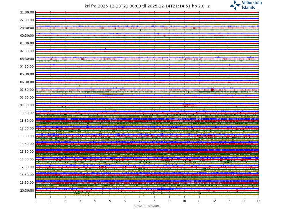
Where would that be?
Grimsvötn?
Krisuvik, but other nearby stations do not show the same signal which suggests it was a local noise.
Rush hour 🙂
Wind maybe? Does not look like a very busy road…
The weather is fine today…not much wind. And this is a quiet road….not many cars go by. Maybe some glitch in the equippment?
I think Richard Barrett and I probably have the same sense of humour…
And, obviously, I didn’t get it 🙂
😉
GRV would be the nearest station to the uplift region right ?
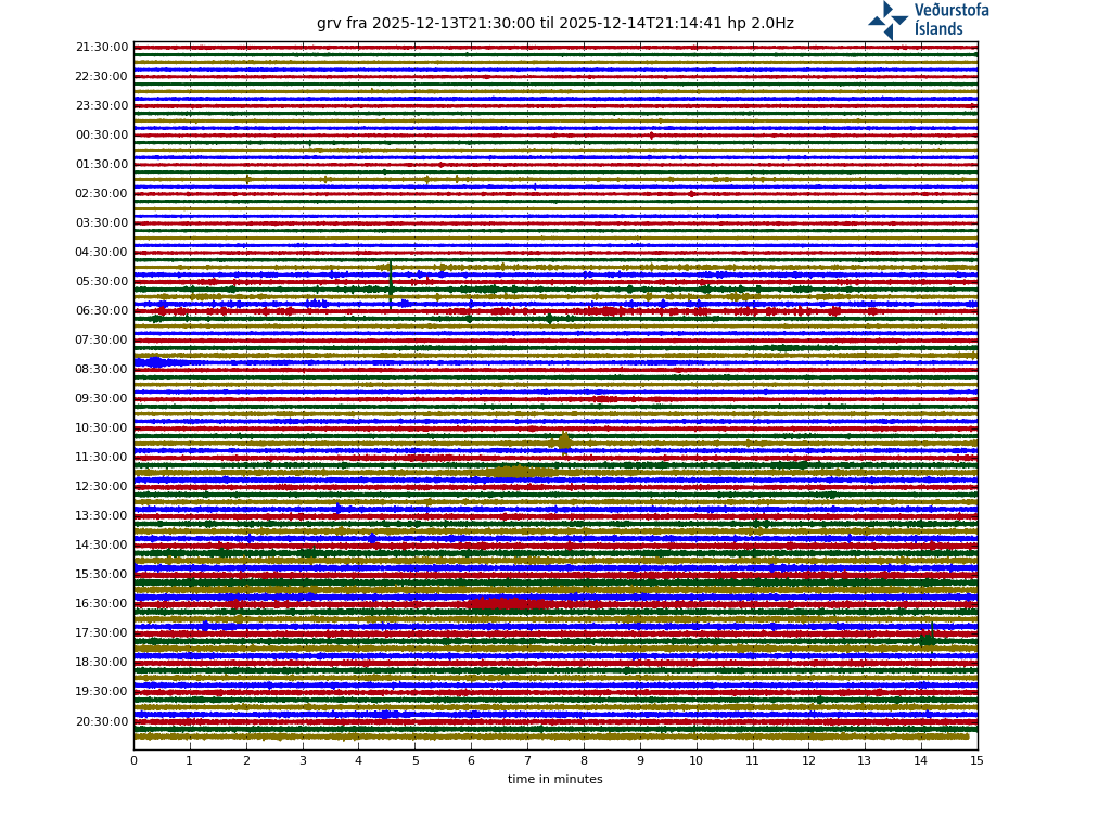
Yes that´s right
There is an identical event as KVI at 17:26hrs. Looks rather wet to me.
All the other activity looks like rock-fracturing. What we may be seeing is GRV is more over the expanding shallow magma chamber where magma is pooling/staging, while KRI is more over the feeder tube?
Not bought off on local noise…the waveforms look too much like hydrothermal signatures which can be highly attenuated over even short distances….. but I could be mistaken.
Then it would have to be very close to the surface, not a deep process. The Krisuvik station is 15-20 km from Grindavik, anything related to the inflating magma chamber should show much better in GRV.
That might fit: Krisuvik has a geothermal field, and the one at Reykjanes is larger and shows (to my extremely amateur eyes) activity more like that at KRI than at GRV, which has no geothermal field.
What is IMPORTANT to remark is how strong and repeated has activity been in the whole of Reykanes peninsula during the recent months, spanning four adjacent volcanic systems:
Jan 2019: three minor swarms in Reykjanes volcano, inland and just off the coast
July 2019: swarm in Krisuvik with largest quake being a M3.4
Aug and Sept: two swarms in Reykjanes, in Eldeyjardoda (off the coast)
Nov 2019: very strong swarm in Eldeyjardoda (off the coast), several stars
Dec: another very strong swarm in Fagradalsfjall, sparks our wonders of the risks a volcanic eruption
5Jan 2020: smaller swarm in Reykjanes, Geirfugasker, off the coast
18 Jan: very strong swarm further out in the sea than Eldeyjarboða (another volcanic system), with several M3 -4.5 earthquakes
Late Jan: current strong swarm in Thorbjorn, with magmatic intrusion and inflation detected.
Notice how swarms have become more frequent and stronger.
My though is that there is an overall awakening of the Reykjanes peninsula, as volcanic activity in this region goes in cycles.
If you plot this, you will see the trend.
In bet on an eruption happening this decade, possibly even this or next year, somewhere between Krisuvik and Eldeyjarboða.
Thank you for This information !
As I mentioned before
This arera is far away from Icelands Hotspot and most dominant active rift.
So any eruption at Reykjanes Penninsula
will Not be huge and it will be a gentle fluid, basaltic eruption. Basicaly perfect for tourists
Probaly a small event it will be if it erupts
This is not fully correct.
The plume influence spreads all across Iceland but least in Reykjanes. The plume divides into 2 or 3 branches, one towards Reykjanes. Can’t find the paper link now.
Eruptions there are often efusive but can have large volumes, least in Reykjanes and the most the nearest one gets to Hengill, where shields dominate the landscape.
So yes, can be large magma volumes but slowly erupting. Large lava fields.
Water can make eruptions occasionally explosive and sometimes even on a big way.
There has been a VEI4 eruption in Reykjanes system 800 years ago that covered the south of Iceland with ash.
Finally there are some impressive lava falls, bow frozen into rock, in the southern coast of Reykjanes. This wouldn’t happen ar Mt Thorbjorn as the slopes there are gentle. That’s more between Krisuvik and Hengill.
Would love to see that!
All the pahoehoe in Reykjanes Penninsula is also signs of slow long lived eruptions
Earthquakes at Reykjanes Penninsula now!
You aren’t kidding.
Virtually all the drumplots around Reykjanes are lit up with multiple forms of activity…including tectonic, rock fracturing, hydrothermal tremor and V/T quakes.
The latest set of quakes seems to be clustered along an old fissure line
From IMO
Ongoing earthquake activity has been recorded around Grindavík, a minor swarm started just before noon today where the largest earthquake was a M2.5 at 11:17. There is still ongoing uplift west of Mt. Thorbjorn.
With increased monitoring efforts, IMO now receives more data which gives a clearer picture of the ongoing events close to Mt. Þorbjörn. The latest GPS processing shows that the uplift west of Þorbjörn is still ongoing. In total the uplift is over 4 cm since the 20th of January. Ongoing earthquake activity should be expected in the area and that the largest earthquakes of the swarm continue to be felt in Grindavík and vicinity. The most likely explanation of the uplift and earthquake activity is that we have a magmatic intrusion at 3 to 9 km depth just west of Þorbjörn. It is most likely that this activity will stop without any volcanism.
Written by a specialist at 31 Jan 14:37 GMT
An eruption here is potentially bad in terms of material damage. As it will flow directly into Grindavik, a small town, But the good part of it, is that it will not flow into the blue lagoon and the power station and instead more eastwards where there is nothing. This happens because the slope towards the west (where the road runs) is quite elevated.
But the lava would rush downhill into Grindavik.
The swarm location is at the exact point where lava can flow simultaneously to both slopes, both northwards and southwards.
There is always the option of building a dike. And pumping cold ocean water.
Certainly IMO knows what they are talking about. The uplift is remarkable!
But 100 quakes in two days pickedup by sensible equipment, hardly a swarm!
Volcanic gases were a great theme during the Holohraun eruption. Can anyone estimate, how people in the highly populated areas (in Icelandic relation) may be affected by toxic volcanic gases, if an eruption occurs at this place?
Something just cracked, there is a pretty sizeable quake and after rumbling