
Iceland has ice. Glaciers cover 10% of its landscape, including its highest volcanoes. Of its frequent eruptors, only Hekla is (almost) ice free. Katla, Bardarbunga, and Grimsvötn, which together account for the large majority of eruptions, are all hidden underneath ice sheets, which gives problems studying the volcanoes themselves. But a more serious issue is that ice on a volcano can be a dangerous combination. Even minor eruptions can generate catastrophic melt water floods which destroy everything in their path. These are not just flash floods. Think of it as a tsunami coming down the mountain. Several volcanoes in Iceland are frequent offenders. But the infrequent ones may be more dangerous than the usual suspects.
Öræfajökull is one of those infrequent erupters. It is Iceland’s tallest volcano, and is the fourth tallest stratovolcano in Europe (after Elbrus, Etna, and Beerenberg). The name gives an indication of its nature: Jökull means glacier. The mountain itself has no single name (the original name was Hnappafel), only its ice cover does. This is a wild land with a glacier that towers over its mountain.
After the settlement of Iceland, the fertile plains on the southwest of Öræfajökull were called Litla-Hérað and although isolated, the area was densely populated with twenty or more farms and several churches. (The name ‘Hérað’ was used for a wealthy parish, so Litla-Hérað was a ‘small major parish’.) On the southeast side of Öræfajökull was Breiðamörk, also well-off, where around 900 AD, the settler Þórður Illugi built a farm at Fjall. The farm did well, acquired a church (or the church acquired the farmstead – both happened at times), and a large number of other farmsteads came. At that time the glaciers were much smaller than they are now, and between the glaciers and the coast was a prairie-like landscape with lush grass, copses of trees, and rivers. It must have seemed like heaven.
And than the disaster of 1362 struck. Afterwards, the land was left empty for over 40 years. When people returned, they called it ‘Öræfi’, meaning wilderness. The glacier took its name from this. Today, the fluvial sand desert of Skeiðarársandur borders where once the paradise of Litla-Hérað was.

Öræfajökull in the autumn, showing the clear outlines of the caldera at the top of the stratovolcano and the outlet glaciers extending from it. On the far side of Öræfajökull is Breiðamerkurjökull. Source:Helgi Björnsson, The Glaciers of Iceland, published in 2017
The mountain
The glacier-covered mountain of Öræfajökull dominates the skyline here. Its caldera, 14 km2 in areas, is filled with ice, 550 meter deep. Around the caldera rim are the individual peaks of the volcano: Hvannadalshnúkur , Rótarfjallshnúkur , the twin peaks of Hnappar, Sveinstindur and Sveinsgnípa. Hvannadalshnúkur is the tallest, at 2110 meter, and is the highest mountain in Iceland (albeit by a margin of only ten meter). The mountain is 20 km across at its base near sea level, making it rather steep. A quarter of its base area is covered by the glacier. The volume of the mountain is around 370 km3, which makes it the largest volcano in Iceland by volume as well as height.
Öræfajökull has another claim to fame: it has Iceland’s highest amount of snowfall. Each year, over 10 meter of snow accumulates at the summit. The glacier did not get there by accident! The rain in Iceland comes mainly from the south (the north is drier), and Öræfajökull is close to the sea – it captures quite a lot of it. At sea level the weather is not quite as wet, and there the climate is mild – for Iceland!
The current mountain formed when two older, adjacent volcanoes merged. This was during the ice ages, when the glaciers hemmed in the eruptions. They kept the lava close to the eruption sites, and forced the mountain to build upward rather than outward. This is why the mountain is both tall and steep: it was made that way by the containing ice.
1362
The largest explosive eruption in Iceland since the settlement occurred with little warning. Whether the mountain was known to be volcanic is not known, but it had been quiet ever since the settlement. The explosion in 1362 blew out 2.5 km3 of rock, or 10 km3 of tephra. Of this, 2km3 fell on land, mainly on the southeast of the country. The western parts of Iceland were protected by the westerly wind of the day of the eruption. The debris caused damage 70 km away, but the wind blew a lot of the tephra out over the ocean. Six jökulhlaups came out from the various glacial outlets, mostly to the southwest. The Litla-Hérað region never fully recovered its vegetation: the debris from the eruption is still evident in many places. It is among the least recognized volcanic disasters of the last millennium.
There are descriptions of the eruption in several old documents, but few are contemporary with the events. One of the oldest is from the annals from the Skálholt bishopric, and date from about 30 years after the eruption, within living memory. The description gives an impression of the devastation:
‘Fires appeared in three places to the south. They kept on from June to autumn. With a great deal of noise. All of Litla Hérað destroyed & much of Hornafjörður & the Lón district. Roads to the Alþing also destroyed. Knappafell glacier surged into sea. Up to thirty fathoms deep. With landslides, mud & dirt that levelled gravel plain. Kirk & parishes at Hof & Rauðilækur all razed. Sands piled up on plain. Icebergs stranded on them. Houses could hardly be seen. Ash fell in north of land. Could be traced all the way. Accompanying this, pumice seen in western fjords. Ships could hardly sail because of it [& even more widespread to the north]’
The report of ash in the north refers to the fact that this document was written in the north of Iceland. Thus, it describes a local impact and does not imply that ash did not fall elsewhere.
At the time of writing of this annals, the area of Litla Hérað had not yet been resettled. People began to move back in shortly after, but this was 40 years after the event. After the eruption, the area was left not just depopulated, but also uninhabitable.
The Flatey Book written during the last decades of the fourteenth century, adds another description:
‘Volcanic eruption in Knappafellsjokull with darkness so intense that roads could not be seen at midday, and the entire Litlaherad was devastated.‘
The ‘roads’ of course refers to a poorly visible path or track, not an A-road! It was so dark that the track could not be picked up – not complete darkness, perhaps, but darker than twilight.
The ‘Annals of Oddi’, dating from around 1580, report another tradition, albeit from 5-10 generations later:
‘Anno 1366: Fires arose in Litla Hjerad and destroyed the whole region: there once had been 70 farmsteads: no single living being left except one olde woman: and mare’ The year that is stated is not exactly correct, but it must refer to the 1362 event. The later stories about the death toll of the 1362 eruptions and about the two survivors come from this, but this detail is not backed up by the earlier report. The total population of the area has been estimated at a few hundred people, based on the number of farms, so this would imply a survival rate of less than 1%.
Ísleifur Einarsson, around 1700, wrote down the oral tradition from the area itself, including the story of the survivors. In this tradition, the old woman was now a (presumably male) shepherd:
According to the folk of Öræfi, from what they have heard [and from those who had heard it from their predecessors, and they from theirs, by word of mouth], the Öræfi district has been wiped out twice. [Some say three times]. On one occasion, the shepherd at Svínafell, by the name of Hallur, had been herding the sheep home and the women had begun milking them, when all at once a huge crack came in Öræfajökull so that they were truly amazed. Then after a little while, another crack came. And then the shepherd said: it would not be wise to wait for the third. He had then fled up into the Flosahellir cave – it is up on the mountainside to the east of Svínafell farm – and then the third crack came in the aforementioned glacier, and it all burst open and so much water and so many rocks gushed right out of it and through every gully that all the folk and livestock in Öræfi perished, except for this shepherd and one horse with a blaze on its forehead’
These stories give rather little to go on. Their emphasis is on the effect of the floods (the jökulhaups), and the surging glaciers. Ash is only mentioned as falling towards the north. However, this description must be incomplete. The floods were enormous and devastating, but the damage was from more than just water. I will come back to this later. The lack of survivors has meant part of the real story was lost, and the reports could have been based on later exploration of the damage, rather than reports from eye witnesses. The layering of the tephra deposits found by geologists have suggested that the explosive event was brief, a day or less; the reports that the eruption lasted until the autumn may refer to minor later eruptions, or just refer to ice or permafrost geysering from the heat.
1727
This was a much smaller eruption, which produced about 0.2km3 of ash. It came after 450 years of quiet. The first sign of trouble was a series of felt earthquakes, on Sunday 7 August 1727, beginning during the church service. For a while things calmed down, but early on Monday the shaking became severe enough to do damage inside the farmsteads.
At 9 o’clock a huge crack in the mountain side appeared and jökulhlaups burst out from beneath several of the glacier outlets. They destroyed the fields, but only three people were reported killed. The flood waters bore boulders, pumice stones, ash and icebergs. The ash fall made everything dark for three days, but it cleared up on the fourth day, after which there was little further ash fall. Volcanic ash covered the farmlands of Svínafell and Skaftafell, and there was no hay that summer in the districts nearest the eruption site. Sandfell, the main settlement, was missed by two landslides, coming down on either side!
Niels Horrebow described the jökulhlaup:
‘The water flowed from the mountain between two farmhouses called Hoff and Sandfeld , which lie not above six miles from the foot of the mountain, and about the same distance from each other. It spread itself beyond these houses in the flat country, and washed through the lower house and dairy, and carried off all the milk, butter, &c. the people saved themselves by getting on the tops of the houses. The water did not rise so high, and only filled the inside. Numbers of the cattle from both farms were carried off, and some of them were afterwards found parboiled. It ran along the valleys and emptied itself into the sea; but the stones, sand and earth, carried away by the current were not any way equal in quantity, nor rushed on so violently as the former, though greater damages were sustained. No cattle were lost in the other eruption, nor any field of grass destroyed, the same being entirely demolished by former inundations: but the stream of the eruption we are now talking of, passed over fine fields, and destroyed the better part of the cattle that were grazing in them’
In another version, rather than the cattle it was one of the missing people that ended up boiled.
The priest at Hof, Pastor Jón Þorláksson, had to flee for his life but survived. His stories were later written down by a traveler, Ólafur Ólafsson:
‘When I was below the middle of Flögujökull looking up at the summit, it seemed to me the glacier grew higher and swelled out one moment and then collapsed and sank inwards the next. Nor had I been mistaken, for it soon came to pass what this sight boded. The following morning, Monday 8 August, we all not only often felt tremendous earth tremors, but also heard a horrifying cracking sound as loud as thunder. In all this commotion, all loose objects in the home were falling down, and everything seemed most likely to collapse, both the buildings and the mountain. … At 9 in the morning, three tremendous cracking sounds were heard, much louder than the previous one, and accompanying them were jökulhlaups or eruptions, the final one the worst, carrying away all the horses and other livestock in its way in one fell swoop. After which the glacier itself slewed down onto the lowland, like molten metal poured out of a melting-pot. It was so high once it had surged down onto the level ground that I could see only a tiny part of Lómagnúpur promontory above it, about the size of a bird. Once this had happened, water began to pour out to the east of the glacier and destroyed what little grassland that was left there. … The situation then changed yet again, the glacier itself surging forwards, bearing icebergs all the way to the sea, though the largest remained right at the foot of the mountain. The next thing, the air was filled with fire and ashes, with ceaseless cracking and crashing; the cloud of ash was so thick that it caused there to be no difference between night and day; the only visible light was coming from the edge of the fires that had arisen in five or six gashes in the mountain. For three continuous days, the parish of Öræfi suffered from these fires, floods and ash falls. It is not at all easy to describe all this exactly as it really was, for all the earth was black from pumice cinders and it was risky to go outside because of glowing stones that rained down from above, so that one had to hold buckets and tubs above one’s head for protection.’
Jón Þorláksson later commented that the floodwaters had been so hot that the horses shied from them.
It appears that the eruption itself took place within the caldera (as it did in 1362). The jökulhlaups came before the main explosions. The melt water came from a fissure, on the western side, about 1100 meter above sea level. Six or seven columns of flame were seen within the fissure, and smoke was visible until the following spring, but no evidence of any flow of lava.
A more detailed reconstruction can be found in http://www.vedur.is/gogn/vefgogn/jokulhlaup/haettumat/oraefajokull_markarfljotsaurar/bok_en/chapter_II.pdf

Hérað district between the outwash plains. Ancient and new farming communities on Skeiðarársandur and Breiðamerkursandur and the courses of the jökulhlaups from the Öræfajökull eruption. Source:Helgi Björnsson, The Glaciers of Iceland, published in 2017
Water and pyroclastics
The reports and papers suggest that the damage in both eruptions came from jökulhlaups and glacial surges. But for the 1362 eruption, it seems very unlikely that only water and ice caused damage. This was a VEI6 with 10km3 of ash, tephra and pumice; some of the ash and pumice reached Europe. Such large eruptions devastate their immediate surroundings. There must have been major effects of the explosion itself. (As an aside, eruptions from Öræfajökull have a significant fraction of rhyolite eruptions, and this may be the most explosive volcano in Europe.)
In fact, Dave McGarvie (https://ounews.co/science-mct/science-environment/icelands-tallest-volcano-awakening/) mentions that there are massive ash and pyroclastic deposits visible in the landscape. This explains why the land was left empty for so long, and why it became a waste land. The ash and tephra had covered the land and killed all vegetation. The farms were wealthy before, but after resettlement, the farming was poor, and the land had lost its fertility. In 1362, there appears to have been a sequence with, in order, tephra and ash, followed by pyroclastic flows, followed by pumice. Jökulhlaups were the afterthought. In 1727 the jökulhlaups came first and did almost all of the damage, but the subsequent ash was still significant, in spite of the eruption being puny compared to 1362.
Interestingly, archeology of the farmsteads of 1362 suggest that they had been abandoned, together with their valuable content, before the ash and pumice from the main eruption destroyed them in 1362. When the buildings collapsed under the weight of ash, they were already empty. People had time to flee. Did they make it to safety? That we don’t know. They may well have been killed by the rain of hot pumice.
Changing ice
Another point to make is the effect of the ice. At the time of the 1362 eruption, glaciers had begun to grow but probably were still small compared to later. In 1727, the glaciers were much larger, and were still growing as the Little Ice Age moved towards its peak. Farmsteads were being destroyed by the advancing ice. The two eruptions occurred with very different sizes of the glaciers and this may have affected the flow direction and severity of the jökulhlaups. Nowadays, glaciers are rapidly diminishing but are still large. It may not be easy to predict how the floods would flow under current ice conditions and we should be careful with extrapolating from the two known eruptions. The past is not always a good indication of the future.
The caldera
An interesting question is where the 10km3 of tephra in 1362 came from. The caldera where the explosion occurred is 14km2 in size and up to 500 meters deep, giving a maximum volume of 7km3. The volume will be a bit less if the caldera is bowl-shaped. Now the tephra is considerably expanded compared to the rock that was blown up. The dense rock equivalent (DRE) is 2.5km3. This means that the caldera is larger than the eruption volume, or at worst similar in size. Part of the caldera may in fact come from the 1362 eruption. However, the numbers leave no room for any mountain peak on top of the caldera. It appears likely that there was already a depression, but that it was enlarged by the explosion. The rim of the caldera was probably already there at the time, but perhaps not fully in its current form. Of course, an excavated hole may have been filled in by lava after the eruptions: how can we tell, beneath half a kilometer of ice? But Iceland’s volcanoes are a changeable lot. Big eruptions can re-design their shapes.
Albert, November 2017
The main source used for this post is Helgi Björnsson, The Glaciers of Iceland, published in 2017.
Also well worth reading is Sigurdur Thorarinsson, THE ORlEFAJOKULL ERUPTION OF 1362, pubished in 1958. It is available at http://utgafa.ni.is/Acta-Naturalia-Islandica/Acta-Naturalia-Islandica-II-2.pdf

The hamlet of Hof. The nearby landslide is still visible


Thanks Albert and Carl for always keeping us so well informed!
From RUV via our favourite translating device
Geothermal power causes the sewer in Öræfajökull 21.11.2017
The results of geoscientist surveys on water from Kvía to Öræfajökull indicate that the outflow of geothermal water is the cause of melting in the glacial kettle. There are no signs of fungal disease, indicating that the nitrogen has not penetrated into the geothermal system under the carton.
“These are important information, they strongly suggest that kvika did not get into the geothermal system itself. It is likely that the major causes of earthquakes are magnet movements at a significant depth below the volcano. If this scenario ends with volcanic eruption, it’s not very far away, “says Magnús Tumi Gudmundsson, geophysicist in a conversation with the news agency.
Water samples were taken from the river last Saturday, these are the results from them. Andri Stefánsson, Professor of Geoscience at the University of Iceland, interpreted the results.
Oh so the carton DOESN’T isn’t infested with fungi, in that case there’s nothing to worry about!! 😛
erm, a rogue word in there! D’oh!
Thanks Carl and Albert for exiting and informative reading (as always)!
Another wonderful article transporting us in place and time. i have only one small comment, Albert, about not being able to see the road… and You mention that it was probably not a proper road and perhaps could be seen if it had been a proper road(my interpretation of Your discription) Let me assure You, as i have been in several eruptions from Redoubt and Augustine and even Spurr, the black of a direct hit from volcanic ash is total blackness; more dark than midnight. The ash totally cuts out the sunlight and even shinning a light into the gloom doesn’t help much as the ash doesn’t reflect back and the light doesn’t go far as there are actual particles blocking the light beam. Its darker than a lightless cave…. other than that small comment of Yours, which i totally forgive as You haven’t perhaps experienced an eruption like that. (and here i assume that not all eruptions are like mine 🙂 ) this is another excellent article.. Best!motsfo
Thanks for the kind words, motsfo. I have not been in an eruption like this. In the UK, fireworks are traditionally done on Nov 5, during the season of fogs. If the smoke of a firework display gets into the fog, visibility goes near-zero. There have been some serious traffic accidents from this. The reason of course is that water scatters light but smoke absorbs it. So in fog, you can still see (half the light still gets to you) but you only see haze as the light comes from random directions. In smoke, all light very quickly is gone. But in the Iceland case, i was wondering why this funny description of not being able to see the road. That doesn’t sound like pitch darkness to me, as it focusses on something specific that is no longer visible. I tried to visualize (sorry – wrong word) what they were trying to convey. But you may well be right, of course.
The reference to the road would, I would think, be to the guideposts of “vörður” – the piles of stones marking the way – that ought to have been there showing the path between farms and to the coast. These are usually spaced maybe 1/4 mile apart, easy view from one to next in normal conditions.
(rescued from akismet, future comments should publish without trouble)
Vörður (= “cairns” in English) are clearly visible – especially in winter, because they stand out against the snow – on the Icelandic road network webcam for Mývatnsöræfi, looking East: http://www.road.is/travel-info/web-cams/north-east-iceland.
A pretty hostile öræfi in winter that is, too.
Nice pics. You say “overdone” but a friend who lives up the road from Grindavik, at Gardur, tells me that proportionately more people have died crossing the “heiði” between the east and west coasts of that peninsula than anywhere else in Iceland.
So under a metre of snow, those Grindavik cairns would be life-savers. In the UK there are 2 metre cairns on the very dangerous summit plateau of Ben Nevis; I’ve been up there in winter when only a few inches are showing!
Ah am57, I remember those cairns on the top of Ben Nevis, we went up there in bright sunshine one year, then into thick fog! Those cairns were very helpful then! I also remember an infamous road in the Highlands, Cockbridge to Tomintoul, always the first to be closed by snow. We were up there in late May one year and had a blizzard on that road, the high poles marking the road were essential to keep us on the road. Those poles were about 2 metres if I recollect correctly so they got tremendous snow up there and a snow plough desperately needed those markers in the winters! That was in the early ’70’s and I often wonder how bad the snow still gets up there?
That road is always having trouble during bad weather and the winter, I often hear it mentioned in the traffic reports on Radio Scotland.
For anyone interested and a little off topic I am afraid, here is a fascinating article about the road.
http://www.heraldscotland.com/news/12056285.Road_that_does_a_vanishing_act___From_Cock_Bridge_to_Tomintoul_across_the_infamous_Lecht/
Frances, are you talking about The Lecht? The road to Tomintoul?
Hard to believe now, but I once cycled up thar. July ’86. Nearly 30 celsius… I hadn’t even thought I might need more water in the highlands, but it was a bone dry rocky wasteland, and an evil suntrap…. As well as being a fearsome climb.
Hi Neil, yes that is the road. Very extreme conditions there. Definitely all or nothing. I think it was around 2,000 feet high and no shade at all! I can easily imagine that it is like very many places in Iceland!
I think that day I was about as red-lined as I have ever been in terms of pushing my body to the limit. On the previous day I had cycled from Edinburgh to Braemar… over the Devil’s Elbow, and then down , melting a brake shoe to kill my speed to make the turn into the camp site… from summit to Braemar, 11 miles in 15 mins, max speed 63 mph ! That’s brown trouser time on a bicycle…… Half way down I saw a wildcat for about 2 seconds !.
Then the following day, along the river to Balmoral, turned left at Crathie to join the Lecht… 2 small but severe passes before that, then the Lecht… just evil that road is !
I clearly didn’t hydrate enough in Tomintoul, because after crossing the Bridge of Brown , climbing the Haughs of Cromdale I must have been hallucinating. I had a shouting match with the wind (and I wasn’t acting… and it was answering me back ) , so I remember lying on the side of the road on the mountainside crying . I had a good long drink, rounded the next corner, and the rehydration kicked in.. Reason returned just before the road pitched downwards , and I was pretty exultant by the time I rolled into Grantown on Spey wondering just what the hell had happened to me up in the mountains. Then cycled the last few miles along the awesomely beautiful Findhorn River.
Thanks for the memory 🙂
Here is a video of how badly conditions can deteriorate quickly on that road! Icelanders don’t have ALL the fun but they DO have far, far larger areas and much longer stretches of road where is can become very dangerous very quickly!
Thanks
Here is an example, the “Prestastigur” – “priests steps” – bit overdone, from Grindavík on the southwest coast
I would have expected a prosperous region inhabited for 400+ years to have had a grid of these, especially given the terrain and weather down there
Here is a better example
Sorry – my reply should have come after your pictures.
Replying to am57 comment – I meant “overdone” in the sense that a farm road on the southeast coast would be unlikely to have such a close grid of tall vörður – most of them are smaller and less imposive.
The ones on Hellisheiði are the other classic high traffic life savers.
I find this absolutely fascinating. It gives context to the ancient writings. They make so much more sense when you know the local area and backdrop.
Thanks Albert for another fascinating article about Öræfajökull. I am finally learning about an Icelandic volcano I never knew existed until recently.
Someone on another forum has this evening captured a shot from Agung’s webcams of the huge plume being lit up from below by the eruption. Sorry I can’t post it as it is fascinating. It is on this cam https://www.youtube.com/watch?v=bAl7wgc983E and is at 3:36:42 but is a VERY momentary flash so how they caught the image I don’t know, I certainly am no longer quick enough to freeze a picture like that!
Lightning perhaps?
Looks like lightning but it certainly illuminates the plume…. Thanks! Best!motsfo
I personally don’t think it is lightning as that illuminates the whole area, this was just the plume lighting up, been a lot like it and a few lightning but the lightning always lit up everything. Not saying I can’t be wrong though! 🙂 :0 🙂
there is often lightning within volcanic eruptions which mainly light up just the column of plume so i was thinking this looks like lightning from the eruption and not a nearby rainstorm…. hope i’m understood now… and i’ve seen volcanic lightening whch lit up the whole ash area and that is amazing and somewhat terrifying.
AH! Thanks motsfo, of course! I had forgotten that fact of the lightning in volcanic plumes, I shouldn’t have forgotten as I was so fascinated watching it when Eyjafjallajokul erupted. Put it down to getting old rapidly I think.
I’m fairly sure it was lightning. I saw it happen, and I saw a few other flashes. It appeared to me like a lightning storm somewhere on the far side of the mountain, such as we have seen on several night over the past couple of weeks.
The difference here is that the plume is somewhat more solid than he steam plume we’ve had on previous nights.
Wow, daylight and Agung no longer looks innocent! More ugly than pretty pink now I am afraid!
minor tweak/update to the map:
Iceland data now in seperate box
Clicking Iceland Data zooms to Iceland and opens hidden box with Iceland options
And selecting between 0.7hz and 2.0hz no longer causes zoom to change.
and 3d terrain now activated.
http://www.volcanocafe.org/vcmap
Managed to roughly match the primary image from Albert at the top of the post in VCMap
You even managed to capture the blue sky!
Thank you Albert and Carl for all your time and effort. Very informative.
Am I being dumb, or has the skyline of Agung’s peak changed? There looks like a chunk has been taken out of it. I am used to the block off to the east of the peak, but looking at it this morning (Bali time) there appears to be another bite taken out of the crater wall.
And the answer is no. Just cloud.
There has been a small eruption – perhaps throat clearance?
Reading the article and noticed a teeny error… The mountain itself is called Hnappafell, though not many people know that, hence glacier’s old name of Hnappafellsjökull…
Or you know, Knappafell and Knappafellsjökull if you prefer the Old Icelandic spelling… In either case we are talking about Mt Buttons and Mt Buttons’ Glacier…
Also I’d like to dispute the translation of Öræfi into wilderness (óbyggðir) as it is more negative, desolation would be a better translation in my native opinion…
“Wasteland” would be my word of choice, but yeah in any case more negative than wilderness.
Thanks, I have added this in. I had come across the name in the oldest records but did not know it was still in use. It is the name of one of the peaks along the rim.
As to the word ‘wilderness’, I had to rely on what I read (not knowing Icelandic myself). You have to ask what it meant in the 14th century. It was argued that the original meaning was ‘coast without harbour’ in which case the new name meant that the harbours had gone. So I chose the less emotive translation, as otherwise you run the risk of imposing an image on the area which may differ from what was originally meant. Better to err on the side of caution. But I am aware that in modern Icelandic, the meaning is more severe than that.
After the Hobbit movies came out, my family dubbed the sandur west of Öræfajökull as “The Desolation of Smaug.”
To my untrained eye, the Agung seismogram seems to be registering the same sort of noise I was seeing yesterday, just prior to the phreatic event. Louder than the usual daytime activity, and much more … spiky.
https://magma.vsi.esdm.go.id/live/seismogram/
Yes, It is confirmed by local media. Also from 9,11 to 10 local time.
To those having Microsoft Edge posting problems:
Support team is asking for more information
Is the problem only in Edge, or does it occur in other browsers?
In my experience only Edge.
Only Edge
But now its working??? I have found this to be hit or miss, very inconsistent.
I agree. In my case, it seems larger text posts risk the Invalid Security Token message.
That appears to be Carl’s experience also
possibly security token for wordpress/facebook/twitter or whatever timing out ?
if you write a long post, stick it in your clipboard then log in, paste the comment and post it might get around the issue ?
Thanks Albert for this awesome historic insight into a generally unknown volcano.
Oraefajokull is a true monster, that was almost lost to time for most people, a distant memory, except for those that live near it or have the big responsibility of monitoring it. It is now slowly getting the attention of general public, the attention it deserves and demands. 🙂
I agree. These last 2 posts on Oraefajokull have been an absolute pleasure to read.
I suppose it is the way of things with human nature that we focus on those things which most often come to our attention, and with volcanoes this would mean the famous, the frequent or historically “important” eruptions and so on.
Consequently people are aware of Vesuvius, Krakatoa, Fuji, St Helens and so on.
But eruptions such as Pinatubo demonstrate that those that sleep the most soundly, and which are thus overlooked, can cause the greatest devastation. This is surely in part because we are the least prepared for them.
Afternoon, another good article Albert.
I would like to canvas some views on the seismo at Agung. A lot of noise today, especially afternoon/early evening, abating slightly come late evening. I would assume this noise is tremor?
We than have a small quake around 10.15 local time then another just before 11’ish then another about 10 mins later. After each the noise drops down to finish as a flat line after the last. There have been another 3 eq’s in the following hour. Could this be interpreted as magma movement coming to a halt and then fracturing rock as pressure builds?
Not sure those are actual quakes. Look closely and you’ll see that it’s not one quake at 10:15 and one at 11:00, but a single signal at 10:30. It almost looks like a binary sequence. These signals do appear from time to time and I have assumed that they are some sort of markers. Always a short burst, followed by a short pause, then a longer burst, where the bursts have a constant amplitude.
Hi Tomas,
Oops, think i’ve caused some confusion – My Bad! – I should have written 22.15, 23.00 and then 23.00- to midnight for the signals i’m interested in. Apologies. Yes the signal at about 10.00am their time is what i have assumed to be some kind of calibration signal, often get a couple of those a day.
Hi Swebby, I also noticed that a couple of minutes after that first small quake there was a cessation of the tremor and the first thing I wondered was had some pressure been relieved by that quake? I am afraid I don’t have the answer either and it may be we have to wait and see what comes about now. However there are many more knowledgable ones on here so hopefully we may gat a possible answer later when more come on to here.
I’ll stick my neck out again.
I think it’s going to go large at some stage in the next couple of weeks. I hope everyone gets clear, because many seem too close for comfort.
I personally totally agree with you Neil, going on it’s past history Agung can get very ugly very, very quickly. I find is almost impossible to believe that they are still operating that sand mine which is on the very slopes of the volcano! Perhaps it is in a safe zone but I have my doubts because it wasn’t operating when the alert level was IV. I see that almost 1 hour after the last small quake the tremor is back and slowly increasing again. Strange that it is either quakes or tremors, seldom both together. I am sure that tells the experts something, for me it is an interesting phenomena.
I think someone is messing with the gain controls on the seismo.
That’s a good thought Frances – I was thinking the other way round, movement stops due to blockage = loss of tremor signal, pressure builds causing fracturing of surrounding rock. But yes, the EQ’s actually opening up conduits and relieving pressure could also i suspect stop the tremor signal.
Nothing more than musings on my part, I’m just trying to paint a mental picture of how magma can move through a system, and in this instance we do not even know if those quakes are local or if the noise is actual tremor. Likewise, I’m also hoping some of the knowledgeable contributors on this board may be able to give their thoughts on this.
I also see cleary connection between this quake and dimmision of the tremor. The same happened yesterday. But in detail, my thought is slightly different. I think that these quakes not relieved pressure, because of their tectonic nature, but locked vent / chanel where continous tremor emerges. After a while, growing pressure leads to create vent/chanel again. But I am not an expert about volcanos too.
Yes, I think exacly what Swebby said.
https://uploaddeimagens.com.br/imagens/agung_2-jpg – A light in the darkness
Nice one Albert, you caught the historic setting perfectly. I felt a certain wiff of Thorainsson 🙂
If life in general will allow me there will be an article about the mechanics of the volcano during the weekend. Me and Andrej Flis has dome some serious sciencing in the background… Bigly!
I only read Thorainsson after most of this had been written. But I did incorporate some of his work.
Veður.is shows orange alert??
That’s weather related, there’s a fairly intense snowstorm going on atm. http://en.vedur.is/alerts
Thank you for clearing that up for me – my heart stopped for a second
Currently the state of Öraefajökull is as follows.
Volcano state: Uncertainty phase
Ash advisory: Yellow
👍🏻
That was a wonderful read Albert, thank you.
I found an article with a time lapse of the changes in Bogoslof island since the beginning of it’s last eruption.
I found it interesting to see how much erosion has happened since it quit actively erupting. I am thinking the seals will have a nice protected bay to enjoy before too long.
https://www.earthstartsbeating.com/2017/11/07/bogoslof-island-a-puzzle-for-geographers/
Speaking of Alaska, Great Sitkin has been raised to Yellow.
It has an uncanny resemblance of Calbuco.
Yes, but without ‘WOW”.
Pretty dramatic change in seismicity characteristics after the phreatic hiccup..especially as far as rock-fracturing quakes are concerned. Tremor is still there, but it would appear that some fraction of the internal pressure that was causing the rock fracturing has been reduced?
Re above: Agung
One thing else, and sorry for the multiple posts…but the source of the rock fracturing quakes appear to be in a different location than the source of the tremor, given there is little correlation between tremor and quakes. Also, the quakes still do not have a “wet” signature indicating that the quakes are probably not opening up new magma channels?
The interesting thing is that a small phreatic eruption should not have any effect on the tremor. The explosion is a surface event, and the tremor happens deeper. The phreatic eruption was probably caused by rain water percolating down meeting the heat coming up. The tremor is probably what the mountain was going to do in any case and is unrelated. But I do wonder whether the gain has been constant on the plots, or is being auto-adjusted. The sand digging can be used as a rough calibration for this.
Albert, this is why I said I thought someone had been messing with the gain.
As I’m watching whilst running a shop, I don’t get much time to look at the cameras for long enough to really see anything meaningful, so mostly I just update the seismogram reading.
Whilst doing that I have noticed… several times… that I notice a particular intensity of noise, but I check back 30 mins later and suddenly the same time period looks greatly diminished. Hence I say somebody is checking it on a regular basis and resetting the gain. And hence our data feed is dubious.
…And it’s just happened again. There was a small but not insignificant noise, about the same size as the one currently showing at 1809 local time.. The noise in question was at about 18.57.40.
It is now a barely noticeable bump on the line.
Gain at Agung has definitely being adjusted at various times. Compare the calibration signals (@ 04.25 & 22.25) in a plot posted by cbus05 in this thread http://www.volcanocafe.org/europes-tallest-volcano-mount-elbrus/ when i would say it was turned right down to those now. I feel it was raised since the daytime mining started but then dialed back down a bit in the past two days since the phreatic event.
I am wondering if the noise we are seeing (ignoring the 8-4 sand mining) is actually tremor as it does not appear obvious on the histograms? I’d also have assumed the authorities would have made mention of it, a tweet posted by Pyter the other day from a BNPB official seemed to say seismic activity was low after the phreatic puff (assuming giggle translate can be trusted).
Just a thought but the weather has clearly been rough over the past few days with numerous storms. Not only is this a possible source of water for the phreatic “prout” but could the noise we are seeing actually be floods in mountain streams?
Just to add – in the absence of location data for the seismic signals what we need is some prolonged fine weather. If we see noise and extensive steam plumes after a few dry days then i’d assume that things are still on the move.
Yes, it is likely that the noise we see is weather related. My friend’s sister and her husband works as diving instructors in Bali and they reported heavy raining yesterday.
Yes, it could be rain if the weather has worsened. Background noise due to rain and wind can wipe out signals. As for the scaling, that can be done automatically based on what is present on the plot, in which case it can change of some event drops off the end of the 24 hours that is being displayed.
Today Agungs seismo has been scaled back up, see the calibration marks at the sides of the plot. Initially they scanned 3 lines, then down to 2 then yesterday down to 1 line. Today they have been scaled back up again to two lines. I am assuming they get scaled down to make it easier to read the signals and not have them totally obscured by the mining.
Swebby, the Indonesian seismologists have said that there were long periods of continuous non-harmonic (they call it micro tremor) during the day yesterday.
I also very much doubt the tremor is rain signals, Bali has been having terrific rain storms and thunderstorms for weeks now and no signal ever showed up until after the phreatic eruption and not likely the eruption caused it because it started after that had finished. Most likely gas or magma moving.
From Bail Tribune.
Usual google translation.
Mount Agung Type of Closed Volcano, Likely The Fasenya Same as the 1963 Eruption
Thursday, November 23, 2017 10:48
Mount Agung Type of Closed Volcano, Likely The Fasenya Same as the 1963 Eruption
Tribune Bali / I Nyoman Mahayasa / Prima
Appearance of Mount Agung from Monitoring Post of Great Fire, Rendang, Karangasem, Wednesday (22/11/2017) afternoon
As a result there is an explosion inside the mountain, and bringing the material of side rocks that have been preheated.
“Pipes of magma during the increase of volcanic activity of Mount Agung is very high temperature, plus the pressure of water vapor.This is what brings up the ashes,” explained Suantika.
He predicts the phreatic eruption of Mount Agung will be more frequent or repeated periodically in the next few days.
“Last night (Tuesday night, red) I think the volcanic ash puff will continue to occur and the higher, coupled with the high activity of continuous tremor earthquake.But it does not happen.Aberough dark smoke gradually subsided, the amplitude of tremor also decreased,” he said.
Despite the eruption, there is no increase in the status of Mount Agung, which remains at Level III (Standby).
According to Suantika, the increased status of volcanoes still have to look at various other parameters, such as seismic and deformation.
“When we drew a crater, it has been detected starting sulfur, but so far we are still in alert status, because the activity of the earthquake also decreased yesterday night .. We are still monitoring the volcanic activity of Gunung Agung,” he explained.
Record Tremor Menerus
Yesterday, PVMBG again recorded a continuous tremor (microtremor) on Mount Agung, Wednesday (22/11/2017).
The quake was recorded at 09.11 Wita until 12.00 Wita, with amplitude 2-4 mm.
Continuous tremor earthquakes are also recorded in the period of 14.00 Wita to 18.00 Wita with an amplitude of 9 mm and dominant 4 mm.
“Our seismographs are recording continuous tremor, after last tremor recorded last night (Tuesday night) .We are still checking whether this tremor is likely due to C or tremor activity caused by gas flow like yesterday,” Suantika said.
In addition to the volcanic activity of Mount Agung, C excavation activity in a radius of 6 km to 7.5 km from the crater of Mount Agung is also very influential on the results of seismographic recording of seismograph tool in Post Monitor Volcano Rendang.
Suantika did not dismiss, if it interferes with the recording data made by PVMBG officers.
He even hopes that the C excavation activity at a 6 kilometer (7.5 km) sectoral radius can be stopped, so as not to disturb the seismic recording of volcanic activity of Gunung Agung
“Tremor this afternoon has an effect with the activity of excavation C. But the more dominant tremor is caused by the smoke blow.Visually, today the blowing of white smoke blow high enough, up to about 700 meters.This tremor is caused by the smoke blowing to the surface. such as tremor (Tuesday) last night, “he explained. (*)
Google Translate for Business:Translator ToolkitWebsite Translator
Many thanks for the article Frances, that helps clear things up and helps me interpret the seismo. I’m still surprised the tremor is not more apparent on the histograms.
The article does read as if the interviewee is expecting things to escalate which is concerning. In regards to the mining noise, you would have thought that if it is causing problems with monitoring and PVMGB wanted it stopped then that would be a given!
No, that never happens. Economic activity does not stop for science monitoring. Scientists just have to find ways to get their data in the presence of economically-induced background noise. That is what they get (under)paid for.
Hi Swebby, glad that article helped. I also could not believe that they were still mining when I checked the seismo this morning UK. I think that sadly money talks louder than seismologists! The company in question I think brings in a good amount of money to the country! As the mining is right on the lower flanks of the volcano I was sure it was in the danger zone anyway.
If you have Google Earth just type Pura Dalem Suci Pendem Bali into the search box and you will see the sand mining close to the Hindu temple.
“Economic activity does not stop for science monitoring.”
Which in itself has lead to the development of innovative noise and signal processing techniques in order to weed out usable data.
Thank you Albert for explaining the location discrepancy….and one frankly I should have realized if I had given it more thought.
I think my main point, though is still valid….in as much as there are little signs (as yet) of serious magma movement….and that the phreatic event (as noted) has not changed the current overall seismicity pattern.
Here’s an English language article on the Öræfajökull evacuation plan: http://icelandmonitor.mbl.is/news/nature_and_travel/2017/11/22/emergency_evacuation_plan_for_oraefajokull_volcano/
Somewhat OT, but giggle translate did a beautiful job of expressing both gibberish and fact all in one paragraph:
“That it has become a magic snap into the rock that then warms and splashes the ice. Whether this indicates that Öræfajökull is preparing for volcanic eruption or not, is impossible to say.”
(from http://www.ruv.is/frett/segir-thurfa-ad-setja-gps-maela-a-oraefajokul)
I got a chuckle from it. I needs me a bit of magic snap this am.
Well, this is Iceland after all… Or perhaps Google got carried away reading the Edda.
There is a function where you can click on a translation and suggest changes in order to help the AI improve. Maybe the Icelandic elves found that function and decided to help us all understand the true mechanism behind their volcanoes.
The most magic morning snap I know of is bacon. Are there any pig farms in the area?
Sorry Eddie, it’s got to be bacon AND eggs, plural of course. A few mushrooms, fried tomatoes and toast help too. 🙂
Ref the pig farms. No thank you. Yeah, bacon is cool, but you can keep the pig farm.
Haha Lurk, I have a sister-in-law who loves pigs. She even has a picture of some on her kitchen wall! Actually if they are kept in proper conditions there is no need for them to be smelly any more than any other animal. Having mucked out a byre after a cow then they can be pretty whiffy too.
Is there still any live camera on Agung ? They all seem to be down at the moment.
They seem to be back on now.
https://www.youtube.com/watch?v=islcMmfHHqE
and
https://www.youtube.com/watch?v=Gtf6iccnkHE
I usually do a search for “live stream CCTV Pemantauan Aktivitas Gunung Agung dari Bukit Asah Karangasem” usually if you tube finds one it suggests the other.
The streaming seems to go up and down a lot. Usually when I check it is night or really cloudy. The birds an insects are entertaining at times. Have yet to see a sheep go by …
Great site. Hope I can stay. The coffee here must be melting hot 🙂 There was some sulphur in the air here in the north the other day- it smelt unusual…like toasted sulphur? North Iceland says a blizzardy hello.
Moderator: Released from limbo
SO2 has an aroma similar to burnt matches. H2S is similar to rotten eggs. I think both can deaden the sense of smell over time which makes “not smelling it anymore” not a good measure of there no longer being a threat from it. This mainly applies when entering a previously sealed compartment or room.
Unrelated thing you reminded me of. Many Easters ago, one of my grandkids found an egg from the previous Easter. When he grabbed it, it exploded in a puff of yellow dust. From the shriek, I thought he had found a snake. He stunk a bit afterwards, but was okay.
Hello Baldvin, let me be the first to welcome you here. I agree about this being a great site and I have learned much in the years I have visited this site. Even when not much is happening in Iceland there is so much to learn on here but now that Iceland has so many volcanoes becoming active then it is a very good place to be. I envy you the snow!
Did the sulphur smell come from the direction of Vatnajokull? Or did it come from rivers?
Sorry for my question that might sound stupid but can an avalanche be recorded on a seismograph? And if so, can we dissociate it from an earthquake?
Moderator: Released from limbo In response, yes, avalanches can be detected on seismos. discerning the difference? To a point. It mainly has to do with attack and decay rates in the waveform.
The detected depth and the structure of the waveform will allow someone skilled at it to tell the difference.
BTW, it’s far from a stupid question.
I’ve done some fiddling around with accelerometers, and found that the waveform from a rock hitting the ground generates a negative “first motion” on the detector. The “First Motion” of the waveform is used to work out what the faulting mechanism is when lots of detectors are used. When seismic agencies release those “beach ball” plots, it is based on those first motions. An explosive event will show a positive “first motion” on detectors all around the event. In some strange cases, a no net displacement event will show as a non double couple event like happened at Bardarbunga a few years before the Gjálp eruption. The wizards who study such things determined that it was either magma moving up the sides of the central “plug” or that the magma had moved up the center and the sides had shifted down.
Note, I am not one of those with that sort of skill. I’m just a geology aficionado and one of the moderators wandering about the café. Plus I can sling a mean plot when I have decent data.
If anyone is interested in getting into the hard core nuts and bolts of seismic traces, I recommend “An Introduction to Seismology, Earthquakes, and Earth Structure” by Stein and Wysession. (2003) Blackwell Publishing. It will also give you a far better explanation of a double couple than I can.
But, here in the authors own words; “…Similarly, although seismology provides great deal of detail about the slip that occurs during an earthquake, we still have only general ideas about how earthquakes are related to tectonics, little understanding of the actual faulting process, no ability to predict earthquakes on time scales shorter than a hundred years, and only rudimentary methods to estimate earthquake hazards.”
And these guys are some of the leading experts in the field.
Merci beaucoup pour votre réponse 🙂
Very useful site, found via Janine Krippner:
learnicelandicvolcanoes.com
https://twitter.com/id_magma/status/933589642112200704
Here is a small video that the drone took flying over Agung crater. Halfway through you can notice on the right hand side a red area. I am not sure if that is magma, hot rock, or just a trick of the light. It is truly if red hot rock or magma then I am wondering if it could be the cause of the small flashes of light we see at night below the plume? Surely something hot enough to be red would likely ignite any gases in the plume. Any comments on this?
Given how dark it is there, and that you can see the dull red/orange at the bottom of the crater wall in one fairly small area, my impression is that the video shows a dull glow, rather than coloured rock.
I may be wrong, but the crater seems deeper than it did in earlier overflights. But it’s hard to be certain about that.
I also wondered about the depth Neil but wasn’t sure if it was just a different camera angle, again I think one need a few more shots to be sure as that video didn’t seem the best quality but then likely a very small cam and I think their main interest is emissions sampling so good to have any views at all.
https://daerah.sindonews.com/read/1260150/174/waspada-magma-gunung-agung-terdeteksi-mendekat-ke-atas-kawah-1511484591
Drone results and says magma detected already getting close to crater so could be a hot area seen in the drone. Tanslated with our old friend which handles Indonesion better then Icelandic.
KARANGASEM – Magma Gunung Agung is detected already approaching to the top of the crater, as seen from the observation of drone PVMBG which was flown on Thursday 23 November 2017. Previous Volcanology Center for Geological Hazard Mitigation (PVMBG) has flown the drone to the crater of Mount Agung, Karangasem.
Expert Staff Madya PVMBG, Umar Rosadi stated that the drone type AI 450 successfully flew for 29 minutes 27 seconds.
He explained that the results obtained SO2 0.4 to 0.6 Part Per Milion (PPM) CO2 concentration of 70 PPM ratio of SO2 to CO2 was 82.
Umar explained that on Tuesday 21 November 2017 before his side also blew the drone at that SO2nya not been detected. Only detected CO2 35 PPM and the ratio is above 100.
“This means that compared to CO2 is increasing, we see than the CO2 ratio against SO2 82 previously predicted more than 100. Logically this number is getting smaller it magmanya getting closer to the crater but this is still far,” he said in Karangasem, Friday (24/11 / 2017).
He stated, in some writings that states 2 to 3 ratio of CO2 to SO2 within a week can usually erupt. “That’s abroad usually like that,” he said.
It confirmed, that SO2nya already detected, but the levels are still normal. “The exit is between CO2 and SO2.Now it is still equally large right between CO2 and SO2,” he added.
He said yesterday there should be two drones that were flown, but only one was successful.
“The plan yesterday there are two drones that are flown, because there rain only one that successfully flown,” he concluded.
I couldn’t understand that at all !
😀
Hurrah for giggle translate! Reading that has made my head hurt but I think the gist of the article is that SO2 levels are increasing and that if they exceed CO2 emissions then an eruption is on the cards. Currently, CO2 is well in excess of SO2 but that difference is starting to diminish.
In relation to the drone footage. I’d go with rock, or more likely water, colouration that is contrasting well with the rest of the crater that now appears to have a nice dark coating of new ash.
https://uploaddeimagens.com.br/imagens/magma-jpg
Tried to make this work but failed too. Note that you are not linking to an image but to a website – that would not have worked before either. The image itself is at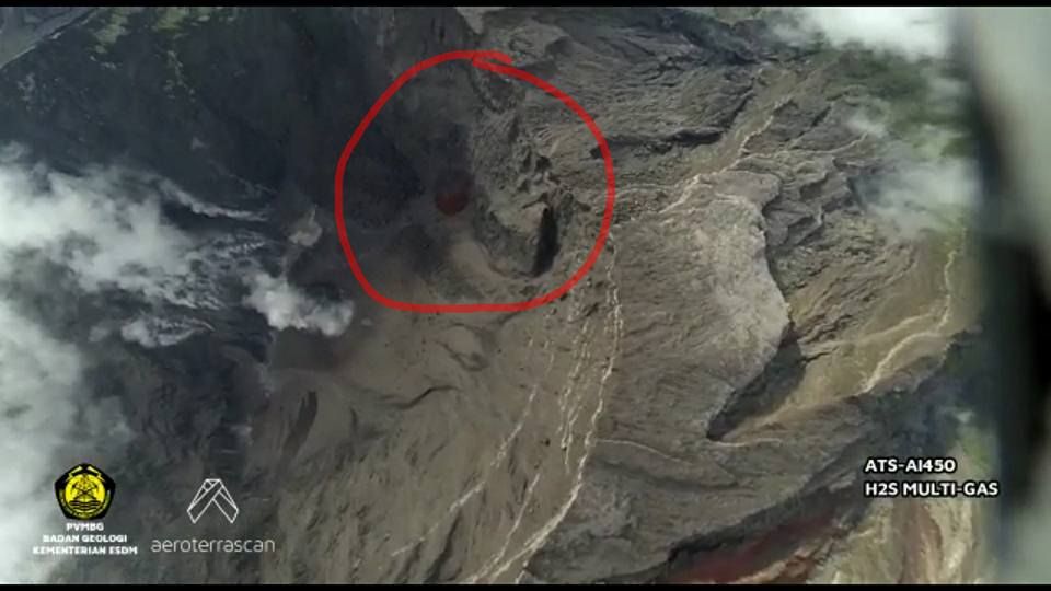
Admin
wrong 🙁
thanks ! 🙂
Hello Frances: regarding the ignition of gases in the plume: what should ignite? The plume consists of Air, water vapour, CO2 and SO2. So nothing to burn there…
But I also don’t think that it’s magma and would go for Rock or water…
Thanks Colloid, I missed the chemistry lessons at school! 🙂
I think the picture Marek posted just above your post proves pretty conclusively that it is rock! So thanks to Marek also for the proof.
As part of my attempts to resolve the Microsoft Edge posting bug, I need to temporarily disable one of our plugins that automatically embeds images from urls.
For the moment, can you please use [img] and [/img] around any image urls.
Edge users, please tell me if there’s any change.
Tried to post this in Edge and received the “Invalid Security Token” error
Testing Testing 1 2 3
I have no problems switching to another browser to post here rather than having the plugin disabled.
While I’m here, it is noticeable how the energy is still curving upwards at BB the quakes seem to be trending shallower and the GPS readings keep rising at quite a steady rate. Wonder what the new popping pressure will be?
Ok so we know that that hasn’t helped, image plugin restored
The upturn is quite noticable. I don’t see the shallowing of the quakes, only that the deeper quakes are now lacking. However, the quakes are now more focussed on the eastern side of the caldera.
Did anyone notice this strange cloud? http://www.livefromiceland.is/webcams/hekla/
Hi Pyter, did you manage a screen grab? Not seeing anything unusual, just snow and wind – Great view however – very picturesque.
Iceland drives me crazy, sorry. I see things from looking at the images so long. Must be the goblins … 🙁
Fyi for everyone… Hekla will very likely not leave any questions about what’s going on when it gets around to erupting. Historically, it is very clear about what’s going on when it goes.
I see something like burning brush?
Dear Volcanoes:
I am at work bored out of my skull. DO SOMETHING ALREADY! 😉
Two quick questions … Is the slowdown of reported earthquakes in Iceland atm real or is it caused by the ongoing weather muting the data? …. Does anyone know what the 2-3 minute repeated tremor-like-signal at FAL and FAG are all about? Magma/melt-water/steam/mini-landslide/???
(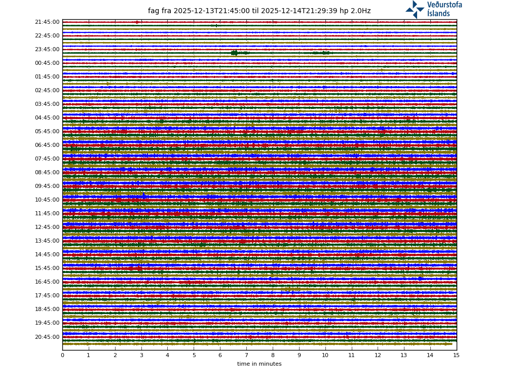 )
)
Looks artificial to me, although I have no idea what is going on. They have the same duration and the same shape, and two sets are the same time apart (40 minutes, I guess).
Don’t worry too much.
Inactivity means strain is building somewher.e… You just have to find it. 🙂
There was an article (icelandic media)yesterday or the day before saying that the weather would likely disturb/affect the monitoring at Öræfajökul, so it’s close to think that the rest of the country would be affected.
Fagurhólsmýri is in inhabited area, even with an airstrip. The fag readings as shown do happen regularly, during daytime only I noticed past weeks.
The station fal is on a slope near a glacier. Quote from IMO in a news item about the unrest in Öræfajökull volcano:
“In addition earlier in the month, IMO gained access to the seismic station, owned by the British Geological Society, located near Falljökull (Fal), west of Öræfajökull. This station, which was installed for ice-quakes research, has proofed to be very beneficial to locate earthquakes in this volcanic area.”
So more is happening there aswell as earthquakes only. I cannot interpret the readings of this station though.
Specialists remark at IMO website:
“High conductivity has been measured in Múlakvísl for several months due to a constant geothermal water leakage. The conductivity has been rapidly increasing in the past days and today measures up to 500 µS/cm, however, water levels remain very low.”
Múlakvísl is a river sourcing from Mýrdalsjökull (covering Katla).
I lived very close the volcanic eruption in El Hierro, Canary Islands. It was a great experience. If you want, I can share more info about this volcanic eruption. I wrote this article several years ago in a local newspaper: http://www.elhierrodigital.es/inicio/erupcion-volcanica/item/216-la-evolucion-de-la-erupcion-volcanica-puede-tener-cuatro-fases
there’s something wrong
https://magma.vsi.esdm.go.id/live/seismogram/
I was reading Jons blog on one of the recent pages he did on activity regarding oraefajokull and apparently he thinks (based on this website: http://isor.is/frettir/hugleidingar-um-eldsumbrot-i-oraefajokli) that oraefajokull has already started erupting and it is a lava dome extrusion under the glacier in its caldera. I dont know how likely that actually is but given how it means oraefajokull has already started erupting it seems significant.
On the site I of interest there is also a link to an interactive geological map of iceland which some of you might already know about. (http://jardfraedikort.is)
-turtle
FAO wordpress dragons, I just had an idea for once an eruption run up properly starts for oraefajokull or agung. Perhaps it’s possible to split the comments into 2 columns – so left hand side is agung and right hand side is oraefajokull – so that people posting drumplots for exaple don’t confuse which volcano is being refered to. Dunno if it’s even possible my very cursory google search threw this link https://www.billerickson.net/code/two-column-comment-form/ which looks like it might work, don’t know if it’s worth testing backstage?
Something to think on, I’ll take a deeper look later
Agung erupting today again.
Agung 20171125/1008Z
(1) VOLCANO OBSERVATORY NOTICE FOR AVIATION – VONA
(2) Issued : 20171125/1008Z
(3) Volcano : Agung (264020)
(4) Current Aviation Colour Code : RED
(5) Previous Aviation Colour Code : orange
(6) Source : Agung Volcano Observatory
(7) Notice Number : 2017AGU16
(8) Volcano Location : S 08 deg 20 min 31 sec E 115 deg 30 min 29 sec
(9) Area : Bali, Indonesia
(10) Summit Elevation : 10054 FT (3142 M)
(11) Volcanic Activity Summary : Eruption with volcanic ash cloud at 0920 UTC (1720 LT). Eruption and ash emission is continuing.
(12) Volcanic Cloud Height : Best estimate of ash-cloud top is around 14854 FT (4642 M) above sea level, may be higher than what can be observed clearly. Source of height data: ground observer.
(13) Other Volcanic Cloud Information : Ash coud moving to west-southwest
(14) Remarks : Seismic activity is characterized by low frequency earthquakes.
(15) Contacts : Ministry of Energy and Mineral Resources
Geological Agency
Center for Volcanology and Geological Hazard Mitigation (CVGHM)
Tel: +62-22-727-2606
Facsimile: +62-22-720-2761
Email : vsi@vsi.esdm.go.id, gunungapi@vsi.esdm.go.id
(16) Next Notice : A new VONA will be issued if conditions change significantly or the colour code is changes.
Latest Volcanic information is posted at VONA | MAGMA Indonesia Website
Link : https://magma.vsi.esdm.go.id/vona/
Agung 20171125/1008Z
I haven’t been able to see the plume at all today, but that suggests it is up to 1000m now? If that’s correct, that would seem like it is more pressurised than previously.
Change of camera and…
Wow… That’s actually a substantial ash cloud ! This looks like a significant ramping up of activity, and correct me if I’m wrong, but it doesn’t strike me as any phreatic event. Ongoing for over 1 hour so far.
But little on the seismographs – apart from a rumble around 6am UT which was during the sand digging but looking different from that.
What does that signify?
Open system now?
I’d say that the beginning of any significant eruption (as opposed to a phreatic event) would be accompanied by very obvious seismic signals. For instance, I would certainly expect these signals to override those we observe from the sand mining.
Or maybe not! Noise now apparent and fairly obvious an eruption of some sort is now occurring but noise nothing compared to the mining. Where was this seismo located? Next to the mine??
Did the 1963 eruption start in a similar way before lava flows started? Or is this more sudden.
From what I’ve read on here, it seems to be following the 1963 pattern?
Hevy smoke now!!???
MAGMA Indonesia
@id_magma
3 min 3 minutos
Mais
Mount Agung eruption occurred at 17:30 WITA. The gray columns are dyed to medium-grayish-blackish-gray as high as 1500 m above the peak of Mount Agung. People stay calm and follow PVMBG’s recommendations on Level III (Standby) status.
https://twitter.com/id_magma/status/934369473213034501
https://www.facebook.com/sigit.purwono/videos/10213349670594893/
Mount #Agung situated in Karangasem Regency of Bali erupts again on Saturday (25/11/2017) at: 17:30. The column of ash gray-blackish observed as high as 1,500 m above the top of Mount Agung.
https://twitter.com/janinekrippner/status/934389586570153984
I did hear from a friend in Bali smoke column 7000mtrs at that time.
https://twitter.com/fikgm/status/934377154007072768
Phreatic or not, that’s certainly a bit more than a “puff”.
Something big has just popped up on the agung seismo. Local or further afield?
Further afield – USGS info as follows:
M 4.7 – 23km E of Labuhankananga, Indonesia
Time
2017-11-25 13:14:06 (UTC)
Location
8.129°S 117.985°E
Depth
199.5 km
M4.7 on a neighbouring island. Not Agung related. So far there is little to see on the seismographs and this is probably just phreatic, and not very large. Luckily it happened shortly after the sand digging was finished for the day! There is now some light visible near the summit but not clear what that is. A heat signature?
I see incandescence in the webcam. Definitely not phreatic now.
At 20:55 local time, there is a visible glow on the webcam. At 21:00, a glow is visible also on the slopes. Looks like there actually might be a lava stream.
Second thought, it might be that the glow at 20:55 is in the ash cloud, and at 21:00 the crater rim becomes visible. A clear heat signature at least.
Good spot! that is Interesting. Don’t think the lower glow is actually on the slopes, more the crater rim being very well highlighted by a plume. Would you get such a glow from phreatic emissions is the question?
The camera is in IR mode, so it doesn’t really need to be a glow visible to the eye. The Momotombo webcam comes to mind. There the glow is clearly visible when the camera is in IR mode, but it is only really hot fumaroles. It is the first time I see it on any of the Agung cams, so there is definitely an increase in heat.
That would explain it then. Had assumed that it was in a low light mode so would only pick up incandescent material.
Screen grab (hopefully!)
https://www.facebook.com/photo.php?fbid=1409082739202976&set=p.1409082739202976&type=3&ifg=1
Here you go:
Thank you 🙂 22:18 cam 1 too.
Orange Aviation alert for Agung.
And a small swarm overnight underneath the summit of öraefajökull. Who said there was nothing going on?
If you live in England Albert you should know ‘it never rains but it pours!’
It is actually snowing today..
Looks like now a fair bit of human activity down below (car headlights etc), hope they are evacuating.
Lights on the left flank, presumably the temple, I’d be bugging out now!
A USGS plot to show what signal can show up on seismographs. It may be helpful
And another guide, also courtesy USGS
And this is the signal of the past 15 minutes

Is one a LP earthquake ?
Large glow on cam now !!!!
Look from 23:17:31
https://youtu.be/islcMmfHHqE
Out of curiosity in regards to phreatic eruptions. How long do they normally last? I would have assumed they would be short lived, albeit possibly repetitive, rather than providing a continuous plume of ejected solid material (other than steam/gas) over some hours?
They are like geysers: sudden explosions. The ash cloud though takes a long time to dispel and this sets how long it lasts. It is also kept aloft by the heat from below. The explosion today was not huge (also note the absence of volcanic lightning). Let’s see whether the warning stage is increased back up, in which case the poor people will have to re-evacuate.
The bursts of heat that show up on the webcam, barely register on the seismo. From 23:17 to 23:22 there was a nice little show, the seismogram just thickened slightly. An earlier event 22:36 to 22:41 looks like it didn’t even register.
Activity on Cam now.
Two seperate plumes now glowing.
As of 5 minutes ago…the twin plumes are clearly visible….but are coming/going and not consistent (yet). http://tinypic.com/r/5n2nte/9
Another try.

A third plume also started in the middle the left hand plume turned to a black Ash cloud .
Seismo seems quite ATTM despite the on/off incandescent “plumes” seen on the webcams.

Try reload: you stopped just before it got more interesting. Just now there was something that looked like a rock fall.
Something happened at 24:20, though webcam now quiet.
Make that 00:20, not enough coffee
Earthquakes. Note how the signal begins with a sharp spike and decays after that.
Well I guess agung has probably started a real eruption now.
Now just to watch a nice quite lava flow for 5 or so months before the big one and possibly first real big eruption in almost 2 years.
Maybe something will happen in iceland before that happens, I would be very confident that next year will see the next eruption in iceland the way things seem to be going at bardarbunga and oraefajokull (and deep quakes at askja, and katla being probably set to erupt, and hekla being generally unpredictable……. im probably missing some stuff elsewhere too)
Yep i’d say definitely erupting based on this https://twitter.com/Sutopo_BNPB?ref_src=twsrc%5Etfw&ref_url=https%3A%2F%2Fwww.express.co.uk%2Fnews%2Fworld%2F882348%2Fbali-volcano-eruption-latest-updates-mount-Agung-news-Indonesia
Now some new seismics on the Agung drum. Looks more like local quakes, not like tremor……