Volcanic tremor pulse started near Keilir at 14.20 local time. Eruption not confirmed yet. Scientific flight underway.

Keilir, this is the area that has possibly erupted. Do note that the mountain is not a central volcano, this is a fissure volcano and the entire area is the volcano. Image from Wikimedia Commons.
The quote is the official Stonetablet by IMO, translation to English by the author.
The colour code has been upgraded to Orange, please be advised. The area near Keilir is being evacuated due to the volcanic tremor pulse.

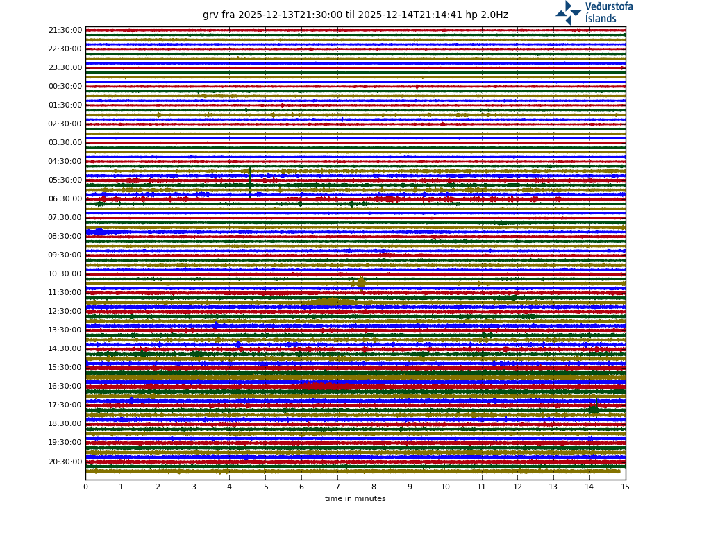
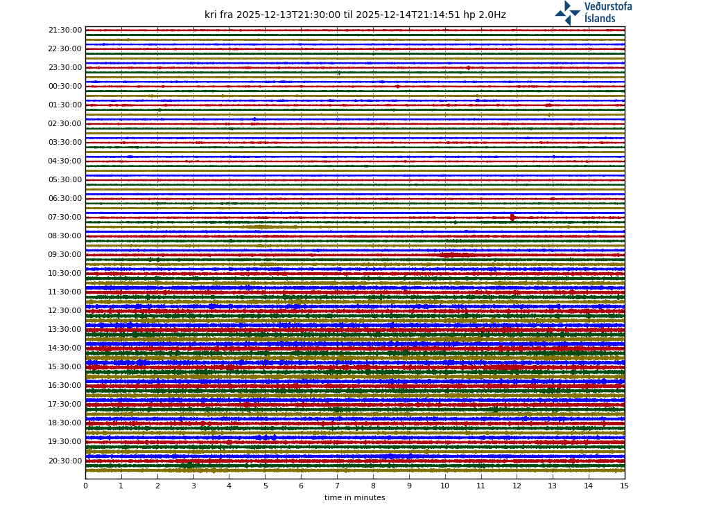
The tremor pulse is clearly visible here, and on all other station in Iceland. Image by the Icelandic Met Office.
It still remains to be seen if the eruption i prognosticated a few days ago has started, or if it is still in the making. The article will be updated as more information is coming.
If the eruption occurs at the most likely spot it will be known as either Þráinsskjaldarhraun or Þráins Fires (depending upon if there will be one or several eruptions.
We will shortly start to add links to webcams and other sources.
CARL REHNBERG
Update: Almannavarnadeild ríkislögreglustjóra is reporting that they have not seen any eruption during the eruption, but that they are expecting the eruption to start within hours to days. Visiting the area is not advised due to bad weather.
Bonus fact Update: 7 years ago I kissed a vent at Litli Trutur (the spot of the possible eruption) from the inside. I guess I should not have done that. All photographs by Nick Small.

Road of The Volcano Kisser.

Walk of The Volcano Kisser.

The Volcano Kisser in action.

The Volcano Kisser delivers a hot and steamy volcanic schnogg.


So now no quakes? It’s a glitch?
Just a glitch .. it wont stop so suddenly
Coud be even more quakes when its back
Seismic activity at the Icelandic site appears to have subsided.
https://en.vedur.is/earthquakes-and-volcanism/earthquakes
I also remember an article from 2017 that claims that the temperature of Reykjanes hot springs had risen.
https://icelandmag.is/article/growing-levels-activity-all-geothermal-sites-reykjanes-peninsula
A possible connection with current phenomena?
I also saw the fireballs but they are only the reflections on the camera of the headlights of the passing cars.
It was just a glitch. The earthquakes are still occuring.
Evacuations on-going in New Zealand coastal towns because of the expected tsunami
there was a tsunami. sorry for quality..
https://twitter.com/LukeChandler/status/1367606687864029187?s=20
All good, there was some tsunami surge, wave height was low. Somewhat disturbing seeing 3 magnitude 7+ quakes in two clusters in two places 600km apart on the same very large fault. Aftershocks are now about 35 greater than magnitude 5 in the Kermadec region, five or six that size in the East Cape NZ region.
USGS has the main shock NZ quake depth at ~20km, and M7.3. NZ GNS science has it much deeper – at 90km, magnitude 7.1.
The Kermadec main shock was quite close to Raoul Island. I understand that the island was uninhabited, normally full-time station staff not on the island due to Covid. The shake seems to have taken out GNS tsunami gauges and seismic equipment on Raoul (or at least has taken out communication links).
Here are the NZ “de-tided” tsunami gauges.
1 is approx the time of M7.1 quake off East Cape NZ
2 is the M7.4 Kermadec pre-shock
3 is the M8.1 Kermadec main shock (then the local tsunami gauges go blank)
HI, where can I find a “drum” recording of these earthquakes?? TIA
I think I have found it: http://hraun.vedur.is/ja/drumplot/
Has anything changed recently?
looks kind of quiet for the last 4 hours or so …
Ref the Mag Eight;
Formulas used from Wells-Coopersmith. They note that reverse faulting formulas do not follow 95% significance. So take these values with a grain of salt.
USGS data suggests max displacement >5m.
https://earthquake.usgs.gov/earthquakes/eventpage/us7000dflf/map?finite-fault-overlay=true&shakemap-intensity=false
As noted “Reverse-Slip relationships are not significant at a 95% probability level”
(directly from the paper)
Interesting read on the role volcanoes play in climate change https://www.bloomberg.com/news/articles/2021-03-04/a-20-year-old-climate-change-mystery-has-finally-been-explained?sref=Yg3sQEZ2&utm_source=twitter&utm_content=business&utm_medium=social&utm_campaign=socialflow-organic&cmpid=socialflow-twitter-business
It’s been 7 years since I’ve been watching this site. Feels like yesterday. Much love.
Steadily thinking this might be another failed eruption.
Temporarily failed, the dike to Keilir might not erupt but the situation mow is far too progressed to stop like this with nothing. And as yet we are still early, the tremor began only 2 days ago and pauses of a day or more are common.
Tremor still going… seismic feed updated
Icelandic geologists also think this will end in an eruption. The question is how long it will take. Could be one day, could be one hundred years. I just hope it won’t be too long of a wait.
I think it will end in an eruption too, but it might not necessarily be at Keilir, that dike might fail where another could succeed. I would expect with this though an eruption is imminent, this week or at least some time in 2021 more broadly. As Irpsit says the Reykjanes tectonic cycle should be turning over in the 21st century, and theres definitely a lot of magma involved with the current swarm question is if it is rising, which it probably is if theres no advancing dikes.
Dunno. It took Holuhraun roughly two weeks to erupt after the onset of the earthquake swarm. Magma has to find the weak spot.
Holuhraun was different to this though it was a rift fed from the side not from below, this is more like at Krafla. That suggests there could be tiny eruptions and intrusions for a while and when the rift is filled the bigger eruptions start. I would like to know if there is written observation of this during the Middle Ages, as I understand it this is typical of rifts fed from below.
Since I started following this site and trying to understand the mysteries of all things volcanic, I have learned that volcanology should instill a sense of perspective where time is involved.
It’s a good subject for those with plenty of patience.
…and it looks like seismic activity is off and running again.
3/3 Yesterday around 3000 earthquakes were detected and from midnigh around 800 been detected. Most activity after midnight has been near Fagradalsfjall, has moved a bit NE, compared to yesterday. No tremor been measured during the night, but earthquake activity is still active
https://twitter.com/Vedurstofan/status/1367761800473772033
2/3 Since then two earthquakes over M5.0 detected. Occurred on Feb. 27th and March 1st. Over 20000 earthquakes have been detected in the area since activity started. At 19:14 an M4.2 earthquake was detected 2 km N of Grindavík. It was felt in the Grindavík and in the capital area
We just had 4 M3 quakes at Fagradalsfjall within 10 minutes. This ain’t over yet.
They were shallow,too.
I got excited when I saw that one in that swarm >M3 was at 1.1km depth, then I noticed it was only 90%. Ah, well…!
There’s a tendency for unverified quakes to be placed at 1.1km depth. I have a suspicion, but have never gotten it confirmed, that 1.1km pretty much means depth undetermined.
Yes, there’s three unconfirmed >M3 at 1.1 kms in the last 48 hours, though there’s a lot more at other depths. For example, here’s a fun one:
Friday
05.03.2021 14:31:27 63.679 -22.318 **54.1 km** 0.8 90.01 18.8 km SSE of Grindavík
Today 3 earthquakes of M4.1, M3.7 and M3.6 where detected at 11:50am, 11:54am and 11:59am. At 1-3km SW of Fagradalsfjall, the earthquakes were felt in settled ares in the SW of Iceland.
https://twitter.com/Vedurstofan/status/1367823398370480132
Exciting times and plenty of action to keep an eye on across the globe. Let’s hope it’s spectacular and human friendly.
Would it be possible to add the webcam links into the article please?
Great to see familiar faces here, hope everyone is doing OK and has coffee and volcanic cocktails ready in the bar!
Please can someone tell Iceland to hold off eruptions for a couple of hours? Off to get my “plague vaccination”…
A volcanic eruption would most likely be at Mount Fagradals
…
This time it is believed that a fire can occur in five areas, although it is specifically stated that there is almost no chance of an eruption in all areas.
It is understood that the seismic activity has clearly moved to the southwest, far the mountain keili and at the same time closer to Mount Fagradals. It is most likely according to the forecast that an eruption occurs at Mount Fagradals, which can be seen from the large red spot on the right side of the map.
…
https://www.mbl.is/frettir/innlent/2021/03/05/eldgos_yrdi_liklegast_vid_fagradalsfjall/
Unfortunately, i do not think that red spot is within view of any of the web cams that are centered on Keilir?
The one by the 41 road near Vogar is certainly pointing in the right direction,
https://www.ruv.is/frett/2021/03/03/beint-vefstreymi-af-skjalftasvaedinu-vogastapi
but the area highlighted on the map is obscured behind a range in what we see on the camera as the hills with a little bit of snow on the top to the right of frame.
The two Keilir webcams Luis Godhino provided the links to below are now on the Míla webcam page (https://www.livefromiceland.is/), and the link to the 360 degree Reykjanes webcam that was installed last year on Þorbjörn has been restored, but the camera doesn’t yet seem to be live. If and when it is, and if the eruption is near to Fagradalsfjall and the lava flows S, then it might give us a decent view of the action. (Lots of hypotheticals there!)
On this web stream looks like a vapor plume over Fagradalsfjall 😁https://www.ruv.is/frett/2021/03/03/beint-vefstreymi-af-skjalftasvaedinu-vogastapi
Just a cloud D:
Yes, but that may change😁
Vertical dynamic lies at a depth of 1.2 miles
The dynamic corridor is likely to lie vertically in the area from Mount Fagradals in the direction of Keili according to model accounts. The magma is estimated to have reached depths of up to two kilometres.
This is what Geophysicist Freysteinn Sigmundsson attended a meeting of the Scientific Advisory Council at lunchtime. The magma is about one metre thick and reaches a depth of five to six kilometres. He adds that there is some uncertainty about the interpretation of these model accounts, but that the situation is most likely like this.
‘It’s in line with what we were talking about yesterday but there’s a clearer picture. It is clear that if the dynamic has come close to the surface but not quite up and where this lies so shallow, there remains a period of special care,” he reports.
…
https://www.mbl.is/frettir/innlent/2021/03/05/lodrett_kvika_liggur_a_2_km_dypi/
Good article. They probably should have added that they can measure these phenomena with satellite interferometry.
How? Radar?
The Iceland Road Athorities with new webcams at the possible eruption site one equipped with night and heat vision. #keilir #lavacentre #iceland
https://www.ipcamlive.com/60401b8d3413c
https://www.ipcamlive.com/60410e5225858
Who knows where “it” will happen…a lake level rise without melting water or any rain? Temperature change? Other ideas?
Kleifarvatn
http://vmkerfi.vedur.is/vatn/vdv.php/historical/460
Some unusual things…
Lake level up not down
Instead of sulfur gases only hydrogen?
Open for surprises?
https://www.volcanocafe.org/reykjanes-volcanic-field/
Well I am beginning to think that this one is going to surprise (more so than now ?!).
So perhaps we should be looking at places like Krysuvik ?
Although so far it still seems to me that magma is finding a way up (with less rumbling than previous days… easier pathway ?) somewhere near Fagradalsfjall .
Fagradalsfjall is considered part of the same volcano as Krysuvik, actually on here is the only place that names them separately that I can find. Its not really that obvious where any of the volcanoes here start though and the eruption will look the same anyway, so probably not important except to decide whether to add a new volcano to GVP.
Krysuvik is a lot easier to say in english though than Fagradaldsfjall… 🙂
Can anyone help me please? I remember seeing a graphic of one of the Icelandic fires that showed the eruption compared to the height of some skyscrapers. Does anyone know where I can find this please? Thanks.
What’s the best drumplot station to follow this event? It seems that Grindavic station is piking it better than Krisuvik station…
Probably both of them.
And just like that, silence.
Not really, quakes still coming in on spectros, looks like list needs to update.
Icelanders can be playful with words, so they’ve decided to name the upcoming eruption GOSIÐ-21
Excellent. I wonder what the Icelandic is for “aerosol”, as in Covid transmission; is it cognate with “gos”?
Aerosol is sprey or úði.
In this context, would it not be svifryk? Or actually in this context, gjóska?
(Not sure whether they’re talking about volcanic mists or ash….)
Hm, if mists then móða is a possibility…
I should probably figure out what context they’re looking for…
Gos means eruption. Also – fun fact – it also means soda. 🙂
Takk fyrir! I was wondering whether “gos” had a further range of meanings. Thanks to all you speakers of Icelandic, I now know it hasn’t.
To further your question about “aerosols”, it depends on the context.
* Svifryk is particulate matter. Like, say, “PM10” – that’s svifryk.
* Gjóska is tephra.
* Eldfjallaaska is volcanic ash (eldfjall = volcano, aska = ash), e.g. very fine tephra.
* Móða is mist; vog would be móða. If you’re familiar with the term “móðuharðindin” (The Mist Hardship) with respect to the Laki eruption, that’s from the same word.
He began to believe that this event will be more like the Eldfell eruption, but with several eruptive events on a multi-decade scale.
The seismic activity has continued since 2019, but the first signs were seen with the addition of the temperature of the thermal springs already in 2017. (previous comment)
A magmatic intrusion of this type over such a long period is quite voluminous and over a fairly large area.
The only recent similar events were Kilauea and Bardarbunga, but these were caldera collapse events, this is different.
I’d love to hear yours.
Can anyone tell me why the MIROVA satellite doesn’t work?
Most recent similar event was at Manda Hararo in Ethiopia, in 2007-2010, but its very remote so as far as I know there isnt any video of it. Krafla fires is probably the best example with good records. Kilauea and Bardarbunga were gravity drain eruptions, there was no magma generation underneath the site of eruption and the volume involved was much larger because it was a self sustaining event, for Holuhraun it was about 3 km3 with about half of it erupting, Kilauea was 1.2 km3 but 90% of it erupted, it was effectively a normal sized rift that got very out of hand. Here we might get that much magma but only 10% of it will erupt, or somewhere about that.
I am expecting this will be a few years long, possibly a decade. The first few years might see no eruptions or very tiny eruptions, but large intrusions, of which at least one has happened already now. When the rift is full eruptions will suddenly get a lot bigger as the lava cant go underground anymore, and while not big in volume these eruptions are very fast, the visual aspect is probably the only realistic comparison to make between a Reykjanes eruption and Holuhraun.
The MIROVA system is temporarily out of service. We apologize for the inconvenience.
Maybe a space weather issue or did the magnetic field lose it’s strength already? Most likely only an IT issue? Or someone didn’t pay his bills?
https://www.businessinsider.com/earth-magnetic-field-weakening-satellite-problems-2020-5
I don’t know why but I have a bad feeling for this year, I can’t shake it, it feels like everything is going to go to hell soon.
I know that feeling, it is strangely prophetic. I don’t know what your spiritual/religious beliefs and I am not going to impress upon you in that regard. For my own part, when I get those feelings that I can’t shake, I feel it is God speaking to me.
Strangely, this is related to the grand solar minimum and heightened volcanic activity. It is in these periods that great change and fall of empires occur. Change doesn’t come without tribulation.
I am a Christian who believes that the Rapture of all Christians is at hand. For prophetic things see the following websites about the end times, the coming Great Tribulation under leadership of the antichrist and the Second Advent of our Lord and Saviour Jesus Christ, God’s only begotten Son:
links removed for being off-topic
Our first rule is: be nice. -admin
remember our First Rule. -admin
We are stopping this thread. Further comments here will be deleted. We have a wide range of readership and are very happy about that. Everyone is welcome regardless of background, physical characteristics, or believes. But VC is not the place to refight the French revolution.
Does that mean it feels like a normal year?
With all this activity (Sinabung, Etna, Kilauea, Keilir) we still need a southern hemisphere volcano to balance things up.
That’s just a lingering aftereffect of having survived 2020.
… I think.
🙂
Just build a good ark and GYATM asap…
Keep safe and don’t stay home if the lava is knocking on your door 😉
From the Department of Civil Defence:
(& Google translate)
“Meeting of the Scientific Council for Civil Protection on 5 March
March 5, 2021 4:57 PM
Science Council 05.03.
The Scientific Council for Civil Protection met at a teleconference today to discuss the earthquake on the Reykjanes peninsula. The meeting was attended by experts from the Icelandic Meteorological Office, the University of Iceland, the Environment Agency, Orkuveita Reykjavíkur, Kaust University, Uppsala University, the Office of the Medical Director of Health, the Epidemiologist, Isavia-ANS, HS-Orka and ÍSOR.
The meeting reviewed measurements and data received in the last 24 hours.
As in an announcement from the Scientific Council yesterday, it is the opinion of scientists that the latest data do not give any indication that magma is moving closer to the surface. During this period, there is not much chance of an eruption, but the possibility that the situation can change quickly must be taken into account.
It is the joint opinion of the Scientific Council that in the event of an eruption, all available data indicate that it will be in the area between Fagradalsfjall and Keilir. This is in line with the scenarios that have already been published in the Scientific Council’s announcements. Voltage effects from the metamorphic area between Fagradalsfjall and Keilir probably explain the earthquakes that have occurred in Svartsengi and near Trölladyngja in recent days, as no deformation has been detected that can be linked to magma being on its way to the surface. Therefore, there is no reason to believe that eruptions are imminent in these places now, nor elsewhere on the Reykjanes peninsula outside the metabolic zone at Fagradalsfjall and Keilir.
More about the functionality and processing of the latest data
Earthquake activity and magma movements continue. The greatest seismic activity after midnight is limited to Fagradalsfjall and has only shifted to NA, compared to yesterday’s activity. Model calculations show that seismic activity west of Fagradalsfjall and by Þorbjörn is due to voltage changes caused by the magma channel in a large area all around. Likewise, activity at Trölladyngja is related to voltage changes from the magma chamber.
No disturbance has been observed, as was the case two days ago. The turbulence indicated that magma was moving in the area where the seismic activity has been greatest. This is probably a so-called magma chamber that is forming, which can possibly break its way all the way to the surface.
A more detailed interpretation of the satellite images received yesterday was reviewed, as well as the latest GPS measurements, which show ongoing records in the area. Several models were created based on the satellite images and the latest GPS measurements to better understand the extent and location of the magma chamber. The magma chamber lies almost vertically in the earth’s crust and is estimated to reach a depth of about 2 km in the earth’s crust. The largest opening in the earth’s crust is below and reaches a depth of about 5 km. Based on the results of the model calculations, it is considered most reliable to assume that in the event of an eruption, a crack could open somewhere in the area that has been most active recently, which runs from the center of Fagradalsfjall to Keilir.
Models indicate that this was a medium-sized eruption of 0.3 km3, which is comparable in size to the Arnarsetur lava field on the Reykjanes peninsula. Such an eruption image probably does not threaten the settlement.
The magma chamber is very shallow in the earth’s crust. The most likely models indicate that the corridor is 5-6 km long and that 1.5-2 km can be down to its upper level. Therefore, there is every reason to continue to react when disturbance pulses are measured, as they did the other day, which may be an indication of the onset of an eruption.
The most likely scenarios:
It reduces seismic activity in the next few days or weeks.
The eruption will increase with larger earthquakes, up to magnitude 6 in the vicinity of Fagradalsfjall
An earthquake of magnitude up to 6.5 will have its source in the Sulfur Mountains
Magma intrusions continue in the vicinity of Fagradalsfjall:
Magma intrusion activity decreases and magma solidifies
Leads to a lava flow with lava flow that will probably not threaten settlements
The status of the installation of new measuring instruments was also reviewed. Experts from the Meteorological Office, the University and other partners have worked hard in recent days to increase the number of measuring instruments in the area in order to give a clearer picture of the course of events on the Reykjanes peninsula. The number of GPS stations has already been increased this week and work will continue on the installation of more such stations over the weekend as well as the installation of seismometers. All measuring instruments are then connected to the Meteorological Office’s monitoring system.
The Science Council will meet again shortly tomorrow to discuss the latest data and measurements.
Rada Naukowa 05.03.”
Source: https://www.almannavarnir.is/frettir/fundur-visindarads-almannavarna-5-mars/
So they aren’t expecting it to erupt now?
Seems more like they are thinking all scenarios are equally possible. We have an ongoing intrusion that may or may not erupt.
2km depth is very shallow for magma. It is above neutral buoyancy level, meaning left alone it will try to drain down. To get to that level requires that there is considerable pressure from below. What happens next will depend on how solid the remaining two kilometers is. Any fault will do ..
Not sure; Google Translate may have given the wrong impression. The earthquake swarm is progressing westward. They may be meaning that any action, if there is any, will still be around Keiler and Fagradalsfjall.
The Reykjavik Grapevine summarises the current thinking as of 05.03.2021: i.e. an eruption is not imminent – satellite images are not showing further growth in the magma intrusion and the tremor pulse (signs of instability) are not visible.
However, they don’t think that it is slowing down so they are waiting to see how it develops. They are refining the plots of where they think an eruption may occur.
Source: https://grapevine.is/news/2021/03/05/seismic-roundup-quakes-continue-four-areas-where-eruption-could-happen/
Hopefully they are having a laugh here: how to pronounce some of the volcanoes in the area. (I can just about manage Krisuvik 🙂 ).
https://grapevine.is/news/2021/03/05/how-to-pronounce-icelandic-volcano-thrainsskjaldarhraun/
Kroosevik 🙂
Some more (old) infromations about the outside metabolic zones of Fagradalsfjall and Keilir on the Reykjanes peninsula…
GEOLOGY AND GEOTHERMAL CONSIDERATIONS OF KRISUVIK VALLEY, REYKJANES PENINSULA, ICELAND
https://orkustofnun.is/gogn/unu-gtp-report/UNU-GTP-1992-13.pdf
Here’s some relevant excerpts from Almannavarnir’s own English version of the news item (https://www.almannavarnir.is/english/english-news/meeting-of-the-civil-protection-and-emergency-managements-science-board-5th-of-march/):
“As per an announcement from the Science Board yesterday, it is the scientists’ assessment that the latest data does not indicate magma moving rapidly closer to the surface. While this situation lasts the likelihood of an eruption is not high, but a possible rapid change in the status must be assumed.”
“if it comes to an eruption, all available data indicates that it will be in the area between Fagradalsfjall and Keilir….There is therefore no reason to expect an imminent eruption … in any other location in the Reykjanes Peninsula outside of the area of unrest by Fagradalsfjall and Keilir.”
“No unrest like the one detected approximately 48 hours ago has been measured since. That unrest indicated that magma was moving in the area where the strongest quake activity has occurred. This is probably a so-called magma path forming, which can possibly break through, all the way to the surface.”
and there You have it….doesn’t sound too bad… let’s hope not anyway.
The surface deformation southwest of Reykjavík as seen by Sentinel-1, indicating continued opening along a NE line. Tremor yesterday, but no eruption, yet. The ascending-orbit interferogram spans 25 Feb – 3 Mar, by Adriano Nobile
https://twitter.com/Sjonni_KAUST/status/1367568116302151683
Volcano-tectonic earthquakes in the mozambique channel, a good read:
https://academic.oup.com/gji/article/223/1/22/5850758
https://eos.org/articles/new-volcano-old-caldera
There was a Mag 4.5 in the vicinity a couple of days ago.
Looks like they’ve been adding 9 more GPS stations in the last couple of days. https://notendur.hi.is/~hgeirs/iceland_gps/rnes/rnes_100p.html
National Geographic Society article from yesterday…
A swarm of earthquakes shakes Iceland. Are volcanic eruptions next? Thousands of quakes in southwestern Iceland could signal the beginning of a new period of heightened geologic activity that may last 100 years.
https://www.nationalgeographic.com/science/article/swarm-of-earthquakes-shakes-iceland-are-volcanic-eruptions-next
At http://icelandicvolcanoes.is/ a Catalogue of Icelandic Volcanoes.
https://twitter.com/GeirssonHalldor/status/1368174816205938689
Reykjanes unrest update: GPS velocities before and after the intense seismic swam on March 3 indicate that on March 3 the NE part of the dike (“2”) stopped inflating, and propagated to the SW (“3”) by ~ 1-2km. It also seems the new dike strikes a bit more N-S, and dips westward.
Will this erupt or not? IMO suggest no….
And I also thinks we wont get a show
No one knows… we have to wait and follow the event. It still goes on…
New post is up. Watching and waiting and watching and waiting and waiting ..
https://www.volcanocafe.org/reykjanes-monitor/