
Before climate change denial, there was volcano denial. This is the story about a forbidden eruption, the one that was suppressed and deleted from history. It is the one that got away.
Blame Iceland. This post had been up for barely one day when events in Iceland rapidly moved towards another, potentially very damaging, Reykjanes eruption. Iceland demanded a new posting and with that, this post disappeared into the archives. Now that Iceland has decided that an eruption would be too much work, left the magma underground and instead moved parts of Grindavik a meter closer to the centre of the Earth, we can give Guatemala another chance. Iceland was an eruption that almost happened. This post is about an eruption that did happen – but which was denied.
Guatemala is a volcanic country. It is also known for some of the best coffee in the world – the two are not entirely unrelated. Wikipedia, that infallible resource, lists 29 volcanoes in the nation of which 23 have been active during the holocene, and 8 in historial times. Fuego and Pacaya are perhaps the best known. Others, such as Tacana, are rarely mentioned. The fourth highest volcano of Guatemala is Santa Maria. Although frequently active at its subsidiary, Santiaguito volcano, Santa Maria itself only erupted once. Guatemala covered it up. Blame coffee, with sugar, no milk.
2023
The story began in October 2023. This month was extraordinary wet in the UK. East Scotland was hit hard with two exceptional rainfall events within two weeks. (It is remarkable how often disasters come in pairs.) There was flooding in the towns. England and Wales too had their share of flooding when swollen rivers broke their banks. I wrote this on a long distance train, two days after the rain event. From the train there were houses visible next to flooded fields, almost submerged. The houses looked new. Flood plains apparently are irresistible to housing developers, being flat, green and empty – and no questions asked.
But this October did not break records. Those records were set in October 1903, at the end of a very wet and exceptionally cool UK summer. One wonders why.
1902
It was a bad year for volcanoes. On 23 April, Mount Pelee erupted in a minor event that became catastrophic. The eruption culminated on 8 May, when a pyroclastic flow came down the side of the mountain. Such flows have happened many times in many different places. But this time it was in the wrong place. A city was directly in its path. 28,000 people perished.
But the main volcanic action that year was further west. It had started (in hindsight) shortly before the Pelee eruption. In the evening of 18 April, an earthquake shook much of Guatemala and Mexico. The damage was large: the towns of Quezaltenago and San Marcos were largely destroyed. The earthquake had an estimated magnitude of 7.5 and the epicentre was near Quezaltenago. There had been a number of foreshocks over the previous three months. The major volcanic eruption of the year would be in the same area.
Faults and volcanoes of Guatemala

Faults of Guatemala. Santa Maria lies approximately at the ‘o’ in Cuilco. The volcanic arc lies along the edge of the coastal plain. The yellow star shows the capital of Guatemala. Source: Guzmán-Speziale and Molina, 2022
Guatemala has many earthquakes and events this size are not unusual. The country lies on the intersection of three plates. The low-lying plains in the north of the country belong to the North American craton The rest of the country is part of the Caribbean plate, and out in the Pacific lies the Cocos plate. The major faults of the country lie between the North American and Caribbean plate: the Motague fault and 50 km north and parallel, the Polochic fault. Parallel to these are the Ixcan fault in Mexico (very active) and the Jocotan fault (presumed inactive). The Motague fault carries most of the major earthquakes. As it runs only some 60km from Quezaltenago, this was a plausible cause for the 1902 earthquake. However, at Huehuetenango, which is located directly on this fault, there was much less damage reported. That suggests another fault was responsible.
The actual cause may be some fault that runs along the volcanic arc, between the mountains and the Pacific coastal plain of Guatemala. There is a similar fault further along the coast, called the Jalpatague fault. There was also a large earthquake in southern Mexico in September 1902: this may have been the northern extension of the same fault that failed in April. The coastal plain is where the Cocos plate subducts underneath the Caribbean plate. The 1902 earthquake may have been triggered by this subduction, although it was too shallow to be located in the subducting plate. In a nation as fractured as this, there may also be more faults hiding, only revealing themselves when they fail.
The Pacific coastal plain is around 50 km wide. It ends quite abruptedly at the mountainous chain where the volcanoes of the Central American Volcanic Arc are located. The volcanoes receive their magma from the subduction of the Cocos plate below. Behind the line of volcanoes, and partly mixed in with them, lies a series of calderas of all sizes, remnants of an older phase of volcanism. The wide coastal plains contain a series of low ridges, fan shapes extending from the mountains. These are ancient lava flows and land slides. They suddenly end some 20 km from the sea: when they were emplaced, the shore was where the ridges end. The calderas and lava flows show that at times, this region was a mover and shaker of the world. Perhaps it still is!
The Central American Volcanic Arc is an impressive sight. The following is from Gustav Eisen, 1903, describing the volcanoes one by one.

Santa Maria is a tall stratovolcano, reaching over 3700 meters, high, located near the northwestern end of the Central American Volcanic Arc. The local name was Excanul or Gagxanul (‘the naked mountain’). The volcanoes here, near the end of the arc, are not among the most active in the country. Nearby systems that are quite similar to Santa Maria include Almolonga and Atacana. Atacana has occasional minor phreatic eruptions, whilst Almolonga (also known as Cerro Quemado) had an effusive eruption in 1818. But both can also do dangerous stuff. Atacana had a large explosive eruption 2000 years ago. Almolonga suffered a major flank collapse 1200 years ago.

Drawing of the 1818 eruption of Almolonga (Conway et al. 1992)
There are more volcanoes here but the others are considered inactive. That included Santa Maria. There is however a Mayan legend of spectacular activity at Gagxanul. This has been assumed to refer to the eruption of Almolonga but this is far from certain. Santa Maria is considered to have been inactive for 25,000 years. However, Eisen’s describes it as ‘beautiful’ and ‘perfect’. Volcanoes tend to age poorly: they quickly deteriorate from erosion, becoming rugged and impressive but not pretty. The pretty ones are young and active, which make them resurface themselves frequently with volcanic make-up. And why was Santa Maria ‘naked’? It makes me wonder whether Santa Maria had been more active than it is credited with. But there had been no eruption reported since the Spanish occupation.
That inactivity changed after the earthquake. There had already been earthquake swarms in the months before the April 1902 earthquake. It is not known whether this was due to re-activation of Santa Maria or from precursor activity on the fault. After the earthquake, the aftershocks focussed on the vicinity of Santa Maria and the activity seemed to have shifted over the months from tectonic to volcanic.

Eruption
The long silence came to a sudden end on 24 October. Earthquakes were felt and in the afternoon steam was seen on the southwestern flank of the supposedly extinct Santa Maria. Things build up very quickly from here. At 5pm came the first report of ‘retumbos’ near the volcano, meaning the underground rumbling which you can hear and feel during earthquakes. By 6:30pm, these were heard (or felt) all over Guatemala and El Salvador. For a volcano that had not done anything for 25,000 years (presumedly), this was already off the scale. By 7pm ash began to fall at a farming estate (‘finca’) 14 km west, quickly followed by pumice. A cloud was seen to rise from the volcano, triggering lightning. The cloud was measured at 10 km tall. Santa Maria had woken up from its long slumber.
That was only the beginning. The explosions were heard from further and further away. At 11pm, distant cannons were heard in central Guatemala, thought to come from celebrations in the capital for the fiesta of the following day. During the night and morning the eruption intensified. The finca that had previously been showered in ash and pumice, by 6 am reported hot rocks falling from the sky. The wind was blowing the ash northwest. The explosions and retumbos were now heard as far away as Costa Rica, Mexico City and the Yucatan. Earthquakes peaked at 3am, 7:30am and 11am. A sulfur smell pervaded the air at Coban, 160 km northwest, and in Guatemala city. The ash column could no longer be seen from nearby as everything had gone dark. Already in the morning of the 25th there was no dawn, and candlelight was needed throughout the day up to 25 miles away. To the west, the near-total darkness would last for 3 days. However, the cloud was visible from a ship in the Pacific: they measured the column at 28 km tall.
Loud explosions were again reported in the evening of the 25th, and on the hills in central Guatemala the ground was shaking by the force of the explosions. This shaking was caused by the sound waves, as the shaking was felt much less in the valleys. From the evening onward, these explosions grew less and they could not be heard from as far away. The extinct volcano was now winding down.
During the afternoon of the 25th, the area south and west was hit by a hurricane, accompanied by tremendous lightning. This unrelated storm (don’t disasters often come in pairs!) lasted four hours and in its area did more damage than the eruption itself. Trees were destroyed up to 15 miles away and forests had become impassable. People reported St Elmo’s fire within the falling ash. This rain storm has been confirmed by studies of the ash, which show in one area that the upper layer of the ash has been partly washed away
In the morning of the 26th there were further explosions, now producing a muddy ash which fell up to 12 miles away. Steam columns showed that these were phreatic events, triggered by water, perhaps related to the storm. Ash fall continued and destructive lahars came down to the coastal plains. But the ash became lighter and more local. The Sun was first seen near the volcano on the 30th.
The frequent, watery explosions would continue for months,lasting until April 1903. During November they were at times near continuous, still causing retombos. One of these later eruptions in January 1903 coincided with ashfall in San Fransisco, 4000 km away. However, an association with Santa Maria must be considered as doubtful: during the main eruption, the most distant ash was reported from Acapulco, 900 km away. But although there were hot rocks and hot water, there are no reports of lava. That would come 20 years later.
The land around Santa Maria seemed destroyed. All vegetation was covered by a blanket of white ash, appearing like a mid-winter landscape. Trees were stripped of their branches. The coffee and sugarcane plantations were gone, showing only as openings in the forest. Close to the crater, the ash was reported to be 20 meters thick. The ubiquitous rain quickly formed deep erosion channels in the ash. The mudflows destroyed all bridges along the rivers. Their replacements (baskets being pulled across on ropes) were not for the faint-hearted.
The crater
The area was difficult to access for some time after the eruption. The crater was first described only in December. It was located on the southwestern side of Santa Maria, and measured 1 km by 800 meter, with a depth of 250 meters. At the bottom of the crater were 6 holes, up to 30 meters in diameter, which were the location of vigorous fumaroles.
But the crater size is inconsistent with the severity of the eruption. It seems like an afterthought, caused only by the later phases of the eruption. Is there a much bigger crater buried under the ash? Williams and Self (1982) propose that the magma chamber was much deeper than usual, and that this meant that the area of subsidence is much larger. The magma was highly evolved, hence it’s white colour, which is something that is common among Guatemalan volcanoes that rarely erupt. And several volcanos in the chain have had these oversized eruptions without overly changing their topography. Following Williams and Self, this is often attributed to them having deep chambers that are fairly oversized. As long as the eruption is not too large, the bedrock just flexes downwards and avoids caldera formation. The absence of a sufficiently large crater in flank eruptions is also seen in Huaynaputina.
But why a flank eruption? This is the flank towards the coastal plain. Was it caused by the April earthquake? It seems unlikely that that earthquake was triggered by magma supply to the volcano: it was too large and too extended for that. But it may have caused the eruption by destabilizing the flank of Santa Maria. We can speculate that this created a new magma pathway, and eventually led to a flank collapse.
This suggests another aspect of the lack of a crater. After the main event, the flank would have collapsed over the eruption site. This may have filled in much of the crater which had formed. Perhaps this was the cause of the later, phreatic explosions?
The eruption clearly did not involve the summit or any shallow magma chamber underneath it. The height of Santa Maria reported before the eruption by the International Railway of Guatemala (really) was 3777 meters. The current height is 3772 meters. There has been no real change here. The eruption came from the flank, and involved only the flank. The summit was unaffected.
Fatalities
The number of fatalities is very poorly known. Most were among the local Indian population, either in their villages or as seasonal workers (slave workers in all but name) on the coffee plantations, and they were never counted. The most distant casualty occurred on board the ship Acapulco, where an American refugee reportedly died from breathing! (The captain blamed the sulfur and the ash in the air.) Local reports mention deaths among labourers on one plantation (115 out of 122) and 350 fatalities in one Indian village. People died in collapsed or buried houses, and within 10 km of the volcano from rocks falling through the roofs of houses. The total number of documented fatalities is 650. But refugees streaming into Mexico and the US reported many more deaths than this.
After the eruption, local society broke down. There were deaths from starvation, disease, but also murder and alcohol. Malaria caused further casualties: one reporter attributes this to the lack of birds eating the mosquitos! We will probably never know how many died from these later consequences. Eisen estimates that 1500 died, from causes including burial (nearby houses were buried up to their roofs), asphyxiation and drunkenness. The commonly stated numbers of 5000-7000 who died are based on estimates from US newspapers in the months after the eruption. They all agree that the large majority of the casualties were among the Indian population, and were uncounted.
Ash

Ash thickness. Source: Berry et al 2021
The image shows the distribution of the ash, ranging from 1 meter near Santa Maria itself (actually 10 meter or more near the crater), to 0.1 cm at the edge of the blue region. The two directions come from a change in the wind during the eruption. The numbers next to the lines indicate how many hours into the eruption the ashfall began. The ash extends a smaller distances than the sound did: the most distant reports of heard explosions are from Costa Rica and Mexico City.
In principle, adding up all the ash within the contours should provide the total amount that was erupted. The historical reports help considerably and make this more accurate than is normally the case. Berry et al find a total volume of 11.4km3 – a VEI 6. The dense rock equivalent, or the size of the hole, comes out as 6.4 km3.
The column height also suggest such a large eruption. The measurement of 28 km may have missed the peak height. There is in fact another measurement of 48 km, but it is not clear how reliable this is. The grain sizes suggest a peak height of 33 km. All of these rank among the highest of the 20th century!
There have been four VEI-6 events in the 20th century: Santa Maria in 1902, Katmai in 1912, Cerro Azul in 1932, and Pinatubo in 1991. In terms of DRE, their volumes are 6.4 km3, 12 km3, 4 km3 and 5 km3. Assuming these values are accurate (and they are not that easy to measure!) the order is: 1. Katmai; 2. Santa Maria; 3. Pinatubo; 4. Cerro Azul. (Cerro Azul is borderline – it may have been just below VEI-6.)
But Santa Maria is often left out from this series, or relegated to a lower place. Why is that?
Suppression
Within hours of the start, the sound of explosions was heard across Central America. It was clear that a volcano had erupted. But which one? Already early on October 25, Gustav Eisen send a telegram to Guatemala City to inquire. The response was negative: the government had blocked any news of the event. Later that day, a telegram came from the government saying that a volcano in Mexico had erupted. That was clearly wrong as the sounds did not come from that direction. Within days it was known that the eruption had come from the vicinity of Santa Maria. But Guatemala remained silent. In the UK, the first report of Santa Maria erupting came on 29 October, sourced from a journalist in Guatemala City who stated that the town and villages in the region had been abandoned. US newspapers began to report on thousands of casualties. Guatemala remained silent.
The government finally acknowledged the existence of the eruption on 3 November, with a statement that there had been a small eruption, there were no casualties and only some light ashfalls with a few damaged estates and that other reports were greatly exaggerated. This message was distributed as a cable by the department of Foreign Affairs. This was at the same time that newspapers abroad came out with detailed descriptions of coffee plantations buried 7 feet deep with immense loss of life (and of cattle). One reported ‘as far as the eye could see everything was blue and grey and dead, like a mammoth cemetery’. To this, Guatemala said that ‘in view of the facts, we can only censor such scaremongering’ and that the English and North American press were only interested in throwing shades over the towns of Latin America. Refugees mentioned that there was complete suppression of news from the region and that all cable stations had a strong censorship. The situation was very different from that after the April earthquake, when there had been extensive reporting in Guatemala of the damage done. In contrast, the Santa Maria eruption was first denied and later was claimed to be only a minor one.
Why this denial? We don’t really know. The first censorship was immediate, before the impact of the eruption was known. That day (25 October) there was a fiesta, and perhaps the president did not want that canceled as it was partly in his honour. The government also had a significant financial problem, and lacked the money to even pay for the damage from the April earthquake. Coffee provided one of the main income streams of Guatemala. Perhaps half of all plantations had been destroyed: if this news came out, it could destroy the confidence in the financial health of the nation. Add to this that the previous president had been assassinated and one can imagine some reluctance to announce another major disaster. In the end, the coffee harvest in the rest of the country that year was better than usual so there was some compensation.
Coffee was a major source of income at the time. Although not the only one, the government had focussed on it, to the degree of even re-instating forced seasonal labour for the Indian population. The sugarcane industry was also growing in importance, and this was cultivated on the Pacific coast and so was also affected, although not to the same degree. Bananas were becoming important. This was the time when the United Fruit Company began to almost take over much of Central America: in Guatemala they were exempt from paying tax, and by the time of the eruption, even ran the national postal service. (Perhaps they were the Amazon of their time.) The company focussed on growing bananas: the United Fruit Company is the cause of the later expression (1930’s) of ‘banana republic’. The company is known nowadays as Chiquita. But for export, coffee was the major crop. Indeed, the economic disruption after the eruption became a major cause of the famine. People could not afford to buy the food that was still available.
In the end, the dominant motivation for the suppression of the eruption must have been the president. Changing the tune may have been too personally embarrassing.
Denial has consequences. There was no help for the recovery of the local area: this is perhaps one reason that the number of fatalities is so poorly known. But it has also left us a legacy of a lack of knowledge. Santa Maria is still the least known of the major recent eruptions. And that lack of knowledge brings risks. The city of Quezaltenago is only 10 km from Santa Maria. It is at risk if the eruption would recur. How prepared is the region, after a history of denial? It is tempting to downplay risks if that means no action needs to be taken. It is a very human attitude which can lead to disaster.
Afterwards
One of the effects of the eruption was that a small Swedish spice company started to name their consumer line of spices as Santa Maria. It was a show of respect for the dead people at the spice farm from which they used to buy their cardamom. Something to ponder while eating texmex food..
The mountain silently recovered for 2 decades. But in 1922, the crater which had formed in 1902 became the site of a new eruption, this time with real lava. In 1927 a larger eruption here again caused several hundred casualties. Over the years, a new mountain grew consisting of four different peaks. Only the original one from 1922 is currently active. Santiaguito, the new mountain, is among the youngest and fastest growing volcanoes in the world. It is an undeniable volcano.

Left: the new volcano Santiaguito which started in 1922. Right: the same view from 1922 as Santiaguito first erupted. Source: Emma Rhodes et al. 2018

Weather
1903 is not in the list of years affected by volcanic eruptions. The climate of 1903 isn’t a major outlier. But it was a year that was colder than average. In the NASA annual averages, 1903 is -0.37C below the average for 1951-1980. And 1904 was even colder: it was -0.47C below that average, making it the second coldest year of the 20th century. But since random year-on-year fluctuations can also be this large, it is hard to prove that the cold was volcanically induced. El Chicon, for instance, had its effect on the climate masked by a strong El Nino.

Looking at the four VEI-6 eruptions in the 20th century, the years 1903, 1933 and 1992, one year after the eruption, were all about 0.1C cooler than the year before. Katmai (1912) had no such effect though. Agung in 1963 was also followed by a cold year. Is a VEI-6 really large enough to change our weather? Pinatubo did manage this, though, even affecting sea levels.
And how about local climate? When looking at a small region, the year-on-year random fluctuations become much larger, and it is therefore harder to detect small effects. But for instance a change in the location of the jet stream may affect a particular area while leaving others unchanged, Local changes are not impossible.
Looking at the British Isles, the weather of 1903 was notable. On 26 and 27 February, the British Isles (including Ireland) was hit by storm Ulysses. This happened long before storms started to be named, so having a name was rather exceptional. It is mentioned in Joyce’s book Ulysses, hence the name. Re-analysis of the records indicate that this was one of the strongest storms every recorded in the British Isles, on par with the English hurricane of 1987.

Ulysses aftermath, Dublin
June 1903 was singled out in reports of the time for its unusual rain distribution. While parts of the UK had little rain, the south was drowning in it. From 13 to 15 June it rained continuously in London and the Thames Valley for 58 hours, at a near constant rate. It was caused by a low-pressure system getting stuck of the Isle of Wight. But this was just one weather event. The year overall, over the entire British Isles, was one of the wettest ever recorded. This was caused not so much by those three days in June, but by the summer and especially by October when it rained every day. Places where this is normal (such as the Lake District) had their usual amount. But this time the rain was far more widespread across the UK. The summer had also been unusually cool: it was for instance the coldest June for almost 50 years, 3C below the norm. All three summer months were much too cold.
But was this volcanic? It is impossible to be sure. But it was what drew me to look at the events of 1903. And to find out more about an attempt to suppress a VEI-6 eruption.
Albert & Carl, November 2023
References
Hannah C. Berry, Katharine V. Cashman, Caroline A. Williams, The 1902 Plinian eruption of Santa María volcano, Guatemala: A new assessment of magnitude and impact using historical sources. Journal of Volcanology and Geothermal Research, Volume 414, 2021, 107167
Conway, F.M., Vallance, J.W., Rose, W.I., Johns, G.W., Paniagua, S., 1992. Cerro Quemado, Guatemala: the volcanic history and hazards of an exogenous volcanic dome complex. Journal of Volcanology and Geothermal Research, 52 (4), 303–323.
Rhodes, E., et al. Textural Insights Into the Evolving Lava Dome Cycles at Santiaguito Lava Dome, Guatemala. Frontiers of Earth Science, Section Volcanology, Volume 6 (2018).
Williams, S., Self, S., The October 1902 eruption of Santa Maria Volcano, Guatemala. Journal of Volcanology and Geothermal Research, 16 (1983), 33.
Eisen, G, The earthquake and volcanic eruption in Guatemala in 1902, Bulleting of the American Geographical Society, 35 (1903), 325-352.
Guzman-Speziale M, Molina E., Seismicity and seismically active faulting of Guatemala: A review. Journal of South American Earth Sciences, 115 (2022), 103740.


Thomas Jaggar recognizes this one in his Chapter XIX of ‘Volcanoes Declare War’, but as detailed as this contribution. Many thanks.
Correction….that’s ‘but not as detailed’
I will continue the Marapi discussion here, to answer Ryan and Andy.
I have taken a look at SRTM topography from Open Topography for the volcano. Here is a slope map of the area:
https://ibb.co/FgyPFch
Marapi is part of a group of four volcanoes/complexes in an E-W direction.
The first from the west is the massive Maninjau Caldera which is 20 km long and 10 km wide. The outer flanks of the caldera are similarly steep to the flanks of Marapi, and feature visible lava flows in places, the flat-topped tongues with steep edges. The flows come from within both the north and south ends of the caldera from what must have been a series of volcanoes in a N-S direction that are now obliterated.
Next from the west are the similarly looking Tandikat and Marapi. Each is a small complex of two volcanoes with an older edifice to the NE and a younger edifice to the SW. The have slopes on the shallow side for subduction volcanoes, and abundant blocky lava flows make up the flanks. They remind me of grown up version of Sabancaya. A pile of lava flows topped by a shallow sloping pyroclastic cone. My guess is that the main volcanic style is effusion of blocky lava flows from the summit. Vulcanian explosions are volumetrically less important, although perhaps more common, and have probably constructed the upper pyroclastic cones and excavated deep summit craters. Can’t tell if there have been plinian eruptions or not because those are hard to recognize from topography. Tandikat has a singular young-looking crater nested inside an older bigger one but the older edifice to the north has two craters on a N-S direction that align with Tandikat’s youngest. Marapi is a chain of overlapping craters connecting the young SW edifice to the old NE one, I count 13 craters on Google Earth probably formed in vulcanian/phreatic explosions. I don’t think a sudden explosion like that of December 5 is unusual for Marapi.
The last edifice on the east end of the chain is Melintang (not to be confused with Malintang, these volcanoes have confusingly similar names), which is eroded and looks inactive. Another pile of blocky lava flows with a summit area that has been eroded away.
GVP’s entry about Marapi: https://volcano.si.edu/volcano.cfm?vn=261140
The upper limit for explosive eruptions is VEI2. That matches with Vulcanian explosions, that can emit impressive ash clouds, but last short. May 2 2018 was the last of such VEI2 eruptions.
Marapi’s magma looks intermediate with Andesite, Trachyandesite and Basaltic Andesite, but also some Basalt.
All in all I would judge Marapi as one of the frequently active volcanoes, that are relatively friendly, but you shouldn’t climb on it. It is a risky volcano for hikers.
Most volcano accidents lately seem to be from hikers that go up to polygenetic stratovolcano craters that do sudden explosions, Ontake, Popocateptl, White Island, Stromboli, and now Marapi. Although pyroclastic flows coming down from steep stratovolcanoes can be worse disasters. The only simple way to be safe from the volcano when visiting a volcano is to go to a monogenetic vent.
On Marapi it is obviously mainly the risk for Vulcanian explosions that are usually larger than Strombolian or phreatic explosions. Some volcanoes can appear peaceful, but change suddenly. Etna is an example for a dangerous Strombolian volcano. Even when the summit craters appear peaceful, a sudden Strombolian explosion is always possible.
Marapi likely doesn’t do Vulcanian explosions as often as Etna Strombolian ones, but when it does, they are relatively “grey” with big ash plumes, block bombs and Pyroclastic flows.
These volcanoes are different to the Unzen eruption that killed the Kraffts. When Unzen was active, it did very large Pyroclastic eruptions (Pelean type?). Marapi has done a smaller one, but it was a sudden event.
Thanks Hector, appreciate your thoughts!
https://astronomynow.com/2023/03/21/analysis-of-magellan-data-shows-apparent-volcanic-activity-on-venus/
And finaly prrof of a venusian eruption, changes seen in magellan data. The lava flow here looks rather viscous, so probaly is evolved stuff thats been sitting in the crust for a long time
Looks like it did a 2018. An analogue of Pu’u O’o caldera-collapsed while lava erupted from a lower altitude flank fissure.
Yes seems so, venusian volcanism is little like Io often on a larger scale then Earths, but this eruption is very terran in scale, medium small and suggests that Venus does frequent smaller scale eruptions too. The lava flows kind of looks almost like sillicous andesites, basaltic andesites that you finds in andes monogenetic tuff cone vents suggesting a more evolved composition than basalt. Venus does have some other evolved blocky flows of incredible scale that makes even yellowstone sillecous effusive flows look small
Interesting how opposite Venus is to the Roman Goddes. Venus as Goddes has a female, peaceful image, a big contrast to Mars as God of war and aggression. The planets are very much the opposite to the Gods. Venus is the aggressive planet, and Mars is the peaceful planet.
One is red, the other is yellow. We are quite susceptible to colour. It is strange though that the british symbol of Christmas peace on Earth is the european robin, in spite of its red breast. And its nature in fact fits its colour: this symbol of peace will kill any other robin encroaching on its territory. Which I guess is one way to maintain the peace
“this symbol of peace will kill any other (European) robin encroaching on its territory.”
Wow. American Robins are a bit more chill. This time of year they form huge flocks and practice peace, love and understanding.
And thanks, as always, for the latest fascinating read.
AKA get bullied by European Starlings…
My view on robins as symbol of peace was given in https://www.volcanocafe.org/jokulhaup-in-the-english-channel/
Robins are the most territorial bird I have ever seen, and yes, as Albert says, I have myself seen a robin try to tear another intruder robin to pieces. Most robins back down thankfully and peace is restored. Sadly nations almost never back down despite the cost in human sacrifice.
Thanks for the link to the La Manche article. Only knew the basics before reading it.
According to Wikipedia, European Robins are in the flycatcher family while American Robins are thrushes, ground feeders.
Reykvolc, American Robins are a tad larger than Starlings, and unlike Startlings, they do not eat at bird feeders or nest in tree cavities. The species don’t compete so they co-exist. Temperamentally speaking, the American Robin is a pretty good exemplar of the holiday spirit.
American robins are very similar to European blackbirds (apart from the colour, obviously), birds that do need some personal space but are largely well behaved.
And Io is a real life inferno, better to name it Vulcan. I call it Mustafar personaly, because Mustafar is very much the same thing, its Io just with a thick atmosphere and a warm climate https://starwars.fandom.com/wiki/Mustafar
Indeed it’s a hellish volcano moon. One important difference on Mustafar (like most Science-Fiction planets): It has atmosphere like Earth. Otherwise they had to wear astronaut’s costume there. That’s bad for the story.
In reality I think it’s very difficult to find a suitable planet like earth with atmosphere and volcanoes like Mustafar. Many planets they’ve found outside our solar system have wrong conditions for humans. Even Earth would be likely be difficult for life without the Moon, because the Moon creates stability for the Earth’s rotation. There are so many factors we need for a good planet, that it’s unlikely to find a second Earth like this.
Mustafar is much linked to Etna, its lava eruption 2002-2003 was the visible background for Anakin and Obi Wan Kenobi. During active times Etna can erupt like Mustafar.
Volcanophil
Earth does not have to be ideal for carbon based life. We are way too stuck with old dogmas that Earth woud be ”ideal for life” so lets do a tought experiment
Some Super Earths IF they are in the correct situation coud be ideal .. better than our planet
Many Super Earths have a longer lived Sun
Astronomers look way too much on sunlike stars but sunlike stars are not that common most stars are smaller than the sun, and Infact those are the most common, Super Earths in the outer habitable zone around a larger red dwarf on the border of orange dwarf, souch stars acually shine rather sunlike, just being dimmer overall and having a smaller habitable zone, but worlds with dense nitrogen pressure like some Super Earths may have can orbit further out and stay warm with that density and avoid tidal locking that so many other sunhugging Super Earths suffers from. Complex life seems to take a quite some time to evolve on Earth it took almost 4 billion years! So having a long lived star is crucial to allow life to evolve on Earth it have taken almost Half the suns lifetime thats 10 billion years to get large animals, so all larger stars are out of the question to search for exoplanets they live too shortly.
Many exoplanets suns is a bit smaller than our sun is K to borderline M dwarf star and that one will live around 500 billion years so thats 50 times longer than our suns entire lifetime! giving plenty of time for complex life to develop on souch planets around souch stars, and beacuse of this fact, Red Dwarf Stars and Orange Dwarf Stars that live much longer than our sun will do are today prime candidates in search of habitable exoplanets among astronomers beacuse of their incredibley long lifetimes, today larger red dwarfs and orange dwarf stars are seen as ”superhabitable stars”
Some Super Earths may haves a stronger magnetosphere on Earth that will last longer too
Having a larger and hotter interior will also cool much slower than Earth will, alot so that means the the geo dynamo will keep going in the core for much much much longer than our own will perhaps 15 times longer or even much much more so due to their slow cooling with it being 7 times the mass of the Earth so results in way slower cooling of the core, having a magnetosphere is crucial to protect the atmosphere from stellar wind erosion that eroded Mars atmosphere away. Super Earths enchanced geomagnetic field will outlast Earths own by alot of billions of years defentivly and its life depends on it.
Gravity wont be crushing even with 7 Earth masses
They coud be as heavy as seven Earths, yet you could walk! Surprised? Gravity rises only as the cube root of mass. Also, big worlds aren’t as dense, since they can hang on to more light matter–hydrogen, helium, ice, carbon, quartz. The result? Similar gravities. Saturn’s mass is 110 times Venus’s–and their gravities are both Earthlike! Alien biospheres may roast, freeze, drown, or poison you–but not flatten you. The core is quite small for its size and that means less density, and its fast spinn also lowers gravity, and being more rock than metal Many Super Earths may have a lower overall density than Earth haves and results in only marginals higher gravity. This is meant to show that even huge worlds can have supprisingly earthlike gravities
Super Earths may have more active tectonics than Earth haves
being a much larger planet will be ideal for keeping Plate Tectonics active, beacuse of a much hotter interior than Earths, The interior retains more heat from formation, and more radioactive decay in a larger planet keeps cooling slower. Plate Tectonics are indeed crucial in recycling Carbon Dioxide and Minerals. On the Larger super Earths, Tectonics are indeed very very lively with a thinner litosphere under more stress that may result in twisted small active hilly landmasses, they may have very fast tectonics indeed, forming an oceanic planet with a chaos of microcontinents, and mountain ranges and volcanoes everywhere. Icelands and New Zeelands everywhere on souch planet. There is Chaos Tectonics in these big oceans. Plate Tectonics is crucial for keeping the CO2 levels stable so biosphere can photosyntesis and breathe. On Super Earths there is plenty of volcanic outgassing and as well as fast subduction may keep the CO2 levels more steady than Earths and avoid snowball events and climate disasters. Tectonics is the planets CO2 thermostat. Super Earths class planets like these maybe ideal at this cO2 recycling with their larger mass and increased geological activity.
Their volcanoes belch far more cO2 than Earths But the deep seas aborb it quickly but they needs to Belch under their dim sun. They bubbles with volcanoes and tectonics and therefore suffers little swings in climate togther with the insulation of its dense atmosphere. Having large deep oceans are useful as well to absorb excess volcanic cO2
Their highly active tectonics have formed a very diverse enviroment and every continent and landmasses are hilly rugged and active and therefore diverse enviroments and therefore a more rich enviroment for life. Super Earths being hyperactive does not have Earths endless craton interiors, but have highly diverse hilly, rugged volcanic arcs, protocontinents and mountain belts all these enviroments woud be alot more habitable than Earths interior continent plains that results in lower biodiversity here on Earth. Their enormous size and numerous isolated protocontinent clusters and diverse landmasses may allow the evolution of many intelligent life forms and the air pressure is also there … every landmass is lush and fertile.
They likley have a denser atmosphere than ours and correct orbit
Having haves a much denser nitrogen atmosphere than Earth haves, say about 6 atmospheres, and that haves so many advantages in terms of habitability over Earths just 1 bar atmospheric pressure, it keeps a Super Earths – equator – pole temperature diffrence much much less than Earths contrasts, so lowland polar landmasses are mild and temperate and habitable. The denser air evens out the equator – pole diffrences, so the poles are MUCH warmer than Earths poles and Ice free at sealevel, dense air traps heat better and disturbute its better, the equator are not warmer than Earths, but its poles much warmer.
The dense atmosphere also traps humidity much better than Earths, so they are rainy and humid and that allows enormous rainforests to sprung up on its numerous active protocontinents, poles are thanks to that dense airs greenhouse effect temperate and covered in polar cool rainforests, the worldwide climate is much much more even climate compared to Earths and also much warmer globaly, yet also much milder overall than Earths harsh contrasts. Thinner -aired worlds like Earth can have wide sterile belts–desert zones and polar caps. Pole – Equal Temperature gradients are much even on thick-aired worlds like these and less cO2 is needed too to keep the planet warm too. Much of their Lowlands are tropical rainforests due to greenhouse effect of the dense atmosphere
Their thick atmosphere is the reason why its even habitable at all in its colder orbit and why its superhabitable compared to Earth, Thick-aired exoplanets like these , with their stronger greenhouse effect, can orbit further out, to balance their greenhouse effect where the zone in which water is liquid (and life can evolve) is much wider. This may not automatically increase the number of such worlds–the match between atmosphere and orbit is still a matter of chance–but rigid formulas declaring outer solar systems totally sterile are just plain wrong. Small red stars, for example, have been misstankenly written off, since their liquid-water zone was so close that tidal drag becomes a problem. But thick-aired worlds could orbit further out with their bonus greenhouse effects, where they run no risk of ending up with one face always to the sun. Super Earths thick air keeps it warm in a cold orbit and despite it recives sligthly less sunlight energy than Earth recives. They needs its dense air to stay warm.
Their dense atmosphere also makes contents of oxygen and cO2 that woud not be habitable on Earth with 1 bar, very habitable on this scenario with 6 bars of atmosphere pressure . Due to the enormous nutrient poor seas and relativly small landmasses the oxygen maybe % is only 12% and due to erosion weathering cO2 is only 150 ppm…BUT thanks to 6 atmospheric pressure its pressure equalent is 3 times more oxygen than we haves here on Earth and cO2 is equal to 900 PPM with 6 Earth atmospheres of pressure so a thick atmosphere can make an atmosphere composition very habitable .. when it woud not be under lower atmospheric pressures..
The thick o2 pressure of more nitrogen atmosphere pressure on Super Earths will also supercharge muscles and organs at creatures and even more fuel to fuel evolution or complex life and complex brains even If oxygen is lower than Earths, alien creatures dont need as much red blood cells either with the thick air pressure that increase oxygen density. This rich dense air is the major reason why arieal lifeforms are common too on worlds like this its easier to fly compared to Earths and many of the potential sapient species are flyers thanks to the air density and brain – oxygen ratio. The thick cO2 pressure alos benefits plant growth, but 6 Earth atmospheres are good pressure on their own, having high cO2 and O2 are not very important when you haves a high gas nitrogen pressure that elevates the partial pressure of even small ammounts of cO2 and Oxygen to very habitable levels.
Here on Earth 6 atmospheres wont work as we are too close to the sun and woud overheat, but Super Earths needs it thats on the outer rim of the habitable zone in a cold zone.
This is VERY SPECULATIVE but based on real sicence and most Super Earths will not be livable
But many Super Earths will be hellworlds too, some are stuck so close to their stars that their daysides gets so hot that the crust is actually evaporating. They have a rock vapour atmosphere on the dayside and as that hot magma vapour gets carried to the nightside and cools and condense into glowing hot lava clouds. It probaly rains lava and may snow olivine minerals on the nightside thats still very hot. Dayside is probaly a magma ocean of these worlds
Souch strange sillicate weather exist too on Brown Dwarfs that also have rock and iron vapour clouds in their atmospheres. The temperatures rule what elements that forms clouds, iron clouds and corundrum clouds forms in the hottest atmospheres
It would already by a great thing if they find some strange bacteria somewhere. In my view that’s more likely than to find intelligent individuals like Star Trek. Maybe somewhere there exists a biology with different chemical base than ours. During the first biological Ages on Earth we saw examples of life forms that showed how this possibly can work.
Venus really vent beyond all repair with the geological sillicate – co2 weathering cycle being shut down. Long ago the planets oceans evaporated as the sun got brigther and the weathering shut down, the scrubbers of volcanic co2 shut down, If it had tectonics thats crucial for recycle volcanic co2 it may have shut down too due to lack of water lubricantion. Unable to remove and cycle in and out volcanic co2 the volcanoes coud pump the entire planets carbon stoores in the atmosphere as its still doing today. If all of Venus atmosphere was turned into co2 Ice it woud be a layer a kilometer thick covering the whole planet, Earths atmosphere woud only be an Ice layer a few meters thick.
That means in the future, its only going to get worse for Venus because the silicate – weathering co2 cycle have been broken down and cannot work again as Venus is too hot now for a water cycle, and too dry for tectonics. It cannot No longer cycle in and out volcanic co2, only put out more of this gas. Venus remains volcanicaly active and in the future co2 will only keep accumulating in its atmosphere leading the more pressure and heating. Infact it coud get so bad that the entire surface of Venus is going to melt in the comming 100 s of millions of years, due to accumulating of mantle co2 in the atmosphere and an ever brigther sun. The hell planet is not complete yet as the conditions are set up to become far worse than they already is, assuming it does not loose its atmosphere due to lack of magnetosphere but that does not seem to be the case. There is probaly plenty of mantle carbon left that can be degassed through volcanoes .. and added to the already disasterous atmosphere state.
The future Venus surface will almost certainly melt competely as surface temperatures and volcanic co2 pressures keeps going up togther with solar input.
Now the atmosphere pressure on the surface is so very thick that you can only see about 3 km even in the lower clear co2 air, even If you stood on a mountain, the reyleigh scattering is so very strong. Its almost like a gas ocean now and will become one If more co2 accumulates.
Regarding the atmosphere being eroded by the solar wind, I wonder how much that really matters. CO2 is a lot heavier than N2 or O2, the solar wind might be able to take away lighter atoms but CO2 abd other similar compounds will stay. The only way would be for solar radiation to dissociate it and then take away the O, but that would require the oxygen to not react with something else first. Over long timescales this will add up but Venus isnt losing its atmosphere before the Sun starts its death sequence. More likely Earth will join it in the mean time…
One thing I have wondered is that H2SO4 probably can exist as a liquid on the surface of Venus, it has a boiling point of 337 C on Earth assuming it is azeotropic but on Venus the pressure is nearly 100x higher than that, should be sufficient to raise the boiling point only 80 C to allow ambient liquid. It sounds unlikely but then we have literally 2 pictures from the surface so chances are miniscule the Venera lander landed next to a pond… H2SO4 is only a small component of the atmosphere by percentage, but a small percentage of a big number is probably still a big number.
Basically I think it is entirely possible Venus has got ponds or even lakes of H2SO4 on its surface. Probably nothing big enough to see easily from orbit though, which will make investigation into the idea difficult.
It will melt competely at least outer crust in the future even before the sun turns into a red giant, at least the upper mantle, in 2 to 3 billion years it will still have that heavy atmosphere, and due to volcanism over long timescales we may have have another 100 bars or so of co2 added. Add in a solar input of 20% to 40% higher than today depending on time and yes Venus surface will go well over 1000 degrees C Infact finding models of surface temperatures up to 1600 c before the sun leaves the main sequence. The whole Venus will become a huge lava lake, lava sea due to retaining future co2 output and under a much stronger sun. The surface will melt and become completely smooth, all features and geology will become a liquid soup. Earth will follow a similar development during the suns later main sequence years, but Venus will get the most hellish most quickly.
There’s an energetic earthquake swarm happening on the mid-Atlantic ridge nearest to the bottom tip of Greenland.
A number of high M4.0’s and quite a few M5.0’s. No idea what depth because they all say 10km but that’s a placeholder because they can’t tell how deep they are.
Thanks, nice to know even if there’s not much information.
That’s the same area on Reykjanes Ridge where there was similar activity earlier this year. I don’t remember exactly when.
Googling around, the swarm is in the Bight Fault Zone which is the northernmost active transform fault offsetting the MAR south of Iceland. The BFZ is a left lateral transform zone which separates the Reykjanes Ridge from the mid Atlantic.
The swarm happens in the southern part of Reykjanes Ridge between Ireland and Labrador Sea. It must be similar to the region which had some submarine eruptions around 1990. An eruption like this would only be recognized by tremor, not by Surtseyan behaviour. It would be a calm effusive deep sea eruption.
This is the swarm I found:
(Source: USGS)
To compare with the activity around 1989-1992:
https://volcano.si.edu/volcano.cfm?vn=371022
This was a bit more close to Iceland than the current swarm. But if tremor happens there, it would indicate that something volcanic is going on there. Are they able to monitor tremor on the MAR at growing distance from Iceland?
Is that Eldey? Don’t know how accurate any detection of a tremor there would be (not an expert), but any volcanic activity would be preceded by a large earthquake swarm.
It is very far away from Eldey somewhere on the MAR. There is a long segment of MAR that is called “Reykjanes Ridge”. It begins west of Ireland and goes the whole way until Iceland.
True Eldey eruptions are close to Reykjanes Peninsula and can do Surtseyan eruptions, because they happen in shallow water.
The more distant part of “Reykjanes Ridge” on the MAR is deeper below sea surface. There Surtseyan eruptions are impossible. Water pressure suppresses any steam expansion/explosion at that depth. There any eruption would happen effusively on the deep sea level ground. Pillow lava eruptions.
This one seems slightly off from the one that had happened around 1989-1992. I guess these would be classified as separate fissure like volcanoes because there separated by various rift and transform faults.
All in all what ever can happen down there is (volcanically) boring. We can’t watch, we can’t get images, videos or whatever. Just digital data.
With captain Nemo’s Nautilus it would be different.
Ah yeah now I remember that other swarm. Bight Fault Zone was the name I remember seeing back then too.
There also seems to be some movement from Jan Mayen up to Svalbard, 3 M4.0+ earthquakes at 3 almost equally separated points. I guess these are more tectonic opposed to the swarm, which is possibly volcanic.
Thanks very much, Albert. A most complete and satisfying summary of this important eruption. Well done, Sir!
Thank you. But it wasn’t just me. Carl is our Guatemala expert and helped with the background
Havent been able to follow much on here the past week but back now 🙂
Had a proper look at the data for Kilauea, the tiltmeters are a bit misleading I think. They show wekk the short term fluctuatiobs but the overall trend is that of strong inflation at every station accessible generally near the summit.
UWEV and BYRL, which are away from the south flank, have both been raised by between 5 and 10 cm since the September eruption, which already is a very fast rate comparable to seen before the prior eruptions and far higher than any level of deformation seen during the Pu’u O’o era before 2018. But going to the south flank and it gets crazy, OUTL has moved up by nearly 30 cm since the September eruption. AHUP has moved up by only slightly less, between 20 and 25 cm. Even way away from the magma system, the MANE station has been uplifted by between 5 and 10 cm, its a lot harder to read though. Shame there isnt a station at the Kamakaia hills as I expect that area has probably uplifted in the range of 20-30 cm too, although even the inSAR doesnt show this area…
Its hard to quantify how much magma is involved, the magma system is irregularly shaped and there are no new intrusions just addition of magma to existing ones. But the fact the summit is still consistently inflating as fast as it was before the last eruption even alongside the massive changes on the SWRZ and probably also upper ERZ, if the supply rate hasnt significantly increased then I dont know how to explain it.
Something tells me the next eruption could be quite the spectacle to witness 🙂
Man, Kilauea refuses to calm down for even a (geological) second. What a dynamic mountain, you can really see how the big island acquired its big-ness.
Yes, its easy to take it for granted with how easy it is to just drive up there, it seems mundane. That is to some degree true as Kilauea is not exactly the most dangerous volcano, but that 3 km wide hole sits on top of a magma flow equivalent to the entire output of Iceland being focussed into one place. Well, it did, seems the magma is looking for another way out nowdays.
I have no idea what to expect regarding the time of the next eruption though. A summit eruption would have probably already happened by now if that was the easiest option, or more likely the September eruption wouldnt have stopped after only 5 days. It seems like magma flows into the SWRZ in pulses and I guess eventually one of those pulses will be too much. If a dike starts high up then an eruption might be minor or not happen but a breakout down at the 700 meter elevation or lower would probably prove quite voluminous (relatively, nothing anywhere close to 2018 and no one lives on the SWRZ anyway 🙂 )
HLNA (Hilina Pali Overlook?) station is the most close station to middle/lower SWRZ. It sits on the southern flank of Kilauea. It has an exciting trend:
Yes. The increased seaward motion of HLNA and KULE, as well as the increased uplift of HLNA shows that magma is deforming the entire rift zone down to the Kamakaia and Puu Kou areas.
An over 15 km long area that is slowly opening up with magma. Probably much of the deformation is in deep vertical dike bodies and is shifting the south flank seawards. KULE which is as much as 18 km southwest from Halema’uma’u has moved some 3-4 cm seaward in a bit over two months, probably pushed by magma that is accumulating in perpetual deep dike bodies under the Kamakaia Hills since early October. Added to this the sills complexes above the dike bodies are filling with magma and uplifting. The area immediately southwest of the caldera (Outlet station), where the spreading and sill inflation is probably most intense, has uplifted nearly 25 cm since early October, whilst adjacent stations to the SE of the rift have displaced 7 cm seawards in the same time. The spreading seems a bit more intense in upper part of the SWRZ than in the Kamakaia area, and the vertical uplift is probably much more intense near the caldera, but the deformation is widespread and the entire magma architecture of the SWRZ is gradually filling up with magma.
What we are seeing is probably not too different from what happened to the ERZ in 2018-2020, but this time it seems perhaps more intense and has better chances of culminating in an eruption or major dike intrusion, given that systemic pressure is more elevated now and may be capable of erupting in the Kamakaia Hills, and if not then it should be capable after another summit outbreak or two.
I wouldn’t rule out the next eruption happening from Halema’uma’u though. Although at this point there doesn’t seem to be magma building up under the summit building the strain necessary to erupt it wouldn’t take that much magma to drive to the summit into overpressure and that could happen with a few small spurts of inflation. Whilst the Kamakaia Hills proceed more slowly and the amount of magma needed to drive that area into eruption could be much more superior, really no idea how close it is to eruption since there is no geodetic data from before the last Kamakaia rifting event (Kamakaia Waena).
The Kamakaia Hills have erupted at least three times since the Observatory lava flows that were formed around 1400. So maybe the eruptions happened around 1500, 1650, and 1800 during times of strong rift activity and summit collapses similar to the present one: the high fountain cones eruption, Kamakaia Uka, and Kamakaia Waena. That would actually make the Kamakaia Hills due or overdue. Potentially enough magma has accumulated underground from inflation episodes like the current or the one in 1981-82 for that area to split open. So I don’t think the chances are bad for a Kamakaia Hills eruption to happen within the next two years or so.
Halema’uma’u is spreading too, together with the SWRZ. Maybe even faster if the southeast caldera rim is used. So despite not much uplift or earthquakes, it might end up rupturing again just from being pulled apart and make another E-W fissure across the caldera. So the way I see it now any of the three strands of the SWRZ could potentially rupture. I think the options are three for the next big event: a Halema’uma’u dike that erupts inside the caldera, a non-eruptive dike that rifts the Puu Koae area, a dike that would probably start from Kulanaokuaiki Pali and erupt downrift in the Kamakaia Hills or further down.
The thing that I find so interesting is that the SWRZ is being filled under pressure. It would be easy to say magma is flowing from the summit into the rift but the summit itself is still inflating just as fast as it has following the January abd July eruptions. Its the much stronger inflation just to the south of CRIM that makes it appear like the caldera is sitting still or contracting slightly.
It is something to wonder what is really possible as an outcome from all of this activity. Kilauea is enormous, and we can only really see what the last 1000 years is like. The SWRZ is overplated by summit derived lava but the exposures of older lava underneath suggest eruptions there are rather large and highly intense with a’a flows to the ocean.
The ERZ also shows a bit of this, being that at present there are 4 large shield volcanoes along it, and a similar number of large pyroclastic cones in the lower section of the rift. But nearly all of these are under 1000 years old, really most of them are not even 300 years old… I dont blame HVO for not expecting Pu’u O’o, because there was really very little precedent, but yet it happened anyway, and to end with a lava flood to rival some of the largest in Iceland totally threw out all the precobceptions of Kilauea and I get the impression even today they are a little bit in disbelief that it actually happened still.
Basically the activity now really should leave no cards off tge table. I wont expect any Pu’u O’o or Ahu’aila’au to form at the Kamakaia hills but I do get the impression something is building out that way which is more than the area shows on the surface at present. The deep Pahala quakes are still active as always but look very different to a few years ago, much more ordered and less diffuse, like a hufe area of fertile ground has assembled into a magma body that is making its escape and pushing around the faults above it. It is not all that different to what I imagine was going on deep under Vatnajokull in the years and decades before 1783… although I am far from confident to suggest anything like that is going to happen of course.
Perhaps it is because most of the last few centuries Kilauea has always had to compete with Mauna Loa, the two seemed more evenly matched with both doing numerous eruptions too close together to confidently date with enough accuracy to truely call obe dominant over the other in any significant way. It seems from what you detailed about Mauna Loa in the 1st millennium AD that it basically ruled the island most of the time until Kilauea took off around 1000 years ago, but never completely. Maybe Kilauea has been subdued the whole time we can see its surface geology and the last few decades have been where it has truely come alive. Mauna Loas 2022 lava had the lowest MgO of any lava it has erupted in the HVO database, the only sample under 7%. While Kilauea is pushing about the same its lava is usually a bit less magnesian on average possibly because its source isnt as deep as Mauna Loas or maybe because of the Loa vs Kea trend, im not well researched in that area. Still at a casual observation it appears Mauna Loa is much weaker than much of the past 2000 years and Kilauea is much stronger, and is only getting more so by the year at present.
I expect you have a much more substantial catalogue of the geochemistry of both Kilauea and Mauna Loa than I do though, so maybe all of my speculation is just that, but still fun to engage 🙂
Kilauea’s dominating eruptions often allow subordinate eruptions to occur. F.e.
– Mauna Ulu (dominating ERZ) allowed during breaks both Summit and SWRZ eruptions
– Puu Oo (dominating ERZ) allowed the small Halema’uma’u lava lake 2008-2018 at the same time.
So it is likely that a dominating SWRZ will also allow the summit to do several kinds of eruptions.
Kilauea is stronger than in the past 2000 years and I think that is obvious from Mauna Ulu and Pu’u’o’o. Kilauea is the ERZ really, most of the volume of the volcano comes from ERZ lavas and intrusives. Having two shield volcanoes with central volcano characteristics growing in the ERZ in the past 50 years out of only three that have formed in the past few thousand years (Kane Nui o Hamo, Mauna Ulu, and Pu’u’o’o) and one of them being the most voluminous ERZ eruption that we know of, is remarkable. But Mauna Loa too.
After 100 AD or so, following a time of vigorous rifting of both volcanoes and Kilauea summit overflows, activity really died down in Hawaii as a whole. Kilauea did practically nothing in about 1000 years, until ~1100-1200 AD Kane Nui o Hamo, which was a shield that did high fountains, lava lakes, and crater collapses a similar eruption to Pu’u’o’o although probably a bit smaller. During the 100-1100 AD time there was just one of the smallest rifting cycles of the ERZ in the past 2000 years that formed Puu Honualua and was probably related to the Lower Kulanaokuaiki explosive eruption, as well as some very minor summit overflows (Hornet Kipuka).
Mauna Loa was probably fully dominant during most of the time since there were at least two voluminous cycles of summit overflows fed by a summit lava lake. That said I don’t think these were that big. Although I haven’t estimated it, the 15th century Observatory and Aila’au overflows of Kilauea may well have the same volume as all the Mauna Loa summit overflows in those 1000 years of activity. There were two important rifting events during this time. The one with the Panaewa caldera-forming eruption in the NERZ that also included the large long-lived Kukuau eruption. And then the probably caldera-forming eruption of Pohue Bay in the Hawaiian Ocean View area of the SWRZ.
However the last 400 years involve an incredible sequence of eruptions of both Kilauea and Mauna Loa, that probably represent the most vigorous rifting of both Mauna Loa and Kilauea in at least 2000 years, if not since Pahala Ash times.
Around 1650 Kilauea does a very large fissure outbreak in the Lower East Rift Zone (Kahawali eruption), probably associated with caldera collapse and subplinian explosive eruptions at the summit. At roughly the same time 1640-1660, in the span of some 20 years or so, Mauna Loa does a series of 4 NERZ eruptions (two of them important long lived events: Kipukamauna’iu and the saddle radial eruption), and Hapaimamu in the SWRZ. The NERZ eruptions produce 1.24 km3, whilst Hapaimamu does 2.6 km3 collapsing the summit and entirely swallowing up the earlier smaller Kipuka Kanohina caldera from somewhere around 1100 AD. The rifting episode that culminated with the Hapaimamu eruption is very important, in terms of volume it is roughly comparable to the other two most voluminous series of rift eruptions of Mauna Loa in the past 2000 years, the Kukuau-Panaewa eruptions, and the ~1450 Kalahiki-Kipahoehoe SWRZ episode.
Inmmediately afterwards commences the Kilauea rifting cycle of the ERZ that involves the 1750 AD shield volcano Heiheiahulu in the LERZ, not in the same style of eruption as Pu’u’o’o but that is probably due to being too far from the summit. It is still the third largest resurfacing event of the ERZ since ~100 AD. Also involves numerous fissure eruptions in the MERZ and LERZ and culminates in one of the two largest Holocene explosive eruptions of Kilauea in 1790, when the summit collapses during what was probably a major fissure eruption in the submarine ERZ.
Around 1800 activity shifts to Mauna Loa’s lower SWRZ with the two Pele Iki-Manuka eruptions, starting with this event and until 1950 the SWRZ produces as many as 9 intense fissure eruptions affecting the lower half of Mauna Loa’s SWRZ with a lot of activity in the NERZ too, including the lowest elevation SWRZ eruption in a while, 1868, that also collapsed the summit although not to the extent Hapaimamu did. This is completely unprecedented in the past few thousand years of Mauna Loa activity, pre-1800 SWRZ eruptions have been rare and almost always long lived eruptions that include thing such as tube fed lavas, rootless fissures fed from uprift long-lived pyroclastic cones. The shift to very frequent intense fissure events was basically in 1800. I mean from 1450 Kalahiki-Kipahoehoe to 1660 Hapaimamu the SWRZ was dormant below the summit area, as it was from there to 1800. 1950 is completely different from any flow in the SWRZ, such an intense lava flow that rips open half the flank and with aa lava that is less than a meter thick all the way to the ocean is unique among the exposed lavas of the SWRZ in terms of intensity. There may not have been a Hapaimamu-like event in this cycle, but the amount of intruded material, mostly in very long SWRZ dikes that reach remarkably low elevations, is probably the largest in the past 2000 years, as is the number of rift eruptions in such a short time, and in terms of erupted volume it probably doesn’t fall too far behind other eruption cycles of the past 2000 years.
You add in the most important Kilauea ERZ eruption cycle of at least the past 2000 years and you get 400 years of remarkable rift activity of both Kilauea and Mauna Loa. They have alternated each other but at the same time ramped up in rift activity. And at least for Kilauea I think this period may have been the most important in the Holocene thus far, considering that Pu’u’o’o style shields started to show up only with Kane Nui o Hamo, no other similar feature has formed for thousands of years before, or it would be quite obvious in the topography. That the 1100 Upper Kulanaokuaiki and 1790 explosive eruptions are the largest known in the Holocene from Kilauea, which may be related to the scale of caldera collapse. And lastly that ERZ pit craters are a new thing too, since 1100 AD, no paleo-lava lakes filling earlier pits show up in the walls of Pauahi or Makaopuhi pit craters, a phenomenon likely related to the expansion of the ERZs plumbing system as are probably Pu’u’o’o style shields with which they share the same time interval.
“I expect you have a much more substantial catalogue of the geochemistry of both Kilauea and Mauna Loa than I do though”
You can find the data in the open geochemical catalogue of GEOROC, I don’t know of extra geochemical data of the two volcanoes beyond what can be found there.
If only it was possible to get data on the underground workings of Hawaii back then. Particularly for the Pahala quakes, they have always been somewhat present but nothing like the sequence seen post-2018, why HVO doesnt consider it related to the 2018 eruption in any way I dont know because a major earthquake swarm happening in the deep plumbing of a volcano that has just had a major eruption of unprecedented scale seems like exactly the sort of thing you expect… It happened in Iceland too, after Holuhraun, even attracting the pet name of ‘Greip’ on this forum under probably fanciful speculation it is a new embryonic central volcano, but it was basically the same thing only not nearly so deep in the crust as Pahala and far smaller in scale.
But I guess HVO are not allowed to openly speculate as we do with their responsibilities so its understandable.
Still, if the interpretation of the Pahala swarms as sills is to be taken directly, then in the span of a few years a Laki sized body of melt has spontaneously fractioned itself out of the mantle. If THAT happened in Iceland this forum would be seeing 1000+ comments on every post for years. I dont think Kilauea is about to do a Laki but this is how I imagine a Laki sized eruption happens. Grimsvotn isnt big enough to do it alone, probably huge amounts of magma rich mantle separated out spontaneously under Vatnajokull and made a break for it when the chance arose. Grimsvotn was just the closest way out… Eldgja and Laki were very atypical for their parent volcano, I dont believe they operated the same way as Bardarbunga rifting events.
Kilauea would be even more atypical for this but I just cant shake the idea and if it plays out that way its not going to be long before we find out the hard way.
Its always ironic to me how the volcano so many people see, and with such a docile reputation, is in reality the most powerful volcano on the planet. A single volcano that erupts as much lava as the whole of the ring of fire, and fittingly right at its center. When it is put that way maybe we should be more surprised there hasnt actually been more huge eruptions, unless the ocean has kept them hidden…
2018 fissure 8 showed a very different behaviour than the longterm activity of Puu Oo and Mauna Ulu. The broad lava flows from fissure 8 looked more like Mauna Loa’s broad lava flows than the typical narrow Kilauea lava flows and lava tubes. Was this a sign for a change of Kilauea or was this part of a singularity of LERZ?
If we look back at the SWRZ active period 1790-1823, during the same time also the summit did eruptions. The Koa’e fault eruptions can happen on the upper ERZ along the Chain of Craters Road.
The LERZ doesnt do eruptions like Pu’u O’o, at least there isnt anything in geologically recent history there. Eruptions down there are infrequent and usually very voluminous with high eruption intensity. We may have been a bit misled by the historical interval because 1924 failed to erupt on land, and 1955 was relatively weak. 1960 was actually the largest eruption of Kilauea before Pu’u O’o, larger than Mauna Ulu, and also larger than most historical Mauna Loa eruptions too… 2018 was probably on the high end of what an eruption completely on land can be but it is far from unique.
The ERZ has spread quite a bit since 2021, if the kink next to Mauna Ulu unblocks then magma will drain in but could also go far down, its a bit of a dicey situation. That being said the SWRZ and ERZ are not aligned and if the SWRZ is spreading it will probably push unfavorably on the south flank and perhaps prevent the ERZ from unblocking until pressure is very high. So the ERZ could be quiet for a while but when it does unclamp things could move quickly. I guess just enjoy the upcoming SWRZ eruptions while they last 🙂
I believe it’s possible that even during a SWRZ dominated period small ERZ eruptions can happen. Kilauea is so active as a whole volcano, that no part is deadly dormant. There is volcanic life in all parts, sometimes dormant, sometimes hyperactive.
They say that 1800-1850 the Koa’e fault produced some eruptions. It’s possible that such eruptions happen on the Upper ERZ between Kilauea Caldera and Mauna Ulu.
If we look on the behaviour of Kilauea 1790-2018, it looks like a cyclic behaviour of the dominating eruption type:
1. SWRZ “Fires” 1790-1823
2. Summit activity (often lava lakes) 1823-1954
3. ERZ Period 1955-2018 which ends with a great collapse at the summit
During any of the three stages, other types of eruptions happened, but were subordinate events. F.e. ERZ 1840 or SWRZ 1919-1920.
We will see soon, whether we get a SWRZ “Fires” period like 1790-1823. It is possible that after 1790 there happened Summit eruptions that later were buried by lava, tephra and collapses. HVO mentions for the period 1800-1850 several short events both on Keneakakoki’s area and Koa’e fault. These were events outside the main caldera, but maybe this time we should expect some effusive events inside the main Kilauea caldera.
The Krafla Fires 1975-1984 or the beginning Reykjanes Fires show what we also can expect during the SWRZ Fires. A lot of deformation/intrusion events up/down … and sometimes eruptions. Also graben or fissure structures are possible. 1919-1920 they had this kind of fissures in the Ka’u desert above the dyke: https://www.nps.gov/media/photo/gallery.htm?pg=6534899&id=22BABE50-D715-4720-90BE-B2D980E1E407
After 1790 Kilauea was a deep pit for a while, the SWRZ eruptions probably all happened after 1800 at least. In 1794 Kilauea was seen from a distance by an expedition measuring the height of Mauna Loa and other studies of the islands. At that time Kilauea was still a massive hole with no visible floor and this was 4 years after the 1790 eruption. Its unclear how high the supply was back then, but assuming it about the same as in recent decades (~0.15 km3/year) then it would probably take 3-5 times as long to recover from the 1790 collapse or possibly as long as a decade, and likely still after that 1794 observation.
Following resumption the caldera also had to fill high enough that the pressure of erupting through the summit was higher than to push into the flank. It seems in 1823 the lake was about 900 meters elevation and lava was leaking out of the SWRZ before that, as well as the Kamakaia hills rift erupting. I dont know how much magma would have been required to fill the 1790 caldera to 900 meters elevation but it was surely a lot more than the 0.2 km3 in the caldera today. My guess is about another decade, so the SWRZ eruptions probably all happened after around 1810, maybe even all within only a few years before 1823.
Today is moving much faster than after 1790, which makes sense as 2018 was a lot less hole to fill in. The crater floor of Halemaumau is over 900 meters elevation now, and some of the September vents below the cliff probably got to 1 km elevation, magma pressure is high enough to get there now.
Seems like that second stage where magma starts finding its way out the SWRZ is very imminent now.
So if we are in a similar period now as in 1790-1823 then maybe we have a SWRZ-dominant decade starting now and then a return to a caldera-filling era (i.e. completing the filling in of the 2018 collapse and then continuing filling beyond that) like 1823-1894.
Or maybe this post-2018 period is just a temporary interruption in the 1955-present ERZ-dominant era, so that when this SWRZ episode is over, the caldera fills in the rest of the 2018 collapse, and then ERZ activity resumes, and it would be almost as if 2018 never happened.
Whatever happens later on, I think it’s likely that the SWRZ is going to be highly active for at least a few years.
One question, could the movement of the south flank adjacent to the SWRZ cause another big earthquake (M6+)?
I have the impression that they/we don’t know much about the Summit Caldera activity 1790-1823. There may have happened many “Caldera filling” eruptions like 2020-2023 that happened unnoticed and were buried by later intracrater lava flows and lakes.
It will be interesting to watch the coming eruptions of both the Summit and SWRZ. Will they do eruptions together or seperated? Will they do steady continuous eruptions or short but unpredictable “Blitz” eruptions?
We know very little of the 1790-1823 period. Missionaries hadn’t arrived to Hawaii Island yet. There is only the first person account from Menzies who climbed to the summit of Mauna Loa in 1794 and didn’t seem too preoccupied with Kilauea, he only complained that in his way up ash from Kilauea was blowing on their faces as they made their way up through Kau from what he said to be eruptive activity.
There are some accounts of the natives to later missionaries about the 1790 explosive summit eruption and the destruction of Keoua’s army as well as of 80 felt earthquakes, some strong enough to throw down houses, before the explosive eruption (presumably the south flank shifting?).
Most of what we know is from stratigraphic or geological evidence, We know high fountains erupted from two locations in the caldera after 1790, the Golden Pumice (from Halema’uma’u) and the Eastern Pumice (from north of Keanakakoi, if I remember right), and that this was followed by a series of minor explosive eruptions, maybe what Menzies saw. The presence of a giant lava lake in 1823 that drained away that occupied the caldera means the later had probably formed recently, presumably during the 1790 eruption. And there’s 3 or 4 pit craters along the Upper East Rift Zone, that postdate 18th-century lavas (thought to be of this age because of very little vegetation and accounts of LERZ eruptions during this century from hawaiians), so probably some portions of the ERZ collapsed in 1790 too. Then the Kamakaia Waena eruption in the Kamakaia Hills overlies 1790 ash so is later in age, but not known when. Mauna Loa erupted twice from the lower SWRZ somewhere around 1800-1810, making the two Manuka and two Pele Iki lavas, which is known from one radiocarbon age and the surface of the flows being much more fresh looking than the adjacent 1660 Hapaimamu eruption.
In 1823 the missionaries arrived and found the caldera to contain a huge caldera-wide lava lake, with many erupting vents, about 100 meters lower than what was called the black ledge. A ledge of fresh lava running all around the caldera, inside it. So it was assumed a lava lake had risen to the black ledge level and then drained away in the 1823 flank eruption. I think it is also possible I think that the black ledge was simply the solidified edges of the lava lake. The Hawaiians said that the summit had not been so active since 12 years prior, so it may have been in a relatively quiet state since about 1810. The lava lake draining in 1823 may have restarted rapid caldera filling which continued till 1832, when it drained away, not clear to where. It filled and drained in 1840 again. Around 1850, as the pit overflowed the black ledge at about 950 meters elevation, the activity of Kilauea died down somewhat, and although continuous, was overshadow in terms of volume by Mauna Loa. From 1823 onwards although activity happened in many places of the caldera it seemed centered on Halema’uma’u where a vigorous convecting lava lake was always to be found.
Interesting that bit of information with the lava lake in 1823 being described as more active than for the past 12 years. Maybe that gives a timeframe to put the SWRZ activity, from 1811 to 1823. Before that would have been summit filling probably for about 10 years too, based on post 1823 activity. So the lava lake probably started to form in 1799-1800 or thereabouts.
I guess that 900-950 meter elevation is the point it becomes easier to push magma into the rift connectors than upwards. And vecause the SWRZ doesnt have that sharp kink like the ERZ it may take advantage and erupt first, before the south flank can slip or otherwise pressure pushes magma into the main ERZ structure. Just a bit of a guess but it makes sense with observations both now and fits with presumed statigraphy in the early 19th century
If we put the chronology of the eruptions since 2018 on the timeline after 1790, the eruptions would have happened:
1792-1795 Summit eruptions that begin to fill the collapse crater with lava flows and lava lake. The eruptions 2020-2022 were mainly concentrated deep down in the caldera. They wouldn’t have noticed them on most places on Big Island, if they happened like this in 1792-1795. 2023 already showed a significant change in the eruption behaviour on the Summit. Instead of steady lava lake activity we’ve got episodic eruptions with mainly lava fountain fissures and quick end after the lava fountains dropped.
1795/1796 first SWRZ eruption and parallel possibly continuing summit eruptions in the Caldera as subordinate events. 2023 is like 1795 and 2024 like 1796.
Apart from Kilauea, in 1801 there was also activity on Hualalai. Mauna Loa was quiet that time. Do dormant times on Mauna Loa shift activity back to older Hualalai? If I’m right, Hualalai is the precedessor of Mauna Loa (like Mauna Kea for Kilauea).
SOEST has published a good map about Hualalai (and Mauna Loa’s 1859 lava flow):
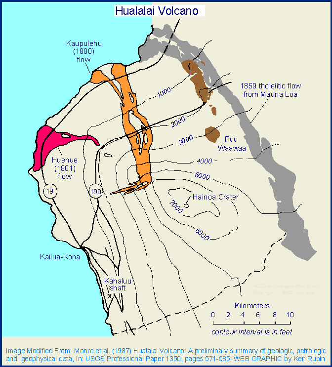
I always wondered why this apparently large and impactful eruption was given comparatively little attention when talking about the major eruptions of the 20th century. Novarupta and Pinatubo always had lots of attention but Santa Maria would be mentioned almost in passing.
Apparently I wasn’t quite as jaded as I thought because I did not expect the answer to be that accurate coverage was suppressed for (presumably) political games. Well, thanks for your small contribution towards righting that century-old wrong.
Albert, thank you.
It’s both amazing and appalling that the cover-up occurred. I do wonder, had it not, whether some of the many (perhaps thousands) who died in the 1929 lava dome collapse there might not have been in the danger zone.
CJ
Oops, I see I left out Carl in my thanks. And while I’m at it, a but Thank You to all the fine article writers on this site, including Albert, Carl, Hector, Jesper, Tallis, Geolurking, and I’m sure I’m leaving quite a few out (Sorry, no slight intended, it’s just my bad memory).
These analyses of the major historical explosive eruptions are definitely my favorite articles on the site (followed closely by the paleotectonic / paleoclimate stuff like White Christmas or Ice Age). I have such an immense fascination with large scale explosive volcanism, I’ve spent an uncomfortable number of hours trying to visualize the phases of different eruptions. And I definitely knew the least about the Santa Maria eruption out of all the recent VEI 6 events, so when I first saw this published I beamed a huge smile.
Thank you Albert and Carl.
1030 hrs Grindavik time, I’m counting 15 flashing-lighted vehicles (not necessarily emergency vehicles) in the East portion of Grindavik (East of Grindavikurvegur Vikurbraut street — hwy 43, or the main N/S street). 7 clustered near the marina (or port). Obviously this could be unrelated to any EQ and volcanic situation. Could even be a drill for all I know. Just mentioning it because that number of flashing lights, if nothing else, broke my boredom.
1115 hrs Grindavik time, whatever it was seems to have passed. They’re doing a good amount of work along the length of that crack. Occurs to me that if they’re repairing hot water and other piping, the activity I saw matches pressure tests and the like.
An excellent read as usual! Thanks Albert and Carl!
Was talking to a civil engineer buddy (not in Iceland) and asked him what happens if they put parts of the wall in the wrong place. He said that just having the wall generally in the right area, say within 2 km, makes moving it much faster and easier than starting from scratch. He said with a couple of cats supporting a scraper circuit (6 or so constantly working scrapers) you could move a lot of wall very quickly. The material is stockpiled in the wall itself as effectively as anywhere else. This all sounds reasonable. They’re supposed to be finished with the present wall(s) by this coming weekend.
Not to be that person but the dike a month ago formed in a few hours, and if it erupted would have probably reached the surface even sooner given it only needs to go up a few km not laterally almost 10 both ways. Bulldozers arent moving the wall 2 km in an hour.
Also the idea that the sill is going to just erupt through its middle doesnt really have any good basis, it just seems like something that gets thrown around because at a glance it sounds like it makes sense if you dont think about it. The weak points above an inflating sill are the edges, not the middle, its the same mechanism as a ring faulted resurgent caldera and in fact those systems are usually shaped as sills, makes one consider which came first. We also literally saw this a month ago when the dike broke out exactly in this location, and had it ruptured on the other side it would go to Eldvorp and Illahraun, though it appears the older ground at Sundhnjukur was easier to crack. There isnt any young vents at the location of the center of inflation, only Thorbjorn and its line of hills. Those are subglacial, maybe being uncharacteristically prominent hills makes magma collect in sills underneath and those routinely rupture on either side but not along the axis.
Its also looking like round 2 might be imminent. This time there isnt likely to be enough space underground left in the rift to keep it all there. No more quiet tiny spatter cones, this thing is going to look like the opening of Holuhraun, if not stronger.
I can still see the barriers Iceland built a few years back on Google maps. The ones they didn’t start until well after the eruption began. But I’m a very weak novice with regards to both volcanoes and dirtwork, so I’ll defer on both subjects to people who know more — you on volcanoes and my old friend Andy (presently in Germany) on how long it takes to move dirt.
Santa Maria is one of those volcanoes that usually do gentle dome growth, but in some moments can do very different giant eruptions. The last GVP report about Santa Maria (Santiaguito):
“Extrusion at the El Caliente dome continued […] Weak to moderate degassing was observed daily; gas-and-steam plumes rose to 300 m above the lava dome and drifted SW and W. Daily explosions produced gas-and-ash plumes to 3.2-3.5 km a.s.l. (700-1,000 m above the dome complex) that drifted S, SW, and NW; sometimes areas around the volcano appeared hazy due to ashfall. Ashfall was reported in Loma Linda (6 km WSW), San Marcos (8 km SW), and nearby farms on 30 November and 4 December. Block avalanches descended the SE, S, and SW flanks, and some were accompanied by pyroclastic flows (PDCs). On 30 November and 5 December PDCs nearly reached the base of the edifice. Incandescence from the lava dome and flow was observed in the crater and along the flanks during most nights and early mornings.”
So partially effusive Dome growth and occasionally explosive interruptions. It is still the volcano that was dormant for 25,000 years and continues its active period since 1902. It a break 1913-1922, but has been steadily active afterwards. The eruption 1902 reminds to Plinian eruptions of Vesuvius 79 or St. Helens 1980 after a long time of “doing nothing”, and after the Plinian eruptions the volcanoes move towards more moderate longterm activity. F.e. St. Helens 1980-1988 did Dome growth most of the time. The famous eruptions 1980 only were the “bottle opener” for the main eruption style.
Pinatubo 1992 was different to St. Helens, Vesuvius and Santa Maria. Pinatubo made its climactic eruption 1992, but quickly returned to dormancy. It was not a bottle opening eruption, but was the one and only eruption.
There is a difference. St Helens did a flank eruption but afterwards activity was again at the summit. Santa Maria’s summit has been utterly silent. The post 1902-activity was all out on the flank and recently has been solely focussed on the 1902 eruption site. GVP implies that Santa Maria and Santiaguito are the same, but nowadays they are separate cones
The Santiaguito domes and Santa Maria look like parts of a whole complex volcano. Is this a reason why this volcano behaves different to “simple” volcanoes?
I imagined it as the old cone of Santa Maria was a stratovolcano that probably behaved very like Fuego or Pacaya, and the post-1902 activity is from the same system but it has created a different central vent that could have been anywhere in the general area and just happened to be close to the original cone. There is a caldera east of Santa Maria that erupted in the early 19th century and I wonder if maybe the two are connected as one. Which, would also be a worrying sign as it is probably big enough to be a VEI 8 progenitor but it iswhat it is. The two volcanoes are probably separate anyway just close.
What is the history of the obvious slope collapse scar behind Santiaguito complex? Did that pre-date1902, or is it a consequence? I cannot find any discussion about it in my searches.
I always assumed it was the 1902 crater but never looked into it earlier. Even if it was there though it might be hard to see in old pictures unless up close, it doesnt really greatly alter the mountain sillouette.
Probably best to ask Albert or Carl.
There a large ancient caldera behind Cerro Quemado and that might be what you are referring to. There are a number of old calderas in the region behind Santa Maria.
The Fagradalsfjall webcam has just done a detailed zoom around the area and spent a long time following a crack in the ridge of rock immediately in front of the camera. There seems to have been a recent rockfall, right in line of sight of the camera. I can’t remember see this rockfall before, but that might just be me. It’s the orange area immediately behind the second ‘panel’ from the left.
https://www.livefromiceland.is/webcams/fagradalsfjall
That’s been there for a few weeks now. I think the recent stronger seismic activity shook it loose. There’s quite a lot of recent rockfalls along that ridge, and that suggests to me the old intrusion is rather brittle.
i can recall that crack from right after the big swarm in Grindavik
https://twitter.com/VTLAB_Joel/status/1731746205556756556
Some close ups. 🙂
https://twitter.com/VTLAB_Joel/status/1732105692331315510
Some rock fall in the area.
Thank you! 😊
Some shallow quakes above the sill itself. Could it breach there? Would be good for Grindavik, less so for the power plant unless the berm holds.
If magma finds a weak spot, it could erupt there. If it’s anything like Fagradalsfjall, the weaker spots will be on or near the older edifices.
Tremor is increasing at GRV and MEH today. This might be something to watch.
GRV’s tremor has increased more than MEH’s, to a higher level than it’s been for quite a while, accompanied by a M2.5 earthquake that doesn’t appear prominently enough on the tremor chart. This is something to check out in the morning.
Also a 2.8 quake this morning. It looks as if there is more action right now, which is interesting since the amount of uplift near Svartsengi is approaching the same levels as on Nov. 10th.
Be interesting to see if the same fault system gives or another one does.
its getting very windy there, that could have an effect on the seismometers :
https://umferdin.is/en/weather-station/1119
Wednesday through to Saturday will be very stormy in the Grindavik area. Si it is definitely going to affect a lot of the instuments in that area. Plus visibility is likely to be very poor on the cams at times.
On the Fagradalsfjall cam, I’m presently watching the dreary cold mist drift over Grindavik from the sea. Lot of busy vehicles moving about like they’re trying to finish errands while visibility extends past a few meters.
Well, it looks like a false alarm, GRV’s tremor is heading back down.
I understand a lot of the noise on the GRV drumplot is work on the berm. The copycat seismic signals look like a regular process taking place – maybe dumping soils or something.
Albert and Carl.
Thank you for this in depth article about Santa Maria and Santiaguito. My wife and I were on a “chicken bus” along the Pan-American Highway when we first saw a small eruption from Santiaguito. Folks on the bus said these small eruptions happen like clockwork these days. It was amazing how passe they were, while for me, it was my first view of an active eruption.
I appreciate the deep dive and am not surprised by the apparent information blackout by the government of Guatemala. It seems like a complete case of “nothing to see here, business as usual” instead of today’s world of international assistance with a mere phone call. This is an article my intro to physical geography and intro to geology courses will be reading for the coming semesters. We will analyze the governmental reaction as well.
Questions about the dates of eruptions: the major eruption was the 24-26 of October, but later it is stated that, “In the UK, the first report of Santa Maria erupting came on 19 October, sourced from a journalist in Guatemala City who stated that the town and villages in the region had been abandoned.” Is that report supposed be 29 October instead of the 19th? Thanks.
Great work. Thanks.
Brian DiBartolo
Thank you for your kind words. The question about the dates sent me back to the sources. It is mentioned by Berry et al. 2021 (see references) and indeed, was 29 Oct rather than 19. It has been fixed now.
Possibly the people should take a bit more care about Santiaguito. Carl mentioned that if you stand upwind on the crater rim of Santa Maria as Santiaguito goes off, it is a quite impressive and noisy explosion. He also said that (quote) I do not trust this volcano as far as I can throw a pebble, over time those blasts have become ever more powerful, and in the end I suspect we might get something large again (end quote).
In Ernest Zebrowski Jr.’s ‘The Last Days of St. Pierre’, the politics of the moment are not lost with respect to how Governor Mouttet the principal official, managed the evolving emergency.
Albert:
A question about the use of SO2 monitoring for helping to predict volcano eruption times. Please see https://www.geo.mtu.edu/volcanoes/06upgrade/Volcanic%20Emissions.htm and a picture of a DOAS instrument is looking at the Santiaguito Volcano emissions.
What is your take on this? Are such instruments able to give a heads’ up on the nearness to an eruption? I think of Mt Baker in the USA, it had an episode of gas emission, but then things quieted down.
– Randall
volcanic SO2 came from shallow degassing. It tends to show where an eruption is occuring, since open lava is best for this. Fumaroles can also bring it up but they tend not to be indicators of impending eruptions. There may be a sweet spot where SO2 comes out just ahead of an eruption. HVO measures it regularly but I don’t recall an increase before an eruption.
You don’t focus on just one parameter, or even just one gas. For instance, CO2 generally comes out of solution and degasses at a significantly deeper depth than SO2 – so gas *ratios* and changes in them over time are more illuminating than simple gas *flux*.
https://www.lpi.usra.edu/publications/slidesets/hawaiivolcanoes/images/tifs/hawaii08.tif
Repost with better inputs, yes Venus does have scary huge volcanoes as it release internal heat in a diffrent way with a stagnat litosphere mod. Hawaii is almost certainly way way more productive over short timescales compared to pretty much all these volcanoes, Sapas Mons is far older and larger. Still Sapas Mons coud dwarf Hawaii when it erupts next time, as typicaly venusian eruptions do, Venus hotspot volcanism is diffrent scale under a stagnant lid situation. Hawaiian magma source coud even be far more powerful than Sapas Mons as its more materials over long timescales but not in terms of eruptions. Radial fissure eruptions here can produce lava flows almost as long as CRFB flows. Venusian Shields range from from a few times wider than the Big Island to much much bigger than Olympus Mons in terms of diameter. Hawaii is still an absolute monster
Then there is the insanity that is Ozza Mons thats almost as large as large parts of Scandinavia itself and is the most Impressive shield volcanoes among the terestrial ones. Theia Mons is even larger than Ozza Mons and Olympus Mons in scale. Theia Mons dwarfs anything on Earth and most other venusian shields with radial flows flowing over a thousand km, the magma source there so powerful it ruptured the litosphere forming a kind of plate boundary. Perhaps Ontong Java plateau coud be souch a volcano, but its more like a flood basalt and yes not a shield, but If it had a caldera and central system as active it coud be one. Tamu Massif looks also rather venusian but way much smaller than example Theia Mons. The lava flows can be mindboggling from the eruption centers some Aa sheets are as large as Finland and raises many questions on how they where erupted fissure wise and pre – stoored
The biggest of all mega volcanoes are of course the rifts and coronae on Venus with flows flowing many thousands of kilometers in some chases, baltis vallis poses many questions how souch huge huge ammounts of lava is even stoored. The largest volcano of all on Venus is defentivly Artemis Corona magma complex and its sill and cone sheet and radial intrusions systems that strectch an area the size of pacific almost, its the largest magmatic – tectonic system on the solar system really and probaly feeds the gigantic canals eruption flood basalts that can litteraly flow all around the planet. Volcanism is sluggish not very active on human timescales in most of these areas, but when eruptions do happen they maybe un – imaginabely huge with basalt flows the size of entire countries. The collapsed lava channels and lakes are just as Impressive some are litteral Grand canyons craved by lava. Earth avoids souch monsterious volcanism by having tectonics that vent heat constantly. They are probaly the most Impressive magma supply in the solar system at least in active episodes.
This is problem a silly question, but on Venus is lava slow to cool / harden due to the surface temperature? Looks like the surface temp is similar to cool rhyolite?
Err, probably not problem.
Thanks Jesper.
Venusian crust seems on large scales being more flexible and mushy than Earths crust at least in some areas. The hot atmosphere probaly increase the plasistic deformation nature of the crust so its not as brittle in the outer parts, still too thick and dry for tectonics, but beacuse of the 500 c atmosphere and combined with much higher internal heating than say Mars, Venus have a soft like nature of its crust, clearly seen in global maps of cornoa deformation, smaller Mars thats much colder as an interior does not have like this. The hotter the planets gets the more deformable the crust will become too when more co2 accumulates due to the broken sillicate carbon weathering cycle.
Its a few 100 s of degrees below a cool ryolite eruption temperatures. Yes its true that this hot dense atmosphere woud help lava flows flow further and lower the viscosity of a surface crust. Venus is so very hot that on the nightside it may glow an ever feeble dark red – brown. The dense atmosphere both robs heat and adds heat by its high temperatures to a cooling lava flow
Mindblowing volcanoes, but most of them, If not all are not anywhere close to Etna and Kilauea in eruption frequency today. But they are very likley active and some of the rifts are still active as seen with the eruption near Maat Mons. But when eruptions do happen from these large central volcanoes, it will be on an unimaginable scale, the avarge radial intrusion eruption from Theia and Ozza Mons are bigger than Laki sized and flows over 100 kilometers, some flows 100 s of kilometers. And the big rift coronas makes country region sized flows.
And Sapas mons have strange summit calderas that does not look like calderas at all really, other ”smaller” venusian shields have true drain collapse calderas of terestrial shield kind. But Sapas Mons looks like wast pits that magma have flowed into and drained into. Well its probaly the result of erosion, venusian air is so very dense it erodes more like a fluid, and that suggest the calderas are very old If this is aoliean erosion of a caldera feature. There is collapse pits too that line up with ring fractures that goes like rings in the edifice, cone sheets and radial intrusions seems to to be the norm of venusian volcanism, all venusian shields have more or less the same shape, suggesting same magmatic processes involving circular sheets that builds large flat round volcanoes. The volcanoes Maat Mons, Idunn Mons and Sif Mons are more terestrial in edifice structure archictecture compared to Sapas and Ozza Mons, but even they are huge compared to any earthly shield and are more Marsian in nature in size. Galapagos shields woud be most analougus for the smaller venusian major shields in shape. The larger venusian volcanoes gets so powerful they gets an unique archictecture
Sapas summit centers look more like flat-topped promontories. If you look closely there are dark landslides that extend away from a series of ravine-like landslide scarps on the sides of the two features. Venusian landslides are dark because the dust settles last in the dense atmosphere so you get a smooth surface which is black on the radar. So the summits of Sapas are probably two steep truncated cones with the sides gouged out by landslides, maybe some exotic form of perched lava lake. The southern summit does have a caldera in its northern side though.
Another interesting thing from the image is a group of numerous lava shields visible in the lower-left corner of the image. They have summit pits and radial dikes from Sapas cut the ground in between them. Probably the dikes feed the flank shield eruptions.
Yes landslides and erosion tought it was that its a combination of erosion and volcanic processes
I think Maat Mons had 300,000 km3. Ozza is probably even bigger, but also somewhat older. Both look very young and particularly Maat. All of Maat’s flows are among the freshest-looking in Venus, very bright to the radar and without large patches of dust. The reason why it’s the tallest Venusian volcano is probably that it hasn’t yet sunk into the planet like the older volcanoes of Venus seem to have done.
Ozza’s Ningyo Fluctus is impressive. A Martian style lava flood with substantial ground erosion in places near the fissure. It came from a radial dike of Ozza Mons, and it is maybe the youngest eruption of its kind in Venus.
With souch a very dense atmosphere most meteors burns up and never leaves craters. And the winds near the surface are very sluggish, so despite the great air density, erosion on Venus will be very slow without precipitation and fast winds and water. These volcanoes are probaly much much older than south Hawaii Islands, but still be geologicaly young for an object thats almost 5 billion years old. At 300 000 km3 its about 3 times bigger than the avarge very large Hawaii shield. Sapas Mons are less productive on short timescales but does huge eruptions on longer timescales.
A magma source like Hawaii woud form an absolute monster on Venus when all magmas accumulate on the same place for long timespanns, but the venusian litosphere is thicker as its not subducted so may result in a similar result as venusian shields
I doubt they are less productive though. These volcanoes have a scale of volcanism that is akin to flood basalts. Dikes and lava flows are often hundreds of kilometers long. Ningyo Fluctus erosive lava channel is over 20 km wide near the feeder fissure. And the main form of volcanism is sustained effusion. Features of the main shield volcanoes suggest continuous effusion as the main form of volcanism in Venus, like Mars, to a lesser extent, where lava flow features in most cases indicate unbelievably long-lived effusions. For example, Maat Mons is made of rootless shields structures that build up the bulk of the cone, with a less important thin distal apron of giant flood lavas. I personally expect the, probably few, active volcanoes of Venus to be more individually productive than any terrestrial volcano, and I think that is why you get these oversized intrusive and eruptive structures.
The air is so very thick that visibility in the lower atmosphere thats clear and transparent is only 3 kilometers or so. Even without the clouds and acid droplets you woud not be able to see Venus surface from orbit. Clear co2 woud scatter blue sunlight from orbit, Venus woud appear like a blue ball a little like Neptune, perhaps less deeper blue, but you woud not be able to photograph the surface even without the sulfur acid clouds, reyleigh scattering is strong. Even without the clouds at 100 bars the skies woud probaly be yellow or white seen from the surface, and the sun woud be strongly orange, beacuse reyleigh scattering is so strong.
So high resolution radar will always be the best way to monitor venusian volcanoes for surface changes like these https://astronomynow.com/2023/03/21/analysis-of-magellan-data-shows-apparent-volcanic-activity-on-venus/?fbclid=IwAR06bNGf2oB5rQx3WzqQyWwXpInALYW8mnFDB_tQERlOz0-MoIBrLTf4y5Q_aem_AbbWFXONU7HuYXS-kMdnTZ63eIniAiHgKApJX6P6A1tYD_nCPjG7R8is8gdGhahx1bA
The atmosphere is simply too thick for visible light photography, even without the clouds it woud be difficult with that. So radar is best. The atmosphere is so very thick ( dense ) that seismic waves and sounds from volcanic eruptions boounce around in the atmosphere, that woud be detectable by balloon probes floating at the 1 bar level using instruments, similar to the ones that are used for similar deep sea investigations
Are there any pahoehoe features, there are lava shields, but I mostly see massive radial Aa flows kind of like Fernandina on steroids at least for these two but resolution is poor. Well the dark intricate non lobate flow areas on Venus woud be pahoehoe flows as they are more fractal and haves a smooth surface and they are unreflective compared to the bright Aa flows. Yes Sif and Gula mons have plenty of dark pahoehoe, a clear sign of long lived volcanism that you say. Good resolution at Gula Mons flows showing smaller scale lava flows of both Aa lava and pahoehoe. The venusian pahoehoe fields must have been through 1000 s of years long eruptions some of the plains examples
Also link the Magellan overlay on Google Earth her as link as its pretty awsome 🙂
Yes they are more powerful than Hawaii in terms of magma stoorage and eruption size absoultely. But its difficult to know how often they erupts and how old they are as erosion on Venus does not work like it does on Earth. But they looks alot alot more active than Olympus Mons with sharper features that looks much younger too. But If Venus had same thin atmosphere it maybe just as meteor cratered. But Venus haves much much more internal heat than Mars do beacuse its bigger.. so volcanism should be more frequent too as proven with the 1990 s eruption
Sustained effusion at high rates makes aa lava, and that is probably the dominant type of lava in Venus. Maat Mons has terraces and rootless shields, features that are reminiscent of Earth’s long lived eruptions. It’s the same as Olympus Mons. Olympus Mons in Mars is made of aa lava but which forms gigantic rootless shields and terraces. It’s the same flow structure that you see in Pu’u’o’o’ or Etna pahoehoe but with aa and on a much larger scale:
http://jmars.mars.asu.edu/maps/
Seems pretty conclusive that really enormous volcanoes require planets without plate tectonics. Venus is no larger than Earth and Mars is a lot smaller yet both have volcanoes that make even extrene flood basalts on Earth appear fairly standard. Its probably a combination of stable location allowing a plume to do a lot more, instead of being interrupted and restarting. But also allowing for enormous magma storage potential.
Baltis Vallis 🙂 and unlike most of the marsian and lunar flood basalts, Venus being a large and probaly quite very active body it coud be a young feature at least in geology terms. But Mars Athabasca Valles lava flood is probaly very young too. Venus having more internal heat haves more absolut volcanic potential than Mars but all of these there are geologicaly active in diffirent time – spanns
Still Hawaii is INSANE for being any earthly volcano and is the cause of my fascination of Hawaii just like you and Hector. Some of the largest hawaiian shields are about as large as the entire Columbia river flood basalt sequence in volume! so 140 000 km3 and most other small land volcanoes absoutley struggle to get even to Etnas size. Its very Impressive also how fast these Hawaiian shields grow that big in geological terms. had seafloor movement been twice as slow, the shields woud twice as large. Plate tectonics prevents Hawaii to grow into an Venusian monster, still remains the most monsterious volcanic edifices that exist on Earth today. The size and output is fascinating and that fluid shiney lava and lead to many Hawaii visits for me.
I have hiked Mauna Ulu numerous times with female partner and toured most of the HVNP features and hiked active lava flows with her. Even with no lava seeing Mauna Loas enormous shape is one of the most awe inspiring things that exists on Earth. Im happy you too got to see the Halema’uma’u activity. Im a bit older than you, so have gotten to see alot of the Puu Oo activity too in person
Woud be great to get her intrested too in writing an article.. my GF likes mid ocean ridges and spreading tectonics, but perhaps like you, she woud be an infrequent article poster. But your comments are fabulous Chad 🙂 Im looking forward to your New Zealand article.
And as told before Venus really vent beyond all repair with the geological sillicate – co2 weathering cycle being shut down. Long ago the planets oceans evaporated as the sun got brigther and the weathering shut down, the scrubbers of volcanic co2 shut down, If it had tectonics thats crucial for recycle volcanic co2 it may have shut down too due to lack of water lubricantion. Unable to remove and cycle in and out volcanic co2 the volcanoes coud pump the entire planets carbon stoores in the atmosphere as its still doing today. If all of Venus atmosphere was turned into co2 Ice it woud be a layer a kilometer thick covering the whole planet, Earths atmosphere woud only be an Ice layer a few meters thick.
That means in the future, its only going to get worse for Venus because the silicate – weathering co2 cycle have been broken down and cannot work again as Venus is too hot now for a water cycle, and too dry for tectonics. It cannot No longer cycle in and out volcanic co2, only put out more of this gas. Venus remains volcanicaly active and in the future co2 will only keep accumulating in its atmosphere leading the more pressure and heating. Infact it coud get so bad that the entire surface of Venus is going to melt in the comming 100 s of millions of years, due to accumulating of mantle co2 in the atmosphere and an ever brigther sun. The hell planet is not complete yet as the conditions are set up to become far worse than they already is, assuming it does not loose its atmosphere due to lack of magnetosphere but that does not seem to be the case. There is probaly plenty of mantle carbon left that can be degassed through volcanoes .. and added to the already disasterous atmosphere state.
The future Venus surface will almost certainly melt competely as surface temperatures and volcanic co2 pressures keeps going up togther with the solar input.
I recommend to keep the length of the comments and number of images down a bit.
“CRFB” = Columbia River Flood Basalt?
It fits that magmatism on that scale on Earth occurs mostly in the places where Earth locally approximates stagnant lid conditions: under large continents (e.g. North America, Eurasia, Africa) and in midplate locations (Hawaii, OJP). In oceanic midplate locations it produces steady long term effusion like Hawaii if the plate motion and water erosion suffice to carry lavas away from the site. In continents or if too much material builds up over the deep source the activity becomes episodic and the episodes massive in scale.
The odd one out in all this is Iceland, which is producing a Hawaii-scale mass of lava on a plate boundary instead of in a midplate setting. It may be because the MAR is fairly slow by divergent plate boundary standards and gets slower the farther north, letting Iceland become a kind of hybrid between a rift and a midplate hotspot. The rifting is just enough to prevent Iceland from piling up so much that it goes full-on episodic LIP, with ten thousand year dormancies and then 1000 cubic km flows, but not to prevent it from having some smaller-scale episodic phenomena, like the large dead zone eruptions and the millennial Reyjanes fires cycle. Perhaps the OJP formed under similar circumstances, with local plate motion above its hotspot being much slower than at Hawaii letting more material build up in one place.
Earth have plate tectonics so vents it heat in smaller and more gentle eruptions than Venus do. But Venus did small scale eruptions in 1990 s in its own rifts, Infact it probaly haves tectonics too, just without subduction and spreading oceanic ridges. Venusian crust is not stable and seems hot and flexible in many places. I guess the high surface temperatures are a part of it kind of it infuenses the strenght and mechanics of crust rocks that kind of get soft. It woud still be death hard physicaly a 500 c basalt piece, but not as physicaly hard as one in room temperatures or below freezing.
( If it pops up ) High resolution Venera photo of the venusian surface showing aoliean eroded basalt lava blocks, clearly very diffirent from Mars in look. In technical terms it was a feat and very Impressive for my biological homecountry in the 1970 s and 1980 s the venera program when spaceprobe landers where rather primitive.
On Venus the air is like a furnace and the atmosphere is corrosive eating and roasting away any man made stuff. It looks like a diseased and sick world which is kind of true as the carbon – sillicate have broken down long ago on Venus
Actually the surface atmosphere is not corrosive. The problems with the landers were caused by the heat and the pressure, which killed the electronics when the air got into the landers. That took a few hours
How long woud it take with 1 bars of 470 c co2? instead of 100 bars
The more air pressure the faster the probes die, more hot molecules that toutch the lander, and if density is low enough, you can be outside in spacesuit in 5 million degrees gas enviroment and the thermometer still reads – 270 c because of low density
Why is it pitch dark at Grindavik at nearly 9 o’clock in the morning there?
High latitude. Grindavik is at 63.8434° N. On the Northpole it is dark 24/7 in this time of year.
Bad weather?
Sunrise is at 11:09 there today.
It’s light there now, at nearly 5 pm local time. So it should have been comparably light at 7 am as well, surely, and lighter still at nine?
Iceland uses the same time zone as western Europe although it is further west, so it is lighter in the evening. I’m in the Highlands and Islands and we only get 6 hours of daylight at this time of year and Iceland is further north so it gets even less. In summer we get 18 or 19 hours of light and I guess Iceland will get nearly 24 hours of light in June.
This website is useful for looking up sunrise-type information. It shows not only night and daylight but also civil twilight, nautical twilight, astronomical twilight, plus lots of other fun stuff.
I have sent a link for Reykjavik but you can also just enter http://www.timeanddate.com/sun to get a prompt which allows you to enter the city of your choice.
https://www.timeanddate.com/sun/iceland/reykjavik
Unlike Svartsengi the 1970s Krafla Fires did no failed intrusions before the first eruption in December 1975
“The Krafla Fires 1975-1984 CE were preceded by increased seismicity, detected on instruments in 1974 with increasing intensity; 10-15 instrumentally detected earthquakes per day in the summer of 1975 CE. Earthquakes up to M4 were felt in the area in the autumn.”
The first intrusion was successfull and did a tiny, but real eruption. That’s unlike the intrusions around Thorbjørn. Is this difference caused by the shorter distance of Krafla to Vatnajøkull (compared with Reykjanes)? If we look at the
volcanoes on and around Vatnajökull, are intrusions there more likely to erupt than on Reykjanes’ volcanic systems?
Not sure it is completely comparable. Krafla has a magma chamber, which is not really a thing present anywhere on Reykjanes. The sills are not equivalent to the first dike of the Krafla Fires, the intrusion a month ago would be that. It didnt erupt but that is not atypical, the 1975 Krafla eruption was very tiny and volumetrically insignificant, and a proper large eruption where most of the magma went up instead of sideways didnt occur until 1980. Had the intrusion on the 10th last month happened a week later maybe there would have been just enough magma that a bit could have surfaced. Rifts need to fill, its the later stages of a rifting event that put a lot of lava out.
The same thing happens at Kilauea. 1961-1969 was a sequence of intense rifting that saw initially extensive intrusive activity with little lava surfacing. Over time intrusions got less extensive and eruptions got larger and more powerful, until Mauna Ulu grew. And Pu’u O’o also formed along the same line later on.
The question now regarding the activity at Svartsengi is will the sill rupture again in the same place as last time. If it does then will it all be contained or will it all go right up and be gushing out of the ground an hour later.
One different characteristic between Krafla and Reykjanes is that Krafla has a central volcano that has a high altitude from which intrusions can move relatively easily horizontal towards the fissure systems. Reykjanes doesn’t have a high central volcano like this. Intrusions have to move a lot upwards to make an eruption. On Krafla (or Bardarbunga) the origin of intrusion is so high, that they don’t have to climb much to make an eruption.
The biggest eruptions of Krafla in the Holocene were south of the caldera though, at Heidarspodar. For some reason this area is considered a separate central volcano because it has some silicics but it seems a big stretch. 2500 years ago it did an intense fissure eruption that erupted 2-3 km3 of lava fast enough that it didnt channelize and flooded over old Myvatn, resulting in all the pseudocraters there now. The lava then gushed down a canyon almost to the north coast. Closer to Laki than Holuhraun despite the volume.
What might be the fastest flowing lava ever recorded on video. Kilauea right on day 1 of refilling Halemaumau.
https://youtube.com/shorts/5nqJkpgpfIM?si=imTtMA1Qeyjoggtj
Seems to be the original footage taken that USGS stabilized to put on their catalogue.
It reminds me of the videos showing lava cascading down the hills around Fagradalsfjall in 2021, seeing it so turbulent and fast moving. Only the eruption in the video above is probably about 10x the effusion rate… 🙂
Crystal free and at 1200 c it may be the most fluid of any sillicate magma, yes that lava fall was amazing in 2020. Giant steam pheratomagmatic explosion when it hit the lake that was gone in just a few minutes 🙂
The water lake was so small 2020 that it likely only did a white steam plume. During night no one could see the plume, but I’d expect that it would have been very white in sunlight. Only very small amounts of tephra were found afterwards.
It’s uknown whether there really happened many phreatomagmatic explosions. 1790, 1924 and 2018 were (sub-)plinian collapse eruptions. After the collapse sooner or later gradual lava filling happened. 2020 and after 1924 this happened effusively. No phreatomagmatic explosion.
As Hector explained us, there is a risk for explosions of gasrich magma, if it rises fast on the summit area. Those explosions are neither causes by phreatomagmatic nor by visous magma, but by fast rising gasrich magma that makes sudden explosion if the pressure inside the magma falls below a certain degree.
The floating island coud have been materials resulting from that, or coud be from earlier gas rich lava fountain tephra materials from pre 1800 s, halemaumau thats usualy tought as a gentle lava lake vent, is capable of apocalytic basaltic fountaning
It is difficult to examine how this block was created. Likely it already was there after the collapse 2018, but remained unnoticed. Maybe it was a mixture between old, aged lava and tephra.
The floating on fluid lava of the island shows that the material had lower density than liquid lava and than young basalt. Has oxidated basalt lower density than young basalt?
I think the tephra island was basically a pseudocrater/littoral cone as the lava gushed into the lake. Its likely the lava flowed into the water lake so fast it basically displaced it and evaporated it from below but not without some violent interaction. The first video was after the water was gone but there was a lot of strong fountaining within the lake where no vents existed, presumably the last of the water in the wall rock escaping.
Its a shame this very early stage was not observed as the thermal cam was completely blinded until after this point.
Great question. I struggled to get the distance from the camera to the overflow on cone #4 (the last one) at Fragradjfall as the lava river was gushing along at a clip. I’d estimate at least 50 km/hr at least. There is a clip of Hawaiian lava gushing from fissure #8, in the recent 2018 eruption, and the local news said 45 mph or 72 km/hr which is really fast. See https://www.youtube.com/watch?v=a36BxWJKuDY If you watch the occasional spatter, it is clear that this flow is really moving fast.
The lava channel at fissure 8 flowed as fast as 11 m/s, or about 40 km/hr. This was on a pretty much flat slipe though, if fissure 8 was a couple hundred meters southeast and its lava channel went directly down the much steeper south flank then I think we would have got some truely absurd numbers. That being said, SWRZ eruptions of Mauna Loa tend to be exactly the situation that describes, to say nothing of the similarly powerful fissure eruptions on Hualalai which has slopes of over 30° 🙂
I guess its dependant on the viscisuty. Fissure 8 lava was about 1150 C at the high end, while the 2020 lava was hotter at 1165 C or more and probably had lower crystal content. It wouldnt surprise me if the majority of post 2020 lava is the same 1200+ C the old Halemaumau lava lake was, the stuff in September looked extraordinarily fluid even for Kilauea and the fountains looked like a spray of water rather than the dense orange that is expected.
Fagradalsfjall was also over 1200 C, so wouldnt surprise me if it is pushing records in the right situation too.
There was a 3.x quake at Hualalai the other day I saw. That volcano has a chance at waking up in the next century or so, yeah?
I remember you guys discussing it a while back and it was pretty fascinating.
Hualalai usually does a dormant break of 200-300 years. The last eruption was 1800-1801. The next eruption is possible this or next century. An eruption would happen without long signs before, magma would come fast vertically from basins in the deep crust. The style of eruptions would look like La Palma, Etna or small Vesuvius eruptions in part with fast lava flows and in part with explosive strombolian activity. In rare cases subplinian plumes are possible.
1930 there was an intrusion with many quakes.
Its hard to be sure but Hualalai seems to do episodic volcanism where multiple large eruptions occur within a couple hundred years and then the greater part of a millennium between these episodes. The most recent started in 1650 and is presumably ongoing as 1929 was not even a century ago.
The interesting thing is that most older visible eruptions on Hualalai are large cones and shields but the eruptions in the past few centuries have all been much nore intense. This brings up questions as it appears Mauna Loa has done something very similar in the same time, going from large volume long eruptions to less voluminous but extremely intense fissure eruptions. Together with Kilauea and what it has done in the past 500 years it seems like Hawaii has undergone some change in volcanism style.
1800-1801 Hualalai was a very dormant time of Mauna Loa. Did this happen more often?
Those speeds are only reached at the surface of the lava flow. Below the surface the speeds are much slower, as can be seen from the lava boats which moved much slower
The ground haves drag on the lava current, so thats why, still hawaiian lavas are so extremely fluid that lava can drain away and leave milimeters thick deposits, at least near the vent. I have with GF hiked many of Kilaueas features and near mauna ulu and halemaumau and the other vents there, you can see half a centimeters thick cowpie bombs and peles hairs, all proof of incredibely low viscosity, whole lava channels of mauna ulu drained out leaving milimeters thick tachylite deposits. Hawaiian lavas have very low viscosity, and allows turbulent flow as seen in this video with the lava pond and fall https://www.youtube.com/watch?v=fL8-GnHQnOA
Many hawaiian eruptions looks like liquid iron, if they are large and lava output fast, the larger the scale the lower the viscosity becomes in apparance, meaning for a virus a water droplet is probably as viscous as tar almost.
In the lava channel downstream yes but in the channel next to the vent it was turbulent and very fast at pretty much all depths. There are videos of the channel surging where it looks like Murchison Falls recreated in magma.
HVO has published a new map about recent unrest on Kilauea:
https://www.usgs.gov/observatories/hvo/news/new-map-continued-unrest-kilauea-volcano
They mention that this map “shows a new locus of seismicity in an area known as the East Rift connector.”
In the building and use of pressured vessels (boilers, gas separators, etc) we use two devices to assure safety. These are rupture discs and PSVs. A rupture disc is a plate of metal (usually a shallow dome) with a carefully controlled thickness and metallurgy such that it will reliably rupture at a pressure below that of the maximum allowable pressure of the vessel to which it is attached. Once a rupture disc goes, it must be replaced in order to continue pressured operation of the vessel. A PSV (pressure safety valve) contains a spring that holds a plug against a valve seat, chosen and adjusted such that it will open and vent the vessel contents before the vessel itself blows open. Unlike the rupture disc, however, once the pessure in the vessel returns to a safe level, the valve will re-seat and working pressure will continue to be maintained. On pressure cookers, the spring of the PSV is usually replaced by a simple weight atop a needle valve.
Okay, here’s what I’m wondering about. On the Svartsengi GNSS Time Series up and down chart, we see that the bulge in that area is approaching the point reached on November 10th when the underground pressure was vented to the East. A quick guess tells me this will occur a little more than a week from now, say in 7 to 12 days.
There’s obviously not a PSV kilometers underground that is allowing the area to re-inflate, but it must be closer to a PSV than a rupture disc or that re-inflation wouldn’t have occurred. What’s the mechanism?
Are the upper layers of rock on the East edge of the bulge acting similarly to the weight atop the relief valve on a pressure cooker? Or is there an equilibrium maintained between separate volumes of molten rock at depth in both areas?
I suspect I’ve greatly oversimplified everything involved and neither of these answers comes close to explaining why Svartsengi is being allowed to re-inflate. A quick look at the Svartsengi GNSS up/down plot shows the two periods of inflation are very nearly parallel, very nearly identical. As a fan of the various ways data can be represented visually, I find that plot, um… beautiful. I’ve seen similar watching the flow dynamics of a 3-phase pipeline over a series of hills and valleys, but again, that has to be an oversimplification.
Wait.
Analogy: I guess it could have blown a rupture disc that vented to another vessel — that vessels rupture disc might then vent to atmosphere. That requires no reset and will match the data better. Don’t have to reestablish a seal.
No. That would mean we’re presently “Awaiting The Rupture.” Anything but that.
Someone’s been to AGU!
“For nearly half a century, we have been unable to find a single crater on Io, the moon of Jupiter that constantly erupts lava.
That is, until now. A guy named Jesper from Sweden looked at old spacecraft images from the 1990s and noticed a crater that every scientist missed.”
Nicely done!
https://twitter.com/PeterBJames/status/1735125878391079152
Seconded.
Thirded! Very nice find. And Jesper is now a certified amateur astronomer! In a field where ‘amateur’ is a badge of honour.
https://twitter.com/PeterBJames/status/1735125878391079152
Yes Im in the news… : )
Congratulations
Do you get the crater named after you? 🙂
Nope .. No idea
There are rules about naming of craters on bodies other than Earth. Living people are excluded!
“No names having political, military or religious significance may be used, except for names of political figures prior to the 19th century.”
“Commemoration of persons on planetary bodies should not normally be a goal in itself, but may be employed in special circumstances and is reserved for persons of high and enduring international standing. Persons being so honored must have been deceased for at least three years, before a proposal may be submitted.”
(The authority for assigning names is assigned to the International Astronomical Union. A summary of their rules is on https://planetarynames.wr.usgs.gov/Page/Rules)
(Craters on Io are named after sun gods in various mythologies.)
Wow .. is it ? : )
Wow! Well-deserved congratulations to Jesper! This is epic.
Kilauea’s SWRZ inflation has recently become visible on the eastern GPS of Mauna Loa. F.e. this one:
It doesn’t show big change, but because it’s Kilauea’s influence, it’s a significant indicator for Kilauea’s SWRZ inflation.
Until October the station both went slowly east and north as recovery from the Mauna Loa eruption November-December 2022. Since October this trend has clearly stopped and the station has remained on its position.
At the same time the AHUP station has escalated its inflation (hyperinflation?):
Does this station show a development on Koa’e fault zone?
The SWRZ of Kilauea is lively today. Seismic stations show an average of nearly 1 earthquake per minute. The whole connector has lighted up from OUTL to Kulanaokuaiki Pali, and the SDH tiltmeter is accelerating upwards.
Its another pancake like – shaped magma load thats getting in right? infact looks like both ERZ and SWRZ are active magmaticaly now
Yes, comes in waves, some bigger some smaller.
Kulanaokuaiki Pali.
Sundhnjúksgígaröð.
Could the Earth’s next episode of volcanic unrest please happen somewhere with short, easy to pronounce place names? Three syllables at most? Thank you.
Bonus points if they aren’t full of diacritics that require advanced keyboard gymnastics to type.
Do you prefer the Ke‘āmuku Kīpukakulalio lava flow of Mauna Loa?
May I suggest the Boring Lava Fields as a suitable location? The Boring Eruption seems to satisfy the request
Looks like some quakes on Hengill?
Short / sweet: Bam. https://volcano.si.edu/volcano.cfm?vn=251010
Agreed on the names!
Currently, I can spell two volcanoes in Iceland, Katla and Hekla. As for the much more westerly Icelandic volcano we’ve been following during its 3 recent eruptions, I call it fagra-unspellable.
Taal may be a canditate for you with a SO2 emission about 11000 tons per day and a boiling crater lake.
Yes, Taal is one I’m able to spell, so that sounds good to me. 🙂
Currently, when I have to name something that’s a very long and jumbled name, I have to copy and past it in. My spelling is atrocious at the best of times (I’m literally dyslexic, which probably makes it even worse).
Curious seismic signal visible in Kilauea seismic stations. At 3:49 HST there is a tremor sequence lasting 15 minutes with some embedded long-period earthquakes. It seems coincident with the start of a deflation-inflation event. I have seen that in rare cases particularly impulsive deflation-inflation start with sequences of strong long-period earthquakes and tremor, presumably emanating from shallow depths under Halema’uma’u, which is the most common source of local LP earthquakes. In this case, there are few LP earthquakes and mostly continuous tremor. The SWRZ has calmed down with the DI event.
HVO mentions that the center of inflation is south to the Caldera now. This can mean that a summit eruption on the caldera rim is possible. F.e. like 9/1982 or like 7/1974 (Keneakoki Crater):
An eruption in this southern area of Kilauea can be e pretext to later SWRZ eruptions.
However, I’d exepct that the next eruption will surprise us somehow. There must be a reason why the eruption still hasn’t happened yet, although the intrusion/inflation is higher than prior all eruptions 2020-2023.
https://www.youtube.com/watch?v=1theatygctw
Whats lava on Io woud be like when it flows over sulfur Ice
Are we sure that the same reactions occur in an environment almost completely devoid of atmosphere and almost without any atmospheric pressure, exposed to the vacuum of deep space?
I ask this as a person ignorant of the phenomenon.
I also have another question.
The sulfur particles of Io’s volcanic plumes, interacting with solar particles, generate a sort of blue-turquoise aurora, because this phenomenon has not also been observed with other kinds of eruptive plumes with a different chemical composition such as those of Enceladus or Triton, the Neptune’s moon?
The latter does not have a significant atmosphere, although it has an extremely thin one similar to that of Io.
Would think if anything it makes the interaction even more violent. It wouldnt be surprising if the faster flows like those of Pillan Patera or similar have pseudocraters on their surface in places where the flow went over old terrain.
That being said pseudocraters and littoral cones seem to form specifically from interaction with liquid water on Earth, not direct ice interactions. And while sulfur does have a much lower boiling point than the temperature of lava it is still way higher than water as well as not having the heat capacity or expansion ratio, which are what makes steam explosions so immensely powerful. Turning anything into a gas rapidly will result in an explosion but water is particularly energetic for being a simple phase transition and not a chemical reaction.
I guess until we get some up close pictures though it will be hard to verify any of this. Hopefully the Juno team picks some good landmarks for the 1500 km pass 🙂
Probaly but without much clouds, the pheratomagmatic ( sulfuromagmatic ) blasts blasts will look like a rocket exhaust in space on Io with no condensation clouds or fluid dynamics
Largest solar flare of the current cycle so far at X 2.8
Maximum 14 Dec 2023 17:02:00 GMT X2.8 Integrated flux: 1.9e-1 J m-2
Space Weather Message Code: ALTTP4
Serial Number: 618
Issue Time: 2023 Dec 14 1726 UTC
ALERT: Type IV Radio Emission
Begin Time: 2023 Dec 14 1708 UTC
Description: Type IV emissions occur in association with major eruptions on the sun and are typically associated with strong coronal mass ejections and solar radiation storms.
——————————————————————————–
Space Weather Message Code: ALTTP2
Serial Number: 1258
Issue Time: 2023 Dec 14 1725 UTC
ALERT: Type II Radio Emission
Begin Time: 2023 Dec 14 1708 UTC
Estimated Velocity: 2118 km/s
Description: Type II emissions occur in association with eruptions on the sun and typically indicate a coronal mass ejection is associated with a flare event.
And updated “experimental” solar cycle forecast
More details at https://testbed.swpc.noaa.gov/products/solar-cycle-progression-updated-prediction-experimental
No Corona images from SOHO yet for the CME associated with the X2.8 but this image from Stereo-A via Solarham
Super impressive! Not going to see anything where I live though
Strange! The vafri.is earthquake map, https://vafri.is/quake/#close, shows/showed five M3.0 to M3.5 quakes near Reykjanes Ridge and Iceland from 18:49 to 21:14, Nov 14; but none of these show up in the IMO map, https://en.vedur.is/earthquakes-and-volcanism/earthquakes/reykjanesridge/. Is this something that happens regularly with the vafri map? I haven’t been using it very long.
According to the page author Hreinn Beck (as said on his Live from Iceland youtube channel) these quakes are coming from IMO. Normally they delete false quakes from the database (in which case they also disappear from his page) but for some reasons these ones remain. Beck added that as a matter of policy he doesn’t edit the IMO feed himself.
I notice they all appear to be at 5.2km almost as if that is some kind of marker.
Is anyone else disturbed by this video production as I am? The Utlimate Discovery pushes a video claiming “This Iceland 100ft Volcano Crack Is About To Cause The BIGGEST Eruption In Europe” See https://www.youtube.com/watch?v=B-RB1xIPz1E for this panic-inducing video. What bothers me the most is the video composition which shows that several people (and this takes $$$ to do) have collaborated on the video. Did someone order them to make this production? The video is definitely semi-professional in the presentation, particularly the music selections. Does someone want to keep the public fearful? I don’t find a single positive point about this video, but wondered who is stirring up uncertainty and fear?
I can’t see videos on this system, but in general, most such clickbait is done for $$. Same as with tabloids. Case in point; a UK tabloid was posting articles a couple of years ago about the imminent eruption of Mt. St. Hellens. To do so, they used edited interviews with a real vulcanologist (done by someone else) from 2006 (when there actually was some unrest) while claiming it was current. It’s pure sensationalism (Clickbait), so fraud done for $$, and they really don’t care whom they hurt.
Inducing fear and panic helps them, so they do it.
This sort of thing will become more common regarding volcanoes, in areas where the government withholds the actual data. That makes it so very easy for the scammers to claim to have said data, and “report” a falsified version of it to back their claims.
Personally, I’m betting that very soon we see volcanic/seismic scaremongering that uses the fact (with links to prove it) that the local government (as several in the world are) has begun hiding/withholding seismic data as “proof” of imminent massive eruptions soon to occur in one of those areas.
“Coverup EXPOSED! Leaked data from IGEPN says CCN is about to do a VEI8! Oh no, oh no, we’re all about to DIE!!!1!” screams the Daily Fail.
IGEPN immediately issues a blanket denial, which no-one believes since it’s been acting very secretive. Panic buying leads to the Great Toilet Paper Shortage of ’24. Stocks crash, states of emergency are declared over the economy, central banks futz with interest rates some more, and we enter a recession.
Three months pass. CCN has another episode of seismic unrest, and another, before finally farting out a low-end VEI4 after which it turns over and goes back to sleep.
But the damage has been done. The recession torpedoes Biden’s reelection chances and the US goes all jackboots-and-sieg-heils in 2025, resulting in World War III erupting in 2027. We do all die — that part was an accurate prophecy, of the self-fulfilling kind.
After which CCN erupts in peace, as a VEI-8
Speaking of volcanic cover-ups, my memory may be at fault, but didn’t something happen to the seismomiter at Fagra-unspellable, either in episode 2 or 3? I know the faf.gif bookmark I have no longer works, and I *think* I recall that instrument being taken out by lava?
If so, I think it’s highly suspicious that the volcano did that. A volcano taking out a seismomiter is very much akin to having a known thief in the area disabling security cameras… and we know that that volcano did indeed take out some of the cameras (That , I remember for sure).
CJ 🙂
I think it was moved before being buried but basically the same thing
Thanks Chad! I could only recall it being no more due to lava.
And, the lava took out a couple of webcams.
Very suspicious… I think that volcano was up to something. 🙂
Looks like some quakes on Hengill?
(admins- may have fat fingered this comment with an incorrect name/pass)
Nevermind, just duplicated it accidentally by replying to a comment up above. Apologies.
Nope never I go into space, never its a no no. Because I does not dare to do a reentry, reentry into the atmosphere is a frying pan, the plasma around the space capsule burns at over 6000 degrees c and the surface exterior heats up to 1600 c, hotter than typical basaltic lava. There been previous astronauts that burned up on way home like Columbia disaster.
The Galileo atmosphere probe also vent though this, but on Jupiter its way much worse because reentry speeds are much faster in Jupiters immense gravity. There the nose cone plasma woud have been like being inside a nuclear fireball and the surface exterior heats up to 16 000 c, the Jupiter atmospheric probes heat shield was made from carbon phenolic, that can widstand 3700 c and then it begins to vaporize, and thats what this heat shield did. The heat sheild at Galileo was about 80% vaporized after entry it was more than white hot. Im soure that the Jupiter plasma around the cone reached 100 000 c and prevented to toutch the heatshield through its shape, it woud be bright as the sun.
https://www.iflscience.com/incredible-pov-shows-orion-entering-earths-atmosphere-at-32-times-the-speed-of-sound-71967?fbclid=IwAR1f2quBudierwQVYtyBNywPqbw-gX-csxLI7QKbjNXZusuPW_TPtMwXtnw_aem_AU37SmF_Q0FdMvK_Pqa5C0OrJqMNqb-hhiQzHlOGjGZehnSywiVKPuPvyTvBS5PXoNs#lq5o5bmj74tsboq667q
https://m.youtube.com/watch?v=L58pWzCsR5I&pp=ygUNb3Jpb24gcmVlbnRyeQ%3D%3D&fbclid=IwAR1Emg-UndznbFydyCasJHNzu0EVqLTVz1z1xjyicQ5YtozwmshNT7OjRNg_aem_AZuJvTYj748-bB0AhGRkKFxuj9kaxCqIZkS32PsR1r3ni4XITg0mcKD6y0usq4RGXJA1bjtxDfgfTNW9L-Tvnczd
Thats why probing really massive objects like Galileo entry did, but with ”super jupiters” and cooler brown dwarfs, may not be possible at all if we colonize the stars, beacuse entry speeds will be super high in an even higher gravity enviroment. Jupiter is already a very high speed entry 60 km a second, but on more massive objects it woud be 100 s of km a second in some cases, making a heat shield pretty much Impossible to engineer in all senses. The entry heat will be too intense. Jupiter is whats barely possible today in terms of atmospheric probes
The sun is the worst entry in our solar system thats around 600 kilometers a second, an Impossible engineering challenge.
Anyway hopes for an Io probe soon
For such massive objects, it sounds like aerobraking is a non-starter (absent some sort of unobtanium shields) and you’d actually be better off lowering yourself in standing on your rockets, like is done for airless bodies like the Moon. That means budgeting a lot of delta-V just for the landing (if it can be called that) though. It also means getting slammed around by the weather during the descent, which might actually be more bumpy and turbulent as a result (and for a much longer time).
Could do the same idea as the re-entry burn that falcon 9 does, basically firing backwards in the direction of travel, both slowing down that way but also basically making a shield around the rocket using the exhaust. It wouldnt be enough to stop moving but maybe enough to make a concentional heat shield practical after.
This wouldnt be practical for a common use but for a one off landing it would be fine. If we are in a position to explore something with gravity that strong at the surface I doubt we would be having problems getting something to re-entry with fuel to spare either.
Maybe the hardest object to land on would be a supermassive terrestrial planet. The only way those could form would be within the hot zone of their star to avoid turning into a gas giant, so it is possible they have limited atmosphere. Combine that with the high gravity probably a lot higher than Jupiter at the surface, and sitting deep within the gravity well of their star, you would need nuclear rocket technology to even dare to land there. I imagine such planets have very flat topography possibly no more than a few km total elevation variation, compared to about 19 on Earth. They may also have very large impact basins as impacts there would be extremely powerful, although that makes a heavy assumption such worlds are not highly geologically active which seems unlikely with so much mass and gravity.
Not going to space? Then you should appreciate this YouTube video, Jesper! It is of the Artemis 1 re-entry to earth. Fascinating video. https://www.youtube.com/watch?v=U88DzZcsubs
Jupiter entry is insane enough and only possible along the equator where you can cancel out 12 km a second from the total entry speed, and thats what the little probe did. The entry conditions are extreme, and you haves to have a very shallow angle too, to prevent from burning up. Carbon phenolic for now is the only good materials that are possible as heat shields for jovian entry and its on the edge of whats barely possible.
One option for a Jupiter-entry type situation is to slow to low orbital velocity before entry. Low Jovian orbit has a velocity of around 30kps, about half of a direct entry. (I’m ignoring the radiation exposure here, just looking at the delta/v budget and entry speed).
So, how to get into a low Jovian orbit? Tot aerocapture (single-pass) but aerobraking.(many passes). Basically, enter a highly elliptical orbit (much like what Juno is in) that has a perijove low enough to just barely touch atmosphere, thus lowering apijove a small amount with each pass. Some of the Mars probes have done this at Mars to enter circular orbits, no heat shield needed.
Theoretically (I think) this approach should work with even larger grav wells, and help shed some of that delta/v, to keep the entry speed within the possible for engineering.
Jupiter is a nightmare anyway, a bottomless pit thats Impossible to escape from with current technology once you done the entry. There is No solid surface at all, blue skies over either a reflective cloudscape layer, or over a dark hazy bottomless plain If you enters a dry spot. Just a pit of ever increasing pressure and density
Jupiter plays with many of our inner phobias and fears, the whole planet is kind of a ball of both thalassophobia and extreme bathophobia. The Galileo atmospheric probe entered a dry spot without clouds, that woud be an unsettling sight. Gas Giants are not tourist destinations
I rather go in a radiation proof suit to Io that haves a solid surface and volcanoes to play with
Does anyone have a current link of an image of the current inflation rate at Svartsengi at all. Just wondering if it has finally stopped inflating or not. Sad for Grindavik with the earth movements in the town continuing.
It’s still inflating, albeit at a lower rate.

hmm, link doesn’t work. Try https://vafri.is/quake/ and select the Svartsengi station from the GPS station
Thanks very much for the info and the link Alberto. I hadn’t realised it had now got so close to the level when the dyke formed. So it will be interesting to see if it forms a run westwards this time. Hopefully so, that Grindavik may be spared further misfortune!
Last data is from the 13th and showed it actually gapped upwards and northwards by a bit since the previous reading. I don’t know how to post a link here that won’t get stripped, but I’m sure someone can.
Thanks for trying Jeffrey. It is appreciated.
Here’s the rapid GPS link for all the charts
https://strokkur.raunvis.hi.is/gps/8h.html
SENG
ELDC
IMO Latest
Many thanks Squonk for the info. A massive inflation in such a short period of time. I really hope it may find an easier outlet to the west this time to spare Grindavik! Those poor people have been through so much already. However eruptions rarely are so obliging as Fagradalsfjall was.
Im in the news! : )
https://eos.org/articles/amateur-astronomer-finds-a-possible-crater-on-io?fbclid=IwAR1KAJANbH7lNLZf7gWi2mf8yRSoUMyWrlBaJq-DQLRcUFbRtniixKdhb1M_aem_Aao8Dlg4CYkAdUTtGEEikOnwCfn_jenD4uL8VB3oqOEaYHpjJ1UDpzlovGiS5SFhBZ
nice 🙂
Sharp eyes! Congratulations Jesper.
In the first image of the article, is the crater the small dark spot at the top centre of the image, not the centre of the image as the description states?
Congratulations Jesper. Got to see your picture too 😉
My Youtube tab with the Thorbjorn feed crashed somehow and now I can’t seem to get it back. It incorrectly claims “this video is private”, despite the fact that a) it’s video from a news organization on a public-video site and b) I was watching it literally an hour or so ago.
How do I fix this? Reloading or closing and reopening the browser tab hasn’t worked.
I had a message come up telling me I had to start paying to watch videos on Youtube. Thankfully I may be old but I am not yet stupid, So I just closed down my laptop and then restarted. Silly annoying message gone. It may be worth trying shutting and restarting. But then I expect you have tried that. My son is an IT expert but always tries that before anything.
Probably means the livestream was turned off and restarted, which is normal to do after a couple hundred hours.
Youtube also doesnt force Premium, only puts up an annoying banner which can be deleted without computer restart 🙂
Mine didn’t say it was for premium, just said I couldnt watch any more videos at all!
I just thought it was a scam. We get scam calls on our home phone multiple times a week here in UK. So I just ignore everything now.
If it says it’s private, it means the originator of the stream has decided to make it private. That can be a way of effectively cutting off an ‘old’ stream when a ‘new’ stream was started. I suggest you go to the Youtube home page of the broadcaster in question and see if there’s a new version of that live stream. If there isn’t, it’s not coming back, at least for now. It’s not an error.
It absolutely is an error. I am supposed to have a view panning back and forth over the range of likely eruption sites. Someone seems to have taken that away from me, without justification (e.g. a misbehavior of some sort on my part). I want it back but I don’t even see a way to appeal this erroneous decision.
The camera is even still there and still working as there is a live “multiview” stream that incorporates it into a tiny thumbnail-sized portion of the screen. So this is not a technical problem, it’s clearly a layer 8 problem. Some person erroneously decided to cut me off from direct access to that stream (at full size rather than tiny thumbnail), and needs to be convinced to reapparaise that decision, but I’ve no idea how to make that happen.
Fact is, that is a public vantage point and the technical infrastructure to provide that vantage point is still functioning and still maintained. The onus is therefore on whoever would restrict access to justify doing so, not on us to justify having access. Public vantage point is public.
(And to IGEPN and IMO and other such organizations: Public(ly funded) data is public.)
Assuming you are talking about RUV feed. What do you mean you are “supposed to” – is that written into a law somewhere? As Mike Ross said above the stream has been removed from public viewing by RUV and it isn’t available to anyone – not just you but you always seem to take things personally.
Yes the multiview is still available but that’s the only live stream RUV is putting out in public to youtube right now. There is nothing you or anyone other than RUV can do to change that.
And unless you are an Icelandic citizen/tax-payer I don’t think you can try and lecture IMO/RUV or anyone else on what they should do. We’d all like more data but we can’t demand it.
That gave a smile, poking fun at one self. Anyway, if there is thumbnail available on a multiview, they will have the same access as you. The stream may just have relocated to a new youtube address?
The stream just isn’t there, Maybe RUV think there is no point running multiple streams when nothing is happening to see so they have just left the 4 in 1 stream up. My guess is if something does happen they will restart the individual stream(s) if they show anything. Or maybe it is a genuine mistake by someone at RUV. Someone could always email them and ask.
Or you can watch on Live From Iceland webcams. Click on on small image in Multiview to get full screen image.
https://livefromiceland.is/multiview/
This is the only currently available public youtube stream on the RUV channel right now. Other streams available from other sources including Life From Iceland and mbl.is
HVO posted: “inflation to the south of Kaluapele” “Overall, Kīlauea’s summit region remains at a high level of inflation; relative tilt is above the level reached prior to the most recent eruption in September 2023, and it is higher than at any time since the 2018 eruption.”
“The onsets of previous summit eruptions have been marked by strong swarms of earthquakes caused by magma moving towards the surface 1–2 hours before the appearance of lava. This type of earthquake activity is not being detected at this time.”
Anytime, Kilauea can begin this 1-2 hours span of heavy swarm activity preceding an eruption. Unless this begins, we are in the “fog of volcanic predictions”. Present tilt is a sufficient condition for an eruption, the next step towards an eruption is short. Why is Kilauea still waiting? I think that the main reason is, that the next eruption will be different to the 2020-2023 eruptions. Either the location or the style or both will be different.
Probaly is the lava lake in the caldera thats heavy, the magma supply is monsterious now, so perhaps a Wolf like eruption maybe able to jump out at any moment. This is getting quite insane the 170 million cubic meters a year influx that keeps going. Will be a curtains of fire soon 🙂
Dont think we will get a high fountaining fissure eruption out of a summit ring fault, but an eruption down on the SWRZ could get intense. Most of the eruptions in the early 19th century were slower but that shouldnt be a complete guide on what is going to happen there in the future. Maybe the pressure wasnt there for a high pressure eruption back then but the deep caldera today is much smaller than after 1790 and has filled in only a few years, the supply may be higher too although that seems to be an uncertain metric for that early time in history when observations were rare.
I think soon we will see a SWRZ intrusion, with a likely case of it erupting. Even if it fails though activity will probably focus to that area meaning an eruption regardless even if maybe not immediately. Very similar to my expectations about the new rift under Grindavik, the sill is getting close to its last failure point and I cant see it breaking open a new rift when one has just been created barely a month ago and still active. Scary situation.
Kilauea is a lot like that, a sill inflating south southwest of the caldera and adjacent to a highly fractured zone. Only difference is that sill is just a tiny percent of a massive magma chamber so things are going to move FAST. 1974 broke out within 3 hours of the first sign.
It doesn’t have to start with a SWRZ eruption. It can be a kind of summit eruptions. There are many ways to erupt along the southern Caldera Rim as the Summit map about historical lava flows shows.
SWRZ is more close related to the summit than ERZ. It can make eruptions at the same time as the summit. It will be exciting to see live the interaction between SWRZ and the summit. Who gets what first? Who is going to follow how?
Last eruption made some Impressive fountains, there is no reason the next eruption should not so that too.
Last eruption was rather incredible as you say, superfluid and pretty hot, it seems that the lava have not cooled anything at all in the lake. The force must be incredible to allow the lava to erupt so straight through a 100 s of meters deep cooled lake of degassed lava. And thats been so through many of the recent eruptions. Now the dam maybe is getting so heavy that the magma is indeed forced to seek another way out as we see in SWRZ. If it erupts in similar place next time, Hopes we gets some lava falls them on the downdrop blocks 🙂
Halema’uma’u coud be the lowest viscosity of any sillicate magma, they say below 10 pa.s for some estimates for the magma bodies, Halema’uma’u 2008 – 2018 have been put at 20 to 30 pa.s which is very low too, when most other erupting fluid lavas usualy is 200 pascals. 1974 was a good example of souch ultra low viscosity summit lava.
The tendency 2023 already was towards short spectacular eurptions unlike longterm steady continuous eruptions that we were used to 1990 until April 2018. I’d expect that this trend continues. Kilauea can do short eruptions that last only one day. They can be both spectacular and unpredictable. Maybe we get something like this at the summit with short eruptions for one to five days. At the same time the onset of more longer lasting SWRZ eruptions. I have the impression that the SWRZ is intruded enough to make an eruption for dozens of days.
Iwo Jima’s new island is in the process of connecting to the main island. This is taken three days ago
There was a strong swarm of deeper quakes right under Kilaueas caldera, mostly around 10 km deep. Nothing shallow at all within the caldera though, only to its south on both rift zones.
Seems a new surge is on the way and that might finally put an eruption on the table as a possibility for new years 🙂
The long period earthquakes started at the same time as this double-drop DI event, they must be related to it. There was another complex DI event at the start of December that featured as many as 3 drops like a staircase (in the tiltmeter), it started with shallow long period earthquakes and then changed to those 10-km deep earthquakes. The same thing seems to have happened this time. Maybe an avalanche of rock is going down the vertical Halema’uma’u conduit and that is why there are first shallow long period events then deep long period events.
But a surge is probably coming. Mauna Loa deep long-period events have just resumed after a month of quiet and I think I know what comes next:
https://www.usgs.gov/volcanoes/mauna-loa/science/past-month-monitoring-data-mauna-loa
https://www.usgs.gov/volcanoes/mauna-loa/science/past-year-monitoring-data-mauna-loa
Green depth earthquakes have appeared too. I have started associating them in my head with something potentially éruptive.
Geologyhub reported that Kedeng in Indonesia is undergoing a magmatic intrusion, strong seismic activity.
Not much information but interesting to say the least.https://www.youtube.com/watch?v=nZZz1MXOPh8&t=14s
I saw that video too, apparnetly there was a magmatic earthquake swarm there in 2019 too.
I don’t know anything about the volcano but it’s possible the intrusion never ended and this swarm is caused by other volcanic processes.
Interesting. First I hear of this volcano.
The USGS has released a volcano chemistry database of the Kamakaia Hills eruption (I’m assuming 1800 Kamakaia Waena). All samples are evolved basalts with lower MgO than typical Kilauea lavas, but more evolved in the early aa lavas than the late pahoehoe. Silica reaches up to just below 55 wt%, so not that much, about Klyuchevskoy silica content.
https://www.sciencebase.gov/catalog/item/6413c077d34eb496d1ce8ba9
Explains why the lava looks similar too probaly : ) there is lots of older pockets in Kilaueas rifts as seen in fissure 17 and the other pre main vent fissures in Leilani eruption
2.25 near Hagafell (which again, is too pronouncable to be Icelandic) with several smaller but shallower shakes preceding it nearby. Wouldn’t think any more of it than usual if it were not for the way the Svartsengi GNSS up/down plot is looking. That’s one of the few plots that are nearly identical to the ones on October 10th before things sloshed Eastward. All that and a near totally uneducated, creeping feeling that just generally something is fixing to bust loose.
They were scheduled to complete the blocking/diverting wall yesterday evening and it’s time this blob of molten rock threw those folks a bone and made it perfectly useful.
I also have that feeling something must happen soon, mainly because of inflation at Svartsengi being so close to the level where the magma ran all the way underneath Grindavil and out to sea. Probably a different scenario will happen this time (I hope) and could even propogate westward. The best scenario for saving Grindavik any further problems would be a breakout to the west.
If nothing does happen in the next week then it will be interesting to see how high the inflation under Svartsengi area can get. Or if it stalls.
As GPS station SENG reaches its previous highest level the Blue Lagoon re-opens to day visitors tomorrow…
https://www.bluelagoon.com/reopening
What could possibly go wrong.
I wonder if IMO is hinting they think the Blue Lagoon is opening too early?
Certainly looking at the latest GPS there is no sign anything has stopped.
Not sure I’d be tempting fate by booking the “Lava” at the Blue Lagoon (last possible seating time at 18:00).
Haha Squonk. I had absolutely the same thought about booking Lava!
I thought that would be pushing ones luck a little too far…. possibly?
I might be a bit worried about the phrasing ‘last possible seating time’. Apres nous, le deluge de lava.
That gave me a really good laugh on a grey and gloomy day. Thanks Albert!
New post is up! flows of lava – floods of rain
https://www.volcanocafe.org/a-rain-gift-to-spain-from-shiveluch-shishaldin-and-kliuchevskoy-in-2023/