
Source: wikipedia
Some nations seem decidedly unvolcanic. They lack the geology and the temperament for eruptions. Take Norway – a no-nonsense nation which prefers a bit of solitude and does not go for attention grabbing. A search for Norwegian volcanoes does come up with some good examples, but these are distant islands which Norway acquired accidentally. Of course this is also a nation with a Viking history where marauding Norwegians (hard to imagine) pillaged and conquered half the known world just because their own harvests hadn’t done well. The past, of course, is different. In the end all nations have a volcanic origin. Volcanoes have made every continent’s base rock. But nations cannot be blamed for their ancient roots. Still, even a nation as inoffensive as Norway is not entirely devoid of active volcanoes. It has Haakon Mosby, a continuously active mud volcano all of ten meters high. And in typical Norwegian fashion, they keep it hidden at the bottom of the Barents Sea, 200 km north of Tromso. Excitement is not for them.
South Korea is another such quiescent country. The official description says that it is “known for its green, hilly countryside dotted with cherry trees and centuries-old Buddhist temples, plus its coastal fishing villages, sub-tropical islands and high-tech cities”. A search for volcanic activity comes up blank, perhaps not surprising as this is solidly continental, even cratonic. But like Norway, there is more here than meets the eye.
The four musketeers
The Korean peninsula of carries two nations. North Korea has a rather more eruptive reputation then is southern brother. Its self-defense knows no borders. It has two volcanoes, both borderline. One is very well known: Baekdu (also known as Tianchi), the mountain with the Heaven Lake, origin of the devastating 946 AD eruption, a high VEI-6 (not VEI-7, according to recent research). It is exactly on the border between North Korea and China and is claimed by both nations. It lies on a large volcanic plateau with many different cones. One of those cones self-destructed in 946. It has erupted several times since then, although obviously not with the same intensity.
The second North Korean volcano is almost entirely unknown: it is Chugaryong. It straddles the border between North Korea and South Korea, and is inconveniently located exactly in the demilitarised zone. Good luck investigating that one. It may have erupted in the holocene and should not be considered extinct, but finding even maps of the area is near impossible. Chugaryong lies at the end of the Chugaryeong rift structure (a variable western spelling may be noticed). This fault runs south-southwest (15 degrees east of north, to be precise) from Wonsan to the border at Jeongyeon-ri, where a basaltic plateau has formed. From there it continues to Seoul. The volcano produced large lava flows about half a million years ago and again 150,000 years ago. The lava flows reached tens of kilometers into South Korea, just west of the Hantan river. The eruption site itself is unstudied because of its location just north of the border
South Korea also has two potentially active volcanoes. One is a 10-km wide island in the Sea of Japan, called Ulleungdo. It is the tip of a submarine volcano which last erupted 5000 years ago. Perhaps optimistically, some 10,000 people live on the island. It is reported to be one of the most beautiful islands in the world but beauty can come from danger. Ulleungdo has a 3 km wide caldera which formed 10,000 years ago in a Pinatubo-sized eruption. One wonders whether it is wise to live on such a volcano with no means of escape.

The second South Korean volcano is far more obvious and much larger. A look at the map of Korea shows a large island off the south coast. This is Jeju island. The satellite image (show above) immediately draws attention to the dark area in the centre. Indeed, Jeju island is a volcano. A large one.
Jeju
Jeju island measures 80 by 40 km, oriented almost east-west. It is a perfect holiday destination, easily reachable and with beaches all around it. Jeju island is especially popular for honeymooning. The island is located on the continental shelf, surrounded about 100 meter deep water. This already makes it very different from Ulleungdo.
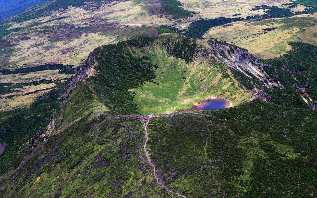
The island forms a neat ellipse . The interior is mountainous, rising towards the volcano at the centre. The central mountain is called Hallasan, or Yeongjusan. But the volcano is more than the mountain. It covers the entire island.
Hallasan reaches 1950 meters in height. If there was any doubt about its nature, there is a nice crater next to the summit, 400 meters wide and 100 meters deep. It even has a crater lake which can be small or large depending on the season. The name of the crater is Baengnokdam; it formed by collapse, possibly during a rift eruption
The central crater. Image from https://www.expatolife.com/mount-hallasan-jeju-island-south-korea/
There have been many eruptions on Jeju, often not at Hallasan. The island is mostly a basaltic lava plateau (as are other volcanic areas in Korea). Hallasan grew with the same elongated shape as the island. A wide, lower ridge extends it further to the east. The central mountain looks eroded: it has clearly not erupted much for quite a long time. But there are many other peaks on the island, including some 360 cinder cones. The cones are typically between 150 and 200 meters high. A few lava domes line the coast, but almost all eruptions were on land.

Source: Lee 1982
The main eruptions started around 1.9 million years ago. They continued into the historical period. Four eruptions have been reported in old documents, in 1002 and 1007AD. This volcano is not extinct.
Jeju island build up over four stages. In the first two stages, a lava bed formed. This happened while the region was submerged. The low-viscosity lava was erupted on a granite basement. This is basement is no longer exposed anywhere, but was included in some pyroclastic ejecta. The initial eruptions were centred first in the northern coastal part of the area and later moved southeast. A 90 meter deep lava bed formed. Mudstones show that the island suffered frequent collapses. In the second phase the activity shifted to the centre and increased. A thick lava plateau formed which grew to around the current size of Jeju island. The lava was basaltic at first, but towards the end of this phase became andesitic. The lava plateau retained a gentle slope, indicative of lower viscosity.
During the third phase Hallasan build up. This happened again in stages, and it appears the centre of the eruptions moved around a bit. Some of the other peaks may have formed at this time, before the eruptions focussed on Hallasan. The eruptions initially remained basaltic. But above 500 meters Hallasan becomes steeper: as it grew, the viscosity of the lava was increasing. A volcanic field formed around the summit, which at this time grew to 1700 meters. At the end of this phase, a lava dome 300 meters tall formed at Hallasan’s summit. An eruption on the eastern flank of this dome formed the current crater. It has a double ring structure (now eroded) and may therefore have formed in phases. A thick layer of scoria on the southeast side is a remnant of this phase. In contrast, the southwestern side of the crater is trachyte lava.
In the fourth and current phase, Hallasan ceased and from now on eruptions formed the many individual cones across the island. No dikes have been seen, which suggests that during this stage there was no longer a central magma reservoir. This phase has clearly lasted a long time, as shown by the sheer number of domes. The domes have an average length of 1-2.5 km and a height of 50-250 m. They contain scoria, volcanic bombs, and what the Koreans rather charmingly call ‘volcanic rice cakes’. (At least, that is what giggle translate makes of it.) One large cinder cone erupted basaltic to andesitic lava, a characteristic of a stratovolcano, but it did not manage to grow into one.
There are brief historical descriptions of volcanic event on Hallasan in 1002 AD and off-shore to the west of the Jeju island in 1007 AD.
The ‘History of Koryo’ reported that in 1002 AD, four holes opened in the mountain and after five days, turned water into tiled stones. This requires some interpretation! It is read as meaning that four of the parasitic cones erupted and produced rope-like lava. The eruption occurred in July and/or August and lasted less than a month.
In November 1007 AD, a mountain in the sea erupted amidst dense air. It is thought to have been at Feiyang island (Biyangdo), just northwest of Jeju Island. This has two craters, and one of these may have formed in the 1007 eruption. The description suggests that the island already existed prior to the eruption: this fits with the double crater.
We know a bit about older eruptions. Carbon dating of charcoal found below a lava layer shows that Byeongak Oreum erupted around 5000 years ago. It is a parasitic cone, 10 km west southwest of the summit of Hallasan and some 500 meters tall. It is 1 km north of the Camellia Hill botanical gardens. Before that, Mount Songak erupted about 7000 years ago. Songak is at the southwestern tip of Jeju island, and has several craters. The central cone appears to be the most recent and may have been the one that erupted. The two sites are not far apart, and are on the same western side of Jeju as the 1007 eruption.

Beyongak
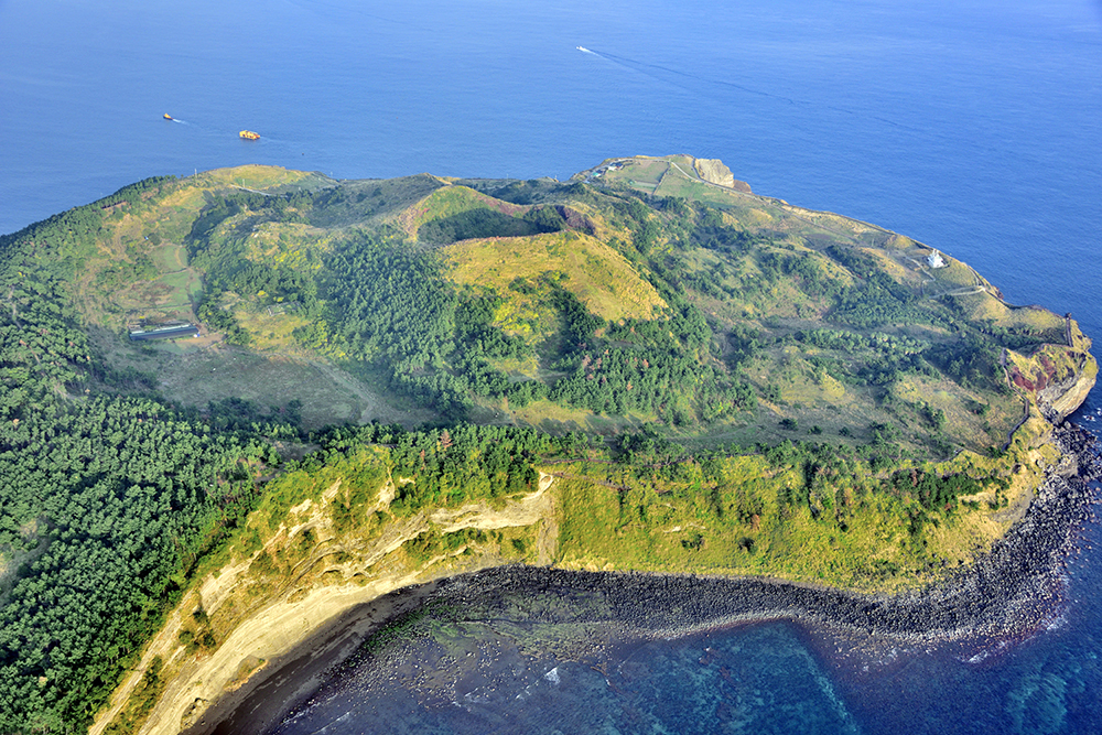
Songak
Lava tunnels
Jeju island is famous for its lava tunnels. They occur in the gentle-sloping lava beds of the second phase. There are over 50 of these tunnels. The largest is the Manjanggul tube which is almost 9 kilometers long and in places is 30 meters tall. It is a double-story tunnel, and in one place there is a frozen lava column, 7 meters tall, where the lava flowed from the upper tunnel into the lower one. The tunnel shows the lava-equivalent of features of normal caves: wikipedia mentions lava stalactites and lava stalagmites, lava columns, lava flowstone, lava helictites and lava blister, cave corals, benches, lava raft, lava bridges, lava shelves and striations.

Mamjanggul lava tube. Source: https://www.amusingplanet.com/2014/11/manjanggul-lava-tube-cave-in-jeju-island.html
Location
Jeju Island is a funny place for such a major volcano. It is far from the Pacific subduction arcs, sitting on a stable continental plate and without any indication of a hot spot. Something is clearly generating magma and something is letting it reach the surface, but what that something is is a mystery. It is a volcano without a cause, one that shouldn’t be there.
The same problem exists for the other volcanoes in Korea. They too are far from anywhere volcanic and have no reason to erupt. There are some other similar volcanic fields further north, in China. And these are not incidental volcanoes. Korea has had two VEI-6 eruptions in the past 10,000 years – not bad for a peninsula with only four volcanoes! All four have had voluminous eruptions in the past, building up large basalt plateaus. And all four date from around 2 million years ago. Whatever cause they don’t have, it is the same one for all four. And they are largely immobile. The four volcanoes have been erupting in the same location (roughly) for 2 million years. They are not being affected by moving plates. This means that the volcanic activity is attached to the plate, not to the deep mantle. The only change one can see is that on Jeju island, the volcanic activity may have moved a bit further west over time, at something like 1 cm per year.

Source: Ward et al. 2021
So what is going on here?
Let’s have a look at the compositions. All four volcanoes have mostly had basaltic eruptions. Such low viscosity lavas would normally build a shield volcano, but because the eruption locations were moving around a bit, rather than single volcanoes they formed plateaus. Only Ulleungdo, as a deep marine volcano, has managed to grow a proper strato-seamount.
Basalt would suggest a mantle origin, but the evidence mentioned above suggests otherwise. The other source of basalt can be oceanic crust, as this is largely made of (enriched) mantle material.
The figure belows shows the compositions of the four volcanoes and a few related volcanoes in China. Light grey are the volcanoes of the subduction arc. The other circles are the intraplate volcanoes discussed here and in adjacent China. These volcanoes have the same range of SiO fraction as the arc volcanoes, but are enriched in potassium and sodium – the two northernmost in sodium, the others in potassium. Location is clearly important. The SiO range shows that the magma evolves somewhat over time, increasing the SiO, but this is happening in arc volcanoes as well.

Source: Ward et al 2021
Looking at the trace elements, a very clear picture arrives. There are two main sources of basalt: mid-oceanic ridges and oceanic islands. Arc volcanoes show compositions that are similar to the mid-oceanic ridges. This is not unexpected, since they are fed by the melting of subducting oceanic plates and these plates are formed at the mid-oceanic ridges – from the basalt that is there. Their basalt comes from the upper mantle. Oceanic islands get their magma from a deeper part, the lower mantle. All the Korean and Chinese volcanoes discussed here have very similar trace element distribution, and this is similar to that of oceanic islands. They do not get their magma from subduction melt. But is it from the lower mantle? Or from a different region of the upper mantle?
Could we have mantle plumes? This is always the tempting magic solution to any volcanic problem. If a volcano needs explaining, there will be someone who has an unused mantle plume in the cupboard and offers it as a solution. But in this case, this is not the case. Plumes give increased 3He/4He ratios and cause broad swells on the surface. Neither is seen here.
In this area, the upper mantle is very confused. We have come across that in the post about Fuji. In the east is the Pacific plate, old and cold and quick to subduct. In the south is the Philippine plate, also oceanic but younger, warmer, and more resilient against subduction. Both subduct underneath the Eurasian plate but in different directions and at different depths.
The Eurasian plate is actually fragmented here. Korea lives on the Amur plate. However, that does not seem to be an important distinction as far as our mysterious volcanoes are concerned.

Source: Ward et al 2021
Here we can see what is happening in the upper mantle. The colours are velocity measurements of earthquake waves, where lower velocities (red) indicate warmer and the higher velocities (blue) colder material. The top right panel shows where the cross sections were taken – all of course intercept one of the mystery volcanoes. Dark blue tends to show the subducting Pacific plate. A slightly lighter blue will be the Philippine plate. In places they are stacked on top of each other! (You may remember the layer cake of Mount Fuji.) The subduction slows down at a depth of 410 km and again at 660 km: these are two transition regions in the mantle which the plates have difficulty transcending. Below these lies the lower mantle.
The intraplate volcanoes are located above places where the subducting slabs are at depths between 410 and 660 km. This is too deep for subduction melt, and this explains why these volcanoes are different from subduction arc volcanoes. They cannot get their magma from those plates. All but one of the volcanoes are close to places where the subducting plate ends or has a gap. Is that the secret?
One suggestion is that at such an end or gap, a convection flow starts. The slab depresses the mantle below, and it escapes by flowing around the edge, upward. As it does so the pressure decreases (the heavy oceanic slab no longer pushes on it) and decompression melt sets in. The melt now continues its upward journey because it has a lower density than the solid mantle rock around it. This model seems to work quite well for most of the volcanoes, but not Ullengdo which is not sitting above such a gap. Other suggestions have been made for that volcano.
The model explains why the volcanoes remain fixed in place on the surface: they stay at a constant(ish) distance to the subduction front. So they move with the plates rather than with the mantle. It puts the source of the magma at the top of the lower mantle, which fits with the lava composition. As an interesting aside, it relates the volcanoes to the edge of the subducted Pacific plate, but not Jeju which would be driven by the Philippine plate.
Questions
It is not the full answer, though. Why does the volcanism only happen in a few places, rather than all along the subduction edge? And why are all four Korean volcanoes 2 million years old? Subduction has been going on for much longer than that.
The answer to the first question may perhaps be found in the mantle. There may be some old recycled crust in the mantle, from an older subduction event. The Pacific ocean has existed since a long time while one plate was replaced by another. Oceanic plates that existed before the current Pacific plate became dominant have subducted all around its edges. Perhaps we are seeing some variability in the mantle itself, underneath Korea.
Did anything happen here 2 million years ago? There are two suspects. The first is to the south. As recent as 3 million years ago, the Philippine plate was moving to the north. Then it changed direction, and now it is moving west to northwest. The direction of subduction changed. Plates don’t decide to do this themselves. They are being pulled around, and it is the location of the subduction zones that determines which way the plate moves. There was a subduction change.
The second suspect is to the west: the Sea of Japan. Japan rifted from Eurasia because of the pull from the subduction of the Pacific plate. The Sea of Japan formed behind, with some oceanic crust forming in the process. The connection between Korea and Japan, the Korea Strait, opened 2.6 million years ago. This is when Japan became an island.

Source Van Horn et al. 2017
The two events are of course related. Subduction of the Philippine plate ceased for a while, then restarted 5 million years ago. As the subduction extended, the plate changed direction. This change caused the opening of the Korea Strait.
It is clear how this could have affected Jeju Island which depends on the Philippine plate for whatever causes its magma. But the other volcanoes live off the Pacific plate subduction: why would this have been affected? One can only speculate. Underneath Baekdu, the Pacific plate shows a gap. Is this gap caused by the changes along the Philippine plate? Plates affect each other, and the changing stress may have caused breaks in the Pacific plate.
We don’t know. The Sea of Japan has a complicated history, being at the mercy of this double subduction of plates of different ages. Somewhere in that history lies the answer to the mystery of Korean volcanoes.
Korea
Korea should not be underestimated. It may not have had eruptions over the last few hundred years, but that is the exception, not the rule. When it goes, it can go big. 2 VEI-6 eruptions in 10,000 years should be enough warning. And when so many people live on sleeping volcanoes, even small eruptions can cause havoc.
For all its civilized quiescence, Korea is not Norway. It has volcanic potential. One day, some people will get a honeymoon to remember.
Albert, November 2022

Jeju Island. It could be the honeymoon of a life time
Jack Ward et al, Geophysical and geochemical constraints on the origin of Holocene intraplate volcanism in East Asia. Earth-Science Reviews 218 (2021) 103624
Moon Won Lee. Geology of Jeju Volcanic Island , Korea. Journal of the Japanese Society of Rock and Mineral Deposits 77, 55-64, 1982
Marco Brenna, et al. Spatio-temporal evolution of a dispersed magmatic system and its implications for volcano growth, Jeju Island Volcanic Field, Korea, Lithos, Volume 148, 2012, Pages 337
Van Horn et al. Evolution of the Sea of Japan back-arc and some unsolved issues. Tectonophysics. Volumes 710–711, 25 July 2017, Pages 6-20


Thank you Albert for another great lesson!
Is it possible that one of the Philippine Plate fragments (at depth) is in the process of slowly disintegrating into micro-fragments (for lack of a better term) with gaps opening up along the edges of these micro-fragments which in turn creates pathways for magma to migrate towards the surface, and eventually break through to form a volcano? As the mantle-magma rises, it melts the micro-fragment thus forming new magma but of different composition and temperature. The process could be like a buried ice-cube that’s slowly melting, not very seismic as far as earthquakes are concerned…but rather a slow accumulation of magma created largely in-situ.
Perhaps! It is hard to know what goes on underground. As you say, there are no earthquakes here. That might argue against breakages. You would also still need something that provides the melt. With small fragments, decompression melt does not work well. The velocity maps don’t have the resolution to show small details. We only get the big picture. We see the forest, but not the trees
What about a beginning rift zone or an obliterated rift?
On the picture by Ward & al they seem to be on a line with others pointing north and then, interestingly enough, there is another one, Udokan, in the north west, and, following that bow we arrive at the northern end of Lake Baikal.
How ductile have those subducted slabs become by the time they’re down in the 500-600km range?
I’m thinking maybe the twisting from the change in direction of the Phillipine plate might have torn both subducting slabs, perhaps pulling them apart like toffee. If this happened around 2 million years ago or a bit longer, and along the NNW-SSE line that the volcanoes at issue lie along, it would explain both the timing and geography here. Pulling the slabs apart would also obviously mean decompressing everything in the vicinity, generating melt as well as a gap for it to rise through.
The D and E slices seem to support this. Jeju appears to lie above the eastern edge of a gap that runs vertically through both slabs. Both slices also show signs of a possible third slab, underlying even the Pacific plate slab, with said gap punching through it as well. That one is below 600 km and likely extremely old, a relic from God knows how many hundreds of millions of years ago. It’s warmer than either of the other slabs because it’s been down there such a long time, rather than because of it not having aged as much before starting to subduct, while still colder than the surrounding mantle material.
The C slice is the only one not showing a gap in the Pacific slab, but it does seem to have the third slab and a gap in that. If you’ve ever seen toffee pull apart, you’ve seen threads and ribbons of it stretch and stay connecting the pieces even while gaps open up between them. It might be that such a still-connected ribbon of Pacific plate material is seen in the C slice. The material rising to either side might part like a river around a rock and converge again once past it, explaining how one of the volcanoes is directly above the ribbon.
Jeju must have a fabulous climate thats called Oceanic Subtropical Climate. A Very rare type of climate that elsewhere only exist in Northen New Zeeland, Azores and Madeira. Generaly always mild and pleasant 16 to 24 C depending on the season on sealevel. Must be a pleasant and mild place..
Not the rainy cold of Iceland, Not the opressive heat of Hawaiis lowlands .. instead Jeju is just right
Looks like a monogentic cinder cone eruption can happen anywhere there. A New eruption may resemble La Palma 2021 with a cinder cone growing up
TAS diagram from Jeju Island
Jeju Island is too alkaline to produce andesite.. closest you get is trachyandesite.. but thats very close to andesite just with some alkalinity thrown in
Another good read from the excellent Albert!
Good to be reminded that everything isn’t explained by Magic Mantle Plumes!
It is hard to get people to wean off plumes ..
Perhaps they get a feather in their cap if they can link everything to a plume ….
It coud be a ”wet shallow plume” caused by subducted water .. like the one the feeds the volcanism at the Kim Jong Un volcano ( cant remeber the name )
That is pretty much one of the hypotheses I have heard. Essentially, the water “hides” within the faults of the subducting crust. Once it passes through the zone where the main arc is, the faults remain dormant until they reach a bend of which it seems to go flat and that is when it releases all the water, flux melting the mantle a bit to produce, like you said, a sort of hydro-plume.
The Changbai (the Chinese name for it and Paektu the Korean name) volcano isn’t quite the only volcano there as it is also kinda surrounded by other volcanic fields, but Paektu is the only one there active. On that one video where I kinda got the info from, it seems this plume is melting bits of continental crust as evidenced by the lowlands west of Paektu.
The chemical analysis has shown that water was not involved in these volcanoes. The mechanism which you describe does happen, but not here
So that is disproved, which leads to this hypothesis that, like you said, the edge of the plate is producing its own sort of plume. Quite interesting there.
And, also by the way, you said that this sort of mechanism could occur, but where? That peaked my interest.
it has been suggested as possible for Yellowstone and for the French Massif Central
Hmm… I thought Yellowstone was a sort of mantle plume, but it seems a sort of mechanism somewhat similar to the Paektu volcano (not the wet-upwelling model) where the Farallon Plate is stirring up bits of hot mantle to the surface.
https://www.researchgate.net/publication/325271410_Yellowstone_debate_erupts_again
And I am curious if there is any bits of water in the Yellowstone magma.
Yes, Yellowstone was suggested as an example, certainly not proven to be so. I don’t know about its magmas. The magma there evolevd t rhyolite in long-lived magma chambers. It may be hard to know the original composition to this detail.
https://academic.oup.com/petrology/article/53/9/1837/1397198
https://www.google.com/url?sa=t&source=web&rct=j&url=https://scholarworks.umt.edu/cgi/viewcontent.cgi%3Farticle%3D7153%26context%3Detd&ved=2ahUKEwiHlM-2zsz7AhXbAjQIHXd1Azw4ChAWegQIAhAB&usg=AOvVaw3K_W8KljXIl8mhbvDCJM2x
https://www.researchgate.net/figure/Dissolved-volatile-contents-in-quartz-hosted-glass-inclusions-Squares-are-effusive_fig4_299370830
Very hard to look for articles on the magmatic composition of the Yellowstone lava, but there might be something useful here (the first is about a different volcano of the same area, the second is a really old paper and the last has something to do with the recent eruptions at Yellowstone.)
https://academic.oup.com/petrology/article/42/8/1491/1507326
Finally found a paper on the magma compositions at Yellowstone! (Knew I would find it as I downloaded it a few years ago).
Woud not supprise at all then .. If a Volcano erupts in Seul or in Pyongyang
Did you knew that part of Korea and that part of China .. there been massive alkaline holocene lava flows? Some of these lava flows been 80 km long and large volumes that have dammed rivers and filled valleys.
A very large monogentic eruption is always a possibilty there.
Seoul or Pyongyang would be surprising. Certainly the locals would be surprised. Mind you, lava cold flow through the enormous underground shopping centres in Seoul without the people on the surface noticing.. But I think the volcanics come from two things. One is the edge convection from the subducting plate which provides the magma. The other is a weakness which allows the magma to the surface. In the case of Jeju, that may be the crustal thinning from the opening of the Korean Strait. For Chugaryong it would be the rift that runs here, so also a bit (little bit) of spreading. It can’t erupt just anywhere. There is a method behind the mysterious madness.
There are huge flows in Korea and China happened a few 1000 years ago ( Laki sized ) North Koreas Ch’uga-ryong, Chinas Jingbo some of these lava flows flowed a 100 km .. probaly acossiated with a wet plume
Old Chinese Red Fire Dragons after all .. flowing and burning its way through the landscape and Once the dragon slithered where its wants .. it cools and turns dark .. and the dragon turned to stone ..
As I already said, water was not involved with the Korean eruptions. The chemistry shows this. Chugaryong is already in the post (really!). As mentioned there, its flows happened 500,000 and 150,000 years ago. Not a few 1000.
I thought a lot about that volcano was still uncertain as studying it is more than a little awkward since it’s smack dab in the DMZ?
The ancient lava flows are in South Korea, so well studied. They extend some 60 km. The eruption site itself is effectively unknown. There is a plateau, but the location of the vent itself is not known, apart from that it is in an awkward place in the DMZ, on the North Korean side
Mainland Asia does not have any plumes.
But the ultimate home for chinese fire dragons is IO
With one volcano named after Souch mytologichal beasts
I have always been fascinated by old Asian art and culture .. Old China and Japan and Korea are Beautful in art and style .. pretty .. modern stuff in Asia is just steel and glass
But yes there is a volcano inside north korea as well Althrough is monogentic fields ( But huge eruptions )
I believe and also checked that Tianchi is the name of the crater lake. The mountainchain itsself is called Changbai-San on the Chinese side.
Interesting topic.
I would consider Ulleungdo the more dangerous of the two island locations. Comparing pictures it reminds me a little of the western part of Sao Miguel, Sete Cidades. The Sete Cidades Caldera is slightly larger.
When I look at the harbour of Ulleungdo and then the city behind the harbour betweel the peeks I have the association Saint-Pierre.
This is one of those notorious beasts which haven’t erupted in a long time and can be good for a surprise.
Pretty decent explanation of the setting by ging far into the past:
JI and the Korean Peninsula have experienced a similar tectonic evolution during the Mesozoic and Cenozoic (Chough et al., 2000; K. H. Kim et al., 2002; Sager et al., 1988; Yang et al., 2010). In the Cretaceous, the regions were part of the arc-back-arc system associated with the subduction of the proto-Pacific (Izanagi) plate beneath the continental lithosphere (Chough et al., 2000). Since the Late Cretaceous to early Tertiary, the rollback of the subducting plate led to a change to a back-arc extensional environment with the emplacement of calc-alkaline magmatism (Chough & Sohn, 2010; K. H. Kim et al., 2002; Woo et al., 2014). The opening of the Cenozoic back-arc basins, for example, East Sea and East China Sea, occurred between 27 and 15 Ma (Chough et al., 2000; Otofuji et al., 1985), and JI and the Korean Peninsula transitioned from a back-arc to intraplate tectonic system.
https://agupubs.onlinelibrary.wiley.com/doi/full/10.1029/2018JB015979
with interesting figure of teleseismic events
Back-arc basins often cause voluminous basaltic volcanism, which can then evolve as it isn’t constant. Tyrrhenian sea is a good example of this including volcanism like the Ischia-Procida-Campi Flegrei progression which follows the trench retreat eastward.
Speaking of Ischia, I’ve just read that it had a landslide today, rest in peace those affected.
Thank you, Clive:
https://www.theguardian.com/world/2022/nov/27/ischia-anger-construction-landslide-devastation-italian-island
고마워요 알버트 (Thank you Albert!)
I must confess when I saw Jeju Island I had a mild warm melt of my own. How fantastic to read about it and what a thorough article, once again.
I’ve digested many Kdramas via Netflix, and one I remember warmly is “Warm and Cozy” which is a nice romance based on Jeju Island, and involves the Haenyeo traditional local fisherwomen that dive for scallops and other shellfish there.
How nice to read about the volcano on the island, too!
Yes and should have an Oceanic Subtropical Climate like Azores
So pretty mild and pleasant all year around
Azores are probaly warmer in winter with the Gulf Stream
Thanks for the nice comment. I did not know about those dramas. How can you have a romantic drama and not use the local volcano? Sounds like a missed opportunity..
나도!! (Me too!). My lockdown habit, no sourdough bread for me…
On that drama I remember thinking how the old stone houses looked like they were built out of really rough dark stone and I think it just clicked. It must be lava!
I remember once reading that the voluminous volcanism in eastern Australia is in part caused by this. There is probably some sort of plume too, to explain the tracks of volcanoes, but the large lava fields are not known to correlate to plate movement. Most obviously, that the two areas active today are both at exact opposite ends of the continent…
I also see a lot of similarity between Paektu or Jeju and the descriptions of how the old Wollumbin volcano looked like in crossection. Beginning as a basaltic shield or plateau, before becoming a bimodal mostly rhyolitic and/or trachytic caldera, and then a basaltic volcano in the late stages again. Undara I think is at this stage one, an early basaltic shield, in a million years there could be a caldera there. Although this area has been active for closer to 6 million years so could be a little slower paced than the Korean volcanism.
I do somewhat get the impression that subducted slabs could be quite a crucial part of all volcanism. It is noteworthy that Hawaii, which is the deepest and hottest of all plumes and the one which put them on the map, has got subducted crust signatures. The idea is very deep slabs from who knows when, possibly the ocean around Rodinia, react with the iron in the outer core, then rise. This could also be thought of as evidence that plate tectonics may have partly started on Venus and probably Mars too at some point but that is a bit off topic 🙂
For Hector, I might have found a possible location of the summit stage of the 1852 eruption.
https://www.volcanocafe.org/wp-content/uploads/2022/11/xq7gFTk.jpeg
As you say the obvious radial fissure seems unlikely to be the vent in question, but there is a spatter rampart just downslope that is now surrounded by younger (1942 I think) lava. There is also a pit crater that I included, mostly based on it being directly in line and reading it was created in that year a long time ago although I cant remember where I saw that now.
The cluster of vents a bit further south that are right at the edge of Mokuaweoweo might also be part of this, as they are historical and drape the caldera wall, but it looks like the lava from that fissure could overlie the 1859 fissure, it is very hard to tell. In case of the latter, this fissure could be from 1880, 1899, or is an unidentified vent from 1933 or 1935. Apart from the major eruption centers, only the 1942 vents within Mokuaweoweo and the 1975 and 1984 vents I have been able to trace with any sort of confidence, up there weathering is basically nonexistant so all the lava up to 1000 years old looks brand new…
Thanks, the 1852 fissure is probably somewhere in that part of the rift. It might be the one you have mapped. It is very unlikely the age of that crater is known though, and if someone has claimed the crater was formed in 1852, then it was just speculation. There is no historical report of that crater forming in 1852, not to mention it would have been impossible for anyone to notice a collapse in such a remote location of the island at the time, and there is no other evidence that could date that crater.
That is on my line of thought, was just a casual recollection. Although given the 1852 eruption was more powerful than most NERZ eruptions it wouldnt really surprise me if it did create this crater, there are not really any other good alternatives and it is unlikely the crater is prehistoric given how many recent eruptions have happened near it and it is still visible.
It is something to wonder how old all the pit craters are. The major ones are probably associated with the creation of Mokuaweoweo, so early 18th century, but Lua Poholo is probably a lot younger. It does cut a fissure that is mapped as the first 1880 eruption, so it probably formed during that eruption and was missed. Lua Hou also is deep despite many of the 20th century eruptions beginning there or close by including 1950, so could also be younger than Mokuaweoweo.
It would be nice to knkw how these larger pit craters form. Smaller ones are from caving in of a cavity, but the largest ones like Kilauea Iki, Makaopuhi and Napau seem likely to be small calderas, with ring faults and actual magma chambers. The craters on Mauna Loa arent as big as those two but are bigger than all the other ERZ craters, so interesting to see how they fit. And I guess one can become the other, as we saw in 2018…
Chad posted a link about Katla, but I think it got lost because a new article was posted shortly after. The AUST gps station has shown 14cm uplift in just a few days. This made geologyhub post a video claiming that there is a magmatic intrusion in Katla. I would like to hear your opinions about it.
Personally, I think that no others signs support the idea of an intrusion. Yes, there are those shallow quakes sprinkling stars over Katla, but I would expect an intrusion to cause a more intense swarm of deeper quakes, not these shallow ones. Furthermore it’s just a single GPS and only vertical motion. Intrusions tend to create both horizontal and vertical motions in several GPS stations over a wider area. The vertical component has bad precision and is sensitive to disturbances. My guess is that something like snow and ice on or inside the radome of the gps antenna has caused these readings, but I might be wrong. Any thoughts?
Katla haves a upper magma storage so perhaps intruded in an already hot, mushy region
Yes it got lost right at the end 🙂
If Katla has an active ring fault it could negate the need for a proper intrusion to take place, just push up the lid. But I think the caldera of Katla is more like that of Kilauea where it had a ring fault when it collapsed but the subsequent eruptions all went through the lid rather than showing resurgence. It is opposed to Bardarbunga which as you know refills by pushing up the caldera floor along the mobile ring fault, so eruptions are rare and tend to be big. In a way it is an ‘active caldera’ as opposed to an ‘inactive caldera’ that is present at Kilauea. My knowledge of Katla is that it is of the latter type and each eruption is in a relatively random location through the lid but I have admittedly never looked into it that much.
I dont know why GH considers it the most dangerous Icelandic volcano though, not when Hengill could cut the power supply to Reykjavik, Svartsengi and Krysuvik can erupt inside residential areas, or Oraefajokull actually doing a real VEI 5 not just a 6 month long VEI 3… Probably some more of the whole ‘katlatubo’ thing, which is made up by the media after Eyjafjallajokull.
I have looked at data from many eruptions and the intrusions that led into them. An often misunderstood problem is that there are different ways of using the word intrusion. In particular 2 main ways. To me, an intrusion is the formation of a new magma body, it involves the magma intruding into rock in the form of a sheet. An intrusion will start in a magma chamber. In Katla’s case probably a shallow chamber, I presume. Somewhere between 10-2 km deep maybe? An intrusion grows rapidly by drawing magma from a magma chamber or storage. In Katla’s case I expect the intrusion will probably start horizontally as a sill, and then probably curve towards the surface, transitioning into cone sheet or radial dike geometries. The intrusion will likely erupt from fissures around the caldera. It is very likely that the first sign of an intrusion will be a dramatic increase in earthquakes, it should be very obvious I think. The changes in stress by the intrusion will cause faults to break around the intruding magma, as such the seismic response to the intrusion will vary a lot depending in the volcano and the arrangement of its faults, and I don’t know Katla so I’m not too sure what to expect, but it should certainly be well above the ordinary levels of seismic activity, given that the changes in stress induced by an intrusion will occur at far higher rates than those caused by slow influx of magma or from long-term tectonic processes. From your description it doesn’t seem an intrusion of this kind is taking place. Katla doesn’t seem to have any active volcanic conduits to the surface, so an intrusion is a requirement for an eruption to occur here.
The other meaning this word often takes, and I think incorrect, is when a volcano inflates. Inflation usually means that magma is flowing into its magma storage. The magma does not really intrude anywhere. You simply have an existing intrusion/s that is swelling up from an influx of melt. This swelling may culminate in the rupturing of this magma storage and formation of an intrusion that may or may not erupt. Inflation episodes may end without any eruption happening, or last years, decades, or even centuries before they culminate in an intrusion that leads to an eruption. This may or may not be happening at Katla. GPS data must be interpreted carefully. You may see what you think is an inflation signal, but then a week later the data does no longer look like it did, maybe because that signal has entirely reversed.
Not sure about the inflation. No other GPS (even quite nearby) shows anything. The picture belows shows the location. It is on the caldera rim. In case of caldera inflation, you would expect there to be some extension as well, but only the ‘up’ show the effect. My guess would be an instrumental problem, perhaps weather related.
https://www.volcanocafe.org/wp-content/uploads/2022/11/AUST.jpeg
Iceland is being such a tease now! I don’t want another tourist eruption from fagra-something! I want a massive basaltic VEI 5 or Lava flood from Grimsvotn or Katla and a amazing VEI 6 from Oraefajokull.
All three volcanoes have a decent chance of erupting in the near future but I’d put my cards on Grimsvotn for now, since it’s the most active of the 3. While Oraefajokull has the most persistent inflation signature, that doesn’t really mean it’s closer to erupting. Katla is the wildcard, will it break it’s relatively long dormancy or will it stay in bed for a few more decades? I don’t know.
We don’t need that in Europe right now.
How about Oregon instead?
😉
Sounds like we’re pretty much on the same page then. I haven’t seen any reactions from IMO or Icelandic news either, only comments on social media. That also speaks against an intrusion.
The day IMO suspects magma is moving towards the surface, I’m sure there will be emergency briefings to ensure that everyone is up to speed with any potential evacuation plans.
Good points. The warning boards in the vicinity of walking routes that are in range of Katla and its jokulhlaups make it pretty clear that Icelanders are prepared for, and worry (in a cool, Icelandic way) about, an eruption.
I’d forgotten that the regular summer earthquake swarms got as big as there being a few >M4 earthquakes in 2016 and ’17. They were part of a pattern of periodicity in Katla’s eqs in relation to which what we’ve seen in the last couple of weeks seems definitely anomalous: http://hraun.vedur.is/ja/Katla/temp_qu_katla.html
And here are some comments from the wise Kristin Jonsdottir: https://twitter.com/krjonsdottir/status/1594290942323970048
Katla erupts from fissures. From memory, there wasn’t much in the way of earthquake swarms preceding the 1918 eruption. Icelandic Volcanoes say that the expected precursors are felt earthquakes 2 -10 hours preceding a subaerial eruption or a jökulhlaup.
In 1918 they didn’t have the seismometers we have today, so any quake activity in the records would be felt earthquakes only. There’s no way to know if there actually were weeks of activity that we would have detected had it happened today, or if it really only was a short period of activity hours before the eruption.
OTH “felt” earthquakes would presumably be those over a certain magnitude.
Outside of major rifting or an old volcano waking up I wouldnt expect any of the Icelandic central volcanoes to be that noisy until an intrusion actually begins and even then only felt very locally, not in person at any safe distance. It is the same as Hawaii, we see a lot of quakes before Kilauea erupts but they are all very small, without the network you would have no idea. People were watching when it began erupting in 2020 and never suspected anything until the glow appeared. A very similar story exists for 1952. Rift eruptions are typically much more seismic though, which is also the case in Iceland as the residents of Reykjavik are all to aware of recently…
Katla will be noisier than Kilauea but it isnt exactly like anyone is wandering around up there with any frequency to notice a couple of mag 3 quakes, and bigger quakes will only be during the intrusion which possibly will only last a few hours if magma really is as shallow as is often claimed. Probably all of this is also true of Grimsvotn, except timescales there are probably shorter given it is more compact and has a higher supply.
For Hekla it seems likely the conduit/fissure is an extensional fault, so is not under any compression, there is no force with which to generate quakes. For all the extreme violence it has in the beginning of its eruptions Hekla is really not actually very explosive, there isnt a great deal of pressure, the opening is more of an extreme degassing after which the bulk of the magma arrives and erupts quietly and slowly, although the last couple of eruptions have been a bit different. The compositional zoning of the magma chamber even at the great depth it resides also argues it is not very active down there. On the other hand the high frequency and large average size of eruptions shows something is making magma. Perhaps the heat and magma for Hekla is generated somewhere else not directly under it and moves under the crust to that location, effectively infiltrating the rift zone of Vatnafjoll which is more typical composition for that area. Vatnafjoll erupts mildly alkaline Fe Ti basalt, same as Katla, and there are some old basalts from Hekla with this composition from the middle Holocene, but nothing since it began cone building.
Maybe it is the fact that Hekla is basically a lubricated fault that is preventing tension from building up at Vatnafjoll, hence why eruptions mostly stopped there about the same time Hekla began to build into a stratovolcano. Only thing is presumably magma still accumulates there, so has to go somewhere. Eventually it will either rift in a major way and make a big lava flood, or it will intrude into Hekla and still make a lava flood but with added fireworks, that could be quite spectacular 🙂
Hi Tallis better you visit IO and you Will get everything you wants
I might try since I don’t mind dying. 🙂
Do tell us how it went!
#incenirated by some Giant lava fountain
IO is the most dangerous moon in the solar system really .. even a fiction scenario without the Jupiter radiation
Any mineral mine colony woud not surivive long ..
https://www.ct.ingv.it/index.php/monitoraggio-e-sorveglianza/segnali-in-tempo-reale/video-sorveglianza-vulcanica-etna
Little flank eruption started on Etna
IO s volcanoes are nuts really .. many of its open lava lakes are much larger than Jeju Island .. that says something really. Luckly we dont have those volcanoes on Earth
So2 output from Halema’uma’u have now dropped to 300 tons a day. Thats small for souch a monster volcano that Kilaūea is, but probaly huge compared to most other volcanoes.
Halema’uma’u during the Puu Oo years did around 3300 tons of sulfur everyday, so the lower output of So2 probaly indicates that more of the magma supply is now accumulating at greater depths, rather than being brought to the surface to atmospheric pressure. Kilaueas supply is always high Althrough where it goes varies. The supply just before 2018 was enormous and was huge since 2007 and is not smaller today
https://volcanoes.usgs.gov/hans2/view/notice/DOI-USGS-HVO-2022-11-28T01:28:44-08:00?fbclid=IwAR26Pgy6NTdfygwSmj5j34xjq4SW7E3xv3_QqdaE9DdGwLLEbabiTz6hLu4
Mauna Loa is erupting!!
Eruption at Mauna Loa

https://www.usgs.gov/volcanoes/mauna-loa/webcams
wow
Nice Aa sheet there looks just like Krafla
Literally was looking at the data for Mauna Loa an hour ago and there was nothing strange at all. Seems both of the volcanoes are adept at erupting right under our best instruments.
Well, the long wait is now over, we have an eruption of Mauna Loa in the 21st century. And I think we can say that we here call it correct in erupting before 2023 🙂
Now THAT is what I call a lava flood :O
I guess we know this graph isnt so useful…
How sudden this really was:

This is a picture of the very start, taken from Hawaii Tracker on FB. They are live now too both there and on youtube if anyone is wondering 🙂
Really massive fountains when the fissure first opens, probably several hundred meters, although the fountains are not that tall now.
Erutions seems to be about here. So pretty much in the same place as most of the recent summit eruptions, along a fisure through the middle of Mokuaweoweo. it is not clear if the eruption goes further south than the 1940 cone though, that bit is hidden in the smoke. But it is not unlikely this will go outside the caldera a bit to the southwest if that has not already happened, same as the 1940 and 1949 fissures did. Pretty much, this is about where the eruption should have been expected really.
It won’t stay at the summit. I feel quite happy – I predicted an eruption within 8 years (at least, a 50% probability of this..). That was in 2016, 6 years ago
https://www.volcanocafe.org/trouble-in-paradise-awakening-mauna-loa/
I predicted an eruption within the next year the other day, I feel happy too 🙂
I think this eruption will stay at the summit but a flank eruption will probably happen soon too. That may be in a few days or in a decade though. The fissures can go up to a few km down either rift without becoming a ‘real’ rift eruption though, as in staying within the summit area. SWRZ dikes seem to start from the pit craters though so are a new dike, which will probably be very fast but quite obvious in the quakes. a NERZ eruption could just happen right as it is now though, same fissure swarm.
I guess we will know in a few hours 🙂
New post is up! Actually, it isn’t, it is an old post which has become topical again with the sudden eruption of Mauna Loa. From Hawaii with love
https://www.volcanocafe.org/trouble-in-paradise-awakening-mauna-loa-2/