We are waiting for developments! Volcanoes can’t be rushed, or forced, and they can sit there seemingly quietly while in reality they are raging on the inside waiting for any trigger that will cause an eruption. Be careful with volcanoes: they will sit there innocently and then suddenly explode in your face. Or not. If there was a geology mental health service, volcanoes would be queueing outside for a bit of support and counselling.
The Reykjanes peninsula was due a significant quake, with many decades of unresolved transform motion. It decided to give way in a segmented way, with several M5 quakes since last year on different parts of the fault. This culminated in a double quake last month. But after this had happened, the earthquakes kept coming. You expect aftershocks, which continue for some days and declining with time. The largest aftershock is typically 1 magnitude lower than the main shock. But this was not like that. The shocks kept coming, in small clusters. This suggests that something more was happening.
The main fault that runs along the Reykjanes peninsula is not a pure transform, but also has a spreading component. That is important. The South Iceland Seismic Zone, further east, is a pure transform fault. It has less volcanic activity. In contrast, the Reykjanes peninsula is packed with volcanic features. In fact, that is how it formed. The peninsula is a long volcanic rift feature, a bit like Puna. The spreading component of the fault allows magma to come up by creating space for it. Pure transform faults, such as the SISZ, are much less efficient for magma transport.
The density of volcanic features shows that the Reykjanes peninsula lacks a central volcano. Features here tend to erupt only once. There is no major magma chamber, just distributed magma pockets with a variety of pathways for heat to come up. The brittle crust in Reykjanes is as thin as 5 km. Reykjanes earthquakes are normally not much deeper than this: they take place in the brittle crust. A guess would be that magma pockets can form near the bottom of this brittle crust.
The magma pockets are fed from the depth. But the peninsula is far from the hot spot in Iceland, and the magma supply is not high. Magma pockets will take a long time to grow to an eruptible size. This is probably the reason for the long periods of quiescence here. The magma pockets do not coalesce into a single chamber, but in a series of smaller ones. Therefore eruptions happen over a range of locations, with many small lava flows rather than one big one.
That is what was happening over the past weeks. The earthquakes created pathways, and some of the magma pockets started moving. Did magma pressure cause the earthquakes? Probably not initially, but the continuation was due to this added pressure, and the moving magma.
Where did the magma move to? There are two important directions. An obvious one is along the main fault. But many of the earthquakes happened on short faults at an angle to the main transform fault. They acted as book shelfs, toppling one after the other. They provide the eventual conduits. These faults run mostly north-south. Further from the fault, they turn northeast, and run along the main Icelandic spreading axis.
Magma moves along the main fault until it feels its way into one of the perpendicular NS fault. Here it will coalesce. It took some time for that to happen, but eventually the magma found the Fagradalsfjall region as the ideal central location. The earthquakes elsewhere died down, but in this area they kept coming.
The strongest earthquakes were at a depth around 5 km where the two faults connected. Magma pushed its way into the perpendicular fault. Now it formed a dike. Dikes are independent structures. They don’t follow a particular fault but take a direction of least resistance. In this particular case, that was northeast, towards Keilir. As the magma reached higher up, the crust breakages were frequent but small. This process is still continuing: the M3 earthquakes are at 5 km, the weaker earthquakes are at a range of depth. (Do be aware that locations of weak earthquakes are often uncertain.)

The current dike is reported to be 1 meter wide and extending up to 2 km depth. The dike follows the perpendicular faults, but at a fairly steep upward angle. The particular fault that is leading the magma is pointing approximately at Keilir. It reached that region, but not much further.
The tremor event a few days put everyone on edge and indicated an eruption was imminent. Even IMO thought so. The tremor was caused by magma flowing along the dike and filling it up. But the magma didn’t cooperate, and it stopped flowing.

In recent days the magma has stopped pressuring the tip and it is now pushing upward closer to Fagradalsfjall. At some point, the dike may find a weakness and comes to the surface. That hasn’t happened yet, but it could happen anywhere between Fagradalsfjall and Keilir. Or it may not happen!
What would it take for Reykjanes to erupt? The region remains primed for an eruption. The earthquakes are continuing. But the main pathway is currently blocked. The likely outcome is still a small eruption, within weeks. This may be triggered by the slow build-up of pressure in the magma chamber reaching some critical point, by an earthquake that breaks the blockage, or by a new inflow of magma into the forming chamber. Renewed tremor will be a sign that this is happening. But if none of these happen, we will be waiting in vain. That is a perfectly possible outcome. Disappointing it would be (for us), but you can’t force volcanoes. Eventually, something will happen somewhere. You just wait. Our sleeping beauty may have gone back to sleep, but one day the prince will come. One day.
Albert, March 2021
Links
Drumplots. Use KRI or ISS for ones close to the activity. (ISS is not the space station (where tremor would not be welcome) but is near the coast, a few km east of Grindavik.)
Some useful Icelandic words which you may come across in names of locations. Accuracy is not guaranteed.
| icelandic | English |
| alda | ridge |
| á | river |
| aska | ash |
| botn | head of a valley |
| breiða | flat, broad |
| bunga | rounded hill |
| dalur | valley |
| drangur | rock column |
| dyngja | dome or shield |
| eldur | fire |
| ey | island |
| fell (or fjall) | mountain |
| gígur | crater |
| gjá | fissure |
| hnjúkur | peak |
| höfn | harbour |
| hraun | lava flow |
| jökull | glacier |
| kviku | magma |
| lækur | brook |
| melur | gravel plain |
| nes | peninsula |
| öræfi | wasteland |
| reykur | smoke |
| skjöldur (skjald) | shield |
| tindur | summit |
| tjörn | pond |
| vatn | lake |


Will this thing erupt already?! I can only look at earthquakes maps for so long!
Tallis have a look at the GPS data for some alternation…
Albert do we see the inflation/deflation off the sea ground around the Reykjanes ridge/peninsula somewhere on the IMO website? Just in case there would something happen…
I guess at least the Iceland Defense Forces should have some sonar or echolot equipment around? The danger of submarines should be known, the drug Mafia also use them too… What’s about submarine terrorism?
For sure we have seen some EQs in the white areas of this nice colorful interferometric modern maps – didn’t we?
Bathymetry isn’t it a wonderful word?
https://en.wikipedia.org/wiki/Bathymetry
Is the blue lagoon still open and with activity nearby isn’t there a risk for temperature rise and become unsafe?
I understood it was closed this weekend. Don’t know if it reopens today.
No. According to their website, they only open at weekends because of COVID. They don’t say anything about next week end.
Next to the powerplant at Svartsengi https://www.mbl.is/frettir/innlent/2021/03/07/malbik_sprungid_vid_hs_orku_i_grindavik/
Not able to check if they got now even more heat energy to transform to power
https://www.mirovaweb.it/
I live in Scotland. All the roads look like that here.
Private roads?
They look worse than that anywhere in england.
Don’t think any eruption in next few days.
Icelandic news are back to covid instead of Reykjanes/Keillir.
This shows nothing new happened there since yesterday.
Surface cracks found https://twitter.com/Sjonni_KAUST/status/1368924267132424192
WOW!
Quakes since yesterday 1800. I added the event frequencies for >0 and >2 magnitude quakes.The categorization into groups is of course always kind of arbitrary, for example one could argue that the yellow and blue quakes could be assembled into one group. It’s noteworthy that the red quakes (Krisuvik area) all have a smaller magnitude. Another observation: Big quakes occur preferably around 5km below the surface (see diagramm in the bottom left corner) – if the depth estimations are correct.
This waiting is killing me! D: Something happen please!
As long as the moses and lichen are green, I guess, we have to wait longer…
If Lecanora would grow in Iceland you could make your own Litmus paper, in case the swimming pool shop is already closed.
This is geology. That means waiting for 99,9% of the time and 0,1% when there is action.
Personally I think we are now between 2 more intense periods of heightened seismicity in Reykjanes. Last one was Saturday/Sunday. Now it is a bit more quiet, although still very active compared to before Feb. 24th.
It could be quieter for two reasons: 1) magma is taking a break; or, 2) magma has made it to less brittle rock so fewer and smaller quakes.
Another reason could be that the intense quakes of yesterday have relieved stress in the crust and that it takes some more influx of magma to increase stress again.
Imagen you have to dig for Diamonds with your naked hands for hours, days or years without any success…
This white fog is what we see on the cams since…?
https://youtu.be/njzTw92RWv0
Weather?
Sure is it weather, climate is later…
Looks like Gamestop GME may go to the moon before this eruption occurs. Patience, and hold.
It took just over two weeks for magma to break through at Holuhraun. We are only on day 13 of the swarm now. Rocks on the Reykjanes Peninsula are colder than those at Holuhraun so it might take a little while longer, unless magma finds one of the many faults the area is riddled with.
Update from the Scientific Council today:
https://www.visir.is/g/20212082354d/gera-afram-rad-fyrir-gosi-thvi-kvikan-sitji-grunnt
Summary
-The top of the magma is now quite shallow at 1km.
-The flow of magma has decreased but continues
-Increased seismic activity can still be expected like the activity we had over Saturday/Sunday night
-While the magma continues to expand an eruption may still happen
-There is no evidence to suggest magma movement outside of the area between Fagradalsfjall and Keilir
Was at 2 km the other day, so only a day or so to go 🙂
If it is that shallow it can begin degassing, so if it hasnt erupted now its probably not going to be a big eruption, but if more magma arrives it will.
1 km is very shallow. One more M5 may do it ..
In Krafla it took ages for a proper eruption to start. First eruptions were very small also.
This might be similar.
A time for patience
It might take days or weeks until an eruption
But then don’t expect anything big yet
The new eruptive period will last centuries
Larger eruptions might happen later in the century…
Most readers of this blog are not that patient
It is what it is.
Krafla was 5 years of mostly intrusions, with bigger eruptions in 1980 and 1981, and the biggest eruption in 1984 at the end. Medieval activity seems to consist of about 4 of these sort of rifting events over 300 years. This one has just stsrted, so probably will be active for a few years maybe a decade, with nothing afterwards for a long time and it will be somewhere else on the peninsula.
I guess you guys are correct. Patience! It is kind of like watching grass grow. 🙂
Like watching the grass grow and knowing that, at some time, you will have to mow the hraun.
Does anyone know anyone at the Iceland Meteorological Office? How hard would it be to convince them to please put this page https://skjalftalisa.vedur.is/#/page/map on the English version of their website? This page shows the validated quakes and it is an important page to know.
This one is also very illustrative
https://skjalftalisa.vedur.is/#/page/graph_quakes
As for IMO, you can hope they have read your comment. Otherwise, you can send your request in on https://en.vedur.is/about-imo/contact/ Do be aware they have a whole country to support, and may lack the man power to translate all the documentation into English! We don’t pay their bills and can’t expect to be given priority!
I guess there are more than one Met office around the world without native English tax payers or even use native non Latin alphabet with much less “English” sites and data access…(and we all are able to use Google translation tools – or?)
Really a compliment for all the stuff on the IMO site and the free access…(there is always a more possible and better for the nice Gollum’s)
It’s not a fair comparison but have a look behind the great wall:
http://www.cma.gov.cn/en2014/m/
I did already email them, but heard nothing back. I suspect they are overloaded at the moment. For example they have rewritten the same paragraph on the quake page at least 3 times covering the same topic so they are very sensitive to the content in this section. I have seen a few things which indicate that a webpage is not high priority right now.
and who can blame them!
The page is rather intuitive! Just fiddle around a bit and there you go. The used words are not so difficult to derive (although, admittedly, it does help to know some germanic languages other than English (which is half French anyway)
Do you know if this is true?
https://twitter.com/MatMonde_/status/1368569305504362502
La naissance d’une île au large de l’Islande…
Fake news… not in Iceland… sorry.
We live in an age full of fake news.
I miss the time when is as young (30 years ago) when fake news were very rare and news were not sensationistic.
The internet is full of trash
You bet! We can’t trust in anything now… very sad!
and i remember when it was just the facts… no political bent… i’m so fed up with ‘news’ i don’t even want to listen to it any more…
Go to the library and read the old yellowish (German) newspaper from 1930 to 1945 and come back and repeat your statement!
At least we have known a chance to choose the source… Trust is something unscientific more philosophical…
Would you trust someone who says:
I know that I know nothing.
Or more to the newsletter of the Royal Scientific Society before Darwin: This is the human truth, based on facts and nothing else than the truth.
now
Air pollution isn’t IMO business…
“…
The most abundant gases are carbon dioxide (CO2) and sulfur dioxide (SO2). Other substances such as hydrogen sulfide (H2S), hydrogen(H2), carbon monoxide (CO), hydrogen chloride (HCl), hydrogen fluoride (HF) og helium (He) are also released, but in smaller amounts.
…”
For real time data have a look at:
https://loftgaedi.is/en?zoomLevel=11&lat=63.982768073351096&lng=-22.46908048099878
Or wait for the next satellite fly over…
Thankfully for a link to the measurement background info (SO2/SO3/H2SO4/sensitivity /uninhabitants areas/etc.), I guess the wind direction I could figure out by myself 😉
Sorry this energy lie, currencies prices, etc. makes it hard to trust governments…
Does the government has any plans, what to do before the Lava would reach inhabited areas?
Stay home and close doors/windows? Wear a mask if you still have to go outside? In case the wind blows in your direction?
Not sure I follow your post, but I wonder whether this page, and the associated links, might provide some of the information you are looking for?
Sorry, meant to add this link:
https://www.almannavarnir.is/natturuva/
THX – This one
https://www.almannavarnir.is/natturuva/so2-mengun-vegan-eldgosa/
So if this does erupt how big might it be? Obviously not Holuhraun or Kilauea sized but maybe a small fraction of it? :p *crosses fingers*
Just a blob. 😈
Concerning ground cracks, this article just came up, but my browser is having trouble posting the photographs. See http://www.bbc.com/earth/bespoke/story/the-cracks-ripping-earth-apart/index.html
They believe the #earthquakes on either side of the magmatic dike is not due to magma movements, but rather due to tension building up as a result of magma inside the dike. Given how shallow the #magma is, a potential #eruption might not have a long alert time. #icerupt
https://twitter.com/gislio/status/1369051231461773313
Following the latest observation on #Reykjanes peninsula scientists now believe that #magma is sitting at about 1km depth. They also believe most likely area of potential #eruption is between #Keilir and #Fagradalsfjall where magma dike has formed (red line). #icerupt
https://twitter.com/gislio/status/1369050465573470212
Anyone want to take bets that the lava fissures open up here? 63°54’30.6″N 22°14’06.4″W ?? (sheer semi-educated guess) See https://www.google.com/maps/place/63%C2%B054'30.6%22N+22%C2%B014'06.4%22W/@63.9085083,-22.237304,480m/data=!3m2!1e3!4b1!4m6!3m5!1s0x0:0x0!7e2!8m2!3d63.908506!4d-22.2351099
How I will look like when it erupts
Highest joy ever! This is me at Reykjanes Penninsula when it erupts
Soon it will erupt …. we gets the .. Preeeeciiiuuoussssssss!!!!
Emaciated and dead?
Strange goal in life…
You are right it’s better to stop climate change…
Thanks for the update, Luis.
On March 7 the top of the dike was at 2 km, today on March 9 today it is at 1 km deep, at this rate we get an eruption in 1-2 days 🙂
I would expect very soon we will see a visible faulted graben forming, at Kilauea in 2018 cracks began appearing when the magma was about 1 km deep a day before the eruption started.
Taal to level 2
This serves as notice for the raising of the alert status of Taal from Alert Level 1 (low level of unrest) to Alert Level 2 (increasing unrest).
https://www.phivolcs.dost.gov.ph/index.php/volcano-hazard/volcano-bulletin2/taal-volcano/11418-taal-volcano-bulletin-9-march-2021-8-00-am
It is getting busy everywhere.
Other Taal stuff… evidently they are just as daft as we are in the US
https://newsinfo.inquirer.net/1219130/phivolcs-admonishes-man-who-recorded-viral-video-in-taal-volcano
Best I could find. If you are fluent in Tagalog it will go a long way in understanding what is said.
Is this from last year? It refers to ash emission and alert level 4. That isn’t the case now.
Maybe another tremor pulse is ongoing? A lot of small quakes in a short amount of time.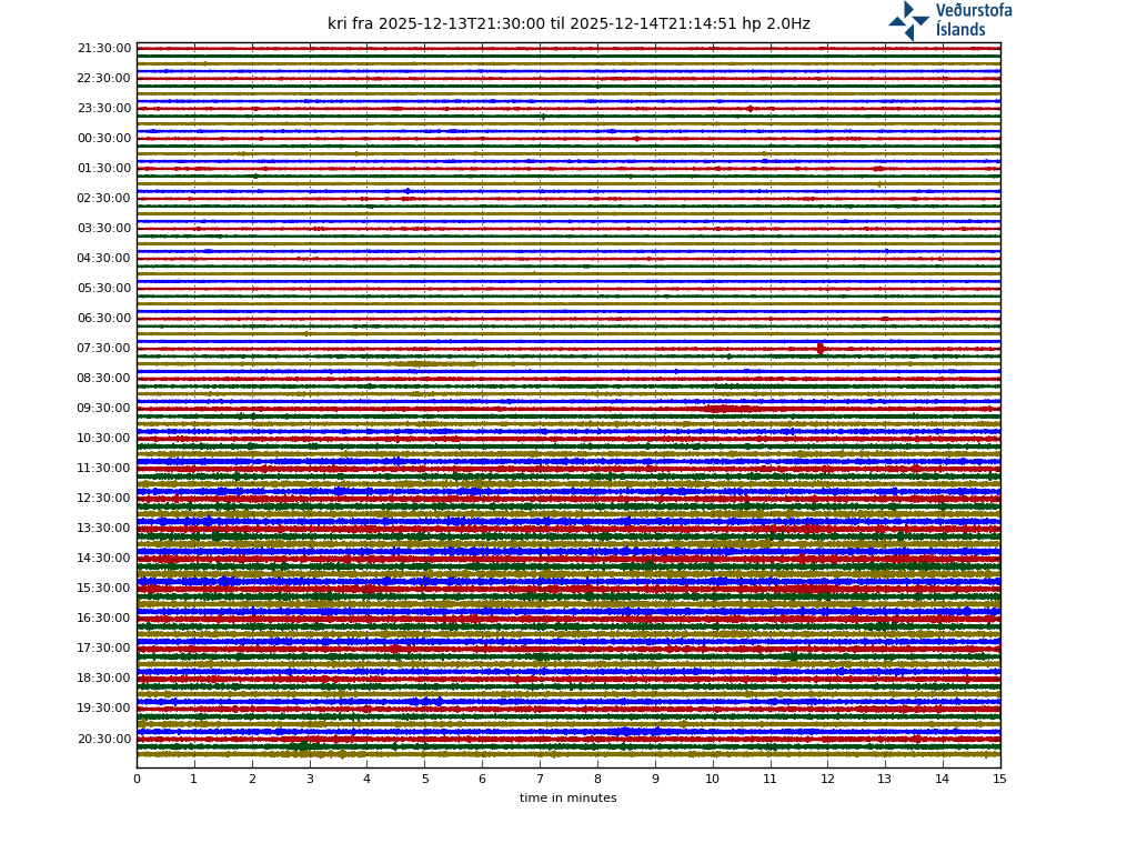
Last time we had such a tremor pulse, some big quakes came afterwards.
Yes, and the magma rose up at least 1 km in that last pulse, another one will probably be the final push.
There is ongoing tremors, cowabunga it is 🙂
And a glow on one of the webcams!!! 😀
False alarm 🙁
Frettir fro IMO this morning, google translated.
Uppfært 09.03. kl. 8.30
“At At 5:20 this morning, the activity at Fagradalsfjall, south of the magma tunnel, increased. The turbulence was measured around the time the activity increased and the heat lasted until about noon. The activity was very localized to the south of the tunnel and is probably an indication of the expansion of the tunnel.
As stated in the announcement of the Scientific Council of Civil Defense yesterday, it can be expected that activity will be divided into sections with seismic activity and turbulence comparable to those measured this morning with the expansion of the magma chamber.
The activity this morning is at the place that is considered to be the most likely source of magma, which is south of the magma tunnel, as stated in the announcement of the Scientific Council for Civil Protection yesterday.”
Take a seat, relax and enjoy the show…warm hills and IR flashing already happening:
https://www.visir.is/g/20212080986d/oroasvaedid-i-beinni-utsendingu
It is day right now there, also the eruption is probably going to be behind Keilir, or up in the mountains, not in the foreground of that camera.
But the IR-flashes which enlighten the hills on right part of the whole cam area form time to time a great, I guess magma explosion down in the dyke…didn’t know this phenomena
Inside the hill is the enlightening, same thing as an fibre-optic cables…the hill is the fiber/glass…
Now the IR flashing happens even on the normal ground:
https://cementboy.files.wordpress.com/2021/03/svid_20210309_150741_1.mp4
There is a road near the cameras. Are you seeing cars?
No Merlot that IR flashing isn’t from cars, busses, trucks or airplanes…
New video from yesterday, time is CET, the hills did not enlighten anymore but the ground close to the cam…
https://cementboy.files.wordpress.com/2021/03/svid_20210310_211822_1.mp4
Isn’t it sad that I’m not able to do future studies on the happenings? There is no we also sad but I live in the cockaigne and don’t think that I will get grilled and/or smoked and fore sure you have better eyes for science because…
After downloading the video/time-lapse video you are able to edit it…there are frames missing (where is the raw data) after reducing the speed of the time-lapse videos but you still see more after slow down…
I prefer on my Android mobile phone YouCut ® or © app for editing videos
https://play.google.com/store/apps/details?id=com.camerasideas.trimmer
Never heard before today…to many with eggs on their eyes running around…ah sorry old dusty books on their focus…
https://www.geospatialworld.net/article/detecting-earthquake-precursor-a-thermal-remote-sensing-approach/
A new word but is it the solution for the IR flashes or do we know already what it was?
“Flash heating” would it explain that whole hills were enlightened?
From an Swiss presentation about
“THE FIRST SUPER-SHEAR RUPTURES TO BE OBSERVED IN THE LAB” and more,
7.5km/s = Mach 22, pictures of P-/S-waves effects, yes not IT simulations or models, pics! Sadly only 2-D and sadly only faults without thin crust and mantle plume like what we observe with passion…
For sure not basic earthquake knowledge but have a look by your self:
https://ethz.ch/content/dam/ethz/special-interest/mavt/department-dam/news/documents/STODOLA%20MEDAL%20LECTURE_Rosakis_2019_1.pdf
This morning’s article talks about magma at at a depth of *one-half* to one kilometer. Progress!
https://www.ruv.is/frett/2021/03/09/oroi-vid-fagradalsfjall-i-morgun
Things are looking up! No guarantees though. Anything or nothing could happen
You got lost in translation, one and half in icelandic is 1.5 so 1.5-1km deep. Admittedly, it’s strange to word it like that and not 1-1.5.
Thanks! That was a welcome dose of reality
I suppose if you’re talking about negative numbers, half to one km would be -1.5 km to -1 km – which is a valid way to describe depth. Drat.
What is causing that INSAR inflation, magma or Zeno’s Arrow? First it was at 4 km, Then it was at 2 km. Then it was at 1 km. Now it’s at half a km …
Birth of the new cone on Eurasia’s highest active volcano – the Klyuchevskaya Sopka on the Kamchatka Peninsula – filmed by videographer Artyom Gromov and his team
https://twitter.com/siberian_times/status/1369201606911094785
On my second cup of coffee and already rooting out the popcorn for popping later…….. I have to do some chores then a relax watching the live vids. (here’s another one in case nobody has found it https://www.facebook.com/watch/live/?v=264008978633459&ref=external ) Sorry if I have repeated this..Repetition is a curse of old age!…There again if I don’t repeat myself and others … I forget! ) This takes me back to the days of La Restinga off El Hierro…9 years ago!!!! How time flies. We volcanoholics need a harmless eruption to pass these Covid days at home. So I watch with anticipation and read with huge interest. Stay well and safe everyone.
9 years ago, seems like yesterday, how are you, Ursh
Diana! How nice to hear from you. El Hierro NINE years? I would have said it was three.
I remember the floating lava balls and the discolored circle of water. I SO wanted it to go Surtseyan. I still keep up on any unrest there.
From stress models of the dike, combined with joint interpretation of other data, the Science Board concludes that the seismicity to the east of the N-tip and west of S-tip of the dike are triggered earthquakes. An important conclusion. #volcanomonitoring
https://twitter.com/krjonsdottir/status/1369224585481175040
An important conclusion, but unclear. I assume from context that their conclusion is that the eqs are triggered by the magma dike, yes? Did anyone else get a different take?
i agree with you. The expansion of the dike is inducing quakes on south of intrusion.
I understood it to mean that they were as a result of the magma intrusion near Fagradalsfjall and Keilir.
The importance is that the area where an eruption could occur, is confined to the Fagradalsfjall-Keilir area and does not include places like Grindavik and the Blue Lagoon.
N tip : Trölladyngja area. S tip : Þhorbjörn area.
What the science board says, most times makes sense.
My amateur, long time watch view, sees that many Gps in the Reykjanes P. move quite a bit.
Partly explained by rift -> giving possibility to magma rising and form dyke -> which gives the gps another push.
Apart from the station in vicinity of the dyke, THOB SKSH SENG and GRIC are moving northwest/northeast a lot compared to other stations in the most southwestern area.
http://brunnur.vedur.is/gps/thorbjorn.html
Þhorbjörn is a suspect device to keep an eye on!
It is also interesting to see KRIV’s (almost the only station in the RP area which is on the Eurasian plate) speed is declining more and more past days. I wouldn’t be surprised if the action in Kvikugangur dyke (name from Kristín’s map) will end soon too. The eq graph shows a slow declining of the numbers and strength.
Just a small remark before it becomes an established name. Kvikugangur simply means dyke in Icelandic. So calling it Kvikugangur dyke is a bit redundant.
My Old Norse background failed me; I was thinking it meant like kvick gång, ie fast path.
But i just learnt that “Kviku” is magma in Icelandic. So Magma path or magma corridor.
Interesting:
kvick = quick
gång = corridor as in gangway.
Thanks Tomas, so it remains “just a dyke” for now. 🙂
Does anyone know which volcano has the highest radioactive fallout during an eruption?
Isotopes? He/Ra/Cs? Any?
Heat source of the earth mantle is…
Definitely Udachny (see https://www.volcanocafe.org/terra-incognito-the-verkhoyansk-mountains/, near the end). Although that may not be quite what you had in mind.
McDermitt caldera has a uranium mine.
You are right Albert, the Udachny wasn’t what I’m looking for but the connection Diamonds which need to get fast through the mantle/crust up with some speed form a boom would fit.
Also McDermitt doesn’t fit but it’s from a hotspot (Yellowstone) and has a lot of heavy elements around…the ugly liquid…
Strange that Iceland has a low naturally occurring radioactivity compare to other Nordic Countries. The volatile radioactive elements could be an explanation but…
https://www.gr.is/wp-content/media/2013/07/NaturallyOccurringRadioactivity.pdf
Hawaii volcanoes release 300 g He3 (!) per year…
Iceland 0? 🙁
https://en.wikipedia.org/wiki/Helium-3#Terrestrial_abundance
Caesium (Cs-137) looks like imported to Iceland if I got the author right…
https://inis.iaea.org/collection/NCLCollectionStore/_Public/33/071/33071264.pdf
Hi old and new friends!
Is it really nine years since La Restinga?
If you watch the IR webcam and are lucky … you may catch the heat signal from a quake … some of them are spectacular as they cross the surface!
https://www.visir.is/g/20212080986d/oroasvaedid-i-beinni-utsendingu
Hi Suzie
Could you send me a link to other recorded video of the “heat signal from a quake” before March 9th 2021?
Youtube or VIMEO or what ever you preffer…
Sorry … I just caught what resembles horizontal lightening fizzing across the ground whilst watching the IR cam live. I have no recordings.
Suzie
Or was this the first recording and live broadcast of such a signal?
If yes we could congrat Freund and Ouzounov – you are right – or?
https://www.newscientist.com/article/dn1696-temperature-rises-hint-at-earthquake-prediction/
Hi Suzie. Good to meet up again…. Yes 9 years!….. Excitement with watching IR cam…. you can see Hot Sheep 😀 😀 😀
Etna’s dark plums are increasing. Evening paroxyxm got started?
https://www.skylinewebcams.com/de/webcam/italia/sicilia/catania/vulcano-etna-sud.html
“2.5 days since the last paroxysm from the New SE crater, signs are increasingly pointing towards a new lava fountaining episode in the next hours (or even earlier):
Accompanied by rising tremor, intense strombolian activity has started at the New SE crater.”
Source: https://www.volcanodiscovery.com/etna/current-activity.html
Webcams show a glow and a flow of lava, but no paroxysm so far.
Source: http://www.ct.ingv.it/index.php/monitoraggio-e-sorveglianza/segnali-in-tempo-reale/video-sorveglianza-vulcanica-etna
Now this live cam got a view:
And local team added another one (with sound):
Big fountain now.
Etnal looks apocalyptic right now 6:40 PM PST (not sure I think GMT is 8 hours later, continental EU 9 hours later). Very white hot glow and a lot of dark clouds on the Local Direct webcam.
Hot Sheep alert on IR cam. For those young watchers.. sheep have a special place in the hearts of our older members………… almost as important as graboids …..:
Far too complicated to explain…just accept this as fact 😀
Meeeeeehhhhhh 😉
What would VC be without a bit of wind-blown and lava-fried sheep!
Sounds tastey.
Some fast ones!
And a dragline digging a hole!
Can’t wait for friday…
Webcam is a bit shaky at Keilir, I saw that there is a storm warning on the east coast of Iceland tonight and tomorrow. Must be the wind shaking the camera.
Lurker here, from time to time, my “first eruption” was Eyjafjallajökull. Long time since.
Sorry, I meant west side of Iceland, North-easterly wind direction
Another period of unrest incoming, could this be the final drop?
The quakes of today and yesterday, grouped into four colors.
Some notes from a mostly clueless observer.
i) The figure in the top right corner shows the ‘outbreak’ of 2+ quakes during the wee hours of the morning; the frequency jumped from average ~2/h to more than 10/h.
ii) The green quakes from the peninsula’s tip are stronger in the average compared to the other groups; moreover, they are nicely confined to small area and a small intervall of depth.
iii) here seems to be a westward drift for the red quakes in the eastern area.
As mentioned already yesterday:
iv) the orange quake’s magnitude does not reach high values
v) the stronger quakes in the blue group are mainly concentrated at depths around 5km.
vi) Finally, I notices that whenever I open my fridge there is a flicker on the IR webcam at Reykjanes.
That must be some fridge
Hmm…just going to check our fridge…
The fridge repairman is again here today, 4th time in a month. Works for 3 or so days then gets warm. Every time they fix it there is a high pitched whistle at the limit of human hearing. When the whistling stops the ice cream melts.
(Now I wonder if this is correlating to the fountains on etna.)
The fringe is under warranty, Now I wonder if one can get an extended Warranty on volcanoes. It always seems like the one you are not watching is the one that goes popping off.
Coolant leak. The repairman isn’t finding the leak, just refilling the coolant. When it runs out again, it stops working again.
Couldn’t venture to guess if the repairman is intentionally ripping you off or is just incompetent. But if there’s an audible leak and he just leaves claiming the job’s done, must be one or the other.
Looks like they are going to replace the fridge Different repair person each time. Replaced whole sections and it still leaks.
It really is a bit like volcano watching, Waiting and waiting for something to happen…
Here’s an Icelandic news piece quoting a University of Iceland geophysicist who says a Reykjanes eruption would be comparable to Fimmvörðuháls. The article also says the current magma flow into the intrusion is about 15-20 m3/sec.
https://www.ruv.is/frett/2021/03/09/getur-gosid-an-fyrirboda
And it looks like we have some tremor pulse going on right now.
This is a key statement:
“Since it has come down to this, maybe only a kilometer to the surface, it can be expected that there may not be a clear sign, no clear prohibitions for the change to get to the surface. Small earthquakes, a small pulse of unrest and there could be an eruption almost at very short notice, I think, “says Freysteinn.
Not that it matters really. The weather is atrocious right now. We can’t see shire…
You have a point there, Iceland weather can blow sheep, shipping containers and small eruptions clean off the screen at a rate of knots, I can tell, ye, pal!
Best said in a deep Scottish highlands Accent, or coarse ash ridden Icelandic.
I think the large Lady is about to sing.
About time too.
It was the Shire bit …
Another tremor now at Krísuvík drumplot?
yes looks like it
Here we go in Reikjanes peninsula… at least more volcanic tremors going on…
I really want to go feed it ice chips and coach “breathe … breathe … now PUSH!”
The thermal cam can see just fine.
Myself in joy because of the current magmatic pulse ..
Shhhhh Preeecccuuuiouuus!!!!!!!!!!!!!
Oooo. 21:35, just felt a quake, little one, but first one in days.
Good catch? M1.9, but shallow on the quake table
results are not in yet, but its on the ruv.is news.
early results say 3.6.
3.5 now.
Another volcanic pulse that end without an eruption…
The quakes are Very dense just wait : )
Stronger now…
And it’s been steady for 3 hours. I hope the weather clears up.
I did a quick check on verified quakes today.. wow none, so IMO might be overloaded preparing for the (possible) eruption. Lots of quakes on the raw monitor as we all have noticed, and picking up slightly in magnitude.
And IMO reported “no signs of volcanic tremor” of the post-18.45 sequence. I’m a rank amateur but the plot doesn’t look all that different from the sequence early this morning which they reported as a “tremor pulse”. Thoughts, anyone?
I agree with you…
These tremors we keep getting are not the right frequency to be those that are seen immediately before eruptions. Instead they indicate magma being injected or magma moving in the dyke. Waiting for the frequency of the tremor to decrease before anything happens…
Wow, just had another good one. 23:03, this one messed with my balance. Felt dizzy.
We are playing guess the earthquake size in my house whenever we feel one 😛 there is a point system and everything
guessing 4.3.
🙂
One was a 4.2 and the other was a 4.0.
wow, that’s pretty close. I’m getting pretty good at this.
Is alcohol involved? Stay safe. Has the hazard increased or stayed the same?
M 4.0 – ICELAND REGION – 2021-03-09 23:01:43 UTC
2021-03-09 23:04:45.9
05min ago
63.88 N 22.27 W 4 3.8 ICELAND REGION
2021-03-09 23:01:43.8
08min ago
63.89 N 22.27 W 7 4.0 ICELAND REGION
Doe’s anyone know what direction this camera is pointing? I havnt figured it out yet.
https://www.livefromiceland.is/webcams/reykjanes/
I saw either the sun or moon rise in the middle of the view so it is looking east. If there is an eruption it will be visible as a glow but it wont be a close view. I would presume the glow on the left side is Reykjavik.
I think it’s on Þorbjörn, looking towards Fagradalsfjall. Presumably a static version of the rotating one that was up there last year.
Santorini is all shook up too! http://www.geophysics.geol.uoa.gr/stations/realtime/THR3.htm
Hi, Diana…. any Mediterranean cruises? Nice to ‘see’ You. Does Santorini do this often or is it a new development?
Best!mots
I’ll be happy to see Santorini go safely back to sleep !
As Motsfo said… Is this part of a known pattern? Or common?
Of all places, Santorini really IS one I would not like to erupt in my lifetime !
I read earlier that larger earthquakes are possible Mag 6+, and at the volcano Brennisteinsfjöll it could be even larger. Can anyone explain how this could be ? , are they on the same fissure?. Or something else like tectonic movement?
There’s a transform fault running through the entire length of the peninsula. When there are large quakes, it doesn’t rupture along its length. Instead you get a number of smaller faults at an angle. The eruptive fissures follow the orientation of the smaller faults.
When there are quakes in one part of the fault, stress is released in that area and that can put more stress on other parts of the main transform fault. East of the lake Kleifarvatn the crust becomes thicker, so it can withstand more stress and therefore support the buildup of larger quakes. Brennisteinsfjöll is along a fissure that is further east and it’s possible for quakes up to M6.5 to happen there.
They are on faults that run perpendicular to the main one. The maximum size comes from the lengths of those faults, and they are longest in that region.
As I understand it, the maximum length of a fault is proportional to the depth of the brittle-ductile transition zone, so we are saying pretty much the same thing.
We normally do..
I am watching that Keilir Thermal Camera like a hawk. Nothing yet though. 🙁
Looks like very busy night and stars now forming a line directly South.
5.1 but quite deep. Is this the night?
5.1 M at 3:15 am. I slept right through it.