The terrible disaster in the Nepal and (probably) Tibet has happened, when a debris flow came down one of the river valleys. The toll is still unclear. The images show a wall of mud, tens of meters high, coming at extreme speed, giving no warning. The cause was 5 km up in the mountains, where a large glacier broke off and slid down the mountain towards the river.
A very similar event occurred in the Caucasus in 2002, this time coming from a glaciated volcanic peak. Glaciers can move well below the melting line on a mountain, especially if fast moving. If the melt occurs at the top than the glacier will quietly melt while moving forward. If it happens at the bottom, it can make the glacier unstable. It used to be that the main danger came from surging glaciers and from volcanic eruptions underneath glaciers. But now global warming is moving the melting lines up the mountains and destabilises glaciers that were safe before. We don’t know whether warming caused what happened here, but the same Himalayan mountain has now had two collapses, on either side. This will happen again, and more often.
We are republishing the post on the Kazbek glacier collapse. It gives an idea of the event in Nepal.
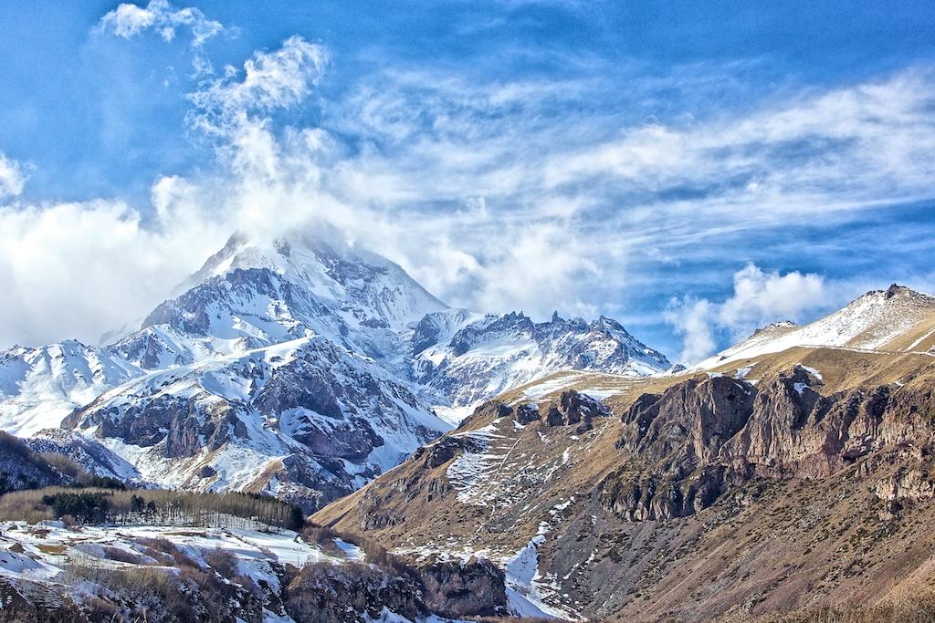
What makes a volcano dangerous? Clearly, the severity of any eruption plays a role. So does the presence of people nearby. But it is not always the best known volcanoes that are the most dangerous. Tseax is hardly world-renowned, but it caused a major volcanic disaster in Canada. And sometimes a volcano can be dangerous without actually erupting. Lake Nyos in Cameroon is a well known -and feared- example.
Over time, we have become much better at managing volcano hazards. Accidents can still happen, but timely evacuations have helped tremendously, and sometimes even mitigation is possible. Among European volcanoes Vesuvius and Etna are known to be particularly dangerous, but there have been few casualties since the 17th century. But one event is invariably overlooked in these statistics. Few people have heard about it, even though it happened as recent as this century, and in spite of this being the largest volcanic disaster in Europe since 1669, and the second-largest world-wide since Pinatubo. And we still do not fully understand what happened, how it happened, and what role the volcano played.
Mount Kazbek
It is an impressive mountain in an impressive region. The peak lies at the centre of the Caucasus range, at the border between Russia and Georgia. At 5047 m (16,560 ft), it is the second tallest volcano in Europe. According to a Georgian legend, a cave high on the mountain contains various relics, including Abraham’s tent and the manger of baby Jesus. The shape of the stratovolcano is rugged, reflecting a long history of erosion, a volcano past its prime. Ancient lava flows have spread some 15 kilometer, mainly to the south and filling in the ancient river valleys. Like Elbrus, it is an extended volcanic centre which has been in the same location for half a million years. And like Elbrus, this is not just a relic: there is still life left in it.

Dating of the various flows and volcanic centres show four phases of activity, separated by long times of dormancy. The oldest phase was 400-430 thousand years ago: the lavas from that time are mafic. The Caucasus upthrow fault appears to have provided a magma conduit from the mantle at that time. The next phase was not until 200-250 thousand years ago; now it produced lavas that were andesitic. The faintly visible caldera, 5 kilometers across and surrounding the current peak, dates from this time. The third phase occurred 90-120 thousand years ago, with andesite and dacite lavas. The magma was evolving over time, and the direct conduit to the mantle was closing. At this time the mountain reached its largest size. The current phase started 50 thousand years ago and appears to be still continuing. Distant ash covering Neanderthal sites in Russia has been chemically identified as coming from Kazbek, indicating a large eruption happened here 40,000 years ago, perhaps at the start of this phase.

Geological map of the Kazbek neovolcanic center, Greater Caucasus, composed by V.A. Lebedev. (1) Glaciers and firn fields; (2) Quaternary alluvial sediments and stony talus; (3–7) volcanic rocks of the Kazbek center: (3) phase IV (less than 50 ka); (4) end of phase III (90–120 ka); (5) beginning of phase III (90–120 ka); (6) phase II (200–250 ka); (7) phase I (395–435 ka); (8) Late Quaternary andesite dikes and necks of the Devdoraki copper deposit; (9) Pliocene granodiorite and quartz diorite of the Dzhimara pluton; (10) sedimentary and volcanic rocks of the Early and Middle Jurassic; (11) Jurassic gabbroic rocks of the Fiag don complex; (12) Late Paleozoic metamorphic and volcanic rocks; (13) Carboniferous granitic rocks of the Dar’yal and Gveleti plutons; (14) ledge of the caldera of the Paleo Kazbek volcano; (15) Quaternary volcanic apparatuses (Figure and caption from Lebedev et al 2014: see Sources at the end of the post).
The central peak seems to be inactive: it hasn’t erupted for perhaps 100,000 years. Instead, the eruptions are coming from satellite peaks, which form an arc to the south of the summit. The Lesser Tkarsheti peak erupted some 6000 years ago and this is most recent confirmed eruption. One lava flow is dated 750 BC but this is unconfirmed. Widespread hot springs show that the heat is still there, underground. These are mostly situated on the flanks, around 3 kilometers altitude.
The summit region is covered by glaciers, but the mountain is rather steep to hold on to its snow and ice. Glacier collapses are not unusual. The Kazbek area has 12 main glaciers. Of these, three are known to cause collapse flows, the Devdorak, Abano and Kolka glaciers.
The first recorded example is from the 18th century. To the south of Kazbek runs the Georgia military road, later used for the Russian conquest of the region. It runs along the Terek river, and has suffered several times from blockages caused by ice flows coming down the mountain. On June 19, 1776, a thunderstorm occurred after a period of hot weather, and during the storm a large ice-debris flow came down, which blocked the Terek River for three days. A temporary lake formed, flooding several villages and drowning both villagers and their cattle. When the Terek River broke the ice dam, it flooded the valley downstream, destroying bridges, dwellings and crops.
Similar episodes occurred during the 19th century, but mainly as mudflows: the ice-debris flows did not recur. The reason appears to be the retreat of the glacier. It no longer reaches the site where the glacial collapses occurred.

Devdorak glacier terminus: the origin area of the “Kazbek blockages” of the 18th-19th centuries. Note the sheared edge of the glacier, and the rock face to the right and above it. Left: in 1899 (Mushketov 1905); right: in 2005 (photo by O.V. Tutubalina).
Glaciers are known to surge, when the ice flow suddenly speeds up, and the glacier covers distances in days that otherwise would have taken months. The surges can bring the ice forward by hundreds of meters or more. The speed at which a glacier advances is set by the pressure from behind, caused by the weight of the snow and ice, and by the friction between the ice and the ground. If melt water lubricates the bottom of the ice, or worse, so much water collects that it physically lifts the ice, the pressure from behind is suddenly pressing against an open door. Surges are unstoppable, and can move ice walls tens of meter high. But they are slow enough that people can safely evacuate. But if the ice were to break up, and mix with the water, and especially if this happened on a steep slope, the results could be more dangerous. Perhaps this is what happened on that day in 1776. Certainly the thunderstorm and the previous hot weather suggests that water, both rain and melt, played a role.
Kolka glacier

Kazbek seen from the International Space Station. Kolka is the dark glacier just below the centre, running from right to left.
The Kolka glacier lies in between Kazbek itself and Mount Dzhimarai-Khokh, the second highest peak in the Kazbek formation, 4780 meters tall and 10 kilometers to the west of Kazbek. The blackened glacier starts at a little outside the old caldera, in a cirque: a semicircular basin with near vertical edges. Cirques are a common feature at the head of a glacier: they form by erosion of the rock sides, forming deep basins with vertiginous sides.

An example of a deglaciated cirque, a mini-Kolka: Loch Brandy in Scotland
The cirque at the head of Kolka is located at an altitude of about 3500 meters. Far above the cirque are the glaciers coming down from the peak of Dzhimarai-Khokh: they forming overhangs which seem in perpetual danger of collapsing unto Kolka. From the cirque, the Kolka glacier follows a short valley before it joins the Maili glacier, in a larger valley which descends towards the north. This becomes the Genaldon river. There is a small village down the valley, Karmadon. Shortly after the village, the river enters a narrow canyon with the appropriate name of Gates of Karmadon.

The Kolka glacier has history: there is something inherently unstable about it. In 1969, the glacier began to surge. It pushed forward meters to tens of meters each day. Initially, it had been 3 kilometers long. By the time the surge ended, in 1970, it had grown to 7.5 kilometers. During the surge, it did not detach from its source: the surge was fed by thinning of the ice up-stream.
But Kolka can also do much worse. In 1835, the original town of Genal, sharing its name with the river, in the valley above Karmadon, was destroyed. It is not known what happened, but in hindsight we can make a guess. In 1902, a double disaster occurred. On July 3rd, an ice/rock slide came down the valley which reached a distance of 11 kilometer. It started when four hanging glaciers fell on the glacier below. Apparently, the entire distance only took four minutes! This indicates a speed of flow of 180 km/hr: this was no mere surge. Three days later, an even larger slide came, caused by two further glacial falls. 36 people died, both at Karmadon, and at Werkhni Karmadon where a thermal bath house had been constructed. The flow had reached 100 meter depth, with blocks thrown up 140 meters into the air.
The 2002 disaster
The first indication of the looming trouble was on Sept 10. Mountain climbers found that there had been mudflows along the upper river valley, with trail and the river banks washed out. At the top of the glacier, they saw evidence for rock and ice falls: the steep wall of Dzhimarai-Khokh was unstable over a kilometre of length. Three lakes had formed along the upper river valley. All this indicated that there was a considerable amount of water building up. It should be noted that the climbers had not been there for two years, and the mudflows and rock falls could have happened at any time in that period.
The disaster struck on Friday night, Sept 20, at about 8 pm. Images taken a few weeks later showed that a section of the steep wall of the cirque had come down. The scar had a volume of four million cubic meters, a mix of rock and ice. In the years before the fall, these rocks had been covered by hanging glaciers. They were no longer there. The material had fallen on to the Kolka glacier from a height of 900 meters above it. The Kolka glacier has a gradient of 5-10% over a length of 3 kilometer. The force of the impact and rebound detached the glacier from the rock wall and from the ground. A volume of 80 million cubic meter of ice began to slide downhill, containing up to 75% of the total volume of the glacier with a thickness of 50 meters.

Upper avalanche path of the Kolka-Karmadon rock/ice slide. The summit of Dzhimarai-Khokh and the detachment zone are in the background; Kazbek volcano is to the left (outside the image). Red arrows point to active talus-derived rock glacier in the lower right corner, steam or dust cloud at the foot of the slope where Kolka glacier has been sheared off and overridden the tongue of Maili glacier. Flow directions of two different and subsequent flow phases are indicated with yellow arrows. Photo: I. Galushkin, 25 September 2002. Figure and caption from Haeberli et al. 2004.
From the subsequent events, we can infer that the glacier had been held in place by static friction. The impact briefly detached the glacier from the ground and when it re-established contact, within seconds, it was a broken mass, beginning to move sideways. Moving material is governed by dynamic friction which is less than static friction. Because the glacier was already lubricated by extensive melt water, the friction was now insufficient to stop the movement. The glacial mass began to accelerate down the steep slope. This is already unique. Rock falls of this volume and height on glacier are rare but not unique: such falls have occurred elsewhere. But those falls didn’t make their glaciers detach and move. And if this was already unique, what happened next was extraordinary.
The broken ice mass splashed over the moraine opposite the wall, but most was redirected by the moraine down the glacial valley. The wave moved from left to right, leaving marks high on the surrounding rocks, before reaching the Maili glacier. The flow kept accelerating as a wave. The wave front came to resemble a flash flood of mud, ice and rock; it was followed by a second wave with even more debris.

Impact zone where Kolka glacier was eroded. Numbers refer to important parts of the triggering mechanism (cf. text): 1. main impact from wall; 2. ice debris thrown across left lateral moraine; 3. first (minor) splash of mud at lower end of left lateral moraine; 4. start of swing- like flow of the main mass due to deflection at left- then right-lateral moraine of Kolka glacier; 5. second (large) splash of mud forming fast mud/debris flow outside the right lateral moraine of Kolka glacier and across the tongue of Maili glacier; 6. slightly slower flow of main mass along inside of right lateral moraine; 7. temporarily blocked distal parts of fast mud/debris flow (5), crossing gap between right lateral moraine of Kolka glacier and left lateral moraine of Maili glacier and flowing across traces of main mass after its passage. Photo: I. Galushkin, 25 September 2002. Figure and caption from Heaberi et al.
The flow now had to make a 90 degree turn. At this place, it left a mud mount 250 meters above the glacier. Seeing how fast the flow would have had to go to reach that kind of height in the turn gives a minimum speed of 250 km/hr, and possibly up to 300 km/hr.
How could the flow reach such enormous speeds, and maintain them, on slopes no steeper than that found in a road tunnel? Over the glacier, it can have been the effect that makes ice skaters reach high speeds on a solid surface: high pressure on ice can create a thin, almost frictionless layer of pressure melt. In the valley, it must have been the sheer mass of the mud which carried the flow. A quick calculation shows that a speed of 300 km/hr can be reached in free-fall when falling 700 meters. The detachment occured at 3500 meters, and the joining with the Maili glacier is at 2700 meters. That means there is only just enough vertical fall to reach those speeds, assuming the flow was frictionless. The original impact on the glacier may have contributed but it had a volume of only 10% of the total, so it cannot have contributed very much. Perhaps only a fraction of the flow reached the fastest velocities needed for the height of the mud mounds. Air resistance could have been overcome by the sheer mass of the flow, or the U-shape of the valley caused the air to be pushed ahead, forming a blast wave.
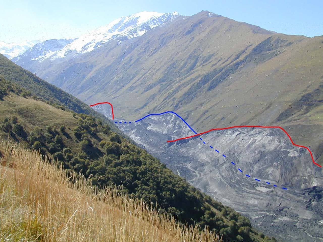
From here on, the Genaldon valley is almost straight but the flow kept moving from side to side, still reaching 200 meters above the valley. The flow now slowly decelerated: when it reached Karmadon, the speed was down to 100 km/hr. But it remained dense: nowhere were trees thrown up by the flow, as happens in snow avalanches. Imagine what this would be like. The first thing to hit you is the gale-force air blast wave, almost immediately followed by a category 4 hurricane, where the wind is made of mud and water and the rain is a horizontal waterfall consisting of rocks and ice.

The seismographic record shows that from the collapse of the glacier to the destruction of Karmadon 18 kilometers down-stream, the event took only 5.5 minutes, which makes out the average speed over this distance as 200 km/hr. This includes the initial acceleration and the deceleration in the Genaldon valley! The numbers are absolutely frightening. And it maintained these speeds even though the gradients aren’t that high. This was not a steep mountain slope: it was river valley where people could live.
At the entrance of the gorge, the flow became severely restricted. The ice dropped out and formed a black barrier. The residual went on as a mud and fine-grained debris flow. It continued for another 15 kilometers. There had been flooding earlier that summer, from rain storms, and the debris from that became entrained in the flow. The flow was now down to 10 meter thickness and the speed was a leisurely 40 km/hr. Finally, it petered out, perhaps 35 kilometers from its origin. Over the next days, a shallow lake formed behind the ice dam which flooded much of the area.
There is little in the way of eyewitness reports. One couple mentions a ‘white cloud had come through the dark’. Another person heard a noise like heavy construction machinery. But otherwise, it seems to have come out of the night without warning (although it was almost full moon), and for such an enormous event, it was remarkably silent. The noise was absorbed by the flow itself. It took time for the news of the devastation to come out. The destruction of the power lines would not have helped. Authorities in Moscow were informed only on Saturday morning.The search-and-rescue started shortly after but there was little left to be rescued.

This image was captured NASA’s Terra satellite on April 9, 2004. The Genaldon River Valley (center) appears to have been lined in slate where the avalanche left an 18-kilometer trail of ice, rock, and pulverized stone along the slopes.
The big danger in snowy mountains comes from avalanches, which can reach speeds almost as high. But this was no avalanche; the density was ten times higher than that of snow and the slope much less than that needed for avalanches. The closest analogue is a pyroclastic flow, when a frictionless mass of fragmented rock, hot ash and possibly water is blown out at high speed. Of course, another name is needed when the mix includes cold ice rather than hot ash: let’s call this a cryoclastic flow. It is just as deadly as its hot counterpart.
The Kazbek event killed around 70 people around Karmadon, and a further 50 died in the mud flood below the canyon. One of the casualties was a actor of national fame, Sergey Bodrov Jr., who had been filming in the canyon. All but four of his film crew also died. Only about 20 bodies were ever recovered from the disaster. The actual death toll may have been higher than what is reported: there are reports of refugees having settled in the upper valley, unregistered. But even a total of 125 would be the second largest number of fatalities from a volcano since Pinatubo, and it could be the largest number for an European volcano since the 17th century.
Or no collapse?
An alternative view of the disaster is that the initial collapse did not occur, at least not on the Friday night. This was argued by Stephen Evans et al. (see Sources, below), who used a satellite image taken 8 hours before the collapse to show that the rock had already gone by that time. They point out that the seismograph had shown no clear signal of an initial impact, and argue that the rock wall had fallen down over months, and that the slide started because of the increasing weight pushing on the water underneath the glacier which pushed the front over the constraining toe of the ice. Apart from the onset, their reconstruction of the event is similar to that presented here. They find a larger volume of moving ice (130 million cubic meters) and a much thicker initial glacier (over 100 meters in depth) but similar velocities. The initial acceleration is found to be 0.8 m/s2. For the slope of the glacier, that corresponds to almost frictionless acceleration. They fit a friction coefficient of 0.05, which is only a little higher to that obtained in the olympic sport of curling, and a factor of ten above that of ice skates.
Their points are well made but not fully conclusive. The continuing rock falls reported several days later suggests that the wall had been severely destabilised, consistent with a larger fall. The impact could have been muted by the water under the glacier. The splashing sideways over the moraine is more consistent with a more energetic start. it is also difficult to see how water can lift ice over a toe while maintaining a very high pressure: one would expect to water to spurt out, leaving the glacier grounded. But neither is their model excluded. The truth may be in the middle: much of the rock had already collapsed, but the final push came from a further rock fall. However, their assessment of a ‘standing start’ (no forward push from the impact) agrees with my own conclusion, I was happy to see.
Glacial heat

What makes the Kolka glacier so unstable? Notably, it is one of three glaciers on Kazbek to show slides and collapses, although not all do. But no other glacier in the Caucasus, other than on Kazbek, shows this behaviour. What is unique about Kazbek? Did volcanic activity play a role? This is disputed, but the fact that these cryoclastic flows are only seen in a volcanically active region ,and start at an altitude where hot springs occur, is suggestive.
The name of the village contains a clue. Karmadon means ‘warm water’. There are a variety of hot springs in the region. When the Kolka glacier began to retreat in the late 1800’s, one such spring surfaced from underneath the tip of the glacier. The opportunistic locals quickly build a bath house and huts around the sulphurous site. This was the bath house that was destroyed in 1902. In 2002, the first team to land (by helicopter) in the source region after the event had to leave in a hurry, overcome by the overpowering sulphurous smells. There clearly was strong geothermal activity in the region. The smoke seen in satellite images has also been interpreted as due to this, although this may also have been due to continuing rock falls.
However, heat underneath the Kolka glacier cannot have caused the collapse of the rock wall and overhanging glacier 900 meters above it. The geothermal regions are mainly around 3-3.5 kilometer, while the summit of Dzhimarai-Khokh is considerably higher than this and is itself not known to be volcanic. So the situation is more complex than this. A plausible suggestion is that the collapse was a natural, inevitable event, caused purely by the build up of the overhang, perhaps aided by the warming during the 20th century weakening the rock. But the completely unexpected effect on the Kolka glacier was made so disastrous because of melt underneath it. The whole glacier was already being lubricated, and the purchase to withstand the impact from above just wasn’t there. Sloping ice and ground heat are an unstable combination in any case. The unstable overhang became a sword of Damocles hanging over a powder keg. The collapse came just at the wrong time, when the glacier was already primed to go into surge mode.
If a glacier grows in cold conditions, where the bottom is ice, the friction can carry a considerable amount of weight. If now the bottom begins to melt, the weight carrying capacity is less, and the glacier may suddenly become unstable. This has been seen in ice falls in the Alps, although such glacier collapses there happen on much steeper slopes (some 35 degrees) than seen on Kolka (10 degrees).
Could it happen again? The satellite images show that the newly-grown overhanging glaciers have some deep crevasses. The danger that they will fall is certainly still there. The rock wall is a kilometre long and a collapse could happen at any location along it. The Kolka glacier was almost entirely lost in the event. The cirque has been refilling with snow and ice and we don’t know whether the glacier is beginning to reform. This region of the Caucasus is perhaps not particularly safe for scientists to visit and that could be hindering the assessments of the situation. It is an uncomfortable situation, with a clear danger but too little knowledge of the current state of affairs.

Left: NASA image from 2002, post-disaster, Right: a recent image on google maps. The orientation and scale is approximately (but not exactly) the same. (The current map also includes Kazbek which is just outside of the old image.) Zooming into the head of the glacier, the cirque walls can be clearly seen. The snow overhangs are back. The visible glacier is the Maili, which is not implicated in the disaster. The Kolka glacier always was dark with dirt and rubble, and it is impossible to see how much has regrown. A collapse remains possible. Whether it would initiate a cryoclastic flow depends on what it collapses onto. That will require an on-site investigation.

Could it happen somewhere else? Perhaps: with the current warming, meltwater can make both glaciers and rocks unstable. Rock falls have become common in the Alps, especially around the level of declining permafrost, at altitudes around 3 kilometer. They have reached sizes well over 100,000 cubic meters. An event similar to the Kolka collapse is not impossible, and Kolka has shown that a moderate slope does not preclude a cryoclastic flow.
In fact, there have been events with notable similarities. In 1962, part of the ice cap of Huascaràn in Peru broke off, and fell down a kilometer. It set off an avalanche of ice, snow and rock which traveled at 100 km/hr over 15 kilometers into the valley of the Rio Sante where 4000 people died. 8 years later, it recurred and this time the flow reached a city, causing 20,000 deaths. The Kolka flow was three times faster and came as a wall of ice instead of snow. If such a cryoclastic flow would happen in a densely populated area, the magnitude of the disaster could be inconceivable. The chance may be small – but it is non-zero. And the dangers may be growing: have a look at this ice fall. We don’t yet know how to recognize precursors. If it begins with increasing stress, the best way may be with monitoring ice quakes, but seismologists tend to remove those from their data!
One thing is clear: volcanoes do not need to erupt in order to be hazardous. An unstable environment can turn any dormant volcano into a clear and present danger. And that is well worth remembering.

Ice cliffs frozen to the steep rock walls of the Kolka Cirque are nearly all that remains of the Kolka Glacier. The person standing at the bottom right of this photograph is dwarfed by the ice wall and the talus slope beneath it. (Photograph courtesy Dmitry Petrakov). Source (figure and caption): https://earthobservatory.nasa.gov/Features/Kolka/kolka.ph
Albert, August 2026 (first published February 2017)
Sources
Collapse of the Kolka glacier, Rebecca Lindsay, 9 Sept 2004
Remains of the Kolka glacier. September 11, 2004. Robert Simmon, based on ASTER data
http://www.mn.uio.no/geo/english/research/projects/nato/results/kazbek.html
Glacier and debris flow disasters around Mt. Kazbek, Russia/Georgia. S.S. Chernomorets et al. 2007. http://www.glacier-hazard.narod.ru/pdf/Ch11_1.pdf
Major events in evolution of the Kazbek neovolcanic center, Greater Caucasus: Isotope-geochronological data. V.A. Lebedev et al. 2014, Doklady Earth Sciences 458, pp 1092–1098
The Kolka-Karmadon rock/ice slide of 20 September 2002. W.Haeberli et al. 2004, Journal of Glaciology, Vol. 50, 553
Catastrophic detachment and high-velocity long-runout flow of Kolka Glacier,
Caucasus Mountains, Russia in 2002. S. Evans et al. 2009, Geomorphology Vol. 105, pp 314–321


Really interesting article, thank you Albert
Thank you for digging this out.
This was a certainly non-volcanic collapse, no hot-springs:
https://www.bluewin.ch/en/news/switzerland/60-years-ago-88-people-died-after-a-glacier-collapsed-in-valais-li.2845258
The Chinese are warning that a new lake has formed and that a second flow might happen.
The film with the running people who don’t make it is from Gyirong Port, one of the six border crossings with Nepal.
https://en.wikipedia.org/wiki/Gyirong_Port
The other place is called Rasuwa Fort
https://en.wikipedia.org/wiki/Rasuwa_Fort
It is not the first flood:
Rasuwagadhi flood: A severe flash flood on 8 July 2025 should have been a warning sign.
Caused also by the burst of a supraglacial lake in Tibet.
The river concerned is Trishuli, a merger between two rivers coming from Tibet:
https://en.wikipedia.org/wiki/Trishuli_River
The are about 800 missing tourists, the majority from India, over 50 from the US, over 30 from the UK, same number from Australia, smaller numbers from other countries.
According to your statement in the Kazbek piece most of them won’t be found. Very bitter for the relatives. If they are found in the future they might be fossilized which means that they could be identified at least.
Very terrible for their relatives and the families of the locals.
Maybe the place should be given up after two floods in 2025 and 2026.
Blatten was completely evacuated, a shepherd died, that was all:
https://en.wikipedia.org/wiki/2025_Blatten_glacier_collapse
On a side note: The Chinese have good scientists and enough money to warn in time.
One difference is that the Nepal disaster is in a well-developed area. That will certainly help with the recovery, compared to Kazbek
Hopefully. Interrupted due to second threat:
https://timesofindia.indiatimes.com/world/south-asia/second-flood-imminent-nepal-halts-rescue-ops-as-china-border-lake-begins-overflowing/articleshow/133585435.cms
You mentioned Huascarán, 1970, in the piece (est. 30.000 fatalities). It sounds very similar to what we saw in the videos:
“We heard a deep noise, different from the earthquake, but not so much so. It was coming from Huascarán and we saw between the mountain and Yungay a giant cloud of dust. The quake had caused an avalanche. Part of Huascarán was falling… You could see a giant wave of gray mud, about 60 metres (200 ft) high, about to hit the left hand side of the city. This wave was certainly not dust… The sky went dark. We looked around. Yungay and its many thousands of inhabitants had disappeared.” Source:
https://en.wikipedia.org/wiki/1970_Huascar%C3%A1n_debris_avalanche
In Bondo, Graubuenden, Ch, (2017) the mechanism was different. First a large piece of rock fell onto the glacier, then the glacier destabilized and caused a mud-flow.
The phenomenon is not new in Switzerland. They used to say: “Der Berg kommt” which means: The mountain is coming.
I can’t really decide to believe that global warming or a drastic El Niño year like 2026 (peak expected in November) make parts of glaciers come down. It is possible, but it is not the only reason. There are other factors.
The underground is very important. If the underground is softer the glacier whose morphology changes all the time can better adapt to it. If the underground is hard like high up in the Andes, the Caucasus or the Himalaya the glacier can lose hold to the underground, and meltwater would not be soaked up into the ground. Another important point is pressure inside the glacier.
There is no denying that glaciers melt and lose thickness since the end of the small glaciation ~1850.
It seems logical to me though that the breaking-off of a part of a glacier has many causes, also a rockfall like in Bondi and earthquakes like at Huascarán, Peru in 1962 and 1970 and in Tibet right now or hot springs and volcanoes like in the piece by Albert. But the fact that glaciers move on their surface and don’t always have the ideal underground seems much more important as there are numerous events like this one in preceding centuries. The numbers of victims are smaller of course as there was significantly fewer population and, besides, no tourism in the mountains.
The other thing that is often forgotten is the movement of the Indian Plate, the suture sits where this happened. The net growth of the Himalaya is close to zero as sedimentation up there is higher. This means however that lots and lots of sediment cover the Himalaya which adds to such catastrophes as nothing can grow up there.
It is not a matter of what we decide to believe, it is data and probability. There is rarely a single cause for disasters: several things come together, where one thing brings the system close and something else acts as the trigger that tips it over the edge. Take sea level rise. In itself, it doesn’t cause flooding: the immediate cause of that is a bad storm. But it makes a flood more likely, as the storm acts on a higher base level. The probability of this happening increases over time, but people don’t respond to probabilities, only to events.
The typical pattern is that a system slowly changes. What used to be a once in a 100 year event becomes once in a decade. But this is noticed only when something happens – and happens again.
Global warming has a definite impact to which glaciers are particularly sensitive. It may be a bit early for El Niño t be involved here : we have only just seen the weather in the UK change to a more El-Nino-like pattern.
The latest analysis I’ve read suggests that the Nepal event was not, primarily, glacial in nature. It’s clear from satellite imagery that a vast volume of rock failed beneath the glacier, and the ice just came down with the rock and lubricated it, forming the debris flow that was so damaging. See here for imagery:
https://bsky.app/profile/watershedlab.bsky.social/post/3mu4vkafxqs26
(And thank you for not calling it a flood, as so many are still doing, unfortunately. What came down likely had a density similar to wet concrete, not water – a lahar would be a good comparison)
Lahar sounds good, yes.
Readers in Indian papers also mention the construction of Medog Dam, expected capacity 60 k MW. The deafening silence before it happened was strange. It is further yo the NE, whereas the source of the Trishuli River is further NW though.
It seems daring to construct such a huge dam in an area which is the collision point of two plates and prone to earthquakes.
Some info:
“Tibet, often referred to as the “Third Pole” of the world, plays a critical role in global environmental stability. The construction of the dam threatens this balance through extensive deforestation, increased seismic risks, and disruptions to glacier melt patterns—all of which could accelerate climate change. The project may also contribute to extreme weather events, altered monsoon patterns, and worsen global environmental challenges.
Tibetans inside Tibet will experience the most severe impacts of this project, including habitat destruction, desertification, and the collapse of traditional agriculture. These impacts threaten Tibetan livelihoods, increase food insecurity, and could result in population displacement, further marginalising the Tibetan people in their homeland.”
https://tibet.net/medog-dam-threats-on-tibets-yarlung-tsangpo-river-raised-at-un-human-rights-council/
I absolutely wouldn’t over-egg that pudding; I’ve only seen the dam mentioned by trolls in comments trying to deflect from the real cause of the disaster.
The collapse happened a long way from, and far above, any hydro project. Zero connection.
It was a combination between a “mountain-slide” (German “Bergsturz”) and a jökulhlaup without volcanic/plutonic elements.
Yes, Tschirgant, Tyrol, Austria, comes to mind, 3000 years ago. If you go over Hahntennjoch you can see the fragility. They are wise. they close it for some days after rain.
Indeed, the risk for events like this exists in the Alpes. The human memory is too short to remember well the longterm risks there. Both the Alpes and Himalaya are an active, growing mountain chain / orogency with melting ice, glaciers and permafrost. This combination creates much instability.
I saw that this morning. At Kazbek, it was mainly ice and the impact came from its extreme speeds. A pure rockslide will evolve very differently. Nepal was a different mixture of ice/rock from Kazbek, with a different slope angle. Whether the trigger was in the rock or in the glacier will take some time to determine, I think. If it is the rock, insar might have been able to detect early warnings, although this is difficult on steep-angled terrain in mountains.
The pictures of the destruction of the border crossing are like that of a blast wave – not a flood!I had never seen anything like it. I guess that the deep shape of the valley caused this, like it did at Kazbek. The kinetic impact of the collapse into the river bed must have been enormous.
Some useful maps in here. The original river is Lende Khola which merges with Trishuli.
https://www.theguardian.com/world/2026/aug/27/what-caused-the-catastrophic-flash-flood-in-nepal-and-tibet-and-how-does-a-glacier-collapse
In article several quotes as:
Shugar said construction could also be a factor.
Prof Andrew Mackintosh, a glaciologist at Monash University in Melbourne, said it was unclear whether the collapse was isolated to the glacier, or was the “whole mountainside collapsing that included part of the glacier”.
Most precise assessment I’ve seen so far in European media. Thank you, The Guardian.
An interesting read. I was on Mount Kazbek last week, in poor visibility up by where the trail crosses the glacier and could hear loud crashes and rumbles from rockfalls further down the glacier. Combined with heavy rain and streams rumbling with rocks in spate it felt like the whole landscape was highly dynamic rather than being something frozen from previous events. I didn’t really associate any of that with any wider scale risk other than to those foolish enough to try to visit the icefalls at the snout of the glacier.
Wow. Were you on the north or the south side?
We walked up from the south of Kazbegi, starting at Stepansminda, via the most common path that passes the famous church at Gergeti (as in the picture) and the various huts before the glacier. The path wisely stays on the cliffs above the valley immediately below the Gergeti glacier, as the periodic sound of rock falls suggested the area below the glacier was best avoided. The whole landscape felt active, with the ongoing war between erosion and uplift still happening.
Could be of some use later on:
Research confirms active tectonic fault under China’s dam project on Brahmaputra
https://www.thehansindia.com/news/international/research-confirms-active-tectonic-fault-under-chinas-dam-project-on-brahmaputra-1102000
Brahmaputra locally called Yarlung Tsangpo, descends ~2000 m in Tibet and then enters India where it becomes Brahmaputra. Deepest canyon on earth. Fault is called Haizhen Fault, is active and was discovered recently by Beijing scientists.
Found only this paper which might cover it though, published 14th Aug. 2026:
Kinematics and Dynamics of Normal Faults in Southern Tibet: Insights From the 2025 Mw 7.1 Dingri Earthquake
https://agupubs.onlinelibrary.wiley.com/doi/10.1029/2025JB033666
Here is why I didn’t find the research. It is in Mandarin:
“According to a report by the South China Morning Post (SCMP), citing a paper published in Mandarin in the journal Sedimentary Geology and Tethyan Geology under the supervision of the state-owned China Geological Survey, researchers identified the active Paizhen Fault directly beneath the Medog dam site on the Yarlung Tsangpo, the name by which the Brahmaputra is known in Tibet.”
https://www.indiatoday.in/world/story/china-news-medong-hydropower-project-tibet-yarlung-tsangpo-brahmaputra-river-paizhen-active-fault-line-earthquake-2945152-2026-07-10
https://theconversation.com/how-does-a-collapsing-glacier-turn-into-a-lethal-wall-of-mud-and-water-an-expert-explains-what-happened-in-nepal-290677
Thanks. Very balanced man making it also clear that this is an early analysis.
There was s.th. important missing in most reports. Altitude.
Gyirong Port, the border crossing between Nepal and Tibet, where the video was made has an altitude of 2.850 metres. It is now 12 s.th. am there, and the temperature is 19 degrees.
I was on that altitude three weeks ago, French Alps, temperature a bit lower, we needed a sweater.
The mass came from an altitude of 4.800 m. I would be interested in knowing the temperature there calculated from 19 in the border town.
I bet you can figure that out after you figured out precisely the VEI of HTHH.
I read the Kazbek piece again and came to the conclusion that in the case that shit hits the pan gravity does the rest. Plus mass.
There seems to be more material to come downslope. Problem is people forget or rather refuse to face it. It happened with Huascarán. There had beem a killing event eight years before. Scientists did a thorough report about the chances of another such event, but authorities in Peruvian dictatorship forbade any mentions to it. Nothing was said. 20 000 killed. The earthquake was only a trigger in that case. It would have happened anyways. My heart goes to all the people in Nepal.
@Albert Thumbs up for the article, very informative, But in the link of the page you write cryoplastic instead of cryoclastic
Both versions were there. Of course neither is a recognised geological term, but the plastic one has now been removed
The monster came from 5.200 m, it says in Times of India. Another site says temperatures there between 4.800 m and higher altitudes are under zero all year long. So, the explanation is hidden elsewhere.
Maybe it is very simple: Like e.th. glaciers are getting old. Even rocks are not eternal. Where the Himalaya is now, there was an ocean between ~34 and ~55 Ma.
The Himalaya’s instability which it shares with other mountainous areas is probably even higher as there is a lot of sedimentation at those heights. So where most glaciers decided to sit the underground changes all the time, and rockfall is frequent and indicated on every single mountain pass in Europe. Some where this is easily visible: Hahntennjoch, Austria, Col d’Izoard, France, Col de la Bonnette, France.
Rockfall can take parts of glaciers with it. So, it will take time to figure out what this was. And as I gathered there will be a precise look at the construction sites of a railway from Tibet to Nepal and at the oversized hydro-electric power stations being built. If the one on Yarlung Tsangpo, the upper stream of Brahmaputra, gets into trouble due to earthquakes all of Assam and some of Bangladesh will be flooded. Then this would have been only a footnote.
“The monster came from 5.200 m, it says in Times of India. Another site says temperatures there between 4.800 m and higher altitudes are under zero all year long. So, the explanation is hidden elsewhere.”
The tensile strength of ice does decline as the temperature rises towards -0.5°C, yet still ice, still frozen.
It would be interesting to see if there is data on the mountain ice temperatures – their daily and seasonal variability – in the region.
There is much to investigate with multidisciplinary approaches. Hopefully, probabilities and conclusions will form from verifiable data and extrapolations. It’s going to take time.
Whatever the order of, and primary cause(s) behind the collapse, the scale of the valley disaster is sobering. The human cost, catastrophic. The communities were ribbon-like, discrete, geographically hemmed into land tendrils. With flow lines and swashes so high, what was below is mainly gone; leaving what is left, societally and infrastructurally shattered.
Yes – and the valley will be uninhabitable for some time. The sediment will move after every rain and lahars may be frequent.
Glaciers normally extend well below the permafrost line on the mountain. For instance, if they flow at 10 meters per day and the thickness takes a year to melt, they flow 3km before the melt is complete. On a typical slope, that may be 100’s of meters lower altitude. I remember seeing a glacier on Mount Rainier at summer-like temperatures
Current weather conditions at the summit of Langbo Kangri (nearby peak with altitude of 6,648m) is 8C with light rain and wind of 2 mph from the south, whereas Ganesh II, with an altitude of 7,118m is experiencing freezing temperatures and heavy snowfall.
Varying weather conditions on the lower peaks will certainly destabilise the glaciers and permafrost.
The Kazbek disaster occurred in September after summer warming; local geology would have done the rest.
Current summit weather conditions on Mt Everest are 0C with snow; forecast temperatures for the rest of the week are 3C max, -5C min.
https://www.meteoblue.com/de/wetter/woche/mount-everest_nepal_1283416
I believe that the temperature of 3C and -5C refers to Base Camp, not the summit which never gets to zero. (Or, if it is F rather than C, that would come out about the same as at the summit..)
A better picture of the area geologically:
1.) Process of Indian-Eurasian collision, map with YTSZ (Yarlung-Tsangpo-Suture Zone, also IYTSZ with first letter for Indus)
https://agupubs.onlinelibrary.wiley.com/doi/full/10.1029/2006JB004706
2. Early Eocene Volcanism with the possibility of a VEI8 (Linzizong Volcanic Rocks, possibly former island arc, continuation Sumatra in the south)
https://www.sciencedirect.com/science/article/abs/pii/S0024493723001433
Secretly hoping that Albert tackles the area and can use this
One thing folks aren’t mentioning much is glacial ice is old, and was likely heavily saturated from past rainfalls making it extra heavy and thereby inherently unstable. Given it’s still the end of Summer (and the monsoon), most likely there have been several rounds of liquid precip recently. So, the water that was part of the debris flow not only came from sub-glacial/melt water, but the extra water entrained in the ice itself.
A lot of reports state that the water lubricated the flow. That doesn’t really work with landslide debris (rocks are much heavier than water). It works better with mudflows where the density of the flow is closer to that of rock. Glacial ice does float, so it works for ice but a thick glacier has a thin water layer on the bottom anyway. The pictures show a lot of mud: did that come from the glacier? It indeed seems plausible that there was water entrained or locked underneath the glacier: it is peak melt season.
There is limited evidence for rocky debris but there were some pictures showing it. I am wondering whether that debris is mainly on the Chinese side where we don’t have pictures and where the worst of the impact is likely to be. Ice certainly was mentioned in a few reports but again I expect the Chinese side will have much more evidence for this.
The composition of the new two (at least) debris dams will tell a story. By comparing the various rock types to different elevations of the mountain, where the rocks originated from (elevation-wise) could be determined. Also, current thinking is the glacial ice/landslide travelled on top of a previously solid base (i.e. the rock of the mountain) with the disintegrating glacier scraping rocks/boulders off the surface. But that layer has been scraped for as long as the glacier has existed, so why all the boulders now? Are they all from down low where they got dislodged by the slide above or, what if the solid base layer under the upper reaches of the glacier/water layer first cracked as a “pseudo sub-aerial” landslide which in turn tore the over-laying glacier apart? If so, then there could be larger rocks/boulders from higher up than expected? Note also that Nepal saw a record warm Summer this year with temps and rainfall/snowfall at the highest elevations likely oscillating from wet to frozen. It’s well known how liquid water turning to ice can cleave rocks (or many other materials). If so, then an abundance of liquid then freezing water (freeze/thaw cycle) could have been the trigger for an initial landslide (that was already nearing the limits of friction) followed by the glacial detachment event.
Pure speculation of course, but future information should yield more insights as to the true cause for the lahar and ideally, better assess the probabilities for similar catastrophes elsewhere. As noted, this was not a Black Swan event, but rather another in a continuing series of major cryoclastic debris flow events…of which only early warnings and/or preventive action will minimize more deaths and destruction.
The flow would have picked up water when it met the river further down the valley. Also water would have come from melting ice.
A BBC article mentions that a Nepalese border post that was swept away in the flood was 100 meters above the river. I find it hard to see how river water can do that. I think it is about 10 km from the glacier to the border post (correct me if this is wrong!). This was traveled in 7 minutes, at an average speed of 100 km/hr.
I don’t know how they would know that.
Did they mention at all that there is a confluence of two rivers, Lende Khola and Gyirong Tsangpo?
The confluence is right next to Rasuwa Fort, built in 1855, and Rasuwa Fort is or was right next to the border post.
So, the mass slammed into the confluence which might explain s.th. Adding to the power of the impact are probably the multiple gorges in all three rivers.
It refers to the immigration office on the Nepali site which is 1.5 km downstream from the border post which is on the CCTV. footage. That office (with no survivors) was 100 meter above the river, according to a person who worked there.
This is a still from the Chinese CCTV showing the flow slam into the border post. The flow is coming from the left on the other side of the building. The second river you mention runs on the right, so the wall of mud here is just before the confluence. The border bridge is on the other side of the building. The people you see have already crossed this bridge into China. There were no survivors here, based on the (limited) Chinese messages.
And here is a satellite picture from Apple Maps (google maps has a poor image for this region). The small arrow shows where I think the camera is (was). The long arrow shows where the mud flow came from. The Nepalese immigration office is 1.5 km further downstream. Judging from older photos, the bridge was probably 30-40 meters above the river. Add the height of the building, and note that the flow reached far above its roof. The flow continued from here downstream (far side of the building) toward the Nepalese immigration office
Then the difference in altitude. It’s supposed to have been a hanging glacier, so like the one in the pic of the Piz Palu glaciers above.
“Estimates of the size of the collapsing ice mass have varied considerably. Some estimate it to be between 0.2 km and 1.5 km wide, descending from about 5 km above the river surface. An expert on the Tibetan Plateau, analysing satellite images on a social media platform, stated that the ice chunk was likely 1.5 km wide and 1.4 km deep – almost twice the height of the Burj Khalifa. The total area of the ice chunk could be equivalent to 250 football fields, while claims have put its volume at about 30 million cubic metres.”
It fell into Lende Khola btw.
from: Nepal disaster lays bare Himalayan hanging glacier threat
Story by Jitendra Choubey
Side note: The comparison to football field is very silly as this behaves more like a meteorite. We have a real image for the dying of those dinosaurs at Hell Creek Formation, a wall of mud.
It is also being compared to the 2021 Uttarakhand flood, also known as the Chamoli disaster.
It is supposed to have come from Langtang Himal from a height of 5.200 m. There might be a lake involved.
https://en.wikipedia.org/wiki/Langtang
Gosaikunda Lake
There was an earthquake with an avalanche before in 2015.
If it is 1,5 km downstream it might be after the confluence.
When I look at the video I see the people running away and then the water come in from the left side and from the right side of the building. The building might have worked like a barrier for a few secs or a minute which might explain the height. Then the building came down.
If it came from Langtang Lirung it would explain why there was no early warning. Langtang Lirung is in Nepal, and it says here:
“Upstream monitoring stations in Nepal were swept away by the flooding before alerts could be sent.”
So, if it was Langtang Lirung, Tibet&China wasn’t involved at the beginning.
https://en.wikipedia.org/wiki/2026_Nepal_floods
Langtang Lirung has already caused other problems:
“Langtang Lirung, near the site of the 2026 landslide, experienced a major glacier collapse and debris avalanche triggered by the April and May 2015 Nepal earthquakes. The landslide in the Langtang valley destroyed and buried several villages, killing over 350 people. A July 2025 flood caused by a glacial lake outburst washed away the bridge at the border crossing.”
For practical use, pic of the confluence, to be compared with pics posted by Albert and by me to understand the geograph. situation
Probably wasn’t only river water inflating the flow; a lot of mud and debris would have been picked up en route. It’s the monsoon season so there would have been a lot of extra water around.
However, from images of before the debris flow hit, the border post appears to have been in a narrow gorge. The geology probably produced the very high waves.
Coming back from Bernina area, Switzerland. Rain in the valleys on Thursday/Friday. Saturday fresh snow over 3.000 m, visible and documented. Important for the accumulation of the glaciers which is in the upper part and ideally bigger than the lower part.
All glaciers are different. This one is Piz Palü:
The part right of centre (hanging glacier of Piz Palü might come down one day because of sheer weight and gravity. Highest point Piz Palü 3.900 m.
Barad-dur is slowly upping its eq game again, itll be interesting to see if it goes bacvk to its 3-4months cycle or if the sudden timing of last m5 (in terms of missing quake build-up) was a hint towards further escalation.
i meant bardarbunga
: ) You will find Gollums incenirated skeleton inside the Holuhraun lava flow
After three days of hesitation, Kilauea is inflating again, although still not as convincing as in previous episodes. Almost immediately after the previous episode, a DI event messed things up
The Kazbek Disaster is an example that many lethal/deadly impacts of volcanoes don’t oocur during the famous great lava/ash eruptions, but during ugly dirty side events like Lahars, silent CO2-flows, Pelean eruptions. This applies also to Mount Rainier’s greatest threat, that a minor eruption causes a fast and big Lahar.
Indeed>
https://volcanocafe.wordpress.com/2013/05/07/nevado-del-ruiz/
25.000 deaths by lahar
This is interesting and not easy to understand:
“Scholars’ studies of glacier changes in the Karakoram region have found that there is an abnormal mass increase in the Karakoram glaciers”.
And this has risks as well:
“Karakoram: the presence of a large number of surging glaciers and a glacier in a weakly positive mass balance. The Karakoram anomaly refers to the fact that in the late 20th century, when most of the glaciers in the world were retreating and thinning, the glaciers in the Karakoram region showed a stable or weakly advancing thickening trend, and a large number of glacier surge events occurred compared to other areas in HMA. This phenomenon is also manifested to varying degrees in eastern Pamir and the western Kunlun. The existence of a large number of surging glaciers makes the ice body collapse, blocking rivers, thus inducing the emergence of natural disasters such as glacial lake outbursts, floods, mudslides, and other natural disasters, which cause incalculable losses to human production and life. The west branch of the Krajayilak Glacier on the east side of Gongge Jubei Peak in Xinjiang experienced a leap on 17 April 2015, with the glacier advancing 12 km rapidly forward, and the leaping ice body overtopping the lateral moraine ridge on the northwest side caused damage to 61 herdsmen’s houses in Aktau County, burying pastureland and killing livestock. Therefore, glacier surging, a special phenomenon of glacier change, has attracted widespread attention from all walks of life.”
https://www.mdpi.com/2073-4441/15/18/3215
Area:
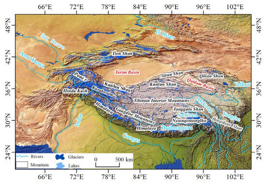
Zou people will like this. Animation Chogori:
https://en.wikipedia.org/wiki/File:K2-Animation_280611_DLR-Logo_1280x720.ogv
You people
Also very interesting:

Plume-Induced Rifting of Thickened Crust: 2D Numerical Model and Implications for N–S Rifts in Southern Tibet
https://agupubs.onlinelibrary.wiley.com/doi/10.1029/2022GL101479
The melt below there is likely extremely sillica rich ryolites thats basicaly liquid granite plutons
There seem to be some Fake News online.
It says that the mass started at Lantang Lirung and then proceeded to the river Lende Khola which is supposed to have its origin there.
The problem is that this river has its origin on the Tibetan Plateau in an area with glaciers and glacier lakes, bigger ones.
There is no bigger river at Lantang Lirung which is in Nepal, further south than the border post. Langtang Lirung is surrounded by valleys and also some gorges I think, hard to see.
In order to get to Lende Khola which is further north the mass would possibly have to climb at he end. A topographic map gives this impression.
If one follows the river one can see that the mass couldn’t have come from the Langtang Lirung glacier.
But basically it is very difficult to assess the geographical situation only with Google Maps and without having been there.
But there is s.th. murky about the info coming from the area. I am tending to exclude that glacier. A rockfall elsewhere with a glacier tongue (always muddy) is more probable. Or an explosion somewhere.
It is possible though that there were two events in the sense of lice and flees.
The same obscurity surrounds the info of a witness that the bridge be 100 m above the river. Was it a local?
Not the bridge. The Nepal immigration office, near Timure, which was destroyed, was 100 meter above the river according to the sole survivor (who was away on a training course).
Got it. It is the second one mentioned here, no picture, 13 min by car from the Rasuwagadhi Border Post, the Timure Dry Port, still in construction it seems:
https://english.onlinekhabar.com/rasuwa-customs-points-future.html
Please see the two most recent videos on the channel “TheGeoModels” in Youtube:
https://www.youtube.com/@TheGeoModels/videos?view=0&sort=dd&shelf_id=1
Thank you.
https://www.youtube.com/watch?v=iPHyZ_X8N5w
Getting very interesting at min 19 and afterwards
Kilauea seems most reluctant to continue its episodes. It has now done the amount of tilt increase after 7 days which after the previous episode took one day. There seem a continuing series of small DI events halting the inflation
Well, it did start to wake up Wednesday, but that 6 m/s has to go somewhere, unless the Pahala plume has declined. Mauna Loa has had a slight deflation, too.
I think the change in behaviour came after the tropical storm mid August. The green line move by about 5 microrad during that rain and it has not changed back. No idea why but it seems to have strengthened a change in the DI events that had already been on-going. As you say, the trend at this moment is a steep increase again.
Could the DI events be driven by hydrothermal activity? If a storm with heavy rain can strengthen the cycles, then it’s not unreasonable to assume that water is involved somehow. The timing could of course be pure coincidence and the eruption sequence just reached that point at the same time as the storm came in.
Here we see the longterm deformation of Fimmvörduhals / Eyjafjallajökull since the famous & expensive eruption 2010:
While over the last one year deformation was zero, over the longterm it was positive. Does it indicate the slow reloading of the magma chamber or an inflation because of slow deglaciation (climate warming)?
it is completely impossible for us to discern the cause without further study. It could be either or a bit of both for all we know. Katla and Eyjafjallajökull have been showing these signals for years and we’ve learned nothing useful or conclusive in over 5 years. MIght as well put it in the back of your head.
Can the inflation be the classical re-inflation as Mauna Loa did after the eruption 2022?
Another eruption in the saddle between the two within 10 years, in my inexpert opinion.
You see the same trend around all of Iceland’s glaciers, so the boring answer is that it’s most likely glacial rebound. The asthenosphere below Iceland is hot and has low viscosity, so rebound happens fast. After the last deglaciation, Iceland rebounded in around 1000 years, while places like Sweden are still rising 10000 years later.
This was also a very destructive lahar:
https://www.volcanocafe.org/the-terraces-of-tarawera/
And this:
https://en.wikipedia.org/wiki/Tangiwai_disaster
Getting back to the murky subject with at least 3.000 unaccounted for. Comments to this link, first sat map with many mistakes wondering who they got this from):
https://edition.cnn.com/2026/08/26/weather/floods-nepal-cause-vis
Mistakes:
1. Direction. What we see on this map in the NW ist in reality NE. The map was turned by ~90 degrees counter-clockwise, compare yourselves, the little border triangle helps with orientation.
2. Terminolgy. Lantang Lirung is not in that position, but further south. The glacier there might still belong to Langtang Lirung in case it is a larger mountain massif though.
3. Most decisive: The River Lende Khola isn’t there. Its source is in the North on the Tibetan Plateau. It flows south and then, in Nepal, takes a sharp turn to the West east of a village called Sequong village. A glacier from Langtang Lirung would not be able to get there.
The other sat map shows the border post between Nepal and Tibet. The bridge pointing north (in reality it’s east) comes from Nepal. The bus parking is west in China.
The river that is clogged by the lahar is not Lende Khola but Trishuli coming from the north. The river with sediment and water is the Lende Khola.
Would be thankful for counterchecks by who has time. Compare with ggl. and feel free to correct if wrong.
Summary: Neither the Trishuli nor the Lande Khola has any glaciers close to the border post. Even further up all glaciers at a considerable distance.
For comparisonhttps://www.google.com/maps/dir/Langtang+Lirung,+Langtang,+Bagmati+45000,+Nepal/Kathmandu,+Bagmati+44600,+Nepal/@28.3090705,85.4695262,12419m/data=!3m1!1e3!4m13!4m12!1m5!1m1!1s0x39ea8b71244db98b:0xfe9634d896668964!2m2!1d85.5175!2d28.2558333!1m5!1m1!1s0x39eb198a307baabf:0xb5137c1bf18db1ea!2m2!1d85.3221634!2d27.7103145?entry=ttu&g_ep=EgoyMDI2MDgzMS4wIKXMDSoASAFQAw%3D%3D
https://www.google.com/maps/dir/Langtang+Lirung,+Langtang,+Bagmati+45000,+Nepal/Kathmandu,+Bagmati+44600,+Nepal/@28.3090705,85.4695262,12419m/data=!3m1!1e3!4m13!4m12!1m5!1m1!1s0x39ea8b71244db98b:0xfe9634d896668964!2m2!1d85.5175!2d28.2558333!1m5!1m1!1s0x39eb198a307baabf:0xb5137c1bf18db1ea!2m2!1d85.3221634!2d27.7103145?entry=ttu&g_ep=EgoyMDI2MDgzMS4wIKXMDSoASAFQAw%3D%3D
Map with rivers. Trishuli left, Lende Khola right side.
ttps://www.google.com/maps/dir/Langtang+Lirung,+Langtang,+Bagmati+45000,+Nepal/Kathmandu,+Bagmati+44600,+Nepal/@28.3006068,85.4417171,13z/data=!4m13!4m12!1m5!1m1!1s0x39ea8b71244db98b:0xfe9634d896668964!2m2!1d85.5175!2d28.2558333!1m5!1m1!1s0x39eb198a307baabf:0xb5137c1bf18db1ea!2m2!1d85.3221634!2d27.7103145?entry=ttu&g_ep=EgoyMDI2MDgzMS4wIKXMDSoASAFQAw%3D%3D
Sorry. Exhausting.
https://www.google.com/maps/dir/Langtang+Lirung,+Langtang,+Bagmati+45000,+Nepal/Kathmandu,+Bagmati+44600,+Nepal/@28.3006068,85.4417171,13z/data=!4m13!4m12!1m5!1m1!1s0x39ea8b71244db98b:0xfe9634d896668964!2m2!1d85.5175!2d28.2558333!1m5!1m1!1s0x39eb198a307baabf:0xb5137c1bf18db1ea!2m2!1d85.3221634!2d27.7103145?entry=ttu&g_ep=EgoyMDI2MDgzMS4wIKXMDSoASAFQAw%3D%3D
Corr. east China, west Nepal. Sorry
I don’t see any serious problems with CNN’s description of events; they agree with what I’ve been reading. The only difference is that some reports say that there was a temporary dam on the river at the bottom of the initial slide off the north side of Langtang Nirung peak. The map that shows the direction of the slide is oriented with east at the top, but that is indicated by the north arrow at the bottom right of the map. Langtang Nirung is shown correctly labeled just above the peak, and the start of the slide agrees with the notation “The Great Slide” shown on Google Earth. The map could have been improved by showing a continuation of the flood to the south, after the border crossing. I don’t know the names of the rivers because Google Earth doesn’t clearly show their names, but the names aren’t important to me.
As far as I know google shows the state like it is.
The rivers are important. There is no mud to be seen near the bed of the Lende Khola River. The mud can clearly be seen on both border posts and down south in Nepal and reaching out north-west from the border posts and the Trishuli confluence following a STREET. The Trishuli river upstream has none of it.
Between the Langtang Lirung and the Lende Khola I see nothing. That would be the first lahar that doesn’t leave a trace.
One can see a piece of a glacier missing north of Langtang Lirung peak. If the dark part south-west of it is an abyss or a valley that piece might be sitting on the bottom. It is hard to tell though because of mountain shadows.
Maybe Jesper should take a look. He found a crater on Io.
https://www.msn.com/en-au/news/other/how-china-buried-tibet-flood-images-after-nepal-disaster/ar-AA2bh84B?ocid=BingNewsSerp
From article:
“In July 2025, Gyirong Port was completely shut down after being devastated by another severe flash flood. It took nearly six months to rebuild and reopen the port on January 1, 2026. Eight months later, the port has been destroyed again.
As the deleted “Matou Qingnian” article noted, Gyirong Port has now suffered mudslides during the flood seasons of 2024, 2025, and now 2026. In 2025, several Chinese personnel went missing or were killed.
By erasing the “half-year” trend, censors blocked an inevitable and dangerous train of public inquiry.
If the state-of-the-art border facility was destroyed twice in 14 months, it raises critical questions about site selection, shoddy infrastructure construction, and the complete failure of glacial lake monitoring and early-warning systems in Tibet.”
It was no glacier. It was not in Nepal.
The July 2025 flood came from a glacial lake above Purepu Glacier at ∼5150 m elevation. It came down the Lhende river.
That makes sense as it follows the Lhende River and the Lhende River comes from a region in Tibet with lots of glaciers and gl. lakes.
But I think a rock- or glacier fall from Langtang Lirung would end up in the Langtang River which joins Trishuli further downstream at Syaphrubesi.
https://farsightnepal.com/news/a-hidden-glacier-lake-caused-the-deadly-bhotekoshi-flood-scientists-say/
The narrative here, covered by China AND Nepal, but not everybody in India, is not logical. They like to speak of Bothe Koshi which means River from Tibet. There are at least three of them, all coming from Tibet. One is Trishuli. A glacier or rockfall from Langtang though has no connection to Trishuli.
Maybe there was an earthquake after all (there were four around the Tibetan Plateau in the last 24 h) which triggered a rockfall with part of a glacier in Langtang and s.th. else around the border.
One thing seems sure to me: The Chinese have two much construction (6 lane highway, Mega-Dam) on a suture zone riddled with faults and a possible remnant of a subduction zone.
https://www.sciencedirect.com/science/article/abs/pii/S0012821X00002879
On a side note: India sent in a tunnel team to look for survivors in tunnels.
I’ll try to make this clearer. This is the northern part of Langtang Lirung. There are lots of traces of lahars there, and I can’t say whether they are fresh or older. The one in the middle here is in Nepal, the one on the right side in Tibet.
Both would end up in the beforementioned Langtang river which runs in a famous valley with the Langtang River Trail. Joins the Trishuli further south plus no news about damage in that valley.
https://www.google.com/maps/@28.2731958,85.7023663,19736m/data=!3m1!1e3!5m1!1e1?entry=ttu&g_ep=EgoyMDI2MDkwMi4wIKXMDSoASAFQAw%3D%3D
South of Lantang Valley there is another part of this mountain chain running east-west. I can see some lahars there as well. They would run down to a valley called Danger Valley 😂 or 😒 and a river starting there – name unknown to me, so let’s call it Langtangkoshi that flows down to the eastern area of Kathmandu.
https://www.google.com/maps/@28.1338284,85.6993193,4940m/data=!3m1!1e3!5m1!1e1?entry=ttu&g_ep=EgoyMDI2MDkwMi4wIKXMDSoASAFQAw%3D%3D
So, there is no logic in the story. It seems important to know that they are looking for survivors in Powerplant Trishuli 3A and 3B which is an enormous project further down from the border, ~30 km. I guess a mass would end up here first as there should be a dam.
The whole thing is an enigma for me. The narrative makes no sense so far.
You may be overthinking things. There is no doubt where the debris flow came from.
There are different names in use for the various rivers. Trishuli is the main name after the confluence of the Lende Khola and the Kerung Khola at Gyirong. Google maps uses the name Trishuli also for the Kerung Khola. Water from the north side of the Langtang complex ends up in the Lende Khola (that is the glacier collapse). Water from the south side of Langtang ends up in the Langtang Khola river which joins the Trishuli further south.
The Lende Khola is also known as the upper Bhote Koshi. It originates in Tibet but flows along the border for much of its length, with tributaries from both sides.
The Trishuli ends close to Kathmandu. The debris flow became more of a flood further downstream but still did a lot of damage along much of its length, including at the power plants.
Thank you Albert for taking the time. Hope I was of help too with the precise questioning of the situation. Googled Langtang Lirung from the east and got this which explains it, the glacier being a bit under the peak on the north-east side. It is indeed possible. In the second link it might be the structure in the middle.
https://www.reuters.com/graphics/NEPAL-FLOODS/MAP/byvrdywwlve/
https://www.google.com/maps/place/Langtang+Lirung/@28.2616148,85.4454448,9869m/data=!3m1!1e3!4m6!3m5!1s0x39ea8b71244db98b:0xfe9634d896668964!8m2!3d28.2558333!4d85.5175!16zL20vMGMxbXJu?entry=ttu&g_ep=EgoyMDI2MDkwMS4wIKXMDSoASAFQAw%3D%3D
The river bends here, and there is a lot of brown stuff in otherwise green surroundings. The meeting point might be somewhere here then>
https://www.google.com/maps/place/Langtang+Lirung/@28.2616148,85.4454448,9869m/data=!3m1!1e3!4m6!3m5!1s0x39ea8b71244db98b:0xfe9634d896668964!8m2!3d28.2558333!4d85.5175!16zL20vMGMxbXJu?entry=ttu&g_ep=EgoyMDI2MDkwMS4wIKXMDSoASAFQAw%3D%3D
https://www.google.com/maps/place/Langtang+Lirung/@28.3220322,85.4163353,17z/data=!4m6!3m5!1s0x39ea8b71244db98b:0xfe9634d896668964!8m2!3d28.2558333!4d85.5175!16zL20vMGMxbXJu?entry=ttu&g_ep=EgoyMDI2MDkwMS4wIKXMDSoASAFQAw%3D%3D
Thanks again. A real conundrum with the mess with the many names.
First link to be ignored, double.
Sorry. I reconsidered it. What Reuters show is the glacier with the tongue. This would probably come down east of Benbo. There is no Lhende Khola there as the Lhende Khola descends from Tibet between Seqiong Village and Benbo.
That means that the narrative changes all the time. First something fell into the Trishuli, then it fell into the Lhende Khola, but pictures are from another glacier.
There are traces of debris on practically every mountain ridge and in valleys.
Anyway, something might be missing on the next glacier or the southwestern part of the same glacier, and then it would fit precisely. The direction would be on a mountain ridge towards Seqiong Village. Any damage there?
No pics I guess. No info
The Kolka slide and the Huascaran Slide are listed as similar events under this, 2025:
https://en.wikipedia.org/wiki/2025_Blatten_glacier_collapse
The Nepal catastrophe might have a different mechanism at least as long as we do not see Sat images from the starting point, and that means info from Nepal or India. Info from China is worthless in this case. A nation that tries to make an area far away in one of the poorest countries in the world the culprit shouldn’t be taken too seriously concerning info.
Not mentioned so far is the Alaskan tsunami this year, which was similar – a massive rock failure associated with a glacier.
Massive Alaska megatsunami was second largest ever recorded (BBC, 6 May)
Fortunately the area is uninhabited as a 500m high tsunami would be vastly destructive.
Thanks BoN
“and a reminder of the risks posed by melting glaciers, say scientists.” says the BBC.
Problem is that there is a picture in there and that is and probably was no glacier around, but a rockfall in the sense of a “Bergsturz”. In an area with high erosion.
Their repetitions without studying the case make me wary. Their endless fiddling the same simplification in order to avoid doing some research. It will get worse or better with AI, we’ll see.
The thinner red lines are strike-slip if I read this correctly
https://www.researchgate.net/figure/Principal-active-faults-and-historic-earthquakes-in-the-Himalaya-Mountains-Tibetan_fig1_332496823
in here
https://www.tiktok.com/@imtz.ali/video/7681229579171712274?
Sth different, yet interesting, didn’t know it.
https://scienceinsights.org/how-do-tibetans-survive-at-high-altitudes/
Fascinating example of a glacier that at the time had a positive mass balance, but developed pockets with hidden glacial lakes which since 2010 is observed and pumped out:
“Prior to 1878 the glacier would not have been well-visited, so any surface lake could have gone unnoticed, and after 1878 the glacier experienced a positive mass balance (i.e. year-on-year accumulation of snow and ice) which would have hidden the lake from view until the eventual outburst flood in 1892.”
Overflow in 1892 caused destruction and ~200 fatalities.
https://en.wikipedia.org/wiki/T%C3%AAte_Rousse_Glacier
This should be done where it is possible. Would donate any time. Might be technically difficult in the Himalayz though.
https://glaciersalive.ch/en/diavolezza/
Covering a glacier with fabric is a bit more effective than stopping tectonic movements with duct tape, but still futile and not scalable, Germany has been trying it for many years on what used to be out largest glacier. It is a lot of work, a lot of plastic (good for the Swiss to use a more sustainable new product though), look ridiculous in summer, and didn’t stop its rapid decline. Snow cannons sound like they could be more effective and cheaper if the ski area already has them. Still all glaciers in the Alps are doomed in the near future.
Oh yes, it stopped the decline of Diavolezza. Around the corner they use snow cannons. If the results are superior they will go on with them. You didn’t read it.
Doomed like they were 10.000 years ago when the ice had retreated to near non-existence when a larch tree started its life on a place that is now still covered by the Morteratsch Glacier? Come on.
In order to stop this process we need two or three VEI 7 in the right places. Campi Flegrei might help. Does anybody want this?
It would dwarf these problems.
This is another method, again the problem of access in the Himalayas, it might workin some places in the Andes though:
https://en.meteorologiaenred.com/Switzerland-wants-to-save-a-glacier-from-global-warming.html
Albert,
is there an explanation for this?
It is the upper section of the Llende Khola. You will find it when you follow it north in Tibet. It looks huge.
https://www.google.com/maps/search/seqiong+village+tibet/@28.4154105,85.4328742,2464m/data=!3m1!1e3?entry=ttu&g_ep=EgoyMDI2MDkwMS4wIKXMDSoASAFQAw%3D%3D
Anak Krakatau in high-level eruption…apparently not your runadamill eruption (by recent standards). Ash cloud reported up to 50000 ft per Darwin VAAC. Info is meager, but satellite shows a very dense ash cloud.
Satellite link:
https://slider.cira.colostate.edu/?sat=himawari&sec=full_disk&x=3540&y=12372&z=4&angle=0&im=6&ts=1&st=0&et=0&speed=130&motion=loop&maps%5Bborders%5D=white&p%5B0%5D=geocolor&opacity%5B0%5D=1&pause=20260905004000&slider=-1&hide_controls=0&mouse_draw=0&follow_feature=0&follow_hide=0&s=rammb-slider&draw_color=FFD700&draw_width=6
50,000 feet, about 15 km. 50 km. would be…alarming.
Urgh. Thanks for clarifying the typo!
Sure wish I could edit posts.
done
Thank you, Albert!
Indeed, but, as we discovered with Hunga Tonga… all too possible (maybe not with this type of volcano, though?)
The shock waves are also incredible. There are numerous reports and videos of constant rumbling and vibrations around Carita, and even in Bandung.
Nice one.
It takes me travelling:
https://en.wikipedia.org/wiki/File:2025_Myanmar_Earthquake_(M_7.7)_shakemap_v2.pdf
The subduction zone which contains Krakatau: I travel north and get to the Myanmar earthquake zone (now transform fault). Wondering whether it was a continuation of the subduction zone some 30-60 Ma and whether the Indian plate might be a bit larger reaching east to end at the transform fault.
Following it around the Indian plate we can paint it all blue and subtitle it 60 Ma. We should draw some island arcs in there. Then we can see precisely the banks of Tethys.
If I project this into the future I have the Somali Plate travel east, collide with Sumatra and Indonesia and finally cause a new orogen. This is absolutely unsafe because a rift can fail. The Somali Plate would stay put then.
Another phantasy of mine can see s.th. like CAMP happening around the Indus-Yarlung-Tsangpo-Suture Zone (IYTSZ). The chain has about the same height as the Transpangaean Mountain Chain is imagined. There are zones with higher velocity underneath. This all for 30-100 million years in the future being some Jesper-inspired fun. Plate tectonics might decide otherwise.
But the region will stay fragile. There will be more earthquakes and more land- plus glacier- slides.
People who travel there will be confronted with striking beauty (Annapurna Trail from Manang, Langtang Trail etc), but should be aware of the risks, on higher ground also from snow storms like this one building up on a Typhoon:
https://en.wikipedia.org/wiki/2014_Nepal_snowstorm_disaster
I found this video on Youtube: https://www.youtube.com/watch?v=Reg_TypDDRQ
I guess it is legit. At least it has less AI-images/animation than on some other “news” videos.
And funny that some of the local newspapers in Singapore and Jakarta mention nothing about this.
Although that guy, Stefan Burns, likes to use quite apocalyptic click-bait titles in many of his videos.
Is he really a Geophysicist?
They do. In their language. I had ggl translate this. It is an intermiittent eruption that started on the 4th Sept there.
https://www.infoindonesia.id/info-daerah/96117597817/mengapa-erupsi-anak-krakatau-bisa-terdengar-hingga-bandung-ini-penjelasan-badan-geologi
Article about the sounds heard in Bandung, 700 km from Krakatau.
Thanks. So I guess that the “expat-magazines in English” want just to concentrate on politics, sports, and the lifestyle-issues, and do not want to make the tourists worried about what is happening outside the city…
Could be. They are like that.
They are basically irresponsable, A.K., want to make money. I read a site about Manang Valley and the Trekking around Annapurna (~14 days) The site said two overnights in Manang Valley, then start. Travel time march to May (before Monsoon) and September to November, after Monsoon, before winter. Both wrong.
I read s.th. more responsable. Adaptation time in Manang Valley 4-5 days (to avoid AMS, Acute Mountain Sickness). And then I read about the snow storm in the middle of Octobre with 40-50 fatalities.
They are irresponsable and would never inform about 1. risks, 2. the crime rate.
We are on our own. With other people we ask. And with AI we have to learn to contest. I did that the other day with another subject. It was funny. AI had to take turns. It wouldn’t give up. I gave up seeing how it is fabricated.
GeologyHub just made a video about it but he doesn’t seem to ghave much in the way of footage other than satellite imagery. There appears to be quite a bit of dirt in the water.
https://www.youtube.com/watch?v=GFdRyNeKcxU
He also says that the officials do not see a tsunami risk.
Concerning protection for glaciers in the Karakoram or Himalaya or Pamir mountains: I just read about MD Asma Mushtaq from Birmingham who climbed Spantik, “only” a six-thousander in Gilgit-Baltistan, beautiful:
She died of altitude sickness while descending on Aug.20. They just finished transporting her body from Camp III to CAMP II. Choppers cannot land there. So access is difficult. The European Alps have different conditions.
Spantik close to Chogori (K2) and the Gasherbrums:
Forgot. You want them small>

 ?utm_source=commons.wikimedia.org&utm_campaign=index&utm_content=thumbnail
https://www.youtube.com/watch?v=ILngACgq4w8
Video which explains the failed glacier. Good
By
https://www.willseygeology.com/about-me
Same author, comparison with Chamoli disaster.
https://www.youtube.com/watch?v=X6pSEYTsY7s
It wouldn’t have been a disaster if there hadn’t been a dam construction going on, Tapovan Vishnugad Hydropower Plant is a 520 MW run-of-river hydroelectric project being constructed on Dhauliganga River in Chamoli District, (info from wikip.) It would have been nature at work without fatalities. This means that these things happened probably all the time before industrialization and tourism started in the Himalayas and, before Satellites, without anybody taking notice.
It seems to be a similar mechanism, rockfall with parts of a glacier, going down an empty valley and then hitting the construction site. Near Nanda Devi National Park, an est. 400-500 km as the crow flies from Rasuwaghadi, Nepal. Same southwestern border of the Himalaya.
https://www.google.com/maps/@29.0249532,82.2463989,7z?entry=ttu&g_ep=EgoyMDI2MDkwMi4wIKXMDSoASAFQAw%3D%3D
This is easier to understand. The plant sits on a river called Alakananda. I had never heard of it, it is a famous river though. It starts with a considerable width under an enormous glacier, and on the other side there are glaciers as well. It has five confluences of which the last with Baghirathi is the most famous one, in Devprayag, prayag meaning confluence, as this is the birthplace of River Ganges.
Pic small size.
From those enormous glaciers on both sides it flows east first, then mostly south and west, sometimes a short distance to the north, surrounding some rocky structure, down to Devprayag.
No problem for a rockfall to be transported with or without ice.
The first confluence is Alakapuri where it turns south. The description (mythical) is interesting. we can see that it was green once. If it existed. If it really existed it has been warmer there once. If not, this should be a dream of a lush place, maybe by a person who had travelled to some place in the Middle East or came from there.
https://en.wikipedia.org/wiki/Alaka
The street follows the river Alakananda most of the time unless there is some obstacle, mostly rocky. One can go from the birthplace of Ganga all the way up to Alaka, at the end with hairpin needles. Some of the grandparents of the older Britons might have done that.
It does with me what India often does with me, makes me a bit nostalgic thinking: It must be nice to go up there. While hoping on the ride that nothing bigger comes travelling down.
The peak of Kilauea’s tephra cone is now 47m above the old ground. That’s 1/3 of Monto Nuovo’s height with 132m.
If we assume a dormant period of two weeks between E54 and future E55, we can expect E55 around September 8th.
Sensible article:
Although climate breakdown and global heating may have been the trigger for this disaster, the question that will have to be asked is why the death toll is so high. And the answer lies in the lack of zoning laws to prevent unregulated settlement along vulnerable floodplains. Infrastructure plans for hydros and roads did not take into account climate impact on an already fragile mountain range.
Once the emergency search, rescue and rehabilitation has been addressed, the new government has to work with local governments to prevent densely-populated settlements along river banks. But this has to be done with the sensitivity that was lacking in the mass evictions of squatters under the Prime Minister’s orders in Kathmandu in April.
Building cascade hydropower plants on a single river basin is an obsolete concept. Projects need to be decentralised to spread the risk from future floods, they should be more but smaller plants, and the energy source must be diversified. This is self-evident for a multi-hazard country with the co-risk of seismicity and climate change.
https://nepalitimes.com/a-disastrous-state-of-affairs-in-nepal
They know best:
Our ancestors knew not to live next to Himalayan rivers. Nepal’s townships used to be located along high ridgelines, and floodplains were only used to grow food or grind grain. Bridges were temporary, and designed to be rebuilt after monsoon floods washed them away.
Economic desperation, outmigration from rural areas and proximity to roads have pushed people to settle along river banks – despite full knowledge of the risks. Hazard mapping of settlements along river banks enforced by local governments could have saved many lives this week.
https://nepalitimes.com/not-if-but-when-next
The little girl in the pictures has not spoken since her mother and older sister have been washed away
Also brillant
Alton C Byers is a mountain geographer, conservationist and researcher on Himalayan glaciers with the Institute for Arctic and Alpine Research at the University of Colorado, Boulder. Sophia Kalantzakos of New York University’s Geopolitics and Ecology of Himalayan Waters Initiative spoke to him about this week’s Himalayan flood disaster.
https://nepalitimes.com/this-is-by-far-the-most-horrific-flood-i-have-ever-seen
This is why focussing only on climate warming is wrong:
The analyses also showed that a close sequence of at least five major earthquakes preceded the landslides about 3000 years ago. “We therefore suspect that seismic tremors not only trigger landslides themselves, but also gradually make the rock slopes more and more unstable,” adds Michael Strasser. “With all this new information, we now want to make a contribution to better estimating and forecasting future earthquake and landslide hazards in the densely populated Alpine valleys. Earthquakes of this magnitude are rare, but they can have devastating consequences.”
This might pop up in German but can be translated:
https://www.uibk.ac.at/de/newsroom/2021/starkbeben-waren-ausloeser-fuer-tiroler-bergstuerze-am-fernpass-und-am-tschirgant/
We can shut down e.th. world-wide, it will still happen. The Himalaya is unstable. The Karakoram is more stable. I’m not saying that climate warming doesn’t facilitate it, I only want to stress that it is only a factor. It says “preceded” btw. Gorkha 2015
I think this is important.
Found a local news report about the Krakatau eruption, it has better footage.
The question is, is it going to stop soon?
Even better footage of Krakatau, some from a boat:
https://www.youtube.com/watch?v=SkyMxUPAuuw
It resembles a bunsen burner.
It resembles a bunsen burner.
Funny. It does.
15 km tall ash plume – the first actual Plinian eruption 2026?
Ambae 25.08.2026 16km plume as well
The image of Krakatau’s ash/steam plume looks very massive, so likely enough volume for a Subplinian VEI3:

https://www.vulkane.net/blogmobil/anak-krakatau-vulkanausbruch-eskaliert/
Sometimes volcanoes do high ash plumes with relatively small volume. This applies f.e. to Etna’s usual major explosive eruptions and the above-average explosive eruptions of Stromboli. These are big Strombolians. It’s a bit difficult to distinguish between big Strombolian and small Subplinian eruptions. Both can be impressive with high ash plumes.
Note the ash affecting Jakarta. This was not Strombolian
Mount Rainier. Same mechanism.
“Geologists have found evidence for at least nine large lahars (or volcanic mudflows) from Mount Rainier in the last 5,600 years that reached into the Puget Lowlands. Several areas around the volcano inundated by these large lahars are now densely populated and contain critical infrastructure such as highways, bridges, ports, and pipelines. Geologic evidence tells us that most large lahars occur during Mount Rainier eruptions. However, scientists have found no evidence of eruptive activity associated with the most recent large lahar (the Electron Mudflow of ~1500 A.D.), which instead was caused by a large landslide off the west flank of Mount Rainier. Scientific studies show that the west flank of Mount Rainier is potentially vulnerable to a future large-scale collapse, which could produce a large lahar down the Puyallup, Mowich, and/or Tahoma Creek and Nisqually River drainages. Mathematical models indicate that such a lahar would reach residential areas inside the park in about 5 minutes and residential areas outside the park in 15 to 60 minutes.”
https://www.usgs.gov/volcanoes/mount-rainier/science/monitoring-lahars-mount-rainier
Mount Rainier’s deadliest threat isn’t lava, it’s a mudflow called a lahar
https://morningoverview.com/mount-rainiers-deadliest-threat-isnt-lava-its-a-mudflow-called-a-lahar/
Back to Kazbek, back to Himalaya. Been looking at hotsprings in Tibet and Nepal. Numerous.
https://www.bbc.co.uk/news/articles/cvgy5k4n07ko
From the image, the top of the newly build cone appears to have blown up. The bunsen burner might because of a lava pond that is now exposed – it is hard to tell from the images but the fact that the reflected light is continuous suggests exposed lava.
It looked to me like there is a lot of upward moving air, maybe a lot of gas being released?
Also there was some lava fountaining.
The lava fountaining presumably came after the main explosion. Based on the ash, I would expect VEI 4.
https://www.msn.com/en-xl/travel/general/warning-for-aussies-as-indonesian-volcano-eruption-sparks-travel-chaos/ar-AA2bFPbv?ocid=msedgntp&cvid=6a9da022a1ed4bf8a7dec7a66434b5a4&ei=15
Here we are. If it had been bigger news some people could have cancelled their flights on time.
https://finance.biggo.com/news/431bfcf0-a0b5-498c-908a-2deb39eab857
Io haves a crazy geothermal gradient! new findings
Interesting for everybody interested in ~1.600 BC:
https://oup.silverchair-cdn.com/oup/backfile/Content_public/Journal/pnasnexus/1/2/10.1093_pnasnexus_pgac048/5/pgac048fig1.jpeg?Expires=1791798940&Signature=XkIMCJNt2luK2dCzF1Q2uNkv4Ou50bHQQcWO49swhMDUWhUP4q2DhzuBFuGSAjNshRdwtMDjg1TZuw9Uw~p9ZP6Sbuv8S8wM18Am6jjWPhx0E0XfZ-CF1doU-wNVZzQAF9heVmNSKmeJrgWXFTF5BJqWpmGhhMK9xWisSHLyiFj93kS6eY-91Q5zVkzMy4MhO4Q6XbiM01KVFPGuEIOZFu4O9Uc9nH9jfiRJoOeJvkMparw~dVGijCjF0uZUOmz4febWfl06ICxZvnI2RaPA4i46cOS~mN0KR2E3trARE-T-na8ExuND39bdLk-Aq8sZhSzzoGecEH1kYcXVcaikvw__&Key-Pair-Id=APKAIE5G5CRDK6RD3PGA
https://academic.oup.com/pnasnexus/article/1/2/pgac048/6575909
Authors of paper above think the haze seen in Babylon was from Aniakchak.
A NEW LOOK AT THE VENUS OBSERVATIONS OF AMMISADUQA: TRACES
OF THE SANTORINI ERUPTION IN THE ATMOSPHERE OF BABYLON?
https://www.researchgate.net/profile/Teije-De-Jong-2/publication/254913983_A_new_look_at_the_Venus_observations_of_Ammisaduqa_traces_of_the_Santorini_eruption_in_the_atmosphere_of_Babylon/links/5512f9f80cf23203199a0ccb/A-new-look-at-the-Venus-observations-of-Ammisaduqa-traces-of-the-Santorini-eruption-in-the-atmosphere-of-Babylon.pdf
Good morning Albert,
I read your piece about the Anatolian Fault again, getting there by first following the Himalaya-Karakoram region west through Iran and the Turkey while counting earthquakes and then looking for lahars on Ggl Earth as there is little info about lahars aside from Mount Rainier, Ruapehu, Merapi, Nevado del Ruiz and so on.
After that I started an overview of the Tibetan Plateau which has high mountains around like a horse shoe on the southeastern, southern and northwestern sides. From North going counter-clockwise we have the Tian-Shan Mountains, Kunlung, Pamir, Karakoram, Himalayas and others.
It jumped out at me that in the middle there is an enormous desert called Taklamakan. Surrounded by mountain ridges I asked AI: Was the Taklamakan once a part of Tethys? I got the following answer:
“Conclusion
While the Taklamakan Desert is not a direct “remnant” of the Tethys Ocean itself, it is a geological successor to the Paratethys, which was part of the Tethys system. The desert’s formation is thus a product of both ancient marine history and modern tectonic and climatic processes. This makes it a key example of how ancient oceans can leave behind desert landscapes long after they have disappeared.”
https://espace.library.uq.edu.au/view/UQ:4058e1f
After that a found another remnant:
https://en.wikipedia.org/wiki/Lake_Balkhash
The area is a trust fold belt.
https://www.mdpi.com/2072-4292/16/17/3343
China, on a side note, has the largest afforrestation project going on there in the north of the Tarim Basin that contains the desert.
Anyway, what I want to say: The horseshoe plus Iran plus Turkey will always have earthquakes, rockslides and lahars.
As I enjoyed all your pieces about earthquakes, I would be happy if you’d continue with that area in case you have time and interest. Always willing to help with some ideas, papers or info.
With kind regards
Addendum as most readers prefer volcanoes:
https://en.wikipedia.org/wiki/Tianshan_Volcanic_Group
Addendum II: The picture is Molcha River Delta, alluvial fan:
https://en.wikipedia.org/wiki/Molcha_River
How about this one:
https://www.volcanocafe.org/the-aral-sea/
Oh great. Lake Balkash is mentioned in there, but not its nearest volcano. That should be Tianshan, eruptions 50 AD and 650 AD, (The Chinese General, Teu-Hian (who was fleeing from the Chinese army) said that when climbing the Tianshan Mountains, saw “The Fire Mountains which send out masses of molten rock which flow for many Li”). From link I posted to Tian Shan VG. Both lakes are supposed to be remnants from different arms of Neotethys.
I also recommend to compare these maps:
https://nepalitimes.com/which-way-will-the-tibet-nepal-railway-go
3rd picture
https://www.google.com/maps/place/Rasuwa,+Bagmati+Province,+Nepal/@28.267916,85.4752169,19838m/data=!3m1!1e3!4m6!3m5!1s0x39eaec6a1ca77a0f:0xefb0fc61bccf18e8!8m2!3d28.1755277!4d85.3962769!16zL20vMDhjbF85?entry=ttu&g_ep=EgoyMDI2MDkwMi4wIKXMDSoASAFQAw%3D%3D
From article above this one:
“The gradient required to descend from 4,000m on the Tibetan Plateau to 1,400m above Kathmandu is so steep that engineers have proposed drilling through the mountains with 98% of the tracks on the Nepal side inside tunnels…….
Although drilling under the mountains will minimise environmental impact in two national parks, the tunnels will traverse the Main Central Thrust faultline of the Himalaya. Mitigating earthquake risk will push the total cost even higher than a normal tunnel project.”
https://nepalitimes.com/which-way-will-the-tibet-nepal-railway-go
Read the Aral Sea nostalgic piece now in peace and quiet. Beautiful piece. Everybody I know who gets into Tethys becomes a bit nostalgic, you, Dorrik Stow, me, my daughter, Jesper. You also begin to see it, its calcified remnants or desert. It has the right name. In a way it is still here, a goddess therefore. I am sure it will return. Pangaea lasted only 50 million years. The processes in the mountain ranges around the Tibetan Plateau are unique on earth. What, if we witness the first chapter of a break-up, the range is high enough. What if there is a spreading ridge in 10 – 20 million years? A LIP as well?
Unimaginable?