We are still learning. There is much we humans don’t know about volcanoes or about how they behave. The past few years have been enlightening. It all started in January 2020, the Svartsengi region started rising, and an elliptical area of inflation appeared that encompassed Mount Thorbjörn, the Svartsengi Power Plant, and the 800 years Eldvörp fissures. It became apparent that magma was building up under the area, the elliptical shape implied that there was a sill inflating below the ground, a flat body of magma. At this point, this was merely some unrest, but it would escalate into the once-a-millennium cycle of Reykjanes eruptions. This would become clear a year later.
On 24 February 2021, a dike intrusion started growing under the northern part of Fagradalsfjall, a cluster of subglacial volcanoes formed during the ice age, which is located 10 km NE of Grindavik. The dike continued to grow slowly in a remarkably long-lived and complex intrusion, spurts of magma made their way into the rock cutting open the plate boundary to eventually erupt a month later, making a series of surface fissures that effused magma to construct a small shield volcano. This eruption was complex, at first it shifted in between different fissures, then stabilized into a single cone that featured episodic fountaining, sometimes the eruption would stop for a while and then resume. The chemistry of the magma also shifted over time. This may be considered to have been the start of the Fagradalsfjall Fires. Over the next three years, this volcanic system would continue to experience activity, which consisted of dike intrusions that originated from the same spot, under the northern part of Fagradalsfjall. Dikes are expanding blades of magma that intrude from a volcano, and in mid-ocean ridges, they are the ones that generate oceanic crust, by filling the plate boundary and then solidifying into rock. These Fagradalsfjall dikes took place on 21 December 2021, 30 July 2022, and 4 July 2023. The first did not erupt, the last two erupted. All Fagradalsfjall eruptions were of a low intensity and moderately long duration. It’s unclear to me if Fagradalsfjall will continue to do dikes and eruptions or not.
2023 was an important year for the volcanic cycle. If 2020 was the first magmatic activity below the surface, and 2021 was the first eruption onto the surface, then 2023 was the year the activity went crazy. July had two dike intrusions, the eruptive event of Fagradalsfjall, and another simultaneous dike in the Eldey volcano, just offshore the Reykjanes Peninsula. The seismic swarm of Eldey had all the characteristics of a dike intrusion and was most certainly one. Another event took place on August 13 a few tens of kilometers down the submarine Reykjanes Ridge, it featured many characteristics of a dike intrusion, although due to the distance, the earthquakes were poorly located and it’s hard to know for sure, but my feeling is that it was a dike. During late October the Svartsengi area resumed inflation, but faster than on previous occasions.
On 10 November 2023, the plate boundary snapped into a massive dike, some 18 km long. The sides of the dike rebounded, unleashing their pent-up strain from the plates pulling apart over two millennia and at the same time the ground above the dike sunk, undermined by the extension of the earth, Grindavik was to be found in this unlucky graben, this linear depression along the dike intrusion that experienced deflation and formation of large fractures. The intrusion had commenced under the Sundhnukur fissure swarm. This is a polygenetic system of fissures that last erupted 2000 years ago. This fissure system is along the east end of the Svartsengi magma sill that has experienced episodes of inflation since 2020. The dike did not erupt, but the area did not fall quiet either. Inflation seemed to be underway again and seismic activity was continuous all along the Sundhnukur fissure swarm.

The red line is the Sundhunukur fissure swarm of 2000 years ago. Circles are earthquakes from IMO. Red earthquakes belong to a swarm that was ongoing during the hours preceding the November 10 dike. During the dike intrusion, that area was aseismic, as it was during the following 2. Yellow are early intrusion quakes, blue are the last events. I made this map back then while it was going on. The dike continued to lengthen afterward and grew offshore as well as northwards.
This situation of constant inflation and seismic activity continued until December 18 when the system ruptured again and in just over an hour magma made its way from the 5 km deep area of magma accumulation to the surface, it blew into a huge fountain over 100 meters tall and the ground started to rip open in both directions, up and down the fissure swarm, cracks opened up and lava gushed out of them. Soon a continuous curtain of fire some few kilometres long was born. This eruption was far more intense than those of Fagradalsfjall, which some of us had warned they would be in the comment section beforehand. In my Reykjanes Fires article that was released again just after the eruption, I talked about two types of eruptions that occur in the Reykjanes Peninsula, slow and fast. The eruptions of Fagradalsfjall were slow. The eruptions of Sundhnukur 2000 years ago were fast, and the eruption of December 2023 was fast too, although not as large as some of the earlier eruptions in the area that managed to send flows to greater distances. The eruption was over in under a day. Again continuous earthquakes and deformation resumed, and a line of earthquakes also became active under the western part of Fagradalsfjall, more than 6 km deep, probably a deep perpetual dike.

Map showing earthquakes of the December 18 dike intrusion, from IMO. Blue circles are the earliest earthquakes, while orange are last. It shows propagation both up and down the swarm. A relatively aseismic area in between the blue earthquakes, towards the middle of the dike is the spot that seems to be supplying the intrusions. This spot flared with earthquakes for several hours before the first November dike, which itself was aseismic there, it is also where the largest Sundhnukur craters are located and where the tallest fountain of the December 2023 eruption formed, The first fountain of the eruption which towered well above 100 meters in height above its base.
As I write this article Sundhnukur rages into life again. It erupted after a 5-hour-long dike intrusion that started around 3 AM on January 14. The intrusion made its way southwards and reached under Grindavik, eruptive fissures then opened around the central part of the intrusion, north of Grindavik. One of the fissures opened inside the protective wall, constructed to keep away the lava, and thus is heading towards town. Luckily this is only the output of one single fissure, the walls have deflected the rest of the flow away.
Unfortunately, just after publishing this article, I’ve seen in the comment section from Quinauberon and Chad that a new fissure has just opened up within Grindavik, right next to some houses, although it’s really weak and unclear whether this vent will do much damage. The main flow is right now outside the wall, following its perimeter, and seems to have protected the town thus far.

Earthquakes of the last, 14 January, dike intrusion shown on a map. Green events are earliest, pink events are last. The sequence started just south of the aseismic area and advanced towards Grindavik. Fissures opened towards the middle of the earthquake line.
A dike in November, another in December, and now one in January. We are going at one event per month right now. The once-in-a-millenium Reykjanes cycle seems to be escalating and has entered a new chapter, that of the Sundhnukur Fires. Meanwhile, Eldey, Fagradalsfjall, might want to repeat at some point. Krysuvik swarms, and who knows what else awaits. The broader Reykjanes activity is unprecedented in modern observation times, but the Sundhnukur Fires do have precedent, the Krafla Fires and the Afar episode of 2005-2011.
The Krafla Fires
The Krafla Fires were a series of 18-20 dike intrusions of varying size between 1975 and 1984 from Krafla volcano in northern Iceland. 9 of the Krafla Fires dikes erupted. The eruptions totaled some 0.3 cubic kilometers. However the intrusive volume must have been much larger. The first dike was the largest and generally the dike size decreased through the sequence. The first 3 eruptions alternated with non-eruptive dikes and were minuscule. The six last dikes, from March 1980 onwards, were all eruptive and of increasing eruption size. Eruptions focused towards the end of the episode and were all close to the center of the fissure swarm, whilst the distal ends of the swarm were more affected by the early dikes and did not erupt. Eruptions happened as little as one hour after the dikes started growing, and up to several hours afterward. By the end of the Krafla Fires the central parts of the fissure swarm had opened by as much much as 9 meters. The logical interpretation is that magma started to fill the plate boundary, at first most of the magma stayed underground, but in the last few years, more magma started overflowing, probably due to magma taking up the available space. These eruptions happened as dikes intersected the surface, and sometimes must have been simultaneous with continued dike growth. The Krafla Fires demonstrated the creation of oceanic crust and the way that mid-ocean ridges work, the most important type of magmatism/volcanism on Earth.
The last event, in September 1984, was the largest eruption and happened after a long dormancy of 3 years. This eruption formed an 8.5 km long curtain of fire, a continuous line of fissures meters to tens of meters high. A flood of lava engulfed the area around the vents, up to 3 km downslope of the fissures, the whole landscape becoming a mass of flowing incandescent lava for kilometers. The eruption stabilized into a single vent that fed lava at high rates for two weeks into a vast channel that traveled 9 km north, covering a swath hundreds of meters wide with aa lava.

This whole place is the Krafla volcanic system, normal faults visible in the image form when dikes intrude below the surface and open up the ground. Source USGS.
The “Afar Fires”
The other location with a subaerial mid-ocean ridge is the Afar Depression in Ethiopia. This location featured a similar volcanic episode to the Krafla Fires, from 2005 to 2010. This event is interesting and worth looking into in more detail. It started in September 2005 with a gigantic dike intrusion that rifted an area 80 km long of the plate boundary with up to 8 meters of opening, this dike is estimated to have had 1.5-2 cubic kilometers of magma. This dike also involved three different volcanoes. It started near Dabbahu and Gabho, two central rhyolite volcanoes. This phase included a small rhyolite fissure eruption in between the two. Both these volcanoes experienced circular areas of deflation followed by rapid reinflation afterward. The largest portion of the dike, however, formed around Ado’Ale basaltic shield volcano, a day after the Dabbahu dike. Most of the magma is modeled to have come from a deep reservoir under Ado’Ale, with a smaller contribution from shallow magma storage of Dabbahu and Gabho. Over the next years, 14 additional dike intrusions took place which started from under the summit of the Ado’Ale shield volcano and propagated in both directions along the plate boundary. These smaller dikes may have intruded nearly 2 cubic kilometers of magma into the crust, which added to the earlier dike made this one of the largest volcanic events of recent history. Two small but intense basaltic fissure eruptions took place from dikes that did not extend far from the central reservoir. These eruptions came from a dike roughly towards the middle of the dike sequence, and another that was the penultimate intrusion.

Topographic map of the area affected by the 2005-2010 activity.
At the same time as the Ado’Ale dikes, activity started to spread across the Afar Depression, the Red Sea, and even Arabia. In 2007, Jebel at Tair volcano in the Red Sea erupted. Next year, Alu-Dalafilla, a neighbor of Erta Ale, produced an intense fissure eruption. Harrat Lunayyir, in the Arabian Peninsula and close to the Red Sea, followed with a major non-eruptive dike in 2009. Activity resumed in 2011 when Nabro volcano of the Afar Depression erupted explosively. And finally, the Zubair volcanic field birthed new Red Sea islands in 2011 and 2013.
Future of the Reykjanes and Sundhnukur Fires
From earlier historical events we can conclude that mid-ocean ridge rifting occurs in tight sequences of dike intrusions and accompanying eruptions, where the events occur at intervals of months and go on for years as a whole. The Sundhnukur activity is likely to produce a series of repetitive dike intrusions. So far from what we’ve seen from Fagradalsfjall and Sundhunukur, it seems that most dikes erupt. Unlike Krafla where only half erupted, or Ado’Ale where only a small fraction did so. It could be because the fissure swarms are much shorter. Sundhnukur rifted nearly 20 km, but that is far from the 80 km of Dabbahu-Ado’Ale. Drawing from the Krafla Fires, Ado’Ale, and Reykjanes events thus far, I expect that dike intrusions will continue to grow from a seemingly aseismic spot under the Sundhunukur craters 3 km NE of the Svartsengi power plant and 6 NNE of Grindavik. These dikes will propagate NNE and SSW as underground blades of magma that may reach Grindavik to one side, and a similar distance in the other direction. These dikes will, most of them, erupt within hours, maybe in as little as an hour after the intrusion starts, so will have very little warning. Geodetic data may perhaps help given that these eruptions seem to be happening when the Svartsengi area inflates back to the level of the last event, or shortly after surpassing this level, the deflates during the dike. I expect over time there will be less space underground and the dikes will start to overflow more abundantly. As the eruptions go on, they might get bigger and more long-lived and I wouldn’t rule out an eruption of this volcano to last for 1 or 2 weeks, which is something that has happened nearby in similar systems during the Ogmundarhraun and Arnarseturhraun eruptions 800-900 years ago. Some of these bigger later eruptions may unzip the Sundhnukur fissure swarm for kilometers. It’s hard to know how long this will go on or how many dikes will it form.
As for the Reykjanes Fires, I expect a rough repeat of what happened 800-1100 years ago, however not a perfect one since it’s already different. During the previous Reykjanes Fires, activity advanced westwards, starting in Langjökull with the Hallmundarhraun shield volcano around 900 AD, then the Brennisteinsfjöll eruptions around 1000 AD, the Krysuvik eruptions a century later, and the Stampar (Reykjanes power station area) and Eldey eruptions around 1210-1240. So far activity has been focused in the Fagradalsfjall-Svarsengi area, and the volcanoes that have erupted did not do so during the previous cycle. If activity moves west it may jump over Edvörp and Stampar which were active 800 years ago and go into the submarine volcanoes offshore. There are some hints of activity already starting offshore with the swarms in July and August this year. But it’s hard to know. One area that as far as I know did not erupt 1000-800 years ago comprises the fissures west of Trölladyngja, so that is one possible area to watch if activity does not shift westward but eastward, another is Hengill. It’s hard to know since there is not very clear information on how the previous cycles developed in the area. Perhaps a paleomagnetic and radiocarbon study of the lava flows could be carried out and help establish the chronology of the past eruptions in better detail. Otherwise, all we can do is watch how this cycle develops and what surprises it may throw at us.


Looks like a rescue operation ongoing at the greenhouse on the sundhnukur webcam. Guess in the dark you can see where the lava is better and it’s the last chance they’ll have to get any valuable kit out.
Has another small fissure opened bottom right of the village.
You mean at the southern tip of the lavaflow in town? I think that’s just a fire but hard to tell in the dark.
This camera is still showing the Northern end of the eruption. There may be others but this is the only one I’ve found with a hasty poll through my bookmarks, that isn’t concentrated (with good reason) on the Grindavik end.
https://www.youtube.com/live/BerZJunvSik?si=mDwu4F1bXdpYqCeI
RUV moved a second camera to Þorbjörn so now we can see both ends.
I haven’t found anything documenting any deflation at Svartsengi since the eruption began. Am I missing something? Seems unlikely that it would maintain it’s elevation this far into an eruption.
The HS02 station is showing some deflation on the 4-hour graph
But yeah, nothing at SENG yet.
Svartsengi has not shown any deflation yet (on the 8hr plot); Thorbjorn and a few others have.
I think the GPS data is a day behind. The last point may indicate some deflation, but we’ll need more points to see any trends.
They are current for 14th January 2024
Any data on Grimsvotn’s Jokulhlaup?
The outflow from the lake is beleived to have peaked. Not sure about the status of the river.
Maybe not, the tremor is still rising. I don’t remember where I read that. Never mind.
Gut says it will erupt this month or next,
Tremor plot
The statement was actually from IMO, so not just some random speculation.
https://vedur.is/um-vi/frettir/hlaup-hafid-ur-grimsvotnum
It looks like tremor is still rising, but the level in the river on the other hand seems to have stopped rising. Too bad we don’t have a GPS on top of the ice this time.
Could it be that a relatively large elongated magma chamber has been formed under Grindavik which can supply the ongoing eruption for several months?
We were a bit behind in rescuing comments from the dungeons – the consequence of a Sunday eruption. Our demon keeps comments there that it has doubts about (mainly first time commenters) and those have to be released manually. All comments dungeoned sofar today have been released. If this was you, future comments should now appear instantly.
I don’t remember ever posting anything so important that I worried about a comment or two falling into the bit bucket.
The most important comment people make is their first one. We do try to keep on top of it
I’m a little spooked by these 4-hour GPS plots. ELDC, SKSH, and SENG all show sharp movements to the northwest coincident to the eruption. ELDC and SKSH both registered about 10 cm of deflation.
But SENG’s vertical reading didn’t really budge at all. And SKSH looks like it may already be recovering.
It’s very difficult to see trends until there sufficient data points. However, the stations on that side of the fissure are probably showing the changes as a result of the intrusion, by being pushed away to the NW. The sill is also receiving a constant supply, they may not drop in the same way with the slower eruptive rate.
I’m not at all bothered by the horizontal displacements, but by the fact that SENG hasn’t moved vertically. All three stations showed consistent deflation on 10 Nov and 18 Dec, and two of them show consistent figures today. But not SENG. I wonder why?
I think it’sca combination of a slower eruptive rate and continued feeding of the sill.
Also, it’s probably too early to tell if there is any deflation yet.
It moved a little up, as other stations nearest to fissure – GRIV, GRIC, THOB.
I know that at night, active fissures look more impressive just due to the greater contrast. Still, doesn’t the fissure close to Grindavik seem more angry and explosive than say, four hours ago?
Probably just the contrast.
I thought the same; Strombolianish.
It seems to be consolidating into a central cone, that one pipe now spewing the flow of its diminishing neighbors. Maybe that’s it.
Jeffrey, I compared, and I think that this fissure area is starting to slow down. It went from a complex of emission centers 4 hours ago to just 2 or 3 now and I believe that’s why we see some more eruptive activity because the solidifying of lava is restricting the vents.
And the 3D model is here:
https://sketchfab.com/3d-models/sundhnuksgiga-14012024-time-1620-500085ec3b4c4e46bba21a658b2f99bd?utm_medium=embed&utm_campaign=share-popup&utm_content=500085ec3b4c4e46bba21a658b2f99bd
These are so useful! We can develop an idea of what the overall lava accumulation looks like in our minds, but these 3D models (at least for me — I’ve never excelled in constructive reasoning) always contain a surprise or two. They answer questions decisively.
And some numbers are coming out as well.
https://www-mbl-is.translate.goog/frettir/innlent/2024/01/14/fyrstu_maelingar_30_40_prosent_minna_en_sidasta_gos/?_x_tr_sl=is&_x_tr_tl=en&_x_tr_hl=en&_x_tr_pto=wapp
With all the times in the last month that weather made every live cam in the area next to useless, what are the chances we would get perfectly clear footage of the very beginning of the last two eruptions?
Historically, those events are rarely captured.
Bet we don’t get the next one. Not on the live cams anyway.
RUV”s summary of the day (translated)
https://www.ruv.is/frettir/innlent/2024-01-14-adeins-hefur-dregid-ur-virkninni-401853
Héctor – Thanks for an interesting post. The way dikes form is interesting, linear splits. You would think there might be radial patterns as plutons come up from below, but in Reykjanes at least they all seem to stay on the mid ocean ridge seam.
My first encounter with a dike was The Breadknife. Fifty years ago! We had a school tour and we were able to walk alongside it.
Surley we are due for an erupion in New South Wales,am running out of time in waiting!
Hopefully not, I’ve already been through an earthquake. That was only a few weeks after I arrived here. 😀
Thanks Bruce. That’s a pretty exposure, quite thick of a dike, I see it’s one of the many old intraplate volcanoes of Australia. I think the first dikes I saw up close were in the walls of the Caldera de Taburiente, in La Palma.
I have been on that path. It is an impressive formation and the area is beautiful. I don’t know what is was like after the fires
Well, it looks like it’s nearly over; Grindavik is safe for now. We can all have a good night’s sleep tonight.
Thank you Hector for a superb summary of activity leading to the present. I have been watching between travelling backwards and forewards for curative treatment for Cancer. (My Mantra now is GET YOURSELVES CHECKED! THE SOONER YOU GET THE B….GER THE BETTER IT IS! DON’T BE SCARED!)
Only two more weeks now and I should be ringing the bell to declare end of treatment and then a slow return to normality.
Iceland has provided interesting watching and commments in the last few months and this turn of events gives more food for thought. Thank you to Iceland and VC for helping me through and keeping my brain cells working . Keep well and warm everyone . Blessings to all those who sadly have lost their homes but I am so happy nobody has been hurt.
Sorry to hear about your health issues, but glad the treatments are going well. Hang in there!
Get well Diana!
So sorry to hear about your health struggles Diana but also happy to hear they will soon be at the end of treatment. I get the impression you are much of an age as myself. Thankfully my own health problems are all heart related for which treatment is easy currently. Please keep us updated Diana as it is so lovely the ‘hear’ you on here.
As for Iceland I have constantly been amazed at the strength and resilience of the Icelanders. The workers on the berm can truly celebrate today, as their unstinting efforts to build that berm so quickly has saved the town. I was never so amazed in my life as to see them down in the town attempting to build another berm when the first one was breached. All my best wishes go to such brave men and possibly women.
Glad to hear that the treatment is nearing completion. All the best for your full recovery!
Take care Diana and don’t ring the bell gently give it enough clanging to wake the sheep in Iceland.
Sorry to hear about this. I hope you can fully recover.
Get well and destroy the bad guy diana, we all love you here and hopefully you can treat yourself to celebrate the end of your treatment.
This eruption is not going to last long, less than 24 hours and it’s already weakening at a decent pace
Maybe not to kid ourselves that this is the end. Current experience (and historic evidence) suggests that once started these eruption sequences may go on for many years. Grindavik is not saved, it is repreived.
Agreed. I think one thing that we are learning, is that the sill has been filled and still being filled, so the whole area is like a crust floating on a magma lake. This will leed to the occasional dike eruptions from time to time, but one key question is how long this filled sill condition will last? hundreds of years?
Inflation seems to be continuing. Only a few stations showed some deflation but even they are now showing a small amount of inflation. So magma is still entering the system and faster than it is being erupted.
Is there another small vent which is open near the main complex? Just now I see from the exuding volcanic smoke that perhaps a vent offset from the lineament is also active. See https://livefromiceland.is/webcams/fagradalsfjall (timestamp 9:04 am Iceland time)
Now that the daylight is back it cant yet be sure but it appears that the smoking area is just a smallish lava flow. Hopefully anyway. If this follows the previous eruption in behaviour then it will be over in 11-24 hours, however this one may have a stronger lava supply so nothing can be sure until it happens in my view.
Looks more like something is on fire to me
At first, I thought it was peat or lichen–but it never moved. Is that perhaps the location of a water pipe?
Is the svartsengi/ blue lagoon power out? No lights on the webcam or has the webcam moved?
https://www.livefromiceland.is/webcams/svartsengi
Daylight and the cam is pointed well away from Blue lagoon or power plant.
What is the town looking like now? Hugs to everyone…. too much destruction for popcorn.
Source: https://www.youtube.com/watch?v=Bqudj0x0POA
I’m glad to see Grindavik has largely been spared, but it is very sad to see some families have had homoes destroyed.
It worries me this isn’t over. The feed seems to re-gas itself and blow out. Which means the next episode will re-open old fissures and – potentially – open new. Since we know the dyke also lies under Grindavik and out into the sea, I have a horrible feeling the next surge could arrive right inside the town.
Let us hope not.
Meanwhile, Diana, good to hear from you and hope your recovery is full and bright!
Homoes… face, palm. Sorry.
Also there are cracks in the ground that have not reached the surface, which could affect the town in the months / years to come as the ground settles.
I was wondering why the lava flow took a SW direction instead of moving the shortest way towards the coast. There is a general decreasing altitude from east to west on the Reykjanes peninsula. Therefore a SW direction of lava flows is understandable.
Was diverted by the wall otherwise it would have gone right into Grindavik and probably into the ocean.
What a weird volcano. Grindavik lost 2 structures, at most 5 out of what, 400? And they learned stuff. They’ve got to feel they’ve won this inning pretty decisively. Get ready for the next one.
Shows the berm in action
https://www.ruv.is/english/2024-01-15-live-coast-guard-helicopter-to-fly-over-eruption-402305
I’m afraid the highly visible destruction of these three houses is probably just the tip of the iceberg. The lava flow yesterday has destroyed the hot water main into town from Svartsengi. The town currently has no district heating and rebuilding the pipe to Svartsengi is a job that will take at least several days at a superhuman pace. More likely, a few weeks will be needed. The temperature is freezing in Grindavík today and will be for the next few days according to forecasts. This is bound to cause severe damage in pretty much every building when stagnant water starts freezing in pipes. This really is starting to look incredibly dark.
You can see some large cracks in the ground on the video. Don’t know how many, if any are new, but if there are also cracks that have not made it to the surface, subsidence will be a major hazard, too.
Saw this article with pictures, will try to do a google translate.
Volcanic activity on the Reykjaness Peninsula
Electricity has been restored in the western part of Grindavík.
Electricity restored in the western part of Grindavík
It is clear that a number of cracks have formed during the earthworks of the last 24 hours at Grindavík.
Older cracks that had been repaired have opened and widened. Then new ones have formed.
The Road Administration reports on this in a notice after the site inspection.
“After an inspection of Suðurstrandarveð and the road into Grindavík on the east side, it is clear that many cracks have formed during the clashes of the last 24 hours,” says the announcement.
“It is clear that heavy transport does not go that way, but the most damage in this round has been in the eastern part of the town.”
It is noted that the Road Administration has today examined the condition of the roads that lead to Grindavík and lead down to the harbor in the town, in consultation with the Civil Defense.
“We started by checking the condition of the roads with a drone. After that, the employees of the Road Administration inspected the damage and cracks and assessed the road system. This took place accompanied by rescuers. Maximum security has been taken care of in every respect,” says the announcement.
This was done in order to choose the best route for transporting Landsnet’s backup power station down to the port.
“Road builders also inspected Grindavíkurveg, Norðurljósaveg and Nesveg, and it is clear after the inspection that minor changes have taken place there and therefore suitable for heavy transport on that route. We immediately started moving the backup power station that way to bring electricity to Grindavík,” says the announcement.
“Road construction workers have been involved in the response and activities of emergency responders in connection with the recent earthquakes and closely monitored the progress of the eruption last night. The Road Administration is involved in the construction of the defenses and their development, among other things. in connection with the road connection to too from Grindavík, but work on their construction lasted all night. Now there is an opportunity to assess their situation and consider the position of new defenses and the improvement of those that have been built as well as the utilization of the road system in general in the coming days and weeks.”
Sorry forgot the link. needed for the photos.
https://www.mbl.is/frettir/innlent/2024/01/15/myndir_nyjar_sprungur_i_grindavik_og_eldri_sprungur/
Bjarki, freezing water pipes are hardly inevitable. Home owners, or anyone else, can shut off the home’s main water valve and then open the lowest faucets in the building, which drains the pipes in the whole building. People with summer homes do this all the time at the end of the season. Not a big deal.
I doubt draining the water system was high on the priority list when they being evacuated due to an expected imminent eruption.
The greenhouse survived! Yesterday I thought the south flow would stop at the roundabout, I was wrong, it stopped before it got there.
But still with the density of earthquakes under the town, and the ongoing inflation, Grinavik dodged a bullet, but the gun is still loaded. But I must commend the heroic efforts of the construction crews.
https://icelandmonitor.mbl.is/news/news/2024/01/14/increased_magma_in_the_dike/
Some somewhat worrying news, opinion on this?
Most stations in the area are showing inflation. Some had initial deflation with the onset of the eruption but inflation has resumed. It’s not only the dike that is showing magma influx; the whole area is.
It seems that we haven’t seen the last of eruptions in this area. Ongoing inflation means an eruption can (re)start at any moment.
Which makes me wonder about the eruptions some 800 years ago on the Reykjanes peninsula: were these a few large effusive flows, or several separate smaller ones, like we are seeing now?
In my opinion there might be an empirical bias when they research on Middle Age or more distant eruptions. The time of weeks between single lava flows/fissures might be too small to distinguish them from each other. So they sum up potential series of many small eruptions into a single large once, because there is no way to divide them scientifically. In the end it doesn’t matter wheter a village is buried in one big single eruption or in thirty small eruptions.
Even in a single eruption, lava may flow in different directions at different times. You will get separate flows lying on top of each other. It makes little difference whether there are two eruptions a month apart or one eruption with several cones flowing in different directions. If the interruptions are some years long, you may see a bit of weathering between two layers. If decades, more weathering..
Failing any solid evidence to the contary (as far as I am aware), one tends to the opinion that what we have today is typical behaviour in the area. As such we should expect many outbreaks over very many years. Indeed some may erupt multiole times during that period.
Time will tell if these are large, typical or just small precursors.
It will also be interesting to see the behaviour of Svartsengi during next Fagradalsfjall eruption. If Fagradalsfjall continues with 11 months interval and Svartsengi with 1 month interval, they should co-erupt in June.
The amount of deflation around area of the sill was also less than previously, so it seems that only a small proportion of magma found its way to the dike this time.
That article came out 10 hours after the eruption started. Almost a day later, eruption has almost stopped. It doesn’t look like it’s suddenly going to pick up again, if anything, I expect the eruption to die down while the magma reservoir recovers for a third run within another 3-4 weeks.
And then perhaps we’ll get an explosive harbor eruption. At least one unexpected situation is going to emerge.
Ongoing inflation means that there could be another fissure at any time.
Hi Zach. To me that is a worrying scenario indeed. I would hope that after all this unrest has died down that present and any future crevasses and fissures in Grindavik will all be fully mapped and preserved for any future generations that live in Grindavik once this current era of unrest is over. Fissures MUST be mapped and safely archived so that this episode is never forgotten. With such massive amounts of time between these fissure eruptions and unrest occuring, the the future of the town, if ideed it has a future, will only be secured by archival evidence of what is currently happening. Never again should the massive fissure through Grindavik, as well as smaller fissures, ever be allowed to be covered over and built upon again. The future must look back to the past regarding where they build in Iceland.
LIVE 15.01.24 Day 2 at the new volcano eruption in Iceland! Drone live stream
Isak Finnbogason – ICELAND FPV
Check in @ 11:40 into the video.
That is that fence made of that it could withstand the lava?
Looks like it’s soon to be over. Barely any activity left. Good news for Grindavik, for now, they will have a chance to improve that wall.
Seems to be the equivalent of a Fimmvörðuháls event (fissure eruption that preceded Eyjafjallajökull), if the inflation at SENG is anything to go by.
looking at the 4 hours GPS, i am wondering if it can be said that the SouthWest part of the sill has partially drained , while the NorthEast part of the sill is at previous volume levels?
This one seems to have drained then refilled to a level higher than before the eruption
Source: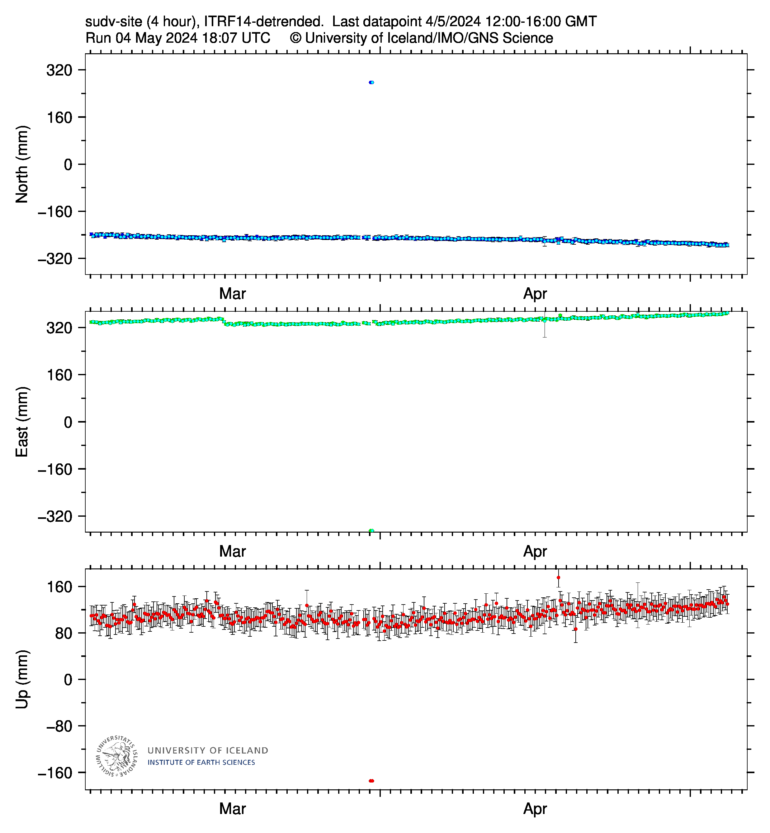
Locally the dike may induce uplift. The flanks of the dike will go up due to elastic rebound of the ground when the extension is released. I’m guessing that’s what happened to this station
That’s why I think that SKSH and ELDC might be better to judge the sill deformation. Because they are farthest from the dikes and might be the least affected by their deformation (elastic rebound of the ground around them).
SENG and NORV show almost no deflation, which leads me to hypothesise the NorthEast part of the sill is almost a seperate-ish(?) magma area ….
i suppose if there if there is any subsance to my speculation , the next fissures will be in the northeast part of the current fissure system ??
Yes, that’s why you shouldn’t stare blindly at just the up-component of any single station. The deformation is in 3 dimensions. To get an understanding of the volume changes in the system you need to observe both horizontal and vertical changes over a large area. This is how IMO could say that the fill level had reached the previous fill level only several days after the up component of Svartsengi had passed the previous high level mark.
The situation here is complicated by the fact that we have a sill (just one?), a dyke (or three?), and the general sliding motion of the tectonic plates. All contribute to the GPS movements and all need to be considered when assessing the amount of inflation of deflation taking place.
I don’t think that station is reliable for looking at the sill inflation. The four surrounding the sill area are HS02, SENG, THOR and GRIV, with SKSH and ELDC as supplemental indicators.
If I get a chance to get onto my PC, I’ll try to upload an image from when I was playing around on Google Earth over the Christmas period. It shows my estimation of where the sill is located, based on my visualisation and calculations of relative lateral movement of the stations. I didn’t post it because it was more for my own benefit, but it was close to the shape of the deformation in an Insar image I found on Facebook last week.
I’m not sure I would call SUDV part of the sill(reservoir) proper, as it is east across the fractures/rifts (my personal opinion) .. some accumulation certainly seems to going on (I agree)
The jumps are tectonic in my opinion, the pressure of the magma only releases stress. Eruptions are small compared to the ground deformation.
Seems things are slowly dying down. The Svartsengi station hasnt shown any deflation but Eldvorp does, about the same as the last eruption though a bit less. So assuming no big changes in magma supply the next eruption might be in 3 weeks time or about February 6th.
Seems like the dikes might have a slight preferrence to go southwards, which is unfortunate as it means Grindavik might not be so lucky next time. But maybe it was just coincidence too.
15. January 2024 – 14:50 – updated
Eruption is not over
Lovísa Mjöll Guðmundsdóttir at the Icelandic Meteorological Office says that the eruption is not over. Activity in the northern fissure has decreased, but land continues rising at Svartsengi, which is a different pattern from the eruption on December 18, and data is now being reviewed to see what this means.
Lovísa says that there is considerable uncertainty about what will happen next and that nothing can be ruled out. It is being examined whether the magma in this eruption is coming from a place other than Svartsengi, given that the land rise there has not stopped.
From the ruv.is website, english edition.
Seems teh scientist have the same questions as are discussed here…
Lovísa admits that this development surprised them
2 alternatives: the dike has its own source of magma or it is coming from Fagradalsfjall, or (longer shot) Krysuvik.
There are probably more options …
Ok. My idea which is probably total rubbish but makes sense to me. We have seen the seng chart going up and down like a yoyo for well over a week. Suppose the times the chart showed a down trend were magma almost silently making it’s way beneath the area where the current eruption was. I say almost silently but there were plenty of quakes from 4km NNE of Grindavik right down to quakes far closer to Grindavik.
Do feel free to shoot me down in flames, I wont mind in the least as it is a total supposition
I did not see any significant drops in SENG chart over the past week or so. The general trend was upwards, with a few unexplained upward blips. (I’m looking at the 8hr and 4hr plots).
You may be right but the consistent upward trend at SENG which has not stopped yet (up to 16:00 today) has led some to ask whether the dike has a different magma source.
I guess it is theoretically possible that magma moved from SENG to the dike and was replaced by a c. equal amount within a 4hr period so it did not show in the graphs. A bigger blob of magma injected into the system? Or just enough to mobilise magma already there?
Sorry, I did not say that I was talking about the period since 18th December.
@Merlot, Svartsengi is still increasing as you say. In addition, the inflation at Thornjorn has actually increased in rate. The other stations around the likely site of the sill did deflate, before continuing to rise. I believe the dike is being fed from the sill just north of Thorbjorn. I wonder whether this is the reason Svartsengi didn’t deflate and why Thirbjorn has inflated more. Essentially, is there something like a feeder that is currently full of magma? That is the only explanation I can think of to account fir the deflation mire to the south and west, but not towards the north.
@Richard, I suspect that there is a common source in the crust / upper mantle. Perhaps the magma has found two (or more) routes upwards: one to Svartsengi and another between Stóra-Skógfell and Hagafell. Whether it is a single route that divides or two distinct routes, I would not like to say.
The SENG GPS station sure is breaking my mental picture of the sill…
I still think it is previously emplaced magma that was pushed out. The rifting in the days before the eruption seems important. If no new magma gets to this location, then I think this will quickly peter out. Otherwise all bets are off, but I think the first option is more likely.
The First eruption lasted for three days. Today we’re on second day. Likely tomorrow will be last day of lava effusion. Fourth day only Fumarole and beginning of dormancy.
Latest from vedur, G-translated since they haven’t updated the English version (and no it’s not the Norwegian Meteorological Agency 🙂
Short version: they are still seeing activity under Grindavik so it’s not over.
https://www-vedur-is.translate.goog/um-vi/frettir/jardskjalftahrina-nordan-vid-grindavik-hofst-i-nott?_x_tr_sl=is&_x_tr_tl=en&_x_tr_hl=en&_x_tr_pto=wapp
Iceland Coast Guard flight overview – https://www.youtube.com/watch?v=qTIhbr2FrAU with captions
From the IMO (translated by Google)
Updated Jan 15 at 15:00
Web cameras show that the flow of lava from the fissures that opened yesterday has decreased. The flow from the southern fissure that opened at noon yesterday right at the town border seems to have stopped. Most of the lava flow is to the southwest along the levee that was built and seems to have proven its worth.
It is difficult to estimate how long this eruption will last. Seismic activity has decreased and, according to GPS measurements, movement in the area is decreasing. However, movement continues to be measured in the southern part of the magma tunnel under Grindavík.
Based on measurements, sliding within the town limits has been up to 1.4 m in the last 24 hours, which is spread over many cracks, new ones have formed and older ones are opening up more. New cracks may be appearing on the surface in the coming days.
As mentioned before, the eruption centers are a high risk area and it cannot be ruled out that new fissures will open without warning. That was the case when the crack opened at the border of Grindavík yesterday. No signals were seen on the measuring instruments in connection with that eruption in particular.
Now (16:53 UTC) there is only one vent with lava fountain activity and one significant Fumarole (steam & gas) vent. Also the borders of the new lava field show minor release of steam (maybe a wet burning of vegetation).
What is the farthest distance that lava flew during this eruption? The fissure of December 18th-21st mainly did short lava flows of several 100m from the long fissure. This time it looks as if the SW lava flow was a bit longer. Elsewhere the lava field looks similar to December with short distances of lava flows.
In sum, the most dangerous time of the eruptions of Svartsengi are the first hours. What they reach during these hours, is buried. But they spare most places which are more than 500m away from the fissure. Future risk for Grindavik is mainly the risk for fissures close to town. More distant fissures will likely spare the village. Long lava flows like Mauna Loa 2022 are unlikely both due to size of lava volume and to the even landscape.
Question concerning past Fires on Reykjanes: Did they sometimes falsely view seperate eruptions as a single one? The present lava field is not far away from December’s lava field. Eruptions like this may in distant future (3000 AD) be unified into a single eruption. The Middle Age fissure eruptions may be overestimated, because a series of many small fissure eruptions looks like a single big eruption.
It’s a case of whether you consider each episode as a separate eruption or part of a single larger event. For example for the most recent cycle at Krafla you could say there were 9 eruptions (1975, 1977 twice, 1980 thrice, 1981 twice and 1984) or one from 1975-1984. Same goes for the crater-filling at Kïlauea since 2020, there has either been one multi-episode eruption or five individual eruptions.
Just a comment that in the coming decade(s) these fissures may open again joining the new lava flows up. 300 years later that will look like one continuous eruption even though from the human perspective its many.
Basically the most likely sequence is one that duplicates an earlier historic (ok olden-days) sequence, although perhaps not in the same place, exactly.
There was once also a discussion about explosive pre-historical eruptions that look like one VEI8, but could have consisted of several VEI7 eruptions. I have the impression that it’s difficult with both effusive and explosive eruptions, if there is a “swarm eruption”. Science is not perfect, it can sometimes only choose between a mistake and the statement to “know nothing”
Was about the Huckleberry Ridge eruption of Yellowstone, where there is evidence of lengthy time interval between the deposits, something in the years to decades range. Its a bit irrelevant though as every one of those eruptions would have been multiple times larger than Tambora so it doesnt really nullify the enormous scale of eruptions at these calderas.
Yes, it was one of the distant past eruptions of Yellowstone. 2.1 million years ago. We can call it the “Supereruption -3”, because it was followed by two later supereruptions 1.3 mio and 0.6 mio years ago.
Eldvorp, Ogmundarhraun, and Sundhnukur have at least two distinct parallel rows of fissures in many places that run very close to each other but are separate. So those events had at least two eruptions that can be recognized in the flow field, but it’s hard to know how many individual eruptions took place. There are also ways to know that a particular flow is from a single eruption, for example, Arnarseturhraun seems like a singular event. Arnarsetur consists of two large channels that open unto broad fans of flood lava, the two channels can be traced back to twin lava lakes that top the same shield structure. The shield structure must have formed in the waning stage of a long-lived eruption, maybe a week or two long and the lakes must be from the same event and by extension the channels and the vast lava fans that they feed. Arnarseturhraun covers some 22 km2, the thickness over most of the flow may be some 10 meters, although towards the center, around the lakes, reaches 40 meters thick or so. So the volume is perhaps 0.2 km3 or a bit more. It might be a good example of what a large eruption of the Svartsengi area can be.
Finally I’ve found a favorite Webcam for this day. It shows an ongoing lava bomb eruption:
If any eruption deserves a timelapse, from start to end this one does.
10:29 Icelandic time today a 2.7 quake at 0.1km depth Bardarbunga. A glacial/jökulhlaup quake or a sign that Grimsvötn is getting ready?
A’a lava in Grindavik:
https://dankxip1iu8u9.cloudfront.net/eyJidWNrZXQiOiAicnV2LXByb2QtcnV2aXMtcHVibGljIiwgImtleSI6ICJtZWRpYS9wdWJsaWMvb3JpZ2luYWxfaW1hZ2VzL0lNR180Nzg2LmpwZyIsICJlZGl0cyI6IHsicmVzaXplIjogeyJ3aWR0aCI6ICIxMjAwIiwgImZpdCI6ICJpbnNpZGUiLCAiaGVpZ2h0IjogIjkwMCJ9fX0=
Unfortunately I think the next one opens up inside Grindavik/the sea.
It may take a few weeks for the pressure to rebuild again though.
The map with Holocene fissures and lavas shows that 100m west of Grindavik is an area where previously a line of fissure occured. From there lava could both flood Grindavik and make ocean entry.
Where happend last effusive ocean entries after 2018? If I remember correct, Stromboli has several times done “Blitz” ocean entries over its “Sciara del Fuoco”.
La Palma in 2021, Home Reef in 2022 and 2023.
Did La Soufriere St Vincent’s pyroclastic flows reach the ocean?
Stromboli too
Oh yes, La Palma of course! It had both the advantages of more fluid lava, steeper slopes and higher volume.
Was also an ocean entry at Anak Krakatau, I think in 2022.
There is also Nishinoshima too, which I think might have erupted last year but at least definitely flowed into the ocean after 2018.
Indeed, Krakatau 2022 was an effusive eruption, with small distance to the ocean. Isn’t Nishinoshima a more viscous Surtseyan volcano?
I was looking at a Reykjavík Grapevine video earlier that showed no further work being done on the lava barriers. Made me realize that some of those folks had worked for something like 26 hours straight through. An intelligent superintendent would order them to go home, bathe, and sleep — and leave the alarm clock unset.
Thank you all for your messages of support. I so appreciate it. What would I do without VC and Sheepy bleaty conversations.? I have a feeling this new scenario is going to prove mighty interesting and will give us some stuff to really get our teeth into,
They seem to have restored power to part of Grindavík. The western half is lit up on the Þorbjörn webcam
So far today (or tonight, depending upon where one is) I’ve seen no statements from the people in Iceland paid to study volcanic systems, that argue against my initial estimation of a few hours ago.
“What a weird volcano.”
I mean weirder than usual for volcanoes, which are pretty weird just by being volcanoes. Every time I think I have the least little thing figured out (like the relationship between inflation at Svartsengi and these latest eruptions) this volcano says, “Guess again, genius!”
None of my amateur hypotheses are any more useful than the one I developed at 8 years old, 60 years ago — at which time I thought volcanoes were attracted to corn fields. (We had a geologist visit our school and talk about Parícutin)
I’m not complaining. There’s no place I enjoy being wrong or confused more than Volcano Cafe.
You and me both!
😀😀
Agree! Very nice mix of hobby volcaholics and real professionals here!
The volcano is not weird, but likely typical for MAR eruptions 1-4 km below sea level along the Atlantic Ocean from Iceland to Antarctica’s Ocean.
Although it’s already a giant disaster for Grindavik, it’s still better than the Nyiragongo style. I always had the fear that Grindavik gets a fast running lava flow like Goma, but until now the eruptions were slower and smaller. So no risk for humans to be caught by lava.
For years now, basically since Kilauea erupted in 2018, I had a list of 3 places that were most at risk of being flooded by a lava flow. Those were Ocean View estates, Grindavik, Goma, in that order.
Since then though, Goma got away with it this time in 2021. It is still at risk of course but maybe not for a few decades still. Mauna Loa also has erupted since, and demonstrated that eruptions low on its SWRZ are rare and the historic period has a preservation bias. Another caldera forming eruption would be devastating but such an eruption is unlikely any time soon.
That just leaves Grindavik… To be honest, I dont think most of it will be there in 2025, and not every eruption is going to be like this past one. The Sundhnjukur eruptions might have been a sequence rather than continuous but the last eruptions were much larger than either of the eruptions of this sequence to date. The flow that reached the ocean originated to the north of Hagafell at Sundhnjukur itself and flowed into the ocean seemingly so fast it didnt even make a channel. The Sundhnjukagigar fissure where the December eruption was seems to have been a later and much larger eruption that flowed mostly towards the Blue Lagoon.
Grindavik has luck, that its volcano does small eruptions (until now). So there was and is time to escape. Nyaragongo, Mauna Loa and (until 1944) Vesuvius did/do unpredictable, big and fast eruptions with fluid lava.
There also the steep slopes facilitate the rapid movement of lava flows. Compared the these volcanoes the landscape around Grindavik is dutch landscape. Imagine a volcano behind the dutch dunes/dykes near Amsterdam or Groningen. The lava wouldn’t flow any different to Grindavik/Sundhnukur. I think that personally I underestimated the flatness of Grindaviks landscape before the eruptions. Even a larger volume had difficulties to flow fast anywhere.
The biggest danger for Grindavik is an eruptive fissure very close or inside the village. There was a small side vent that let a small lava flow flow into Grindavik. But it was small. Imagine the main large fissure somewhere there around. Grindavik contrary to Goma sits partially ON the volcano where potential fissures can occure.
“I thought volcanoes were attracted to corn fields”
Wishful thinking? Lava popcorn, yummy! 🙂
But yeah, the only consistent thing about this volcano is that it only wants to go when the Blue Lagoon is open to the public.
Corn-fed free-range volcanoes!
Grindavik: There were no long lava flows. Lava stayed “lazy” close to the fissures:
It would be interesting to see models of what the lava flow would have looked like without the berm.
Grimsvötn/Grimsfjall: The glacial flood has reached its peak.
“Since midnight on January 15, the seismometer at Grímsfjall has recorded increased tremor, which is likely related to heightened geothermal activity in the Grímsvötn system and is a phenomenon commonly observed towards the end of glacial outburst floods.”
https://en.vedur.is/about-imo/news/glacial-flood-jokulhlaup-has-started-from-grimsvotn
Volcanic heat is already increasing. How long would a potential eruption remain hidden below the glacier/water?
Updated 15 January at 18:00 UTC
The water level in Gígjukvísl has remained relatively stable since last night, indicating that the river has reached its peak flow. It is expected that the flow will gradually decrease in the coming days until the flood subsides. Since midnight on January 15, the seismometer at Grímsfjall has recorded increased tremor, which is likely related to heightened geothermal activity in the Grímsvötn system and is a phenomenon commonly observed towards the end of glacial outburst floods. Similar unrest has been documented during previous jökulhlaups from Grímsvötn. While seismic activity in Grímsvötn has been minimal today and over the weekend, the earthquakes that have been detected in the region all measure below magnitude 2.0. If an eruption were to occur in Grímsvötn, a significant increase in seismic activity is expected before the eruption begins.
In the past eruptions often happened, when the Jökulhlaup was over. So this is a possible moment to precede an eruption afterwards. Also the high temperature shows that magma could be more shallow.
So yet more fissures and cracks opened in Iceland after this recent eruption as this vide shows.
https://www.youtube.com/watch?v=gfJc-Zn69GY
For myself, I do not think I would ever feel safe living in a town that looks like a boiled egg cracked open with a spoon. The bent house in the picture would give me nightmares all by itself.
“It is too early to declare the end of soda.”
Cracks me up every time! 😀
Still a chance for a coke volcano? 😉 But I’d suppose that true vikings prefer Øl (translation likely applies to carbonic acid as soda).
And now it is snowing again. I doubt whether anyone will dare to venture into town with snow covering all the new and unmapped cracks.
Icelandic Met Office Update
Updated 16 January at 11:45 UTC
There is currently no visible activity within the eruptive fissures, with the most recent lava observed emanating from the northern fissure shortly after 1 am last night. Seismic activity continues to decrease, signifying that the area is stabilizing. Approximately 200 small earthquakes were recorded near the magma conduit since midnight, indicating that magma is still migrating. Most seismic activity is located near Hagafell, close to the first eruptive fissure that opened on Sunday morning. At this point, it is premature to declare that the eruption is over.
GPS sensors continue to detect ground deformation in and around Grindavík, illustrating that the magma conduit beneath Grindavík is still causing expansion in the area. Thermal images from a drone last night show that fissures previously mapped southwest of Grindavík have significantly enlarged. Considerable hazards persist in the area.
At https://www.businessinsider.nl/wetenschappers-ijsland-gat-boren-magmakamer-onbeperkte-geothermische-energiebron/ “Wetenschappers uit IJsland willen een gat boren in een magmakamer: dat zou een ‘onbeperkte’ energiebron kunnen opleveren”.
English translation: https://www-businessinsider-nl.translate.goog/wetenschappers-ijsland-gat-boren-magmakamer-onbeperkte-geothermische-energiebron/?_x_tr_sl=nl&_x_tr_tl=en&_x_tr_hl=nl&_x_tr_pto=wapp: “Scientists from Iceland want to drill a hole in a magma chamber: that could provide an ‘unlimited’ energy source”.
I woke up this morning and started watching this camera https://livefromiceland.is/webcams/fagradalsfjall but at 17:35 pm I noticed that a second spot in the lava flow area went orange hot, close to the first which looks like a burning area. Does anyone know what is going on?
While I am watching, at 17:48 pm, new areas (small incadescent) spots have activated in the lava flow. including two on the left, one spot in the middle (very faint) and the area on the right where something is burning.
This could be a trick played on our eyes by the dusk and lowering light illumination, which enables these hot spots to now start being picked up and not washed out by the illumination from the sky. That is my best guess at the moment.
Chemical analysis: https://jardvis.hi.is/is/eldgos-nordan-grindavikur-nidurstodur-efnagreininga-hraunsynum-fra-14-januar-2023
One important difference to Fagradalsfjall is that there was more Magnesium (around 7.8%). Grindavik North (December 18th) had around 6%, Grindavik South 5% Magnesium. Fagradalsfjall had a direct magmatic lift from the mantle to the volcano, while Grindavik/Sundhnukur have a mediating magma reservoir.
The magma reservoir is both confirmed by the lower Magnesium content and the homogenous magma (K2O/TiO2-relation). Fagradalsfjall had a broad variation of K2O/TiO2 relation.
(all words based on informations in the linked analysis)
Kilauea is having a tremor tantrum
Where is the likely source?
Underground… Intestinal plumbing!
Or rain, perhaps?
I think so. There was a severe weather warning on Bigisland news, and Mauna Kea Meteogramm shows the weather conditions:
Very weird, there is nothing very obvious on the quake map to suggest rock breaking, its not like the quake swarms on the SWRZ of recent nor a dike forming. But at the same time it seems to be only on Kilauea, the seismometers at the top of Mauna Loa show only a weak signal, while stations far down Kilaueas ERZ still show a strong signal.
Wondering if this was some kind of deep intrusion or maybe a surge in the magma supply that hasnt got to the shallow system just yet. There are quakes at Pahala just outside the Kilauea quadrangle but the tremor signal there is weaker than at Kilaueas summit so doesnt look like the source to me.
It looks like a Winter Storm has hit Big Island. Mauna Kea is the weather station for the island, there were wind speeds of 90mph. Likely less on Kilauea altitude level, but likely still enough for weather tremor: http://mkwc.ifa.hawaii.edu/current/seeing/
To check for weather tremor I’ve looked at Mauna Kea’s seismometers which should exclude volcanic tremor: