[Guest article by Gijs de Reijke.]
Well, the big word is out. The results of a study (‘Deep low-frequency earthquakes reveal ongoing magmatic recharge beneath Laacher See Volcano (Eifel, Germany)’, Hensch et al.) have been published on the 7th of January, pointing out the presence of magmatic movement beneath the East Eifel Volcanic Field, Germany. Many people are oblivious to the fact there are volcanoes in this part of Europe. Geoscientists are now telling them there is evidence for the volcanism in the area to be ‘alive’. Time for real estate prices to plummet and for the area’s inhabitants to run and scream? Hardly.
[Video credits: Marc Szeglat]
Before I get to what the new findings are all about, I want to provide you all with some background information on the Eifel Volcanic Fields. Volcanism has been occurring in Germany for tens of millions of years. Tertiary volcanism have been taking place in volcanic centers like the Kaiserstuhl, Hegau, Rhön, Vogelsberg and even Eifel. The volcanic fields of the East and West Eifel are of Quaternary age, however, so that is what I’ll be focusing on for this article.

Tertiary and Quaternary volcanism of Germany. © Hans-Ulrich Schmincke
The West Eifel Volcanic Field
For an estimated 700,000 years the West Eifel Volcanic Field (from here on ‘WEVF’) has been volcanically active, producing some 270 scoria cones and maars with a fairly modest total volume of about 3 cubic kilometers, quite common for this type of volcanic field. The mostly small, monogenetic (one eruptive episode per volcano) vents produced very primitive magmas (e.g. variations of leucitite, nephelinite, melilite etc.) and a few volcanoes produced more evolved, intermediate phonolite coming from polygenetic (several eruptive episodes per volcano) complexes. The WEFV is the type location for the Maar volcano type: the word ‘maar’, which stems from the Eifel dialect, means as much as ‘lake’.
The most recent eruption in the WEVF took place as little as ~11,000 years ago, when the formation of Ulmener Maar took place, also making it the most recent eruption in Germany.

The West Eifel and East Eifel Volcanic Fields. © Hans-Ulrich Schmincke
The East Eifel Volcanic Field
The other volcanic field is that of the East Eifel (from here on ‘EEVF’). Since about ~650,000 years this area has been volcanically active, with the formation of monogenetic scoria cones and a maar or two, totaling about 100 volcanic vents. The average size of the volcanoes is somewhat larger than that of the cones and maars of the WEVF, which could be the result of larger faults allowing for more magma to rise from the top of a plume or plume-like anomaly in the Mantle (Ritter et al., 2001). The most significant differences between the EEFV and WEVF volcanoes do not lie within the sizes of the scoria cones, but in the composition of the volcanic rocks and the types of volcanoes that are to be found in these fields. Where the volcanoes of the western field seem to lack magma chambers, being fuelled by magma coming straight from a region of partial melt at the base of the Earth’s crust, the volcanoes of the eastern field do have, in some cases, significantly sized magma chambers, allowing for long-term storage of magma and therefore more evolved magmas (various types of phonolites and trachytes). The evolution happens mainly due to processes that fall under the term of ‘magmatic differentiation’, which basically means that magmatic compositions is being influenced by factors such as cooling, absorbing materials from the Earth’s crust (assimilation) and replenishment by younger magma. In most of the EEVF, basanitic lavas are produced by the scoria cones, but in some cases the aforementioned phonolites and trachytes leave much larger scars in the landscape. At least two calderas are to be found in this volcanic field, one of them being the caldera of Wehrer Kessel, which is approximately 2 kilometers wide and was formed by explosive eruptions (trachyte) some 215,000 and 150,000 years ago, of which the first event was the largest (‘Hüttenberg Tephra’), possibly having been a VEI5-sized eruption: ~2 km³ DRE (Schmincke). There is still debate about the larger and older (450,000 – 350,000 years BP) Rieden complex being an actual caldera and not being composed of overlapping, smaller craters and erosive features. Most of the literature still points towards this volcanic complex to have undergone (several phases?) of caldera formation, possibly initiated by multiple events that could have been fueled by up to ~1 km³ of erupting magma (DRE) each.

Dispersal of the Laacher See tephra over Europe. © Hans-Ulrich Schmincke.
The Big One
The second of the calderas, at least of those of which are certainly present in the EEVF, is one that makes the others almost look insignificant. After having undergone an estimated ~20,000 years of magma emplacement and magmatic differentiation (Schmitt et al., 2011) , the violent eruption of the Laacher See volcano took place, an estimated 12,900 years BP. Some 6.3 km³ (DRE) of zoned, phonolitic magma (evolved from basanite) was erupted out of the volcano in the form of mostly ash and pumice, after which an 8-shaped caldera (two overlapping vents) formed. The brunt of the eruption is assumed to have lasted eight to ten days, with three distinctive phases being recognized in the voluminous deposits: the Lower Laacher See Tuff (partially phreatomagmatic, vent-breaching phase), the Middle Laacher See Tuff (the main, ultra-Plinian phase) and the Upper Laacher See Tuff (weaker, Vulcanian explosions being fuelled by increasingly mafic phonolite). During the main event, ash columns might have reached altitudes of up to 40 kilometers above the Earth’s surface, dispersing large quantities of ash over large parts of Europe. Traces can still be found in Sweden, Italy and France. Large ignimbrite sheets now fill up the valleys surrounding the caldera, sometimes being many tens of meters thick. The nearby, narrow valley of the Rhine river was blocked for a while, forming a natural lake in the plain of Neuwied (Neuwieder Becken), which may have reached a depth of up to 20 meters. After a while, the weak, natural dams composed of pyroclastic deposits gave way to the pressure of the water behind them and unleashed a destructive flash flood into the lower parts of the Rhine. The SO2-traces of this event, which are significant in volume, can still be found in ice cores from Greenland. It is assumed that the Laacher See eruption was a weather-changing event, possibly making the already cold, last phase of the most recent ice age even colder, limiting the size at which vegetation grow, which can be seen in the narrower rings of trees from that time.
An eruption of this size and with such impact was new to the Eifel. The largest eruption from Wehrer Kessel is not to be underestimated (probably significantly larger than the infamous 1980 eruption of Mount Saint Helens), but is dwarfed by the Laacher See event. The estimated bulk volume of the erupted materials lies between 16 km³ and 25 km³ (VEI6), making the eruption larger than the one from Pinatubo (1991, Philippines) and possibly about the same size as the one produced by Novarupta/Mount Katmai (Alaska, 1912), maybe even getting fairly close to Krakatau (Indonesia, 1883). If an event comparable to the 12,900 year BP eruption were to take place now, or even something of a size comparable to what Wehrer Kessel or the Rieden volcano produced, the consequences for the Eifel area and the German and European economy would be devastating.

A wide-angle shot of the Laacher See caldera during a thunderstorm. © Gijs de Reijke
The current situation
So what is the new publication concerning Laacher See’s magma all about? Is something happening that should have us worried? The answer is actually both yes and no, but to make one thing clear: what is going on beneath the volcano is ‘business as usual’. For a long time it has been known that the Eifel contains young volcanoes. So young, in fact, that we should consider the volcanism in the area dormant rather than extinct. Add to that the fact one of the youngest volcanoes there also happens to be the most violent and destructive we’ve seen on this side of the European mainland, north of the Alps for millions of years and there is plenty of reason to at least ‘keep an eye on things’. The study by Hensch et al. came after several geoscientists within the volcanological community, including German volcanologist Hans-Ulrich Schmincke, emphasized the fact that the Eifel volcanoes were not properly monitored. They still aren’t, but since 2013 there have been some important changes, now allowing for just enough insight in the seismic processes taking place below the EEVF to be able to tell what is and what isn’t seismicity caused by tectonic processes. The findings: swarms of tiny earthquakes, often too deep to be tectonic in nature, occur on a regular basis below the volcano. The conclusion: magma is on the move, likely to slowly recharge the magma chamber of Laacher See that can be found between 5 and 8 kilometers below the volcano. And that is all there is to it. It is what we should consider business as usual. Reason for a healthy amount of concern, but it lies well within the possibilities that this process has been steadily going on since the cataclysmic eruption of 12,900 years ago and will do so for thousands if not tens of thousands of years to come. Yes, it is true that Laacher See has also been producing CO2 emissions longer than any records have been kept, but magma chambers tend to degas at any stage of their life cycle, including dormancy and even during their slow decay into definite extinction. It may well be the case the tiny, rising bits of magma will never be able to contribute to another eruption of Laacher See, because they might cool down too much on their way up or simply aren’t large enough to have a serious influence on the ~50 km³ of viscous, crystal mush that is now the magma ‘chamber’.
Then again, what do we know? We can’t look back into what happened at depth since the only eruption Laacher See has produced so far without the right data, nor can we foresee the subterraneous behavior in great detail. Maybe a large intrusion of magma will occur. Maybe several. Maybe large quantities of magma have been emplaced slowly, not causing too much disturbance or any at all for us humans.

The seismic swarms that have occurred below the Laacher See area since 2013. © Jens Skapski.
There are two very important things we’ve learned. The first concerns Laacher See and other volcanoes that are fueled by strongly evolved magmas. Magma evolution takes a long time. A few thousand years is short, tens of thousands of years is common, longer is well possible. We know this slow process has been the case for the thus far only Laacher See eruption (Schmitt et al., 2011). Slow cooling of the magma body, solidifying the mafic minerals and keeping the more felsic minerals to remain in a fairly liquid state, enabling the formation of potentially eruptive and explosive magma in the center of the chamber, seems to be the main factor in magmatic differentiation below Laacher See and many other volcanoes. This can change when the old magma is abruptly replenished by younger magma making its way up in vast quantities, but as already stated: such events have not yet been observed, nor do we know if this intrusive behavior will occur at any time in the future.
To conclude the first important point: what has now been observed for the first time, is an ongoing process of magma being in motion. Not in a way that points toward an eruption any time soon, but more toward one, simple conclusion: we now have solid evidence of the East Eifel Volcanic Field, and in particular the Laacher See volcano, being in a dormant and not an extinct state.
The second matter of importance is that of monitoring. The monitoring of processes that might lead to an eruption, at any time in the future. To quote directly from the publication by Hensch et al.:
“So far, no direct observations could be made indicating ongoing recharge in the magmatic plumbing system beneath the LSV. The location of magmatic feeding channels and active crustal magma reservoirs is unknown. However, although the volcanic hazard in the Eifel is assumed to be low, the risk in case of an eruption would be high due to the dense population and high damage potential of this region in Central Europe (Leder et al. 2017). Thus, volcano-related seismic activity requires thorough monitoring and analysis.”
More specific examples are given when it comes to much-needed research concerning Laacher See’s ongoing magmatic processes.
“Ultimately, the present volcanic hazard posed by the LSV cannot be assessed solely based on the findings of our study. But bearing in mind that the LSV already experienced an explosive eruption 12.9 kyr ago, a deeper analysis of the magmatic/volcanic activity in the region and the resulting hazard is recommended. Despite of the close seismic monitoring, high resolution seismic and geophysical experiments are required to image potential shallow and deep crustal magma reservoirs. For example, large S-wave residuals on single stations close to the LSV (e.g. station DEP02 for the Glees 2 cluster) might reflect low velocity zones, possibly linked to shallow crustal fluid batches, which can only be resolved by a shallow seismic tomography. Further, geodetic measurements would help to constrain potential shallow volume changes, either during DLF sequences or during episodes like the Glees clusters. Continuous geochemical measurements would be another valuable enhancement to better understand CO2 emissions and potential changes in gas flux during episodes of seismic unrest.”
At this moment, Laacher See is an ideal destination for recreational purposes. The crater itself looks magnificent, with a lake covering the majority of the crater’s bottom and the walls being covered by a lush beech forest. The old monastery of Maria Laach can be found at the southwestern shore of the lake and camp sites and hotels dot the area. Whenever the weather is good, hundreds, if not thousands of people will walk and cycle their way through the area. At the eastern shore of the lake, the volcanic CO2 emissions can be seen in the form of bubbles rising through the water, which is both fun and of great educational value. Just south of the crater, the impressive deposits of the Laacher See eruption can be seen in a quarry known as ‘Wingertsberg’. Hopefully this will remain the case for a long time to come, but the geology of the Eifel should still be taken seriously, if only to know nothing unusual is going on. That goes for the WEVF just as well, where the presence of very primitive magmas indicates the warning time for an eruption might be very limited (hours to days) anyway; these magmas can only be present at the surface when there hasn’t been sufficient time for any sort of significant magmatic differentiation.
I think it is a safe bet to say the Eifel will have eruptions again in the future. When that will be, or if any will occur at all, no one knows. It might be a small, cone-forming eruption from a monogenetic vent. It might be the formation of a maar through a phreatomagmatic event. Maybe a phonolitic lava dome will form. Maybe a large, caldera-forming eruption will occur. Immediate fear for any of these events, especially in a time that points out the area is showing perfectly normal behavior considering the volcanism is dormant, only does more harm than good. But as a society it can never hurt to be awake before a volcano will be, meaning we should know what is going on, to the best of our capabilities.
Gijs de Reijke, January 2019
Literature:
Hensch, M., Dahm, T., Ritter, J., Heimann, S., Schmidt, B., Stange, S., Lehmann, K. (2019). Deep low-frequency earthquakes reveal ongoing magmatic recharge beneath Laacher See Volcano (Eifel, Germany), Geophysical Journal International, 2019; DOI: 10.1093/gji/ggy532
Schmincke, Hans-Ulrich (2007) The Quaternary volcanic fields of the East and West Eifel (Germany). In: Mantle plumes – a multidisciplinary approach. , ed. by Ritter, R. and Christensen, U.. Springer, Heidelberg, pp. 241-322.
Schmincke, H.-U., 2006. Environmental impacts of the Lateglacial eruption of the Laacher See Volcano, 12.900 cal BP. In: von Koenigswald, W., Litt, T. (Eds.), 150 years of Neanderthal Discoveries. Terra Nostra, Bonn, pp. 149- 153.
Ritter, J.R.R., Jordan, M., Christensen, U.R., Achauer, U., 2001. Mantle plume below the Eifel volcanic fields, Germany. Earth Planet. Sci. Lett. 186, 7–14.
Schmincke, Hans-Ulrich (2009). Vulkane der Eifel – Aufbau, Entstehung und heutige Bedeutung, Spektrum-Akademischer Verlag 2009, ISBN 978-3-8274-2366-5.
Meyer, W. Geologie der Eifel, Schweitzerbart, Stuttgart, 4th edition (2013).


“assembly members” should be “ensemble members”
Sorry, couldn’t resist. But you may have a franchise there… 😀
England is beacuse of the westerly winds and warm Gulf Stream almost subtropical at latitude 50.
In South West england palms grows in gardens and wine is grown.
While in Siberia Russia at same latitude its Sub Artic and can drop to – 60 c
Without the Gulf Stream and westerly atlantic winds, England and Europe woud get brutaly cold indeed!
Sub tropical!? A gentler, less frosty but wetter English climate, more like. I’ve been to sub tropical areas and I don’t ever recall Torquay being the same…. 🙂
But yes, some small palm trees do huddle in shaded corners of the south west, and wine growing extends right across the south of England. Dorking, near to me, has large wine estates and the hills look more like Chablis than Surrey (which still gives me a ‘that’s not right’ feeling, because I remember how it used to look).
Without the Gulf Stream we would be stuffed, that’s for sure!
There are palm trees growing on the main street in the village of Plockton on the West coast of the Scottish mainland, near Skye. I have heard the gulf stream as the cause of this.
A housing subdivision near here is named “Grande Cedars Reserve” and is populated by pretty much nothing but transplanted Palms around the houses there. Left to their own devices, the palms tend to stay closer to the coast. Oaks and Pines are the dominant tree this far inland. Cedars can do just fine, but you have to really look around to find them. Generally you don’t notice them until a storm takes one down.
Last year this guy ate a Coca Cola truck near there. And just an opinon from a local, he had to have sped through a school zone to get to the accident location. How he managed to maintain enough speed to hit the truck is odd, there is a serious “dog-leg” as you come to the intersection where it happened. Had he lost control in the dog-leg he would have wound up in a house. (Vehicles verses structures is not an uncommon occurrence in Pensacola. I had my mail-box taken out by a guy “dodging a squirrel” a few years ago)
Not a totally bad thing for me, I needed to replace that mail-box and post anyway.
If Earth spinned the reverse way
The Siberian Winter high pressure woud dominate europe as air flows from east constantly in winter.
Germany, England, Sweden, Finnland, Norway woud have an almost Artic climate if that was the case
Mediterranean, woud be alot colder in winter too if that was the case
If the Earth would spin the other way the Moon would have had a shortening rather than a widening orbit, and smashed into us. The Siberia high pales in comparison.
If the moon crashed into Earth
That woud melt the whole planet and form an atmosphere of rock vapour hotter than the sun
Any life is instantly doomed and oceans boils away too
“The moon would have had a shortening rather than a widening orbit” Really? Why would the direction of spin make a difference? And if it’s too technical, You can say, “It’s ok, motsfo, you aren’t smart enough to understand the explaination” and i’ll at least understand that. 🙂 Best, from a warming world, motsfo
It is true! THe moon is moving away from us because the ocean tides on earth slightly pull it forward. That is because the bulge of sea water is moving faster than the moon (as the earth rotates in 24 hours but the moon takes a month to do the same), so it tends to get ahead of the moon. Hence the forward pull. The moon in the same way pulls us back, so the earth’ rotation slows down – hence the occasional leap second.
Make the earth rotate the other way, and the tides lag behind the moon and pull it back. The sky will fall in. It is happening to Phobos, the moon of Mars. It is expected to crash into Mars in perhaps 50 million years.
ok….. let me think about this…….. Thanks for answering.
question from ‘out there’: if we had started spinning in the opposite direction, wouldn’t the moon have rotated around us in the opposite direction too? In otherwords; is the moon’s rotation around us due to our rotation or is it not related? Best!motsfo
That depends on what happened when the moon formed. It is believed due to a Mars-sized body slamming into the proto-earth. Part of the earth was ejected into orbit and became the moon. If the impactor had come from the opposite direction, it could have formed a moon going round the other way which eventually would have fallen back to earth. It could also have slowed down the earth’s rotation. It is possible this happened to Venus, which strangely has very little rotation and lacks any moon.
https://www.youtube.com/watch?v=PtavJ3Tt9XE
This climate woud dominante much of Europe without the Gulf Stream and Westerly Windflow.
The whole eastern and western europe above latitude 46 woud become Sub Artic
English channel full icebergs and ice rafts
And intense snow showers over bay of biscay as the cold winter air flows out over sea.
Mediterranean woud experience frequent snowfalls in the northen parts of that ocean
Spains Interior woud become extreme temperate.. cold winter and hot summers.
Scandinavia woud become almost unlivable
Pretty much what woud happen without the Gulf Stream and If the earth spinned reverse.
GFS must have seen yesterday’s Japanese run and thought I can do better than that…
+300 hours
+384 hours
What’s astonishing is that both the GFS and ECMWF normally revert to more typical weather the further on in their fantasy range runs but they keep throwing the silly stuff out at the moment. Likely the next operational run will back off but amusing to watch – unless it actually happens.
Oh well, just as well the Russians have ice-breaker LNG tankers as they’ll need it to get to our import terminals. In 1963 the Royal Navy had to use ice-breakers to keep Chatham dockyards open.
http://www.bbc.co.uk/london/content/articles/2008/09/04/bigfreeze63_feature.shtml
Just reading this is making me cold. Brrrr! 🙂 Personally, I’m looking forward to a few snow days. So long as it is just that, a few days over the weekend with it all cleared up by Monday.
Off to NYC this weekend and not looking forward to Monday’s current daytime temperature forecast of -11c! Nipply 😀
I still remember the totally ghastly UK winter of ’62~~63, as we took my little brother to his kiddie-clinic by sledge. I ‘man-hauled’ in my double-socked wellies. Mum stomped along in hers with the vast ‘kiddie bag’. My brother, bundled unto near-spherical, laughed and sang all the way…
The suburban clinic was usually very, very busy but, that first day, only three mums and two nurses showed up…
What was really, really remarkable about 2018 in the UK was just how extreme the weather was. We had a summer to rival that of 1976 (and the only reason it wasn’t as bad from a water supply perspective as 1976 was that we hadn’t had a dry winter beforehand) and we also had a dose of 1963 in the winter as well. Obviously the winter wasn’t anywhere near as bad as that of 1963, but we got 2 weeks of weather just as bad as that of 1963.
It’s the fact that the two extremes happened during the same year that’s so incredibly unusual.
And in other news, it appears we have had the first recorded death on the moon. The seedling sprouted in the Chinese lander is reported to have succumbed to the cold.
Recovery mission planned?
“Bimodal seismicity in the Himalaya controlled by fault friction and geometry”
“Abstract
There is increasing evidence that the Himalayan seismicity can be bimodal: blind earthquakes (up to Mw ~ 7.8) tend to cluster in the downdip part of the seismogenic zone, whereas infrequent great earthquakes (Mw 8+) propagate up to the Himalayan frontal thrust. To explore the causes of this bimodal seismicity, we developed a two-dimensional, seismic cycle model of the Nepal Himalaya. Our visco-elasto-plastic simulations reproduce important features of the earthquake cycle, including interseismic strain and a bimodal seismicity pattern. Bimodal seismicity emerges as a result of relatively higher friction and a non-planar geometry of the Main Himalayan Thrust fault. This introduces a region of large strength excess that can only be activated once enough stress is transferred upwards by blind earthquakes. This supports the view that most segments of the Himalaya might produce complete ruptures significantly larger than the 2015 Mw 7.8 Gorkha earthquake, which should be accounted for in future seismic hazard assessments.”
https://www.nature.com/articles/s41467-018-07874-8
Just so that i don’t make myself look stupid like with clear lake, is there any man-made or anything else non-volcanic that could cause this level of seismic activity that i haven’t noticed?
https://www.volcanodiscovery.com/#
https://www.volcanodiscovery.com/kolbeinsey-ridge-earthquakes/archive/2018.html
Made myself look stupid anyway.
Just your normal tectonics of spreading imo
Some of the earthquakes seem to be REALLY shallow for a tectonic cause not only that these earthquakes are very localized, usually with 20-35 km range away from the volcano.
Found something on Mayotte, it is two months old but it is the only good information regarding the possible eruption: http://volcano.iterre.fr/wp-content/uploads/2018/11/mayotte_note_deformation_GPS_20181112a.pdf
Apparently some GPS on the island are picking up a signal similar to that of the deflation of a magma body which suggests a possible eruption. They suggest that the source is located 50 km east of Petite-Terre and 30 km deep, The vent, if there is, could be about 3.5 km underwater. They also propose that the eruption may have started on July 12 with an erupted volume of 1.15 km³ by October 20. Assuming the late october-november effusion rate estimate of 91 m³/s is correct and has remained constant then the volume of erupted lava could be of 1.85 km³ by now. This does however need confirmation because even there being an eruption is still not completely clear, I at least hope that investigations will be done now that there are dead fish floating on the ocean, maybe a bathymetry survey.
This is the link to a GPS on Mayotte: http://geodesy.unr.edu/NGLStationPages/stations/MAYG.sta
It appears to have dropped about 8 cm and moved about 12 cm east. It also seems to me that the subsidence has not slowed down and that the possible eruption could still go on for a while.
There is also this paper with some general information about the geology of Mayotte and the bathymetry of the flanks: https://ac.els-cdn.com/S1631071306002288/1-s2.0-S1631071306002288-main.pdf?_tid=56a0b216-1f9e-43a8-a7b7-da5fbb5228e5&acdnat=1547787715_cbed77cf2d915741a9bfb4221cbf6928
Numerous volcanic cones are located on the NE and SE submarine slopes of the island further supporting the posibility of an eruption.
If a big deep sea eruption has happened there then that is definitely an event for the history books, and the completion of the trifecta of massive effusive eruptions this century. One other thing I found interesting about this,
holuhraun was entirely on land about 1 km above sea level, fissure 8 was on land but near sea level with significant ocean entry, and now this eruption is in deep ocean 3.5 km deep, and all within 5 years.
Holuhraun and fissure 8 both created calderas so it would be sensible to assume an eruption like this on mayotte would too, maybe even a way bigger one and which takes years to form and the island slowly subsides. Given mayotte is not an especially active volcano to say the least it will probably never recover from this entirely but will be a very interesting process to observe. A big new calderas would also possibly make it more active in the future once some more magma has arrived.
There is no active central volcano in or on the flanks of Mayotte, and if there is it would be a small felsic volcano on its last legs. The Eastern volcanic field of Mayotte then probably lacks a magma chamber on shallow levels, making a caldera collapse impossible. The source seems to be 30 km deep and whatever it is I don’t think it is collapsable given the enourmous depth it is at..
I think this eruption could be compared to the Lanzarote eruption of 1730 which resurfaced 1/4 of the island, lasted 6 years and erupted 3-5 km³ of basalt, didn’t result in any caldera collapse. Both Lanzarote and Mayotte islands are old volcanoes of a hotspot chain that should be dead by now but seem to be ongoing rejuvenation volcanism, a process very common in hotspot volcanic chains and that is usually explained by crustal flexure and with some defenders of edge-driven convection in the Canaries. Eruptions on Lanzarote are unfrequent with periods of dormancy of 20 ky or even 90 ky but tend to be huge effusive events.and as shown by the eruption in 1824 sometimes a smaller event can follow the big one some years/decades later. This is maybe similar to what goes on at Mayotte, or not. In any case this eruption has the potential to dwarf Leilani and Holuhraun,
I also wonder if this is similar to the north arch volcanics near hawaii. Some of those flows are probably the biggest lava flows erupted in the past 20 million years, at least 5 of them probably exceed 100 km3 and the area of the flows is about 10 times bigger than the surface area of the islands. These flows probably as much as double the amount of lava erupted by the hotspot in the past 2 million years, maybe 900,000 – 1,500,000 km3 of magma.
The north arch lavas are probably erupted at temperatures of over 1300 C and rates exceeding that of any terrestrial effusive eruption, an order of magnitude higher than leilani.
The lava is also not basalt, it is nephelinite similar to the lava erupted at nyiragongo today and during the rejuvenation volcanics on all of the older hawaiian islands. Most likely these eruptions are infrequent but ongoing to the modern day along the more eastern part of the arch which hasnt been mapped yet.
Biggest flows in the past 2 million years not past 20.
That seems exagerated, the North Arch VF covers 24000 km² which is more than the islands which are 16000 km² but not 10 times more. Also consider that the main volcanoes extend far underwater and most of their surface is submerged. They are also huge piles of lava that can be thicker than 10 km towards the center. The North Arch forms a thin sheet that I doubt to be more than 1 km thick anywhere. Individual flows seem to be massive, there is one lava flow covering 3600 km² and with an estimated volume of 36-72 km³, but eruptions are very rare and some estimations of the total volume of the field are of 1000-1250 km³, insignificant compared to the main chain as it is after all a secondary volcanism.
I guess Mayotte could be located on the flexural arch of the Comores islands and therefore be related to the submarine volcanic fields of Hawaii.
North arch is not even close to fully mapped, it extends east of the mapped area and that could as much as double the surface area, still not twice the islands but at least 4 times bigger.
In order to flow underwater the lava will have to carry enough extra energy to flash boil all the water in contact with it without solidifying and that requires a massive volume. These lavas are very likely far more voluminous than 1000 km3, probably not as big as my original number but the entire field would only be about 20 meters thick with a volume of what you described and that seems way too low, even 10 times higher than that sounds like a minimum value.
In any case the volcanism in Hawaii is evidently very voluminous and is not only on kilauea, and in particular the past 3 million years have really taken off on another league to other hotspot islands (just looking at the base of the islands it is clear a massive increase has happened since Oahu formed). Reunion is sometimes called kilaueas twin, but piton is 10 times older than kilauea while having less volume, superficially they may appear similar and indeed all basaltic volcanoes do behave in a similar manner, but long term Hawaii is more of a LIP pretending to be a normal volcano, even most actually recognised LIPs are nowhere near the volume of Hawaii over the equivalent length of time.
We actually already had a ‘big deep sea eruption’ back in 2015. Off the same volcanic arc as New Zealand, a solid VEI-6 if it was above sea level, collapsed the seamount and everything, leaving an underwater caldera with interesting post-collapse fill-in. Only sign we had for it was the absolutely titanic pumice plumes on the surface about the size of Long Island; at least until someone realized there was a seamount missing.
Given the location this eruption is probably effusive though which explains why only fish and gases are coming out. We will have to wait for confirmation but this could be the largest submarine lava flow emplacement ever “witnessed”.
If this deep it can only be effusive. Explosions are not possible at that depth. Deeper than 2 km water can’t turn into a gas.
Very true. Axial seamount had a bona fide flood basalt event not too long ago and almost no one noticed.
An eruption in the arctic ocean at the start of the century was noted to have been pyroclastic despite being 4 km deep. Explosive eruptions aren’t impossible in the deep ocean they just aren’t driven by water as the primary working medium.
?? Can you give a bit more information? Including what medium was proposed to vaporise. And under water, a pyroclastic flow is just a hot mud slide – not a sign of an explosion.
That eruption wasn’t effusive though, or at least not mostly, it also wasn’t a VEI 6 it was a large VEI 5 like cerro hudson in 1991. This area probably has a recurring habit of destroying islands, it is a major subduction zone, maybe even the biggest on earth, with frequent eruptions at least every year or two but only a few islands. There are lots of deep calderas though…
Im getting a true Artic Winter now in Sweden
The cold is expected to last for weeks, with intense cold spell this weekend
That is exact opposite of where I am… 40° C most days in Australia although not as bad as that at about 30° where I am.
I haves to move south!
@TurtleBirdMan
I lives as far North as middle greenland
Made the BBC TV news that an unfortunate town in Australia has just suffered a 39+° C NIGHT…
Sorry, 35+° C Night.
Still ghastly…
More than 100C difference in temperature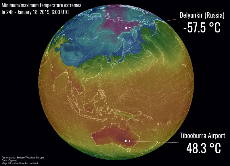
Your web server is having a sulk today. It needs 10-20 typically and sometimes upwards of 50 clicks on “reload” to coax it into getting off its duff and serving a page. Next time you want to follow a link, wash, rinse, repeat.
Getting quite tedious.
Mind doing something about it?
Is it still playing up? I have not noticed it today.
Do you know where i can find information on the Kolbeinsey Ridge? I can’t find any studies on the earthquakes near it.
Seems to be back to normal today, but what happened?
I have no idea. More powerful admin’s may be required. I did note some spamming activity, which perhaps gets the deamon edgy.
At least it didn’t go after me for once.
If anything goes wrong along the path to the server and packets get dropped, you will see stuff like that. It could be traffic related with a common router or switch on the circuit getting slammed with traffic or just a port on one having issues and near failure. It could even be nefarious activity with some group trying to hijack traffic on a related router somewhere along the path or traffic splatter from a DDOS attack somewhere. It doesn’t mean we were the target, just that some unit along the path had issues.
I’m not clear on what O/S runs the server, but Apache, a popular webserver daemon in the Linux O/S will spawn additional daemon processes to deal with the traffic as needed, M$ webserver does something similar (just not as well), so I’m pretty sure it was not server related.
New quake under the submarine “Volcán de Enmedio” in the Canary Islands:
2019/01/18 06:36:53, 4.2 mbLg, 14 Km
Link to the spanish “Instituto Geológico Nacional”:
http://www.ign.es/web/ign/portal/ultimos-terremotos/-/ultimos-terremotos/getDetails?evid=es2019alpdp&zona=1
Pevolca have been called to a meeting on Monday there have also been ongoing swarms Vilaflor near Teide and around Volcano Enmedio.
https://diariodeavisos.elespanol.com/2019/01/el-gobierno-de-canarias-convoca-al-comite-cientifico-del-pevolca-para-analizar-el-movimiento-sismico-registrado-hoy-entre-tenerife-y-gran-canaria/
http://www.ign.es/web/vlc-ultimo-terremoto/-/terremotos-canarias/get10dias
And you can bet Nemesio will be in there trying his best to see how he can monetize it.
I need a memory refresh here. Wasn’t there a deadly eruption 300-400 years ago to the south of Thera? Is that vent anywhere near where the current seismic activity is? A cloud of hot gas hit the island during the blast.
The Kolumbo eruption of 1600? That volcano is north of Thera so in the opposite side.
Arrg 1650 not 1600
Ah! Thank you. So no threat at all. Don’t know why I thought it was south.
Looks like a new strombolian blast from Agung. Maybe not as big as the one in July.
https://youtu.be/9PpIYKlJ0tI
I thought I found a webcam video from the other direction, but it turned out to be from last year. Volcanos don’t do schedules, but if they did I would say Agung is on a 6 month repeat cycle. Strombolian activity so far:
Jan 19, 2018
July 2, 2018
Jan 19, 2019
I wouldnt say volcanoes dont do scheduals, many times a volcano can be observed to show consistent behavior and on roughly similar timescales. On smaller timrscales of days or less is when things become unpredictable but most volcanoes are rather easy to predict once the initial earthquake swarm has fixed to an upward intrusion of magma. As an example it was pretty obvious that something was going to happen on kilauea last year, and even the hint of something really big happening was there with the impressive inflation value of the past several years and consistent high lake levels, it was just the focus was on pu’u o’o and not on the whole system. In hindsight, it is clear that what happened last year on kilauea has happened on a similar scale at least two other times since 1500. Detailed observations dont go back to the late 1780s when the last major collapse happened though so we call last years event unprecedented.
This is the tilt at Kilauea and Pu’u’O’o. Note how the DI event at Kilauea is followed by one shortly after at Pu’u’O’o. That suggests there is still indeed a connection between the two. With the closure of Leilani, pressure equilibrium is re-establishing itself. Pu’u’O’o may not re-activate (the pressure from the summit is much less now, after the collapse) but it isn’t quite dead.
The tiltmeter downrift at JOKA also seems to have picked a DI event at the same time as the one in Pu’u’o’o. This could a sign of a connection ERZ-summit, not the first one, but I don’t think this is necessarilly a sign of activity within the Pu’u’o’o conduit. Magma from the summit may have been bypassing Pu’u’o’o and has maybe also been responsible for the inflation of the MERZ in these last few months.
It is hard to say what will happen next, the new pit of Pu’u’o’o could open an easy path for magma to the surface but so may the new summit caldera and maybe segments of the rift that have been left under a low stress after the 6.9 earthquake, The recent quake might change the eruptive patterns of the rift zone as the 1975 Kalapana quake did back at its time, activity then shifted from the UERZ to the upper MERZ, I see as a posibility that the recent events might mark the transition to the lower MERZ and LERZ, maybe even the Puna Ridge.
On maps showing the age of the rock on kilauea, the area just downrift of puu oo is mostly very old, about 1500 years or more, kalalua is the oldest part of the ERZ. This would be the area I would pick for a new shield eruption as we have noth come to conclude several times. Eruptions since 1955 have also happened along every part of the ERZ so far except two areas, between mauna ulu and the caldera, and a triangle area between pu’u o’o, the 1840 fissure and the 1955+1960+2018 line, going right through from heiheiahulu through the middle of leilani estates. The upper portion of the rift is non eruptive and has no shallow magma but this other area of the rift is exactly within the middle of all of last years chaos.
Another area where a shield will probably form eventually is between pu’u o’o and kane nui o hamo where napau crater is but that probably wont happen this time around.
If another shield forms then a repeat of ladt years eruption is very probable, likely not 1.2 km3 but even 1/4 of that exceeds 1955 and 1960 combined so moving back to the LERZ is not advised. This gear hot an early warning from tge old magma but a new eruption will probably stsrt more suddenly and that is where thongs can go very wrong very fast. Look at 1955 vs 1960, 1955 was like a smaller version of last years eruption but more drawn out, 1960 was fast and fluid immediately, with 500 meter fountains in 3 days… The next eruption may well be more like 1960 than 1955.
One other thing to keep in mind, the bottom of the caldera is 600 meters above sea level, about level with the bottom of pu’u o’o and so the theoretical magma conduit could easily take either option. Both are actually at a lower elevation than the 1977 vents which are about where a proposed shiekd would form if the downrift lrogression is to ne expected to continue. Likely the bottom of both craters will erupt before any significant eruptive activuty on adjacebt rift areas occurs but resumption of the style of activity that pu’u o’o had before is unlikely. The two might even erupt simultaneously for a while in the same manner as erta ale now, with even a 3rd vent opening up downrift when pressure is high enough, a bit like in 2007 except maybe larger scale and probably with more fountaining.
Before the DI event the inflation managed to reach higher than before the previous event in late December, so I dont think there is any real reduction in anything. These DI events are probably the same as the ones which happened during the past years at puu oo where fir several days the activity would reduce considerably before recivering back to normal. This is what probably saved pahoa in 2014. I think these are caused by some sort of very temporary but significant reduction in the magma supply to the main system, so that the amount leaving the summit exceeds the supply for a bit before fixing itself.
clear cold and lunar eclipse tonight on my section of the globe….. You flat earthers need not bother…… 😉 Best!motsfo
Visible now hear on the east coast. Thought we might not get to see it, but the clouds cleared out (and temps have dropped over 30 degrees since this morning).
I did some measuring on google earth and found that the main lava pond in the fissure 8 channel, starting near the base of the cone up to past PGV has a surface area of 0.83 km2. Several sources say it has a depth of about 15 meters, this neans that at any one time there was about 13 million m3 of lava in the pond. Apparently the pond was emptying at a rate that it would be replenished several times a day so the eruption rate could have been even higher than predicted earlier.
The lava at the ocean also apparently is up to 20 meters above sea level in places that were offshore before the eruptions so the lava flow is something like at least 30 meters thick in the lava delta and that ignores lava significantly below sea level off the edge of the dropoff zone with new lava found at a depth of over 1 km in the recent bathymetric survey. The flow between pohoiki and cape kumukahi will probably steam for many years into the future just like kilauea iki does, and while the rest of the flow will likely green over to some extent within a decade or two this part will still be barren.
https://kilauealidar.com/potree/browse.html
and i was thinking…. wouldn’t it be funny if i was wrong about the lunar eclipse?? Go ahead and laugh, everyone……. it’s tomorrow night….. 🙂 Best!motsfo
You actually confused me, for a moment I thought I was about to miss the oportunity xd. Then I looked it up on google.
sorry…… i confused a lot of people tonight at Mass….. instead of saying “Peace be with You” i was saying….. “Eclipse tonight”… ” Eclipse tonight.” well i’ve lost all credibility…. it’s a very freeing feeling. 🙂
Enjoy your new-found freedom, Motsfo! Don’t let others eclipse you….
Its pretty much impossible to live here in Artic Europe or any other place above latitude 55
I Lives in Latitude 60. Stinky cold ass Sweden.
We needs a huge lens… 100 km wide in space.. superthin like a huge mirror
that collects as much sunlight as possible.
Imagine a second sun…
The light beam coud be focused on cities like Stockholm, Anchorange, Kiruna,Reykjavik.
Souch a thing coud be built.. in space to orbit earth in Geostationary orbit and focus sunlight on Sweden.
A thing like this is needed for North Europe…
I’m at 62 north, no big deal
Well i’m at 61.2181° N but other considerations are more important. Weather here is vastly different in a very small distance considering the local topography. Had a friend who lived in the shadow of a mountain and had much shorter days and Anchorage gets lots more cloudy days and even poor Kenai Alaska gets more fog on the beautiful days than we do because it sits on a projecting arm into Cook Inlet. And Your comfort or discomfort has more to do with the kindness of the people You live with. Be the bearer of Kindness. er… more coffee… motsfo
You are near the Gulf Stream and a ”warm” ocean. You haves a extremely mild oceanic climate similar to Iceland ( little warmer at you )
https://inhabitat.com/19-year-old-teenager-makes-homemade-solar-death-ray/
We needs this for Sweden
But this one needs to be 100 km wide and superthin
The whole solar system needs to be mined for materials
Shock announcement Stuns The World: Some Things Are Not True. Here is our new post on science and not-science, with no news on Yellowstone!
https://www.volcanocafe.org/science-and-pseudoscience/