
Myrdalsjökull glacier and the Katla Volcano. Photograph by Chris 73.
First of all, I should clearly state that there are no current signs that an eruption at Katla is about to happen in the near future.
Instead, the reason is that I was asked by one of our readers, Patricio Oliver, what would happen if the volcano erupted, especially for the inhabited areas.
This is a very good question; we rarely write about eruptions from the perspective of what the effects would be on the local population. First, we need context.
The Icelandic LIP
Conjecture – All Icelandic volcanism is a function of strain caused by the spreading of the MAR and magma intruding from the Mantleplume and the Mantle.

Katla 1918 eruption.
Iceland is a true geologic marvel, but few people realise that for the last 14 million years it has been running the tectonic show for the entire Northern Hemisphere. We know this because that before the Icelandic Mantleplume was born 16 million years ago, directly under the MAR, Northern America was moving in the opposite direction.
As the mantleplume started Northern America switched trajectory in a geologic instant. One good thing is that the oceanic crust above the mantleplume was thin, otherwise we would have seen volcanoes that was epic in size and scale of eruption.
Instead, the crust was too thin for ‘super-eruptions’, and we got numerous slightly more manageable eruptions to deal with.
On average Iceland is spreading at a rate of 2.8 centimetres per year, but at the point central of the LIP it can move apart at express speed during larger events. The largest known spreading event occurred at Eldgjá as the local rate of spread was 150 metres in a year. Don’t worry, it somehow averages out into 2.8 centimetres again over time and distance through processes that we still do not fully understand.
Now, let us look at the chain of other large volcanoes along this portion of the Mid Atlantic Rift (MAR).
The Local MAR

Overview of the Mid Atlantic Rift in Iceland. I stole this image from Alamy that stole it from a paper that I could not find online. If anyone can find a better image with more details of the various parts, I would be much oblliged to switch it out.
The Mid Atlantic Rift is more complex as it goes through Iceland than what I am describing here, I am after all concentrating on Katla now.
Katla belongs to a chain of large central volcanoes that stretches all the way from the easy to pronounce Þeistareykjarbunga down to Eldfell on Heimaey. From north to south these large volcanoes are, and yes there are more small volcanoes there, Þeistareykjarbunga, Krafla, Askja, Bárðarbunga, Grimsvötn, Þórðarhyrna (it just flows off the tongue), Torfajökull, Hekla, Vatnafjöll, Eyjafjallajökull, Katla and Eldfell.
These are all fed by plume-derived magma at various grades, and are subject to the ripping apart of the MAR. There are though a couple of features more local to Katla that is also interacting with it.
The Local Group
Katla is affected by no less than 3 different regions of the Icelandic Portion of the Mid Atlantic Rift. The first one of these is the East Volcanic Zone (EVZ) that roughly runs from Grimsvötn down to Katla.
South of Katla you have the Vestmannaeyjar Volcanic Belt (VVB), this is where the Mid Atlantic Rift is desperately trying to find a new and shorter route through Iceland. Over time this one will take over as the new MAR-route. Over time the VVB will connect the islands into a peninsula that makes landfall south of Katla.
To the west you have the South Icelandic Fracture Zone (SIFZ), this feature is mainly not volcanic, with the glaring and obvious exception named Hekla that is the Easternmost part of the SIFZ.
By now most people would feel that this was a complex enough setting for any volcano on the planet. Nope, this is where it starts to get really funky.
The Dead Zone

Eldgjá, the unzipped crack of Katla. Photograph by Andreas Tille.
In the movie Stalker by Andrej Tarkovsky, they enter a place called The Zone, a place where physical laws and causality are suspended. The Dead Zone is similar in many ways.
Obviously, the laws of physics and causality are not suspended in the Dead Zone, but we do not understand what is happening enough to yet understand what is going on in there fully.
The Dead Zone is an intensely aseismic area located roughly inside an area that is bordered by Katla, Vatnafjöll, Torfajökull, Þórðarhyrna, and back to Katla. The margins of the Dead Zone can at times be extremely seismically active, but inside the area very few earthquakes occur, and they are very small when they do happen.
It is believed that the region is made up of ductile hot crustal material that is more akin to rubber than rock, and that this causes the aseismicity.
We also know that the area is prone to suffer from the largest known effusive eruptions on Earth, and that it during those eruptions suffers from the fastest tectonic movements on Earth. What we do not know is how it happens, what is causing it, and why it is happening at this spot and at no place else.
It is the beating heart of the LIP, and I will come back to this feature in an upcoming article about Vatnafjöll.
The Katla Central Volcano
Katla is one of the Big 3 volcanoes in Iceland if you look at the combined ability of explosive and effusive eruptions. Yes, Grimsvötn have caused larger explosive eruptions, but the average explosive eruptions are smaller out of Grimsvötn, and yes Bárðarbunga has caused larger effusive eruptions. But Katla is on average as good as Bárðarbunga and Grimsvötn at producing the greatest shows on Earth.
It is the ability of causing on average large explosive eruptions that set Katla apart. Only one confirmed eruption at VEI-3 has happened in historical times. The average size is in the large VEI-4 range bordering to VEI-5, and a VEI-6 is never out of the question from this volcano.
It is also able to produce effusive eruptions in the near 20 cubic kilometre range out in the Dead Zone, this last happened in 934AD at Eldgjá.
The last confirmed eruption at Katla happened on the 12th of October 1918 and it was a borderline VEI-5. The current hiatus is unusually long, but not unheard of.
Like most other volcanoes a prolonged hiatus will often end up with a larger than average eruption, so when the eruption happens next time, it is likely to be in the VEI-5 range but that is far from a certainty.
The risks of Katla
A volcano like Katla comes with a diverse set of risks depending on the size of eruption and where it happens. I will here go through the risks in order of likelihood to cause problems.
Jökulhlaups – Katla is situated under the Myrdalsjökull Glacier. The glacier has completely filled in the caldera with Ice, and during an eruption the geothermal heat caused by the eruption will melt large amounts of the ice causing massive jökulhlaups.
The Jökulhlaup caused by the 1918 eruption was large enough to create 5 square kilometres of new land on the beaches near Katla due to the amount of tephra and ash deposited by the water.
The Jökulhlaup of 1755 had a peak discharge rate of 200 000 – 400 000 cubic metres per second. More than the combined output of the Amazon, Mississippi, Nile and Yangtze River combined. Not something you wish to be in the way of.
Ashfall – Even though this is not deadly in and of itself, it will in large amounts cause roofs to collapse and damage building and infrastructure. If the prevailing wind is southerly during an eruption the local villages will be impacted.
Southerly winds would also cause problems for airlines in the same way as happened during Eyjafjallajökull in 2010. Obviously, the problem would be even greater since the amount of airborne ash would be much larger.
Volcanic bombs – The world record of Lava Bomb killing is set by Hekla with a 12kg lava bomb being hurled 32 kilometres before decapitating a farmer, Katla is amply able to hurl lava bombs quite a distance. The safety zone here during a larger eruption would be around 30 kilometres.
Pyroclastic Base Surges – This would be counted as an uncommon risk and would only be a factor during a VEI-6 eruption. It is when an eruptive ash column collapses and hot ash and gasses fall down and come running down the sides of the volcano. If that would happen nothing within 50 kilometres would be safe.
Rifting Fissure Eruption – Having 10 to 20 cubic kilometres of lava gushing forth within a few months would be bad mojo indeed. Do not around be the safety tip here due to the ample amount of volcanic gases.
The good news is though that the volcano will give off ample warning signs prior to erupting, so evacuating the locals will not be a problem. And also, the locals are well aware of what they have to do and are well prepared to do so.
The Fallout of Katla X

The Village of Vík. Photograph by Efrainlarrea.
So, in a few years Katla will suffer from the hypothetical eruption X. It turns out to be exactly like expected, it was a medium sized VEI-5, it caused a large jökulhlaup peaking at 50 000 cubic kilometres, the beaches got extended with yet another 5km.
There was only one death that happened during the eruption, it was caused by a French volcanic tour guide who smuggled in tourists through the safety checkpoints. One of the tourists tried to steal drugs from a village pharmacy and succumbed to volcanic gases.
The Bridge across the Road 1 was washed away, and the road was closed for a week after the eruption before the Icelandic authorities had it replaced.
In Hólt and Vik several roofs caved in due to the weight of ash, but the houses was rebuilt in short order. Some houses at the outskirts of Vik were destroyed by the Jökulhlaup and was also rebuilt.
After two years all was back to normal in Iceland, and everyone was waiting for the next large eruption.
The eruption caused the SAS Airline to default due to volcanic ash and bad food. It was missed by nobody.
Conclusion
Why is Iceland so uniquely able to withstand large eruptions compared to other areas in the world?
The first thing to remember is that Iceland is sparsely populated, and there are not that many people living near the biggest volcanoes in Iceland.
It is also important to acknowledge that the Icelandic Met Office is among the best volcanic authorities in the world, they will be able to forecast an eruption and evacuate the locals with ample time to spare. Well, not perhaps in regards of Hekla, that one just has to be special…
Also, the knowledge and preparedness of the Icelandic people in regards of volcanic eruptions is second to none. They know what to do, they are ready to do it, and they will do it when needed.
If Katla erupted anywhere else on the planet it would be an unmitigated disaster, but in Iceland it will be a nuisance of temporary nature before the locals go back to eating the national dish, hamburgers.
CARL REHNBERG


Better look this up I thought: “Swedes, destroyers of fun since 793AD…” (Carl)
Vikings, okay. Do you think this can be true?:
“The Vikings were drawn by the growth of wealthy towns and monasteries overseas, and weak kingdoms. They may also have been pushed to leave their homeland by overpopulation, lack of good farmland,,,,” (wikip., viking age)
Overpopulation?
They destroyed other people’s fun. They were enjoying themselves
Yeah, I take the overpopulation part with a ginormous pinch of salt too.
The Vikings was just a bunch of dudes afraid of their much tougher wives, so they had to go and rob places to get things to bribe their wives with. 😉
Oh, and get drunk… definitely to get drunk.
I am convinced that the reason for Lyndisfarne was that the monks sold them bad mead or wine.
In reality they mostly where merchants, the looting was quite uncommon with Lyndisfarne being the best known example.
It is also easy to forget that they built veritable Kingdoms like Normandie, England, Russia…
In all the Vikings was a mixed blessing for Europe since they forced the weakened Europe to get their shit together to stop us. 😉
Centuries later hordes of modern Vikings are descending upon Brussels masked as bureaucrats. Don’t be fooled, it is just a bunch of Swedes hellbent on taking over Europe again.
Caveat: Something I rarely talk about.
I am as much a trueblood viking as can be, straight down unbroken line since 1100-something (23).
What I truly hate is that rightwing twerps are usurping my cultural and ancestral heritage and using it for their foul and despiccable purposes. Having Bob McBurp in clan-dress in the deep south claiming to be a viking is just plain making me sick.
I wish they knew how much a true Viking despises them.
A Viking, wow. Carl-Erik the Volcan.
Did you know there is also mead in Poland (1000 years old) and – amazing – in Ethiopia called tej there?
I’ve had Ethiopian mead. It is bright orange and opaque. Not filtered I guess.
It’s good.
As a Viking, then this will appeal to you, Carl
“Figure 7.8 shows Damavand, 5610 m, a typical composite volcano in the Alborz mountains north-east of Tehran, Iran. It is made of of intermediate volcanic rocks, mostly trachytes and andesites. ” – http://www.quartzpage.de/gen_rock.html, 2021
In Iran are mountains?
In Iran are volcanoes?
IN IRAN ARE MOUNTAINS HIGHER THAN IN SWITZERLAND???
Wheeeeeew I didn’t know that 😀
And I didn’t expect that. Not that insanely high!
It is an amazing country. It also has history, monuments, archaeology, and is the origin of chess AND it has volcanoes. And all Iranians I know are lovely people.
+1 from me about the people.
In Iran there are ski resorts. Also some of the hottest deserts in the world.
Ooooo boi
That is hefty 😮
What is its name? Only around Mount Damavand or somewhere else too?
I’ve not been there but my understanding the skiing is in the mountain range northwest of Tehran.
Lots of Iranians where I live, so I’ve heard about it.
And very very very very beautyful islamic architecture
So much more pretty than the boring modernism that the rule today
I loooves old European, Middle Eastern, Asian Archtecture
Woooh. That’s a great page describing igneous rock types. One thing nobody has mentioned in all my years here is that high silica lava is viscous and tend to contain water, because (like carbon makes hydrocarbon chains) the silicate groups form into long chains, like thick engine oil.
Quite a long read though, too much to take in in one reading.
Rob here from VC suggested the page to me.
Credits go to him 🙂
Yes that chain explanation about silica was truly enlightening to me!
Thank you. Saved it, very useful for paople like me.
The biggest ash emission in days hits La Palma at 7 pm. Skies turn dark. 06.12.21 Seen from El Paso by GutnTog
https://twitter.com/involcan/status/1467925478514348038
http://www.ign.es/web/ign/portal/ultimos-terremotos/-/ultimos-terremotos/getDetails?evid=es2021xxddm&zona=1
es2021xxddm 06/12/2021 21:17:11 21:17:11 28.6177 -17.8858 3.0 2.2 mbLg S EL PASO.ILP
hmmm 3 km depth…
Grimsvötn is only noisy when the magma breaks the caldera roof. The magma inflow is almost silent, with only minior sporadic earthquakes as the chamber inflates and strain the bedrock.
Grimsvötn haves competely open conduits, it only lacks an open vent up.
Katla is probaly open conduited too below the caldera roof?
Yes Iceland is sparsely populated and Reykjavik is far from any large glacier clad volcanoes. That lowers volcanic risk in Iceland. In Iceland you live beside the volcanoes and not on them.
In Hawaii you haves almost the same population, but there they live directly on their Volcanoes and thats the problem with Hilo and Kona town on the Big Island.
And not to forget to mention Vesuvious and Campi Flegeri.. the worlds most risky volcanoes and thats specialy is flegeri. Even a small Flegeri eruption woud cause mayhem
Pictures of the population of Naples that live in and around Vesuvius and Campi Flegrei almost don’t even do it justice. I’ve lucky enough to have visited a decade ago, and there’s SO many people crammed into that area without significantly advanced warning I have no idea how you evacuate all who would need to in time to avoid an eruption of either volcano.
I wasn’t volcano-aware back then, but thinking back to it combined with what I know now… it’s just shocking. I absolutely don’t blame people for staying in their ancestral lands, and both Vesuvius and (especially) Flegrei may just erupt infrequently enough to keep danger out of the cultural conscience there, but it’s really a ticking time bomb.
Not saying anything you guys don’t know, just as someone who’s been to the area, I shudder to imagine something like the 79AD eruption taking place in modern times. The build up is just insane.
And of course you don’t even need a VEI-5 in Naples to be catastrophic, a 3-4 already would be a nightmare.
Interesting to thinking back how unassuming Vesuvius was in person. It honestly didn’t leave much of an impression and was just kind of “there.” I do remember touring Pompeii and looking up at Vesuvius and thinking “wait, that eruption reached HERE?”
Unbelievable what volcanoes can do, and how naive most of us are to them.
I’ve been there too, about 15 years ago. I love southern Italy and Sicily, as both are beautiful places with a lot of history and excellent food.
Yeah, it’s nearly wall-to wall people from Ischia to about 1/3 up the slopes of Vesuvius. Not quite as bad as having a volcano in the middle of the Los Angeles metro area, but pretty close.
I saw that too; homes about 1/3 of the way up the cone of Vesuvius.
What shook me the most, though, was looking down from the summit at Pompeii in the far distance, and then at the homes just downslope; those are so very close to the vent, closer than pictures taken from a distance make them appear.
I’d seen Vesuvius from Pompeii the day before, so the contrast was especially strong.
It’s also worth bearing in mind that downtown Naples is only about a mile further from Vesuvius than Pompeii is. (5 miles vs. 6). Of course, Naples also has the Campi Flegrei even closer to the west, and some of its eruptions make Vesuvius (79AD) look like a popgun. On the other hand, it has erupted fare more quietly many times, most recently in the early 1500s to build a small cinder cone. (which, if you decide to hike up, watch out for pickpockets and thieves). Uplift is significant there, and increasing (.7cm a month, as of 2017-2020, I have no clue presently). Unrest seems to be increasing as well. My wild guess is that any eruption will be akin to the one in the early 1500s, rather than a massive eruption. My guess is it’s kind of like Yellowstone; extremely rare big bangs, though most eruptions are far smaller in scale (for example, the mostly effusive eruption at Yellowstone 70k years ago.)
At least, that’s my hope.
To give them some credit the upper two-thirds of Vesuvius has a lot of abandoned hotels and villas, which even the Neapolitan authorities decided were just too close to the summit for their liking!
“beautiful places with a lot of history and excellent food” tend sometimes to be also the sort of places where a lot of the history you wouldn’t want to be around for. Ask someone from Turin or Milan how they see Rome and points south.
Only a few years ago there were reports of a Calabrian town having its road closed by the local council so that a mafia guys grandson could leave the church after his wedding and fly by helicopter over Stromboli to start his honeymoon.
https://www.thesun.co.uk/news/1815891/probe-launched-after-mafia-bosss-grandson-shuts-down-small-italian-town-just-so-he-could-land-a-helicopter-on-his-wedding-day/
If you’re using the Transvesuvio line that runs all round the bay, check your tickets when you buy them. The first time the guy took the money for a return to Naples, he handed us return tickets for exactly one station down the line! I don’t think we ever paid the same fare twice for returns to Herculaneum either!
I love the place, but it’s not like the north.
Naples produced an evacuation plan a few years ago….. It was this plan that made it clear to me the complete impossibility of driving, going by train, or anything other than walking to the nearest high ground away from the low lying areas most likely to be inundated with ash, lahars and walls of crumbling hot lava. The long coastal stretch of Castellamare would need a boat evacuation plan, but only the city and Pozzuoli were considered in the plan – to put on extra trains….
And then, this:
https://www.youtube.com/watch?v=_NBG4HG6Z94
Aside from the world wars the South of Italy (il mezzogiorno) might have the most brutal story of Europe, lots of poverty. Yet it might also be the most beautiful part of Europe. They would never go away, unless they have to earn money elsewhere.
This is for Hugh Mann:
My grandma’s family is from near Naples. I never realized just how Italian she was until I visited the area. They moved to the US in the early 20th century, and it was apparently pretty abrupt, but I never did find the exact reason.
Most of the Italians in the US have roots in the south or in Sicily.
Vesuvius is Often written as a killer volcano. But acually most of Vesuvius activity is very very mafic gentle and fluid, Vesuvius is a really strange volcano. Hawaiian and Strombolian activity is the historical common at Vesuvious. It erupts low sillica Basanites.
Vesuvius explosive eruptions are formed when large old chambers of evolved Phonolites are blown off, But that happens Only after thousands of years of sleep like 79 AD Phonolite blowout. But those are rare. Vesuvious usualy behaves more like Etna and Nyiragongo than St Helens
1900 to 1944 was almost non stop Hawaiian activity in Vesuvious summit with low sillica Basanite, as Spatter cones, Pahoehoe, lava lakes, it became a big tourist attraction in the Early 1900 s Vesuvious summit. It all was terminated in 1944.
Pretty sure I’ve watched footage from the 1940’s eruption that showed lava engulfing quite a number of homes / buildings / structures. The area right around the volcano is even more built up than it was then, seriously there’s an enormous number of people living right at the base of its slopes.
Even an effusive eruption would be rough, you know?
In 1920 s – 1940 I think there where non stop pahoehoe activity in Vesuvious summit crater.. kind of very much like Nyiramuragira 2016 – To current today
In the future it woud not supprise If a Villaricca style lava lake opens up in Vesuvious summit crater. Thats more typical of Vesuvious activity. Vesuvious can also do enormous lava fountains like Etnas recent ones.
It has been inactive for a long time. That increases the risk for an explosive re-awakening. But the next eruption in Naples could well come from the other side of the city, the phlegraean fields. It would be minor but destructive
Or Epomeo, Ischia. A flank collapse would cause a tsunami in Naples.
Not living there is no option for the locals. I know waiters from the area here whose face illuminates when they talk about it and realize that the other person knows it.
Enrico Caruso, born 1911 in Naples:
None of us would be able to explain what we loved about Coppola’s masterwork. It says it all in the music though. And it’s not only the crime, the shooting, it’s also deep love. The whole story started with love to the countryside, to their home. Then the foreigners came. And then the Italian politicians didn’t do any better, there was the same old, never-ending story of permanent betrayal. “Il Gattopardo” can explain it and Francis Ford Coppola. A volcano is the least of their troubles:
And this:
https://www.youtube.com/watch?v=N9glzimwvbE
Well done by Coppola. Nobody was ever able to explain them better.
Given it is a tephra cone with lava lake activity, I wonder if some of its eruptions have been lava floods like on Nyiragongo. Maybe not that intense but probably it is an underappreciated hazard.
I think Campi Flegrei are dangerous, yes.
They can do dangerous trachyte according to GVP database 😮
Looking down on the landscape of The Phlegrean Fields from the air it would seem that an area inflates and then pops, leaving a round, shallow crater. It is hot close to the surface, and there is a lot of water close below the surface as well, but Campi Flegri is just a town, with a football stadium, and a rather grand station. Locals seem unaware that it is synonymous with an important volcanic system
I can’t think of any cause for this subsidence, there isn’t any large volcano or tectonic faults that I know of in the area but other insar data shows the same trend. This area is just to the east of Tulcan Ecuador, can some please enlighten me on what’s going on?

That is perplexing!
Any idea what kind of timeframe this was measured over? The reason I ask is that the only reason I can think of would be (maybe) drought; dry soil contracting.
There may two reasons. The first is a small error in the location of the satellite. If it is a few cm west of the assumed orbit, this is the pattern you would get. A phase error in the atmosphere can also do this. If it is real (confirmed by independent measurements), then what you see may be the subduction of the Pacific plate. It pulls the coastal area down with. That stress is eventually resolved in an earthquake where the coast snaps back. But the first option is more likely.
After a short eruption pause activity has restarted at Kilauea, vent is overflowing now. The pause was caused by a DI event.
Looks like it is following a similar style as the eruption in 1967-1968. The eruption is vigorous, before it became blinded there was a proper fountain in the cone, and it looks like the cone is being eroded by the lava flows more. It is a shame it is night, this would be like the eruption was back at the beginning. It is hard to believe that ‘little’ cone is nearly as big as Fagradalshraun cone (Fagradalsgigar?), puts things into perspective a bit…
Bjarki,
Thank you again for the interesting film about the Madrid earthquakes.
I always draw lines.
Caveat; This doesn’t mean anything. Nothing whatsoever. It’s just a hobby which changed my way of looking at maps. So, I draw a line from the corner of Kentucky/Tennessee where New Madrid is, to the Columbia river basalt. It’s an interesting line to travel along as you come right through the Yellowstone area. If you take the same line to the east you get to the area of Charleston where the earthquake was most stringly felt.
I wish – I already said it once – I really wish we had an eternal life to take a look at things in 50 and 100 and 150 million years from now.
North America is much more a mystery than say South America and Africa.
https://eas2.unl.edu/~tfrank/History%20on%20the%20Rocks/Nebraska%20Geology/Cretaceous%20Webpage/Timescale/Timescale.html
Take the map 75 Ma. What we see in the middle is the Wyoming craton. North is the Hudson Seaway, West is the Western Interior Seaway aka Kansas Ocean, a hub of Mososaur fossils (and Ginzu Shark, his one and only enemy), South is the Tethys Ocean.
The island is Laramidia, the mountain chain on the island is not the Rockies, but mainly the Sevier Mountain belt which is eroded today. The Rockies will form from the subducting Western Interior Seaway. The Colorado Plateau will be pushed up from the bottom of the ocean where it started to form arounf 2Ga in the area of the equator.
And east if that, says the film, is a lot of accreted terrain and sand going far up north in the Mississippi Valley.
North America is an interesting fascinating mystery. The only thing I have figured out so far, is that Wrangella which isn’t clearly visible on this map, but on Ron Blakey’s maps, travelled North, nicely described by Albert in a trilogy that the continent deserves. And that California is moving North.
Without the fossils science would be lost in North America.
For Jesper and Chad:
https://en.wikipedia.org/wiki/Cretoxyrhina
The tooth was for the viking.
Btw, tha speed for the change of the continent seems breathtaking to me and similar to India. It might have s.th. to do with Chixculub if it’s really unusual.
What he forgot in the film (he will do a second part though) is Lake Agassiz. Much of what’s accreted there might also have to do with the thawing of Lake Agassiz.
We have this megalodon teeths here in Costa da Caparica… i have some that i found there.
I can imagine, Luis. It was the same ocean, the Tethys Ocean, and sharks are travelling far.
Is very fun to catch them! And in the same area i found other fish tooth and big dollar sea urchins…
Africa, Luis, had the same seaway before Morocco came in, and one of the first Mososaurs was found in the Atlas. So they were there.
Grimsvotn is still considering what to do. There is some seismic activity continuing. The M3 yesterday brought the seismic moment to the ‘critical’ value where it erupted the last times. But the previous eruptions did not have earthquakes of this size, so it is hard to compare. There is a significant chance it is not ready yet to erupt. Or it could now pick up again as stress rebuilds after the M3 and blow tomorrow.
Kristín Jónsdóttir, group director of natural hazard monitoring at the Icelandic Meteorological Office, is saying that the longer Grímsvötn takes to erupt after the 3.6, the less likely an eruption is. OTH Grímsvötn is like Hekla and gives little warning.
Source: https://www.ruv.is/frett/2021/12/07/hverfandi-likur-a-eldgosi-i-grimsvotnum
Shallow magma chamber, fluid magma, recipe for sudden eruptions. Kilauea in September is a perfect example, basically Grimsvotn would look like that except it cheats 🙂
I am willing to make an assumption that before 1104 (or maybe 1158) when Hekla was silicic, it probably had a shallower magma storage and didnt erupt with as little warning as it has recently. Now it erupts less evolved magma from a chamber 12 km deep, probably close to the base of the crust in that location. I also imagine the parallel fissure swarms of Hekla and Vatnafjoll as pushing against each other, which might be why one is inactive now, in the future Hekle might well absorb Vatnafjoll if it isnt already beginning to do so, which might do some things…
Grimsvötn is connected to Bàrðarbunga, both in between Northamerican and Eurasian plates functioning as pressure relief valves when bigger tectonic events are happening. Sure “angry ladies”, Hekla and Katla have the same function. So the tectonic pressure is usually released in either places.
Eurasian plate is fractured from Poland thru northeastern Germany and northern Denmark and south of Norway all the way to northwest ending to the Grimsvötn/Bàrðarbunga area (note: not to Hekla/Katla area) . Watch out for the big one, over 5 richter scale earthquake (close to 6) along this fracture line. When that happens..after couple of days.. Bàrðarbunga will blow its whole cap caldera off. Mark my words.
There are some misunderstandings here. There is no fault zone across northern Europe, and if there were it would not connect to Iceland which is geologically unrelated. Those earthquakes do not exist. (There are some M4’s along the coast of Norway but they have a different origin.)
In Iceland, larger earthquakes release stress along transform faults. Bardarbunga and Grimsvotn are rift zones, and they act differently.
this made me open files about central europe as well. Significantly less boring.
https://web.archive.org/web/20110927151514/http://pages.unibas.ch/earth/tecto/research/dezes_ziegler.pdf
Elbe-Fault-System (EFS) ?:
https://www.researchgate.net/publication/223832820_The_Elbe_Fault_System_in_North_Central_Europe-a_basement_controlled_zone_of_crustal_weakness
No Iceland though.
Ah, the joys of two people being wrong at the same time, even though they have opposing standpoints.
There are indeed faultlines crisscrossing my backgarden, and they are quite active.
Most of them are though regional faults, and they all have no influence non-whatsoever on Icelandic geology and the MAR.
There is one slightly larger fault that is doing interesting things in regards of slowly and creepingly cracking the Baltic Shield, but that is a discussion for another day.
M5s are centennial earthquakes, and M6 is millennial earthquakes. The former has been instrumentally measured, and the latter is inferred from known damage and human reports. M4s are around 2-4 per decade.
I will now commence with chucking freeze dried blueberries at both of you for not knowing more about my neck of the woods 😉
The only thing remotely related to Iceland is the buckling of the sea-floor towards Norway, that is a proto-subduction spot, that may or may not become a true subduction faultline in the distant future, but is as such not overly interesting for the discussion at hand.
It does though explain the rapid uplift and magma accumulation under the Southern parts of Norway.
Norway will be a bad spot to be at in a million years or so as Mt Glittertind does a VEI-8.
There are regional faults. But no long fault zone connecting Poland via Germany to Grimsvotn. There is an ancient fault running from southern Poland across Europe but it is not active, and there is the edge of the Baltic shield but that is also seismically inactive. Large earthquakes (M5) occur on the east side of Denmark, at the northern end of the rift zone running from France through the Rhine valley to Oslo, and just off the Atlantic coast of Norway (where M6 has been measured). But that is not the fracture zone that was claimed.
Can I have beer with the blueberries?
The part of it running to Iceland was where your opponent was majestically wrong.
But you are still wrong about two faults. One is the spread zone that is Denmark, that is on occation whacking of M4s in the straight between Sweden and Denmark.
The second one runs along the coastline of Northern Sweden is cracking the baltic shield ever so slowly.
The latter produces an M4 per decade, and last did an M5 turn of the century (the former such), and there is damage from one in the 16th century near Norsjö of an M6.
I have been through one of the M4s of the northern fault, and the Denmark/Swedish one was just prior to me moving here.
I think I just won a beer… 🙂
For reference, the craton cracker is quite visible up North.
https://www.snsn.se/#:~:text=SNSN%20registrerar%20i%20genomsnitt%20ett,med%20magnitud%203%20eller%20st%C3%B6rre.
Nice map! The intense cluster in the very north of Sweden, near Kiruna, is the Pärvie fault. The main event happened some 9500 years ago. The fault measures a whopping 155 km and locally displacement measures in tens of meters. The main event has been estimated to M8.0+-0.4. The things that happen when you remove a few kilometres of ice from a craton…
Interesting about the fault breaking up the Baltic Shield. What is causing that breakup, something involving Africa smashing into Europe? BTW I spent a few months in my early 20s around Haparanda and Torio (across the border in Finland) and had no idea that area was seismic!
What’s causing it? My guess is the almost 300m of post glacial isostatic rebound that has happened in the last 9600 years. The coast is called “Höga kusten”, Swedish for high coast. It still rises by roughly 8 mm per year.
Definitely not Africa.
It is Iceland shunting Northern half of Norway and Northern Sweden upwards and Eastwards. We will end up above Siberia in a geological timeframe.
If anything weird is going on in the northern hemisphere, Iceland is a safe bet as the culprit.
Actually, in the northern hemisphere the first culprit is always India’s car crash. Once that is ruled out, Italy is the next suspect. The Rhine graben is Italy’s fault. There is a zone of extension running across most of Europe, from south of Barcelona to northern Germany which lines up most areas of tectonic, volcanic and hydrothermal activity. And that line has been suggested to to be traceable to Oslo (but perhaps not). It is caused by Italy which caused some rotation of western Europe. Whether that puts stress on Scandinavia, no idea. Iceland is a spreading zone, so pretty relaxed about the rest of the world
Gentlemen. No provocation in my post. Just basic observation that all the major earthquakes follow the fault lines or fracture zones. This zone line I was referring to is called Sorgenfrei-Tornquist Zone in northwest and it continues in Teisseyre-Tornquist Zone in southeast
The Sorgenfrei-Tornquist Zone extends between the North Sea in the north and Bornholm in the south. From there Teisseyre-Tornquist Zone goes to Warsav an Lvov. But these zones extends in both directions. To the Romania in southeast and to Iceland in northwest.
Yes it is seldom when over 5 magnitude eq occurs along this line. But when it hits.. that will be the day.
It generated informative discussion. That is always good.
That’s right. But you know when you draw a line between the southern tip of Norway and Warsaw you pass by Bornhom indeed, and if you prolong that line to the north-west you just miss Iceland in the north.
https://www.researchgate.net/publication/238739056_Structural_analysis_of_superposed_fault_systems_of_the_Bornholm_horst_block_Tornquist_Zone_Denmark#pf3
So, I do not manage to see any relation to the EVZ with Hekla and Katla.
It might be interesting to read about the Dead Zone instead:
https://www.volcanocafe.org/activity-at-hekla-and-the-dead-zone/
The Tornquist-line is about as dead as a dodo today.
But south of it you do have a spread-center, the same one that is fueling the Laacher Zee and Vulkan Eiffel on the other side of it.
I have quite a bit of fun logging the small (and not so small) earthquakes out under Denmark from my private seismometers.
The Tornquist line never continued to Iceland, it predates Iceland by quite a bit…
https://en.wikipedia.org/wiki/Trans-European_Suture_Zone
And I still want beers 🙂
I repeated that exercise a few times and have to correct myself, JuHa. You get right to Krafla in the north-west of Iceland.
Cheers for the beers. I feel a liitle cold today and not that well (f…..g booster), so went quickly over the piece I linked from res.gate. It reads Mesozoic, Cretacious, Jurassic and is interesting for the time after the break-up of Pangaea, and you are probably right with your Dodo.
“The Mesozoic faulting of the Bornholm-Skåne segment of the Tornquist Zone was governed by three-dimensional strain composed from superposed stress fields trending NE-SW and NW-SE. The Mesozoic palaeostress fields were estab-lished during the break down of the Pangea continent”.
The situation was like this during the break-up of Pangeae (and thx for Teissière’s fault):
Everything sitting close together up there and split up precisely under Krafla which then might contain, as assumed, a mantle-plume under Krafla, then the same that caused the NAIP first with rests found in Greenland, Norway, The Hebrides (Fingal’s Cave) and N.Ireland (The Giant’s Causeway) and might be responable for Krafla and Jan Mayen, around 60 M old though. Possible.
In this case a plume trail is complete BS as the whole thing exploded from the middle, like around the CAMP as well, and remnants are found all around having travelled away. The plume got bored and created Iceland.
Totally different situation to the continuously west-wandering Pacific Plate, more spider-like, centralized.
So, the daily beer count is
Carl = 3 Beers (Will buy the first round due to Albert)
Albert = 1 Beer for Grimsvötn (One round)
Juha = 0 Beer (One round)
Denali = 0 Beer (One round)
This will be a good party!
😀
“There is an ancient fault running from southern Poland across Europe but it is not active”
Are you mind about Teisseyre-Tornquist Zone ?
3.5 mbLg W VILLA DE MAZO.ILP
2021/12/07 10:35:46
41
Wow Kilauea really going big right now, the whole crater might flood over again. Seems it is determined to catch up the last few days of slow flow in just a few hours…
https://imgur.com/3zUQZdM
hard to tell on this level of overexposure but it looks like the lava flow is moving really fast on the cone, it is gushing out at high rate.
https://imgur.com/3zUQZdM
If DI events start happening more often the eruption might become episodic. Surges like this one would happen at the end of the DI events. Although one might think that the repeated pauses could end up killing the conduit and thus the eruption.
Depends on how big the conduit gets. Overlook was pretty well bulletproof, it took a full scale caldera to destroy it. I think there is probably quite a robust conduit below this vent now, one that will probably be there for years, though whether it can stay open continuously is another matter.
Lake filling rate has been at about 1 million m3 every 1.5-2 days, except in the pause. The total volume of lava erupted into the crater in this past year is about 80 million m3, a bit less than what would erupt at Pu’u O’o in a year but the deformation is overall inflation of 20 cm since the start of the year too, so evidently not everything is erupting. It is getting scary how deep the lake is now, nearly 300 meters, same pressure as being 1 km underwater at the bottom… Might only be another year before the lake is high enough to drain into the southwest rift.
If the caldera filling goes on years then it’s going to end up being a huge lava lake. All of that volume will most likely add up to Kilauea’s magma storage, and at some point drain. Plus Kilauea has had frequent magma intrusions, like the sill earlier this year, or the many intrusions of the 1976-1983 years. And also the DI events that became frequent since 2008 might be pieces of the magma chamber walls crumbling down and falling into Halema’uma’u, enlarging the chamber, if so then the magma storage of Kilauea is rapidly growing,
Kilauea during most of the historical period has been a crippled volcano, heavily damaged by the 1790 caldera collapse. But now it is rapidly building up its magma architecture in multiple ways at the same time. It is transforming. I’m curious to see what it will do next when it turns to flank eruptions, although now it is fixated on filling the caldera and that might go on for some time, up to years potentially.
What is the long term average in Iceland? I mean actual amount of lava erupted, not how much magma is generated in the mantle. My own calculations for the last 120 years is 2 km3 for Bardarbunga and 1.8 km3 for both Hekla and Grimsvotn. 0.4 km3 for Katla, 0.3 km3 for Krafla and Askja, 0.1 km3 for Eyjafjallajokull. Might also be over 1 km3 at Surtsey but numbers seem variable there.
Total is about 5.7 km3, going up to 6.8 assuming Surtsey is 1 km3. Hawaii since 1900 is going on 6.5 km3 just for Kilauea after 1950, Mauna Loa before 1950 might be another 1 km3, maybe more, off the top of my head. So the two are comparable, but Hawaii is a much smaller area.
Well that misplaced, was a question for Carl further down.
I do hope the summit eruptions stay at least 1 more year, I am planning to go see it in April 🙂
Next rift cycle will probably begin within a decade. I also expect it will probably see eruptions bigger than those of the 20th century generally, based on the large extent of the 18th century flows relative to those of the 1960s. A few of the 18th century flows were very sizable, like the east napau flows that filled that crater to overflowing and reached as far as the coastal plain, as well as a lava lake drain down into Puna, the northern ‘1790’ flow I think is this flow, and at least it is possibly dated to the late 1770s just before Cook’s visit. This would have been a very large eruption, probably more on the scale we have seen at Mauna Loa compared to most historical Kilauea eruptions. The early stage flows of Heiheiahulu also look to be something big, not a lava field like the early Pu’u O’o flows but a single flow unit.
This eruption has remained more robust than the previous one so far, so it is very possible that it will last many more months or years. Although I’m still not sure what killed last one.
The summit of Kilauea kept inflating throughout the December 2020 – May 2021 summit eruption, so one possibility is that it was not pressurized enough to drive sustained effusion. Perhaps because the the floor of the caldera rose up so fast that Kilauea was not able to keep up, it needed to increase pressure to raise magma to the increased height and this “sacrificed” the eruption. However there are other possibilities, like DI events blocking the conduit or supply dropping low.
This time the summit pressure has remained roughly stable and the Southwest and East Rift Zones are undergoing deflation. So it is unlikely Kilauea will turn to the rifts anytime soon and summit pressure seems enough to keep pushing magma out. Therefore looks more robust than the December 2020 – May 2021 eruption.
Will be very interesting if the lake actually manages to reach the edge of the 2018 collapse. Almost 1 km3 of lava ponded in a liquid state… The fact that is entirely possible in only a few years is quite terrifying especially if it all drains out.
I have spent a lot of time mapping the ground cracks that extend east from the chain of craters, some are very extensive, the fissure swarms go as far as Pahoa. I cant help but think of a scenario of an eruption like Mauna Loa in 1950 happening in the area just to the north of Pu’u O’o, 20 km long curtain of fire and a lava flood as the caldera drains of lava. Maybe fanciful thinking but then 1840 saw something pretty similar…
I’ve seen it a couple of times now – but I can’t work it out for sure from context. What does DI stand for ? is that magma intruding at depth – or some sort of discrete interruption (earthquake terminology?)?
Deflation Inflation, D I
The tiltmeter shows a sudden drop that then is followed by a recovery to the original position, it is usually not a net change. What causes them isnt known but is probably something related to dense material falling down, be it degassed lava falling back down the vent or caving in of the magma camber walls internally, as per Hector’s theory.
Here is an explanation by HVO:
https://www.usgs.gov/observatories/hvo/news/volcano-watch-di-events-kilauea-what-are-they-and-what-do-they-mean
DI events temporarily reduce the pressure of the shallow storage system of Kilauea, including the summit, the rift conduits, and Pu’u’o’o (when Pu’u’o’o was active). Then the pressure suddenly returns to normal as if nothing had happened.
The first known DI event was in 1986, if I recall correctly, but they were very rare up until 2008, then started to increase dramatically. This lead to thinking they may have been related to degassing of the open convecting lava lake that was born in 2008. Dense magma that had lost gas would overturn occasionally. When it sinks it causes deflation, then fresh magma rises and causes inflation. However the degassing rate decreased over the years after 2008 while DI events kept going up. When the lake disappeared in 2018 and degassing dropped to almost nothing DI events kept going at very high rates. So all of this seems to argue against the idea of degassing. Plus I doubt dense magma would overturn cyclically. In the lava lake of 2008-2018 lava convection happened continuously, dense lava permanently sinking and being replaced fresh magma. Most likely the magma chamber of Kilauea should show the same open convection and be a smooth continuous process not causing pressure fluctuations.
Instead I have developed another idea which I believe fits observations well. First one should consider the shape of basaltic magma chambers. Geology has studied many ancient magma chambers exposed to the surface through erosion. Basaltic magma chambers are known as lopoliths or stratified intrusions. In exposures these magma bodies generally have a concave floor, like a funnel sloping towards the centre. Additionally caldera systems are known to produce mostly a type of intrusion known as cone sheets, these are petal-shaped intrusions which slope towards the centre of the volcano and erupt from circumferential fissures, like in the volcanoes of Galapagos. The shape of cone sheets and lopoliths seems related.
Additionally lava often shows the ability to raft big chunks of rock. For example, once, when Pu’u’o’o drained in 2011, large fragments of the crater floor started sliding towards the centre of the crater over a slippery lava surface.
Thus, assuming Kilauea’s magma chamber was a lopolith, which isn’t known but is a reasonable assumption, then the shape of the magma chamber would be able to funnel avalanches of rock towards the central conduit of the volcano under Halema’uma’u. So I think DI events might be such avalanches of rock originating from the walls of the chamber perhaps from a cone sheet swarm that has weakened the rock by cutting through it with numerous intrusions.
There is no net change in volume during such an event which is why pressure before and after a DI event would be the same. The deflation phase is the avalanche of rock down into the conduit of Kilauea removing a volume of rock. This is replaced by magma pushed out from a deeper storage by the rocks and would be the inflation phase. It also solves the problem of how Kilauea’s magma chamber grows.
Anyway that’s what I think is most likely to be happening although there might be other explanations.
Cone sheet above, and stratified intrusion/lopolith below:
I once explain that to you, Carl, so hopefully you understand it.
You might think that there was that group first and I was influenced by their books and papers. It’s the other way around. I’m asking myself questions, when s.th. doesn’t seem to be logical. Then I found the group.
It was a natural process asking q’s. And I believe one thing: I was always told from when I was a child that I have a good observation. It’s possible that Alfred Wegener would have liked that, and it’s also possible that I would have seen right away that Alfred Wegener was right. It’s not only the shelf borders, it’s also Palaeontology.
I’m permanently asking questions and looking things up and am quite happy about the internet. These questions started with the West coast of America, and that’s how I found (glg) Albert’s article about the Pacific Ocean and Hawai’i.
It’s a development.
And I am not in the slightest way interested in annoying you. If I seem to annoy you, it’s a joke like the tooth.
I am very thankful for VC.
“There was only one death that happened during the eruption, it was caused by a French volcanic tour guide who smuggled in tourists through the safety checkpoints. One of the tourists tried to steal drugs from a village pharmacy and succumbed to volcanic gases.”
Which eruption are you describing there? That sounds like Eldfell, though I didn’t know a tour guide had helped his clients breach the checkpoints.
Points for remembering the Eldfell part, the French tourguide part comes from Kilauea.
I mixed up idiotic behaviour to get the right “feelz” of idiocy 🙂
It was a ‘what if’
Kilauea is dangerous in its own right
Very gassy and the air is full of Tiny lava glass threads and If caldera pit wall falls into the lava lake You can get washed by splash of lava. The 2008 – 2018 overlook lake was a real glass wool machine
The current rootless lava lake is much safer, But dangerous anyway.
Still the french tour leader are one of the most famous european volcano entusiasts, he meet the Kraffts and many other famous pepole in the volcano world, he seen ALOT of eruptions for soure. So not everything they do is bad, their Discovery TV programs absoutley is excellent. Erta Ale and Ambrym, Etna, Nyiragongo, Ysaur, are famous trip spots for them
But I also Agree To follow the rules of the Volcano – National parks, which they did not at HVNP
Proving once more that you can be both famous, and an idiot, at the same time 🙂
Better than not be famous, and an idiot. Or not?
La palma, 8;15 local Thermal Drone Fly by
Woud be fun If Iceland was as active as Kilaūea But its too much passive rifting in Iceland that steals magma. Iceland Hotspot is as powerful as Hawaii, But it operates so very diffrently with Icelands unique tectonic setting.
In Hawaii much more is allowed to come up: no tectonic rifting in Hawaii. Still Iceland is as whole region is almost as very active, But it woud woud be fun with long lived tourism activity in Iceland.
The best bet we can hope for in Iceland is that a New Theistareykjarbunga, that woud mean lava flows non stop for more than a lifetime. Its the biggest non stop shield in Iceland, and was likley formed during many Puu Oo like episodes. The ideal tourist Iceland volcano, it woud look not very diffrently from Puu Oos activity in 1987 – 1988 At Kupainaha
And still it squirts out more magma on average… 😉
4.0 mbLg N FUENCALIENTE DE LA PALMA.ILP
2021/12/07 13:29:46III-IV
14
Carl another fun question
Iceland gets its spectacular landscapes from volcanism interacting with Ice Ages and so on.
What woud Icelands landscapes look like If Iceland Hotspot emerged at the mid atlantic ridge at latitude 15 in Atlantic? Iceland tropical version, What woud the landscapes look like without glacial history? Iceland itself woud be owned by the spanish colonies If that was the case, and given another name.
In the Miocene Iceland was warm temperate Almost subtropical when CO2 was higher and then there woud be a ridge hotspot landscape without glacial features, but hard to say What it looked like
Not Carl, but the obvious answer is no tuyas and no glacial erosion.
No Carl too^^
There would be no jökulhlaups for example 🙂
Las Islas Filipinas di Atlántico.
Jesper, I really appreciate getting to peer into your thoughts and ponder your hypotheticals. If nothing else, always makes for a good thought exercise.
I’ve been reading about Hateg island recently and have been trying to imagine what that would’ve looked like, ecologically. You know, beyond the giant dragon-o-saurs running around.
Grímsvötn alert level has been lowered back to yellow, since the seismic activity has slowed down considerably.
Just the Glacier thats settling.. its not going to erupt, it maybe very inflated But it does not mean that its ready to erupt. Still IMO have measured very high gas emissions from Grimsvötn in sleep .. wants tons a day in sulfur in numbers
Bad bad volcano…
I honestly wanted some harmless boom…
And that aged well, seismic activity have resumed.
Yes, the M3 quieted things down for a while but over the past few hours activity has been picking up again. Too soon to write it off – although that might well be the outcome. I’ll hold at 50/50
Well well just the glacier setting Carl
IF it was eruptive it woud be an intense short swarm as the magma goes through the caldera roof
No eruption Im sorry 🙂
Grimsvötn is playing hide and seek : D I also haves a secret penguin military base under the caldera roof, perhaps its waddling feet that shakes the ground?
Cannot wait To invade this Island with my pengiun army and throw out the corrupt politicans, then I will install myself as dictator over Iceland
Anyway IF This is eruptive You will have a very short lived dense intense swarm.
Some a quite deep for the glacier settling.
King pengiuns woud be ideal in Icelands cool oceanic climate, they live in similar climates in the Sub – Antartic Islands. Im concidering to import these to Iceland.. I dreams of wast pengiuns colonies in the Myrdals-sandur plains 🙂 and tudexo figures swimming in Hafnarfjördur Bay
Woud be an amazing introduction To the North Atlantic Fauna .. 🙂
They won’t survive for long Jesper. The climate might be suitable, the problem is the land based predators they are not used to. Rats, cats, the occasional Icelandic fox.
If I remember it well it has been tried once at the Lofoten islands in Norway.
They did not survive.
bears too.
The great auk managed and that used the same ecological niche. Was wiped out by Icelanders. We would need to solve that first – removing Iceland should do it.
There was not many enough in Lofoten Thats why they did not survivive .. had they imported many 1000 s then That woud be a completely diffrent game 🙂
I am completely mad eh ? : D
only volcanoes and huge geneticaly modifyed murder pengiuns im my head
What woud happen If Grimsvötn waited 10 years more without eruption? Woud it be an even bigger blast then? Magma is generaly always accumulating in Grimsvötns shallow magma chamber.
Soon I will make soure that the entire Sub- Antartic population of king pengiuns gets imported To the westmannaeyjar Islands in Iceland… althrough the fishermen will be mad at me
Now back to Volcanoes
Nope No eruption yet in Grimsvotn .. not yet
“(although) the fishermen will be mad at me,” to say nothing of the puffins.
Kilauea is in full eruption now, but another DI event (a days long drop in Kilauea’s magma pressure) has just started, thus it might go into another pause. Up until now DI events had been rare during the eruption but they seem to be getting more common, with 2 already this week plus the new one that is starting. If this continues it might affect the eruption.
Great picture. Superbowl.
4.0 mbLg N FUENCALIENTE DE LA PALMA.ILP
2021/12/07 16:56:26
13
That’s quite shallow for a 4
Sorry if its a repost but nice view of the cracks in the ground further south west of the la palma cone
Looking slightly scary those holes in the ground… 😮
Whole system of shallow dikes there, that is why the cone is inactive because lava has been going into these cracks. It is like Pu’u O’o in 1986 erupting from lateral fissures and then an effusive flank vent far from the cone.
Is there any chance that this could result in an effusive vent much closer to the sea than what we have now?
I have been hoping for that, because if there are no (or at least very few) homes or infrastructure between the vent and the sea, we’d have vastly less damage.
It could but there really isnt much left that way to destroy anymore. It also looks like possibly the dike is not taking all the lava, there is still some erupting at the cone while the lower vent at Las Manchas is inactive. Probably risk of more vents opening still but it doesnt change the scenario much overall.
Grimmy doesn’t look healthy, I think it failed :/
Keeps going down…
That’s the jökulhlaup.
Britain has a volcanic history… however God being British has made this land the safest natural place on earth.
Tongue-in-cheek aside, are there any fractures/faults going through the UK? We don’t really get earthquakes, and the BGS seem clueless as to why they do happen when a massive 3.6 occurs.
Hypothetically and stupidly low probability, in what ways could the UK “reactivate”, how many millions of years could it take?
The only one I know of in the UK is one of the most easily visible and prominent faults on the planet, the Great Glen fault.
https://www.geolsoc.org.uk/Policy-and-Media/Outreach/Plate-Tectonic-Stories/Great-Glen-Fault
No need to spend time waiting for it to reactivate – it’s not inactive. 🙂
I believe that the channel between Wales and Anglesey is an old fault which may still have minor earthquakes. There are many ancient faults and fracture zones in all continents. But they tend to be inactive. It is possible to reactivate them, by applying outside pressure, but few faults do this
After having a look at a map, I think you’re right about Anglesey! It does look suspiciously fault-like.
There are definitely a few active faults in the UK, such as the one that caused the 5.2 in Lincolnshire in 2008. And, while looking that up (I could not remember the magnitude or location, just that it was in 2008) I blundered into this, the largest UK onshore quake since instrumented measurement began, which happens to be suspiciously close to the Anglesey channel, and not far out of line with it.
https://en.wikipedia.org/wiki/1984_Ll%C5%B7n_Peninsula_earthquake
The Menai Straights Fault Zone is pre or actual Cambrian.
https://pubs.geoscienceworld.org/gsa/geology/article-abstract/15/8/744/204514/Menai-Strait-fault-system-An-early-Caledonian
Wales is almost an island. The river Dee and the River Severn exit different sides of the same mountain in mid Wales and earthquakes occur from time to time. There was a side slip in the 1980s in Mid Wales, when people felt they had moved sharply laterally a few feet, but nothing appeared to have changed. Also between Wales and Anglesey, the different geology meets in the Menai Strait, and a deep quake under Birmingham around 1996 (?) rattled all the way through the shale mountains of Mid Wales and out to sea, roaring like an express train as it came closer and then quietening as it went on its way
There’s a large fault running though Canary Wharf.
https://www.historyextra.com/period/georgian/seismology-seismic-history-earthquake-earthquakes-london/
Whats the worst case summit eruption scenario for Grimsvötn?
VEI 6, going by her Holocene history.
Source: https://volcano.si.edu/volcano.cfm?vn=373010
Mind you that was 8230 BC. There may have been more snow, ice / water around then.
Today, December 7, a dust devil could be seen at 22: 27: 25Z (La Palma eruption)
GPS measurements in Grímsvötn shows that the ice-cap has subsided by about 78 meters. The subsidence is much slower than before and tremor from Vatnajökull has decreased, so one can assume that most of the water has left Grímsvötn. The discharge in Gígjukvísl river on Sunday around noon was 2800 m3/s.
The discharge in the afternoon was 2310 m3/s.
The discharge yesterday around noon was 1100 m3/s.
From IMO
Thats almost 8 atmospheres removed from the shallow magma chamber 2700 meters below the subglacial lake. But the caldera roof is sourely most of the downwards pressure rather than the water. Still woud not supprise If the water drops by 90 meters.
The earthquakes are of because the glacier is moving downwards and huge Ice masses quakes
I like the jab at SAS, but I’m kind of worried how much chaos them being gone would cause for the time being with rail service being a tad rubbish or nonexistent in areas until a replacement can be found, Norwegian not doing well financially either could probably do then in too in ant event that would down SAS
The service in Northern Sweden is very lucrative, so another airline would move in directly.
So, it would be an improvement.
I would certainly hope so, traveling by train there is a a bloody nightmare, on average every time me and my mother have taken the train up to visit family we’ve been delayed by something like 4 hrs on average on either the trip up there or the return trip.
Made my mother swear off never taking the night train again.
I’m pretty sure some areas of Norway are practically only reachable by boat or plane too.
So until a deal has been settled with a replacement it would be quite chaotic
And in other news…
Sonny White “accidentally” created a warp-bubble.
If true it is much easier to create them than previously thought, and if true it would also mean that you can create warp-bubbles inside a gravity well.
The reason I am writing “if true” is that White has not done the experiment again, and not released all data to make it replicable for other research teams.
It also speaks volumes about our times. If it is true it means that space travel would be truly achievable, a few decades ago there would be giant arsed Warp Programs running in several countries, instead we will get more of Kardashian.
https://www.techtimes.com/articles/269047/20211207/worlds-first-warp-bubble-discovered-serendipity-darpa-researchers-find-strange.htm
For a decade I thought that this was Kim Cardassian…
I was rather miffed when I learned the truth.
I expect it was a ‘very small’ wormhole. Perhaps only a few nm long.
Possibly not really one at all.
It was measured at 1 micron.
Not bad since the test-chamber was 4 micron.
I should here clarify that I do not believe for a second that White fibbed the data.
He could though have been wrong, or there was one but it is unreplicatable, or any such non-nefarious thing.
I am though quite certain that he rigged the experiment (that was about something else) so that there would be a likelyhood for a warp-bubble to arrive.
The sad thing is that he has been wanting to create a warp-bubble for years, but nobody wants to fund it.
Go figure, the most groundbreaking physics research in our millennium and there is no cash for it, we truly live in the new dark ages.
Let us for the sake of argument say that he is right and there was a warp-bubble that he created.
This would make it possible to warp straight off the surface of Earth into deep space. It would remove oodles of energy expenditure and make Musk as yesternews as possible.
One would think someone would have the balls to fund a project, after all the jackpot would be to basically own the Universe.
This is above my knowledge of physics, but aren’t you replacing the energy it takes to send a payload into space with combustion with the energy it would take to generate a “wormhole/warp bubble” big / powerful enough to cover real distances?
Perhaps when we’re a full Type I civilization that won’t present much of an issue?
Currently the energy expenditure would be a lot bigger, but you can omit the entire part of sending up a space construction facility, then sending up space ship parts, then sending up the fuel, and then going very slowly to let us say Europa near Jupiter.
Instead you leisurely build the ship down on the ground, push the button, and go really fast to Europa with a travel time counted in minutes…
And as soon as we are talking about travelling to the stars, then it will be downright energy cheap to use an Alcubierre-White Drive.
One thing to note is that we are currently not that far from becoming a Kardashev Type 1 Civilization. Our current energy demand is pretty much on the level of a Type 1, it is just that our means of production is lagging behind, and will do so for at least the next 80 years or so.
And when our production is Type 1 our demand will be moving towards Type 2. I am afraid that we will never catch up.
Hmmm…
One micron, probably for a us or less does not interstellar travel make ….
We cannot even manage the moderate conditions required for useful fusion after all.
Quite correct, but as long as we do not strive we will fall flat on our noses.
The lack of striving tells me that we have entered another dark ages. Soon we will be burning witches again.
What was actually done, moved a few atoms 1 micron in a time faster than they could move otherwise?
I have always wondered about the threat of collision with something in a warp drive. The bubble would move you through spacetime but presumably you would still hit objects, unless there is no momentum involved and hitting an object would be low velocity? Probably more a question for Albert that one…
This is one of the criticisms of any form of Alcubierre-metric.
One solution is that it will be shovelling particles in front of it that will arrive as hyper-energized particles destroying the target destination. Another solution is that the materia would slide along the border of the bubble and remain in place, third version is that you get a bow-wake… Let us say that it will be hotly debated until someone tests it.
The entire idea of Alcubierre-metrics is that they are without momentum.
Not a criticism just a genuine question, it functions by contracting spacetime in front and expanding it behind an object, that isnt the same thing as phasing through stuff. Basically you create a black hole in front of something and make it move to drag the craft, at least from the outside that is the effect it would have on the surroundings.
I think there is an extremely big gap between doing the experiment successfully and being able to do something useful, even with our rate of innovation today this is playing with stuff we have no real experience with yet.
I used the word criticism in the specific way as used in hard science.
Criticism here means that there is an area that is problematic and lacks answers, in other words it needs more research (more or less).
After finding the criticism scientists will spend several papers, a congress, several pub visits, more papers, another congress, more beers, and then a consensus will be achieved (this would be the fast option). This process can make entire careers and take decades with a little bit of luck.
I was both hopeful and skeptical when I heard about that. I hope it pans out.
The Debreif article gets a bit more into the science of it.
https://thedebrief.org/darpa-funded-researchers-accidentally-create-the-worlds-first-warp-bubble/
I also found the project to create custom Casimir cavities intriguing. One potential application of those is zero point field energy extraction. Basically, extracting energy from space itself.
https://www.sciencedirect.com/science/article/pii/S1875389212024959
Ah, so not a wormhole, a warp bubble.
Whatever that is I’m sure its only a small cog bit of what would be required.
Difference being that we sort of know how to make warp bubbles, wormholes is a whole other ballgame.
We know that it is theoretically possible to produce both, but for the wormholes we have no clue on the “how”-part.
And, of course, there is the age old question: do wormholes in the south of the galaxy rotate the opposite way to ones in the north?
I’ll get my coat…
If there is a lack of money for this research in the civilian sphere it tends to suggest it’s happening elsewhere out of the public eye? The military implications are big.
Physics has learned not to bet against Einstein. That comes from experience. I have no doubt that there is some research going on in this. I also have no doubt it is getting nowhere. This particular report is not a paper, and it mentions a journal for the publication that has limited impact. I don’t think there is anything to this story.
I do note that there is nothing in Alcubierre metrics that violates Einstein.
So, I will bet on Einstein. 😉
But, Albert is absolutely correct. It is not in the form of a paper, nor has the experiment been repeated, nor have the team disclosed data making the experiment repeatable.
Something that I noted up above.
That being said, if it turns out to be repeatable I would be more than happy to fund further development out of my own pocket. Heck, I would be happy to fund the initial repeating of the experiment.
Even if there is just a few percent chance of it turning into useful technology it would still be a few percent chance of getting my grubby hands on the entire Universe. World domination is for amateurs.
https://twitter.com/involcan/status/1468500806815162368
Images of the lava flow advancing from the Las Hoyas Viewpoint at 8.00 am Canarian time
HVO updated the website. The links on the instruments are working better, but I do not like the way the earthquakes are formatted. It does not show you where the earthquake is on the map (+) when you hover on the quake on the list. Still looking around.
Mac
There also seems to be a glitch between the earthquake list and the map. Quakes on the map are listed in km (my setting for depth reporting) but the list shows the depth as miles, but the number is the same (33km on map and 33 miles in the list) so just a formatting error?
Mac
Wednesday
08.12.2021 10:44:44 63.874 -22.387 5.7 km 3.1 99.0 4.8 km NE of Grindavík
Anyone know what is going on in the Blanco Fracture Ridge off the Oregon Coast? There have been at least thirteen mag 5.0+ quakes and Thirty-four mag 4.0-4.9 quakes in the last 48hrs.
Not an expert, but to me it seems a bit above “background levels”….
“Why the Blanco Fault Zone Earthquake Is Fun, Not Fearsome” by Dana Hunter
September 5, 2019: “A recent M6.3 earthquake off the Oregon coast triggered Cascadia concerns. Here’s why seismologists don’t share those particular fears.”
“Why the Blanco Fault Zone Earthquake Is Fun, Not Fearsome
It’s as certain as sunrise: the moment there’s a sizeable earthquake anywhere near the Cascadia subduction zone, nearly everyone starts wondering if it means The Big One is next. The M6.3 earthquake that struck on the Blanco Fault Zone on Thursday, August 29th was no different. Almost as soon as the mild shaking along the southern Oregon Coast stopped, worried folks were asking if Cascadia might rip. Worries will probably increase as aftershocks, some of them hefty like yesterday’s 5.9, continue…….
The verdict of seismologists: there’s no increased risk. If Cascadia does rupture soon, it won’t be because this latest earthquake triggered it. The fault zones are connected to the same plate, but they’re very different beasts. (And no, despite the words placed in a professor’s mouth by one eager reporter, the Cascadia subduction zone is most certainly not “overdue” for a megathrust earthquake. We’ll get to that in a bit.)
Lots of people have written very serious words about this event, so I’m going to take a much breezier tone with this post. The BFZ is seriously awesome and a lot of fun to get to know!
The Blanco Fracture Zone: Seriously Not Even Close to Cascadia
The BFZ is a nice transform fault zone that’s a bit like the San Andreas, only underwater and much less dangerous to humans. It forms the boundary between the Juan de Fuca and Pacific plates, and is around 200 kilometers west of the Cascadia subduction zone, where the Juan de Fuca dives under the North American plate.”
Credit: USGS
https://blogs.scientificamerican.com/rosetta-stones/why-the-blanco-fault-zone-earthquake-is-fun-not-fearsome/
All the quakes seem to have purely strike slip mechanisms, with fault planes that line up nicely with the transform fault.
Is Grimsvötn still 50/50?
Or has it thrown away its opportunity and won’t do anything interesting now for the next ?? years…?
Better to wait 5 years more I think on Grimsvötn
Not sure it’ll take that long, if not in the next few weeks in the first half of next year.
Unless it does something unusual which would mean more magma accumulation/ bigger eruption.
A jokulhaup will happen early spring regardless and that might be enough to push it over the edge
No, there won’t be a jökulhlaup in spring. It takes about 5 years to accumulate enough water in the lake to lift the ice dam. The only way we could get a new jökulhlaup from Grímsvötn in spring is if an eruption happens first and generates a lot of melt water, but in that case the eruption trigger will obviously not be the hlaup.
Grímsvötn erupts on average once every ten years.
Not really though, 1995-2005 saw 3 eruptions in a 10 year frame, and 1983 broke a nearly 30 year gap. 2011 was a really big eruption, probably the biggest eruption from the volcano since 1785, so to go past that average would be more likely now than after most other eruptions, though that is not to say an eruption cant happen now either.
Definitely calming down again at Grimsvotn. The main window for an eruption is beginning to close. I think the M3 took a lot of pressure off. The event has left Grimsvotn closer to an eruption, but chances of an imminent one are below 50/50 now.
The problem it runs into is that the rock above the magma is not particularly brittle, being hot and moist. That allows it to distribute the pressure over a wide area, by deforming, rather than focussing all the pressure on a break in the rock somewhere. It can still go very quickly, but it does not look ready at the moment.
I hope Clive can confirm this, so that we do get an immediate eruption
The idea that Jökulhlaups causes eruptions has always been spurious at best.
I would state that the causation is reversed, it is the process leading up to an eruption, or an eruption, that causes the hlaup to happen in the first place.
I would say that Grimsvötn is very close to an eruption, but that it may happen in a few hours, a few days, a few weeks, or a few months. But definitely not further away than that.
That’s exactly what I said a couple of pages ago. Glad to see someone agrees.
It is one of those tropes that just mysteriously exists in Volcanology.
This one is exactly as true as the Eyjafjallajökull-Katla co-eruption meme.
Carl you may have To wait 4 years more, Grimsvötn does not do what you tells her to do 🙂 we will never know. Buy I Agree that she is very close to erupting now. With open conduits, a robust supply, I hopes she goes open vent one day, althrough That will never happen in that tectonic setting
Nyiramuragira is in a similar Hotspot and Spreading Setting, and she is shield building, But her hotspot – Ridge setting is continetal and spreading is much slower in Africa.
Grimsvötn is in an oceanic faster spreading hotspot – ridge setting and that perhaps robs even more magma from it.
I will collect my beer in a while Jesper.
If Grimsvotn takes another 4 years to erupt i’ll eat my hat. I’ll have to buy a hat first, but i’ll still eat it. Before Easter I reckon.
Welcome to the “eat my hat” bet club.
We are still waiting to see if I will have to eat my hat due to Katla erupting before Hekla. 🙂
Grimsvotn is probably having a bit of fun with us; just as Fagradalsfjall did….
The blue line is going rather haywire at the moment, though I suspect that could be wind…
Fagradalsfjall: “Let’s make geologists look silly… ”
Grimsvotn: “That’s a good idea…”
Hekla: “Can I join in too…?”
I think it’s the wind too.
FAF used to do that 1000 times, but not much interesting was happening in the end.
La palma, Canary island goverment start to lift the evacuted zones.
https://twitter.com/VolcansCanarias/status/1468678094416457736
La palma raising otherwise?
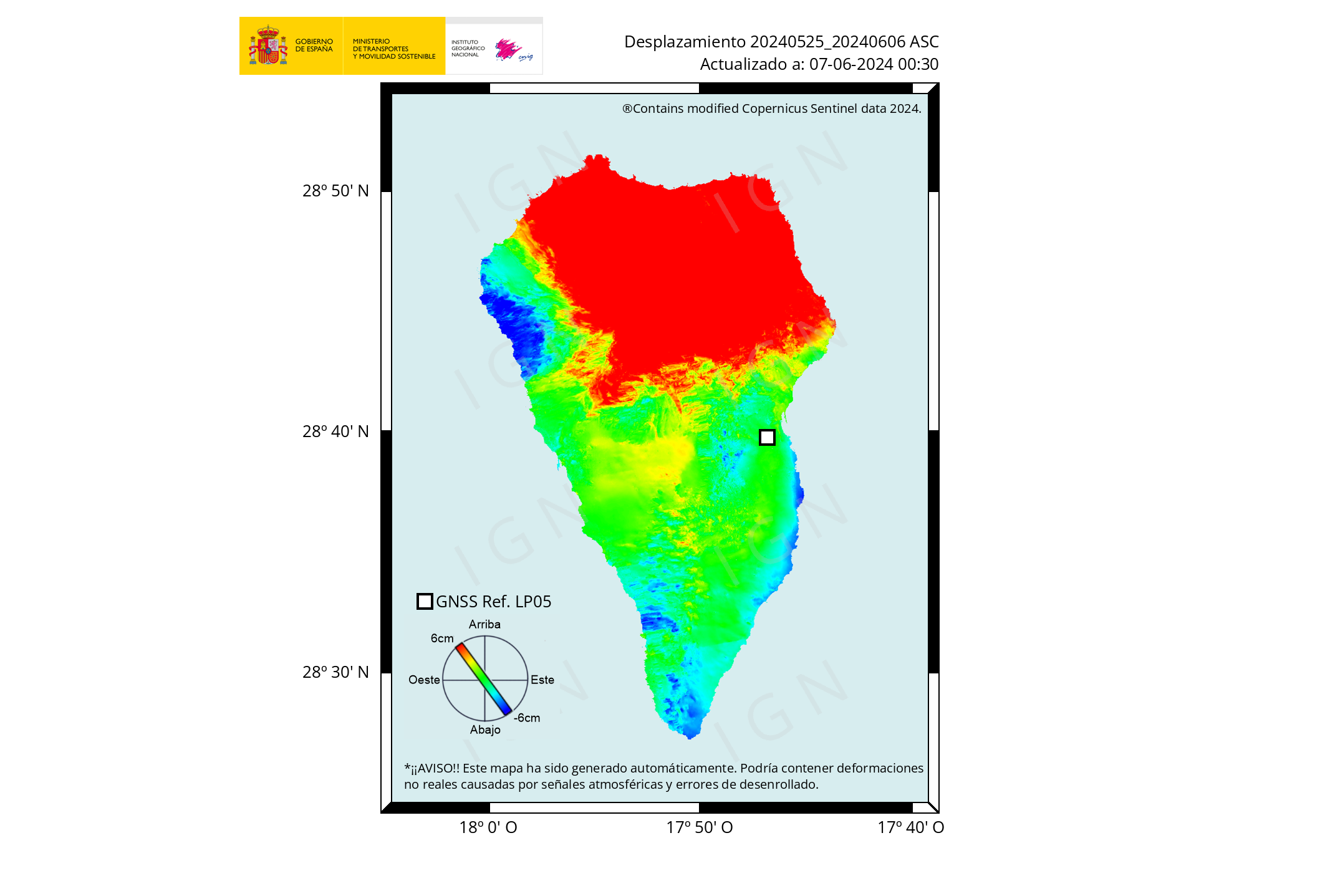
Interesting swarm on the Blanco Fracture zone off the coast of Oregon… any chance of an eruption in the cascades?
No. Go four of the main comments up. I linked a piece there which explains precisely why no. Two different areas.
Is Katla an open conduit system under the caldera roof?? Carl maybe You knows?
Open conduit volcanoes tends To inflate without earthquakes and be mostly seismicaly silent even if magma flows into them.
Etna, Kilaūea, Mauna Loa, Villaricca, Nyiragongo, Nyiramuragira, Masaya, Ysaur, Stromboli, Mount Michael, Pavlof, Shishaldin, Grimsvötn, Pacaya, Fuego, Erta Ale
Are examples of Open Conduit volcanoes with stable supplys
Yasur, not Ysaur 🙂
I am not sure to include Grimsvotn in that list either. It would be, but it has got a trapdoor caldera. Galapagos volcanoes also have them, it pretty much prevents a stable open lava lake vent forming, the conduit is cut off below the floor and it forms a sill that erupts from overpressure. Fernandina and Sierra Negra are also exactly like this, both would be open conduits but formed trapdoors instead of lava lakes.
I would also add Erebus to that list, it is possibly the most stable open conduit of them all actually, we just have no idea how long it has been going but it is at least as long as its recorded history.
Also Klyuchevskoy.
Grimsvötn is not a trapdoor caldera, it is a doming fissure caldera.
During different intra-caldera eruptions different parts will split open.
Basically it is following the rifting fissures orientation.
Same goes for Katla that rips open at different spots for each eruption.
It is believed that the 2-2.5km thick caldera floor of Grimsvötn, breaks where it is least ductile/most brittle.
The calderas of Grimsvötn does not correspond to the two upper magma-reservoirs, the currently most active is the southern, and that has grown quite a bit in under the Southern caldera wall. That means that there is no ringfault, and that is prerequisite for a trapdoor caldera.
To the best of my knowledge Long Valley Caldera is the only proven trapdoor caldera currently existing in some form of active status.
I think at least some of the Galapagos calderas are trapdoors too, Sierra Negra in the last millennium has mostly only erupted from one place, a fissure zone on the north edge of its caldera that is called Volcan Chico. It is actually one of the forgotten big hitters, eruptions as big as Holuhraun and with much higher intensity have happened there as recently as 1979.
I was under the impression Grimsvotn was operating this way too, given its apparent reluctance to actually fill its caldera and that all the eruptions are in the same area more or less with a similar style of being brief and high intensity for small volume.
If it is not a trapdoor then maybe it is just the fact it is stuck under a glacier that is keeping it from being open. When the ice eventually melts it could well start filling in its caldera with lava just like Kilauea is doing today, though we will probably not be around to see it 🙁
Yes Erebus and the Russia volcano too I forget them😂
Properly it is Ключевская сопка 🙂
Klyuchevskoy is one of the most prominent volcanoes and freestanding mountains on Earth, its at latitude 55 and well over 4 kilometers tall, and so active it does not haves a glacier. In the comming 10 s of thousands of years it may grow much taller than Kilimanjaro and will bury the other cones there as it grows.
Still Shishaldin is the most perfect mafic stratovolcano
Shishaldin is probably going to become an arctic Nyiragongo, once (maybe if) it has a summit collapse and can form a more open conduit. It is basically a massive lava fountain cone, fluid lava but erupted a fountain so mostly tephra. In 2020 Shishaldin was also the only volcano monitored by USGS that had a lava lake 🙂
Klyushevskoi is not quite as fluid, it is similar to Etna, but it might also be possible for it to form a lava lake if it has a big enough caldera collapse to open the conduit wide enoug hto prevent fountaining. Klyuchevskaya group is an area that I think one day could do something comparable to Thjorsahraun, massive mafic complex with enormous height and very high supply, already eruptions of Holuhraun scale have happened here.
Nyiragongo looked like Shishaldin before its summit was cut in half by caldera collapse. They are both formed in the same way by tall fountains. Shishaldin is one of the most perfect stratovolcanoes on the planet!
Shishaldin is probaly not as fluid as Nyiragongo is but perhaps similar to Masaya in viscosity.
Very few volcanoes haves viscosity as low as Nyiragongo, Only Kilaūea is the current active example of a volcano with nyiragongo viscosity.
Shishaldin is at latitude 54 same as Germany and shows How much colder Alaskas cold subpolar oceanic climate is than Europes continetal warmth
It is a Taal without the lake, but with ice instead
https://twitter.com/TheWatchers_/status/1468920118767882250
Ground deformation at Okmok volcano suggests shallow magma intrusion, U.S.
Any reason nobody wants to talk about Semeru? https://edition.cnn.com/2021/12/08/asia/indonesia-mount-semeru-volcano-eruption-cimate-intl/index.html
As of right now, more than 30 people have been killed by a rain induced dome collapse / blowout. Just wondering – would this be considered a phreatic or phreatomagmatic occurrence?
Don’t you understand? Grimsvotn doing nothing is more important then any other volcano no matter how bad they erupt!
Well, Semeru is a tragedy while Grimsvötn is pure entertainment. Ok, it might cause a bit of trouble locally due to ash fall and bridges washed away by jökulhlaups, but people usually don’t get hurt and die. Iceland is also closer to home and has more accessible data, although Indonesia is a lot more open with data than the Philippines. Last, but not least, it’s important to remember that we ourselves create the contents here and if we want more discussion about a particular topic we are all free to start the conversation here in the comments section.
I’m still amazed at how many people live on Java. It’s a big island, but not that big.
Almost makes Japan look sparsely populated.
Film of Semeru erupting. Not sure if it’s the most recent one 5ough.
https://www.instagram.com/reel/CXEL0ijB9mq/?utm_medium=copy_link
“The role of rain in this case has raised questions around whether climate change could bring more frequent eruptions of this kind.”
No. Not really. I don’t want to talk about it. They live on the volcanically most active part of the earth (besides Iceland). The difference is that Iceland doesn’t ask the West to pay for it by making climate responsable for volcanism.
Insulting each other is not cool.
This comment was beyond the “Be nice”-rule.
It is not what was written, it was how it was written that was the issue.
Next time, ponder if you wrote it in an insulting manner, or in a manner conducive for furthering discussion.
/Admin
This reminds me of a comment that a Channel 4 journalist said the other week stating “We saw the effects of climate change on our train journey to COP26 because a single tree fell on the track”. People quickly reminded him that it was autumn and that strong winds do in many cases bring down trees in the UK onto railway lines and have done so for many years.
Sorry. I am about one of the least prejudiced people around, really. On the other hand we are getting sick here about paying taxes for every single country in the world which doesn’t get its act together while our streets and above all bridges are in bad state and some people are living on the street.
Every now and then this anger has to get out.
And volcanoes can cause climate change. The other way around is rare to non-existant. Bad weather is also a forgotten thing in journalism. Bad weather can cause lahars and worsen things, for sure.
But for your sake I make it clear that it has less to do with Java than with journalism. Journalism is close to forgetting the word weather.
It does seem like the people behind that statement were just trying to blame more stuff on climate change without really possessing the knowledge about this type of volcanoes to make such a claim.
Volcanic eruptions by and large do not depend on climate change. There are exceptions: the large eruptions after the ice age were caused by melt of the ice age glaciers, so that is a climate change effect. A wetter climate might also increase the risk of a phreatic eruption. Maybe we should do a post on this at some point. The impact of volcanoes can be affected by climate change. But more important is the population growth which makes people live closer to the volcanoes. Before criticising Indonesia (which has done a pretty good job on volcano management), people should look at Naples – or Mount Rainier. And the comment about money seems ill-informed to me.
They do it all the time.
I was interested in Semeru, although there isn’t that much information that I could find on it. Sounds pretty bad though:
“Thousands of buildings were damaged, many buried under heavy piles of ash that shrouded homes in entire villages.”
It sounds as if whole villages were caught in the path of pyroclastic flows. Had the people evacuated before the eruption? Because if not then there might have been much more than 30 victims. What is the true magnitude of this disaster?
I did say once that villages where too close to the summit of Semeru and that it was only a matter of time before a volcanic disaster took place again in Indonesia.
It is not phreatic or phreatomagmatic. Rain may have triggered the collapse of the dome, which is speculative. But the eruption came from the lava dome and was thus magmatic, best classified as pelean/vulcanian. The dome must have collapsed, blown up, or most likely both things at the same time. Merapi style.
Looking at the post by Luis Godinho below, the pyroclastic flow path is actually very narrow, so it is not as bad as I originally thought. Still though it must have been like hell for those poor people found along the path.
It must have been more of a collapse rather than explosion. An explosion would have sent pyroclastic flows in multiple directions from the summit, but in this case only affected a particular direction. It must have been an avalanche from the dome/lava flows, initially running downslope ,and then mixing with air and lifting up into a coignimbrite cloud. Perhaps that’s why it was unexpected. There was no change in the eruption, it was simply a gravitational failure that grew out of hand, like a landslide but from lava. No warning given by the volcano.
Similar also to Pelée or Soufrière St. Vincent?
Compared to Mount Pelée 1902 this was minor then. Big progres in observation around the world.
There are similarities. However, in the 1902 eruptions of Pelée and La Soufriere destruction was more widespread. In La Soufriere a large explosion sent pyroclastic flows down every side of the mountain and advancing all the way to the coast in most directions within a few minutes. Similar thing happened with Pelée, Saint Pierre was not directly downslope from its summit, but there was a powerful explosion that sent pyroclastic flows soaring over hills and ridges reaching Saint Pierre.
In this Semeru eruption the pyroclastic flow has followed the steepest line of descent and seems concealed to a small valley. It must have been a dome collapse rather than an explosion. That makes it also harder to predict. Nowadays a tragedy like that of 1902 would probably be avoided because there would be obvious eruption precursors. However the side of dome falling off is much harder to predict.
Weekly report on Semeru by the Global Volcanism Program:
“PMVBG reported collapses of the lava dome in Semeru’s Jonggring Seloko Crater and SE-flank flow during 1-6 December. On 1 December material collapsed from the unstable distal end of a 1-km-long lava flow in the SE-flank Kobokan drainage, sending a pyroclastic flow 700 m down the valley. Subsequent avalanches were recorded by the seismic network that day and on 3 December were not visually confirmed, likely due to several days of rainy conditions. At 1330 on 4 December the seismic network recorded avalanche signals. A larger collapse began at 1447 was seen by an observer at the Mount Semeru Volcano Observation Post and identified in data collected by PVMBG. Avalanches of incandescent material from the summit dome and SE-flank lava flow descended 500-800 m. Pyroclastic flows were visible at 1510 descending the Kobokan drainage and a sulfur odor was noted. At 1520 a large pyroclastic flow produced a large roiling and expanding ash cloud that eventually rose to 15 km (50,000 ft) a.s.l. Reports from residents described darkness from airborne ash and rainy/foggy conditions. Pyroclastic material was deposited in two districts in the Lumajang regency, and eight districts in the neighboring Malang regency were covered with ash. Preliminary estimates suggested that deposits extended at least 16 km SE from the summit.
According to the Darwin VAAC satellite observations acquired at 1630 showed a detached ash cloud drifting SW at an altitude of 15 km (50,000 ft) a.s.l. At 1740 the ash cloud continued to drift SW and a second ash cloud was drifting W at 9.1 km (30,000 ft) a.s.l. The second ash cloud had detached by 1840. On 5 December satellite images showed the two ash clouds still drifting SW and W, and possible diffuse ash emissions rising to 4.6 km (15,000 ft) a.s.l.; ash had dissipated by 1000.
Following the 4 December pyroclastic flow Badan Penanggulangan Bencana Daerah (BPBD) issued a warning to residents to stay away from drainages due to lahar hazards and began evacuating people in high-risk areas. Ten people trapped in a building could not be reached because of scalding hot deposits but were later rescued. Almost all of the houses in the Curah Kobokan area had been destroyed, mainly by pyroclastic flows, though some residents reported roof collapses from ashfall. One area of Curah Kobokan was inundated by hot lahars that took down trees. Pyroclastic flows also destroyed the Gladak Perak bridge, 13 km SE of the summit, which linked residents of Pronojiwo and Lumajang; the national road leading to Malang was blocked by tephra and fallen trees. According to news articles and BNPB, by the next day 14 people were confirmed to have died, 57 had been injured and taken to hospitals (more than a dozen of were in critical condition due to severe burns), and at least seven residents and sand miners working along the river in Curah Kobokan were missing. About 1,300 people had relocated to evacuation centers or alternative housing.
Additional pyroclastic flows during 5-6 December descended 2-3 km SE, and incandescent avalanches descended 500 m. At 0855 on 6 December a pyroclastic flow traveled 4 km down the SE drainage, temporarily halting rescue and recovery efforts. Later that day, the head of BNPB, police officers, and others conducted a 15-minute overflight of Curah Kobokan and observed steam plumes rising from the deposits. Initial estimates were that 2,970 houses and 38 educational facilities across several sub-districts in Lumajang Regency had been destroyed or damaged by the pyroclastic flows. Authorities also traveled to the fallen bridge and other nearby locations, noting damaged vegetation, fallen trees, and volcanic deposits up to 30 cm thick along the road.
By 7 December an estimated 4,250 residents were displaced in about 20 evacuation centers; most people originating from the Lumajang Regency and fewer from the Malang and Blitar regencies. The number of fatalities reached 34, with another 22 people missing. Search efforts focused on the villages of Renteng, Sumberwuluh, and Kobokan Curah, but daily afternoon rains hampered rescue and recovery efforts.”
https://volcano.si.edu/volcano.cfm?vn=263300
So probably 56 when still missing a few days later.
Here’s a compilation of videos from the Dec 5 eruption. I was obsessed with Agung for about two years and in the process, learned some (volcano-related words) Indonesian.
https://www.youtube.com/watch?v=6hTj7yRXj00
It looks pretty nasty.
According to his colleagues the entire rain induced thing is an error in translation from a statement by Surono in a Dutch newspaper. The newspaper did correct the translation, but then it had flown across the planet already.
Instead of translating into “during” they translated “caused by”.
Thanks.
Volcanic tremor just give a jump…
I think it is place 2 now?? Second-longest was 80 d, it is 81 d now, if I’m right?
If it’s not the first now is almost there…
It is not yet first, but I believe it might be possible.
Could be erased in 5 days though, I think both possibilities are possible.
https://twitter.com/CopernicusEU/status/1468607042466295815
#Semeru started erupting on 4 December causing dozen of causalities and ~1,700 people to be evacuated
Effects of the eruption are visible comparing #Sentinel1 images of 25 Nov. (before) and 7 Dec. (after the event)
https://twitter.com/EIlyinskaya/status/1468861482582556679
Water volume released in a jökulhlaup from Grímsvötn volcano over the last few days, with Reykjavik city for comparison. The sphere is 1240 m in diameter and holds 1 billion litres (400,000 Olympic pools). Infographic by
@Vedurstofan
https://www.ruv.is/frett/2021/12/07/risk-of-volcanic-eruption-diminishing?fbclid=IwAR2X012kTyRmU8YutmGU2PPXCpi9UICdrQWOA8R7pvQvdU3MAwXTaWc0ld4
Grimsvötn wont erupt this time..
As Albert says, the rocks around Grimsvötns magma chamber is hot and ductile and also wet, that makes it easy for the magma chamber to expand. Looks like its expanding South now by seismic activity since 2017. IMO geologists dont think an eruption will happen this year either
Absolutely, tremor looks dead in the water to me.

Is the magma now going to evolve in the shallow chamber?
How long is such an evolution gonna take in the first place?
Grimsvötn erupts too often too have any really evolved magma
Grimsvötn erupts too often to have any really evolved magma
Correction
Where billion = 1,000,000,000,000
Oops! refers to infographic about jökulhlaup (Obvs)
How many lakh is that? (the math is not that hard, is a joke)
It is 27 Lakhsmi.
https://imaggeo.egu.eu/view/275/
Grimsvötn tephra Island in the meltwater lake during the 2004 eruption, had the eruption continued it woud turn effusive like Surtseys lava phase
This comment section

I understand your disappointment, Tallis. Well, let me find a Euro Volcano!
https://www.wired.co.uk/article/artificial-volcano
Hope that balances the books! 🙂
Slow news day default: let’s hypothesize about Icelandic volcanism, with occasional forays into extraterrestrial volcanism and Kilauea.
Things change when something else erupts.
Semeru killed 34 people though, and we haven’t talked much about it.
Semeru Pyroclastic Flow was a scary sight to see in the news, and thats still a small PDC
I can barely imagine What La Garita or the 20 000 km3 arabian pyroclastic blowouts woud have looked like .. Tobas 4000 km3 PDC s was bad enough
Semeru PDC looks a little bit like Sinabung PDC, white ash.
Supposedly an andesitic volcano, though. In shape and erosion patterns it looks like a bigger version of Agung.
SI GVP page for Semeru: https://volcano.si.edu/volcano.cfm?vn=263300
They have a great map archive on that site.
Very funny.
There is a reason that I did not write about Semeru, and rarely write about volcanoes that kill a lot of people.
And that is that it is very hard for me to do it. I end up thinking about the victims, and start to feel bad.
I have seen to many bad things in life to be able to write about bad things well because it affects me a lot.
That being said, we will always be happy if someone who have the interest and knowledge to write about eruptions like Semeru. I would have published such an article in a heartbeat.
I hope that this explained things a bit better.
And I do not know if Iceland is really the problem.
I have noted previously that when a Vorlon battle-fleet of come to Earth and start blowing the planet up, then the final comment written in here will be…
“Pelées hair in the 1342 eruption was 14.359 inches long, this means that Kilauea is more powerful than any other volcano” 😉
I’d write an article but fear I’m not really knowledgeable enough.
Couldn’t pass calculus, that’s why I was a biology major. Original interests were chemistry and geology.
I have noticed though, that people who do well in organic chemistry have trouble with calculus, and vice versa.
Hm, sounds like the perfect person for a geochemistry article.
I really have to fire up the brain to understand those articles…
Perhaps calculus hinders chemistry understanding. 🙂
@Carl
Calculus requires linear thinking, and organic chemistry requires the ability to visualize invisible moving/changing objects in 3D. Different skill sets.
Problem is, ito be a chemistry major, they want you to do both.
I think the last comment will be what is that in metric?
Or…
Could I have that in fractions of a lightsecond…
(The Vorlon is by now getting into the conversation)
After that follows a 439 comment long thread why Mount ))#%(=)(=”XHERT is the most powerful volcano in the Universe, and a lofty comment about drinking @$$€ on the slopes of said easy to pronounce volcano.
The Vorlons have by now forgotten about destroying earth, and we are all saved by the comment section in Volcanocafé.
Jesper will become a new member of the Grey Council on Minbar.
Yes Volcanocafe is an amazing site, and I too is working on my own article, thats on my computer at home, If I can find It. Volcanocafe also helps me To feel a little better, and get in better mindset.
Yea .. Im an Aspie and thats the reason why Im fanaticaly intrested in volcanoes. But it is also very tough for me to have Aspbergers, defenetivly true horror in many kinds of ways of being so diffrent, Also Im not good at being social, But I try : )
Im working on my own text: IF its still in my on my computer disk. Its about Nyiragongo and its lava and peculiar nature
You are an “Aspie”, and that’s why you are intelligent too. It has two sides, right?
Asperger’s Syndrome seems like a perfect psychological makeup for a doctoral student.
Basically, you have to come up with one topic you want to think about for five years, then write a very long paper about it.
We do well when we are acknowledged for what we are and can work within our special interests, and we don’t have to socialise or communication too much. Working a normal 9 to 5 job is damned near impossible, though.
I suspect the greatest British engineers, academics and scientists of the 19th century were “Aspies”. Nowadays, instead of letting them flourish we stick them in an SEN unit as soon as possible, which gives them a stigma in school and knocks their self-esteem.
You ain’t alone; I am slightly Aspie, I can stay focussed on editing for hours on end (or watching geology in real-time). I don’t do parties… My dad is that way with his design engineering. A friend of mine is a computer programmer… There is rarely such thing as normality. You will find most blokes are. It is how we operate.
Sir Nigel Gresley, when he designed his conjunctivated valve-gear for the LNER A4; I suspect he would have been at that for a long time. Like all of us, you have been blessed. Your fanatical interest in volcanoes could save someone’s life.
Its worse to be undiagnosed and expected to be normal, to spend most of your life wondering why you can’t do what everyone else finds easy, and why everyone around you seems unable to understand what is very obvious to you. To lose your job because you can’t explain why you can’t communicate effectively. To be bullied because you are ‘weird’. To constantly feel like an outcast. I agree that the current education system for people like us isn’t necessarily helpful, but at least now we can be recognised and supported from childhood. I would have made a lot more of my life had I known earlier.
I think knowing is important; but equally once you know, not letting it become a barrier or dwelling on hindsight. We are what we are, we are here for a purpose. Whilst others losing their heads, we remain strong. If I had known, would it have helped me or hindered me? I can make a case for both. I have pushed on. I have a degree in Music, going for a 2nd degree, this time in theology, might do a third in Geology. Currently running the family business. Personally, I think what is satisfying is the fulfilment of overcoming the barriers by myself (with the help of God) rather than wishing it had been easier.
We all go life’s trials and tribulations, we have to play the hand we are dealt. We sink or swim. Who is to say that if we were wired differently, we wouldn’t have struggled in other ways.
Blessings
SEN units don’t exist. Students are in main stream classes and offered one to one support in some subjects. Lack of funding means many don’t get support across all subjects. One of the main focuses of teacher training and PM is to differentiate across the ability range to improve access to the content. It’s not perfect, but it’s much better than it was.
Edmdas, I think it is here good to remember that the commenters in here comes from many different countries with different systems.
True Carl. I have worked in four different countries education systems. My comment was response to Peter who said ‘British’. By which I assumed rightly or wrongly England and Wales as Scotland has a different curriculum.
The eruption of Semeru reminds of Fuego in 2018.
When the pyroclastic flows move swiftly over the ground they are not very tall, easily hidden behind trees or inside small valleys. You may not even see it coming at you until you get caught in it. Most survivors of pyroclastic flows didn’t see them coming. It is only afterwards that it mixes with atmospheric air and starts swelling into that, big, mean-looking, billowing cloud of ash that gives the impression of erupting out from the ground all over the place and towering high up into the sky. It is only then that people panic, even though the pyroclastic flows have probably most or all of their damage already.
https://youtu.be/LObNBfnF9R8
Interesting explanation, thank you.
Some detailed youtube videos of pyroclastic flows:
https://youtu.be/Wg1GkeZvtWk
https://youtu.be/KxrSpHnWFFw
The Arenal-video is great, you can see quite well what you explained, Thank you v.m., muchas gracias.
Official death toll 190, 256 missing. Locals estimate 2000 deaths a local org. 2900 around Fuego.
Prayers
Short update on Grimsvötn.
Earthquake activity is still ongoing at heightened levels in regards of number of earthquakes.
The initial activity was mainly inside the caldera, or just south of station GRF outside of the caldera.
A few days ago a minor dyke formed from the southern edge of the central magma reservoir, that led to Háabunga SSW of Grimsvötn.
Today intra-caldera activity resumed and is complement by activity on the Gjálp fissure.
There have also been activity at Greíp, but that is normal for this proto-volcano.
Tremor, the only recorded tremor was during the formation of the dyke, it was low level and indicated that only minor amounts of magma moved out of the reservoir.
What is happening currently at the volcano will become clearer as we get fresh GPS-data that is unaffected by the jökulhlaup (that have stopped at the Lakeside now).
If an eruption would occur it is right now hard to state where it would open a vent.
All of the four alternatives are possible, but I have placed them in order of what I currently perceive as most likely to happen. This may/will change as new data comes into light.
1. Intra-caldera eruption, near the southern caldera wall.
2. Exo-calderic eruption 1-1.5km south of station GRF.
3. Gjálp-eruption.
4. That the new dyke opens up again causing hot gas-rich basalt to enter the old reservoir filled with rhyolitic mush in Háabunga.
What’s your take on the new cauldron that formed in the ice southeast of the caldera? Flood water eating away the ice from underneath? Increased geothermal output at that spot? Something else?
One cauldron was due to water moving out, but the one near the caldera-wall is geothermal output. It was open water there before the hlaup started.
Wont be an open vent, even if the conduits are open. Grimsvötn operates a trapdoor style Galapagos caldera, perhaps similar to Sierra Negra, just a bit more active.
Althrough I do want the system to form a lava lake in the caldera wall and it will never happen because of these reasons https://www.volcanocafe.org/lava-lakes-the-great-equilibrium-machine/
” lack of icelandic lava lakes”
But non stop shield building are the next least likley scenario for Grimsvötn
It is not a trapdoor caldera, see longer answer up above.