Have you ever been bitten by a dinosaur? That would be something worthy of Jurassic Park. In those movies it tends to be a lethal experience. But most children will get bitten by the dinosaur bug at some point in their early years. Dinosaurs fascinate; it is the excitement of a lost world, a wild place with unimaginable animals. I am the proud owner of a clutch of fossilized dinosaur eggs. Children are drawn to those eggs, with many recognizing them directly for what they are. Museums showcase dinosaur fossils – the large friendly dinosaur with its tail bones stretching along the floor is the first attraction you will see on entering the National History Museum in London. In New York, the Museum of National History similarly impresses but with a far more aggressive-looking fossil reaching far above the impressionable (and feeling very edible) public. For many, the dinosauric fascination continues into adulthood. Some become paleontologists, studying the fossils in the field. Rich people buy the fossils, showing that an abundance of money can feed the child inside. I understand them well – why else would I own those fossil eggs?

American Museum of National History, New York
There are many sites in the world where dinosaur fossils have survived. Sometimes it is not the dinosaurs themselves but the impression they made which survives. Dinosaur footprints can be recognizable, where the massive animals depressed the surface. Soft tissue sometimes survived by impression, which is how we know about scaly skins and in some cases, feathers. Egg shells have already been mentioned as a dinosaur remnant. But mostly it is their bones, sticking out of an eroding rock.
Fossil dinosaur footprints, Spyway, England (photo by author). Not much to look at, but great for the imagination! These prints were left 145 million years ago.
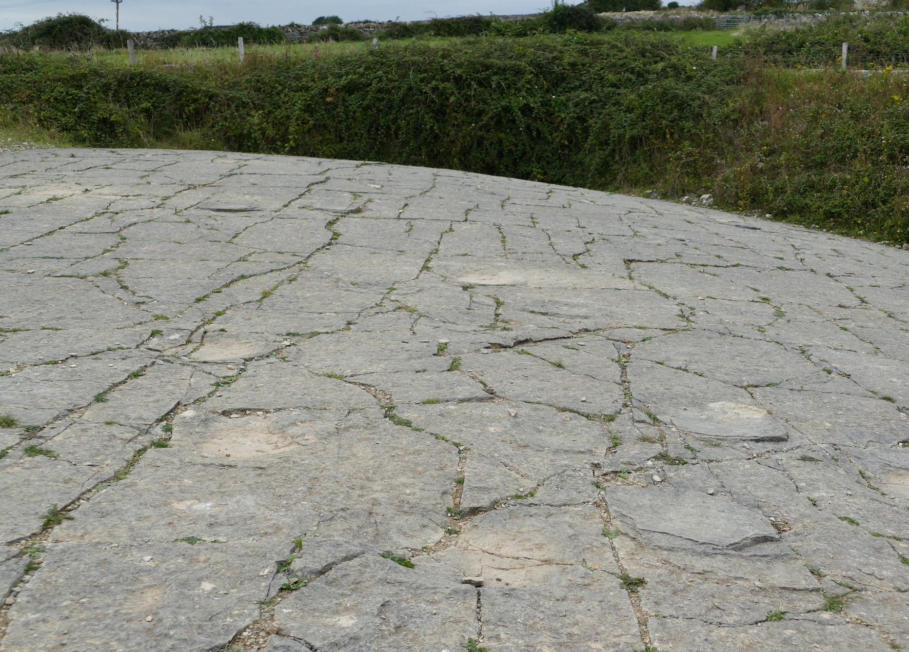
One of the best places to see the fossils as a tourist is the Dinosaur National Monument, Utah, USA. The site, on the border between Utah and Colorado, is a gem. A viewing gallery covers a large rock wall, which at first impression is a jumble of irregular rock. A longer gaze reveals patterns in the jumble, which resolve themselves into petrified bones. Every square meter of the wall has several such bones sticking out. It is in effect a near-vertical dinosaur cemetery, the place where the old dinosaurs went to die. Excavations are still on-going, more than a century since the original discovery. If you are lucky, you will see people excavating in front of you, the paleontologists on display together with their finds. This museum is alive with the past.

The discoverer of the fossil treasure was Earl Douglas. In August 1909 he wrote: “At last in the top of the ledge where the softer overlying [sandstone] beds form a divide—a kind of saddle, I saw eight of the tail bones of a Brontosaurus in exact position. It was a beautiful sight. Part of the ledge had weathered away and several of the vertebrae had weathered out and the beautifully petrified centra lay on the ground. It is by far the best looking Dinosaur prospect I have ever found. The part exposed is worth preserving anyway”. It took some time before the true wealth of the site become clear. By November Douglas wrote: “… the ledge is full of bones… We realize that we have a stupendous task and the men are working like beavers… If we stopped to consider what a terrible lot of work there is to do we might fall over…” The area over which the bones were found measured less than 150 meters in width. The bone layer was strongly tilted, by over 60 degrees, so that bones that were originally spread out horizontally now seem to stack almost vertically. Over the following few years, complete skeletons of an apatosaurus, a diplodocus and an allosaurus were excavated. Animals had died at all ages: there were fully grown adults and young dinosaurs, including a diplodocus only 1 meter long.
Geology
Dinosaur National Monument is much more than a viewing wall, even if the description may give the impression of a Truman show with dinosaurs on a very wide screen tv. This is a national park which covers a large area, which is begging to be explored, although far harder to reach than the visitor centre with its car park. There are dinosaur remains in several places. But those are only one aspect of the park. The landscape is varied, with rocks and layers dating from a billion years ago to the much more recent past. When hiking here, or taking a river trip, you should try to take a geologist with you to explain the landscape. Rock watching may not sound as exciting as bird watching, but the Earth has spend a long time putting this place together. It is a work of art and should be given the attention it deserves, even if the view hasn’t changed much in the past 30 million years. You are not here to watch paint dry. You are admiring the end product.
But in spite of the geological riches, people are drawn mainly to the big friendly (or not so friendly) giants of their childhood. Of all those different geological layers, dinosaur remains are present in only one: the Morrison formation. This layer is a relative newcomer in the region. History here starts about a billion years ago with an ancient mountain range. It wasn’t exactly at this location, but nearby: as the rain weathered the mountains, the sediment came here. This bottom layer is a dark rock called the Uinta Mountain Group (it is named after the local mountain range of modern times). Much later, the land sank and the sea came in. The second layer, called the Lodore formation, is a sandstone that was deposited in a shallow sea around 500 million years ago. As the land sank further, 340 million years ago, the Madison Limestone and the Round Valley Limestone were deposited. At this time the sea stretched from north to south across the continent. 30 million years later, as the sea shallowed, the Morgan formation formed. This is a sandstone which forms a series of nine layers, each cycling between red sandstone, brown mudstone and light-coloured limestone. The red sandstone formed when the surface was drier, the others during wetter times. The layers can be seen in the deep canyons of the park. The layering has been attributed to an ice age which kept changing the sea levels. Now the land rose again above the sea. A vast sand desert formed: this left us the Weber Sandstone, 300 million years old, which form thick layers in which the shape of the sand dunes is sometimes visible.
Nothing now happened until 150 million years ago, as the paint dried. Any rocks that were deposited during this time have been eroded away, leaving a gap in the record. Now, a new episode of sandstone came. This is the Morrison Formation, and this is where the dinosaur fossils reside. The age is between 155 and 144 million years ago. The formation is not unique to this park. The Morrison Formation is found across several states, from New Mexico to Montana, along the east side of the Rocky Mountains. If you see a dinosaur in a US museum, it is not unlikely it came from the Morrison. The Dinosaur National Monument also has some fossils from the later Cedar Mountain formation, rougly 100 million years old, but the large majority are from the Morrison era.
Much later, the growth of the Rocky Mountains caused large scale uplift in the region. This brought with it erosion, and canyons formed. Very recently, glacial erosion has added its signature. All these events has left us a varied and deepy impressive park – which few of the visitors will ever see. They had straight for the visitor centre and the famous wall of crumbly rock-and-bone. The people don’t come for the view. They are here to celebrate an ancient Day of the Dead, a visit to the cemetery to keep the memory alive of this who have departed.
At the time of the Morrison formation, the western USA was just beginning to take shape. In Nevada, the first of the highlands were rising that were later to become the Rocky Mountains. This started 160 million years ago and is known as the Elko orogeny – Elko is a lovely town in northern Nevada, once voted the ‘best small town in America’, and recently upgraded to the ‘best city to live in the state of Nevada’, presumably after some population growth had occured. I once spend a few days in Elko and nearby Spring Creek and can confirm it was a nice place! But it wasn’t nearly as nice here during the Jurassic. A subduction zone had formed off-shore, where the Farallon oceanic plate was subducting underneath the continent, bringing with it the first of the Pacific terranes to join the west coast. An Andean-type mountain range formed above the subducted plate. Rivers were flowing east from those mountains with their load of debris, in some places sand, in other places mud to the low-lying land beyond the Elko mountains. This debris was to become the origin of the Morrison formation.

Ecology
The region east of the mountains had become a huge basin, thousand of kilometers long, and watered by those rivers. The climate was subtropical and fairly dry; the land would have been savannah, except that it didn’t look anything like a savannah because grass had not evolved yet. The area was located in the rain shadow of the newly risen highlands, and away from the rivers water would have been in limited supply, although not desert-like. There were lakes and swamps around the river, as in an ancient Pantanal. Plants were abundant along the rivers, with beds of horse tails, and on drier lands tree ferns and conifers. Across a large area of the USA, the fossils of the Morrison show an abundance of aquatic life, such as mussels and snails (both gill and lung breathing).
The sheer number of the dinosaur fossils in this Formation, including embryos, shows that this was a good environment for them. But there was much more than the occasional large dinosaurs. Much of the animal worlds would have looked somewhat familiar to us, with salamanders, frogs, turtles, and small mammals. And crocodiles.
Just like grazing animals on the African savannah, the local dinosaurs may have been migratory, following the rains and the water. In each location, they probably loitered along the rivers, where the salad bar was set for them. And of course, wherever there is a salad bar, carnivores are patiently waiting for their share. They are not after the salad bar: what they see is a walking buffet. The vegetarians would have needed to be careful eaters; any carelessness could be a recipe for disaster.
Dinosaur volcanics
Just like today, volcanoes were active in the western USA. We don’t know too much about them, but the evidence for their presence is clear in the Morrison Formation. Between 25% and 75% of the Morrison Formation consists of volcanic ash! The volcanoes themselves have not survived – this was, after all, a long time ago and much of the western USA has been remodeled as old oceans subducted, new terranes docked, basins formed and mountains grew.
The oldest Morrison beds, between 155 and 160 million years old, have fewer ash layers. They become more common in the younger layers, between 150 and 155 million years ago. After that, the deposits suddenly end. There is a time gap of perhaps 20 million years, before the Cedar Mountain Formation. By that time the Jurassic had become the Cretaceous and the dinosaurs had changed. If you liked Jurassic Park, you would have enjoyed the the Cretaceous: all the best dinosaurs from the movie were from the Cretaceous. But why the missing 20 million years? These may have been removed by erosion. However, it can be difficult to know whether something is missing because it was removed, or because it was never there.
But let’s return to the Morrisons. The eruptions that occurred over those 5 million years were massive. Ash beds in Utah are over 100 meters thick, containing at least 35 separate explosions. The size of the ash beds, far from the eruptions themselves, suggest these were caused by caldera collapses. Where did these happen? The calderas themselves have not been found and weren’t here. The ash was blown here by the wind from the southwest. This puts the calderas closer to the coast. We can envisage a volcanic arc stretching from western Utah and central Nevada to California’s Mojave. Ash can travel surprisingly far. For instance the ash of the Bishops Tuff is 1 meter thick 800 km from the source! This is not due to ash fall which would have been a few centimeters at this distance. Wind and water transported the ash over such large distances.
Some of the ash beds of Morrisons contain rhyolite and dacite, and a little andesite. The oldest beds are less evolved, the Dinosaur National Park lacks these older events. The volcanics may have changed over time.
What triggered the sudden spike in activity in a brief 5-million year period, 150 million years ago? We can only speculate. The subducting slab may have gone down steeper, causing extension in the overlying continental crust and allowing magma to rise. A slip-strike fault may have developed with an extensional component. There may have been a change in subduction direction. All of these may have occurred! In one view, there were alternating phases of contraction and extension in the region, leading to the Elko highlands, the Morrison basin, and further west the volcanic calderas. This side of the Pacific Ocean has long been a complicated place. This has since a long time been the main long-range east-facing subduction zone on Earth. As America is moving west, it is collecting all the debris that ended up in the eastern Pacific, has swallowed spreading ridges, and incorporated microcontinents. The western USA is where the Pacific ocean dumps its waste.
The volcanoes erupted and deposited thick ash over the land, over several millions of years. The ash did not always remain where it was laid down. Rivers took it down into the basin and the ash ended up in lakes and on mudflats. The interaction with water changed the minerals: sometimes clays such as smectite and illite formed, while in another place it might be albite. It depended on the chemistry of the water. Some of the SiO2 in the ash dissolved into the water. This made the local sediment and clays enriched in the other minerals which did not dissolve, while downstream the dissolved elements would become enriched. This alteration makes it more difficult to know what type of magma caused the eruption. The rare earth elements give the best indication of the original magma: they have ratios that are like rhyolite to rhyodacite, but are not as extreme as found for instance in the Bishops Tuff.
The composition confirms that the volcanoes formed in a volcanic arc along a subduction zone. There was no hot spot or spreading ridge involved. This fits with what we know from the geology.
As the ash was subjected to water in lakes and elsewhere, two important elements dissolved: uranium and vanadium. As the ash beds altered, the sediment layers that formed downstream became enriched in these elements. The sedimentary beds of the Morrison Formation are the main source of mineable deposits of these elements in the USA.
The crumbly stone of the Dinosaur Wall formed from sediments, downstream from the ash beds that fed them, which themselves were downwind from the volcanoes that caused them, which themselves were downstream of the subduction zone that caused them. A chain of cause and effect links the Wall to the distant Pacific ocean.
Dissecting the Morrisons
In the Dinosaur National Monument, the Morrison Formation contains several distinct beds, only one of which contains the famous bones. The four beds are called ‘members’, and called Windy Hill (the oldest), Tidwell, Saltwash and Brushy Basin (the youngest) – the dinosaur wall belongs to the last. Windy Hill is a marine sandstone, and was deposited when this was a sea. The others were deposited when the area had been raised above sea level: Tidwell is a mudstone, Saltwash a river sandstone and Brushy Basin is mainly clay, deposited in lakes, floodplains and in a few cases, streams. Brushy Basin contains more volcanic ash than the other members, and seems to coincide with a peak in volcanic activity. This ash interacted with the water and changed into the red or grey claystone which we now see in the landscape.

Sandstones and mudstones of the Morrison Formation. Source: John Foster, Jurassic West, 2020
The dinosaur wall is part of the Brushy Basin member, but it is not a typical part. While the Brushy Basin is primarily clay, the Quarry bed consists of sandstone. It is present only in the immediate area around the dinosaur wall.

The red line shows the sandstone bed. Figure from Brezinsky and Kollar, PALAIOS, 2018, v. 33, 94–105
The sandstone layer, sandwiched between the clays, can be readily recognized in the landscape. The picture (also from Bezinsky and Kollar, 2018) shows the view east from the parking area, with the Brushy Basin indicated, and the Quarry sandstone forming a ridge above the rest. It stands out because the sandstone is harder and therefore has eroded a bit less.

The sandstone indicates a river. The clay may have formed in lakes where the sediment rained down over time, but the sand was brought by flowing water. The streams went roughly northwest to southeast. The sandstone is found along a line that runs almost west to east, a bit over 1 kilometer in length with a series of outcrops. This is not the line of the river: instead the length of the sandstone bed may correspond to the width of the river bed or it flood plain.
The sandstone is not a single deposit. The picture clearly shows layering. Twelve sandstone layers can be recognized. The layers are coarse-grained sandstone, separated by conglomerates of pebbles and granules. As you move along a layer in the (original) downstream direction, the grains become finer. One of the sandstone layers shows up as isolated, rounded features, around 4 meters in diameter, and perhaps half as thick; they are approximately lens-shaped.
The clays indicate the presence of standing water, or water-logged terrain. At other times there were rivers here in a drier environment. It was more complex than a single, fast-flowing river channel. The lenses may have been sandbanks, build up by the river.

A river runs through it
What about the dinosaurs? The abundance of bones is seen in only one of the many layers and in only one location in this layer. They are found near the bottom of the sand, in what would have been the deepest point of the channel. But the animals can hardly have died there. At least 20 individuals of 10 different species are found. That does not sound like a herd and more like panic. In fact, the location is considered a ‘death assembly’: this is not the place where dinosaurs went to die, but is where the dead dinosaurs ended up. It is the cemetery. They died elsewhere, although probably not far away as dead dinosaurs can’t easily move. If you think of a river bed, the largest pebbles move the least distance. Now think of a dinosaur as a very large pebble. It takes a big flow to move one even a small distance. A major water flow would be needed.
A carcass can actually float. This happens during part of the decomposition. Otherwise, they move by sliding. In some cases there is also evidence of rolling of the carcass by water. The completeness of the bones indicates that they fairly quickly became protected against the elements, presumably by being buried in sediment or sand. Many of the bones show insect damage, and there are indications of drying out. There are a few cases of fossilized skin. This suggests an anoxic environment, as may occur in wet soil below the carcass – but only if there is no flowing water. The alternative is a hot and dry environment, but this leads to the same conclusion: although water created the assembly, the dead dinosaurs did not remain submerged. The water went away.
It should be noted that not all bones are together. In addition to the complete animals, there are many single bones as well. We don’t know whether these belong to a few other individuals or are unrelated to each other. On the east side of the quarry, these separated bones are so dense that they would have obstructed the flow channel by capturing the sediment. And above the bone layer is a thin layer containing many bone fragments, some only millimeter size, showing signs of abrasion. They were perhaps moved by rolling across the surface. We do not know how far they would have travelled. We can’t even be sure it was done by water (although likely): abrasion by sand can also be considered.
The discussion has been going on for decades. Was this a river? It has even been given a name: the Quarry river. But did it exist, and if it did, was it here? There was certainly water, and quite a lot of it: the fossils include evidence of aquatic life, such as turtles, bivalves and gill-breathing snails. Some of the bivalves are still closed: normally they break apart after death. This suggest they were buried while still in water. Many though are disjointed, and someties even stacked. This indicates that the shells, including the closed, buried ones, died somewhere else and were brought here later. There was transport from a place with permanent water to here. It is beginning to sound very much like a river. Dinosaurs, however, would not be expected in deep, fast flowing rivers. They died outside of any river, were brought here by deep, fast water that wasn’t there when they died, and after the bodies had been moved here, at some point the water disappeared. The drying out may have taken months (or even years), but it happened before all soft tissue had decayed. Was the water seasonal? Afterwards, the water did not return to the burial site, probably for many years.
There is some evidence for scavenging of the carcasses, but not nearly as much as might be expected. Whatever happened perhaps did not leave a lot of predators around. As the vegetarians and the lost salad bar, so the carnivores and their carvery.
Death on the Quarry River
Before moving on, a discussion is needed on cause of death. This is always hard to certify in the case of fossils, and especially if the fossils are not found at the exact place where they died. Death by predation can be excluded: that never gives mass mortality. Drought has often been suggested. This is common on the African savannah, which is a similar environment. However, the animals tend to be spread out along the vanished rivers rather than concentrated, so this requires that the corpses were brought together after death. Disease can be ruled out as the main cause of death, as this would not impact such a variety of species. Migration can lead to mass mortality by drowning, if the herd feels compelled to cross a river which happens to be in spate. But this tends to happen to single-species herds, and here the great variation of species argues against it.
This leaves two main options: the deaths may have been caused by drought, and occurred over an extended period, or the dinosaurs died in a catastrophe. The former explanation is generally preferred; it explains many of the characteristics including variation in the amount of decay, but requires that the bodies were brought together by a flood. The limited evidence for scavenging may be a problem. For those who prefer catastrophe, the main choice is normally a major flood.
(The option of death by volcanic eruption (pyroclastics) may seem attractive on VC but lacks evidence and a nearby culprit. Volcanic possibilities such as CO2 poisoning (lake overturn) or a sulphur cloud from some volcano have not yet been suggested. I mention it here just to fill this gap still unclaimed by speculationists. And yes, that is a new word. You read it here first.)
Both the drought and the catastrophe require a flood as part of the explanation. That is the only thing most people would agree on – and it agrees with the presence of the remains of turtles.
The power of water
The next question becomes, what kind of flood? There are two main options: an event within a river bed, or a break-out to a flood plain.
Some of the deposits are suggestive of the latter, what happens when a stream breaks its banks and overflows the surrounding land. The illustration below is taken from the paper by Brezinsky and Kollar, 2018, already mentioned above. The first panel shows the situation at the start of the break-out. Next to the river is a splay, perhaps build up by a previous break out or by an abandoned meander of the river. The next panel shows the situation a while later. As the river broke out over the flood plain, several deep channels were formed by the fast flow, levees build up around these channels and soil developed in the standing water around the levees.
In this model, the dinosaurs could have been on the initial splay, overcome by the sudden flood and ended up at the bottom of the deep channel. The mussels, snails and turtles came from the river, and were brought by the flood. Afterwards, the break healed or the river found a new bed, the flooded area dried out, and insects (but few carnivores) feasted on the buffet. And very much later, scientists come and wondered how so many dinosaurs managed to die in such a small area.


Mississippi splay. No dinosaurs
This model explains many aspects, but is not the most popular one. Most commonly, papers argue for an event inside a river bed. A braided river system has been proposed, with many individual channels in a wide river bed. Here the dinosaurs would have gone to the river bed in times of drought, and succumbed due to lack of food or water. They remained where they died. Sometime later, the river flooded and the bodies were picked up by the flood. This idea does not require a dramatic flood, nor that all dinosaurs died in one catastrophe. It is an attractive and plausible model that has been around for a long time. The main argument raised against it is that the sand layers have the coarsest deposits at the top. That is typical for splays but not for river beds. The variations of the structure along the Quarry sandstone is also not expected for a river bed. However, this does not seem a conclusive argument, and the river bed remains attractive. The fact that the river did not return for a long time may be more problematic.
A variation of this model has suggested a meandering river. This combines features of both models and less of a problem with the subsequent drying out. This model was in fact already proposed by Douglas. It is consistent with much of the data. The main problem may be that the animals are proposed to have been deposited on the inner bend of the meander where the flow velocity are small. It might be expected that the largest, least mobile animals would have ended up in the faster channels further out. A braided river or a break-out flood may therefore seem preferred. However, this discussion is continuing and has not come to a final conclusion.
Whichever model is used, it should be able to explain the partly chaotic properties of the sandstone amidst the mud and clay, and the sheer density of the dinosaur remains.

Example of a braided river
After the flood, the remains formed a Jurassic jumble with bones and bodies thrown together in an area of perhaps 100 by 40 meters. Some were quickly buried, either partially or completely. Now the water went down again, leaving some (perhaps all) on dry land. The bones remained close to their position, showing there was little disturbance for a considerable time. They were quickly buried, and the water did not return for a very long time.
Volcanic speculation
The final question should be what caused the flood. We cannot know how extreme the flood would have been. Was it a river flow from months of rain, or a one-off event? The lack of scavenging may make the latter a bit more likely but it remains speculative.
But let me become a speculationist. The Quarry river came down from highlands covered in tephra, during an era of distant but high volcanic activity. Although there is no evidence that a volcano was directly responsible for the mass casualties, tephra is unstable and it is dangerous stuff to have near rivers. A landslide an easily happen, and this can block flow channels and cause water to pile up behind. I wonder about such an event in the Quarry river, far upstream of the park. A tephra landslide could have created a dam. Now the river was blocked and stopped flowing.
If this happened during the dry season, the animals would have been in trouble. They ran out of food and water, and many died. The land was littered with their corpses. The predators also died – there was plenty of meat near the now-empty salad bar, but they also needed their drink and the bar was closed. Vultures would have helped – but these long-distance scavengers hadn’t evolved yet, leaving a gap in the market for dead meat.
Later the rainy season returned, first in the mountains. The new lake rose, and began to overflow the dam. The river returned. But the dam was only made of tephra and it was dangerously unstable. The water eroded it, and as dams do, it gave way catastrophically. A massive flood came down the river. Much of its power was spend before it arrived here, but enough arrived to pick up the dinosaur bodies, overflow the banks, and dump them at the end of the line.
After the flood, the river went back to normal – perhaps, and the channel refilled. But the future fossils were dumped outside the usual channel and after the flood waters had dried, they remained dry. Alternatively, the flood scoured out a new path and the river never returned.

Kenneth Carpenter, Annals of the Carnegie Museum, 2013
This may even have happened more than once. There are indications that the bone beds were build up by three or four events. I don’t know what the evidence is as the paper is hidden behind an insurmountable paywall. Perhaps that disqualifies the evidence – it certainly makes the proposal untestable. It would indicate that the event was not a complete one-off catastrophe, but four events over perhaps 100,000 years is rather infrequent.
Finally, although Dinosaur National Monument is most viewable dinosaur cemetary in the US, it is not unique. There are other bone beds that are equally densely populated. These were large animals, but sometimes events became too much for them. They lived in a world like ours, where events, from volcanic eruptions to floods and droughts, could happen, until the biggest accident of all ended their reign.
Dinosaurs – the end
This all happened while dinosaurs were young. They had been around since the million years of rain, 230 million years ago, when a major volcanic eruption created perfect conditions in a hostile world. Now they were having the time of their life. The Morrison Formation is the largest sedimentary formation in the USA. It formed a paradisical subtropical basin stretching from New Mexico to Canada. Volcanoes in California provided a regular dusting of fertilizer. But sometimes, even paradise has trouble and at the quarry the dinosaurs had a bad day in the office. Did the volcanoes help create their disaster? whatever it was, it created a wonderful monument to Jurassic life, one that would excite their eventual successors.
But that was far into the future. The dinosaurs would rule the world for another 85 million years, before finally they met an extremely unlikely accident. It changed the world, perhaps for the better – at least for us. But what a wonderful world it was.
Albert, April 2022


Big lavafall into a drain pool on the edge of the lava lake now in Halema’uma’u at Kilaūeas summit
Hope it stays that way, if it is high it is not as bright, unless it actually overflows which has not happened much in recent days. With this there is a stable area with no crust so it is going to be bright. Will be seeing it tonight 🙂
Exactly its a lava whirpool there och where its rapidly flowing into that hole
Flowing too fast and too turbulent To skinn over. But even that flow haves a thin flexible cooling skinn on it Althrough hot enough to glow.., But only in insulated lava tubes .. do lava have No skinn 🙂
Looks like a hole into the filling lake where the lava is crashing in under the crust .. really flowing fast now
The lava whirlpool is still going. I find it weird given that the tilt is stable, meaning pressure has not decreased and shouldn’t be draining the lake. Draining would be expected to happen when there is a deflation-inflation event which there is not. It doesn’t look like gas pistoning to me either, gas pistoning is very short-lived, this whirlpool instead has been going for several hours.
🙂
That’s amazing. I’m glad you managed to see the lava.
I’ve always been amazed by 19th century accounts of adventurers who climbed to the edge of the caldera and sat upon the cliffs, gazing at the fiery abyss below, while hearing wonderful legends about Pele and her family, how they traveled through subterranean passages from the volcano and emerged elsewhere in the island to take revenge against those who had offended them. How they had overflowed some land or another during the reign of every king that had reigned in Hawaii.
Also there were those even more adventurous who climbed down into the crater and walked on the lava lakes, sometimes in places where the crust was so thin that it could be broken with a stick. The floating islands in the lava lake, the cascading streams of liquid sulphur going down the walls, the exploding hornitoes, and the vertical black cliffs, the descriptions are always enthralling.
There were actually a few people at the overlook that talked about if anyone had ever just gone down to have a look. I doubt it, you would need to get down the steep cliff to the downdropped block before a safe access to the lake was possible.
There was an active area on the north side of the lake too, near the downdropped block. Another area was active below the cliff on the south side out of view. I think if the lake was high it would have not been as bright, the cascade kept a large area completely free of crust, it was a lot brighter in real life than pictures show, was possible to see some of the other side from the glow.
The drive up is also very different to what I expected. It is not so tropical, feels very similar to rainforest in Australia actually, especially at Kilauea Iki which is largely pristine. Some parts of the drive almost didnt feel like Hawaii at all, the lowlands are overgrown to the extreme, but up there it was a temperate-cold rainforest. At no point anywhere would you ever know you are on a volcano, up until the carpark at Kilauea Iki 🙂
Wow can you really walk on a live convecting lava lake?
That crust will be very thin indeed and hot thin and hot enough To be flexible and the stuff under while dense is very very fluid and If its gas rich and foamy you will sink like a stone
In Hawaii lava is more fluid than pretty much anywhere else on the planet ( just look at the lava whirpool)
Perhaps it was rootless lava lakes that They walked on ?
Most other lava flows on Earth can be walked on even If they are active: since lava is very viscous stuff typicaly
But the hot fluid Hawaiian lava channels and lakes are very diffrent than most other lavas
But slow pahoehoe lava flows can be walked on When active as they develop thick inflated crusts ( Althrough does not step on the breakouts 🙂 )
In 1838 Captains Chase and Parker walked on the surface of the lava lake in an area where the crust was very thin, it could be broken with a stick, and they could light cigarettes in the cracks. In fact this area overturned when they got out of the crater which may have resulted deadly had they been down tyere. The part of the lake in which they walked was stagnant, it was next to the edge, the part where the crust is thin and often overturns, what HVO calls ooze-outs. There have been others who have walked on the lava lake, I remember another earlier instance of someone who describes walking through an area with incandescent cracks, I cannot recall exactly when or whom it was.
Then it was not a circulating lava lake
Well s stagant lake will have a stronger crust than a convecting lake
On the circulating overlook lava lake the crust as 1 milimeter thick I guess or less
See letter A? That is roughly where they walked on the lava lake in 1838. It was an area of young, frequently overturning, crust near the edge of the greater lake. It is also separated from the center by a small scarp which probably marks the limit between the older crust and the younger crust. Much like it happens today where there is a central thick-crusted region surrounded by the ring of lava formed during the present eruption. The map is actually a mosaic of smaller maps of particular locations of the caldera in 1838.
There was an intrusion on the ERZ that year, was this before or after that? Was a precursor to the eruption in 1840.
That’s what Klein and Wright thought, that there had been an intrusion in 1838 based on some earthquake swarms felt in Puna. I’m not sure if it was before or after the visit of Captains Chase and Parker.
I’m not aware however of any drops in the lava lake level that year. From what I’ve read, the lava lake rose continuously from 1832 to 1840, until it underwent a massive drainage in 1840. According to some testimonies, just before the 1840 eruption the whole Kilauea Caldera turned into an enormous lake of lava, most likely it was that the lake was already there, but crusted, when it started to drain the crust may have broken down, revealing the melt underneath.
Thats right the Highland Rainforests and dry forests on Kilaūea is one of the most Beautyful stuff on the entire Big Island! They are so moody and spooky with the mists and the ferns and it grades into desert south of Halema’uma’u
Been lots of gas pistoning before at downwelling sites .. but not alot since the whirpool emerged, and yes its a real lava vortex there .. how hot is this stuff .. is it 1245 C like Fagradalshraun? Its from Kilaueas shallow stoorage
Noticed on thevGPS data that there is an upwards trend, coming out of a DI not too long ago it is steep but beyond that an upward trend is still very noticeable. Might see a surge in the activity again, or maybe an intrusion somewhere else in the coming months. Probably nothing major yet, maybe a small eruption in the Chainnof Craters, or the ring fault below Keanakako’i viewing area, or in that crater. That section is where the intrusions before both recent eruptions began. If anything does happen though probably just a small eruption in the summit area, as happened many times in the 19th century and 1970s/80s.
I think now with hindsight having two distal eruptions in 1955 and 1960 was not common. 1959 vent had formed an open conduit and would have become a new shield up at the summit, but a rift cycle had been initiated in the 1950s so pressure was lost and the shields formed further east. Probably because the 1959 vent was so high up it had too much hydraulic head, today the erupting vent is a lot lower, so no extra pressure to force much magma downrift, hence little risk of an eruption far to the east at present.
In 10 years it could be a different story, however. I would not bet on having another 50 years of quiet.
I also only noticed today, there are quite a lot of earthquakes at shallow levels about half way down the southwest rift, just northeast of where the deep Pahala swarm ends but much shallower, 10 km deep up to nearer the surface, with strongest quakes at some 2-3 km deep. Nothing inbetween them, and also nothing at either volcano summit. But this is intriguing, it really looks like more than just a secondary reaction to the deep swarm below it. Maybe we are about to see a direct deep rift eruption.
It is in the general area of the Kamakaia hills, which erupts strange lava, and is a bit offset from the dominant rift track and beyond the end of the conduit. Most SWRZ eruptions are completely effusive and fed from the summit at shallow depth but Kamakaia is strongly pyroclastic, strombolian cones and some tall fountain cones too. Perhaps the mystery might be solved?
Kamakaia was basaltic andesite If I remebers correct
Yes, same as the lava erupted by fissure 17 a bit later in its life when it got hotter. Most of the most recent eruption there was normal basalt though. It is interesting, Kilauea summit is obviously very liquid but distal rift eruptions seem much more variable. 1955 eruption had several strombolian stages too, same in 1977. Also in 2018 many of the fissures erupted in this manner for several months out of view, especially the 22nd which made a sizable perfect cone.
I know about that shallow swarm. It forms a band of earthquakes that connects a location next to the Kamakaia Hills to the accretionary wedge that marks where the decollement fault reaches the surface. It appears to be a tectonic feature, strike-slip faulting along the western limit of Kilauea’s mobile flank. It is also remarkably active with many microearthquakes per day as shown in the past week data, thus being one of the locations with consistently high seismic activity, together with the Pahala Swarm and the south flank of Kilauea.
So not a deep eccentric eruption in the making :(. Still interesting, and shows there is considerable magma on the move if it is inducing a secondary swarm on the decollment fault. I dont recall this swarm being that old, only this year really.
The supply to the lake today is already substantial, around 115-120 million m3 since December 2020 and that is not accounting that there was a gap and there has been uplift that whole time at the summit, meaning deep supply is higher than eruption rate as it was in the 2010s. If Pahala deep swarm is a forming magma reservoir that is set to move towards Kilauea some time soon, when that happens the deep supply might temporarily go to insane values, order of magnitude higher than now for a few years. Other volcanoes sometimes have temporary surges to comparable deep supply as Kilauea, so perhaps Kilauea itself occasionally surges, which given its already greatly elevated base rate supply, things could get pretty crazy. Alternatively, it might just directly erupt, unlikely but not impossible. If that happens I dont think we have any way to know what it would be like. Fagradalsfjall maybe similar, but this would be much bigger. If there is anything capable of erupting komatiite lava in the present it would be something like this.
I really cant shake the idea we are looking at the beginnings of a Laki scale event here, it is a bit concerning HVO largely ignores it and says it is unrelated, when it flares up a year after a major eruption, doesnt sound unrelated to me…
Lava keeps filling the Halema’uma’u
Magma supply is too high now for a circulating lava lake so its an overflowing lava lake that overflows non stop. On the rift it woud be massive shield vent
More amazing work by Ingenuity!
https://twitter.com/NASAJPL/status/1519401118152888321
Mars have No active germs at least on its outer surface, and it haves No rain and little wind erosion, But enough atmosphere to burn up smaller meteors
Coud these crashed parts be visible for millions of years ? On Earth They woud dissapear in little over a 1000 years or less
And a contrast enhanced image of the parachute by user Tau at unmannedspaceflight.com
Nice picture, but one nasty question: Will mankind leave its usual trace there which is besides good things trash?
Just what I was thinking.. but it is kind of inevitable. A bin collection service is not yet available on Mars. 100 years from now, these will be space archeology pieces, and the area will be protected to protect this debris. In the mean time, we are enjoying the views!
And to help get a sense of scale and what we are looking at
https://twitter.com/65dbNoise/status/1519816131355320321
Looks like Wolf in Galapagos is still erupting and its erupting a slow Pahoehoe type eruption feed by a lava tube system, its been going for months now and lava is just 200 meters now from making an ocean entry, the eruption canal is still active
https://www.instagram.com/p/CbPwm57r8n5/?igshid=YmMyMTA2M2Y%3D&fbclid=IwAR2YB2EQ9bPRK1MSSRLo1h5gWVpn_46QL2F1riupiNPAtdeklpPeqbO5Bck
https://volcanodiscovery.com/wolf/news/177941/Wolf-volcano-Isabela-Island-Galapagos-lava-flow-continues-to-reach-shore.html
The hidden big eruption of this year. The lava flow is also possibly the longest of any eruption thus century so far, will be well over 20 km long at the ocean entry. I thought the eruption stopped months ago, if it is able to flow radily at such a distance from the vent the volume is going to be very substantial when this ends.
It is a lot like some Mauna Loa eruptions in the 19th ventury, powerful eruptions that transitioned to slow effusion directly. 1859 eruption particularly, a lava flood to begin with but then slowing down without stopping completely. These eruptions are different to shields, more like a massively scaled up version of the small flank eruptions that happen from active shields.
Morning over the New vent and lava lake in Kilaueas caldera: the show keeps going in Hawaii Volcanoes National Park webcams here
The summit GPS on Kilauea is starting to noticeably trend upwards now. DI cycles are also very distinct in it, where before they didnt really show at all. Looks like now an open conduit has fully established, the visible lake being above the submerged vent.
Nothing showing on the GPS further east, or the ‘up’ data, but the strong south flank motion is concerning. I dont recall there being so many south flank quakes for a long time, and they have not gone east of Pu’u O’o for some time either. Ignoring the Pahala quakes it is the dominant source of quakes for the whole island.
It is a strange feeling now to have this knowledge of the area from a scientific point of view and yet be at ground zero of the last big eruption. In some ways it is distressing, Puna is no longer a distant place but somewhere I have called home even if for the briefest of time. Those who actually live here are tied much more so, and stand to lose everything again. I think if an eruption happens there in future now it will most likely kill my interest in this subject, it is a moral nightmare to be intensely fascinated by an event that is also a natural disaster after all…
Don’t forget that it is that interest which has led people to study volcanoes in enough detail to be able save lives.
I’ve been of the same mind because of my tornado chasing. A friend posted once that tornadoes will occur and will damage property and take lives whether we’re watching or not. My part of that equation is to not gloat or get giddy when I experience a tornado.
And help out in some way. I bought one of Ikaika Marzo’s fundraiser t-shirts–I did what I could.
My Hawaii monitoring links don’t seem to work anymore. Where can i see a map of the latest eathquakes and deformation? i thought it used to be on the Hawaii volcano observatory page ( am i blind?)
I’m in the same boat. The USGS and Dept. of the Interior have ‘improved’ their sites to the point of them being useless.
Not sure if this is what you’re looking for or not.
https://www.usgs.gov/volcanoes/kilauea/past-week-monitoring-data-kilauea
close, thanks 🙂
https://blogger.googleusercontent.com/img/a/AVvXsEiss3JZvBUs5eMWGQf_3Mdkc2AJFST1WYLFBC8Z64FQdxeY-gDxXwCqyBYoggyaIy7thK3I8WqJsZtMUET3L23asAbcnQk0—2ZzHnAC7B1mNEXwKjgVYPkYOXcesukRSz89UZM3R2n0KGlG8rTXkwMOqs2oI7IdpJx-OGbi8sAdnjoa3F5XpRhYSNdQ=s1041
Super nice view of Jupiters clouds by Juno Probe. You can see the cloud shadows cast by cloud towers on the lower cloud – decks, the white bumpy clouds are probaly Cumulunimbus that rise from the water condensation layer. The sourrounding clouds are made of frozen ammonia cirrus and are – 150 C . Far under the clouds is a bottomless pit where the atmosphere turns into hot liquid under pressure 10 000 kilometers below the lowest clouds.
There is probaly rain and hail failling from the cloud layers and into Jupiters hotter depths
An unlucky astronaut falling into this woud fall all way to the 2000 000 bar level where its perhaps 8 000 C and the fluid atmosphere is so dense that you cannot sink further. The body becomes a carbonized space potato because there is No free oxygen on Jupiter. At Jupiters core its perhaps 40 000 C.
At the uppermost cloud layer.. you will probaly see a dark blue sky as Jupiters hydrogen atmosphere above clouds scatters blue light, thunderstorm towers woud trail huge cirrus at Jupiters tropospause
Jupiter have swallowed alot of other materials too rather than only hydrogen, helium, water, ammonia and so on
Lots of sillicate materials have also been ingested by Jupiter as comets and Asteorid impact events
Does Jupiter have sillicate clouds in its hotter depths? where vaporized sillicates condense into lava droplets and grains on sand and mineral crystals, IF Jupiter have sillicate clouds they are probaly Impossible to see from orbit as They are simply too deep. The 4000 Bar level Maybe haves sillicate clouds on Jupiter?
Sucks they did not put a camera on the Galileo Atmospheric Probe .. But was a Highly experimental probe that was never expected to surivive the violent atmospheric entry.. But it did
I wonder what it saw.. But that probe fell into a dry region .. so probaly blue skies and dark grey blue abyss below
Ultimately the atmosphere descent probe itself was crushed vaporized in the hotter depths just like any meteor and anything else that falls into Jupiter does
In 2024 Juno will fly past IO and get us a closeup of the volcanism
Today the Galileo atmospheric probe is a part of Jupiters atmospheric composition mix.. we sligthly changed the composition of this Giant Planet ahahahaha!
Jupiters atmosphere apparence from inside is always curious for me: well the skies woud be blue like on Earth since the hydrogen atmosphere above the clouds will scatter blue light
How far you woud be able to see into cloud free dry areras on Jupiter like the one the probe parachuted into .. woud depend on Raylenght Scattering .. But it woud not be transparent for 1000 of miles below probaly looks like like a dark bluish pit, with blue skies above. This is so incredibley strange.. wandering the landscapes of a Gas Giant .. in my mind 🙂
The cloudscapes are even harder to process in my mind.. but probaly like Earths cloud systems, with diffrent layers mostly cirrus stratiform clouds with isolated cumulus and cumulunimbus: Jupiter is so dam sick huge.. soo you may not see the Cumulunimbus towers disspear into horizon they just fade in distance with raylenght scattering as well .. You coud cloud towers 1000 s of km away on Jupiter because of its size : O
Really dont know how it woud be like
Also imagines Supercells in Jupiters bands with tornadoes seeking their funnels into the bottomless pit cloud ocean
Moons woud be visible at night and perhaps even the lava eruptions on IO
Dreams of steampunk Zeppelins flying around in Jupiters storm clouds 🙂 always have wondered How it woud be like in Jupiters upper clouds.. But it woud not be nice to fall down there : D really disturbing is a gas giant .. not even a parachute woud save you.. the further down the hotter and denser the bottomless pit becomes .. really deep down under the clouds the Jupiter enviroment gets so hot and pressurized it becomes like liquid iron .. yet its compressed hydrogen gas
Many parts of Jupiters cloud systems are probaly very familiar .. water clouds and blue skies and rain. Althrough No surface underneath: falling into a gas giant is becomming stuff of total fascination for me
Althrough better To put it in the VC Bar but too late
New post is up! Germany in volcanoes: a two part series delving into the past present and future of the Eifel.
https://www.volcanocafe.org/sleeping-in-our-back-garden-the-past-present-and-future-of-the-eifel-volcanism-part-i/
Pingback: Dinosaur Deaths and Distortions – Dr. Roseanne Chambers