
Mount Adatara (wikipedia)
Today is the 10 year anniversary of the Tohoku earthquake. The M9 off the coast at Sendai, Japan, was impressive enough by itself, but the main impact came from the huge tsunami that followed. I remember it well. My lecture the previous day had been on the physics of tidal waves and tsunamis. I had the same group of students again that morning. Immediately before that lecture I saw the first videos of the disaster in Japan which had happened only a few hours before. It was a very sobering lecture that day, with the excitement about the physics of waves the previous day in sharp contrast to the real-life events from those waves. One of the videos of the disaster especially remains in my memory. It shows people looking on from a long distance, first in excited chatter about the wave, then rising consternation as the destruction becomes clear and finally fleeing in blind panic as the final flow of the tsunami reaches them.
Nowadays we seem to remember Fukushima more than we do Tohoku. The combination of the earthquake and the tsunami caused the biggest nuclear disaster since Chernobyl. The immediate cause of the nuclear failure was the fact that the complex had been build too low above the flood line. The elevation was originally based on the highest tsunami they had ever seen in the area, over a century of observations. The buildings were 11 meters above sea level. The pumps that operated the coolants in the Fukushima nuclear reactors were placed much lower. For obvious reasons, they were meant to be within reach of sea water. Later they were raised. The reactors survived the earthquake, even though they were subject to ground accelerations that exceeded the design requirement. They turned off, as was foreseen. The pumps had their own diesel generators to make sure they would operate even when the nuclear power was off. Nuclear reactors overheat without the pumps that move the coolant – even when the reactors are off. The tsunami here reached 14 meters, well above the worst case scenario. It flooded the pumps and even the lower floors of four of the six reactor buildings. The diesel generators were located on these floors: all four generators failed. Now both the reactors and the pumps were off-line for four of the six reactors. That had not been foreseen. The rest could not be prevented.
Ten years later, much of the area still remains prohibited and the local population evacuated. It shows that when safeguarding nuclear reactors, the risk analysis should be overcautious. It had been unwise to base the design on only one century of data. In addition, the risk analysis should also have considered unexpected combinations of events. Of course, an earthquake of M9 is far from a common occurrence. But the consequences of failure are too severe to skimp on the emergency plan.
This was ten years ago. There will always be earthquakes here. There was an M7.3 just last month. But these are not at the level of Tohoku. However, earthquakes are not the only problem affecting the region of Fukushima. It also has volcanoes. Troublesome volcanoes.
The region

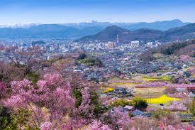
Fukushima is a province (or Prefecture) of Japan. It is rather more than the exclusion zone on the coast. ( The infamous Fukushima reactor is approximately where the ‘6’ is on the map.) The cities are mainly in-land, in a basin within a mountainous region. The capital city is also called Fukushima. The area is known for its food: fruit from its orchards, Kinsuisho sake, and a wooden lunchbox called wappa. It has the 4th largest lake in the country. And it has eye-watering mountains.
The eye-watering nature is because these mountains are volcanic, and emit sulfur. There are two main volcanoes here, Bandai is the tallest and best known. At one time it was compared to Mount Fuji. Nearby Adatara is slightly lower and far less famous. Let’s look.
Adatara volcano
Adatara consists of several overlapping stratovolcanoes, with different ages. (Japan is a crowded island and even volcanoes have to live with limited personal space.) (This area is not densely populated by Japanese standards, though.) There are two main peaks, Tetsuzan (1709 m) and Adatarayama (1699 m). In between the two lies Numanodaira crater, about 1.2 km diameter and 300 meters deep. The crater is old : it formed during a plinian eruption 120,000 years ago.
The three cones form a north-south oriented chain. There has been a volcano here for 250,000 years. This is an old system, a survivor. There were three main phases in its development. The oldest eruptions were on the eastern side, and happened between 250 and 200 thousand years ago. A quiet interlude followed which lasted 80,000 years. It ended when 120 thousand years ago the summit area erupted in a fairly short-lived phase of activity. This was the time of the major eruption that formed the crater. By 100,000 years ago the activity had shifted to Numanodairo: since that time, all eruptions have come from around this crater. The crater still contains sulfuric fumaroles, hot springs, and some hot mud pools. The river that begins here and flow to the west is called ‘Iogawa river’, meaning Sulfur river; in its upper reaches it has a pH of 2-3. (Further downstream it is known as Sukawa river.) The magma composition has changed over time. The oldest magma was andesitic. Later, tholeiitic magma was added. The two magma sources were active simultaneous, as two separate magme chambers. Eventually the andesitic magma became exhausted, and now the felsic (tholeiitic) magma dominates.
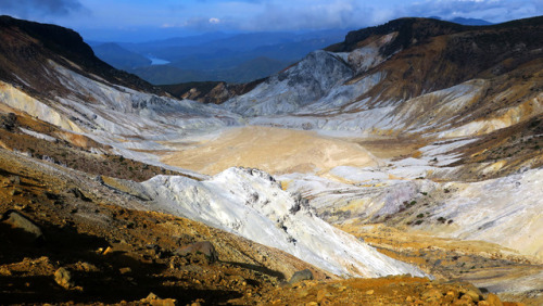
Numanodairo crater
The last documented eruption was in 1996. On the world scale of volcanic eruptions, this may well hold the record for the smallest reported event, ever. An explosion spread mud about 100 meters distance. A similar explosion happened in February 1950 with the plume reaching a massive 50 meters (that is meters, not kilometers). It doesn’t sound too frightening.
However, don’t let these micro-eruptions fool you. This is a deadly volcano, not a tourist attraction. Think White Island and you’ll get the idea. There are popular hiking trails on the forested slopes of Adatara. But you should not go into the crater. In 1997 a group of 14 hikers became disoriented in fog, lost the hiking trail and ended up on the floor of Numanodaira crater. At other times that would not have caused major problems. Not so this time. The fumarole gas had not dispersed as usual, but had collected on the floor of the crater because of very light winds. The air at the bottom had turned toxic: four of the hikers died from exposure to a lethal dose of H2S and CO2.
And this mountain had done much worse in the past. There was a more significant eruption in 1900, on July 17. At that time there was a sulfur mine within the crater. (It sounds so much like White Island.) At 4 pm on that day a small explosion occurred. The workers at first stayed where they were. There had been similar mud explosions in the previous year, so they were used to a bit of muddy excitement. Only when a second explosion came at 6 pm did they begin to evacuate. They took the western road. When reaching the rim of the crater, a third explosion came, on the opposite side of the crater. This was large enough to generate a small surge with some damage around the mining settlement. At 6:30 pm a much larger explosion came. It destroyed the mine and the houses. Ash fell, and a pyroclastic surge formed, in the direction of the western evacuation route. The workers were overtaken by the surge. 22 of them died and the others had serious burns. the total number of casulaties (dead and wounded) is reported as 72. A lahar came down the river and affected a village about 2 km away where some houses were destroyed. Even a volcano with micro-eruptions deserves caution.
Bandai volcano
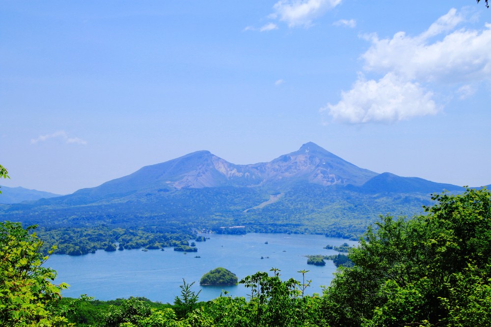
Mount Bandai
This unpredictability is shared with its neighbour, Bandai volcano. It is about equally tall. Bandai used to be a well-shaped volcano, known as the Fuji of the north. (Apparently, anything north of Tokyo is known as ‘the north’ in Japan.) It wasn’t quite as regular as Fuji: there were four peaks around the summit region. It changed 1888. There had been some earthquakes at the mountain in the previous weeks. But Fukushima knows all about earthquakes and these did not seem concerning. At 7am in the morning of 15 July, the earthquakes became strong and frequent. At 7:30am, there was a big explosion: Bandai had erupted, out of nowhere. An eye-witness (a survivor) said that the ash column came from Ko-Bendai, the second highest of the four peaks.
‘Showers of large and small stones were falling all around us. To these horrors were added thundering sounds ..’ The eye-witness fled, but almost immediately fell from a strong earthquake. ‘It was pitch-dark; the earth has heaving beneath us; our mouths noses and eyes were stuffed with mud and ashes’. When he escaped an hour later, he was the only one remaining of his group.
This had only been the first explosion. The strong quake which brought him down was probably the first landslide which was triggered by the eruption. But around 9am, the peak of Ko-Bendai ceased to exist. It collapsed in its entirety, not with an explosion but with a slide. More than a cubic kilometer of rock came down the north face of the mountain, reaching as far as 15 kilometers. Several villages disappeared. The death toll is reported as 477. The rock slide dammed the rivers in the region, and water levels began to rise. Where once was the town of Hibara, now is lake Hibara with the town submerged below it. Other lakes formed, large and small.
Since 1888, Mount Bandai no longer looks like Fuji. From the north, the central part of the mountain is missing. The new lakes are still there, in a landscape covered with hummocks left by the debris flows. New villages have grown. And Bandai is still there. Waiting.
Patterns
Adatara is not seen as highly dangerous. Its recent activity and eruptions present a danger only to people who venture too close. Bandai is different. It has a much more violent recent past. But one thing we have learned from Fukushima is not to base your risk analysis on the recent past. The reactor was build to withstand the biggest event in recent years. But in the more distant past, much larger events had taken place and those had not been considered. The 2011 Tohoku earthquake was extreme but not exceptional. Go back millennia, and this had all happened before, and it will happen again. With that in mind, what is the real danger of these two volcanoes? It turns out, a very unexpected one.

Source: Kyoko Kataoka and Yoshitaka Nagahashi, 2019, Sedimentology, 66, 2784-2827
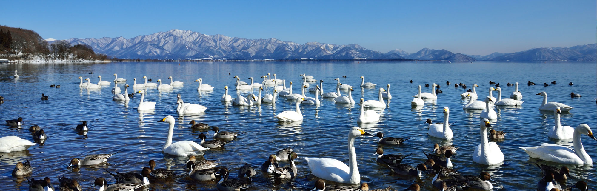
But first the expected ones. Lake Inawashiro-ko has already been mentioned as one of the attractions of the region of Fukushima: it is that 4th largest lake of Japan, 55 kilometers long. It wasn’t always here, and it arose from volcanic activity. 50,000 years ago, Mount Bandai erupted. It was a large plinian eruption, but the main effect came from a flank collapse like 1888. This was a large collapse, with 4 km3 of mountain coming down the slopes (four times more than in 1888). The slide went south rather than north. The debris flow and the pyroclastics dammed the local valley, and this is the origin of the lake. It was caused by that innocently looking volcano on its northern shore. Much of the water it has still comes from Bandai and Adatara, via the Nagasegawa River. It was a notably acid lake, probably casued by Adatara’s sulfur (Bandai lacks sulfuric fumaroles.). Nowadays, agricultural run-off and pollution have brought the pH of the lake to near neutral.
Inawashiro-ko (Japan National Tourism Organization)
So Mount Bandai has done these St-Helens-like collapse-eruptions before. This is an inherently unstable mountain. There have in fact been 8 major debris avalanches over the past 100,000 years. It also has effusive eruptions which slowly rebuild the mountain, ready for the next collapse.
Adatara is also explosively eruptive, and shows evidence for sub-plinian and plinian eruptions (VEI 3-4), once every 1000 to 20,000 years. There is no recent evidence for lava flows: the youngest dated one was 70,000 years ago. The VEI-5 eruption which formed the crater was a one-off event, 120,000 years ago. Smaller, vulcanian eruptions (VEI 2-3) have left 5 tephra layers dated to the last 10,000 years. Adatara does not show evidence of any flank collapses. But the Sukawa rivers does show lahar deposits from Adatara: 17 lahar layers are known from the last 14,000 years.
Lake Inawashiro-ko contains a 50,000 year record of eruptions from both volcanoes. Tephra falls form thin layers at a variety of depths in the sediment at the bottom of the lake. Other layers are caused by lahars from both volcanoes which reached the lake. The two volcanoes can be distinguished by chemistry: ejecta from Adatara has a higher potassium content. That may be related to differences in the basement: Bandai volcano grew on the thick Shirakawa ignimbrite, perhaps 10 million years old (Pleistocene) and 60 km3 in volume (DRE). The lahars were mostly triggered by phreatic eruptions, but a lahar layer dated to the spring of 497 BC is suggestive of having been caused by snow melt. There are also multiple debris layers which are attributed to small flank collapse events at the southern slope of Bandai, the scar region of its largest collapse 50,000 years ago.
The many layers indicate that Adatara was frequently active between 50 and 29 thousand years ago and decreased after that, while Bandai remained at a high level of activity for 5000 years longer but after that also declined. The decline in activity may not have been volcanic: the growing delta meant that lahars and debris flow had to travel further to reach the lake. In the past 10 thousand years, Bandai has left the lake largely alone but phreatic eruptions at Adatara have deposited 10 cm in various (at least 5 major) events. Note that Bandai may have erupted and collapsed in other directions, avoiding the lake. (The 1888 eruption was large enough that it does show in the lake even though the collapse went the other way.) Each volcano erupted into the lake some 30 times over the 50,000 years that the lake has existed.
The layers of the lake have shown that the frequency of eruptions from Adatara is three times higher than had been recognized before. Its tephra-producing eruptions have a mean recurrence time of 640 years. For Bandai, the eruption rate is about 50% higher than thought, and 1888-type eruptions may occur every 2000 years. This count may still miss eruptions, since there are some eruptions known that left no trace in the lake.
Such activity levels should not be ignored in the local risk analysis. For Adatara, the risk is mainly local as its phreatic eruptions are not large, but it does do vulcanian and sub-plinian eruptions which cloud reach the local hiking trails and ski regions. However, lahars are a danger. Bandai is inherently dangerous and should be monitored.
And notably, the town of Inawashiro with 14,000 people is located within the reach of the lahars from these volcanoes.
So far the known dangers. But recently, an unrecognized danger was found.
The 2021 Fukushima earthquake
In February this year, the Fukushima region was affected by an M7.3 earthquake. The focal point was 70 km off the coast, and it may have been an aftershock of the 2011 earthquake. There was quite a bit of damage in the area, with cracked walls, broken water pipes, and some landslides. There were 180 injuries and 1 fatality.
The most significant damage affected the famous motor racing circuit of Ebisu, 50 km east of Adatara. It is famous especially under afficionadas of drift racing, and has multiple separate circuits built into the side of the mountains. There were some cracks in the asphalt caused by the quake. But much worse was a major landslide which took out some cars, a two-story building and several of the tracks. The site had been deserted at the time, and no one was hurt. But Ebisu will be closed for the foreseeable future, or at least until funds have been raised for repairs.

Investigations into this landslide showed that the cause was not any local building work. Landslides are often caused by building activities (such as roads) which destablize a steep slope. The first suspicion was that something similar happened here. But instead, the slope itself was to blame.
It turned out that the slope consists of soil which rests on wind-blown tephra layers from Adatara. The tephra layer is 10 meters deep and dates from Adatara’s entire quarter of a million year history. This again rests on a much older debris layer of similar thickness, and below that is the even older ignimbrite. The cause of the slope failure was hiding in the Adatara tephra. The shaking destabilized the loose layer, and this started the landslide.
Volcanic soils on steep slopes carry a risk of landslides. This is in particular during earthquakes. The 2011 Tohoku earthquake had caused three similar landslides in this region, traced to the same wind-blown tephra. And it happens elsewhere in Japan too. The M6.6 earthquake in Hoikkaido in northern Japan, September 2018, caused a large series of slope failures on steep slopes. These happened in pyroclastic fall deposits from Tarumae, Eniwa and Shikotsu Caldera in western Hokkaido, dating from 9000 to 47000 years ago.
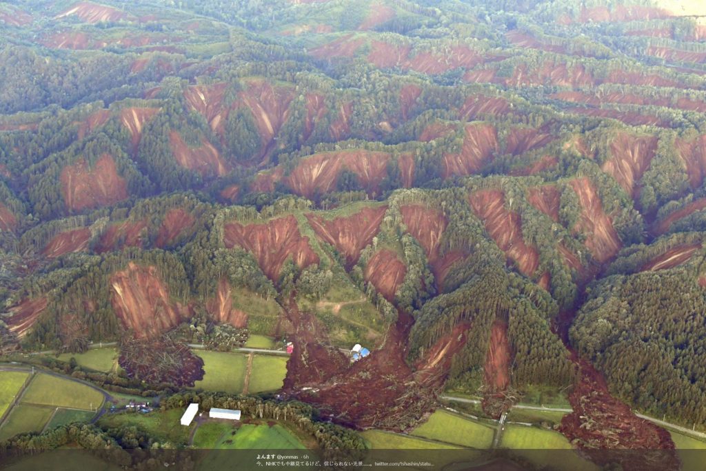
Slope failures from the 2018 Hoikkado earthquake
Volcanoes are dangerous, but we understand those dangers and can be prepared. Earthquakes are dangerous, but again we can be prepared. Both are manageable events. The Fukushima nuclear reactor ran into trouble when two manageable events combined, in a way that the emergency plan had overlooked. So it is here. There are unexpected dangers in the combination of earthquakes and volcanoes. Even when those volcanoes have long been inactive. Beware of volcanic soil.
Albert, March 2021
https://unseenjapan.com/mount-bandai-japan-eruption-volcano/
https://onlinelibrary.wiley.com/doi/full/10.1111/sed.12629/
https://blogs.agu.org/landslideblog/2021/03/09/ebisu-circuit/


Looks like frost is spreading i the webcam valley. Will be interesting to see if there are any warmer spots
Little IR enlightening at hills and ground time!
https://cementboy.files.wordpress.com/2021/03/svid_20210312_215451_1.mp4
Sad still no answer what sort of IR light is recorded…
Even worse, again a negative answer… They don’t know anything *rofl*
3. Chance?
Should I ask who’s the owner?
#TopSecret
Im not actually sure what you are even asking them, if it is something like rocks acting like a fiber optic cable that doesnt make sense, rock is a very good insulator of heat meaning it is very opaque to IR light just as it is in visible, actually it is opaque even to cosmic ray energy gamma radiation, and to make things even harder basalt is also black, which as we know black things absorb heat.
There are natural fiber optic crystals, like diamonds or quartz crystals, or selenite which is my favorite example, but you dont find those in basalt.
It also could be confidential who is the owner of the camera so legally no one is going to tell you, its probably easier just to get a recorder, rather than ask the owner.
Chad, what is glas made of? We in Switzerland use glasswool as isolation material because it’s a good insulater of heat, the fibre-optic cables are still working (don’t know in which range the best transmission happens IR, VIS or UV)
Yes I know that amount of IR light/energy would have to be extremely high. If it’s not magma related it could be the energy releases of earthquakes… I would be easier if we would know the IR specifications of the used cam.
I know also understand why this company does not know anything about the used thermal cam…
https://www.sciencedirect.com/science/article/abs/pii/S0264370717300996
We also have to keep in mind that heat is transferred in more than one way…
Advection, conduction or diffusion, convection and radiation…
https://en.wikipedia.org/wiki/Heat_transfer
There are two new tabs on the IMO gps page, for overview.
http://brunnur.vedur.is/gps/reykjanes_rt.html
http://brunnur.vedur.is/gps/reykjanes.html
Here is the FEFC station “up”. Its showing some drastic uplift right now. It’s just a few kilometers south of Nátthagi.
One has always to be a bit carefull interpret these “lodret” figures. It is relative. It shows the height change of FEFC compared with SENG. It shows something is going on. It may bounce back just as fast. Better look at the gps graph of a station.
I think ….
There are bright lights showing occasionally on the webcam below to the left of the tab for Stykkisholmur. Is there are road there?
https://www.livefromiceland.is/webcams/reykjanes/
Is that the right direction? There isnt anything on the Natthagi webcam, which is at basically ground zero where the magma was reported shallowest, theres been no quakes anywhere else on the dike to suggest it is getting shallower anywhere other than this location, at least right now anyway.
I think this might be the light house at Reykjanes.
This webcam looks over the harbour, and then out over Breiðafjörður towards the Western Fjords. So, Yes, there are roads there, and the camera also rotates, so there are buildings, too, that come in and out of view. It’s a really lovely view when the weather is clear, and the harbour is quite tricky to get in and out of, too, owing to submerged lava flows.
Oops – you said Stykkisholmur, and it’s in relation to that that I replied, but your link is to one of the Reykjanes webcams.
ooo. Northern lights
https://www.youtube.com/watch?v=YpRPXmGLa5o
The timestamp in the bottom left of the webcam feed 22:58:35 is very interesting… what do you make of it?
Hi there, long time lurker here, spurred into commenting from all the excitement. Love all the commenting here and the intelligent discussion (well mostly 😉). And the great articles (thanks Albert and Carl and co). No idea what the real difference between all the different rock type are but learnt a lot about volcanoes 😀
What’s going on in the middle of the reykjanes webcam at the moment? Can see what looks like a light house to the right, but in the middle there is a reddish glow that to my fevered imagination looks like the fountaining at Holuhraun in the far distance. Is that the northern light, or some factory or town lights glowing? Just left of centre. What on earth is it?
Is the link you are watching?
https://www.livefromiceland.is/webcams/reykjanes/
Seeing the reddish glow with my completely untrained eye, looking at pixelated webcams gives, stirs the imagination.
Welcome! It is hard to know what this light is. It is not the rising moon (the most common source of excitement) as it is new moon tonight. I guess some distant habitation. With a bit of low cloud above it, artificial light can be seen over long distances. Many tens of kilometers.
Yes it’s that webcam. Is it the harbour mentioned above?
I may need to go and put a cool towel over my head 😯
there have been pink/red Auroras during the night ?
Yup. Just got back from shooting the lights. Lots of red, some scarlet, purple, and of course green.
If that’s not an eruption on the left side of this camera I will eat my hat!
https://www.visir.is/g/20212083736d/bein-utsending-af-fagradalsfjalli
Absolutely an eruption – check out the right hand side of this camera. My heart is pounding!!
There are 3 cameras on that link. Which one are you seeing this on ?
I’ve spent a few minutes checking out all 3 and I’m seeing nothing except a few lights on the far left of the first cam.
Exactly what are you seeing ?
I don’t see any eruption-like activity.
There are 3 cameras. Is it the top one you’re seeing this on?
I can see lights at the far left of that one, but that’s what they look like to me. Lights.
No movement, no effusion, just static lights.
Or are you seeing more than that ?
This is the camera – in the top right hand corner. I initially thought the flashing was a lighthouse but new flashes have gradually been appearing that would appear to mark out the length of a fissure in the distance? https://www.livefromiceland.is/webcams/reykjanes/
It’s livening up now! Definite fissure.
Looks to small to be a fissure. I think it’s just lights.
I see what you’re seeing. Just to the left of the Stykkisholmur tab. It is intermittent but with a orange glow at times. Also occasionally above the tab as well.
I’m not sure of the field of view of the camera, but the Reykjanes geothermal power plant should be nearby, as well as the Gunnuhver hot springs
I can see Hopsnes Lighthouse, Grindavik, flashing on the right.
Think that’s the one I mentioned earlier. Harbour lights I think from others comments.
From the Mila cam. I have been watching for about 2 hours now. What started as a singular pulsating light has become a row of 4 or 5 independent light sources that appear to be coming and going. https://twitter.com/samnichol_/status/1370582406634278916?s=21
I saw something about 11.30 UK time on that webcam before I had to go to sleep – there’s the single steady light, and the flashing lighthouse light to its right (3 o’clock). At about 8 o’clock from the steady light and about twice the distance of that between steady and lighthouse lights there was a light that came and went, increased in brightness and was orangey at times.
I remember back in Holuhraun a lot of people saw orange flowing lights for many days, but the reality was that no eruption was taking place.
Humans have a tendency to want to see things where there aren’t.
Remember there are all sort of things that make light at night, and even in this volcanic landscape: jeeps, crazy people with a flashlight, lighthouses, helicopters, small airplanes, boats, tractors, elves, ufos, flying sheep, and northern lights, which can be mistaken for an eruption. 😀 😀
One day you will see something starting like a fire there, and within a couple of hours, it will be announced in the Icelandic news.
Been looking around, some statistics for the situation right now.
Dike is between 2 and maybe less than 1 km below ground, and maybe 4 km deep possibly up to 6 km in places. It is apparently 1-2 meters wide and contains 15-20 million m3 of magma. I would guess these are all a bit dated now, its changing fast.
The influx of magma is about 20 m3/s, the dike began forming on March 3 so 10 days ago, the supply rate to do this is 23 m3/s, but the dike also probably began to actually form a few days earlier and wasnt yet confirmed, so the rate of influx now is basically unchanged from when this started and is not looking to be slowing down either.
Supply rates to feed the Krafla Fires were in the range of 1-5 m3/s, so this is at least 4x as fast. This means the volume of the dike will nearly double in just this week, I actually doubt that can happen without breaking something. It would look like eruptions in the ocean from these volcanoes actually are not common outside of at Reykjanes/Svartsengi, so theres a good chance the dike now is as long as it will get.
Basically this is a situation where there is more magma coming in than you can actually fit in the space available… you cant get a better scenario for an eruption really.
This one small volcano is getting fed at the rate equivalent to almost 0.7 km3 a year, its like combining the output of all the volcanoes of Vatnajokull into one spot and doubling it, and then adding Hawaii too… We have only been watching for 10 days we just have to be patient 🙂
Assuming March 3 to March 12 at 20m^3/sec –> 0.01555 km^3 if I did my math correctly, that a lot of magma.
Yes, officially the dike is 15-20 million m3, so slightly above your number. It also is still going that fast now. Previous flows in the last series of eruptions on Reykjanes come in at around 0.1-0.3 km3, so possibly it will still be a while before the eruption actually happens, which is why I put a day for May 19 (when the dike is over 0.1 km3). It isnt actually clear if the lava fields are single eruptions or successive smaller eruptions though, but in any case an eruption is looking very likely.
Looks like an eruption…
https://www.livefromiceland.is/webcams/reykjanes/
I have actually got one question though on this, one I have not seen brought up here before or anywhere else, and which might actually be a very important detail. Perhaps a question for Carl or Irpsit 🙂
Is the magma generation rate under the Reykjanes peninsula constant, and does it collect into chambers that are under the crust?
Sounds very simple, but I ask this because if magma collects in chambers that are separated then it would seem logical that the one under Fagradalsfjall, not erupting in millennia, would be the biggest one, compared to Krysuvik and Svartsengi that have erupted many times. It does strike me how absurdely high the rate of inflow is, there is no way it is down only to mantle decompression, there must be a magma chamber feeding this. Perhaps this is the situation on Fagradalsfjall getting even with its neighbors, which while not apocalyptic could make the area rather dangerous for a while, and be a lot bigger than the 0.3 km3 flows we expect.
It is fed by transport, not by new magma. Melting rates here are not high, far from the hot spot, but a fair amount will have collected deep below the crust (15 km?). The oblique spreading rift will have a series of magma pockets in it, apparently in several groups which correspond to the four or so volcanic centres, at typical depth of perhaps 5 km (I am guessing here). These are fed (slowly) by the melt which happens much deeper. The earthquake sequence opened up a series of tranverse faults. (‘open’ is not the right word: ‘loosens’ is better).
In this location, the magma managed to move into one of the loose faults and a dike began to form. It did not get far, and stopped at Keilir,. That seems common here. There are dikes that go much further, tens of kilometers, but they are much deeper and never reach the surface. What happens here is probably typical for shallower dikes. The dike is as of today still expanding southward, albeit very slowly. As long as that continues, the chance of an eruption is less (but non-zero). When the expansion stops, the magma is more likely to open a pathway to the surface. I give it 50/50
Lots of larger quakes last night.
Albert just replied to your question.
But I can say it again: there are no known magma chambers under any Reykjanes volcanoes (Reykjanes, Svartsengi-Thorbjorn, Fagradalsfjall, Krisuvik, Blafjoll and Brennisteinfjoll).
Eruptions here happen because of tectonic movement. The plates are pulled apart, in an oblique angle, and magma can pour out. It does so in cycles, every few centuries, and this event marks the start of a new cycle. This is important.
The (oceanic) crust is thin at Reykjanes (a deep contrast to under Vatnajokull, where the crust is thick). So magma is always rather close to the surface. Simple transport, as tectonic rifting creates an empty space, which magma rushes in to fill.
Eruptions are usually around 0.1-0.3km3 as mentioned, so nothing unexpected is happening here. So nothing dangerous for Iceland (except for Grindavik). Sometimes they take the form of shield volcanoes (while unlikely, it is still a possibility).
I agree with you, Chad, we might have to wait some time until we see an eruption. Or maybe not. I sincerely do not know. However do not forget that usually in Iceland most intruded magma does not erupt, it just stays under the surface filling the gaps.
Some wind today. The webcam shaking.
Activity seems to have subsided somewhat over the last 4-6 hours. Mind you, that’s hardly an indicator of anything so far as Iceland – or anywhere else, for that matter – is concerned. It will pop when it’s ready – or not.
Do you want to know where an eruption will most likely start?
Go to this map http://kortasja.lmi.is/mapview/?application=kortasja
South of Fagradalsfjall, you have a little rift valley named Natthagi. A bit more southwest there is a place where the road number 427 makes a loop northwards. This is the location of the southern tip of the dike, where magma is only 1km deep.
The eruption site will probably probably begin at Litlihals or Drykkjarsteindalur.
Magma will probably go down to the sea at Lambastapi.
This is highly speculative.
From a temporal point of view, what could trigger the eruption?
Probably pressure, it will probably not get any shallower than 1 km, but then suddenly it will erupt. It is going to be something like when Kilauea erupted in December, it will just happen, one minute it is dark then it is erupting.
Question is how much pressure, if it is only a little then the eruption will happen soon, basically at any time now, but it will be small and probably now in effusion rate, it might just erupt as a shield until the magma is used up. If the pressure needs to be high it could take until the volumes involved are somewhere up to 10-20-30x the volume of the dike now, that would take months but the eruption is going to be like a flood from hell when it starts, and probably rift open the whole fissure line not just the part under Natthagi.
I do not see much evidence for magma at 1 km from the surface. The activity is deeper, between 4 and 6 km, and I think that is the depth where the dike expands.
IMO has different data? 1 to 1.5 km they’re saying (Updated 11.03 at 16:00)…
…or is beneath the crust not equal to beneath the surface?
IMO has better data. But current activity is deeper than that and there is not much going on at shallow depth
Lost link…
en.vedur.is/about-imo/news/earthquake-swarm-in-reykjanes-peninsula
Yesterday morning the camera on Borgafall was panning to the right (south) briefly. From its current position it could probably see activity in the Drykkjarsteindalur area, but Litlihals would be obscured by the brow of the hill.
Is that a person I see on that cam, bottom right corner of the shot?
If not it’s an animal. But not a sheep !
let’s hope so, just for the entertainment of listening to the world media mangling those names!
Hellooooo Irpsit. Good to see you again. I do hope you and your family are well.
T
Thank you for this heads up…. but the road users won’t be happy!. How will an eruption there affect the airport?
The area is far enough from either KEF or REK airports that lava will not threaten them, if there would be any ash production that could shutter the two airports temporarily while IMO worked out ash projections. Think the biggest thing would be the haze but Reykjanes volcanoes are not nearly as gassy we other Icelandic volcanoes
I see we now have little ‘like’ stars! Excellent. Thanks.
Except its a palaver to log on each time to use them, so I won’t bother, sorry guys.
Great we have like button!
I don’t know its possible, but I think the Like star should be a ‘Green star’.
Question, why is it they are only confirming the largest quakes? Why not the shallower quakes as well, you would think they would take precedence. Also, exactly how much manual work is it to confirm the quality of a reading off the SIL meters?
The swarm seems tired … This is the most important moment.. will the dyke erupt or get stuck undeground… ?
Is deformation still suggesting that the dyke is filling? If it does it will push against the rock walls around it
Based on past behavior that gradual reduction in magnitude seems to lead to another breakout in quakes, I have seen this 7 or 8 times now. Perhaps the magma finishes filling out the underground fissures, then the continued expansion breaks new ground? I strongly suspect we will see a new surge in quakes soon.
Would’t there be a pulse of quakes that crack the rock and extend the dike. Then a lull as the magma fills the space that the cracking left and to build the pressure back up again until it all cracks again trying to find release?
One for the experts to confirm, but seems logical to me.
Couldn’t such a lull give more indications of how fast the intrusion is and how much the dike extends each time?
There is often a few hours of quiet between the forming of the conduit and the eruption. The formation of the conduit (cracking open) gives earthquakes, the filling gives tremor, but once full both stop until the surface fails. That is in normal volcanoes. Rifts are a but more complex. The Holuhraun dike had 2 or 3 failed eruptions under the ice before it managed to erupt. That dike had a much higher and stable magma supply from Bardarbunga. Here the supply seems more intermittent
My gut feeling is that this is on a knife edge.
The magma is there, and it will come out somewhere eventually.
But I suspect that if anyone were to map out the daily energy released during this series of seismic events it may appear to be trending downward.
I don’t know why. I don’t pretend to understand.
But as far as I’m aware, a significant body of magma has been only 1-2 km below the surface for quite a while now, whilst thousands of quakes up to M5.1 have been rattling the landscape, and even that has not induced a breakout.
Maybe this magma is just not able to make that last step to the surface for some reason?
I think Iceland has just responded to your comment..
All sound and fury, signifying…Still no lava ?
The crust may be thin, but it seems very tenacious.
Using Google Earth, if you go to Kálfatjörn, place the little man on the 420 road ( the southerly section away from the town) and look towards the south you can pick out the line taken by the cams. Then imagine you were flying in a mini drone over the land towards Keilir you can see the rifts made in the land by tectonic movement. The land is positively being torn apart. It’s most spectacular but can be seen only from above. Isn’t modern IT wonderful? Years ago I would never have thought the geological diagrams in my text books would “come alive” for me all over the world. I feel so lucky.
I found a mast around half a kilometer or so south of Stofnfiskur, outside Vogar. It is the right angle to match the Mila Keifir webcam. GPS 63.967795, -22.392715.
Sorry it’s road 41……………
Did you know that NASA Firms satellite data can catch active volcanoes before anyone knows? I caught 3 today, which the satellite signaled as hot, today, March 13th and let the Volcano Discovery know about it. One was Barren Island Volcano, then Tofua Volcano, and finally Nii-jima Volcano, all showed up very well on the map. It also caught the geothermal plant?? in Iceland, well a complex of buildings emitting a lot of heat anyways, to the satellite. I will all of you use the satellite to chase this thermal anomal down 😉 If the fissure eruptions in the Keilir area occur, you can bet that this satellite will catch it right away. See https://firms.modaps.eosdis.nasa.gov/map/#d:2021-03-12..2021-03-13;@0.0,0.0,3z for the interactive zoomable map. I appreciate NASA’s work in supplying good data to the public.
Small corrections, there is no “Mirova” satellite up in the sky, it’s just a project which use different IR satellite signals. The reason for the missing Blue Lagoon signal is probably that only temperature changes appear as a signal. Please ask the wellness temple owner to change the ocean water (~1 °C?) , thermal deep water (~240 °C Blue Lagoon homepage) mixture for 24 hours in case they had to close anyway because of safety concerns…
Yesterday was a small signal measured on one of the two Reykjanes peninsula sites:
https://www.mirovaweb.it/?action=volcanoDetails&volcano_id=371030
Nice. It claims that Kilauea is no longer erupting though.
Clouds?
Thank you Randall. That’s superb. and so useful. Just had a quick “go” and found Veniaminof , Alaska
glowing away..
I have been playing around with the Skjálfta-Lisa tool and I have made two observations. The first is that the moment that tremor was detected seems to be the moment the dike changed direction and started expanding southwest instead of northeast. The second is that the dike seems to more or less follow the topographic gradient, just like the Holuhraun dike did.
Now it has reached a low point. Directly in its path between the valley and the ocean is a small mountain. Will it ignore the mountain and continue out under the sea? Will the mountain be enough to stop the progression and force it to erupt, or will it turn further west to avoid the mountain?
I actually have a theory the ocean itself can provide a resistance. The fissures seem to stop before reaching the ocean at all of the Reykjanes volcanoes except right at the end. The same thing actually also seems to happen at Kilauea, which has better observation. In 1924 a deep dike went out to sea no problem but didnt erupt, in 1955 and 1960 dikes began in the same place under Leilani estates and moved east but stopped abruptly only a km from the ocean. 1960 was actually a pretty big eruption, as big as the biggest Reykjanes eruption in the middle ages, but as the dike was quite shallow probably 2 km deep at most I think the weight of the ocean prevented it going offshore. The ocean drops off beyond Cape Kumukahi so that even the shallowest part of the Puna ridge is 500 meters deep, I dont know what the ocean is like on the south side of Reykjanes but if it is deep like that it could actually provide a barrier as opposed to a path, seawater is much heavier than air.
This is just a theory of mine but if shallow magma is as sensitive as to be induced to erupt by melting ice seawater is much heavier than ice and you cant get rid of it either.
Other question, why does the vertical flow from mantle/magma chamber change to horizontal dyke?
The initial earthquake did…
…made a cave?
…changed the pressure in an unknown magma chamber/pocket?
…did change the strength of the soil where the dyke now is?
…other ideas?
I’m not sure if I remember right but in liquids, the pressure is always only the height of liquid column and not the area (same horizontal pressure at -100 m in Atlantic, Mediterrane or Deadsea to the cliffed coast/crust)
(ignoring the salt concentrations)
Its the weight of water pushing on the seafloor, that is what I am hypothesising. A shallow seafloor gradient wont prevent a dike going offshore, you could see this at Ambrym in 2018 where the eruption was offshore, but in places with a steep offshore gradient it looks like there is actually a hinderence to vents opening close to the shore, which you can see at Kilauea. Only the biggest dikes at the moment can probably erupt on the Puna ridge, related to major caldera formations as Hector has hypothesised happened in 1790.
If the ocean immediately offshore of Fagradalsfjall is pretty deep, say 100 meters or more, it could exert enough pressure that the dike wont advance in that direction far. The rock is also going to be pretty cold and waterlogged.
As for why a dike happens it is because the magma flowed up in a fault, so fills in all of the fault. Its also because the crust is spreading it is easier to break in that direction.
A steep slope can tend to push a dike upward. The plane of least resistance is parallel to the surface (that is why sills are horizontal), but the dike also tried to go upward. If there is a sudden steep slope, the dike is forced into a direction it can’t go. The stress forces it down, the buoyancy forces it up. That can stop the progression. I don’t think a 100-meter drop is enough for that though.
To get far along deep-ocean rift, the dike should start out very deep.
Chad, do you think it’s possible that the dyke is already pressing against the layers beneath the sea ground?
There seems to be prime conditions for strong auroras tonight. Keep an eye open when watching Icelandic webcams.
Quakes are back after an almost idle period. And interestingly: the depths shifted considerably from values below 5km to now mainly above 5km. Strange things happen.
Hope a smaller figure size is now ok for the server and the dragons…
Like your figures. Very informative!
Happy to hear that. I don’t want to post too many pics though.
We have 4 quakes with magn. > 3.4 in just 30 minutes… It’s not over.
Are these the registered quakes or the raw quake data?
I scanned the depths of the last 68 registered quakes mag 3 and above, and there are two recent quakes with shallow depth, one is < 2 km. Most clustered around 6 – 4 km depth. timestamp: 00:07:06 UTC Sun 14-March-2021
The data is from vedur.is (preliminary data). If you compare the quakes before 2100 and after, there is a shift. I don’t say they become actually shallow, but definitely less deep. See second figure above.
The ISS drumplot is getting jumpy again. Nothing like last night so far but we’ll see where it goes.
Just now a relatively big one. Startled my as I was watching Netflix.
A magnitude 4 earthquake occurred at Mount Fagradals in Reykjanes at 22:06 tonight. His size is not overhauled. The seismic activity in the area is only increasing, but it was rather small today, according to Einar Hjörleifsson, a natural resources specialist with the National Weather Service.
There were several tremors in the larger side at Reykjanes in the 10th hour tonight, including one in size 3.6 at 21:36 and another a size 3.7 at 21:39.
https://www.mbl.is/frettir/innlent/2021/03/13/skjalfti_ad_staerd_4_vid_fagradalsfjall/
Saturday
13.03.2021 22:06:20 63.883 -22.269 4.2 km 4.1 99.0 2.2 km S of Fagradalsfjall
2.2 km south of Fagradalsfjall is pretty much in the middle of the muddy pond visible in the webcam from Borgarfjall.
That webcam has been problematic for me but this link seems more stable.
https://www.ruv.is/frett/2021/03/11/beint-vefstreymi-af-skjalftasvaedinu-borgarfjall?fbclid=IwAR2FQN8FrKMUvtlfuVUinKwxMl4MDlLD5H_KYjZtZo8fLcIWd9j0T8Dfp7Y
Just black now but if anything happens we’ll see it.
The feed from it is duplicated at https://www.youtube.com/watch?v=YpRPXmGLa5o so try that if the ruv site is giving you problems.
(If there’s no live at that link anymore, search “Keilir í beinni” on YT for a fresh stream.)
Thankyou! Neither the ruv or visir webcams will load in my browser, the youtube link is very helpful.
What isnthe light areanat far end of the valley belownthe ridge line. Is it reflected off snow ornis not steam. Suddenly happened.
https://www.ruv.is/frett/2021/03/11/beint-vefstreymi-af-skjalftasvaedinu-borgarfjall?fbclid=IwAR2FQN8FrKMUvtlfuVUinKwxMl4MDlLD5H_KYjZtZo8fLcIWd9j0T8Dfp7Y
I’m pretty sure we have Lava!
Just wait a few minutes.
If you mean that double point of light on the far side of the valley, it could easily be sunrise hitting the camera lens. If so, we’ll see that very quickly.
Far side, in the valley! I’m watching!!!!!
Possible.
But for now I’m inclined to believe it’s lens flare caused by the rising sun. But let’s keep watching for a while.
Tomas is right, and here’s the proof.
Slide the timeline back about 10 minutes… The points of light are moving as the angle of the sun changes.
Lens flare.
Another clue… No steam? No ash ?
With all that snow and frost around ?
It fooled me yesterday. The camera seems to sit inside a box with a glass front. When it’s hit by the morning ligth it first looks like steam from the other side of the valley. A while later you can see the camera lens reflecting on the inside of the glass. The camera is taking a selfie.
Oh well! It was exciting for 20 minutes! Sorry for the false info 🤪
Hey don’t !
Better to check things out… Call in others for their views on things.
They say “The camera never lies”…. but experience tells me that cameras bend the truth sometimes.
We NEED multiple views , because all of us are imperfect observers.
https://twitter.com/VTLAB_Joel/status/1370824991172874251
Ground cracks observed west of Sandfell (Fagradalsfjall area) likely triggered by the dike intrusion
That’s ESE of the presumed line of the dike.
I saw two vehicles driving through the bottom of that valley just now. Either they are scientists doing their work or alternatively a couple of excited adventurers looking for fire?
I saw what looked like a person at the bottom right of the image yesterday afternoon, staying in the same general area, just by the bottom far side corner of that rectangular feature (white and orange-brown… Someone said it was a body of water ?)
I’m probably way off, but it looks like the area in the photo in Luis’s link above? Is that where the cracks have been observed ?
I would think they would refer to it as Natthagi, rather than west of Sandfell, if they were there. West of Sandfell seems too far east to be the track of the dike from the diagrams I’ve seen linked here. Lgically, west of Sandfell, would refer to the valley east of Stori Hrutur, basically the next valley over.
https://twitter.com/subglacial/status/1371063578237747203
There is uncertainty. In this report #Fagradalsfjall is shown as a separate system with no recent (Holocene) activity.
https://twitter.com/subglacial/status/1371093738374713348
Sunday
14.03.2021 12:34:36 63.867 -22.283 4.6 km 5.0 99.0 3.9 km S of Fagradalsfjall
A very nice and clear map of the area in a pdf format. https://www.visitreykjanes.is/static/files/pdf/Bordkort/0000_reykjanes-layout_6ju-ni-_a2_si-export_final.pdf
Takk. Iceland is really excellent with the free maps it publishes, and the peninsula is such a great area to explore. So many tourists overlook Reykjanes and head out elsewhere, but there’s so much to see and do in the area that it would make a good destination in its own right.
The final number isn’t out yet, but this one looks way bigger than the one earlier today on the drumplot.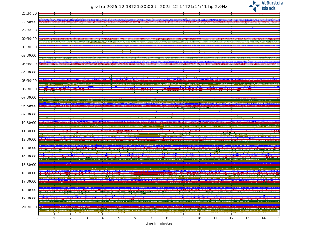
A big quake at 14:15 local time in Reykjanes. Felt far longer and more powerful than the initial quake of the swarm on Feb 24.
RUV says that one was felt in Kirkjubæjarklaustur. Wow.
Hobbes had a lot to say about it, too.
The one at 12pm (M5.0) had a funny, distorted shape on the seismograph. The new one was bigger, and multiple. The largest is now reported as M5.2. Shallower and further south than previous quakes. If this continues we will have an eruption off the coast.
Now 5.4
Upgraded to M5.4. Apparently, they felt it up in Búðardalur, too.
Heck, I felt it all the way to Sweden just by watching the webcam. You can rewind the stream and watch as the quake hits. The moment before it strikes there are some rocks shifting, then boom! Watch how the foreground swings back and forth for a few seconds and then the second one hits.
14:14:28 and 14:15:47 on the video/ webcam.
Oh yes, impressive! I found it on twitter
Sunday
14.03.2021 14:15:25 63.863 -22.338 3.1 km 5.4 99.0 5.4 km SW of Fagradalsfjall
It’s so far west so it’s probably a triggered quake and not a part of the dike itself. It doesn’t really indicate that the dike has progressed further south. Judging from the main activity, I think it looks like the dike has stalled right under the mudpool the last couple of days.
The 14:38 pair of quakes was located directly underneath the blue lagoon.
I bet that made a few waves. The 5.4 seems to have been under Fiskadalsfjall.
Little wondering.. If erouption off coast. Is it deap water or shallow How are the bathymetry in that aria.? What i was thinking it must effect how far out it could be from land aria. or maybe we not going to see much even if its deep water. If shallow i can think it can be a interesting water mix erouption.. Or maybe i think totaly wrong 🙂
Preeeeeeciouuus! big tremors now on the Penninsula
If I recall correctly, 5.4 should be the second biggest since this started two and a half week ago. And this coming right after a 5.0 is unusual.
https://twitter.com/Vedurstofan/status/1371110715700953088
At 14:15 there was an earthquake of M5.4 about 2.5 km W of Nátthagi. No seismic tremor measured as a result. The quake was felt well in the SW corner, north of Sauðakrókur and south of the Westman Islands. Another earthquake at 14:38 with a magnitude of 4.0 (first estimate)
https://twitter.com/seismo_steve/status/1371111044270133251
Something tells me this may be the day!
Given how far South the quakes are migrating … which is the best situated webcam currently?
Probably this one. https://www.youtube.com/watch?v=YpRPXmGLa5o
Thank you!
The fact that the 5.4 comes right after a 5.0 and they happen shallow and at the southern tip of the file, is a telltale that an eruption might be just around the corner.
Magma was already at 1km from the surface, so this it is getting very close to erupt.
https://twitter.com/lava_ice/status/1371115117618864130
While the lavas/magmas are produced by different processes (hot spot versus oceanic spreading center), it is an interesting size comparison to show Kilauea and the Reykjanes Peninsula next to each other. They are roughly equiv. in size…
I don’t think that is a relevant comparison at all. The systems have nothing in common
A drone just photo bombed the webcam.
timestamp: 16:04:27
“Increased chance of volcanic eruption”
“As long as this continues, there is an increased likelihood of volcanic eruptions, and it comes down to it giving itself something there,” said Kristín Jónsdóttir, director of natural resources at the Bureau of Meteorology, in a conversation with mbl.is.
A hard earthquake raged at 14:15 under the South Coast Road about 1.6 miles west of Nighthaga measuring 5.4 magnitude. It is the second biggest quake since the devastated began on February 24. Soon after, at 14:38 and one minute later, two tremors occurred that were 3.4 and 3.7 magnitude.
In the period 14:16 to 14:38, three tremors were measured above three in size; 3.1, 3.4 and 3.5, as well as numerous smaller tremors in these areas.
…
So-called trigger tremors
The Bureau of Meteorology’s announcement says there was a so-called trigger tremor and that there is a high level of activity in the area. It says a magnitude 4.6 tremor occurred at 12:34 p.m. in Nigeria, where the southern end of the dynamic is believed to be.
“Less than two hours later, the activity moves westwards in accordance with tension changes in a large area as a result of local pressure changes in the southernmost part of the dynamic corridor, which is now thought to be at a depth of about 0.6 miles in Nigeria. Such tremors have been called trigger tremors.”
https://www.mbl.is/frettir/innlent/2021/03/14/auknar_likur_a_eldgosi/
That moved quickly… Iceland to Nigeria?
You know it’s google traduction thing…
Hehe
Google Translate is your friend. Your weird friend from high school, the one your parents warned you about.
Magma is about the depth as Burj Kahlifa is tall now..
Once it hits 500 meters below it will quickly erupt and blow hydrothermal resovairs
I never realized it took this long for magma to make its way to the surface at Reykjanes
This is a long dormant region, we can’t expect an easy eruption after several hundred years! I am SO ready for this baby to erupt, hoping for a nice phreaomagmatic eruption!
Looks like this cam is less sensitive in the needed IR range, less fast (fps) or just too fare away but in all this background noise I still think we can see the IR flashing…
Record 20210314
https://cementboy.files.wordpress.com/2021/03/svid_20210314_180315_1.mp4
Cam live:
https://www.ipcamlive.com/60410e5225858
Datasheet cam:
https://www.mobotix.com/en/support/download-center/documentation/technical-data-sheets
Since the big 5.4-quake many quakes occur far west of the supposed dyke, even exceeding thorbjörn to the west. I didn’t quite catch what Kristin Jonsdottir (above) explained about these new quakes.
It’s possible the dike is going to west?
They are triggered quakes. When the dike expands it creates stress perpendicular to the dike. This can trigger nearby faults.The southern part of the dike triggers faults to the west and the northern part triggers faults to the east.
Thanks. So the quakes west of the dyke should come to rest soon.
“Kristín Jónsdóttir, group leader of nature monitoring at the Meteorological Office, says the [M5.4] earthquake has been very strong. It was not at the site where magma is accumulating, but is probably a direct result of a sequence of events that began at noon with a magnitude 4.6 earthquake. There are no signs of eruptions and the quake has probably been a so-called trigger earthquake as a result of voltage changes. Such earthquakes have been very common in recent days and are the result of pressure building up in the magma tunnel that is forming south of Fagradalsfjall.”
Let’s see if this works. I put together an animated gif showing the progress of earthquakes so far. I never used this image hosting site before so not sure it will work. Image source: skjalftalisa.vedur.is (yes, I manually selected different time for each frame and then saved each frame as a separate image).
https://i.imgur.com/YiO0pTa.mp4
Hmm, it didn’t embed. I used tinypic before and there you could just paste a link to the image.
That gif file you uploaded is saved on imgur as MP4 format (video file), I don’t know if that will embed like a still image file (jpg etc). Here’s the file:
https://i.imgur.com/YiO0pTa.mp4
That didn’t embed. Not sure which hosting service could be used for the original gif file.
Jón Steinar Sæmundsson has recorded a video, with the help of a drone, showing well conditions in Festarfall, but has collapsed from the mountain following last week’s earthquake.
Jon Steinar said he didn’t hear about the crash, but went to check on the area “because this is the kind of place that a crash is very likely in such a gesture as it’s mossy and rather loose in itself and therefore endures rather badly so fussy.”
With the gesture of Jon Stone during the earthquakes that have dunked over the last week.
Jon Steinar says that the mountain has previously collapsed. “For the last few weeks and since the earthquakes started, it’s been falling here.”
Jon Steinar, a resident of Grindavík, felt like so many other Grindr, before the big quake at 14:15 today.
“Never felt such a powerful tremor here, neither before nor later,” Jon Stone said of the quake.
Jon Stone said the quake was very unpleasant, adding, “I don’t think anyone can find this pleasant.”
https://www.mbl.is/frettir/innlent/2021/03/14/hefur_hrunid_ur_festarfjalli/
video on link…
Nice video, you see at least one dyke and probably a sill (both without chemistry or mineralogy verification)…
https://en.wikipedia.org/wiki/Sill_%28geology%29?wprov=sfla1
Together with the many earthquakes out in the ocean it still makes me think, what does the sea ground do…
I would guess the water behaves like a gun silencer for earthquakes, so I wonder if the M would change a lot if you would measure the seismic on the ground of the water closer to the epicenter…specifically for <M3 earthquakes…
There are still areas that don’t look very stable and are likely to collapse at the slightest encouragement. I doubt they’ll last the next big storm or significant quake. Festerfjall was very close to the epicenter of that 5.4 and the area that is collapsing is about 1.2 km from Fiskidalursfjall, where it it likely occured. If it was directly under the coast road, as was suggested on Twitter, then it is even closer.