
Grindavik nowadays is the proud owner of the golf course where it is easiest to make a hole-in-one. Photographer unknown, borrowed under fair non-profit eductional purpose.
Due to this article being so graphics heavy, I had to break it up into two parts, with the second part coming tomorrow evening.
It is somewhat ironic that my brain is operating mainly in a graphical mode, and that I think in visualisations and graphic models, whereas at the same time I am about as artistic as a four-year old doodling stickmen using a dead carp as a pen.
This has led me to rely on some truly talented people producing the visuals through the years. Among them are the talented Andreij Fliis of Severe Weather Europe-fame. Grindavik brought him out from his weathering, and he delivered some truly stupendous plots for me to expound upon.
Albert was also the sounding board for this, and he did the heavy mathematical lifting in producing the volumes and flow rates mentioned tomorrow.
What came out in these extremely exact plots is that from a geologic, seismologic, volcanological and tectonic standpoint a true Cherenkov coloured swan is happening.
For those not familiar with Cherenkov radiation, it is blue incandescent light caused by neutrons radiated from a reactor core through water and these fast neutrons are travelling faster than light through the water. There are also other instances where Cherenkov radiation can occur. And if you believe that nothing can go faster than the light in water, well then you can go ahead and argue with Einstein.
What I am trying to say with this analogy is that what we are seeing is exceedingly rare, a once in a lifetime opportunity to see a geologic process. After all, you rarely see swans that glow blue in the dark.
The MAR & The Dyke
The regular readers in here know that I always harp on about how important it is to only use earthquakes above a certain size that are appropriate for the area. The reason is that it is easier to manually correct a larger and more distinct earthquake compared to a smaller one, this makes the larger ones more exactly placed on the map.
In Reykjanes 2Mw is enough to get specific EW/NS-locationing, but you need 2.5Mw to get a good depth-location.
I also always harp on the necessity of only using manually corrected earthquakes when making assessments.
If one does not follow these two rules you will be led astray, or be overwhelmed by what you see. I guess that most readers have seen the hopelessly messy standard plot put out be the IMO that is containing uncorrected earthquakes of all sizes, and that is including “ghost earthquakes” that the automatic system is picking up from reflections.
During a large seismic crisis this otherwise nice map is rendered useless. Now, put that messy map in your head and compare them to the laser-sharp plots by Andreij below.
They are in turn, all corrected earthquakes, 2Mw and above, 3Mw and above, and finally Mw4 and above. In all of them the data timeframe is June to October 15. Note how the details emerge.

All corrected earthquakes June – November 15. Copyright Andreij Fliis, used under written permission.

All corrected Mw2 and above earthquakes June – November 15. Copyright Andreij Fliis, used under written permission.

All corrected Mw3 and above earthquakes June – November 15. Copyright Andreij Fliis, used under written permission.

All corrected Mw4 and above earthquakes June – November 15. Copyright Andreij Fliis, used under written permission.

Image borrowed under non-profit fair-usage.
What we are seeing is what I believe to be the clearest locationing of the Reykjanes part of the Mid-Atlantic Ridge (MAR) to date. It was always a fairly amorphous and badly located entity. It was not until this event that we got the data needed to pinpoint this part more accurately.
One of the reasons for it being sort of shy is that it is predominantly strike-slip faulting, with a minute part of spreading. Whereas Iceland is rifting apart at a rate of 2.8cm per year, this part is moving along each other instead.
Rifting is comparatively silent compared to having two tectonic plates rub against each other in a noisy manner.
At many points a strike-slip fault will lock against outcrops building up a lot of strain. The total pent-up strain in Reykjanes is above Mw7, and in this section it is above Mw6.
This is why the bulk of the Mw4 earthquakes are along the MAR section in these plots, and not along the dyke/Graben formation.
It is also likely that this area is pre-disposed to Graben-formation and as such already weakened.
After all, normally a Graben/dyke event of this size would have come with an Mw6 earthquake along the fault.
It obviously also rifted apart and those are as mentioned a bit “quieter” compared to other modes of faulting.
We also see the Sill that was produced during the intrusion of magma, and we clearly see the dyke as it went up North of the MAR and down south into the Atlantic.
Now it is time to go deep.
Into the Abyss
“Deeper and deeper, harder and harder”
General Kyrylo Budanov
This famous expression lends itself to geology as well. The deeper an earthquake is, the harder it is to correctly locate the depth.
Here we have two depth plots by Andreij showing the shape of what is happening at depth, both are filtered with a cutoff at Mw2.

Vertical image, corrected Mw2 and above earthquakes June – November 15. Copyright Andreij Fliis, used under written permission.

Vertical image, corrected Mw2 and above earthquakes June – November 15. Copyright Andreij Fliis, used under written permission.
The first image is showing the depth of the Sill and the dyke as it passes by Grindavik. From this we get a good visualisation of the depth and size of the sill. We also get a feeling of how the dyke dips downwards as it enters under the sea in a slightly unusual fashion.
The latter indicate that there’s a difference in the geology of the plate as it enters into the ocean, it is far harder and less easy to fracture nearer to the surface. One probable reason is that no previous eruptive period has fissured this far out.
On the second image we can also see that the dyke dips down at the northern end. This is logical since there are comparatively fewer eruptions North of the MAR, and there should be less faulting in this direction and a far harder overburden to crack open.
In the middle you see a few deep earthquakes that belong to the deep feeder from the MOHO. Above that you see a region of more shallow earthquakes making the dyke to all points and purposes look like a funnel. This shallow area is where an eruption is most likely to happen.
There is also a curious aseismic area in the middle of the left plot on the second image at a depth of between 5 and 3.5km. At a central volcano I would have assumed that this is the location of the magma reservoir, but supposedly there is none here.
It could though be where the magma ended up in the 2019-2020 intrusive period. Let us just say that unexpected aseismicity normally indicate a very hot and ductile area and I will leave it up to you to draw your own conclusions about the reservoir, and if you are a young strapping Ph.D.-student, please feel free to include us in your references if you write a paper about it.
I will here leave things hanging until tomorrow, then I will deal with temporal evolvement, and draw my conclusions.
CARL REHNBERG, ANDREIJ FLIIS & ALBERT


Most likely scenario is this:
It doesn’t erupt anytime soon
Inflation is continuing at Svartsengi
This has triggered a dike near Grindavik
But the rifting created a lot of space for magma to fills hence the graben and lack of pressure for an eruption
Magma continues to feed under Svartsengi
One of two things happens (only months down the road)
A) magma triggers an eruption at the dike north of Grindavik
B) magma erupts at Svartsengi near the blue lagoon
A third scenario, but less likely, magma creates a new dike and eruption towards the west
I think…
The problem here , in working out what we think we need to work out, is time. Or I should say timescales and our need to factor them in.
It seems to me that we have magma flowing into a vessel (the dike and sill system as a whole ) of unknown capacity , but currently… probably.. finite.
So it seems that it’s when and not if. Because sooner or later, if magma continues to enter the system, something has to give.
I wonder if this isn’t the most dangerous outcome ? It may not be a big eruption when it comes, but the longer it goes on without erupting, the more lax people will become.
Having done a lot of the hard work already in terms of breaking a trail to the surface, perhaps it will erupt with little or no warning, and perhaps people might find that they’ve put themselves at risk by being too relaxed about it.
Now I have the impression that we’ve seen the creation of a magma chamber. It was not an eruption, but it will likely be the base for impressive (and dangerous) eruptions. So it’s up to Etna and Kilauea to do the last eruptions of 2023.
But I expect that 2024 will get two eruptions in Iceland.
My amateur take on this is that a magma reservoir is building at Svartsengi / Fagragalsfjall – or both – and that the graben reactivation was part of a crustal tear in response. Which would indicate that there is a lot of magma in the the system(s). Magma is flowing but we are not entirely sure where, other than the presence of SO2 indicates that it may be near the surface. The decrease in earthquake size and frequency also indicates that magma could be near the surface. A pity that the storm made it more difficult to detect micro seismicity.
Time will tell in the end what’s going on. But in the meantime, I’d be looking for a back up power supply for the airport and working out what’s best for people living in the area. Nature may have been kind in giving warning (then again it might not).
Maybe we should view them like Grimsvötn and Bardarbunga, but with smaller size and without central volcano. They are somewhat related, but can behave independently. Still Grimsvötn 2011 and Bardarbunga 2014-15 did major eruptions close to each other. Also Gjàlp 1996 involved both volcanoes. Maybe the decades 1996-2015 were some kind of “Vatnajökull Fires”, that finished with Holohraun.
Since 2020 the new “Reykjanes Fires” period has begun. It shows that (at least) two systems have become active. Until now Fagradalsfjall has acted independently, but Grimsvötn and Bardarbunga show, that two neighbouring volcanoes can have a peak of activity together.
The latest GPS measurements have me puzzled. After the 10 Nov deflation event, we saw a smooth, steady inflation at ELDC, SKSH, and SENG from 11-20 Nov. But yesterday’s data shows a slowing of inflation at SENG and SHSH, and deflation at ELDC. I know cooling can cause contraction and lead to deflation, but I don’t think it would be picked up literally overnight. The ELDC figures suggest to me that we’re seeing another draining of the sill, though not as dramatic as before.
* I recognize that there may also be a slowing of the inflow to the sill, and that could account for the SKSH and SENG readings. But I think the most likely explanation for the ELDC data is an outflow somewhere.
Not sure how the data is handled differently but the 8 hour plots for SENG and ELDC from the university do not show any signs of inflation slowing down.
One thing I have been wondering for the past few days is with the GPS data showing increased inflation is if the formation of the dike and graben has resulted in an enlarged conduit feeding the sill? Specifically the spread indicated by the formation of the graben, could this spread impact the feeder conduit increasing maximum flow rate through the conduit? This could explain the increased inflation rate of the sill over the past two weeks.
You are looking at the last two points on the plots. But it looks to me that the first one of these may be slightly off. If you ignore this one, the trend remains as it was, although slowing dow a bit. In cases like this, it is best to wait for more data.
GFUM looks interesting
You’re right, Albert, it does look like the Tuesday data point was a bit of a sport. Odd though that all three should show deviations from the trend on the same day – I wonder if the (bad) weather affects the readings?
It does. The water in the atmosphere affects the transmission. There are ways to correct but they may not be perfect especially if there is snow or ice on the receivers. But the trends may well be changing so something to keep an eye on!
I’ve noticed some earthquakes around L’Aquila today. They were weak (M 3.7), but they remind me to the danger of deadly destastrous earthquakes like 2009.
I think that this all boils down to the outcome of the rapid continued intrusion into the Svartsengi sill.
My admittedly uneducated guess is that one of the following 3 things will happen in the next week or two…..
1. 60% chance? ……The Svartsengi sill will burst and rapidly drain eastward again into Grindavik again, probably but not certainly triggering an eruption.
2. 20% chance? ……..The Svartsengi sill will burst and generate a completely new dike, which might or might not erupt.
3. 20% chance?……The Svarsengi sill will accommodate all of the new magma flux over the next 2 weeks. This outcome is probably more likely if the magma flux into the sill slows down or stops over the next 2 weeks, and less likely if the high flux rate continues.
As for the Grindavik dike, I think that if it is not replenished, there is a 80% chance that it will gradually crystallize in place, without an eruption. However I think that there is a high chance (70% ?) that the Swarsengi sill will burst and rapidly drain eastward into the Grindavik dike again. If this happens I think there is a vary high chance that the dike will erupt (perhaps 90%). Hopefully the Grindavik dike will erupt at the old crater row further north, giving the town time to prepare or perhaps be out of reach of the lava flows.
3. The Svartsengi sill will accommodate all of the new magma influx without bursting. This would probably be most likely if the magma influx slows down a lot or stops over the next few days.
Unless this intrusion slows down a lot or stops over the next few days, the sill will probably rupture again and either generate another dike or rapidly drain into the Grindavik dike yet again. My guess is that the sill will burst and rapidly drain into the Grindavik dike again in the hours or days ahead
We have at least one volcanologist who believes that the new eruption with surface in the Eldsvorp area.
do youknow which one that is Randall? I am just very curious which one has the guts to be different to the others, be he right or be he wrong.
Ármann Höskuldsson.
https://english.hi.is/staff/armh
Thanks Bjarki. I like a person who dares to be different.
Amazing (to me) and fairly long interview with Professor Þorvaldur Þórðarson. It’s recent (like today). Pleasure to watch a gifted educator explain these geological processes. He even conveys the various levels of confidence the scientific community has regarding descriptions of those processes. I tried posting a link but I probably did it wrong. Just find the The Reykjavík Grapevine’s YouTube channel and it is the most recent video or one of the most recent videos. I’ll probably watch it twice.
Indeed! That is one of the best interviews I’ve seen with a scientist in a very long time. He is very well-spoken.
The link for people interested:
Graphic from the video (31:26) showing a good overview of the defensive wall around the Svartsengi power plant and Blue lagoon:
https://i.imgur.com/A8JAWpl.jpeg
Say what you want, these cams do show wonderful images and surreal scenes.
Coud be Io s night terminator when jupiter is not in view, the white is sulfur snow covering basaltic rocks, and a weak aurora from strong radiation is the light : )
Very scenic today and…….. will be interesting to see if anywhere in the valley, patches of melted snow cover form? Patches would suggest warming of the ground from below.
magma and rock have incredibely low heat conductivity, you wont see anything on the surface unless there is hot gas streaming out that can carry energy
Does any one have a theory about the occasional red bands of noise on the top quarter of the graphic? One started at about 7.45am today. There have been several over rge last few days, but this one looks like a different signal.
Is it trucks building the berm? Traffic on a road? Or could it be earth movement (magma flow)?
Sorry on the DAS fibre cable signal.
Those are I believe caused by the thermal power plant.
No my Io article is not done yet, it needs to be keept working on as a VC draft when Im allowed todo that, its lenght is more or less complete, but I wants to increase quality in the text… but that will do done when its uploaded in a VC Draft form
Cambridge station shows regularly happening sections of strong LF noise. The DAS experiment doesn’t show any machinery going on at this time. Possibly tremor?
I also think that almost all, if not all of, the noise we saw the past two days, both on Cambridge and on the DAS, was weather related or at least indistinguishable from whether noise. It never really affected much the lowest frequencies as opposed to that which is limited to low frequencies.
Unfortunately the Cambridge team doesn’t do as good of a job as the ETH team communicating which changes they make to the visualization, if there are filters, etc. If the LF noise was constant I would think it was simply due to a setting change, but it stops and starts, and not in a clean way like machinery would.
These wavy lines with light blue covering the bottom of the color band are very pronounced right now. I have yet to see something like this!
I wouldn’t use the waveform as much of an indication, it looks like they changed the scale now that the wind has stopped.
Unless if you mean the spectrogram? In which case I would agree but maybe they just boosted those frequencies to make it easier for us to see them and now we notice things that were always here?? Too bad we can’t tell.
HVO corrected their updates to say the ERZ is back at background but the SWRZ swarm is still ongoing with most activity being in the distal end of the connector between Kamakaia Hills and Yellow Cone. It seems pretty likely there will be an eruption in that area in the near future.
Interesting are the eastward migration of stations east of SWRZ. F.e. this one with a nearly vertical growth recently:
Station HLNA sits on the southern flank of Kilauea, SE of Mauna Iki and E of the 1790-1823 eruption sites.
When did the current unrest period on the Reykjanes peninsula begin? It is clear that since 2020 (or latest months 2019) there is more or less steady activity. But were there signs before that they/we didn’t notice as early signs for a new Fires period?
2015 there was an episode with “increased seismic activity” at Kryusvik: https://en.vedur.is/about-imo/news/nr/3150
This map showed 2015 the distribution of earthquakes above Magnitude 1 from 2000 to 2015:
Interesting that already during this 15 years the area both of Thorbjörn and Fagradalsfjall had the majority of earthquakes.
How it look toward west, along the undersea part of Reykjanes ridge? Nearest undersea eruptions were Nýey in 1783 and Geirfuglasker in 1830,
The last Surstseyan eruption of the Eldey system was 1926. It didn’t produce an island, but a Tephra show.
After that around 1990 they discovered a few Pillow Lava eruptions on the more distant Reykjanes Ridge. Pillow Lava eruptions are quiet from the perspective of a fishermen’s boat. But they can be noticed by instruments as Tremor. It’s likely that many of those happened historically unnoticed.
The first VC post on Fagradalsfjall threat of an eruption was in 2017. Interesting, even at that time activity was pointing at the fissure between it and Keilir as one of the danger points.
I’ve also thought about the severe earthquake 2008: https://en.vedur.is/about-imo/news/nr/1326
Heavy earthquakes are normal for Iceland. It is difficult to decide whether this earthquake was involved in a movement prior to the onset of the Fires.
Are there besides the earthquakes any other indications like deformation or some gas seeping through, that may point to deep magma ascent in those previous years?
RUV Live News:
„As Grindavík drops from an emergency to a danger level, we will now pause our RÚV English live blog. We will be back with any news as soon as it happens – or doesn´t.“
That was 80 minutes ago.
IT IS HAPPENING!! 🙂
Isn’t this what harmonic tremor looks like? It matches the example seismograms I’ve looked up that try to explain that concept.
This one looks particularly beautiful:
It could look like that (hence my comment above). But know I also noticed that they started buiding a wall closer from the seismic station location, so maybe we pick up some machinery?
While fun, it’s difficult to interpret data when we don’t have all the existing information.
I hear they scaled their graphs.
Maybe they scaled the waveform graphs. It seems that is common practice to dynamically scale those. However, I scrolled back to before the current episode started, and I see a gradual increase in intensity as the chart scrolls by with no obvious evidence of any artificial change in the color scale mapping to suggest that it is anything but real. If they had simply changed the mapping at some point I would expect to see the entire chart refresh at once with it, and not a smooth transition.
I could be wrong of course. Given that there is a) no colorbar to show the mapping of colors with intensities, and b) no y-axis scale on the waveforms, we can’t know for certain unless one of the operators tells us.
To clarify, by “no obvious change in intensity” I was referring specifically to the spectrograms, not the waveforms….
The up/down is the most important vector and this shows the crust straining under pulsing magma. Harmonic tremor is generally something similar to that above, but more consistent and slowly building towards the eruption. We are seeing it now and again throughout the day as pressure builds in certain areas, and then when it fails equilibrium is re-established…until it goes again.
According to the Catalogue of Icelandic volcanoes the intervals between eruptions during the Svartsengi Fires is 2 to 12 years. 1210-1240 there were six eruptions. If we look at the current intrusion (November 2023) and the previous one (January to March 2020), this interval of 3 years and 8 months matches the rule of the Middle Age Fires. If this rule continues now, we’ll have to wait for at least another two years, until the next intrusion or first eruption will happen.
Fagradalsfjall has shown a different interval since 2020: 11 months. It is a different system in many ways. It has a shield volcano, it hasn’t erupted during many Reykjanes Fires, it often erupts directly from the Moho. It is indeed a “Magma Geysir” as some laymen labeled it. Fagradalsfjall releases its pressure relatively regularly during its Fires.
Fagradalsfjall has not previously been active during a Reykjanes fires episode. We only know of those fire centuries for about the past 8000 years. All the shield volcanoes date from before that time. Fagradalsfjall itself if much older
How much do they know about the Fagradalsfjall Fires 8000 years ago?
The big shield north of Fagradalsfjall is I think of that age, and it is not covered by later flows. This are also has many SW-NE faults running through it which are always clear, while further west in the area of the current activity those faults are fully covered by more recent flows. Nor were there obvious flows inside the mountain area, before the 2021 eruption began. But someone else may know more about the area
I applied to this shield when I mentioned “shield volcano”. Maybe this was a bit too big label for the shield of Fagradalsfjall 😉
8000 years are a long time for weather, birchs and erosion to change the landscape of Fagradalsfjall. If I look on the last three eruptions 2021-2023 they look like Piton’s typical eruptions, but located on a SW-NE line. The eruptions are different to Krafla’s fires, and I likely also different to possible Reykjanes-Svartsengi eruptions.
No more beachballs
Live From Iceland announced that their https://vafri.is/quake/ page will no longer be able to show beachballs for manually verified quakes as IMO have withdrawn that data from the public feed. IMO told Live From Iceland that it was a mistake they made them available in the first place.
I don’t understand why they wouldn’t make such information public… What downside is there in sharing beachballs? Is it to cover their ass in case they make a mistake (as in they don’t want some random strangers on the internet to have gotten it right when they got it wrong)? I’m not saying it’s the case, I’m just trying to understand.
Beach balls are quite handy….they involve a lot of seismic stations spreading out around the quakes area that pick up quality “first motion” data.
You see how much trouble it is digging through through raw data as it is to eliminate ghost reflections.
While handy… they are a bit of a workload to produce.
What a pity.
I guess they wanted to prove the point Carl made earlier.
Giving the benefit of the doubt that they are doing so to reduce server load or some such, but if the reason is simply “we didn’t mean to have it out there and are correcting a mistake”, that strikes me as petty. I have a feeling there is more to this…
It could also be that I am spoiled. In the U.S. there’s a huge culture of making publicly funded data freely available (in a reasonable manner) even internationally, and I am a strong advocate of this practice. Despite all our flaws, this is one thing we get right in the realm of science, at least.
Just a few days ago Professor Haraldur Sigurðsson criticised IMO for making certain readings difficult or impossible to find but praised the Live From Iceland quake map for making access easier.
A few days later IMO respond by limiting the data they supply to Live From Iceland. Maybe IMO plans to invade Cambridge and Zurich next to shut them down.
I’d consider a server or staff workload reduction a valid-but-regrettable reason to limit the IMO science data.
I’d also consider this to be the ONLY valid reason.
There are, occasionally, valid-though-regrettable reasons for governments to keep secrets, such as national defense, intelligence, and such. Technology likewise can sometimes be sensitive, even for commercial reasons.
However, earthquake data? Aside from cost concerns, can anyone even think of a non evil and authoritarian reason?
Since that data was not accessed directly by the public, only by vafri.is to be stored locally, it’s hardly a bandwidth issue. Someone didn’t enjoy getting negative press is probably closer to the truth.
Or maybe they just didn’t like the idea of Randall making advanced plots including fault planes (not that I’m blaming Randall, just o be clear about that). Remember that there are people trying to do research, and if someone has already presented something in line with your work, using your data, it might make it hard to publish your own work.
I’ve worked in IT for over 20 years, many of those as a webmaster and server admin. I don’t consider server bandwidth to be a valid reason in this case – as Tomas stated, the beachball graphics would have been cached on his server, not IMO’s. So that’s one request between IMO and vafri.is (a simplification, but it makes the point) – hardly server-breaking. Other geological agencies around the world publish beachballs publicly without issue. It’s possible to obtain the source of the IMO beachballs from digging through his source code – it’s something I could do, but that’s hardly common knowledge and certainly beyond the scope of the majority of web users. I know Randall mentioned it the other day after he went digging through code, but he didn’t disclose the actual link.
I think the answer lies elsewhere, but I can only comment on my area of expertise. Anything else is just speculation and I don’t want to get into conspiracy theories on the blog. I just find it sad that it has come to this restriction. After all, information restriction breeds distrust.
@ Tomas and Beardy,
I agree with you both in the main. However, IMHO, one major issue here is public trust. It’s sometimes needful that evacuation orders be obeyed, and a public oppsie such as it now appears the Gridivik evacuation has been is bad enough (though certainly understandable), compounding that by hiding data is a defacto shot to their own foot, plus puts innocent people at risk due to diminishing trust in the agency (therefor making a future evacuation order more likely to be ignored).
If there’s a legitimate reason, they owe is to their own people to say what it is, but even more importantly, they need to do this for their own credibility, which is needful from a public safety aspect.
@ Tomas, your point about research is a good one, but how does that work? If a person is developing the data themselves or via private auspices, such as the company running the powerplant, that’s one thing, but if it’s data being generated by, say, government-employed geologists, then it’s public data.
Anyhow, thank you both, and I’m just spouting my own opinion here, because my concern is that a public safety agency that diminishes public trust in itself is thereby undermining public safety.
The RUV Mosaic multi-cam is back online again this afternoon: https://www.youtube.com/watch?v=kXD4A9uFHcg
It has pretty decent coverage over the most relevant area around Hagafell/Thorbjørn, with one (upper left) panning all the way around from Grindavik (S) to the power-plant (NW) via Hagafell (east).
The top right camera is located on Husafell (east of Grindavik) and is also panning to overlook the area with Grindavik on the left hand side, Hagafell/Thorbjørn in the middle, and the power plant/blue lagoon on the right hand side (with Sylingafell far right in the frame).
The third camera is a zoomed in view of a part of the defensive wall being built, and the fourth one states it overlooks Eldvörp… I reckon this is an area of Svartsengi, south of the Blue lagoon and power plant? I’m not entirely sure….
It seems they moved the Húsafell camera down from the hill. It’s almost on ground level now. I haven’t been checking the Eldvörp camera much but this one also seems close(r) to ground now.
The third camera shows the work that is visible on the traffic camera – Grindavikurvegur south, with south being to the right.
I’m on the Langihryggur cam as this has the best view in my opinion – that is when the sky is clear.
It’s also rather far away. And it tends to shake badly in the wind.
On a completely different subject looks like the Mars uplink command freeze, while Mars is close to the Sun, is over as Goldstone DSS 24 is uplinking to Mars Odyssey and also has downlinks with Odyssey and Mars Reconnaissance Orbiter.
Curiously, the english MET news page is up to date but the icelandic version isn’t available:
https://en.vedur.is/about-imo/news/a-seismic-swarm-started-north-of-grindavik-last-night
It’s a late translation of the Icelandic article released yesterday.
Note that they mention to partial solidification of the dike. That has to do with the thickness: the thin end of the wedge where it is less than a meter thick could do so in a week
To all of those wondering about possible volcanic tremor on the Cambridge stream: people saw vehicles move away and at the same time the LF noise died away.
There is also a constant 25Hz line which would be typical of a generator.
Cheers for that – really useful. There were so many commenters thinking there was consensus for harmonic tremor but I was extremely sceptical along a few others. Glad to find out the truth of it and it’s something to keep in mind for the future (unless Murphy’s Law applies and it turns out to be harmonic tremor next time!)
I don’t even know if it’s true for sure, I just caution everyone to be careful before jumping to conclusions when we don’t have all the information. As we speak the noise has started again but IMO has lowered the alert level for airplaines. Since the noise is very visible I doubt it’s volcanic tremor or they would have acted differently.
No manually reviewed (99.0) quakes since 10:50:50 even on the IMO website. I’m starting to wonder if they broke their own website with their changes to format of manually reviewed quakes.
Hello, I have a little question to ask as a very non-geological person! I always enjoy reading VC articles and it seems to me that a lot of volcanic activity is triggered by tectonic ‘rifting episodes’, recent events in Grindavik being a prime example, I hope I’m not mistaken. I recall a previous article (Reinterpreting Grimsvötn) mentioning that along a line stretching from Krafla to Katla there is a major rifting episode every 230 to 270 years (was the last around Skaftár Fires or Askja 1875?).
So my question is, since rifting episodes seem to be cyclical and particularly damaging, have geologists developed a way of measuring and forecasting, to some degree, when they are likely to occur?
I noted with great interest in the video of the interview with Professor Þorvaldur Þórðarson, he expressed a hope that in future more detailed forecasting of volcanic activity could be possible, and I was thinking that perhaps the most predictable factor that could lead to improved forecasting in future might be based on tectonic movement.
Please forgive my simplistic and confusing question.
I think that the 270yr mean is unfortunately not helpful, and gives an impression that there is a knowable pattern. Too many factors combine to make any useful prediction at a human timescale. I would be pleased to be wrong.
There are a lot of variables at play. There is also a historical bias both because it is more recent and likely observed, but also because Laki and Eldgja happened post settlement and those were the 2nd and 3rd largest rifting eruptions that Iceland has actually done in the entire Holocene, it throws off the numbers a bit. It also very reasonably challenges the idea that Iceland was more active in the earlier Holocene, perhaps parts of it further from the plume were but Vatnajokull is probably mostly the same continuously.
Ok, thanks for the responses, it seems that a daily rift episode forecast is still some way off then. 🙂
Meanwhile…
21:55:04 2023-11-23 MAGNITUDE 2.42 mlw DEPTH 0.135 km Area: Miðhálendið – Vatnajökull – Grímsvötn
Grimsvotn’s been rebuilding for what, 11 years now? I’m sure Carl and Albert predicted it was going to erupt back in 2021
The last eruption was in 2011, so it’s 12 years ago. although Grimsvötn is a frequent erupter and receives a more or less constant influx of magma from the hotspot, it appears that the magma chamber(s) have changed after the powerful eruption in 2011 (it was almost VEI 5). So it might need a little bit longer until the critical pressure is reached, but the general pattern hasn’t changed (only the endpoint of Carl‘s and Albert‘s prediction had a slight unexpected shift to the near future, I think).
It has constant supply but not that much, most of the magma generated under Grimsvotn is completely plutonic and never gets anywhere near the shallow magma chamber that eruptions originate from, or even the intrusive complex below that which is probably wherd Laki originated from. The heat does escape, hence why Grimsvotn is such a huge heat source, but it doesnt erupt as much magma as I think people here are usually expecting. 2011 was about 10x bigger than its typical eruptions, and it also did Gjalp only 15 years earlier, which was probably a similar volume of magma although it was also a rifting event so possibly more complicated too. So that is probably close to 1 km3 of magma in less than 30 years, when it only erupts maybe double that in a century on average.
To be honest I am actually a bit surprised anyone is predicting an eruption so soon. The intense inflation could easily be hydrothermal and almost certainly plays a part even if magma is involved too.
Next eruption at Grimsvotn will probably be small and still maybe not for another decade. The volcano most likely to do the next big eruption in Iceland is probably Askja, although its not all that unlikely to be a surprise location elsewhere. But Grimsvotn is near the bottom of my list to be honest.
Yes, I personally had the impression that the period 1996-2015 looks like a “Vatnajökull Fires” period with many and relatively big eruptions of both Grimsvötn and Bardarbunga. Gjàlp included a participation of Bardarbunga, it did a final shot on the last day of the eruption.
Since the end of these Vatnajökull Fires, Grimsvötn is back to normal level. If we look for the previous eruptions that preceded Gjalp 1996, we find two small eruptions 1983 and 1984. 1984 was tremor without significant eruption (likely subglacial), 1983 was a VEI2 eruption. Three days of in fact phreato-strombolian (big strombolian tephra plumes) eruption.
Here is a nice (historical) article about 1983: https://jokull.jorfi.is/articles/jokull1984.34/jokull1984.34.001.pdf
They write about the 20th century:
“The pattern of small eruptions at short time intervals, nine this century, seems to be characteristic of Grímsvötn.”
1983 the ash fall happened only local on the Vatnajökull glacier. There were two very thin fans of ash on an aera of 5 km². Added this there was a tsunami inside the caldera lake (by collapse of big ice blocks into the lake) which left some mud on the glacier.
Yes, we did. And Grimsvotn didn’t, so back to the drawing board! It gave Reykjanes a clean shot instead. The 2011 eruption was large but I don’t think that is the only effect. The Holuhraun eruption had an impact. Grimsvotn went quiet during that eruption and it may have acted as a reset.
I would say that the rate of small earthquakes at the moment is similar to the previous run-ups, so from that it seems likely that an eruption could occur within a year.
Grimsvötn is an incredibley overestimated volcano as Chad says Infact most Icelandic volcanoes are rather weak even if the magma systems are very large and they not very productive over short timescales in terms of productivity, the activity level in Grimsvötn is not that much, its about the same of medium activity subduction zone volcanoes, many other volcanoes are far more active and productive over similar timescales. Iceland as a whole area is a monsterious magma source, but most of the induvidual Icelandic volcanoes are rather weak compared to many other volcanoes, but thats beacuse most of the magma is never allowed to surface even. Most Grimsvötn caldera eruptions are quite small VEI 3 events of not even that, some are so small they dont even break the Ice.
While weak in productivity over a human timescales, the induvidual Icelandic systems do sit on large ammounts of magma and the infrequent eruptions of each systems tends to be rather large when they happen at least in intensity and often in volume at many systems, Icelandic eruptions are one of the largest avarge lava flows now on Earth togther with Hawaii with up to 0,1 km3 per eruption as an avarge
As a whole area Iceland is a monster and the magma supply is big too .. But most of its volcanoes are rather weak in terms of frequency of lava productivity, many of the central volcanoes in Iceland resembles continetal rift – even subduction volcano complexes rather than any ultra active volcano like Kilauea and Piton or Nyiramuragira or Etna. Iceland does have very very thick oceanic crust and haves a deep rifting geology and I think its that, that makes the induvidual volcanoes weaker than they woud be without this setting, some calderas in Iceland are almost like the large subduction zone calderas in Alaska rather than any typical hotspot stuff, Icelandic volcanoes are both very strong, and both quite weak in terms or volcanological capabilities depending on how you rate them
In terms of eruption size and eruption intensity Icelandic volcanoes are quite to very strong, and thats often the case with low supply volcanoes in rifts and subduction zones that go big infrequently
But in terms of world productivity of erupted lava they are induvidualy quite weak and some systems are very weak, even If the magma systems are large, most of the magmas goes into making gabbro, anyway as a whole area then Iceland have an Impressive magma output
As a volcano Grimsvötn is a big system.. But as Chad says its very overestimated, most of its activity is like most of all other Icelandic volcanoes: its making gabbro of its deep magma supply like most of Icelandic volcanoes are doing.
But things coud get Impressive if Grimsvötn enters a rifting episode, but hard to say If 1996 – 2011 was any rift cycle as that often means large scale rifting of the crust in a much faster than normal rate and that was not seen at all at Grimsvötn. So it was probaly only a magma pulse from the source. But the Laki event was a true rifting episode and perhaps Grimsvötn only does large scale when it haves rifting episodes thats infrequent stuff
If we look at the 20th century there appear several “Fires” or series of volcanic systems:
1. 1883-1910 Vatnajökull (Grimsvötn, Thordarhyrna and Loki-Fögrufjöll of Bardarbunga)
2. 1921-1929 Askja
3. 1963-1973 Westman Islands
4. 1975-1984 Krafla
5. 1996-2015 Vatnajökull (Grimsvötn, Bardarbunga)
? 1947-2000 Hekla ? (mainly 1970-2000 an eruption every ten years)
We were biased and spoilt by Grimsvötn’s many eruptions 1996, 1998, 2004 and 2011 during our lifetime. Also this happened during the Internet Age (starting around 1994) which is a bit blind towards older things.
It coud be pulses from the magma source too, at least for Grimsvötn and Askja because the crust did not have any major movements in crust structure along the rifts, and I think the diffirence between rift and plume pulses are rather blurry, eachone can cause eachone etc…and magma pulses are rather speculative, and both penomena they probaly can cause eachother as its true that hotspot and tectonic processes are working very close togther in Iceland
That’s true. There are more active periods of Vatnajökull than other systems. If we look at the late 18th and whole 19th century there was …
1783-84 Laki, but was relatively independent from Grimsvötn’s central volcano
1861-1867 Vatnajökull
Close to the Hotspot there are likely more often times of high activity than on purely volcanic rift systems. If we look at Hawaii there happen “swarm eruptions” on the postshield volcanoes Haleakala, Hualalai and Mauna Kea. There are decades with many eruptions on one of them, and then centuries without activity. The Vatnajökull is more active than Hawaii’s postshield volcanoes, so it does both “swarm eruptions” like 1996-2014 and isolated single eruptions during quiet times like 1983.
This is the eruption frequency of Bardarbunga and Grimsvotn, from https://link.springer.com/article/10.1007/s00445-011-0461-4 (2011). The number on the right gives number of eruptions per 1000 years, measured from tephra in areas around the glacier. They find from historical records that only one in four of Grimsvotn’s eruptions leave a measureable tephra layer, so they correct for that. Both volcanoes show fewer eruptions in the past millennium. This may be due to other factors. It was a time of high ice cover, so perhaps that affected the tephra spread. If so, the numbers in the previous millennium may be overestimated. 64 eruptions from Grimsvotn are known since 1200.
https://www.volcanocafe.org/wp-content/uploads/2023/11/445_2011_461_Fig7_HTML.jpeg
Do the numbers also include purely subglacial eruptions with hyaloclastites? Some eruptions were only noted by Jökulhlaup, but not tephra.
A jokulhaup is not in itself a sign of an eruption. They occur regularly from ice melt. Eruptions will likely cause one (and perhaps the other way around) but one does not require the other
Several topics back, on 13/11/2023 at 23:23, I posted, “My current guess, based on the steady decrease in seismic energy (It’s an accelerating downward curve in net energy release) remains that this event is pretty much over until at least next year. I know I’m being a bit contrarian here, and that just about everyone here knows far more about this than I do, but I’m trying to learn, and one way I learn is by putting my guesses out there, then seeing where I went wrong. Plus, it gives others something to laugh at. 🙂”
The reason I mention this (I’m not claiming to have been right ) is I’m wondering, based on current events, might there be something to the method I used; looking at the net decline in seismic energy release, wondering what a stalled dike would look like in that regard, and seeing a match? There were contrary indicators at the time, such as the opinion of many that the inflow continued, but I held to my guess because, to me, it looked like what I thought the profile of a dike that stalled would look like (and would thus probably stay stalled). The other factor was the quakes were declining in a pretty smooth downward profile, which I didn’t recall Fragra 1 or 2 doing, as I recall those having more swarm behavior. So, to me, Grindavik looked like what I imagined we’d see after a major intrusion that stopped; smoothly diminishing seismic release due to the strain of the intrusion.
Is there anything to this, or did I simply get to the right result via false reasoning?
I pretty much agree. This is a stalled intrusion.
Here’s my take on things. That does not mean the source of magma is stalled. The pulse of magma that started this is likely very active, and having lost some of its gas to the intrusion, may need time for fresh gas rich magma to work its way though the denser, degassed mass left at the bottom of the dyke (imagine lava lamps). The fresh, more bouyant magma will – in due course – reassert pressure and things could move very swiftly from that point.
That’s my theory! (Cringes and awaits Albert and Carl’s harsh laughter…)
Clive, at the moment, my opinion is the same. (as if my opinion meant anything 😉
Most of the quakes this morning have been around Hengill.
Unverified 3.7 quake2.5 km NNW of Grindavik
Now verified and downgraded to a 1.3.
But depth is given as 0.1 km ?
I have noticed that Skjálfti 2.0 seems to report quite a lot of quakes at 0.135 km depth (and not so many at 0.125 or 0.143, etc). Either that’s an artifact of the signal processing, or there’s something important going on 135 meters underground near Grindavík.
I lean toward the former.
There have been a few quakes that shallow showing up on the rift. definitely one yesterday that shallow plus the larger one a few days ago.
IMO says today:
“Data from GPS measurements show that deformation continues near Svartsengi, and deformation is still measured around the dike intrusion. However, there are indications that the rate of deformation has decreased based on data from the past week. Though, the interpretation of deformation data is complex at this stage. This is because other processes, such as fault movements related to earthquakes and the viscoelastic response of the Earth’s crust to unrest in the area, have an impact on the deformation signals.
Considering the latest interpretation of all data, the likelihood of a volcanic eruption at some location along the length of the magma intrusion persists. It is possible that magma could emerge in the area between Hagafell and Sýlingarfell. However, as crustal relaxation continues to occur and seismicity decreases, along with a decrease in magma inflow to the intrusion, the likelihood of an imminent volcanic eruption diminishes with time.”
The likelihood for and eruption is decreasing, and likely the show is over … but Fagradalsfjall IV is scheduled for June 2024.
Kilauea currently does more earthquakes near Pauhahi Crater on the Chain of Craters Road. 1973 and 1979 were three eruptions there.
https://www.nps.gov/places/pauahi-crater.htm
Its currently doing bursts of quakes in pulses that mostly align with DI events. Previous eruptions have been triggered by less activity, so seems like something has changed.
Doubt the next eruption will be on the part if the ERZ showing quakes, that part is historically non eruptive. The SWRZ seems most likely particularly lower down.
My USGS Professional Paper 1350 is packed away, but I seem to remember a fairly large eruption between Kokoolau and Pauahi, and there was a late-prehistoric eruption that created Puu Huluhulu and reached the ocean. And that inferred intrusion (or something) in 1938 at Puhimau https://www.usgs.gov/news/volcano-watch-puhimau-thermal-area-gradually-enlarging
I think I know the one you are talking about. Problem is those maps always end up disagreeing 🙂 Kokoolau crater on some maps is seen to be a vent and possibly a small lava shield, i guess a bit like the one on Fagradalsfjall in 2021. But on other maps its just a cone and the lava around it is from the summit, and Kokoolau is much older.
Pu’u Huluhulu also brings up a question I have had about inner workings of the ERZ. Kanenuiohamo sits within the fissure swarm if Alae crater, and yet is immediately adjacent to Makaopuhi, which was presumably a voluminous storage. To me it looks as though that was the source of the lava shield, despite the vent location, but I have nothing exactly concrete to back this up.
Pu’u Huluhulu is the same, its adjacent to some former craters and extant lava shields that inficate magma storage, but is on the fissure swarm with only smaller craters and minor eruptions, of which there are actually only two that are younger than it anyway, one in the early 18th century (guessed, no data) and then the stuff in the 1970s. But then, Kilauea changes so much that this isnt a foolproof argument just something I noticed 🙂
An eruption on the ERZ connector would basically be a summit eruption though, even if it was on the side of Mauna Ulu, the elevation is the same today. The westernmost quakes on the SWRZ are a couple hundred meters below that and if magma is connected that far down gravity will eventually do the talking. Its not to say an upper ERZ eruption actually cant happen though but its not the most likely spot in my opinion.
What’s up with the fat lines on the drum plots? Is it the heavy machinery? It’s not that windy at least…
It looks like wind. It is visible on all locations in the regions but with different amounts of turbulence.
Yeah I saw it after I posted. Didn’t feel it here in Reykjavík so I assumed incorrectly that it was calm in Grindavík.
I have some doubts that the situation has stabilized, this intrusion of magma started very quickly and at the same time stopped just as quickly after a period of impressive seismic activity.
Most likely the reason for this is that the dam is saturated.
I have the impression that the eruption will begin suddenly, not with a new burst of magnitude 3.0 earthquakes but rather with small tremors.
The eruption of Eldfell in 1973 began with a series of small tremors that could not even be felt by the population, then they stopped, and finally there were a series of modest tremors up to magnitude 2.7 and the eruption began from a fissure that it later spread.
If we learned anything from Fagradalsfjall then that we must expect the unexpected. 🙂
I don’t particularly trust the automated earthquakes. The Cambridge Seismic graphs were interesting yesterday but it is once again stormy today so they become slightly useless.
What we haven’t seen yet really is sustained tremor, just fits and starts. The shallow 2.7 the other day was an attempt but the pressure seems to have saturated somewhat since.
I think we are waiting for the pathway between the sill and the dike to reopen before anything can happen.l
The MET news kept mentioning there is inflow into the dike (magma corridor/tunnel). That the pathway is closed is speculative, I’ve only seen it commented on here but not in any official updates which seemed indicating more if not certain that the dike and sill remain connected.
https://www.ct.ingv.it/index.php/monitoraggio-e-sorveglianza/segnali-in-tempo-reale/video-sorveglianza-vulcanica-etna
Paroxysm starting up at Etnas NEWSEC
https://m.youtube.com/watch?v=2TKXGcwgm5A
I’m not an expert but I find the recent news about how everything is calming down and Grindavík is looking safer seems pretty naïve. Svartsengi uplift seems stronger than ever, the GPS data has not levelled off at all, surely if anything this means a bigger event can be expected in days or weeks. Perhaps the Icelandic volcanologists have had enough of the scaremongering tabloids and have just decided to reduce the information flow, and judging by the lack of part two of this article, they got Carl with a nice court injunction! 😉
When the (much smaller) uplift was ongoing a few weeks ago, there were constant updates from MBL and the like, with news articles along the lines of “expect tall fountains” etc. Perhaps magma fatigue has set in. As they say, familiarity breeds contempt.
Think they expect more earthquakes before Svartsengi does anything. That is caveated because the ground has taken a hammering so there may be weak points for magma to take advantage of.
I am also feeling like people might be a bit quick to consider Grindavik safe. To me things look better for the town than a couple of weeks ago because the dike looks more likely to erupt north of the town rather than in it. Also, the existing dike (as it is now) will probably crystallize in place without an eruption unless replenished. The Grindavik dike seems to be disconnected from the sill that originally fed it, but as long as the inflation of the sill to the west near the geothermal plant continues I think that there is a major risk that the sill will rupture yet again and suddenly drain east into the dike for a second time. If this happens I think that an eruption of the dike is more likely than not, and might start quite suddenly. I would feel that Grindavik could be considered a lot safer at least in the short term (weeks-months) IF the intrusion of the sill slows down or stops, reducing the chance of another sudden rupture eastward into the dike. With the continuation of the intrusion into the sill, I think that the risk remains substantial.
There is still a lot of ground movement happening but it is earthquake-free. Svartsengi is moving up. Howeverm it moved down a lot during the rifting episode and has not fully recovered to the level it had even before the Octobver intrusion started. So rather than a new intrusion, this is still relaxation, although this relaxation may involve repositioning of magma to take advantage of the changed stresses. Eldvorp (the real one) has stopped moving. Grindavik has stopped going down but is going south at a dizzying rate. At this rate, Australia will be getting worried about clashing territorial claims to come. However, in reality it is back where it started from in October, at least in the NS direction. But there are two GPS stations here and while one is going south, the other is going up. I guess one is inside the graben and the other isn’t. The difference agais points at relaxation. Whatever is relaxing must be a very ductile layer.
I hate to correct you on this:
“At this rate, Australia will be getting worried about clashing territorial claims to come.”
You may want to explain how Iceland or Grindavik (should it detach) is going to make its way past (or over/under?) Antarctica or how it might take a near right-angle turn to the east to slide past the horn of Africa. 😉
The aid package for Grindavík is looking at 3 months.
Any name given the recent, fairly concentrated-but-mild earthquake activity in the Eastern peninsula? Around um (reading map) Hveradalir Geothermal Area.
Just as I wrote the word “mild” it racked a 3.35.
It’s shown on the earthquake app as “Hengill.” There’s a definite N/S line being drawn.
Activity at Hengill is a fairly regular occurrence, but the unreviewed quakes this morning formed a horseshoe shape
Hengill is a living, but dormant volcano like many on Iceland. They show earthquakes as life signs, that show that these volcanoes aren’t extinct. But usually no sign for significant change.
A maybe longterm thing are quakes around Öræfajökull. 2017 they noticed some unrest around November-December. I’d assume that it’s possible that it slowly prepares something for the end of our century. It’s far away for us humans, but near future for volcanoes.
Hengill is a fissure volcano too, like Svartsengi and Krysuvik. If a dike forms there it will be like the one we just witnessed except possibly rather larger, the rift valley containing the northern end of Þingvallavatn is from Hengill although it is too high in elevation to erupt on that side, the eruptions on the north side of the lake are different.
Hengill is also different in that a proper central volcano has formed which is unique among the Reykjanes volcanoes. Maybe because it is also part of the western rift zone, it gets a larger area to draw magma from when rifting does reach it. The central volcano seems to be dead though, all of the Holocene eruptions have been basaltic fissure eruptions or small lava shields like the other Reykjanes volcanoes, although generally at a somewhat larger scale. The last eruption 1900 years ago was a 20 km long rift going out both sides of the volcano and erupting about the same volume of lava as Holuhraun, except probably mostly in a few days. Its unclear if it was a single event or several eruptions, most likely the latter, although even with that indivudual eruptions were as much as 0.5 km3 for Nesjahraun on the south side of Þingvallavatn. The last eruption before that was about 5900 years ago and in nearly the exact same location, so seems to be a recurring rift.
Problem is if Hengill does erupt then it will probably destroy Hellishieldi, which would basically cripple Iceland. Somehow an eruption at Hengill might end up being worse than another Laki, we know how to deal with that today, we dont know how to build a power station in a few months. Best build some big batteries on the north side of Reykjavik away from the volcanoes, maybe some wind turbines too to put those storms to good use 🙂
The bigger problem with Hellisheiði is the hot water supply to Reykjavík’s district heating system. It supplies roughly half of the thermal energy into the system while Nesjavellir (also near the Hengill volcanic system) supplies the other half. Losing the electricity generation from Hellisheiði would be a significant economic loss but it wouldn’t be an emergency as there is plenty of electricity being generated elsewhere on the national grid. Homes and businesses in the Reykjavík area would still get electricity but some of the massive aluminum smelting plants might have to scale back production.
Losing half or all of the district heating system would be catastrophic though, especially if it happened in winter. It’s the same problem we face now with Svartsengi but on a much larger scale. I guess we would have to build some massive boilers in a hurry and start burning some fossil fuels. At least until the geothermal capacity could be rebuilt.
You could just use the lava as heating 🙂
That was done with the 1973 lavas those where very thick and provided warmth for over a decade, a large cinder, spatter cone coud work well too takes quite a while to cool off, fagradalshrauns very deep lava pool woud be ideal to tap heat from If an eruption destroys a power plant
That is near the geothermal plant that provides all of the hot water to Reykjavík and suburbs…
Yup. Looking at the map, the quakes are pretty much clustered in amongst that geothermal field. So that’s twice in a row with the geothermal facilities at risk.
Okay potentially at risk.
Very low at risk, but very bad if it happens. My heat, along with most of us, comes 100% from that source.
Latest
I think it’s effectively vying for our attention. Be interesting to catch the dragons’ takes.
Not much going on back here.
But this is my last; “GeoLurking:
Hengill is over near the NAmer-Eurasian-Hreppar microplate intersection.
Triple junctions are very sensitive to the motion vectors of the bordering plates.
So if NA-EU is having relative motion… like at Grindavik…you can bet your arse a nearby triple junction will feel it
I don’t have my copy handy… but Global Tectonics 3rd ed is quite useful
Example… it is not unheard of to have a mag 7.0 south west of the Mendocino triple junction.
Not on the San Andreas or the Cascadia subduction zone.
This is just kicking around ideas and is not a definitive statement about what the dragons think.
Nice plot over time of quakes including the last two eruptions and the past couple days:
https://youtu.be/_R3jvFhprHI?si=NdH-sCOZob3aK1Yn&t=523
The seismicity of the current event is far beyond previous eruptions. Yet, it didn’t erupt. Insane.
Anyone care to offer any conjecture regarding these quakes near Hengill?
I have no clue, but surely too far away to be caused by the same intrusion, unless it is very much bigger than previously thought. . . which I doubt.
Usually during a cycle of reykjanes fires the tension unloads in multiple places, at all the points where tension builds during the zig-zag zipper interaction between the two tectonic plates.
Chances are it will erupt at Hengill within the next couple hundred years just as it will at reykjanista at the far end, maybe this is the start of an earthquake swarm and a sill influx into the crust just like at Svartsengi.
Interesting, thanks.
I may have been too simplistic in my understanding of activity on the peninsula. I didn’t envisage unrest at Hengill this early in the (alleged/suspected) cycle.
Of course there is no reason why any such phase of activity should be so fixed and predictable. Nothing else about it seems so scripted, so why would that be either ?
Probably geothermal well quakes, which have happened at this spot before. Hengill hasnt participated very consistently in the cyclic activity of the Reykjanes volcanism, maybe because the fault is most oblique there and rifting to its north is infrequent, requiring the two to coincide. The last rifting in the area was in the late 1700s but an eruption didnt result, so I have some doubts there was a lot of magma involved or that Hengill itself has a lot of magma stored ready to go. I would imagine the area around Hellishieldi would be seeing uplift for a long time prior to an eruption as magma surges into the system, like what we see at Svartsengi now but either larger in scale or for much longer, probably both.
These happen regularly when the power plant is pumping out water.
Nothing beats local knowledge!
Magma movement caused the EQ’s gaps in crust were created. Now with space to fill the magma is slowly doing so, and thats why the EQ numbers and instensity has droped. When the gaps are filled, pressure will be created and there will be either a series of more mild 2.5 – 3.5 mag EQ creating more gaps to fill, or and untill there are no more gps and the only way is up. the sooner it goes the better imo. If it continues to build and build it could turn out very disasterous.
I’m going to go out on a limb and say that the earthquake swarm at Hengill look exactly like the formation of the sill at Svartsengi. Slightly offset to the west in the North American part of the plate too.
I think we will come to realise that this is common occurrence during a Reykjanes cycle.
I’m just curious if the triple junction there isn’t a bit prone to being noisy with activity on one of its arms.
There’s a triple junction there? Can I read more about that somewhere? Triple junctions are always interesting.
What’s the most relevant tremor chart for Hengill? There’s two locations close, but neither is active. Wonder if todays activity will prompt putting them back in service.
Engidalur.
The easiest way to see what the charts are (when you don’t know them by heart…. 😉) is to look at https://vafri.is/quake/#close. Click on a circle representing a quake and follow one of the links in the text.
Interesting quake over at Hengill. M3.4@3.2 km. There’s probably not going to be eruptible magma there so this is purely tectonic. Just goes to show how far and wide the current SW intrusion affects Iceland as a whole.
Happy thanksgiving to all of you who celebrate that thing! It’s snowing here in Stockholm and I’m feeling those Christmas vibes. 🙂
Hengill has an activity level of “low”. This means, that eruptions are unlikely, but possible.
Reykjanes, Eyyjafjallajökull and Krafla are examples for volcanoes that have a “moderate” activity level. They are more frequent active than the “low” class, but not regularly.
The volcanoes with the highest probability for eruptions have activity level “high”: Katla, Grimsvötn, Bardarbunga and Hekla.
Do we know if Hengill has a magma chamber, or if it is purely rift that just so happens to have built a shield at some point?
I stand by my claim that the quakes could be from magma pooling at depth there.
There is likely a magma chamber in Hengill somewhere, though potentially quite deep. but it is not active. The GPS’s in this area show no movement other than normal plate movement and in one case a small jolt from the Nov 11 event.
It has or had a shallow chamber, which was able to evolve into andesite and rhyolite, as well as spawn a few radial vents. A caldera apparently never formed though even if the mountain is kind of indented.
There is some kind of deeper storage though too, eruptions at Hengill in the Holocene have generally been fairly large going over 1 km3, and are extremely intense fissure eruptions sending floods of lava rapidly flowing away from the fissure. So basically what we have been expecting to happen this padt few weeks but around an order of magnitude larger. That requires a magma chamber to be drained.
Hengill doesnt seem to participate in the cycles of activity as neatly as the other Reykjanes volcanoes do though, and has rifted without erupting in I think 1789 and evidently a lot more times than that too based on the deep graben on its north side the recent lava flows were channeled into. Its pretty unlikely to erupt, which is good considering how important Hellishieldi is.
Iceland really needs to get some big batteries and wind turbines going, put all those storms to good use, so that if Hengill does erupt under Hellishieldi it can be a spectacle and not a disaster… 🙂
WVZ is generally a weak system, and Hengill is where it begins.
It is weak but tends to compensate fkr that by having huge eruptions when something does happen. There are lots of lava shields there, maybe the only place with more is north from Vatnajokull but that is not so surprising. It is likely the shields started with some faster flows though, not like Laki scale, but probably in the range of 100-200 m3/s, before slowing and probably becoming episodic at low rate and eventually just slow continuous, or possibly alternating between those two.
Hengill is more like the Reykjanes volcanoes in behavior, just with a bit of the above factor. Brennisteinsfjoll is overall a larger mountain, perhaps not as tall but it is much more voluminous. So Hengill isnt particularly productive, it just saves its magma and goes big when the time is right.
Hengill is also where the Reykjanes fault becomes the SISZ, the western rift is slow because it is only doing something like 10% of the rifting but that only applies north of the SISZ. But unlike what I have seen stated here the plate boundary isnt running through Katla and south, it goes pretty much right through Veidivotn and Hekla then across to Reykjanes. So Laki and Eldgja, as well as Katla and Grimsvotn, are rather conclusively intraplate volcanoes with some extension, Bardarbunga is the boundary itself, and Hekla is where the boundary goes from spreading to transform. While it is probably true the western rift and Langjokull are slowly dying the Reykjanes volcanoes are not at all. Maybe in a million years this might be different but by then all the modern volcanoes will be dead or dying anyway and most likely so will we so it doesnt matter much 🙂
I feel like maybe that idea was a bit of speculation that was not made clear or was taken too seriohsly and ran with.
Is there any good papers on this?
Not really, one of the geologic maps shows rock types by colour with some andesite and rhyolite on Hengill. There is a paper on the lava at Nesjahraun that gave it a volume of 0.5 km3, I assumed that was talking about the lava on the southwest edge of Þingvallavatn, there is a lot more lava from the same eruption or rifting event so I assumed the maximum but that 0.5 km3 could also refer to the whole thing too. Also gives ages, so does GVP although that page incorrectly attributes Skjaldbreidur and Thjofahraun on the north side of Thingvallavatn as part of Hengill when those are unrelated, so I dont know if it is too reliable for this particular volcano.
The evolved magma is interesting. Thanks!
The Hengill area got some attention in May, when the geothermal area at Hveradalir began expanding. Without any particular warning, steam started emerging from several locations hundreds of meters farther south than before, crossing the main highway (Iceland’s ring road) in the process. The roadway’s north and south embankments cracked in several places and started emitting steam as well. This caused some consternation for the civil engineering folk, who installed some piping and vents in the asphalt in June.
https://www.mbl.is/frettir/innlent/2023/05/12/vakta_hitaaukningu_i_hveradolum/
(Hveradalir, btw, is right next to the old ski lodge seen in “The Secret Life of Walter Mitty” – it’s where Walter gets his skateboard).
Maybe there are changes like in Yellowstone’s hydrothermal system. Water can make its own “water eruptions” either by hot springs, geysirs, explosions, … without any magmatic intrusions.
No doubt. Having a new hot spring open up underneath your most important highway is, however, not a good thing … something I think about whenever commuting through the area. :/
Krafla hurried much more with its first eruption than Thorbjörn: “In the morning of December 20 1975, there was a severe earthquake near Krafla, and at 11:08 a.m. that day, an eruption began along a 3 km long fissure produced by the Mývatn eruptions, north of Leirhnjúkur.”
https://icelandictimes.com/krafla-eruption-1975-84-2/
1976 GVP released a graph about Krafla’s deformation and seismicity:
https://volcano.si.edu/volcano.cfm?vn=373080#bgvn_197512
https://icelandicvolcanos.is/# adds:
“Inflation of the central volcano, microseismic activity increasing with time. The Krafla Fires 1975-1984 CE were preceded by increased seismicity, detected on instruments in 1974 with increasing intensity; 10-15 instrumentally detected earthquakes per day in the summer of 1975 CE. Earthquakes up to M4 were felt in the area in the autumn.”
1975 eruption was very small though, a few tiny fissures over a longer area. It barely surfaced while the dike went beyond the coastline to the north. It was very possible for that to have happened somewhere along the Grindavik dike too even if it didnt. Intrusions got smaller with time at Krafla while the eruptions got much larger after 1980. Its not the first dike that is the real problem, its what happens when it is time for round 2…
The GPS in Reykjanes is all over the place, does anyone have a clue what’s up with that? Very curious.
Calibration is off. It happens sometimes. Just wait for the next data points to show up
You know, it’s very hard to be an impatient person in this volcano-watching game 🤣
Volcanoes are like cats: they do what they want, when they want. And they don’t care if they break your stuff.
Hahaha yeah. Volcanoes are like cats. They’re independent, unpredictable, and when they start hissing, you know it’s time to evacuate the area!
They also like to claim your furniture as their own. 🙂
And only pretend to be domesticated
Our favourite cat-volcano is Cat-la
https://www.volcanocafe.org/the-quantum-volcanologist-2/
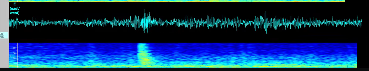
Just posting this because I think these are beautiful:
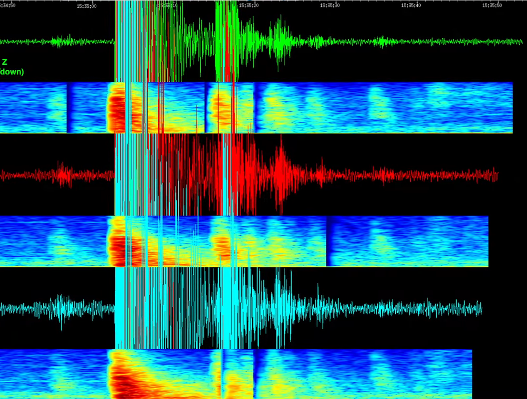
was a 2.56m at 3.9km depth at 15:35
Nice sequence here:

I don’t know, I just like the looks of those graphs and knowing, that they look like this because of some real event and some science. 🙂
To all:
I am probably the reason that the Iceland Meterological Office pulled the focal mechanisms from the vafris.is server.
I was trying to grab the focal mechanisms from a certain file in the website https://vafri.is/quake/#close and discovered on my own inspection that a certain file had the event information including the focal mechanisms. I created a simple linux bash script file for grabbing this information and converting it to a csv file. Unfortunately I posted to Facebook that I was willing to give this linux bash script file to whoever wanted current Iceland earthquake information from the IMO. I believe that both individuals moderating certain facebook groups and the IMO themselves saw my post and this became the tipping point, so that the IMO made the decision to delete giving focal mechanism data to both varfi.is and to the public in general.
This decision of the IMO to NOT provide public information of the focal mechanisms, is to me, in my personal opinion, a step backwards. But they have good reason for the decision that they have made.
What would be good for all of us, is if the IMO explained why they did what they did. I am not critical of them, I have spoken very well, in my past few posts. I would like to hear from them.
The dike is stated be 90% solid by now. All 1,4 meters of it, yet there is still feeding in progress.
One of them five wise man (“experts”) states to mbl.is.
I presume dike funding are secure so no need for more scare mongering.
And danger … reasonable .. but was it real?
But Nov 10 there was one detail missing; intrusions make lots of boiling noise.
I felt none at Grindavik that day. Was this only Trans-Tensional (aka rift).
(saw that on internet)?
There was a dike but I imagine the depth it reached under Grindavik itself was maybe overestimated. The graben seems to have been over 2 km wide, so the dike is over 1 km deep. It may have got shallower further north.
In general rifting events get a lot longer than the area that erupts. You can see that with all the cracked terrain adjacent to Keflavik, which has nearly no vents but evidently magma went there. The same is true of the area inland of Reykjavik, rifted by intrusions from Krysuvik despite no eruptions reaching this far.
Magma will probably reintrude the rift, eruptions are almost guaranteed but probably wont get to Grindavik, it will probably be more or less in the same place as the old craters .
Is the sill going to survive hot and fluid for longer time than the dyke? Can the sill become a base for future eruptions (Fires)?
It will probaly rupture under pressure soon and you gets a Krafla fissure : ) the flows in that area are Aa floods very much like the recent Krafla fires, looking at the flows in this area there is not even well developed lava channels so eruptions are very fast and very short lived probaly according to their features the Blue Lagoon coud vanish very fast If the walls fails
The ongoing inflation looks like the sill still gets new magma. I have the impression, that it is stable for now. Historically Reykjanes/Svartsengi made pauses of 2-12 years between eruptions. It’s not clear how many intrusions happened 1210-1240. But it’s likely that the rythm of eruptions there has longer pauses than Fagradalsfjall.
Looks like a coldwave is comming for Iceland in the comming days .. so will be nice to see the snow settle on the New lava fields, lava is a great insulator so will be snowy on top and hot below I think, lava is souch a nice insulator that Holuhraun even had snow on it when it was erupting with only the lava channels being snow free in winter 2014 – 2015
The rate of inflation at Svartsengi has been very consistent. If it continues like that it will reach the pre-inflation level on 28 November and the highest point before the dike intrusion on 5 December. I guess interesting things start happening in between those dates.
This graph looks like it might be significant 🙂
New post is up! The other southwest rift zone with eruption potential
https://www.volcanocafe.org/kilaueas-triple-swrz/