
(click on image for full resolution)
The expanse of water seems to go on forever. The Pacific ocean covers a third of the Earth surface, more than all the continents combined. The east-west width between Indonesia and Colombia is almost 20,000 km. There is 700 million cubic kilometer of water down there! 45 different countries own part of it. The averaged depth of their property is around 4 km, but it varies from the lowest point on Earth (10.9 km below sea level) to mountainous islands, including the second tallest island in the world, Hawaii. The first people who spread into the Pacific ocean from Asia found a paradise, but one with limited living space. There were islands dotted around in the west but they found far fewer of them as their reach expanded eastward. In the end, the lack of large islands stopped them from reaching the shores of South America: their story petered out at Easter Island. This ocean was never meant for humanity: this was shaped for the gods. Pele has her hideout here. She has a story to tell.
As befitting an ocean this side, it is quite a long story. You may want to make yourself comfortable, and get a coffee (or stronger), before immersing yourself. Oceans need space and time.
The Pacific ocean is the domain of the Pacific plate, the largest of the Earth’s tectonic divisions. But this is not the full story. The Pacific ocean is home to at least nine (!) plates, including five major plates (the Pacific, Antarctic, Nazca, Cocos and Juan De Fuca) and four microplates along the eastern boundary (the Rivera, Galapagos, Easter and Juan Fernandez). And there are further plates along the western side, such as the Philippine plate. The individual plates are separated by the usual arangement of spreading ridges, transform faults, and subduction faults. The Pacific ocean has them all. Major subduction trenches exist on all sides except the border with Australia. The main spreading centre is in the southeast of the ocean; older ones have gone extinct. On balance, the Pacific ocean is losing size because of subduction outweighs spreading. The volume is reducing by about 2 km3 per year. At this rate, it will last another 350 million years. Still, if your Monopoly version contains the Pacific ocean, I suggest you buy. It should be a safe investment.

The numerous islands dotting the ocean suggests that volcanic activity is common, at least on the western side. Take away the water, and the topography indeed shows this. There are sea mounts (submarine volcanoes) everywhere. Typically, a subducting oceanic plate should be passive: the volcanoes which feed on the subduction zone are located a hundred kilometer or more on the other side, on a different plate. The subduction tranches which surround the Pacific are themselves surrounded by the famous ring of fire, which should leave the Pacific as a haven of tranquility within the turmoil of the surrounding continents. But the multitude of volcanoes within the ocean basin shows that the Pacific ocean is far from pacified. It is restless, with many breaks and faults in the oceanic crust providing pathways for heat and magma. There are volcanic stories to tell. The largest flood basalt known on Earth is on the floor of the Pacific: the Ontong Java Plateau, which erupted 120 million years go. Some of the islands and sea mounts are arranged in long chains, such as the Hawaiian–Emperor chain and the Louisville ridge. They show the impact of local hot spots continuously drilling holes through a moving crust. There are few other places on Earth where volcanoes can last for 100 million years.
The struggle for survival
Oceanic crust is very different from continental crust. The continents are made of low density rock, formed by melting basalt and letting the lightest stuff rise up and solidify. Because of the lower density, the continents float on the denser mantle below; not even the weight of a glacial icecap can push them back into the mantle. Continental crust lasts forever; some is almost 4 billion years old, and many places are underplated by crust 1 billion year old or more. Continents are indeligible blemishes on the surface of the Earth.

Oceanic plates are very different. Their crust is created at mid-oceanic spreading centers, with magma that comes directly from the mantle. There is no separation between dense and light rock: the magma composition is the same as that of the mantle, dark and dense basalt. But if it is the same composition, the density must be the same, so why does it sit atop of the mantle? What stops ocean crust from sinking? In a way, it does sink. Oceanic plates lie much deeper than continental plates – they don’t float well because they are too dense. The oceans above them are a consequence of this: water unerringly aims for the lowest point. That still begs the question why oceanic plates sit above rather than within the mantle. The reason is heat. The oceanic crust comes up as hot magma, and is warmer than much of the mantle. Because of the residual heat, oceanic crust is typically about 10% less dense than the underlying mantle, and so it floats, albeit reluctantly and not nearly as well as the continents.
Let’s put some numbers on this. The continental plates are about 20 per cent less dense than the mantle. For a thickness of 40 km (this is typical for continental crust), their surfaces should sit approximately 8 kilometers above the surrounding mantle. Oceanic plates are about 10 per cent less dense than the mantle below, and are about 10 kilometer thick. So they sit about 1 kilometer high. Therefore, the ocean floor should be about 7 kilometers lower than the continents. This is roughly correct: the deep ocean is about 6 kilometer deep, and continents sit typically 500 meter above sea level. This leaves 32 kilometers of continental crust unaccounted for. This forms a keel: it sticks out the other way, into the mantle. If you want to make your continent higher, you have to make it thicker. Indeed, mountain ranges sit on very thick crust. (Alternatively, you can also use heat. A hot spot underneath a continent will typically push up the land by 1-2 kilometers.)
But much of the ocean is less deep than 6 kilometers. Why? The reason is excess heat. The spreading centers sit very high (typically 2 kilometer below sea level): they have the lowest density because their heat is fresh and their crust young. As the oceanic crust moves away from the centre it ages and cools: it becomes a bit denser, and therefore sinks a bit. The ocean floor grows deeper as it moves away from the spreading centre. After 100 million years, it has cooled enough to reach the standard 6 kilometer depth. The depth of an ocean tells you a lot about its age.

And it tells you that the Pacific ocean is ancient. A cut through it shows that apart from the seamounts and volcanic islands, much of it is the standard 6 kilometers deep. The crust here must be at least 100 million years of age.
But after 100 million years, the density has increased to the point where the survival of the oceanic crust becomes marginal. It is now close to beginning to descend and subduct. Oceanic plates can only survive for so long. Unlike the continents, oceanic plates have short lives and they die young. 200 million years is about the limit, and many start to subduct earlier. As long as there is a spreading center, the subducted crust will be continuously replaced and the plate can survive. But without a spreading center, the oceanic plate would soon disappear altogether.
So how could the Pacific ocean possibly survive for another 350 million years? A single plate can’t. The only way is by having one (or more) spreading centres, and that means at least two plates, one on either side of the spreading center. If there are more plates, only those bordered by active spreading will survive. The others will disappear. The current situation, where much of the Pacific ocean is governed by a single plate, is neither stable nor healthy. The ocean is going downhill.
The Pacific story
How old is the Pacific ocean? It is older than you may think: the water has been here for a very long time. When Gondwana existed, there was no Atlantic ocean or Indian ocean (there was however an equatorial ocean called the Tethys, partly bisecting Gondwana). But all around Gondwana was an ocean, known as Panthalassa. This was the Pacific at the peak of its powers. And the Pacific ocean is older still. It formed during the break-up of the previous super continent, called Rodinia. This takes us back almost a billion years. The Pacific ocean is as ancient as the continents!
How can this be? There must have been a continuous process of crust replacement, which compensated any loss of the older crust into subduction zones. Whole plates must have gone down into the abyss. We indeed have evidence for several lost plates of the Pacific. The Farallon, Phoenix, Izanagi, and Kula plates have all disappeared, and there will have been others. And new plates have formed. The Pacific plate itself, despite its current domination of the ocean basin, wasn’t always there. It is less than 200 million years old, making the ocean itself four times older than the current plate. The Pacific has seen many changes. Subduction zones have consumed entire plates, with their remnants ending up below the surrounding continents, or sometimes underneath the Pacific ocean itself. New plates formed to replace the fallen, and new subduction zones formed but not always in a similar place. New spreading centres came into existence, wherever the pull from subduction split an existing plate. These spreading centres could jump to new locations, but eventually would go extinct. And sometimes a hot spot would come and cause havoc, creating volcanic islands or flood basalts, and perhaps tearing the crust. It is all part of the game. The process was always driven by the physics of aging. All oceanic crust needs recycling and replacing. The ever changing plates and plate boundaries are just the way that the Earth makes this happen.
How do we know?

The ocean floor carries the imprint of its history. But it can be difficult to read! The oldest history is regularly erased: nothing older than 200 million years survives the subduction. A subducted plate can still be recognized in the mantle, as a region where seismic waves travel faster. During subduction events, parts of the oceanic plate may end up attached to the continent and avoid being taken dow. That is most common with volcanic arcs, and both sides of the northern Pacific ocean contain remnants of these.
But this is not enough to satisfy curious scientists. They want to know how plates have moved, how fast, and where from. How do you measure this? Again, the answer its at the bottom of the ocean. Its history has left scars which tell us what happened. Among those scars, the volcanic island chains are the easiest to recognize.
The chains tend to have one volcanically active island at one end. This is assumed to be the position of a hotspot which drives the activity. If the hot spot is stationary, the string of islands is formed by movement of the plate.
The Hawaiian-Emperor chain is the prime example. Currently, the hot spot is powering the island of Hawaii. The islands and seamounts behind this becomes progressively older the further they are away from Hawaii. When each island was formed, it was at the location where the island of Hawaii is now. The chain points into the direction the plate is moving. There is a bend in the chain: about 46 million years ago, the direction suddenly changed and became much more northerly. This shows a general re-organization of the plates of the Pacific. It can be more difficult to know whether the plate itself changed its motion, or that the hot spot moved to a different plate. The chain also records how the activity of the hot spot waxed and waned, which is an interesting bonus.
The second piece of the puzzle comes from the magnetic field. When the crust solidifies, at the core of a spreading center, the iron in the solidifying lava orients itself to align with the Earth’s magnetic field. Once solid, the iron cannot change it orientation: there is now a magnetic field frozen into the ocean floor. The direction will always show where the Earth’s magnetic field was pointing at the time and place the crust formed. The Earth’s magnetic field sometimes reverses its direction. The ocean floor remembers this: you can see stripes of opposite directions of the magnetic field, divided by the reversal events. Counting the number of reversals from the currently active spreading centre gives the approximate age of each segment of the ocean floor. It is a powerful method. There are over 50 reversals known over the past 150 million years. They are randomly distributed: sometimes they are less than a million years apart, but at other times the separation can be many times more. The accuracy of the dating therefore varies, but in general it is very good. The stripes show which way the ocean floor is moving, and so in which direction the spreading center was located. The magnetic field also remembers the angle that the field made with the ocean floor, and this measures the latitude. By measuring this angle you can know how the plate has moved in latitude, at least with respect to the magnetic pole.
The magnetic field does not record the longitude. For that, you need to use the nearest hot spot and island chain. Hot spots should be tied to the mantle below, independent of the crust. This provides a stationary reference frame. Spreading centers, in contrast, are not stationary. Even when active, they move with their plates, and they can even be subducted (when this happens within an ocean they will have gone extinct well before; a recently active, warm spreading center can however be overridden by a continent).
But the assumption that all hot spots are stationary is no longer accepted. There is growing evidence that hot spots do not keep exactly the same position with respect to each other. Some models now use a frame of reference that is fixed to Africa, as it appears that Africa has been moving very little: it is our most stable continent. Going back more than 80 million years, Africa was attached to bits of Gondwana and at this time things become more uncertain.
Dating the Pacific

As a well-behaved example, the figure (from Seton et al.) shows the magnetism pattern in the eastern Pacific. Some reversals are labeled – note that the same label may occur in several places. Near the coast the reversals have lower numbers which means the crust here is younger. The direction towards younger crust points at the responsible spreading center. In this case, the oceanic crust appears to have come from underneath the North American continent. That is not possible, and it means that the original spreading center has been overridden by the continent. On the other side of that spreading center was a different plate, called the Farallon plate. The subduction zone that pulled it all in was on the far side of Farallon. Farallon was one of the major plates of the Pacific ocean. Nothing is left of it. Even Ozymandias left us more. Still, science is not easily defeated, and ancient magnetism has revealed to us its past existence, how and when it died, and what is was doing just before the end. Even the speed of its demise has been recorded.
In the north, below Alaska, the labeled lines run in a very different direction. This sudden bend in direction, from an angle of 161 degrees to one of 279 degrees, has been recognized since the 1960’s. It is called the ‘Great Magnetic Bight’ (it is ‘Great’ because it is in the US). Clearly, the western regions were attached to a different spreading center, which was located far north. It too has been lost in subduction. On the far side of this different spreading center must have been yet a different plate. It is known as the Kula plate, and it is the second of the Pacific’s ancient building blocks, dating back to when the ocean was called Panthalassa. Again, nothing is left. Only the sea remains. To quote the poet Percy Shelley:
I met a traveller from an antique land
Who said: “Two vast and trunkless legs of stone
Stand in the desert. Near them, on the sand,
Half sunk, a shattered visage lies, whose frown,
And wrinkled lip, and sneer of cold command,
Tell that its sculptor well those passions read
Which yet survive, stamped on these lifeless things,
The hand that mocked them, and the heart that fed:
And on the pedestal these words appear:
‘My name is Ozymandias, king of kings;
Look on my works, ye Mighty, and despair!’
Nothing beside remains. Round the decay
Of that colossal wreck, boundless and bare
The lone and level sands stretch far away.

The patterns in the western Pacific are even more complex. The young Phillipine plate has a clear spreading center. To the east, the patterns visible on the Pacific plate point at a spreading center between the green areas labelled ‘SR’ and ‘MPM’. (Green indicates remnants of old flood basalts.) This spreading center is in fact visible on the map of the Pacific, running from the Aleutia-Kamchatka corner towards the southeast, across much of the Pacific. It is notable how old the magnetic stripes here are. Magnetic reversals younger than about 80 million years have numbers; older than 120 million years have ‘M’ numbers , starting with M0. (There are no reversals known in the 40 million years in between.) The stripes here have ‘M’ numbers. The spreading center on the Pacific plate went extinct around ‘M10’ which is 130 million years ago.
Further to the east, the magnetic stripes point at a different spreading center which now lies underneath Asia. The plate on the other side was the third of the major plates of Panthalassa. It is called Izanagi. Originally, the mid-Pacific extinct spreading center separated Izanagi from the Pacific plate. When it went extinct, the combined area was claimed by the Pacific plate. Elsewhere, the precise locations of the borders between Izanagi, Kula and Farallon are not known because of the erasure by subduction. But it is amazing how much we do know about these plates which made up an ancient ocean, but which now have all gone down into the mantle.
South of ‘MPM’ there is another sudden change in direction of the magnetic stripes, even more extreme than the one near Alaska. This one has no name but it surely deserves the name ‘Greater’. It points at another spreading centre located in the South Pacific.
Sometimes the lines do not line up very well. This is what makes the pattern confused. The cause is spreading center instabilities. The center is not intrinsically tied to a specific position on either the plate or the mantle: it is just the place where the outward pull makes the plate break. At times a spreading centre jumps to a new location. Such an event happened in the central Pacific, where it jumped northward by as much as 800 km. Another complication is evident just east of Japan where the ‘M10’ and ‘M14’ lines cross. This suggest that around 135 million years ago the plate boundary in this area changed. This was approximately when the central spreading center went extinct, a time of upheaval in the Pacific. It appears that the Izagani plate also rotated a bit over time with respect to the Pacific plate.
In the above figures, Hawaii is located just to the right of the words ‘Pacific, on the stripe labelled ‘34’: this magnetic stripe covers a very large age range, between 83 and 120 million year. The ocean floor around Hawaii is 100 times older than the island itself.
The southeast Pacific is much simpler. The pattern shows a spreading centre to the east of the Pacific plate, which still exists and is still active. In contrast, the southwest Pacific is an utter mess. The green areas are the Ontong Java, Manihiki and Hikurangi Plateaus: they are all the same flood basalt eruption, later divided by spreading right through the center of the flood basalt plateau. The plateau formed about 120 million years ago. South of this spreading center was the Phoenix plate. The complexity of the patterns suggest there were several microplates as well. When the spreading stopped, the Phoenix plate became part of the Pacific plate; spreading restarted at the edge of the Antarctic plate, far to the south.


An ocean in motion
The Pacific ocean was given that name because it seemed peaceful to the first European explorers. The Polynesians would have known better. Now we know that the history of the Pacific is far from peaceful. It is a destroyer, an eater of plates, an ocean of ruthless competition. If Darwin had known, the theory of evolution would have looked quite different. This is no route towards improvement of the species. Survival is just a matter of luck of location, and the struggle is of old against young – with the latter the invariable winners. Oceanic plates have a ‘best before’ date written on them in magnetic ink.
Can we depict how this battle played out underneath the peace of the Pacific? Various reconstructions have been attempted over the years. The main uncertainties are in knowing where the plate boundaries were. Microplates, such as have formed along the coast of North America, can easily be missed in the reconstructions.
Before the Pacific plate existed, 200 million years ago, the main plates were the Izanagi, Farallon and Phoenix. They met in the middle, in a triple junction, and all three boundaries were spreading centers. We have no data regarding this as the crust around the triple junction has now disappeared underneath Asia. The Pacific plate formed from a disturbance near this triple point. By 150 million years ago, there was a new triple point between the Pacific, the Farallon, and the Izanagi plates. The spreading center between the Pacific and Izanagi plates remained active for 100 million years. Spreading between the Pacific and Farallon plates continued until very recently. By this time the Farallon plate had broken into pieces. The Kula plate split off 80 million years ago, later followed by the now lost Vancouver plate (at 48 million years), the Juan De Fuca , Cocos, and Nazca plates. The Great Magnetic Bight traces the location of the Kula-Farallon-Pacific triple point.

The image here illustrates how the East Pacific has evolved. It is taken from Seton et al. The frames are centred on the US. The colours show the different plates. The growth of the Pacific plate (green) is clear, as is the break-up and subsequence disappearance of the Farallon plate. There are differences between the main models, for instance in how long the various spreading centers remained active. But the overall picture is generally accepted.

The picture above shows how the origin of the Pacific plate is envisaged. It begins with a bifurcation of the speading center between the Farallon and the Izanagi plates, just above the junction with the Phoenix plate. The two arms separate out, and the enclosed area becomes the new plate. Because it is surrounded by spreading centers, the fragment begins to grow.

40 million years later, the new Pacific plate has grown into a decent size and is expanding northward. From here on, it will push the other plates into their graves.
Shatsky Rise
The floor of the Pacific ocean contains several remnants of flood basalt eruptions. The biggest one is the Ontong Java Plateau. In the north, there is one: the Shatsky Rise, located towards Japan. This also is huge and is one of the largest volcanic eruptions known on Earth. It contains three separate structures of which the southwestern one is the largest. The total volume is 4 million km3. It fills 0.5% of the volume of the Pacific ocean. This eruption will by itself have raised global sea levels by 10 meters. It clearly formed by an enormous emplacement of magma, some of which erupted on the ocean floor and the remainder contributed to the bulge. The Shatsky rise is dated to 144 million years ago.

The Shatsky Rise. Named lines show the magnetic reversals. Image from Li et al.
The magnetism around the rise (see the left panel) show how the ocean floor here has spread. On three sides, the clear striping of a spreading center can be seen. On the south side, the pattern is perpendicular and more confused. Look harder, and you recognize the pattern of a triple point. Three faults, delineating plate boundaries, came together; all three acted as spreading centers. At one time, this was the beating heart of the Pacific ocean.
Triple points were already mentioned above. They are fairly common: wherever there are more than two plates, a triple point should be around somewhere. In practice, almost all triple points are under the sea. Currently, only the Afar triple junction is on land. Each of the three plate boundaries that meet at a triple point can be different: some are a spreading centre (termed R for ridge), some have a subduction trench (T) and some are just transform faults (T). The Shatsky rise was of type RRR, i.e. all three arms were spreading centers where new ocean crust formed. RRR is a stable configuration (not all possible combinations are, and some (esp. TTT) are physically impossible). The three faults are traditionally at angles of 120 degrees but such perfect symmetry is pretty rare in real life.
Most triple points are fairly passive but some are associated with a break in an existing plate. When a hot spot pushes up a large bulge in the crust, the crust can crack in the traditional triple-armed way, at 120 degree angles; the cracks can extend outward and grow into new plate boundaries. Where once there was one plate, now there are three. And by the nature of hot spots, all three arms initially become spreading centres. This can also happen on continental plates, for instance the Afar triple point broke up the Africa-Arabia plate 30 million years ago. Most hot spots don’t do this: the Yellowstone or Hawaii hot spots, for instance, have not broken up their native plates. But the Shatsky hot spot may have come close.

From Li et al. SR stands for Shatsky Rise, OJP is the Ontong Java Plateau
The Shatsky rise has been suggested as being responsible for the formation or growth of the Pacific plate. In the former case, it would have erupted near the Phoenix plate, two of the three arms would connect to it and thus separate out the triangle that was to become the Pacific plate. If the Pacific plate formed as early as 190 million years ago, than the Shatsky rise is clearly too young for this. The second option has the Shatsky Rise erupting at or near an already existing Izanagi-Farallon-Pacific triple point, invigorating it and causing a rapid enlargement of the young Pacific plate northward.
The Shatsky rise is located on the Pacific plate. But part of it will have erupted on the Farallon plate. This part has been subducted underneath North America and is no longer available to any submarine volcanologists.
Hawaii
Hawaii is the famous example of a hot spot trail. The island chain forms a perfect recording of 80 million years of history. It raises some questions: why the sudden bend, 45 million years ago, and where and how did the hot spot originate?

Regarding the first question, a plate can change direction from a re-organization of neighbouring plates. A spreading centre may form (or go extinct), or subduction may start somewhere. It is not entirely clear what happened in the Pacific ocean but many suggestions have been made. It may have been externally driven: this was about the time that India crashed into Asia. More likely, it was a change within the Pacific basin. The most plausible suggestion is that this happened just after the spreading center between the Pacific and Izanagi plates had subducted, and Izanagi was no more. This caused the Pacific plate to move more to the northwest, no longer restrained by the Izanagi plate.
But where did the hot spot come from? It was always near its current position. Don’t try to extend the path and look for the origin in the Bering Sea: the hot spot has never been there, and it was never on that plate. Some of the magnetic data suggests that some of the islands formed a bit further north than Hawaii is now. The Hawaiian hot spot appears able to move a bit. The linear chain shows that any hot spot jitter was much less than the plate movement which took the islands away to northwest and north, into the abyss of subduction.
There is however an interesting coincidence. The chain points directly at the sharp corner between the Aleutian arc and Kamchatka. The age of the islands (or rather, sea mounts, as they have long since eroded to below sea level) at the northern end of the chain is about the same as that of the sea floor in this location, 85 million years. (The age of the sea floor is a bit more uncertain because it coincides with the long delay between two reversals, but it is between 80 and 120 million years, and given the distance to the older reversal, will be closer to the former.) That places the Hawaii hot spot of that time very close to the spreading center. In fact this is visible: the map at the top of this post shows the extinct spreading center which bisects the Pacific, which 100 million years ago separated the Izanagi and Pacific plates. Around this time, it failed. The Emperor chain seems to come from the end point of this now-extinct spreading center. A bit over 80 million years ago, the Hawaiian hot spot was close to or on the spreading center.
Spreading centers have a tendency to be attracted by hot spots (see Iceland where it follows the hot spot against the direction of plate motion, which has caused a considerable detour of the mid-Atlantic rift). So it is is plausible that 85 million years ago, Hawaii was on the spreading center. Between which plates? On one side was the young Pacific plate. On the other side, it was close to the border between the Izanagi and Farallon plates. But this was also the time that the Farallon plate began to break up, and a spreading center developed between the new Kula and the Pacific plate. The Hawaiian hot spot was close to this point, and was there at the right time. Perhaps this wasn’t a coincidence? Perhaps Hawaii was, at the time, actually the triple point between the Izanagi, Kula and Pacific plates? Perhaps it initiated the first break-up of the Farallon plate by triggering the new east-west spreading center.
We have mentioned how hot spots do not normally break up plates. But some do. The Afar hot spot broke up Africa, the most stable of continents. The Shatsky rise occurred near a triple point and may have caused it to migrate. Nowadays, the Hawaiian hot spot is content with drilling holes through the Pacific plate. But in the past, perhaps it did break up its predecessor, formed three rifting arms and separated off the new-born Kula plate. Perhaps Kula was born of Pele.
This still leaves the origin of the Hawaiian hot spot unclear. Did it form on the spreading center? That seems plausible, given the coincidence of position. After all, most of the world’s hot spots seem to be attached to current or past spreading centers. The map below shows the locations of the 50 or so hot spots. Almost all are in the oceans. Flood basalt eruptions, in contrast can be either on land or in the oceans.

A hot spot model
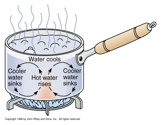
How does a hot spot work? You can see this in the example of a pot of boiling water (a wide pot works best): water comes up, moves sideways, cools down, and goes down again, in a continuous cycle. For this to work, you need a temperature difference between the top and bottom. Turn off the heat, or put a lid on the pot, and the convection disappears. Similarly, a hot spot shows where hot mantle material rises up, in a convective plume. There are two types of hot spots. The first is initiated by heat low in the mantle, and is deep. The second is driven at the top and is shallower. Once they are established, it is hard to see much difference, but they differ in how they begin.
A stable convection pattern needs bottom heat, a way to remove this heat from the material at the top, and a way to move the risen material away so it can descend without interfering with the rising plume. All this happens in a pot of boiling water.
How does this work in a spreading center? The pull from the distant subduction zone causes a tear in the crust. This reduces the pressure, and allows mantle material to rise up. In the process, it partly melts due to decompression. The new crust is pulled away (this is the spreading part) allowing new material to come up. It is the standard way a spreading center works. However, it is not yet a hot spot. Now envisage a triple point. It is like a spreading center, but it is a point rather than a line, and it expands in three directions. It is more efficient than a spreading center. It can be the beginning of a hot spot.
To turn it into stable convection, we need to get rid of the heat and material at the top. The heat is easy. First, the decompression melt takes away some heat, and second, the liquid magma erupts at the surface where it cools efficiently. The material that is brought up needs to be moved sideways, but the spreading of the plate will do this. So now we have a hot spot which is becoming a stable feature.
Once the roots of the rising column reach well into the mantle, the system becomes tied to the mantle rather than the crust. The crust, spreading center and triple point are all moving with respect to the mantle. The new hot spot therefore tries to move away from the triple point. For a while the triple point or spreading center may follow it but eventually the distance becomes too large. But the basic mechanisms that keep the convection stable continue to operate. The volcano on top carries off the heat, and the moving plate carries off the mass (including the volcano!) allowing the descending material to be situated well away from the rising plume. Now we have a stable structure, no longer tied to a spreading center.
This model explains why hot spots prefer triple points: that is where they form. It explains why hot spots can move around a bit with respect to each other: the main action is at the top, so they are not as strongly tied to the mantle as one driven by deep heat would be. It explains why hot spots are in the oceans: that is where spreading centers are normally found, because spreading centers create oceanic crust which lies deep. It may even explain the poor survival of hot spots under continents: continental crust insulates too well, so the heat may not carried off fast enough; this can stop the convective plume. It does not explain everything. Sometimes hot spots do create triple points, as in Afar, rather than wait for one to form: this is best explained by a spot initiated by excess heat deep down in the mantle. Hot spots do impact continents, as for instance in the Siberia and the Deccan traps. But it seems to fit Hawaii. This model can explain why Hawaii is where it is, in the middle of the Pacific ocean. It may even explain Iceland. And with this speculative model I’ll end Pele’s story.
Hawaii is so much more than a paradise with a volcanic temper. It may be born from events in Panthalassa, and it may have helped shaped the ocean it sits in. There are secrets in its past, and skeletons are hidden in its oceanic cupboard. Ozymandias fooled the poet. The missing mighty works were hidden below the sand where the poet failed to look. Pele has gone one better. She shows us wonders on her island, which make us forget to look for treasure below the surface. Was Pele created by the Pacific, and did she, in return, destroy one of her plates? It fits her reputation. What a story it would be.
Albert Zijlstra, August 2018

Further reading: The dancing Earth
Sources
M. Seton et al, Earth Science Reviews, Vol 113, pp 212-270 (2012): Global continental and ocean basin reconstructions since 200 Ma
Sanzhong Li et al., Geological Journal, Vol. 51, pp 562–578 (2016): Orientation of joints and arrangement of solid inclusions in fibrous veins in the Shatsky Rise, NW Pacific
Alan Smith, International Geology Review, Vol. 45. pp 287-302 (2003): The Origin and Distribution of Cretaceous to Recent Intraplate Volcanism in the Pacific Basin,


Kilauea finally lowered from Warning to Watch!
Just give it a few months, if a lake forms in the caldera then I’m sure it will be put back on warning indefinitely even if it doesn’t increase in volcanic activity at that time.
As I have said probably on every page since May 😉 I think it is extremely unlikely that this activity will result in a long dormancy (for kilauea still only about 20 years…), it is really different in some significant way to any of the historical events that have resulted in a true decline in activity for more than a year (1840, 1868, 1924, 1975). The only comparable events in recent time are the 1790 eruptive series, as well as a less clear event around 1500, both of which had eruptions in basically the same place as this eruption as well as summit collapses big enough to be considered calderas. In both of those cases summit activity was very intense almost immediately after the collapse so there is a real risk of that happening now too.
WAY OT from am57: (nice to wake up to the dulcet tones of Albert on the radio the other day) the stuff we learn on here! So Albert might have a job waking up people and apparently does a good job of it. 😉 er, so Albert have more time left over after writing up nice articles here? Good on You, Albert! Best!motsfo
Iirc, it was about how red Mars is looking at the moment. So a bit of moonlighting from Albert! Anyone would think he had a day job as an astrophysicist (again, iirc) 😉
2.3 at hekla. Big this one for hekla. Related to the 3.8 2 days ago
New post is up! Part 3 of the Dawn trilogy. Do you have an issue with water?
https://www.volcanocafe.org/dawn-over-ceres-the-lonely-volcano/
“Do you have an issue with water?”
Only if it’s in my lungs…