VC is a hobby. Watching and discussing volcanoes can be one of the highlights of anyone’s day. No special background is required: everyone can join in, and anyone can spot something others missed. Here at VC, watchers discovered new vents during the first Fagradalsfjall eruption (well before we called it that) which the Icelandic authorities had not yet noticed – and which they received with thanks. Questions are asked, and answered, discussion points are raised and not always resolved, and images and videos of eruptions are shared. Articles explore the background or just celebrate a particular volcano. It is a community of people of any background – or none.
Hobbies are personal. We don’t need to justify it to anyone else. It does not need to pay the bills. But it can become more. There are careers in the topic. They are not easy ones. It is hard to get into, demanding when in it, intensely competitive, lacks job security and hardly pays the bills. But it is also exciting, rewarding, and unique. It is the world of the academic. What is it like?

The World of Science
It is completely international. People of all backgrounds and nations work together and compete. The commonality is the interest in one particular area of science, and it can create a tight-knit community. It is a world that does not sit well with many government policies to reduce immigration. Fairly regularly, countries make it harder to hire academics from abroad, but it quickly makes the universities less competitive. We compare it to the world of sport: imagine football teams being stopped from hiring (’buying’??) talent from abroad while being expected to compete with the best in the world.
It is very conservative. We do science the way it was done 200 years ago. The methods and instruments evolve rapidly and are often new and well ahead of the ‘state of the art’ but the structure remains the same. There are rules. The data have to be correct. An experiment should get the same result no matter who does it: unrepeatable experiments cannot be considered. On the other hand, it has to be authorative: someone needs to put their name on the result. There is no such thing as anonymous science. Wikipedia does not qualify.
It is intensely competitive. There are many more people entering the field than there are academic positions available. People compete for limited funding, with the need to become known and recognized. The emotional cost can be high. And even the best never feel good enough. It is like a high jump competition where the bar is always put a little higher than ever before. But it is also about becoming part of a community, perhaps the most international one in the world.
It is a life of true life-long learning. Scientists work to extend knowledge, not repeat it. Every day is there to learn something new, either new understanding, new methods, or reading up on new developments elsewhere.
Opinions and speculation are allowed and encouraged. In fact, science progresses by disputes and many conferences are remembered for the arguments and disagreements. But in the end, data rules. Opinions need to be phrased as a model, and are tested against their predictions, not against the seniority of the proposer. Senior people may have more factual knowledge and have seen many of the theories proposed by younger scientists before. Their opinions may carry the weight of experience. But in the end, science looks at the data. Even Einstein was found to be wrong – on occasion.
Volcanology

How does one get into volcanology as an academic? It is obviously a branch of earth sciences. People work mainly in academia, some work in volcano observatories, and some in museums. The type of work varies tremendously. We have seen volcanologists dangling buckets into lava: they may do rock analysis and work as geologists. Some study the gasses coming out of volcanoes and are closer to climate and weather science. Some study the human side of volcanoes: why do people live near them, how are hazards perceived. Some study volcanophysics: the complex interaction between many processes involving magma and lava. Archaeologists study the sometimes lethal interactions of volcanoes and people of the past.

Many scientists travel a lot. That may involve field trips to volcanoes of interest. Some, like the US volcanoes are accessible in comfort. Others may not be. ‘Volcanoes are like a box of chocolate; you never know what you are going to get’! There are scientific conferences, essential to share results, to have discussions and arguments, but also to build community.
How is science organised? A lot is based on tradition. Change can be slow. Senior scientists act as the safeguard of tradition. They are in the various grant and hiring committees and make sure that new people fit with the standards of yesterday. There are official bodies: the Learned Societies which exist in some countries. There are also international bodies, such as the International Astronomical Union which speak on behalf of the scientists to government and society. On occasion they have actual powers. For instance, time standards are maintained by the IERS, established by the IAU: they decide when to schedule a leap second. The downgrade of Pluto to a dwarf planet was also done by the IAU. The rule is that scientists advice but don’t rule: they are not politicians. But there are exceptions – such as our clock.
The world of science, with all its innovation, progress and discovery, is an old one. It developed around a university system that dates back a thousand years, and still has aspects that people 500 years ago would recognize. It can be slow and intensely frustrating, but it has served us well and still works. It brings together the future and the past.
The guild of scientists

Draper’s Guild, Rembrandt
Guilds were the trade unions of their day. Their origin lies in the Middle Ages, during the rise of the city economy. People made and sold their wares in the city. Naturally this gave rise to competition: as today, it was always possible to tempt buyers by making something a little cheaper but a lot worse, and just as today, this combination could be irresistible to people needing to count the pennies. (I would certainly not name Amazon as an example.) The self-employed tradesmen found it convenient to band together and set standards – to protect both the trade and the traders. These became the guilds, one for each trade. The butcher, the baker, the candlestick maker, all had their own guild. The city rulers were happy to oblige and to restrict a particular trade in their city to members of their guild. Some of these might surprise you. The first universities were set up by guilds of students! This is how the word ‘college’, which describes a workers’ collective, became used for universities.
The guilds grew into powerful organizations. Their role was in part a social one, ensuring adequate income for the skilled craftsmen they represented, reducing conflicts, and ensuring a standard of quality. Different trades would yield different power depending on how important it was for the city.
Guilds traded with each other – and the merchants also banded together. In one extreme case, this led to the formation of the Hanseatic League, an early European common market which bound together cities from the Netherlands to the Baltics in cross-country trade. The word ‘Hanse’ came from a word for guild. In its heyday, the Hanseatic League covered some 200 cities. The east-west division in Europe still runs along the edges of the Hanseatic League, with Poland and the Baltic republics on the western side and Belarus and Slovakia on the eastern side. Although never a political or military organization, the League held considerable power over much of Europe. You could argue that parts of Asimov’s description of the Foundation is based on the original Hanseatic League.
While the guilds acted in the cities, the countryside was free – here people could do whatever they wanted. This is the origin of the ‘cottage industry’, the free-market economy away from the cities. Lacking the power of the guilds, it allowed people to make a living – just about, as without an organization behind them, they could charge little. Free, but poor.
Over time, some local guilds did become political organizations with could be stronger than the city rulers. But after the Middle Ages, as the power of the state grew, the power of the guilds reduced. Being city-bound, they could not compete with the newly emerging nations. The Hanseatic League also disappeared at this time. The guilds held on until the 18th century, but they failed against the industrial revolution and its emphasis on labour rather than craftsmen.
There has been much discussion whether the guilds were good or bad. As always, both aspects were present. By and large, they worked well for the members, did a reasonable job for the city but made life more difficult for outsiders. There was much scope for corruption, where people had to pay to become member and being allowed to carry out their trade. It stifled competition, and thereby innovation. It foreshadowed the battle between social and financial capital. Both capitalism and communism attacked the guild system – one of the few things they agreed on! One wonders how much of that was based on both their needs for cheap labour.
There are some remnants of the guild system in our society. These are the professional organizations. They act as ‘accrediting institutions’ which for instance allow someone to use a title as an ‘accredited’ worker. They do not have the power to stop anyone from carrying out a trade (with exceptions), but they do set the requirements for accreditation and they act as the awarding institution – in spite of not being a university with degree-granting powers.
There are exceptions to the lack of power. Some professions, such as teaching, remain licensed. The licensing authority is often the government but there are at least two areas where other ‘councils’ act as licensing agency: health and law. To give examples, to work as a dentist in the UK requires a license from the General Dental Council and to work as a solicitor is handled by the Law Society. They act on behalf of the government but are nominally independent.
The scientific Learned Societies in a way also act as a new incarnation of the old guilds, by validating scientists through membership, although this membership is very much optional.
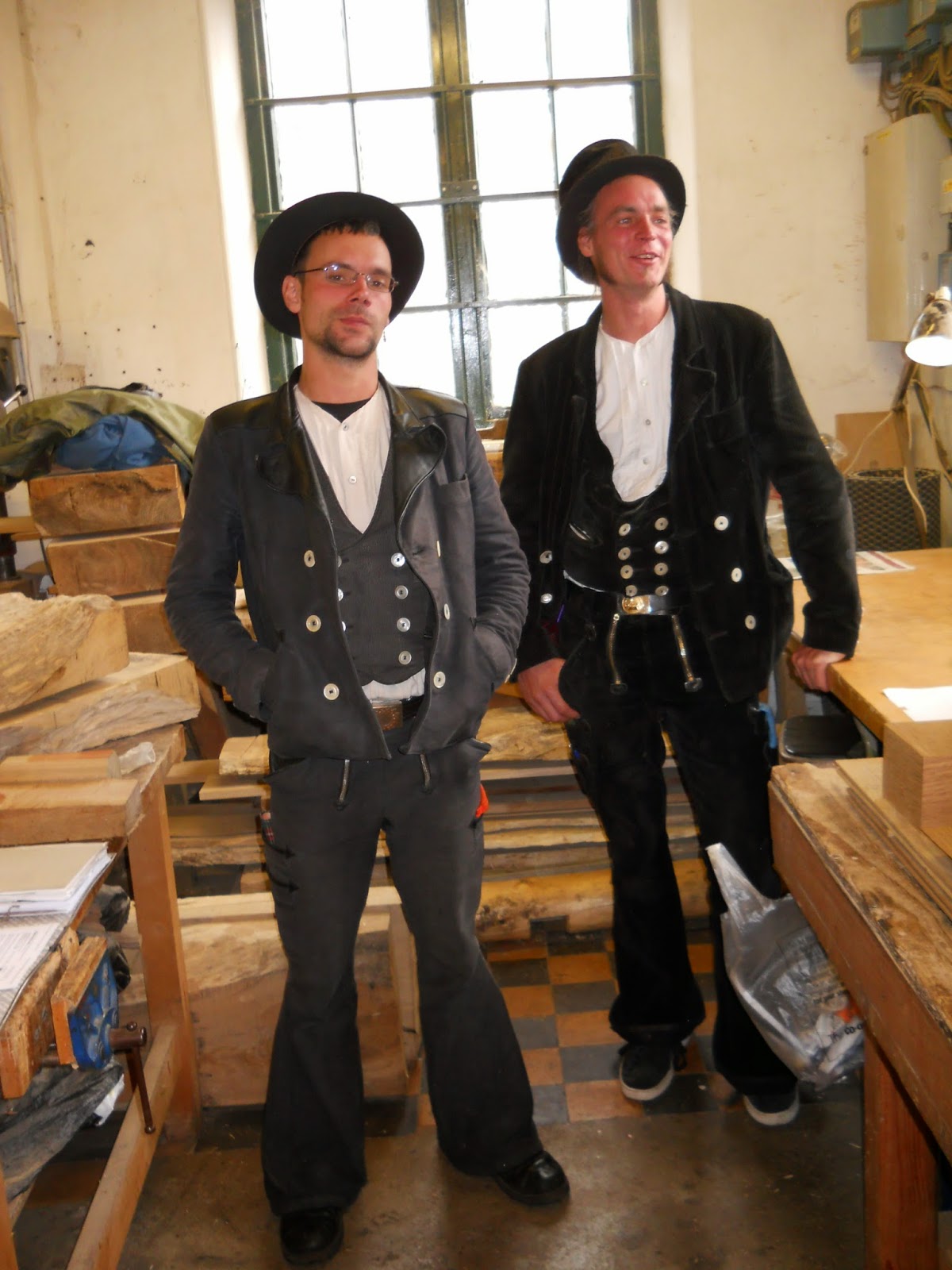
Journeyman
One aspect of the old guilds has left a lasting legacy in our society. This is especially in Germanic countries. It is the concept of the apprentice, and the progression afterwards. It is the process one needs to follow to become a recognized master craftsman.
An apprentice would be taken on by a master craftsman. The apprentice would live in the master’s household, and receive accommodation, food, and training. In return, the apprentice would work for the master for a certain number of years, and a fee may have been payable. At the end, the master would provide a certificate proclaiming the apprentice to have become a craftsman – ready to start work. The apprenticeship was normally for seven years, starting in their early teens. It was very much like our high school and ended with a diploma.
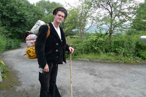
For many professions and/or regions, this was sufficient. But going to work as an independent was often not that easy. Competing with the master was not optimal and in any case, in many towns there was only room for one craftsman in that particular profession. If employment by a local master craftsman was not possible, the graduated apprentice would have to move elsewhere, like birds flying the nest. The search for a new place to work and live could be long and difficult, and a return to the parental town might never be possible. Some would become accepted as master craftsman by a guild. Others would work in employment for another craftsman. Much of the medieval building work was done by such people, who perhaps had to move on when the building was finished.They would be paid per day. The French word for ‘day’ became used for these travelers: they became known as journeymen.
Journeymen at their work
Some professions took more training than an apprentice would have. Examples are carpentry and portrait painting. This became organized by the relevant guilds. The journeyman would register with the guild on arrival in a city, and try to find employment. The guild would help with this, or provide onward traveling expenses if no employment was available locally. The employment would typically be for six months, and at the end the employer provided a certificate for the work. After a set period of such employments, the journeyman would have earned the right to become a master craftsman, and take on an apprentice, thus restarting the cycle. This period of training would take a minimum of 3 years and one day, during which period the journeyman was not allowed to return to their home region. It became known as the journeyman years. These travelers played an important role in the cultural life of Europe from 1400 to around 1800, as an itinerant work force spreading and creating a common culture. In the cities, as many as 80% of the working craftsman would be born elsewhere. As nowadays, there were problems with this system. In times of unemployment, cities could restrict immigration. Amsterdam, as an example, became a more cosmopolitan city in part because it had few restrictions on journeymen even in harder economic times. Other Dutch cities were much more restrictive.
The tradition of the journeyman year still exists in Germany. It was briefly re-popularized in the 1990’s. These journeymen still have the traditional uniforms for each profession. Newer versions of the tradition exist, for example as the European Erasmus scheme which encourages students to do part of their study at other universities in different countries. They are the modern journeymen.
But there is one profession where this journeyman system still very much exists: science.
The traveling years
Universities provide layers of training. The standard layer is that of the undergraduate degree. This suffices for the majority of professions. But for some professions, a postgraduate (also called ‘graduate’) degree is required or helpful. This degree provides a doctorate, or PhD. It takes typically four more years of study and involves a research project done under supervision – the supervisor is normally a professor in the university department. The degree may require courses to be taken, but the research project and resulting thesis are the main part. Depending on the topic, field work may be included. The student should expect to have seen all aspects of the research and done much of it themselves.
A PhD is enough for some jobs in industry or government, but to become an academic requires even more training. This is done as either a postdoc, funded for a particular project, or a fellowship which allows the person to do their own research. A few people will continue to work for and with the PhD supervisor but most will change, and many will move to a new place of work. Many go abroad, to other countries. There are no rules but the period may last 3 to 6 years before an academic position becomes a possibility. These are the formative years. It is also the time when the person develops their international connections and recognition. Much of the international culture of science is based on the movement of people during this phase. Many of these people will never go back to their home country. Not every country takes part. In the US, the postdoc circuit exists but is more commonly used to move around within the US. Smaller nations don’t have that option. A recent change is that more people from the non-western world are now taking part. Science has become more global.
The system is a modern version of the journeyman years. The PhD is the apprenticeship. It is important to pick the right supervisor and project as it is hard to change mid-project. During the postdoc or fellow period, it is important to diversify, by learning new techniques and expanding into new research areas. That is best done by finding a new supervisor to learn from!
Journeyman of science
The wandering years are accredited in two ways. One is by letters of reference. Different from what is common elsewhere, in science these letters are send directly to the institution advertising a new job, and not given to the applicant. It is seen as a personal recommendation, and it has much more detail than just ‘person A worked here at this time and did not cause trouble’. The second accreditation comes from papers published by the wanderer. These papers should show that the person is becoming independent, is not just following instructions but is developing their own ideas. These two aspects replace the old ‘certificate’.
There are alternatives to academic positions, exit routes from the journeyman years. In volcanology, volcano observatories or museums may offer positions. Some people become teachers, some find work as editor in academic publishing. People with volcanology experience are an obvious target for mining companies. Carl has written about geothermal power from volcanic areas, another potential route to employment. The skills that people have learned, especially independent thinking and problem solving, can be applied in many different jobs. And some careers go in very unexpected directions: one expert mountaineer who had climbed extensively in the Alps and who reportedly (I have not found confirmation of this claim) had written about volcanic mountains, became Pope Pius XI.

Pope Pius XI – mountain volcanologist
But most people who are living their scientific journeyman years are looking for a position in academia. Workload is high, pay is not, pressure is constant and expectations are sky high. In recent years abuse of science and scientists by the public (and in some cases by politicians) has become more prevalent. But for them, no other job compares. The excitement of discovering what no one knew, and telling students, fellow scientists and the public about it, is a unique experience. Teaching students at all levels is rewarding. Academia is about creating human capital, developing the people who understand ideas, facts and numbers, who can do the hard jobs and be creative. The movers and shakers of the future are taught by the scientists of today.
The personal cost of the wandering years can be high. It is a lonely life. When in a relationship, the partner may struggle even more. The pressure of performing is enormous – no results, no future. Friendships and relations can be lost in the distance. The total lack of job security takes its toll. And living abroad brings challenges, some cultural, some practical. Not everyone is keen on having foreigners around.
Scientists are human. They make mistakes, and some are not nice people. Supervisors can have too much power over the younger people in the field, who depend on them for direction and support, and often for help in finding that elusive next job. That power has been (and is) misused by some. Things are improving but science too has needed it’s ‘me too’ moments, and there is much to be done. Tight knit communities can be too willing to overlook (and hide) the behaviour of some.
We have learned that people always need to have a route to raise issues that goes around the supervisor – a second supervisor, a mentor, or an anonymous helpline. During the historic journeyman years, the drop-out rate was high. People would walk out and leave. That could be career ending, but perhaps these also were cases where power had been misused.
Scientists are human. The caricature of the evil scientist or the ivory tower isolationist is just that – a caricature. Some are outgoing, some are not. Some are spiritual, some are not. Some are great teachers – some are definitely not. What binds them together is curiosity, and a wish to expand our borders of knowledge. Otherwise, they are just people.
The World of Science
This is the world of science. It is much more than fishing for magma, although that adventure can be part of it. It is a culture and a community where people from everywhere come together. It is not for everyone and has its enemies. But neither the scientists nor the world could live without.

(If you wonder what counts as science, do read about Science and pseudoscience)


Well writ…Been there!
How did you cope?
Clinical practice, research, and administration in a discipline which generated revenue that paid my salary. They call it ‘geographic practice’ in some quarters. The details are irrelevant. The concept is. The recruitment where I was on faculty, evolved to the point where an applicant for a full-time, high level academic appointment like a department/division chair had to have a PhD, been published, be conducting an on-going research project with grant money that could be brought on board. My nephew obtained his PhD in organic chemistry at an elite university, did postdoctoral research at another and has been employed by a major pharmaceutical company for 9 years. He now heads a team doing research in an area of interest. Pure science for science sake is admirable but does not pay the rent unless your gifts can be applied towards something somewhere that has a need which demands what you have and will be paid an individual respectable livelihood for it, like building an atomic bomb or developing, testing and distributing a vaccine to prevent poliomyelitis.”Volcanoes have a splendour that is grim, And earthquakes only terrify the dolts, But to him who’s scientific, There’s nothing that’s terrific
In the falling of a flight of thunderbolts!” But will it pay the rent?
Many of us could earn higher salaries in industry. Universities get much out of their money from teaching students. This allows research to be done which is not immediately practical. It may produce applications in 20 years time, of which no inkling existed. Wifi was developed for a need in radio astronomy. The internet was developed at CERN. Imagine if the internet had been developed and patented by Microsoft! We would live in a very different world.
Fundamental science is crucial even if no immediate application is foreseen. It pays the bills by attracting and educating students. Science dreamers change the world, but more importantly they change people and create human capital. The students will end up in positions all over the place, such as your nephew. Someone had to supervise your nephew towards the PhD! A government official once pointed out to me that scientists don’t earn higher salaries for their longer studies, and that therefore we shouldn’t be offering postgraduate studies. That seemed akin to some extreme arguments in the US that teachers earn low salaries and therefore are not needed!
RE:”Many of us could earn higher salaries in industry…” What you set forth, in the purest sense, is reasonable. However, ‘someone else’ has got to pay the freight, and there’s the rub. Anyone who’s applied for grant money knows that. In the public sector it’s not hard to find severe criticism for granted research projects deemed being ‘wasted’ on the tax payer’s dollar. Lay people are not interested in what current research finding might yield 20 years down the road to the benefit of mankind. Covid research alone has yield a wealth of relevant and applicable information from a variety of disciplines. The general public knows nothing of this. Perhaps better public education is in order.
Experienced professor is explaining the hardship of an academic career and manages to make it sound attractive anyway. Congrats!
We discussed the matter yesterday. I believe (which was agreed to) that it is very important for a PhD to find a scientist one likes and whose theories one accepts and then find a topic that he is interested in.
The need to make a living might make it nearly impossible today to do brillant science which needs enough time.
I also consider it wrong that scientists have to provide a certain number of papers in renowned journals today which creates that notorious competition and might lead to negligence. Much better would be to write some brillant thoroughly worked out papers which might take half a year or more.
Science today has pitfalls. One is that competition. The best science was ever done in a team – the best example is the first atomic bomb.
Aside from that aspect there doesn’t seem to be enough collaboration between different faculties. Knowledge might explode if there were cooperation instead of competition, and that demands older (or young) people who do science as a hobby. The thing is they don’t have access to labarotories. So they can only contribute ideas and logics without the means to prove them.
Maybe a good synonyme for science is imperfection.
Thanks Albert. Great description of the academic world and what it takes to survive / make a career out of it. I can confirm most of it from first hand experience, having moved between countries twice already.
Anyone who wants to read the story of another (now) famous scientist who also had to struggle before succeeding spectacularly, just look at today’s Nobel prize winner Katalin Karikó.
A nice write-up of her career can be found here:
https://www.nytimes.com/2021/04/08/health/coronavirus-mrna-kariko.html?action=click&module=RelatedLinks&pgtype=Article
As of today she is still only listed as an Adjunct Professor at the University of Pennsylvania. Do you think they’ll be willing to give her a proper professorial chair now, with tenure and secure funding? Nobel prizes are known to have that effect.
RE:” Do you think they’ll be willing to give her a proper professorial chair now, with tenure and secure funding? Such an appointment rests solely upon how what she has to offer suits the university’s needs and warrants it. Her current relationship might be the fit that’s comfortable for them, nothing more.
Well, if they want to use her in the fundraising circuit, then they’d better upgrade her position. Nobel laureates have immense fundraising potential, if they’re willing to meet with potential donors and alumni.
Of course, she might decide to switch over to BioNTech completely now, as she’s been publishing with them a lot recently.
Sadly, women still are strongly underrepresented at the higher level of academia. They are promoted more slowly. This is an extreme case – a Nobel prize before a professorship is highly embarrassing to the university. Her phone will be ringing this morning with offers of such positions elsewhere. You should be asking the question why she was not promoted before. Did she not apply? Was she turned down? Was the university afraid of the anti-vaccine rabble in the US? Is it a systematic issue at the university?
Re:”:Is it a systematic issue at the university?” You’re talking about the University of Pennsylvania. When one considers the current political dustups regarding who they’ve been dealing with in recent past, and regarding outside funding, perhaps they had better fish to fry, and do not see this ‘oversight’ as an embarrassment
I just came across this today while studying Redanda Island (extinct?) then Nevis and St Kitts in the Leeward Island chain in the Carribean. Watching a video of airline travel from St Maartan to Nevia to St Kitts was a great way to get acquainted with the topography from an airplane seat. There are steaming fumeroles on Nevis, apparently a steam explosion occurred in the NW slope near the Dew Drop Bar on Westbury Avenue but further up the NE hillside in the mid 1950’s indicating that Nevis Peak is alive. I then found a geologic report on St Kitts and Nevis, see both https://www.oas.org/pgdm/hazmap/volcano/stk_volc.htm and https://uwiseismic.com/wp-content/uploads/2021/10/SRC_NEVIS-volcano-Brochure_spreads.pdf to take a look both volcanoes.
What is fascinating is this statement in the report on St Kitts volcanism – “Baker (1985) concluded that the interval between major eruptions of Mt. Liamuiga is approximately 2000 years. However, it should be noted that not all erupted products are preserved in the geological record. Pyroclastic deposits are unconsolidated and easily eroded. The 1902 eruption of The Soufriere of St. Vincent killed ~1600 people but the deposits from this major eruption have been eroded away and there is no geological record of this eruption (Roobol et al., 1997). Thus estimating the interval between major eruptions by dating deposits must be taken as a best guess only. It is likely that many more eruptions have occurred and that their deposits were not preserved.”
Wow, volcano eruption products in the Caribbean are apparently mostly eroded away and little true records result. Fascinating (if this report is true) that even a 1902 eruption deposits are now gone, as we do have photographs of the devastation.
My take away on this report is that building up a good volcanic chronology for the Leewards Island chain of volcanoes is going to be harder than most realize. It is going to take some more good volcanology to uncover the island chain’s real frequency of eruptions.
Finally Redonda Island is smack dab in the middle of Montserrat and Nevis, and we all know that Montserrat is a lethal active volcano, with perhaps Nevis waiting to go off soon? I keep wondering if Redonda Island is really extinct.
I wonder if some new careers in volcanology might be established from PhD students uncovering new ways to date Carribean volcano eruptions?
Really excellent post, great food for thought Randall.
Not much to add to the analysis and discussion, but I happened to visit St. Kitts & Nevis earlier this year, and obviously with holding an interest towards volcanoes, familiarized myself a bit with Liamuiga & Nevis Peak. I got the distinct feeling that they are the next Montserrat (just next door) waiting to happen.
When raising the point in a discussion with the locals, they didn’t seem to take the prospect as a realistic possibility at all. To them the volcanoes are harmless and died down – simply mountains in the middle of their islands.
Interesting to learn about Redonda Island – I wasn’t aware of it before this! But the island looks so barren and unvegetated in the satellite pictures (in an otherwise rather tropical area), that I’d actually be surprised if it wasn’t potentially active.
I also have to say – The Quill to the NW of St.Kitts looked absolutely amazing from a plane!
Thank you Albert. Such an evocative account. Amazing insight for a non academic such as me! Will be passing this on to a friends child who has their eyes set on this heady world.
A beautifully crafted description that should be published in a newspaper or journal.
I would agree, although I am not in academia (sadly in some ways), I know several who are now profs.
However, although its probably always happened, I am disappointed in the number of ‘career academics’ who will do pretty well anything to get grants and/or steal from others (ie claim they discovered/invented something that was actually by another). Mat be its a minority, but it seems to me to be a rather powerful minority. I find it acutely (really acutely) depressing that in some fields less than half the published results are reproducible.
Since eco/green (and probably politics in general) have influenced both the result and direction of research there has clearly been intense pressure to conform, and ensure your results conform to ‘what is expected’, even if reality does not. I have been pointed to many papers where the abstract says one thing (usually eco-green) but on reading the paper it actually shows the exact (not politically correct) opposite.
Almost the whole human population believes that what is said often enough is the truth and immutable, see Putins Russia and most religions and indeed some scientific dogma, but the universe is like a mega-volcano – it does what it does whether we care or not.
I like the universe.
RE: ” I am disappointed in the number of ‘career academics’ who will do pretty well anything ……” This, to add to my response to Albert. Some 60 years back, as a young man, I came to know the family and one of the men whose team’s research identified DNA as the genetic material. The back story as to why they came NOT to be nominated for the Nobel Prize is classic in the kind of political backstabbing in science you reference. Eolienne’s acquaintance ought to consider carefully what path in science is chosen to tread.
“Since eco/green (and probably politics in general) have influenced both the result and direction of research there has clearly been intense pressure to conform, and ensure your results conform to ‘what is expected’, even if reality does not. I have been pointed to many papers where the abstract says one thing (usually eco-green) but on reading the paper it actually shows the exact (not politically correct) opposite.”
Not to be rude but this sounds more like an opinion than a stating fact.
4.0 M in Flegrei; number of quakes, magnitude and average eq depth are clearly increasing; is this the end of elastic phase?
https://www.nature.com/articles/s43247-023-00842-1
1/3 #Sentinel1 interferogram spanning one year (Sep. 2022 – Sep. 2023) over the #CampiFlegrei area. 6 fringes (color cycles) correspond to ~17 cm of displacement. The direction is toward the satellite, consistent with the uplift observed with GNSS data
https://twitter.com/j_p_joule/status/1709118339174576426
17 cm is substantial, similar to Laguna del Maule, although much less than Campi Flegrei’s inflation episodes in the 70s and 80s when it could go up over a meter in a year. This time it’s more consistent though, seems to inflate year after year without slowing down. So maybe it will culminate into an eruption, eventually
I do think we might see an eruption in our lifetimes. The Monte Nuovo eruption was minuscule and didn’t release much magma, however, a few centuries of deflation followed that reduced the volume in the volcano. This deflation was almost entirely recovered by the brief but enormous inflation episodes of the 1970s and 1980s. I don’t think there is much more to go to reach the inflated state prior to the Monte Nuovo eruption, and inflation rates seem to be consistently rising over the past decade with no signs of slowing down, it seems like the deep magma plumbing has reached a pressurized state similar to Laguna del Maule or South Sister where it keeps sending magma up non-stop. I’ve learned this from Kilauea, once you get the deep rift pressurized the shallow storage can get a consistent flow of magma. I don’t know if it will take years or decades, but if it keeps going this way we are seeing the build-up to the next eruption of Campi Flegrei.
The historical Monte Nuovo eruption had a long period of inflation and finally at the peak a seven day long eruption with cold, wet magma. It was a phreato-strombolian eruption.
I’ve the impression that the present situation makes a phreatic or hydrothermal explosion most likely. Both can happen suddenly and be dangerous, although they’re on a low level of volcanic activity.
They are saying in that article that before seismicity ended for around 30 years in 1984 there were 20.000 events a year. today it is around 2.000 events a year, 2% Mag 4, that would be forty. The uplift is also reduced. The authors try to keep their old theory running with different data. They adapt the theory to the new data.
In between they remark that the magnitude might not even be significant as proven by Rabaul.
So, nothing to see here I’d say whereas Indonesia and the Philippine Sea are quite lively.
“In between they remark that the magnitude might not even be significant as proven by Rabaul.”
They probably mean the enormous false alarm that Rabaul gave in the 1980s, and then how the actual eruption in 1994 came relatively out of the blue, GVP: “Thus, only 27 hours of unusual seismicity preceded the eruption.”
The bulletins’ titles from GVP regarding Rabaul:
06/1994 (BGVN 19:06) Seismicity and deformation rates decrease.
07/1994 (BGVN 19:07) Seismicity remains low; minor subsidence.
08/1994 (BGVN 19:08) Major eruption sends plume to 18 km and covers Rabaul town with ash.
https://volcano.si.edu/volcano.cfm?vn=252140
Expect volcanoes to do the unexpected.
Was that a false alarm or an early warning?
Early alarm I suppose. It was part of the build-up, the most intense part, then came the calm before the storm.
Thanks Albert. A very enjoyable read!
https://www.vedur.is/skjalftar-og-eldgos/jardskjalftar/reykjanesskagi/
Yet another small but intense swarm of quakes in the Stampar region of Reykjanes. I have lost track of how many of these have happened now, but it is in the double digits in the past 5 years at this point, and there was something very similar just inland only days ago. Maybe someone else has kept count better.
Not sure I would call this a proper dike as such, not big enough. But that it is caused by magma seems almost certain now and probably has been all along. This area was probably the most active location of all of the volcanoes in the last cycle, its a curtain of fire high intensity eruption style with large lava flows on land and powerful explosive eruptions in the shallow sea offshore. If an eruption happens here it will probably last less than a week and look like someone opened a portal to hell, its a very different beast than Fagradalsfjall, definitely not a tourist volcano
Woud look like opening of a Krafla eruption I guess Impressive curtains feeding an flood pahoehoe/ Aa sheet flow like Mauna Loa caldera eruptions does, and of course a very Impressive sight with the pyrocumulus and glow reflection it woud cause.
I guess the really mean looking lava fissure eruptions visualy involves more viscous, evolved mafic lavas that makes taller fountains and and lots of tephra and ligthning and lapilli, Hekla is a good example. And of course Reykjanes are quite unevolved Morb/ Plume melts so will be relativly fluid and ”clean” eruptions.
An interesting but also awful eruption were a partially onshore and submarine fissure eruption that crosses the coast line. If I remember correctly, the Middle Ages had sometimes this kind of mixed dry/phreatomagmatic eruption.
The SWRZ of Kilauea is showing inflation again, its early days but the angle of tilt is rapidly increasing. Apparently there is no significant activity on the SWRZ according to HVO, I dont know what counts then if this doesnt. We might start seeing quakes at the summit again within a few weeks at this rate.
The shift to SWRZ inflation coincides with a particularly long deflation-inflation event at the summit, maybe coincidence maybe not.
Mauna Loa has had some inflation. Sometimes there happens some negative correlation between the volcanoes. It is not a -1 correlation, but … maybe around -0.2 (if it was measurable statistically) which is high level for open systems.
I think the negative correlation is more obvious in the long term, decades, and centuries, from example it is very obvious how activity shifted from Kilauea to Mauna Loa in 1840 and back to Kilauea around 1950. It is also very obvious how Mauna Loa had a strong activity during most of the first millennium while Kilauea did basically nothing during that time. This last is particularly it is obvious in chemical indicators, given that Mauna Loa almost returned to its “golden age” chemistry (the one that was prevalent more than 100,000 years ago) during that time, while Kilauea nearly went alkaline composition for the only time in the past 2000 years by the time of the Lower Kulanaokuaiki eruptions, 700 AD or so. But in the short term, months and years, a positive correlation in activity is more common, the major surge of 2005-2008 for example.
Interesting to wonder, if we saw Kilauea 1300 years ago we might conclude it is starting to decline or was a bit of a failed mega volcano, and that Mauna Loa was reinvigorated. Compared to now where it is basically the opposite appearence.
Also interesting that there was such a long time where Mauna Loa was more dominant, compared to the last millennium where high activity intervals have rarely been over a century.
Yes, there are only three samples from that time. But these do show Mauna Loa reverted to the isotopic chemistry it had during its peak productivity of the submarine southwest rift zone during the 1st millennium. The link to article:
https://d1wqtxts1xzle7.cloudfront.net/52420497/Rapid_passage_of_a_small-scale_mantle_he20170401-6059-12ahwk-libre.pdf?1491067312=&response-content-disposition=inline%3B+filename%3DRapid_passage_of_a_small_scale_mantle_he.pdf&Expires=1696423749&Signature=RbSk4Cq22KEKbzzomQkh9~vPSnlaxoJoFw-q6xeBekgPd0YhCIPctDqQYCEZvM3gFZW4wMQVQSd1Hb6-BbIXDq-MxDqcJan-qQUTmVPxHpZs1zgm7g7bYrkDoWznW18ZHz3nfXUR7CDEfQWtQlzbZOFihlt2awGXadWY1yyFTTk17eMQm7UaqYDUc03aw8TFUlWAuBZFzLxMGIFiU0xbviF5fBVc~AqKWP1NnZlR3PGJEwpUFiAAqERjrW3xX88ngBaV2ruiXICuNIFXxZe8ooTJrkVmROTPO3TBuTAwoUTqUDt4-bZN9RzIkY230KmlQ91Z0Js9z1EDSNjWSL9WJg__&Key-Pair-Id=APKAJLOHF5GGSLRBV4ZA
The samples come from summit overflows of Mauna Loa that occurred throughout the first millennium Ad. From 300 to 1000 AD or so. A few large NERZ eruptions also occurred during this time too, they are not sampled for isotopical study sadly, Panaewa and Kukuau. Panaewa was a massive caldera-forming event from low elevations in the rift zone that forms the lava delta in Hilo, Kukuau is one of the largest long-lived eruptions of the NERZ of the past 2000 years, if not the largest, and nearly entered the sea at Hilo Bay, the paleomagnetism is almost the same as Panaewa, they may have happened some decades apart only. During the summit overflows, Mauna Loa acquired a low 87Sr/86Sr (as well as corresponding changes in other isotope ratios), that is the same as the submarine lavas of the southwest rift zone from the time Mauna Loa had robust rifting and activity. Other prehistoric lavas of Mauna Loa have much higher 87Sr/86Sr. During the high phase of activity in 1840-1950, Mauna Loa’s lavas started to decrease in 87Sr/86Sr, but nowhere near as much as during the first millennium.
The significance of this is GIGANTIC. Particularly when Kilauea went to its low activity chemistry endmember during this time, erupting transitional basalts during the Lower Kulanaokuaiki eruptions, and in a flow of the Koae area around 500 AD, which are among the very few things Kilauea did in the 300-1000 AD period. I can’t believe there hasn’t been follow-up research on this, or even later mentions of it, it seems geologists don’t know where to look in Hawaii, they keep missing the important details. Data on the transitional basalts of Kilauea:
https://www.sciencedirect.com/science/article/pii/S0377027322001433
Personally, I don’t think the activity of Mauna Loa during the first millennium was THAT big. It was rather that Mauna Loa was getting everything Hawaii had to offer, with Kilauea starving during that time. The 1840-1950 period of Mauna Loa may have been as intense or more, but Mauna Loa did not maintain such a crushing dominance over Kilauea as during most of the 1st millennium.
The Pohue Bay, possibly caldera-forming, eruption of Mauna Loa’s SWRZ may have also been in the 300-1000 AD interval. Given that it has the same paleomagnetism as the early summit overflows of Mauna Loa.
Did Mauna Loa do during this millenium also more surtseyan eruptions? Historically it did a radial surtseayan eruption. So I’ imagine that an active period of Mauna Loa also produces more surtseyan eruptions.
You mean the 1877 eruption right? The submarine radial eruption offshore Kealakekua, which was probably a lava lake-fed eruption given that the summit caldera had been filling for 7 years with a lake and lighted up spectacularly just before the radial outbreak.
There were probably similar radial eruptions during the first millennium AD, particularly towards the later part. There is a massive eruption that came from a fissure just west of the 1959 fissure, to the NW of the summit. The fissure is entirely degassed, no signs of spatter or pyroclastics of any kind, it is dated at 1150 and 1020 BP, C14 uncalibrated age, similar to the last summit overflows of Mauna Loa. It was probably fed directly from the lava lake at the summit, a sort of Mauna Iki. Another NW radial eruption, Honey Bee, which I think is degassed too although haven’t inspected the vents in detail, is dated at 940 and 1100 BP. The C14 ages of both radial eruptions and the northern summit overflows are displayed in the “Geologic map of the island of Hawaii”, from 1996.
So the lava lake that existed during much of the first millennium AD at the summit of Mauna Loa probably fed degassed radial eruptions from the north flank. Some might have been submarine like 1877, but that is difficult to know for sure. It is nearly impossible to learn the age of an underwater flow, although maybe chemistry could be insightful.
It does seem like Kilauea and Mauna Loa are almost one volcano. Not literally, as they have their own paths through the crust. But the degree that they interact is extraordinary. They appear to be perhaps roughly equivalent, probably Kilauea is long term more active being younger but the point of total transition is not there yet. I dont know about Kama’ehuakanaloa, apparently it is much more active than thought and probably erupts at least a few times a century, but its small size probably means it is at an earlier stage of life despite being only slightly younger than Kilauea, it might be a separate entity.
I wonder if Kilauea and Mauna Loa could be like Kohala and Mauna Kea, which are also close to each other. Kohala is a massive volcano like Mauna Loa. Mauna Kea though doesnt have a lot in common with Kilauea, however, but that might be because Mauna Loa cut off its spreading axis early on and made it more radial. The long term rate of growth of Kilauea is a lot higher than Mauna Kea though from what I saw of it, almost double.
Wow we are going on nearly 30 microradians of inflation in 6 days at SDH, and there was a couple quakes a bit to its south, things might be moving very quickly. UWE is at 20 microradians since the last eruption ended, 10 a week just there and now apparently 30+ in the upper SWRZ connector… 🙂
Bit of a guess but if the last eruption was like the one in July the volume is probably about 15 million m3. Even rounding it down to 10 million, which to me seems a little low for how much the lake rose, that would give a supply rate of 1 million m3 a day for the 10 days the UWEV graph took to go above the pre-eruption point. That is about 11.5 m3/s or about 0.35 km3 a year. And that is probably an underestimate, HVO hasnt released volume data for the last eruption yet though so nothing conclusive. But that upwards acceleration on the SDH tiltmeter is insane.
And the race is on again, quakes swarming on the SWRZ like before the last eruption, but notably are completely absent from the caldera. The fact the last two summit eruptions were so quick, especially the last one, to me it looks like the pressure required to erupt at that elevation is only barely lower than to set off a rift eruption now, maybe even going past the limit in this past week. We will see 🙂
That period includes the inflation phase from a large, long-lasting DI event at the summit, so some caution is needed. The nearby GPS’s show rapid southward movement. The ‘up’ movement is more minor. The tilt is measuring a change in the caldera (not the southwest rift) which may be amplified by the DI event.
I think gas is again collecting underneath the lid of the lava lake.
No only the blue line on the tilt is measuring the radial caldera direction. The green line which is going up rapidly measures the northern tangential tilt of the caldera, but at this particular station that ends up being basically directly radial away from the SWRZ connector. It is the same as what was seen at the same station before the last eruption except the rate of inflation now is faster.
The cross caldera GPS plot also shows that the caldera isnt extending now, which would fit with magma going into the SWRZ connector.
Interesting- Chad refers to SDH, the tiltmeter in the Southwest Rift Zone, the 316º from the north component (green) is radial to the SWRZ’s center of inflation. We are seeing some insane inflation there right now, rapid tilting away from the SWRZ, plus the inflation of Halema’uma’u is also ongoing. Kilauea keeps beating itself this year with increasingly faster inflation. If this keeps going we might see a SWRZ eruption next.
The tilting rate is about twice as fast as before the last eruption.
Maybe the last eruption was somewhat smaller then, with how fast things have recovered.
But at the same time the laser rangefinder looks at a spot the last flows never actually reached and still recorded 10 meters of uplift, which over the whole 150 acres of the lake crust is about 7 million m3 apparently. But that doesnt account for lava on the downdropped block or which covered basically every other part of the crater, just the deep lake rising. 10 million seems reasonable. If HVO ever releases their numbers we will know for sure.
100 automatically located earthquakes in 6 hours at Kilauea. The SWRZ connector is showing nicely in the maps.
HVO is issuing daily updates again, and noted the current activity being close to the December 1974 eruption.
They still say the SWRZ is not showing signs of unusual activity so I guess they just dont include that area as part of the SWRZ which is a bit odd…
The earlier talk of Mauna Loas magma going to very primitive while Kilauea was subdued around 1300 years ago has got me thinking if maybe we are seeing the veginnings of a similar event but roles reversed. The 2022 eruption of Mauna Loa had the lowest level of Mg ever recorded in a historical Mauna Loa eruption, the only time under 7%, even in 1843 which followed a similar or even greater length of time with no eruptions had higher Mg. Im sure there is a lot more I am missing from the geochemistry but this one I know is a big one. Kilauea as I can tell has become generally more magnesian since 1960 at least until well into the Pu’u O’o eruption, and the 2018 lava lake was measured at over 1200 C consistently. I dont know for post 2018 eruptions only that the very first lava in 2020 was a bit cooler but this is not unusual.
Wow over 200 quakes in less than a day going from the background only days ago. The last eruption got above 200 quakes daily only a few times in a month of runup and this has just gone all the way immediately. Unless this stops very soon we might get a dike forming.
Also looks to be some quaking on the Kulanaokuaiki pali next to the kamakaia hills area. An eruption this far down would be surprising but I guess in 1955 and 1960 eruptions went from the summit all the way down the ERZ with no intermediate so precedent exists.
Is the present inflation on SWRZ fueled by the same reservoir as the last summit eruption in 9/2023? The line of earthquakes begins close (ca. 1km south) to the location of the last eruption and goes from there towards SWRZ.
Should we view a possible SWRZ eruption as the second of a “pair eruption”? Sometimes hawaiian volcanoes first do summit eruptions and then flank eruptions. In the past they expected that Kilauea follows more often this pattern. F.e. the ERZ eruption 1955 followed a summit eruption 1952.
Hard to know. The reason for the ‘connectors’ is that Kilauea is displaced to the north from its rift. The rift is shifting southward, as part of the whole-scale sliding of the southern side of the volcanoes, but Kilauea is stuck above its conduit. Over 100,000 years, that is several kilometers. The ‘connectors’ are the weak spots, the faults that connect the peak to the rift. Movement on them can be just tectonic, and in fact when there is inflation at the summit, something has to move at one or more of the faults. But the weakness also allows for a magma path. There is a regular path on the easter connector, as shown by the numerous aligned calderas, all places where magma found it easier to move up rather than along. The western side seems different although I haven’t explored this myself – I have only been along the eastern one (driving and walking). In the last few years, activity along the eastern connector has not led to eruptions here, and so there was probably little magma involved. In fact, some of the activity may still have been tectonic adjustments related to the major earthquake 5 years ago, albeit triggered by pressure from the summit. The eruptions were on the summit. Chances are the western connector is now doing something similar. But who knows. Lava levels at the summit have risen, so the stress field is now different. That cannot continue forever.
I think calling them faults can be misleading, though. Some have theorized the connectors to be strike-slip faults connecting the summit to the rifts but there are a number of reasons why this seems off. The connectors don’t generate large-magnitude earthquakes, they are usually less than M3 in size. In fact of the 300 earthquakes in the connector during the past day, the largest is a M 2.7, I don’t recall the connectors making quakes larger than this. The connectors never follow the mainshock-aftershock distribution typical of faults, you always get flurries of numerous small-magnitude earthquakes usually during times of rapid ground inflation at the summit or rift zones or both. And lastly, the connectors are not planes of seismicity, but tubes of seismicity, with earthquakes concentrated at a very specific elevation:
That was a capture from Robin Matoza’s publication and earthquake catalog:
https://agupubs.onlinelibrary.wiley.com/doi/10.1029/2020EA001253
The inflation is in the same general area as before the last eruption but not exactly. Before the last eruption, inflation was to the SE of the SDH tiltmeter, perfectly matching the green component. This time it started from the ESE of SDH causing a rise in both the blue and green components. Then yesterday it shited to the S or SSW of SDH rising the green component and lowering the blue one. So more than a single reservoir, there are probably many small bodies, a sill network, or something similar, given how each time inflation seems to come from a slightly different location.
1919 the eruption started with an intrusion from the summit. This caused cracks in the desert above the dyke:
https://www.nps.gov/media/photo/gallery-item.htm?pg=6534899&id=a5ea322f-5814-4dc5-8d5e-f4b2060846b9&gid=22BABE50-D715-4720-90BE-B2D980E1E407
1919 the eruption happened when the (rooted) lava lake stood at a high level.
“On December 15, an eruption on the caldera floor just southwest of Halema‘uma‘u produced a small lava flow. More significantly, surface cracks opened in a southwesterly direction outside the caldera to a distance of 10 kilometers (6 miles) down the rift zone. Magma was observed not far below the surface in these cracks, so it was obvious that a dike of molten rock was propagating down the rift zone.”
https://www.usgs.gov/news/volcano-watch-1919-1920-mauna-iki-eruption-kilauea-volcano
The situation was different to now. Whatever is happening now, happens deeper below the surface than 1919 and without cracks in Kilauea’s desert.
Now the blue line is going down, while the green like is still going up with a bit of a change the same time the blue line vegan tilting towards the caldera, maybe an indirect recording of the same.
So now the summit is deflating while the SWRZ connector is inflating rapidly. And the present count of earthquakes is going on 270 which might be the highest single day count since the 2018 eruption ended
UWE in the NW caldera rim shows that the caldera area is not deflating, but rather inflating slowly. The change in the SDH tiltmeter is probably due to inflation shifting downrift along the SWRZ. The current pattern of tilting, taking into account the locations that can source deformation, can only be explained by inflation coming from the south or south-southwest of SDH, presumably close to the downrift portion of the heaviest earthquake activity. Before this change, the inflation was coming from the southeast or east-southeast, from the uppermost connector, so that the green component pointing to the northwest (the radial tilt from the inflation center) was showing the inflation as an increase in tilt. Now that the inflation is coming from the south, the green component that points northwest still points away from the center of inflation but not exactly, so the rise in green tilt has slowed down, while the blue component points partly towards the inflation center and thus shows as decrease in the slope angle from the vertical, a decrease in tilt. Basically inflation is probably the same but has shifted downrift along the SWRZ connector. Meanwhile the connector is flaring with earthquakes.
The AHUP GPS which was relatively close to the inflation center until yesterday, uppermost Southwest Rift Zone, is now showing the inflation. The 4 last data points (1 per day), show some 3 cm of inflation in 3 days. So the ground is probably going up at 1 cm/day next to the inflation center, no wonder SDH’s tilt skyrocketed. Unfortunately, inflation has now shifted to an area where there are no GPS nearby, AHUP is still the closest, but 3 km away or so.
The day ticked over, and we got about 330 quakes in a single day. That is as far as I can tell a record for post 2018, and by a huge margin. Its more than twice the rates in the runup to the last eruption and about 50% higher than the peak. Which, I pointed out for being, at the time, very high values.
That this is all happening not even a month after the last eruption is even more crazy. The only other comparable timeframe I can think of for a summit eruption at Kilauea to be followed by a flank eruption is 1959 to 1960, which involved deep derived magma.
If you go to the seismometers with the least noise, like SDH, you have something like 20-30 earthquakes in every 15 minutes. But most of them are too small to be located by the automatic system. Magma recharge is going at a speed that we haven’t seen since before 2018. I wouldn’t be surprised if we get a SWRZ dike or eruption before the year or even the month is over.
The last 12 hours in the SDH seismometer:
Now we have a very sharp deflation of the summit caldera (UWE tiltmeter), seemingly over already. DI events are not this fast, I think. So either we have a very anomalous DI event or a very small magma intrusion has taken place somewhere, I cannot see any seismicity obviously related to an intrusion, though.
I gather there was a Mag 4 earthquake under Naples / Campi Flegrei last night. Is this in addition to the one mentioned in this blog very recently?
Yes. 4.2 on 27th Sept and 4.0 on 2nd Oct. Both with depths of 3Km. (Source: https://www.ingv.it)
Thanks!
https://m.youtube.com/watch?v=ko2pd699N_U&pp=ygUQYW1icnltIGxhdmEgbGFrZQ%3D%3D
Nice video of Ambryms lava lake .. showing how fluid these subduction lavas are, can be and of course they are very gas rich too
Jesper, for the Ambryn volcano lake to be so static indicates an almost perfect balanced situation. The magma uplift is apparently matched with the subduction at the lake. Not too many lava lakes are currently active. I believe that the account of the lake at Mt Erebus might be embellished. I did come across this very interesting account https://www.livescience.com/65872-rare-lava-lake-antarctica.html about Mt Michael at Saunder’s Island.
A large earthquake swarm near Tori Shima, an island stratovolcano near Japan. It seems to come from a nearby submarine cone
There’s two swarms ongoing, with maverick shocks showing up over at least a 100 mile wide area. Moment Tensor showing a wide range of focal mechanisms are at play…but most are in the upper lithosphere. IMHO, the current activity is still tectonic, though in two totally different tectonic settings.
Let’s hope that this activity doesn’t lead to major shock. With the swarms located about 150 miles SE of where the long-overdue Tokai earthquake is expected to occur, a shallow-foci mid-7 shock near along the Isu Islands chain could help release the stiction further west near Shizuoka along the Tokai segment of the Nankai trough.
https://www.youtube.com/watch?v=5tq_wxP_1V4
Repost: a Beautyful video of the La Palma Basanite, notice how fluid and smooth it is up at the vent where it emerges, basanites have low visocisty looks very hawaiian
Thank-you for your discussion of science, Albert!
Science is not the only way to knowledge, but the most reliable and viable way to get certain facts and laws.
There is a difference between the scientific exploration of whole topics and the typical scientific work to examine certain questions/assumptions.
Philosophy is the “mother” of science, and science is all in all a sub-discipline of philosophy. Isaac Newton was the natural philosopher who took the first steps towards science. David Hume tried to do the same in the field of social sciences.
I like the old, universalist approach of the first scientists like Alexander Humboldt who were educated and interested in all aspects of the world and life. Specialization and division of scienitific subjects have led to huge progress over the last two centuries. But sometimes there also is the need to merge the different findings and to think about what they mean all together.
Historically there has been a deep conflict between scientific world views and religious/metaphysical ones. But if we acknowledge the limits of science, we can allow humans certain space for metaphysical world views. Science can neither falsify nor varify things that aren’t measurable. So it’s possible to believe in Pele’s rule on Kilauea, because its nonexistence was never scientifically proved.
The opposite of science is pseudo-science. It is the world of unrepresentative examples, irreproducible results, made-up data and false facts, and claims based on personal authority.
That’s true. I hate if pseudo-scientists try to fool others and insult their inelligence.
At the same time it’s also possible to look at volcanoes from the perspective of social or cultural studies. The fascination of humans for volcanoes has a long history and tradition. Old ancient myths around volcanoes bear this fascination and what volcanoes meant for humans.
Fun winter with Juno going to pass close to Io two times and we will get the first closeup photographs in over 20 years from its surface.
Junos camera is not that good, althrough it should be able to take some good shots during its january closest orbit
Io is the most dangerous Moon in the solar system very much and the most fascinating world that I ever knows of .. Hopes we can get more specialized missions for Io in the near future, as the technology and radiation shields for that already exists.
Dangerous to whom?
This is funny.
Let’s say for Jesper as he would like to see his Victoria Falls made of lava.
Dwarfs even the Victoria falls really! and happened many times after 1997 as later fissure eruptions also flowed into Pillan Patera
Here on Earth Mauna Ulu 1969 and Sierra Negra 2005 was the largest fluid lava falls so far caught on camera
Ionians?
Impossible to explore for far future human travellers, unless extreme suit technology gets invented
But spaceprobes are possible, woud be good with an Ionian Curiosity one day
I think such travellers – in case they get that technology problem solved – would explore our sister planet first. Io is just remarkable, but last but not least it is only one of Iupiter’s moon. The most fscinating thing about it is the fact that Galileo Galilei saw it so early together with the other moons.
And its volcanoes are stuff of nightmares compared to any of the currently active on Earth, Hopes for a shielded high resolution volcano orbiter of Io .. during your lifetime IF Nasa can get intrested in Io again.
Still the Titan dragonfly will be fun, to see the dense nitrogen atmosphere and strange hydrocarbon lakes and ”soot” ”coffee bean carbon composition sand dunes” and a methane cumulonimbus will be fun to fly beside … but.. its Not Io … sadely
Apparently Ysaur is quite a capable beast, being a large caldera system with a significant magma influx compared to most other subduction zone volcanoes and have produced very large eruptions before that resulted in caldera formations. We humans sometimes always think or missreads Rabaul and Ysaur as small cerro negro like volcanoes that can only spit stones, when they are really caldera monsters, with the historicaly active cones being just small intra vents. Ysaurs resourgent dome delimited by the “Siwi Ring Fracture” The resurgent intra-caldera Yenkahe block (6×3 km) is composed of up to 20,000 year old magmatic intrusions old Coral reef terraces dated at 1000 years BP are found today at altitudes more than 150 m high, which implies a mean uplift rate of 156 mm/year for at least some timescales, so there is indeed significant influx from depth and the presistent strombolian activity is seemingly not removing the accumulating magma resovair pressure, still at 25 km3 per 1000 years as accumulating rate its not that much compared to Kilauea, althrough is far more than most subduction volcanoes. In the far future it may do something really scary like a major caldera collapse eruption or plinian eruption or large flank eruption, stuff of nightmares ..
The lavas of Yasur are also quite fluid, in some of the more recent years it have even hosted small lava lakes so is more fluid than I expected
Its basaltic – trachyandesite at at over 1100 c and seems quite mobile as well, so its a powerful and hot system compared to most other subduction system, not very stale at all.
Some closeup videos of Yasur lavas shows it to be only sligthly more viscous than Ambrym
That is maybe dangerous. Huge mistake on wikip- Yasur: [sic]”It is a stratovolcano, caused by the eastward-moving Indo-Australian Plate being subducted under the westward-moving Pacific Plate.”
https://en.wikipedia.org/wiki/Mount_Yasur
The other way around.
Correct here:
“The northeasterly side is a complex but generally convergent boundary with the Pacific Plate. The Pacific Plate is subducting under the Australian Plate, which forms the Tonga and Kermadec Trenches”
https://en.wikipedia.org/wiki/Australian_Plate
wikipedia versus wikipedia
Some refer to Yasur’s plate as the New Hebrides microplate:
It took me a while, Héctor, to figure this out. This is a picture of several microplates, one of them being the New Hebrides Plate, one the Conway Reef Plate, one the Balmoral (God Save the King) Reef Plate. It is not uncomplicated, enriched by ridges and transform faults and reminded me of this area further north (fifth picture):
“The stress of geological war fare has caused fragmentation and the area is now a jumble of five microplates. To complicate things, some of the microplates have rotated.”
https://www.volcanocafe.org/bagana-child-volcano/
“Warfare” is pretty.
Aobahi, also Manaru Vuoi on Ambae, last eruption in 2017, island size:
Length 38 km (24 mi)
Width 16 km (9.9 mi)
Area 402 km2 (155 sq mi)
Not a single river btw.
Last eruption actually was this year 🙂 seems to be semi open now, maybe going into a construction stage and filling in the summit craters. Although, its still mostly explosive it seems, the water table is stubborn. I guess eventually it will become effusive maybe like Ambrym if the vent stays open but the Vanuatu shields are mostly pyroclastic. I dont know why GVP says Ambae is a hawaiian type shield, apart from being big and with rift zones there isnt much in common.
Ambae has been one of the most consistent sources of volcanic SO2 this year in the TROPOMI data. A very fascinating volcano. Its lakes sometimes turn blood red. The absence of rivers is due to the rapid resurfacing of Ambae, most of the surface is smooth and uneroded. We just haven’t seen it in action, but it probably goes through phases of frequent fissure eruptions.
Much of the volcano is covered in ash, particularly near the caldera where it is clearly visible in topography as loose water-scoured material, so it’s a dangerous explosive volcano too,
Sounds very dangerous, Sakurajima is also in that mode, open conduits and activity yet constant background magmatic inflation .. these large Japanese caldera systems are absolute monsters with capacity of large VEI 7 s
Ambrym thats close to Yasur is also monsterious as a subduction volcano, and haves a high magmatic influx as its too haves an ongoing inflation, it last erupted in 2022 I think and formed cones in the 2018 s collapse pits thats visible in Google Earth. Satelite data shows a sill like body of magma growing, so we coud get some fissure eruptions and lava falls in the calderas If Ambrym erupts again. Ambrym have massive pooled rootless lava lakes in its caldera walls thats been cut by much older collapses, these must have been incredible eruptions with lava falls and fountains like small versions of Pillan Patera and like versions of Mauna Ulu
The Aso 4 eruption was a full VEI 8 🙂
Ambrym is a scary volcano if it goes big. The eruption in 1913 was a full rifting fissure eruption that went along half of the whole island. It began with paroxysmal fountains at the summit craters and then fissures opening down the west rift, with massive tuff cones on the western end of the island forming and a bit inland was a lava flood that apparently flowed at 10 km/hr through the dense jungle… The lava was always described as pahoehoe and as being highly fluid, and being very similar to ocean island basalt. The lava lakes of recent years are trending towards basaltic andesite. I havent seen what the composition of the tephra that washed up in 2018 was, which came from a submarine vent.
And then of course there is the 12 km wide caldera too… 🙂
“I havent seen what the composition of the tephra that washed up in 2018 was, which came from a submarine vent.”
Or from Ambae volcano Maranu Vuoi, eruptions Sept.-Oct. 2017, March 2018
While it is in the same island chain as Yasar, its decidedly closer to another notable system. Kuwae! Vanuatu may not be quite as blatant on a quick look at Google Maps as East Java heading east or Kamchatka, but it has an awful lot of very nasty systems.
Yes Ambryms lavas are very very fluid more so than Yasur, the reason Ambrym boiling sometimes looks more clumpy than Hawaii is beacuse its very gas rich, but Hawaiian lavas looks pretty very much the same when its churned up. Ambrym is more crystal rich althrough is still very very fluid, the microlite rich lavas of the lava lakes looks very much like Holuhraun. Some videos of Ambrym looks alot like Halema’uma’u did in 2009. Ambryms viscosity is probaly only sligthly higher than Halema’uma’u and Nyiragongo and the glass melt maybe just as fluid.
https://m.youtube.com/watch?v=LQiekVSs5Gk&pp=ygUbQW1icnltIGxhdmEgbGFrZSBqb2huIHNlYWNo
https://m.youtube.com/watch?v=ObewIie_eas&pp=ygURYW1icnltIGxhdmEgbGFrZSA%3D
https://www.loopvanuatu.com/vanuatu-news/vanuatu’s-ambrym-volcano-minor-eruption-state-81350 And a rare photo showing one of the lava lakes just before it drained in 2018 looks very fluid
Yasur/Yenkahe is a recurrent mafic-intermediate caldera. It produces spatter ignimbrites. Quite interesting and dangerous:
https://link.springer.com/article/10.1007/s00445-004-0358-6
https://www.sciencedirect.com/science/article/abs/pii/S0377027315003418
Jesper, just now (16:51:00 pm PDT) or 23:51:00 UTC on Thursday October 5, 2023, I am trying to pull up the lava lake at volcano Mt Michael on Saunders Island in the south Sandwich Islands. The NASA satellite FIRMS does NOT show any lava lake, see https://firms.modaps.eosdis.nasa.gov/map/#d:today;@-25.4,-57.1,7.6z for this display. (at current timestamp) We need to have someone come in with drones and do a survey.
Firstly many thanks to Albert for such a very interesting article as always.
Next this:-
Wednesday
04.10.2023 16:11:57 64.626 -17.442 0.1 km 4.7 99.0 4.4 km ESE of Bárðarbunga
As I have been unwell recently and out of things a bit, I wondered if this large quake close to Barbabunga is just an outlier or if anything is likely to be brewing under the ice cap currently?
Large and shallow. Might be on the ring fault
Thanks Albert. I did think that I recalled quite a few quakes in that area some years ago when Carl was more active in posting here. Sadly as I get older my memory plays many tricks so I wasnt sure if I had the same location.
It seems like quakes of similar size happen approximately twice a year. Ring fault or cone sheet, associated with the magma chamber refilling after Holuhraun. Moment tensor usually turns out to be dominated by a vertically oriented compensated linear vector dipole (CLVD), just like during the collapse, only with reversed polarity.
Similar quakes happened regularly during decades before the 2014-2015 eruption, and will probably continue to happen over many decades before the next one.
Tomas, can you please further elucidate what you are talking about when you mention “vertically oriented compensated linear vector dipole (CLVD)” I would like to understand what is meant here. Thank you.
Moment tensors in general are described here:
https://mxrap.com/2019/07/26/moment-tensors-a-practical-guide/
This article talks about vertical CLVD component in earthquakes from ring faulting:
https://agupubs.onlinelibrary.wiley.com/doi/full/10.1029/2021JB021693
Activity resumed in Nyiragongo again and is probaly similar to the current Halema’uma’u eruptions althrough smaller in scale, Nyiragongo is doing the same stuff as it did in 1982 and 1994 now
The 2003 samples from Jacques Durieux where they fished the newborn lava lake with chains where also cystal free like Kilaueas basalt, They found crystal free Nephelinites from 2003 so the birth of the 2002 – 2021 lava lake involved fresh magmas from the rift depths. That lake had in its first years a sulfur output of 50 000 to 75 000 tons a day! so Nyiragongo can be a huge gas vent when its open
Probably has naturally gas rich magma, most likely why it is a stratovolcano abd not a shield. But it also probably degasses a large area around it that might be not directly related to its own shallow system and stays in the rift. That might actually be the case of most high emitting volcanoes, Hawaii could be rather outlying in that Kilaueas high gas emissiobs are more correlated to its magma supply, though even there the 2018 summit lake was degassing faster than the magma supply. Ambrym degasses such a large volume of magma that there was one source calculating its magma supply to be something like 30 m3/s using the metrics for Kilauea. But it obviously has a lot more volatiles in the magma when you look at it, not to mention the island being mostly tephra despite the mafic composition. Unless we are watching the very start of the next OJP 🙂
Earthquake swarm underneath the Sundhnukur craters next to Grindavik. Seems to be another one of those small swarms that might be small intrusions but not full rifting dikes. Theres been something like 3 of these in the past week 🙂
There is also a diffuse swarm of quakes on the active Fagradalsfjall rift, but down near Natthagi instead of up at Keilir. Would be interesting to get an eruption here. Maybe the quakes north of Grindavik are reflexive quakes from Fagradalsfjall, so we might get another eruption there sooner than later. But will wait and see.
There appear three centers for swarms now: Reykjanesstá (west end of peninsula), Fagradalsfjall and Krysuvik (west of Kleifarvatn). Activity alternates between them currently. Interesting the recent activity of Krysuvik which possibly has a relation to Fagradalsfjall. When do tectonic earthquakes there begin to become more volcanic?
Some quakes are returning to the Kilauea area. Not much for now, but the pressure is building. SDH has gone from 2 to 24 microrad in the last 3 days.
2023-10-05 08:45:34
Earthquake
Magnitude:2.3M
Depth:-0.2mi
2023-10-05 08:26:37
Earthquake
Magnitude:0.6M
Depth:1.2mi
2023-10-05 08:15:58
Earthquake
Magnitude:0.6M
Depth:0.9mi
2023-10-05 08:03:49
Earthquake
Magnitude:1.3M
Depth:1.1mi
2023-10-05 08:01:18
Earthquake
Magnitude:2M
Depth:1.1mi
2023-10-05 07:52:01
Earthquake
Magnitude:0.6M
Depth:0.8mi
2023-10-05 07:41:24
Earthquake
Magnitude:0.7M
Depth:1mi
Mac
The line of earthquakes begins to the south of the last eruption. It’s possible that the present SWRZ activity is a continuation of the last summit eruption. Is it the same magma that moves now into SWRZ?
It probably is the same magma, at this point and especially after 2018 I think any significant variability in the major magma system will be gone. Isolated pockets could still be very variable though.
But as to the SWRZ connector being branched off of Halemaumau specifically it seems not, it branches off of the magma system deeper down, so in a way is kind of like a different volcano. At least, it could be considered a satellite, same as the pit craters on the ERZ, although no big pit craters have formed on the SWRZ so far. I guess if the SWRZ fills with magma, be it in the next 10 years or in 1000, and then drains out, that would make some craters, but the end of the SWRZ doesnt actually seem to be a RZ, so to speak, more just the general faults of the southeast flank of the island that can sometimes get intruded if the conditions are right. I imagine the right conditions probably involve Kilauea being pressurized and Mauna Loa being deflated, which is exactly the current situation but that is just a guess still… 🙂
The SWRZ proper that is analogous to the ERZ structure seems to end at the southwest Kamakaia hills, so still inland. The eruptions further southwest than this are almost all just lava from within the summit flowing down cracks. Mauna Iki was like this and slow, but 1823 was very fast, both the same style though. And basically the same as the way Nyiragongo erupts, to give an example of this style that has happened recently.
The Antarctic ozone hole is reported to be exceptionally large this year. A relation to the Hunga Tonga eruption is possible
Albert, I agree. A huge amount of water was thrown up into the upper stratosphere, perhaps mesosphere? This could lead to global warming.
Albert, please see https://www.livescience.com/tonga-eruption-water-vapor
Yesterday, I came across a very revealing video, which showed what really goes on, on certain Carribean Islands. The video is a town hall meeting on the Island of Saba. See https://www.sabagov.com/post/town-hall-meeting-saba-s-volcano. What astonished me was the type of people in this meeting. Apparently (if I am reading this correctly) wealthy Europeans are the movers and shakers for the events and life on the island. While the tourist industry does much it can do to draw people to Saba, the real action is exemplified by the people in this meeting. Apparently many wealthy Europeans have chosen to make Saba their residence.
If one asks “Randall, why the post?” then I will reply that we’re not really seeing the true events occurring here and a brief video is a way for us to find out what is really going on.
I offer this, as a reply to the question “how is science advanced” and we can see some more of the true picture to this important question.
CCN is at it again. 4.7 and 3.6 at the system with a decent amount of earthquakes. Not writing an article on it.
https://www.iflscience.com/intact-dinosaur-veins-were-running-with-blood-80-million-years-ago-67862?fbclid=IwAR1WPtsSQg82NBc5atVLFmtDft2wteN0nq-h82HXm6Lgg_WO3UHqngyjoQI_aem_AYBjcFhmg9W29a4ByYQd3kGosjYutVzIGz7O9eWcAWZuioh7g93pnmF_ymIi0-nSNIU
Amazing it can be preseved for so long, also also read it from other dinosaur finds too, but 80 million years is only 80 times longer than 1 million years so is geologicaly recent in many ways, but most organic materials decay quickly and never survive as original materials so dinosaur finds like these are incredibley rare
Here ya go!!
https://hbnlawtax.com/law-instant-news/emigrating-to-the-dutch-caribbean-the-advantage-of-being-a-u-s-citizen/
EBLM J0555-57Ab compared to Saturn If this photo pops up. Red Dwarfs really haves a huge size range, they range from 0,1 to just 0.0001 of that of the Suns brightness, and EBLM J0555-57Ab is at the lower limit of how small a star can be so is so far the smallest red dwarf star known, its so cool that clouds of sillicates and iron probaly condense in its photosphere..
At little over 80 Jupiter masses yet smaller than Jupiter its as a whole an INSANELY dense star much much denser than even the metal osmium, while our larger sun is about as dense as water as a whole.
Large Red Dwarfs that borders on Orange Dwarfs with 1/10 of the suns luminosity are probaly ideal for life, still quite sunlike and lives for around one 500 billion years. But ultra small red dwarf stars like EBLM J0555-57Ab probaly gives off so little light at only 1/10 000 of sun
.. that you wont get any sunlike experience at all I guess, perhaps not enough for plants, its also so dim that you may not even get a blue sky with one bar But probaly will be pink skies IF Earth was in its habitable zone, I dont think EBLM J0555-57Ab is suitable for life at all .. its too dim. But larger Red Dwarfs and
K orange Dwarfs are very good places to look for life
I can only imagine just how long EBLM J0555-57Ab will live! it will last much MUCH longer than our sun will last
It so very slow fusion .. likley many 10 s of trillions of years! thats a few 1000 s of times longer than the current Age of the universe.
Imagine in the far far far future 100 trillion years when there are only a few red dwarfs left remaining in Milky Way galaxy .. one may imagine than any surviving civilizations will understand that the end is comming, and they will start to crowding around these last stars .. trying to scrape out an miserable existence
I also imagines large space wars.. over who should have the last star in the universe .. nothing left in the universe by then will be hotter or brigther. In the far future universe will sucumb to entropy and old age …
If Earth was placed in habitable zone around this miniatyre star .. what woud I see ? I doubt the skies woud be blue … not with a star that is that weak as this one is, and you woud not be able to get sunburned either I think, It woud be a magnificent sight! EBLM J0555-57Ab woud look like a giant orb of liquid iron in the sky I think … woud be like giant Marum at nighttime lava lake in the sky : )
Everything woud be bathed in an early eveningish light even at Noon time, perhaps the skies woud be pink with a star this dim.. sky color depends alot on atmospheric pressure and the star type as well. Any humans evolved under these conditions woud have eyesight shifted alot to the red spectrum
But larger Red Dwarfs and K Dwarfs are probaly a relativly sunlike experience, EBLM J0555-57Ab is an extreme chase
https://astronomy.stackexchange.com/questions/24048/terrestrial-exoplanet-skies-ive-built-a-visual-sky-chart-is-it-accurate
Chart of sky colors during diffrent stars and diffrent atmospheric pressures and diffrent times of day
EBLM J0555-57Ab does have an INSANE density being smaller than Jupiter and around 80 times more massive in same volume as saturn so the gas reaches incredible density
EBLM J0555-57Ab Is many many many times denser than osmium, while our sun is about the same density as water
And Vy Canis Majoris is just a red hot vaccum that you coud fly a spaceship through the outer parts
Or woud EBLM J0555-57Ab produce a black sky on Earth ? its simply so dim, much dimmer than most other red dwarf stars
Woud it be possible even to grow crops on Earth If it was in habitable zone around souch a very dim red dwarf?
Larger red dwarfs seems good for life, but ultrasmall ones like these seems questionable, but many Super Earths are warm and ”perhaps habitable” around souch small stars, and any life woud probaly have a very diffrent visual spectrum
What woud a rainbow look like on EBLM J0555-57Ab and TRAPPIST 1 ?
I dont think the violet part will be there
It is debated and as far as I know still not decided if red dwarfs would even allow the development of life. Most planets in a habitable zone around a red dwarf would be most likely tidally locked. That’s not the main issue though. Red dwarf stars are prone to very strong flares and generally huge variability (up to 40%), so it is doubtful if a red dwarf system would be habitable at all.
If you have a denser atmosphere you can orbit further out and keep warm and avoid tidal locking and overheating. Worlds with denser nitrogen than Earth haves many amazing potentials for habitability
But the ideal stars for life are probaly Orange Dwarf Stars smaller than the sun yet, quite sunlike and lives longer and perhaps the largest red dwarfs
The red dwarf in discussion here is an extreme case of low mass
Many astronomers also focus too much on stars like the Sun.. the sun lived long enough for life to evolve on Earth. But only been multicellurar the last 800 million years or so. And it will only last some 500 million years more before the sun gets too hot ( complex life took a long time to evolve from bacterial ancestors billions of years! )
Sunlike G Dwarfs maybe somewhat too short lived althrough civilization did evolved here around souch a star.
I woud say that stars thats are sligthly smaller than our sun are the best ones. Like K and M Dwarfs stars
A larger Red Dwarf or middle sized Orange Dwarf coud be ideal for life!. Souch stars lives very long, remains habitable for 100 s of billions of years much longer than our sun will. And they are very good too at making exoplanets. Orange Dwarfs coud be the be best ones sligthly smaller than our sun yet good light source
Souch stars hosts plenty of exoplanets Big Rocky ones too, These stars are of particular interest in the search for extraterrestrial life due to their stability and long lifespan ( much longer than our sun ) So orange dwarf stars and the larger red dwarf stars are excellent in terms of habitabilty, they lives much longer than the sun will, yet are bright enough for a relativly sunlike experience
The very smallest red dwarfs like EBLM J0555-57Ab they are indeed very dim perhaps too dim. But orange dwarf stars and the largest red dwarfs seems ideal. And an Orange Dwarf maybe the best star for life
But the planets specifications are also very important as I talked about before in earlier treads and Earth does not have too be perfect either
Some exoplanets coud be Superhabitable thats orbiting K Dwarfs
They are larger than Earth and haves a stronger magnetosphere and a denser nitrogen atmosphere than we have that evens out the worldwide climate more than Earth, so poles are keept milder than Earth and even strongly tilted worlds and slow spinning worlds a viable with a denser atmosphere that prevents cold and extreme heat.
Dense aired Super Earths can orbit further out to balance their greenhouse effect, Earth woud benefit alot with a much denser atmosphere If it formed or where placed where Mars is today. Pole – Equator gradient are much more even on thick aired worlds..
They probaly also have very active plate tectonics, as internal heat generation are higher in larger Super Earths, with a hotter mantle. Plate tectonics are crucial as they recycle volcanic cO2 and moderate cO2 levels the planets geo thermostat, combine that with wast seas and a denser nitrogen atmosphere and you gets a geo – climate system thats more efficent than Earth. Souch Super Earths may never experience snowball earths and the climate may always be nice and stable with dense atmosphere and efficent plate tectonics. Kind of like carboniferous greenhouse constantly. Large oceans and fast subduction are probaly useful to remove excees cO2 from lively volcanism
The gravity wont be crushing either you needs 10 Earth masses for 2G so worlds can be supprisingly large and yet having a relativly earthlike gravity. Super Earths are likely have large deep mantels and hang on to low density minerals, so Big worlds are not very dense at outer parts, and results in supprisingly earthlike gravities, 2 Earth masses yeilds only 1,2 G I think and less so If the core is smaller. A Super Earth with 7 Earth masses woud yeild 1,7 G or less depending on Iron content how massive the core is.
The larger Super Earths woud be volcano infernos due to sheer internal heating, but the smaller ones coud be very habitable, even more so than Earth If star conditions are ideal. Earth itself maybe a borderline case barely large enough for tectonics
EBLM J0555-57Ab is an extreme case of a superdim red dwarf and yes perhaps too dim for anything earthlike in life, red dwarfs range large in brigthness.. from as dim as this one at
1/10 000 th of the sun up to as bright as 10% of the sun, thats souch a large variation in one star type that a New concept is needed, the smallest red dwarfs are more and more called
”ultracool red dwarfs” to make them diffrent from their larger Red Dwarf relatives.
EBLM J0555-57Ab is so very dim that Noon on a planet around it in habitable zone woud only be as bright as an late evening on Earth and to avoid tidal locking and being warm you needs a very dense atmosphere If you want orbit further out and further out maybe not enough light for plants.
Plants coud perhaps be totaly black on a world like this around souch a small star to absorb all light on smaller red dwarf stars.
Plants around larger Red Dwarfs and Orange Dwarf stars woud probaly be a beautyful dark green. Super Earths with denser air woud produce highly divided leaves to cope with higher absolute wind speeds, small leaves and they are always highly divided. Worlds with thinner air will produce very large leaves as air push is not a problem.
EBLM J0555-57Ab Is so insanely small that the habitable zone is as small as Jupiter Moon orbits its barely large enough to be a star at all as a small red dwarf. Being as dim as EBLM J0555-57Ab is I dont think its very habitable at all really
Larger Red Dwarf Stars and Orange Dwarf Stars are ideal places for extraterestrial life to evolve around .. No doubt about that
And some exoplanets coud be Superhabitable as well ..
Atmospheric entry on brown dwarfs and small red dwarfs are stuff of nightmares, you are accelerated to many 1000 s km per second due to their high density so high surface gravity, its so very fast that we woud not be able to build heat shields for that, even jupiter is very difficult atmospheric entry at 60 km a second. Even if we colonize the stars we may never probe sample the depths of a brown dwarf as atmospheric entries are too difficult at souch speeds. As Chad says I wonder if fusion is possible in these enviroments in the ultracompressed air infront of the heat shield, when atmospheric entries are as harsh as they are on massive brown dwarfs, its an enviroment in terms of reentry temperatures and G forces where nothing we can build on earth woud be able to widstand that. Even if Jupiter was just 3 times massive and further out then the Galileo Atmospheric probe may have never hapened I guess… as reentry heating gets too intense
Activity has really picked up at Kilauea.

I’m not too sure what’s going on now. The UWE tiltmeter shows rapid deflations typical of magma intrusions during the past 6 hours. A complex intrusion into two pulses and some kind of rebound in between. The SDH tiltmeter has not been updated in 4 hours, so information is lacking on the latest deformation south of the caldera. Earthquakes seem to have shifted to near the south caldera rim, the distal SWRZ connector is seemingly less active now, so maybe a magma intrusion is ongoing near the south caldera rim, hard to tell.
This situation reminds me of August 13. On August 13 there were two small non-eruptive intrusions on Kilauea. The first did not have any located earthquakes but triggered a sudden shift in the caldera ring fault in the form of a strong earthquake, and by the seismometers I suspected a northern ring fault intrusion. The second intrusion had located earthquakes near Keanakakoi Crater, in the SE caldera rim. The day after the two intrusions the SWRZ connector started producing massive earthquake swarming. Several days later inflation of the SWRZ started to accelerate, which continued speeding up until the September summit dike and eruption happened.
Now we have the same stuff happening but in reverse order ad faster. First strong inflation in the SWRZ, the earthquakes along the SWRZ connector, now two intrusions, or two pulses of an intrusion. The odd thing is that there are no obvious indicators of where the intrusions are happening. The first intrusion of today did not produce any meaningful change in seismicity, just the continuing SWRZ connector seismicity. This second intrusion doesn’t have an obvious signal either, it should have started just before 5 HST judging from the UWE deflation. But the seismometers don’t show a change at the time, earthquakes have increased, but the increase started two hours before the intrusion. The deformation is like other small non-eruptive intrusions we’ve had since 2018. However the usual seismic sequence that matches perfectly with the intrusion is lacking. I wonder if the ring fault will rupture and make a M3 earthquake like with most of the odd small intrusions that have happened before.
https://www.usgs.gov/volcanoes/kilauea/monitoring-data
“Summit Observations: Inflationary tilt is continuing at a slightly slower rate in the area just south of the summit caldera. Inflation at the summit of Kīlauea remains close to its highest level in over 5 years and has nearly returned to the level seen just before the last eruption on September 10th. Seismicity beneath Kīlauea summit region, which began October 4, increased with about 320 earthquakes occuring in the last 24 hours. Most of the earthquakes are from the ongoing seismic swarm in a region south of the caldera at depths of around 2.5–3.5 km (1.5–2 mi) below the surface. The trend of the seismic activity parallels, but is slightly south of the December 1974 eruption vents. From 3 a.m. to 6 a.m. this morning, October 6, strong seismicity was recorded at the northeast end of this trend at the southern boundary of the caldera. Seismicity in the area decreased around 6 a.m., but still remains elevated. Sulfur dioxide (SO2) emission rates remain low and were measured at a rate of about 150 tonnes per day on September 25.”
From todays update from HVO. It is interesting that they put highest inflation in 5 years, it isnt at pre-2018 levels but at this rate it might get there in only a year which is crazy. If a SWRZ intrusion and especially eruption happens the graphs will probably plummet but likely still only an insignificant amount compared to 2018. And if that last statement is wrong, then enough magma went into the SWRZ that it will probably be the location of most of the eruptions for the next decade after 🙂
I’m not sure we are near the summit pressure reached before the September eruption. If you look at the UWE graph there is a 30 microradian increase that happens nearly instantaneously, this is dike intruding with its associated elastic rebound of the ground by releasing the built-up tension. If you eliminate the tilt increase from the dike, what we have is a ~40 micro radians deflation, of which not even 20 microradians have been recovered right now. Plus there are no summit earthquakes at present. The summit is not even halfway recovered from the eruption in my opinion.
The SWRZ is different. It recovered all the September eruption deflation on October 5. At the same time, it started producing earthquakes. Right now the summit is not visibly increasing pressure, whilst the SWRZ continues to inflate at the same elevated rate, from a location that falls almost exactly south of the SDH tiltmeter, lowering the blue component and rising the green component by the same amounts. That is why, the way things are looking, I’d say the next dike or eruption will be in the SWRZ or south caldera rim. We will see what happens.
Looking back at what happened during the past 24 hours it seems the shift of earthquakes to near the south caldera rim, and the increase in their frequency were associated with the second deflation of UWE, of the summit caldera. Even though the start doesn’t match exactly, the end of both things matches better. So my guess is that a little bit of magma made its way into a southern ring fault of the caldera.
I mean, it has only been 3 weeks or so to get that 20 microradians at the summit, and buildup to the past few eruptions has typically been at least this long, so this might not necessarily mean much. The extreme degree to which the SWRZ has recovered and suprassed is definitely the part to keep watch of. Basically, the caldera seems to be recovering as expected, maybe even fast but not there yet, the SWRZ is doing something extraordinary 🙂
And I agree if this keeps going any longer a SWRZ eruption is probable. The magma is going quite far down, almost to the Kulanaokuaiki fault or maybe already reaching it, an eruption even on a more distal part of the SWRZ is possible. Maybe the sequence is analogous to 1955, where the first eruption on the ERZ in decades was way down in the LERZ, and again 5 years later.
I guess, that a rift dominated period can begin with one or perhaps more large distal eruptions immediately, with following activity retreating further up and becoming frequent to continuous, allowing magma build up and resulting in a large distal eruption that resets everything. So in this case maybe an eruption down in the lower Pu’u Koae or Kamakaia area or even further southwest is not as unlikely as it sounds.
I also have a little suspicion that if activity starts to locate more towards this area than the summit that eruptions are going to be rather different in style than the stuff we got to see in the 20th century. I mean, before 1955 the only eruptions on the ERZ in living memory were a few tiny spatter cones near Makaopuhi and Napau in the early 1920s, fast forward a century after that and around the same amount of lava as a large VEI 5 has erupted from it… Not saying the SWRZ will do that but even 1/10 of that volume, possible before 2030, would do some major remodeling… 🙂
Looking at the IRIS quake browser actually in the month before the 1974 eruption the only place on the SWRZ connector with any quakes was the very northernmost bit, just south of the visible ring fault and basically where the eruption started. The dike of that eruption went way southwest to stop directly south of Mauna Iki.
But there was nothing at all in the connector further down than that, all of the downrift stuff in that year was dike related. To me this means there is maybe a certain likelihood that any eruption will probably breakout further from the caldera than the 1974 eruption did, on a parallel but different fissure swarm.
Yes, in the 1955-1975 period the activity gradually moved from the Lower East Rift Zone to the summit. I’m not sure if a similar thing can happen in the SWRZ or not, but maybe is possible.
Are you sure all the earthquakes are showing for 1974? If I look in the USGS catalog it shows a fully active SWRZ connector before the December 30 eruption, all the way down to Kulanaokuaiki Pali. In fact, the portion down to near Kulanaokuaiki Pali is not very lively right now when compared to 1974. The ERZ connector was also active, but down to Devil’s Throat, the lower portion missing.
This was my interpretation of that data.
This is from the end of July to December 29, before the dike:
It’s one of the most complete displays of the SWRZ connector:
My map started on 30/11/74 and ended on 12/01/75, so from about a month before to 2 weeks after more or less. I wanted to get an idea if the month before to be more comparable to the present situation but maybe today things move a lot faster.
I guess, given this activity only really started in the past few days now it is probably too early to speculate on how much of the SWRZ connector will activate. But at the same time the speed this has come on from basically nothing and so soon after already erupting. As well as that eruption basically ending in days with little pressure loss. It looks like the summit has reached the limit, the elevation of the vents that lasted the longest in the last eruption was at 930 meters elevation before, and maybe as much as 950 by the end, and the vents that opened up at the base of the caldera wall were almost certainly over the 1000 meter mark even if small and short lived. The eruption was powerful despite its short length too, and died rapidly.
The thing that makes this particularly interesting is the sheer intensity of the 1974 eruption, basically only 2 hours and still at least 6 million m3 of lava, and a nearly 13 km long flow that only turned to a’a in the last 2 km. Not even the crazy flows of Nyiragongo go that far without the transition, the gentle slope may help but still it is clear the eruption was crazy intense.
A 1974 but which keeps up for 12 hours would probably reach the ocean and do it extraordinarily fast and with spectacular results as it cascades down the Hilina Pali, the slope there is almost 40 degrees and there is a near vertical drop in a small valley 🙂
Given how SDH is tilting, the inflation seems to be coming from the source of the 1974 and 1981 dikes. The earthquake activity is also remarkably intense in this area. Normally the oblique section has the most intense seismicity by fa, while the 1974 source is fainter, and the Kamakaia source is even fainter. This time, however, at least up until the south caldera intrusion flared up the oblique section, the 1974 source was as prolific as the oblique section. So I’d say the action, both deformation and seismicity is focused in the area where the 1974 dike started. The Kamakaia source is also faintly active, but not the main focus. I’m not sure though if this has any relevance as to where the next eruption will happen. Eventually, the Kamakaia area will have to rupture, it may go slower than the rest, but if there’s 200 years of very slow magma and strain accumulation then it will have to rupture at some point.
It looks like something definitely happened about a day ago.
All of the working seismometers in the area show something similar. It doesnt look like harmonic tremor but something broke down there.
That was a very intense flurry of earthquakes in the oblique section of the SWRZ connector, near OUTL GPS station. It more or less matches in time with the second deflation of the UWE tiltmeter yesterday. The earthquakes started a little earlier but peaked around the time of the deflation, then ended together with the deflation. There was probably a very small magma intrusion near OUTL, maybe above the connector or next to it, which drained the Halema’uma’u storage affecting UWE. It may also have been a very small southern ring fault intrusion associated with a small deflation of the caldera area, and then an elastic rebound along other parts of the ring fault which may have caused UWE to return back up after the very sudden deflation.
It may not be the intrusion that extrudes, but it may be the intrusion before the eruptive intrusion is going to happen. Can the present intrusion pave the way for future successfull ones?
All eruptions since 1800 on SWRZ were relatively small compared to typical ERZ eruptions. So we shouldn’t expect a large event. The eruption rate will be relatively small, only time can influence the size of the eruption.
But a series like the Krafla Fires can be interesting with changing locations and patterns of eruptions, even if the single eruptions are small.
Yesterday’s intrusion was minuscule, so I don’t think it’s very meaningful for the future. Most likely it was a little slip in ring faults that filled with magma, or a block of rock next to a magma body that was pushed a little into it by a magma-filled crack. We are not dealing with a major intrusion here, the magma transport in these events is of an even smaller scale than DI events judging from deformation. It’s interesting though that a lot of these minuscule intrusions have been happening since 2018. One of the eruptive intrusions this year started like this, and there have been three other events in 2023: this one, the August 13 double event, and another one early this year.
Well looks like the show is over for right now, maybe this was something a bit like the 2021 event. But then it has only been days so saying it is really over is a bit premature most likely.
I did notice that on the monitoring map that shows all seismicity the part where the connector meets the Kualanokuaiki fault is active, there is a gap between there and the main swarm. There is also a less visible gap between the south caldera segment and the main swarm area. I wonder if these gaps are locations of magma storage? If that is the case then there are potentially at lest two active magma chambers in play down there now, so quite some potential.
Pu’u Koa’e is a high fountain cone, not crazy high like some ERZ cones but the outer rim of what looks like a nestled crater is about 100 meters which is about the same as the highest in 2018, and there is a wide perched channel and a partly buried cone nearby. The eruption probably began at a high intensity, maybe not dissimilar to the first couple of flows in 2018 that reached the ocean.
The Kamakaia hills area also has a large breached cone, it isnt clear how old it is, but it seems to be the surface the eastern of the two namesake hills (Kamakaia Waena?) is built on. That would probably put it as being at least a couple hundred years old, but younger than the Observatory flows, it might have been connected to activity after the 1500s collapse loosely mirroring the stuff in the early 1800s. That cone also had 100+ meter fountains, it actually looks quite a lot like the cone formed at fissure 3 on Mauna Loa last year which had 150 to nearly 200 meter fountains as it ended and splashed lava over the surrounding area. There is a large a’a field downslope which i originally put as belonging to the younger cone but I think might actually be from the breached cone, or at least most of it.
It has resumed again. There was a sharp pause in SWRZ earthquakes and inflation for several hours roughly coincident with a pause between two DI events. As soon as another DI event started magma resumed flowing into the SWRZ with renewed inflation and earthquakes. The second deflation of UWE that happened during the peak of SWRZ earthquakes turns out to have been an odd DI event with an intense onset. The following is the UWE tilt, with important events marked:
It seems there is a link between DI events and SWRZ earthquakes/inflation. In late August-early September, the SWRZ inflation and earthquakes match with a series of continuous back-to-back DI events. And the start of the current crisis was during a particularly long DI. My guess is that the DI events (I believe internal rock avalanches from the walls of the Halema’uma’u Magma Body) are redirecting magma into the deep rift of the SWRZ, triggering extension, earthquakes, and flow of magma into shallow-level sills.
I’ve always been captivated by the breached cone of the Kamakaia Hills that you mention. It looks like it featured 200-meter sustained fountains, it is among the most intense fountains of Kilauea and Mauna Loa in the past 1000 years. It also looks like a very short-lived eruption that did not form a proper cone, more of a pumice shield 10 meters high:
Also keep in mind that when SWRZ connector earthquakes are better located, with more spatial precision, the connectors look like this (relocation from Robin Matoza):
There is the yellow continuous section, which is oblique to the rift, and then there are a series of small pink clusters parallel to the rift. These clusters group into bigger clusters. The bigger upper connector pink cluster lines up very well with the major dike intrusions of December 1974 and August 1981, and it is also roughly next to the first 1974 fissures to open, as well as near the first 1981 dike earthquakes. So I suspect the pink cluster is an area where extensional strain is concentrated above the slowly expanding deep rift of Kilauea, and which acts as the starting point of dike intrusions. The lower faint pink cluster I suspect supplies vertical dikes that erupt downrift in the Kamakaia Hills after exiting the fissure void of the Koae Fault System, you can trace scarps which are probably the surface expression of buried Kamakaia dikes as they intrude from the connector to the Kamakaia Hills.
Is this the aa you mean:
It’s a flow that is mostly buried under Kamakaia Waena lavas from ~1800 AD. It looks more weathered than Kamakaia Waena and with some trees growing in places along the edge, but overlies the ~1400 AD Observatory Flows. The flow was produced by an eruption with very high effusion rates given that is all thin sheets of aa lava interconnected with braided channels, formed in little time. It contrasts strongly with the complex flows of inflated pahoehoe with rootless shields and overlapping aa lobes of Kamakaia Waena and Kamakaia Uka, which formed during long, low effusion rate eruptions. So I think the flow marked in red is definitely the flow of the breached cone. The red outline flow and the breached cone are the only structures produced by very high-intensity eruptions in the Kamakaia Hills. The flow is much smaller than Kamakaia Waena so it was a small eruption, well under the 0.1 km3 of Kamakaia Waena.
Actually the flows I was talking about are directly downhill of the breached cone. I must have got the location wrong, the older of the two symmetrical hills must be Kamakaia Uka, or whatever it is called correctly. But that cone seems to be built directly on top of the breached cone flow.
But now you pointed out these flows your location seems more likely, the other flows I found are a little more compound and so might belong to the overlying cone instead. It would seem that eruptions in this area are similar in size and intensity to the 1955 vents that erupted south of Pahoa, with moderate effusion rate but high enough to transition to a’a and to give powerful fountains at mature vents. The last eruption also looks like it started after a series of small breakouts and magma accumulation in the general area, if the maps HVO provided are to be taken completely literally. It is also possible that these are just tiny secondary vents that opened after the main vent became mature though.
Might be a little hard to see but the flows I was looking at are the upper set, yours look like the lower set.
There was a relatively large quake at 6-7 km depth right in the midst of the earthquake swarm where it reaches Kulanaokuaiki pali. Probably tectonic but the location is interesting and shows the sort of pressure we are dealing with.
The longer this goes on the more it looks like an eruption will happen. Or rather, that a SWRZ eruption will happen instead of a summit eruption. There is only one picture I have ever found of the 31/12/74 eruption but you would be mistaken for thinking it is a rendering of the Siberian Traps. Based on how strong the last few eruptions have started, it seems likely a flank eruption would be similar.
Interesting! There are a number of earthquakes around the same location and depth, but they don’t seem to have been included in the USGS catalog, only the M 2.2 which is 6.5 km deep. 6.5 km deep is almost certainly the decollement fault that goes under all the southern flank of the island along the volcanic pile. I think it’s probably the deep rift swelling with magma and pushing away the decollement. Decollement earthquakes next to the SWRZ are very rare (they tend to only happen next to the UERZ unless there is an intrusion or a major slip), I’ve only known of this area swarming with the aftershocks of the 1975 M 7.5 earthquake, and maybe with the odd 1982 swarm/intrusion, although what we have now would not show in the catalogs.
https://encrypted-tbn0.gstatic.com/images?q=tbn:ANd9GcSwDejyuTq7yrKBF6Yj2xGP19KiX9pgORlnEw&usqp=CAU
One can only hope we get a view as good as this in the next eruption.
🙂
SWRZ inflation stopped again over a day ago, the SDH tiltmeter has completely flatlined. However, the SWRZ earthquakes are still continuing at very high rates (although not as high as during the two peak days), unlike in the previous pause where they stopped almost entirely. Maybe magma keeps swelling the deep rift but is not enough to reach the sill complexes.
The last changes indicated in the summit caldera UWE tiltmeter:
Or, the center of inflation has now gone too far south to show on the SDH. 🙂
I think that maybe my random hypothesis about major rift cycles starting with a distal eruption, back tracking closer to the summit and building pressure, then another larger distal eruption. It might have some merit. One could think of 1924 being a termination event, after which the ERZ was asleep except for whatever small intrusion made the Puhimau thermal area. In the 1950s it woke up, and the first eruption was way down the end. I suspect before 1955 the ERZ might have looked a lot like what the SWRZ connector does right now.
I guess in the early 19th century the eruptions at Kealaalea probably were like Mauna Iki, coming directly from Halemaumau, something which apparently isnt going to happen spontaneously right now or it probably already would have. The Kamakaia eruptions that are younger are true SWRZ eruptions from the connector. The Black Cone HVO never provided a certain age but it probably formed within this time.
Then Keaiwa happened, it obviously drained out the lake but seems to come from fissure swarms that start at the connector. It is also clear from the 1974 vents and also a lot of Mauna Loa vents, which all saw strong fountaining, that curtains of fire of short duration dont necessarily build a remnant, Keaiwa probably had lava fountains just nothing crazy high. Keaiwa is probably a little bit of both modes, being a combined lake drainout and rift eruption. It seems like the ERZ was also reactivated in that year.
I think Keaiwa is like Kealaalea. 1974 have very little pyroclastics but do have them, there is a black area of pumice around the fissures, most obvious for the uppermost ones but quite ubiquitous, and there are also white-colored sulfur deposits in the fissures. Keaiwa is different there is not a sign of sulfur or pyroclastics anywhere, not to mention the fissure is massive 10-20 meters wide along its whole length, it is clearly a very different eruption. Keaiwa, Lower Kealaalea, and Upper Kealaalea all probably come from Haleama’uma’u dikes and erupted degassed lavas from the caldera-wide lava lake of ~1790-1868, they are probably part of the same episode. Halema’uma’u dikes can and do jump to the 1974 dike swarm, there are old cracks from dike intrusions that visibly made this jump, particularly near the caldera, maybe the same dikes of Keaiwa, Kealaalea, and such eruptions.
A number of cracks north of Puu Koae originate from the Halema’uma’u dike swarm and veer off into the swarm of 1974. The swarm of 1974 is after all the main spreading segment of the SWRZ, what the Alae-Napau swarms are to the ERZ. So it seems common for Halema’uma’u dikes to align themselves with the 1974 swarm.
I did notice the Kealaalea eruptions and the Great Crack seem very close, not quite the same but close enough. But the Kamakaia flows overlay the Kealaalea flows so are younger, but are also older than the Keaiwa flow. That is assuming the steaming areas seen in 1823 were the complete cone and not something else, or the rift being active in that area before the last eruption. If Kamakaia Waena is actually younger than 1823 it would be historical but somehow unobserved. Although, if Mauna Loa can erupt several times with uncertainty in this timeframe maybe it shouldnt be so surprising.
If they are all somewhat related in an immediate sense like this, even being one eruption, then that has some interesting implications.
To be fair too, if you look at the 1868 Mauna Loa fissures, there is no sign of pyroclastics or sulfur deposits either, and that eruption had some big fountains. Same thing at Nyiragongo, not much pyroclastic material and a lava lake drainout, but there was strong fountaining there too.
You were the one who brought attention to the 1868 Mauna Loa pyroclastic deposits though. There is a series of patches and mounds of pumice to the west of the fissures, at some remarkable distance from the cones. In fact, the distance from the cones of the maximum pyroclastic thickness indicates lava fountains of 300 meters (if not 400 meters at places even) for a length of over 1 km of the fissure. A monster fire curtain like Hawaii has not seen since.
The 1868 fissure is in a rainy green area too, so is not as well preserved as the fissures of the Ka’u desert. If it was in a desertic area the features would be more obvious, the pumice would have more of a color contrast and maybe some bright sulphur would be visible.
For 1868 I was more refering to how there is no massive tephra blanket downwind like there is from Pu’u O’o or Pu’u Puai etc. I agree on the other fountain fallout features. There isnt anything like that at Keaiwa but nor is there anything at most fissures on Mauna Loa which had strong fountaining. I think if the vent is only open for a day or so, as Keaiwa likely was, then there is no time to build anything. But it doesnt preclude the presence of fountaining either, it seems unlikely such a high eruption rate would be able to be entirely passive, just the speed of the eruption itself would eject the lava at least some distance up, maybe not at every location but almost certainly where the largest part of the flow originates as the Great Crack takes a bend to the west.
I personally picture an eruption like Keaiwa 1823 featuring upwellings and dome fountains rather than actual fountains. We saw Fagradalsfjall produce a lava lake-fed fissure once, not sure how to find the videos again, a huge flood that came from a series of dome fountains, I think Keaiwa would have been like this. If there is no gas there is no fragmentation and no jets.
Makes sense, I imagined dome style fountains too, just something rather taller than just an upwelling. When you have nearly 1 km elevation difference the upwelling will be a lot faster. Even at that event you describe for Fagradalsfjall, the upwelling was at times rather intense, not a fountain but there was some force to it for sure. And some of the fountains active immediately before that were also lake fed and still sprayed out.
https://www.youtube.com/watch?v=xJ2FQmWWOkM&t=251s
Although after looking, I was wrong in assuming the big breakout had fountaining, apparently it was literally just flowing out of the ground so perhaps most of the Great Crack looked much the same. I would still expect the places of greatest effusion to be more though, the above video has maybe 50 meters of difference, where the bend in the Great Crack was something like 500 meters lower than the floor of Halemaumau at least, and probably more like 600 if the floor was like the present one. The lava lake at Nyiragongo in 1977 was at 3250 meters elevation, while the upper vents of that eruption are at about 2700 meters for a difference of ~500 meters, less than Keaiwa, and those vents had strong fountains despite the lava being degassed.
Here, from 2:37 onwards, that’s a small version of the 1823 Keaiwa eruption of Kilauea:
https://www.youtube.com/watch?v=DedKOJN-QEk
It is true that there is a large height difference between the summit and the Great Crack of Keaiwa, but there is also a lot of horizontal distance to lose pressure through friction against the walls of the dike. Maybe there were pressure-driven fountains, but not fragmentation given the absence of pumice or spatter, perhaps dense dome fountains.
SDH just updated. The deformation continues unchanged in the SDH tiltmer for the past 24 hours or so, same rate, same direction; strong inflation signal coming from the south of SDH.
Probaly will be a caldera eruption again If we are lucky some spectacular fluid lava falls may form if the fissures opens above a caldera rim or some downdrop block
https://watchers.news/2023/10/06/officials-discuss-evacuation-scheme-around-campi-flegrei-supervolcano-following-recent-earthquakes-italy/
Officials discuss evacuation scheme around Campi Flegrei supervolcano following recent earthquakes, Italy
Given the complexities involved, the sooner they have a plan the better, if they do not already have one. Campi Flegrei seems to be taking its time but that could change any time.
Came across something rather odd earlier. Melbourne and the state of Victoria has been struck by several earthquakes of late. In fact VD has it down as 133 quakes this year larger than M3.0. There have been some fairly sizeable ones over the past few years.
There seems to be a cluster on the east side of the city. Anyone know what may be causing this, fracking etc?
There are a series of faults here I found, but some comments said it had never been as geologically active until recent times.
Probably not volcanics: that is on the other side of Melbourne, mainly to the northwest. If fracking occurs there, it would be a prime suspect although the fracking companies will deny that they are responsible (for obvious legal reasons).
https://www.volcanocafe.org/the-green-green-lands-of-australia/
Given what has happened to Oklahoma over the past 10 years or so it seemed quite plausible. But Victoria has banned fracking since 2017. It seems to be purely tectonic and going through a bit of a rough patch. There was an M5.9 here just two years ago.
From what I’ve heard, the KS/OK quakes are not a product of fracking, but rather wastewater disposal. Admittedly, a result of hydrocarbon production, but not due to fracking.
14 >=5.0 Magnitude earthquakes worldwide today. Distributed over Afghanistan, Papua-Neuguinea, Japan, Mexico. Sometimes there happens a global series of major earthquakes like this or stronger. Accidentally or causally?
You’ll laugh but I was on some horoscopes website yesterday (I don’t really believe in that stuff) but to look up about my star sign. There was mention on a section of it about how the current planetary alignment was suited to produce more seismic activity, between 4th and 7th October
I’d imagine one larger quake somewhere may set off a bit of a chain reaction series of events as the next section along adjusts, and then the next section, and so on so forth. The world is interconnected after all and the tectonic plate equilibrium must be maintained.
There are on average 1750 M5+ quakes per year (based on numbers from 2000-2021). If we assume that all quakes are completely uncorrelated and can take place on any given day during the year with equal probability, then it would happen on average once every 6 years that 14 or more M5+ quakes would occur on the same day.
Now, the distribution is not completely random. A large quake, like the M6.9 in Papua New Guinea, will result in a number of aftershocks in the next few days. A few of them on the same day. In this case, the PNG quake contributed with no less than seven M5+ quakes in the time span that we are considering here. The events in Afghanistan contributed with another four to the count. Now we only need three more to get up to 14. Suddenly, the number no longer seems that exceptional.
Forget about alignment of the planets. That’s just a big pile of stinking bovine feces.
I was thinking about either a “makro” desrecte plate movement or an influence by the Earth’s Core on global earthquakes. If the Core does something that influences the surface of the earth, it should be somehow visible in different parts of the world.
At the scale of the whole planet the crust isnt very rigid though. Maybe continental cratonic crust has some large scale rigidity but oceanic crust would be less. And most tectonic activity is at the edges of oceanic plates particularly the edges of the Pacific.
Mag 9+ thrust quakes might be an exception. You might get as much as 1000 km of boundary slipping in one of those although im not sure anything that big has ever actually happened at least recently. But apart from that quakes happening more than a few tens of km apart probably dont relate much usually at least not in immediate timescales of hours or days.
What do you suppose the max theoretical not externally triggered (Chicxulub) megathrust quake would be? I thought I read something like Valdivia’s 9.5 is at least close to the theoretical max, but it seems pretty wild that we’d have an example of the largest possible quake in the immediate geologic present. That’d be like if Toba happened a hundred years ago (just to illustrate the point).
Are 9.5ish quakes just not that spectacularly rare, or is the earth capable of larger?
I guess the theoretical max for a real event is how long the longest uninterupted trench is, or the trench with the greatest convergence. Chile has both, it is a very long convergent boundary, maybe even the longest I havent checked, and the convergence is very fast. But maybe most important is that it is entirely continental, where other arcs are always partly oceanic at the same length. Perhaps some of the trenches bordering Pangea could have given bigger quakes, but maybe at that point the inherent flexibility of ocean crust becomes the limiting factor.
In saying that, the Chile trench, Aleutian trench, Japan trench and the Sunda trench, all of them have made mag 9+ earthquakes in the last century, and two of them even in the 21st century, so they dont appear to be that rare. Out of all of the really long trenches the only one that hasnt had a mag 9 recently is the Kermadec, and maybe the Mariana if you dont consider that part of Japan. But both if those are also completely oceanic so maybe the plate is not strong enough to build up so much strain.
Still, mag 9 quakes are nothing to be underestimated. Your comparison to Toba is ironic because the energy of a VEI 8 eruption converted to an earthquake would be a mag 9.9. Tambora would have been a 9.4. So very loosely mag 9 quakes are the same scale of energy release as a large VEI 6 to VEI 7. But unlike a VEI 7 which is fast but still takes days, an earthquake takes minutes. The only things more powerful are asteroid impacts.
The Chicxulub impact was a mag 12.5, if all of the energy went into making an earthquake. Even if only 0.1% of the energy of the impact went into making an earthquake, a number which seems extraordinarily low for such an event, the resulting quake would still be an 11.1.
The real number is probably closer to the high end if anything, considering the crater it excavated was literally a shockwave powerful enough to just move the crust out of the way, that shockwave wouldnt just stop after that. The whole planet would have been shaking for weeks after, the entire cumulative seismic energy of the Cenozoic is probably not even 12.5… This might well explain why dinosaurs in places where it was cold and dark anyway like Antarctica and Alaska were no better off than the others, it would have leveled forests, probably just killed most huge dinosaurs from blunt impact, the winter wasnt the real killer. Normally quakes dont set off volcanism that wasnt already imminent but I think an exception could be made for something like this. Not that I am proposing the Deccan was set off by the impact, it already had been going for a long time by then. But a mag 12.5 quake is absolutely going to shake things up.
Thanks Chad, appreciate your comments as always!
I know how ridiculous the energy release gets into the 9.0+ region, and I know a 9.5 is much larger than a 9.0. I did not know that Tambora would be equivalent to a 9.4, that’s actually pretty mind boggling and does take away the meat of my query.
And before the discussion you guys had about the Chicxulub quakes a few articles back, I absolutely never realized how extreme the earthquake generation would’ve been all over the planet – especially the duration. I agree that any surviving dinosaurs, carving out a barebones life in an obscure location away from the primary storm and stress of the impact would’ve had a very bad time due to the relentless seismic energy rippling through the crust.
One of the things that I find craziest, is the amount of energy needed to actually make the liquid magma. Kilauea has a magma temperature of at least 1200 C. The volume of lava erupted in 2018 was about 1.5 km3, and had a density of about 2000 kg/m3. The heat capacity of basalt is 600J/Kg every degree. So to make 1 m3 of basalt 1200 C you need 600x1200x2000 = 1.44 GJ. There are 1.5 billion of those cubic meters in the Leilani lava flow 🙂
1500000000 x 1440000000 :D.
= 2.16e+18 J
Whenever you get to multiply a billion by a billion it is a good day 🙂
So to melt 1.5 km3 of Kilauea basalt, would require the same amount of joules as 9 Tsar Bombas, or the same amount of energy as released in a mag 9.0 quake. That does assume it cools all to 0 C which it obviously wont, but 22 C and 0 C are really insignificantly far apart for this comparison. It is enough energy to run the US for a week according to one site I found, which is crazy both directions you look at it…
Maybe the most crazy part of this, is that after the last article on Tambora it is clear Tambora is actually a very hot volcano. Maybe not as hot as Kilauea, not many places are, but to make lava flows like it does the magma must be getting on 1100+ C. The magma of 1815 is also trachyandesite not basalt, andesite has a higher heat capacity than basalt, so the calculation more or less is the same despite the lower starting temperature, it might even be higher. And 100 km3 of that erupted in 1815 🙂
Cooling the Tambora ignimbrite down, if it was at that temperature, would release the same energy as 600 tsar bombas, and have the energy of a 10.2 quake.
The Chixculub impact earthquake was still about 2500x more energy than this
To say this event was apocalyptic is probably unfair to the dinosaurs, it was way worse. To be honest I had always been curious why the K/Pg was so effective at wiping out anything larger than a few tens of kg, with all exceptions I am aware of being aquatic. But an earthquake of this size would be more than a rumble, it probably shattered limbs, threw trees from the ground, shook every body of water on the planet like a wave pool from hell. The Tanis site in North America, the one that shows animals killed by the impact directly, does show a lot of signs of stuff that sounds suspiciously exactly like this scenario.
To be honest I dont think any documentary has ever done the event justice, not even in the slightest. The dinosaurs stood no chance, their very secret to success was what made them so vulnerable.
11 of the 14 were associated with two locations, and both were from M6 earthquakes and their aftershocks. So absolutely normal
Nothing random about the series off Japan; there’s been some activity there for a few days now, and today’s quakes caused a small tsunami, despite being no larger than M5.3 or so. That would NOT normally be tsunamigenic, not even close.
Discussion is around three possible causes:
– A ‘slow rupture’ tsunami earthquake event, where the amount of very low-frequency energy causes the amplitude-derived magnitude to be significantly underestimated. A moment magnitude derived from the inversion of the W-phase would settle that one.
– Volcanic; the area is on a volcanic arc, and an SO2 signal has recently been observed – but quite some distance from the seismicity. So possible but no strong evidence.
– A ?earthquake-induced? submarine landslide of significant size.
Jury still out.
Here’s a good source on the tsunami with linked videos:
https://watchers.news/2023/10/09/tsunami-waves-up-to-60-cm-2-feet-hit-japans-izu-islands-following-shallow-m5-0-earthquake/
I notice the Fagradals area is a bit restless. Lots of small seismic activity that looks a bit liquid as well as disturbances pretty much up to the surface. Nothing big, though.
Seems to be a reaction at Somma Vesuvius to Campi Flegrei’s swarming. All quite shallow quakes.
As far I understand correctly Vesuvius is still in the transitional mode from the last active period towards dormancy. Quakes at Vesuiuvus are mostly related to this move towards deeper somnolence. It may still take 200 years before Vesuvius awakes again.
For the past 3 days, Shishaldin has been doing strong continuous SO2 emissions, before it would only produce a very large cloud some days apart. It seems the eruption style may have changed a bit, maybe continuous effusion?
https://maps.s5p-pal.com/so2/
The only background I have found so far about the earthquake in western Afghanistan. Herat is about 200 km (as the crow flies) east of the area:
https://earthjay.com/earthquakes/20181125_iran/M%206.3%20-%2020km%20SSW%20of%20Sarpol-e%20Zahab,%20Iran_files/walker_jackson_2004_active_tectonics_central_eastern_iran.pdf
From USGS:
“The October 7, 2023 M 6.3 earthquake near Herat, Afghanistan, occurred as the result of thrust faulting at shallow depths near the far western terminus of the Hindu Kush mountain range. This earthquake was followed by a second M 6.3 earthquake that occurred approximately 30 minutes later. Both earthquakes occurred on east-west striking fault planes that dip to either the north or south. The earthquakes occurred within the Eurasia plate in an intracontinental mountain belt.
Earthquakes in Afghanistan and its surrounding regions are common due to the complex and active interactions between the Arabia, Eurasia, and India plates. Earthquakes in western and central Afghanistan are primarily influenced by the northward movement of the Arabia plate relative to the Eurasia plate. Since 1920, seven other earthquakes of magnitude 6 or larger have occurred within 250 km of the October 7 earthquake, all within Iran. These previous earthquakes included a magnitude 7.3 earthquake in May 1997 that caused 1,567 fatalities, and a magnitude 7.1 earthquake in November 1979.”
Source: https://earthquake.usgs.gov/earthquakes/eventpage/us6000ldpg/executive
Saw that too, not very precise.
Statement: Better to die in an earthquake than through the brutal hand of monsters in an Israel desert in the middle of the night. While dying by an earthquake you understand why you are dying. Nobody will ever understand though why he’s or she’s being slaughtered in the middle of the night for being Jewish. It must be a horrible unfathomable death with a total loss of comprehension and sense.
Sentinel satellite image of Shishaldin on October 3 right after the last paroxysm. It shows new lava flows (incandescent areas to the NE and WSW), as well as lahars (probably the black lines on the snow to the NE), and old lava flows from the 25 August paroxysm (black areas in the north flank with very slight incandescence). The south flank is covered in ash which was snow in earlier images, while the north flank has snow (maybe freshly fallen).
Apart from the October 3 paroxysm, Shishaldin produced 3 paroxysms in September, 3 paroxysms in August, and some 5 paroxysms or so in July. It seems to have entered continuous eruption since October 5, but I can’t tell what’s going only because the last images are covered in clouds.
Mount Doom of Alaska
Shishaldin must be one of the most photogenic eruptions ever when it does a large paroxysmal lava fountains, lots of ash, tephra, ligthning and ”dirt filled lava fountains” looking exactly like Peter Jacksons adaptation of Mount Doom just in a colder and marine enviroment. Villaricca, Pavlof and Shishaldin maybe the most stereotypical volcanoes on Earth with a steep cone and fluid lavas and spectacular eruptions, they look just like video games potrait volcanoes, Nyiragongo too of course
There are also many other stereotypical steep stratovolcanoes that have relativly fluid lavas as well
https://m.youtube.com/watch?v=6sveDrMD4fg&pp=ygUKS2lsYXVlYSA0aw%3D%3D
: ) 3:19 – 3:26
6:02 – 6:11
Some very nice videos showing how fluid Kilaueas summit lavas are, looking like liquid aluminium, fludity of its lavas as its massive volcanism and edifice makes Kilauea my favorite volcano as well. Very low viscosity and explains why some SWRZ flows are thin sheets. The viscosity is certainly very low in Kilauea summit lavas
https://www.youtube.com/watch?v=8YC4mSVy4bA
overlook lava lake just before it was destroyed
I walked out to that wooden fence 20 years ago this month to thank Pele for allowing me to check off a couple of items on my bucket list. A stay at ‘Volcano House’, dreamed of since I first read about it, at the age of seven, in Jaggar’s book ,’Volcanoes Declare War’, still on my shelf in my 81st year. . An invitation to special look into his seismology lab, in a bunker below where I had been sleeping. A kindness offered by one of the Park rangers when he learned I owned Jaggar’s book. “There are not many people who can say that’, he remarked with surprise. All gone now. The fence, the parking lot, part of the road, the entire topography of the summit changed, as Pele breathed. I had had thoughts of becoming an interpretive guide in my retirement ten years hence. That would have been a great diversion. We plan, and the gods laugh. Especially Tutu Pele. .
Myrdalsjökull (Katla) has had many small earthquakes at 0.1km depth. Is this the usual depth for hydrothermal earthquakes? Are those hydrothermal quakes caused by subglacial Geysirs or how can we imagine what’s going on there?
Freezing / refreezing of the summit glacier? Early Icelandic winter kicking in and I’ve been keeping an eye on temps, some colder days followed by warmups.
Wife and I going to Iceland for our fifth time in November, I’ll report back on Katla’s temperament =).
Impressive how cold the winter can get in the Icelandic interior .. – 40 c is possible and was reached near Askja area last winter. There is a continetal effect in central Iceland in winter which is indeed rather Impressive for souch an oceanic location as Iceland is.
But the coasts in Iceland are very mild in winter, Reykjavik is as mild as Copenhagen, Gothenburg and Bergen in winter
Moved south as I lived alot in Lapland before althrough winters in the South Scandinavia Does have its own misery in winter .. rain and cold somewhat above freezing and sky high humidity. Its also very gloomy rainy and bare trees so a ”gothic horror film” enviroment in winter in South Sweden, fits perfectly with that
So in other words .. winters here are in many ways worse than the cold dry snowy bright winters in the north
The north coast and parts of the east, however, are significantly colder than the west and south. When we were in Akureyri last year we easily saw -7c at night, closer to what I have in the northeast US during winter. Our average lows are slightly higher than that but with strong polar fronts with arctic sourced air we can easily hit -15c or colder at times.
Reykjavik is much milder, though the interior sections near Selfoss can also get significantly colder than the immediate coast.
I do personally love Iceland’s climate in general, cool and crisp all year round.
Woud suit me perfectly Reykjavik and Im basicaly citizen, I wants to live beside volcano, I needs free energy and a warm home as well.
But the summers are not as warm as they are in South Scandinavia, even If we gets the same mild winters as Reykjavik.
But ultimately its the geology and tolkien- like landscapes that fascinates me
Sometimes even Hamburg is colder than Bergen, if Norway gets westerly winds and Central Europe has an anticyclone. If blocked from Atlantic weather, Europe can make its own cold air. Not very cold, but at least cold enough for night frost.
Last winter was extreme in Iceland really .. Keflavik vent down to below – 15 c which is sourely very very very rare in souch an oceanic location
The OUTL GPS is moving up fast. At the same time AHUP, a little southeast from there, is moving south east but is no longer going up. CRIM is moving east but not up. It seems based on these that the inflation is centred on the southern caldera rim, near AHUP, and that magma there is quite shallow. The activity in the southwest rift is I think secondary – the action is close to the caldera, in an area with few earthquakes. As Mike Ross pointed out, be aware of the quiet ones.
The SDH site is tilting away from a place further south than the south caldera location though. And actually, is being pushed slightly towards the caldera from the south. The UWEV instrument is still showing inflation so the caldera isnt deflating rather the SWRZ connector is just inflating much faster. It seems along its whole length.
The tilting of the ground in SDH has been changing, at first it was tilting away from the east, then from the south, and now from the southeast. So the maximum uplift might be located somewhere SE of SDH. OUTL is to the east of the inflation center but should be more or less in its latitude judging from the little to none north-south motion, although there could also be a southward motion that is typical due to flank movement seawards that is being canceled out by northward motion from the inflating area. AHUP is to the SE of the inflation center judging from the GPS.
I was assuming the inflation center to be along the connector, this seems incorrect. It seems the inflation center is more or less where SDH is located, judging from the GPS and tilt changes, small shifts in the inflation location are causing large shifts in the tilting direction of SDH. The earthquakes however are clearly volcano-tectonic in nature, even without considering historical precedents, just by the distribution in time and small magnitude of the events, so they are a consequence of volume changes in magma. Deep rift, I think, but I seem to be the only one here who thinks this way.
I would agree on the location of the inflation, although we don’t have enough GPS station to be sure. The shallow depth comes from the difference in inflation between two close GPS stations. But there is also a general uplift across the entire caldera of a few cm. My guess (speculation alert) is that there is deeper inflation, several km, and a more focussed shallow uplift which is indeed very close to SDH
It’s probably similar to the inflation of late August-early September:
An elongate area of inflation extending southwest of the caldera, centred just south of SDH. In fact MANE GPS, which is 7 km south of Halema’uma’u, shows very rapid movement to the SE, so it’s within the deformation area of the inflation episode. We have a very large area many kilometres across that is being affected by deformation, spanning the SWRZ connector.
Similar to the intrusion of August 2021 too. However that event was different because deformation decayed exponentially, typical of intrusions, and because it flared the caldera ring fault with earthquakes (probably a sill that crossed the ring fault).
.
My guess for the inflation is a sill source 2-3 km deep below the surface located between the Halema’uma’u fissure swarm (1971, 1919 Mauna Iki, etc..) and the SWRZ connector (where the earthquakes are happening) elongated to the SE of the summit. Plus a dike source 3-7 km below the surface located below the more active portion of SWRZ connector (between AHUP and KOSM), making the earthquakes, and pushing MANE SE.
In 2 or 3 days there will be a new interferogram on the MOUNTs project page, so we will see what’s going on in more detail.
I have wondered sometimes if the SWRZ connector is just the edge of a sill, rather than a tube. Its a bit like how you found most of the seismicity from a dike is actually along the base and not the top, although it seems a little more complicated than just that. I would think sills behave similarly if they are inclined gravity would put some pressure on the lower part. The difference between a dike and a sill is kind of arbitrary anyway, its 45° but a dike that is 46° and a sill that is 44° would be hardly any different in behavior. In the case of Kilauea the SWRZ connector is on the seaward side of the SWRZ as a whole, which is partly from spreading over time but may be because of inclination.
It is worth noting that the SDH station is where the center of a sill of that dimension would be. The downhill side may evolve into a conduit, or perhaps is a combination of a conduit and a sill. The ERZ maybe was exactly the same once, a sill complex between Kilauea Iki and the Koae faults, with a remnant conduit from the ladt major episode. But over time in the centuries since the caldera formed it has matured into a more open conduit. At least, I am not aware of sill-like behavior happening in the area between the connector and Kilauea Iki.
In this respect the SWRZ today may resemble the ERZ a few centuries ago, whether this is because of preference to the ERZ or just observation bias isnt clear but to me what we see now is probably not normal background, the SWRZ is waking up.
HVO now explicitly warning that a repeat of December 1974 could happen and quickly. I guess when they say the SWRZ is quiet they mean the “real” RZ i.e.1971, Mauna Iki. Things seem more complicated on that side of Kīlauea than the seemingly simple ERZ.
I like how the term SWRZ connector is being preferred over ‘seismic SWRZ’. The connector has erupted frequently, just not much since 1868 when good records exist. Its suspiciously similar to what was said about the ERZ before 1955
“I have wondered sometimes if the SWRZ connector is just the edge of a sill”
That’s possible. But I think it’s more likely to be the upper edge of the deep rift. The strain would be stronger if it’s a vertical body, plus would explain why the earthquakes along the connectors do not always match well with inflation in those same areas. For example, I don’t think ERZ connector seismicity is normally related to sill-like inflation in the same area, given how ground inflation has never really been observed as far as I know, in the area of Mauna Ulu to Puhimau, where the ERZ connector is often most intense.
Chad,
Not sure if you seen this, but there was a flurry of media pieces earlier this year on recent data showing/confirming sill emplacements underlie much of the big Island, which also hydraulically link Pahala to Mauna Loa and Kilauea (but through separate feeds). Here’s a quick sample from CalTech on the subject.
https://www.caltech.edu/about/news/hawaii-earthquake-swarm-caused-by-magma-moving-through-sills
Maybe the most likely next eruption is a “borderline” eruption that happens partially on the southern part of the Caldera and the plain land above the caldera rim. So a slight move towards SWRZ inside the summit system, but not an ideal type SWRZ eruption.
Shouldn’t a shallow dyke/intrusion produce a temporary graben? I remember the depression of Taal, when a dyke went from the central cone outwards. It was like a graben, because the dyke extended the earth a bit.
Looks like the Halema’uma’u complex have many many sills on top of eachother, thats what these kinds of events suggest and shows up in many of the USGS cutaways of Kilaueas summit, are there only one souch pipe or many in the ERZ?
Are the connectors like pipes that feeds into large dyke resovairs along the rifts? ERZ is behaving little like a spreading rift, Kilaueas whole side is showed aside during flank dyke intrusions, intresting with your theory that the deep ERZ is very narrow towards the Puna rift
And likley filled with crystal accumulate
Any edivence of many of souch feeder systems stacked on top of eachother in Kilauea ? USGS sometimes display that in their graphs of Kilauea, althrough it is just little like a stickman compared to a real person just a very rough sketch of what ERZ can look like I guess, since Kilauea is a large and insanely complex magma system
I also wonders if the huge deep ERZ sills are encased in gabbro and souch as diorite was found in Puna dacite drilling holes, so some Kilauea magmas sits and gets stale for a very long time, and of course it woud be the rifts where thats more common, the gigantic Hawaiian edifices may have more plutonic components than first expected, specialy so in the rifts where magmas often accumulate and gets stuck, I also guess that crystals sink to the bottom of the magma stoorage zones due to low viscosity, Hawaiian lavas are fairly magnesian and erupts generaly below olivine solid point so the crystals have to be sinking leaving a glass mostly crystal free melt
2018 had lots of olivine crystals in it so dreged up deeper stuff from the system, Puna residents saied it rained gemstones 🙂 2018 event, vent from andesite to near picrite basalt.
Aaaaamazing how fluid the Halema’uma’u lava is, specialy the old overlook lake lava was, the near zero crystal content probaly was why it was so smooth and high temperatures lowers polymerisation as seen in these videos of it, lava as fluid as this leave only a thin veneer on a hammer
https://m.youtube.com/watch?v=eYIebcItkdg&pp=ygUfaGFsZW1hdW1hdSBsYXZhIGxha2Ugc3BhdHRlcmluZw%3D%3D
https://m.youtube.com/watch?v=WwDV4jkMa2s&pp=ygUfaGFsZW1hdW1hdSBsYXZhIGxha2Ugc3BhdHRlcmluZw%3D%3D
Volcanophil since you too often watch volcanoes alot, are these the most fluid lava recordings you ever seen too? Kilauea does have very low viscosity, and specialy so at the summit.
https://m.youtube.com/watch?v=gNoJv5Vkumk&pp=ygUPaGFsZW1hdW1hdSB1c2dz
11:01 – 11:11
Here is an insane example of Kilauean fluidity: the old overlook lava lake that looked and behaved like a pot of liquid aluminium. I dont know any other induvidual volcano that have a sillicate lava thats as runny looking as this. I dont know If any viscosity estimates was done for the 2008 – 2018 overlook lava by the USGS but the videos do suggest incredibley low viscosity this is probaly just as fluid as Nyiragongo If not more so 🙂 and Kilauea is far more powerful as a magma supply system as well, kind of sucks that a lake of souch very fluid lava vanished in 2018
But Nyiragongo is also of course very fluid like seen in this video https://m.youtube.com/watch?v=VvQKCX3L-44
I’ve given much time to think about it, read most literature, and seen most data. I’d say Kilauea is a complex of dikes and sills, both the dikes and sills being molten below 2-3 km beneath the surface. Kilauea doesn’t display any evidence of laccolith or pistolith behavior like it happens in silicic calderas, Iceland, or the Galapagos, so it’s probably the sills that collapse into the major chambers of Halema’uma’u. The rest of the volcano is made of magma sheets I think.
Shifting areas of sill-like inflation reveal that sill intrusions filled with magma occur along the Southwest Rift Zone and East Rift Zone. Regarding the connectors, the first article that described them in detail was “The seismicity of Kilauea’s magma system”, by Fred Klein and some other authors, although they didn’t call them connectors. They found that magma would flow openly into the connectors during times of inflation, which they called inflationary intrusions, what we have now. They also found traditional intrusions that started from the connectors, deflated the summit, and often led to fissure eruptions. So since then, the main hypothesis has been that they are a sort of magma tubes carrying magma into the rift zones, called connectors because they connect the summit with the detached rift zones that have drifted south from the summit during the lifetime of the volcano.
There are two connectors, the SWRZ connector, and the ERZ connector, only one for each rift zone, Robin Matoza has some articles where he relocates Hawaiian earthquakes with extreme accuracy where each of the connectors collapses into a narrow tube. Mauna Loa has a very short SWRZ connector that is akin to Kilauea’s. I think they are not magma tubes though, but rather areas of faulted rock under strong extensional strain, above a series of en-echelon deep dikes that collectively are known as the deep rift. It’s like a knife cutting through a cake, and the cutting edge of the knife is the connectors, so to speak. We know there is some sort of dike body that is accommodating rifting below 2-3 km deep, where rift zone spreading occurs slowly. Above 3 km the rifting is instead dominated by episodic dike intrusions that produce, generally short-lived, fissure eruptions. This deep dike body would be the knife that makes the connectors seismicity by concentrating strain into a very narrow band. The deep rift was first proposed in the following article I think, while the idea that they drive the connector’s seismicity is of my making:
https://www.science.org/doi/abs/10.1126/science.247.4948.1311
Maybe its just the cumulative effect of ongoing quakes but it looks like more of the quakes in total are coming from the most southern section of the connector, the one that might feed the Kamakaia hills. The SDH tilt reading seems to be showing less movement but not 0.
Seems a likely case that an eruption will start on the rift some point soon. Even if it goes into the caldera again it is probably just going to be a repeat of the September eruption and back to the rift again soon after. The only thing I can see actually killing a SWRZ eruption is the ERZ connector opening again but that shut off at exactly the time the SWRZ connector woke up in 2021…
The earthquakes further down the southwest rift are deeper than the ones closer to the caldera. Magma would go the other way
I think that is an already known trend, perhaps a bit of why the Kamakaia segment evolves its magma and erupts rarely and the Pu’u Koae segment is more active. The south caldera part is probably better considered part of the summit, the 1982 eruption is considered a summit eruption despite erupting from here and following several SWRZ intrusions.
Yes, the area where the Kamakaia Hills dikes start has possibly become the main swarming area now, the deep rift is probably swelling mostly in its distal SWRZ segment. I’m guessing we will see a new dike form in the Kamakaia swarm or in the 1974 swarm, possibly resulting in a fissure eruption sometime in the next few weeks or months. But dikes are complicated, suddenly the rock snaps somewhere, and in a matter of hours, you have an eruption. Where and when will it snap? That’s the big question. I doubt it will be Halema’uma’u because the tilt (presumably indicating pressure) is only halfway up to where it was before the last eruption, and the GPS extension has not fully recovered the deflation from the eruption (it should build up extra extension to make a new Halema’uma’u dike). So the SWRZ, which is more pressurized than before the last summit eruption and has been building extensional strain since 1981, with a massive increase this year, seems like the best bet.
The HVO update mentions that they had to reset the SDH tiltmeter because the ground deformation had oversaturated the signal and it was giving a false reading… 🙂
Now it has registered 100 microradians, tapering off a bit but now into the triple digits. It seems like maybe the plateau on the 7th was artificial, the thing was taking off the whole time, although it is likely the rest of the connector further south has behaved likewise anyway.
One thing that I noticed a few times in the previous eruptions, it seems like inflation might decline before an intrusion. That is, the deformation is intense while filling, but it tapers off and appears to die, before an intrusion rapidly begins and lava is on the surface in hours. We could be in that stage now, the seismicity is still strong.
“The Sand Hill tiltmeter located just south of the caldera went off scale during the peak activity on October 6th, but has been reset and is showing continued inflation but at a lower rate than before the event.”
Interesting is the deformation graphe of PUHI (some km south of Kilauea Iki). Until December 2022 it showed an even development, but since January 2023 it has fluctuated more steep and fast between inflation and deflation:
I have the impression that Kilauea’s eruptions since Janury 2023 mirror this change in the summit’s dynamic.
Another shallow 6.3 near Herat, Afghanistan,
Magnitude 6.3
Region WESTERN AFGHANISTAN
Date time 2023-10-11 00:41:56.7 UTC
Location 34.598 ; 62.069
Depth 10 km
Distance 292 km ESE of Mashhad, Iran / pop: 2,307,000 / local time: 04:11:56.7 2023-10-11
30 km NW of Herāt, Afghanistan / pop: 272,000 / local time: 05:11:56.7 2023-10-11
https://www.emsc-csem.org/Earthquake_information/earthquake.php?id=1564417
Why does Kīlauea have two SWRZ branches (“volcanic” and “seismic”) while the ERZ has one branch?
I ‘blame’ that on the geometry of the slumping of Kilauea’s SE flank. Added to this is the continual ‘breathing’ of Mauna Loa, and the ever-increasing mass of Loihi / Kamaʻehuakanaloa.
The following map is a bit outdated, but it’s still a helpful scheme. There are two SWRZs, the one where dike intrusions originate from Halema’uma’u (the summit), and the one where the dikes originate from within the rift itself, the rift conduit/deep rift/connector. However, the two SWRZs partly overlap because some Halema’uma’u dikes jump southwards after leaving the summit area into the area of the 1974 fissures. The “second” SWRZ can be subdivided further because fissures form two parallel lines, the one of the 1974 fissures, and the Kamakaia Hills. These two swarms originate from slightly offset segments of the connector, but I didn’t correctly put it in the map. I wasn’t aware that the dikes in the December 1974 fissure swarm are inclined with a southward dip, which means they originate from a position to the south of their surface expression as fissures, whilst the Kamakaia dikes are probably vertical (like Upper ERZ dikes), but none of the later have been observed historically.
Interferogram is up (MOUNTS project). There’s some 9-11 cm of line of sight motion towards the satellite over a period of 12 days, a nice bullseye pattern. The inflation area is 7 km wide, while the length extends outside the map but probably exceeds 10 km. I don’t think such a rapid magma supply-driven inflation has ever been observed in the InSAR era. I mean sill/dike intrusions are faster, but this is just magma replenishment not an intrusion, it usually takes a year for a caldera to inflate by this much from magma recharge, here is just 12 days.
Very impressive, indeed Kilauea is the most impressive induvidual volcano on the planet for now, whats the magma supply per year now? if this is the new normal then we haves an insane volcano in the making at least during our lifetime
Hard to know, but maybe we can get a rough idea. After the last eruption ended, the caldera rapidly reinflated and recovered 40 % of the eruption deflation in 13 days, then magma moved to the south of the summit. If Chad’s volume of 15 million cubic meters is correct, and assuming the tilt is proportional to the volume removed/added from the magma chamber, then it means around 0.17 km3/year. So that would be my best guess. This is at the peak of the wave though, supply over the past year hasn’t been that high. It has been that high for maybe the past month, hard to know if it will keep ramping up or instead die down.
Based on the way the GPS plot has behaved this year the supply does seem to be higher than before, since the end of the January eruption, in about March 2023, there has been 0.6 meters of cross caldera extension, which is by itself about 1/4 to 1/3 of the contraction in 2018 measured on the same graph. The extension may be slowing there but clearly that is because activity has shifted to the SWRZ and not declined per se.
It is curious how HVO have worded things in their updates. They explicitly mention the 1974 vents and how activity is in the same area, and that an eruption is entirely possible. But they also say there is no unusual activity on the SWRZ, which to me implies they define the SWRZ as only the but starting from Halemaumau, the connector is different. I understand they need to be conservative but if anetures like us can see the SWRZ begins from the connector and it is historical observation bias that we have only one eruption from there, surely HVO must know this too… I am beginning to think HVO really havent actually done any study on the rift zones at all since the 90s, and have only focussed on the summit. I can understand not wanting to plot old flows in the Puna jungle but the SWRZ is exposed. It seems like they put most of their research into Kilaueas explosive hazard and the risk of lava from Mauna Loa, rather than deeper investigation into the patterns of activity at both volcanoes.
HVO has responsibility for the area so they get to decide what names to use. yes, I think the SWRZ in their terminology is the southern part. They consider what you call the ‘connectors’ as part of Kilauea. And that is a reasonable choice. You are critical of them for no real reason. The rift is the line that runs from Puna west and southwest, parallel to the rift zone of Mauna Loa. Kilauea is offset from this rift event though at one time to began on that rift. There is another rift that runs almost west from the summit which looks like Kilauea is trying to create a new rift zone from its own location. I believe that is not unusual for Hawai’i volcanoes. The rift starts on the flank of an other volcano, a new eruption site develops along the rift about 30km from the main volcano and takes ownership. (Or perhaps the eruption site develops first and rifts the flank of the other volcano.)
Also note that earthquakes along the rift zones do not count as unusual activity.
I don’t know, HVO might be trying not to alarm, or be conservative,e or maybe the one writing those updates does not understand the original idea of Volcanic SWRZ and Seismic SWRZ. They are not a real SWRZ and false SWRZ, they are just two branches at different depths and locations, the Volcanic SWRZ to the north and shallow (considered akin to Kilauea Iki), the Seismic SWRZ to the south and deeper (considered akin to the ERZ). The Seismic SWRZ is more important as a rift given how it takes up most of the rifting in that area.
I prefer Holcomb’s work though, which is by far the best. He recognized the three SWRZs, he’s the one who mapped Kilauea with a geologic map so he knows:
https://pubs.usgs.gov/pp/1987/1350/pdf/chapters/pp1350_ch12.pdf
“The northern strand passes from Halemaumau through Cone Peak and Mauna Iki”. “This strand probably is connected to the deeper plumbing by way of Halema’uma’u so that its magma loses gas through summit eruptions and fumaroles”.
“The middle strand extends from the main center of summit tumescence (south of the caldera) through Cone Crater and Puu Koae to the lower segment of the rift zone”. “This strand probably connects directly to a deep reservoir and taps magma that is changed little by differentiation or loss of volatiles but cannot sustain eruption after the gas-rich fraction has escaped”.
“The southern strand passes from the Koae faults through Kamakaia and Yellow Cone”. “Its eruptions have been brief to moderately long, but they are unique on Kilauea because they produce cinder cones and viscous lava flows of (for Kilauea) highly differentiated compositions”. “This strand may have only a tenuous connection to the main plumbing, its magma residing at shallow depths for long intervals after backing up along Koae structures”.
The northern strand is the recently-defined Volcanic SWRZ, the middle strand is the recently-defined Seismic SWRZ, and the southern branch, the Kamakaia Hills, has disappeared in recent interpretations, maybe because it hasn’t been observed historically and because Klein and Wright who are behind the two SWRZs idea mainly discuss historical seismic and geodetic data. Holcomb is probably the only author who has worked on Kilauea with a deep, complete understanding of both the history and the prehistory of the volcano, and of both the rift zones and the summit.
1790 to 1823 I appears like all of SWRZ’s systems were active. I remember to have seen reports about the Strombolian eruptions on the lower part (Kamakaia hills), but mostly the effusive lava eruptions of middle SWRZ dominated the period.
The question now: How does a period of an active SWRZ begin? Is there a pattern that is going to be repeated now like 1790-1823? Is the Summit’s SWRZ going to be the first or will is quickly rush to middle parts?
That would be interesting to know, but it’s hard to make an answer with how little we know of SWRZ eruptions. The 1790-1823 period was not observed, when the Kealaalea, Kamakaia Waena, possibly Black Cone, and Keaiwa eruptions happened. Not even Keaiwa was observed by Westerners since they arrived some months later.
The way it’s looking I’d say we might see the southern strand/Kamakaia Hills, or the middle strand/Seismic SWRZ/fissure swarm of 1974 rupture soon, it could be a non-eruptive dike though.
By the way, some DI events are happening which are unusually small and sharp. There’s been 4 in the past 10 days. At first I thought they were intrusions because of how impulsive the starts are, but they are aseismic and seem to bounce back, so they are probably a different form of DI event.
Based on known behavior these inflationary intrusions, or pressurized connectors, or whatever else they are, they happen soon before eruptions. Actually eruptions usually happen immediately after such events as you know but inflationary intrusions that dont immediately result in an eruption somewhere tend to precede one anyway within short timescales.
Its unclear if they predict eruption location. So far since 2020 we havent got a SWRZ eruption and 5 summit eruptions, but it can be argued the depth of the caldera was mostly responsible for that certainly early on. Inflationary intrusions on the ERZ often happened during times when eruptions were common there, so it seems the general trend may be in favor of a loose prediction but not a reliable one.
In so poor at math that I cannot even read a clock even, brain injury that I got as child
Is that 170 million cubic meters a year, using a calculator with current supply ? then it should be almost twice whats concidered To be normal by USGS, but Kilauea can also vary alot in shallow magma supply
Earthquakes and inflation have paused since about 10 hours ago. It more or less coincides with the bottom of a DI event, so maybe the DI event disrupted the flow somehow, I keep getting the impression that there are some strange interactions going on between DI events and the SWRZ crisis. There was an earlier relative pause of earthquake activity and inflation on October 7 which matched with the start of the inflation phase of a DI event:
https://www.usgs.gov/volcanoes/kilauea/past-week-monitoring-data-kilauea
9-11 cm would tie in nicely to the 100+ microradians at SDH. It looks like there was an intrusion nest to that station after all, as well as pressure in the connector. In 2021 this lead to a summit eruption but the lake is way higher up now so that way may not be available anymore as a pressure relief.
I noticed looking at the GPS stations, in the last eruption BYRL moved north immediately by nearly 10 cm, while CRIM was shoved south by about double that amount. So it seems like the dike actually went beyond the 2018 caldera wall, maybe as far as the caldera wall.
The new map released by HVO also does confirm one thing, the connector appears to be the edge of that bullseye area. Not that it cant also be a conduit or the top of a thick dike but the shape seems unlikely to be coincidental. The seismicity has completely dropped off right now but by all accounts none of the instruments show pressure release in this intrusion so activity is likely to resume sooner than later somewhere. The August 2021 intrusion was only a month before an eruption, and that itself wasnt only weeks after the prior eruption nor when the caldera is as full as now, things are moving quickly.
The GPS at UWEV has recovered 2/3 of the 2018 collapse in 5 years, at this rate it could reach it in mid 2025. CRIM hasnt risen so much, but its rise has been largely negated by strong southwards movement pulling it down slightly, with a net slight positive. The UWEV data, being inland of the caldera, is probably more representative of the base rate.
“The new map released by HVO also does confirm one thing, the connector appears to be the edge of that bullseye area.”
Yeah, that’s correct. The connector being the edge of a sill would fit the location of the sills and earthquakes. However, a model for the connectors should work for both the ERZ and the SWRZ, since they are basically the same. For the ERZ connector, there is no well-positioned sill complex that could be responsible there.
Regarding the possibility of this being an intrusion, I highly doubt so. This is what Klein and Wright called inflationary intrusions, but they are different from the traditional intrusions where a dike or sill grows. Maybe I was wrong in interpreting the August 2021 event as a sill intrusion, and it was actually more of an inflationary intrusion like this. Sills growing have been observed in the Galapagos and Reunion, they are fast like dikes (intrude in a matter of hours). and they deflate the summit of the volcano. At Kilauea sill intrusions might be concurrent with dike intrusions and explain some of the complex fissure opening patterns of eruptions, like for example how the Aloi and Alae swarms/strands erupt together with parallel simultaneous fissures, maybe it starts like a sill (like it has been observed in Fernandina, Sierra Negra, or Piton de la Fournaise), and then rotates into two parallel dikes. The double fissure events of the Upper ERZ pit craters are very common, Keanakakoi+Luamanu, Hiaaka+Pauahi, Aloi+Alae.
Thats more what I was getting at, that maybe the ERZ connector and the SWRZ connector actually arent the same, or are the same but at different stages of development. The ERZ connector is clearly mature, making many shields on the ERZ in large and long lasting eruptions. Most of these were since 1950 but back in the 1700s too. The formation of small pit craters along the connector is further evident to its age too.
By contrast the SWRZ connector at least in the past few centuries has been pretty quiet. Probably the cumulative volume erupted from the SWRZ connector in the 800 years since the area was buried by the summit overflows is less than 0.5 km3, maybe much less. The connector is probably still forming in a way, or has never had a chance to develope the way the ERZ did yet. But maybe that yet has just started, its not going to go crazy like the summit or ERZ and flood a few hundred km2 of the island in lava but things could get pretty interesting if these intrusions keep up.
Taupo.
Glass Shards of Ancient Volcanic Eruption Found in Antarctic Ice 3,000 Miles Away (11 Oct)
Nice bit of dating detective work, looks to’ve been 230 AD, in autumn, around lunchtime. 😀
Thanks for sharing, fun read here this morning.
A sizeable VEI7 blasted out within 10 minutes. Extraordinary.
An eruption no 4 has started in Fagradalsfjall 🙂
IMO posted some updates about the ongoing Reykjanes uplift, including InSAR that has been processed to only show the vertical component.
https://www.vedur.is/um-vi/frettir/hrodun-a-landrisi-a-reykjanesskaga
It’s quite clear that a magma body, centered under Fagradalsfjall, is inflating at depth. The effect is seen on the surface over an area with a diameter of 10-15 km. A curious detail is that a small area between Litli Hrútur and Keilir seems to be subsiding. We know the dyke extended in that direction but did not erupt. I assume that the magma that was left in the shallow crust is now cooling and contracting, causing this local effect. What do you think?
Oh, there’s a new GPS right next to Keilir (KEIC). It’s got a data record from September 28, so I assume that’s when it was installed.
It could be related to rifting too. I dont think a dike would cool that fast and the area seems too wide to be from a narrow blade of material
Magma moving around? Or did gas from the magma cause some of the inflation (that gas now dispersed)?
Has anyone worked out where the eruption is located yet?
It is difficult to tell from the angle but it looks like another fissure has opened up, 2 smoke plumes
Where is Reykjanesviti anyway?
Mods delete my comments. This isn’t the eruption…
New post is up! Campi Flegrei in ups and downs, with dragons and princes
https://www.volcanocafe.org/the-monte-nuova-eruption/