La Reunion – a volcanic gift
The Indian ocean can be a paradise. It has tropical beaches, smiling people, and blue ocean. But a paradise does not come out of nowhere; these tropical island paradises form in violence. Peace only comes after turmoil, when the forces of destruction finally give up, having created where they sought to destroy. Every tropical island paradise is build from volcanic eruptions. I write this when Europe finds itself back at war, where for the first time since 1940 a nation is trying to destroy another one, and is claiming to fight nazism while attacking a nation with a Jewish leader. We now see what people are really like, and somehow it doesn’t surprise to see some, in the UK and elsewhere, who come not to bury Putin but to praise him. I don’t know how this will end – but I do know that the world will become different because of it. But still there is hope, knowing that paradise can grow out of ashes.
La Réunion is such a paradise, but one where the volcanoes are still active. The eruptions are frequent with lava fountains and flows. But they are confined to one area where there is little to be destroyed. So the eruptions are, in the words of Douglas Adams, mostly harmless. As Iceland would call them, they are tourist eruptions.
La Réunion
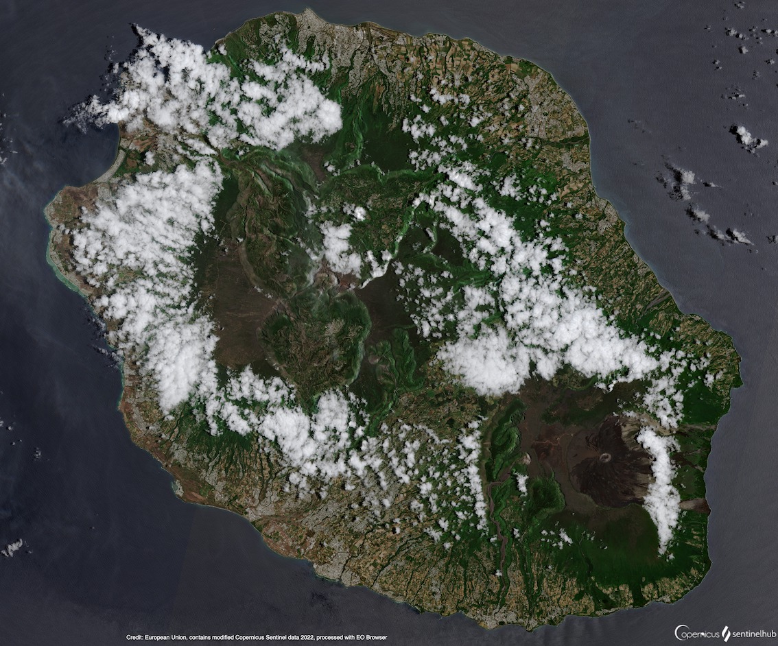
It is a decent-sized island (some 50 by 70 km), 600 km out in the Indian Ocean. The nearest larger landmass (itself an island but rifted from Africa) is Madagascar. Madagascar was first colonized, amazingly, from southeast Asia during the Polynesian expansion. La Réunion must have been discovered at that time. When Europeans came calling in the early 16th century it was unoccupied, both the island itself and the neighbouring island of Rodriguez. It became French, and slavery gave it a diverse population. Nowadays almost 1 million people live on La Réunion. The island is mountainous: the coastal areas are densely populated but the inner area can be inaccessible. Like nearby Mauritius, it is known for the dodo. But it is not the same dodo: on La Reunion, the name ‘dodo’ refers to the local beer – which is alive and well. And Bourbon coffee, one of the two varieties of the better quality coffee (Arabica), was first cultivated here, at a time when the island was known as Ile Bourbon.
If you look for tropical white-sand beaches, La Reunion should be touristed with care. There are such beaches here, but some are black, not white. And in sunshine, black sand can get extremely hot. A UK person tanning on the beach will quickly go red on both sides.
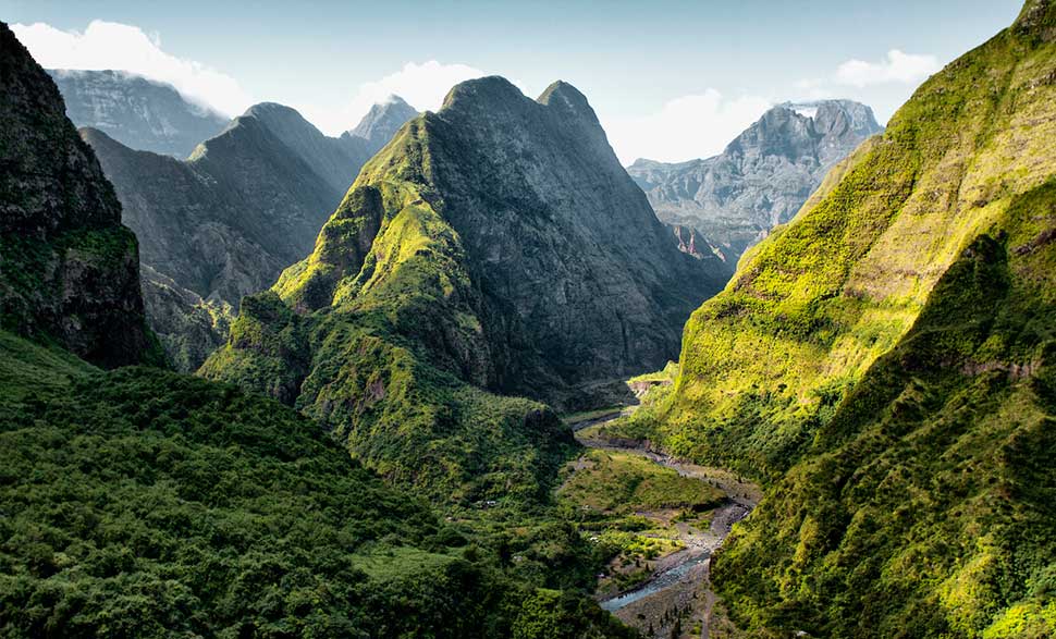
The island is dominated by a 3-km tall volcano, Piton de Neiges (‘peak of snow’), near the centre of the island. It is old. The sides are steep, showing collapses on all sides. The collapses have left three steep valleys, called cirques, Salazie, Cilaos, and Mafate. If you want, you can hike all three on a 60-km long trail. Pico de Neiges is inactive.
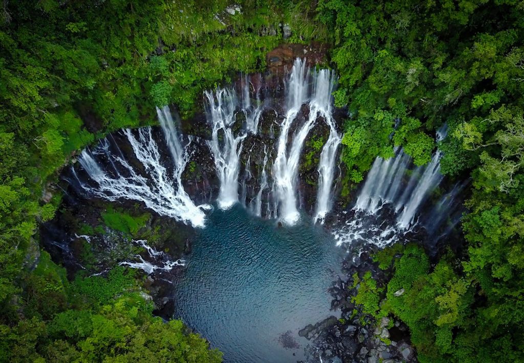
Langevin waterfall, Réunion
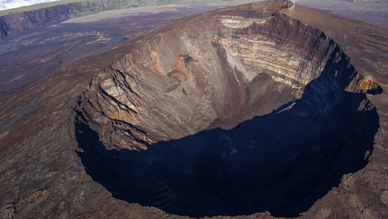
On the southwest of the island is a smaller volcano, the 2.6-km tall Piton de la Fournaise. This is a highly active volcano, frequently erupting. Since the first records in 1640, there have been 173 documented eruptions. In 2021 there were 2; the last one continued into 2022 before it ended in the middle of January. The style, befitting the tropical location, is Hawaiian with fountains and effusive lava which produce basalt. Sometimes the flows reach the ocean but normally they stay close to the summit. Piton de la Fournaise has two summit craters. The older is called Bory, and the younger Dolomieu. Dolomieu, where most current activity occurs, has partly cut through Bory.
Volcanoes that erupt often tend to do little damage. The reason is that they keep impacting the same area, and people get the message and don’t live there. But the eruptions are not entirely harmless. A famous church on La Reunion is called Our Lady of the Lava (Notre Dame des Laves). In April 1977, lava entered the town and destroyed houses and the police station. It also entered the front of the church but here it found its match. It stopped, and the lava instead now flowed around the church on both sides.

The 2020 eruption
Collapse
Like its older neighbour, Piton de la Fournaise shows evidence of frequent collapses. But its collapses are not like the usual flank collapses. They are the inverse, which leave the flank standing but remove everything else. including the summit. The steep walls of these collapses, with a deep gap where the volcano used to be, can be seen all over La Reunion, including behind Piton des Neiges. The map below (from Gillot et al 1994, Earth and Planetary Science Letters) shows the scars; the numbers indicates dates of the rocks. Around Piton de la Fournaise, the Caldera des Remparts is the oldest, the Caldera des Sables younger, and the Enclos Fouque is the youngest. The rocks dates of course only given an indication of when the collapse occurred. The Caldera de Remparts is dated to 250,000 years ago, and the Caldera des Sables to 35,000 years.

The Enclos Fouque is carbon-dated to 4700 BP. The current peak of Piton de la Fournaise, 2600 meters high, has grown since that time. That is a growth rate of roughly 50 cm per year! Looking at the volume of the mountain inside the Fouque, it is possible to derive the average eruption rate. This comes out as 0.03 km3 per year. The current eruption rate is a bit lower, and is measured at 0.01 km3 per year. Either the eruption rate has decreased somewhat over the past 5000 years, or not all the magma that builds the mountain erupts at the surface. Either could be true.

The nested U-shaped collapse features show a long history of severe instability, which seems to have migrated to the southeast. The younger collapse features are smaller, and they are closer in time. The edifice has become more unstable over time, and the collapses came after less growth.
Enclos Fouque is unlikely to be the final collapse. There are open fractures running through the summit area, and these indicate some slumping is already occurring. But the next collapse may still be 10,000 years or more away.
As already mentioned, Piton des Neiges is itself also located within a collapse feature. It runs along the northern end of the island and from the locations where the oldest lava is found, again forms a U-shaped arc which is open to the southeast. This feature may be very old. The oldest lava that is dated here has the same age as that of a collapsed block on the ocean floor. Both give a date of around 1.8 million years ago. The shield of Piton des Neiges and Piton de la Fournaise grew after this collapse had removed its predecessor.
The flank collapses of Piton des Neiges that created the three famous cirques came later, and were different from the major events that caused the U-shaped calderas. They were ‘normal’ flank collapses which is an occupational hazard for old and steep volcanoes. Perhaps he most surprising aspect of Piton des Neiges is that is survived to reach this stage. Being a volcano on La Reunion seems a struggle for survival, with the island always ready to pull the rug fromn underneath you.
The collapses show that there have been many previous volcanoes on La Reunion. What can we say about the size of the pre-existing volcanoes? It appears that the current Piton de la Fournaise may be the midget. It measures around 8 km form one size to the other.The collapse features show the size of those that came before. This was a land of giants. Each of the collapse features is around twice as large as the next younger one. The volcano inside the Caldera des Sables was 15 km across and the one inside the Caldera des Remparts 30 km. And if we look at the oldest caldera of 1.8 million years ago, that shield volcano was 60 km across. Estimations have been made for the volumes of these volcanoes, assuming that they scale roughly as this diameter ratio to the power 3, or a factor of 8. This assumption can be questioned. It would make the ancient shield 8 times as tall as Piton de la Fournaise, or some 15 km. That seems excessive. But let’s ignore this pesky detail. The elapsed times between the collapses (which occurred 5,000, 35,000, 250,000, 1,800,000 years ago) also scale roughly by this factor of 8. This suggests that each mountain grew at a similar rate – but that their life expectancy was rapidly decreasing. And each of these volcanoes terminated in a full collapse.
La Reunion has therefore had at least five volcanoes. The current Piton des Neiges was the second, and located near the first. Piton de la Fornaise is number 5, and based on the collapse features, number 4 was near the same location. There is evidence that the eruption rate may have decreased over time, but the magma pathway has largely stayed the same.
In fact, the reality may be a bit more complex. Gravimetry has indicated a volcanic centre 5 km west of Piton de lat Fornaise, and this was likely volcano number 4. It is called, with the usual scientific creativity, proto-Fournaise. Seismic reflection also suggests a volcanic location north of Piton de la Fournaise, closer to Piton des Neiges. Was this volcano number 3? Or 1? The age is suggested to be 3 million years which is more reminiscent of number 1, the original inhabitant of La Reunion, now gone the way of the Dodo. Why did the main activity move from the centre towards the southeastern area? In an earlier epoch, there had been a rift running this direction which was active in producing lava flows, perhaps a bit like Cumbre Vieja on La Palma. (This comparison comes with a warning. Volcanoes may be similar, they are never identical.) We know this from ages of submarine lava along the slopes, with composition of the lavas of Piton des Neiges. And it appears that four separate volcanoes have existed at the location of Piton de Neiges (imaginatively called PN1, PN2, PN3, PN4), in addition to the two at Piton de la Fournaise (PF1 and PF2) and the primordial one. The deeper you dig, the more complex things become.
It appears that the centre of activity has always been near the centre of the island. There is a line of weakness running northwest to southeast which governs the volcanoes and perhaps even the two craters of Piton de la Fournaise. But activity is not migrating along this line. Piton de la Fournaise may be shifting a bit this way, but the big boss, Piton des Neiges is not. It was active as recent as 20,000 years ago, and may come to life again to take charge of La Reunion. And its predecessor was not far from its location: Piton de Neiges lives in an ancestral home.
Devolution
The oldest lavas known from Piton de la Fournaise are just over half a million years old. To not rewrite history, this was not from the current version of the mountain but from one of its precursors. The lava composition changed about 400,000 years ago and became similar to the mafic lavas from Piton des Neiges of that time. At this time the place changed from a rift to a separate shield volcano. This volcano collapsed between 250,000 and 300,000 years ago, leaving the debris on the sea floor. Rebuilding started 150,000 years ago. We know little about this new edifice as too little remained after its collapse between 45,000 and 60,000 years ago. This lead to a new phase of reconstruction: this one lasted a bit better, and still forms the slopes of the current mountain. But again there was a manufacturing error (or engineering design failure), and the central part gave way in the fairly recent collapse of Enclos Fouque but the slopes survived. The mountain regrew its top but lava flows have not reached the old slopes. Piton de la Fournaise is still a work in progress. And it may forever be, in an unwinnable war against gravity.
Banana peel volcanoes
Why these collapses? Hawai’i has also shown devastating collapses over time, but there only the flank of the volcano would go. At La Reunion, the entire volcano slid into the ocean, not once but time and again. What makes La Reunion so unstable for volcano building? Something underneath must be rather slippery. It is worth noting that only 3% of the island is above sea level. 97% of the volume lies below the sea, and this is where the problem must be. The idea is that the ocean floor is covered in deep sediment, and the first volcano grew up on top of this sediment. And sediment is slippery – put too much weight on it and a bit of imbalance can cause it to slip, sending the poor volcano sliding all the way into the deep, and leaving only a wailing wall behind. The bottom of the volcanic pile is at a depth of 4400 meters, the depth of the surrounding ocean. Assuming that the ocean floor here is 60 million years old (the age of this part of the Indian ocean), the sedimentary banana peel could be a few hundred meters deep. Once the first volcano had grown too tall, and perhaps a bit lopsided, the banana took it down.
But why the smaller and smaller collapses? Perhaps this is because only the first volcano was build on the ocean floor. The second one grew on the remains of the first. The slump had taken it down to below sea level, with a deep layer of rubble, covered with the black sand which on the coast would form the black beaches, ready for the English roast. When the lava started flowing again, it build on this foundation of sand. And that, as we know, is not wise. The shallower but still shaky foundation caused a quicker failure. And the story repeated – and repeated again. Deja deja vu. As the foundations became ever shallower, each volcano headed for a faster exit.
A bore hole drilled on La Reunion down to several kilometers deep has shown a discontinuity at a depth of 556 meters. This could correspond to the latest banana peel. For the factors of two mentioned above (the scaling of the collapses), one might expect other layers at 1 km, 2 km and 4 km. The 4-km depth would be the ocean floor. The bore hole does not quite show this. Instead, it finds a swarm of sills (assuming sills come in swarms: other options include batch, battery, block, bunch, clump, cluster, clutch, constellation, group, huddle, knot, lot, muster, package, parcel, set, suite, or many others. English has a way with collective nouns. But the language overlooked sills) at 1100 meters, and a solidified magma chamber at 2500 to 3000 meters. It is possible that these intrusions also made use of planes of weaknesses, and formed on (and obliterated) the original layers of buried debris.
The model remains speculative. It is possible that many other, smaller collapses have happened for which the evidence was wiped out by the large collapses. The original sea floor is likely a weakness, and this may be a common feature of deep-sea volcanoes. It is seen in Hawai’i, where some of the deep earthquakes correspond to this depth – including possibly the Pahala swarm. Whether the model for the other foundational problems is correct remains to be seen. Maybe it is just the island every now and then pulling out the rug.
Origin
We can extrapolate the sequence backward, to find out when La Reunion first began to form. This uses the total volume of the island, and it gives an age between 5 and 10 million years – the lower age applies if the volcanic activity started out more vigorous than it was at later times. That is about the same time that volcanic activity on Mauritius, 150 km away, began to taper off. The two islands both lie on the Mascarene plateau, the local underwater ridge. They clearly are using the same source of deep magma.
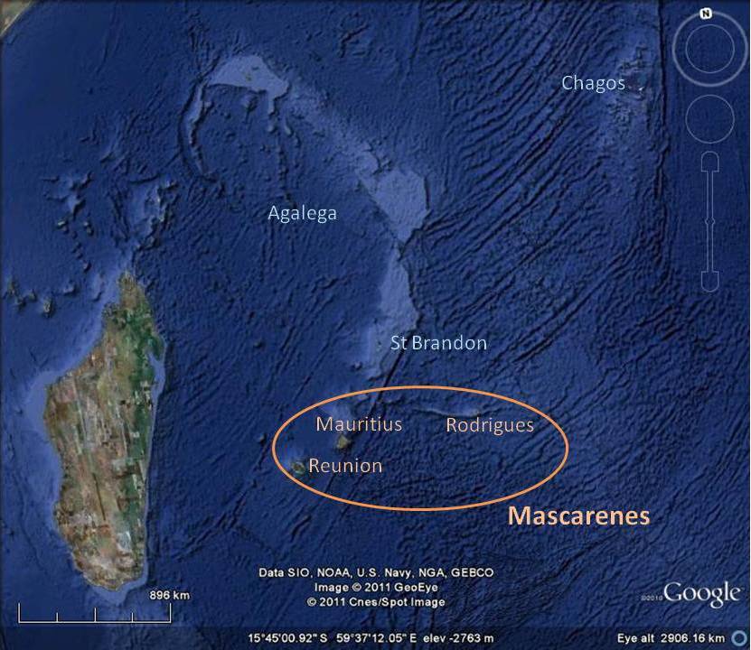
It is all quite reminiscent of Hawai’i. And just like Hawai’i, La Reunion is tracing a hot spot located below the crust. This too is an area where the oceanic crust is moving over a hot spot. The heat pushed up the oceanic crust and the movement of the crust build the Mascarene ridge. On top of this ridge, eruptions build up the islands, one after the other. Rodriguez is a bit to the side, and is the outlier. La Reunion is the latest of the islands. Mauritius preceded it. There are other ones further north-northeast but they have subsided underneath the sea, a fate that eventually Mauritius and La Reunion will also share.
The hot spot track runs roughly north-northeast to south-southwest. This is very different from the general orientation of La Reunion which is northwest to southeast. It shows that the change in location of the volcanic activity was not due to movement of the crust, but to structural failure of the island. It is build on sand.
Do hot spots rule the world?
How important are hot spots? Do they dominate volcanic activity, or are they a minor deviation? How much magma is really produced on Earth?
Eruptions vary from year to year, but magma production underground is much more stable. Much of it will never reach the surface: in oceanic crust some 20% erupts, in continental crust about 10%. (These are typical numbers – local areas may differ.) But magma production does vary from epoch to epoch. When plate tectonics is at its peak and continents break up, the rate is higher. When a supercontinent rules the roost, magma production is as subdued as the rest of the world, although plates never really stop moving. If I take an average over the past 180 million years (easily done..), the numbers are as follows:
- Magma production 30 km3/year
- Oceanic ridges 75%
- Oceanic intraplate islands 5%
- Subduction zones 20% (10% oceanic, 10% continental)
- Flood basalts less than 5%
- Intracontinental less than 1%
(And yes, I know this will add up to more than 100%. Apparently to geologists that is not considered a problem.) It shows that magma on Earth is mostly produced where we don’t see it. It is in the mid-ocean spreading ridges, typically 2 km below the sea. Take the sea away, and our view of volcanoes would change dramatically. Only 10% is on the continents, largely at subduction zones. Islands such as La Reunion, away from spreading ridges, account for 5% of the Earth’s volcanic activity. Interesting, the most extreme eruptions, the flood basalts account for less than that. That is averaged over time: when active, the flood basalts rule the world, but most of the time they are nowhere to be seen. Islands such as La Reunion form a late activity of a hot spot that once ma have formed a flood basalt. But the magma production of the hot spot after the flood basalt exceeds that of the flood basalt itself. Slow but steady wins the race. Not war, but patience is the winning strategy. It is what gives us paradise.
Paradise can be precarious (Morne Brabant, Mauritius)
Albert, February 2022
It is hard to write while war has come back to the streets of Europe. Volcanoes can be destructive, but they are never vicious, in the way that we ourselves can be. I want to end with a bit more humanity. One of my lasting memories of Russia is the singing. Here is a popular Russian folk song, “This evening”, in a recording from a time before before the nation went mad. It is about a soldier feeling the easterly wind and knowing that war is coming.
I saw in my dreams,
That my horse (black as a crow)
Was like crazy
Under my saddle.
Oh, an evil wind has came
From the east
and disrupted the black cap
on my head.
But my captain was clever
He understood and explained my dream
“Oh, you will lose” – He said
You will lose your head”
Oh, this evening, this evening,
I was sleeping so briefly,
I was sleeping so briefly,
Oh, and I saw in my dreams…
And here is a Ukrainian folk song: “The thorn bush blooms”
The thorn bush blooms
But it is shedding now its flowers
Those who have not yet been in love
Know not what sorrow is.
But I, a young girl,
Now know what sorrow is,
I have not yet slept this evening,
Have slept not throughout the night
I have taken my chair,
and sit beside the window .
My eyes have not yet closed,
As the sun begins to rise.
Even if I sleep, I don’t dream
I will not be sleeping,
My darling has left me,
To look for someone else.
Let him go, let him go
Let him never again return,
May in his young life,
Fortune shine on him.
But I, a young girl,
will not be sleeping.
I will be looking out for him,
Day and night, I am waiting.


Superb article, Albert.
That the banana peel itself went through an evolutionary process of it’s own, while still maintaining/increasing a low-stiction quality is amazing to me.
An entire volcano sliding into the sea!
That would have been something to see.
Or, maybe there was nothing we could “see” on human terms? Maybe the volcano slid into the ocean over the course of millenia instead of in a single catastrophic event?
Very sophisticated piece altogether. including the songs.
Not having much time I’ll get back to it tomorrow. Just one thing: You were asking “why smaller and smaller?”
Isn’t that the case everywhere? Isn’t Las Cañadas IV smaller than III, even smaller than II and a lot smaller than I?
Isn’t Wizard smaller than Crater Lake and Taal a lot smaller than the caldera lake?
If that is the rule (and if nobody protests) would it speak a certain language concerning those rings i.e. at Pilanesberg?
Thank you for the Sunday work and a nice Sunday evening!
I think this could be a case of what remains.
If the next caldera is bigger than the one that preceded it, what remains of the old one in that case?
As long as they keep getting smaller, we can still see the reamins of the old ones, too.
Very interesting article…..
Very sad situation in the world.
i wonder if it isn’t time to let women rule.
It is certainly worth considering. Women leaders have done pretty well in the covid era. (Not that there was ever any reason to assume they would be worse than male leaders!) And the UK had a woman leader during the final stage of the cold war. I just hope for leaders with less bluster and more heart.
Less gender related I think, more we need leaders who understand the way the world works today. Most leaders seem to be on the older side, that was fine for a long time but the world moves too fast for the wisdom of age to apply now.
Superb article and discussion, I always love learning more from Réunion from the internet (and it’s my home place!)
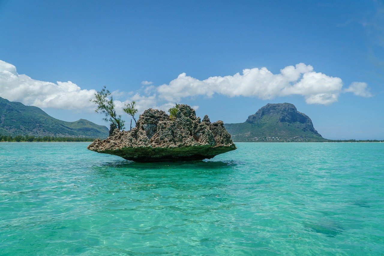
2 minors corrections though: the 3rd photos is not Cirque de Mafate but much more likely the Langevin waterfall, a very beautiful site but whose scale cannot match Mafate’s epic was. And the last photo is in Mauritius (Morne Brabant)
Thank you for the corrections! I have updated the captions. Sometimes images are published with incorrect locations and having local knowledge helps to catch these things!
Only thing wrong with your postulation is that it takes 10 years to gain 10 years experience, and with experience comes wisdom. Wisdom does not reside in the youth, only the passion and fire of life. Wisdom comes once the passion and fire have forged wisdom through the passage of time.
Experience can also cause inflexibility. Not all become wise with age.
A 30 year old, even sometimes a 25 year old, can have that 10 years experience. There is nothing to say that you have to be over 50 (what most people are talking about when they say ‘experienced’) to get how the world works and have a say in the bigger picture.
I am one of those over-50’s.. In my experience(!) age gives patience and that is often a better way to achieve change than instant revolution. It also gives a far too rosy picture of the past and a tendency to defend the status quo or even the past, against better judgement. And it gives a sense of realism which is sometimes needed. For instance, we have to go carbon-neutral but that cannot be done without a lot of realism. It needs both the dynamism of the young and the knowledge of the old to make it happen.
I do recognze that the current world war was started by a 70-year old who should have known better but wants to recreate the past.
Youngster, I am a Navy veteran, saw even longer service than Geolurking, used the 10 years as an example. Generals love 18 year olds, because they have very little experience and believe they are immortal. That’s why they go over the top so readily. Give the same order to a grizzled Sergeant Major and you are sure to get a pithy reply. Experience gives you the ability to listen and learn from those who have done it before and learn the lessons. Wisdom gives you the ability to choose the correct path.
If experience and wisdom were infallible the world would be in a better state. I can only express disappointment with how the rebellious and adventurous generation of the 1960’s has turned out
The point I am making is that the pace of our world today is moving forward so fast that we dont have time to wait and ‘experience’ it before things change again. I am not saying that experience isnt important but we cant rely on it anymore.
It does sometimes appear that with age comes the expectation of unconditional respect, perhaps part of the upbringing. Younger people nowdays though give no unconditional respect, it has to be earned. That is not necessarily a good thing but it is also not a negative trait, nor one that is completely unjustified if you look at our situation and how it appears to originate.
While we see the world through the eyes of patriotic fervour, and judge accordingly, a multiplicity of views is denied, but perhaps from an older perspective the seeds of today can be seen to have been sown
https://www.dailymail.co.uk/debate/article-10581335/PETER-HITCHENS-saw-coming-Thats-wont-join-carnival-hypocrisy.html
While its true on a global scale that most of the magma production occurs in the mid ocean ridge system. But per square kilometer the MAR is not very productive or active across 60 000 kilometers of ridge and specialy the slow spreading ridges. Althrough eruptions on fast ridges can be large in scale
The real beast of global magma production per square kilometers is Hawaii .. that is like an unstoppable tap of liquid rock, Hawaiis yearly magma outflow is equal to 10 s or even 100 s of normal stratovolcanoes in yearly magma production! Hawaiian Hotspot have produced around 20 times more lava than the whole EPR during the last 2 million years. Another beast of magma production is Iceland that have produced around 520 km3 in the last 9000 years
Image shows the yearly erupted output by the Mid ocean ridges
( black ) compared To the Hawaiian yearly erupted volume ( grey )
So Hawaii is very prolific for soure
what do sepr and nepr stand for ?
North-East. South-East Pacific Ridge I guess
Superb article and discussion, I always love learning more from Réunion from the internet (and it’s my home place!)
2 minors corrections though: the 3rd photos is not Cirque de Mafate but much more likely the Langevin waterfall, a very beautiful site but whose scale cannot match Mafate’s epic was. And the last photo is in Mauritius (Morne Brabant
(Sorry my previous comment was not intended to be a follow up of another one)
Well writ, as always.
I too have been wading through the morass of crap news. I’m a product of 1980 to 2000 USN service and my knowledge of what’s going on is hopelessly out of date and very biased. Despite that, it seems that everything 40 years ago has come back to haunt us.
So, with that being said, this is the song that keeps popping up in my head. (This is the English version. The German version is a bit more specific to the story she tells.) I think it fits everybody’s worries.
Note: Don’t ask me for my opinion. It is badly skewed in directions that may not be nice and is complete speculation. Not to mention that my base knowledge is out of date. I was in the Med on deployment when Baku left the Black Sea and watched it go putzing by under escort. It eventually became INS Vikramaditya.
Note: “Being Nice” is a cardinal rule on VolcanoCafe. If I can quell my tendency to be a full-on arse… I’m sure we all can. (I’m not a very nice person once you get to know me 😀 )
If you have come this far and not read Albert’s stellar article at the very beginning, shame on you. It taught me quite a bit about a volcanic system I have been struggling to understand, you need to get your butt up there and read it.
I already put this further up the page, so please delete if it is persistently off topic, but it is a view I was looking for, and found, and it makes more sense that there is more than one right or wrong in the unfolding tragedy
https://www.dailymail.co.uk/debate/article-10581335/PETER-HITCHENS-saw-coming-Thats-wont-join-carnival-hypocrisy.html
This is not a newspaper I would normally share a link from, but in this case I make an exception. And hope that stupidity is constrained by caution and that the usual villains keep their greedy fingers out the spoils of war
Geolurking, this is from 2015, and I think it is worth listening to, like also back then:
Why is Ukraine the West’s Fault? Featuring John Mearsheimer
https://www.youtube.com/watch?v=JrMiSQAGOS4
He says pretty much at the beginning that he is on a lonely post and compares it with Kuba.
Yeah, I grew up in the cold war era. Visited East Berlin in 1988. It wasn’t bad but everyone had terrible, uncomfortable-looking shoes.
Czech people visiting the US at a warehouse party in 1991 or so handing out bits of the Berlin Wall as party favors. I still have one.
This is so senseless. Why are we doing this?
Indiana Jones, Fictional Archeologist; “Power and Glory“
Why are we doing this? The Munro Doctrine. Gas and oil. Dollar hegemony. Can’t go after Iran until Putin is neutralised because he has been guaranteeing the safety of both Iran and Israel from each other for more than a decade. Ukraine is loaded and primed, has a fanatical leader who can inspire the world to load his followers with anti tank missiles, sympathy, safe refuge, and mercenaries. And if the placing of nukes in Cuba was so wrong then surely surrounding Russia is just as unacceptable. Russia is not the USSR. Russia offered to join NATO. Peace ought to be the aim but I fear there are leaders who expect to garner the spoils of war at the expense of the rest of us. MAD!
An unpopular view, I realise, and I’m only here for the volcanoes…..
Second WW- They are said to have stopped fighting on both sides whenever they heard it:
https://www.youtube.com/watch?v=2jlT_Jb2efU
Outside the barracks
By the corner light
I always stand and wait for you at night
We will create a world for two
I’ll wait for you, the whole night through
For you, lili Marleen
For you, lili Marleen
Lili Marleen (Lied eines Wachtposten)
Lale Andersen
Vor der Kaserne, vor dem großen Tor
Stand eine Laterne
Und steht sie noch davor
So wollen wir uns da wiedersehen
Bei der Laterne wollen wir stehen
Wie einst Lili Marleen
(Wie einst) Wie einst Lili Marleen
(Wie einst Lili Marleen)
Unsre beiden Schatten sahen wie einer aus
Dass wir so lieb uns hatten
Das sah man gleich daraus
Und alle Leute sollen es sehen
Wenn wir bei der Laterne stehen
Wie einst Lili Marleen
(Wie einst) Wie einst Lili Marleen
(Wie einst Lili Marleen)
Schon rief der Posten: Sie bliesen Zapfenstreich
Es kann drei Tage kosten
Kam’rad, ich komm ja gleich
Da sagten wir „auf Wiedersehen
Wie gerne würd’ ich mit dir gehen“
Mit dir, Lili Marleen
(Mit dir) Mit dir, Lili Marleen
(Mit dir, Lili Marleen)
Deine Schritte kennt sie
Deinen schönen Gang
Aller Abend brennt sie
Doch mich vergaß sie lang
Und sollte mir ein Leids geschehen
Wer wird bei der Laterne stehen
Mit dir, Lili Marleen?
(Mit dir) Mit dir, Lili Marleen?
(Mit dir, Lili Marleen?)
Aus dem stillen Raume
Aus der Erde Grund
Hebt mich wie im Traume dein verliebter Mund
Wenn sich die späten Nebel drehen
Werd’ ich bei der Laterne stehen
Wie einst Lili Marleen
Wie einst Lili Marleen
(Wenn sich die späten Nebel drehen
Werd’ ich bei der Laterne stehen)
Wie einst Lili Marleen
Wie einst Lili Marleen
(Wie einst Marleen)
(Wie einst Marleen)
It’s an iconic song and performance. However, as always, Dietrich walks the razor’s edge between poignancy and camp. That dichotomy is the source of her enduring allure, IMO.
Wow. I ran the German lyrics through Google Translate, and–although I’m sure that some meanings are missing in the translation–what came through in English is a beautiful and hauntingly touching text. Denaliwatch, thank you for sharing that with us!
Here’s some more on the morphology of Piton and its submarine mountains for who’s interested:
“Geology and morphostructure of Piton de la Fournaise”
https://www.researchgate.net/figure/Cone-Elianne-on-the-southern-submarine-flank-of-Piton-de-la-Fournaise-see-Fig-42-for_fig2_278382669
Free download
It wasn’t clear to me so far, that Piton looks like half an onion falling from a shelf.
Albert’s pieces are often like spotlights.
The French are doing good research in the area though.
The worlds 4 th most powerful oceanic hotspot after Hawaii, Iceland and Galapagos
Reuinion is very active, althrough it mostly does small eruptions, dwarfed by the Galapagos eruptions as well as the Hawaiian ones.
The steep slopes of the Piton de la Fournasie cone is result of numerous short lived eruptions, and have resulted in a cone quite similar to the Galapagos shields althrough far smaller.
Still Piton De La Fournasie is more productive than almost any other continetal land volcano .. with only Etna and Nyiramuragira being perhaps more productive on land
Year 2007 was a fun eruption on Piton When the shallow magma chamber in the summit drained into the flank .. and it burst out on the South side
Piton might be capable of more large scale activity than it shows now, presently it has only got very limited storage, probably only 0.2 km3 or so as was drained out in 2007. At 0.03 km3 annual rate the 2007 drain was recovered in 2014 and that is when activity began to pick up again. I guess though it might be a good while before there is another eccentric eruption like in 2007. 2007 (and also 2005) are considered to be eccentric flank eruptions, the vent was inside the Enclos Forque because the dike followed the cliffs on the side and erupted at the bottom.
Last eruption similar to 2007 was probably in 1776 forming Piton Takamaka on the south flank.
There are also eruptions that seem to derive from deeper storage, tracing the long axis of the island, soemtimes these erupt way beyond the normal edifice and far northwest. These are more intense, and see powerful fountaining, the best examples being in 2019 and 2020 on the east flank. There was also part of the 1998 eruption of this typoe based on chemistry, though it was only small in scale. Some recent prehistoric eruptions on the Plain des Sables are of this type too, at Piton Chisny there is a massive fountain cone surrounding a perched lava lake.
The eruptions of Plain des Sables and the west flank, are most likely eccentric indeed. Piton du Chisny and other vents in that area erupt more alkaline compositions and produce subplinian style eruptions with lava fountains several hundred meters high. They are also more voluminous than normal fissure eruptions.
2007 was so intense and voluminous because the magma chamber collapsed sending pressure pulses towards the fissure. Similar to how it was with the 2018 eruption of Kilauea.
Probably didnt use the right word when I said eccentric, the eruptions in 2007 and 2005 were not independant of the summit storage but they were of the same mechanism as what drove the eruptions outside the Enclos in 1977 and 1986. 2007 was expected to escape but went paroxysmal instead, 2005 actually technically did erupt outside of the collapse structure fault, but it erupted inside an erosion scarp that led it back into the caldera. The dike in the 2005 eruption followed the cliffs, and erupted in the lowest spot it had access to.
Piton du Chisny and Cratere Commerson would have been quite a sight to see, much more of the size of eruptions in Hawaii or Iceland than most of the recent eruptions on Reunion have been. There was a similar sized eruption to these that occurred all the way down near the northeast foot of Piton des Nieges some point within the last 5000 years, and another on the crest of the northwest rift that sent lava flowing 20 km into the ocean at St Pierre
Flank collapses have less to do with mantle plumes than with location, underground (base) and height. Etna is a little further inland and still can slide into the street of Messina.
El Teide has lots of debris underneath in the ocean.
I think that half-onion has to do with the location on the border of the island and, as Albert describes, the fact that only a small part of the volcano is sitting subareal with the rest restlessly settled on slippery sediment. There are submarine volcanoes around Piton. One has a height of 700 m. That’s Elianne, maybe the Loihi of Réunion.
The plume though reminds me more of the Galápagos situation (as you said), with the spreading rift being nearby, but also the Icelandic/Jan Mayen situation with volcanism in places further away, here nere Myotte i.e.
I can think of at least two sector collapses that are not on islands–Meru and Reventador, the latter is not on a plume.
Of course, there are outliers such as St. Helens, Bezymianny. Maybe Bandai, I’ll have to revisit that one.
Thank you for another splendid article, Albert!
Off the topic of La Réunion, but still relevant to VC. I just stumbled onto this nice visualization of earthquakes:
https://twitter.com/LazarusAlon/status/1480258349014953986?s=20&t=4SYo6Q7OmrcefD05UgDOeQ
Thanks! That’s fascinating.
Interesting read: “The Russian Invasion touches Outer Space”
https://www.theatlantic.com/science/archive/2022/02/russia-ukraine-international-space-station/622939/
Second interesting read (the long interview itsself is only for subscrivers I think):
“On Ukraine and America’s interest:
Obama declares Ukraine to be not a core American interest and that he is reluctant to intervene in the country, because Russia will always be able to maintain escalatory dominance there. “The fact is that Ukraine, which is a non-NATO country, is going to be vulnerable to military domination by Russia no matter what we do.”—President Obama”
https://www.theatlantic.com/press-releases/archive/2016/03/the-obama-doctrine-the-atlantics-exclusive-report-on-presidents-hardest-foreign-policy-decisions/473151/
The war in Ukraine seems to be the follow-up of EU-idiocy. The follow-up includes that they can be attacked in the north-east (Suwalki-Gap)
https://en.wikipedia.org/wiki/Lithuania%E2%80%93Poland_border
This reminds me strongly of the fairy-tale: “The Fisher and his Wife” or, in political terms, Imperial Overstretch.
When we were young my father sang with us: “Zogen einst fünf wilde Schwäne” which is from East- or West-Prussia, today Lithuania and Poland. He missed this beautiful home country quite often. It is a little bit depicted in “The Hunt for Red Octobre” and the end in that Maine River. Maine has partly similar landscape and climate being rocky though whereas the Baltic Sea is sandy beaches and sandy strips of land.
Music on guitar:
https://www.youtube.com/watch?v=X09lV9yzsQ0
Insufficient translation, not perfectly fitting the music:
Once five wild swans passed
swans, shining white and beautiful
Once five wild swans passed
swans, shining white and beautiful
“Sing, sing, what happened?”
None was seen again.
“Sing, sing, what happened?”
None was seen again.
Once five young birch trees grew
green and fresh on rivers bank
Once five young birch trees grew
green and fresh on rivers bank
“Sing, sing, what happened?”
None stood in blossoms.
“Sing, sing, what happened?”
None stood in blossoms.
Once five young men passed
proud and brave into battle
Once five young men passed
proud and brave into battle
“Sing, sing, what happened?”
None returned home.
“Sing, sing, what happened?”
None returned home.
Once five young girls grew
slim and pretty at Memel´s bank
Once five young girls grew
slim and pretty at Memel´s bank
“Sing, sing, what happened?”
None bound the bridal wreath.
“Sing, sing, what happened?”
None bound the bridal wreath.
https://lyricstranslate.com
I think it is the basic song which led to Pete Seeger’s “Where have all the flowers gone”. also sung by Marlene and later, probably during the Vietnam War, discovered by Joan Baez.
East-Prussia around Memel, today Lithuania around Klaipede. Next to it, in the west is Königsberg, today Kaliningrad, with one of the largest Russian bases (also naval).
The two songs, esp. the Russian one, reminded me of the old song my father used to sing with us. They are all similarly beautiful.
After Pete Seeger’s initial release, I believe “Where have all the Flowers Gone” was first covered and further popularized by the Kingston Trio, then Peter, Paul and Mary.
After that, it became a staple song for every folk singer at the time, including the always lovely Joan Baez (whom I met several times).
Being a child of the 60’s, I probably heard it a 100 times going to all the free concerts in Golden Gate Park (San Francisco).
A special song then…and maybe even more so now 60 years after it was written.
Héctor. olá, buenas tardes,
I belive you might find this comparison between the rift zones of Réunion to Hawai’i and also Etna interesting, therefore putting it here:
Rift zones and magma plumbing system of Piton de la
Fournaise volcano: How do they differ from Hawaii and
Etna?
Laurent Michon, Valérie Ferrazzini, Andrea Di Muro, Nicolas Villeneuve,
Vincent Famin
https://hal.univ-reunion.fr/hal-01241283/file/2015-JVGR-Michon-HAL.pdf
Thanks Denaliwatch. I remember that article, it was influential in my roots of the hawaiian islands post. It talks about the deep feeder system of Pitón de la Fournaise and how it seems to come from under Piton des Neiges which I found interesting.
Yes: the centre is under Piton des Neiges and it has always been in that general location. Piton de la Fournaise is an off-shoot.
Just made this map that shows the eruptions from Piton de la Fournaise that occurred outside of the Enclos Forque. Most recent eruption where there was actually a vent outside of the caldera was in 1998, but the eruption in November of 2005 occurred in part from a dike that did leave the enclosure, though the final vent erupted at the base of the cliff inside it after it followed the wall to a low spot.
Based on both confirmed observation and indirect dated flows, there have actually been 12 eruptions outisde of the Enclos Forque since 1700, on average about 25 years apart.
Something interesting about Piton de la Fournaise is how it makes intrusions. The intrusions start as sills, flat magma filled fractures with decimetric thicknesses, under the summit of the volcano, and from there they propagate radially in all directions although with a slight preference downslope towards the east. I had a map with intrusions of the last years in Google Earth although unfortunately I lost it. The sills make sort of a flower like structure under Enclos Fouque. Each intrusion a petal. These sills then curve towards the surface and erupt from radial and circumferential fissures. Rare intrusions than erupt outside Enclos like in 1998 are probably sills which curve into dikes and then continue a long distance as dikes.
This is very different from the way volcanoes like Kilauea or Krafla erupt, which instead use simple dikes. This way of making intrusions is more famous, however the way of Piton de la Fournaise is the probably more common. Cumbre Vieja, or the volcanoes of Galapago,s also have been observed with InSAR to make intrusions like this. All Martian and Venusian volcanoes have a pattern of fissure eruptions that resembles that of Piton de la Fournaise, so that they probably use sills that curve towards the surface to erupt. Making a flower-like complex of sills overlain by radiating and circumferential dikes.
This paper modelled one of Piton de la Fournaise’s intrusions quite accurately:
https://agupubs.onlinelibrary.wiley.com/doi/pdfdirect/10.1029/2018JB016856
Some captures from the paper:
This paper on the Sierra Negra 2018 eruption is also very nice:
https://agupubs.onlinelibrary.wiley.com/doi/full/10.1029/2021GL093038
Sierra Negra made a very complex sill intrusion in 2018 which separated into two branches extending northeast of the caldera and which curves into several dikes that erupted in various locations. It is similar to those of Piton de la Fournaise only much bigger. However Martian volcanoes can probably make sills more than a thousand kilometres long and several hundred kilometres across which greatly dwarf terrestial intrusions, in extent and possibly in thickness too. The Sierra Negra 2018 intrusion seen in InSAR :
I did notice that Piton does not have submarine rift zones, at least not well developed. It is really mostly radial though the axis of the deep system is elongated. The deep source eruptions are rare but not extremely uncommon, once every 200 years outside the Enclos and there are at least two suspected (1948, 2007) and one confirmed (1998) eruptions of which a source deeper than the one feeding the main summit complex. 1998 example though was not that years main vent of Piton Kapor but another much smaller vent on the other side of the volcano, which was called Piton Hudson. It might have since been buried under voluminous new flows in that area since 2015.
Given the last time a dike left the Enclos was in 2005 an eruption outside in the next decade is quite likely. The 107 year gap between 1870 and 1977 was quite an outlier and more typically gaps are around 15-20 years between extra-caldera eruptions.
https://www.frontiersin.org/articles/10.3389/feart.2018.00119/full#:~:text=10.3389%2Ffeart.2018.00119-,The%20Effect%20of%20Ocean%20Loading%20on%20the%20Growth%20of%20Basaltic,and%20Their%20Magmatic%20Plumbing%20System&text=Basaltic%20shield%20volcanoes%20most%20commonly,to%20form%20gigantic%20volcanic%20edifices.
This might interest you as far as I know. Basically, the probable reason why Piton de la Fournaise doesn’t have underwater rift zones is because of the ocean load on the dikes themselves, causing the dikes to go to the subaerial areas instead. Also somewhat similar, Santorini’s eruptions are somewhat affected by changing sea level, which if the sea levels are lower, eruptions are more frequent, but if sea levels are higher, the opposite happens.
Should add that I think the two eruptions on the east side of the volcano in 2019 and 2020 also probably originated at deep sources. Both were characterized by massive fountaining compared to typical eruptions, into the 100+ meter range. Eruption rates also peaked at the terminus of the eruption not the beginning. March 2019 eruption also involved the opening of another fissure vent next to the first which was described as having different composition indicating a different source.
The possible link with sea level is interesting. Could mean the majority of the outer flank cones were formed in the last glacial, while now the magma is more focussed to erupt at the summit.
https://www.google.com/amp/s/www.sciencenews.org/article/greece-santorini-volcano-eruption-sea-level/amp
Basically, what caused these more frequent eruptions to occur is due to the fact that the ocean load around Santorini, currently, is constructing the magmatic system. However, when sea levels are lower, the pressure is put off the magmatic system itself, causing more frequent eruptions. This rule doesn’t happen at every volcano like Santorini, but it is quite an interesting dynamic.
Just imagine that, during the ice age, the volcanoes at the high latitudes eruptedless frequently whereas isolated volcanic islands erupt more frequently and the opposite could be true for today and the future as glaciers melt and sea levels rise. Quite a balancing act of volcanism there.
Thanks.
Also this is a nice paper. They call it Trapdoor Fault and also decribe an enormous uplift in the preceding years:
https://www.nature.com/articles/s41467-021-21596-4
Héctor,
“However Martian volcanoes can probably make sills more than a thousand kilometres long and several hundred kilometres across which greatly dwarf terrestial intrusions”
If we think the water away, plus subtract the specific convection of Earth and the magnetic field of Earth we might get the same result here which might basically say that Earth was saved by convection, subduction and water (plus spreading ridges and some more) from being suffocated by plumes.
Exactly without plate tectonics, Earth woud boil over totaly .. unable to vent its internal heat slowly
That is not entirely clear. The Earth has a thin crust compared to Mars or Venus, and will cool more efficiently than those planets. This should keep the melt fraction down. A difference that on Earth the crust moves over any hot spot. That avoids extremes such as the Tharsis bulge on Mars
Without tectonics Earths crust woud get that thick too
Althrough Earth haves plenty of internal heat production because of its mass
Earth did have crust that thick up until the Proterozoic.
One place the crust isn’t moving much Albert, is Antarctica. Were a hotspot to develop there (maybe there is one at Balleny or Marie Byrd Land) it would be very insulated, and it’s already been in place for roughly 40 million years, and doesn’t look like budging any time soon. How long can one stay like that before the pent up strain gives way to a flood of volcanism?
Thought there was volcanism in Antarctica.
https://en.wikipedia.org/wiki/List_of_volcanoes_in_Antarctica
One location that could have potential for a LIP would be the Lake Baikal area, I think. It is in the middle of a plate so there is good insulation, volcanism is weak too, so likely a lot of magma exists in the asthenosphere under Lake Baikal.
There must be some pull from subduction in Japan and Kamchatka. This force could potentially drive plate breakup. At the same time the Gakkel Ridge is propagating from the Arctic acting like a wedge, focusing extension into Asia.
Thus if the Asia unzips there would probably be a surge of magma from the asthenosphere, producing flood basalt volcanism before the whole thing opens up and makes a new ocean.
Of course we won’t live to see this happen, and it may not even happen, but one can dream.
No Chad. The idea is, as far as I know, that Erth’s crust was thinned with the giant impact that also formed the moon. Peeled off, sort off. And, btw. Earth has the moon.
Much speaks for the giant impact early on, but it is, of course still a hypothesis.
Its been a long long time since then, althrough it added mass and added lots internal heat To Earths interior
But the crust woud have thickend since then
Tectonics keeps it thin and specialy the oceanic crust as its recycled and reborn
I think, more likely is that the irregular shape of the Earth or the LLSVPs in the Pacific and the antipode in Africa are more likely to be after effects of this if anything. We still don’t know where it impacted and likely never will because it was that long ago and all evidence has been erased.
Theres lots of theories, but it is supposed that the crust was thicker back up until around 1.5 billion years ago, maybe a bit later, really was up to the formation of Rodinia. Before that continental landmass was small and even supercontinents were probably smaller than single continents of today, Rodinia was the first properly big landmass.
Plate tectonics was not able to start until around 1 billion years after the Earth formed. I think probably at that time there was a Venus-like total breakup, but because our planet was cold and had a lot more water it survived this. Water also allowed the plates to continue moving where on Venus this was impossible. Venus is basically the Earth frozen in the Archean.
Could well have been meteorite impacts that helped shape plate tectonics then Chad, I imagine Venus has fewer impacts being closer to the Sun, and Mercury fewer still.
https://fb.watch/bxJTv9JE7U/
Kilauea earlier today. It is being very consistent, basically looks the same as it did in January, which is very good as it should still be like this in a bit over a month when I am there 🙂
I hope we can get a new volume measurement soon, the last was done over a month ago and the activity looks to have generally gotten stronger since then even if not totally continuous. Even HVO had noted a n increase in filing rate from this year vs last year despite the widening diameter of the caldera and shallowing slope angles. At rates that were seen up to that last measurement, around 400,000 m3/day, the last month has seen a bit over 15 million m3 of lava added, or 60 million total since September. There is a shallow but now noticeable inflationary measurement visible on the GPS too, there seems to finally be pressure building. Pu’u O’o is still deflating so seems there is no longer any connection to the ERZ at this time, whatever conduit has formed in Halemaumau is more open than the one in the ERZ it would seem.
The lava lake is experiencing a lot of outbreaks of lava across its surface. I got curious when I saw that Kilauea has inflated more than usual in the past 2 days, probably because the DI events have briefly stopped, then headed to the webcams. Looks like you will get to see Kilauea in its glory, like it was in the days of William Ellis and Titus Coan.
https://www.usgs.gov/media/webcams/f1cam-kilauea-summit-thermal-west-rim-summit-caldera-looking-east
I do hope it is not exactly like what Ellis saw though, being mere days after the whole thing drained out the side… If it drains out the side while I am there though 🙂
Actually I have never been able to find exactly how long before his visit the Keaiwa eruption occurred, but I expect it was very recent on his visit, probably less than a month.
Looking at things though this lake has still got some way to rise before it is likely to drain out. I am curious to what will happen when the basin fills in, it seems to be slowly shrinking and overflows are increasingly going in other directions, the actual vent with the pond is a small shield now.
Regarding Keaiwa, there are conflicting statements from Ellis, however I think the right date is July 1823, 5 months before Ellis visited Kilauea. Because this date is from the only known eyewitnesses of the eruption, a group of fishermen from Kealakomo. I have this annotated which was reported by the people of Kealakomo, the only description of the 1823 eruption:
“Pele had issued from a subterranean cavern, and overflowed the low land of Kealaala, and the southern part of Kapapala. The inundation was sudden and violent, burnt one canoe, and carried four more into the sea.”
Reports are that the lake he saw was something like 80 meters above the water table, or about 650 meters above sea level I guess. So the lake fell by over 300 meters in that eruption. Must have been something like 1 km3 of lava erupted in a day, something on the intensity of what Mauna Loa did in 1950 at the start of its eruption, those fishermen were lucky.
I wonder what it would have looked like. The lava was degassed but the rate was so high there was probably some significant fountaining anyway, Nyiragongo lava floods have reports of strong fountaining in the same conditions. Might look more like a massive curtain of dome fountains than what we usually think of though, not a lot of splashing more like a burst pipe, hydraulic pressure not gas pressure.
Actually just had a look at the deformation, all of the summit GPS are showing upward movement again, the deeper system is inflating as it was prior to the eruption start. This is in spite of there being no slowdown in activity.
There was that swarm of quakes at 10-15 km depth not that long ago, it looks like that magma has made it to the main magma chamber.
Will have to see, this might accelerate activity significantly in the near future, maybe the lake will suddenly fill by 200% in a few days and I will get to see it with tall fountains erupting and lava flooding onto the downdropped block. Unlikely, but not impossible, especially if there is a huge batch of magma on the way.
Will Grimsovtn just fucking erupt already?! Everything is in place so where is the VEI 5 basaltic Plinian eruption or lava flood? I don’t nuclear winter, I want volcanic winter with a side of superflares for the end of society
Hopefully, Grímsvötn won’t do an eruption big enough to end society (that would have to be a VEI 9+). Her largest recorded one to date is a VEI 6. OTH Laki is connected to Grímsvötn.
Would need to be quite the massive event to get that going, probably would already be a Laki #2 before a caldera collapse ignimbrite could get going. Same as in Hawaii the majority of volcanoes in Iceland probably are not capable of just randomly erupting on massive scale unless they go into a full scale rift, the magma is relatively gas poor and very fluid, needs some biblical eruption rate to explode. But of course both Kilauea and Grimsvotn have got these deposits, so sometimes these exceptions do happen… 🙂
Basically big rift sees magma drain, then caldera starts collapsing, ring dike forms, and the more it drains the bigger the eruption at the summit gets, there is some point that it just has to explode as th rate is too high.
https://www.volcanocafe.org/big-basalt-blasts-i-the-trigger/
This post by Hector, part of a 3-part series, might explain why such eruptions occurred. Basically, Kilauea in 2018 but add water to the summit.
Yes that is part of it, but you need low pressure to get the water in contact with the magma. High pressure magma will just erupt into the water, surtseyan eruptions and such or even just completely silently if it is a lava dome. Kilauea 1790 eruption was a caldera collapse, driven presumably by a major flank eruption out on the Puna Ridge. But there was also a ring dike, which erupted as massive fountaining at the south caldera ring fault, as well as a hydrothermal eruption that was what is most likely the catastrophic event the eruption is known for.
Grimsvotn is structurally very similar to Kilauea, central calderas with a long rift. Presumably such eruptions are caused by the same mechanism. Grimsvotn though is not nearly so open at a shallow level as Kilauea though, it has no open lava lake. On a more local scale it resembles a Galapagos volcano, erupting from overpressure. Kilauea maybe cant get to that point, it erupts too easily. Mauna Loa apparently can though, so it is more a Kilauea-specific thing.
I gotta ask, do you have your bunker prepared, with enough food, running water, electricity, and everything else in place. If not then you’ll be as knackered as the rest of us
I don’t mind, in fact It would be more fun to indulge in the shock and horror with the unprepared and condescending talk with the prepared while society crumbles to dust
The condescending prepared guys would die later and watch the others die. Not nice. Although … one of my neighbours …
I don’t like freezing. Even Tallis might freeze to death:
https://www.saundersrealestate.com/when-florida-was-a-giant-state-theoretically/
Aviation code is green; you’ll have to wait a bit longer.
Space junk, moon not Elon’s:
https://www.theatlantic.com/science/archive/2022/03/china-rocket-moon-collision/626552/
https://www.youtube.com/watch?v=sAJuJcGxkL0 Le Piton de la Fournaise, Feb 2022. Enjoy the lava streams.
https://www.youtube.com/watch?v=B3206zkxAG0
Video on the controversial Apolaki caldera.
Been thinkign about this, at first I was completely sceptical of its existance on Earth, volcanoes here just cant get that big. But after seeing how many, maybe most, flood basalt provinces are still structured the same as more normal shield volcanoes just way bigger, then having a caldera 150 km wide isnt so extreme. It must be on the upper limits for sure but it actually being a true caldera is not so unlikely. It isnt that deep less than 1 km on average, if it was formed in a single eruption that would be about 20,000 km3 of lava. Bigger than any eruption from a still visible terrestrial volcano, but not orders of magnitude out from what is seriously proposed for Toba.
I imagine that these sorts of corona structures on Earth probably see the inner non-rifting plug of the structure abound with abundant silicic volcanism, especially if it is continental. The volume would be minor compared to the basaltic eruptions but there could be entire satellitic supervolcanoes within the confines of the cone sheet, and many LIPs do show silicic rocks.
Am talking about this picture. Apolaki would not even be half as wide as the caldera that could have existed if this LIP collapsed. I dont think many of them ever do collapse enough to form a visible caldera, even an eruption of 1000 km3 of basalt would hardly make a dent on such a wide area, Kunene Kibaran magma chamber was maybe over 300,000 km2 in area, which would be a subsidence of only meters at most to serve an eruption that big, and that is a single eruption that is as big as the entire volume of lava erupted in Hawaii in the Holocene. I really doubt an eruption in the magnitude to drain out such a chamber has ever happened on the Earth since the oceans formed though…
http://www.largeigneousprovinces.org/08oct
I’m not sure they can ‘collapse’, all that would happen would be that the outpouring of lava would be central instead of along a ring fault or radial fissures. I don’t see this as a big magma chamber under the surface, rather a plume from deep up to a certain depth with snaking tentacles of lava tubes reaching above into various sills and chambers. Like an underground tree.
The plume as whole width wise pushes the whole area up hundreds of meters but is never near enough to the surface to outpour directly.
I think there is a difference between the bulge of a plume and a province like this. Not too far away from this area is a quite well known plume bulge that is under the Kenya rift, still active of course. Virunga is another, and actually is at the same place as Kunene Kibaran, it is the same rift opening. Hawaii also has a very large plume bulge, but while volcanism does occur along it the lavas are not tholeiitic plume basalts, so not connected to the islands directly.
Provinces like this probably do result from crustal magma chambers, Africa has got some really thick lithosphere, and in continents the base of the crust is not so hot, the upper mantle is solid too and basically the same. So there is something like 100 km of solid rock to support a magma chamber. That is probably also why the virunga volcanics are still alkaline despite the high rate of magma production, magma is generated too deep to form tholeiite basalt yet. That I suspect will change. Maybe in 5-10 million years there will be a mature hypervolcano at that location once again
.
I think it is missed by most people that a full rift of the continent will see an ocean flood the area and thin crust form, but such openings are preceeded by flood basalts, meaning such eruptions must have taken place before the ocean could invade. It seems most likely then that LIPs are formed in continental crust, which then might rift into an ocean afterwards.
Some LIPs likely had giant central magma chambers. Many Martian shield volcanoes which are basically large igneous provinces have magma chambers 40-100 km across in their center and surrounded by concentric fractures and fissures from giant magma intrusions (cone sheets/circumferential dikes fed from sills).
In our planet there are also some giant known magma chambers, the Bushveld Complex in South Africa which is much bigger than any Martian caldera, 350 km wide. Plus on Earth giant magma chambers are bimodal, with an lower part formed by layered gabbros (layered intrusions/lopoliths) and an upper level formed by granites, unlike Martian volcanoes which seem fully basaltic, and also unlike present “supervolcanoes” which are almost fully rhyolitic. Kunene Kivaran also seems to be that way, the center being formed by granites and layered intrusions which are likely the remnants of a gigantic Bushveld-like magma chamber. It is also known that some LIPs like Afar or the Columbia River Basalts had large magma chambers in their centre that produced large silicic explosive eruptions.
Although some LIPs did not have large magma chambers, a few Martian volcanoes do not have calderas. In fact the volcano that did the largest eruptions and the greatest number of giant intrusions of Mars, Syria Planum, does not have a visible caldera. Or the two youngest eruptions of Mars, the Athabasca and Grjotá/Marte Valles eruptions, which occurred in the Elysium Province and each have about 20,000-40,000 km3 are not associated to any caldera. Likely the magma was stored over a wide idea, possibly within the giant sheet intrusions, and when the eruptions happened, the volcano area simply sagged without a piston collapse.
I have these maps of some Martian volcanoes and their giant intrusions (marked in green), each volcano has a massive ~40-100 km caldera in the center of the giant sheet intrusion swarm.
I’m a bit puzzled why it’s called Kunene-Kibaran as Kibaran seems to be south-east of the Congo Craton, whereas Kunene seems to be south-west between Namibia and Angola. The region west of Lake Victoria is called Karagwe-Ankole.
Figure 1:
https://www.academia.edu/23748629/The_1375Ma_Kibaran_event_in_Central_Africa_Prominent_emplacement_of_bimodal_magmatism_under_extensional_regime
The other thing which is difficult is the topic plumes as this is all over 1Ga old and would have been in another position, and the plumes would be now gone anyway. I am only thinking of mantle plumes here, not magma reservoirs.
This also reminds me of Mars and Venus, but it isn’t Mars and Venus as it moved all the time.
Question for Albert or Héctor, warning: Might be beautifully plain stupid:
Would it be possible that not s.th. like “Theia” collided with Earth leaving Earth and the Moon in good health, but Venus getting wrecked after that? Venus sitting between Mars and Jupiter getting pulled in, then colliding and being transported too close to the sun to recover?
Just going off of what was in the source material. Kunene is in Namibia, it is some remnant igneous rocks that contain possible ore deposits. Kibaran was a major orogenic event that occurred during the breakup of the supercontinent of Columbia, where the Congo and Tanzania cratons collided, not too different in scale to the Himalayas. The massive cone sheet complex was probably formed before the continent moved to its present location, maybe why it is only half of it shown as the other half is presumed still in Namibia and less eroded. Or maybe they dont really know what they are talking about and got the location wrong 🙂
By the way, Pico do Fogo’s (Cabo Verde) structure looks similar to Piton de la Fournaise, with comparable collapse:
https://twitter.com/ar_etsch/status/1500106546793037825?s=20&t=PiW5GYLvisbSJ2hTu4duuA
https://goo.gl/maps/yXBZBs1AnEBGYjNRA
And Mount Etna, to a point, even though it hadn’t occurred yet, but in the future, it may have a sort of deep-seated landslide and cause a large tsunami to occur, hopefully not in our lifetimes.
Vector, as you say Piton intrudes large sills before they find fractures to erupt to the surface. What if a sill was intruded under Piton to a size that the entire structure becomes unstable and slides into the ocean. The mountains foundation sliding on a plane greased by magma.
Indeed. Topography causes the sills to dip eastward, in order to intrude more efficiently. A perfect sliding surface. So it is reasonable to think the sills could contribute to the gravitational instability
For vector read Vector.
Don’t delete. Nice laugh.
Haha!
Please delete above comment. Original comment was for Hector
Confused.,…
Not even close to the level I was until I looked at my predictive text. Things were a lot easier with chinograph plotting tables.😄
Is Davidof going to be our next VEI 6+ volcano? This swarm has been going on for 4 months now, and is starting to get shallower from what I can gather but there is so little information or data that no one can really say what’s going on. I can’t find any data on deformation but this volcano has a history of producing large felsic eruptions and it has erupted in the past 10,000 years. It’s a good candidate conceptually but I don’t really have anything to work with.
The fact that it is well vegetated but lava flows can be recognized suggests it does occasional small effusive eruptions, perhaps millennial. But deadly quiet volcanoes should be treated with care. A bit unpredictable
Maybe not VEI 6+, but something Pinatubo-sized is quite possible. And given it is in the ocean it could be a substantial bang. But it also is not very active so could take years before it erupts.
Still, probably in the best location to have such an eruption, out in the middle of nowhere. Air traffic might be a problem but it isnt like there arent eruptions that affect planes every other year there anyway.
Might be time to begin the serious endeavor to make large scale electric aircraft, those should be fine to fly through ash. Aluminium air batteries are suitably energy dense and non-flammable, they are not rechargable but then that rout might not be sensible for planes anyway. Also quite a lot more compact and safe compared to hydrogen storage.
I wouldn’t be surprised if we got another Novarupta and If it does erupt, I wonder if it can take some magma from Little Sitkin. The Aleutians are no joke when it comes to big bangs, after all the Novarupta eruption was around 4 times larger than Pinatubo
Less violent though, Novarupta was a days long event, not like Pinatubo or Krakatau, or Hunga Tonga, which were mostly within a few hours.
Novarupta had higher ejection rates than Pinatubo at the climax of the eruption
Novarupta would maybe have had multiple surges, like was observed at Kilauea in 2018. Also eruption rate and violence are different, you can have an effusive eruption with a higher eruption rate than Pinatubo. There must have been a substantial plume but most of the Novarupta deposit is as ignimbrite fairly close to the vent. Far as I can find no one actually saw it happen either so most characteristics are not known with certainty.
Actually it was initially thought that the Valley of Ten Thousand Smokes was erupted from Katmai, not Novarupta, and it was compared to powerful “lateral blasts”, like Krakatau, Bezymianny, or Pelee. Later it was seen that Novarupta had produced the plinian phase of eruption and it was assumed that the Valley of Ten Thousand Smokes PDC deposit was formed by column collapse of Novarupta. Column collapse is a very misleading term that gives a wrong impression of how PDCs are formed.
I still think it is possible that the Valley of Ten Thousand Smokes and other PDC deposits around were erupted from Katmai following the eruption phase of Novarupta in an extremely powerful explosive event, although I haven’t looked too much into this issue and may be wrong. GS Gorshkov, who had closely observed the massive blast of Bezymianny, kept defending the idea of the final explosion coming from Katmai.
The 1912 Novarupta/Katmai event does possibly follow the typical sequence of ignimbrite eruptions.
First a precursory plinian event, then a break, and a climactic powerful explosive eruption with ignimbrites. For Hunga Tonga the initial plinian phase was in January 14 afterwards the volcano went quite while the caldera collapsed, then the climactic ignimbrite phase was on January 15.
For Krakatau the initial plinian phase was on August 26, while the climactic phase was during the morning of August 27 following a short break.
I picture the 1912 event being similar in sequence. Speculating, the inital plinian phase may have been at Novarupta and triggered caldera collapse of Katmai volcano, then a powerful explosive event would have come from the collapsing caldera at Katmai.
The Smithsonian site says that Davidof is sometimes referred to as the “Aleutian Krakatau.”
So I suspect in the past it has had some sort of plinian eruption, whether that be a VEI5 or 6 no one really knows by the sounds of it.
I don’t think theres data on what type of magma composition it contains either.
Beautiful, Katmai National Park
Wikim. commons
Idea: New Piece. Up North maybe. Flight time Réunion St.Denis to Anchorage, Alaska, 2 Stops, 1 day 7h. So tomorrow? 😉 New piece? 🙂
Bear cub, Kodiak Island
New post is up! Making waves, the Hunga Tonga way
https://www.volcanocafe.org/sounds-and-shakes/