
Source: https://wulkanyswiata.blogspot.com/2018/03/satsuma-iojima-sundoro-i-erupcja.html
Japan’s largest volcano lies hidden. It can be found, if you know where to look, by starting from the southern island of Kyushu. Find the active volcano Sakurajima. (We will come back to it later. But this is not that volcano.) Sakurajima lies in-between two bays, the twin calderas Aira and Ata: follow the bay to the south. When reaching the ocean, after some 30 km, turn south-southwest and keep going. Beware, the waters here can be wild. After traveling another 30 km or so, two small islands appear, Takeshima on the left and Satsuma-Iojima on the right. The skyline of Satsuma-Iojima is dominated by a steaming volcano. It is called Iodake, and it rises to 700 meters above sea level with a 400-meter wide, 150-meter deep summit crater. This also is not that volcano. But we are getting close.
(As an aside, in case you wonder, I am using a less common spelling of Iojima here in order to avoid confusion with the other Iwojima.)

Kyushu and its southern islands
Both islands are clearly volcanic. Takeshima is dormant, but Satsuma-Iojima has been rather active recently.
An off-shore eruption in 1934/35 formed a small island in-between Satsuma-Iojima and Takeshima, called Showa-iojima, which is just visible on the far right in the satellite map below.

Satsuma-iojima
Volcanoes of Satsuma-Iojima

Satsuma-Iojima on August 25, 2009, taken by the Japan Meteorological Agency. Iodake is at the back, with fumarole activity. The green cone in front is Inamuradake. Source:
https://www.data.jma.go.jp/vois/data/filing/souran_eng/volcanoes/093_satsuma-iojima.pdf
There are two volcanoes on Satsuma-Iojima. Iodake is the dominant and active one. The eroded sides show that larger summit eruptions of Iodake must be rare, but the bare slopes also show that vegetation is quickly killed. The second volcanic cone on the island is green and much smoother-looking, and is called Inamuradake.
Satsuma-Iojima has a surprising variety of lavas. The main cone of Iodake is rhyolitic, as is the new island that formed off-shore in 1934/35. But the green cone of Inamuradake is basaltic/andesitic. That difference is surprising, given that both cones have erupted in the past 7000 years. The Inamuradake cone formed 3900 years ago. Iodake is older, at 6300 years, but remains more active. It has had explosive episodes, probably involving lava domes, on average once per 1000 years. The most recent such event occurred 500 to 600 years ago, based on charcoal C14 dating, although there is no historical record of this eruption. The next oldest eruption from Iodake happened about 1200 years ago.
Iodake was fairly quiet during the 20th century. This changed in 1996 when a widening crack in a road was found, perhaps indicating inflation. In 1997, a strong fumarole formed in the central crater. Earthquake swarms followed in 1998, and some minor ash falls were found. In the subsequent years, explosions occurred in the crater which left ash deposits in the region. The activity declined after 2004 but became more frequent again in the past decade. The most recent explosion was reported on 17 May this year. These eruptions have been VEI 1, to VEI 2 on occasion, dangerous for people within the vicinity of the crater. The SO2 emissions at Iodake are high, indicating an active magma chamber and providing another reason to avoid climbing to the crater. The gas emissions make the summit dangerous and off-limits.

An Iodake fumarole. Source: F. Maeno, https://www.eri.u-tokyo.ac.jp/people/fmaeno/PHOTOS/satsuma-iwo.html
The 1934/35 eruption which formed Showa-iojima occurred from a vent on the sea floor, 300 meters below the surface. Earthquakes had been felt for several months before the eruption started. In September of 1934, floating pumice was found. The largest pieces of pumices were measured at 10 meters across. The eruption reached the surface in December, before an explosion on 30 December destroyed the emerging cone again. It reformed in January when lava was seen and a new dome grew. A second cone broke the surface 50 m off the new islet. The island continued to grow and after March, when activity declined, it reached a size of 500 by 300 meters and a height of 55 meters. The cone subsided by 30 meters within months but stabilised after that. Some of Showa-iojima has since been lost to erosion but the main structure has survived.

Showa-iojima. Source F. Maeno, https://www.eri.u-tokyo.ac.jp/people/fmaeno/PHOTOS/satsuma-iwo.html

The 1934/35 eruption. Panel a: the steam plume observed in September 1934. Panel b: floating pumice. The arrow points at a block 10 meters long. Panel c: the new islet which formed in January 1935. Source: Maeno and Taniguchi 2006, https://link.springer.com/article/10.1007/s00445-005-0042-5
The Showa-iojima eruption had a lava volume of around 0.1 km3. The composition is mainly rhyolitic with a high silicate content, similar to Iodake.
Kikai caldera

Bathymetry showing the caldera. Source: https://www.data.jma.go.jp/vois/data/filing/souran_eng/volcanoes/093_satsuma-iojima.pdf
The two (or three) volcanic islands turned out to be the tip of an iceberg. When bathymetry became available in the region, a whole different world was found. A crater-like hole appeared, with a central dome. The hole surrounding the dome measures 15 by 17 km, with a maximum depth of 600 meter below sea level. It overlaps with a second hole measuring 19 by 24 km, centred a few kilometers further east and with a maximum depth of some 400 meters. The deeper caldera is nested into the larger, shallower caldera.
The two islands are located on the northern rim of the caldera. The southern rim is located towards the Okinawa trough, where the ocean is deeper, and is therefore submerged. Only the northern rim reaches sea level.
Clearly, Iodake is only a minor volcano, compared to the size of the Kikai caldera, and its eruptions are an afterthought. But in this hole we have found our missing volcano. It is like the ghost in the Antigonish poem, hiding, and also not there anymore.
The crater-like basin is known as the Kikai caldera. Here happened Japan’s largest eruption of the holocene, one which changed its history. But how did this caldera form? Why is it double? And what is the large dome at the centre of the caldera, almost making it look like an impact crater (which it isn’t)? And why is there a volcano on its rim?
Sakurajima
We may compare Iodake to Sakurajima, where our story started. Both volcanoes rise from the rim of a large caldera. Sakurajima is on the edge of the large Aira caldera, which formed 30,000 years ago. After a caldera collapses, it is not unusual for new volcanoes to form on the rims, making use of the caldera fault for their magma transport. Sometimes those volcanoes remain minor and the real action later resumes at the centre – an example is Krakatau. In other cases, the rim volcano grows to dominance and may itself eventually explode and leave its own caldera.
Iodake appears to be an example of the former. Sakurajima is more like the real deal. It is frequently active, had a large eruption a century ago and the next large event is expected (by us) by 2044.

Sakurajima by Kawase Hasui (1883-1957)
Name
Some Japanese words are more easily translated than others. The word ‘jima’ (also rendered shima) means island. ‘Dake’ derives from a word for summit or peak. But what about ‘Kikai’?
The name ‘Kikai’ roughly means ‘demon world’. It refers to an ancient (12th century) Japanese epic called The Tale of the Heike. It details a struggle for supremacy between two rival clans, with all the intrigues and battles that entails. Think of it as a Japanese version of Hamlet, with as main theme ‘how the mighty have fallen’. In the story, the Buddhist monk (and samurai) Shunkan is exiled to a southern island called Kikai-ga-shima where he later dies of starvation.
Which island is meant is not known – the epic does not come with a map! Satsuma-Iojima is sometimes identified as the original Kikaijima, which is certainly plausible since just the sulphurous air would justify the name. But there is another island further south in the archipelago with that name and it also lays claim to the Heike heritage.
The Kikai eruption
The Kikai caldera is worthy of its name. Once, this demon underworld rained hell on much of the country. The evidence is found far and wide, as an ash layer that is present across southern and central Japan and South Korea, called the Akahoya (meaning reddish) ash. The layer is thickest in Kyushu and the southern islands, and is absent only from Hokkaido. The volume of the eruption that caused the widespread ash is estimated at >150 km3. The layer has been carbon dated, but it is also sufficiently recent that there are dates from neolithic archaeology. In a lake near Kyoto, the ash is embedded in a series of annual layers. Counting of these layers in a lake indicates that the eruption occurred only 7300 years ago. Both the distribution of the ash and the composition show that the Akahoya ash stems from the Kikai caldera. And the date shows it was recent – well after people had arrived in Japan.
This was likely the largest volcanic explosion on Earth during the holocene! And going back much further, it is the 3rd or 4th largest ash layer in Japan over the past 100,000 years.
The Kikai caldera is therefore related to a very large and very recent eruption. The caldera is also a repeat offender, as one of the other Japanese ash layers of the past 100,000 years is also from Kikai: the older is dated to 95,000 years ago and has a similar volume to the Akahoya ash layer. The holocene eruption is known as the Kikai-Akahoya eruption.
The best carbon-14 date (calendar years) for the Kikai-Akahoya eruption is 7303-7165 yr BP. The ice core data yields 7180+-30 BP.
Onset
The Kikai-Akahoya eruption had three main phases. They are in common with other (smaller) caldera-forming eruptions such as Krakatau, Pinatubo and Hunga Tonga.
Eruptions at Kikai had resumed around 45,000 years ago. Not long before the Akahoya ash, a rhyolitic lava flow occurred at the western rim. Sometime after this, the first phase of the main event started. There were small explosions, possibly phreatomagmatic, which may have continued for some time, days to months. Similar events were seen at the other three volcanoes: the increasing heat flux triggers steam explosions which may become magmatic.
Around this time, there was a large earthquake which affected southern Kyushu. The evidence for this comes from sand boiling and liquefaction found at archaeological sites, which occurred just before the tephra fall. It is hard to tell whether the earthquake was related to Kikai, either caused by or triggering the events there.
The second phase started when the vulcanian precursors gave way to two much larger plinian eruptions. During this phase, eruptions intensified over time. The plinian explosions came from the western area of the caldera, perhaps not too far from the modern Iodake. The plume height is estimated at 15-20 km for the first eruption and up to 35 km in the second one. The ejecta from the phase reached the southern tip of Kyushu, carried by what appeared to have been a southwesterly wind.
In Hunga Tonga, this phase was brief, lasting a day. At Pinatubo it was several days. For Krakatau it is harder to tell because the island had become too dangerous to approach. The intensification with time during this phase is notable. Not all eruptions show this. In the case of rift eruptions, the number of vents tends to be highest at the start, before the eruption focusses on one or a few. In the case of Krakatau, the number of vents had instead been increasing, with the last reliable observations mentioning six. For Kikai, we do not know this but we do know that the first plinian eruption was much weaker than the second one and that both strengthened over time.
The first plinian eruption was followed by some pyroclastic flows. These finished before the larger explosion occurred – this shows that there was a pause between the two eruptions. The second eruption caused much more massive pyroclastic density currents which covered Satsuma-Iojima with a thickness of up to 20 meters in the original valleys. At Takeshima, the layer reached 10 meters depth.
The volume of the plinian tephra deposits of the second phase have been estimated at between 5 and 17 km3. The large uncertainty comes from the fact that the volume has been extrapolated from deposits on-land and there is not much land around Kikai caldera! In dense rock equivalent (DRE, magma volume) it becomes 1-4 km3. The pyroclastic deposits should be added to this. Based on a 20-meter thickness at 15 km, a volume of 14 km3 has been derived for this but this is likely to be a significant overestimate. Together, this plinian phase of the eruption may have reached up to 10 km3 DRE – a large VEI 6. This is significant but eruptions of this size are not that uncommon for Japan!
Collapse

source: https://www.nature.com/articles/s41598-023-34411-5
After this plinian eruption, there was a pause, as shown by the layered deposits. This pause may have lasted hours or days. Now, disaster struck during a third phase. Starting at the western side, the roof of the magma chamber (2-3 km thick) began to fail. Quickly, the entire roof followed, and the caldera collapsed. This collapse triggered the main climactic explosion. While these events unfolded, Kyushu was hit by a second earthquake, less strong than the first.
Hunga Tonga, Pinatubo and Krakatau all showed the largest explosion(s) at the end. After these, the eruptions sharply declined and soon ceased entirely. Kikai is likely to have shown the same pattern, though with a much larger final phase.
The resulting explosions of the third phase deposited thick ash over much of Japan and South Korea, reaching 1000 km distance. Much of Kyushu and southern Honshu was covered in 20 cm of ash, as far as 400 km from Kikai. For comparison, Pinatubo deposited 5cm of ash 60 km away, sufficient to cause chaos and severe damage. A Kikai-size eruption would have done this over the entire Philippines. The database of Japanese volcanic ash falls (Sudo et al. 2007, https://www.jstage.jst.go.jp/article/bullgsj/58/9-10/58_261/_article/-char/ja/) gives a volume of the tephra of 374 km3, or a minimum of 249 km3 when excluding regions where no measurements existed. There may have been a large tsunami but this is not well known.
The pyroclastic flows of the third phase reached Kyushu, after flowing 80 km over water, which added to the destruction.
Part of the pyroclastic flows occurred under water. They can flow along the bottom of the sea when the water is more than 40 meters deep. The sea floor around the caldera shows evidence of these submarine density flows. Seismic profiles show two separate flows. The top one has a thickness of 20 to 30 meters near the caldera rim and 3 meters at 40 km away. (The 3-meter thickness is the limit of the resolution of the seismic profiles.) The bottom flow has similar thickness but is less smooth, containing some large sliding blocks. The flows cover an area of 4500 km2. The top flow is associated with the Akahoya eruption, as shown by the rhyolitic composition of glass fragments retrieved from it. The origin of the lower unit remains unclear but it may be associated with the older eruption.
The bulk volume of the upper flow amounts to 71 km3. The volume of the pyroclastic currents which reached Kyushu should be added to this. This is 5 km3, giving a total of 76 km3 in just the pyroclastic density currents!
Volume
Adding all together, the bulk volume of the Kikai eruption amounts to 335 km3 at minimum, and potentially as high as 490 km3. The likely value is of course midway, around 400 km3. The DRE (magma) volume becomes 160+-30 km3. This is approximately the same as the volume of the inner (50 km3) and outer (90 km3) caldera combined, suggesting both formed in this eruption.
This volume makes it the largest known eruption world-wide during the holocene. The volume is twice that of the Kuri Lake eruption, and thrice that of the Crater Lake eruption in California Oregon, both of which by coincidence happened within 1000 to 2000 years of the Kikai-Akahoya eruption.
There is another caldera-forming eruption in Japan which happened at almost the same time. This is the Mashu eruption in Hokkaido which occurred between 7700 and 7300 BP, with a bulk volume of 20 km3. This was probably just so that the people of northern Japan would not feel left out.
Caldera formation
But how did this happen? What makes the roof fail? The roof of a magma chamber is supported by the magma pressure, including the buoyancy of the gas bubbles in the magma. The first eruption leads to magma withdrawal and a reduction of the pressure. The pressure reduction depends on the size of the caldera: a larger caldera needs more magma withdrawal for the same pressure reduction. (After all, pressure is force per area.) Whether this leaves the roof unstable depends on how much the pressure reduces and on the thickness of the roof.

Caldera diameter versus the magma volume withdrawal required for collapse. The circles indicate various eruptions, ranging from Pn (Pinatubo, a relatively small caldera. ) to LV (Long Valley). Source: Haruta et al. 2026, https://www.sciencedirect.com/science/article/pii/S0377027326000144
The figure shows the various models for this, with a number of known caldera events shown. (The factor x is the gas fraction of the magma.) It shows that for a 10-km caldera, a magma volume of 10 km3 would need to be withdrawn before collapse can occur. But Kikai is much larger than this and would have required around 40 km3 magma withdrawal, corresponding to an eruption volume of 100 km3. As far as we know, the plinian phase did not reach this. So why did the chamber collapse?
There are a number of suggestions. The volume of the plinian phase may have been underestimated. That seems less likely given that the ejecta of the plinian phase did not travel beyond southern Kyushu whilst the rhyolitic magma indicates that the eruption was predominantly explosive. The caldera fault may have been weakened because of the older caldera-forming eruption – however, most calderas go through several such events so this is not unique. The roof may have been weak: the caldera is located in a graben that runs between Kikai and southern Kyushu, and in a graben the extension can thin and weaken the crust over time. Finally, the proximity to sea level may have allowed water to interact with the magma chamber. It remains an open question.
Impacts
The eruption changed Japan. People migrated and had to change their ways of living, with their crops deeply buried. Much of Kyushu remained depopulated for centuries after. The pottery culture in the region disappeared. When a new pottery culture settled, it was a different style of pottery which came from western Japan or Korea.
The climate response remains unclear. A Siberian tree ring record indicates a 5-year long phase with very poor tree growth, which started very suddenly, but it is around 60 years older than the best ice core date. The marine sediment around Okinawa shows a drop of sea surface temperatures of 5C, which lasted for several centuries. The timing is not inconsistent with Kikai but the duration would be far longer than expected for a volcanic winter.
Before the eruoption Kyushu had been forested. This suddenly changed after the Kikai eruption and a barren grassland developed. It took more than 500 years for the forest to recover. Was this still because of the thick ash, or was this the result of a long cooling of the climate?
Resurgence
In Japan, large eruptions are commonly followed by the formation of small post-caldera volcanoes. At Kikai, Iodake may take on this role. But there is a much larger dome at the centre of the Kikai caldera which postdates the eruption, and that is unusual in Japan. The dome reaches close to sea level in the west of the caldera, at the Asase reef.

Source: Tatsumi, Y. et al., 2018, https://www.nature.com/articles/s41598-018-21066-w.pdf
Resurgent domes are typically caused by remaining magma which has lower density than the crust above, and rises up, pushing up the ground above. But the Kikai dome is different. The dome has little or no sediment or pyroclastics on top. Pillow lavas are seen, and the composition of the dome is rhyolitic with similarities to Showa-iojima, slightly different from the main Kikai eruption. It is therefore considered a lava dome. Kikai is rapidly rebuilding its volcano, but in keeping with its hidden nature, it is doing so out of sight. The dome is 10 km long, 600 meter tall and has a volume of 32 km3. It could be among the largest such structures in the world. The next largest in Japan is the dome in the Aso caldera, (also in Kyushu), Naka-dake with a volume of 12 km3.
Recently, seismology has unearthed a low-velocity zone below the Kikai caldera. It is interpreted as a region containing rhyolitic magma with a melt fraction of around 5%. The chamber lies lies directly beneath the lava dome, at a depth of 2.5-6 km and has a width of 13 km at the deep end and 4 km at the shallow end. The total volume is 220 km3, of which some 10 km3 is molten. The dome is expected to have grown from this magma chamber.
This magma chamber is at the same depth as the original collapsed mama chamber. It could not have survived the Akahoya eruption, and in any case the lava composition is slightly different from that eruption. The magma chamber must therefore have refilled with fresh magma. The melt injection amounts to around 0.01 km3/yr.
Japan
Japan is a nation of contradictions. It has the reputation of being among the most civilised and safest countries on Earth. And it also has a history of brutal wars. Nature here too shows these two faces. It is a beautiful country, from the tropical southern islands to the winter wonderlands of Hoikkado. But the world here has exploded in fury in the past – and may do so again.
Only the white cloud above Iodake indicates what lies beneath. The fumaroles and sulphur smells are all that remains of the largest eruption since the ice age. Satsuma-iojima is a worthy memorial to the Tale of the Heike and its samurai monk, Shunkan.
Albert, July 2026

em>Kyushu: the 99 islands of Kujukushima, Nagasaki. Japan’s islands can create a wonderful scenery. But beware: their serenity may deceive. Satsuma-iojima (not one of the 99!) holds a dark secret.
Reading
Haruta, Y. et al., 2026, Reconstruction of the plinian phase of the 7.3 ka “Akahoya” caldera-forming eruption at the Kikai caldera, Japan. Journal of Volcanology and Geothermal Research, Volume 472, 108541, https://doi.org/10.1016/j.jvolgeores.2026.108541
Shimzu, S., et al. 2024, Submarine pyroclastic deposits from 7.3 ka caldera-forming Kikai-Akahoya eruption. Journal of Volcanology and Geothermal Research, Volume 448, 108017. https://doi.org/10.1016/j.jvolgeores.2024.108017
Tatsumi, Y. et al., 2018, Giant rhyolite lava dome formation after 7.3 ka supereruption at Kikai caldera, SW Japan. Scientific Reports, Volume 8, 2753. https://www.nature.com/articles/s41598-018-21066-w.pdf
Nagaya, A., et al. 2026, Melt re-injection into large magma reservoir after giant caldera eruption at Kikai Caldera Volcano. Commun Earth Environ, Volume 7, 237. https://doi.org/10.1038/s43247-026-03347-9


Wonderful article Albert.
Thank you!
Fantastic topic to write an article about. Well done Albert!
Very thought provoking article, Albert. Thank you. I keep thinking of Hunga Tonga–Hunga Haʻapai and how we all thought that this was just another submarine volcano in unrest but insignificant.
That volcanic arc from Kyushu through the Ryukyu Islands is really good at big explosions. It is accordingly well monitored.
I do wonder if there is a part of the line that is underestimated in spite of this. I really have no idea.
Considering the type of system Kikai is a part of, I’m more worried about other graben type volcanic systems in other parts of the world that aren’t as well monitored i.e. the Great Rift Valley or the Northern Cordilleran arc.
I don’t really think the northern cordilleran arc is as big of a risk since there is not the subduction in that zone. In general, if you don’t have subduction + rifting, you need a LOT of rifting (ala Great Rift Valley) to get the big caldera systems.
The bimodal volcanoes of the Northern Cordilleran shouldn’t be entirely counted out.
I can’t find any volume estimate for the Finlay Tephra but they can be pretty explosive when they want to.
The lack of much study of the systems up there due to the remoteness and thus lack of interest irritates me a bit.
It is very well monitored and well modelled. For a volcano such as Sakurajima, that is probably adequate. There will sufficient warning and the nearby population is already prepared for its regular smaller eruptions, so won’t ignore urgent warnings when they come. But for a caldera-size eruption, that may not be enough. Recall that in Pinatubo, people didn’t evacuate anywhere near far enough. How do you prepare for an eruption that could affect most of Japan? It may only happen once every 10,000 years, so perhaps it is not worth the effort (and investment) to do so? I expect that a disaster of that kind of proportion will exceed the ability of any one state and will require a worldwide effort. At a time when international organisations are not funded and not popular, that requires multilateral agreements between nations about who would do what: who keeps food reserves, who has evacuation capacity, etc. I think it goes a bit beyond VC’s remit..
Then perhaps VC needs a wider remit.
I’ve been a follower of this line of thinking since I was exposed to ‘The Politics of Survival’ at ASTRA as an undergraduate astronomer in the 1980s.
I have not read that book! But is a difficult topic because it involves choices, political inertia and personal bias. Perhaps worth a post! Or perhaps that would be risky.
It was a program rather than a book (although I won’t swear there wasn’t a book; if there was, Duncan Lunan was probably the author) – but yes.
Excellent article! Thank you, Albert.
Unless California has a Crater Lake, I suspect you are talking about the Oregon Crater Lake.
Or am I incorrect?
Unless you know another Crater Lake that has produced a VEI 7 eruption and caldera in the holocene given the comparison to Kikai and Kurile Lake, he’s presumably talking about Mt. Mazama/Crater Lake of Oregon.
Yes. The name is indeed ambiguous, so I should have stated Mt Mazama and checked the location! Well – it is a fair amount of work to write posts so things do slip through. Apologies
No apology required.
I note the quite extraordinary amount of work giver free of charge by contributors of articles in this blog. Quite astonishing and I am sure everyone is totally appreciative of this. The odd error or ambiguation is inevitable, and often to be cherished!
So a personal thank you (always implied every time) to all those spending time to produce them.
https://www.nature.com/articles/s41586-026-10785-0 seafloor spreading confirmed, lots of beachballs on the maps, some quite technical stuff. I wondered if that has implications for our understanding of hawaii and iceland?
I tend to think that almost all caldera collapse eruptions are in a product of a chain reaction, with the end result being the penultimate collapse eruption.
We know that typically, most magma in a given magma chamber is crystallized mush. We also know that decompression causes melting and explosivity, especially if there is a high amount of trapped gas / water in the magma.
So given that most magma chambers, especially of more silicic volcanoes are mostly crystallized mush, you would ask yourself: How do you get to a point of caldera collapse when most of the magma is not even in an eruptible state?
Well, since an eruption by its nature tends to clear out a pathway to the surface, this causes the initial stages of decompression. If you get a large enough initial eruption, that then causes a sudden decompression in the magma chamber below it, which means we suddenly have more eruptible magma ready to go. The greater the weakness of the lid, or the more open the conduit is after this initial eruption, the easier it is for this type of thing to become a self-sustaining feedback loop.
And if you start to get a collapse of the chamber itself, that can lead to an even more pronounced decompression, and thus clearing of the magma chamber.
While I’m sure there is a lot more research on this somewhere, I am somewhat skeptical of the idea that any given magma chamber being mostly crystallized mush means that the crystallized magma can’t be erupted. Given, most eruptions won’t cause this chain reaction since you need a significant clearing of the lid to force the decompression feedback. But if you get a powerful enough initial blast, or an edifice failure, or potentially interaction with a body of water, I feel like you can create the conditions for this type of effect.
Also, there is precedent for this. We know that in the Taupo Volcanic Zone, the caldera forming eruptions tend to go very quickly. We also know that most of the Taupo Volcanic Zone is littered with rhyolitic crystalized mush. Which is why we tend to see basalt injections often kick off the eruption processes that lead to a caldera forming event. The basalt destabilizes the magma chamber and causes melting, but also, if it erupts can create the decompression effects that lead to rapid decompression of the underlying crystallized ryholite.
Note – this is my general personal theory and framework for understanding progression of caldera collapse events. It’s grounded in some understanding of things, but I’m not a volcanologist or geologist, so don’t take this as absolute gospel.
Note – relating to the post here, I tend to think that caldera eruptions in volcanoes like Kikai were possibly aided by the ocean causing increased explosivity. That explosivity then creates the conditions for decompression of the underlying magma chamber, and then caldera collapse.
I’ve just finished reading … I didn’t expect that a Japanese island volcano is responsible for the largest Holocene eruption worldwide. How much steam explosion (phreato- something) by seawater-magma interaction was involved in this eruption? I’d distinguish between dry Caldera Eruptions and Phreato Caldera Eruptions. Tambora and Novarupta were dry eruptions, while Krakatau and HTHH were Phreato Caldera Eruptions.
Lovely article! Easily one of my favorite caldera-forming events. What principles can we use from study on Kikai for Ioto?
I remember you saying in your “My Treasured Trio” article that Ioto might have to ability to pull off something close to Kikai, but I don’t know if the Volcano Islands (or the Izu-Bonin-Mariana Arc in general) have any type of rifting similar to Kyushu and the Kagoshima Graben. Because of that, I don’t doubt Ioto is capable of a truly colossal CFE, but I have doubts about it being as big as Kikai.
And as Volcanophil said above in his comment, Kikai, along with other geologically “recent” oceanic mega-eruptions (i.e. HTHH, Krakatoa, Kuwae, Santorini, Ioto’s own prior CFE, etc.) can indeed teach us about the interactions between massive quantities of both water and magma during a CFE. I’d imagine it’s a challenge though to try and understand most anything about those type of events when most of the evidence and aftermath is under a significant amount of water. There’s also the inherent differences between each individual volcano and thus how they behave when the climactic event happens.
Also with regards to Kikai’s climate impact, I know this article brings up the tree-ring data Albert mentioned and how it might serve as a marker for the year of the actual eruption along with its climatic impacts:
https://www.sciencedirect.com/science/article/abs/pii/S1125786524001085
Incredibly frustrating the full paper is behind a paywall!
The eruption cloud of HTHH was very light compared to the black-grey Pinatubo ash plume. I’d assume that HTHH ejected a lot of steam inside the plume, while Pinatubo was a dry Plinian eruption. The VEI8 Yellowstone eruptions are an example for a dry ultra-Caldera Eruption. They have no involvment of seawater. The same applies for the Oruanui eruption of Taupo (NZ). The VEI8 Super Eruptions are in fact a sub-class of ultra Caldera Eruptions.
There was over 2.9 km3 of seawater evaporated with HTHH.
Yes, HTHH was with a simplified label a “White Plinian” eruption. Steam plumes are white (f.e. these of hydrothermal fields) and they give this color to Plinian eruptions that contain a high portion of steam.
The evaporation of 2.9 km³ of water mean a high loss of energy for the eruption. Without it the magma might have kept its heat better during the eruption. Turning water into steam is an endothermic physical change.
Corbetti is a very powerful caldera on rift even though the EAR and Izu-bonin range are 2 completely different beasts entirely. There is circumstantial evidence for Iwo-jima having a large magma chamber but nothing to confirm it.
I have some friends for that…paper
think the similarities to Kikai come from the fact that they are both large islands with caldera producing potential that would collapse into the ocean. Definitely different envirnments, although I would’t say definitively that there is no spreading at Ioto.
Right, but I just have some doubts about Ioto being able to throw as big of a punch as Kikai did.
Yeah I would agree, not likely, and the environment that Ioto sits within isn’t really the type where you tend to see large VEI 7 or borderline VEI-8 eruptions from. I think in the Izu-Bonin-Mariana arc where Ioto sits, you definitely get VEI-7 caldera producing events, but not on the scale that you see in the Kagoshima graben with calderas 15-20+ km in diameter. I think the main difference here being that the Ryukyu arc exists on oceanic crust as opposed to continental crust.
The Kagoshima graben in my opinion could potentially produce a VEI-8 size eruption at some time in the geological future. It’s one of the only regions in the world that is similar to the Taupo Volcanic Zone along with the Central Kamchatka Depression.
Aso 4 was a full VEI 8, and Aira was very very close and plausibly qualified too. Idk about Ata but its likely in the same area. Although I doubt any of them are close to a repeat anytime soon.
Aira is unambiguously a VEI 8 but on definitely on the lower end of it. 400 km3 of magma was erupted
Aso is not a part of the Kagoshima Graben despite being nearby. But yeah, otherwise it’s definitely a VEI-8.
Ata is the one we simply do not have much information about for it’s original caldera formation. It’s kind of the dark horse of the region. Can’t help but think that too much of the research goes to Aira/Sakurajima when there should be at least a little bit of a better understanding of the Ata system. I get why it gets all the research due to it’s high activity level, but Ata is quite monstrous and while it’s been quiet in recent centuries, it has previously been very similar to Aira and Sakurajima.
Aira was probably a large VEI-7? Wouldn’t you need 1000km3 for an official VEI-8? Given, I get that a lot of this depends on how well accounted for all the eruptive products are, and whether doing bulk tephra or DRE.
All that said, not suggesting a VEI-8 from the Kagoshima graben in any near timeframe. Certainly not a human timeframe. But I do think if the system continues to rift or accelerates further (it’s currently spreading at around 8mm per year vs. the Taupo spreading of around 8-15mm per year), it would be a very real possibility to see larger 1000km3+ sized eruptions form.
I wonder how much time there was in the pause between the two plinian eruptions. It could be months or years. If there were enough years between the two, it would seem to a contemporary to be two separate events.
Based on what we have seen at e.g. Pinatubo, I would expect hours to days. Not months, as that would leave sediment and signs of erosion between the plinian layers and that has not been reported.
Kilauea spattering has started.
On top of the spattering, which was mostly at the north vent, the south vent overflowed briefly at 7:03 HST; and part of the spatter cone at the north vent fell down at 9:39, opening up a deeper view of that vent in the V3 camera. This should allow the north vent to overflow sooner.
A DI event interrupted the build-up. It could postpone the next episode by a day or two.
The three DI events before E51 had a wave-shaped course, not with vertical deflation, but soft deflation:
Daylight shows that the north vent must be very hot. The steam emissions behave like above a heat source. At the same time there is a strong steam eruption in the area around the southern vent, sometimes including grey colors (passive tephra particles).
I have a question. We’re observing the baseline of the graph rising higher and higher following recent eruptions, prior to the recharge phase that precedes the next eruption.
Recently, a clear deflation of part of the surface that now covers the caldera floor has been observed. It seems evident that an ever-increasing amount of magma is accumulating, so I’m starting to wonder if that deflation isn’t perhaps the area where a shallow surface magma basin has formed. This basin is constantly being replenished from depth, and in the near future it will become the site of a permanent lava lake similar to Overlook.
The DI events are sitting on an increasing trend. They have quite a steep onset compared to the slope of the trend line, making them look more like the old-fashioned shapes. The sudden onset is also typical. The three DI’s have caused a few days delay for the next episode. Will that make the episode larger?
Yesterday Krakatau did an eruption plume that shows the direction of the trade winds well:
The chain of clouds formed likely by a combination of the volcanic eruption with unstable meteorologic conditions.
I have always wondered that given the ripe environment of the Kagoshima Graben for producing volcanoes like Kikai, Sakurajima/Aira, and others, if we will see similar behavior evolve in the islands further to the south of Kikai.
Kuchinoerabu-jima, Kuchino-shima, Nakano-shima, and Suwanose-jima all sit on the same volcanic line south of Kikai. I would guess that the rifting activity of the Kagoshima graben hasn’t opened up this far south, or at least is not as significant, but might that progress further south? I know there are some large-ish submerged calderas in this area that are not particularly well documented, and likely below the ocean. There was some speculation I saw that there were other large eruptions from this region that may not be well-known.
Kuchinoshima, Nakanoshima & Gajajima look like they sit on the ring fault of a caldera, and erupt explosively, Andesite to Dacite according to GVP. Suwanosejima appears to have gone caldera at some point, albeit relatively small.
Question: Where do you find this information? GVP says almost nothing and Lameve has no eruption data at all.
There’s a wildfire going on in Campi Flegrei, at the eastern rim of the Solfatara crater. Extent ranges from the Fumarole Pisciarelli to the school that was recently closed for elevated carbon dioxide levels. It includes the area around Via Antiniana, which passes over an active fumarole and which gets repaved frequently as the asphalt starts to melt from the hea, and in the car dealership there the cars in the parking lot are burning. It probably wasn’t caused by the vulcano but I’m sure it made the situation worse.
It is unlikely to have been caused by the volcano. Fumaroles tend not to cause fires (and there is not. lot of flammable material around them!) A scary location for a wildfire, though
New map and cross section of Kilauea Caldera:
https://www.bigislandvideonews.com/2026/07/13/new-kilauea-maps-chart-changes-in-summit-eruption/?fbclid=IwY2xjawTCurlleHRuA2FlbQIxMABicmlkETAyZVlHdFlBempaOGJBNnhuc3J0YwZhcHBfaWQQMjIyMDM5MTc4ODIwMDg5MgABHlvycAEyarrEFoUsgW1BWaPLms1uss9iv4glopQ3Slg0Ynl4ipZ4RuAFMJn3_aem_uvJPYFxIjyDC58sE_lzpIA
The volcanic shield is growing above the level of the old Halema’uma’u caldera that existed until 2018. Within six years Kilauea’s summit eruptions have filled the collapse caldera with 490m lava and ash. That’s more than 50% of Stromboli’s altitude.
https://www.youtube.com/watch?v=_49DHe7wtv0
https://www.youtube.com/watch?v=B4HWxCbnamA
Im happy I was not stuck inside that atmospheric probe really there is nothing else in nature thats as disturbing as is the bottomless gas ocean of a Gas Giant like Jupiter. Even in a cloud free hotspot the sunlight will die away as you sink into the abyss the ever denser gas ocean steals light the deeper you go
This small probe is lucky it hit the stable cloud free abyss of an atmospheric hotspot downdraft where the weather was stable, had it hit a convective cumulonimbus plume with extreme rain, water mix ammonia hailstones it may had been destroyed very quickly
https://www.youtube.com/watch?v=ERMDerlleOw
Here is the best video on the entire youtube 1 hour explaning exactly how these Gas Gaint bottomless atmospheres are physicaly like and how that is usettling for human psychology as we are used to solid ground.
Most unsettling on Jupiter must be a sunny day at 1 bar level over a “hotspot” thats a clear blue sky over a dark hazy abyss that swallows light like a murky lake you woud still see a fuzzy horizon without clouds at that pressure level. An isolated cloud in souch an dry abyss will cast a long long long shadow into the peasoup below
This scares me more than anything else .. no pyroclastic flow or hurricane even comes remotely close!
Just as creepy is the denser air below that steals light from above, If you where at say 0,5 bar pressure depth in a clear region and there is a cumulus congestus tower that rises from 7 to 4 bars depth you may not be able to see the top of the cloud! from your altitude even if the air is clear. Thats because the thick hydrogen gas column between you and the cloud steals light you only see a murky abyss below the horizon. A flash of ligthning maybe seen as a dull red glow below you.
If the cloud top is at 2 bars level you may see a orange sunset like cumulus califlower top from your viewpoint thats the last sunlight from above that struggles to reach down into the abyss. With normal global cloud cover most sunlight is already gone at the 3 bar level under the ammonia sulfur cloud layer..
0,1 bar level at Jupiter is extremely cold and very sunny and the thin air is very clear thats the best viewpoint over the jovian meterological landscape
DI event has turned to inflation. The next episode could happen within a day. Hoping.
Some small flows out of the vent on V! cam now.
Deformation appears to turn flat again, maybe a new soft DI moment.
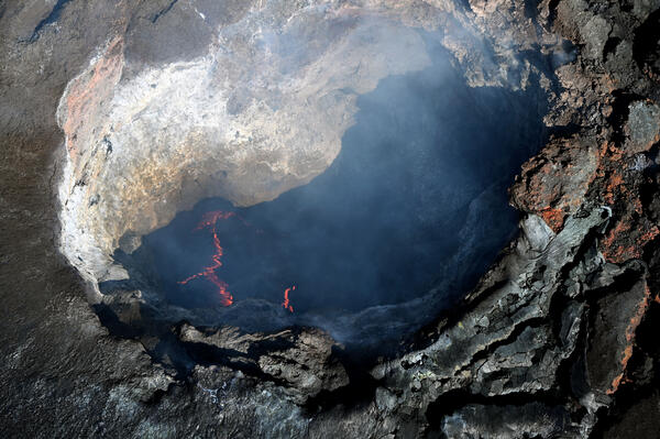 ?itok=l8QYFYAD
HVO has published photos of the lava lakes in both vents. The southern vent has actually a lava lake with lava plates and glowing plate boundaries:
The altitude of the lava lake is likely higher than the Overlook lava lake 2008-2018, that was in a deep hole below the former Halema’uma’u caldera floor.
It is an interesting pattern at the moment! But the tilt is still going up and the next episode can’t be far away.
Note the green line (perpendicular direction) also has started to change
Glow of magma persisted for long time between the episodes. Can we say that the creation of a subsurface lava lake has happened long time ago? But it still has a roof that waits to collaps and reveal the hidden lava lake.
As far as I remember, HVO said sometimes that tremor continued between the episodes. This sounds like a continuous eruption. Maybe the subsurface lava lake will slowly evolve into an open lava lake with an expanding surface, that is occasionally interrupted by episodes.
With the opening of the lava lake 2008 the frequency of DI events increased from 5-10 per year to 87 in 2011: https://www.usgs.gov/observatories/hvo/news/volcano-watch-di-events-kilauea-what-are-they-and-what-do-they-mean
Are the current DI events like 2008 a sign for the slow opening of a lava lake eruption?
This is exactly what I’ve been assuming. I’m convinced that the moments of deflation that occur before an episode are related to the fact that its size is increasing, and its location is exactly in the area where the caldera floor has deflated.
10:50 am EST and we have a decent flow starting.
4:50 local
And there she goes. Overflow with a ‘small’ lava dome on V1 cam
Interesting how it slowed down but didn’t stop. I don’t remember it doing that before previous episodes. Previously it has been either shut down or take off, but this one keeps going at a slower rate.
Dome Fountain NOT lava dome! 🙂 only the very most fluid lavas can do a dome fountain
If you look at the video for around 5am HST, the lava creates a beautiful, though not so large, dome shape. Regardless of what it is called!
Dome Fountain is the term but you can call it a cupola shaped fountain
A lava dome is a very very viscous heap of lava that can only move extremely slowly and is nearly solid yet deformable like molasses
Finally, this is it at Kilouea.
Yes! Episode whatever has started!
Really tall fountain.
seems to be past its peak now but it looked very tall
Tallest so far I think! it coud keep going like this for rest of your life if it does not move elsewhere on the volcano.. there is no other volcano on the planet like this!
Around 14:00 the color of the fountain changed from red to yellow-orange. Was it caused by an optic illusion or by an actual shift of the magma temperature towards higher degrees?
That is curious. It is seen only in V1. The V2 camera did not pick it up. This suggests to me there was no intrinsic change. Is it the camera, slightly changing its settings or sensor saturation? Did the illumination conditions change? At this level, the temperature of he lava would have mainly affected the brightness but the camera may be affected by that
before:
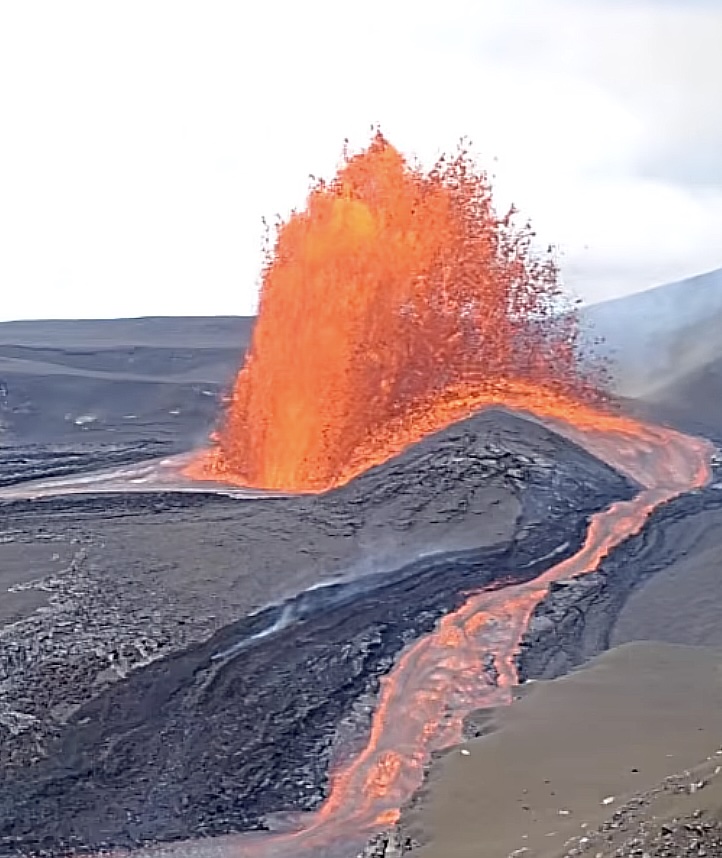
after:
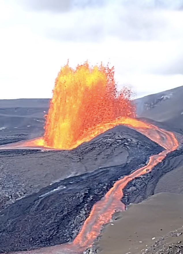
Notice how the clouds changed from being pretty much all-white to actually having some texture. Looks like it was just an ISO change and nothing associated with a change in lava temperature.
Quick question, any idea why the watwr in the satsuma picture us orange? Iron ocide?
Yes, it is from iron oxide coming from hydrothermal vents, reacting with the sea water. Good guess
thanks for the answer, having hydrothermal vents in the harbour seems wild, but I guess it would probably be a cool (warm) way to have a port stay clear year round where you would otherwise need icebreakers – though satsuma looks to be far enough south not to need that 🙂
Looks to me like the south vent is more of a drain than a vent at this point, think the gas release is the only thing keeping it from getting completely buried. Probably be gone next eruption.
That was an impressive episode! HVO gives a fountain height of 290 meters. It seemed taller but that was probably because the base level has gone up so much. Soon we’ll need a name for the new shield. Halema’uma’up?
And elsewhere, an almost-M4 at Katla.
That reminds me of a question that I’ve had for a while. Why is the depth of Iceland earthquakes never shown as negative, which would be above sea level. Surely, some of the quakes in the mountains originate well above sea level, but that is never shown. It must be built into the software used for the calculations. The USGS earthquake list shows negative depths where it is appropriate.
There are two ways to give the depths of earthquakes. I believe that Iceland reports them relative to ground level, while HVO gives them relative to sea level. How to define sea level deep inland is not obvious, by the way. Much of Iceland is within several hundred meters of sea level, but it makes a difference for the high mountains. The seismograph may be at a different elevation than the ground level at the location of the earthquake which can complicate things. Someone else may know more about this than I do!
New post is up! Your task – should you accept – is to save the world. Failure is not an option
https://www.volcanocafe.org/volcano-risk-management/