Six months of episodic earthquakes and ground swelling along the Southwest Rift Zone of Kilauea have finally culminated in a major event. As I write, the volcano rifts. We have a dike. A blade of magma cuts its way across the rift zone generating earthquakes outside of the SWRZ connector, the usual area of seismic activity. The NW rim of Kilauea caldera deflates at dazzling speed. The UWE tiltmeter that most faithfully records the state of Kilauea’s summit magma chamber has plummeted by 35 microradians and is still falling, which is as much as it dropped during the past year’s September eruption. This means a comparable amount of magma has intruded the Southwest Rift Zone in about a day, as was erupted in about five days during the September summit eruption, making it a major event already, regardless of whether it erupts or not.
How we got here
We’ve been following the SWRZ situation in the comment section for months. I also published two articles about it, which are the following:
I will review the situation. On August 14, 2023, following a surge in Kilauea summit inflation and two small summit intrusions, the uppermost SWRZ (Southwest Rift Zone) experienced a substantial episode of seismic activity that gradually propagated downrift and was followed by inflation. This unrest was continuous until the September eruption of Kilauea. After this eruption, the summit entered a recovery period in which the SWRZ was not active. The SWRZ resumed activity with a sudden seismic crisis on October 5. There was spectacular inflation of an enormous area to the southwest of the summit, reaching 1 cm of uplift per day at its center. Activity decayed somewhat after some days, but intermittent episodes of activity lasted until December 15. On December 30 another episode of earthquakes and inflation along the SWRZ took place that lasted just a few days, and from there it was calm until January 27, when a new episode started which has evolved into the current dike intrusion. All of these events generated earthquakes along the same area, which is known as the SWRZ connector, a line of seismic activity that extends downrift from the south rim of the summit caldera. The connector is usually regarded as some sort of horizontal magma conduit that makes up the core of the rift zone. I think it’s more than that though, I believe it represents the upper edge of a complex of deep dike intrusions under the rift zones of Kilauea. This would be the structure referred to in many articles as the deep rift, usually regarded as a vertical dunitic mush body that drives seaward spreading of Kilauea, but its behavior I think is showing to be more fitting of a series of “perpetual” dikes. As these deep dikes expand, what I suspect happens is that the flank gets pushed southward and also the ground above is torn apart making earthquakes along the connector. Rising pressure in the deep rift pushes magma upwards into horizontal sills, producing elliptical areas of ground inflation. That is what I believe the unrest episodes over the past 6 months were.

Map showing SWRZ earthquake activity between August 13 and November 26, 2023. The earthquake locations are from the openly available USGS catalog and highlight the branch of seismic activity known as the SWRZ connector.
The dike
We were having another connector seismic crisis. This one was intense in terms of seismic activity and inflation rates. Things changed yesterday. Towards 4 HST (Hawaiian Standard Time), there was a dramatic increase in seismicity, there were so many earthquakes per minute that they merged into each other. The ground was non-stop shaking in the seismograms of HVO. It appears around this time some magma-filled cracks may have started propagating into the surrounding rock, generating a very intense seismicity. We were following the situation in the comment section yesterday as it escalated. Around 5:30 HST the earthquakes started to hit outside the connector, to the west, and about the same time, the UWE tiltmeter started dropping, revealing that magma was exiting the summit reservoir and Halema’uma’u subsiding as branches of magma spread beyond the SWRZ connector to the southwest. Around 6 HST a cluster of large-amplitude earthquakes occurred in the SWRZ for several minutes coincident with a very fast drop of 1 microradian in the UWE station, at that time it was when I noticed that a dike was forming. IKI and UWE were showing rapid deflation of Halema’uma’u and SDH had also gone crazy with its components showing extremely fast tilting that was probably coming from rapid inflation in the South Caldera area. I went to sleep after another cluster of earthquakes had shown up spreading beyond the connector to the NE, towards Keanakakoi Crater. The intrusion seemed paused, and I thought might be over, but it was not and kept throwing more growth spurts. Now the UWE tiltmeter is down by more than 35 microradians and earthquakes cluster into a nice line, some 6 km long, the trace of a dike intrusion. The distribution of earthquakes is the following:

The orange circles are earthquakes located by HVO today. Blue areas are those active during episodes of connector seismicity. Red lines are possible dike segments that have been intruded.
The map above shows that earthquakes (orange circles) are happening outside the connector (light blue areas) in multiple places. Where they overlap the connector just south of the caldera I think is the starting location of the dike intrusion, given that earthquakes were initially clustered there before exiting to the SW and NE. The distribution may require two separate parallel dikes. It’s not uncommon for this to happen, and the Upper East Rift Zone of Kilauea is known for double dike intrusions where magma makes two parallel but separate dikes, the last time was the 2007 Father’s Day intrusion. The reason could be that these intrusions involve a mix of sill and dike intrusions, horizontal sills turn into vertical dikes so that the whole thing is one intrusion but with multiple interconnected sheets of magma, both vertical and horizontal. In the following map, I compare this event to earlier dike intrusions of the SWRZ, the 1963 dike trajectory is not well recorded so it’s not in it:

Map of the three major, well-recorded, dike intrusions that have taken place since 1970. The seismicity of the SWRZ connector is also shown as blue areas, and the volcanic cones of the Kamakaia Hills as green triangles.
The larger segment would be following a trajectory similar to the 1974 and 1981 dike intrusions. It roughly follows the middle strand of the SWRZ. The smaller segment may be following the southern strand of the SWRZ that last was active around 1800-1810 with an eruption of the Kamakaia Hills.
Will it erupt?
It’s always hard to know the answer to this. The middle strand segment could perhaps erupt in the area of the Puu Koae and Cone Crater cones, but this location is higher than the summit caldera floor right now, so I’m not sure pressure will suffice. The southern strand segment is right now in a non-eruptive area that is too elevated where dikes always fail to erupt, but should it grow downrift it could reach the Kamakaia Hills and erupt there. There is a factor to consider, and it’s the amount of evolved magma that may exist in the area. many eruptions here seem to produce slightly evolved lavas. For example, the last Kamakaia eruption, Kamakaia Waena around 1800-1810, started with basaltic andesite lavas and ended with evolved basalts. This eruption was long-lasting, possibly weeks or months, and emitted some 0.1 km3 of lava. Other earlier Kamakaia Hills eruptions are similar. Prehistoric eruptions of the middle strand, like Puu Koae or Cone Crater have also erupted sluggish lavas and made cones of a strombolianish appearance so while I’m not aware of the composition I suspect they might be slightly evolved basalts. How much evolved magma exists in the area could be a key factor. It’s also important to consider that the major dike intrusions in 1963 and 1981 that rifted the middle strand of the SWRZ did not erupt, and right now Kilauea is in a lower pressure state than it was then. I think that the best chance for an eruption is for the intrusion to follow the southern strand of the SWRZ down to the Kamakaia Hills which are well below the summit caldera floor in elevation and may contain large amounts of evolved magma formed in the past 200 years of dormancy of the volcanic cluster. So as it always happens with volcanoes, they are full of surprises and it’s hard to know what they will do next. It’s also important to note that the area is completely uninhabited, so there’s practically no risk of damage taking place.
Tiltmeters update.
I’m adding a bit about tiltmeters to the article after publishing, to explain a few things. Recently the subject of tiltmeters has shown up during discussions in the comment section. Tiltmeters are instruments used to measure deformation at the Kilauea volcano. You don’t see many explanations of how these instruments work or how their data can be interpreted, so I will explain a few things and show the current event as an example.
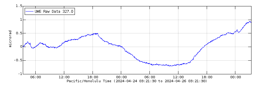
Tiltmeters measure changes in the slope of the ground. The unit given is in microradians which is one millionth of a radian, the standard unit for measuring angles. As Albert noted in the comment section of the previous article, a microradian is the equivalent of a change in altitude of 1 mm over 1 km of distance. They are highly dependent on direction, for example, the ground might rise exactly to the north, and this will change the tilt in a N-S direction, but not in an E-W direction which remains unaffected. That’s why HVO reports the tilt as two directions perpendicular to each other, to give a full sense of how the ground is deforming. The direction is given as a number in the top left corner of the graph, and it is an angle in degrees from the north and in a clockwise direction. For example, 90 would be tilt in an east direction. The tilt value itself refers to the angle from the vertical, if the tilt is going up it means the ground is sinking relative to the station in that direction. HVO uses radial tilt. For example, UWE in the NW caldera rim is given in a 327 direction, which is roughly NNW direction, and this direction is radial to Halema’uma’u, it points away from Halema’uma’u, the central magma chamber of Kilauea. When the tilt goes up it means the angle from the vertical in the radial direction of Halema’uma’u is increasing, this happens when the station is rising relative to the ground to the NNW of it because Halema’uma’u is inflating. Up means inflation and down deflation when the tilt is radial to (points away from) the deformation source, here being Halema’uma’u:

UWE data which is tilt radial to Halema’uma’u
Let’s look now at what the other stations are doing. At IKI the blue component is going down and the green not doing much. That means the greatest tilting is happening in that direction. The blue component is 62.5 degrees from the north, about ENE. This seems radial to Halema’uma’u. So down means Halema’uma’u is deflating, the same as UWE.

Then we have SDH, fundamental in monitoring situations just south of the caldera. It gives two components that are going down at similar rates. These components are almost exactly NW, and SW. The maximum tilting must be in between them, or about W. It’s going down. Is W radial to any source? It is roughly radial to the south caldera area, which comprises two nearby deformation centers roughly located near the OUTL GPS and KKO seismometer both to the east of the SDH tiltmeter. This means the south caldera area is deflating because its radial tilt is decreasing; the angle from the vertical decreasing. I should note that originally the blue tilt seems meant as a component radial to Halema’uma’u, and the green component radial to one of the South Caldera sources, the one near OUTL which is related to the SWRZ connector. But because here the deformation is wide and probably spans all summit sources the deformation is coming from the south caldera area that might be a bit central to all.

Lastly, there’s ESC. There are two components. A 0 component (north), is rising. A 90 component (east) is decreasing. At relatively similar but opposite rates. What does this mean? In between them, NE-SW, there must not be any change. The maximum tilting is in the NW-SE direction. It happens that ESC is to the SE of the South Caldera source, so that SE would be the radial tilt to it. This is not given in the graph but, from the two components given, it can known that SE would be down like in the E component but more, being the direction of maximum tilting. ESC like SDH reflects deflation of the south caldera region.

The south caldera area comprises sills that are related to the SWRZ connector and the UERZ (Upper East Rift Zone) connector, twin nearby sources at the start of both rift zones which together are very important areas of magma storage. Very primitive magmas that evolve under the SWRZ and the UERZ (Upper East Rift Zone), probably end up as basalt in the sills of the South Caldera area. This deflation is to supply the dike that right now advances down the SWRZ.
HVO Kilauea page:


A good article, anyways the UWE is working now:
Besides that, I could think of a few possibilities for this to go –
1. Intrusion stops, no SW eruption.
1a. No eruption from summit but inflation goes on.
1b. Eruption at summit (as usual).
2. Dike remains active
2a. Dike stalls for days.
2b. Dike continues south.
3. Eruption happens.
3a. Small eruption.
3b. Similar to 1974.
3c. Similar to 1800’s.
Based on this, 1a is likely in my opinion.
It looks like tremor, doesn’t?
Thank-you for your in-depth analysis of the current situation in and below Kilauea’s SWRZ, Hector!
The eruption 1974 was a minor eruption and happened, when Kilauea summit had an active phase, as we talked about some weeks ago. Througout most of the historical time the summit was more active than now. During the 19th century as well as 1919/1920 and 1974 there were active lava lakes in the summit that could feed intrusions into the SWRZ.
The present lava lake in Halema’uma’u is too passive to be involved in the activity in SWRZ. So it’s a different situation compared to past known eruptions since US colonization of Hawaii.
Possibly the present earthquake swarm – which includes many for humans sensible earthquakes – is the beginning of a swarm eruption. Kilauea likes to do occasionally swarm eruptions with several episodes … maybe something even in common with Mauna Kea’s most recent swarm eruption 6,000 years ago. That’s unlike the most typical Mauna Loa eruptions which usually are lonely eruptions.
Thanks, Volcanophil. I think the lava lake can get involved in SWRZ activity in the future, but you need the northern strand to rift which is the one that feeds directly from the summit (Halema’uma’u). This is the middle and northern strands which are detached seaward and feed from the connector and SWRZ sills which in turn feed from the summit. The early 19th century SWRZ eruptions may not have been that many, as far as I know only Kamakaia Waena and 1823 are solidly confirmed as happening during that time. There’s a possibility for Black Cone and Kealaalea, but they could be older too, and Black Cone could be part of the Kamakaia Waena eruption.
The lava lake level has not changed so far. The magma came from a different reservoir, not in open connection to the lava lake. The rootless lake still has no roots
Yes, there’s no connection, at least for now. The way the lava lake can get involved is by a dike growing from Halema’uma’u, erupting into the lake, and propagating down the northern strand of the SWRZ. That way the dike would temporarily connect the lava lake to any vents downslope.
The ESC tiltmeter just west of Mauna Ulu is showing increasing back pressure up against that Middle East Rift blockage. I know most of the magma is heading southwest, but it just goes to show how much is moving right now.
Tilt on Iki is now working. Looks like started reporting on around 1/18.
Mac
New cluster of earthquakes in the past 2 hours shows a little advance of the intrusion tip towards the Kamakaia Hills. As far as I know, it’s the first time a dike ventures historically into that area (since 1823).
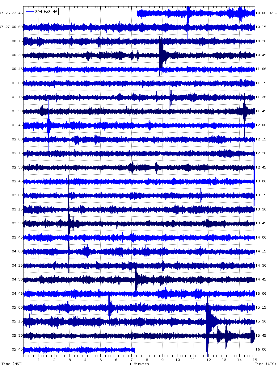
Lots of cool signals in the seismic stations. Seismic events with emergent onsets.
I’ve always found it difficult to follow the Kilauea discussions, as I am very unfamiliar with the general lie of the land, unlike Iceland (which I know pretty well). Your article has helped Hector, so thanks for that.
Fun right? and its the most powerful induvidual volcano on the planet, in terms of release in avarge heat loss and avarge lava productivity, a volcano thats criticaly underestimated by most persons thats getting into volcanoes. Kilaueas magma supply is equal to many 100 s of other volcanoes magma supply at once, or a majority of all of Icelands magma supply put into one single volcanic system. The size of these deep sea hawaiian edifices are also totaly ginormous compared any other induvidual volcanic edifices. Most other land volcanoes struggle to grow beyond 300 km3 .. in Iceland Katla is quite large compared to most other continetal volcanoes ( 500 km3 )
But Hawaiian edifices can reach over 100 000 km3 with 140 000 km3 for one older miocene example in the emperor chain. And if the pacific seafloor moved more slowly they woud be even wastly larger than they already are today as induvidual volcanoes.
I have gotten the rare lucky ( for being a european) to see Kilauea in person in action many times during the Puu Oo era, hiking active flows by foot and boating the ocean entries, today we have a very diffrent Kilauea from
those days with a constant effusion. As Nordic Citizen its best for me to move to Iceland.
Im very busy so will not be much on VC have lots of tricky stuff to work on now, so will be on more later.
I think part of the problem is that I don’t switch my pc on much these days, so I’m resorting to my phone (my knees complain if I sit on my desk chair too long). This makes it to difficult to view maps at the same time as reading discussions. I already have a map in my head for Iceland, as I know it so well, especially in the south and around Reykjanes. I can therefore visualise what is going on very easily. I have know knowledge of Hawaii beyond that it exists in some distant place in the middle of the Pacific, so I don’t have any visualisations in my head. While the tilt meters are of interest scientifically ro me, I can’t get my head around them without any context that a map could supply. I can map the relative movements of GPS stations in Iceland quite easily, but GPS stations and tilt meters in Hawaii are a different story.
That is I can map Icelandic GPS stations in my head (I missed out a few words due to typing on my phone).
I sprt of felt the same way about Iceland, Kilauea was what got me interested in volcanology, seeing the lava flowing into the ocean at Kalapana in 2011 on video. I knew Iceland was volcanic and saw Eyjafjallajokull and Grimsvotn erupting on TV but never really understood much about it until watching Holuhraun. I found VC at this time.
I might be the only person outside Hawaii to have looked at the HVO website almost daily for nearly 14 years 🙂
I also came to VC during Holihraun. I actually came back from Iceland the day before the first swarm started.
I’m from the northeast US but also am much more familiar with Iceland volcanology and topography than Hawaii, and have been to Iceland five times now.
I prefer arctic settings and being in the cryosphere vs the tropics, that’s probably part of it. I also find the interaction of volcanism and ice to be very interesting.
I think the Grindavik area probaly ( maybe ) having a higher magma influx than Kilauea now as induvidual volcano, but in avarge Kilauea haves the highest magma influx of any induvidual volcano in the world.
Reykjanes is the highest by far among any induvidual Icelandic volcano for now
Svartsengi has fewer space between the sill/dyke and the surface. Also the whole distance from Moho to the surface is much shorter than on Big Island. Kilauea is a so huge volcanic mountain that there is a lot of space for magmatic intrusions. The space for the current Grindavik sill is much more narrow. Relative small movements and small amounts of magma can much easier lead to eruptions than on Kilauea.
The Grindavik volcano is likely the most active volcano on Iceland now. We can expect an eruption every single month. Added to this, we can await Fagradalsfjall’s annual eruptions (maybe in June?). 2024 Iceland may get more eruptions than any year had before. If all systems do what they promise, there are 14 eruptions possible: 12 Grindavik/Svartsengi, 1 Fagradalsfjall and 1 Grimsvötn. In normal times Iceland would need 70 years to do 14 eruptions. 2024 might do this in one year.
The current magma supply to Kilauea is around 170 million cubic meters a year, with around half of that going into the shallower parts
Tilt at SDH as reversed, due to magma moving downrift?
Yes. It showed the magma pulse coming past very nicely
I added some information about tiltmeters at the bottom of the article.
Very nice you added the information about the tiltmeters, I barely understand any of it, but my mental capacity is not ideal due to Im not in the most fit shape these days. I will .. re read this tomorrow.
OK, tiltmeter data.
The data appears to be idiosyncratic to each detector as shown/displayed so is not a useful figure to a general audience. It would be more helpful to me, and probably others, if this could be further interpreted, eg:
“tiltmeter XYZ suggests has risen by XXcm.” Those in the know probably translate a tilt to a location and distance in their heads, the rest of us don’t and its just noise. The above use make it interesting.
Just another small point and that is tiltmeters completely ignore vertical movement so that would need to be assessed too for the actual final distance.
I have said before that tiltmeters measure angle not distance, the above translates that angle to a vertical movement at a set distance, which makes sense.
Done this way, I think everyone would find the data more interesting.
sorry triangular brackets get deleted, rephrase key statement!:.
be further interpreted, eg:
“tiltmeter XYZ suggests (site AAA) has risen by XXcm.”
Thing is, tiltmeters don’t measure centimeters, they measure changes in angle between two endpoints. An increase can mean one end went up, or the other end went down. During inflation it’s likely that both ends go up, but the end closest to the inflation goes up more. Bottom line is that what you’re asking for can not be done.
To elaborate a bit more on the microradian scale, there’s 2*pi radians, or 360 degrees in a full circle. A microradian is one millionth of a radian, so another way of putting the 1mm change at 1km distance is that you need more than 17000 microradians to get a single degree of change in slope.
The example given by Sacristan made perfect sense. Knowing the position of a tiltmeter and the distance to the point of interest he then calculated a change in height. Certainly this is a bit rough as you and I said because it ignores any vertical movement of the tiltmeter and assumes the tilt is approx linear between point of interest and meter (probably about true). However it has the virtue of relating things that people understand. Just quoting a random tiltmeter (eg UME) that few people know the location of or relationship to its intended target as changing by XX uR (is this big,normal or small???) is for most people just noise.
Saying it suggests a change in height of a point of interest is something we can relate to and thus even remember from post to comment.
The problem is to separate cause and effect. One can probably work out that an x cm inflation of a certain magma chamber would result in y urad change in tilt, but not the other way around. In particular when there’s an ongoing magma intrusion going on. Look at the complicated ground deformations at Svartsengi during the last eruption, where a sill was deflating at the same time as a new dyke was forming. That particular GPS did not go down as expected, while others did. Looking at the wider picture, including horizontal movements and the fact that a new graben formed to the east of the first one, show that there likely was a new dyke that formed in January, while the December eruption used the November dyke.
The tiltmeters are useful to detect that something is going on. They are very sensitive and react to small changes. Using them to infer precise details about what’s going on like you suggest brings you out on very thin ice.
“Using them to infer precise details about what’s going on like you suggest brings you out on very thin ice.”You would be surprised.
If you have multiple tiltmeters in the same area you can infer where deformation is coming from. The inflation centers of Kilauea were all defined with tiltmeters decades ago; Halema’uma’u, the two south caldera sources, the one downrift of Pu’u’o’o, and the one near Heiheiahulu. They are the same deformation sources that are measured with InSAR or GPS now. And now that you have absolute measurements of deformation from GPS you can figure out from tilt the total deformation, which is something I’ve only seriously considered since Farmeroz brought it up the other day. The advantages would be to infer from tiltmeters rates of deformation that only last a short time, like maybe the pulse of deflation that hit Halema’uma’u during the start of the preset intrusion, which lasted only minutes.
Not to mention that there is a whole kind of volcanic phenomenon where tiltmeters have brought the largest amount of insight, deflation-inflation events. Deflation-inflation events are not known for any volcano other than Kilauea, and that may well be because tiltmeters are not widely used elsewhere. They are barely visible in GPS.
The Uwekahuna tiltmeter is by far the best indication of an imminent summit eruption, because tilt skyrockets suddenly and in an hour is erupting. Halema’uma’u dikes are almost aseismic at times, and GPS don’t have the resolution to pick up the intrusion in detail, so UWE is by far the best and most reliable indication of a summit eruption in Halema’uma’u.
Plus, unlike IMO’s GPS, HVO’s take days to update. They have still not added any data of the dike intrusion! They always do that. If you wan’t to monitor Kilauea in real time then tiltmeters are the only option. Otherwise, you are left with looking at GPS that are lagged who knows how many days behind. I expect the time it takes for HVO to correct the data or something.
Ok, so I think we have come to an agreement.
1) Tiltmeters are accurate but local.
2) Notwithstanding (1) they do in practice give much wider information.
3) Because they only measure angles, extra information is required to make a useful interpretation.
4) If you have much of the ‘other information’ then they are a fast, accurate and very useful way to infer what’s going on, some of which cannot be obtained by other methods.
5) *** When refered to for informing non-experts in the scenario; they should be referred to by the actual interpretation rather than just the delta-uR – which on its own means little or nothing to most readers and may even be misunderstood.
Yes, the key is to complement the data with other measurements. What I mean is that you cannot simply assign a value to a tiltmeter saying 1urad change corresponds to x cm inflation. You need the rest of the picture. Combined with data from a dense network of tiltmeters, and calibrated with GPS data, it’s an excellent tool. Everyone just needs to realise that they measure slope, not vertical motion. Everyone here seem to use microradian as a measure of distance, which it’s not.
Maybe assigning a value like that for UWE would work perfectly for the summit, as long as it always keeps doing what it’s used to. But like Albert said, volcanoes hate to be predictable. As soon as you think you have them figured out, they do something new.
Not to argue but the degree of tilting seen at the tiltmeters does tend to be pretty close to the degree of vertical motion that is measured by other sources. It only works if you know where the deformation is coming from but that is indeed the case at Kilaueas summit so interpreting the tiltmeter like a vertical measurement is not all that inaccurate in this case.
Thank you so much for explaining the tiltmeters. Your explanation is awesome, clear and simple.
It’s obvious once explained. Now I just need to work on the 3D movement in my head!
Seems we have something going on here.
MITD station, which is adjacent to the Kulanaokuaiki pali and the Kamakaia dike. After reading the article I was wondering about which dike will dominate, the upper dike has a better connection to the summit but would be hard to erupt, while the lower segment is further away from the summit but at a lower elevation. I think the tremor answers that question and we might get a visual confirmation of that sooner than later 🙂
Release the liquid aluminium:) this will be fun to see if it manages to break through, these lavas are extraodinary crystal poor and high magnesian so will flow very quickly, earlier flows there and in area really looks like aluminium thats flowed out, Not seen any viscosity measurements of historical upper SWRZ and local area fissure eruptions .. ( but near the fissures woud be deadly to measure )
So after posting it updated to present time and the tremor subsided, but now the DESD station further downrift north of the Kamakaia Hills is tremoring a bit. I think we might just get an eruption out of this after all 🙂
The dike is still growing, and some earthquakes are now happening under the Kamakaia Hills whilst the upper segment seems quiet. With more than 50 microradians of UWE deflation this is a major dike for Kilauea. And from the looks of it, we might get a repeat of the Kamakaia Waena eruption.
Looks like the dike has come into contact with the evolved mag.a sitting under the hills, there is a seismic gap between the main dike quakes and a new cluster that has appeared on the west side of the hills near the start of the great crack.
If fissure 17 is a good model, it started erupting a few days after the dike in 2018 reached that area. But the stuff at the Kamakaia hills is not that evolved so it may take less time. I think at this point an eruption is a near certainty as long as summit deflation is ongoing, hopefully HVO puts a webcam up soon 🙂
Kamakaia would likely get more magma than fissure 17 which was a side vent of the whole Leilani eruption. Maybe the Fimmvörduhals eruption of Eyjafjallajökull with intermediate magma shows how a Kamakaia eruption can look like:
Fimvotduhals was actually nearly ultramafic just crystal rich, had 48% SiO2. Same reason as Etna, which has similarly very low SiO2 but is crystal rich so the bulk magma is viscous. Without crystals both magmas would be very fluid, like the basaltic flank vents at Hekla appear to be. Etna might become a volcano somewhat like Nyiragongo in the future if it evolves its plumbing to the point crystals can separate and leave only the melt.
The Fimvorduhals eruption also only erupted 23 million m3 of lava too, while fissure 17 erupted about 12 million. So about half but also only erupted about half as long too. The Kamakaia Waena eruption seems to have started as a fissure and fed an a’a flow about 6 km before changing to pahoehoe. The tall cone might have formed with the shield or just before it.
It looks like the Kamakaia vents start off pretty much strombolian with a’a, erupting at a moderate to high rate, and then become nearly completely effusive shields with pahoehoe as hotter fluid laca erupts, maybe with the symmetrical cone forming at the uppermost vent as a strombolian cone, like fissure 22 in 2018 turned into late in the eruption. To me this means the eruptions probably take several intrusions to properly get going, just because this one might not do it doesnt mean we missed the chance, rifting episodes usually have many dikes (Alae/Aloi and Makaopuhi/Napau fissure swarms in the 1950s-60s) and while it is true pressure is not as high, the ERZ is out of action so there is nowhere else for magma to go except the SWRZ now. If a summit eruption was the easiest option it would have happened a few days ago, and now it is clear magma can open the rift down to the Kulanaokuaiki area which is lower than the summit so as long as nothing changes elsewhere will continue to be the place it accumulates.
Thank-you for the better comparison Chad!
If the SWRZ does a relatively longterm eruption, it may become a nice Tourist eruptions on a save place in the desert with reliable lava flows.
If there are more intrusions needed for an eruption, it’s possible that the eruptions start with a small one, after which longer and more voluminous eruptions follow.
Would you expect a strombolian cone like Mexico’s Paricutin or a more liquid hawaiian eruption?
And based on the earthquakes on the main USGS site map, they seem to be expanding too…
Some tremor here too.
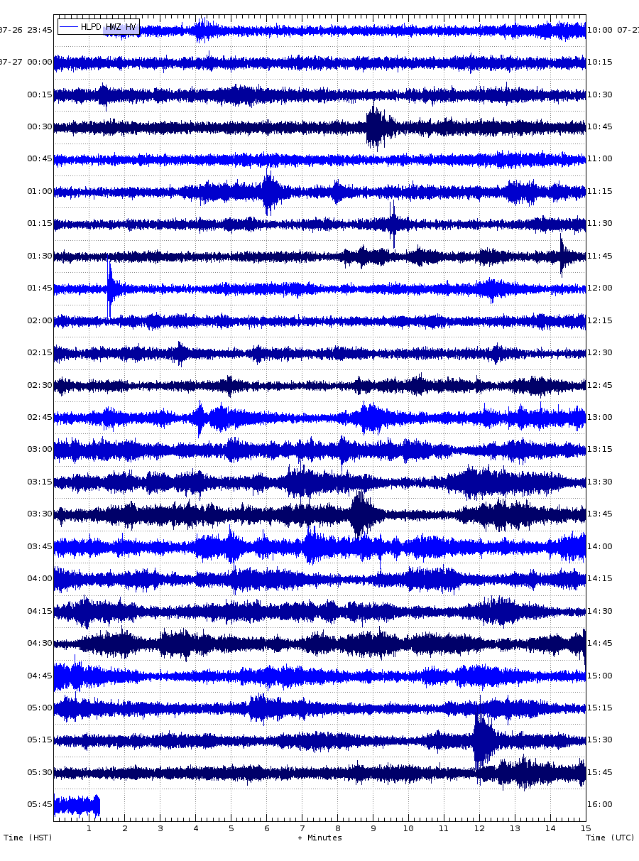
Still shaking here at MITD.
SDH as well
And a few small late jumps at RIMD.
Seems like more quakes are taking place in the SWRZ .
Watching Kilauea and Svartsengi develop dikes made me realize something about Cerro Negro de Mayasquer. I must thank these volcanoes for making me write my current piece on the volcano. I think USGS, JMA, IMO, and any other major geological agency with funding needs to get on this volcano. I can’t convey my new conclusion in the section but I am now 100% sure the dike under Chiles-Cerro Negro is every bit as large as I thought it was and I think it could even be bigger. The magma chamber is also looking far larger than what previous studies suggested.
This volcano is insane to the point that I am seriously beginning to doubt if the volcano is even under intrusion.
Any new data? I’ve been watching this volcano for a while too. I’m interested.
I don’t know if you read the thread but the IGEPN has stated that there is a 20 km long, 800 m wide, and 3450 m deep active dike, if the numbers are accurate then the total dike volume would be 56 km3 which is insane. The dike perfectly answers the oddities with the volcano’s deformation and seismicity. Naturally, the finding was a point of debate for Albert, Reyvolk, Hector, and I. Not at all helped by the lack of clarity in the presentation.
I’ve looked back on the past swarms and at no point in the past 10 years of unrest could a dike have formed. Think about Taal and Svartsengi, the formation of those dykes was accompanied by large deflation in conjunction with inflation and there was never a period of significant deflation in the past 10 years. So unless the IGEPN is dead wrong and there is no dike under the volcano which is unlikely in my opinion. The dike would’ve had to have formed a long time ago and it would have to be massive since any regular dike would’ve cooled in the long years between unrest.
As I’ve said, I can’t convey my conclusion in the comments and I’ve got an article in the works because that’s just the start.
Which IGEPN report was this?
https://fringe2023.esa.int/iframe-agenda/files/presentation-488.pdf
Here it is.
Sounds more like a flat magma chamber than a dike technically. If it had formed entirely within the last 15 years or so too then that is also multiple km3 of magma per year flowing within the crust somehow not causing any noticeable deformation at the surface, which seems unlikely.
The fact it is quaking so much probably means magma is flowing into the dike/magma chamber, but not yet intruding towards the surface.
It is completely impossible for this structure to have developed recently, but it hasn’t solidified and is still very active as it has been causing uplift of 1/cm+ a week since at least November. (still waiting for the December report) If the structure wasn’t extremely large, it would’ve cooled and died out a long time ago
Might be worth directly asking one of the authors given it completely changes your analysis depending which is correct.
I’ll give it a try but they don’t respond.
*They don’t always respond
The quakes have decreased in intensity in the past hour on the middle SWRZ seismometers. It seems like rock breaking has stopped now, but deflation is still going. The degree of deflation is slowing.
I think an eruption may not happen just yet but if the Kamakaia magma body keeps getting magma it will break out.
I cant help but think of this like the first intrusion in November under Grindavik, which didnt erupt but certainly contributed to the later two eruptions being where they were. It might take a while to get back all the magma just intruded into the SWRZ but the data for the Kamakaia Waena eruption is that it may have had a slow start with lots of tiny vents opening in the general area before it became more permanent and made the big cone. Quite a different sort of progression than a normal eruption then. We will see soon I think.
There remains the (for us boring) outcome that the intrusion feeds the magma pockets below Kamakai’a Hills without a eruption.
Iceland’s Svartsengi has an advantage: The sill/dyke are very shallow to the surface, if we compare them with the current depth of Kilauea’s sill/dyke system. The way for an eruption is much shorter.
It’s going to be a bit disappointing if the only historical dike to reach the Kamakaia Hills ends up being non-eruptive. It’s not like dikes in the area happen too often so I’m not sure we will ever see an eruption here if this event remains underground.
Its a bit confuding, because there are still lots of quakes happening on the dike but there is none of the persistent background vibration. That vibration doesnt look like harnonic tremore either though, it looks like the signal that the last eruptions made while magma was breaking rock.
My best guess is that the dike has stopped growing because magma is going into the magma body under the Kamakaia hills, which is probably why there is a distinct gap. So long as deflation is ongoing its only a waiting game.
The UWE drop is slowing down. Looks like we might not have an eruption unless things change.
Patience. It takes a while after an intrusion before the magma decide whether it has enough oomph to make it to the surface. we won’t know for sure for some days
As Albert says, we indeed need some patience. Volcanoes have time, they’re outside of our realm of digital unpatience.
Sooner or later the swarm quakes of Pahala that occured since 2019 must reveal their meaning. Maybe we’re now in the situation that deeper magma chambers have been filled and are going to distribute magma towards more shallow ones and dikes/sills. The deep earthquakes of Pahala still persist. I think we shouldn’t ignore them. It’s possible that they drive the future of Kilauea.
If we look on the longer history (1000 years) Kilauea has from time to time change the behaviour completely. There was f.e. the Aila’au eruption 1470 or the Medieval Observatory shield, also some explosive periods. The collapse 2018 can have opened a new chapter or stage in Kilauea’s lifecycle, but we still don’t know what it includes and what may be different to 1790-2018. The current SWRZ intrusions and possible eruptions can be part of a bigger story.
https://www.youtube.com/watch?v=BILjZOYysGY
Removing the old HVO building, seems like a logical plan, the area being geologicaly hyperactive, so the old HVO building woud have not lasted that long anyway in near future geological scales, now the area will be left for the local wild stuff to recolonize while the HVO moves to a new Hilo base thats under construction for USGS.
Meanwhile, there was a 3.3 near Krisuvik, but not much else. The activity continues near Grindavik, possibly in pulses. IMO issued this update yesterday.
Updated 1 Februry 17:00 UTC
Models based on GPS data, reviewed this morning (1 February) by scientists from the Icelandic Meteorological Office and the University of Iceland, indicate that approximately 6.5 million cubic meters of magma has accumulated beneath the Svartsengi region. According to this assessment, magma will soon reach the same volume as drained during the January 2024 eruption. Therefore, the timescale for the next eruption could be within two weeks or possibly days. This means that the likelihood of a magma intrusion, and a volcanic eruption, have increased.
That is worrying…
I have noticed a trend with these eruptions: the longer the dormancy is, the larger eruption. Now, that is just assuming things, but if that is the case, the volume estimates would be, like you said, same as January 2024. If this goes longer, the chances of a larger eruption is higher, hence a concern for Grindavik…
More than the size of the eruption it’s the location that will matter. The last eruption had a small vent right on the edge of the town. A bigger fissure right in the middle of the town would be devastating, even with a similar volume to the two previous eruptions.
“A bigger fissure right in the middle of the town would be devastating”
Very! Just South of where lava burnt houses in Grindavik, they found water (consistently, I think, but there I could be wrong) 10 meters down (somewhere in that range). If that shallow water exists throughout Grindavik, the initial eruptions could be pretty violent.
If the trend continous that Svartsengi does an eruption every 4 weeks, then the likelihood is very high that Grindavik will get a lava disaster this year. But it’s impossible to predict when this is going to happen.
It is difficult for me to distinguish between earthquakes that are caused by of the current Fires Period on Reykjanes Peninsula and the “normal” earthquakes, that happened there through past centuries without magmatic participation. The list of historical earthquakes on Iceland shows that f.e. 1929 and 1968 happened earthquakes on Reykjanes Peninsula: Brennisteinsfjöll resp. Kleifarvatn. There was always “music”, but now this is mixed with the above normal behaviour.
It could just be dawn, again, but there is bright light on the crater rim now.
Here’s a small research exercise for the curious and/or bored … what event does this image refer to? 😉

Well you made it very easy for me to cheat as you hot-linked the images from the article web page!
https://esurf.copernicus.org/articles/6/467/2018/
“Dynamics of the Askja caldera July 2014 landslide, Iceland, from seismic signal analysis: precursor, motion and aftermath.
Anne Schöpa, Wei-An Chao, Bradley P. Lipovsky, Niels Hovius, Robert S. White, Robert G. Green, and Jens M. Turowski”
I notice drumplots are busy and tremor (all 3 frequencies) are rising for the Grindavik area. The wind is currently 15mph from the west, and I don’t know if snow can affect seismometers. Might be worth watching…
Ignore me. It’s weather. Sorry – bad call on my behalf.
Hmm. Several GPS Stations show a notable drop in elevation in the most recent data. Blue Lagoon most significantly:
Others include: ELDC, SENG, THOB
It’s really only one datapoint, two at best, so we need to wait to see I’d there is a continuing trend. With the weather warnings, the readings could be a bit erratic. It already seems to be affecting tremor parts across the south.
Some of the others have gone back up on the 4hr plots.
This colorized video from Paricutin 1943 shows how a possible Kamakai’a eruption can look like. The volcanic cone won’t likely grow as much as Paricutin, because the eruption won’t last long enough. But the eruption style can be an example. Paricutin has Basaltic to Andesitic magma, so likely comparable to the evolved magma reservoirs below Kamakai’a Hills:
https://www.youtube.com/watch?v=-o_gyXZ5XK0
Also nice to have some historical video clips from very past eruptions.
The eruptions at Kamakaia would just turn into normal fluid pahoehoe shields if it became as big as Paricutin, the volume of evolved magma is probably pretty small if the 0.1 km3 of the last eruption was able to get through pretty much all of it.
A very remote active volcanic island:
Ice and fire: Antarctic volcano may hold clues to life on Mars (Phys.org, 2 Jan)
I’d dispute that claim as anyone can sail into the Santorini Caldera, and often do. Better weather, to start with. On the other hand the South Shetlands volcanic arc is a fascinating place. Why is it like a long long tongue of sea floor with a subduction zone where the tip is? I don’t know.
The map of the recent swarm. Here is the original link.
https://www.usgs.gov/observatories/hvo/news/photo-and-video-chronology-unrest-kilauea
It looks like a dike formed but which pushed only towards the ocean, resulting in a total of subsidence inland of the dike even though the dike itself pushed both ways.
Im not sure if it is just because the interval doesnt last long enough too, but it doesnt appear like a dike has actually formed under the Kamakaia Hills, rather it is a fault moving due to the other intrusion. But I am not very good at reading these signals so this interpretation is likely wrong.
The 2018 eruption started in a similar way, with a dike formation. That dike triggered the large earthquake and that released pressure. It might well have erupted either way but the earthquake helped. Perhaps ?
The eruption actually started before the earthquake, but maybe the scale of it would have been smaller without the earthquake.
Yes, my memory was not 20/20 I’m afraid! But the earthquake had a major impact on how the eruption proceeded
The 2018 eruption would have happened with or without the big quake, as the dike already existed and had erupted a few times already when the quake happened. What probably wouldnt have happened is the enormous eruption that we did get. The quake opened up the deep rift, so while the eruption started from a dike locally in the LERZ it ended up involving basically the entire thing. The summit lake didnt drain when the dike first formed, but immediately after the big quake the lava lake basically free fell down the vent, which seems more than coincidental.
Without the quake the eruption probably would have kept opening small vents, maybe going further up than it actually did in reality, to where the dike started a bit west of the highway. But the quake would have probably just happened some point before now regardless. Maybe in that timeline the 2018 eruption was a bit of a dud but it all went 0-100 immediately the next year in a separate eruption…
It looks to me as if Koa’e fault system area above the SWRZ connector is much inflating. Koa’e fault links SWRZ to ERZ. How is this system going to react to the SWRZ intrusions?
I think they are interpreting the butterfly pattern of a dike as uplift from underlying magma.
I don’t think they are interpreting the butterfly pattern correctly. That northern area of “subsidence” should be some uplift with horizontal movement away from the satellite.
In the past I used the NASA FIRMS satellite to spot volcanic activity world wide, but particularly in the Pacific Ocean basin. I would then forward the information to one of the volcano watch web people. Just now I spotted an interesting anomaly today, at -34.40755 S 178.53508 W, see https://firms.modaps.eosdis.nasa.gov/map/#d:24hrs;@-181.20,-34.45,9.71z
How would one go about finding out if a submarine volcano is in that location?
I am NOT saying that this is definitely a volcanic anomaly, but clearly the satellite has picked up heat, perhaps hot pumic on the surface?
As I am continuing to look, I see that the Tofua Volcano is active, at 19°43’54.0″S 175°04’15.0″W right now.
Also Tinakula, Solomon Islands at 10°23’06.5″S 165°47’43.0″E is active at the moment.
And finally Heard Island, near Antartica, is also hot – 53°06’11.5″S 73°30’39.6″E, this is probably the Big Ben volcano, since the hot spot appears to be in nearly the center.
I checked using the NASA bathymetry map that Hector gave me, there seems to be an unnamed submarine volcano at the right location, if we use the 3 dots to mark a pumice drift. See .
.
Eh, you’re using the wrong tool. We’re responsible for monitoring the Monowai submarine volcano. We use the Terra/Suomi etc birds – and apply a chlorophyl filter to the image. That makes it much easier to spot activity.
Thank you for the reply. I was asking if the 3 spots could indicate activity. As regards the other volcanoes which I posted, that is thermal activity for sure and one of my conversations with VolcanoDiscovery personnel revealed that they did use the NASA FIRMS readings to help keep up with current events.
For subaerial volcanoes, it must be useful, but for submarine ones, I don’t think it would work.
Monowai is quite deep (the highest point is ~100m depth), so when it erupts (which it does, quite frequently) all there is to see is a very faint trace of discoloured water – a submarine ‘plume’ if you like, It’s very faint and hard to spot and easy to mistake for a wisp of cloud. But applying the chlorophyl filter makes the ‘plume’ really stand out. No reason the same techniques we use on Monowai wouldn’t be helpful on other submarine volcanoes.
That’s interesting. Monowai is far from land as far as I know, is it being monitored for scientific interest, or is there a risk for passing ships?
There’s no particular risk to shipping; the reason we do the observations is, AFAIK, to establish a database of images which do, and don’t, show an eruption. Possibly for future AI training. We also monitor eruptions there by looking for RSAM increase on Raratonga.
New deformation map for Kilauea.
https://i.imgur.com/PuO3Pyl.jpeg
Thanks, this one is better labeled. Nice to see that maximum rifting is in the Puu Koae area. The map only covers up to February 1 though, so some of the dike growth happened afterwards.
Interesting commentary by Just Icelandic https://www.youtube.com/watch?v=ocfbhynU03M about the volcanoes in the Reykjanes Penisula all waking up.
Swarm of very shallow earthquakes down near the ocean east of the Great Crack. All within the last couple hours. Its not on the trend of the SWRZ at least not obviously but still very interesting. Some of the quakes are only a couple hundred meters underground.
Some onshore quakes were above sealevel. But has the intrusion reached so far or is there a seperate development?
I dont think it is magma related, but maybe a shallow fault exists that ruptured and it might intersect the surface with those depths. Not particularly big quakes but it will be interesting to see if there are surface cracks or some other displacemenr in either images or possibly in insar data.
There was also a series of quakes between DEVL station and Mauna Ulu. The inflation of Koa’e Fault Zone may indicate that unrest from SWRZ migrates through Koa’e towards ERZ. Koa’e fault looks like a complicated system. How does it behave now?
Koae Fault Zone is mainly comprised of dikes from the UERZ. For example, the largest Koae fault, the Kulanaokuaiki Pali is formed from dikes that intrude westward from Aloi Crater next to Mauna Ulu, the fault itself is the southern edge of the graben formed by these dikes.
Some SWRZ dikes like this one also contribute to the formation of grabens in the Koae Fault Zone.
Does the currently tectonically active SWRZ interact that way with Koa’e Fault Zone? The moving and extending dike/sill of SWRZ pressurize the ground in a different direction than Koa’e Fault. There are historical and pre-historical dikes in the geological architecture of Koa’e Fault. It’s typical there that intrusions happen, but no eruptions.
1969 and 1973 Koa’e Fault did tiny eruptions linked to Mauna Ulu’s (ERZ) activity. The Koa’e Fault may represent the direction of the Maune Kea-Kilauea trail. If we draw a linear line from Mauna Kea to Kilauea Caldera, this line continous directly to Koa’e Fault. Maybe Kilauea’s Summit is going to shift slowly towards this direction over long time.
Yes, some of the Koae fault scarps must have grown with this dike.
https://www.sciencedirect.com/science/article/abs/pii/S037702732300224X
Not sure if this has been linked before, and the full version is unfortunately paywalled, but it is a very recent study on the lava erupted by the Kamakaia Hills (recent as in 2023). They give a much larger volume for the eruption, on the order of 0.26 km3, with 0.15 km3 for just the a’a stage. So either the eruption was a lot more intense or it probably lasted a long time, at least a year and possibly several.
Only 5 observed eruptions from Kilauea have been of this size. 1955, 1960 and 2018 were high intensity eruptions far down the rift at low elevation so not very comparable. So that leaves only Mauna Ulu and Pu’u O’o, which were slow and long. Both of those eruptions were preceded by numerous intrusions and minor eruptions for years before the main event. After reading this I think we have a ways to go before a serious eruption, and the USGS dataset of mapped lava flows does have a number of tiny flows adjacent to Kamakaia Waena which dont all align with the main vent fissure. Black cone is probably also part of this sequence too.
Basically, we might have to wait a while. This intrusion took out 40 million m3, which is a few months worth of supply. But like at Svartsengi now an intrusion has happened and a dike exists with a rift, it will probably be reused. In hindsight it does make sense, Kamakaia is more of a shield eruption, and those need some preparation.
I have the pdf of it. I don’t know if its possible to send here. If easy I can put it in a google drive link.
Don’t see why not, but Albert probably knows better.
VC can’t publish manuscripts that are behind paywalls, I am afraid, nor can we accept links to sites that do.
It is a matter of staying legal! (And I am now happy there is no ‘dislike’ button on the comments.)
Sometimes there are legal links for papers, for instance university depositories and sites like ArXiV. Those are fine.
I’m confident I reliably measured the Kamakaia Waena volume at 0.1 km3. If what they’ve done in the article is assume the volume from the whole flow being 10 meters thick or something like that, then the method I used should be better, which was using topographic contours to calculate the thickness indicated by topography differences for each part of the flow.
The study is quite thorough. It does involve multiple intrusions into old magma mush. The aa phase is basaltic andesite. But the pahoehoe is a slightly more evolved basalt. The two phases do overlap in a lot of areas. They did samples along the all of the flows and took thickness while they were there to measure volume.
HVO has a new insar, it only goes up to the 1st so is not completely up to date, but it does show some fine detail and they are saying it is a dike now too, not just connector activity.
https://www.youtube.com/live/HTML8gdFgWM?si=SNLCizZZgrxsjutZ
From the HVERI YouTube, explaining this.
Kilauea’s alert level has been lowered to yellow and both seismicity rates and deformation have decreased. Shows over for now, I guess.
The show is over for now. But we have to wait for the next inflation on the summit. Then we’ll see whether the next intrusions goes to the summit or to SWRZ. It’s possible that more Summit eruptions are going to precede the first SWRZ eruption.
The 2 day tiltmeter is lagging, but the 1 week tilt at UWEV is showing 5 microradians of inflation already. The latest number is 40 million m3 went into this intrusion, so about every microradian on the tilt is 1 million m3 added or subtracted. It averages out to about 180 million a year but might go up at rates 10x higher before dropping a similar amount days later etc.
Anyway the above supply rate of 0.18 km3 a year is 15 million m3 a month. So give or take 3 months to get back to what caused the intrusion. I dont think a summit eruption will be possible until then at least. It is entirely possible that with the SWRZ having been opened up so much though, and to so low down, that magma will prefer to start intruding into the new rifts again and not accumulate at the summit.
In 1975 and 1981 the floor of Halemaumau was high and both rifts were active, the situation is not as similar to that as it might appear. I have seen it said the pressure is lower so an eruption cant happen but if the pressure was too low we would have got a summit eruption a few days ago, or more likely the one in September would have never stopped. The summit has been under pressure since the end of 2022 when the year long lava lake failed, it has tried to resume 3 times but all the eruptions were brief , and strong inflation resumed before the eruptions even stopped. The fact a major SWRZ intrusion event (basically from Keanakakoi to the start of the Great Crack in 2 days) can happen now without setting off the ERZ or a summit eruption says this is the easiest option. Its the same as the middle ERZ after 1961, 3 summit eruptions that year then a huge dike forms, or possibly 2 dikes, and then basically every eruption was in the upper or middle ERZ until the next decade. Same thing now I think, but we are just at the start.
After the SWRZ intrusion 6/1982 it lasted until 9/1982 for the next summit eruption. So the three month timetable sounds credible. It looks as if the intrusion into SWRZ has shut down the Summit. If we compare the current situation with the time before Pu’u O’o onset, how far are we now?
12/1982 first intrusion in ERZ: “Total deflation was about 5 µrad” (UWEV)
3/1/1983 first eruption of Pu’u O’o series at Napau Crater: “a summit collapase of about 125 µrad”; “In the weeks prior to the eruption seismographs recorded increasing rates of microearthquakes in the E rift zone. At 0030 on 2 January the seismicity developed into a swarm of small shallow (depth < 5 km) earthquakes (figure 16) and weak harmonic tremor."
Subsidence showing on all the GPS stations near Svartsengi. Not sure if it’s a sign of imminent eruption or some kind of error.
The (German) Blog of Marc Szeglat tells that Nyamuragira, the “normal” sibling of Nyiragongo is likely erupting with a release of a lot of thermal heat, but the observation there is weak: https://www.vulkane.net/blogmobil/nyamuragira-mit-thermischer-anomalie-am-03-02-24/
I mapped out the rough location of the dikes in google earth, as well as the 1000 meter elevation mark (light blue) and elevation of the lava lake at present to the contour on the outer flank, around 940 meters elevation (light green).
I think the average lake surface might be a bit less, but the main September vents opened at about 940-950 meters elevation (and some at 1050 meters) so it is not too important.
The first map is an overlay of the IRIS quake map and the second is the trace of the dikes at least how I think it goes. I recall it being mentioned I think by Hector that the dikes on Kilauea are off-vertical and lean southwards, so the quakes trace the bottom of the dike and the top would be closer to the known vents.
I also marked the Kamakaia Hills vents from the early 19th century. I think based on the other paper I found that the eruptions probably lasted at least a year and probably occurred in or after 1820, not too long before the Kea’iwa eruption in 1823. Perhaps the Black Cone formed at the end and it is the source of why William Ellis was informed of two cracks opening to send lava flooding out.
In any case, the dike formed from the south caldera area probably did actually almost erupt, there were many quakes above sea level right around Pu’u Koae which is right at the same elevation as the floor of Halemaumau. This area should be watched in future. The other dike which went to the Kamakaia Hills area, it was basically entirely under ground lower than the summit crater floor. Perhaps if it was the only dike it might have erupted right there and then, but it was not to be. However, the SWRZ connector has for months now demonstrated an open connection to where that dike started, which sits at about the same elevation as the floor of Halemaumau. So I am expecting now a rift has formed there and rock is broken, magma will keep going there. It may take a few intrusions, so it is a reasonable posibility that there will be no Kilauea 2024 eruption at all, but the next eruption wil probably be somewhere along that lower dike.
Quake map:
https://i.imgur.com/jWUjvDH.jpeg
Dike map:
https://i.imgur.com/g5TwhGI.jpeg
i.imgur.com/jWUjvDH.jpeg
i.imgur.com/g5TwhGI.jpeg
Here is the 1 month tilt at UWEV, which shows the steepness of the deformation a lot better than the shorter term plots. It also shows that magma is rushing in fast to recover the pressure, at the current rate of tilting it will be back to its peak the other day in about a month, although getting that far without interuption seems unlikely.
It might be that there is a sort of storage at the SW rift zone. The recent dike probably added more magma to this pocket, priming it for a eruption. There is a chance that previous dikes might’ve also added to this pocket, too. I might even think that one more dike is all it takes to make a new eruption, although it might take more. It is quite uncertain, though, so we’ll have to wait and see in a few months.
The evolved magma pretty much confirms storage, where exactly isnt clear but I think it is a bit north of the Kamakaia Hills, where there was a bit of a gap in the earthquakes. There has been a gap visible in that area in past magma pulses of the SWRZ but seeing it in a dike is different.
I think comparing this to the 20th century SWRZ eruptions might be a bit misleading, as those were basically just side shows to the ERZ, and the lower dike this week was in an area that never moved in the 20th century. Its a lot more like the 1960s ERZ activity to me, which webt on to do big things. The SWRZ is smaller so probably cant quite compare but the Kamakaia Waena eruption was as big as Mauna Ulu so I think such an eruption would require a similar length of preparation. That means many intrusions and some, maybe most, of those will erupt, but nothing major until later on. Its actually very similar to the situation at Svartsengi just slower.
Vest guess, we get at least one more dike in the Kamakaia area this year, which might erupt, but might not. But eventually it will 🙂
“Kamakaia Waena eruption was as big as Mauna Ulu”
Pretty sure that’s not too accurate…
Even if it is smaller, 0.1 km3 is still much larger than what was intruded just now. So best guess is it will take multiple intrusions to sufficiently pressurize the area to erupt, so probably at least another couple months before an eruption of some description happens and likely at least until next year to get something significant.
The usual rate of SWRZ is much smaller then ERZ. SWRZ can only by time get to volume.
The small ERZ 1977 eruption was (18 days) with 0.03 km³ as big as the biggest 1790-1823 eruption of SWRZ (Kamakai’a).
The Kamakai’a flow lasted for weeks to months to make the 0.03 km³ eruption.
Although the volume is typically low, the area (sqare kilometers) covered can be relative big: Kamaka’ia 13,7 km², Keala’ela 11.9 km². Often SWRZ did thin lava coverage on a relative big area. That’s unlike the voluminous ERZ eruptions we’ve witnessed.
Kamakaia was much bigger than the 1977 eruption. Hectors number is about 0.1 km3, which is a bit over 3x bigger. The paper linked earlier has a volume of 0.26 km3 in the abstract which is about 8x bigger. The a’a stage of Kamakaia is also about the same size as the 1977 flow field too, the longest distance flowed was also similar, 8 km more or less. So it is pretty likely the Kamakaia eruption was of a moderate intensity with possibly some high fountaining, and which later became an effusive vent.
One thing I have been wondering is about the age of all of these flows. The kealaalea flows are the oldest but last article I did a rough calculation that it would have taken Kilauea around 15 years to fill the 1790 caldera to the same elevation as the current floor of Halemaumau, and it had not yet begun to do so in 1794 so unless the filling was extremely fast all of the SWRZ eruptions probably happened after 1810. The Kealaalea flows are like Mauna Iki, lava from the summit flowing into the cracks in the caldera wall and out of the other end, the effusion rate was a lot higher than Mauna Iki though as evidence by all the thin a’a flows. They also almost line up perfectly with the Great Crack. Kealaalea was maybe a result of a long lived ongoing summit eruption rather than a real SWRZ intrusion.
The Kamakaia eruptions probably began the same way as we saw just recently, and if by analogy there was probably months to possibly years before it started. The eruptions likely took place all in the 5 years leading up to 1823, perhaps ending in that year. The Kea’iwa eruption was probably a rifting event set off by a south flank quake, and was apparently 2 cracks even though typically it is only seen as one. But the Black Cone is right next to the crack, it may have been the last part of the kamakaia eruption as that lava drained. The Kea’iwa flow might have happened because of a summit vent opening during the Kamakaia eruption, changing it from a fountaining fissure eruption to a slow pahoehoe eruption with strombolian spattering at the uprift end. The high pressure eventually caused the flank to fail, and a shift to ERZ activity.
Thi really is pretty speculative, but it does clear up some of the account details given to Ellis in 1823, and it is also some sort of rough guideline to how fast all of this may have occurred. After 1790 there were probably no eruptions outside the caldera for some 20 years at least, until it filled in to about 900-950 meters elevation, then it started leaking like a sieve. Because of the way it collapsed in 2018 it has already got to this elevation again despite only filling 1/5 of the volume. So rather than 20 years of refilling and about 10 of SWRZ eruptions, now it might be more like 5 years of filling and 25 years of SWRZ eruptions. numbers only approximate of course. So possibly this episode could eventually result in something a bit more substantial, remember it took about 10 years to get to Mauna Ulu, and 22 to get to Pu’u O’o, someone in 1961 would have probably said the ERZ is going to go back to sleep not create a vent to rival Halemaumau within 30 years.
I guess we might be in for a waiting game then, see you in 10 years at Chad’s Hill 🙂
Maybe there is still magma from 1981-1982 intrusions. 5/1981:
1982 the intrusion was in the middle SWRZ. How far was it (and 1981) from the present intrusion?
6/1982 also had Low-level harmonic tremor. Have we witnessed this kind of tremor during the current intrusion?
That is curious. Now, this does or does not prove my hypothesis here, as the intrusion could’ve solidified by the time other intrusions (that I am aware of), but could also mean that the pocket is there…
That really depends on an unknown. If the rock was cold then a narrow dike probably wouldnt last long but I am willing to bet the rock a few km down is going to be anything but cold. Actually, I would expect it to be well above the boiling point of water within 1 km down, and probably near magmatic temperatures when you get to more than 3, kept solid by pressure forcing the magma into melt pockets and mostly solid crystal mush of olivine crystals.
Kilauea had the highest heat output of all volcanoes on the planet for most of the 21st century, going on outputs of over 1 GW continuously for the old pre-2018 lava lake. It was hot enough that after it drained it took two hurricanes, one of which literally set a rain record in the rainiest city on Earth, and then another year exposed to the open air to cool the 2018 caldera below 100 C… And then it began refilling just a year after that 🙂
That being said magma that sits within the rifts probably does so in sills or small magma chambers, not dikes. Sills can be a lot thicker than dikes. My guess is dikes probably last a few years, maybe up to 10 but possibly longer if the area rifts more than once. Pu’u O’o formed basically over the 1960s fissures for example. The sills probably stay liquid for decades if not centuries.
So no 1981 dike, one of the new dikes was pretty close to it anyway and nothing. But there probably is a lot of magma under the Kamakaia area based on the seismic gap. This time wasnt enough but the seismic gap means the dike made contact so repeated rifts will probably set something off.
I am awaiting Patricia Mothes’ response to my inquiry about the dike situation so I’ll wait a few more days before finishing my piece. We can all agree something is not adding up with that “dike”. At no point in the last 11 years could anything remotely similar to a dike or sill formed. No significant deflation or anything else to signal any appreciable volume of moving at once leaving the magma chamber. Any normal sill or structure would’ve cooled and died in a few years without support from the volcano, let alone decades. HOWEVER, in the same vein whatever the structure is, it is still active and causing more instability as time goes on. Strong but erratic seismic activity and uplift sextupled from September to November. (Still waiting on the December report) If there is an active 56 km3 dike below the volcano, then aren’t they being awfully quiet about it? If 1/10 of that magma erupts that’s a VEI 6 which could cause caldera collapse and a much larger eruption. That’s a VEI 7 worth of material leaving a massive chamber and still rising! If it’s true then we have an unprecedented situation in the decades of history in volcano tracking.
Despite the current ongoing swarm, the IGEPN hasn’t released any weekly or daily reports and they never gave me a straight answer on why they stopped. No updates on the equipment and weirder still, I can’t even access the old seismic data which I could always do no matter what happened to the equipment Some have speculated that their trying to avoid hysteria but nothing about the current activity would even cause hysteria among civilians or even most volcano enthusiasts. The only way that would make sense is if they’re anticipating something in the future and want to make sure no one can access the data directly when it happens.
I’ve said before but I’ll say it again, something is wrong with Cerro Negro de Mayasquer. We’ve had almost 10 years of data and reports, and this volcano’s mechanics has only grown more confusing and incredible. Nothing about the volcano or the IGEPN’s response makes sense at the surface level and whenever I think I’ve understood the volcano, something comes up that forces me to rethink the whole situation. My current solution to these new problems is beyond a doubt the craziest conclusion that I’ve ever thought.
Seems just as one show is ending another is beginning. The rift under Grindavik is quaking, and the GPS at Eldvorp has shown a bit of a flatline the past day which happened before the last eruption.
Unfortunately the quaking is all in the bit of the rift near and under Grindavik. Its a shame Kilauea didnt erupt because I feel like this next eruption wont be quite as nice to watch as the last two were…
has anyone else noticed that there has been a definite shift westward on the quakes close to Grindavik. Also a worrying number of shallow quakes showing up that, according to the map on Vafri, are right underneath the houses on the western side of Grindavik.
That is very worrying since there are 1000 people there emptying their homes today and tomorrow. But authorities are keeping a close eye on everything so I hope there will be a little bit of warning before an eruption.
I am pleased now that the 43 road is not open for access to Grindavik anymore as there have been around 4 or 5 quakes at least right on that road or very close to it.
I wondered if there was the start of a swarm when I left a few hours ago, but it was too early to tell anything.
I also noticed an interesting signal on the high pass plot for Grindavik, that started just before 02:50 for several minutes.
There’s a downward trend in the last samples of several stations over a widespread area, so part of the flatline impression is probably due to systematic error. It does look like the long term trend is slowing down though.
Now, there are other interesting signals. Prior to both eruptions, there were quakes deep under Fagradalsfjall. Those are picking up again. I should say that there has been some activity along that line even between the eruptions, so that one is not a sure sign either. I would not be surprised if it erupts again in just a few days, maybe already tomorrow.
Today an earthquake swarm also appeared offshore of Reykjanesstà. The site has the distance to Grindavik as Grindavik to Fagradalsfjall. Are the Fires slowly expanding to west from Fagradalsfjall over Svartsengi towards Reykjanesstà?
Seems to be a significant swarm offshore WSW of the peninsula. It’s simultaneous with the Grindavik swarm.
Sizable convoy of automobiles leaving Grindavik heading East. Moving at a good clip as well.
I can’t seem to share links without the comment being blocked but I wanted to comment on the increasingly chaotic situation regarding the Reykjanes Peninsula. Perhaps it’s the usual conflict of personal interests, environment concerns, financial interests, science and politics, and I’m only an onlooker but the happenings of the last month I find quite worrying. In the last week we’ve had:
-Some very substantial earthquakes in the Brennisteinsfjöll system and very close to Reykjavik
-Statements from several Icelandic geologists speculating that these were magma related, and providing evidence
-A statement from the Icelandic met office saying they were merely usual strain related earthquakes
-The mayor of Hafnarfjörður strenuously claiming that there are negligible risks to the area, and promoting greater large-scale development there
-Greater debate in Icelandic politics and media of which areas are safe for development, but no indication of policy change
-Grindavík filled with people filling holes, repairing pipes and installing electric cables despite the town being uninhabitable, and more than a quarter of the houses now being written off
-Some geologists making far more relaxed comments suggesting that systems will never erupt concurrently, and that the Brennisteinsfjöll system will take decades or centuries to fully wake up
I know it’s a difficult situation but some of the things going on just seem a little bit bizarre. Fixing an uninhabitable town, and claiming that systems might take centuries to wake up in particular just seem a bit disconnected from reality and recent experience. Thankfully Þorvaldur Þórðarson is always there to provide a reality check and fact based analysis, I don’t know how he is still sane though honestly!
It was also something commented on in the Just Icelandic YouTube channel. He also commented that IMO consistently tone down the comments to conservatism, being late to the party in acknowledging the possibility of magmatic involvement.
If we think back to previous swarms at Svartsengi around the time of the Keilir intrusion test lead to the Fagradalsfjall activity and possibly earlier, test was also described as strain. It may be strain at Blafjall, Krisuvik and Brennisteinsfjoll at the moment, but it must put pressure on the system. If we use Svartsengi as a guide, it could be 3-5 years.
In the 2022 eruption of Fagradalsfjall a powerful quake happened just before the eruption and in the same plaxe that this new rift at Svartsengi now exists. I think that really was just a tectonic event but it was showing a line of weakness that came to be intruded. That might not necessarily mean every area of dense quakes will do the same but it should be considered.
So basically, we will probably get an eruption at Krysuvik which goes through the west side of Trolladyngja, and through Kleifarvatn. An eruption in Brennisteinsfjoll possibly at both ends of the fissure swarm but mostly in the northern bit. An eruption in the area next to Hengill, and an eruption up next to Skjaldbreidur. I think at least one of these areas will erupt before 2030
Yeah that seems indicated. And can geologists really be sure that there was never a simultaneous eruption in more than one area during every rifting episode? I don’t think they can be 100 percent on that.
It’s not like it’s known how the Reykjanes Fires work, so there’s going to be a lot of uncertainty. The exact meaning of the swarms we are seeing will only be known once the whole thing is over.
A raspberry shake station has been set up near Grindavik.
https://dataview.raspberryshake.org/#/AM/R5D8E/00/EHZ
I don’t have any context for the station before today, but the signal between 12:00 and 14:00 looks like it could do with a check by someone who knows what they’re looking at.
Richard, I am wondering if that signal you speak of could be increased traffic moise from cars and vans going into Grindavik. The reason I guess that could possibly be the cause is that the same signal is appearing at thismoment on Raspberry shake and this is the time I assume there will be increased traffic again as residents leave at the curfew time.
There is certainly a convoy going through Grindavik as I type this.
Sorry wrong about convoy. just string of lights coming on along one main road out! Face in hands now!
It could still have been a convoy earlier.
Indeed, when they cam in they would have been much closer together than when leaving as that would be more spread out.
I was looking at the list of quakes earlier. one was listed as Mag 2.6 aM
and another as Mag 2.5 m/w , Can some one please explain why the difference for me?
The Grindavik Fires have had a recurrence time of four weeks until now. If this timetable continues 1:1 the next eruption will be next week. We will see soon, if the recurrence time stays the same or is more flexible.
Looks like a lot of vehicles going into town…
How can we imagine the typical eruptions of Vulcano? Are there currently active volcanoes that do eruptions like Vulcano historically did? The last eruptions were 1888-1890 with lava bomb eruptions. But can they be very violent, also more violent than typical Etna eruptions? Were the eruptions more Vulcanian or even Sub-Plinian?
Well it is the namesake of Vulcanian eruptions… 🙂
Probably Sakurajima is the best comparison, along with Semeru and Santiaguito. Vulcanian activity is pretty common just a bit unpredictable. Its basically the same process as a phreatic eruption only the gas is magmatic in origin not heated groundwater. So where mafic volcanoes might have lava lakes and spattering vents more silicic volcanoes will have domes that explode on the surface. Although mafic volcanoes can do vulcanian eruptions too, like Stromboli did a few years ago, or Kilauea in 2018 and 1924.
Has Vulcano always erupted Vulcanian or was there a certain eruption that was the origin for the label?
Vulcanian eruptions of Sakurajima or Popcatepetl do often explosions. Not as often as Stromboli, but bigger, with higher ash plume and bigger lava bombs. Is this the potential Vulcano eruption? This then would be bigger than typical Etna eruptions (Strombolian) and the Monte Nuovo eruption.
“Vulcanian eruptions of Sakurajima or Popocatepetl do often explosions. Not as often as Stromboli, but bigger, with higher ash plume and bigger lava bombs. Is this the potential Vulcano eruption?”
Presumably yes. The cone being a large tuff cone also suggests this to be the main style. I think Vulcanello has some lava flows though. Interestingly, it’s volcanic edifice is joined to Lipari’s. However, Vulcano is different in that it has alkaline lava chemistry, similar to Stromboli.
The magmatic composition of Vulcano varies from Alkali Trachybasalt and Tephrite Basanite to classical Basalt and Rhyolite. This looks as if the volcano both is relative viscious, but can on occasion also change to more liquid and explosive magma.
All in all the Italian volcanoes share some kind of Italian style of volcanism, that’s different to the Pacific Ring of Fire.
The typical VEI of Vulcano eruptions ist 3. The last lava flow was 1731-1739 with obsidian, likely a Rhyolite lava flow? After that all eruptions were purely explosive. Sometimes also with Lahars. Compared to this Etna is a Strombolian volcano with typically VEI1 or 2. Etna’s VEI3 happened over a relative long time and included more lava activity. They should relate the VEI to a time frame to make it better comparable.
Bright lights on the sundhnukur webcam. Are they beefing up the dyke? Seems a bit brave (foolhardy) to be out there at the moment!
Also in the sunrise odd light/exposure you can see steam rising from the middle of the previous lava. Not seen that before
Puffing steam or gas coming from the lava just below the berm looks very similar to the development of the little fissure outside Grindavik that was caught in camera.
Feeling a bit nervous now for the next few hours as there are at least 3 vehicles around the old lava and a big convoy just entered Grindavik. I’m hoping it’s just the lava field degassing in cold air.
But it’s very localised and it’s puffing.
Either an eruption has just started or there are a group of vehicles creating an amazing blob of light. I’m going for the vehicles at this point as it’s not pulsing like you would expect an eruption and it’s white light not red. But it looks very like encounters of the 3rd kind! And way too big for vehicles.
Its not erupting, there would be a strong seismic swarm ongoing and an eruption starting would blind the camera for a few seconds 🙂
But the trend is going for an eruption this week still, just have to wait until a quake swarm starts.
Yes, it was clearly vehicle. But the tricks of the light were pretty amazing.
However, is the degassing on the lava field normal do you think?
Now that the sun is coming up, not only can we seen the puffer on the right, but also between there and the berm there are lots of smaller degassing points. It’s hard to tell if these have spread over the last hour or if they were always there and have just become more visible as the sun comes up. And they are in a pretty straight line that follows the main fissure.
But I don’t remember seeming the lava field degas before, has anyone else observed this?
I can confirm that Close Encounters of the Third Kind is happening and the visitors have come to help build the new berm on the east side of the previous lava flow.
However these new visitors remain hidden in their glowing blob and travel very slowly!
There’s alot of activity out there today.
112 people died in Chile due to one of the worst wildfires of the decade and the death toll is rapidly rising. If the death toll continues to rise at this rate, this could be as deadly as the 2009 Australian Bushfires. The situation is not improving quickly enough.
1983-2008 Pu’u O’o acted temporarily like a Summit Caldera. Do we now observe a similar development?
BYRL station (close to Kilauea Iki) moved north:
PUHI station (Puhimau Crater) moved south:
Somewhere between the stations must be the peak of inflation during this two year period. It must be the area of Keanakoki and Luamanu Crater. 7/1974 was a small eruption close to Luamanu Crater. Is somewhere below this area the current main magma accumulation that feeds the SWRZ intrusions?
“Is somewhere below this area the current main magma accumulation that feeds the SWRZ intrusions?”
It has more to do with the ERZ. Keanakakoi is the start of the ERZ connector. Intrusions in the Keanakakoi area that come from the ERZ connector, like the ones that supplied the 1971 and 1974 eruptions, probably make sills that later inflate during inter-intrusion/eruption periods.
How open is the ERZ connector for accumulating magma below Keanakakoi and Luamanu Crater? Did the collapse 2018 and Leilani eruption disrupt the connection between the Summit and ERZ? Can a possible blockage of ERZ lead to so much magma accumulation that an eruption happens somewhere on or around the ERZ connector?
The 7/1974 eruption of Keanakakoi and Luamanu Crater happened during the end of Mauna Ulu’s eruption. So it shows that during the waning stage of an ERZ eruption (or after its end), the connector area can erupt.
“Did the collapse 2018 and Leilani eruption disrupt the connection between the Summit and ERZ?”
The place to inflate fastest after the 2018 eruption was the area of Heiheiahulu and JOKA GPS, uprift of Leilani. This was followed by the most shallow magma accumulation taking place in the area of Pu’u’o’o, plus the UERZ spreading rapidly, and earthquakes along the ERZ connector through 2019 and 2020. It was not until 2021 that the ERZ fell silent, Chad thinks a blockage, but I think the supply was simply redirected to Halema’uma’u and the Southwest Rift Zone and that the ERZ is as open as always.
The present situation happened before, in 1981-82. During this time magma was only going into the SWRZ, which was associated to fissure eruptions in the summit, and to the large non-eruptive SWRZ dike intrusion of 1981. Lava started flowing into the ERZ again in late 1982 and quickly led to the January 1983 eruption of Pu’u’o’o.
About the same amount of magma as that which preceded 14th January had accumulated under Svartsengi, 6.5 million cubic metres, by the end of [last] month. Uplift has been 8mm per day but has slowed in the last few days. The conditions are now the same as preceded the last eruption. An eruption could happen as early as this week.
Sources: https://www.mbl.is/frettir/innlent/2024/02/05/haegist_a_landrisinu_og_verulegar_likur_a_gosi/
Thanks for the link. I had to chuckle at the Google translate:
“Benedikt says that it is not possible to read much into these earthquakes. He says they come in bellies.”
Haha, I saw that too and smiled. Does that mean belly laughing or belly is grumbling? Heard of both happening with bellies. 🙂
It’s now 9 million cubic metres. A bit of a jump in a short space of time?
https://en.vedur.is/about-imo/news/a-seismic-swarm-started-north-of-grindavik-last-night
Was that is a huge jump from the previous 6.5 million. It is going to be a big baby when it finally arrives I guess. I really hope it erupts to the west of Grindavik and hope the berm keeps it out of Grindavik.
There’s quite a bit going on just off Reykjanesta too, about half way to Eldey.
That’s been more consistent within the last 12 hours than the swarm around Grindavik and with consistently larger quakes, though nothing much over 2.
Look at the map of quakes. Draw a line through the part of the dyke that is currently active with quakes and extend that line 5-10 km. Now, at each end, draw a line perpendicular to the first line. Follow the northern line to the east.More or less all the Krýsuvík quakes are located north of this line. Follow the southern line to the west. More or less all of the Reykjanestá quakes are south of this line. This is not a coincidence. These are trigger quakes, just like the ones we saw when Fagradalsfjall was active.
Between the two lines perpendicular to the ends of the dyke, land is pushed uniformly to the side. This puts increases the strain on the other side of these lines. The quakes happen where this increased strain meets the main dividing line between the two continental plates.
Nice explanation, thanks
Do you think we’ll see another eruption by mid-february?
It’s probably very close now, unless it decides to do something different in the next round. Based on the previous two eruptions, ground uplift and quake patterns, I’d say it’s primed and ready to go. Let’s just hope it stays out of Grindavik this time.
Yes every GPS west of Thorbjorn is at the highest point it’s been, even Eldvorp is almost at pre-December levels even if it is plateauing.
Didn’t last time (Medieval Period) the eruptions begin in the east (Breinnisteinsfjöll) and migrated towards the west? This time the eruptions began with Fagradalsfjall and migrated towards the west with Svartsengi. Reykjanestá (spoken Reykjanestå) could be next, but could need time to open.
Partially according to Wikipedia:
900 Afstapahraun (Krysuvik)
920 Reykjanes with tuff, likely Surtseyan somewhere offshore of Reykjanestá.
Around 1000 Brennisteinsfjöll (acc. to catalogue of icelandic volcanoes)
1151-1188 Kryusivk Fires
1160-1180 two Surtseyan eruptions offshore Reykjanestá
1210-1240 Svartsengi, also eruptions around Reykjanestá
1210-1211 Eldey
This looks as if two cycles of activity moved from east to west: First Afstapahraun and Reykjanestá (10th century), Second Brennisteinsfjöll (1000) to Eldey (1211)
It could just ‘begin’ where the greatest amount of strain is pent up. We could well see some offshore activity near Eldey as well as at Brenninsteinfjoll or even Hengill/Grimsnes. Although the bookshelf faulting scenario where strain is ‘passed on’ makes a lot of sense.
I wonder if anyone is thinking about turning a cam towards Eldey. There’s definitely something going on out that way.
It could be a general waking up of the peninsula due to the lifting. Krisuvik did something similar a few weeks ago.
For Eldey the best monitoring is the observation of Tremor. If you have tremor, you have an eruption, even if it’s deep on seafloor and hidden on the surface.
I’m watching a cam out at Reykjanesviti but it’s pointing back towards Grindavik. There are vehicles making a turn to the West at a 3-way intersection. I’ve seen a dozen or so. Nothing out there except a lighthouse and a beach. Maybe folks are driving out there to have a look.
There’s no need to take a look. An eruption would show up well on the instruments. Look at my comment above. Reykjanestá is at the perfect spot for trigger quakes from the influence of the Svartsengi dyke.
Check the GPS motions for the stations at the edge of the peninsula. SAFH is moving west. SYRF is moving much slower to the west and RVIT is barely moving at all. There’s a strong gradient in the amount of ground deformation, which causes increased stress that in turn triggers earthquakes. It is also a very seismically active area, so it probably doesn’t take much to trigger quakes here.
I would keep my eyes on the Grindavik cams.
“There’s no need to take a look. An eruption would show up well on the instruments.”
There’s no need to take a look on any of these live cams unless you want to watch an eruption. I want to watch an eruption. Even if its just a bit of steam and dark water.
Watch all you like. All you’ll see at the moment is just water, since it’s not erupting.
I should be nice, I think you just missed my point. If the instruments indicate an eruption has started, or is imminent, then it’s definitely worth taking a look. At the moment it’s just a waste of time though.
I didn’t miss your point at all. I think I’ve read everything you’ve written on this forum for the last few months and understood it well enough that I get all or most of your points.
The operators of the collection of live cameras very often train them on possible items of interest. The only relevant question is, “How interesting is whatever the camera is looking at right now?” In the case of the camera I was talking about, it was looking at the same two small steam clouds it had been looking at for months.
The answer was “Not very interesting.”